Total solar eclipse of 03/26/-1734
| Day of week: | Saturday |
| Maximum duration of eclipse: | 01m56s |
| Maximum width of eclipse path: | 91 km |
| Saros cycle: | 21 |
| Coverage: | 100% |
| Magnitude: | 1.0223 |
| Gamma: | 0.5685 |
Wo kann man die Sonnenfinsternis vom 03/26/-1734 sehen?
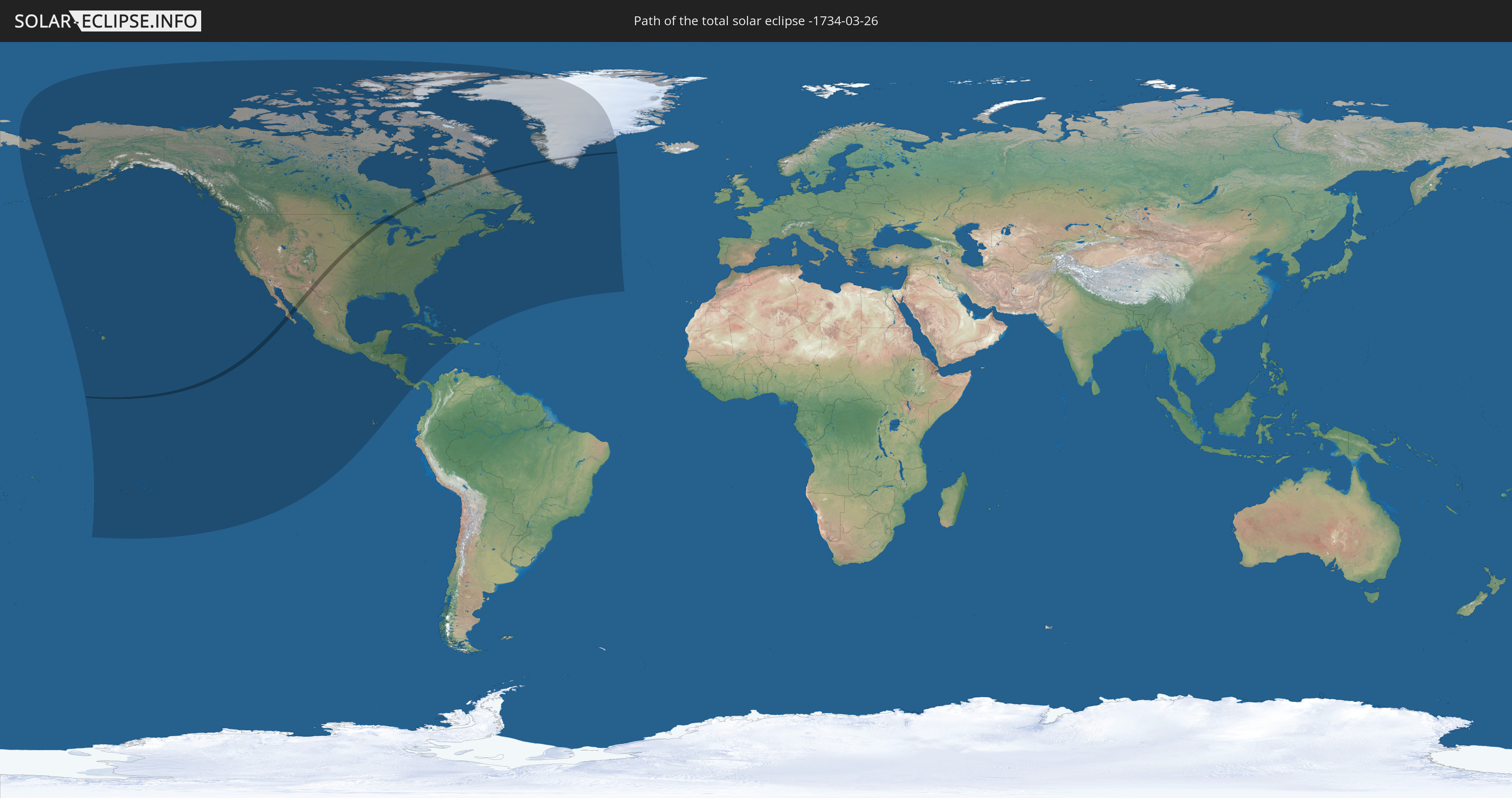
Die Sonnenfinsternis am 03/26/-1734 kann man in 28 Ländern als partielle Sonnenfinsternis beobachten.
Der Finsternispfad verläuft durch 4 Länder. Nur in diesen Ländern ist sie als total Sonnenfinsternis zu sehen.
In den folgenden Ländern ist die Sonnenfinsternis total zu sehen
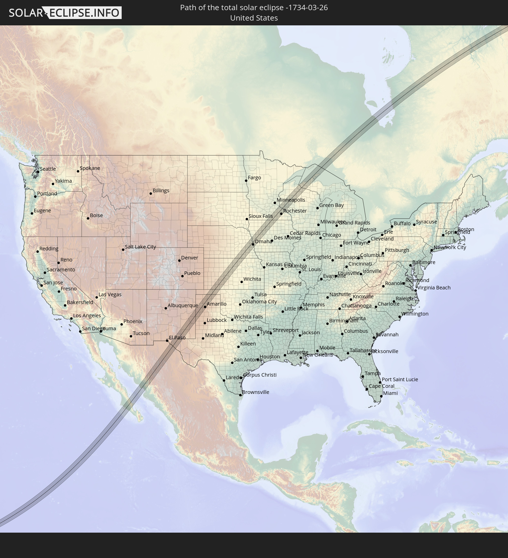 United States
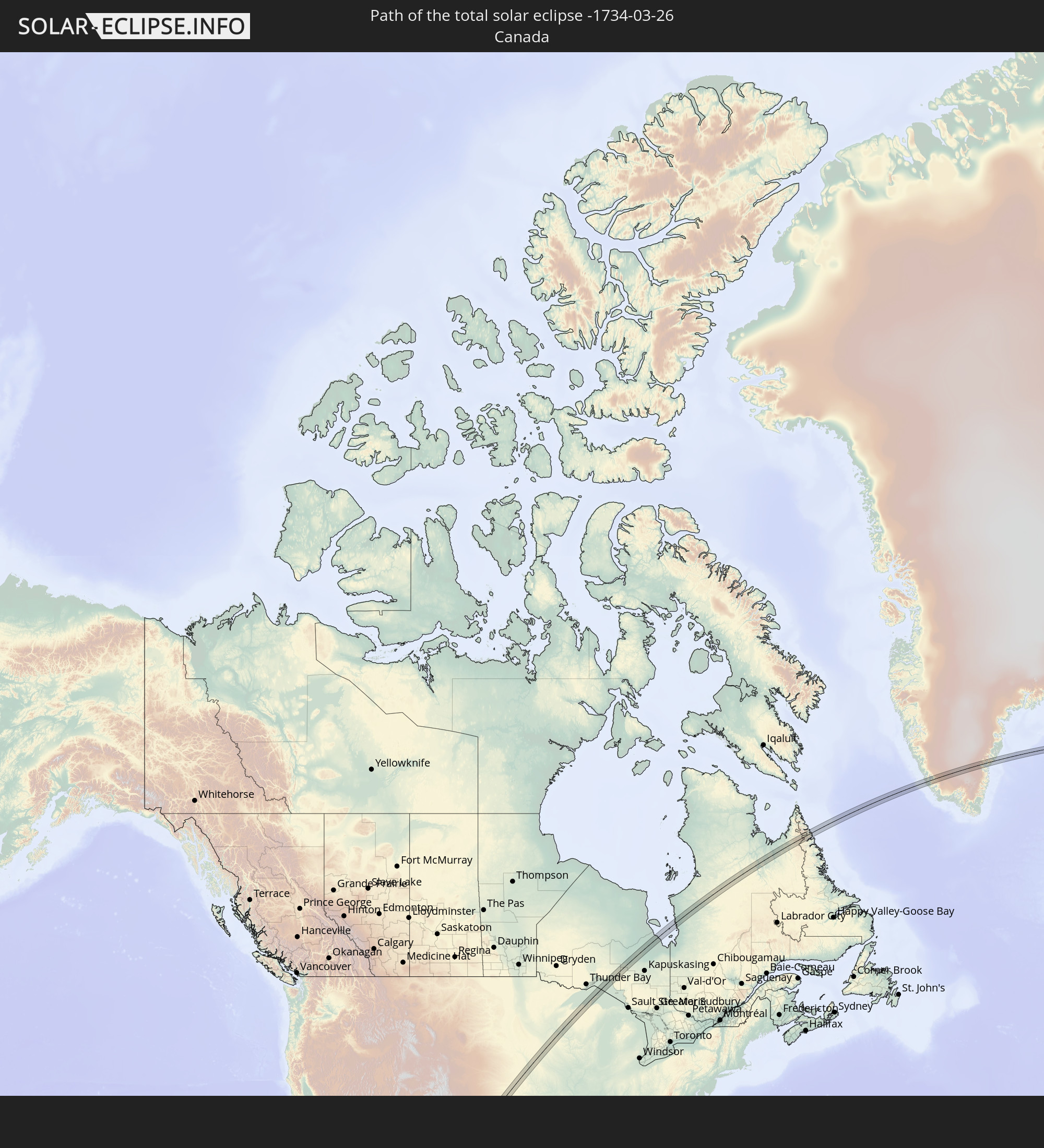 Canada
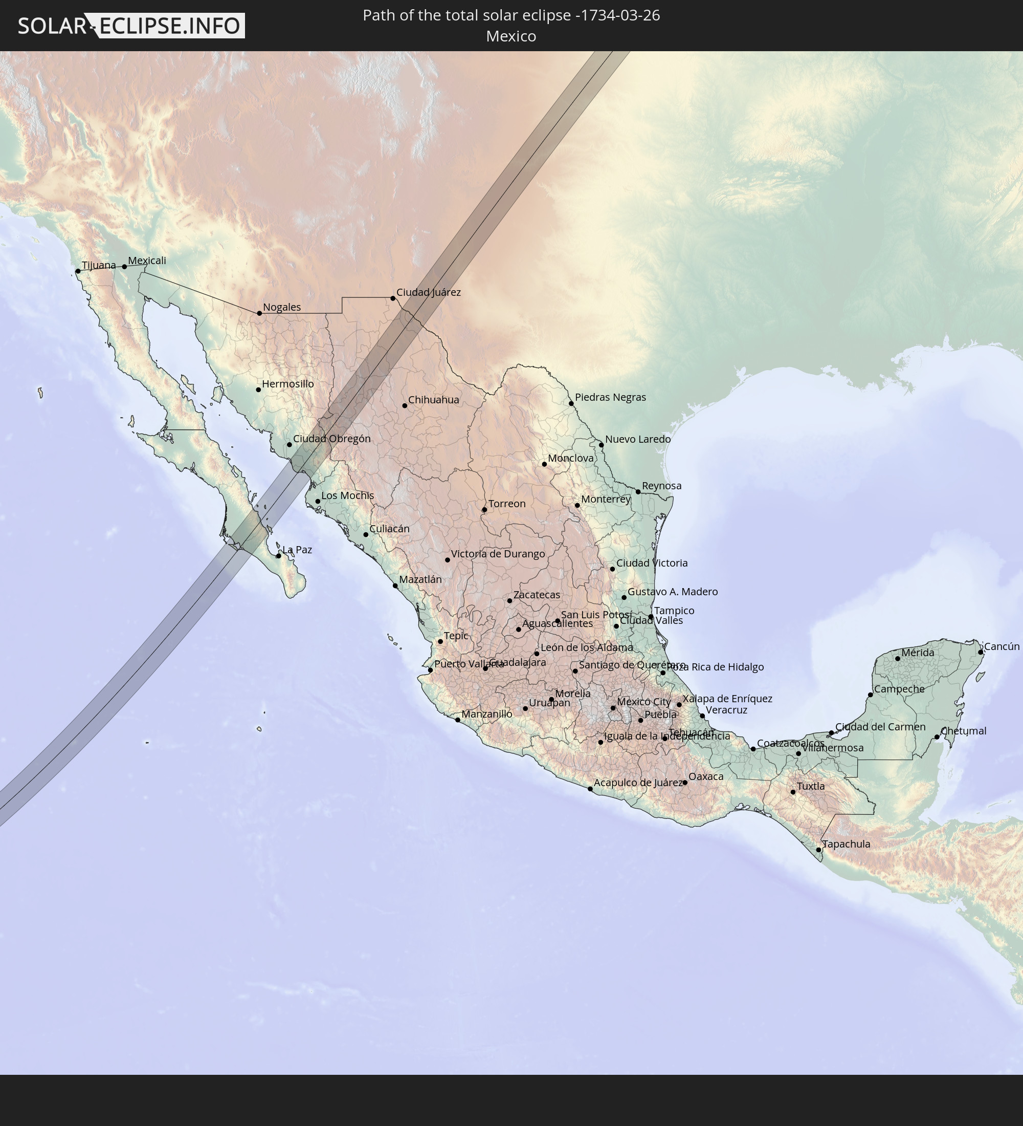 Mexico
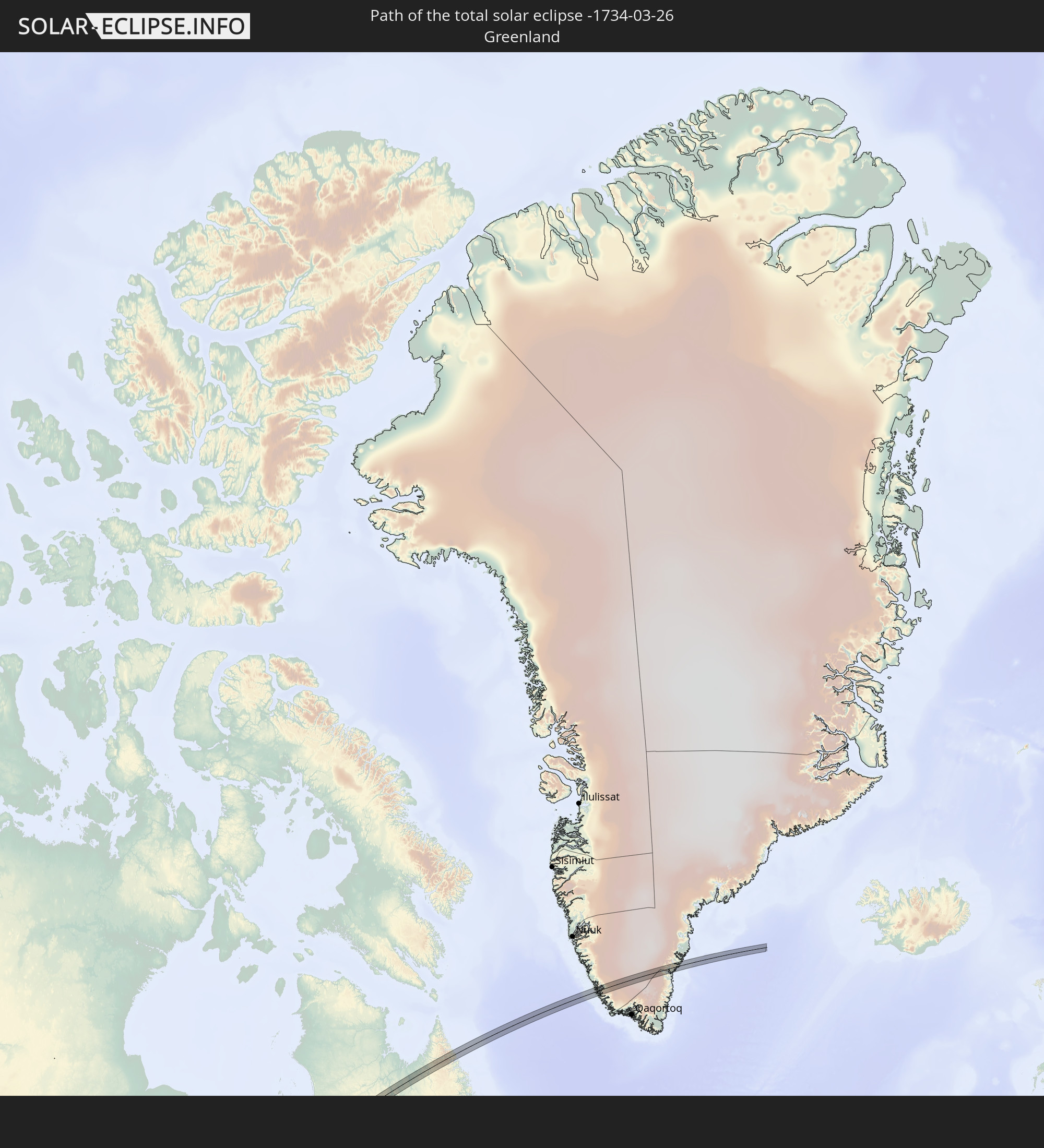 Greenland
In den folgenden Ländern ist die Sonnenfinsternis partiell zu sehen
 Russia
 United States
 United States Minor Outlying Islands
 Kiribati
 Cook Islands
 French Polynesia
 Canada
 Pitcairn Islands
 Mexico
 Greenland
 Guatemala
 Ecuador
 El Salvador
 Honduras
 Belize
 Nicaragua
 Costa Rica
 Cuba
Cuba
 Panama
 Colombia
 Cayman Islands
 The Bahamas
 Jamaica
 Haiti
Haiti
 Turks and Caicos Islands
 Dominican Republic
 Bermuda
 Saint Pierre and Miquelon
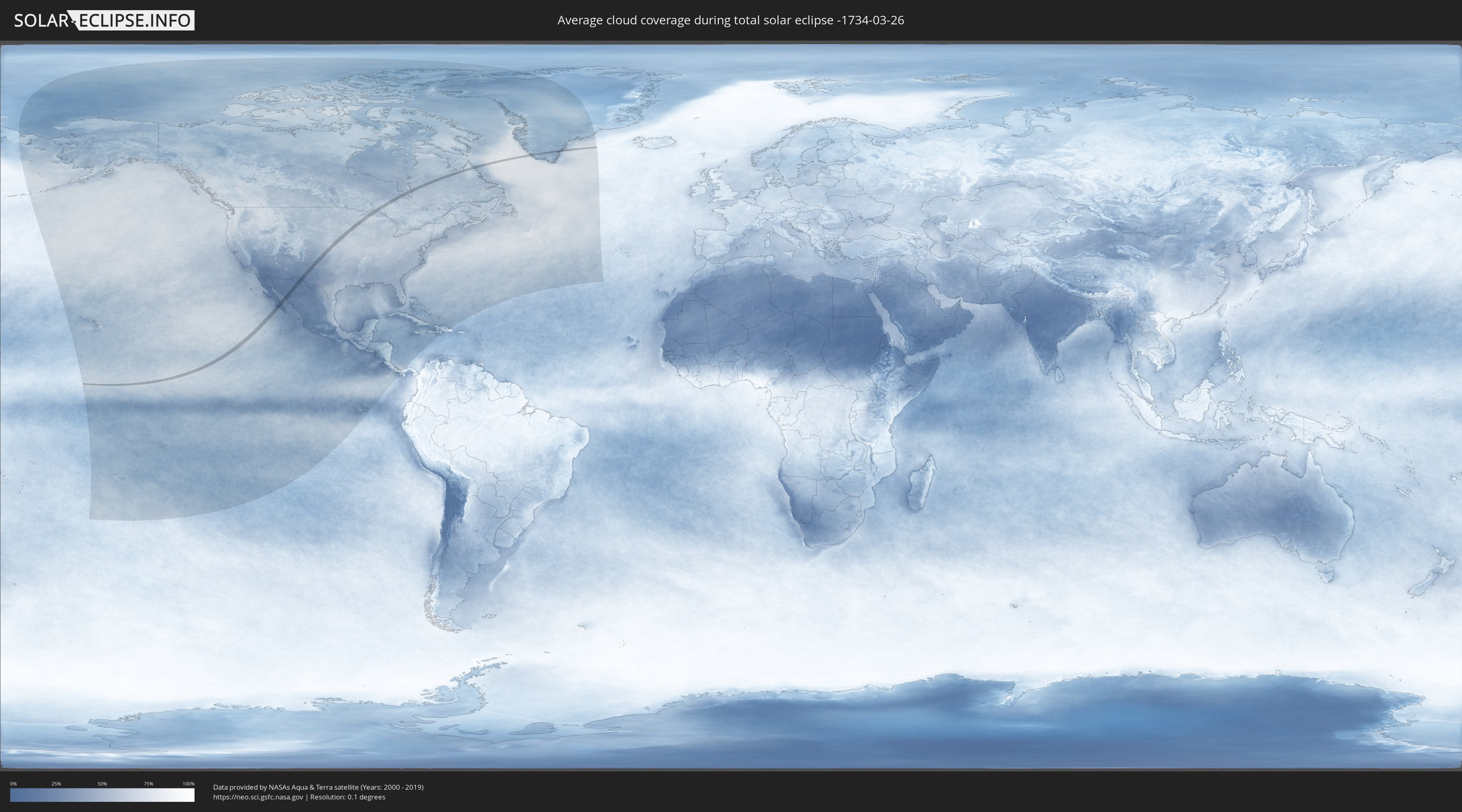
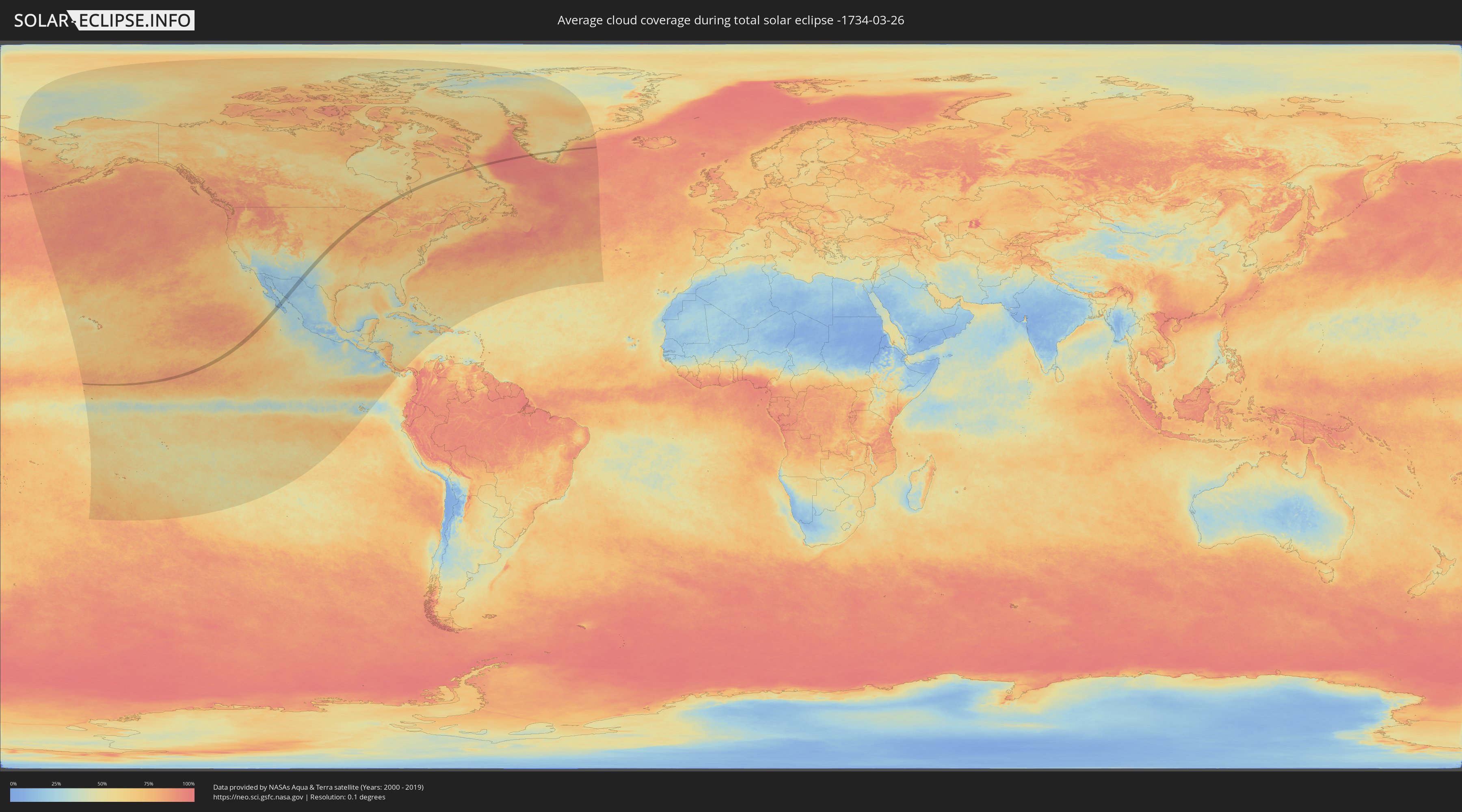
How will be the weather during the total solar eclipse on 03/26/-1734?
Where is the best place to see the total solar eclipse of 03/26/-1734?
The following maps show the average cloud coverage for the day of the total solar eclipse.
With the help of these maps, it is possible to find the place along the eclipse path, which has the best
chance of a cloudless sky.
Nevertheless, you should consider local circumstances and inform about the weather of your chosen
observation site.
The data is provided by NASAs satellites
AQUA and TERRA.
The cloud maps are averaged over a period of 19 years (2000 - 2019).
Detailed country maps
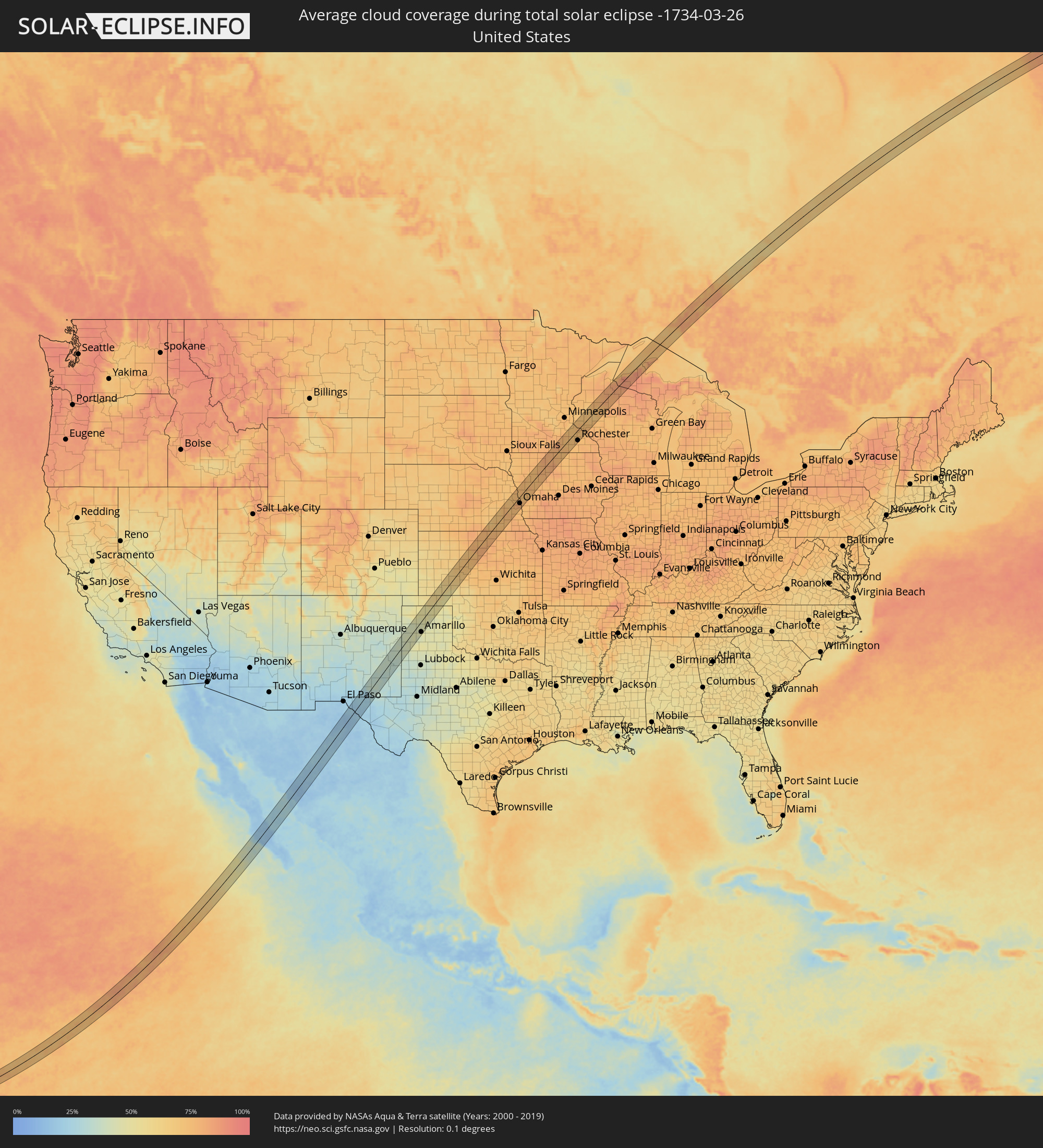 United States
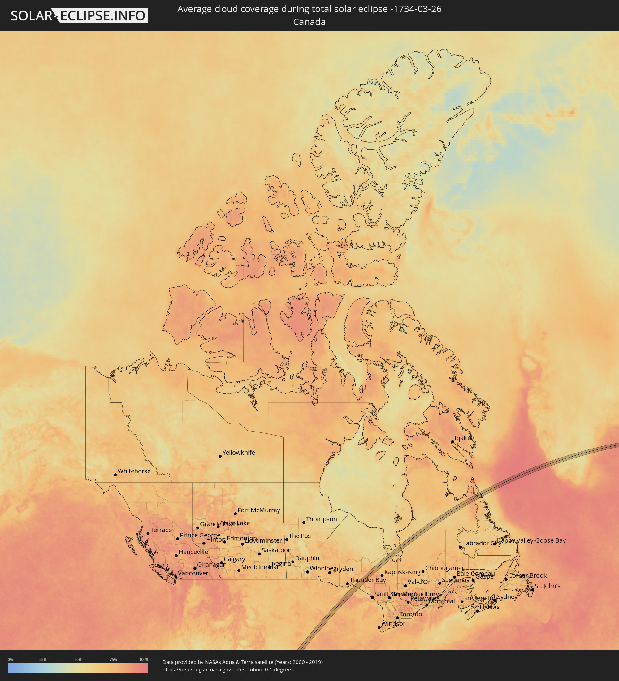 Canada
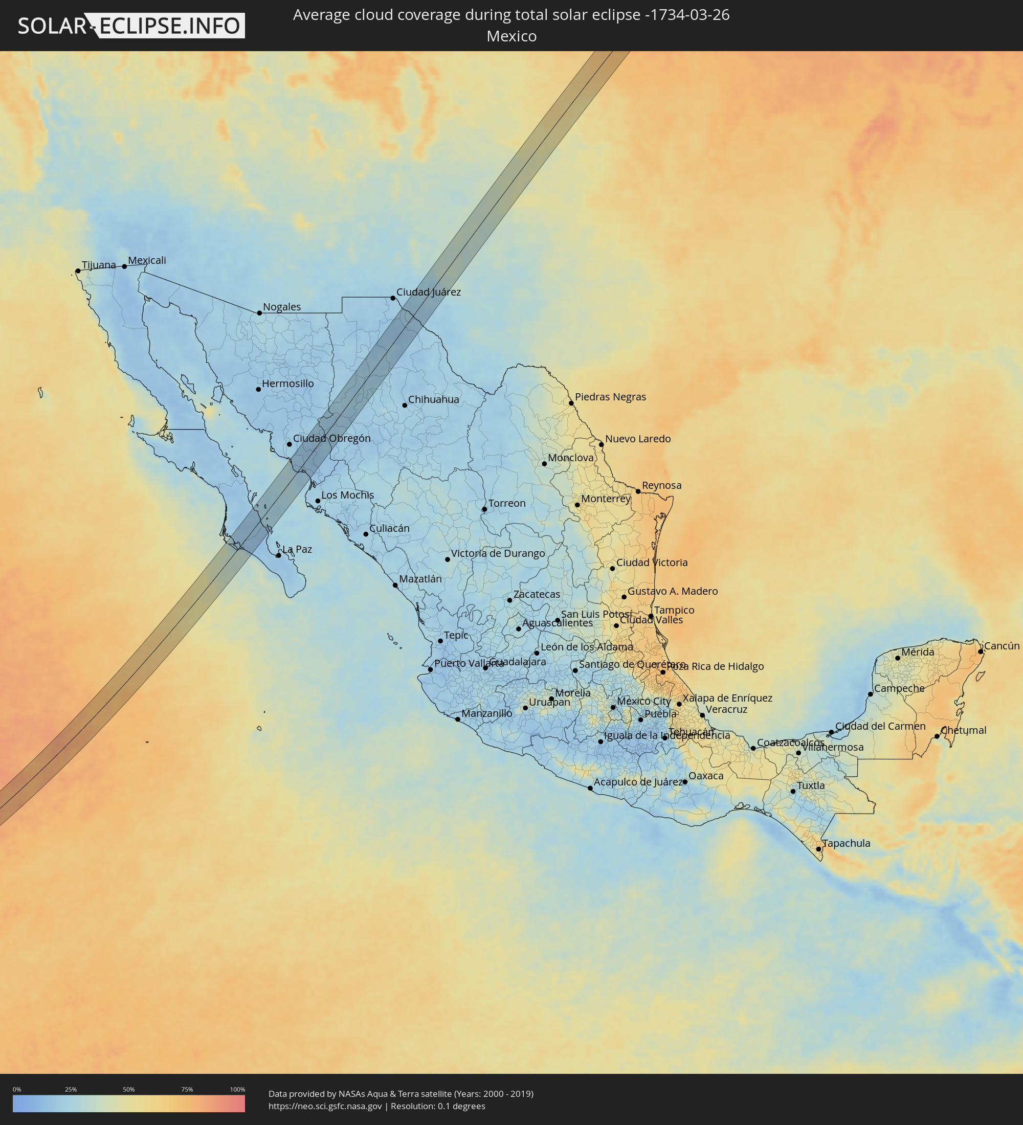 Mexico
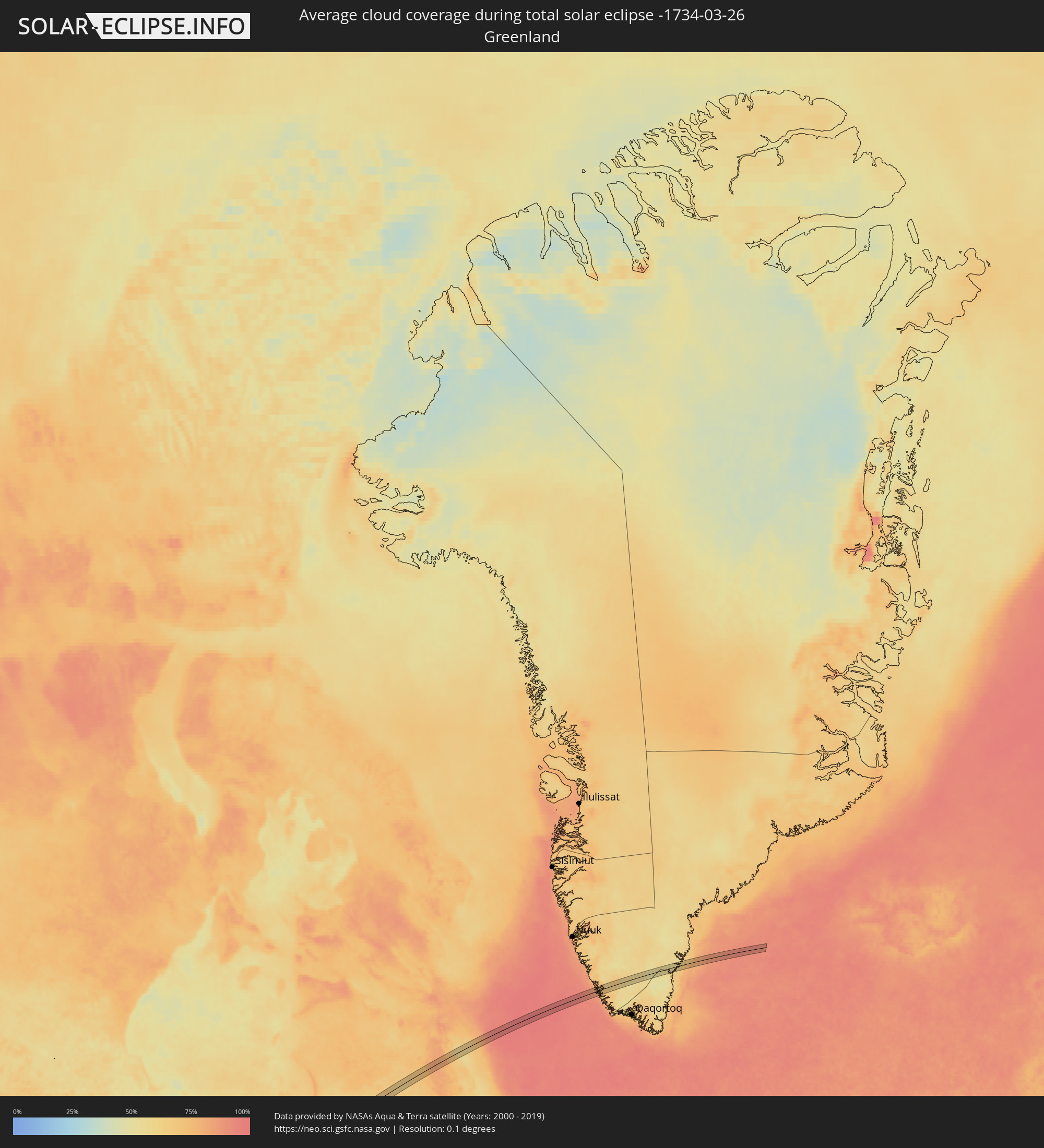 Greenland
Cities inside the path of the eclipse
The following table shows all locations with a population of more than 5,000 inside the eclipse path. Cities which have more than 100,000 inhabitants are marked bold. A click at the locations opens a detailed map.
| City | Type | Eclipse duration | Local time of max. eclipse | Distance to central line | Ø Cloud coverage |
|
Ciudad Constitución, Baja California Sur
|
total | - | 11:11:00 UTC-07:05 | 45 km | 19% |
|
Villa Juarez, Sonora
|
total | - | 11:00:09 UTC-07:23 | 42 km | 18% |
|
Bacobampo, Sonora
|
total | - | 11:00:11 UTC-07:23 | 17 km | 19% |
|
Huatabampo, Sonora
|
total | - | 10:59:53 UTC-07:23 | 6 km | 17% |
|
Etchojoa, Sonora
|
total | - | 11:00:05 UTC-07:23 | 10 km | 17% |
|
La Unión, Sonora
|
total | - | 10:59:56 UTC-07:23 | 3 km | 17% |
|
Navojoa, Sonora
|
total | - | 11:00:43 UTC-07:23 | 7 km | 17% |
|
Alamos, Sonora
|
total | - | 11:01:30 UTC-07:23 | 37 km | 17% |
|
Buenaventura, Chihuahua
|
total | - | 11:27:35 UTC-07:05 | 34 km | 19% |
|
Ejido Benito Juárez, Chihuahua
|
total | - | 11:29:08 UTC-07:05 | 10 km | 21% |
|
Miguel Ahumada, Chihuahua
|
total | - | 11:30:36 UTC-07:05 | 12 km | 17% |
|
Fabens, Texas
|
total | - | 11:38:27 UTC-07:00 | 42 km | 20% |
|
Roswell, New Mexico
|
total | - | 11:44:23 UTC-07:00 | 43 km | 35% |
|
Artesia, New Mexico
|
total | - | 11:43:40 UTC-07:00 | 3 km | 35% |
|
Portales, New Mexico
|
total | - | 11:47:37 UTC-07:00 | 6 km | 37% |
|
Clovis, New Mexico
|
total | - | 11:48:11 UTC-07:00 | 11 km | 37% |
|
Muleshoe, Texas
|
total | - | 12:48:40 UTC-06:00 | 36 km | 38% |
|
Hereford, Texas
|
total | - | 12:50:07 UTC-06:00 | 21 km | 44% |
|
Dumas, Texas
|
total | - | 12:52:24 UTC-06:00 | 19 km | 46% |
|
Amarillo, Texas
|
total | - | 12:51:39 UTC-06:00 | 35 km | 47% |
|
Guymon, Oklahoma
|
total | - | 12:54:22 UTC-06:00 | 38 km | 55% |
|
Borger, Texas
|
total | - | 12:53:01 UTC-06:00 | 36 km | 43% |
|
Liberal, Kansas
|
total | - | 12:55:46 UTC-06:00 | 23 km | 60% |
|
Perryton, Texas
|
total | - | 12:55:01 UTC-06:00 | 29 km | 51% |
|
Dodge City, Kansas
|
total | - | 12:58:08 UTC-06:00 | 7 km | 63% |
|
Hays, Kansas
|
total | - | 13:00:40 UTC-06:00 | 37 km | 70% |
|
Great Bend, Kansas
|
total | - | 13:00:51 UTC-06:00 | 37 km | 72% |
|
Concordia, Kansas
|
total | - | 13:04:00 UTC-06:00 | 28 km | 78% |
|
Seward, Nebraska
|
total | - | 13:06:24 UTC-06:00 | 29 km | 70% |
|
Crete, Nebraska
|
total | - | 13:06:16 UTC-06:00 | 0 km | 72% |
|
Beatrice, Nebraska
|
total | - | 13:06:10 UTC-06:00 | 39 km | 76% |
|
Lincoln, Nebraska
|
total | - | 13:06:53 UTC-06:00 | 7 km | 77% |
|
Fremont, Nebraska
|
total | - | 13:07:50 UTC-06:00 | 27 km | 71% |
|
Elkhorn, Nebraska
|
total | - | 13:08:03 UTC-06:00 | 1 km | 78% |
|
Chalco, Nebraska
|
total | - | 13:08:03 UTC-06:00 | 13 km | 77% |
|
Blair, Nebraska
|
total | - | 13:08:29 UTC-06:00 | 11 km | 75% |
|
Ralston, Nebraska
|
total | - | 13:08:14 UTC-06:00 | 18 km | 79% |
|
Papillion, Nebraska
|
total | - | 13:08:10 UTC-06:00 | 22 km | 79% |
|
La Vista, Nebraska
|
total | - | 13:08:13 UTC-06:00 | 20 km | 79% |
|
Omaha, Nebraska
|
total | - | 13:08:26 UTC-06:00 | 21 km | 78% |
|
Bellevue, Nebraska
|
total | - | 13:08:22 UTC-06:00 | 33 km | 75% |
|
Council Bluffs, Iowa
|
total | - | 13:08:33 UTC-06:00 | 26 km | 78% |
|
Denison, Iowa
|
total | - | 13:10:03 UTC-06:00 | 4 km | 78% |
|
Harlan, Iowa
|
total | - | 13:09:43 UTC-06:00 | 32 km | 73% |
|
Storm Lake, Iowa
|
total | - | 13:10:53 UTC-06:00 | 32 km | 75% |
|
Carroll, Iowa
|
total | - | 13:10:47 UTC-06:00 | 31 km | 75% |
|
Algona, Iowa
|
total | - | 13:12:38 UTC-06:00 | 3 km | 79% |
|
Waseca, Minnesota
|
total | - | 13:14:31 UTC-06:00 | 33 km | 77% |
|
Albert Lea, Minnesota
|
total | - | 13:14:19 UTC-06:00 | 7 km | 75% |
|
Faribault, Minnesota
|
total | - | 13:15:01 UTC-06:00 | 34 km | 76% |
|
Owatonna, Minnesota
|
total | - | 13:14:53 UTC-06:00 | 16 km | 73% |
|
Austin, Minnesota
|
total | - | 13:14:51 UTC-06:00 | 30 km | 75% |
|
Kasson, Minnesota
|
total | - | 13:15:28 UTC-06:00 | 16 km | 72% |
|
Red Wing, Minnesota
|
total | - | 13:16:12 UTC-06:00 | 11 km | 76% |
|
Rochester, Minnesota
|
total | - | 13:15:50 UTC-06:00 | 33 km | 75% |
|
Lake City, Minnesota
|
total | - | 13:16:27 UTC-06:00 | 13 km | 73% |
|
Menomonie, Wisconsin
|
total | - | 13:17:14 UTC-06:00 | 2 km | 72% |
|
Rice Lake, Wisconsin
|
total | - | 13:17:57 UTC-06:00 | 35 km | 73% |
|
Eau Claire, Wisconsin
|
total | - | 13:17:44 UTC-06:00 | 31 km | 76% |
|
Altoona, Wisconsin
|
total | - | 13:17:48 UTC-06:00 | 35 km | 75% |
|
Lake Hallie, Wisconsin
|
total | - | 13:17:51 UTC-06:00 | 30 km | 74% |
|
Chippewa Falls, Wisconsin
|
total | - | 13:17:58 UTC-06:00 | 28 km | 74% |
|
Ironwood, Michigan
|
total | - | 13:20:34 UTC-06:00 | 19 km | 81% |
|
Houghton, Michigan
|
total | - | 14:22:54 UTC-05:00 | 17 km | 79% |