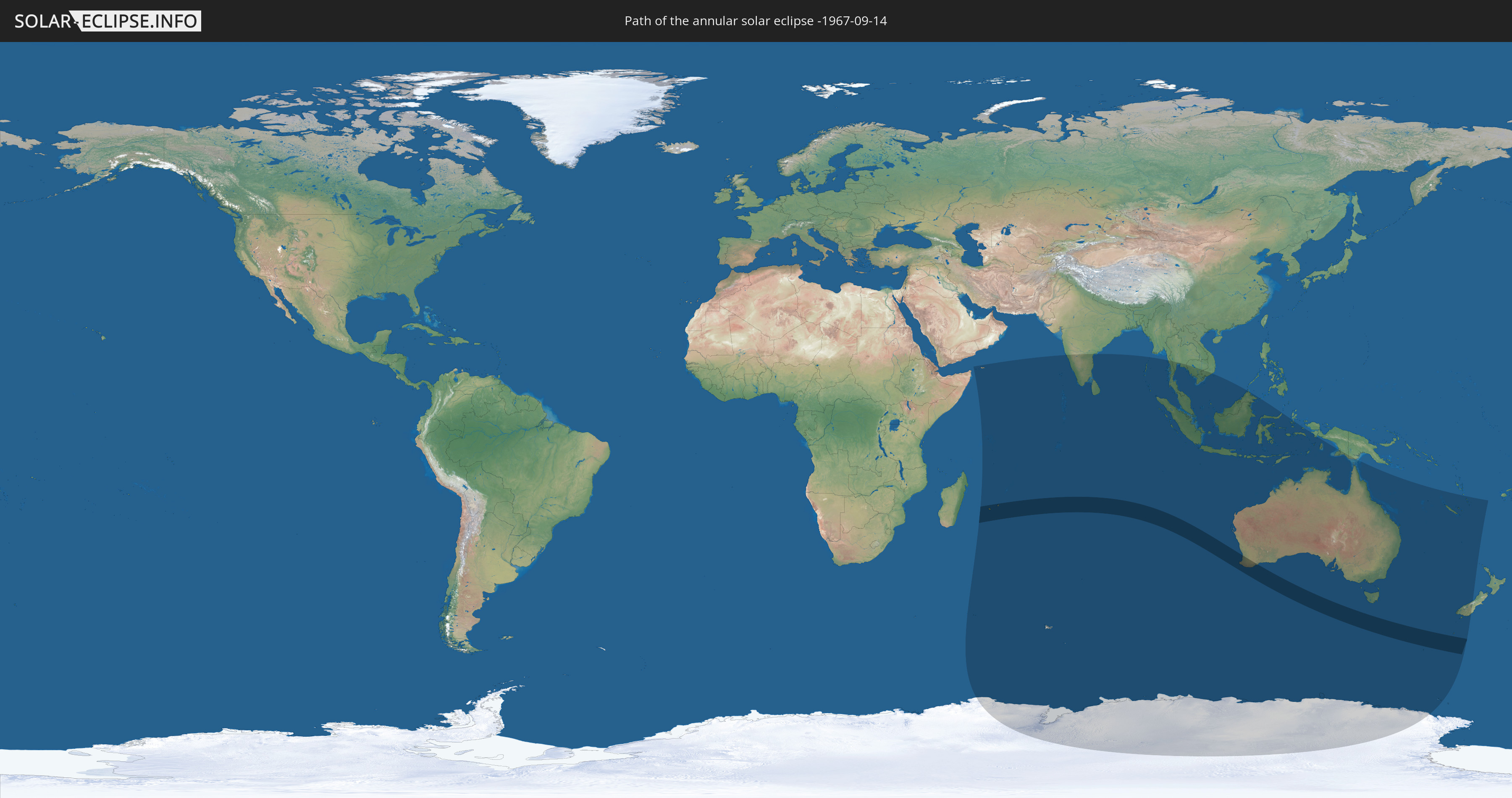
Annular solar eclipse of 09/14/-1967
| Day of week: | Monday |
| Maximum duration of eclipse: | 09m27s |
| Maximum width of eclipse path: | 368 km |
| Saros cycle: | 3 |
| Coverage: | 92.3% |
| Magnitude: | 0.9232 |
| Gamma: | -0.6263 |
Wo kann man die Sonnenfinsternis vom 09/14/-1967 sehen?
Die Sonnenfinsternis am 09/14/-1967 kann man in 29 Ländern als partielle Sonnenfinsternis beobachten.
Der Finsternispfad verläuft durch 4 Länder. Nur in diesen Ländern ist sie als annular Sonnenfinsternis zu sehen.
In den folgenden Ländern ist die Sonnenfinsternis annular zu sehen
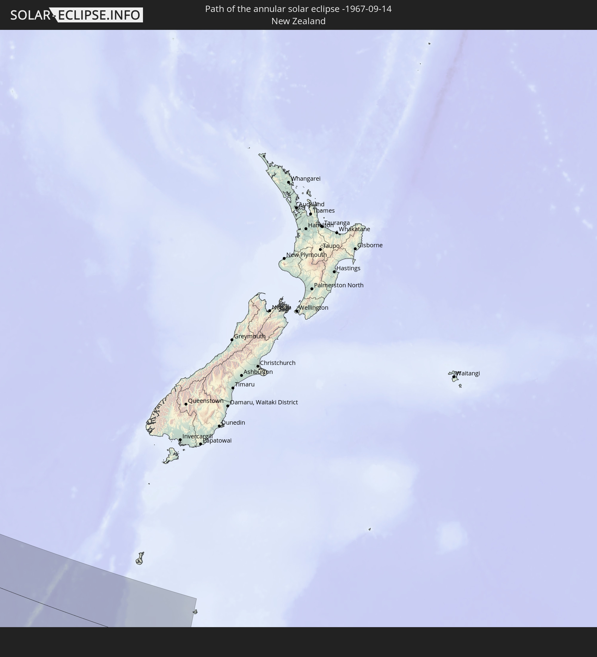 New Zealand
 Réunion
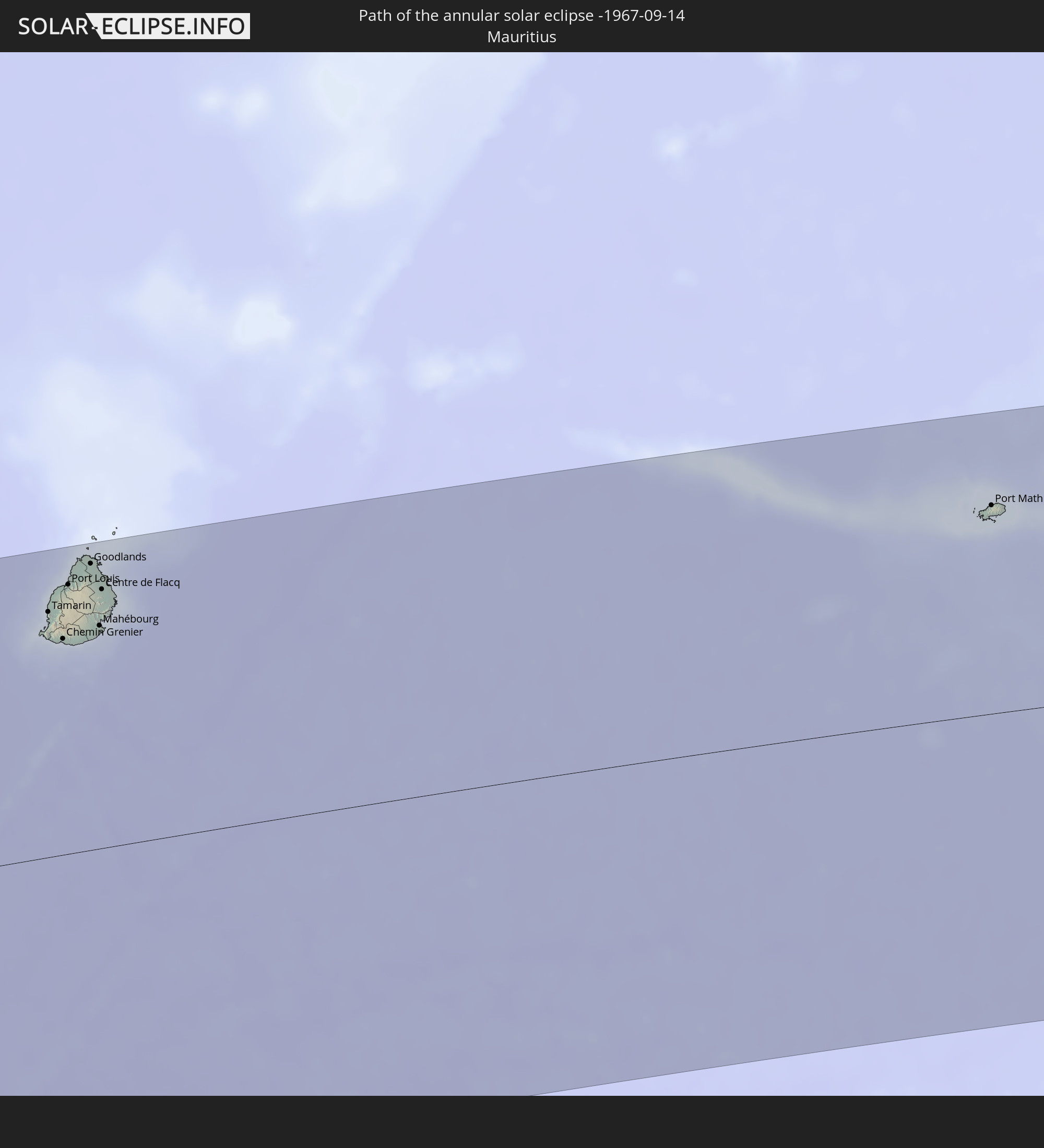 Mauritius
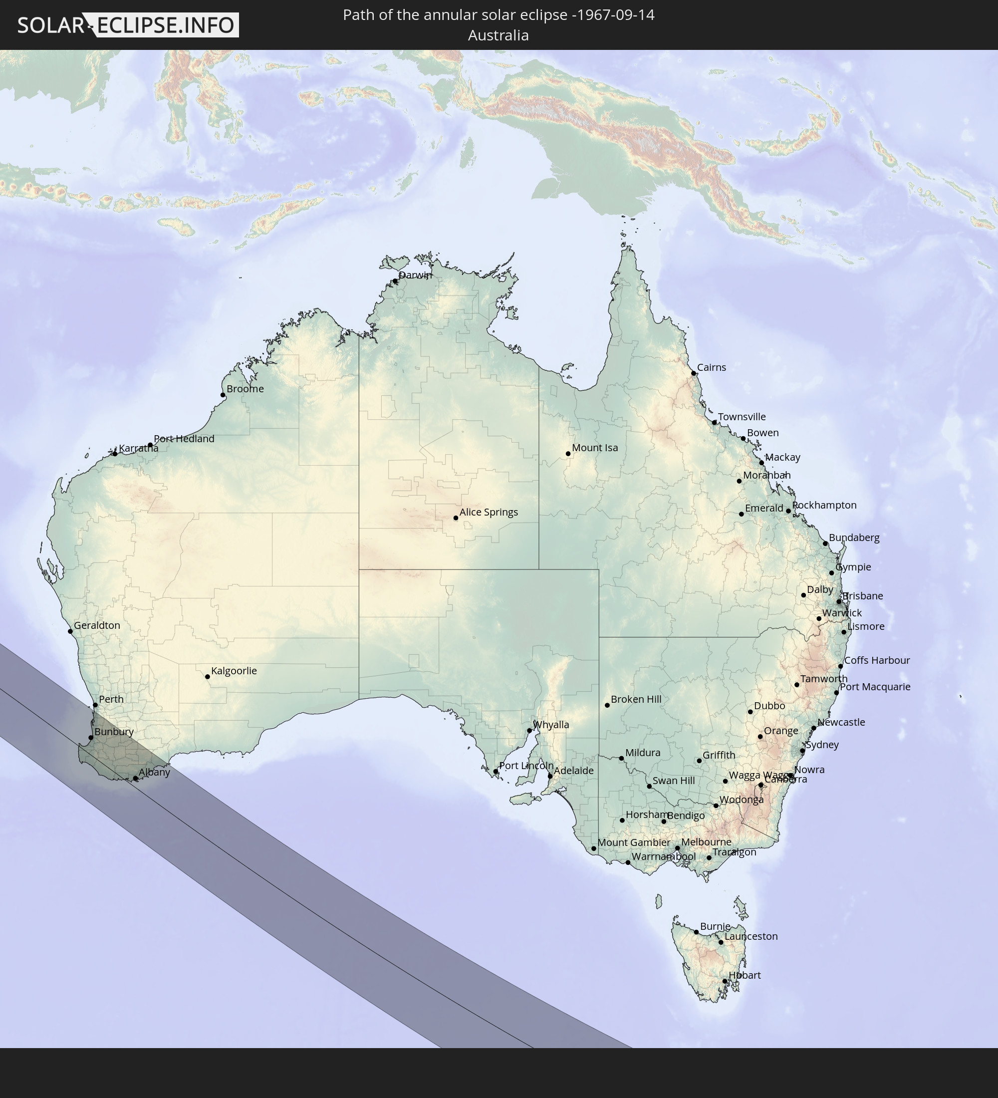 Australia
In den folgenden Ländern ist die Sonnenfinsternis partiell zu sehen
 Antarctica
 New Zealand
 French Southern and Antarctic Lands
 Yemen
Yemen
 Seychelles
 Réunion
 Mauritius
 India
India
 British Indian Ocean Territory
 Heard Island and McDonald Islands
 Maldives
 Sri Lanka
 Myanmar
 Indonesia
 Cocos Islands
 Thailand
 Malaysia
 Vietnam
 Cambodia
 Singapore
 Christmas Island
 Australia
 Brunei
 Philippines
 East Timor
 Papua New Guinea
 New Caledonia
 Vanuatu
 Norfolk Island
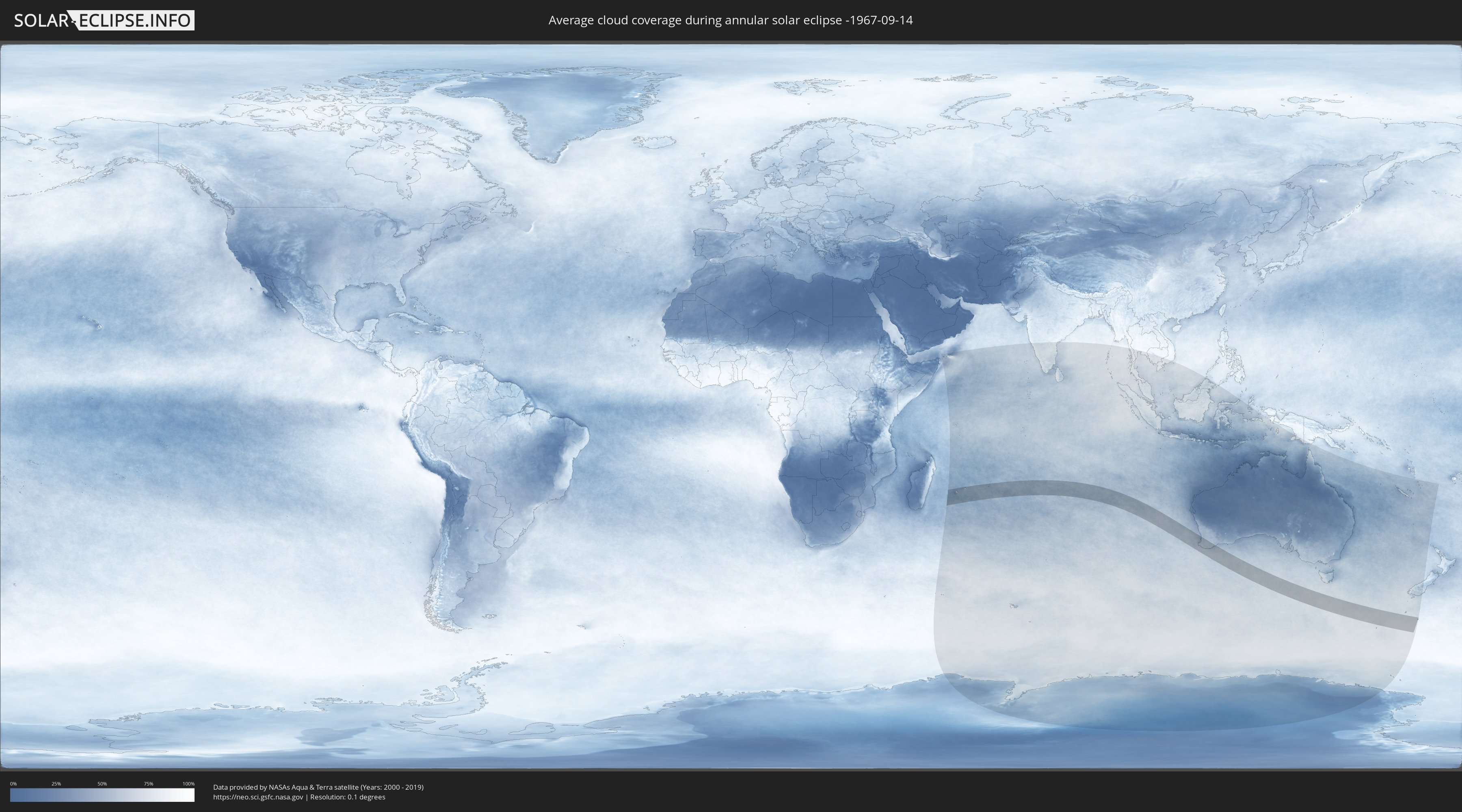
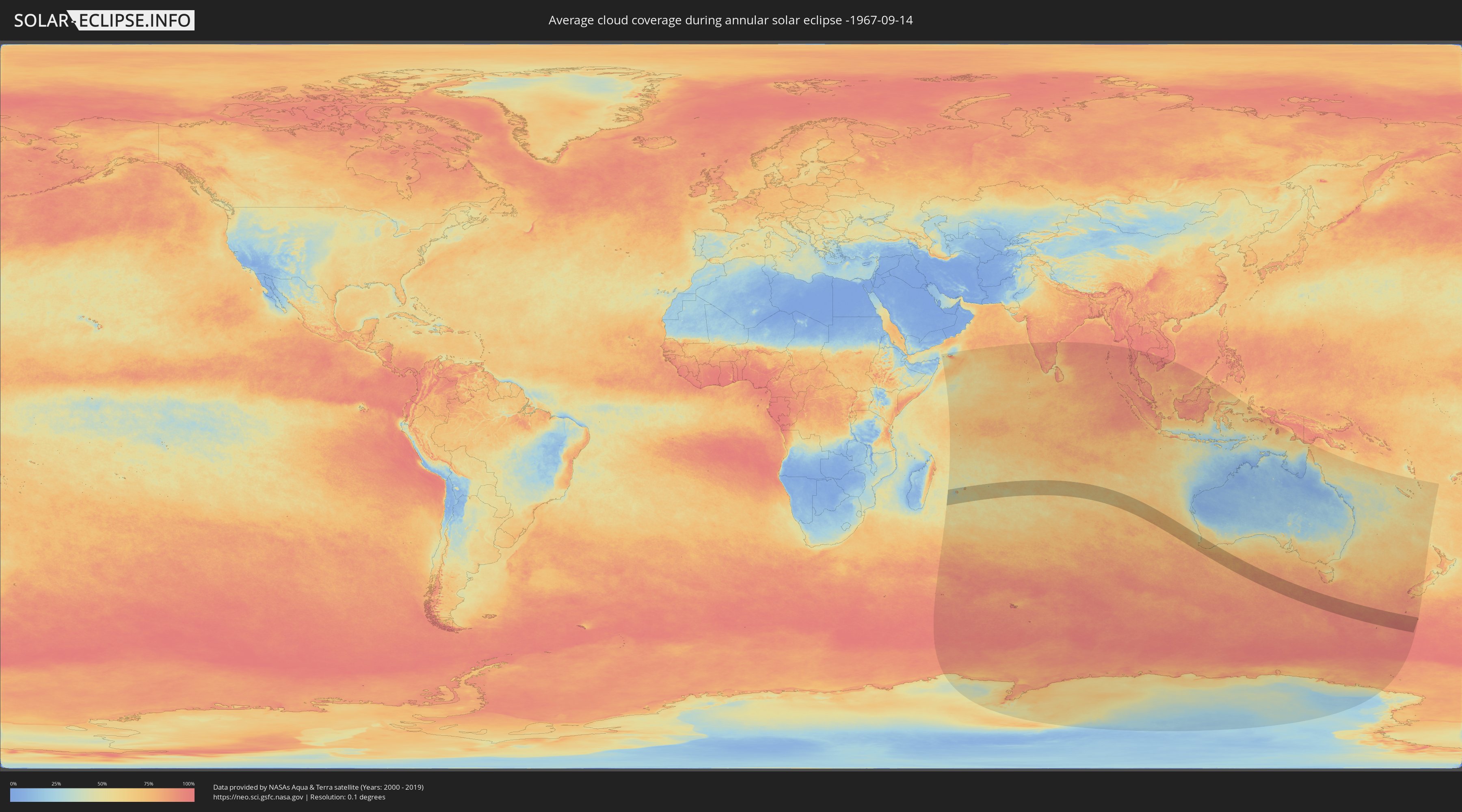
How will be the weather during the annular solar eclipse on 09/14/-1967?
Where is the best place to see the annular solar eclipse of 09/14/-1967?
The following maps show the average cloud coverage for the day of the annular solar eclipse.
With the help of these maps, it is possible to find the place along the eclipse path, which has the best
chance of a cloudless sky.
Nevertheless, you should consider local circumstances and inform about the weather of your chosen
observation site.
The data is provided by NASAs satellites
AQUA and TERRA.
The cloud maps are averaged over a period of 19 years (2000 - 2019).
Detailed country maps
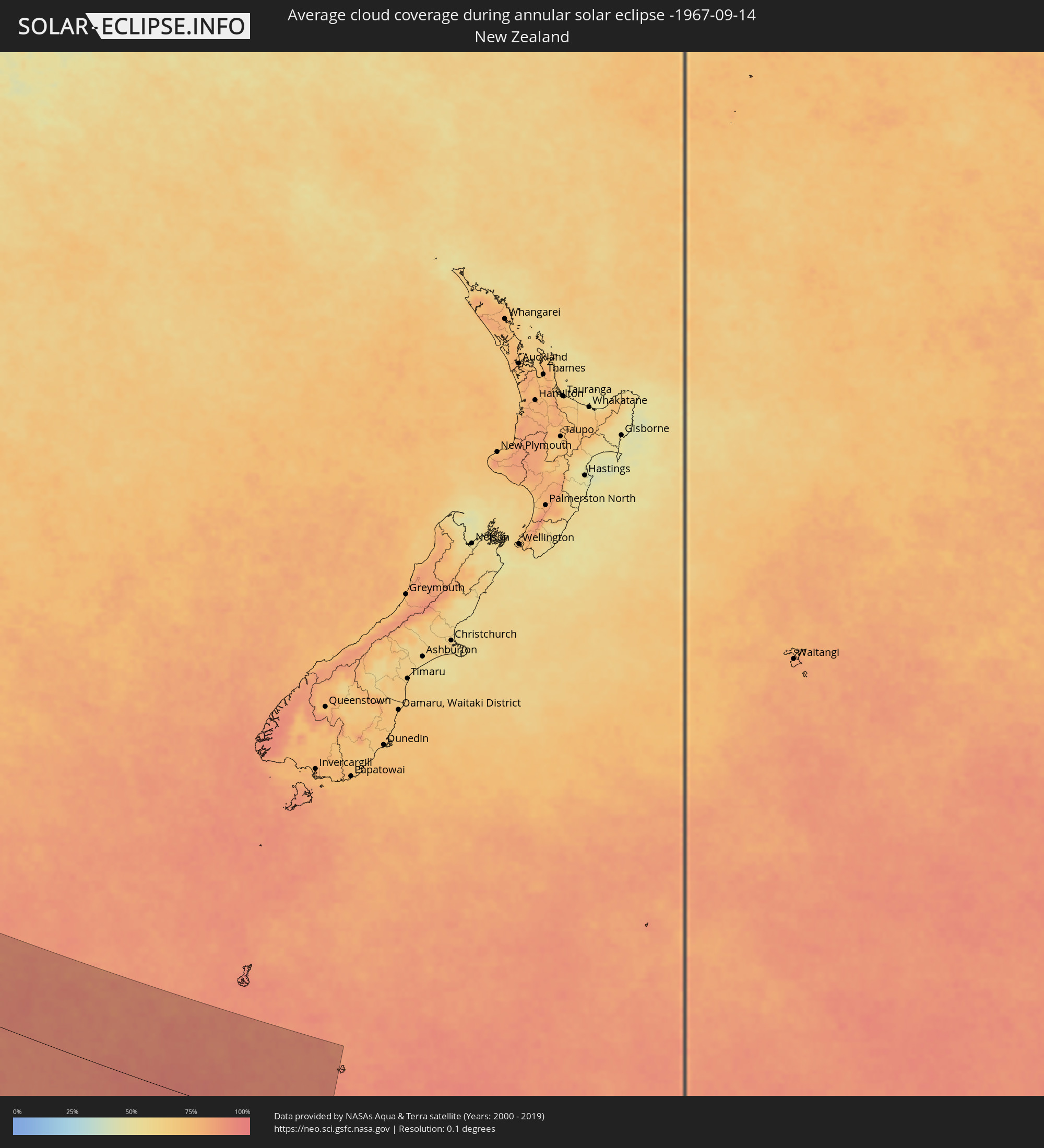 New Zealand
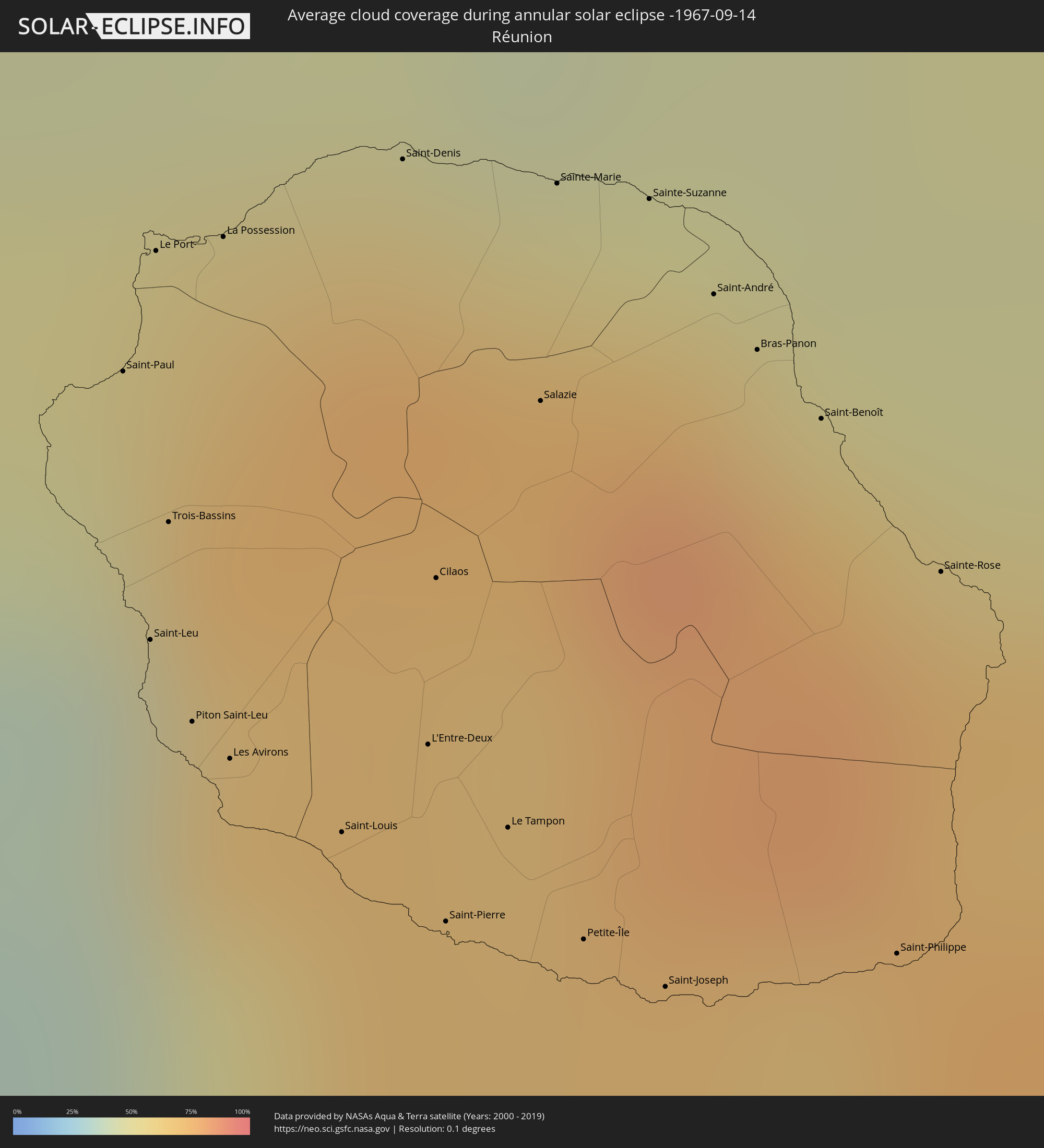 Réunion
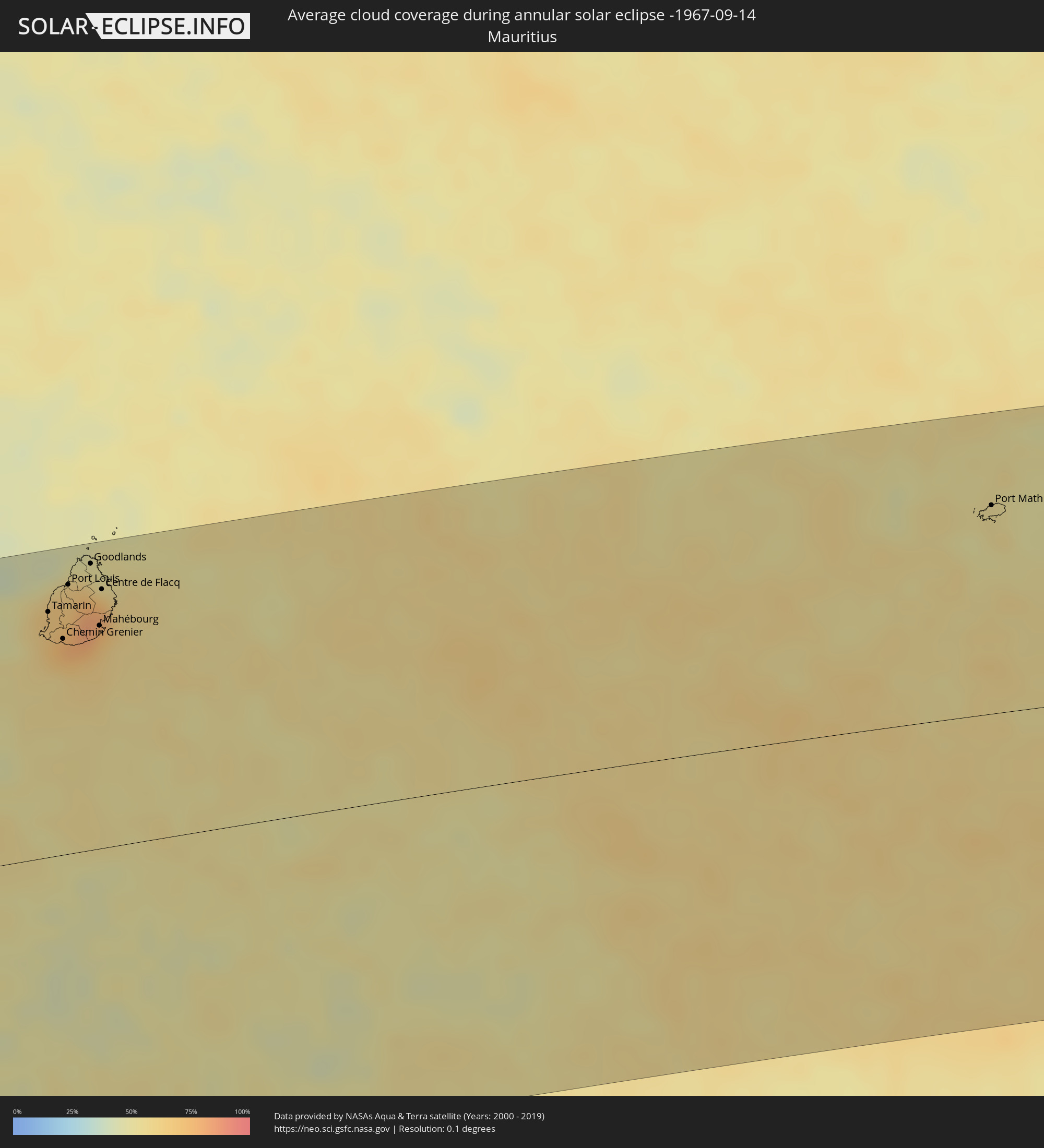 Mauritius
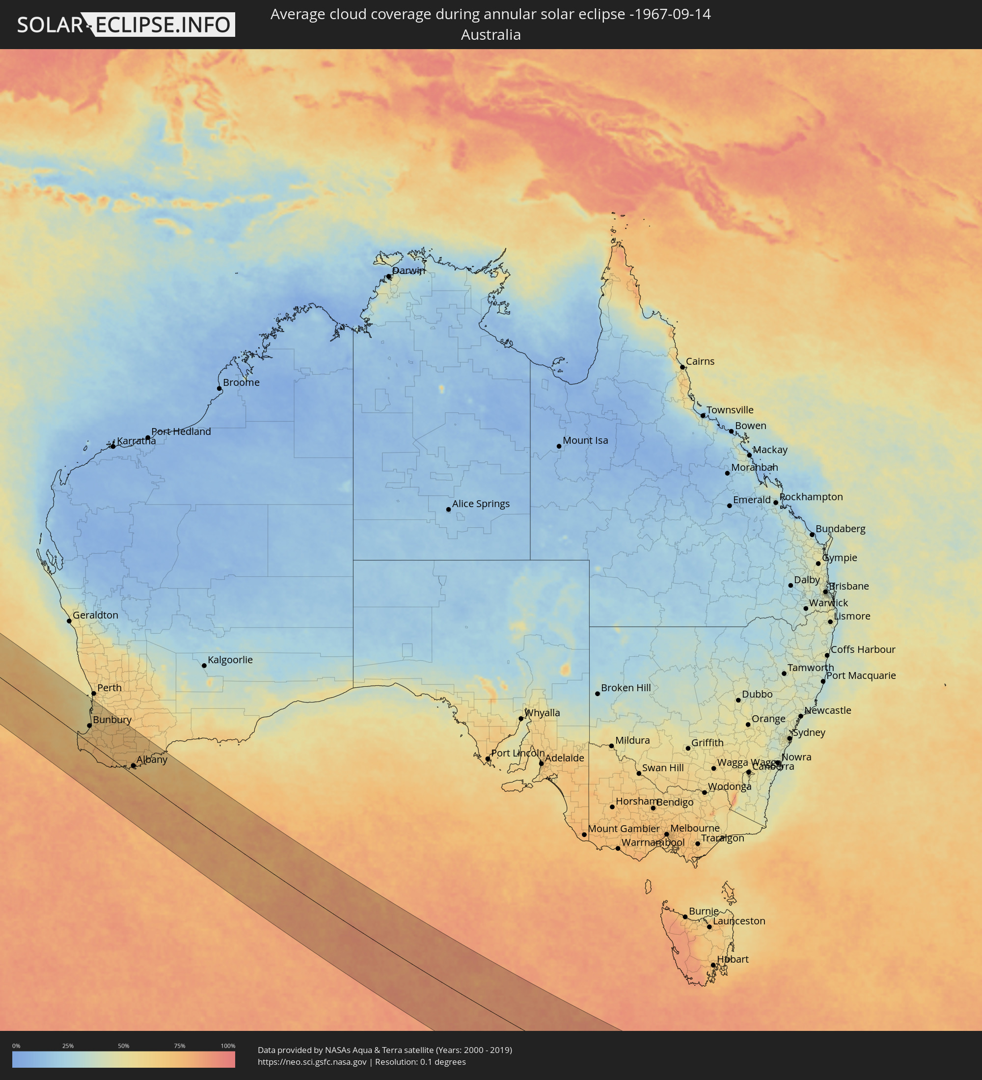 Australia
Cities inside the path of the eclipse
The following table shows all locations with a population of more than 5,000 inside the eclipse path. Cities which have more than 100,000 inhabitants are marked bold. A click at the locations opens a detailed map.
| City | Type | Eclipse duration | Local time of max. eclipse | Distance to central line | Ø Cloud coverage |
|
Saint-Paul, Réunion
|
annular | - | 06:26:21 UTC+03:41 | 124 km | 70% |
|
Saint-Leu, Réunion
|
annular | - | 06:26:33 UTC+03:41 | 106 km | 51% |
|
Le Port, Réunion
|
annular | - | 06:26:16 UTC+03:41 | 131 km | 65% |
|
Trois-Bassins, Réunion
|
annular | - | 06:26:28 UTC+03:41 | 113 km | 63% |
|
Piton Saint-Leu, Réunion
|
annular | - | 06:26:37 UTC+03:41 | 100 km | 51% |
|
La Possession, Réunion
|
annular | - | 06:26:17 UTC+03:41 | 131 km | 65% |
|
Les Avirons, Réunion
|
annular | - | 06:26:39 UTC+03:41 | 97 km | 51% |
|
Saint-Louis, Réunion
|
annular | - | 06:26:43 UTC+03:41 | 91 km | 45% |
|
Saint-Denis, Réunion
|
annular | - | 06:26:15 UTC+03:41 | 134 km | 72% |
|
L'Entre-Deux, Réunion
|
annular | - | 06:26:41 UTC+03:41 | 96 km | 68% |
|
Cilaos, Réunion
|
annular | - | 06:26:34 UTC+03:41 | 106 km | 67% |
|
Saint-Pierre, Réunion
|
annular | - | 06:26:48 UTC+03:41 | 84 km | 53% |
|
Le Tampon, Réunion
|
annular | - | 06:26:45 UTC+03:41 | 89 km | 53% |
|
Salazie, Réunion
|
annular | - | 06:26:27 UTC+03:41 | 117 km | 72% |
|
Sainte-Marie, Réunion
|
annular | - | 06:26:18 UTC+03:41 | 131 km | 72% |
|
Petite-Île, Réunion
|
annular | - | 06:26:51 UTC+03:41 | 81 km | 49% |
|
Sainte-Suzanne, Réunion
|
annular | - | 06:26:20 UTC+03:41 | 129 km | 68% |
|
Saint-Joseph, Réunion
|
annular | - | 06:26:54 UTC+03:41 | 77 km | 49% |
|
Saint-André, Réunion
|
annular | - | 06:26:24 UTC+03:41 | 122 km | 69% |
|
Bras-Panon, Réunion
|
annular | - | 06:26:27 UTC+03:41 | 118 km | 69% |
|
Saint-Benoît, Réunion
|
annular | - | 06:26:31 UTC+03:41 | 112 km | 69% |
|
Saint-Philippe, Réunion
|
annular | - | 06:26:55 UTC+03:41 | 76 km | 59% |
|
Sainte-Rose, Réunion
|
annular | - | 06:26:39 UTC+03:41 | 101 km | 69% |
|
Tamarin, Black River
|
annular | - | 06:34:20 UTC+03:50 | 161 km | 68% |
|
Petite Rivière, Black River
|
annular | - | 06:34:13 UTC+03:50 | 174 km | 67% |
|
Beau Bassin, Plaines Wilhems
|
annular | - | 06:34:15 UTC+03:50 | 171 km | 70% |
|
Chemin Grenier, Savanne
|
annular | - | 06:34:34 UTC+03:50 | 142 km | 68% |
|
Vacoas, Plaines Wilhems
|
annular | - | 06:34:21 UTC+03:50 | 162 km | 75% |
|
Quatre Bornes, Plaines Wilhems
|
annular | - | 06:34:18 UTC+03:50 | 166 km | 75% |
|
Pailles, Moka
|
annular | - | 06:34:14 UTC+03:50 | 174 km | 70% |
|
Moka, Moka
|
annular | - | 06:34:16 UTC+03:50 | 171 km | 70% |
|
Port Louis, Port Louis
|
annular | - | 06:34:12 UTC+03:50 | 177 km | 70% |
|
Surinam, Savanne
|
annular | - | 06:34:37 UTC+03:50 | 139 km | 68% |
|
Grande Pointe aux Piments, Pamplemousses
|
annular | - | 06:34:05 UTC+03:50 | 188 km | 66% |
|
Souillac, Savanne
|
annular | - | 06:34:37 UTC+03:50 | 138 km | 68% |
|
Curepipe, Plaines Wilhems
|
annular | - | 06:34:23 UTC+03:50 | 160 km | 75% |
|
Saint Pierre, Moka
|
annular | - | 06:34:16 UTC+03:50 | 170 km | 70% |
|
Le Hochet, Pamplemousses
|
annular | - | 06:34:10 UTC+03:50 | 180 km | 66% |
|
Terre Rouge, Pamplemousses
|
annular | - | 06:34:10 UTC+03:50 | 180 km | 66% |
|
Grand Bois, Savanne
|
annular | - | 06:34:31 UTC+03:50 | 148 km | 78% |
|
Triolet, Pamplemousses
|
annular | - | 06:34:05 UTC+03:50 | 188 km | 66% |
|
Rivière des Anguilles, Savanne
|
annular | - | 06:34:36 UTC+03:50 | 141 km | 66% |
|
Morcellemont Saint André, Pamplemousses
|
annular | - | 06:34:07 UTC+03:50 | 186 km | 74% |
|
Nouvelle France, Grand Port
|
annular | - | 06:34:28 UTC+03:50 | 153 km | 77% |
|
Dagotière, Moka
|
annular | - | 06:34:19 UTC+03:50 | 167 km | 81% |
|
Long Mountain, Pamplemousses
|
annular | - | 06:34:12 UTC+03:50 | 178 km | 74% |
|
Pamplemousses, Pamplemousses
|
annular | - | 06:34:09 UTC+03:50 | 182 km | 74% |
|
Plaine des Papayes, Pamplemousses
|
annular | - | 06:34:06 UTC+03:50 | 186 km | 74% |
|
Fond du Sac, Pamplemousses
|
annular | - | 06:34:05 UTC+03:50 | 189 km | 62% |
|
Camp Diable, Savanne
|
annular | - | 06:34:35 UTC+03:50 | 143 km | 66% |
|
Grand Baie, Rivière du Rempart
|
annular | - | 06:34:03 UTC+03:50 | 191 km | 62% |
|
Rose Belle, Grand Port
|
annular | - | 06:34:31 UTC+03:50 | 149 km | 77% |
|
Quartier Militaire, Moka
|
annular | - | 06:34:20 UTC+03:50 | 166 km | 81% |
|
Petit Raffray, Rivière du Rempart
|
annular | - | 06:34:03 UTC+03:50 | 191 km | 62% |
|
New Grove, Grand Port
|
annular | - | 06:34:32 UTC+03:50 | 148 km | 77% |
|
Piton, Rivière du Rempart
|
annular | - | 06:34:09 UTC+03:50 | 183 km | 74% |
|
Goodlands, Rivière du Rempart
|
annular | - | 06:34:06 UTC+03:50 | 188 km | 62% |
|
Brisée Verdière, Flacq
|
annular | - | 06:34:15 UTC+03:50 | 174 km | 81% |
|
Bon Accueil, Flacq
|
annular | - | 06:34:16 UTC+03:50 | 173 km | 80% |
|
Montagne Blanche
|
annular | - | 06:34:24 UTC+03:50 | 161 km | 75% |
|
Grand Gaube, Rivière du Rempart
|
annular | - | 06:34:04 UTC+03:50 | 191 km | 53% |
|
Lalmatie, Flacq
|
annular | - | 06:34:17 UTC+03:50 | 171 km | 80% |
|
Plaine Magnien, Grand Port
|
annular | - | 06:34:34 UTC+03:50 | 145 km | 67% |
|
Laventure, Flacq
|
annular | - | 06:34:14 UTC+03:50 | 176 km | 71% |
|
Rivière du Rempart, Rivière du Rempart
|
annular | - | 06:34:11 UTC+03:50 | 180 km | 71% |
|
Sebastopol, Flacq
|
annular | - | 06:34:25 UTC+03:50 | 160 km | 75% |
|
Beau Vallon, Grand Port
|
annular | - | 06:34:34 UTC+03:50 | 145 km | 67% |
|
Mahébourg, Grand Port
|
annular | - | 06:34:34 UTC+03:50 | 146 km | 67% |
|
Roches Noire, Rivière du Rempart
|
annular | - | 06:34:13 UTC+03:50 | 179 km | 71% |
|
Centre de Flacq, Flacq
|
annular | - | 06:34:18 UTC+03:50 | 170 km | 80% |
|
Poste de Flacq, Flacq
|
annular | - | 06:34:17 UTC+03:50 | 173 km | 80% |
|
Ecroignard, Flacq
|
annular | - | 06:34:21 UTC+03:50 | 166 km | 80% |
|
Bel Air Rivière Sèche, Flacq
|
annular | - | 06:34:24 UTC+03:50 | 162 km | 75% |
|
Quatre Cocos, Flacq
|
annular | - | 06:34:21 UTC+03:50 | 167 km | 62% |
|
Port Mathurin, Rodrigues
|
annular | - | 06:36:32 UTC+03:50 | 138 km | 53% |
|
Margaret River, Western Australia
|
annular | - | 12:54:47 UTC+08:00 | 24 km | 71% |
|
Busselton, Western Australia
|
annular | - | 12:55:10 UTC+08:00 | 18 km | 72% |
|
Bunbury, Western Australia
|
annular | - | 12:55:36 UTC+08:00 | 64 km | 56% |
|
Eaton, Western Australia
|
annular | - | 12:55:44 UTC+08:00 | 68 km | 62% |
|
Australind, Western Australia
|
annular | - | 12:55:44 UTC+08:00 | 72 km | 62% |
|
Mandurah, Western Australia
|
annular | - | 12:55:02 UTC+08:00 | 140 km | 50% |
|
Rockingham, Western Australia
|
annular | - | 12:54:48 UTC+08:00 | 163 km | 51% |
|
Safety Bay, Western Australia
|
annular | - | 12:54:51 UTC+08:00 | 162 km | 51% |
|
Warnbro, Western Australia
|
annular | - | 12:54:54 UTC+08:00 | 159 km | 51% |
|
Port Kennedy, Western Australia
|
annular | - | 12:54:57 UTC+08:00 | 156 km | 55% |
|
Secret Harbour, Western Australia
|
annular | - | 12:55:00 UTC+08:00 | 153 km | 55% |
|
Kwinana, Western Australia
|
annular | - | 12:54:53 UTC+08:00 | 170 km | 57% |
|
Parmelia, Western Australia
|
annular | - | 12:55:01 UTC+08:00 | 170 km | 58% |
|
Collie, Western Australia
|
annular | - | 12:56:53 UTC+08:00 | 89 km | 67% |
|
Albany, Western Australia
|
annular | - | 13:02:17 UTC+08:00 | 33 km | 66% |