Total solar eclipse of 01/06/0102
| Day of week: | Friday |
| Maximum duration of eclipse: | 03m00s |
| Maximum width of eclipse path: | 165 km |
| Saros cycle: | 62 |
| Coverage: | 100% |
| Magnitude: | 1.0323 |
| Gamma: | 0.749 |
Wo kann man die Sonnenfinsternis vom 01/06/0102 sehen?
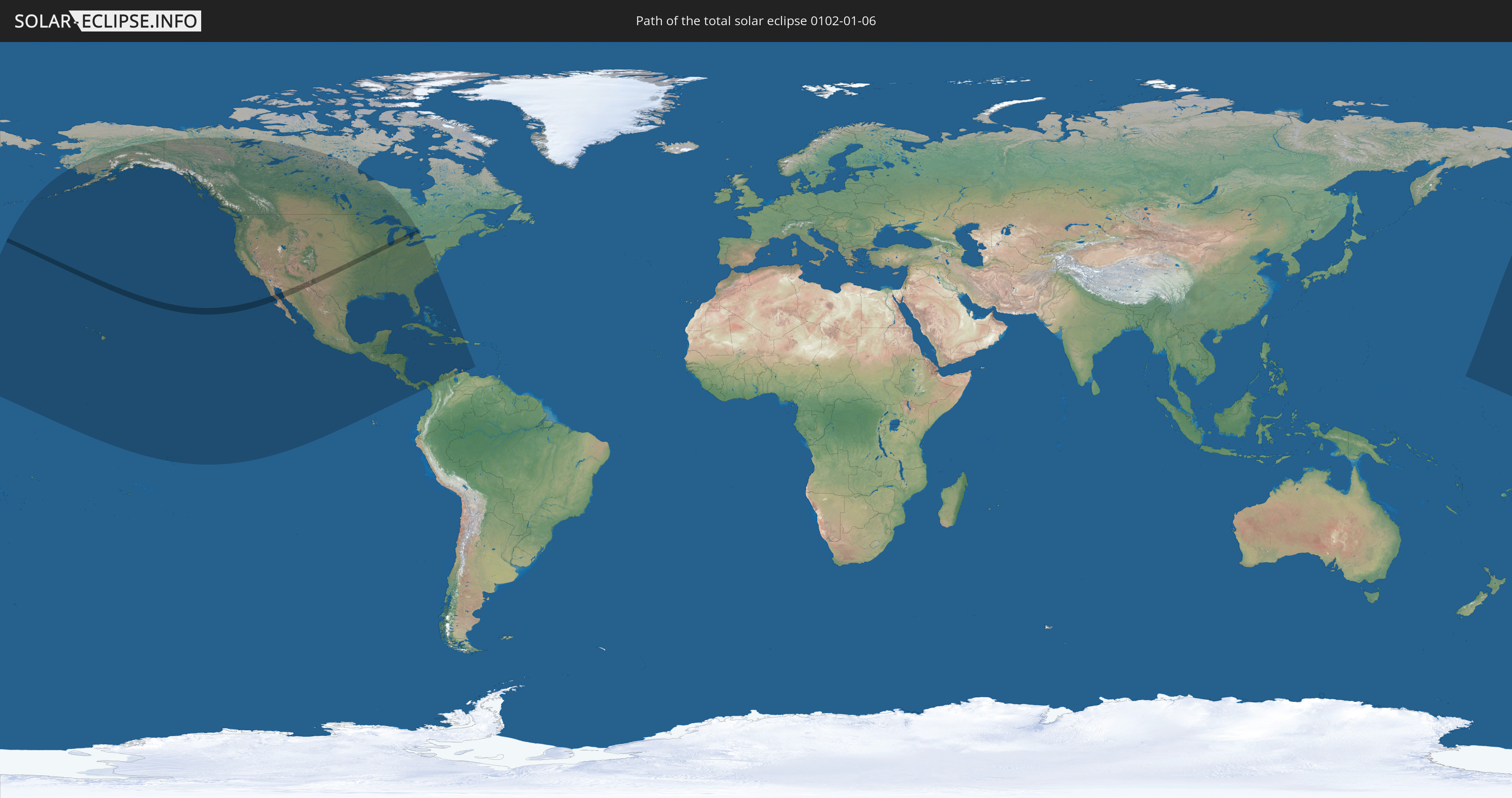
Die Sonnenfinsternis am 01/06/0102 kann man in 26 Ländern als partielle Sonnenfinsternis beobachten.
Der Finsternispfad verläuft durch 3 Länder. Nur in diesen Ländern ist sie als total Sonnenfinsternis zu sehen.
In den folgenden Ländern ist die Sonnenfinsternis total zu sehen
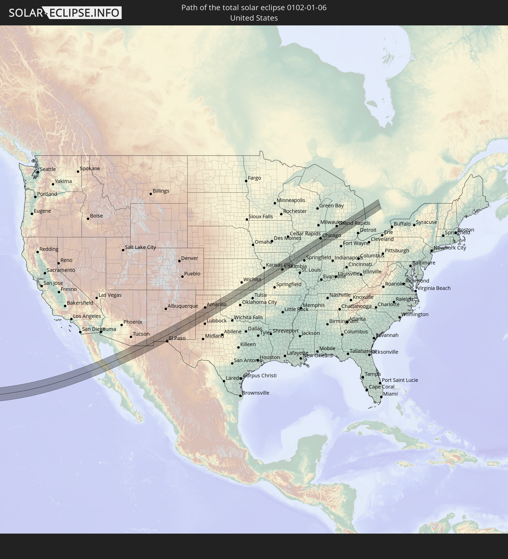 United States
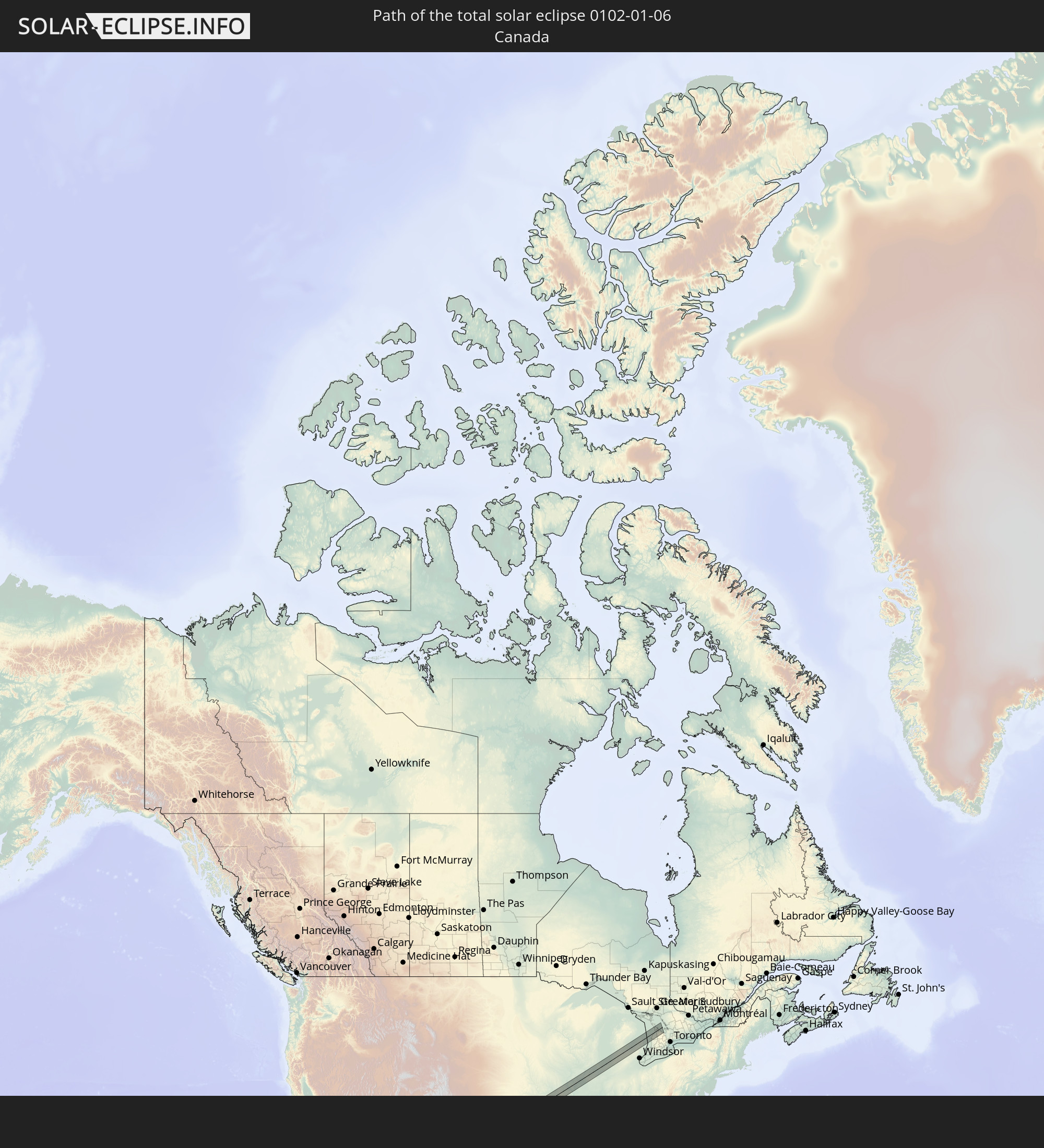 Canada
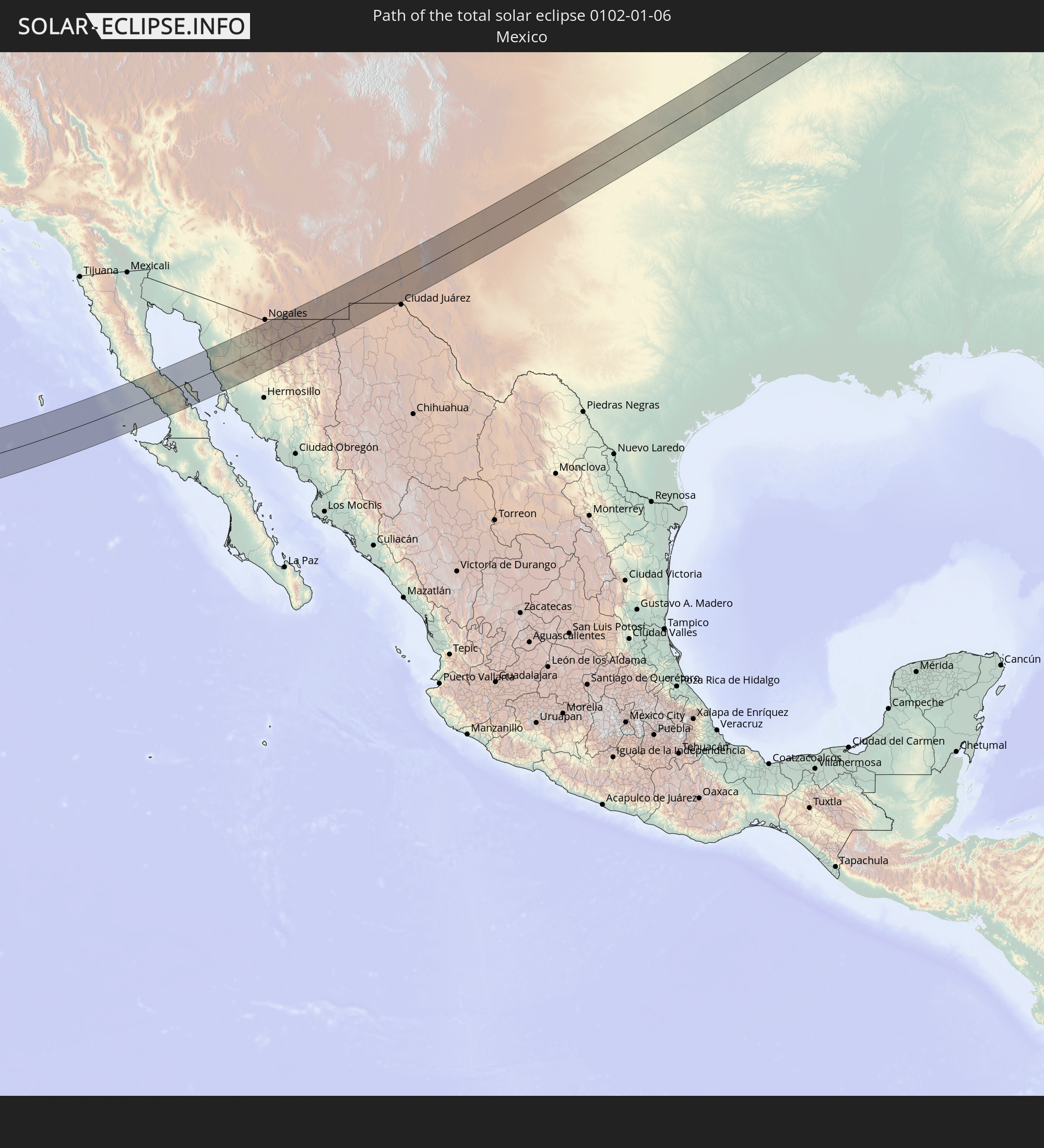 Mexico
In den folgenden Ländern ist die Sonnenfinsternis partiell zu sehen
 United States
 United States Minor Outlying Islands
 Kiribati
 French Polynesia
 Canada
 Mexico
 Greenland
 Guatemala
 Ecuador
 El Salvador
 Honduras
 Belize
 Nicaragua
 Costa Rica
 Cuba
Cuba
 Panama
 Colombia
 Cayman Islands
 The Bahamas
 Jamaica
 Haiti
Haiti
 Venezuela
 Turks and Caicos Islands
 Dominican Republic
 Aruba
Aruba
 Marshall Islands
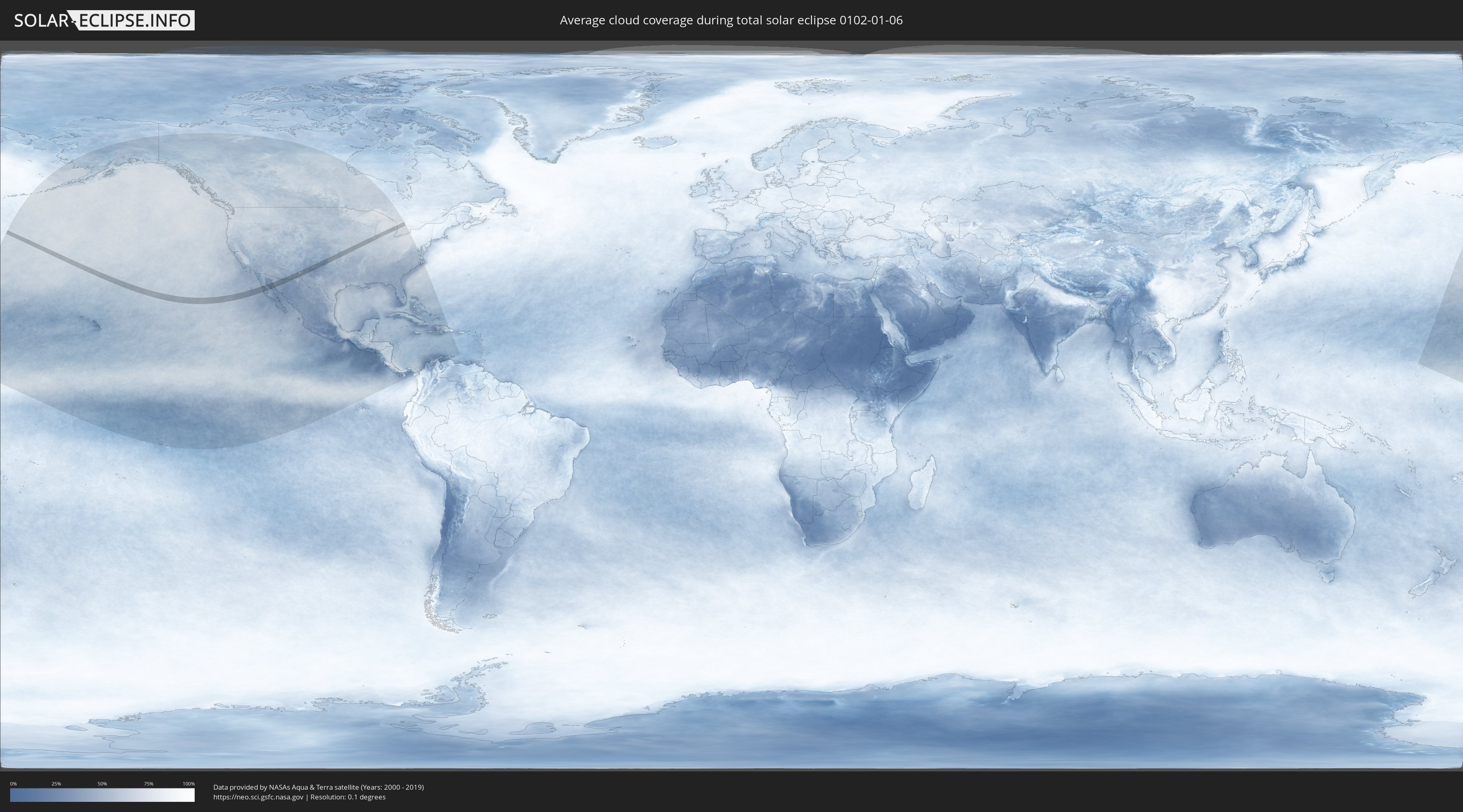
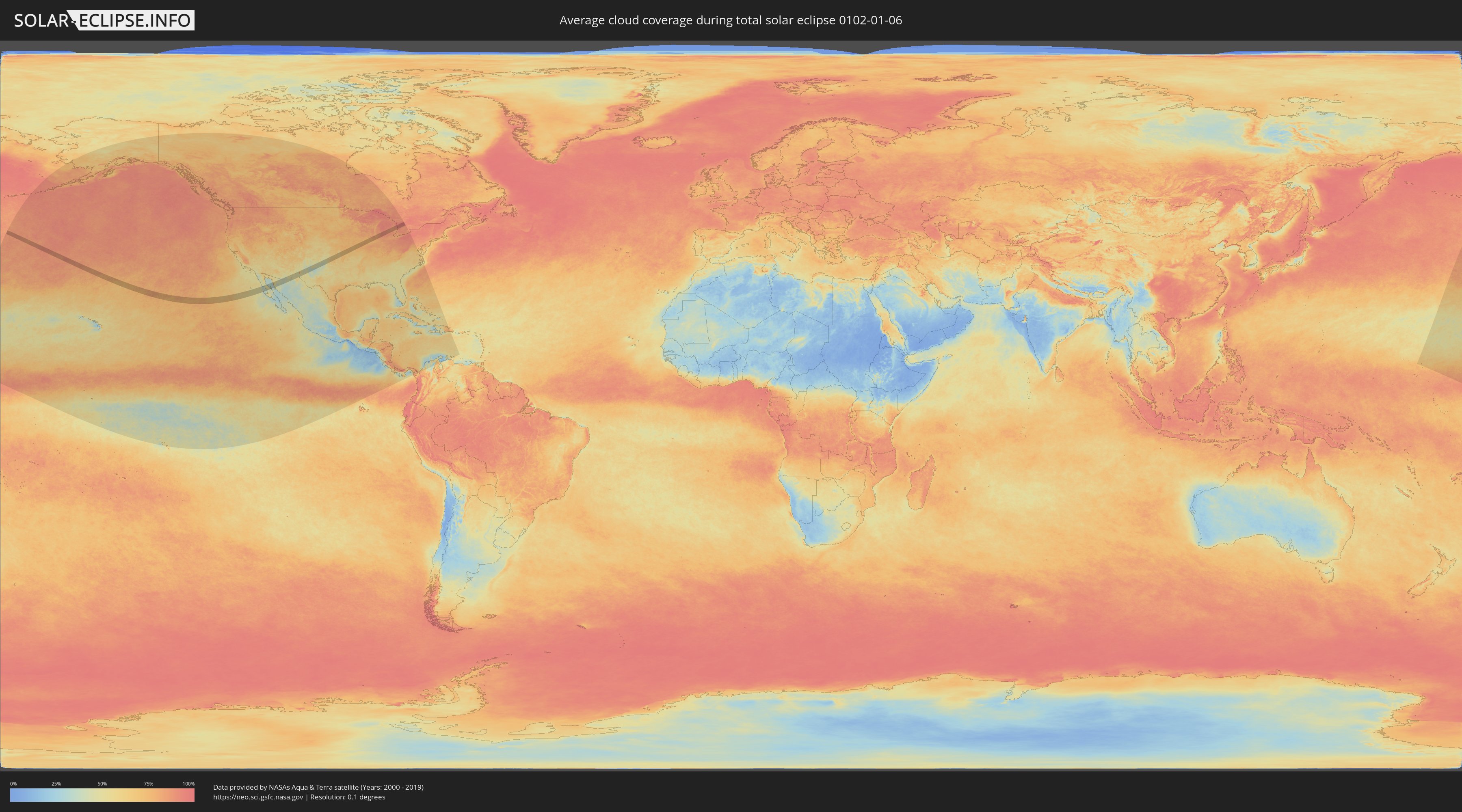
How will be the weather during the total solar eclipse on 01/06/0102?
Where is the best place to see the total solar eclipse of 01/06/0102?
The following maps show the average cloud coverage for the day of the total solar eclipse.
With the help of these maps, it is possible to find the place along the eclipse path, which has the best
chance of a cloudless sky.
Nevertheless, you should consider local circumstances and inform about the weather of your chosen
observation site.
The data is provided by NASAs satellites
AQUA and TERRA.
The cloud maps are averaged over a period of 19 years (2000 - 2019).
Detailed country maps
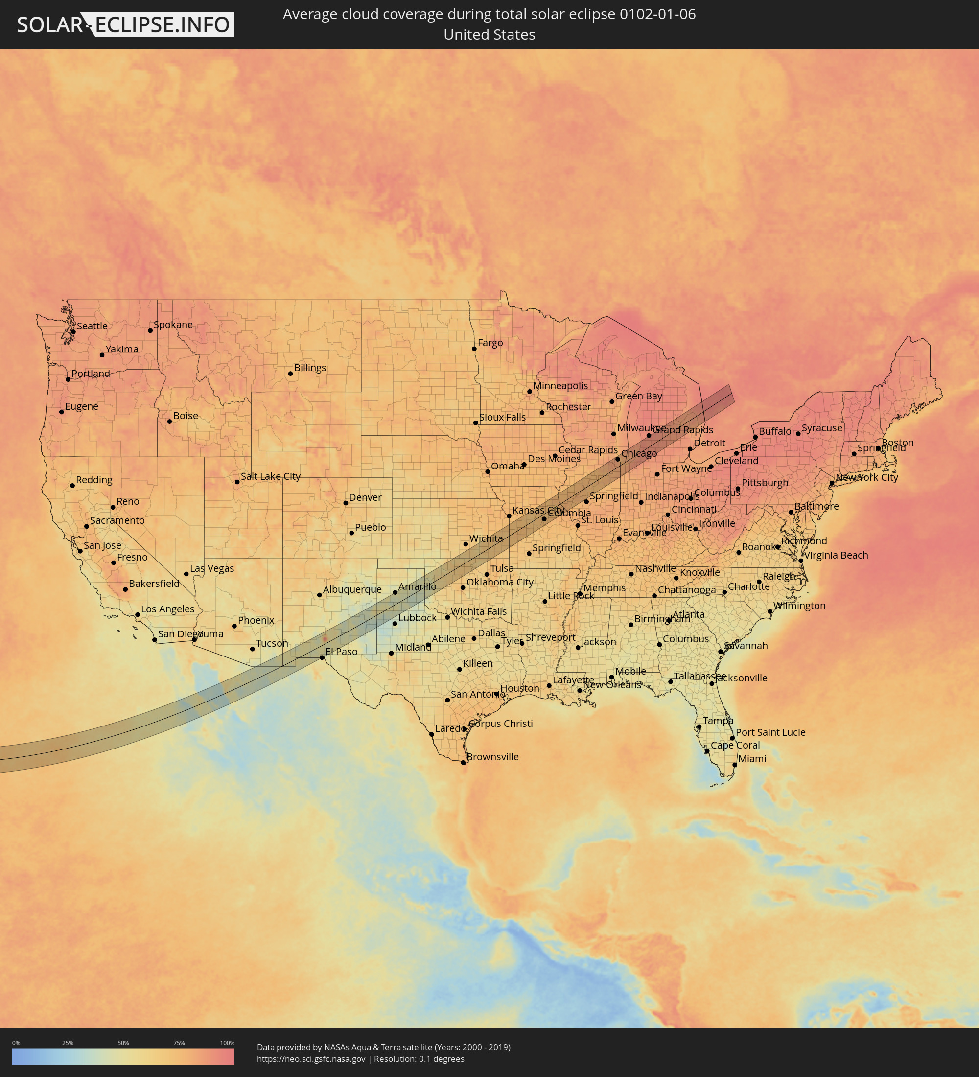 United States
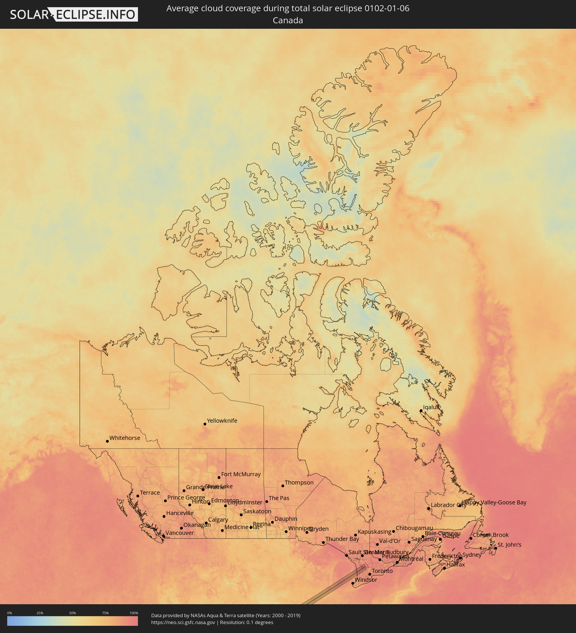 Canada
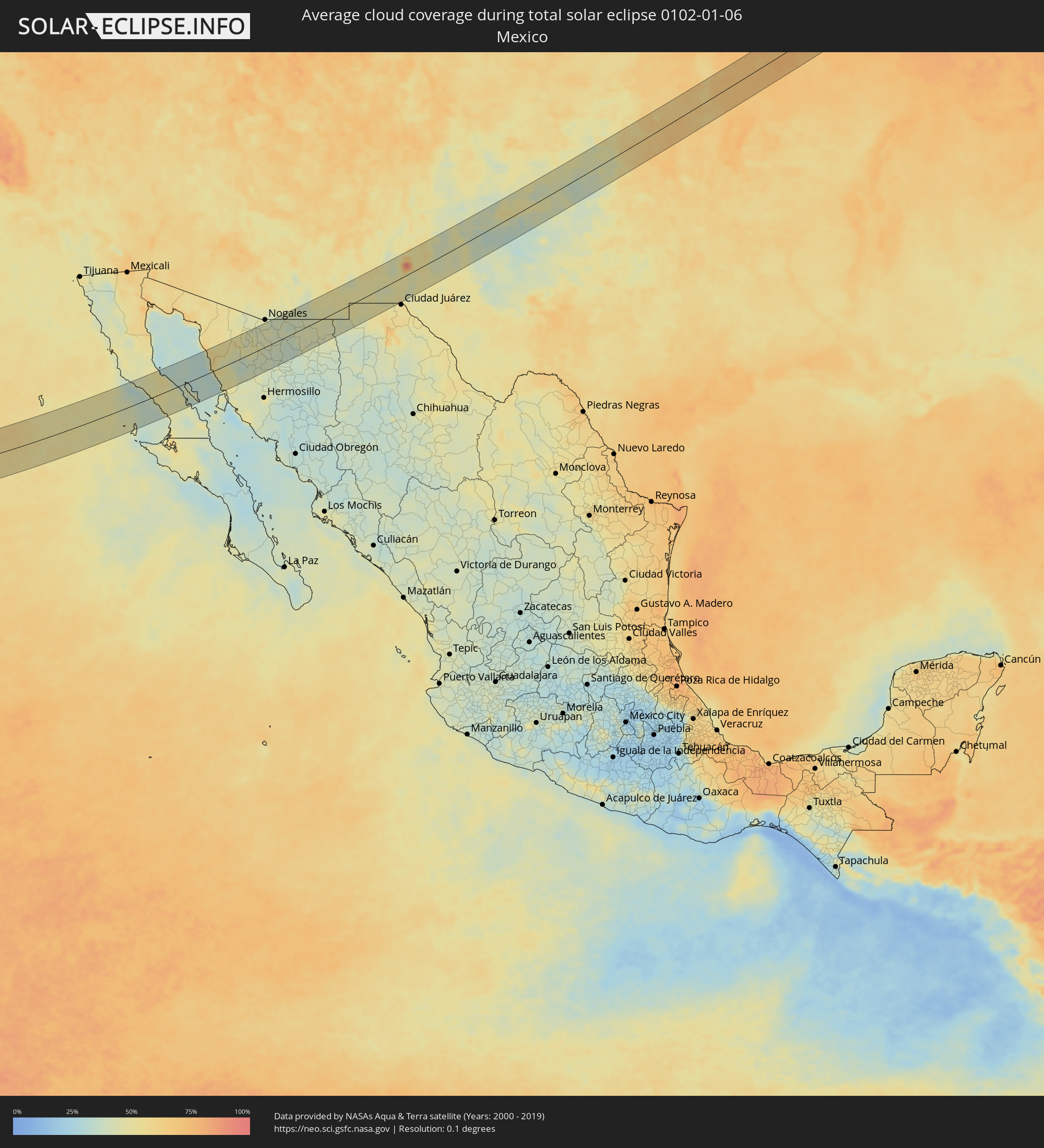 Mexico
Cities inside the path of the eclipse
The following table shows all locations with a population of more than 5,000 inside the eclipse path. Cities which have more than 100,000 inhabitants are marked bold. A click at the locations opens a detailed map.
| City | Type | Eclipse duration | Local time of max. eclipse | Distance to central line | Ø Cloud coverage |
|
Heroica Caborca, Sonora
|
total | - | 14:02:47 UTC-07:23 | 67 km | 51% |
|
Pitiquito, Sonora
|
total | - | 14:03:01 UTC-07:23 | 59 km | 50% |
|
Altar, Sonora
|
total | - | 14:03:26 UTC-07:23 | 54 km | 52% |
|
Santa Ana, Sonora
|
total | - | 14:04:57 UTC-07:23 | 7 km | 43% |
|
Benjamin Hill, Sonora
|
total | - | 14:05:07 UTC-07:23 | 31 km | 41% |
|
Magdalena de Kino, Sonora
|
total | - | 14:05:14 UTC-07:23 | 9 km | 43% |
|
Imuris, Sonora
|
total | - | 14:05:24 UTC-07:23 | 20 km | 42% |
|
Cananea, Sonora
|
total | - | 14:06:24 UTC-07:23 | 17 km | 44% |
|
Sierra Vista Southeast, Arizona
|
total | - | 14:30:12 UTC-07:00 | 61 km | 42% |
|
Naco, Sonora
|
total | - | 14:06:55 UTC-07:23 | 37 km | 39% |
|
Esqueda, Sonora
|
total | - | 14:07:52 UTC-07:23 | 39 km | 42% |
|
Agua Prieta, Sonora
|
total | - | 14:07:40 UTC-07:23 | 20 km | 43% |
|
Douglas, Arizona
|
total | - | 14:31:32 UTC-07:00 | 21 km | 43% |
|
Deming, New Mexico
|
total | - | 14:34:22 UTC-07:00 | 36 km | 50% |
|
Puerto Palomas, Chihuahua
|
total | - | 14:29:11 UTC-07:05 | 18 km | 50% |
|
Las Cruces, New Mexico
|
total | - | 14:36:04 UTC-07:00 | 3 km | 47% |
|
Sunland Park, New Mexico
|
total | - | 14:36:41 UTC-07:00 | 62 km | 51% |
|
Chaparral, New Mexico
|
total | - | 14:36:54 UTC-07:00 | 49 km | 47% |
|
Alamogordo, New Mexico
|
total | - | 14:37:08 UTC-07:00 | 18 km | 52% |
|
Roswell, New Mexico
|
total | - | 14:39:12 UTC-07:00 | 2 km | 49% |
|
Portales, New Mexico
|
total | - | 14:40:33 UTC-07:00 | 25 km | 48% |
|
Clovis, New Mexico
|
total | - | 14:40:37 UTC-07:00 | 40 km | 56% |
|
Hereford, Texas
|
total | - | 15:41:32 UTC-06:00 | 43 km | 46% |
|
Canyon, Texas
|
total | - | 15:42:08 UTC-06:00 | 37 km | 42% |
|
Amarillo, Texas
|
total | - | 15:42:05 UTC-06:00 | 56 km | 47% |
|
Plainview, Texas
|
total | - | 15:42:58 UTC-06:00 | 49 km | 41% |
|
Pampa, Texas
|
total | - | 15:43:05 UTC-06:00 | 46 km | 47% |
|
Elk City, Oklahoma
|
total | - | 15:45:17 UTC-06:00 | 38 km | 51% |
|
Enid, Oklahoma
|
total | - | 15:46:29 UTC-06:00 | 14 km | 64% |
|
Ponca City, Oklahoma
|
total | - | 15:47:12 UTC-06:00 | 21 km | 64% |
|
Arkansas City, Kansas
|
total | - | 15:46:59 UTC-06:00 | 10 km | 63% |
|
Winfield, Kansas
|
total | - | 15:46:53 UTC-06:00 | 25 km | 63% |
|
Warrensburg, Missouri
|
total | - | 15:49:12 UTC-06:00 | 19 km | 71% |
|
Sedalia, Missouri
|
total | - | 15:49:46 UTC-06:00 | 10 km | 72% |
|
Marshall, Missouri
|
total | - | 15:49:25 UTC-06:00 | 28 km | 67% |
|
Moberly, Missouri
|
total | - | 15:49:54 UTC-06:00 | 21 km | 73% |
|
Columbia, Missouri
|
total | - | 15:50:26 UTC-06:00 | 28 km | 75% |
|
Quincy, Illinois
|
total | - | 15:50:24 UTC-06:00 | 22 km | 76% |
|
Hannibal, Missouri
|
total | - | 15:50:39 UTC-06:00 | 2 km | 77% |
|
Macomb, Illinois
|
total | - | 15:50:34 UTC-06:00 | 37 km | 75% |
|
Jacksonville, Illinois
|
total | - | 15:51:39 UTC-06:00 | 51 km | 74% |
|
Canton, Illinois
|
total | - | 15:51:02 UTC-06:00 | 18 km | 77% |
|
Peoria, Illinois
|
total | - | 15:51:17 UTC-06:00 | 10 km | 77% |
|
Washington, Illinois
|
total | - | 15:51:26 UTC-06:00 | 3 km | 75% |
|
Bloomington, Illinois
|
total | - | 15:52:00 UTC-06:00 | 37 km | 75% |
|
Ottawa, Illinois
|
total | - | 15:51:16 UTC-06:00 | 37 km | 76% |
|
Streator, Illinois
|
total | - | 15:51:30 UTC-06:00 | 16 km | 75% |
|
Pontiac, Illinois
|
total | - | 15:51:54 UTC-06:00 | 16 km | 78% |
|
Yorkville, Illinois
|
total | - | 15:51:18 UTC-06:00 | 47 km | 79% |
|
Morris, Illinois
|
total | - | 15:51:36 UTC-06:00 | 19 km | 79% |
|
Channahon, Illinois
|
total | - | 15:51:41 UTC-06:00 | 17 km | 82% |
|
Plainfield, Illinois
|
total | - | 15:51:30 UTC-06:00 | 35 km | 82% |
|
Naperville, Illinois
|
total | - | 15:51:23 UTC-06:00 | 47 km | 84% |
|
Joliet, Illinois
|
total | - | 15:51:42 UTC-06:00 | 20 km | 81% |
|
Elmhurst, Illinois
|
total | - | 15:51:26 UTC-06:00 | 48 km | 83% |
|
Kankakee, Illinois
|
total | - | 15:52:17 UTC-06:00 | 28 km | 81% |
|
Orland Park, Illinois
|
total | - | 15:51:47 UTC-06:00 | 19 km | 83% |
|
Lincolnwood, Illinois
|
total | - | 15:51:29 UTC-06:00 | 48 km | 84% |
|
Evergreen Park, Illinois
|
total | - | 15:51:48 UTC-06:00 | 21 km | 82% |
|
Park Forest, Illinois
|
total | - | 15:52:03 UTC-06:00 | 2 km | 82% |
|
Chicago, Illinois
|
total | - | 15:51:43 UTC-06:00 | 30 km | 84% |
|
Hammond, Indiana
|
total | - | 15:52:06 UTC-06:00 | 1 km | 81% |
|
Cedar Lake, Indiana
|
total | - | 15:52:22 UTC-06:00 | 24 km | 80% |
|
Merrillville, Indiana
|
total | - | 15:52:20 UTC-06:00 | 18 km | 80% |
|
Portage, Indiana
|
total | - | 15:52:21 UTC-06:00 | 17 km | 81% |
|
Michigan City, Indiana
|
total | - | 15:52:26 UTC-06:00 | 17 km | 86% |
|
LaPorte, Indiana
|
total | - | 15:52:40 UTC-06:00 | 34 km | 87% |
|
Niles, Michigan
|
total | - | 16:52:47 UTC-05:00 | 34 km | 89% |
|
South Bend, Indiana
|
total | - | 16:52:56 UTC-05:00 | 48 km | 88% |
|
Holland, Michigan
|
total | - | 16:51:53 UTC-05:00 | 49 km | 90% |
|
Grand Rapids, Michigan
|
total | - | 16:52:01 UTC-05:00 | 46 km | 90% |
|
Kalamazoo, Michigan
|
total | - | 16:52:47 UTC-05:00 | 21 km | 91% |
|
Battle Creek, Michigan
|
total | - | 16:53:02 UTC-05:00 | 37 km | 90% |
|
Lansing, Michigan
|
total | - | 16:53:01 UTC-05:00 | 25 km | 89% |
|
Midland, Michigan
|
total | - | 16:52:16 UTC-05:00 | 43 km | 86% |
|
Owosso, Michigan
|
total | - | 16:52:59 UTC-05:00 | 17 km | 86% |
|
Saginaw, Michigan
|
total | - | 16:52:41 UTC-05:00 | 12 km | 87% |
|
Bay City, Michigan
|
total | - | 16:52:32 UTC-05:00 | 25 km | 86% |
|
Flint, Michigan
|
total | - | 16:53:17 UTC-05:00 | 38 km | 88% |
|
Kincardine, Ontario
|
total | - | 16:53:14 UTC-05:00 | 18 km | 93% |
|
Owen Sound, Ontario
|
total | - | 16:53:12 UTC-05:00 | 13 km | 94% |