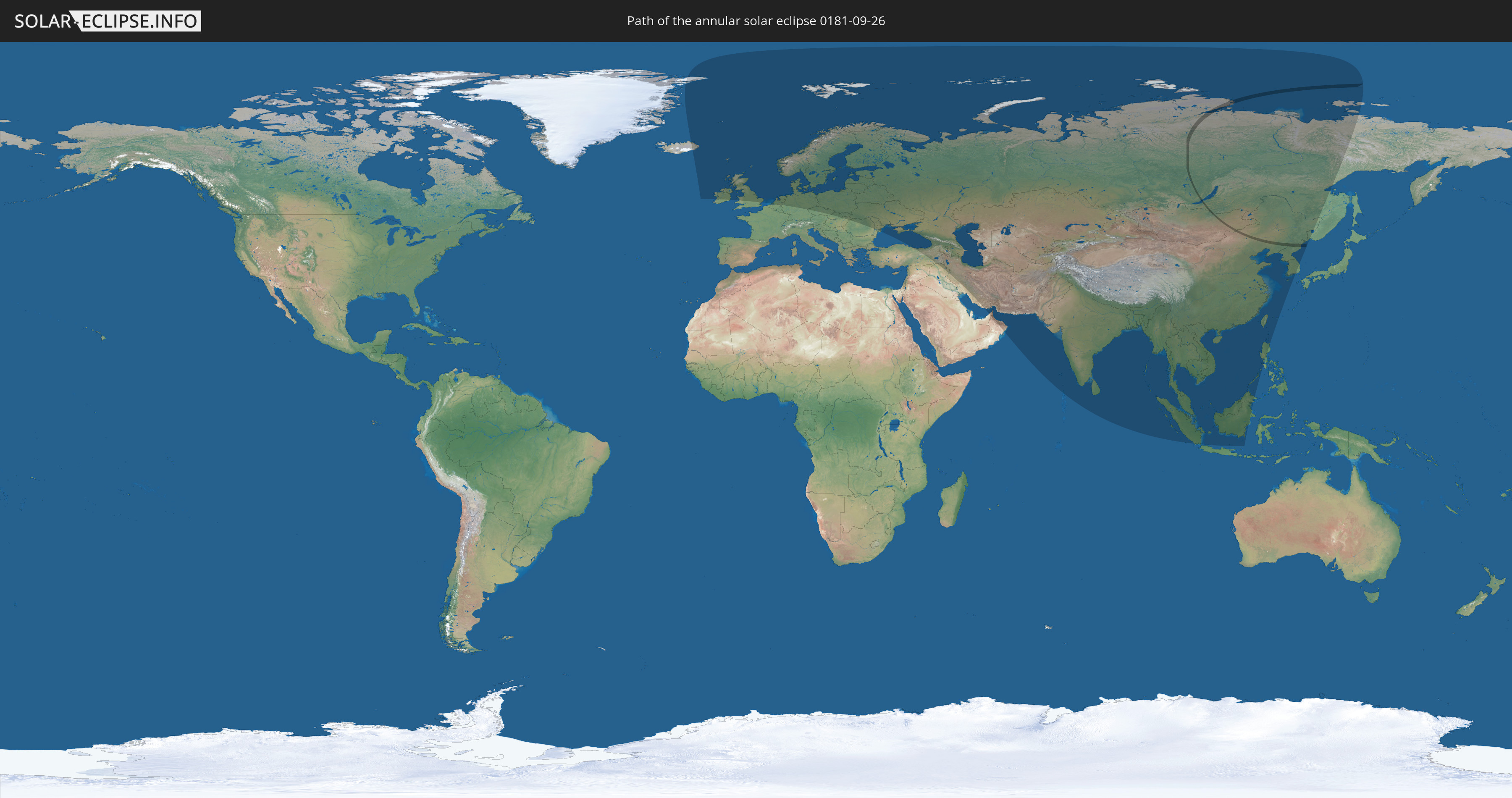
Annular solar eclipse of 09/26/0181
| Day of week: | Wednesday |
| Maximum duration of eclipse: | 00m09s |
| Maximum width of eclipse path: | 23 km |
| Saros cycle: | 66 |
| Coverage: | 99.8% |
| Magnitude: | 0.9978 |
| Gamma: | 0.9426 |
Wo kann man die Sonnenfinsternis vom 09/26/0181 sehen?
Die Sonnenfinsternis am 09/26/0181 kann man in 66 Ländern als partielle Sonnenfinsternis beobachten.
Der Finsternispfad verläuft durch 4 Länder. Nur in diesen Ländern ist sie als annular Sonnenfinsternis zu sehen.
In den folgenden Ländern ist die Sonnenfinsternis annular zu sehen
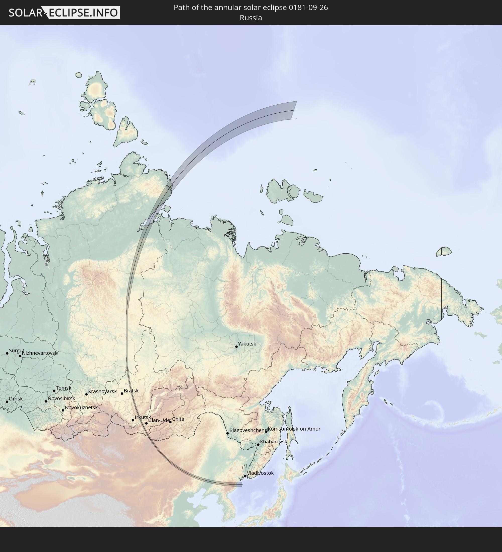 Russia
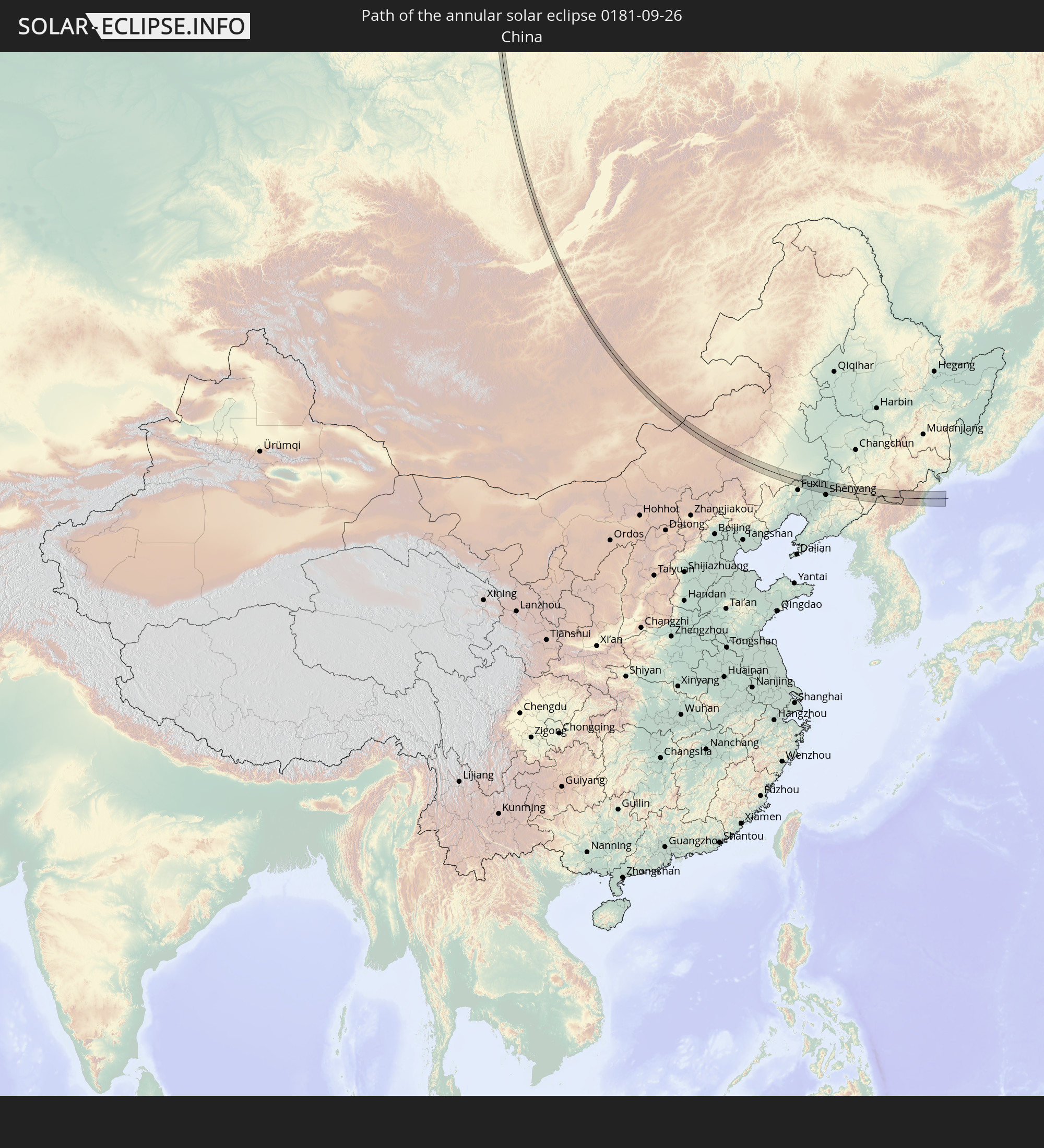 China
China
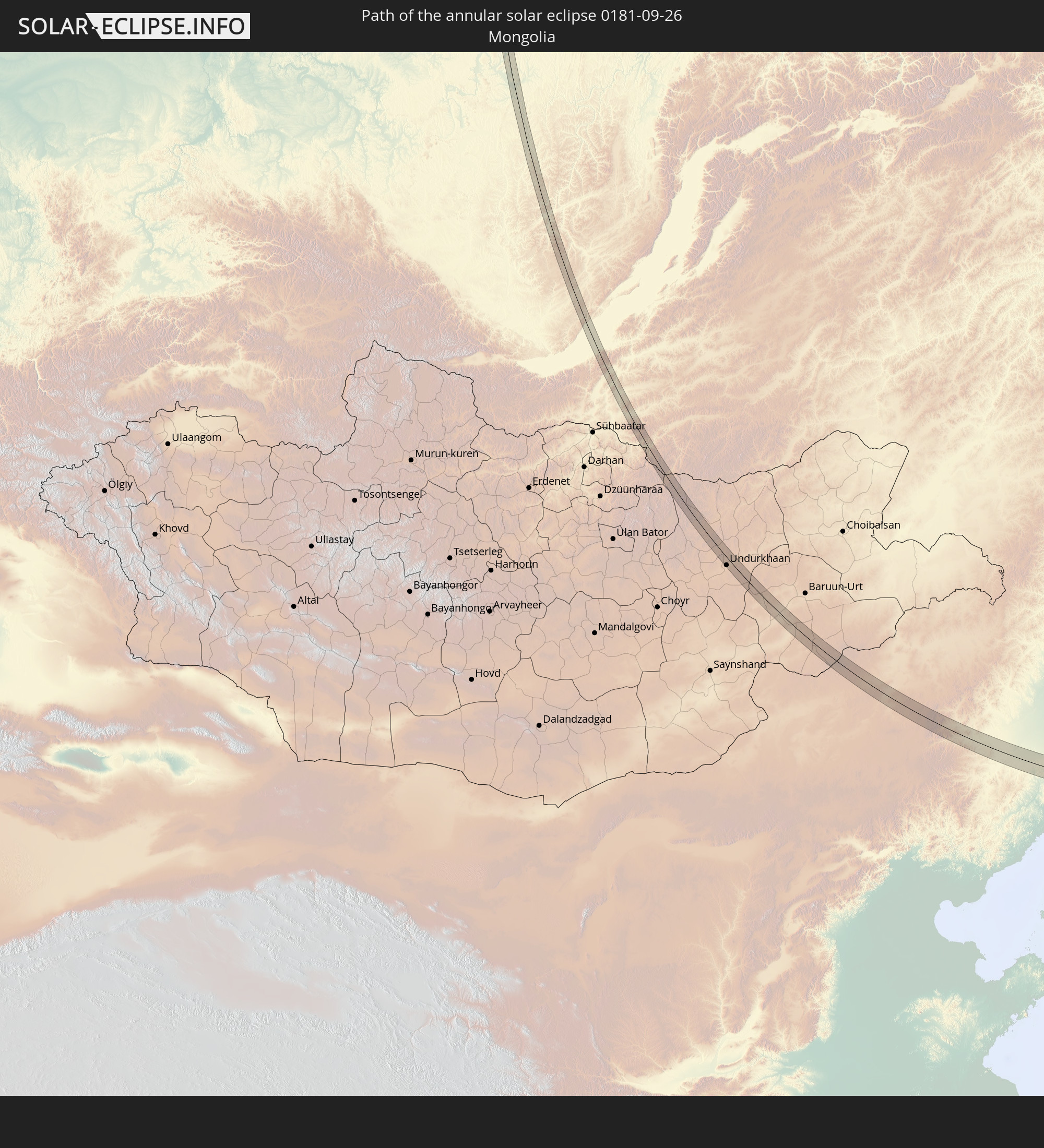 Mongolia
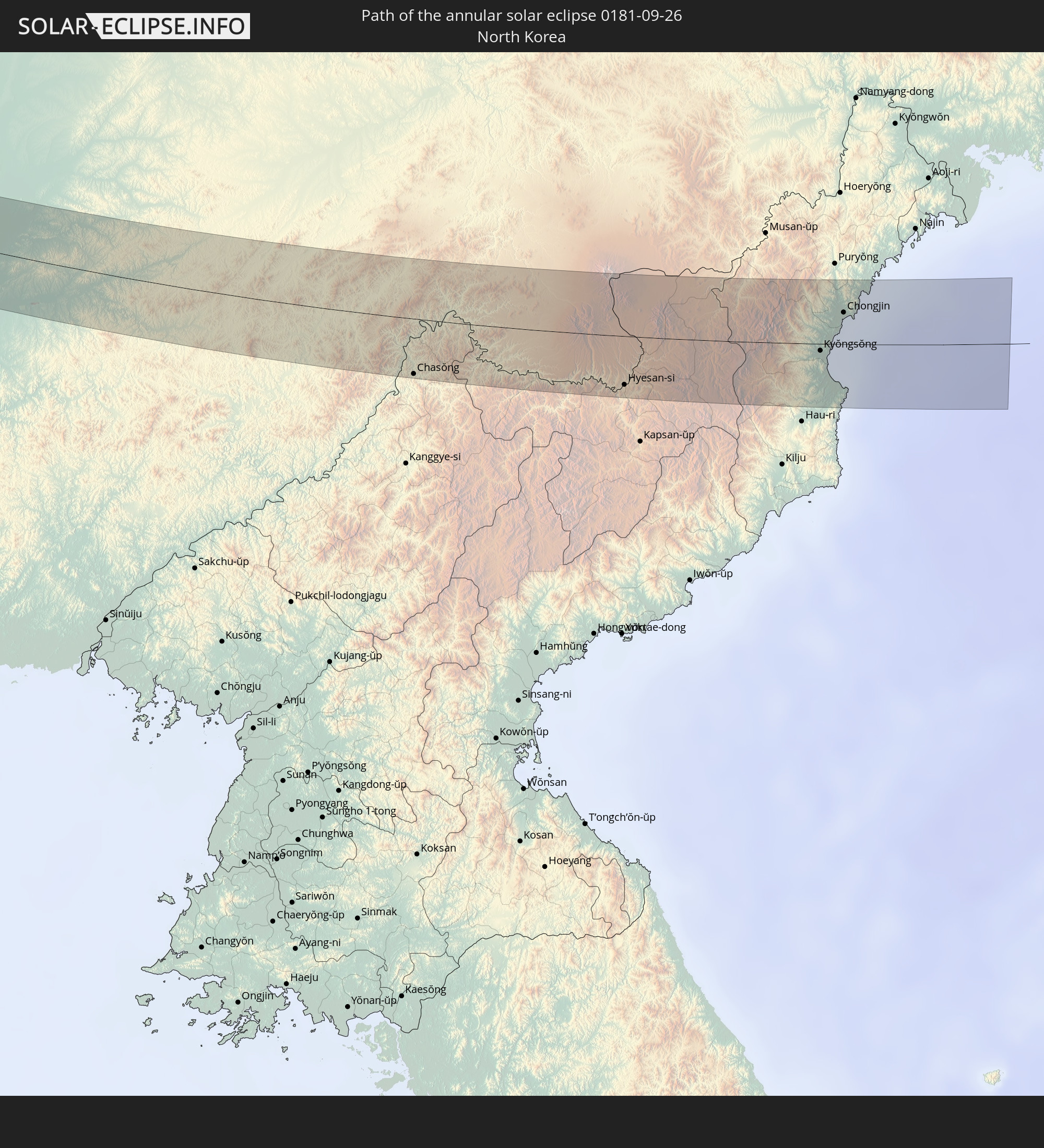 North Korea
In den folgenden Ländern ist die Sonnenfinsternis partiell zu sehen
 Russia
 Greenland
 Iceland
 Republic of Ireland
 Svalbard and Jan Mayen
 United Kingdom
 Faroe Islands
 Isle of Man
 Belgium
 Netherlands
 Norway
 Germany
 Denmark
 Sweden
 Czechia
 Poland
 Hungary
 Slovakia
 Åland Islands
 Romania
 Finland
 Lithuania
 Latvia
 Estonia
 Ukraine
 Belarus
 Turkey
 Moldova
 Iraq
Iraq
 Georgia
 Armenia
 Iran
Iran
 Azerbaijan
 Kazakhstan
 United Arab Emirates
 Oman
Oman
 Turkmenistan
 Uzbekistan
 Afghanistan
 Pakistan
 Tajikistan
 India
India
 Kyrgyzstan
 Maldives
 China
China
 Sri Lanka
 Nepal
Nepal
 Mongolia
 Bangladesh
 Bhutan
 Myanmar
 Indonesia
 Thailand
 Malaysia
 Laos
Laos
 Vietnam
 Cambodia
 Singapore
 Macau
Macau
 Hong Kong
 Brunei
 Taiwan
 Philippines
 Japan
Japan
 North Korea
 South Korea
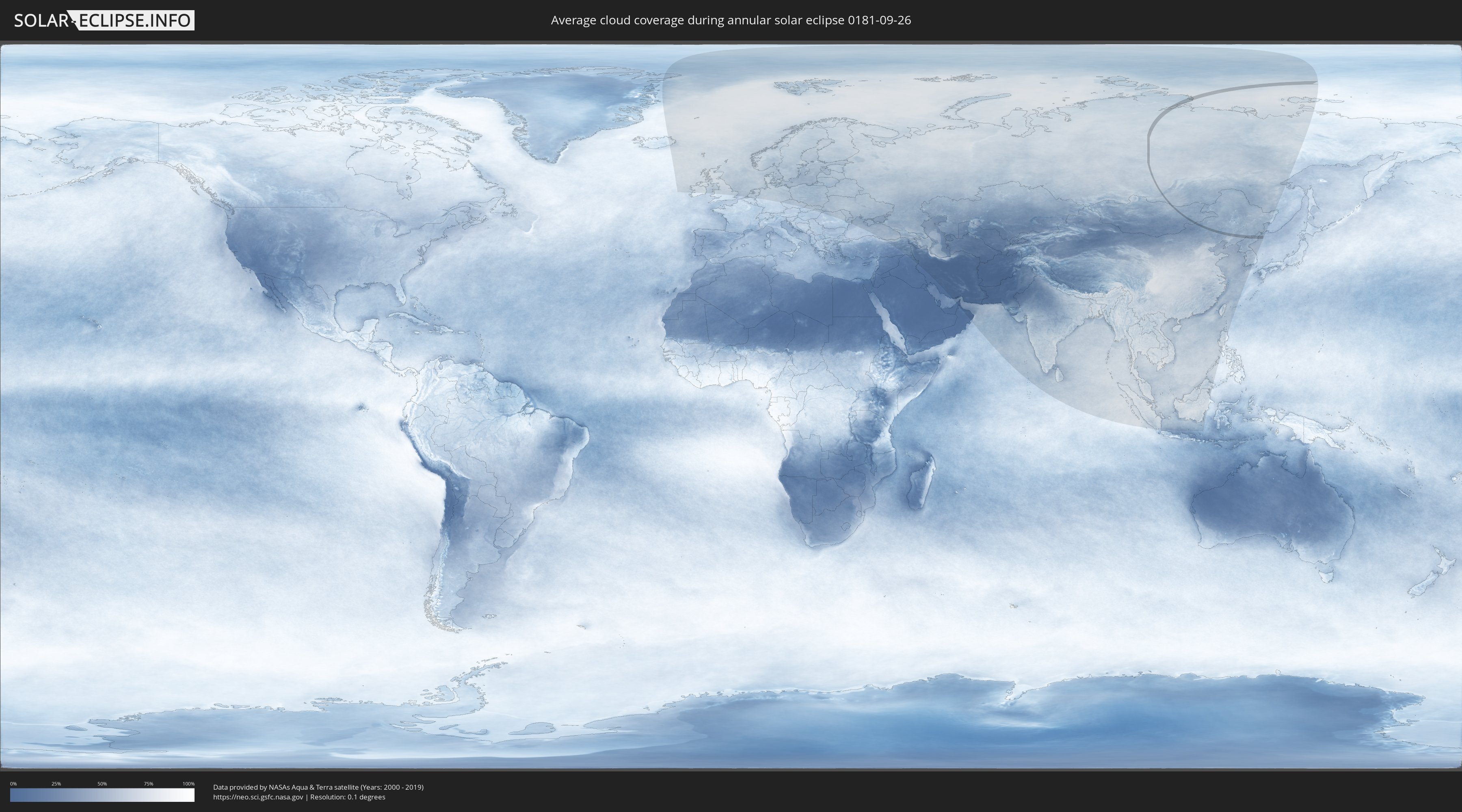
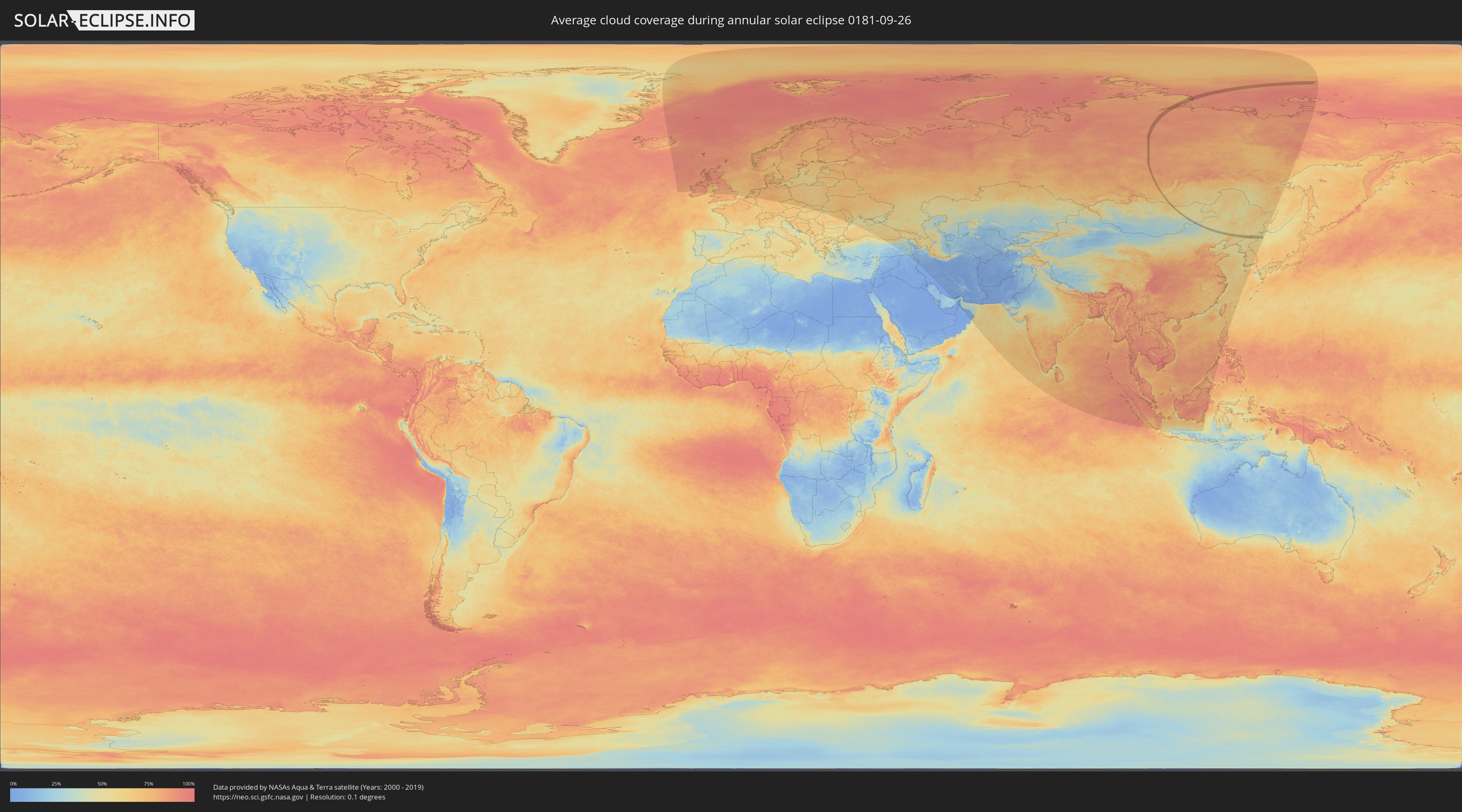
How will be the weather during the annular solar eclipse on 09/26/0181?
Where is the best place to see the annular solar eclipse of 09/26/0181?
The following maps show the average cloud coverage for the day of the annular solar eclipse.
With the help of these maps, it is possible to find the place along the eclipse path, which has the best
chance of a cloudless sky.
Nevertheless, you should consider local circumstances and inform about the weather of your chosen
observation site.
The data is provided by NASAs satellites
AQUA and TERRA.
The cloud maps are averaged over a period of 19 years (2000 - 2019).
Detailed country maps
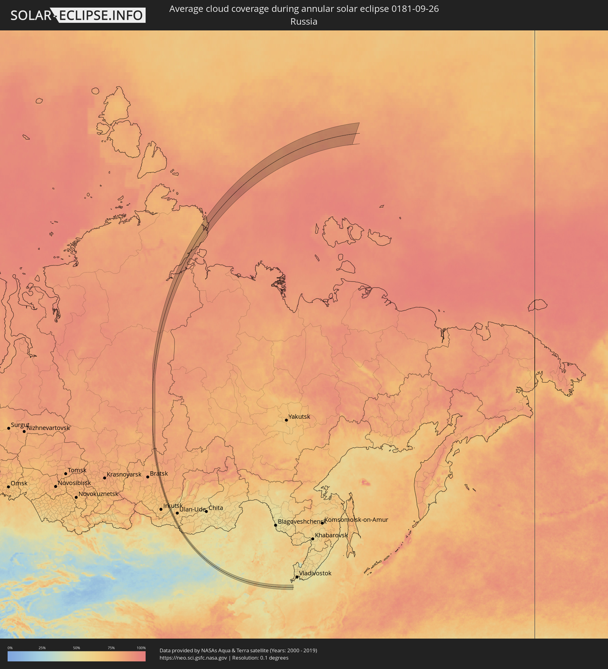 Russia
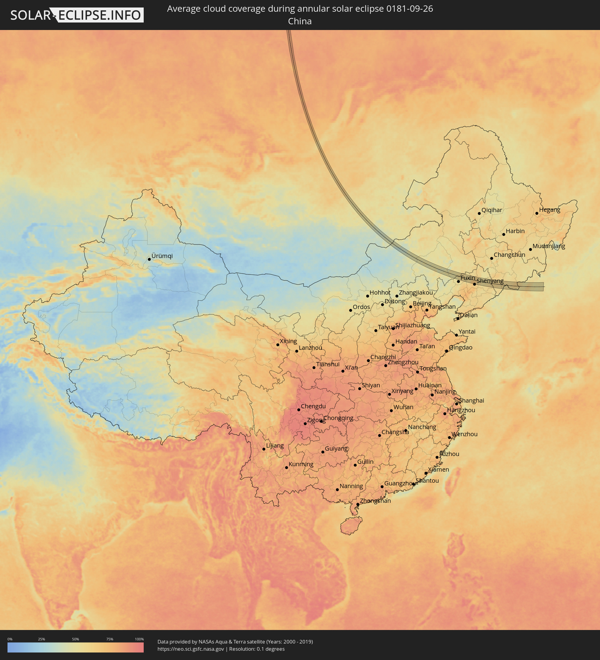 China
China
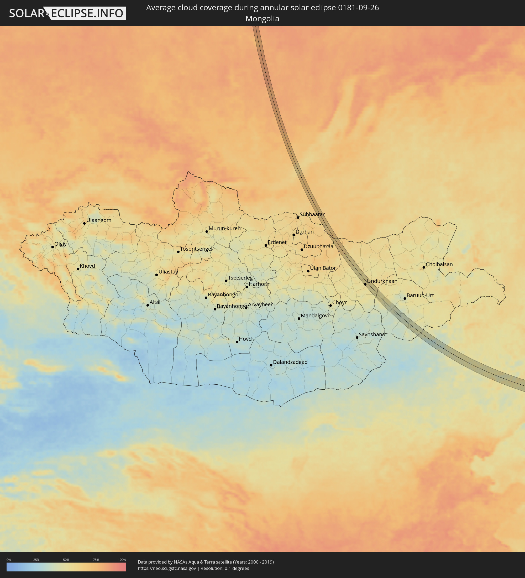 Mongolia
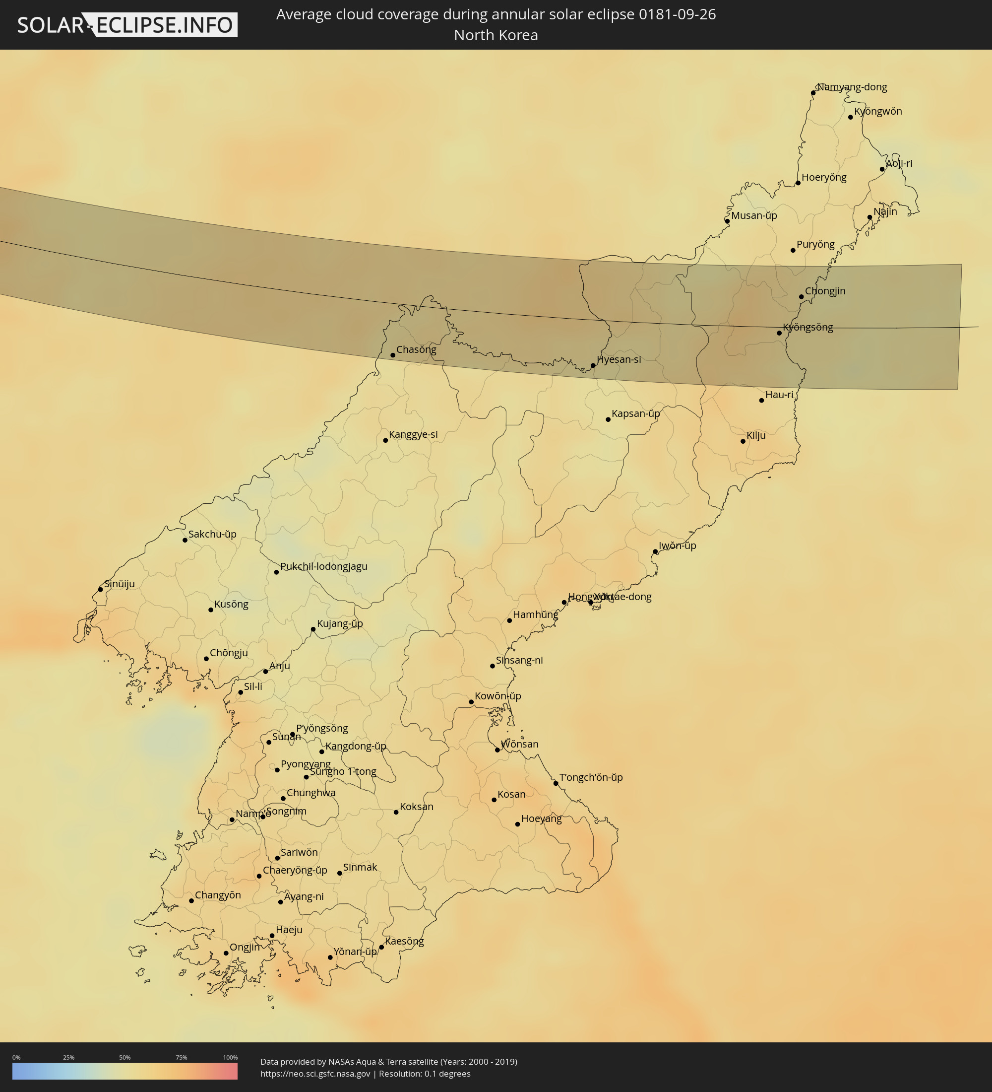 North Korea
Cities inside the path of the eclipse
The following table shows all locations with a population of more than 5,000 inside the eclipse path. Cities which have more than 100,000 inhabitants are marked bold. A click at the locations opens a detailed map.
| City | Type | Eclipse duration | Local time of max. eclipse | Distance to central line | Ø Cloud coverage |
|
Bichura, Respublika Buryatiya
|
annular | - | 15:36:14 UTC+06:57 | 9 km | 62% |
|
Undurkhaan, Hentiy
|
annular | - | 15:54:52 UTC+07:07 | 13 km | 53% |
|
Xinmin, Liaoning
|
annular | - | 17:02:24 UTC+08:00 | 28 km | 59% |
|
Hushitai, Liaoning
|
annular | - | 17:02:39 UTC+08:00 | 22 km | 59% |
|
Tieling, Liaoning
|
annular | - | 17:02:03 UTC+08:00 | 23 km | 61% |
|
Fushun, Liaoning
|
annular | - | 17:02:53 UTC+08:00 | 23 km | 58% |
|
Erdaojiang, Jilin
|
annular | - | 17:03:24 UTC+08:00 | 4 km | 58% |
|
Baishan, Jilin
|
annular | - | 17:03:09 UTC+08:00 | 18 km | 58% |
|
Sanchazi, Jilin
|
annular | - | 17:02:55 UTC+08:00 | 35 km | 58% |
|
Chasŏng, Chagang-do
|
annular | - | 17:27:04 UTC+08:23 | 33 km | 50% |
|
Linjiang, Jilin
|
annular | - | 17:03:27 UTC+08:00 | 7 km | 53% |
|
Hepingjie, Jilin
|
annular | - | 17:03:00 UTC+08:00 | 35 km | 59% |
|
Hyesan-si, Yanggang-do
|
annular | - | 17:27:20 UTC+08:23 | 29 km | 51% |
|
Hyesan-dong, Yanggang-do
|
annular | - | 17:27:21 UTC+08:23 | 30 km | 51% |
|
Kyŏngsŏng, Hamgyŏng-bukto
|
annular | - | 17:27:07 UTC+08:23 | 4 km | 55% |
|
Sŭngam-nodongjagu, Hamgyŏng-bukto
|
annular | - | 17:26:58 UTC+08:23 | 5 km | 54% |
|
Hoemul-li, Hamgyŏng-bukto
|
annular | - | 17:27:24 UTC+08:23 | 21 km | 50% |
|
Nanam, Hamgyŏng-bukto
|
annular | - | 17:26:54 UTC+08:23 | 10 km | 54% |
|
Chongjin, Hamgyŏng-bukto
|
annular | - | 17:26:45 UTC+08:23 | 19 km | 53% |