Annular solar eclipse of 11/04/0598
| Day of week: | Sunday |
| Maximum duration of eclipse: | 01m13s |
| Maximum width of eclipse path: | 40 km |
| Saros cycle: | 91 |
| Coverage: | 98.9% |
| Magnitude: | 0.9888 |
| Gamma: | -0.0271 |
Wo kann man die Sonnenfinsternis vom 11/04/0598 sehen?
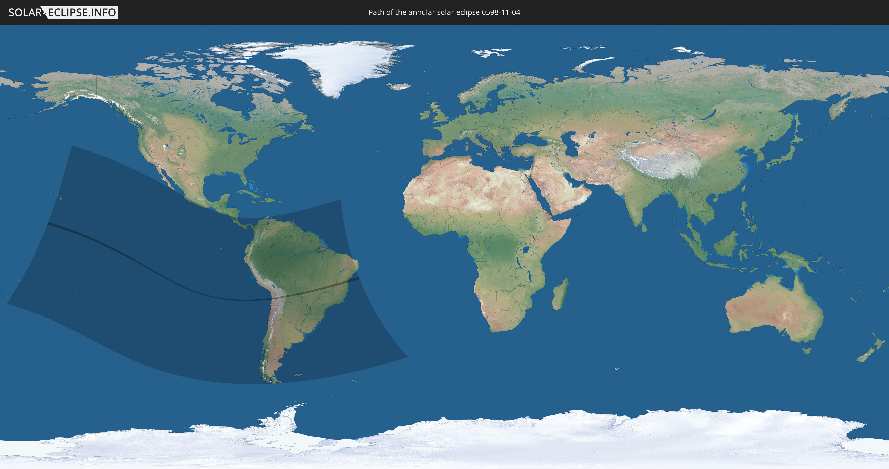
Die Sonnenfinsternis am 11/04/0598 kann man in 33 Ländern als partielle Sonnenfinsternis beobachten.
Der Finsternispfad verläuft durch 4 Länder. Nur in diesen Ländern ist sie als annular Sonnenfinsternis zu sehen.
In den folgenden Ländern ist die Sonnenfinsternis annular zu sehen
 Chile
Chile
 Brazil
 Bolivia
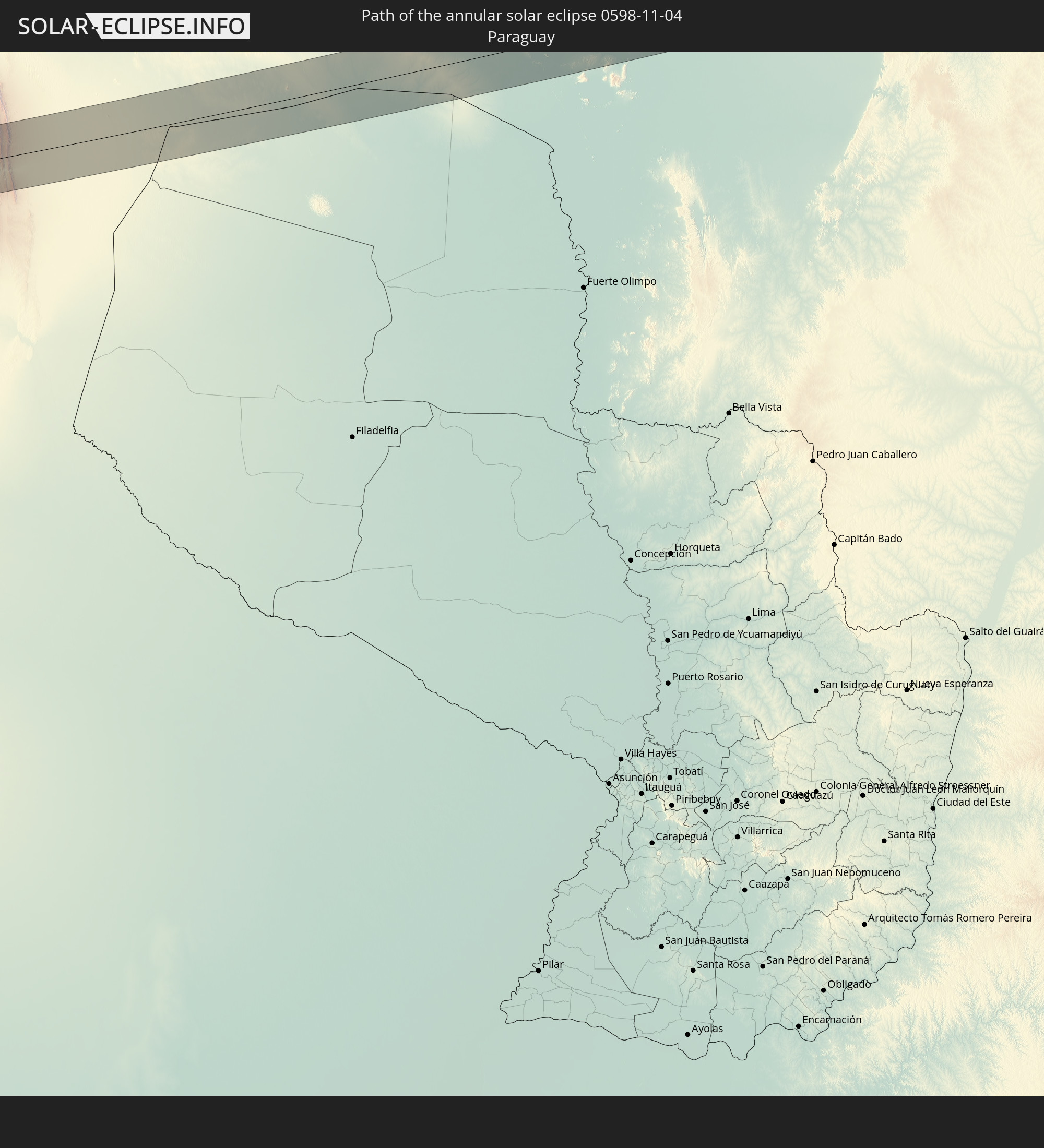 Paraguay
In den folgenden Ländern ist die Sonnenfinsternis partiell zu sehen
 United States
 United States Minor Outlying Islands
 Tonga
Tonga
 Kiribati
 Samoa
Samoa
 American Samoa
 Niue
Niue
 Cook Islands
 French Polynesia
 Pitcairn Islands
 Mexico
 Chile
Chile
 Ecuador
 Nicaragua
 Costa Rica
 Panama
 Colombia
 Peru
Peru
 Brazil
 Argentina
 Venezuela
 Bolivia
 Paraguay
 Trinidad and Tobago
 Grenada
 Saint Vincent and the Grenadines
 Falkland Islands
 Guyana
 Saint Lucia
 Barbados
 Uruguay
 Suriname
 French Guiana
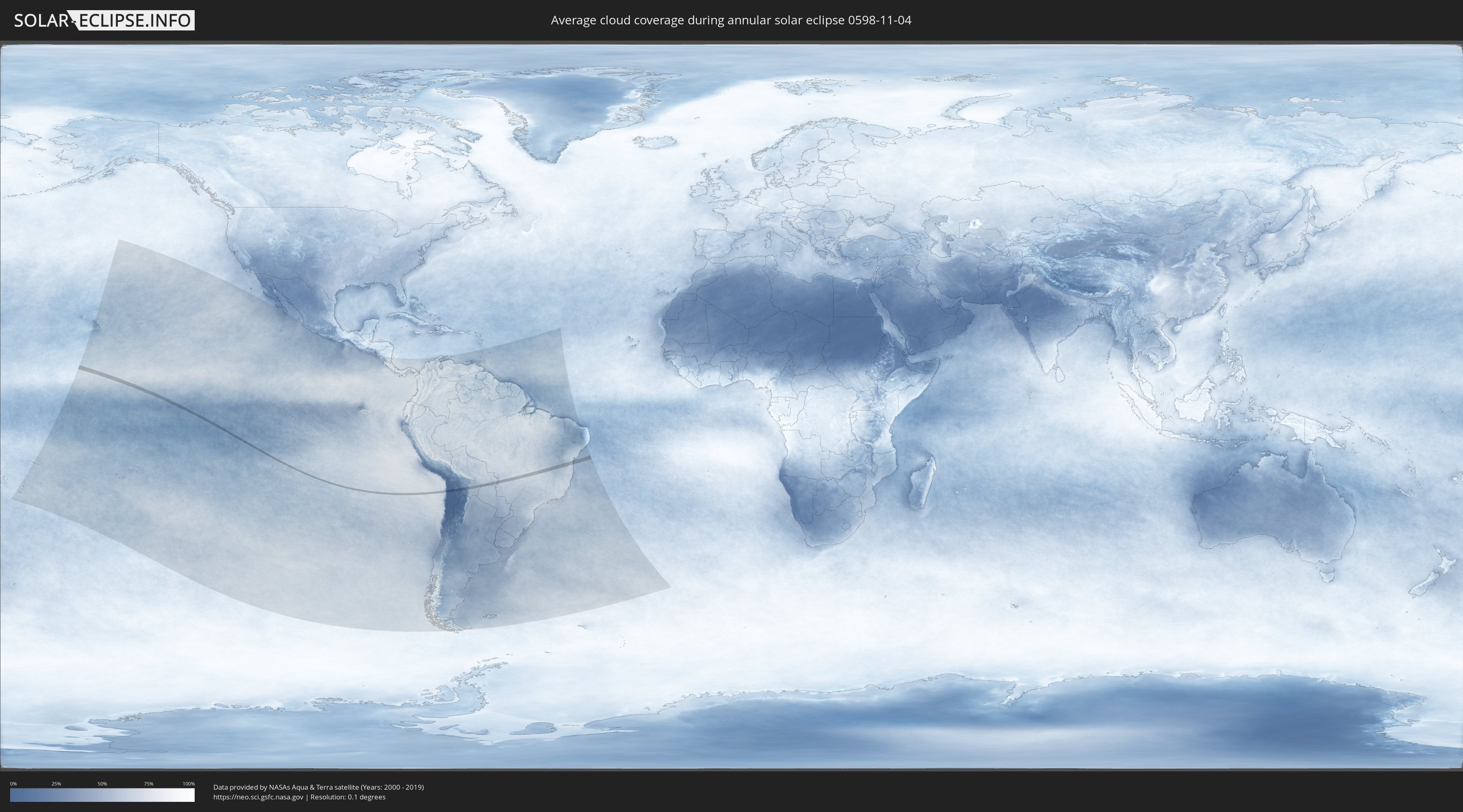
How will be the weather during the annular solar eclipse on 11/04/0598?
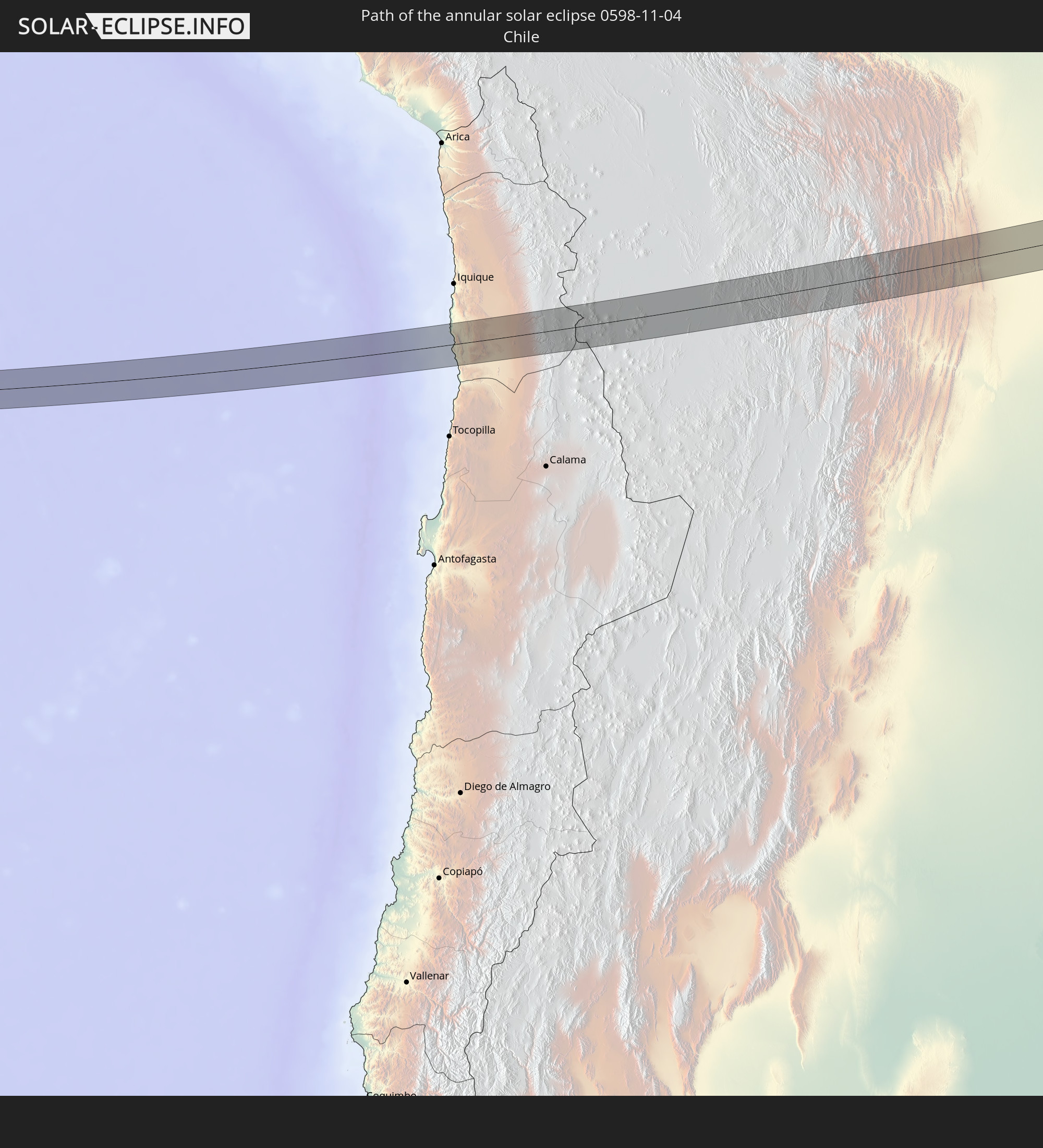
Where is the best place to see the annular solar eclipse of 11/04/0598?
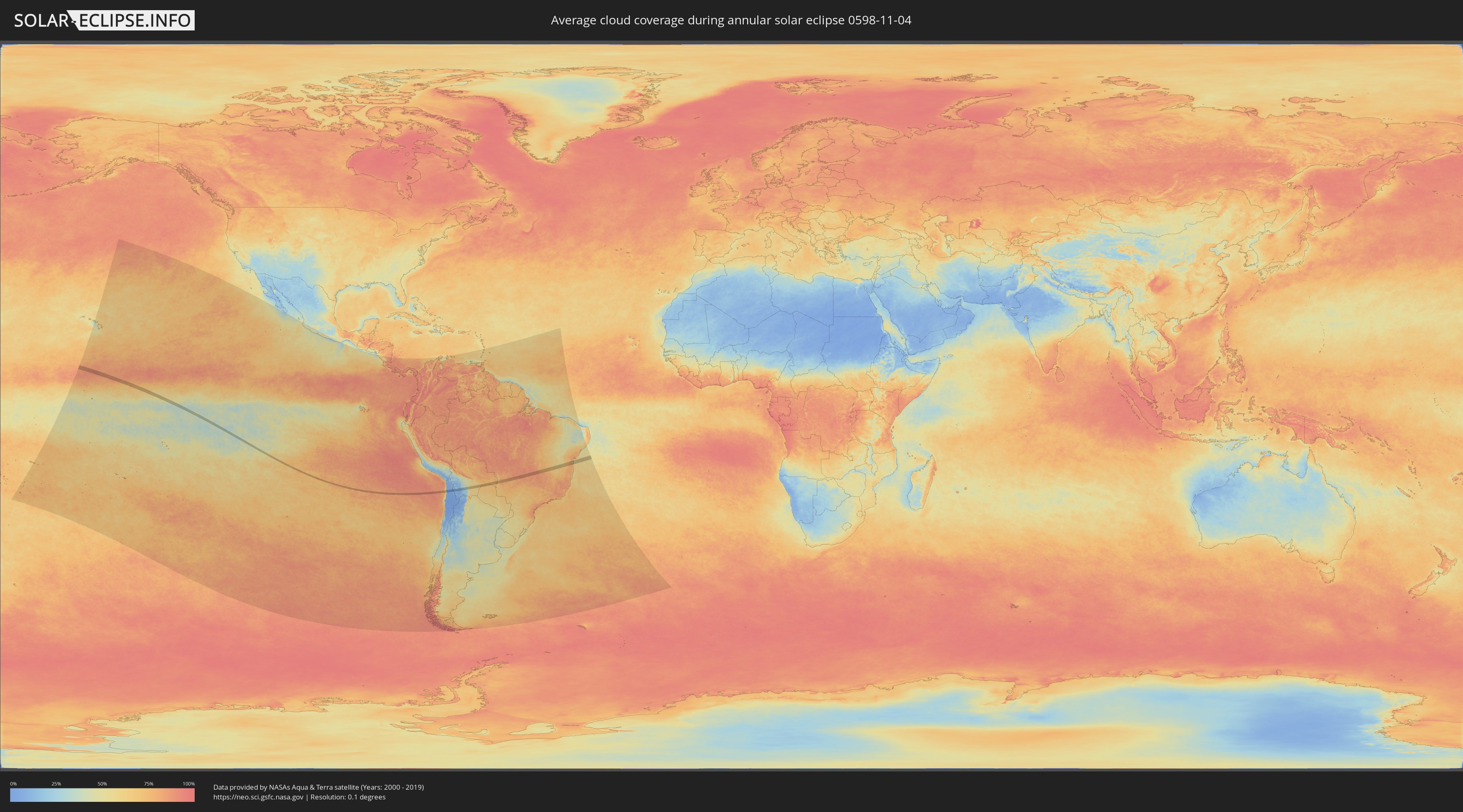
The following maps show the average cloud coverage for the day of the annular solar eclipse.
With the help of these maps, it is possible to find the place along the eclipse path, which has the best
chance of a cloudless sky.
Nevertheless, you should consider local circumstances and inform about the weather of your chosen
observation site.
The data is provided by NASAs satellites
AQUA and TERRA.
The cloud maps are averaged over a period of 19 years (2000 - 2019).
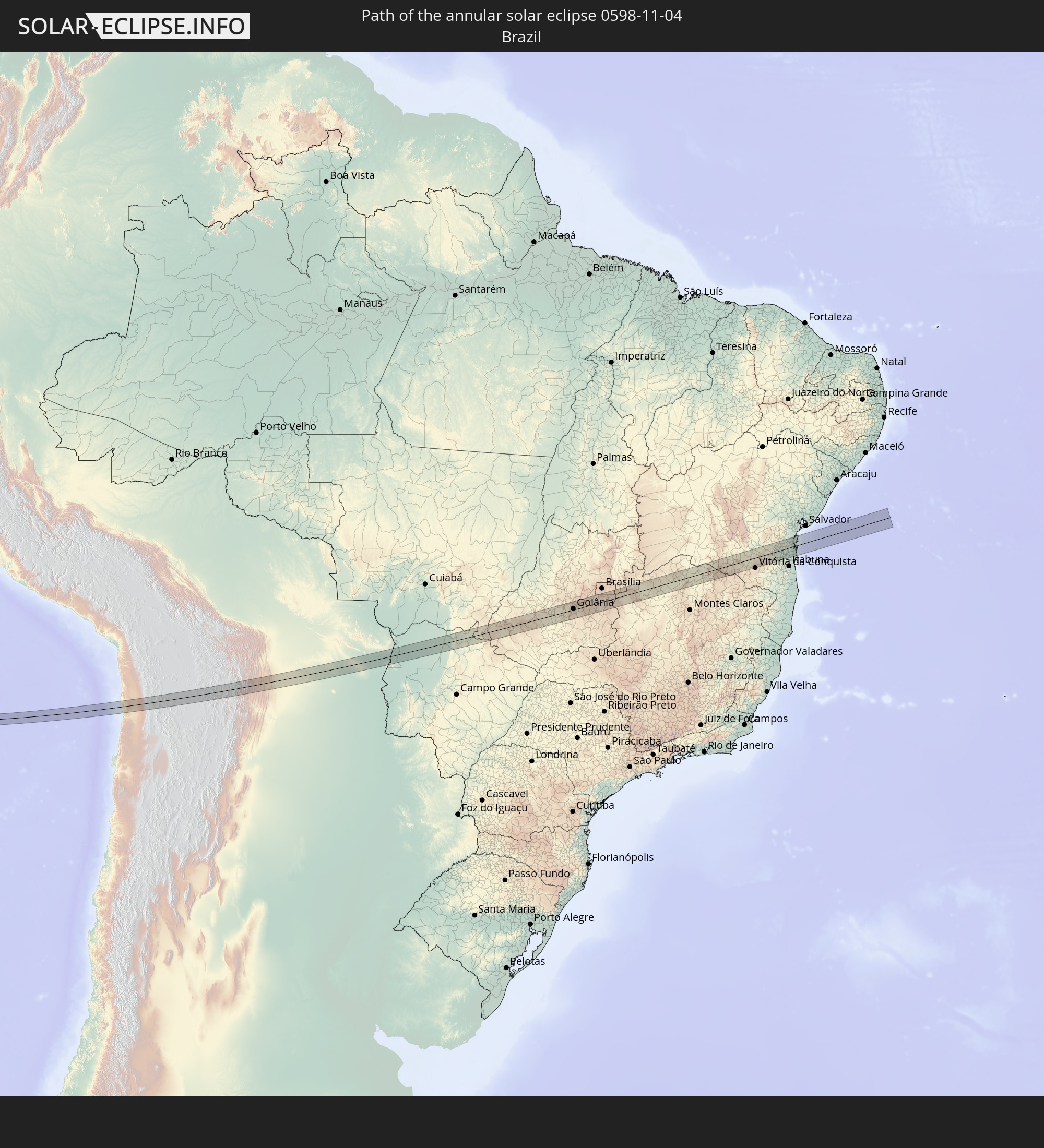
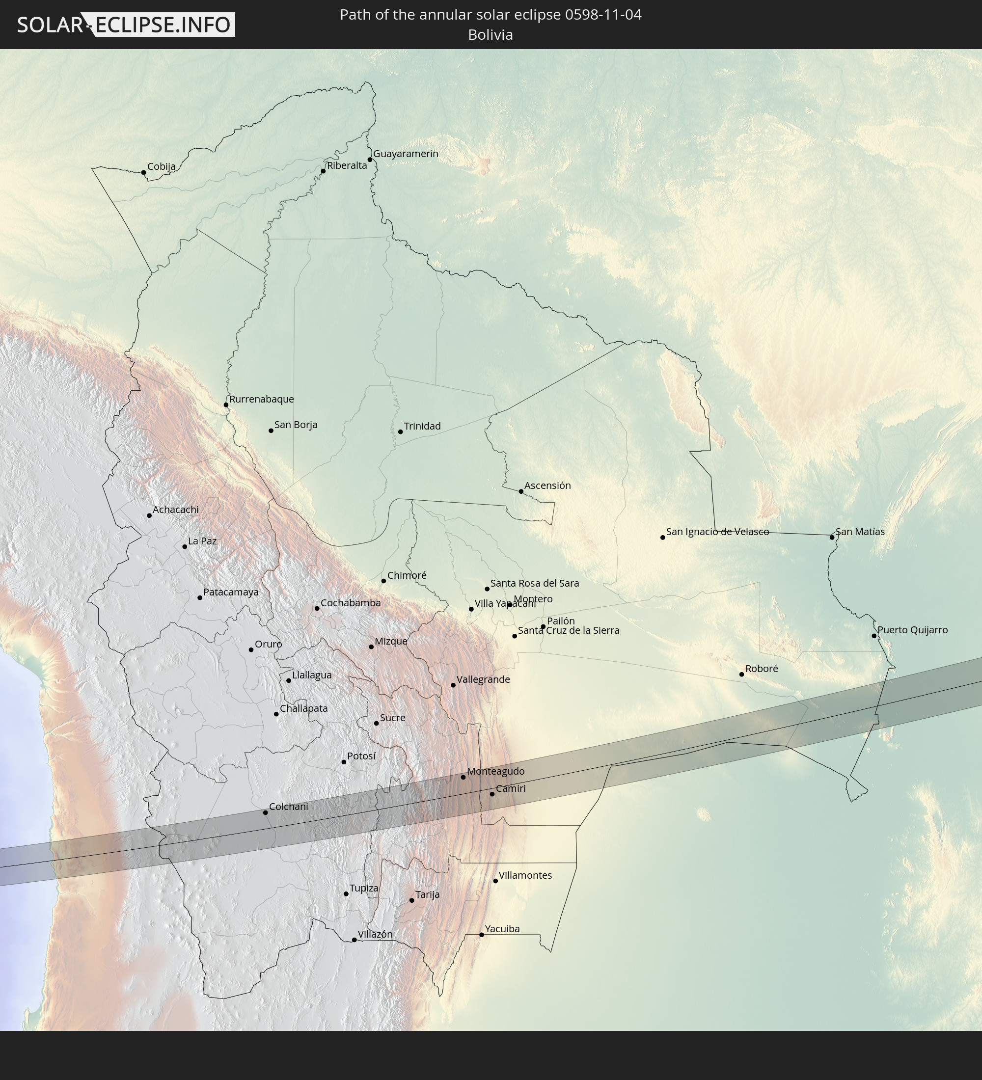
Detailed country maps
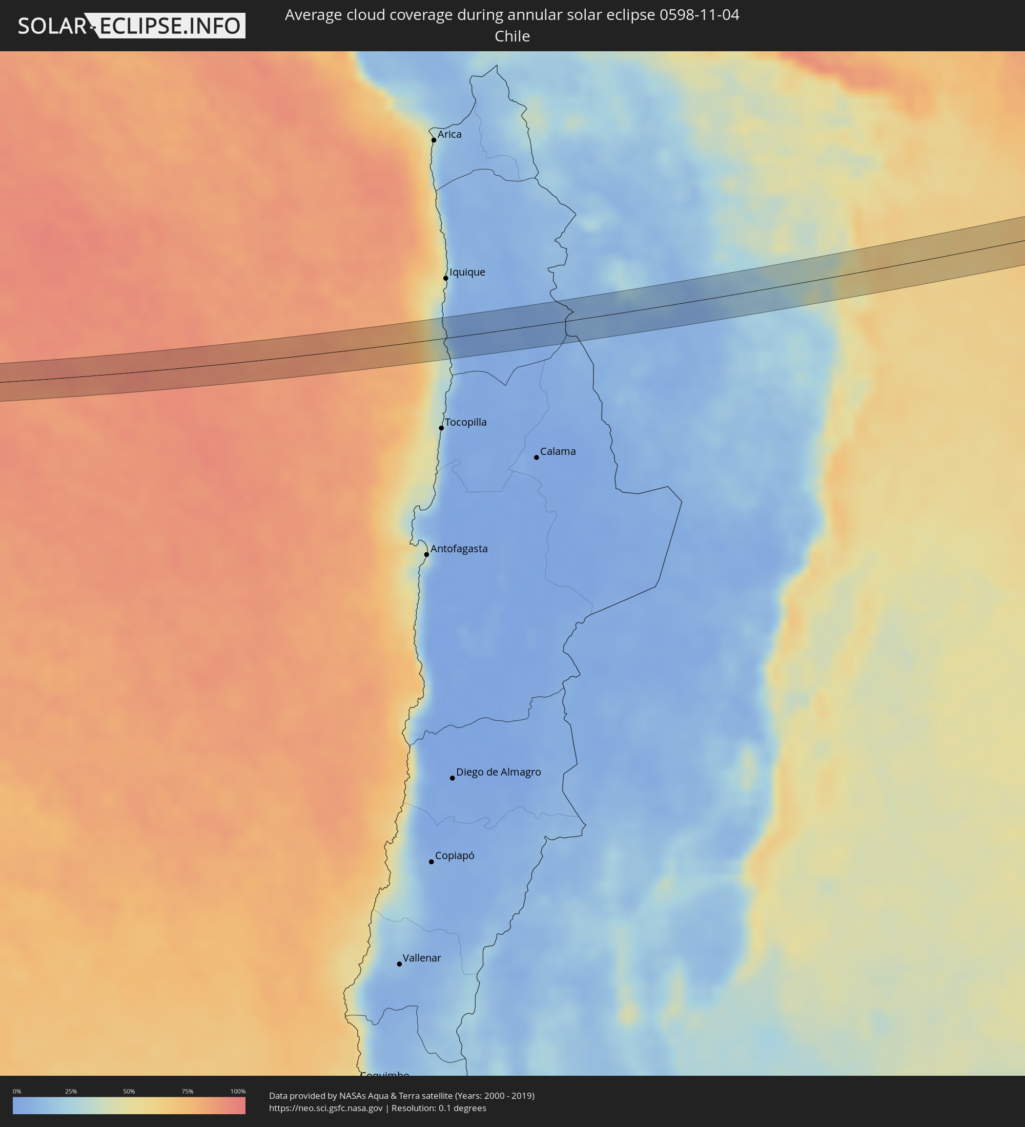 Chile
Chile
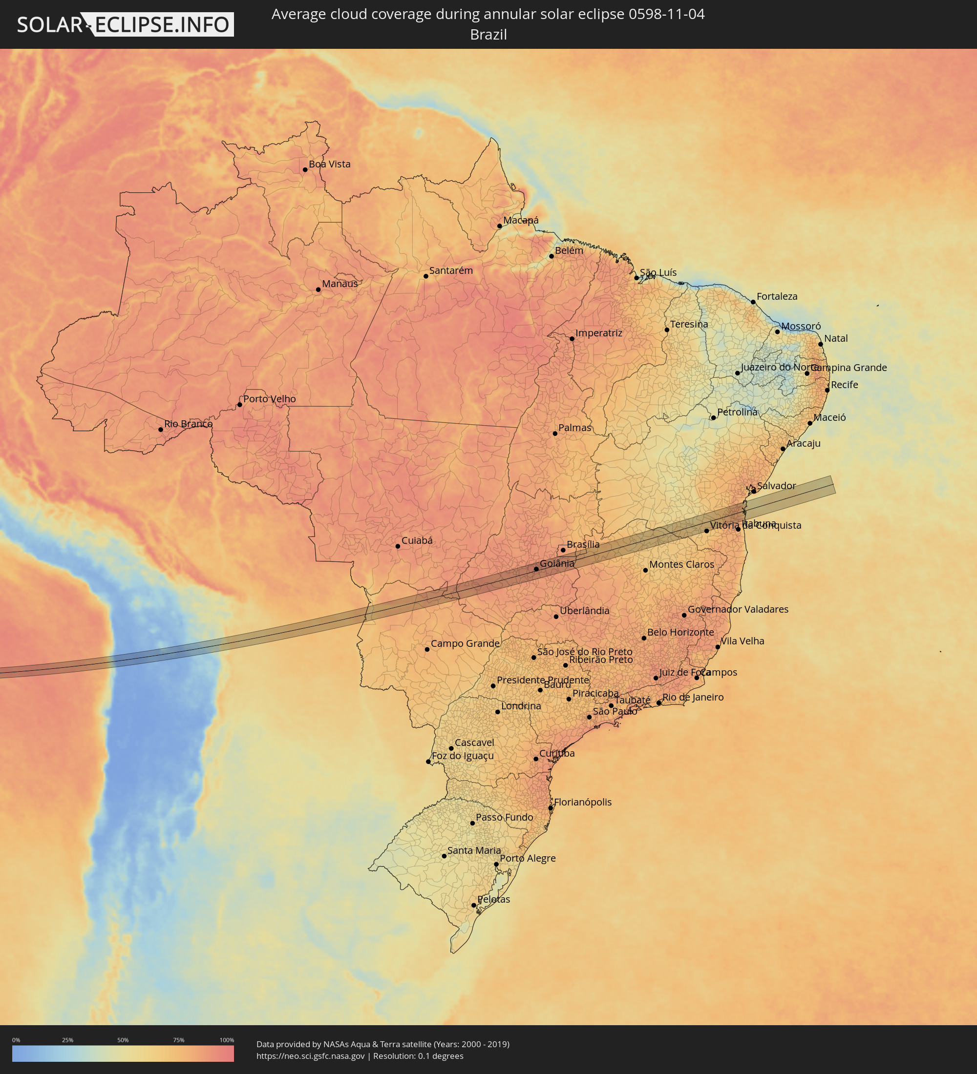 Brazil
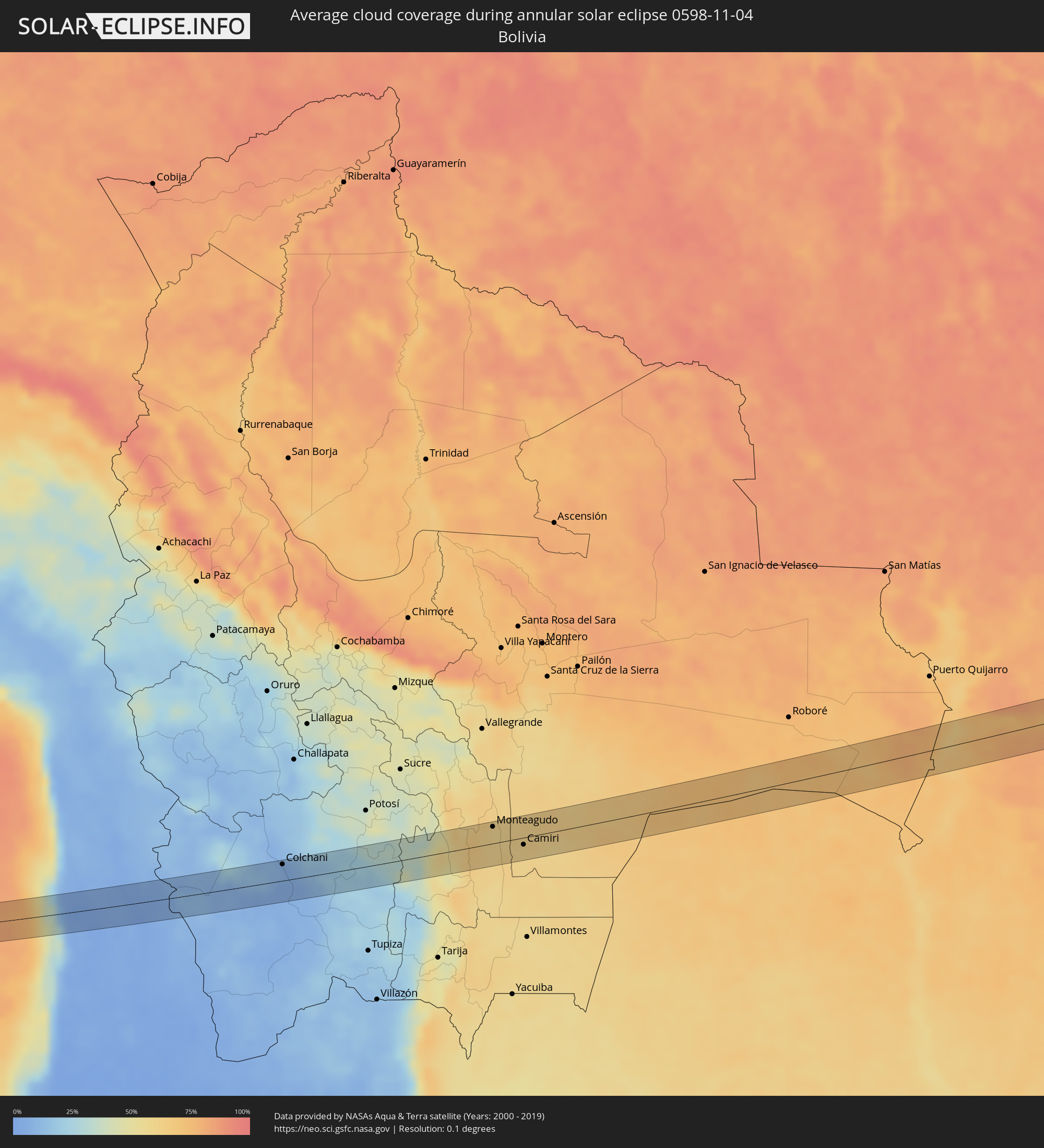 Bolivia
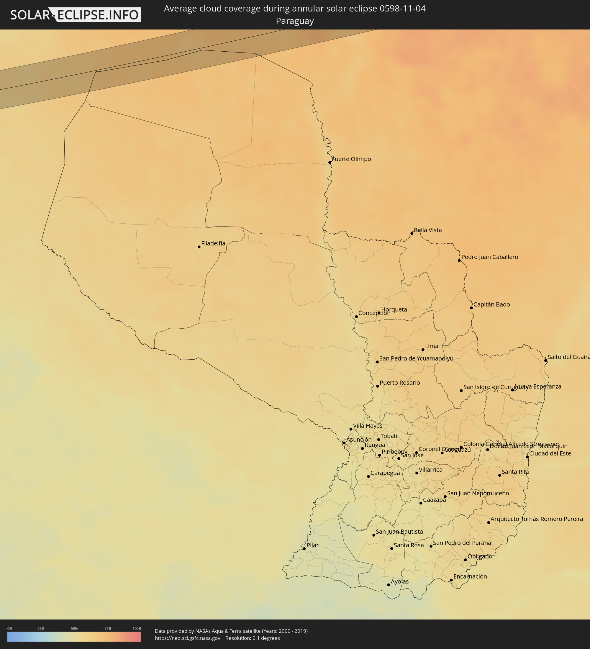 Paraguay
Cities inside the path of the eclipse
The following table shows all locations with a population of more than 5,000 inside the eclipse path. Cities which have more than 100,000 inhabitants are marked bold. A click at the locations opens a detailed map.
| City | Type | Eclipse duration | Local time of max. eclipse | Distance to central line | Ø Cloud coverage |
|
Colchani, Potosí
|
annular | - | 15:24:31 UTC-04:32 | 24 km | 7% |
|
Uyuni, Potosí
|
annular | - | 15:24:36 UTC-04:32 | 5 km | 6% |
|
Monteagudo, Chuquisaca
|
annular | - | 15:28:44 UTC-04:32 | 24 km | 60% |
|
Camiri, Santa Cruz
|
annular | - | 15:29:10 UTC-04:32 | 10 km | 61% |
|
Corumbá, Mato Grosso do Sul
|
annular | - | 16:29:57 UTC-03:38 | 27 km | 73% |
|
Ladário, Mato Grosso do Sul
|
annular | - | 16:30:00 UTC-03:38 | 28 km | 68% |
|
Mineiros, Goiás
|
annular | - | 17:06:28 UTC-03:06 | 1 km | 82% |
|
Paraúna, Goiás
|
annular | - | 17:07:58 UTC-03:06 | 9 km | 85% |
|
Palmeiras de Goiás, Goiás
|
annular | - | 17:08:18 UTC-03:06 | 10 km | 88% |
|
Guapó, Goiás
|
annular | - | 17:08:29 UTC-03:06 | 4 km | 86% |
|
Trindade, Goiás
|
annular | - | 17:08:35 UTC-03:06 | 14 km | 88% |
|
Goianira, Goiás
|
annular | - | 17:08:41 UTC-03:06 | 29 km | 86% |
|
Goiânia, Goiás
|
annular | - | 17:08:41 UTC-03:06 | 5 km | 84% |
|
Aparecida de Goiânia, Goiás
|
annular | - | 17:08:37 UTC-03:06 | 11 km | 84% |
|
Hidrolândia, Goiás
|
annular | - | 17:08:34 UTC-03:06 | 27 km | 84% |
|
Nerópolis, Goiás
|
annular | - | 17:08:49 UTC-03:06 | 33 km | 87% |
|
Senador Canedo, Goiás
|
annular | - | 17:08:44 UTC-03:06 | 3 km | 86% |
|
Goianápolis, Goiás
|
annular | - | 17:08:52 UTC-03:06 | 16 km | 85% |
|
Bela Vista de Goiás, Goiás
|
annular | - | 17:08:41 UTC-03:06 | 36 km | 85% |
|
Anápolis, Goiás
|
annular | - | 17:08:58 UTC-03:06 | 34 km | 88% |
|
Abadiânia, Goiás
|
annular | - | 17:09:08 UTC-03:06 | 40 km | 86% |
|
Silvânia, Goiás
|
annular | - | 17:08:59 UTC-03:06 | 12 km | 87% |
|
Vianópolis, Goiás
|
annular | - | 17:08:59 UTC-03:06 | 23 km | 89% |
|
Luziânia, Goiás
|
annular | - | 17:09:26 UTC-03:06 | 13 km | 85% |
|
Unaí, Minas Gerais
|
annular | - | 17:09:48 UTC-03:06 | 28 km | 81% |
|
Buritis, Minas Gerais
|
annular | - | 17:10:17 UTC-03:06 | 37 km | 74% |
|
Arinos, Minas Gerais
|
annular | - | 17:10:16 UTC-03:06 | 4 km | 75% |
|
Januária, Minas Gerais
|
annular | - | 17:10:58 UTC-03:06 | 10 km | 64% |
|
Itacarambi, Minas Gerais
|
annular | - | 17:11:11 UTC-03:06 | 24 km | 62% |
|
Varzelândia, Minas Gerais
|
annular | - | 17:10:58 UTC-03:06 | 42 km | 68% |
|
Monte Azul, Minas Gerais
|
annular | - | 17:11:27 UTC-03:06 | 18 km | 64% |
|
Mato Verde, Minas Gerais
|
annular | - | 17:11:21 UTC-03:06 | 44 km | 62% |
|
Espinosa, Minas Gerais
|
annular | - | 17:11:33 UTC-03:06 | 4 km | 63% |
|
Caculé, Bahia
|
annular | - | 17:44:17 UTC-02:34 | 32 km | 62% |
|
Santana, Bahia
|
annular | - | 17:44:22 UTC-02:34 | 23 km | 63% |
|
São Felipe, Bahia
|
annular | - | 17:44:18 UTC-02:34 | 29 km | 62% |
|
Poções, Bahia
|
annular | - | 17:44:32 UTC-02:34 | 28 km | 69% |
|
Jequié, Bahia
|
annular | - | 17:44:48 UTC-02:34 | 35 km | 72% |
|
Itagi, Bahia
|
annular | - | 17:44:42 UTC-02:34 | 1 km | 77% |
|
Jitaúna, Bahia
|
annular | - | 17:44:46 UTC-02:34 | 13 km | 78% |
|
Itagibá, Bahia
|
annular | - | 17:44:41 UTC-02:34 | 18 km | 80% |
|
Ipiaú, Bahia
|
annular | - | 17:44:45 UTC-02:34 | 5 km | 80% |
|
Ibirataia, Bahia
|
annular | - | 17:44:46 UTC-02:34 | 1 km | 81% |
|
Ubatã, Bahia
|
annular | - | 17:44:44 UTC-02:34 | 19 km | 80% |
|
Gandu, Bahia
|
annular | - | 17:44:54 UTC-02:34 | 29 km | 82% |
|
Ibirapitanga, Bahia
|
annular | - | 17:44:46 UTC-02:34 | 19 km | 81% |
|
Ubaitaba, Bahia
|
annular | - | 17:44:43 UTC-02:34 | 37 km | 81% |
|
Ituberá, Bahia
|
annular | - | 17:44:56 UTC-02:34 | 20 km | 69% |
|
Camamu, Bahia
|
annular | - | 17:44:51 UTC-02:34 | 4 km | 68% |
|
Taperoá, Bahia
|
annular | - | 17:45:00 UTC-02:34 | 39 km | 72% |
|
Itacaré, Bahia
|
annular | - | 17:44:45 UTC-02:34 | 43 km | 59% |