Annular solar eclipse of 01/13/0967
| Day of week: | Tuesday |
| Maximum duration of eclipse: | 05m28s |
| Maximum width of eclipse path: | 238 km |
| Saros cycle: | 95 |
| Coverage: | 94.3% |
| Magnitude: | 0.943 |
| Gamma: | -0.4687 |
Wo kann man die Sonnenfinsternis vom 01/13/0967 sehen?
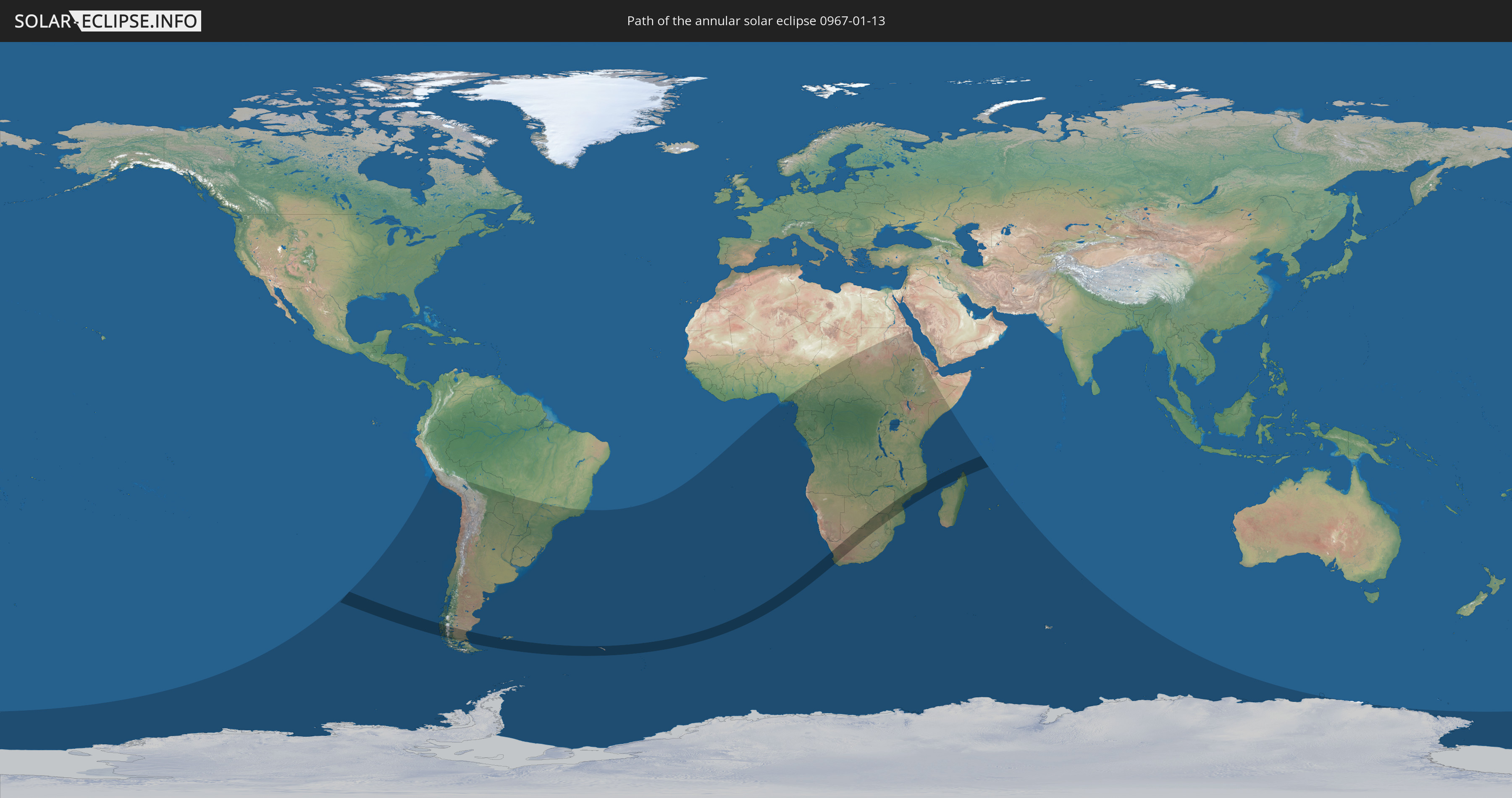
Die Sonnenfinsternis am 01/13/0967 kann man in 48 Ländern als partielle Sonnenfinsternis beobachten.
Der Finsternispfad verläuft durch 12 Länder. Nur in diesen Ländern ist sie als annular Sonnenfinsternis zu sehen.
In den folgenden Ländern ist die Sonnenfinsternis annular zu sehen
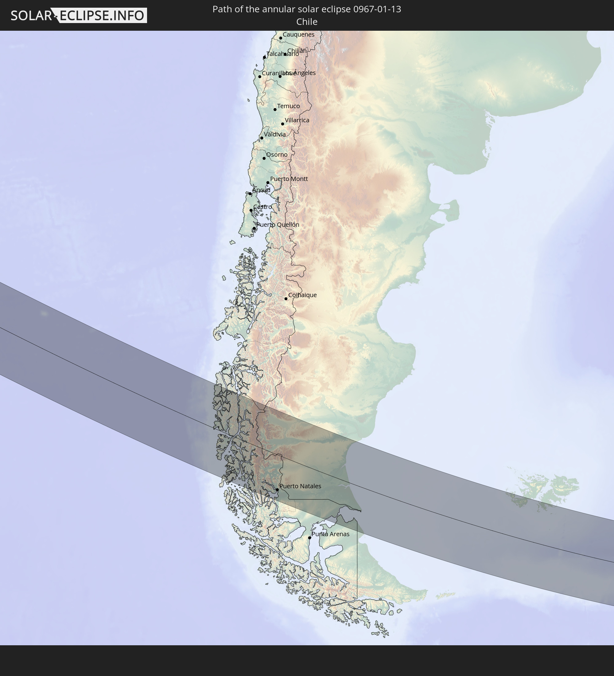 Chile
Chile
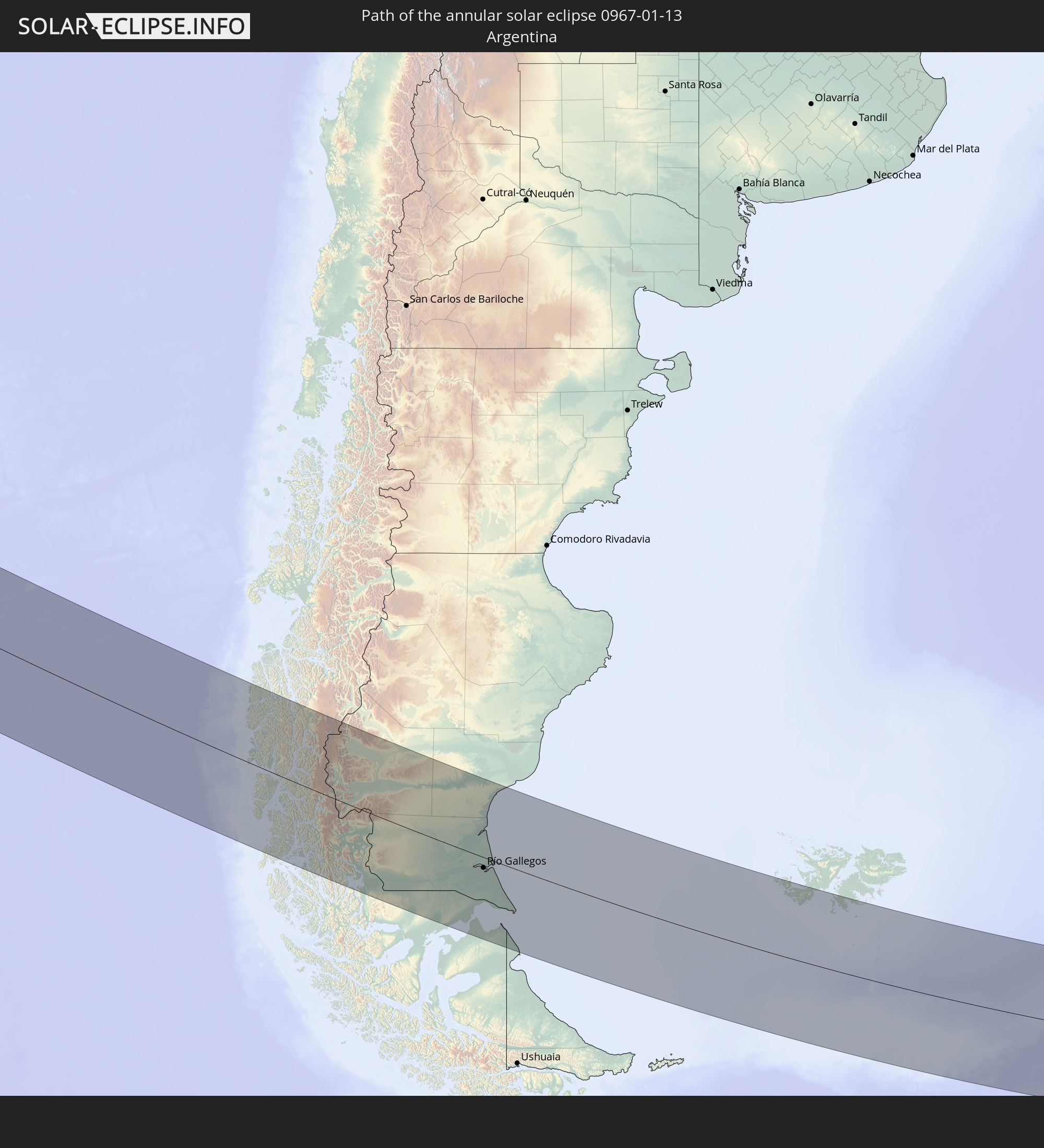 Argentina
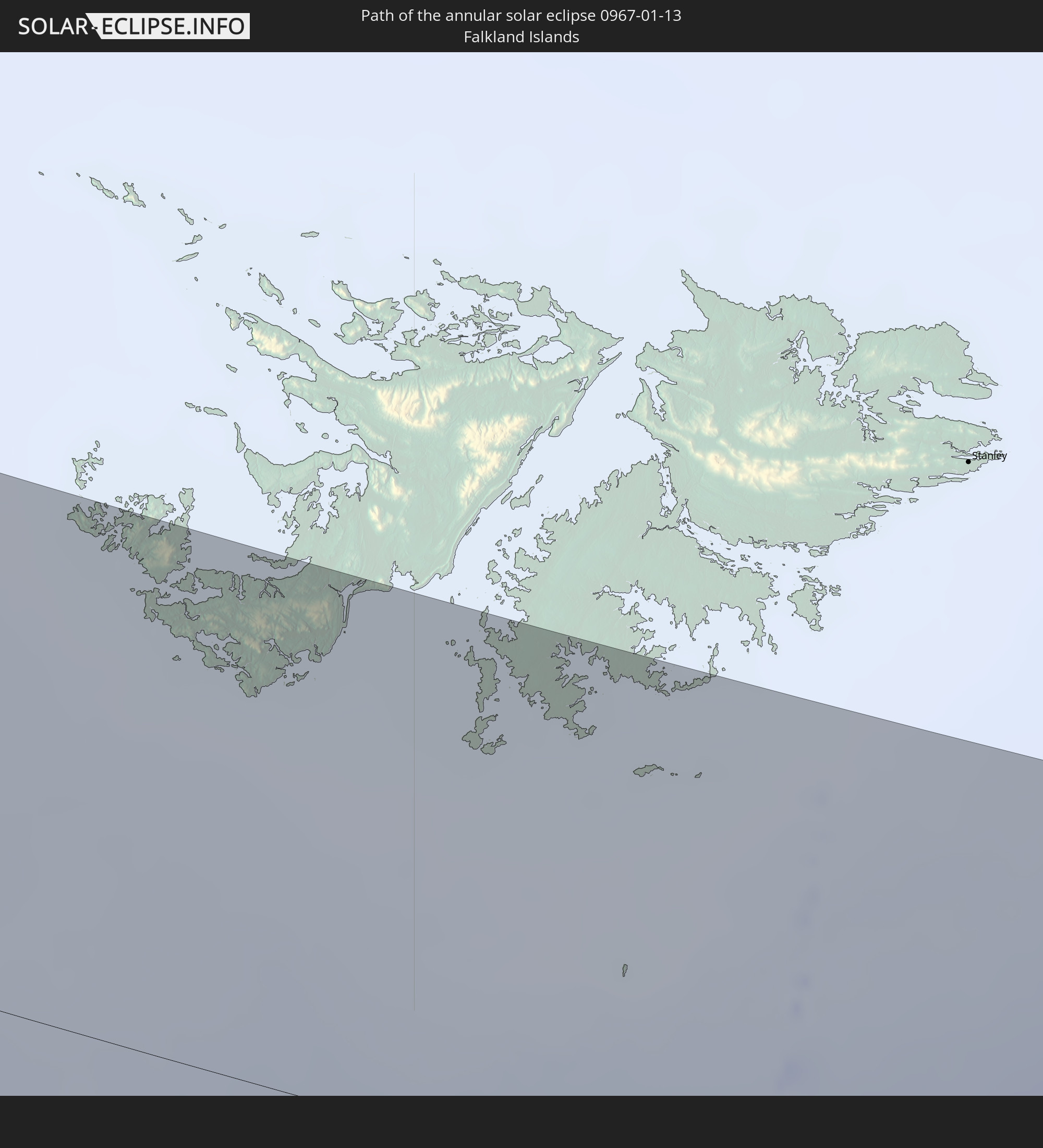 Falkland Islands
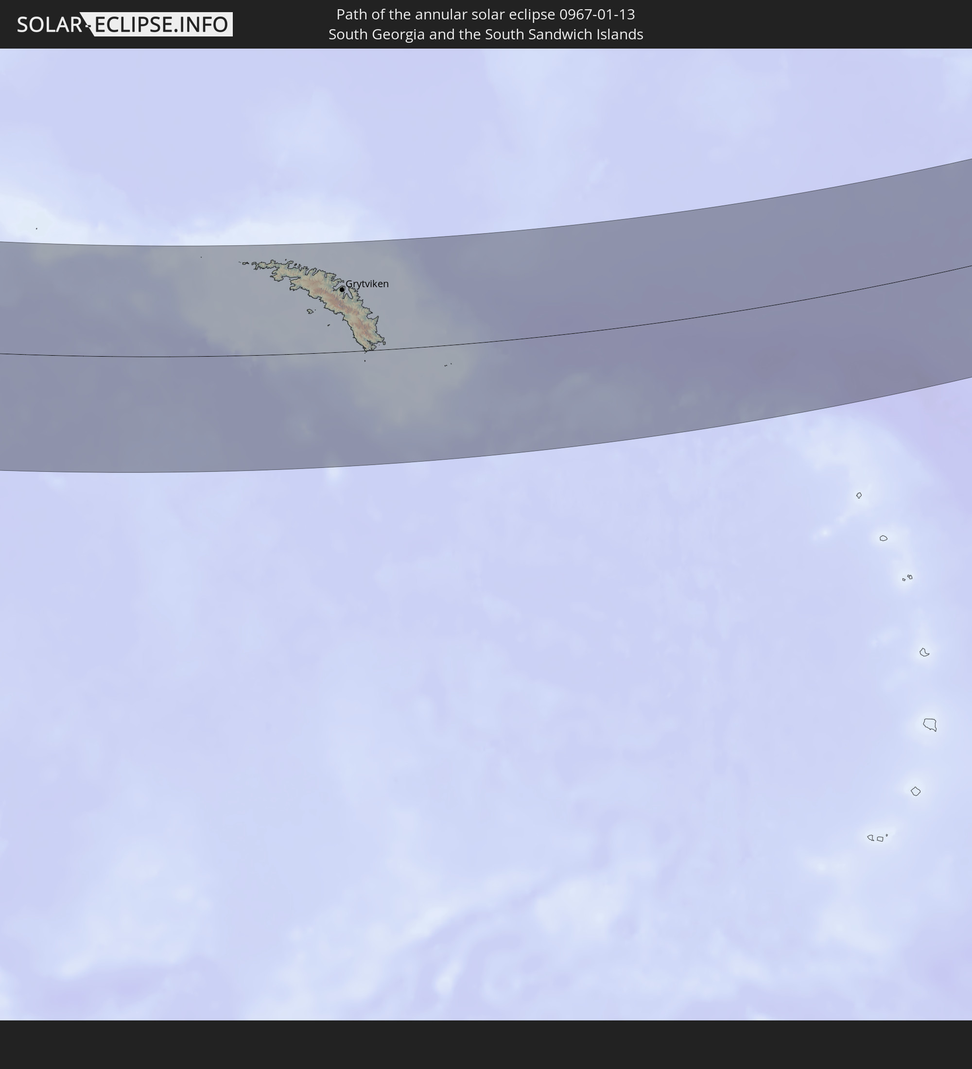 South Georgia and the South Sandwich Islands
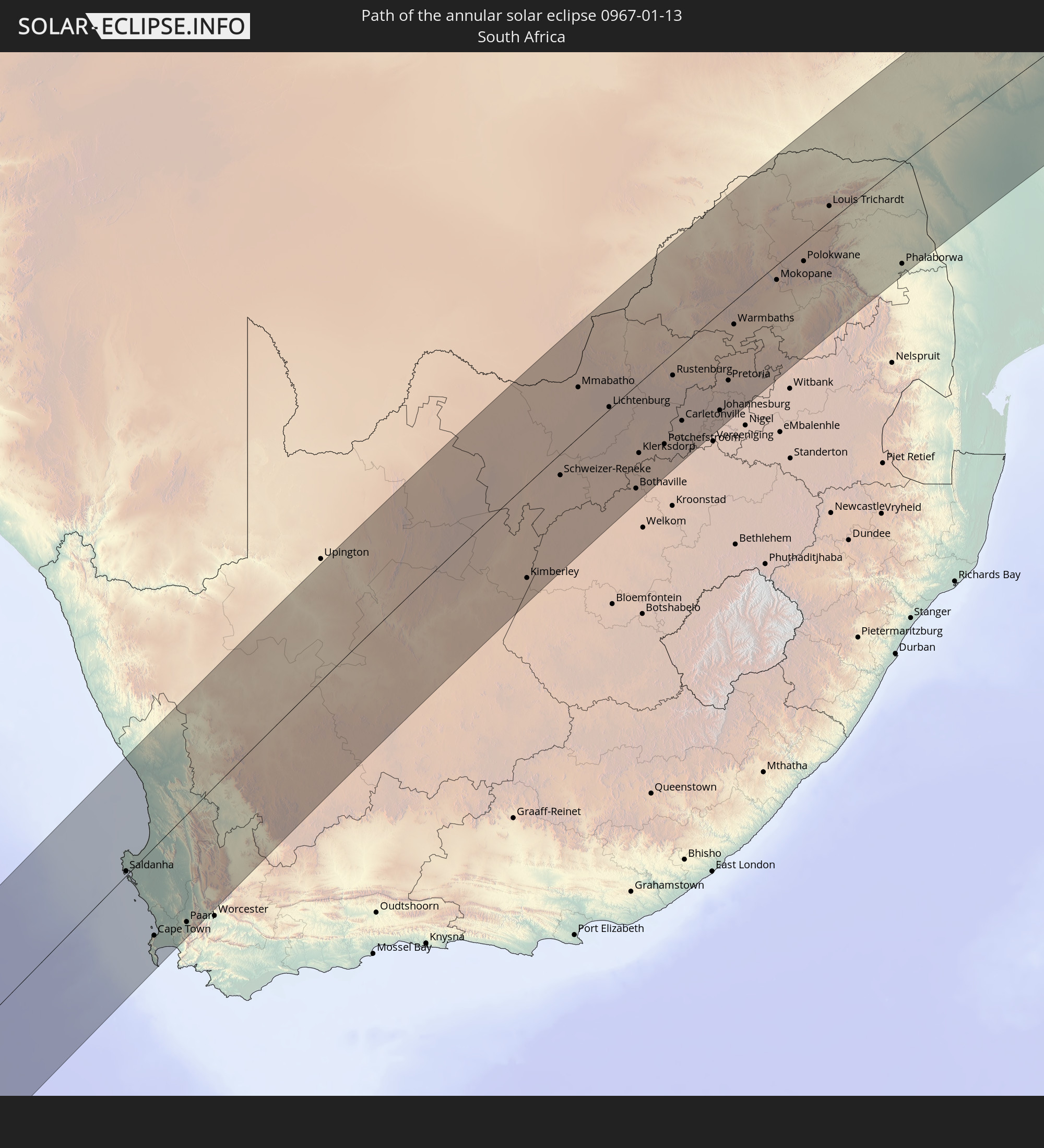 South Africa
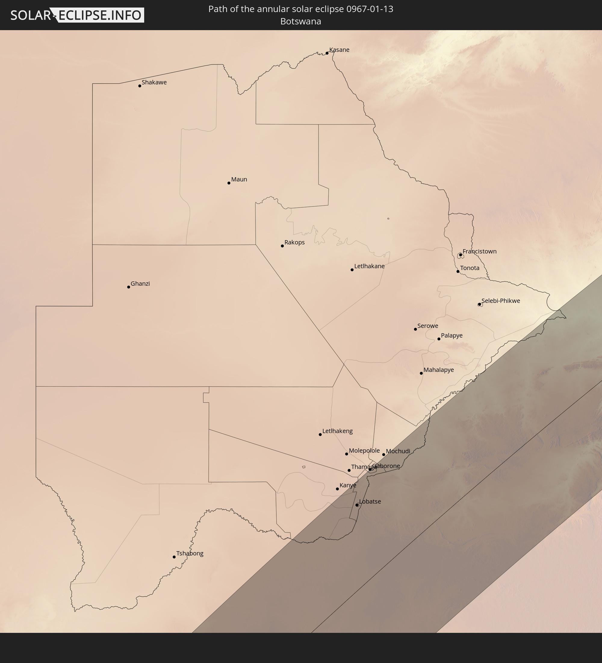 Botswana
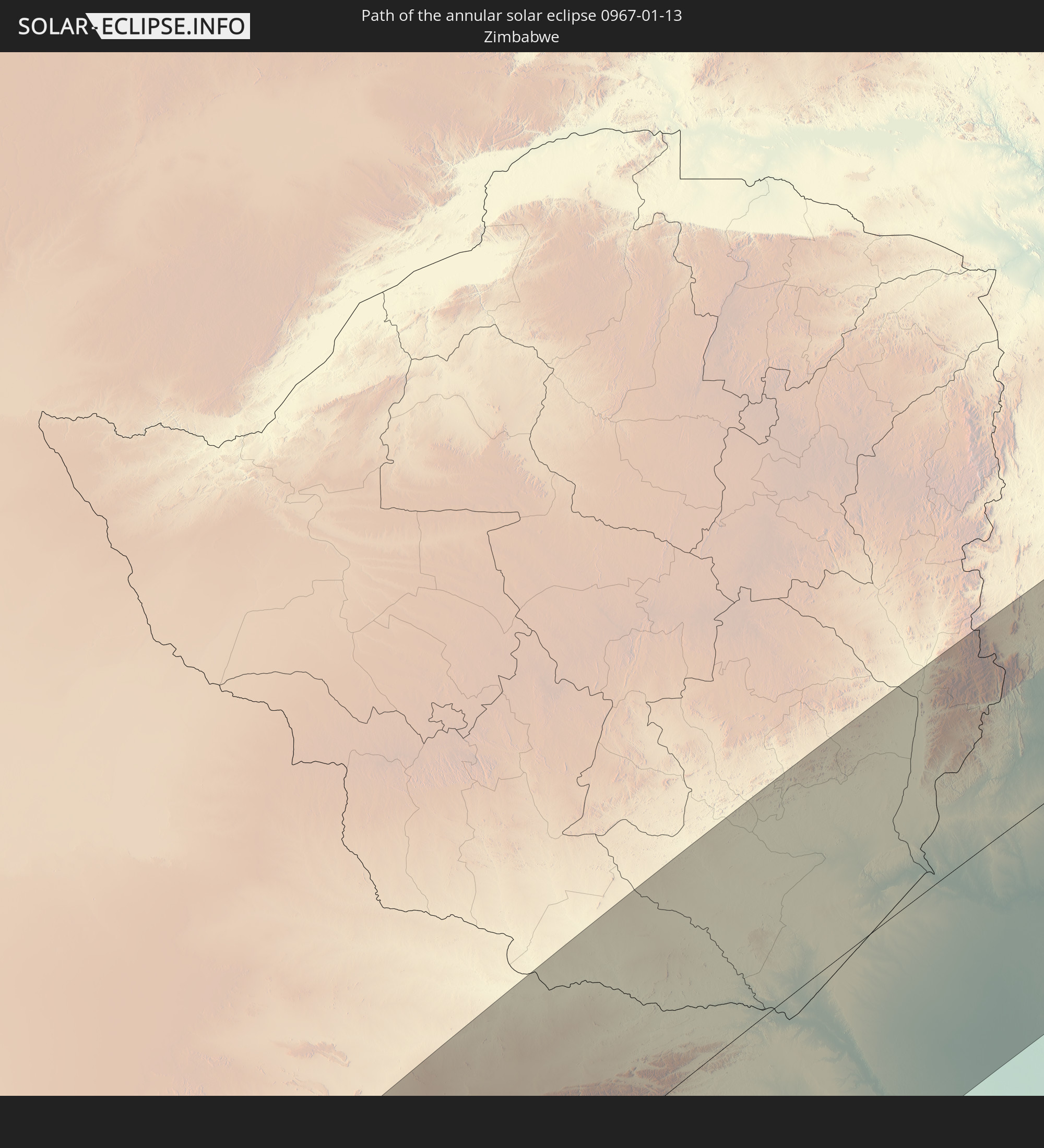 Zimbabwe
 Mozambique
 French Southern and Antarctic Lands
 Madagascar
 Mayotte
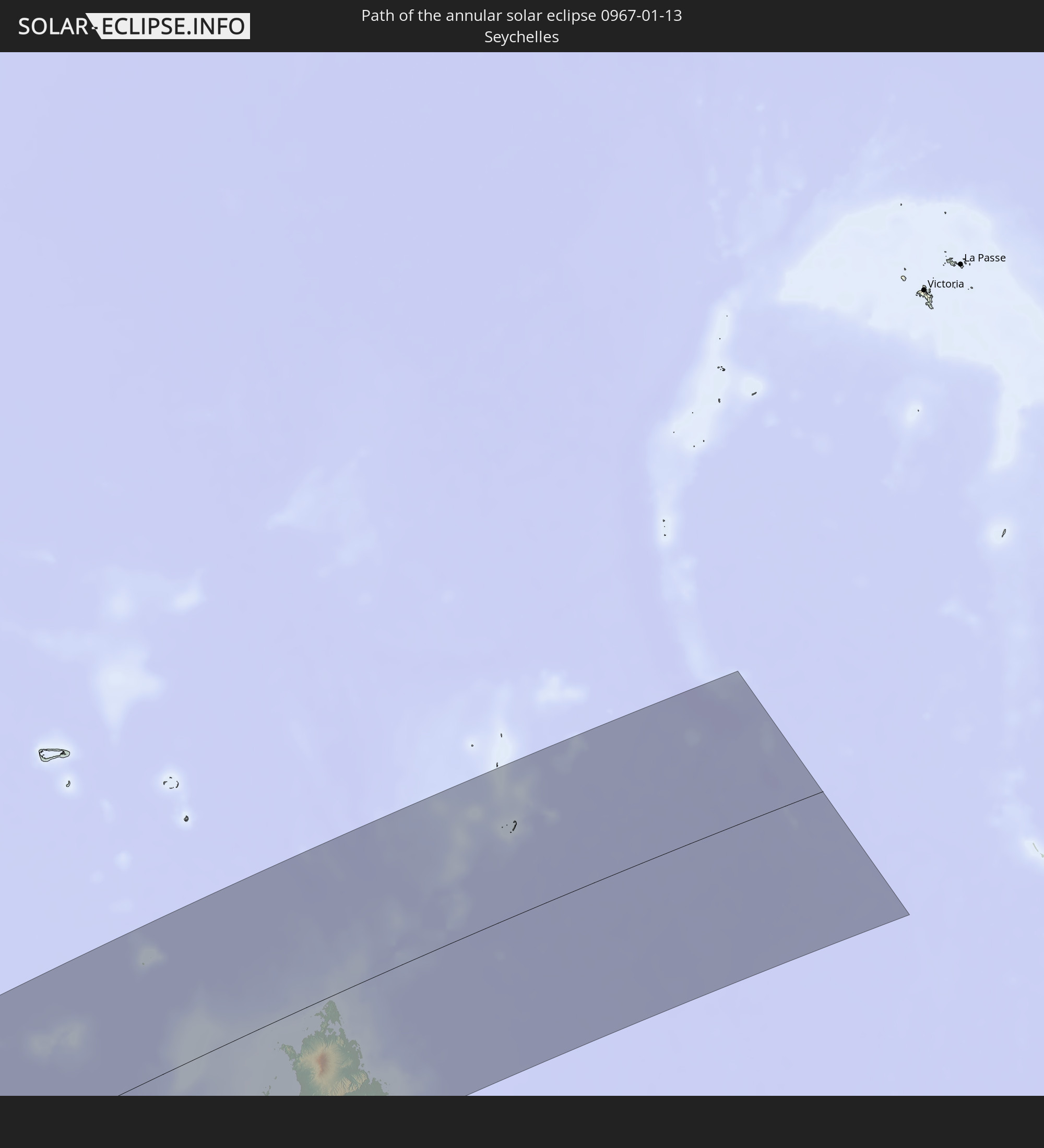 Seychelles
In den folgenden Ländern ist die Sonnenfinsternis partiell zu sehen
 Antarctica
 Chile
Chile
 Peru
Peru
 Brazil
 Argentina
 Bolivia
 Paraguay
 Falkland Islands
 Uruguay
 South Georgia and the South Sandwich Islands
 Saint Helena, Ascension and Tristan da Cunha
 Nigeria
 Bouvet Island
 Equatorial Guinea
 São Tomé and Príncipe
 Cameroon
 Gabon
Gabon
 Republic of the Congo
 Angola
 Namibia
 Democratic Republic of the Congo
 Chad
Chad
 Central African Republic
 South Africa
 Botswana
 Sudan
Sudan
 Zambia
 Zimbabwe
 Lesotho
 Rwanda
 Burundi
 Tanzania
 Uganda
 Mozambique
 Swaziland
 Malawi
 Ethiopia
 Kenya
Kenya
 Eritrea
 French Southern and Antarctic Lands
 Somalia
 Madagascar
 Comoros
 Mayotte
 Seychelles
 Réunion
 Mauritius
 Heard Island and McDonald Islands
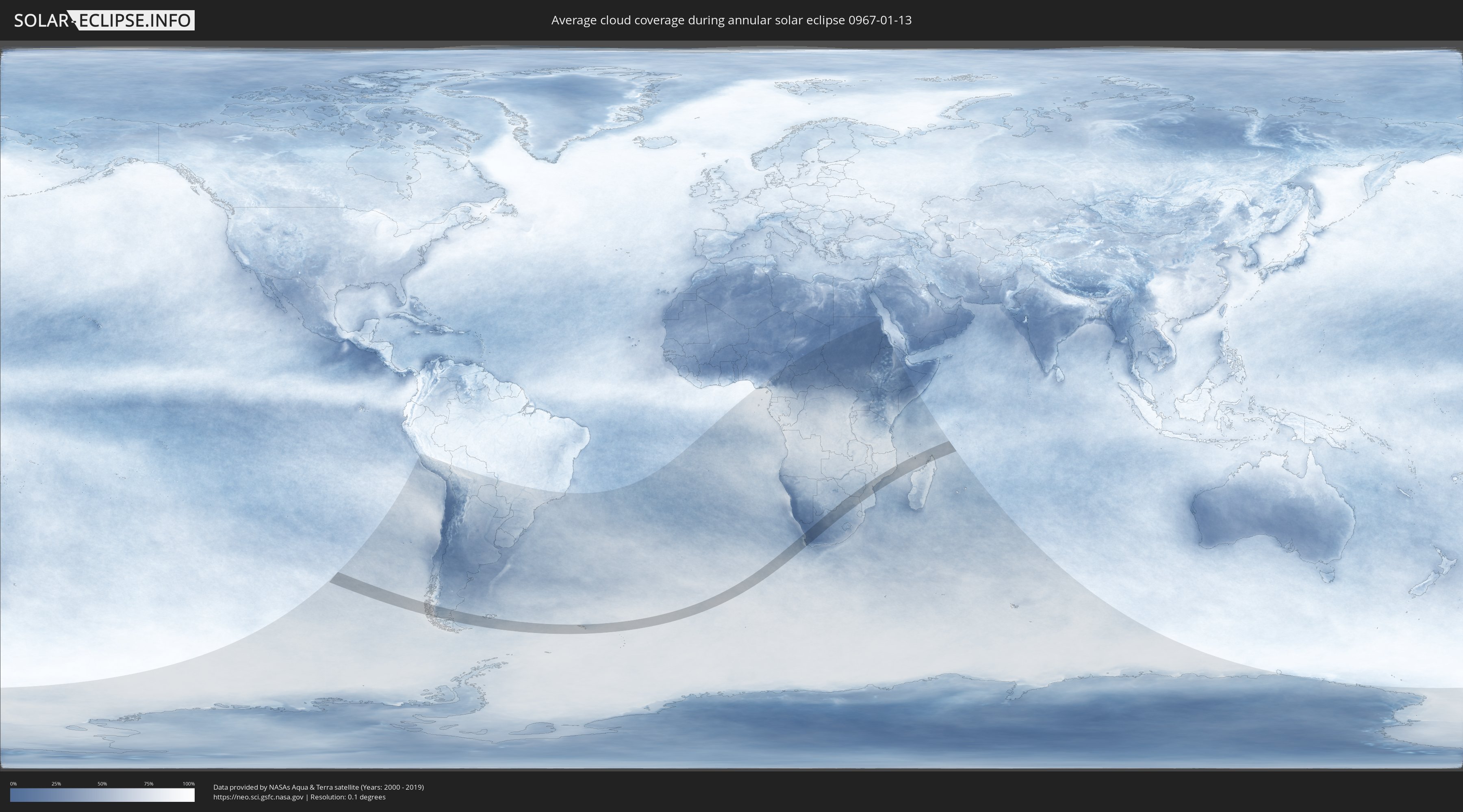
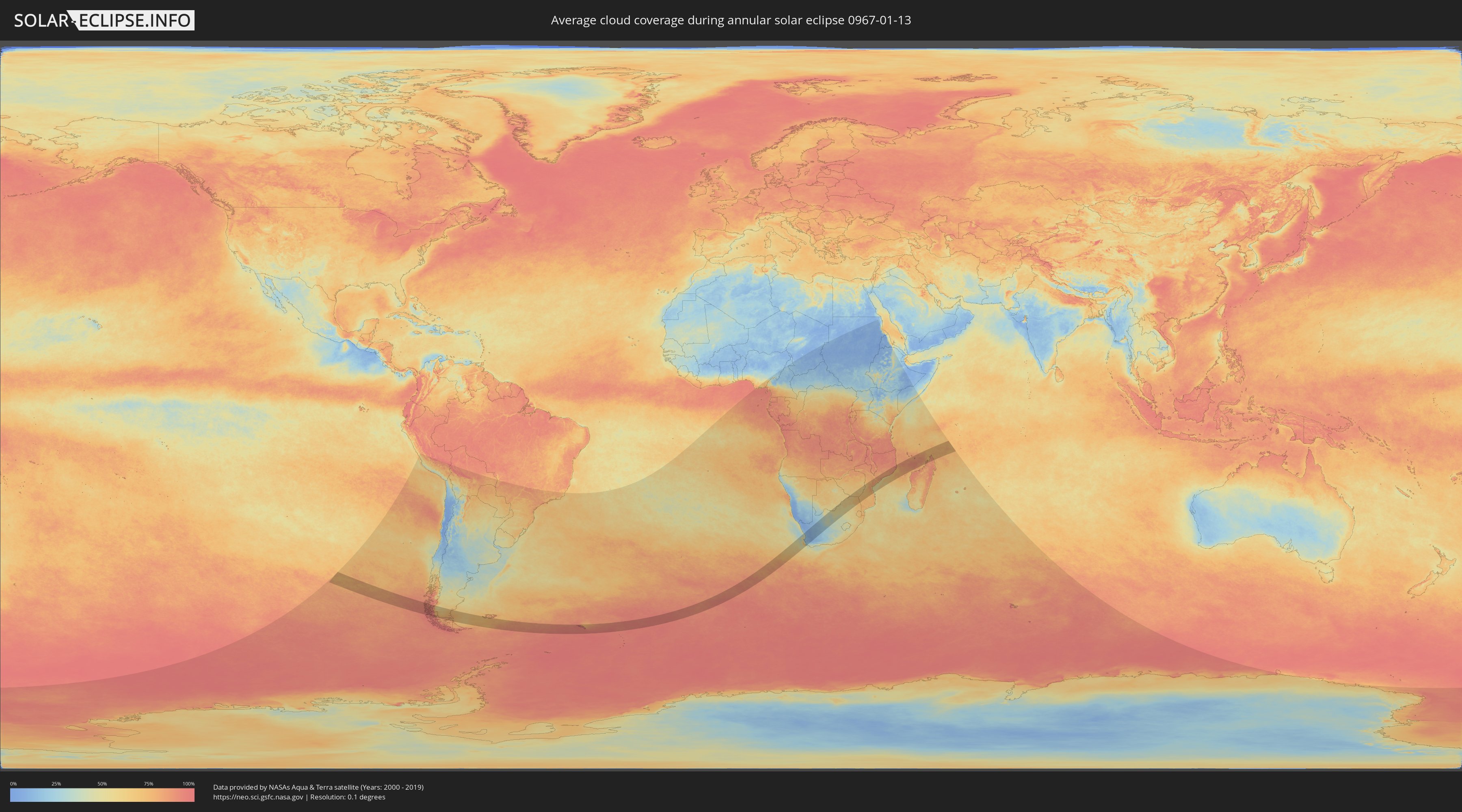
How will be the weather during the annular solar eclipse on 01/13/0967?
Where is the best place to see the annular solar eclipse of 01/13/0967?
The following maps show the average cloud coverage for the day of the annular solar eclipse.
With the help of these maps, it is possible to find the place along the eclipse path, which has the best
chance of a cloudless sky.
Nevertheless, you should consider local circumstances and inform about the weather of your chosen
observation site.
The data is provided by NASAs satellites
AQUA and TERRA.
The cloud maps are averaged over a period of 19 years (2000 - 2019).
Detailed country maps
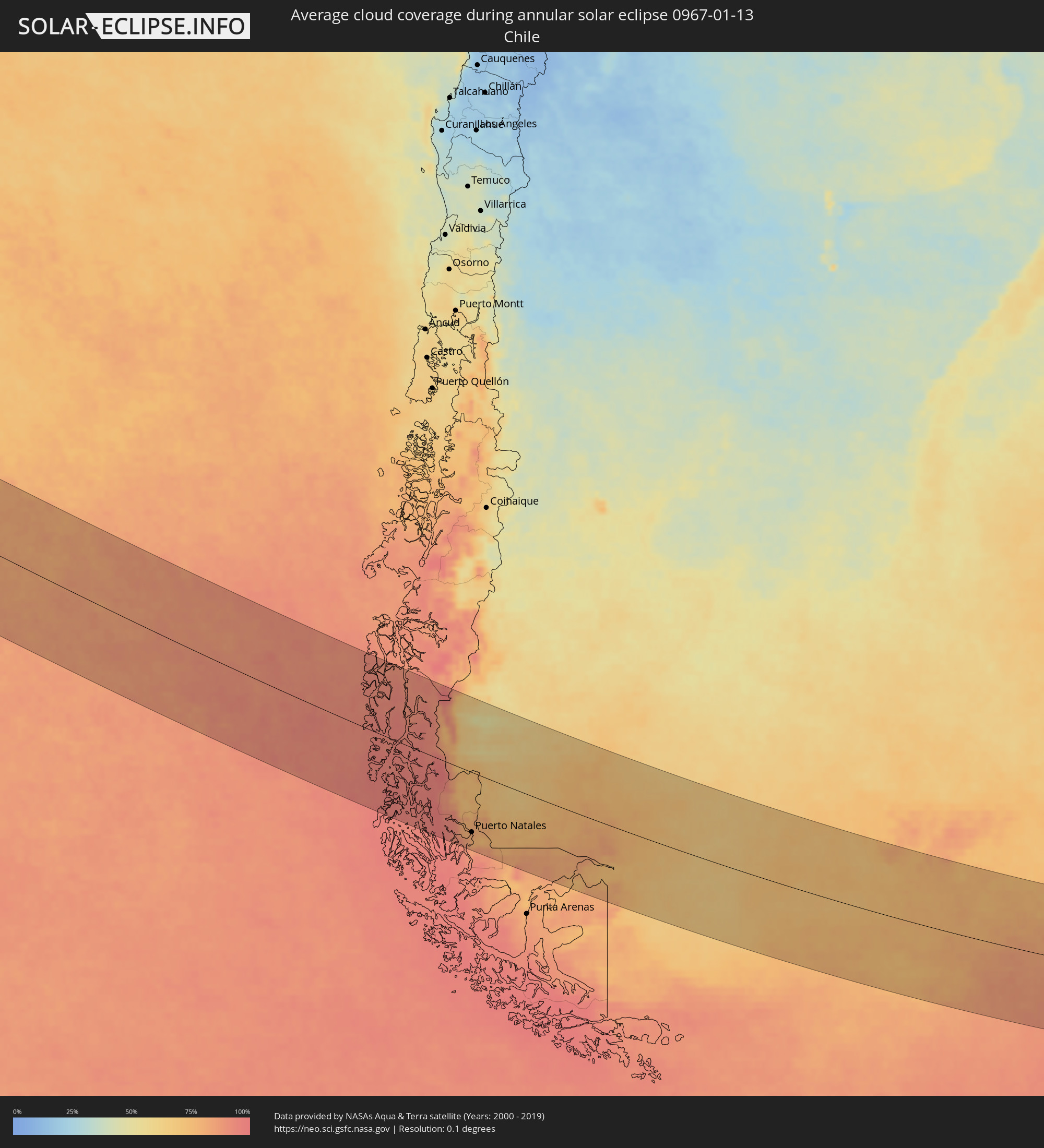 Chile
Chile
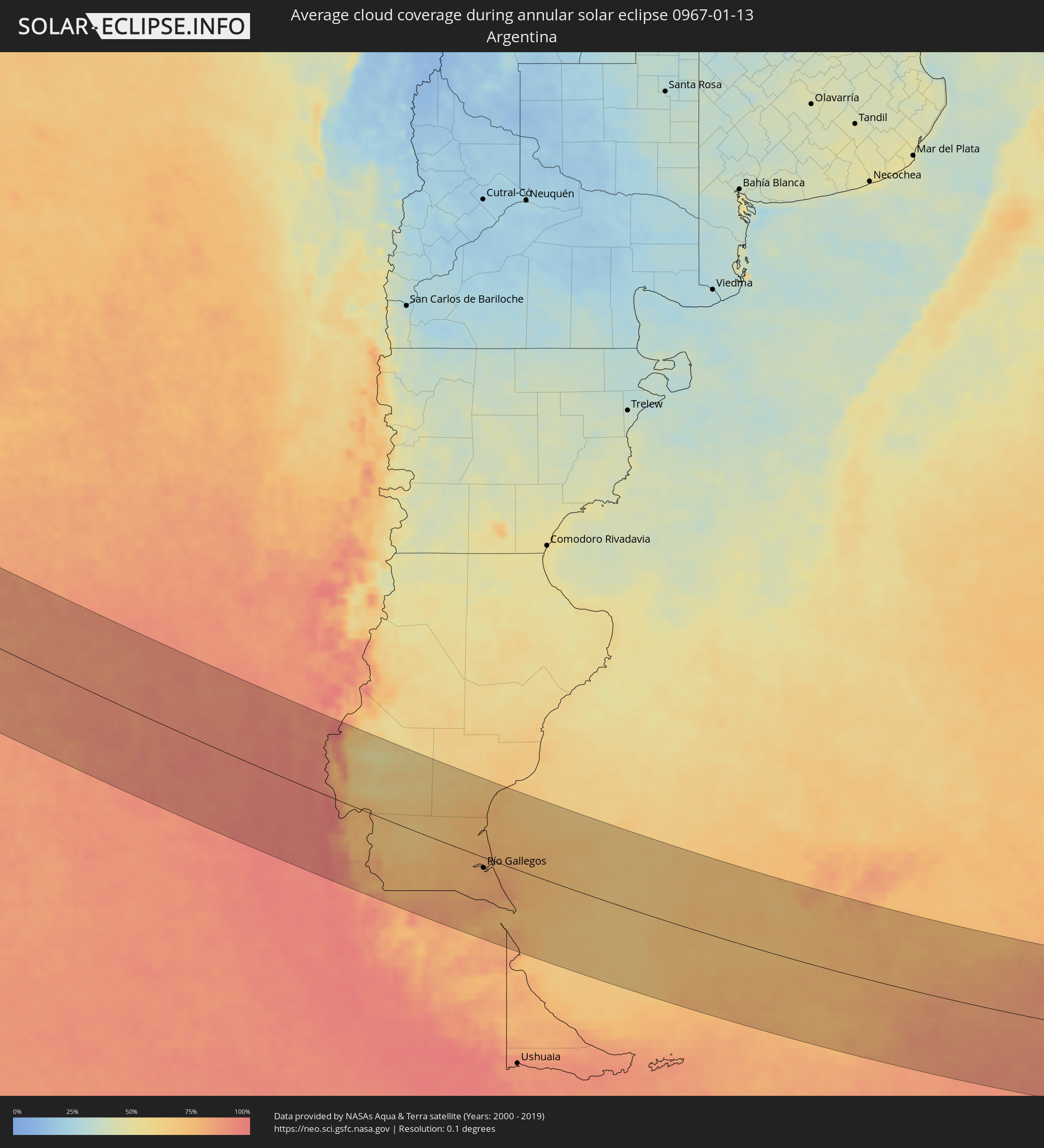 Argentina
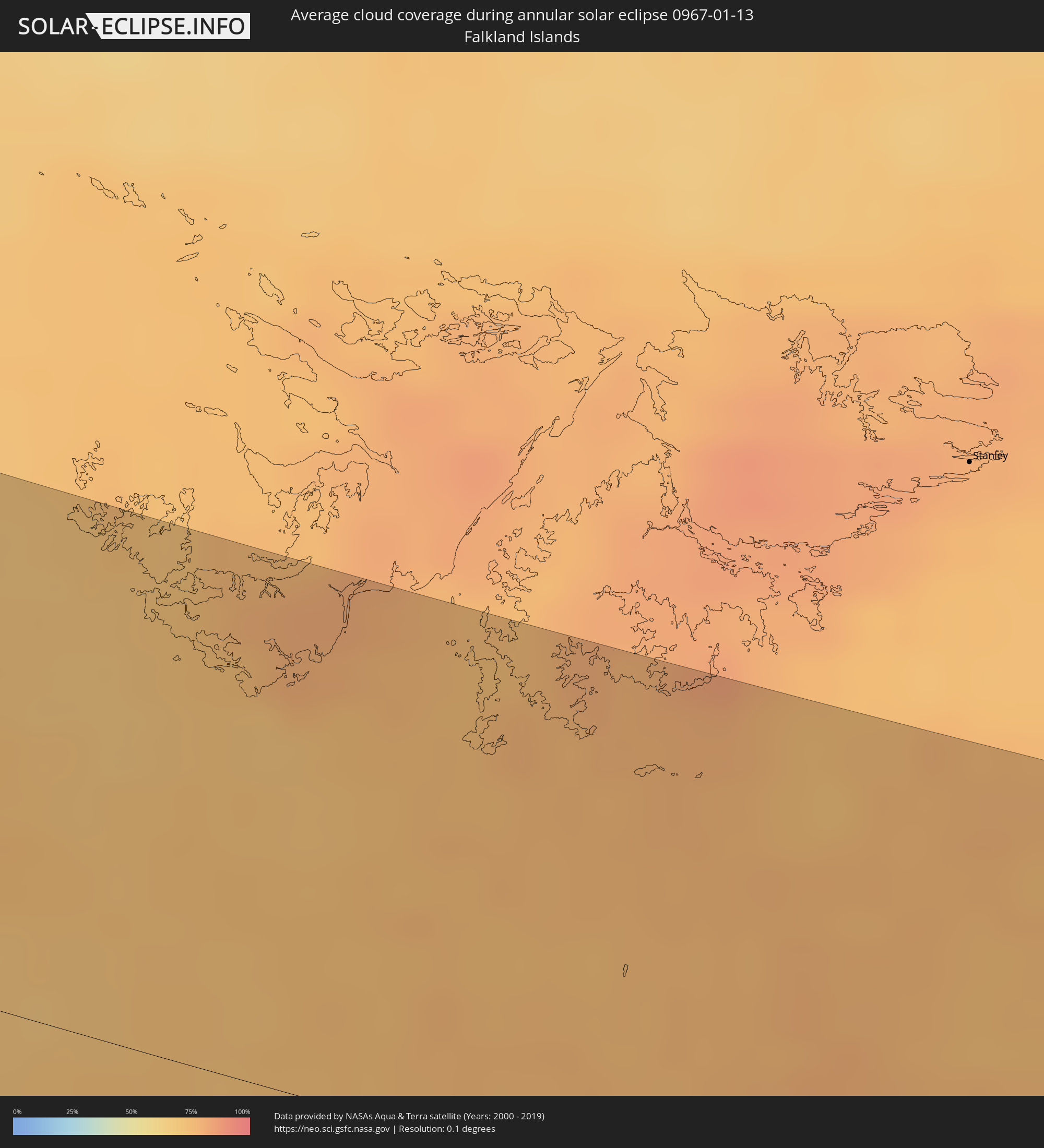 Falkland Islands
 South Georgia and the South Sandwich Islands
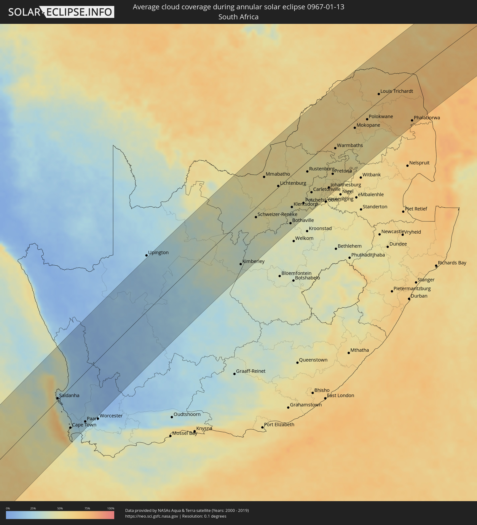 South Africa
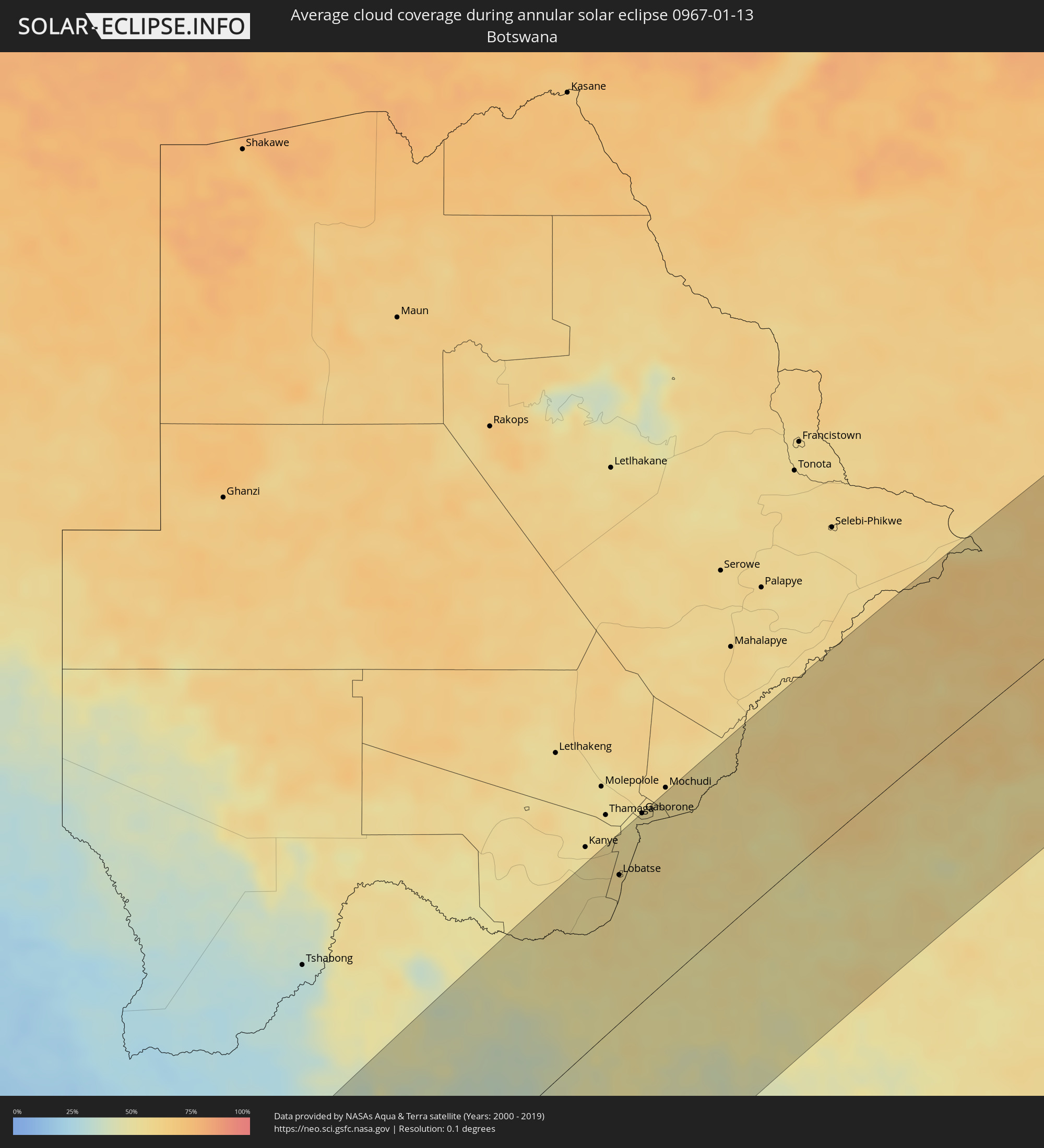 Botswana
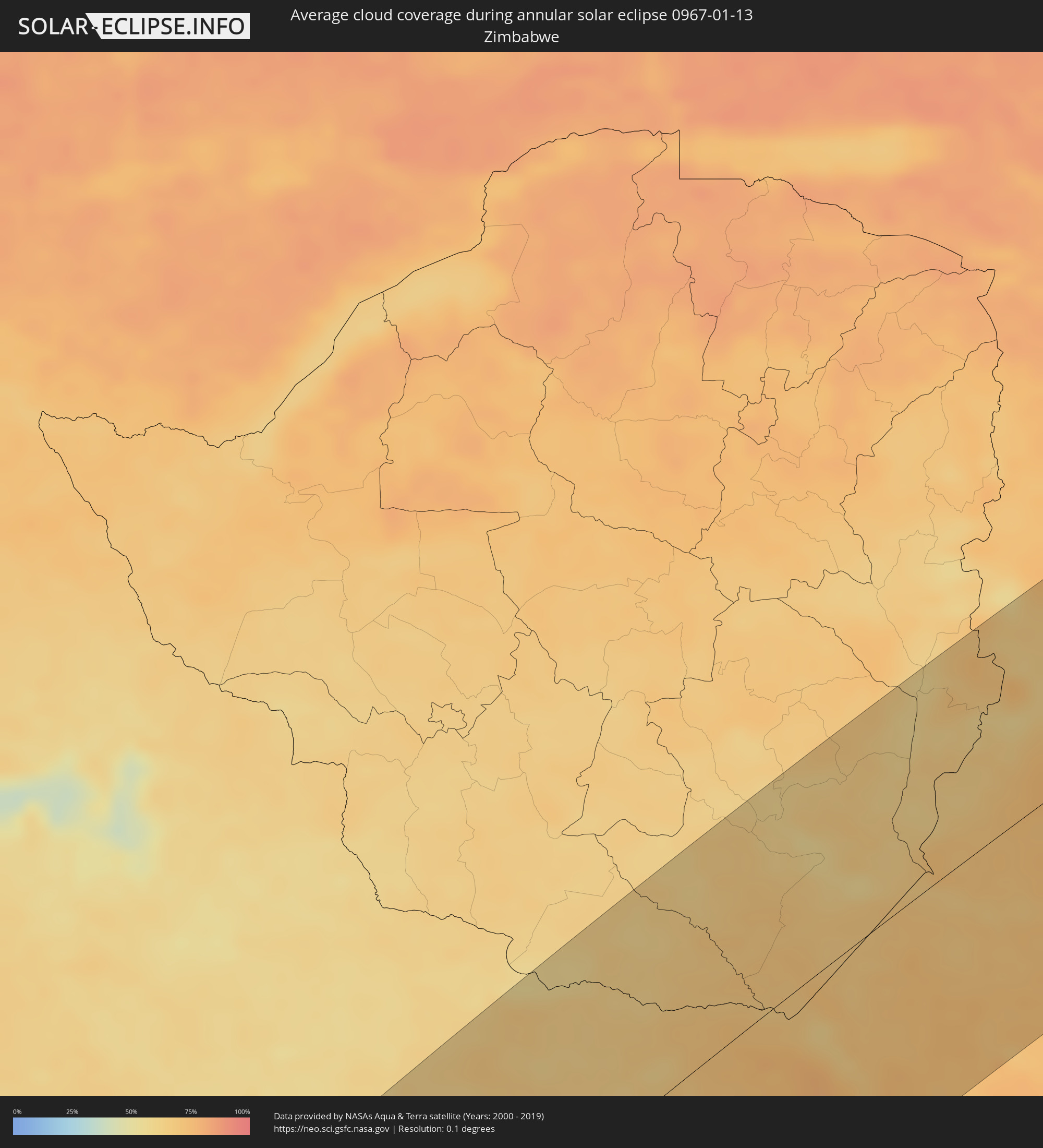 Zimbabwe
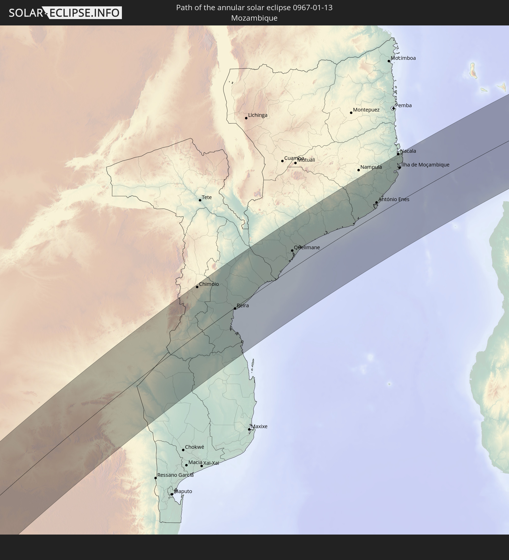
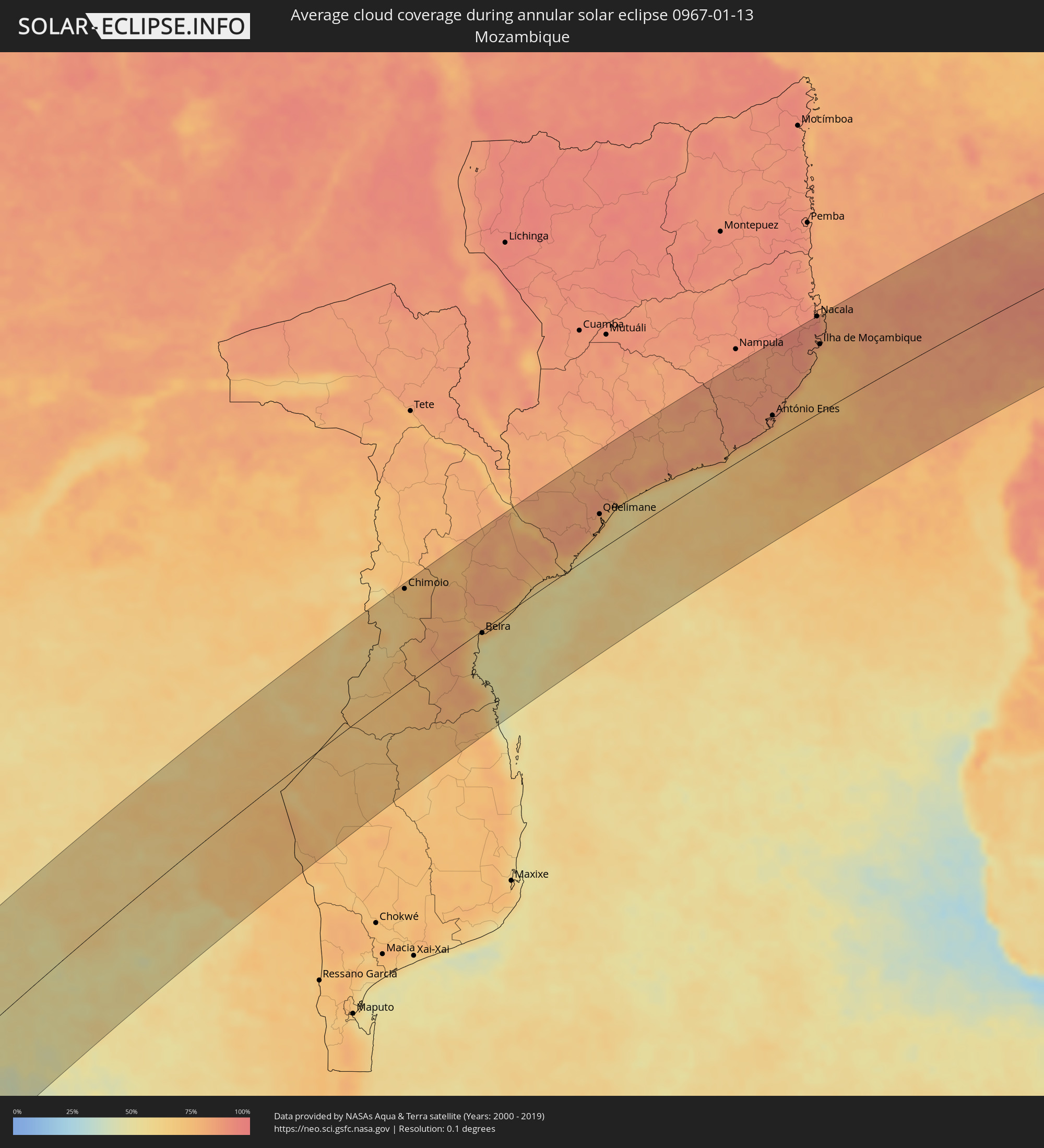 Mozambique
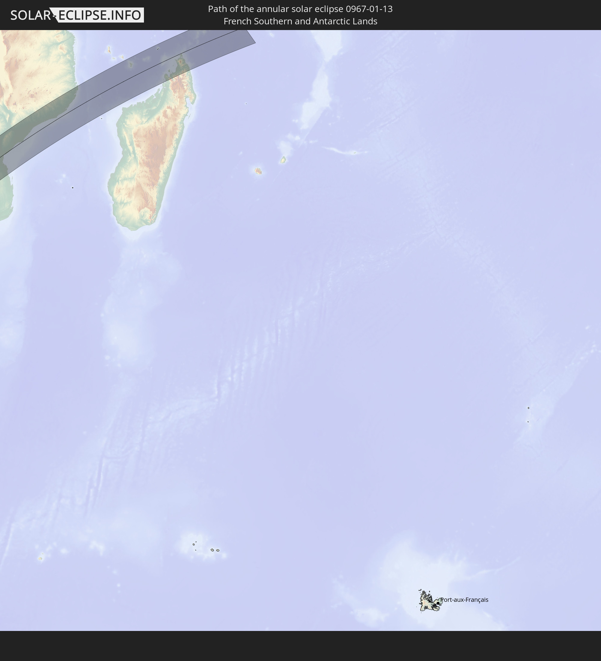
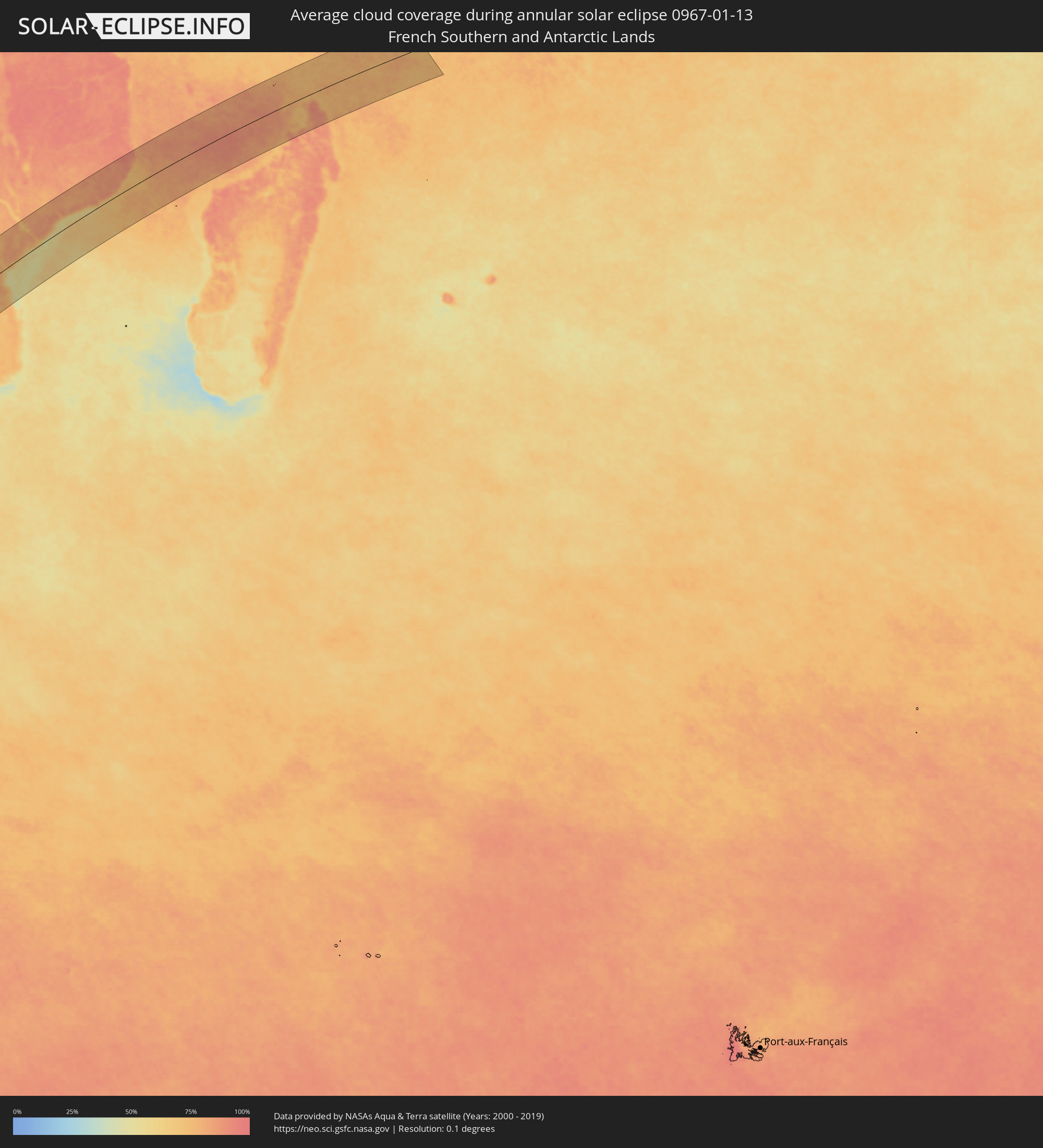 French Southern and Antarctic Lands
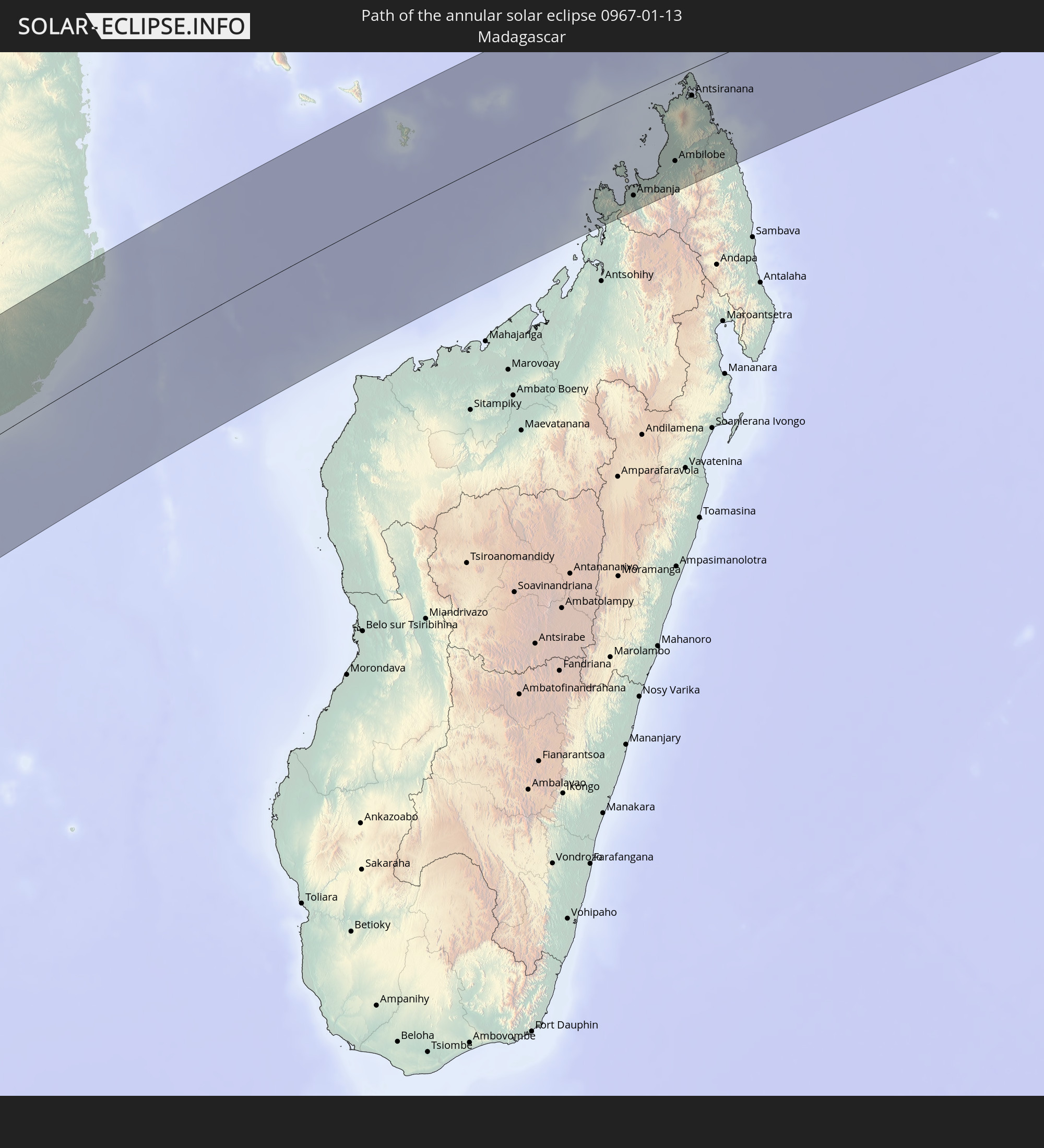
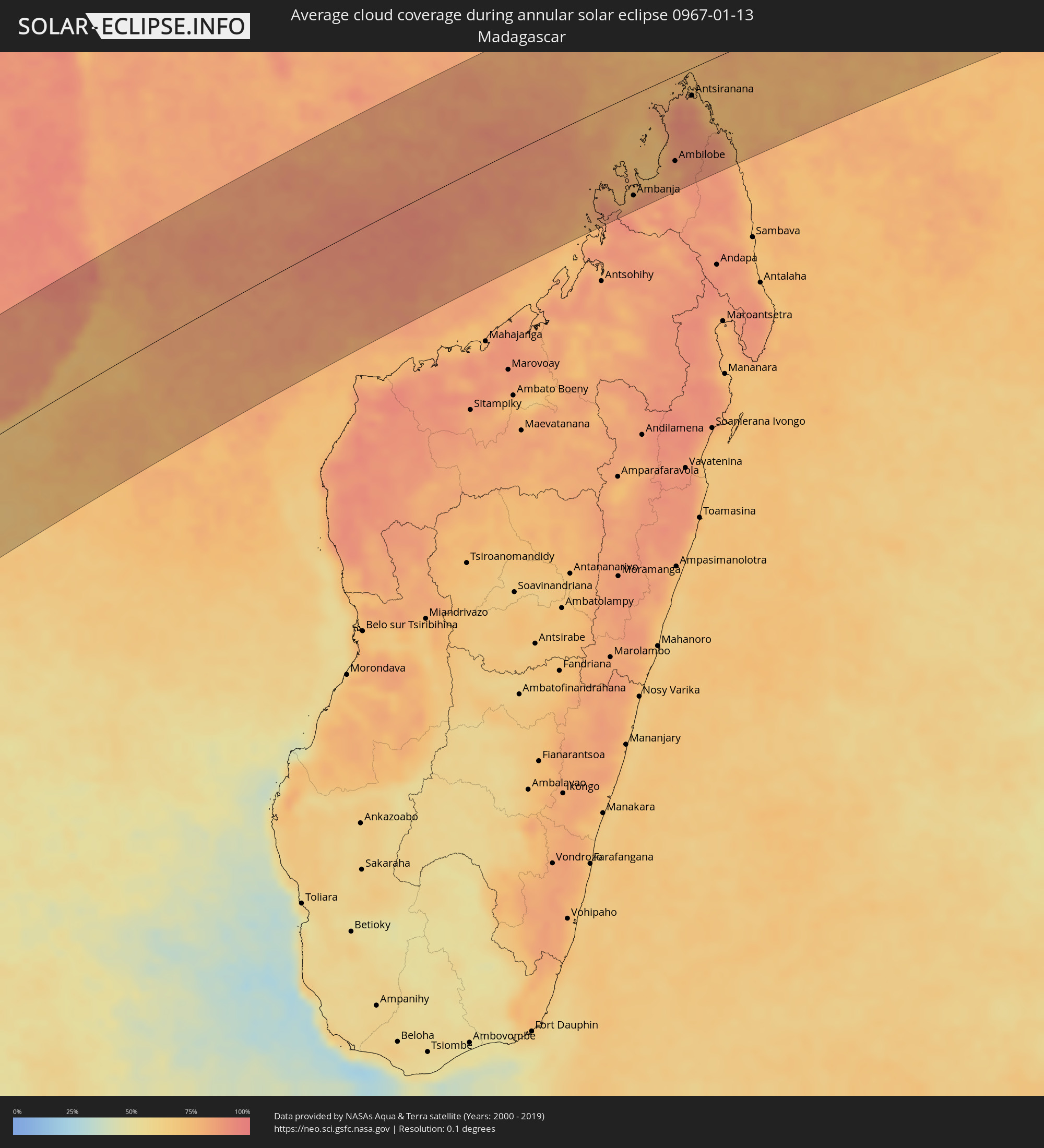 Madagascar
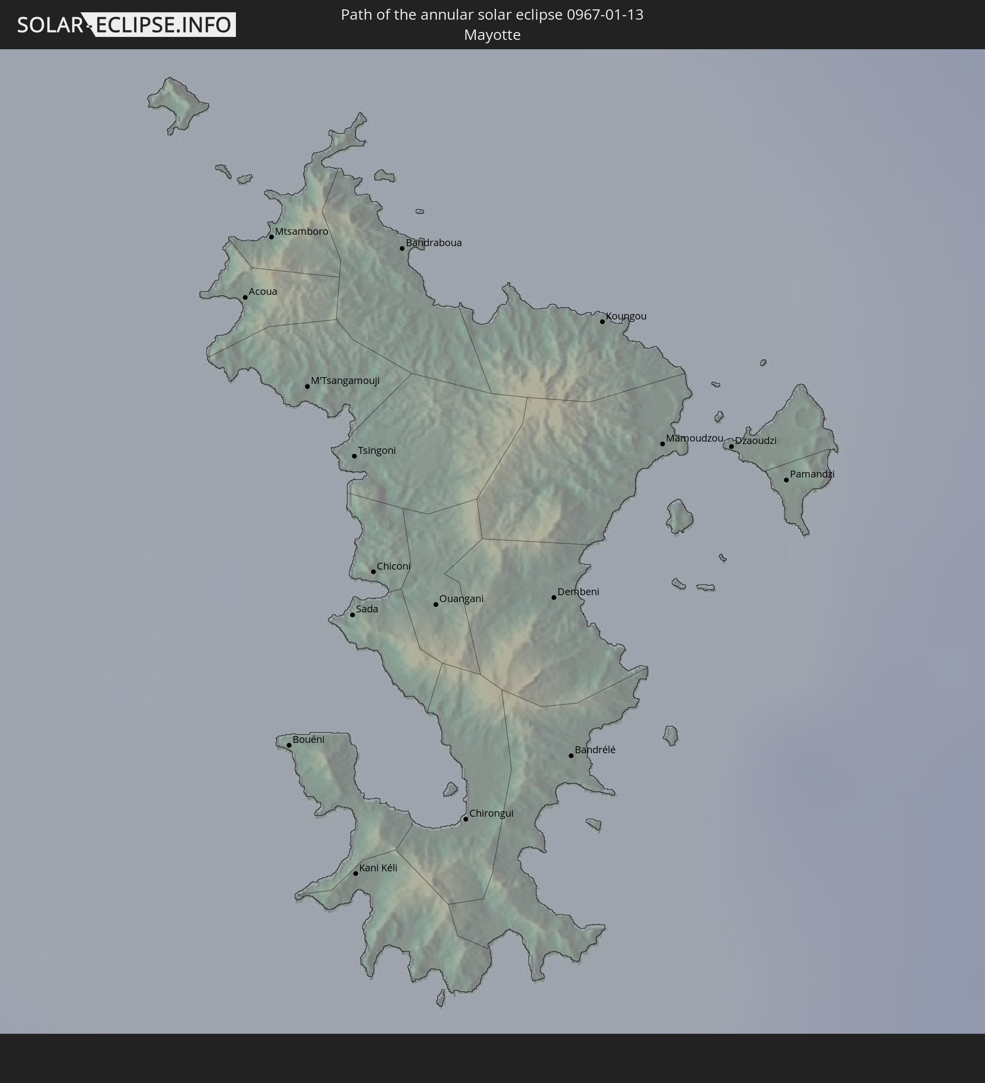
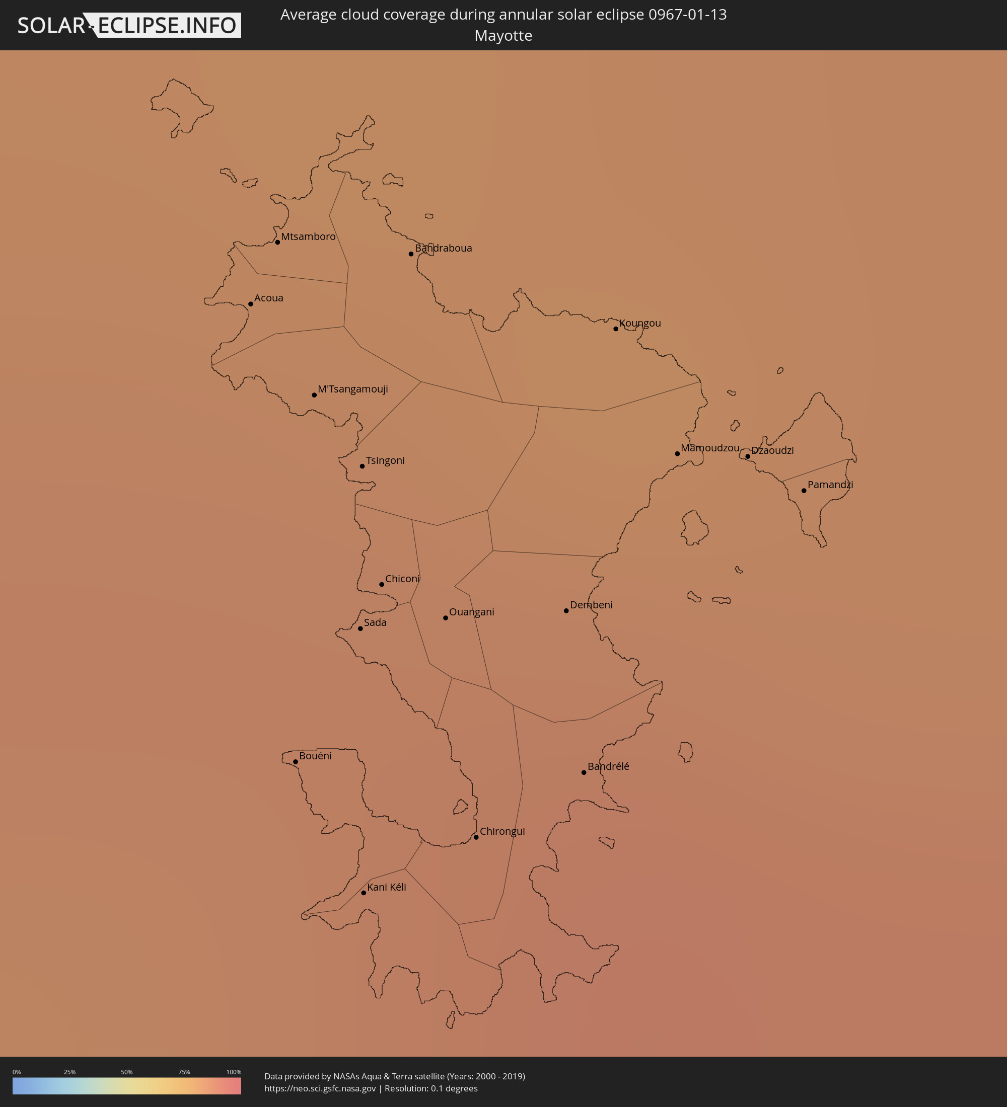 Mayotte
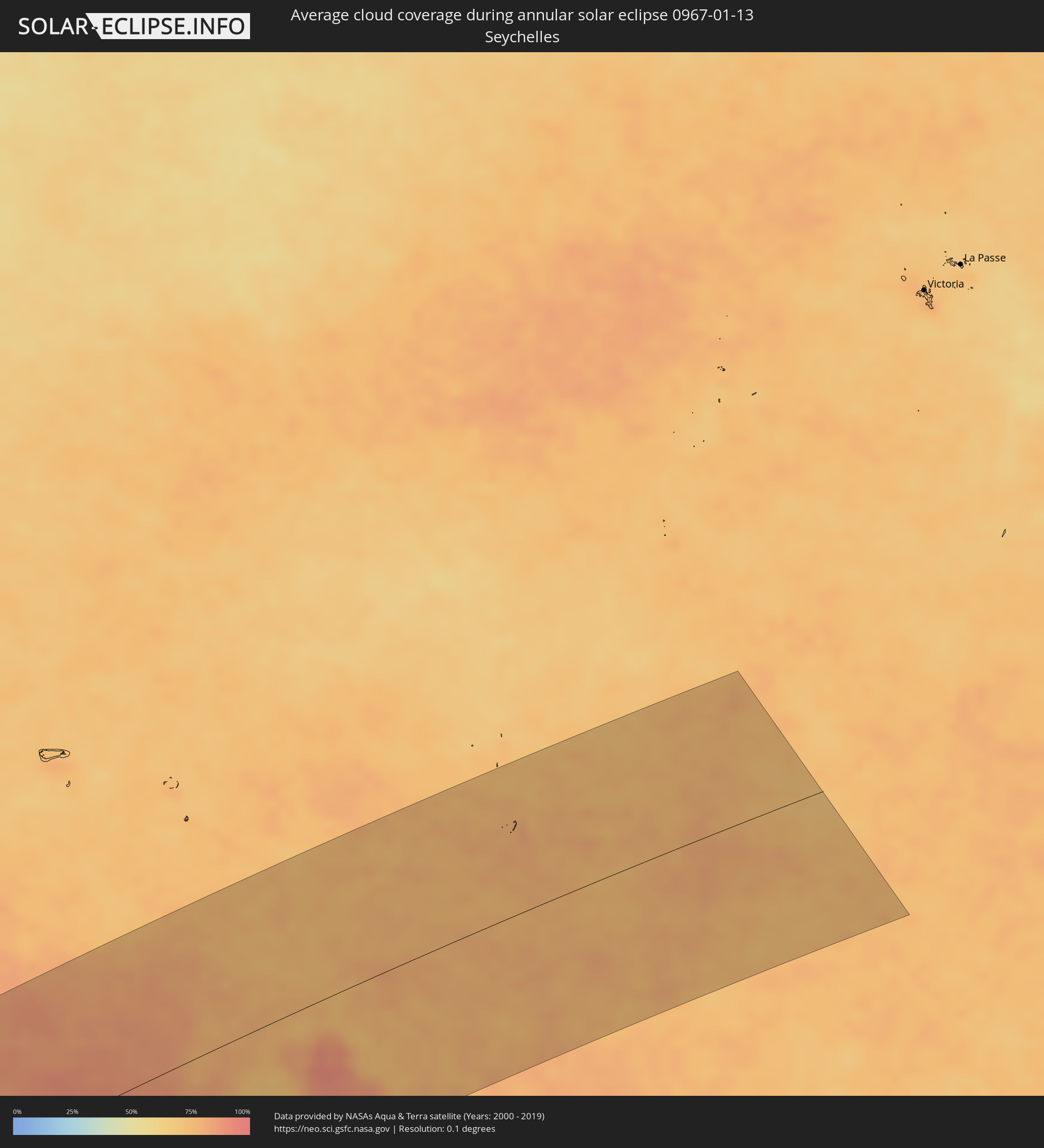 Seychelles
Cities inside the path of the eclipse
The following table shows all locations with a population of more than 5,000 inside the eclipse path. Cities which have more than 100,000 inhabitants are marked bold. A click at the locations opens a detailed map.
| City | Type | Eclipse duration | Local time of max. eclipse | Distance to central line | Ø Cloud coverage |
|
Puerto Natales, Magallanes
|
annular | - | 06:53:30 UTC-04:42 | 111 km | 81% |
|
Yacimiento Río Turbio, Santa Cruz Province
|
annular | - | 07:19:18 UTC-04:16 | 92 km | 80% |
|
Río Turbio, Santa Cruz Province
|
annular | - | 07:19:15 UTC-04:16 | 88 km | 78% |
|
El Calafate, Santa Cruz Province
|
annular | - | 07:17:39 UTC-04:16 | 37 km | 62% |
|
Río Gallegos, Santa Cruz Province
|
annular | - | 07:20:25 UTC-04:16 | 19 km | 80% |
|
Grytviken
|
annular | - | 10:08:01 UTC-02:00 | 69 km | 93% |
|
Cape Town, Western Cape
|
annular | - | 15:32:22 UTC+01:30 | 98 km | 34% |
|
Stellenbosch, Western Cape
|
annular | - | 15:32:47 UTC+01:30 | 128 km | 28% |
|
Paarl, Western Cape
|
annular | - | 15:33:19 UTC+01:30 | 120 km | 23% |
|
Kimberley, Northern Cape
|
annular | - | 15:48:26 UTC+01:30 | 115 km | 36% |
|
Janeng, South-East
|
annular | - | 16:35:43 UTC+02:10 | 105 km | 54% |
|
Mmabatho, North-West
|
annular | - | 15:54:37 UTC+01:30 | 63 km | 53% |
|
Lobatse, South-East
|
annular | - | 16:36:10 UTC+02:10 | 112 km | 56% |
|
Otse, South-East
|
annular | - | 16:36:35 UTC+02:10 | 126 km | 55% |
|
Ramotswa, South-East
|
annular | - | 16:36:57 UTC+02:10 | 129 km | 56% |
|
Gaborone, South-East
|
annular | - | 16:37:23 UTC+02:10 | 145 km | 53% |
|
Bothaville, Orange Free State
|
annular | - | 15:52:16 UTC+01:30 | 130 km | 40% |
|
Klerksdorp, North-West
|
annular | - | 15:53:20 UTC+01:30 | 89 km | 43% |
|
Potchefstroom, North-West
|
annular | - | 15:53:51 UTC+01:30 | 106 km | 48% |
|
Rustenburg, North-West
|
annular | - | 15:55:55 UTC+01:30 | 29 km | 49% |
|
Carletonville, Gauteng
|
annular | - | 15:54:42 UTC+01:30 | 97 km | 48% |
|
Westonaria, Gauteng
|
annular | - | 15:54:55 UTC+01:30 | 110 km | 50% |
|
Krugersdorp, Gauteng
|
annular | - | 15:55:25 UTC+01:30 | 99 km | 52% |
|
Brits, North-West
|
annular | - | 15:56:16 UTC+01:30 | 61 km | 50% |
|
Soweto, Gauteng
|
annular | - | 15:55:08 UTC+01:30 | 119 km | 54% |
|
Diepsloot, Gauteng
|
annular | - | 15:55:50 UTC+01:30 | 102 km | 51% |
|
Johannesburg, Gauteng
|
annular | - | 15:55:21 UTC+01:30 | 126 km | 53% |
|
Mabopane, Gauteng
|
annular | - | 15:56:42 UTC+01:30 | 71 km | 54% |
|
Pretoria, Gauteng
|
annular | - | 15:56:17 UTC+01:30 | 97 km | 54% |
|
Tembisa, Gauteng
|
annular | - | 15:55:50 UTC+01:30 | 121 km | 58% |
|
Warmbaths, Limpopo
|
annular | - | 15:57:56 UTC+01:30 | 31 km | 55% |
|
Benoni, Gauteng
|
annular | - | 15:55:32 UTC+01:30 | 143 km | 56% |
|
Mokopane, Limpopo
|
annular | - | 15:59:33 UTC+01:30 | 20 km | 57% |
|
Polokwane, Limpopo
|
annular | - | 16:00:18 UTC+01:30 | 25 km | 64% |
|
Louis Trichardt, Limpopo
|
annular | - | 16:02:01 UTC+01:30 | 21 km | 64% |
|
Phalaborwa, Limpopo
|
annular | - | 16:00:57 UTC+01:30 | 137 km | 70% |
|
Chimoio, Manica
|
annular | - | 16:50:12 UTC+02:10 | 144 km | 72% |
|
Dondo, Sofala
|
annular | - | 16:49:44 UTC+02:10 | 23 km | 77% |
|
Beira, Sofala
|
annular | - | 16:49:22 UTC+02:10 | 4 km | 65% |
|
Quelimane, Zambézia
|
annular | - | 16:52:48 UTC+02:10 | 55 km | 79% |
|
António Enes, Nampula
|
annular | - | 16:55:27 UTC+02:10 | 40 km | 85% |
|
Nacala, Nampula
|
annular | - | 16:57:46 UTC+02:10 | 158 km | 92% |
|
Ilha de Moçambique, Nampula
|
annular | - | 16:57:07 UTC+02:10 | 110 km | 85% |
|
Acoua, Acoua
|
annular | - | 17:16:42 UTC+02:27 | 115 km | 85% |
|
Mtsamboro, Mtsamboro
|
annular | - | 17:16:44 UTC+02:27 | 116 km | 85% |
|
Bouéni, Bouéni
|
annular | - | 17:16:29 UTC+02:27 | 96 km | 84% |
|
M'Tsangamouji, M'Tsangamouji
|
annular | - | 17:16:39 UTC+02:27 | 110 km | 86% |
|
Sada, Sada
|
annular | - | 17:16:32 UTC+02:27 | 100 km | 84% |
|
Tsingoni, Tsingoni
|
annular | - | 17:16:37 UTC+02:27 | 106 km | 86% |
|
Kani Kéli, Kani-Kéli
|
annular | - | 17:16:25 UTC+02:27 | 89 km | 84% |
|
Chiconi, Chiconi
|
annular | - | 17:16:33 UTC+02:27 | 101 km | 86% |
|
Bandraboua, Bandraboua
|
annular | - | 17:16:43 UTC+02:27 | 113 km | 85% |
|
Ouangani, Ouangani
|
annular | - | 17:16:32 UTC+02:27 | 99 km | 86% |
|
Chirongui, Chirongui
|
annular | - | 17:16:26 UTC+02:27 | 89 km | 84% |
|
Dembeni, Dembeni
|
annular | - | 17:16:32 UTC+02:27 | 96 km | 88% |
|
Bandrélé, Bandrele
|
annular | - | 17:16:27 UTC+02:27 | 90 km | 86% |
|
Koungou, Koungou
|
annular | - | 17:16:40 UTC+02:27 | 106 km | 85% |
|
Mamoudzou, Mamoudzou
|
annular | - | 17:16:36 UTC+02:27 | 100 km | 88% |
|
Dzaoudzi, Dzaoudzi
|
annular | - | 17:16:36 UTC+02:27 | 99 km | 87% |
|
Pamandzi, Pamandzi
|
annular | - | 17:16:35 UTC+02:27 | 96 km | 87% |
|
Hell-Ville, Diana
|
annular | - | 17:15:19 UTC+02:27 | 106 km | 78% |
|
Ambanja, Diana
|
annular | - | 17:14:56 UTC+02:27 | 143 km | 86% |
|
Antsohimbondrona, Diana
|
annular | - | 17:15:34 UTC+02:27 | 101 km | 78% |
|
Ambarakaraka, Diana
|
annular | - | 17:15:04 UTC+02:27 | 144 km | 84% |
|
Ambilobe, Diana
|
annular | - | 17:15:23 UTC+02:27 | 122 km | 78% |
|
Antsiranana, Diana
|
annular | - | 17:16:24 UTC+02:27 | 39 km | 83% |
|
Sadjoavato, Diana
|
annular | - | 17:15:59 UTC+02:27 | 76 km | 87% |