Total solar eclipse of 01/21/1395
| Day of week: | Wednesday |
| Maximum duration of eclipse: | 04m21s |
| Maximum width of eclipse path: | 180 km |
| Saros cycle: | 121 |
| Coverage: | 100% |
| Magnitude: | 1.0487 |
| Gamma: | 0.4555 |
Wo kann man die Sonnenfinsternis vom 01/21/1395 sehen?
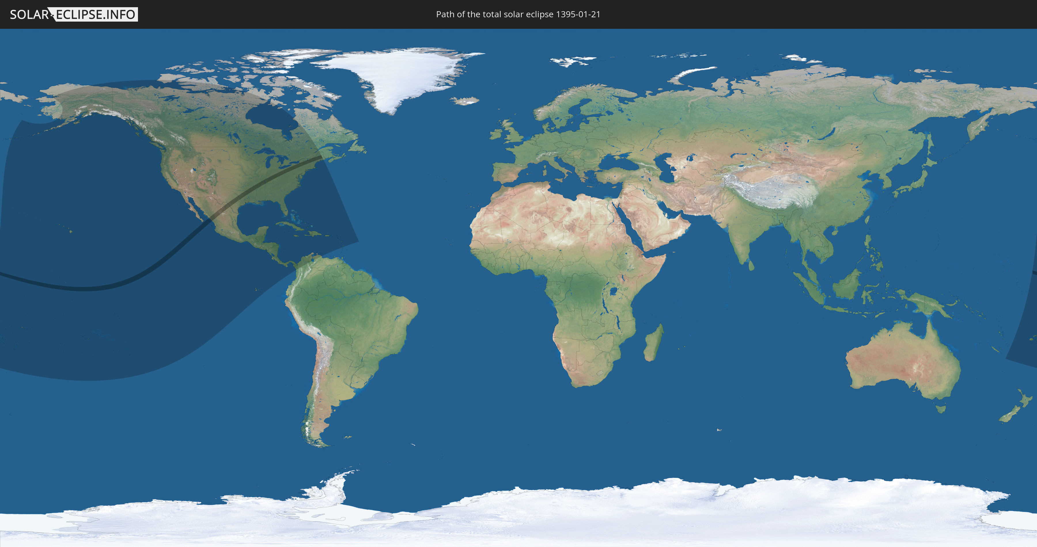
Die Sonnenfinsternis am 01/21/1395 kann man in 49 Ländern als partielle Sonnenfinsternis beobachten.
Der Finsternispfad verläuft durch 4 Länder. Nur in diesen Ländern ist sie als total Sonnenfinsternis zu sehen.
In den folgenden Ländern ist die Sonnenfinsternis total zu sehen
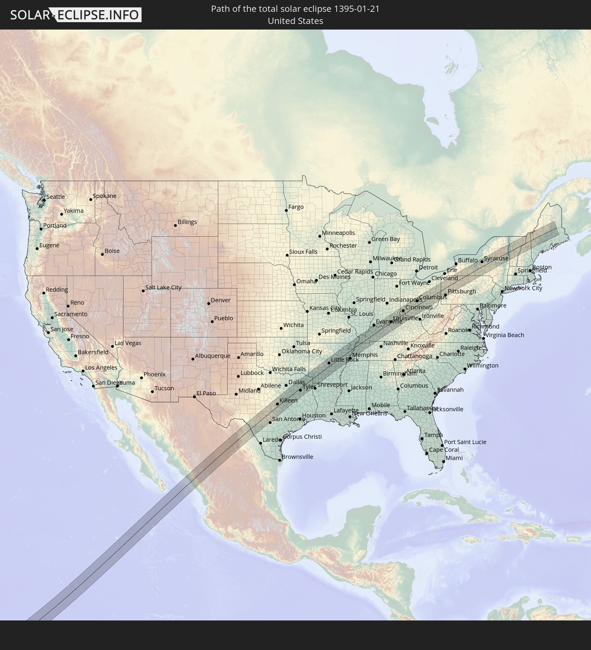 United States
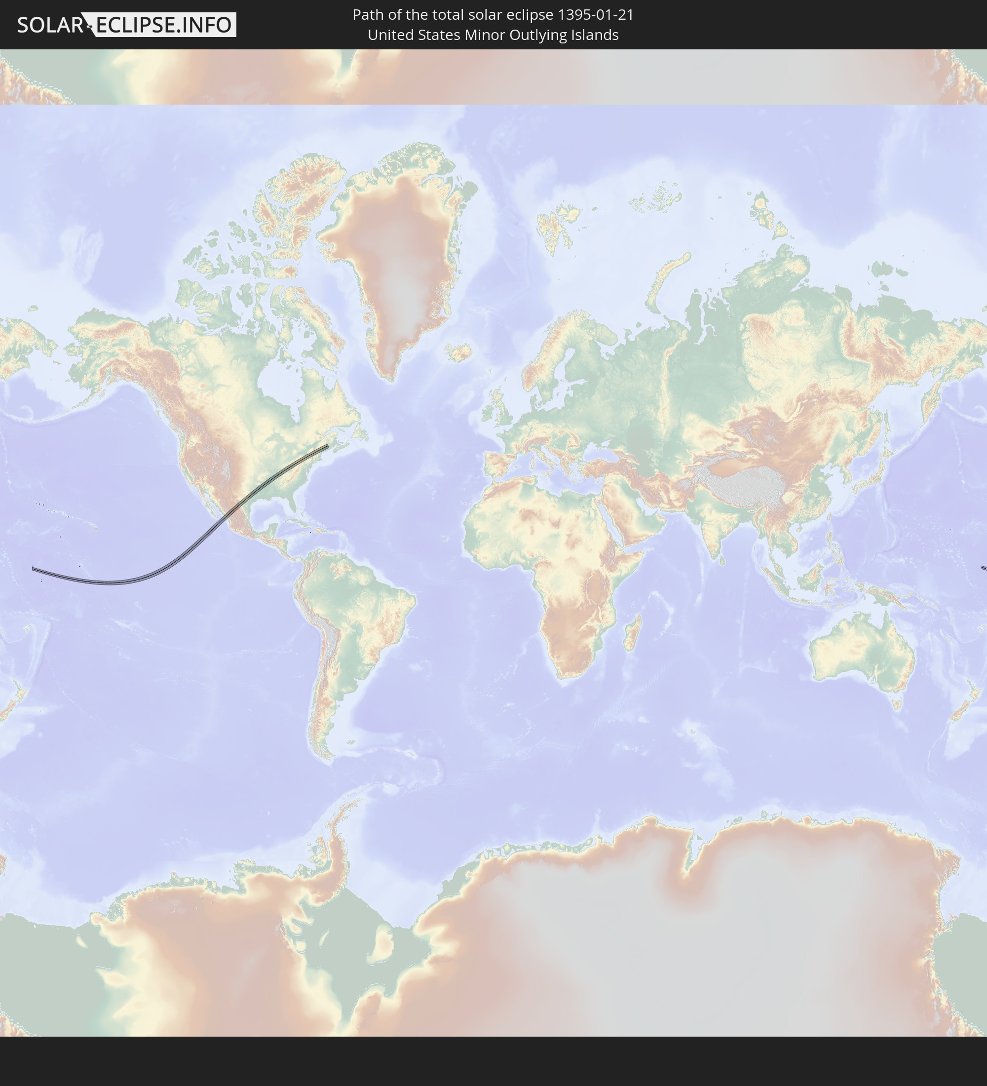 United States Minor Outlying Islands
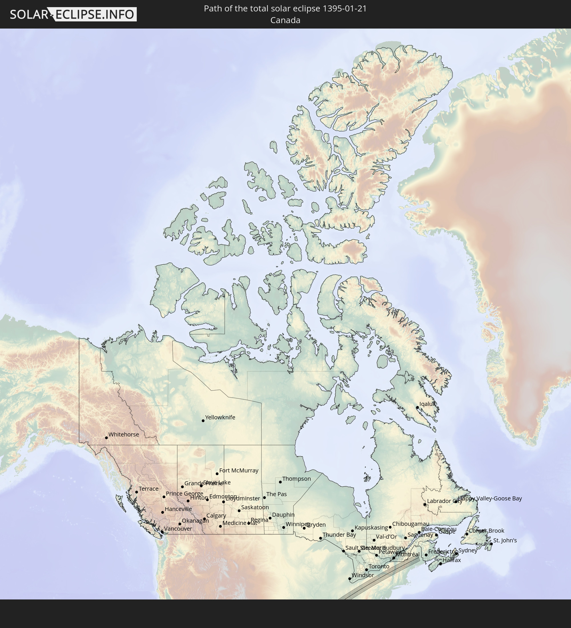 Canada
 Mexico
In den folgenden Ländern ist die Sonnenfinsternis partiell zu sehen
 Fiji
Fiji
 United States
 United States Minor Outlying Islands
 Wallis and Futuna
 Tonga
Tonga
 Kiribati
 Samoa
Samoa
 Tokelau
 American Samoa
 Niue
Niue
 Cook Islands
 French Polynesia
 Canada
 Pitcairn Islands
 Mexico
 Greenland
 Guatemala
 Ecuador
 El Salvador
 Honduras
 Belize
 Nicaragua
 Costa Rica
 Cuba
Cuba
 Panama
 Colombia
 Cayman Islands
 The Bahamas
 Jamaica
 Haiti
Haiti
 Venezuela
 Turks and Caicos Islands
 Dominican Republic
 Aruba
Aruba
 Puerto Rico
 United States Virgin Islands
 Bermuda
 British Virgin Islands
 Anguilla
 Collectivity of Saint Martin
 Saint Barthélemy
 Saint Kitts and Nevis
 Antigua and Barbuda
 Montserrat
 Guadeloupe
 Dominica
 Martinique
 New Caledonia
 Tuvalu
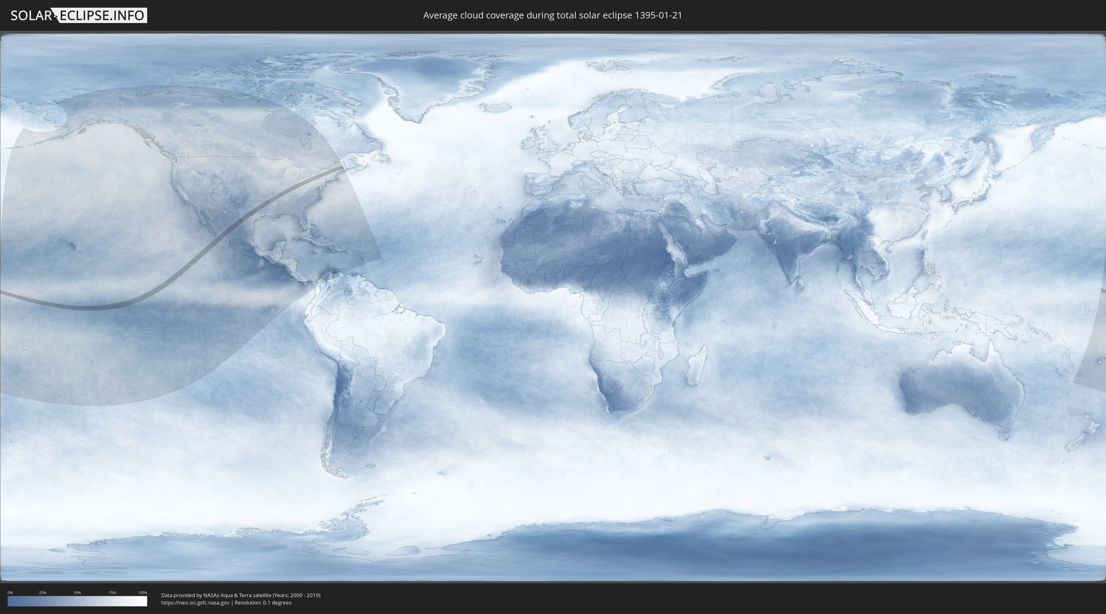
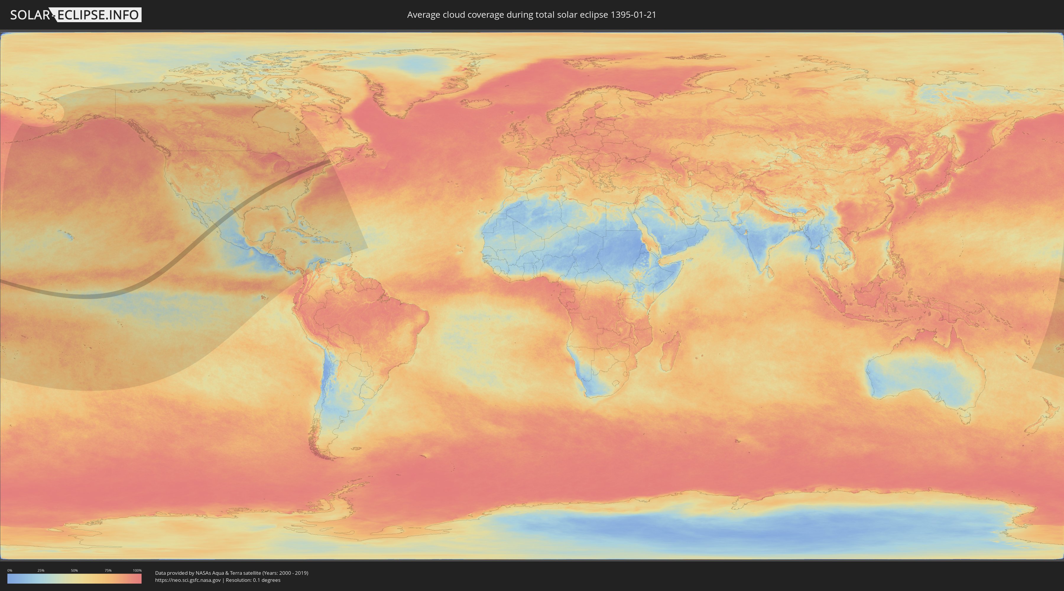
How will be the weather during the total solar eclipse on 01/21/1395?
Where is the best place to see the total solar eclipse of 01/21/1395?
The following maps show the average cloud coverage for the day of the total solar eclipse.
With the help of these maps, it is possible to find the place along the eclipse path, which has the best
chance of a cloudless sky.
Nevertheless, you should consider local circumstances and inform about the weather of your chosen
observation site.
The data is provided by NASAs satellites
AQUA and TERRA.
The cloud maps are averaged over a period of 19 years (2000 - 2019).
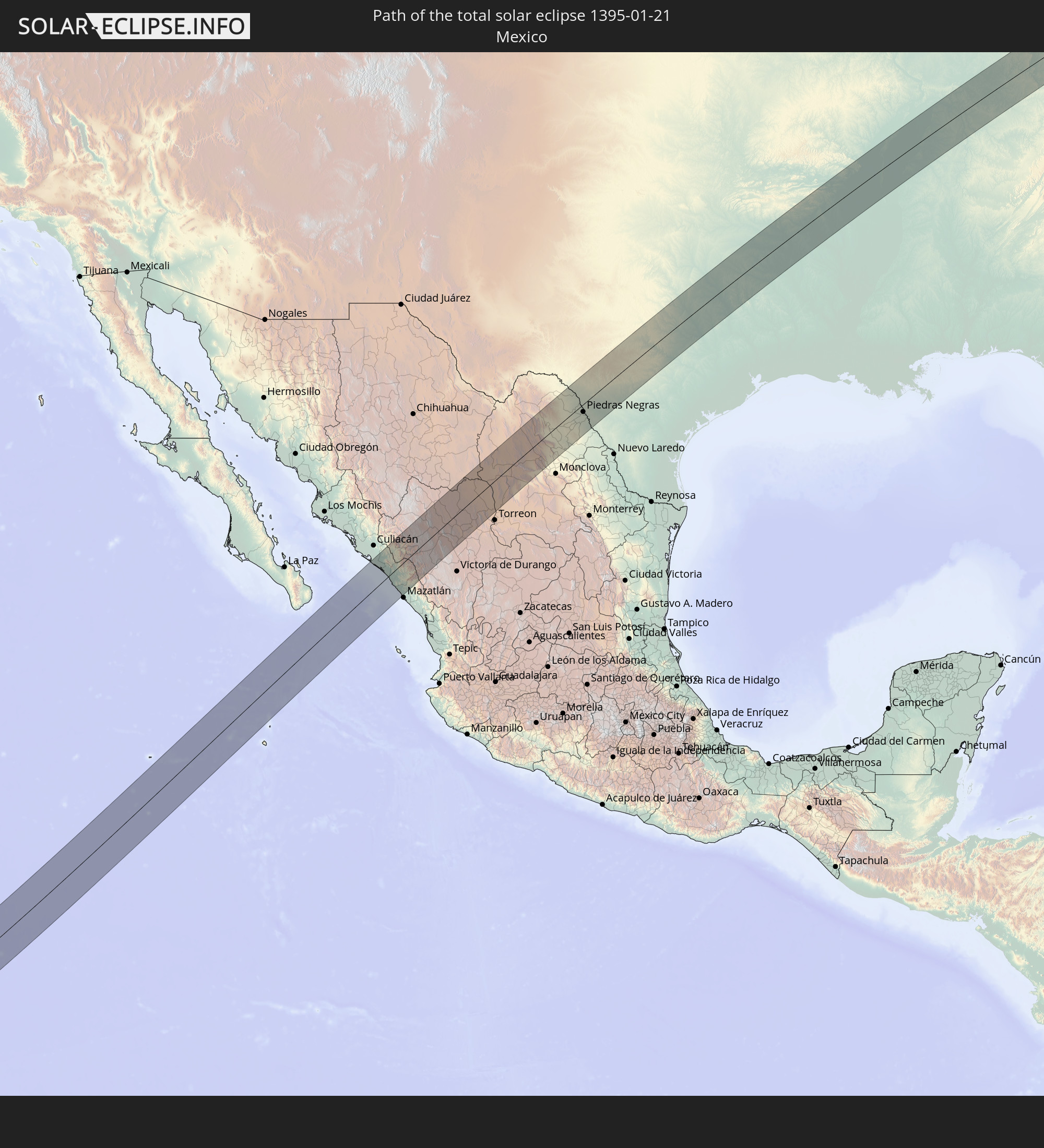
Detailed country maps
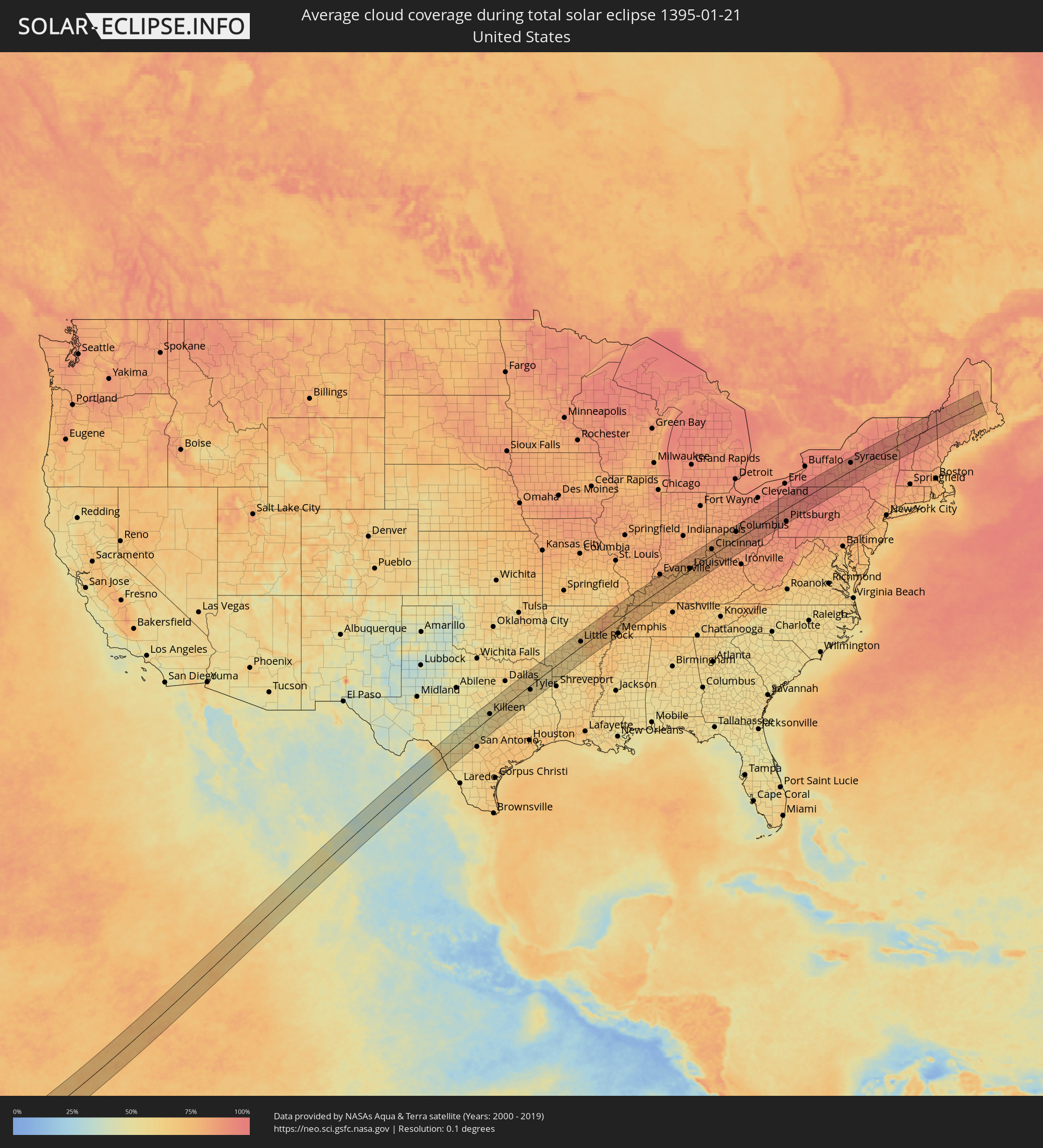 United States
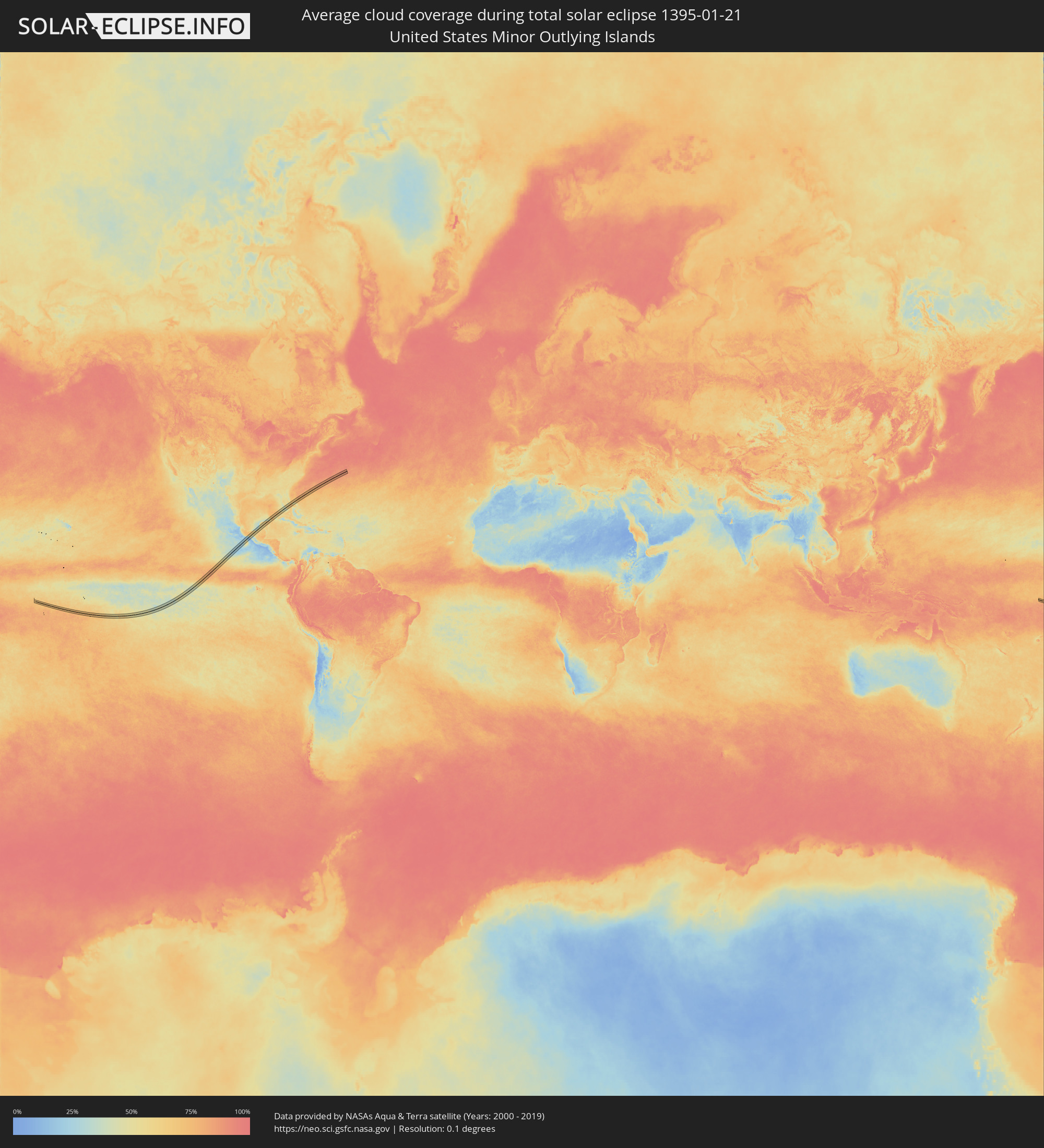 United States Minor Outlying Islands
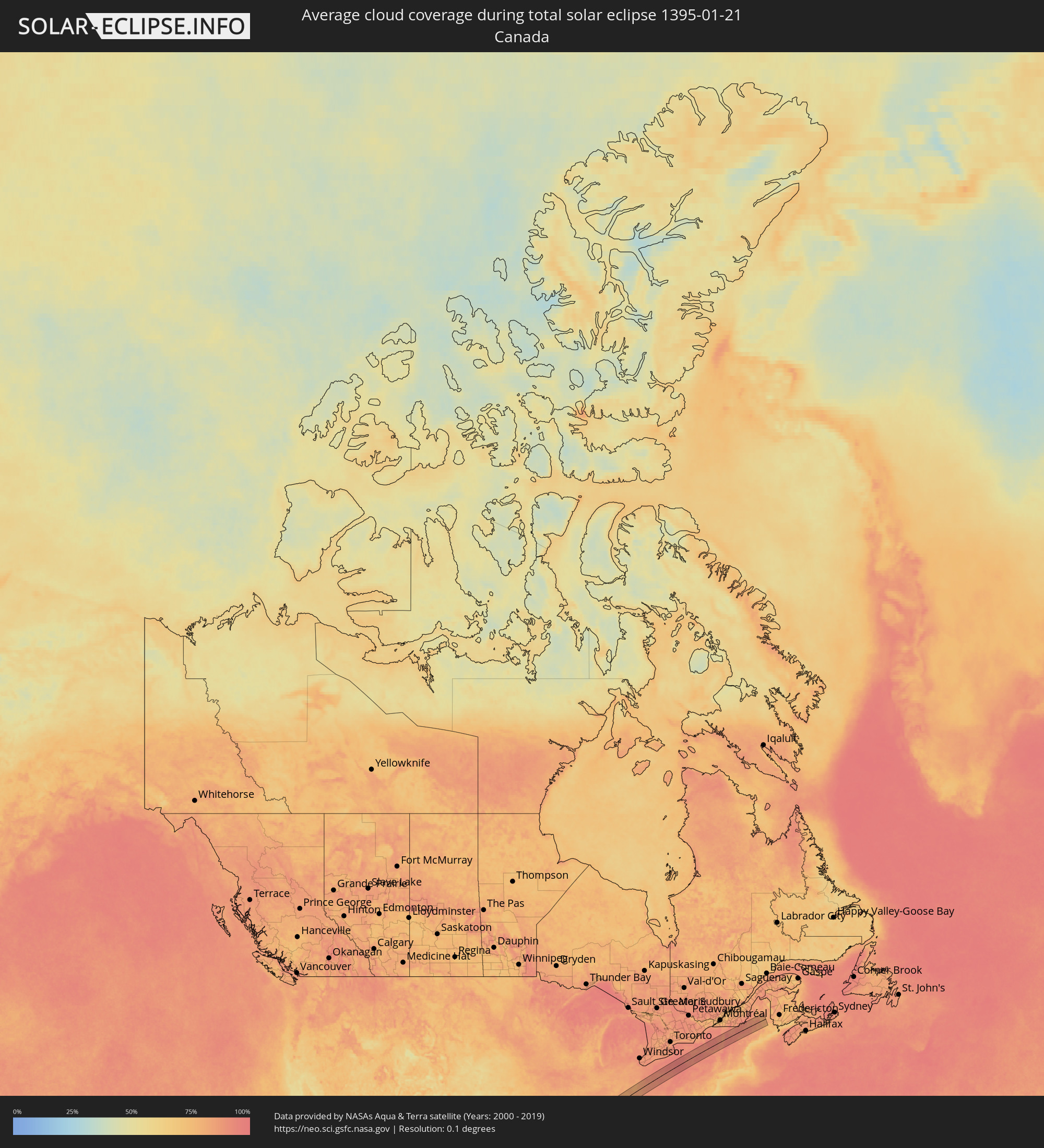 Canada
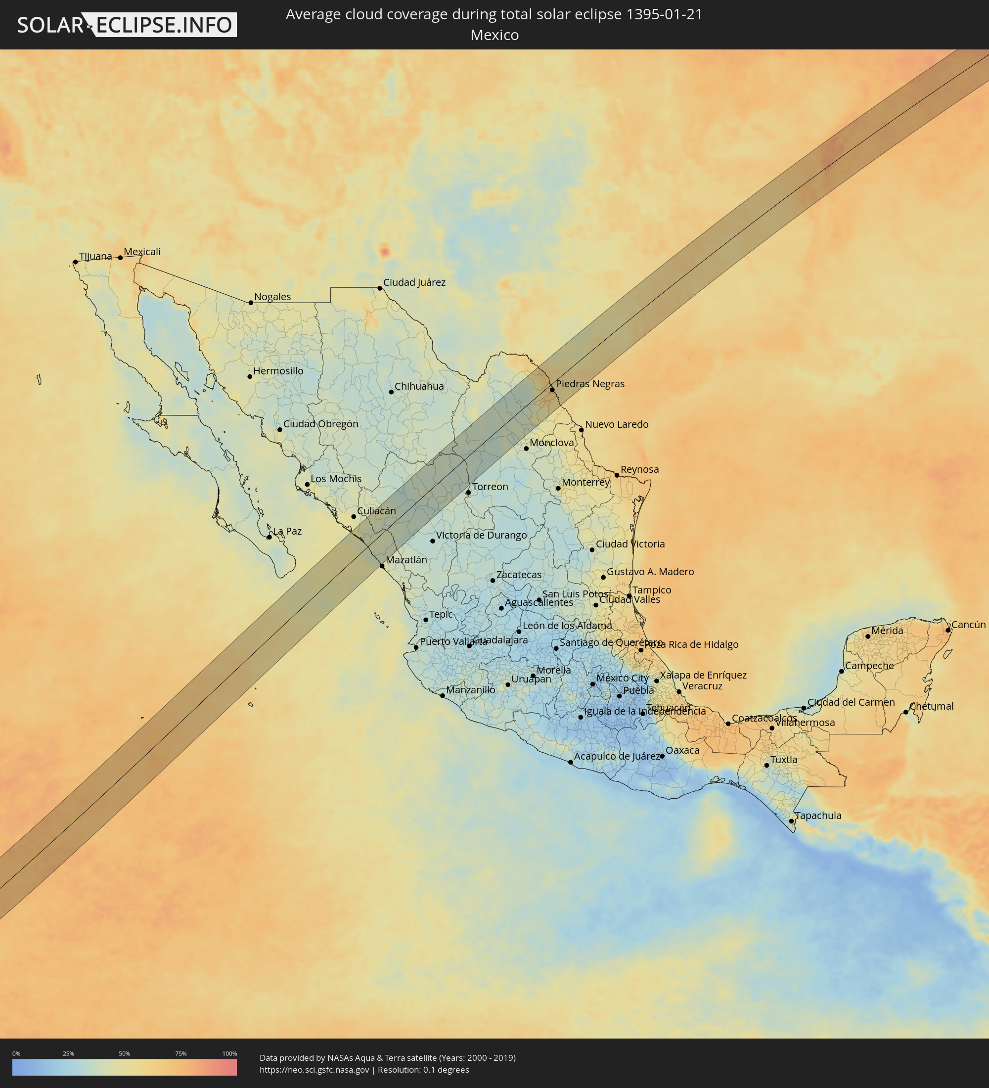 Mexico
Cities inside the path of the eclipse
The following table shows all locations with a population of more than 5,000 inside the eclipse path. Cities which have more than 100,000 inhabitants are marked bold. A click at the locations opens a detailed map.
| City | Type | Eclipse duration | Local time of max. eclipse | Distance to central line | Ø Cloud coverage |
|
Eldorado, Sinaloa
|
total | - | 13:54:10 UTC-07:05 | 69 km | 48% |
|
El Dorado, Sinaloa
|
total | - | 13:54:10 UTC-07:05 | 68 km | 48% |
|
Quila, Sinaloa
|
total | - | 13:54:28 UTC-07:05 | 67 km | 48% |
|
La Constancia, Sinaloa
|
total | - | 13:54:22 UTC-07:05 | 48 km | 47% |
|
El Rosario, Sinaloa
|
total | - | 13:54:24 UTC-07:05 | 50 km | 47% |
|
La Cruz, Sinaloa
|
total | - | 13:54:35 UTC-07:05 | 3 km | 45% |
|
Cosalá, Sinaloa
|
total | - | 13:55:17 UTC-07:05 | 30 km | 39% |
|
Tayoltita, Durango
|
total | - | 14:25:15 UTC-06:36 | 48 km | 37% |
|
Santiago Papasquiaro, Durango
|
total | - | 14:26:44 UTC-06:36 | 5 km | 36% |
|
Santa María del Oro, Durango
|
total | - | 14:27:28 UTC-06:36 | 66 km | 37% |
|
San Miguel de Papasquiaro, Durango
|
total | - | 14:26:42 UTC-06:36 | 28 km | 37% |
|
Nuevo Ideal, Durango
|
total | - | 14:27:07 UTC-06:36 | 41 km | 33% |
|
Bermejillo, Durango
|
total | - | 14:29:53 UTC-06:36 | 55 km | 37% |
|
Poanas, Durango
|
total | - | 14:29:50 UTC-06:36 | 66 km | 35% |
|
Tlahualilo de Zaragoza, Durango
|
total | - | 14:30:17 UTC-06:36 | 49 km | 33% |
|
Melchor Múzquiz, Coahuila
|
total | - | 14:33:53 UTC-06:36 | 25 km | 40% |
|
Palau, Coahuila
|
total | - | 14:34:00 UTC-06:36 | 30 km | 40% |
|
Minas de Barroterán, Coahuila
|
total | - | 14:34:03 UTC-06:36 | 60 km | 40% |
|
Nueva Rosita, Coahuila
|
total | - | 14:34:17 UTC-06:36 | 39 km | 44% |
|
Ciudad Sabinas, Coahuila
|
total | - | 14:34:22 UTC-06:36 | 53 km | 50% |
|
Ciudad Acuña, Coahuila
|
total | - | 14:35:18 UTC-06:36 | 61 km | 65% |
|
Zaragoza, Coahuila
|
total | - | 14:34:56 UTC-06:36 | 11 km | 62% |
|
Del Rio, Texas
|
total | - | 15:11:59 UTC-06:00 | 61 km | 62% |
|
Allende, Coahuila
|
total | - | 14:34:57 UTC-06:36 | 29 km | 52% |
|
Nava, Coahuila
|
total | - | 14:35:06 UTC-06:36 | 27 km | 62% |
|
Villa Union, Coahuila
|
total | - | 14:35:03 UTC-06:36 | 48 km | 53% |
|
Piedras Negras, Coahuila
|
total | - | 14:35:32 UTC-06:36 | 19 km | 63% |
|
Eagle Pass, Texas
|
total | - | 15:12:10 UTC-06:00 | 20 km | 63% |
|
Uvalde, Texas
|
total | - | 15:13:15 UTC-06:00 | 22 km | 57% |
|
Kerrville, Texas
|
total | - | 15:14:22 UTC-06:00 | 10 km | 57% |
|
Canyon Lake, Texas
|
total | - | 15:15:18 UTC-06:00 | 59 km | 57% |
|
Copperas Cove, Texas
|
total | - | 15:16:08 UTC-06:00 | 27 km | 52% |
|
Leander, Texas
|
total | - | 15:16:01 UTC-06:00 | 23 km | 53% |
|
Gatesville, Texas
|
total | - | 15:16:24 UTC-06:00 | 44 km | 52% |
|
Austin, Texas
|
total | - | 15:16:01 UTC-06:00 | 57 km | 61% |
|
Killeen, Texas
|
total | - | 15:16:20 UTC-06:00 | 16 km | 58% |
|
Round Rock, Texas
|
total | - | 15:16:11 UTC-06:00 | 40 km | 60% |
|
Taylor, Texas
|
total | - | 15:16:30 UTC-06:00 | 51 km | 61% |
|
Temple, Texas
|
total | - | 15:16:44 UTC-06:00 | 9 km | 59% |
|
Waco, Texas
|
total | - | 15:17:05 UTC-06:00 | 19 km | 59% |
|
Ennis, Texas
|
total | - | 15:17:50 UTC-06:00 | 55 km | 60% |
|
Corsicana, Texas
|
total | - | 15:17:57 UTC-06:00 | 26 km | 61% |
|
Terrell, Texas
|
total | - | 15:18:17 UTC-06:00 | 70 km | 63% |
|
Palestine, Texas
|
total | - | 15:18:43 UTC-06:00 | 52 km | 54% |
|
Sulphur Springs, Texas
|
total | - | 15:19:03 UTC-06:00 | 66 km | 64% |
|
Tyler, Texas
|
total | - | 15:19:11 UTC-06:00 | 20 km | 58% |
|
Jacksonville, Texas
|
total | - | 15:19:08 UTC-06:00 | 56 km | 57% |
|
Mount Pleasant, Texas
|
total | - | 15:19:41 UTC-06:00 | 32 km | 61% |
|
Longview, Texas
|
total | - | 15:19:47 UTC-06:00 | 39 km | 60% |
|
Marshall, Texas
|
total | - | 15:20:09 UTC-06:00 | 57 km | 57% |
|
Texarkana, Texas
|
total | - | 15:20:36 UTC-06:00 | 3 km | 58% |
|
Hot Springs National Park, Arkansas
|
total | - | 15:21:39 UTC-06:00 | 46 km | 61% |
|
Benton, Arkansas
|
total | - | 15:22:04 UTC-06:00 | 23 km | 63% |
|
Conway, Arkansas
|
total | - | 15:22:14 UTC-06:00 | 61 km | 65% |
|
Maumelle, Arkansas
|
total | - | 15:22:15 UTC-06:00 | 39 km | 64% |
|
Little Rock, Arkansas
|
total | - | 15:22:21 UTC-06:00 | 22 km | 65% |
|
Jacksonville, Arkansas
|
total | - | 15:22:31 UTC-06:00 | 23 km | 66% |
|
Pine Bluff, Arkansas
|
total | - | 15:22:33 UTC-06:00 | 39 km | 67% |
|
Searcy, Arkansas
|
total | - | 15:22:51 UTC-06:00 | 37 km | 72% |
|
Forrest City, Arkansas
|
total | - | 15:23:38 UTC-06:00 | 35 km | 73% |
|
Jonesboro, Arkansas
|
total | - | 15:23:43 UTC-06:00 | 35 km | 79% |
|
Paragould, Arkansas
|
total | - | 15:23:53 UTC-06:00 | 44 km | 74% |
|
Memphis, Tennessee
|
total | - | 15:24:14 UTC-06:00 | 62 km | 70% |
|
Blytheville, Arkansas
|
total | - | 15:24:21 UTC-06:00 | 2 km | 74% |
|
Bartlett, Tennessee
|
total | - | 15:24:23 UTC-06:00 | 66 km | 67% |
|
Dyersburg, Tennessee
|
total | - | 15:24:45 UTC-06:00 | 17 km | 75% |
|
Paducah, Kentucky
|
total | - | 15:25:17 UTC-06:00 | 38 km | 73% |
|
Murray, Kentucky
|
total | - | 15:25:32 UTC-06:00 | 19 km | 74% |
|
Henderson, Kentucky
|
total | - | 15:25:56 UTC-06:00 | 56 km | 77% |
|
Madisonville, Kentucky
|
total | - | 15:26:04 UTC-06:00 | 5 km | 76% |
|
Hopkinsville, Kentucky
|
total | - | 15:26:07 UTC-06:00 | 38 km | 76% |
|
Owensboro, Kentucky
|
total | - | 15:26:17 UTC-06:00 | 27 km | 76% |
|
Radcliff, Kentucky
|
total | - | 16:27:03 UTC-05:00 | 24 km | 77% |
|
Valley Station, Kentucky
|
total | - | 16:27:04 UTC-05:00 | 3 km | 74% |
|
Elizabethtown, Kentucky
|
total | - | 16:27:08 UTC-05:00 | 42 km | 76% |
|
Louisville, Kentucky
|
total | - | 16:27:07 UTC-05:00 | 5 km | 77% |
|
Jeffersontown, Kentucky
|
total | - | 16:27:15 UTC-05:00 | 10 km | 75% |
|
Shelbyville, Kentucky
|
total | - | 16:27:28 UTC-05:00 | 25 km | 77% |
|
Frankfort, Kentucky
|
total | - | 16:27:41 UTC-05:00 | 43 km | 80% |
|
Bridgetown, Ohio
|
total | - | 16:27:39 UTC-05:00 | 34 km | 79% |
|
Florence, Kentucky
|
total | - | 16:27:41 UTC-05:00 | 20 km | 79% |
|
Hamilton, Ohio
|
total | - | 16:27:38 UTC-05:00 | 54 km | 79% |
|
Georgetown, Kentucky
|
total | - | 16:27:53 UTC-05:00 | 57 km | 81% |
|
Cincinnati, Ohio
|
total | - | 16:27:45 UTC-05:00 | 27 km | 78% |
|
Middletown, Ohio
|
total | - | 16:27:42 UTC-05:00 | 57 km | 82% |
|
Mason, Ohio
|
total | - | 16:27:48 UTC-05:00 | 38 km | 81% |
|
Kettering, Ohio
|
total | - | 16:27:48 UTC-05:00 | 62 km | 81% |
|
Xenia, Ohio
|
total | - | 16:27:57 UTC-05:00 | 51 km | 79% |
|
Washington Court House, Ohio
|
total | - | 16:28:16 UTC-05:00 | 14 km | 82% |
|
Dublin, Ohio
|
total | - | 16:28:18 UTC-05:00 | 52 km | 84% |
|
Columbus, Ohio
|
total | - | 16:28:25 UTC-05:00 | 34 km | 84% |
|
Chillicothe, Ohio
|
total | - | 16:28:35 UTC-05:00 | 26 km | 84% |
|
Westerville, Ohio
|
total | - | 16:28:24 UTC-05:00 | 46 km | 86% |
|
Reynoldsburg, Ohio
|
total | - | 16:28:31 UTC-05:00 | 25 km | 84% |
|
Lancaster, Ohio
|
total | - | 16:28:42 UTC-05:00 | 8 km | 86% |
|
Mount Vernon, Ohio
|
total | - | 16:28:34 UTC-05:00 | 51 km | 86% |
|
Newark, Ohio
|
total | - | 16:28:43 UTC-05:00 | 16 km | 86% |
|
Zanesville, Ohio
|
total | - | 16:28:57 UTC-05:00 | 13 km | 89% |
|
Green, Ohio
|
total | - | 16:28:56 UTC-05:00 | 58 km | 91% |
|
New Philadelphia, Ohio
|
total | - | 16:29:06 UTC-05:00 | 13 km | 89% |
|
Canton, Ohio
|
total | - | 16:29:02 UTC-05:00 | 40 km | 91% |
|
Alliance, Ohio
|
total | - | 16:29:08 UTC-05:00 | 39 km | 89% |
|
Warren, Ohio
|
total | - | 16:29:10 UTC-05:00 | 57 km | 91% |
|
Wheeling, West Virginia
|
total | - | 16:29:36 UTC-05:00 | 59 km | 90% |
|
Youngstown, Ohio
|
total | - | 16:29:18 UTC-05:00 | 36 km | 91% |
|
Weirton, West Virginia
|
total | - | 16:29:33 UTC-05:00 | 31 km | 93% |
|
Hermitage, Pennsylvania
|
total | - | 16:29:21 UTC-05:00 | 40 km | 92% |
|
New Castle, Pennsylvania
|
total | - | 16:29:29 UTC-05:00 | 14 km | 91% |
|
Cranberry Township, Pennsylvania
|
total | - | 16:29:42 UTC-05:00 | 27 km | 90% |
|
Pittsburgh, Pennsylvania
|
total | - | 16:29:50 UTC-05:00 | 55 km | 91% |
|
Butler, Pennsylvania
|
total | - | 16:29:45 UTC-05:00 | 20 km | 91% |
|
Plum, Pennsylvania
|
total | - | 16:29:56 UTC-05:00 | 60 km | 90% |
|
Olean, New York
|
total | - | 16:29:59 UTC-05:00 | 34 km | 97% |
|
Elmira, New York
|
total | - | 16:30:39 UTC-05:00 | 32 km | 91% |
|
Auburn, New York
|
total | - | 16:30:23 UTC-05:00 | 40 km | 87% |
|
Ithaca, New York
|
total | - | 16:30:37 UTC-05:00 | 10 km | 93% |
|
Cortland, New York
|
total | - | 16:30:41 UTC-05:00 | 7 km | 93% |
|
Syracuse, New York
|
total | - | 16:30:30 UTC-05:00 | 35 km | 91% |
|
Rome, New York
|
total | - | 16:30:40 UTC-05:00 | 23 km | 90% |
|
Utica, New York
|
total | - | 16:30:48 UTC-05:00 | 4 km | 91% |
|
Gloversville, New York
|
total | - | 16:31:08 UTC-05:00 | 36 km | 89% |
|
Amsterdam, New York
|
total | - | 16:31:14 UTC-05:00 | 53 km | 87% |
|
Saratoga Springs, New York
|
total | - | 16:31:18 UTC-05:00 | 55 km | 90% |
|
Glens Falls, New York
|
total | - | 16:31:14 UTC-05:00 | 38 km | 87% |
|
South Burlington, Vermont
|
total | - | 16:30:49 UTC-05:00 | 58 km | 90% |
|
Rutland, Vermont
|
total | - | 16:31:18 UTC-05:00 | 34 km | 93% |