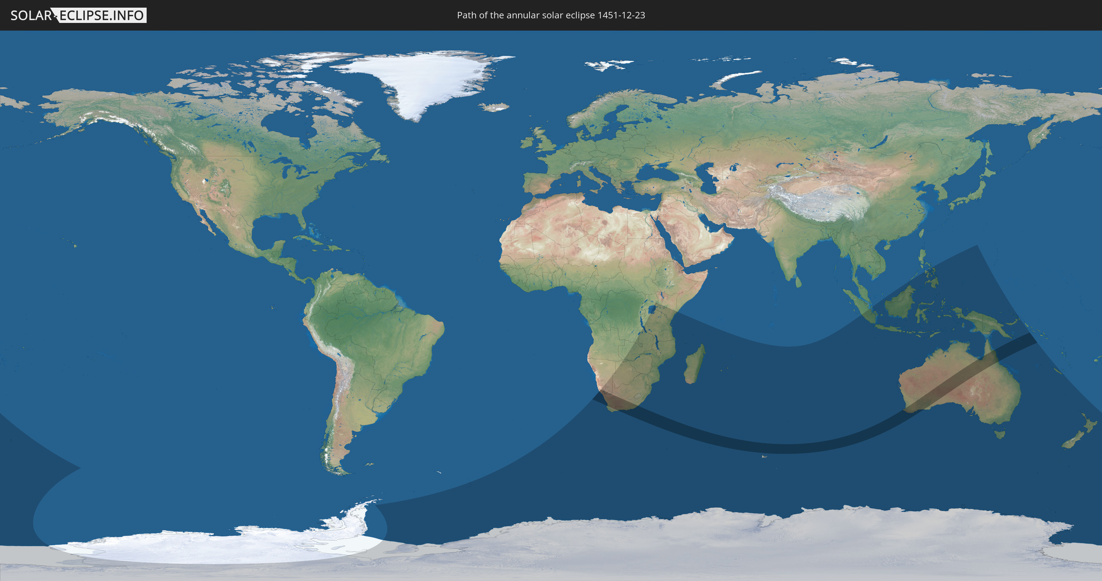
Annular solar eclipse of 12/23/1451
| Day of week: | Tuesday |
| Maximum duration of eclipse: | 09m16s |
| Maximum width of eclipse path: | 342 km |
| Saros cycle: | 113 |
| Coverage: | 91.6% |
| Magnitude: | 0.9164 |
| Gamma: | -0.3651 |
Wo kann man die Sonnenfinsternis vom 12/23/1451 sehen?
Die Sonnenfinsternis am 12/23/1451 kann man in 38 Ländern als partielle Sonnenfinsternis beobachten.
Der Finsternispfad verläuft durch 4 Länder. Nur in diesen Ländern ist sie als annular Sonnenfinsternis zu sehen.
In den folgenden Ländern ist die Sonnenfinsternis annular zu sehen
 Namibia
 South Africa
 Australia
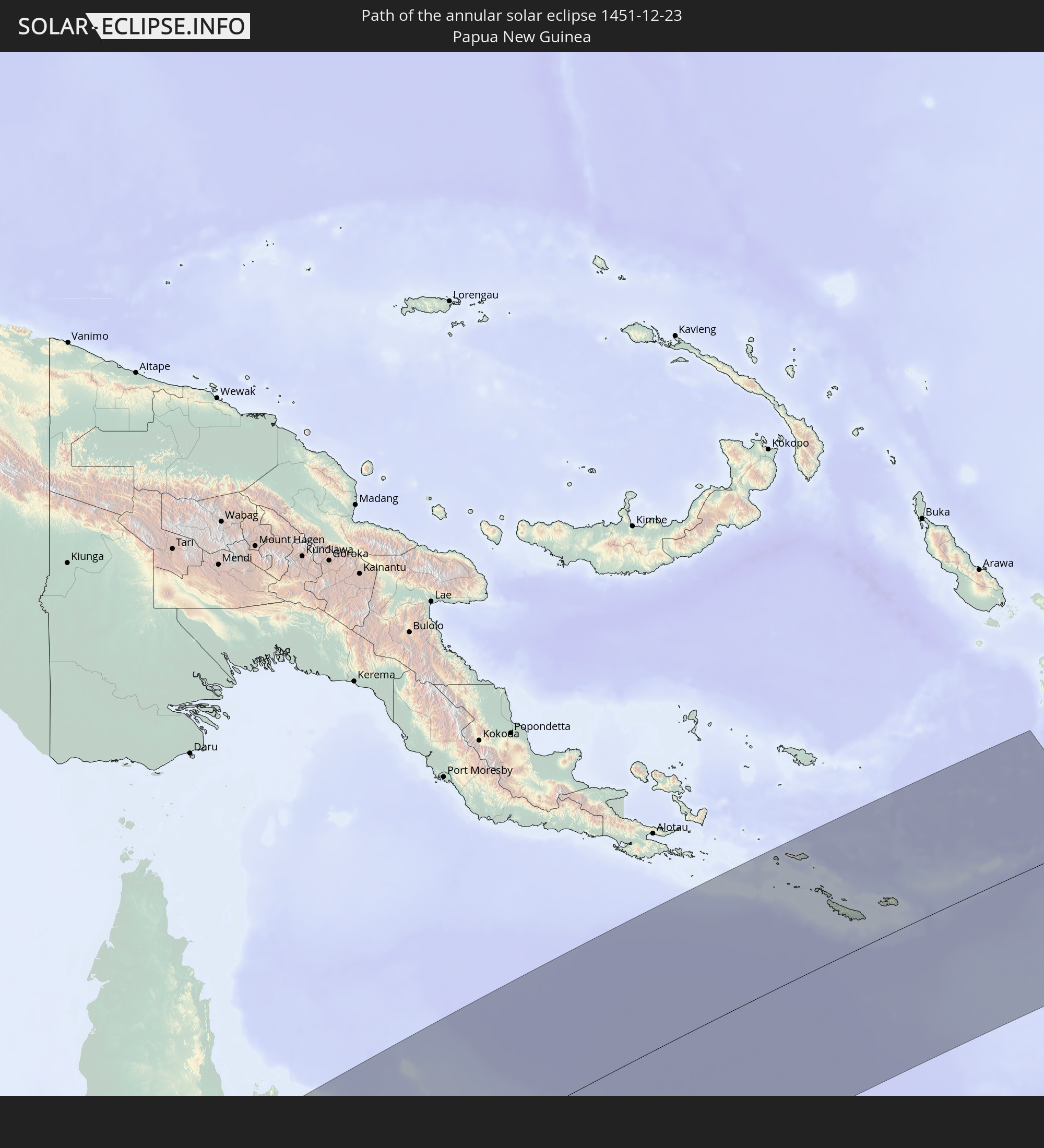 Papua New Guinea
In den folgenden Ländern ist die Sonnenfinsternis partiell zu sehen
 Antarctica
 New Zealand
 South Georgia and the South Sandwich Islands
 Bouvet Island
 Namibia
 Democratic Republic of the Congo
 South Africa
 Botswana
 Zambia
 Zimbabwe
 Lesotho
 Tanzania
 Uganda
 Mozambique
 Swaziland
 Malawi
 Kenya
Kenya
 French Southern and Antarctic Lands
 Madagascar
 Comoros
 Mayotte
 Seychelles
 Réunion
 Mauritius
 Heard Island and McDonald Islands
 Indonesia
 Cocos Islands
 Malaysia
 Christmas Island
 Australia
 Brunei
 Philippines
 East Timor
 Palau
Palau
 Federated States of Micronesia
 Papua New Guinea
 New Caledonia
 Norfolk Island
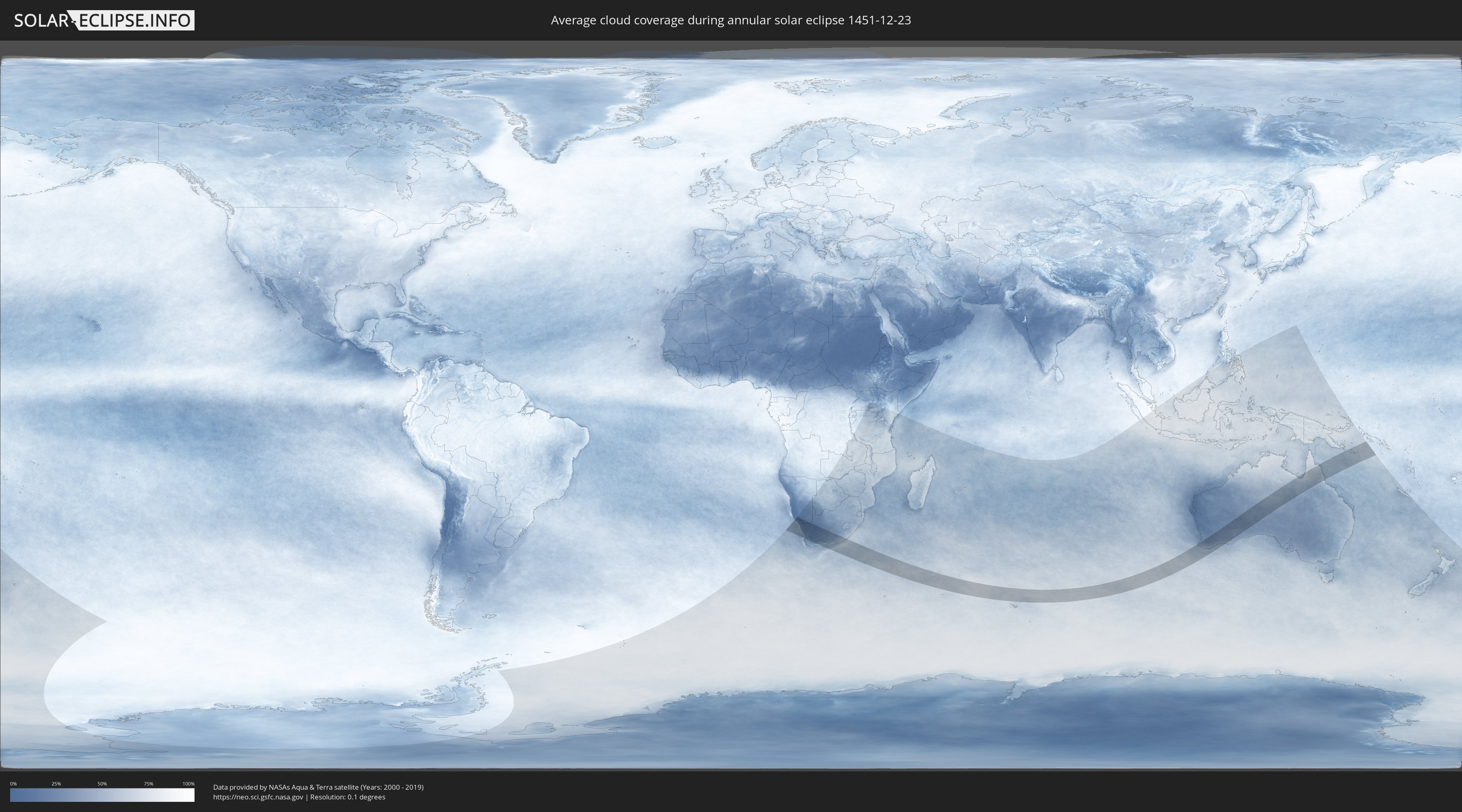
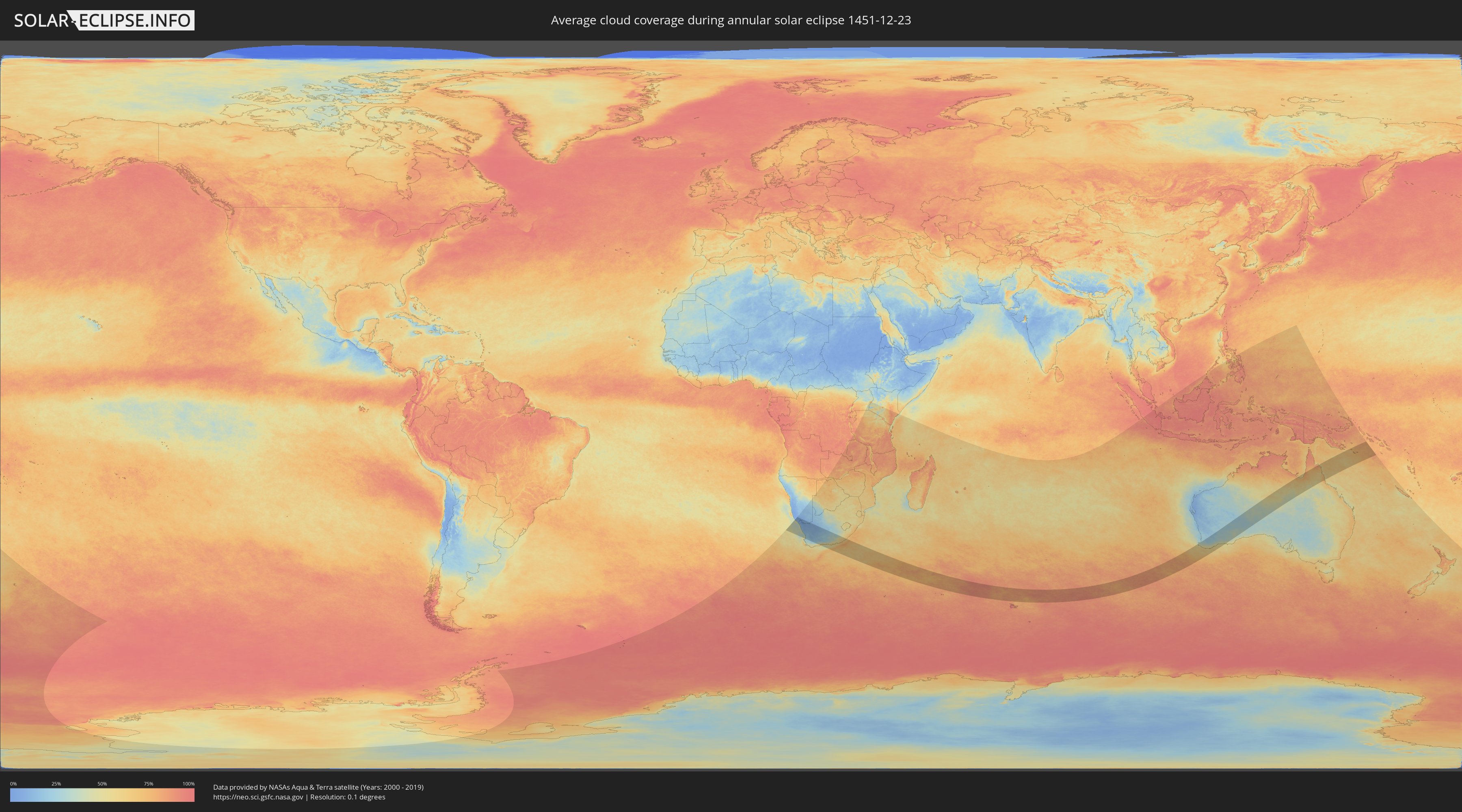
How will be the weather during the annular solar eclipse on 12/23/1451?
Where is the best place to see the annular solar eclipse of 12/23/1451?
The following maps show the average cloud coverage for the day of the annular solar eclipse.
With the help of these maps, it is possible to find the place along the eclipse path, which has the best
chance of a cloudless sky.
Nevertheless, you should consider local circumstances and inform about the weather of your chosen
observation site.
The data is provided by NASAs satellites
AQUA and TERRA.
The cloud maps are averaged over a period of 19 years (2000 - 2019).
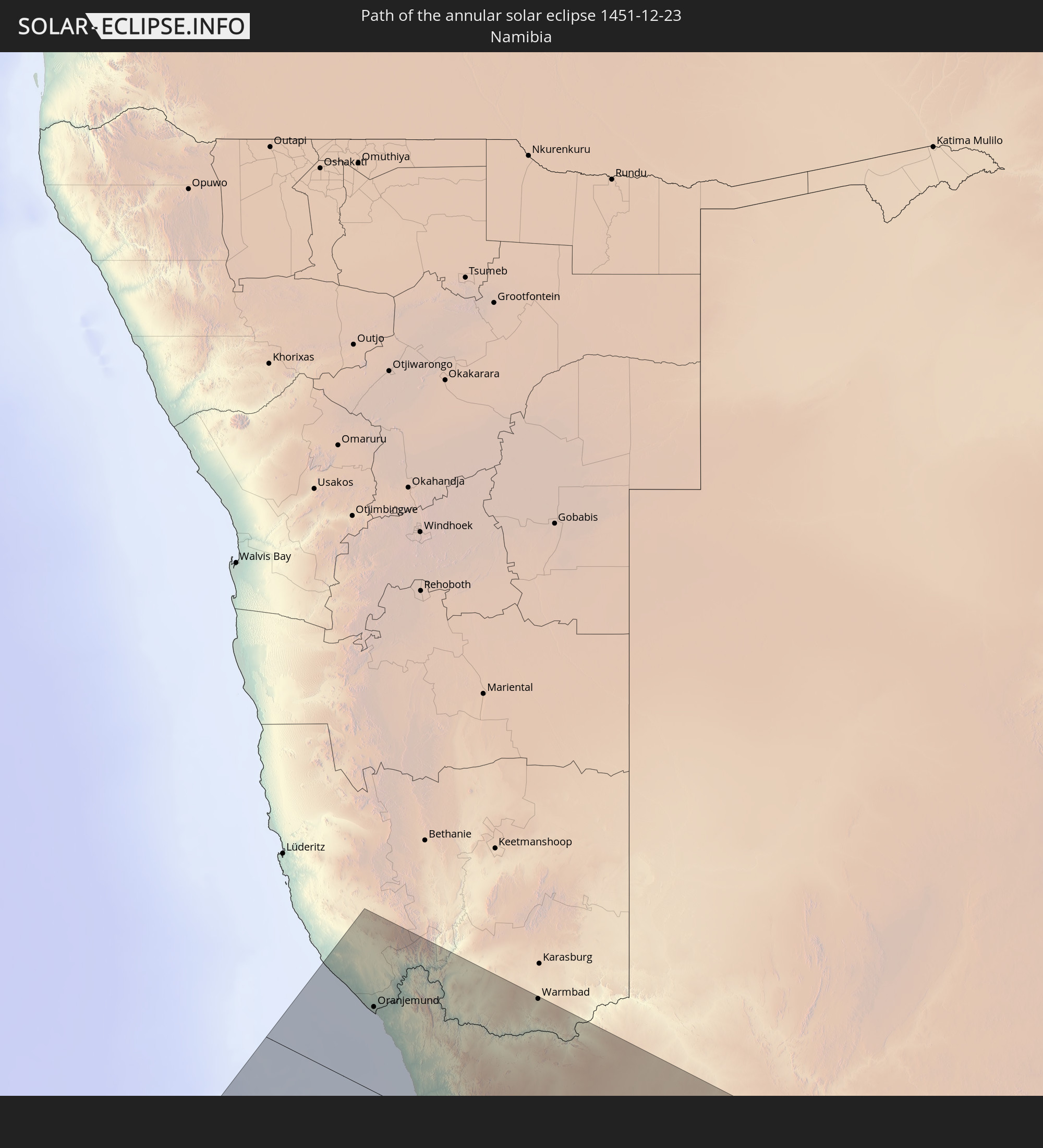
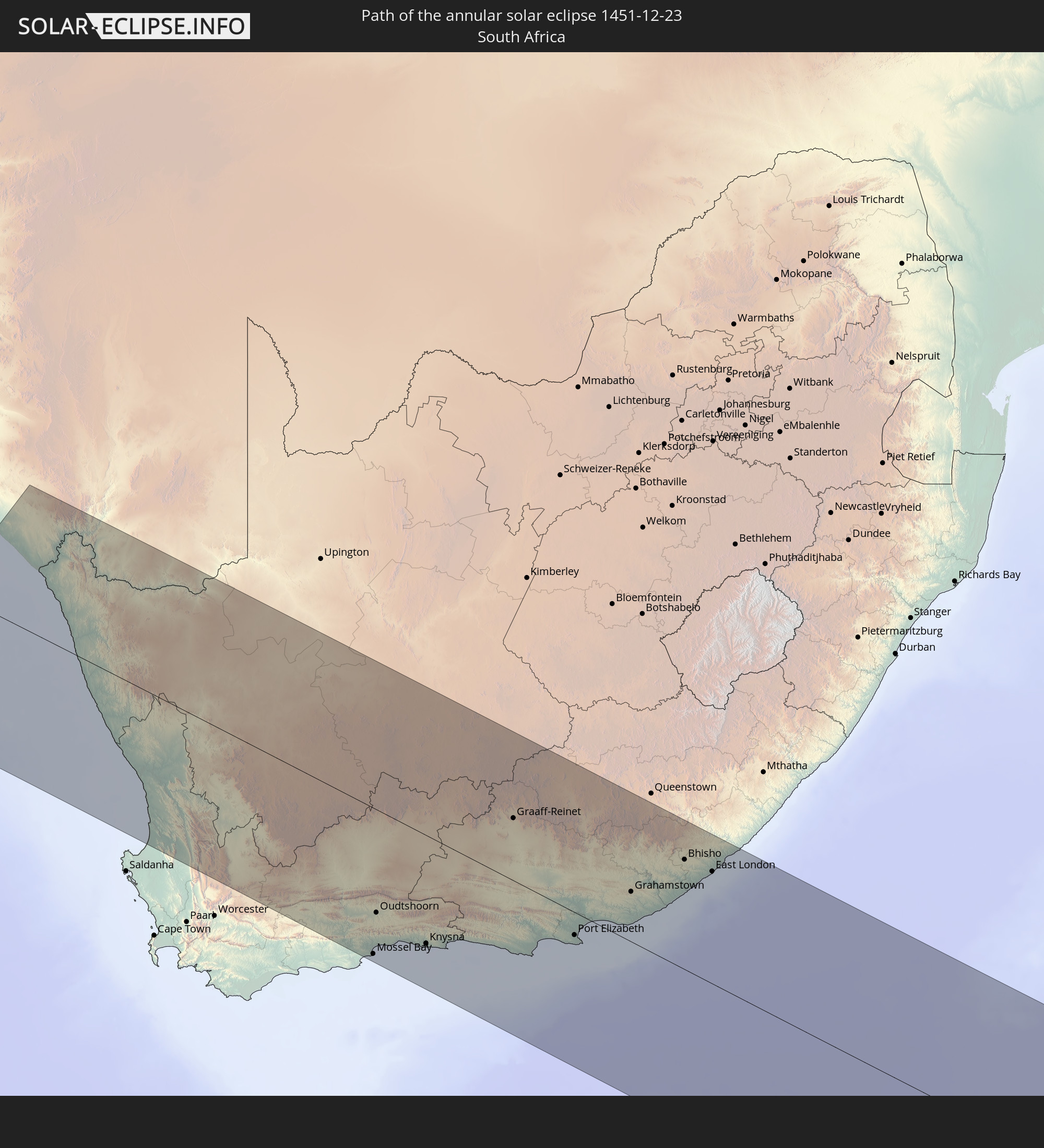
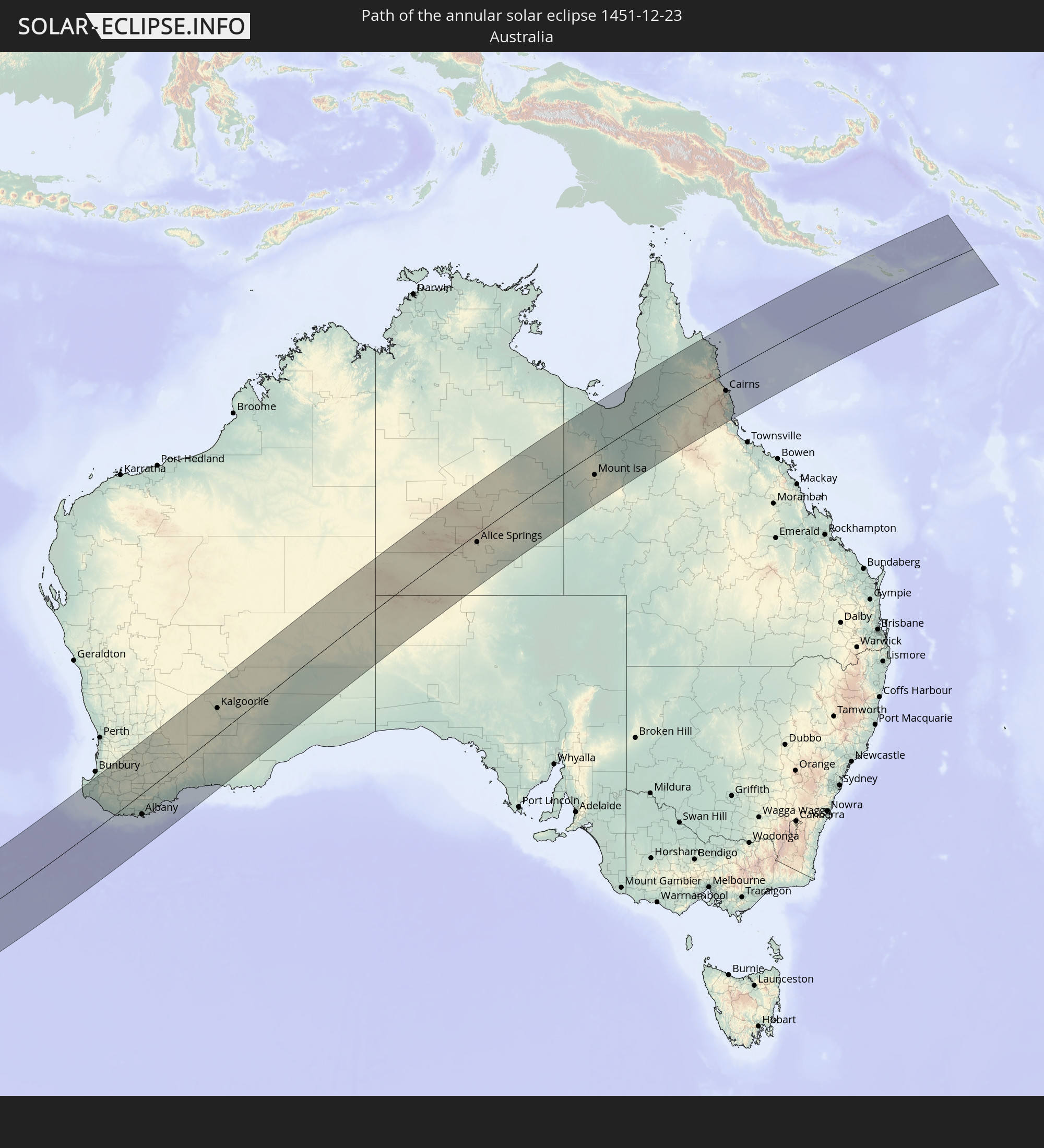
Detailed country maps
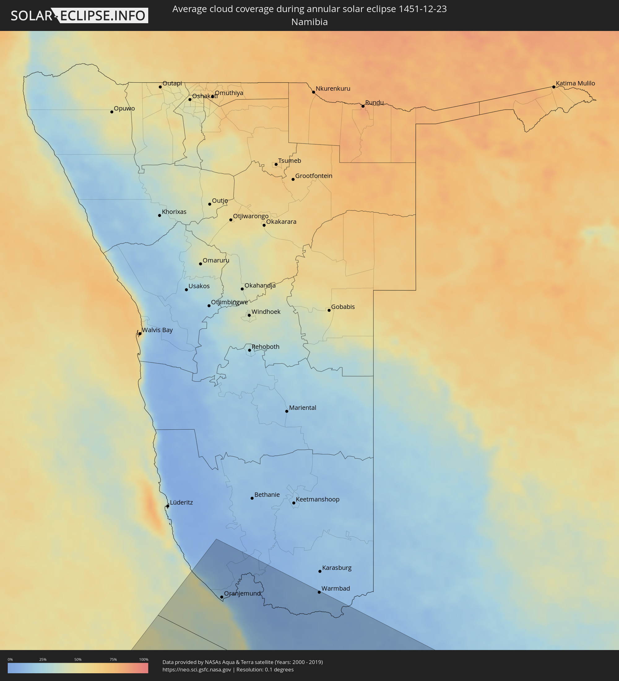 Namibia
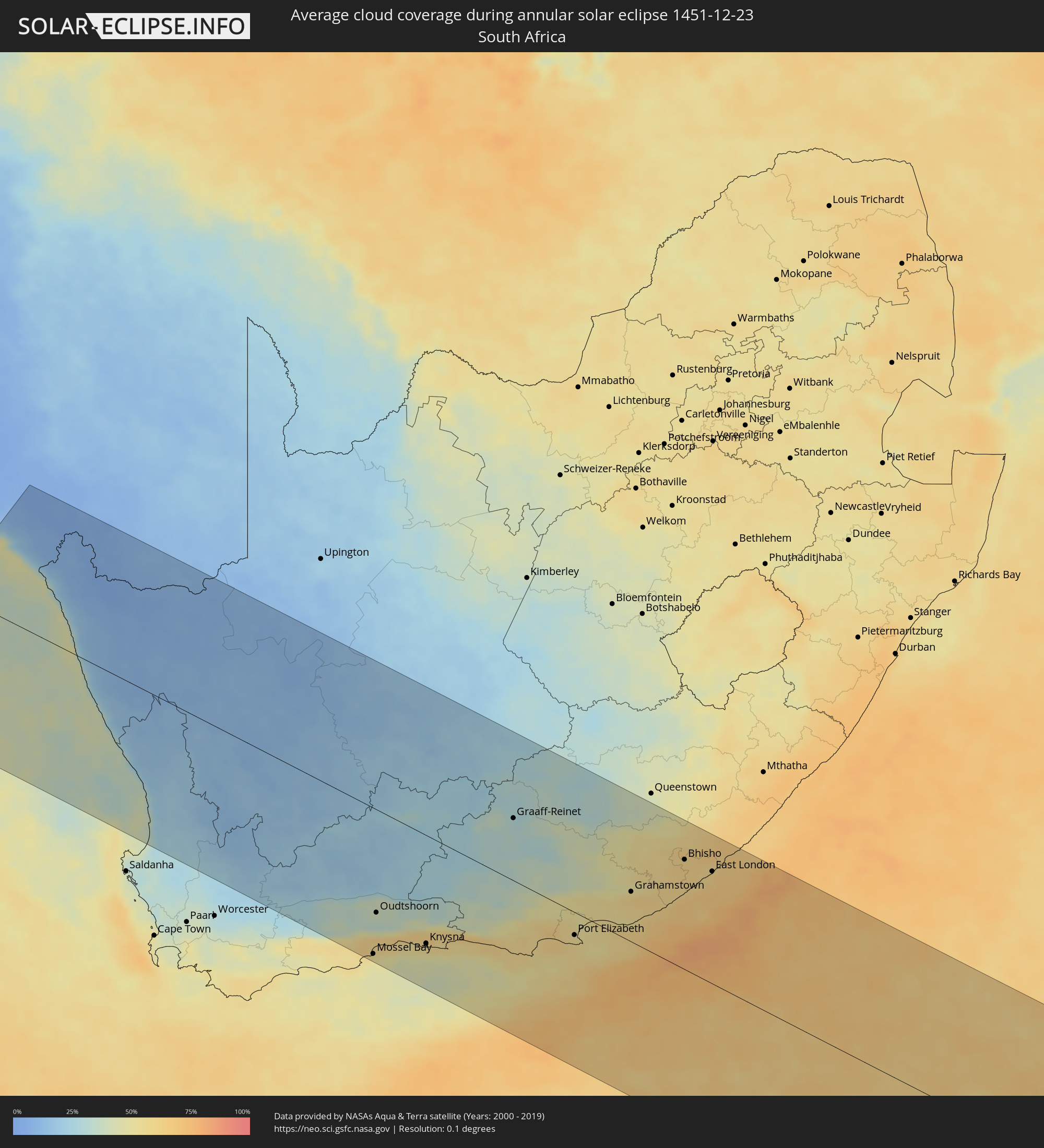 South Africa
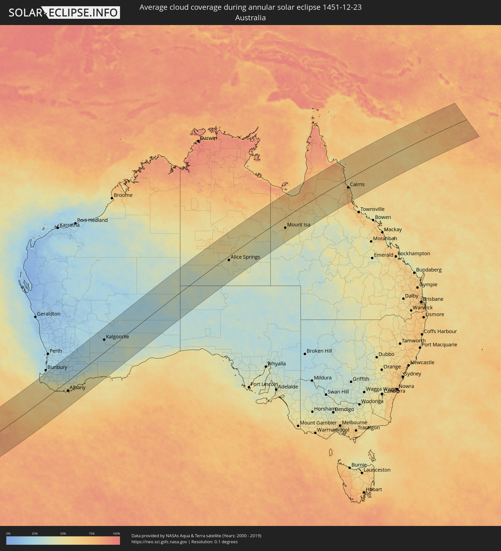 Australia
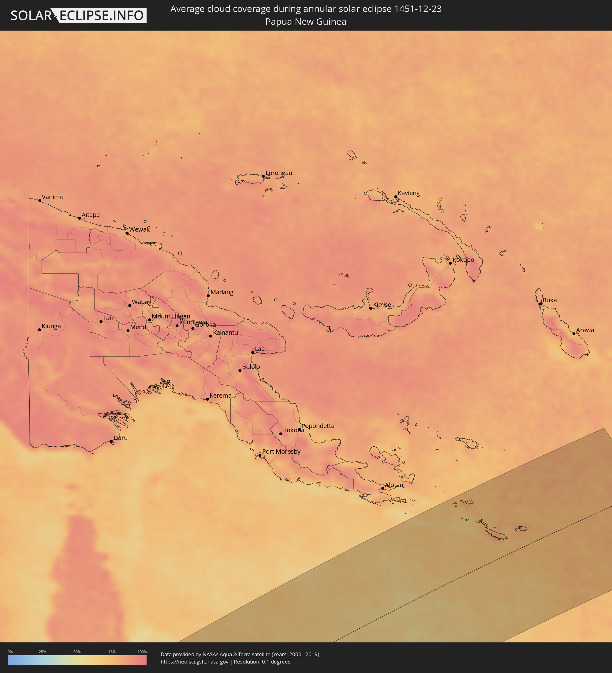 Papua New Guinea
Cities inside the path of the eclipse
The following table shows all locations with a population of more than 5,000 inside the eclipse path. Cities which have more than 100,000 inhabitants are marked bold. A click at the locations opens a detailed map.
| City | Type | Eclipse duration | Local time of max. eclipse | Distance to central line | Ø Cloud coverage |
|
Oranjemund, Karas
|
annular | - | 05:39:18 UTC+01:30 | 103 km | 41% |
|
Springbok, Northern Cape
|
annular | - | 05:39:50 UTC+01:30 | 56 km | 9% |
|
Vredendal, Western Cape
|
annular | - | 05:41:36 UTC+01:30 | 116 km | 19% |
|
Warmbad, Karas
|
annular | - | 05:38:27 UTC+01:30 | 214 km | 11% |
|
Calvinia, Northern Cape
|
annular | - | 05:41:04 UTC+01:30 | 41 km | 16% |
|
Ladismith, Western Cape
|
annular | - | 05:42:52 UTC+01:30 | 175 km | 33% |
|
Prince Albert, Western Cape
|
annular | - | 05:42:26 UTC+01:30 | 116 km | 23% |
|
Carnarvon, Northern Cape
|
annular | - | 05:40:02 UTC+01:30 | 112 km | 17% |
|
Mossel Bay, Western Cape
|
annular | - | 05:43:28 UTC+01:30 | 205 km | 51% |
|
Oudtshoorn, Western Cape
|
annular | - | 05:42:49 UTC+01:30 | 145 km | 35% |
|
George, Western Cape
|
annular | - | 05:43:11 UTC+01:30 | 170 km | 56% |
|
Beaufort West, Western Cape
|
annular | - | 05:41:24 UTC+01:30 | 6 km | 22% |
|
Knysna, Western Cape
|
annular | - | 05:43:10 UTC+01:30 | 152 km | 55% |
|
Plettenberg Bay, Western Cape
|
annular | - | 05:43:09 UTC+01:30 | 139 km | 50% |
|
Willowmore, Eastern Cape
|
annular | - | 05:42:17 UTC+01:30 | 59 km | 32% |
|
Graaff-Reinet, Eastern Cape
|
annular | - | 05:41:01 UTC+01:30 | 88 km | 31% |
|
Kruisfontein, Eastern Cape
|
annular | - | 05:42:57 UTC+01:30 | 76 km | 58% |
|
Jeffrey’s Bay, Eastern Cape
|
annular | - | 05:42:59 UTC+01:30 | 73 km | 55% |
|
Middelburg, Eastern Cape
|
annular | - | 05:40:09 UTC+01:30 | 184 km | 29% |
|
Uitenhage, Eastern Cape
|
annular | - | 05:42:37 UTC+01:30 | 23 km | 56% |
|
Kirkwood, Eastern Cape
|
annular | - | 05:42:12 UTC+01:30 | 14 km | 51% |
|
Port Elizabeth, Eastern Cape
|
annular | - | 05:42:47 UTC+01:30 | 32 km | 53% |
|
Somerset East, Eastern Cape
|
annular | - | 05:41:26 UTC+01:30 | 87 km | 42% |
|
Cradock, Eastern Cape
|
annular | - | 05:40:49 UTC+01:30 | 144 km | 36% |
|
Adelaide, Eastern Cape
|
annular | - | 05:41:22 UTC+01:30 | 119 km | 48% |
|
Grahamstown, Eastern Cape
|
annular | - | 05:42:02 UTC+01:30 | 70 km | 59% |
|
Fort Beaufort, Eastern Cape
|
annular | - | 05:41:26 UTC+01:30 | 127 km | 55% |
|
Whittlesea, Eastern Cape
|
annular | - | 05:40:45 UTC+01:30 | 194 km | 42% |
|
Alice, Eastern Cape
|
annular | - | 05:41:26 UTC+01:30 | 134 km | 56% |
|
Port Alfred, Eastern Cape
|
annular | - | 05:42:20 UTC+01:30 | 57 km | 64% |
|
Stutterheim, Eastern Cape
|
annular | - | 05:41:10 UTC+01:30 | 181 km | 62% |
|
Bhisho, Eastern Cape
|
annular | - | 05:41:29 UTC+01:30 | 154 km | 61% |
|
East London, Eastern Cape
|
annular | - | 05:41:40 UTC+01:30 | 157 km | 62% |
|
Margaret River, Western Australia
|
annular | - | 14:56:38 UTC+08:00 | 177 km | 45% |
|
Collie, Western Australia
|
annular | - | 14:59:29 UTC+08:00 | 170 km | 31% |
|
Albany, Western Australia
|
annular | - | 14:58:33 UTC+08:00 | 71 km | 59% |
|
Kalgoorlie, Western Australia
|
annular | - | 15:11:48 UTC+08:00 | 93 km | 28% |
|
Boulder, Western Australia
|
annular | - | 15:11:44 UTC+08:00 | 89 km | 28% |
|
Alice Springs, Northern Territory
|
annular | - | 17:04:56 UTC+09:30 | 33 km | 48% |
|
Mount Isa, Queensland
|
annular | - | 17:41:39 UTC+10:00 | 91 km | 54% |
|
Mareeba, Queensland
|
annular | - | 17:47:29 UTC+10:00 | 68 km | 68% |
|
Atherton, Queensland
|
annular | - | 17:47:08 UTC+10:00 | 97 km | 68% |
|
Redlynch, Queensland
|
annular | - | 17:47:37 UTC+10:00 | 72 km | 72% |
|
Cairns, Queensland
|
annular | - | 17:47:34 UTC+10:00 | 79 km | 66% |
|
Innisfail, Queensland
|
annular | - | 17:46:48 UTC+10:00 | 151 km | 68% |