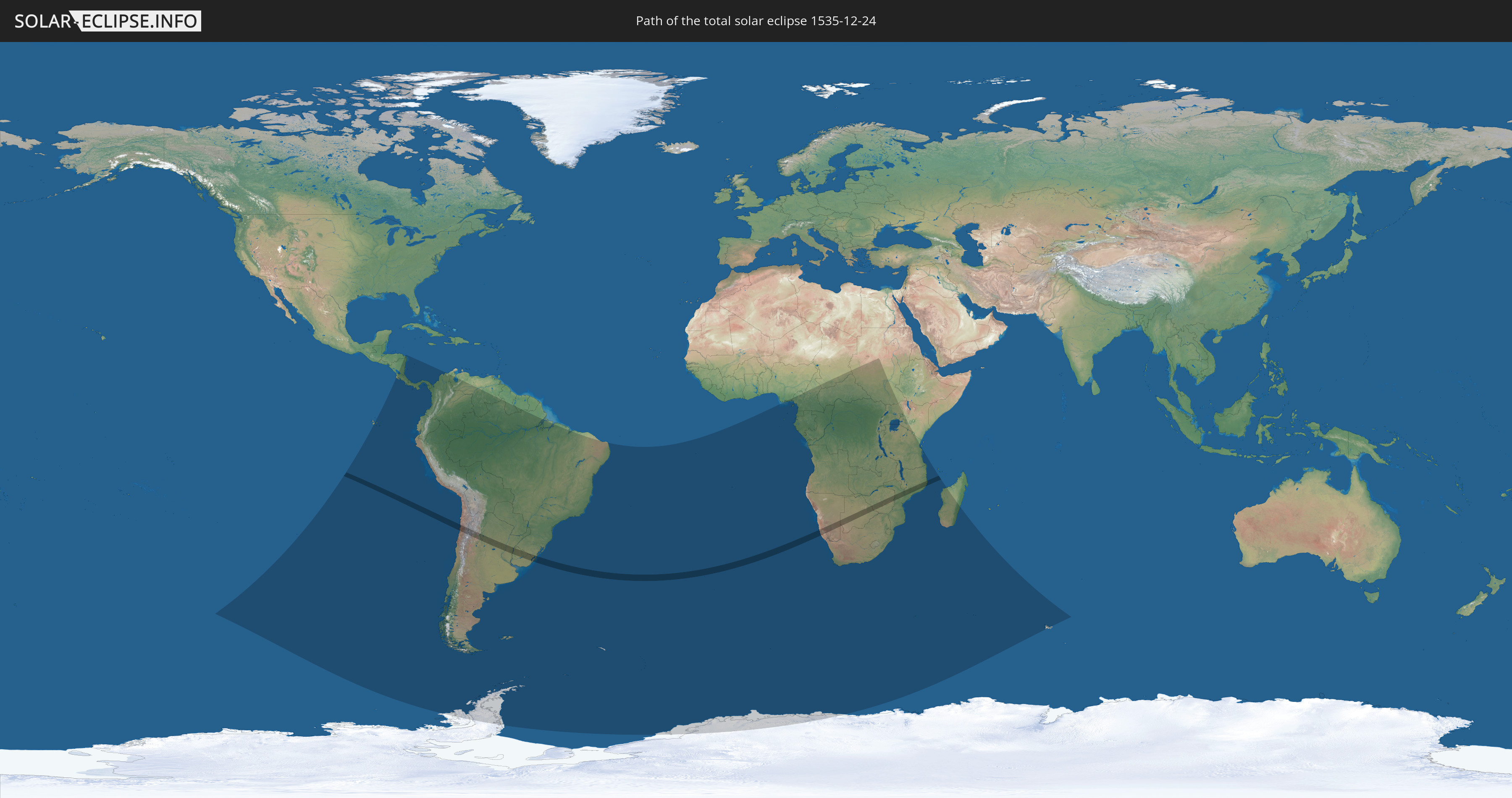
Total solar eclipse of 12/24/1535
| Day of week: | Tuesday |
| Maximum duration of eclipse: | 03m55s |
| Maximum width of eclipse path: | 161 km |
| Saros cycle: | 124 |
| Coverage: | 100% |
| Magnitude: | 1.0469 |
| Gamma: | -0.2482 |
Wo kann man die Sonnenfinsternis vom 12/24/1535 sehen?
Die Sonnenfinsternis am 12/24/1535 kann man in 48 Ländern als partielle Sonnenfinsternis beobachten.
Der Finsternispfad verläuft durch 10 Länder. Nur in diesen Ländern ist sie als total Sonnenfinsternis zu sehen.
In den folgenden Ländern ist die Sonnenfinsternis total zu sehen
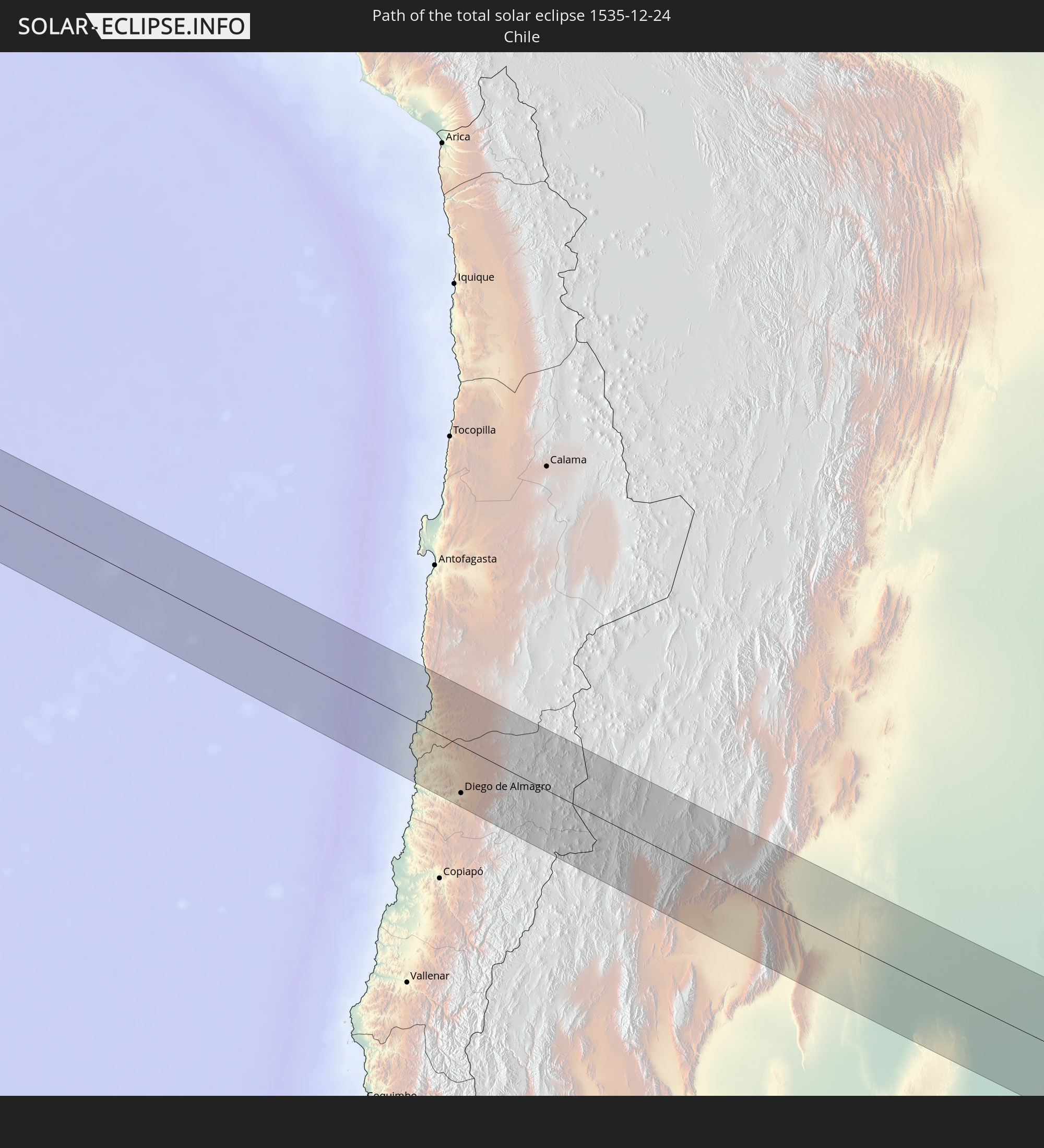 Chile
Chile
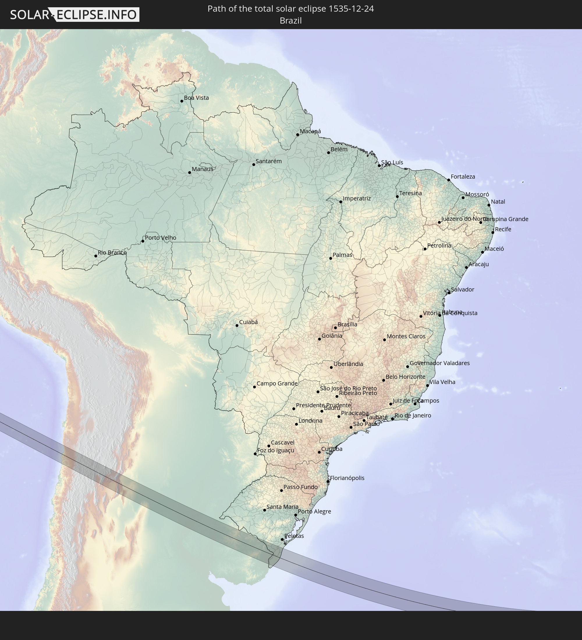 Brazil
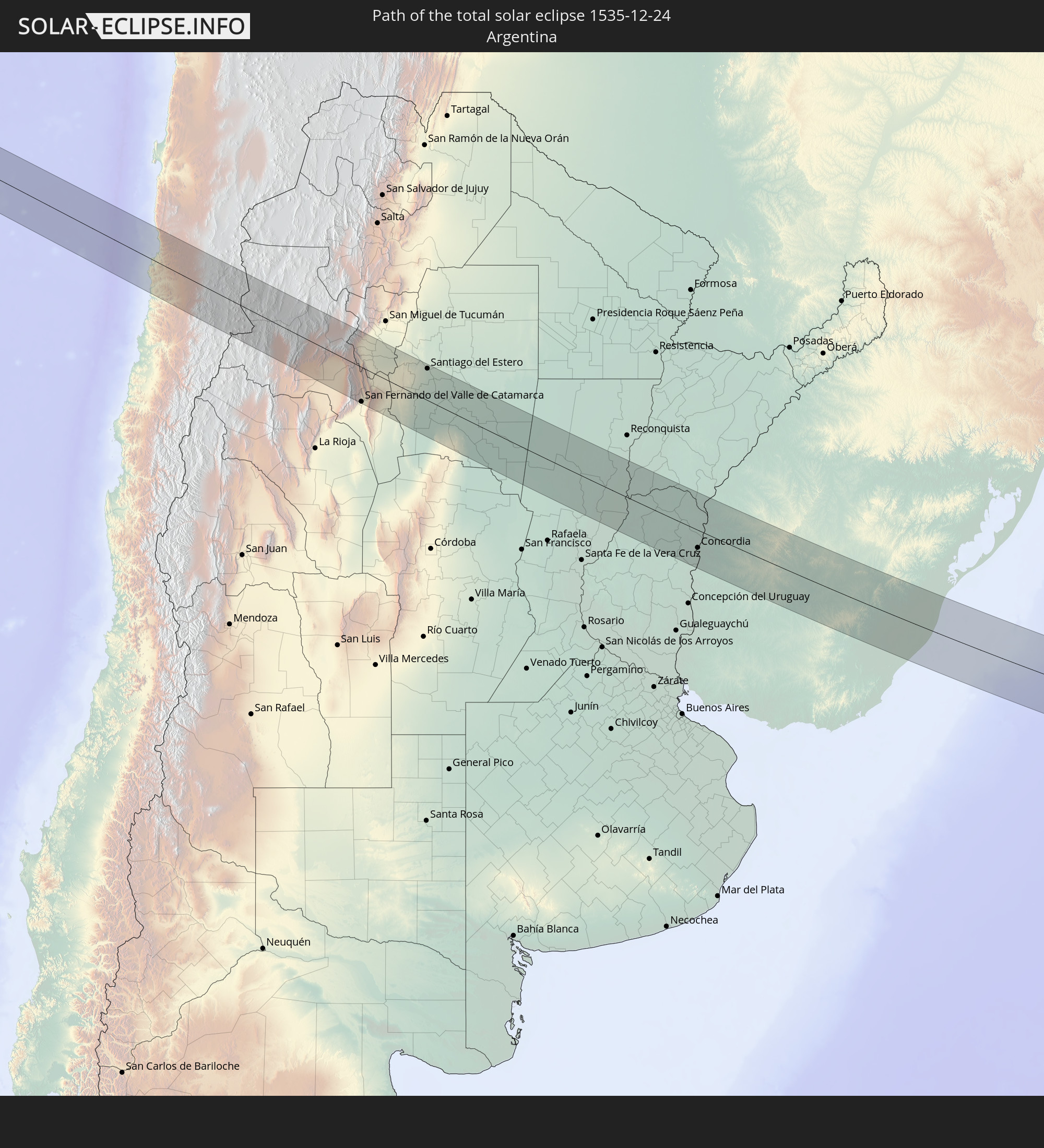 Argentina
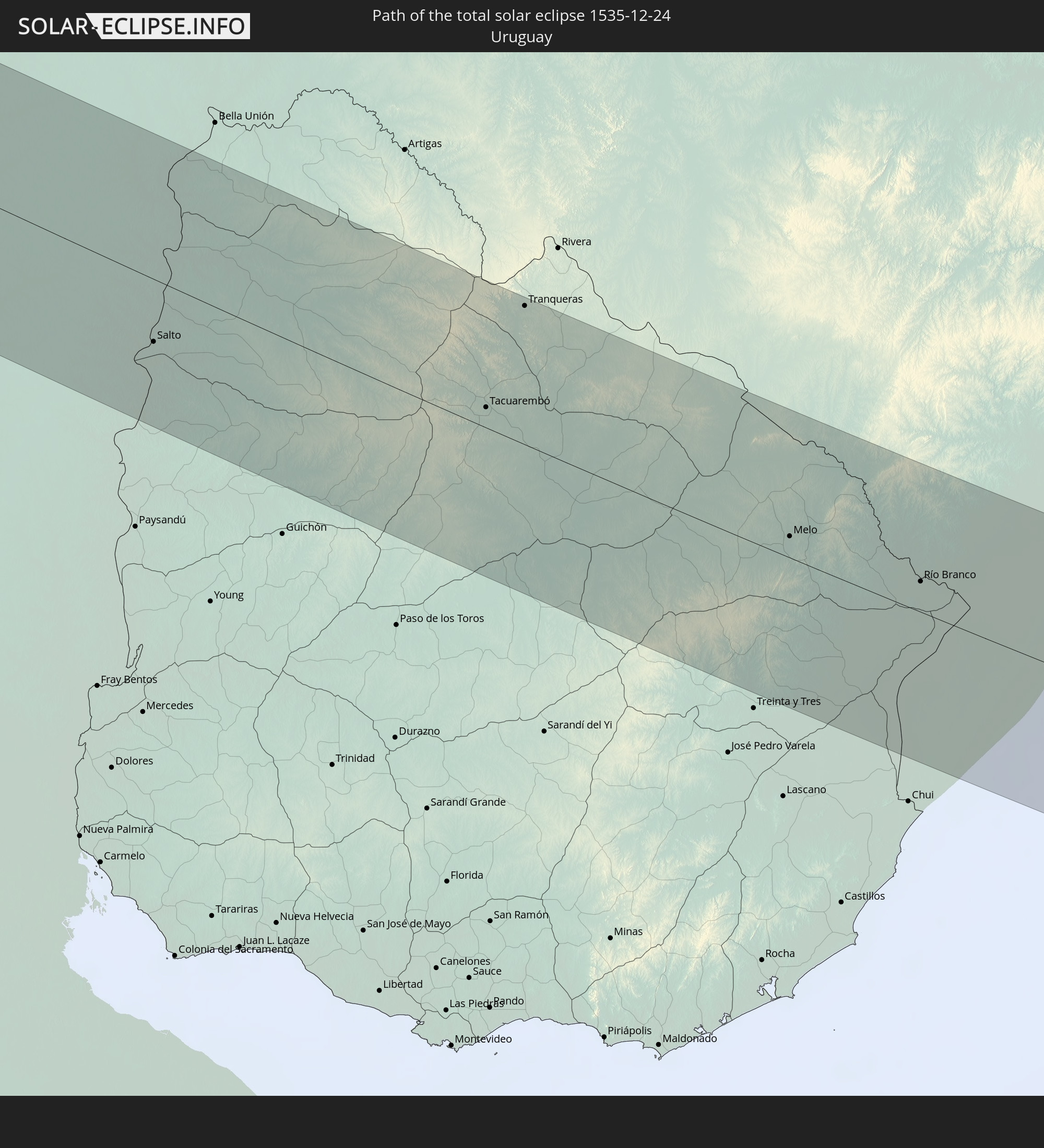 Uruguay
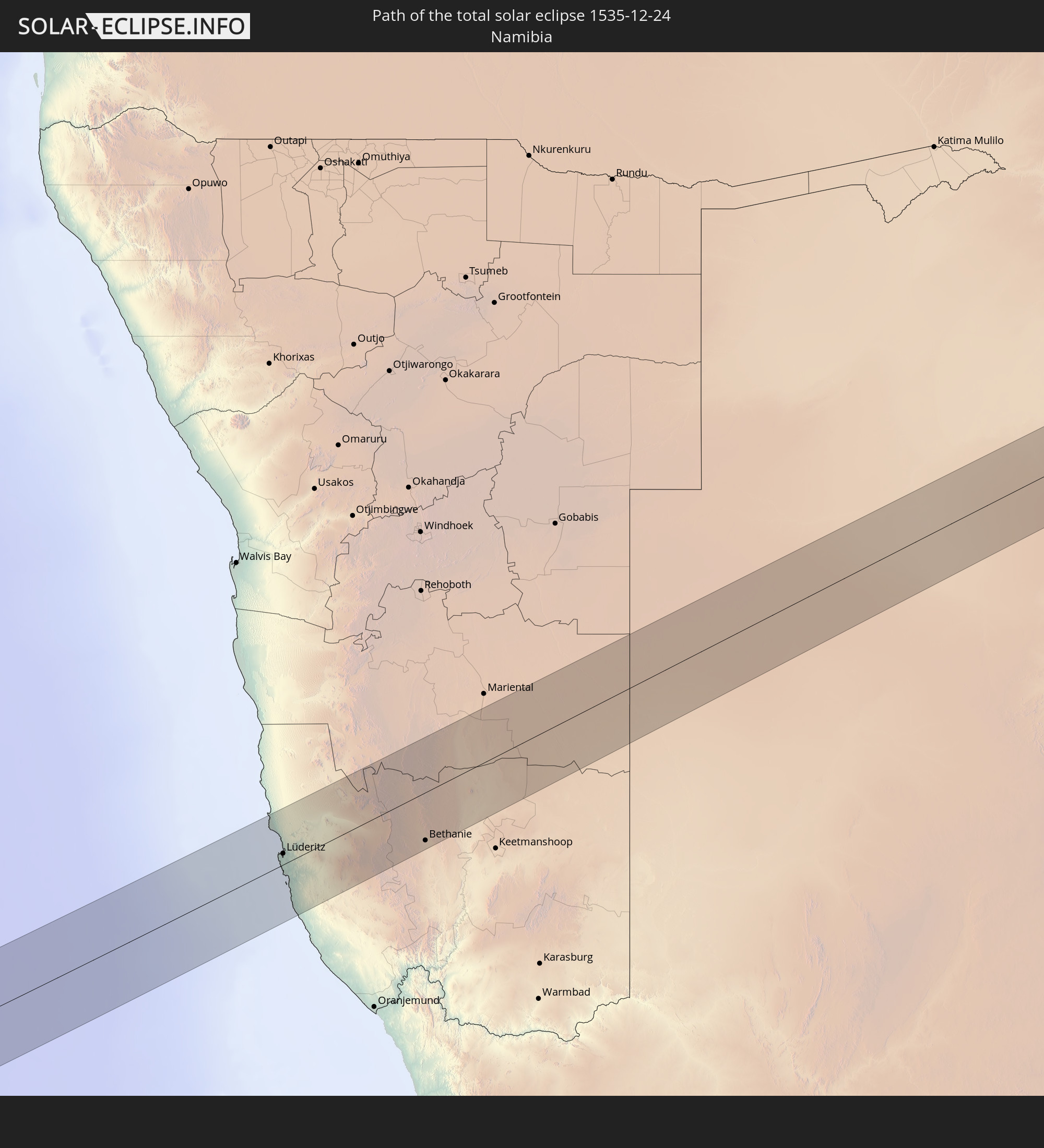 Namibia
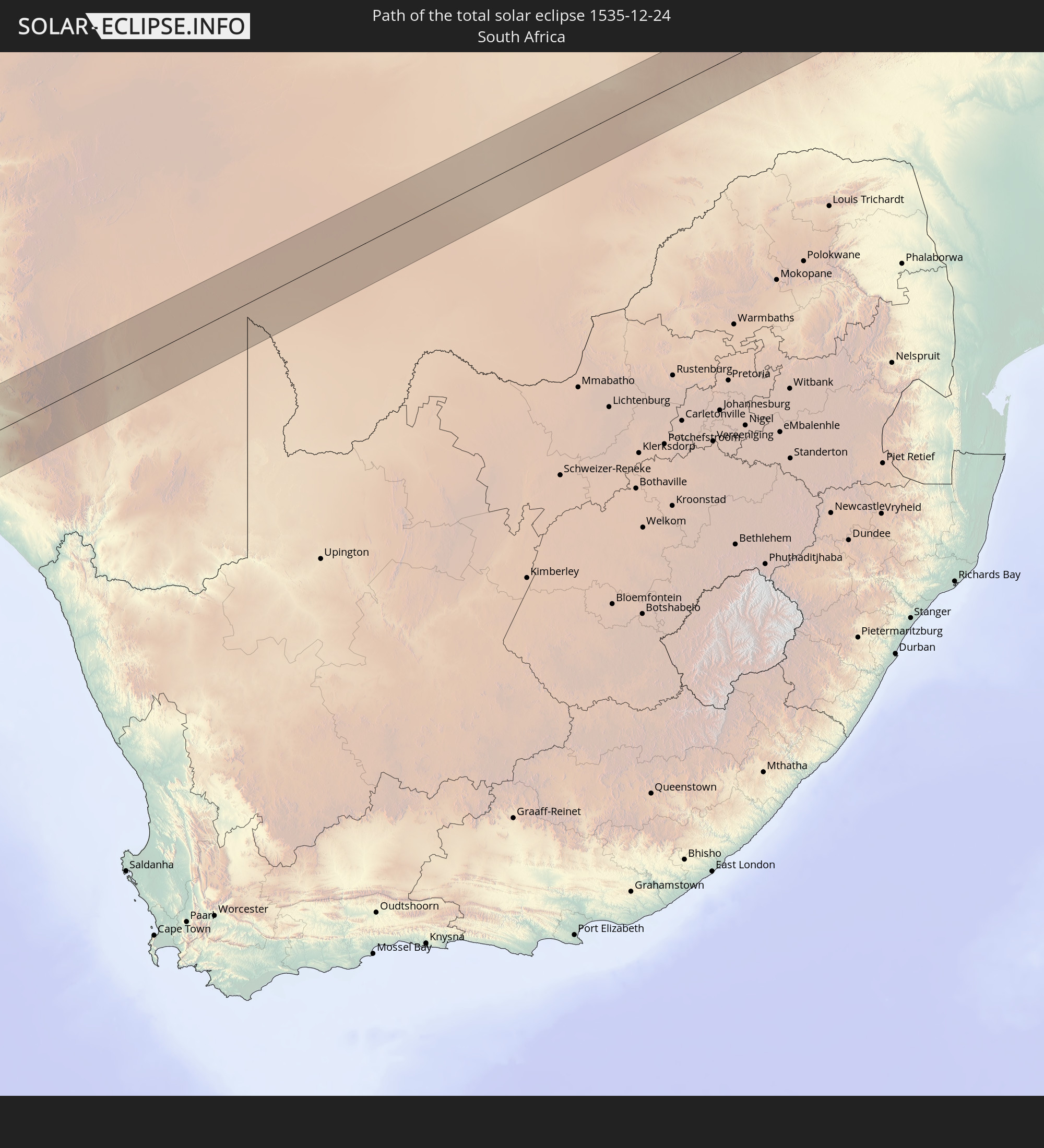 South Africa
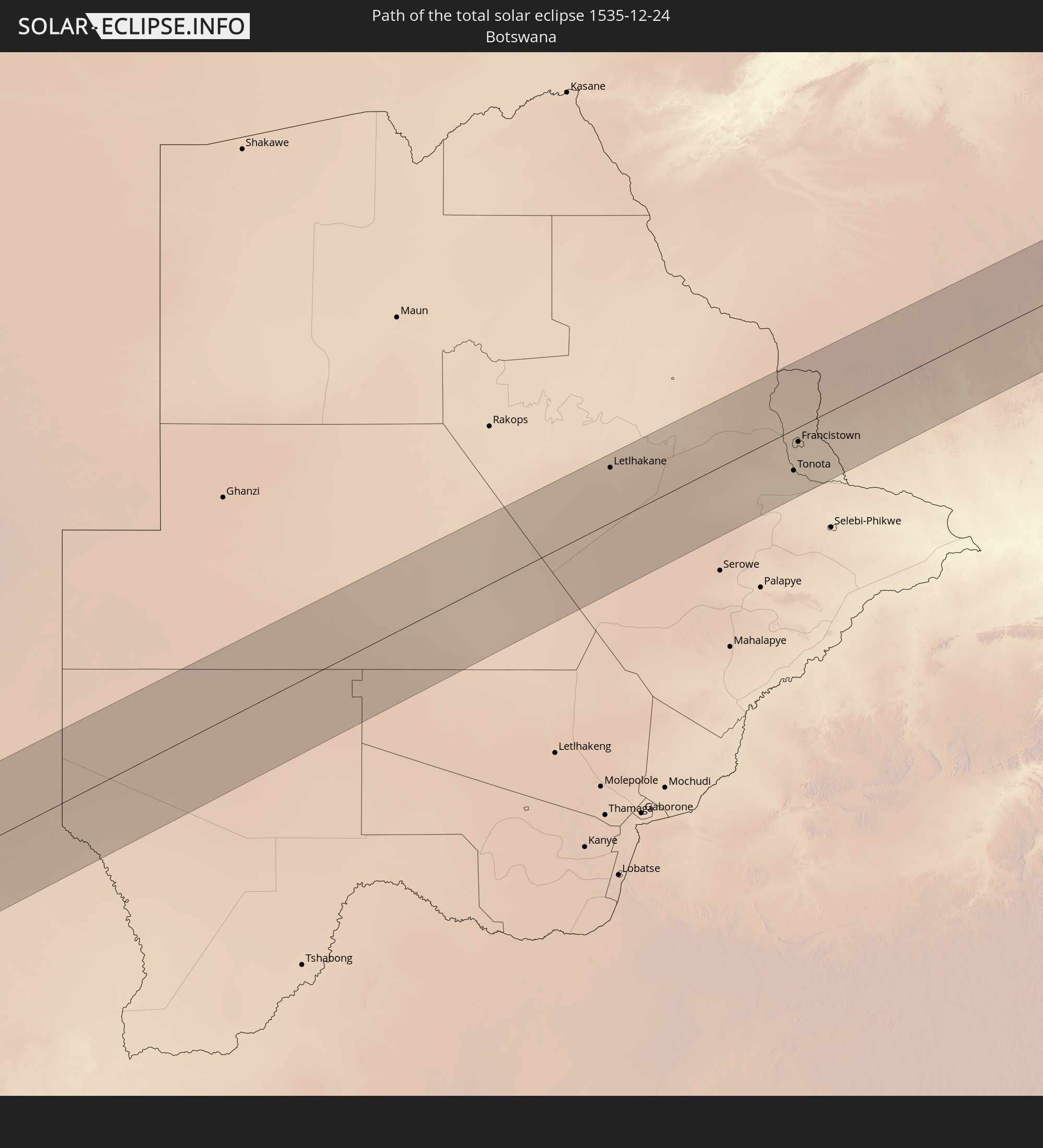 Botswana
 Zimbabwe
 Mozambique
 Malawi
In den folgenden Ländern ist die Sonnenfinsternis partiell zu sehen
 Antarctica
 Chile
Chile
 Ecuador
 Honduras
 Nicaragua
 Costa Rica
 Panama
 Colombia
 Peru
Peru
 Brazil
 Argentina
 Venezuela
 Bolivia
 Paraguay
 Falkland Islands
 Guyana
 Uruguay
 Suriname
 South Georgia and the South Sandwich Islands
 Saint Helena, Ascension and Tristan da Cunha
 Nigeria
 Bouvet Island
 Equatorial Guinea
 São Tomé and Príncipe
 Cameroon
 Gabon
Gabon
 Republic of the Congo
 Angola
 Namibia
 Democratic Republic of the Congo
 Chad
Chad
 Central African Republic
 South Africa
 Botswana
 Sudan
Sudan
 Zambia
 Zimbabwe
 Lesotho
 Rwanda
 Burundi
 Tanzania
 Uganda
 Mozambique
 Swaziland
 Malawi
 Kenya
Kenya
 French Southern and Antarctic Lands
 Madagascar
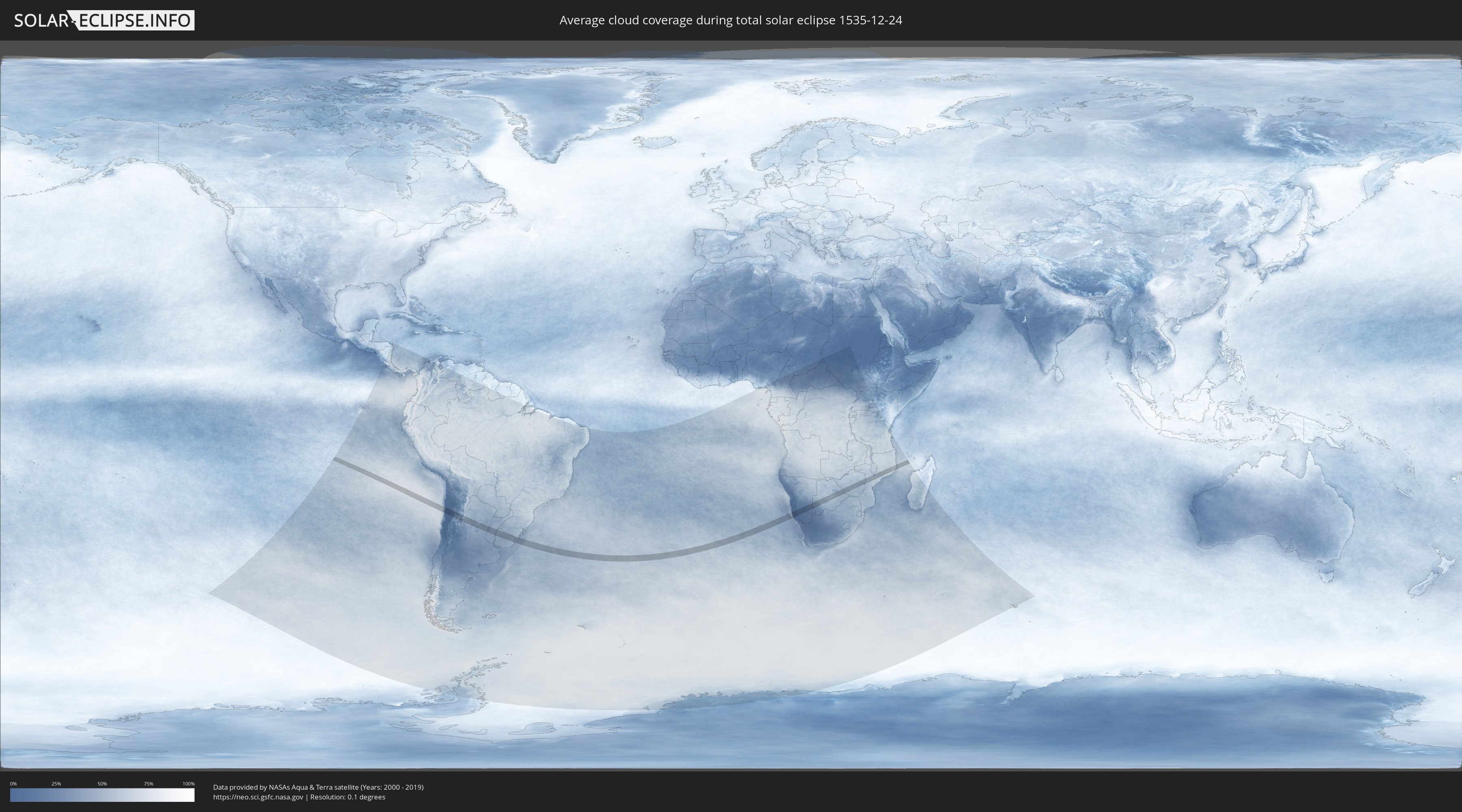
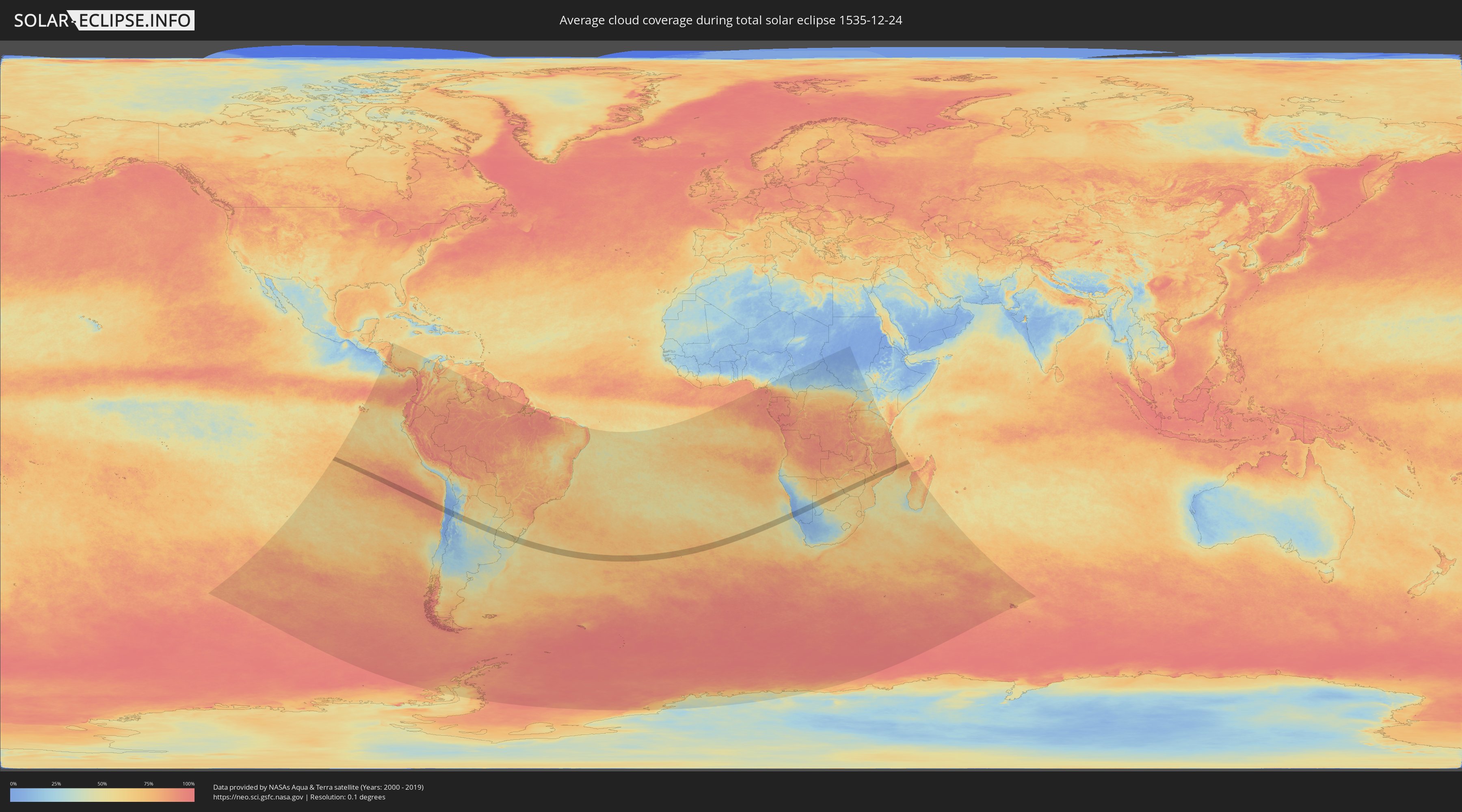
How will be the weather during the total solar eclipse on 12/24/1535?
Where is the best place to see the total solar eclipse of 12/24/1535?
The following maps show the average cloud coverage for the day of the total solar eclipse.
With the help of these maps, it is possible to find the place along the eclipse path, which has the best
chance of a cloudless sky.
Nevertheless, you should consider local circumstances and inform about the weather of your chosen
observation site.
The data is provided by NASAs satellites
AQUA and TERRA.
The cloud maps are averaged over a period of 19 years (2000 - 2019).
Detailed country maps
 Chile
Chile
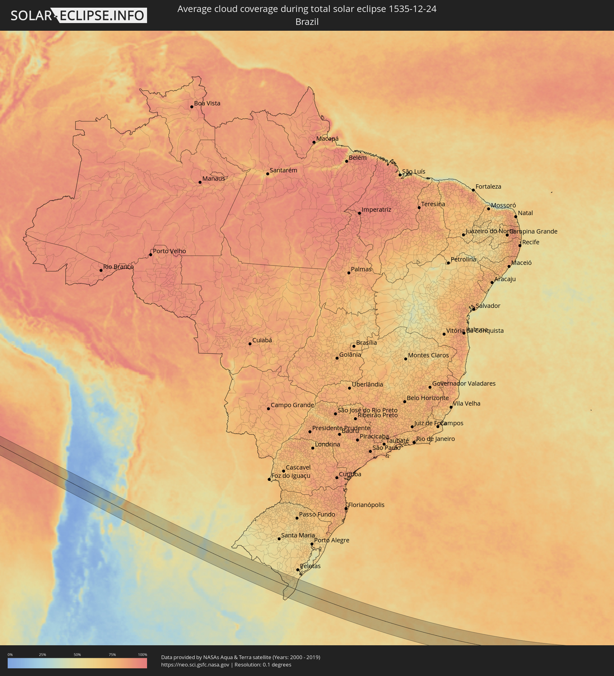 Brazil
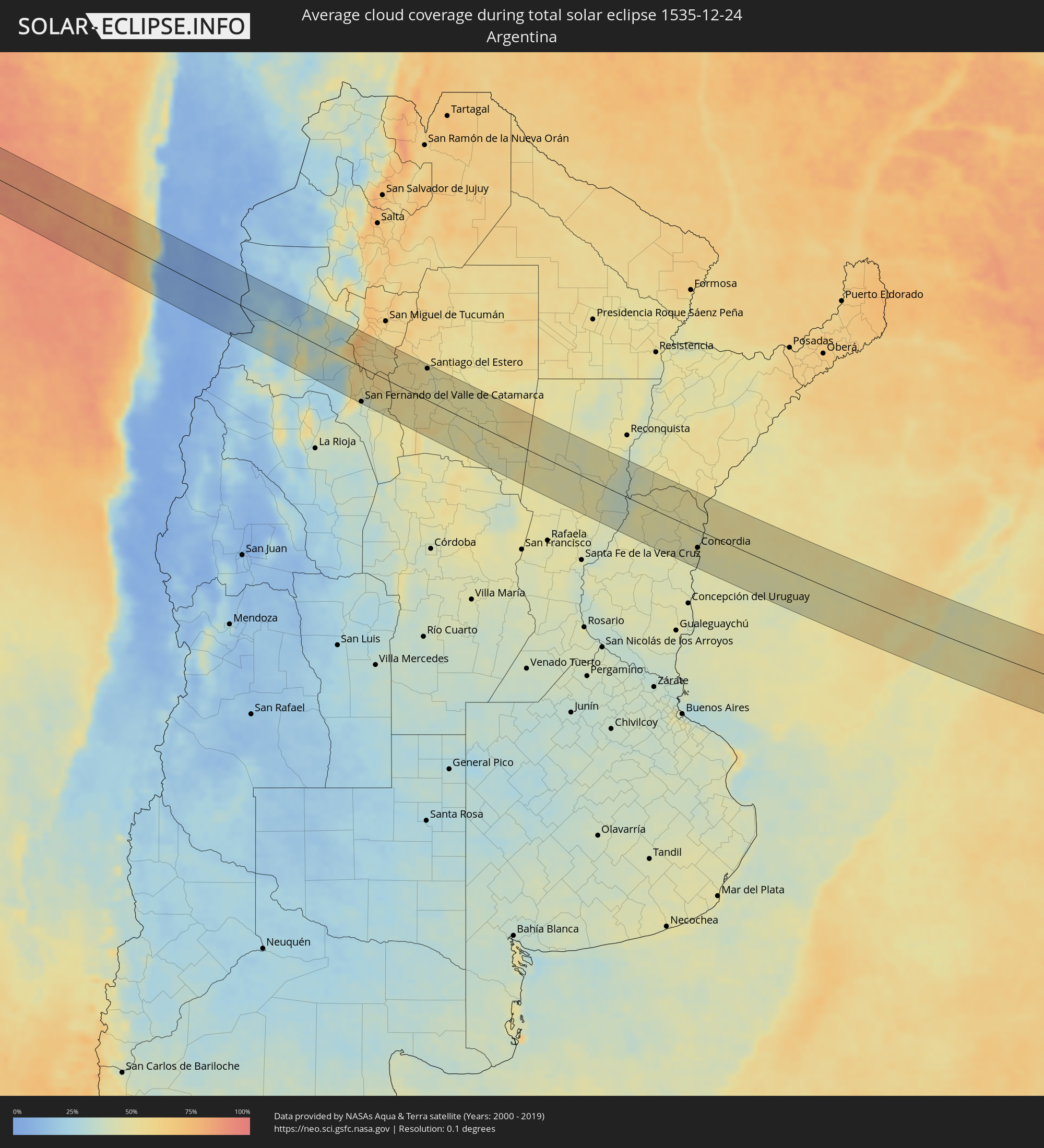 Argentina
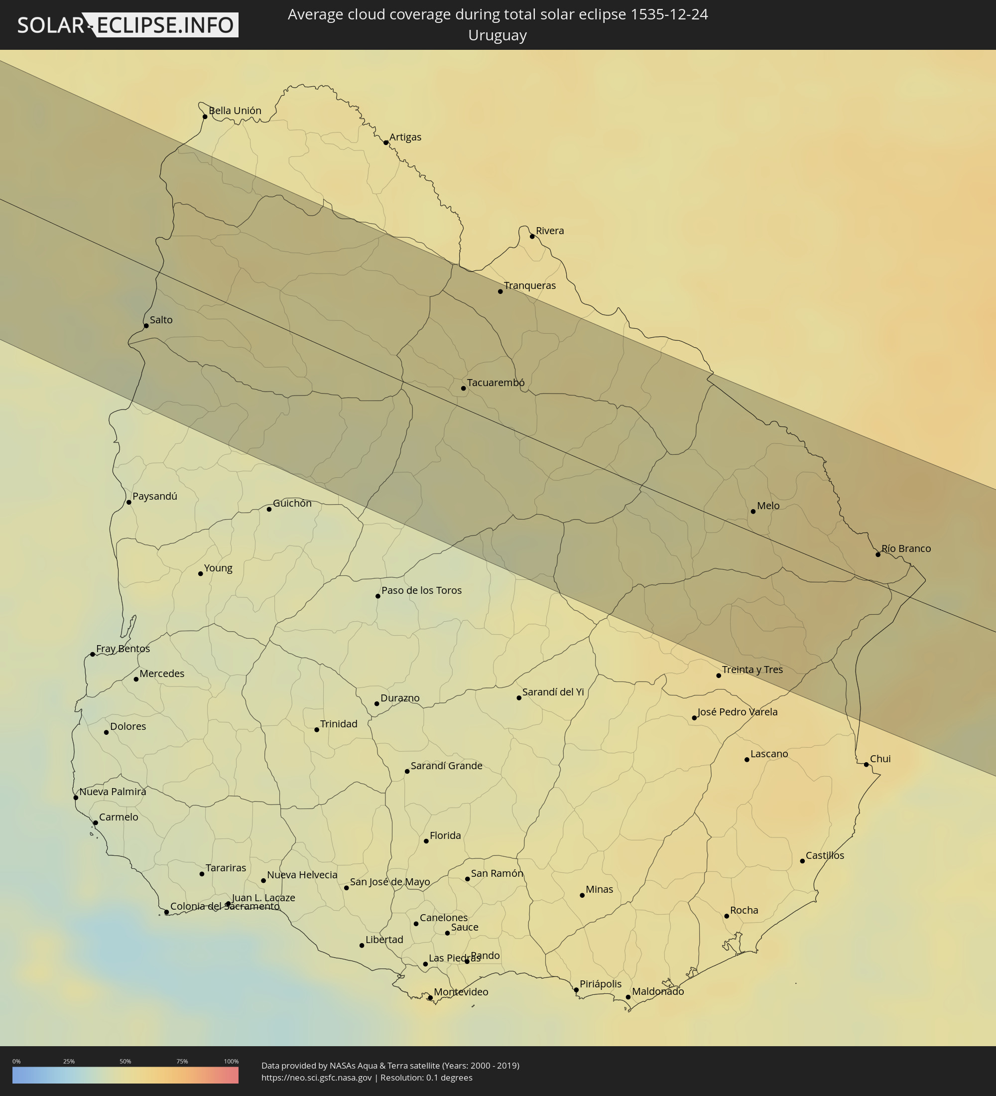 Uruguay
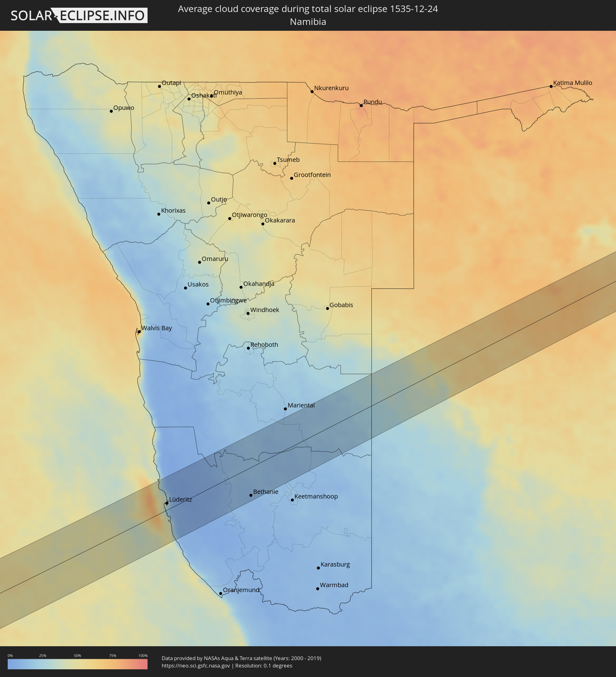 Namibia
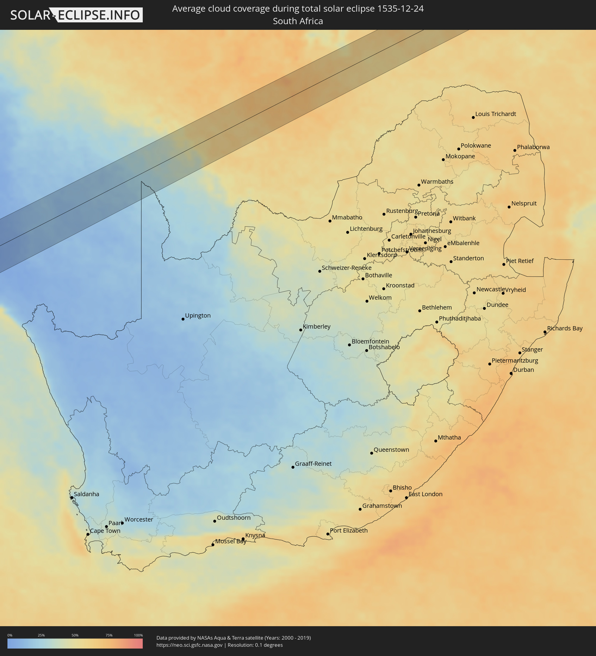 South Africa
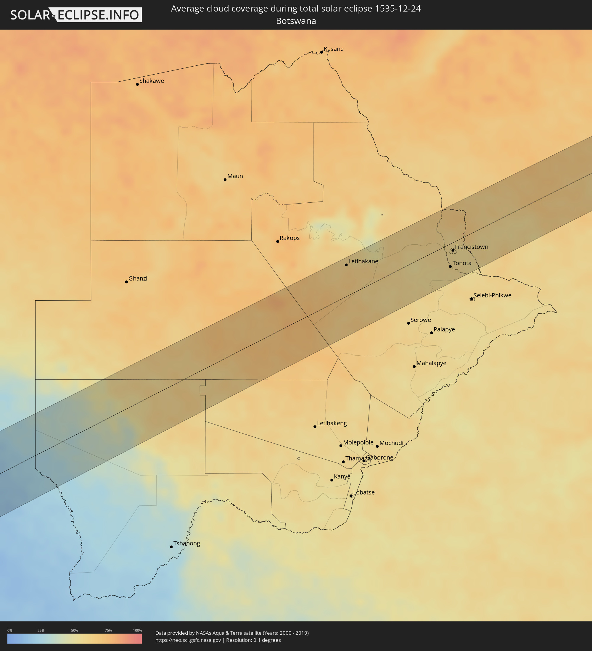 Botswana
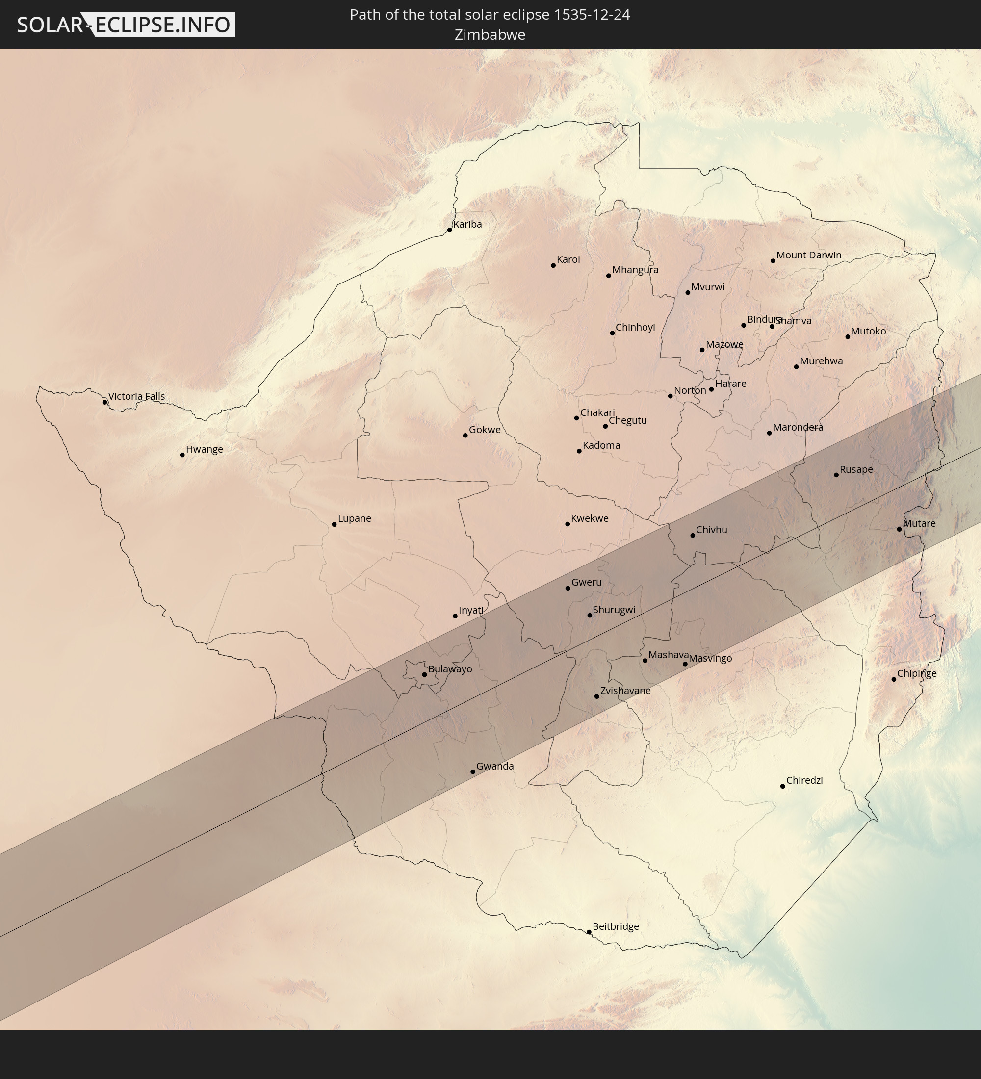
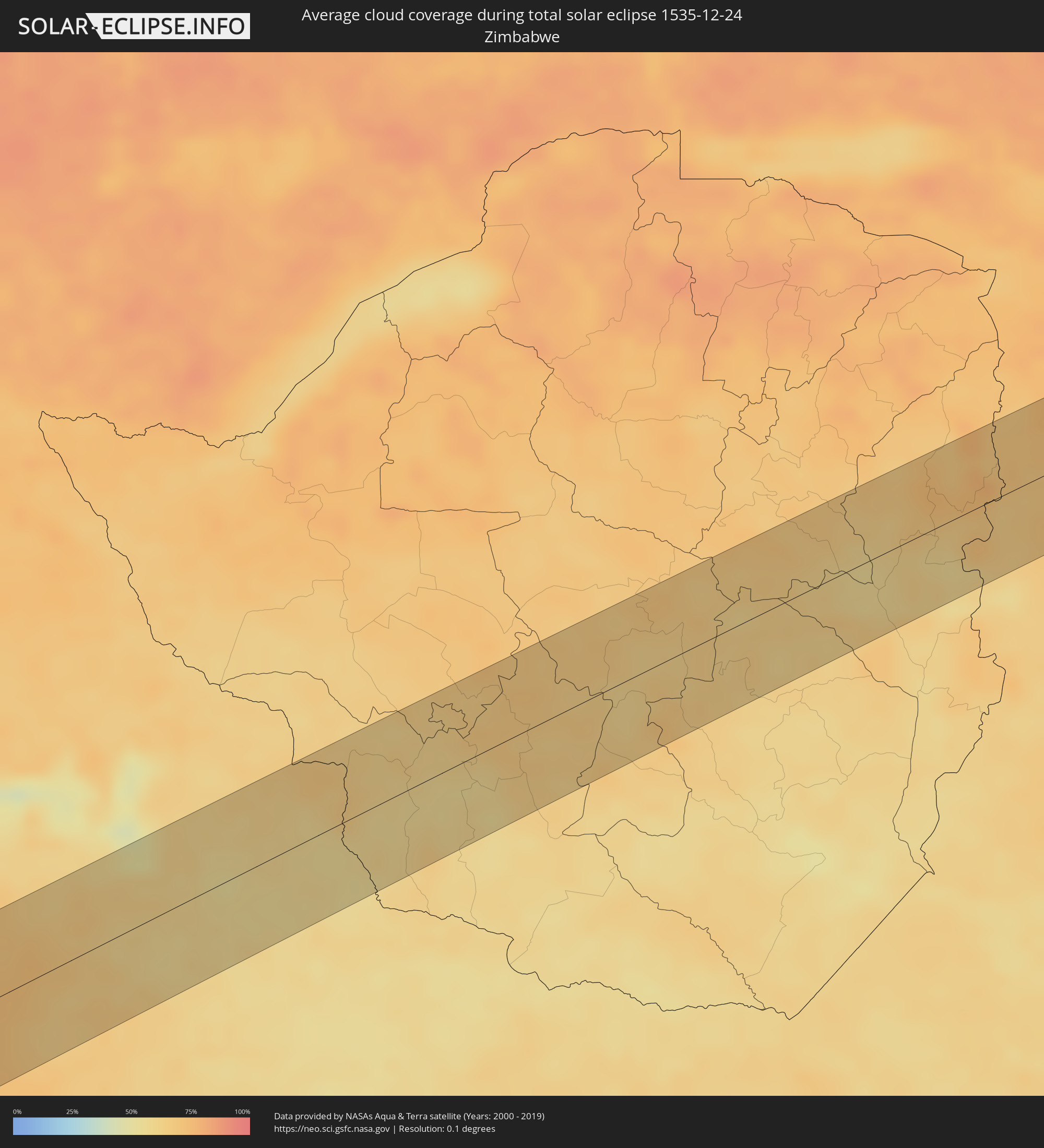 Zimbabwe
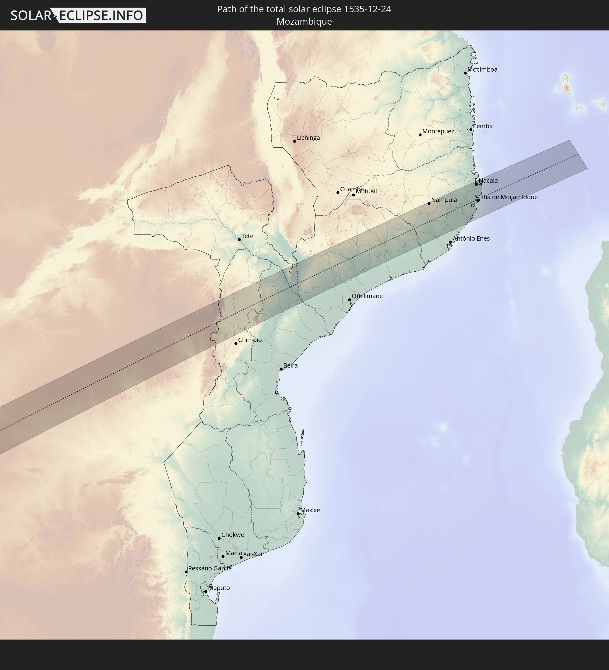
 Mozambique
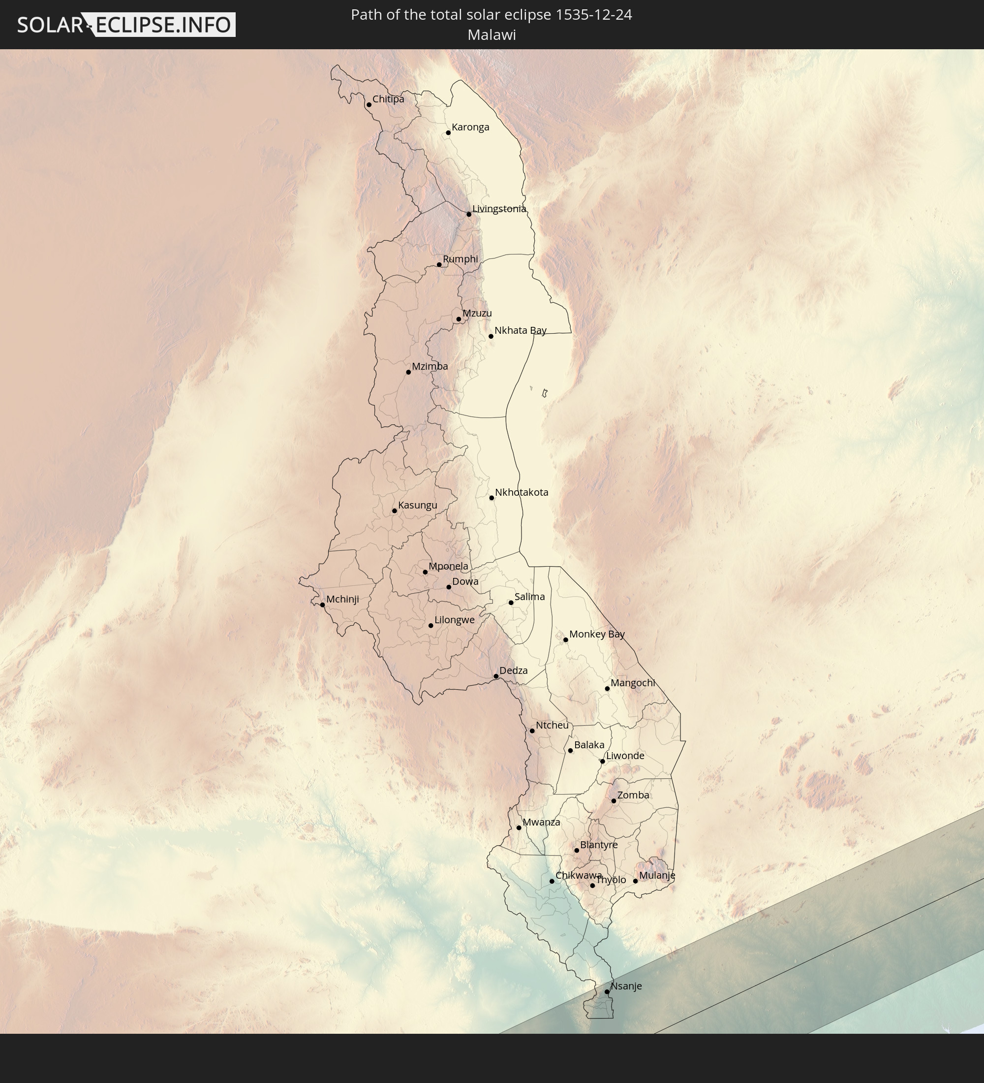
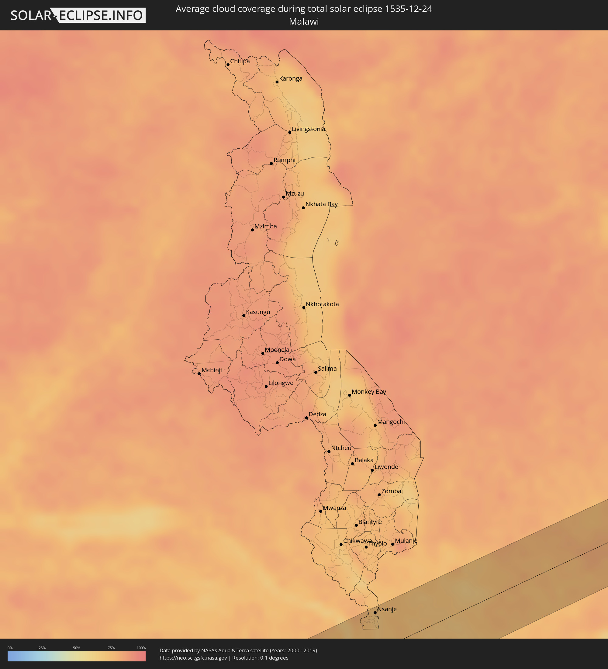 Malawi
Cities inside the path of the eclipse
The following table shows all locations with a population of more than 5,000 inside the eclipse path. Cities which have more than 100,000 inhabitants are marked bold. A click at the locations opens a detailed map.
| City | Type | Eclipse duration | Local time of max. eclipse | Distance to central line | Ø Cloud coverage |
|
Taltal, Antofagasta
|
total | - | 07:47:58 UTC-04:42 | 19 km | 34% |
|
Diego de Almagro, Atacama
|
total | - | 07:49:24 UTC-04:42 | 55 km | 5% |
|
Andalgalá, Catamarca Province
|
total | - | 08:19:55 UTC-04:16 | 7 km | 29% |
|
San Fernando del Valle de Catamarca, Catamarca Province
|
total | - | 08:21:28 UTC-04:16 | 70 km | 38% |
|
Aguilares, Tucumán Province
|
total | - | 08:20:22 UTC-04:16 | 40 km | 56% |
|
La Cocha, Tucumán Province
|
total | - | 08:20:49 UTC-04:16 | 8 km | 57% |
|
Los Altos, Catamarca Province
|
total | - | 08:21:13 UTC-04:16 | 15 km | 60% |
|
Monteros, Tucumán Province
|
total | - | 08:20:09 UTC-04:16 | 72 km | 57% |
|
Simoca, Tucumán Province
|
total | - | 08:20:24 UTC-04:16 | 69 km | 54% |
|
Termas de Río Hondo, Santiago del Estero Province
|
total | - | 08:21:09 UTC-04:16 | 68 km | 53% |
|
Santiago del Estero, Santiago del Estero Province
|
total | - | 08:22:07 UTC-04:16 | 64 km | 51% |
|
Añatuya, Santiago del Estero Province
|
total | - | 08:24:25 UTC-04:16 | 60 km | 47% |
|
Ceres, Santa Fe Province
|
total | - | 08:27:09 UTC-04:16 | 44 km | 49% |
|
Tostado, Santa Fe Province
|
total | - | 08:26:33 UTC-04:16 | 28 km | 50% |
|
San Cristóbal, Santa Fe Province
|
total | - | 08:28:30 UTC-04:16 | 57 km | 47% |
|
Calchaquí, Santa Fe Province
|
total | - | 08:29:05 UTC-04:16 | 25 km | 47% |
|
Vera, Santa Fe Province
|
total | - | 08:28:38 UTC-04:16 | 71 km | 46% |
|
San Javier, Santa Fe Province
|
total | - | 08:30:22 UTC-04:16 | 30 km | 38% |
|
Santa Elena, Entre Ríos Province
|
total | - | 08:31:00 UTC-04:16 | 61 km | 42% |
|
La Paz, Entre Ríos Province
|
total | - | 08:30:55 UTC-04:16 | 35 km | 45% |
|
Esquina, Corrientes Province
|
total | - | 08:30:10 UTC-04:16 | 43 km | 41% |
|
Federal, Entre Ríos Province
|
total | - | 08:32:16 UTC-04:16 | 22 km | 45% |
|
San José de Feliciano, Entre Ríos Province
|
total | - | 08:31:35 UTC-04:16 | 37 km | 50% |
|
Concordia, Entre Ríos Province
|
total | - | 08:33:47 UTC-04:16 | 36 km | 45% |
|
Chajarí, Entre Ríos Province
|
total | - | 08:33:02 UTC-04:16 | 31 km | 49% |
|
Salto, Salto
|
total | - | 09:05:48 UTC-03:44 | 32 km | 45% |
|
Mocoretá, Corrientes Province
|
total | - | 08:32:54 UTC-04:16 | 45 km | 48% |
|
Federación, Entre Ríos Province
|
total | - | 08:33:28 UTC-04:16 | 8 km | 45% |
|
Tacuarembó, Tacuarembó
|
total | - | 09:08:54 UTC-03:44 | 11 km | 48% |
|
Tranqueras, Rivera
|
total | - | 09:08:35 UTC-03:44 | 72 km | 51% |
|
Melo, Cerro Largo
|
total | - | 09:12:18 UTC-03:44 | 11 km | 51% |
|
Herval, Rio Grande do Sul
|
total | - | 09:51:26 UTC-03:06 | 75 km | 57% |
|
Río Branco, Cerro Largo
|
total | - | 09:13:45 UTC-03:44 | 16 km | 53% |
|
Jaguarão, Rio Grande do Sul
|
total | - | 09:52:07 UTC-03:06 | 19 km | 53% |
|
Arroio Grande, Rio Grande do Sul
|
total | - | 09:52:10 UTC-03:06 | 64 km | 60% |
|
Lüderitz, Karas
|
total | - | 16:46:29 UTC+01:30 | 14 km | 11% |
|
Bethanie, Karas
|
total | - | 16:48:07 UTC+01:30 | 60 km | 9% |
|
Letlhakane, Central
|
total | - | 17:38:00 UTC+02:10 | 51 km | 66% |
|
Tonota, Central
|
total | - | 17:38:30 UTC+02:10 | 39 km | 57% |
|
Francistown, North-East
|
total | - | 17:38:47 UTC+02:10 | 14 km | 57% |
|
Nsanje, Southern Region
|
total | - | 17:43:17 UTC+02:10 | 51 km | 68% |
|
Nampula, Nampula
|
total | - | 17:44:15 UTC+02:10 | 51 km | 81% |
|
Nacala, Nampula
|
total | - | 17:44:24 UTC+02:10 | 44 km | 85% |
|
Ilha de Moçambique, Nampula
|
total | - | 17:44:04 UTC+02:10 | 6 km | 78% |