Total solar eclipse of 04/30/1688
| Day of week: | Friday |
| Maximum duration of eclipse: | 03m40s |
| Maximum width of eclipse path: | 234 km |
| Saros cycle: | 133 |
| Coverage: | 100% |
| Magnitude: | 1.0535 |
| Gamma: | 0.6621 |
Wo kann man die Sonnenfinsternis vom 04/30/1688 sehen?
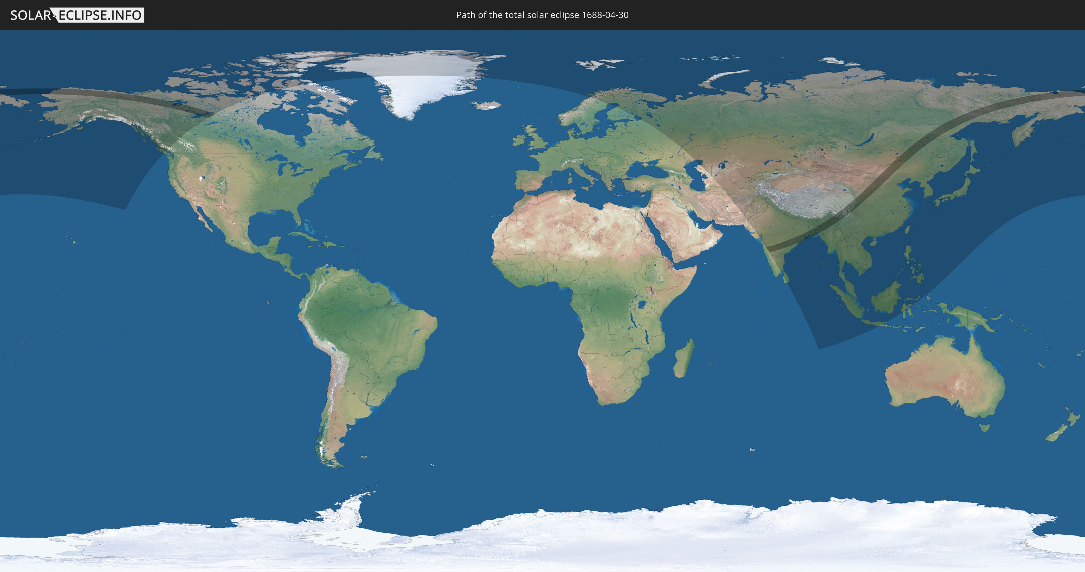
Die Sonnenfinsternis am 04/30/1688 kann man in 42 Ländern als partielle Sonnenfinsternis beobachten.
Der Finsternispfad verläuft durch 8 Länder. Nur in diesen Ländern ist sie als total Sonnenfinsternis zu sehen.
In den folgenden Ländern ist die Sonnenfinsternis total zu sehen
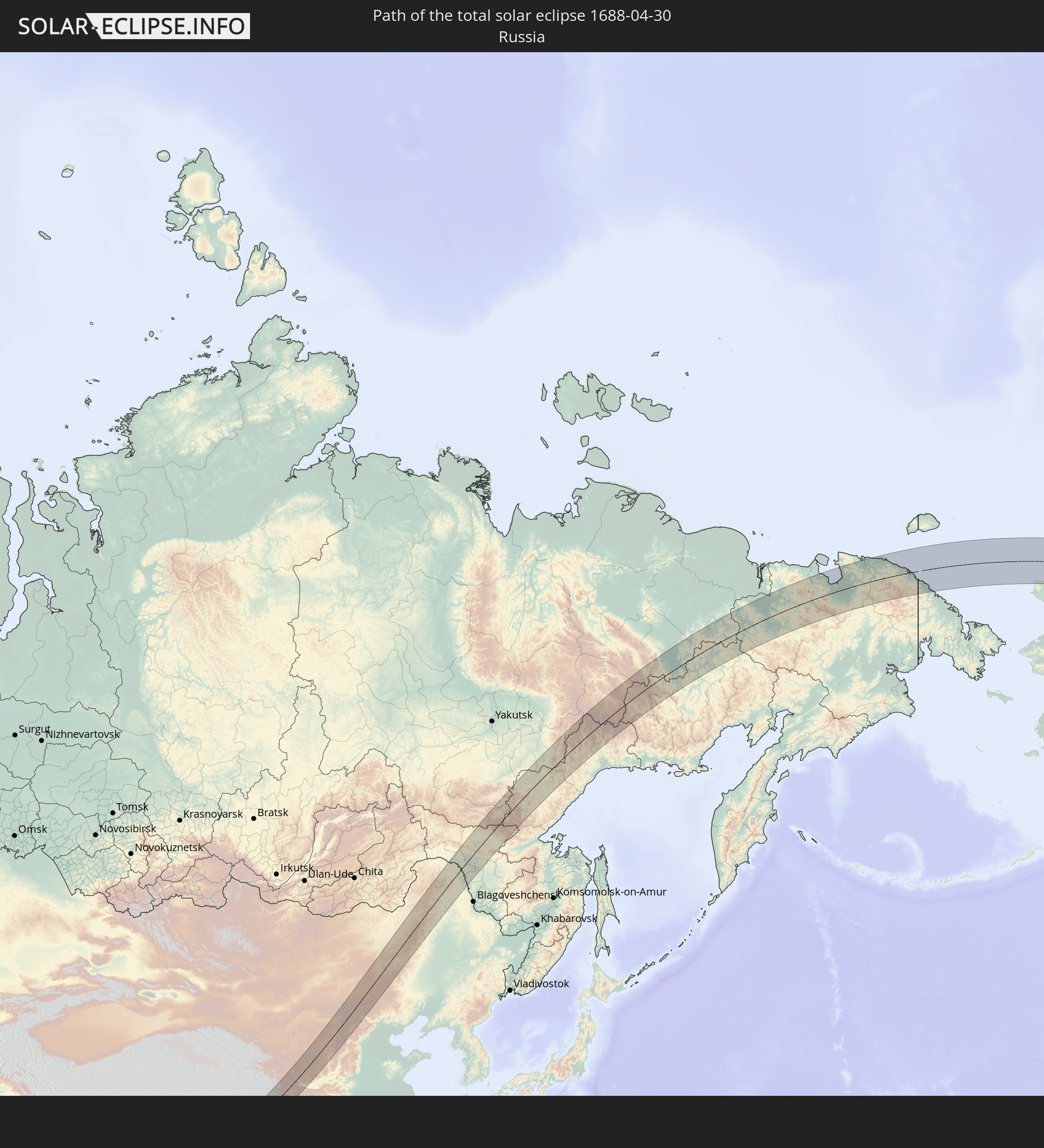 Russia
 United States
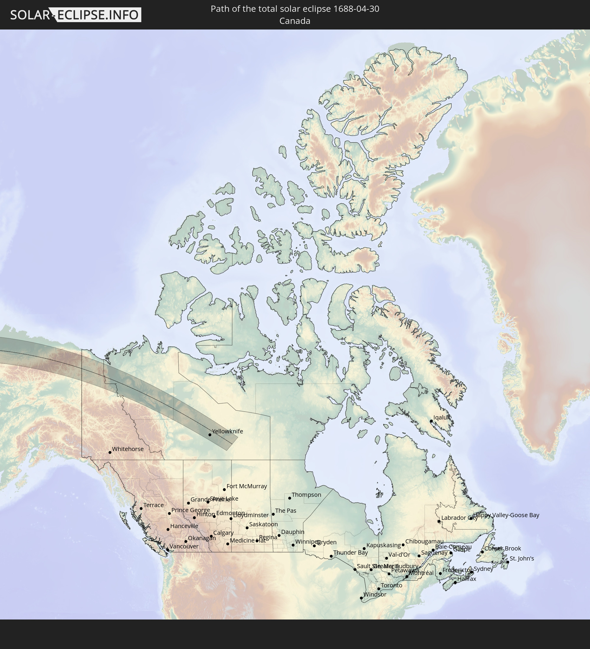 Canada
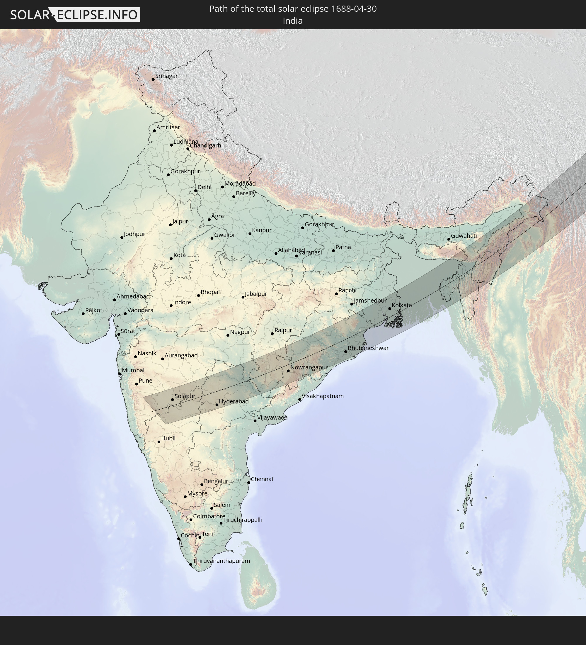 India
India
 China
China
 Mongolia
 Bangladesh
 Myanmar
In den folgenden Ländern ist die Sonnenfinsternis partiell zu sehen
 Russia
 United States
 Canada
 Greenland
 Svalbard and Jan Mayen
 Norway
 Sweden
 Finland
 Iran
Iran
 Kazakhstan
 Turkmenistan
 Uzbekistan
 Afghanistan
 Pakistan
 Tajikistan
 India
India
 Kyrgyzstan
 China
China
 Sri Lanka
 Nepal
Nepal
 Mongolia
 Bangladesh
 Bhutan
 Myanmar
 Indonesia
 Cocos Islands
 Thailand
 Malaysia
 Laos
Laos
 Vietnam
 Cambodia
 Singapore
 Christmas Island
 Macau
Macau
 Hong Kong
 Brunei
 Taiwan
 Philippines
 Japan
Japan
 North Korea
 South Korea
 Northern Mariana Islands
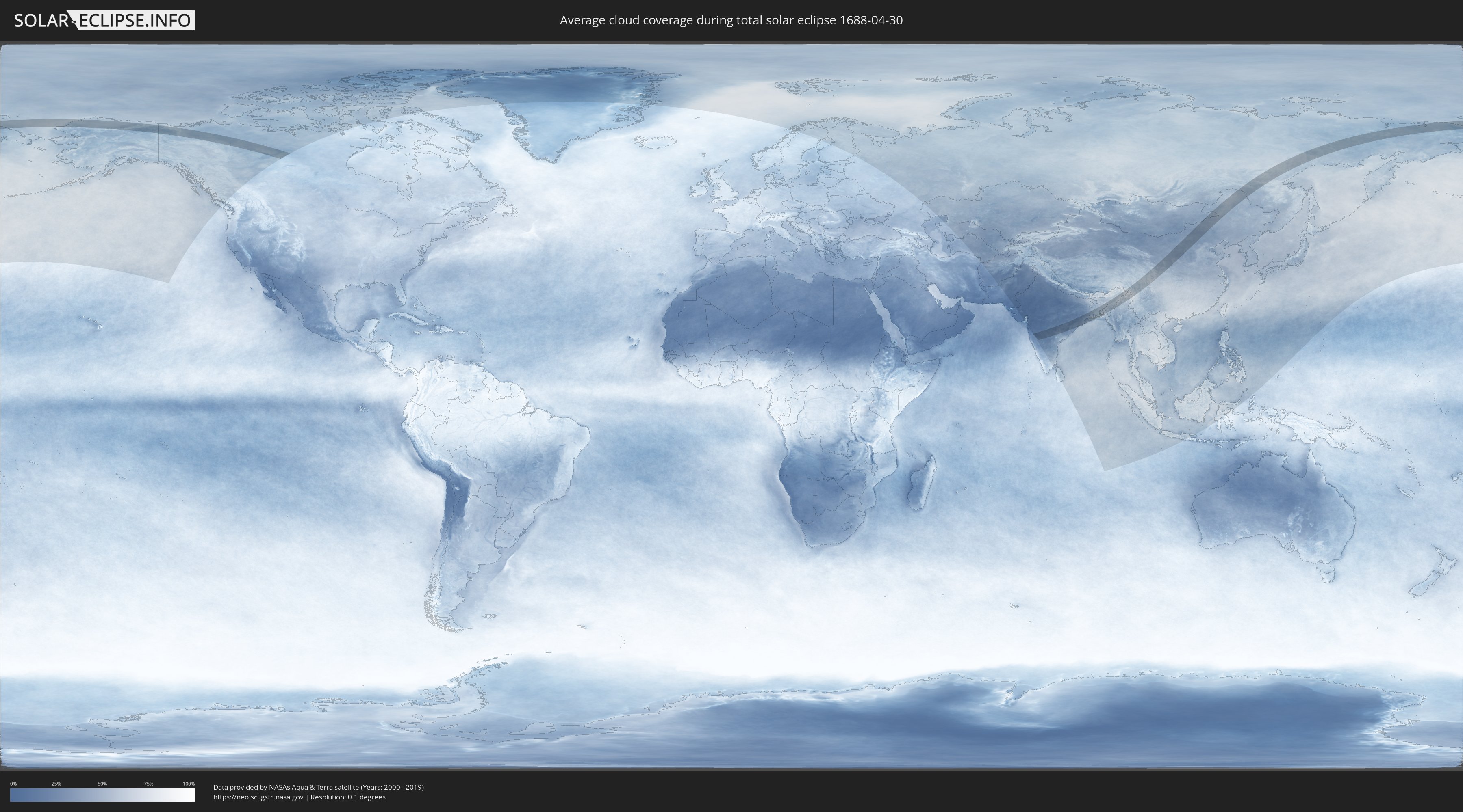
How will be the weather during the total solar eclipse on 04/30/1688?
Where is the best place to see the total solar eclipse of 04/30/1688?
The following maps show the average cloud coverage for the day of the total solar eclipse.
With the help of these maps, it is possible to find the place along the eclipse path, which has the best
chance of a cloudless sky.
Nevertheless, you should consider local circumstances and inform about the weather of your chosen
observation site.
The data is provided by NASAs satellites
AQUA and TERRA.
The cloud maps are averaged over a period of 19 years (2000 - 2019).

Detailed country maps
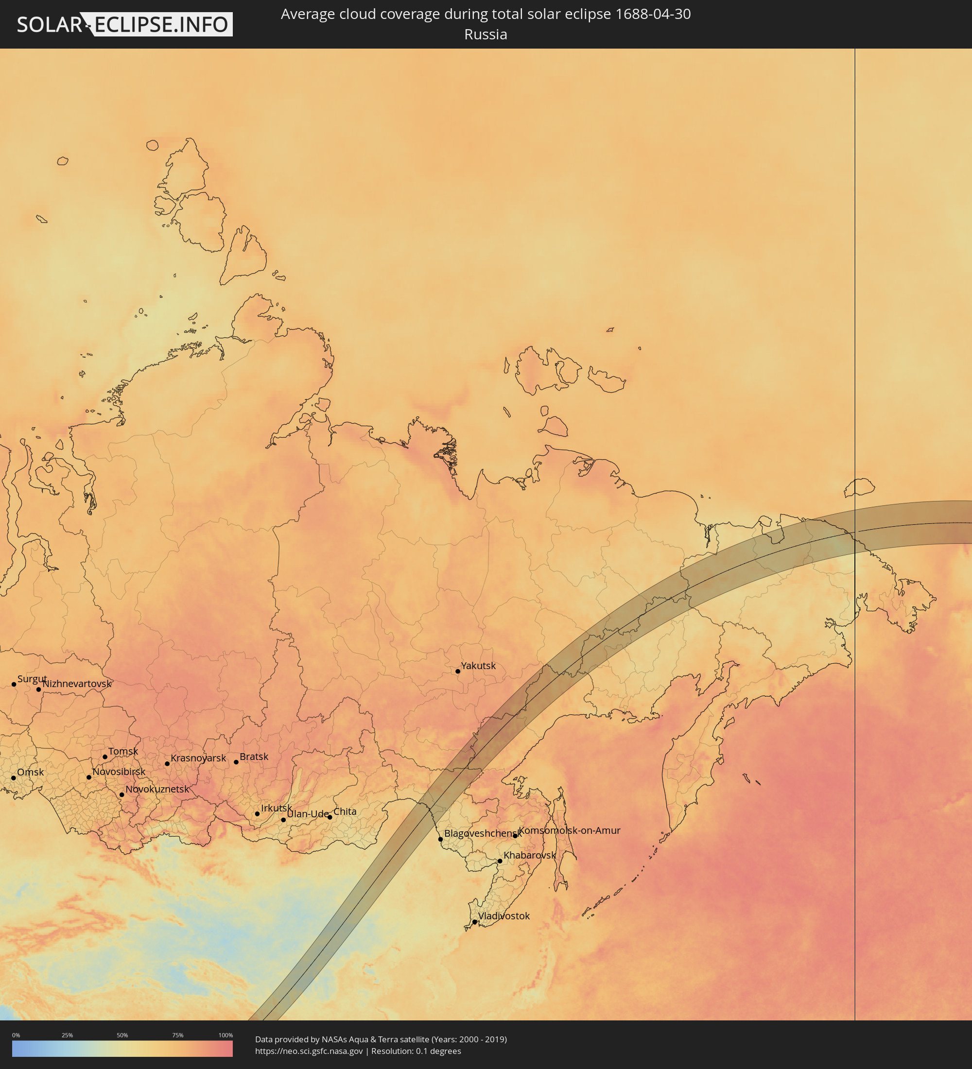 Russia
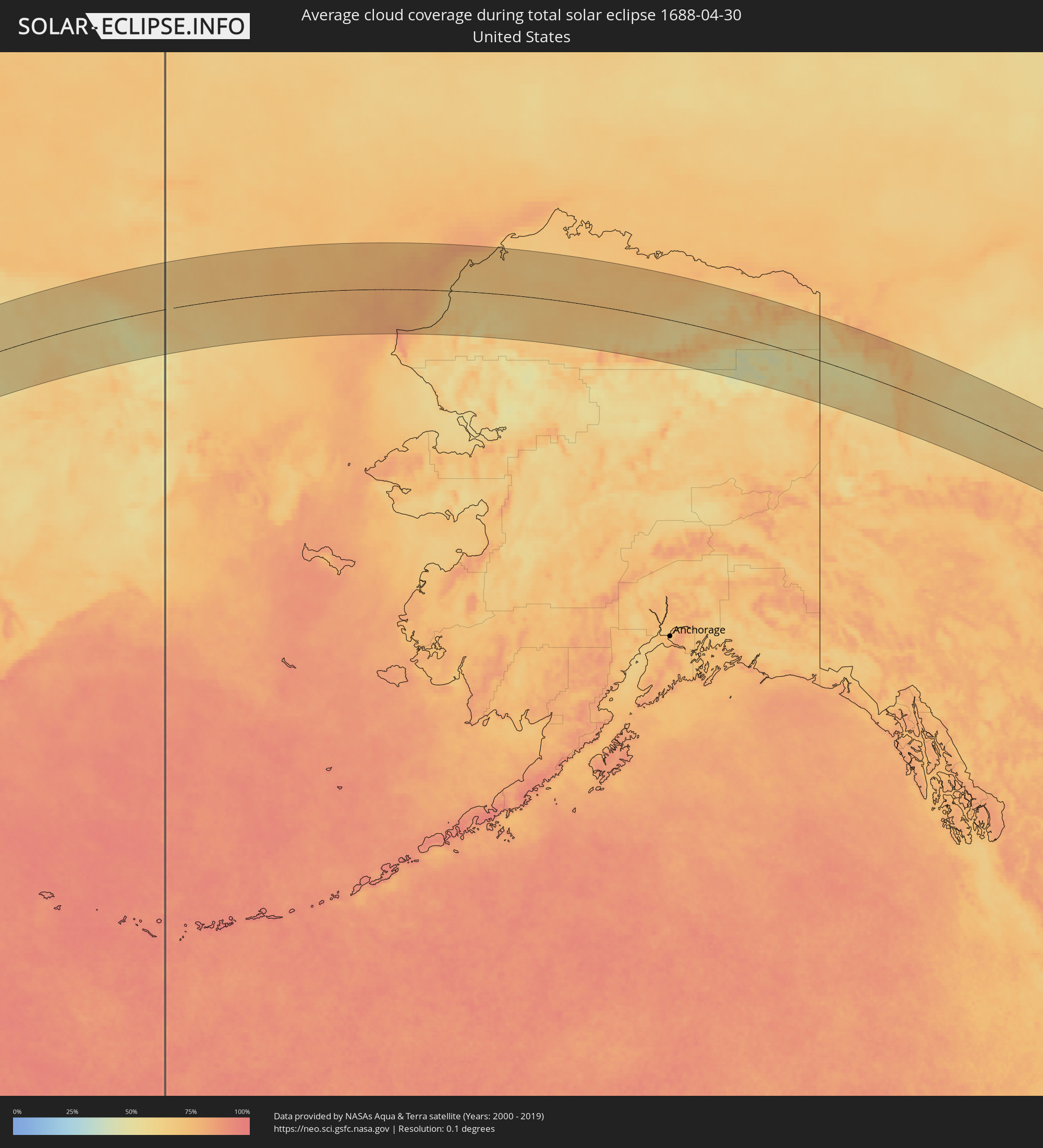 United States
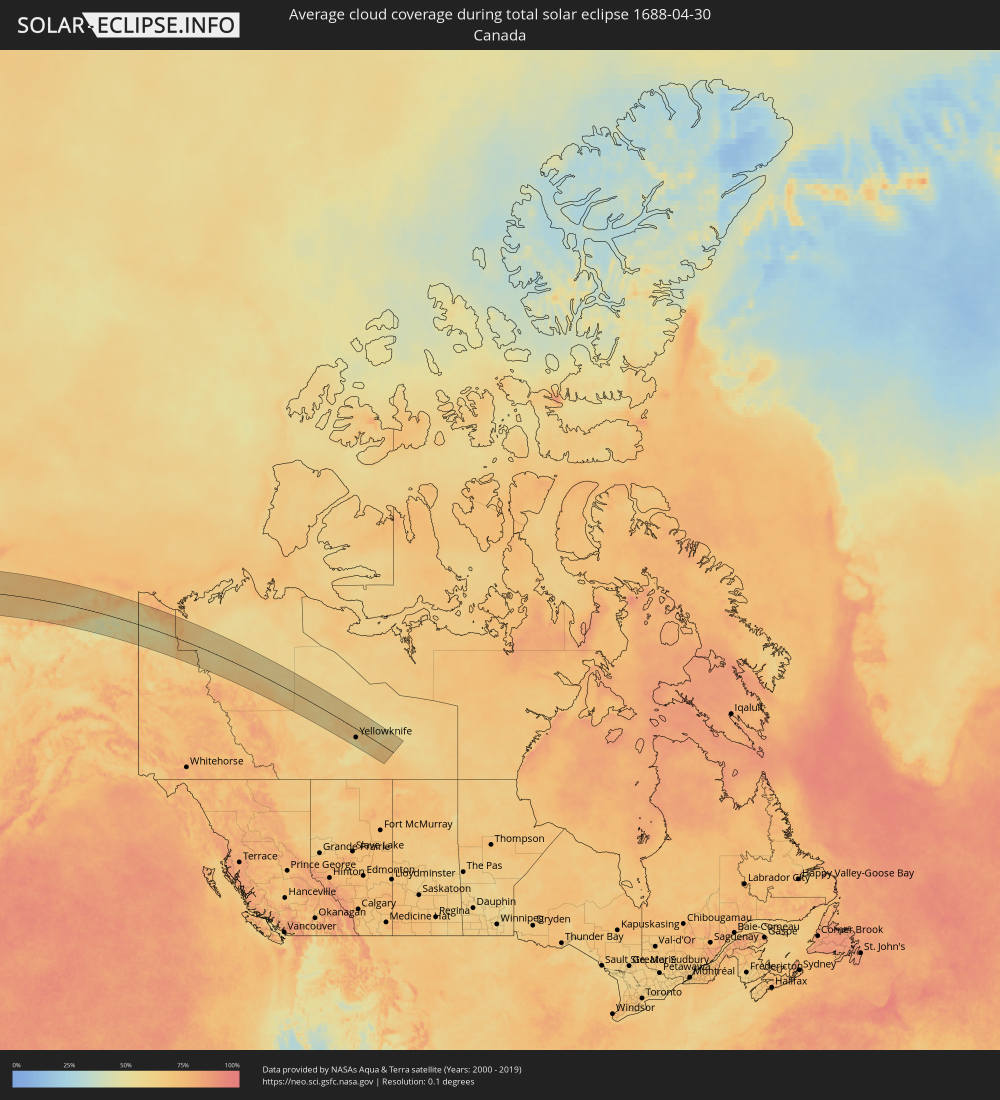 Canada
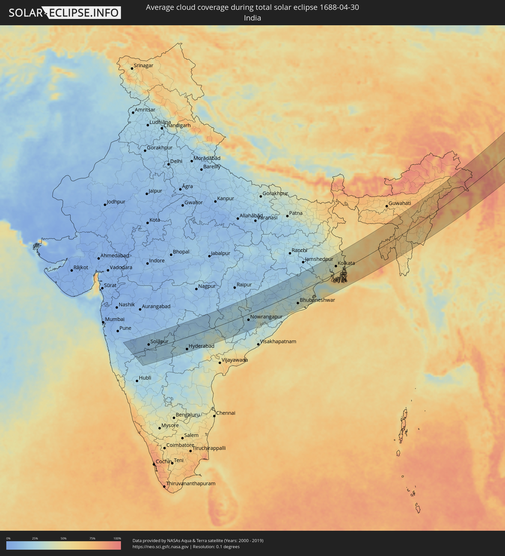 India
India
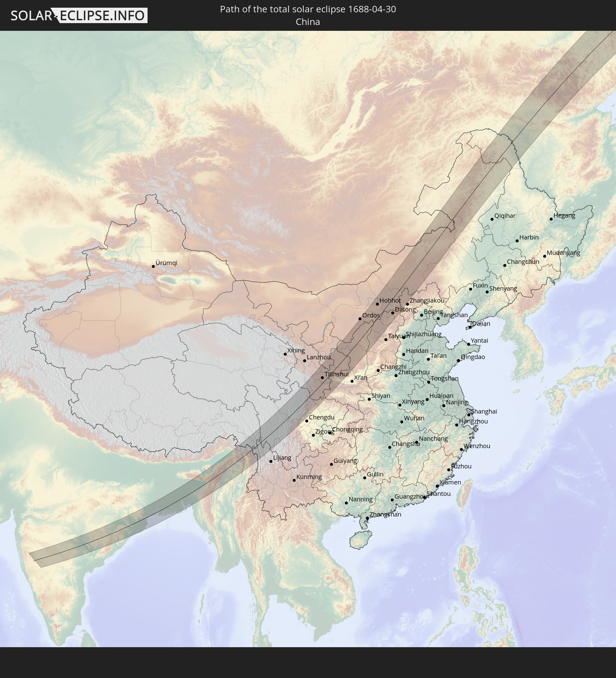
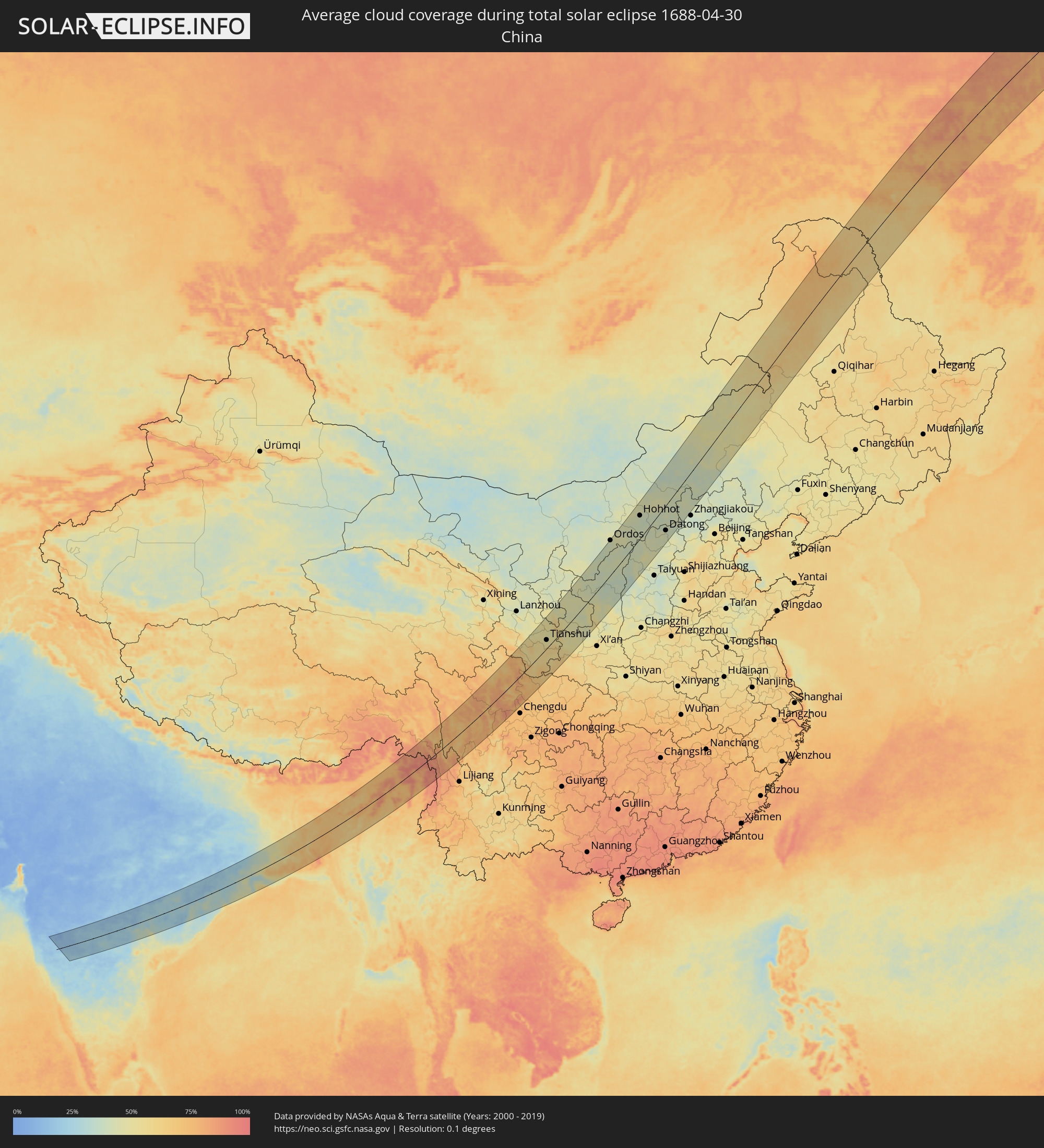 China
China
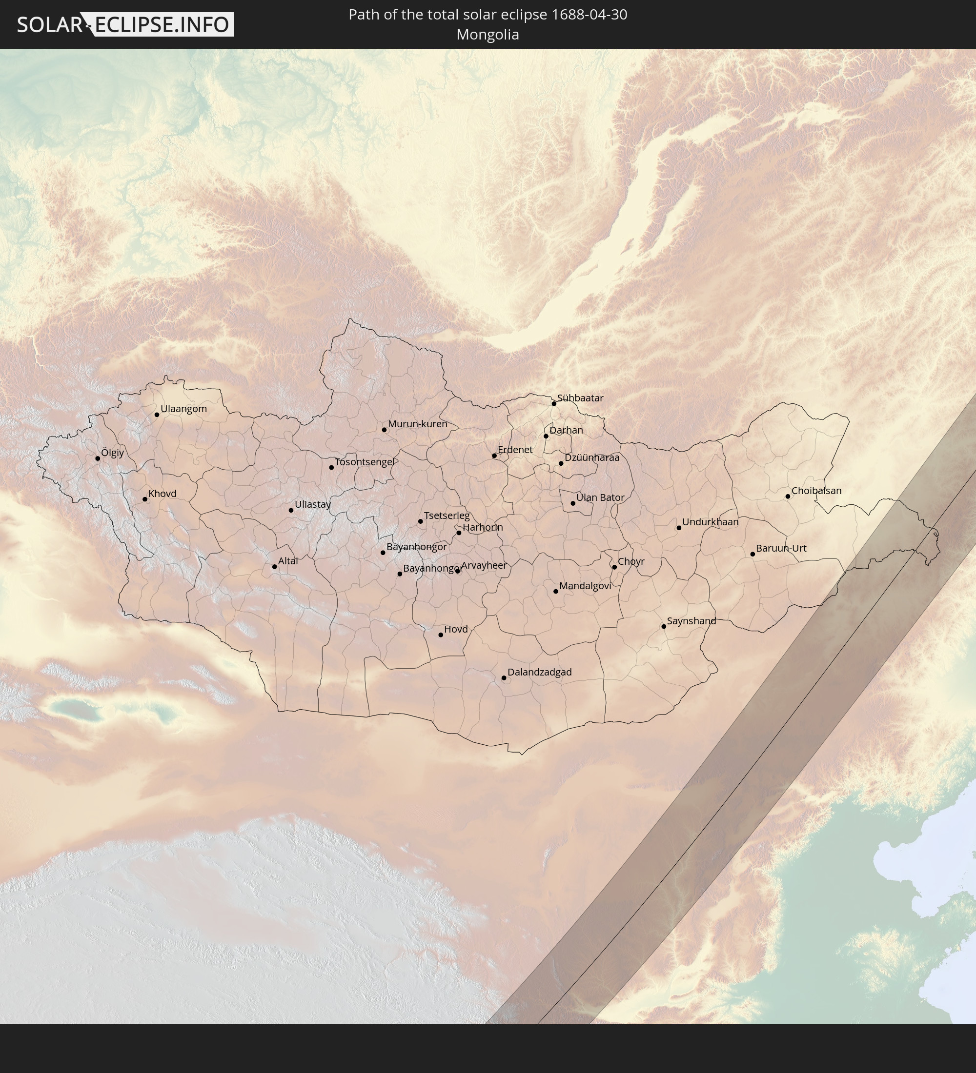
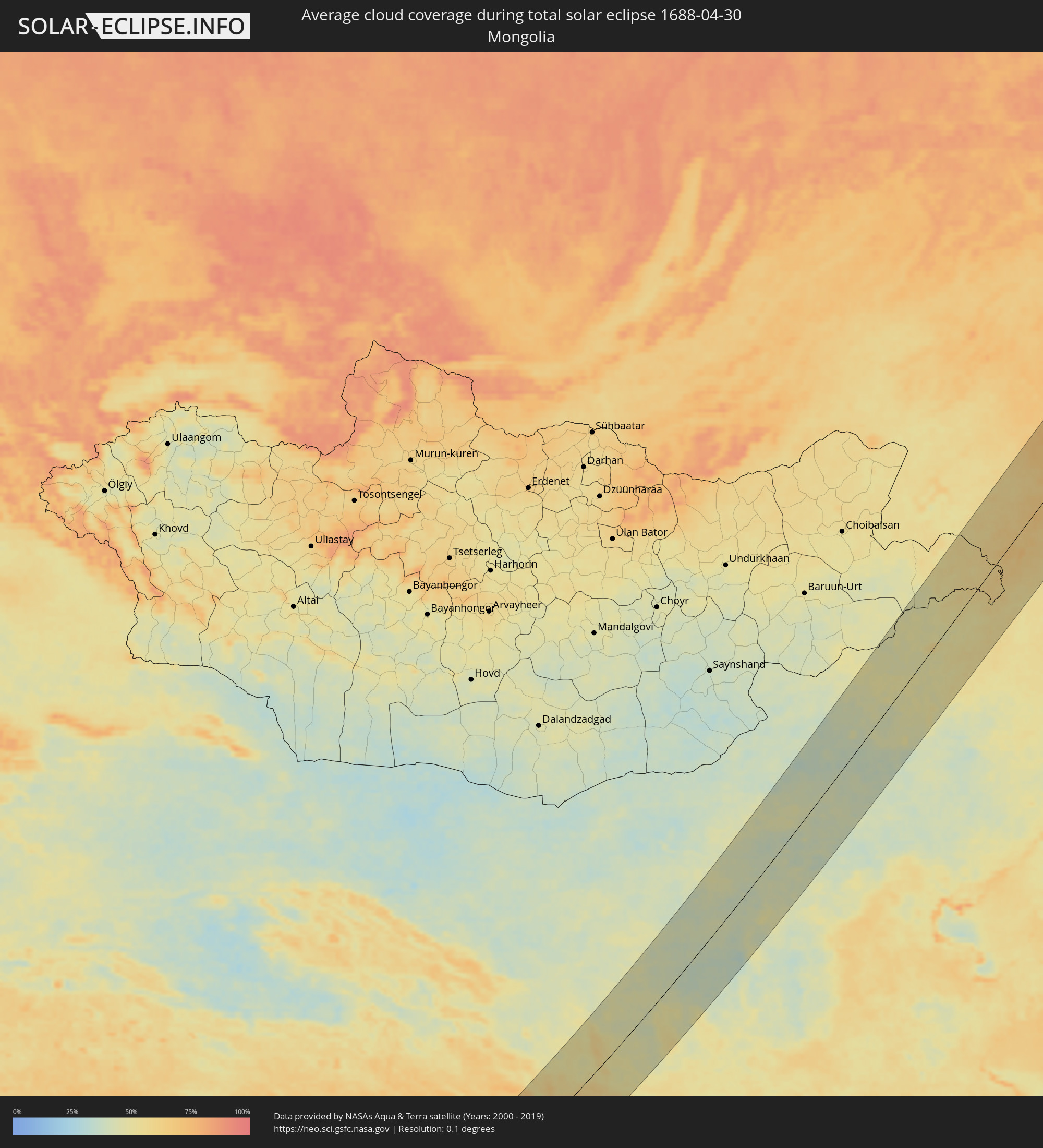 Mongolia
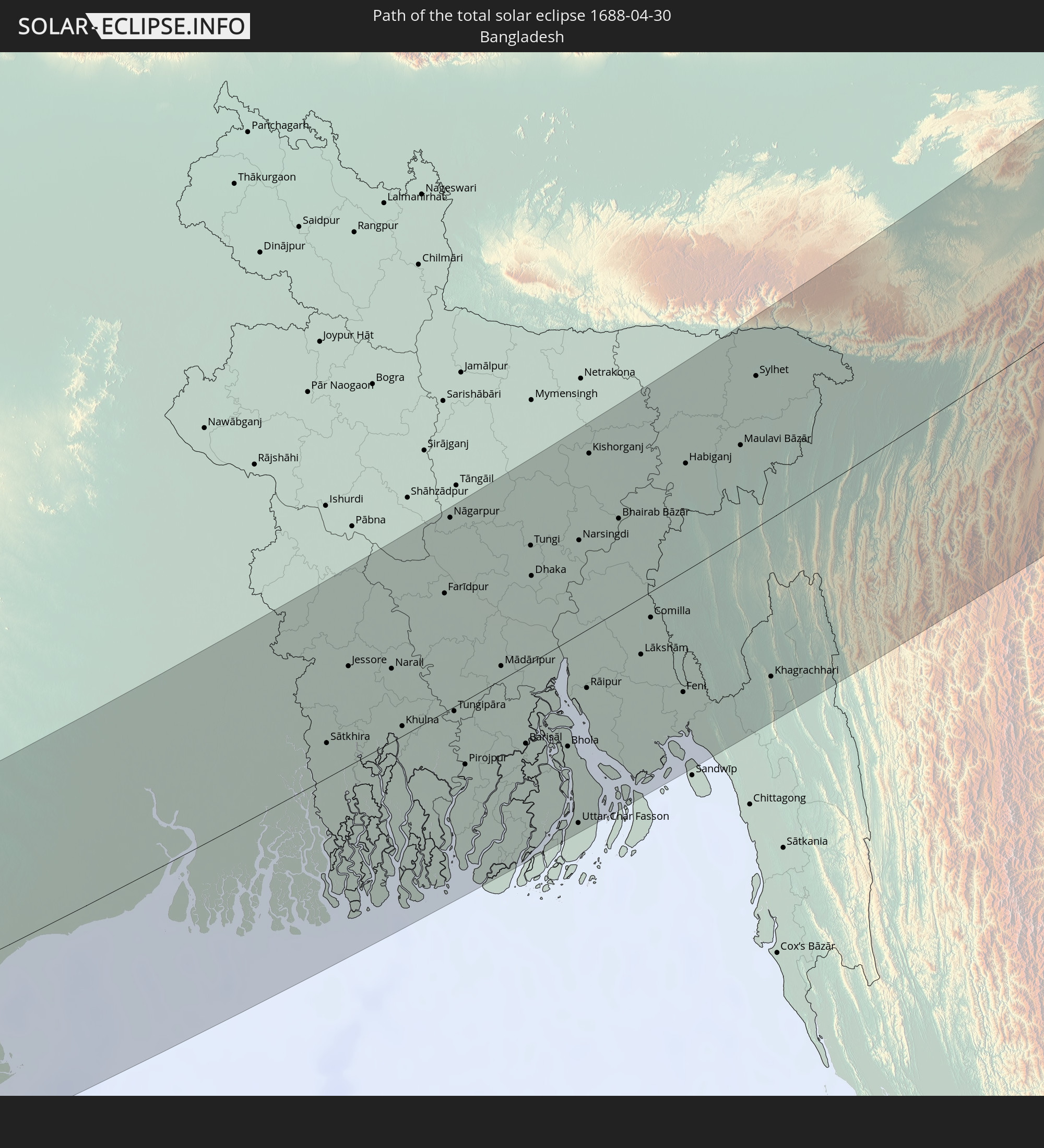
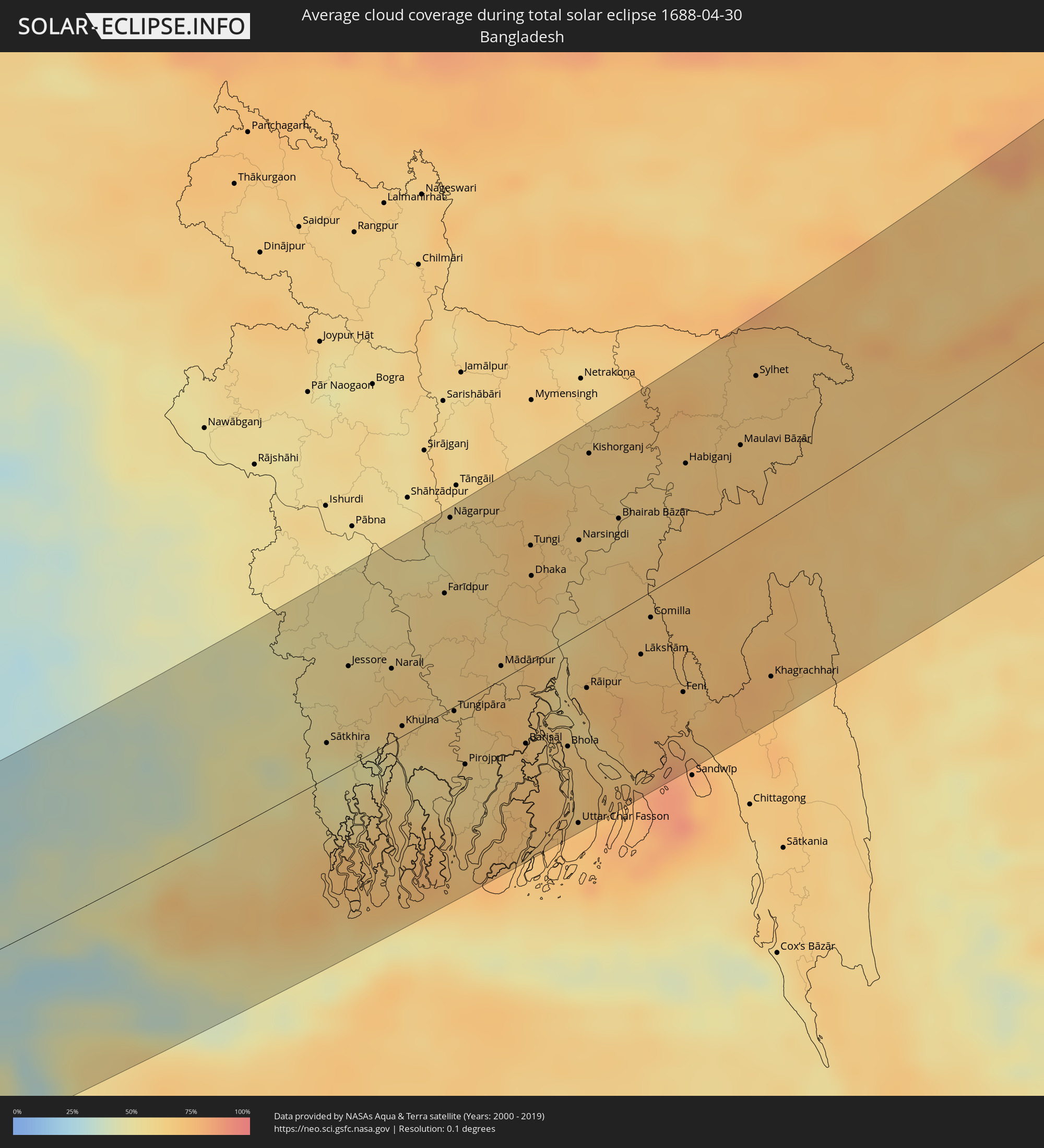 Bangladesh
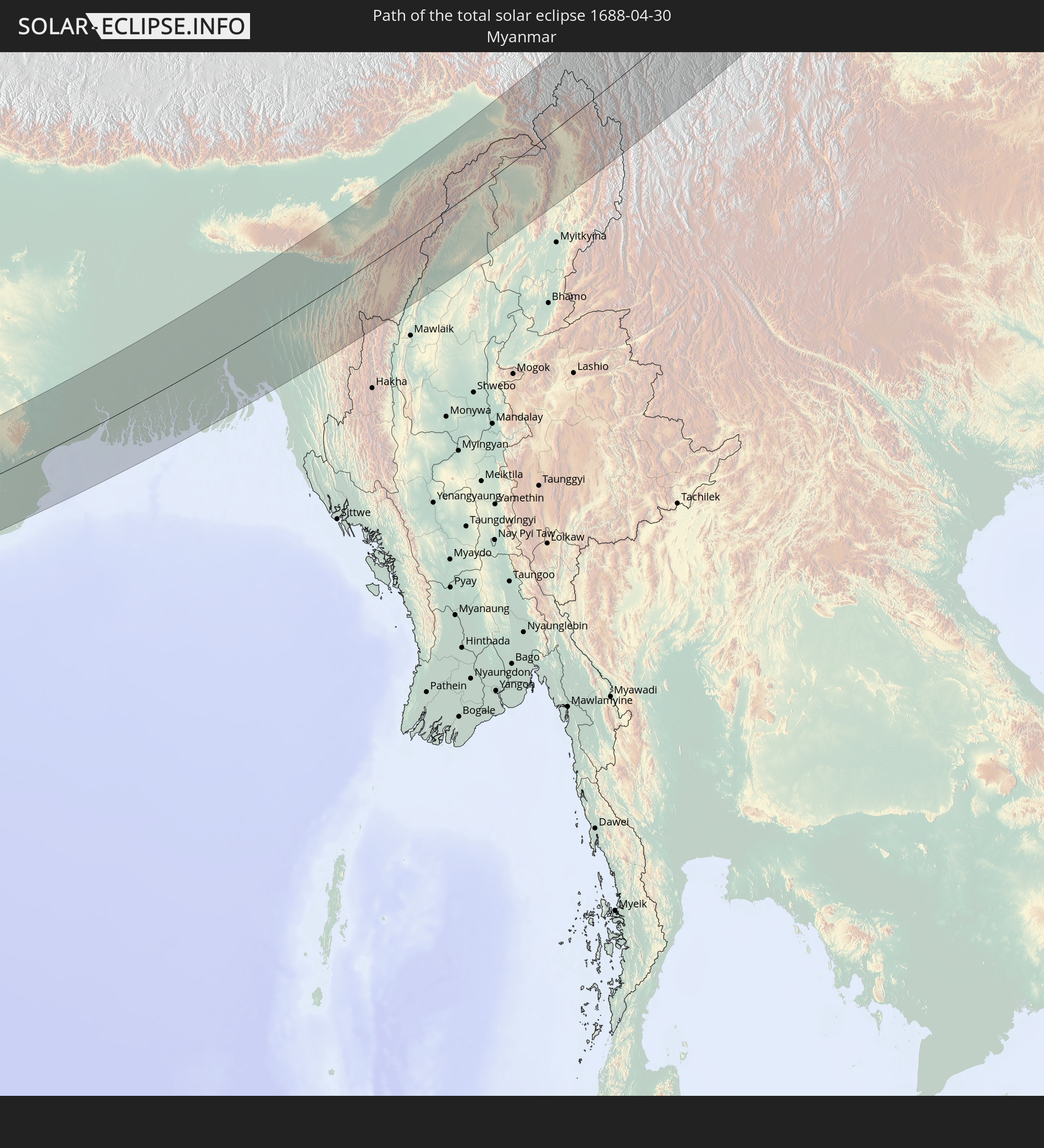
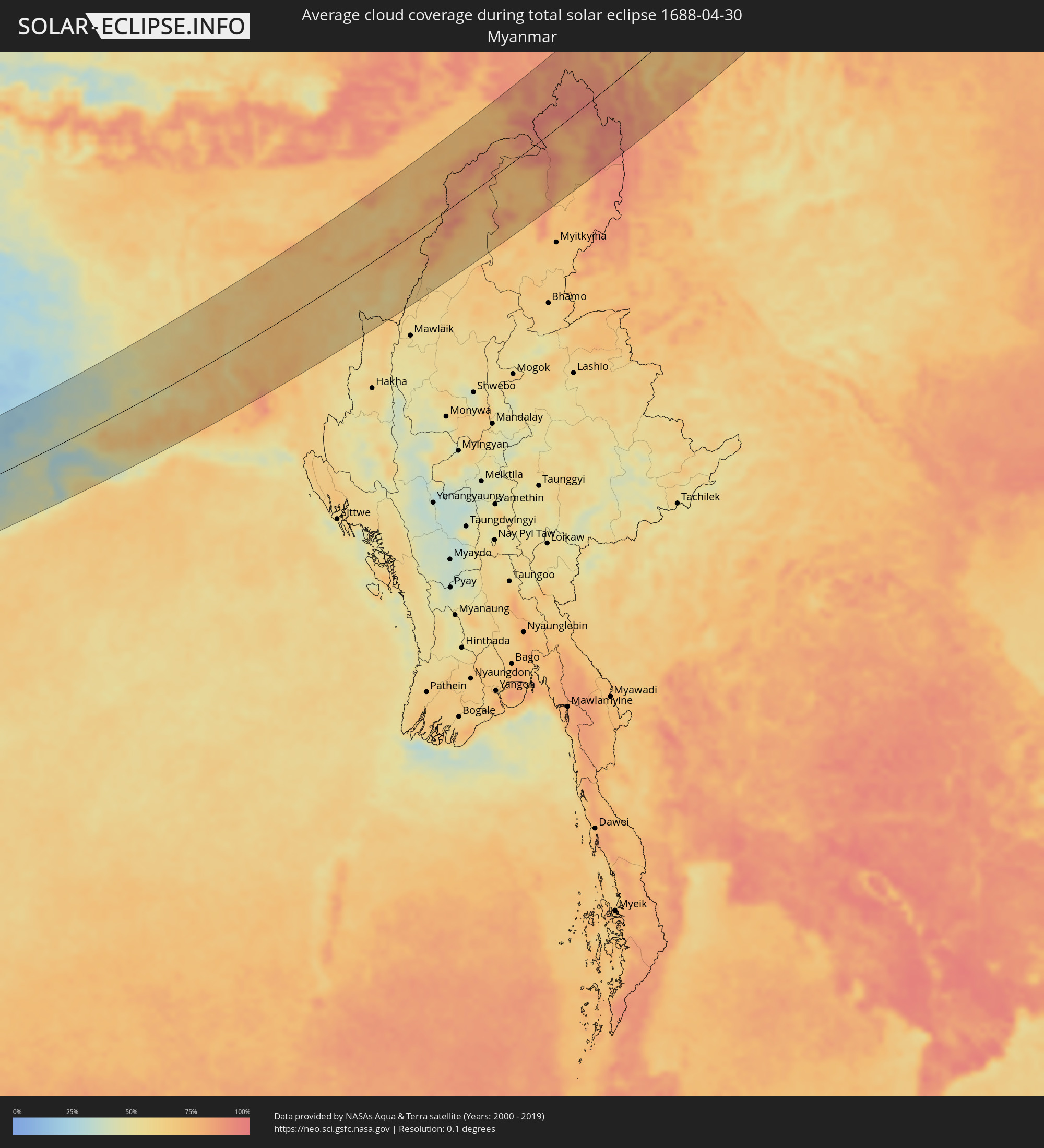 Myanmar
Cities inside the path of the eclipse
The following table shows all locations with a population of more than 5,000 inside the eclipse path. Cities which have more than 100,000 inhabitants are marked bold. A click at the locations opens a detailed map.
| City | Type | Eclipse duration | Local time of max. eclipse | Distance to central line | Ø Cloud coverage |
|
Yellowknife, Northwest Territories
|
total | - | 19:41:44 UTC-07:33 | 46 km | 67% |
|
Pandharpur, Maharashtra
|
total | - | 06:00:59 UTC+05:21 | 50 km | 15% |
|
Bārsi, Maharashtra
|
total | - | 06:01:33 UTC+05:21 | 98 km | 16% |
|
Bijapur, Karnataka
|
total | - | 05:59:52 UTC+05:21 | 54 km | 22% |
|
Solāpur, Maharashtra
|
total | - | 06:00:49 UTC+05:21 | 31 km | 16% |
|
Latur, Maharashtra
|
total | - | 06:01:30 UTC+05:21 | 90 km | 16% |
|
Gulbarga, Karnataka
|
total | - | 06:00:09 UTC+05:21 | 43 km | 21% |
|
Udgīr, Maharashtra
|
total | - | 06:01:22 UTC+05:21 | 73 km | 20% |
|
Bīdar, Karnataka
|
total | - | 06:00:40 UTC+05:21 | 8 km | 23% |
|
Nizāmābād, Telangana
|
total | - | 06:01:28 UTC+05:21 | 70 km | 19% |
|
Serilingampalle, Telangana
|
total | - | 05:59:58 UTC+05:21 | 65 km | 22% |
|
Hyderabad, Telangana
|
total | - | 05:59:48 UTC+05:21 | 85 km | 22% |
|
Secunderabad, Telangana
|
total | - | 05:59:56 UTC+05:21 | 74 km | 23% |
|
Jagtiāl, Telangana
|
total | - | 06:01:26 UTC+05:21 | 53 km | 22% |
|
Karīmnagar, Telangana
|
total | - | 06:00:57 UTC+05:21 | 18 km | 21% |
|
Rāmgundam, Telangana
|
total | - | 06:01:20 UTC+05:21 | 34 km | 17% |
|
Warangal, Telangana
|
total | - | 06:00:18 UTC+05:21 | 56 km | 29% |
|
Nowrangapur, Odisha
|
total | - | 06:01:22 UTC+05:21 | 39 km | 21% |
|
Bhubaneshwar, Odisha
|
total | - | 06:02:28 UTC+05:21 | 70 km | 37% |
|
Cuttack, Odisha
|
total | - | 06:02:44 UTC+05:21 | 55 km | 38% |
|
Bhadrakh, Odisha
|
total | - | 06:03:32 UTC+05:21 | 23 km | 39% |
|
Balasore, Odisha
|
total | - | 06:04:09 UTC+05:21 | 7 km | 36% |
|
Kharagpur, West Bengal
|
total | - | 06:05:22 UTC+05:21 | 71 km | 36% |
|
Haldia, West Bengal
|
total | - | 06:04:58 UTC+05:21 | 15 km | 55% |
|
Nangi, West Bengal
|
total | - | 06:05:38 UTC+05:21 | 44 km | 42% |
|
Kolkata, West Bengal
|
total | - | 06:05:43 UTC+05:21 | 41 km | 49% |
|
Kultali, West Bengal
|
total | - | 06:04:45 UTC+05:21 | 36 km | 65% |
|
Bhātpāra, West Bengal
|
total | - | 06:06:10 UTC+05:21 | 74 km | 48% |
|
Shāntipur, West Bengal
|
total | - | 06:06:44 UTC+05:21 | 105 km | 45% |
|
Bārāsat, West Bengal
|
total | - | 06:05:13 UTC+05:21 | 5 km | 57% |
|
Bārāsat, West Bengal
|
total | - | 06:05:57 UTC+05:21 | 57 km | 49% |
|
Kalyani, West Bengal
|
total | - | 06:06:20 UTC+05:21 | 79 km | 46% |
|
Hābra, West Bengal
|
total | - | 06:06:08 UTC+05:21 | 55 km | 49% |
|
Gosāba, West Bengal
|
total | - | 06:05:09 UTC+05:21 | 31 km | 60% |
|
Bangaon, West Bengal
|
total | - | 06:06:27 UTC+05:21 | 67 km | 49% |
|
Sātkhira, Khulna
|
total | - | 06:38:07 UTC+05:53 | 28 km | 50% |
|
Jhingergācha, Khulna
|
total | - | 06:38:43 UTC+05:53 | 61 km | 54% |
|
Kālīganj, Khulna
|
total | - | 06:39:10 UTC+05:53 | 86 km | 55% |
|
Jessore, Khulna
|
total | - | 06:38:49 UTC+05:53 | 58 km | 59% |
|
Bhātpāra Abhaynagar, Khulna
|
total | - | 06:38:36 UTC+05:53 | 34 km | 62% |
|
Narail, Khulna
|
total | - | 06:38:49 UTC+05:53 | 49 km | 63% |
|
Khulna, Khulna
|
total | - | 06:38:18 UTC+05:53 | 12 km | 62% |
|
Kālia, Khulna
|
total | - | 06:38:39 UTC+05:53 | 39 km | 67% |
|
Farīdpur, Dhaka
|
total | - | 06:39:31 UTC+05:53 | 72 km | 62% |
|
Nāgarpur, Dhaka
|
total | - | 06:40:12 UTC+05:53 | 111 km | 60% |
|
Tungipāra, Dhaka
|
total | - | 06:38:28 UTC+05:53 | 13 km | 67% |
|
Pirojpur, Barisāl
|
total | - | 06:37:59 UTC+05:53 | 44 km | 61% |
|
Mirzāpur, Dhaka
|
total | - | 06:40:18 UTC+05:53 | 104 km | 61% |
|
Dohār, Dhaka
|
total | - | 06:39:32 UTC+05:53 | 53 km | 62% |
|
Mādārīpur, Dhaka
|
total | - | 06:38:54 UTC+05:53 | 30 km | 65% |
|
Gaurnadi, Barisāl
|
total | - | 06:38:36 UTC+05:53 | 23 km | 74% |
|
Pālang, Dhaka
|
total | - | 06:38:59 UTC+05:53 | 16 km | 70% |
|
Barisāl, Barisāl
|
total | - | 06:38:12 UTC+05:53 | 49 km | 69% |
|
Tungi, Dhaka
|
total | - | 06:40:00 UTC+05:53 | 73 km | 69% |
|
Dhaka, Dhaka
|
total | - | 06:39:44 UTC+05:53 | 53 km | 69% |
|
Mehendiganj, Barisāl
|
total | - | 06:38:24 UTC+05:53 | 47 km | 65% |
|
Bhola, Barisāl
|
total | - | 06:38:12 UTC+05:53 | 64 km | 66% |
|
Uttar Char Fasson, Khulna
|
total | - | 06:37:31 UTC+05:53 | 111 km | 71% |
|
Narsingdi, Dhaka
|
total | - | 06:40:05 UTC+05:53 | 54 km | 64% |
|
Burhānuddin, Barisāl
|
total | - | 06:37:55 UTC+05:53 | 86 km | 66% |
|
Lālmohan, Barisāl
|
total | - | 06:37:41 UTC+05:53 | 104 km | 74% |
|
Rāipur, Chittagong
|
total | - | 06:38:45 UTC+05:53 | 36 km | 69% |
|
Kishorganj, Dhaka
|
total | - | 06:40:53 UTC+05:53 | 103 km | 64% |
|
Lakshmīpur, Chittagong
|
total | - | 06:38:37 UTC+05:53 | 47 km | 60% |
|
Rāmganj, Chittagong
|
total | - | 06:38:51 UTC+05:53 | 39 km | 73% |
|
Hājīganj, Chittagong
|
total | - | 06:39:05 UTC+05:53 | 33 km | 67% |
|
Bhairab Bāzār, Dhaka
|
total | - | 06:40:19 UTC+05:53 | 60 km | 62% |
|
Lākshām, Chittagong
|
total | - | 06:39:05 UTC+05:53 | 33 km | 71% |
|
Comilla, Chittagong
|
total | - | 06:39:26 UTC+05:53 | 20 km | 67% |
|
Agartala, Tripura
|
total | - | 06:07:51 UTC+05:21 | 23 km | 69% |
|
Feni, Chittagong
|
total | - | 06:38:46 UTC+05:53 | 69 km | 74% |
|
Habiganj, Sylhet
|
total | - | 06:40:52 UTC+05:53 | 66 km | 66% |
|
Chhāgalnāiya, Chittagong
|
total | - | 06:38:48 UTC+05:53 | 75 km | 69% |
|
Maulavi Bāzār, Sylhet
|
total | - | 06:41:05 UTC+05:53 | 52 km | 68% |
|
Sylhet, Sylhet
|
total | - | 06:41:44 UTC+05:53 | 87 km | 68% |
|
Khagrachhari, Chittagong
|
total | - | 06:38:59 UTC+05:53 | 90 km | 73% |
|
Aizawl, Mizoram
|
total | - | 06:07:52 UTC+05:21 | 74 km | 62% |
|
Silchar, Assam
|
total | - | 06:09:36 UTC+05:21 | 28 km | 69% |
|
Dimāpur, Nagaland
|
total | - | 06:11:30 UTC+05:21 | 76 km | 64% |
|
Imphal, Manipur
|
total | - | 06:09:47 UTC+05:21 | 48 km | 61% |
|
Kohima, Nagaland
|
total | - | 06:11:12 UTC+05:21 | 41 km | 76% |
|
Shangri-La, Yunnan
|
total | - | 08:55:15 UTC+08:00 | 113 km | 77% |
|
Kangding, Sichuan
|
total | - | 09:00:05 UTC+08:00 | 70 km | 76% |
|
Jiangyou, Sichuan
|
total | - | 09:04:35 UTC+08:00 | 116 km | 73% |
|
Tianshui, Gansu
|
total | - | 09:10:24 UTC+08:00 | 33 km | 49% |
|
Beidao, Gansu
|
total | - | 09:10:28 UTC+08:00 | 24 km | 50% |
|
Pingliang, Gansu
|
total | - | 09:12:47 UTC+08:00 | 41 km | 52% |
|
Guozhen, Shaanxi
|
total | - | 09:11:00 UTC+08:00 | 94 km | 51% |
|
Yulin, Shaanxi
|
total | - | 09:20:07 UTC+08:00 | 30 km | 41% |
|
Ordos, Inner Mongolia
|
total | - | 09:22:40 UTC+08:00 | 121 km | 40% |
|
Dongsheng, Inner Mongolia
|
total | - | 09:23:12 UTC+08:00 | 121 km | 45% |
|
Hohhot, Inner Mongolia
|
total | - | 09:26:23 UTC+08:00 | 78 km | 39% |
|
Jining, Inner Mongolia
|
total | - | 09:27:58 UTC+08:00 | 9 km | 39% |
|
Beichengqu, Inner Mongolia
|
total | - | 09:26:52 UTC+08:00 | 56 km | 39% |
|
Datong, Shanxi
|
total | - | 09:26:19 UTC+08:00 | 83 km | 42% |
|
Xilin Hot, Inner Mongolia
|
total | - | 09:36:04 UTC+08:00 | 1 km | 44% |
|
Yakeshi, Inner Mongolia
|
total | - | 09:50:09 UTC+08:00 | 66 km | 58% |
|
Oroqen Zizhiqi, Inner Mongolia
|
total | - | 09:55:16 UTC+08:00 | 18 km | 65% |
|
Jagdaqi, Inner Mongolia
|
total | - | 09:55:25 UTC+08:00 | 51 km | 62% |
|
Tahe, Heilongjiang
|
total | - | 09:59:11 UTC+08:00 | 48 km | 64% |
|
Magdagachi, Amur
|
total | - | 10:40:59 UTC+08:38 | 70 km | 64% |
|
Zeya, Amur
|
total | - | 10:42:52 UTC+08:38 | 16 km | 58% |
|
Susuman, Magadan
|
total | - | 12:49:00 UTC+10:14 | 97 km | 70% |
|
Bilibino, Chukotskiy Avtonomnyy Okrug
|
total | - | 14:39:05 UTC+11:49 | 16 km | 61% |