Total solar eclipse of 12/06/1695
| Day of week: | Tuesday |
| Maximum duration of eclipse: | 01m16s |
| Maximum width of eclipse path: | 64 km |
| Saros cycle: | 137 |
| Coverage: | 100% |
| Magnitude: | 1.0128 |
| Gamma: | 0.728 |
Wo kann man die Sonnenfinsternis vom 12/06/1695 sehen?
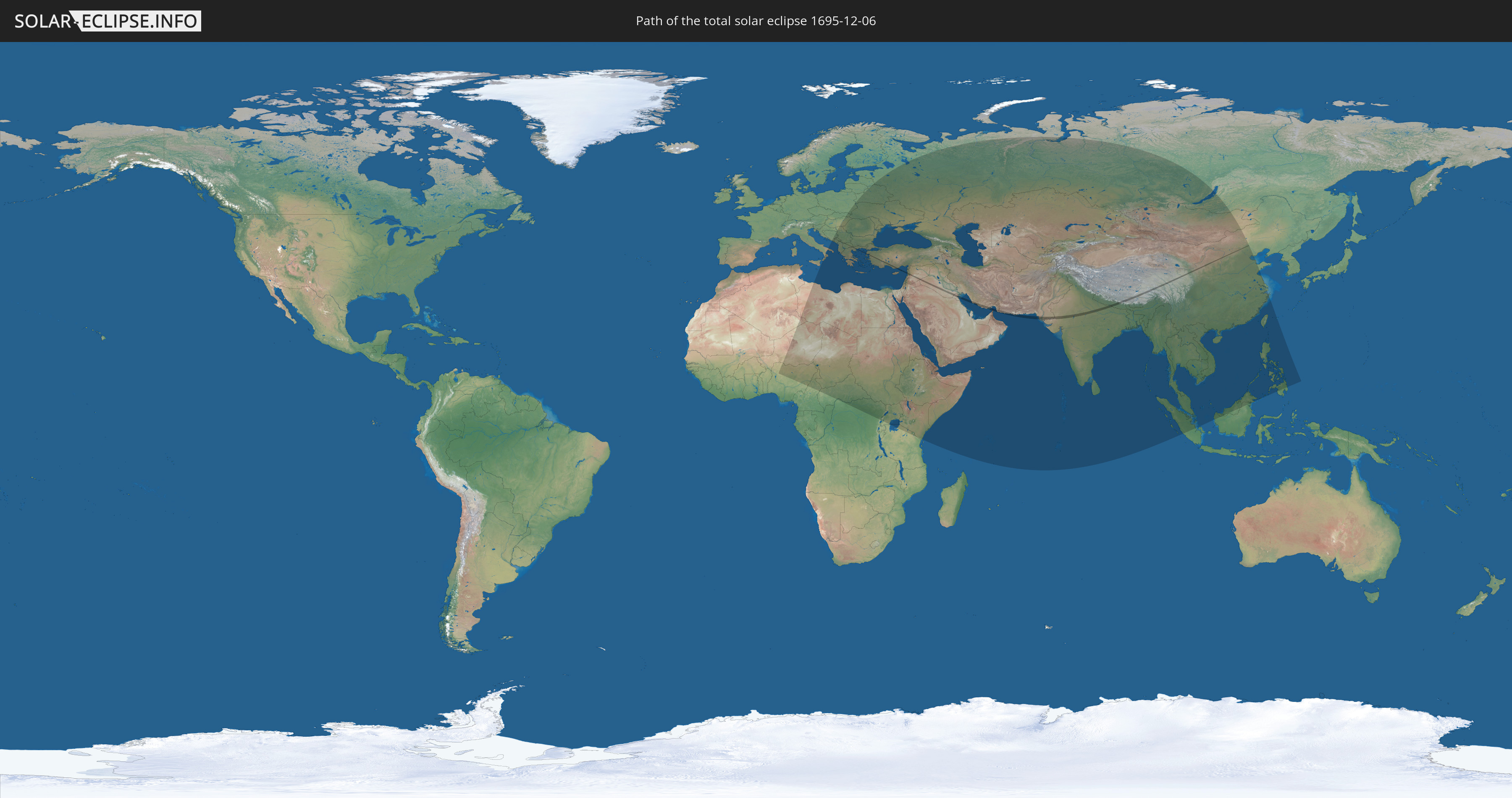
Die Sonnenfinsternis am 12/06/1695 kann man in 86 Ländern als partielle Sonnenfinsternis beobachten.
Der Finsternispfad verläuft durch 16 Länder. Nur in diesen Ländern ist sie als total Sonnenfinsternis zu sehen.
In den folgenden Ländern ist die Sonnenfinsternis total zu sehen
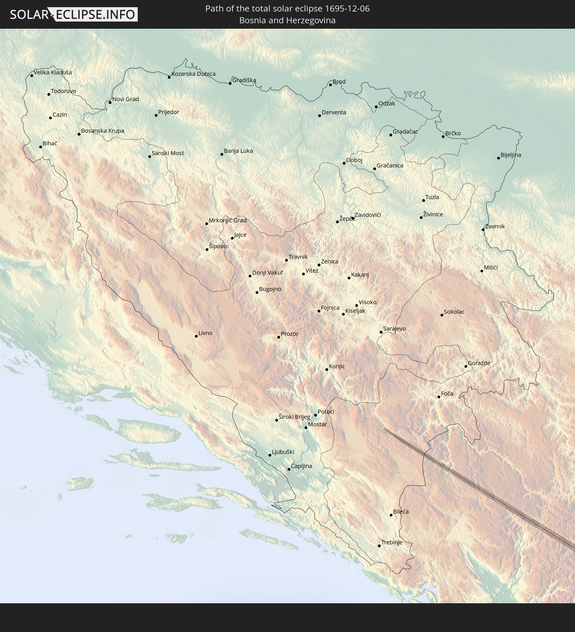 Bosnia and Herzegovina
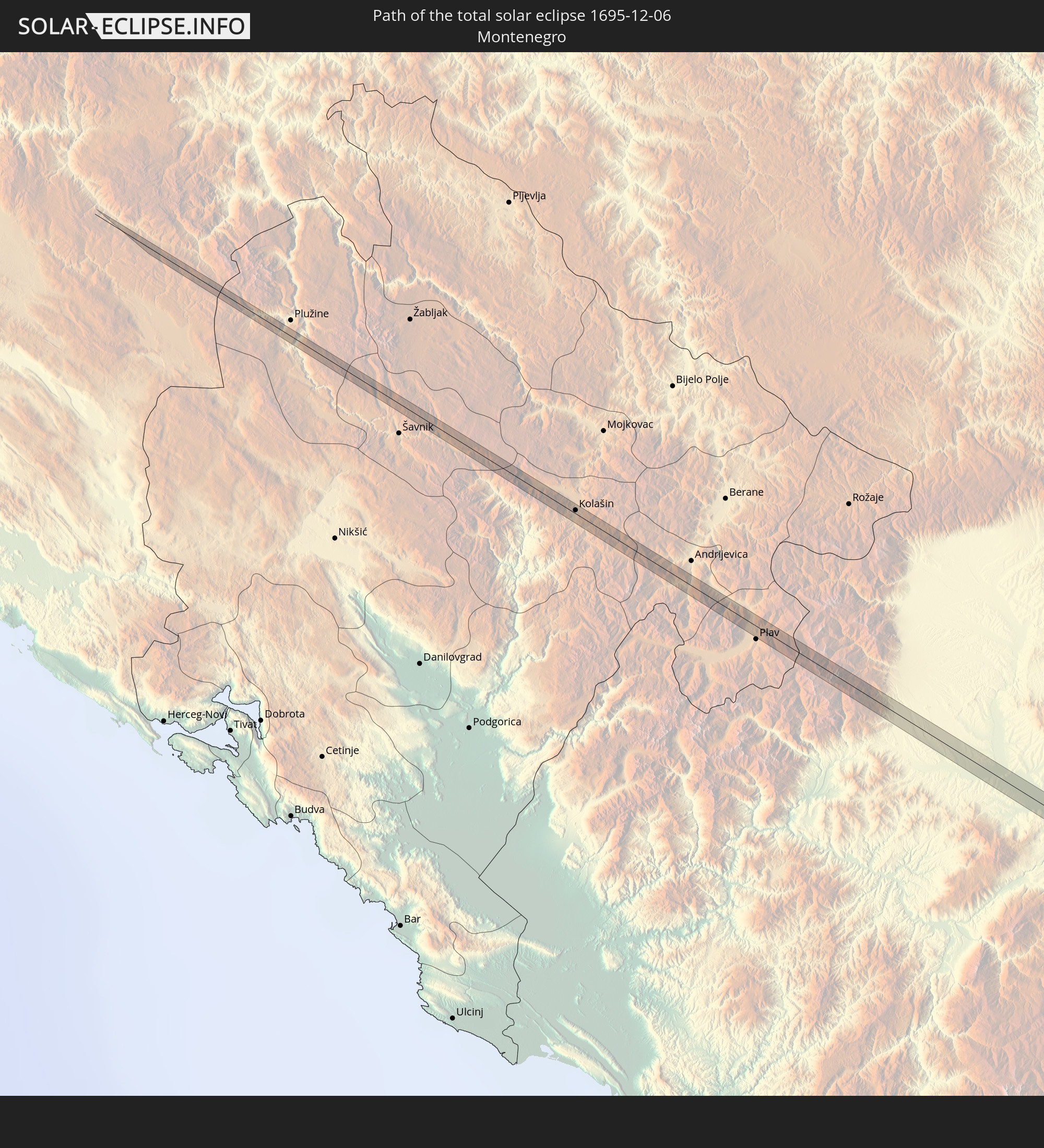 Montenegro
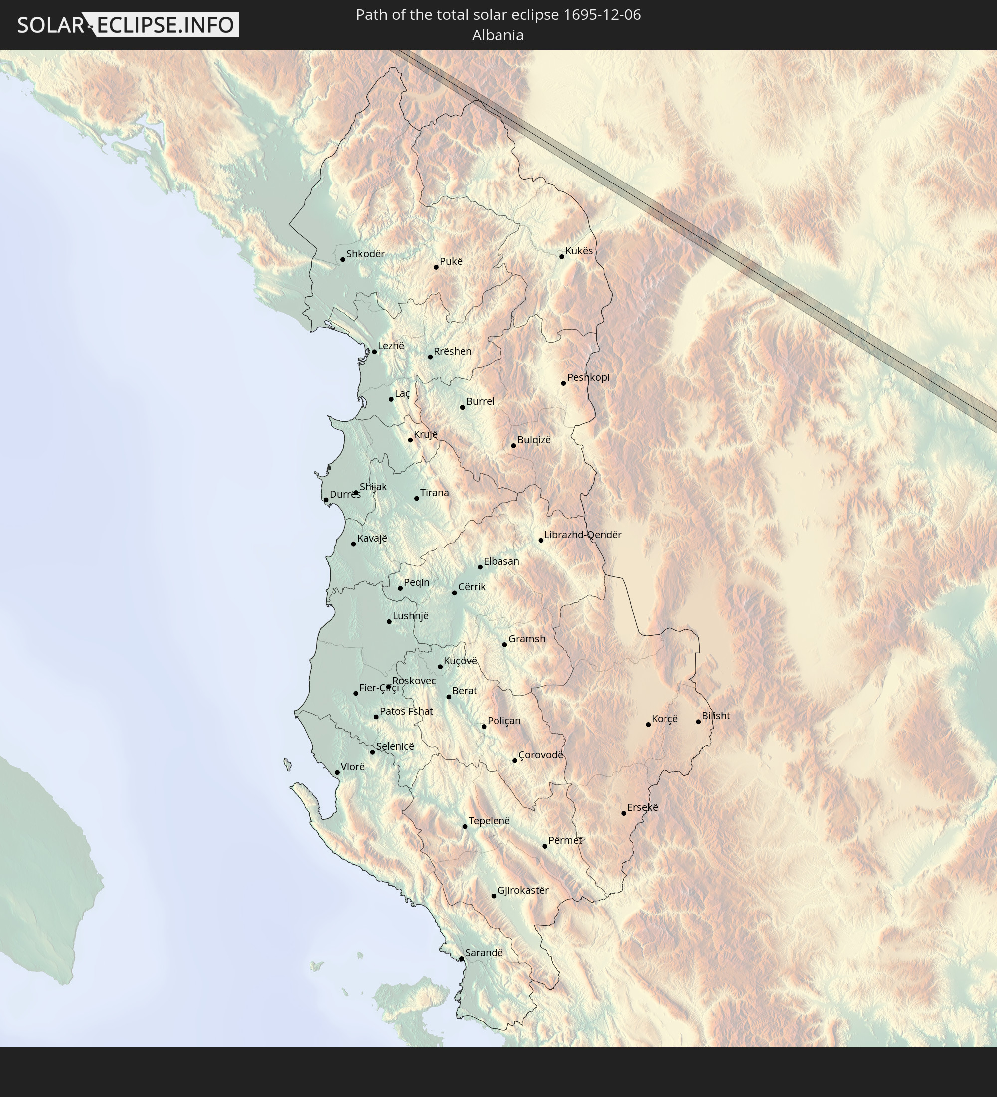 Albania
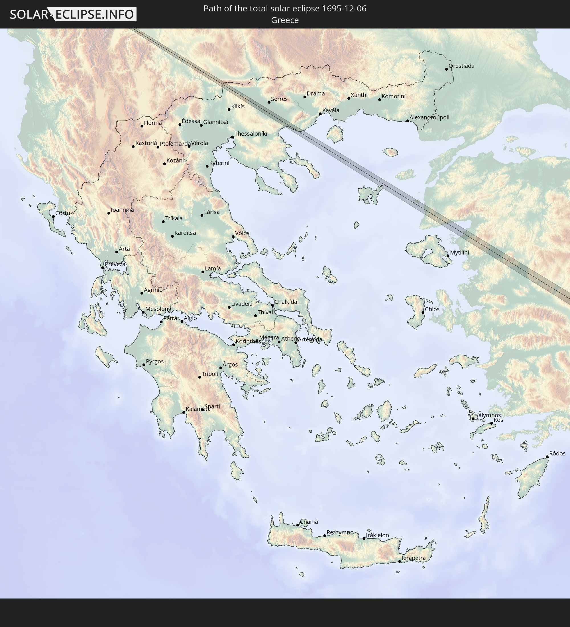 Greece
 Republic of Macedonia
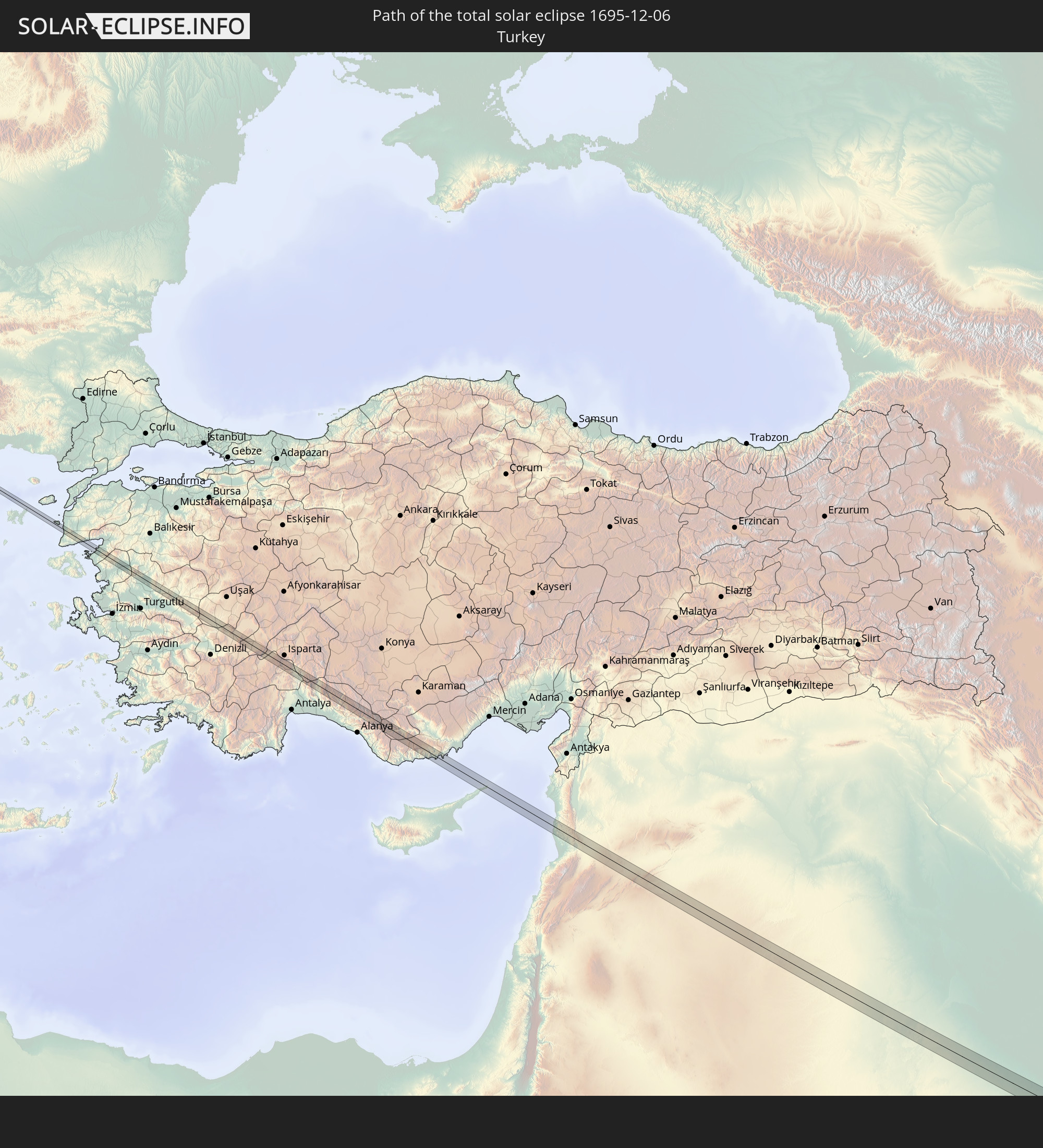 Turkey
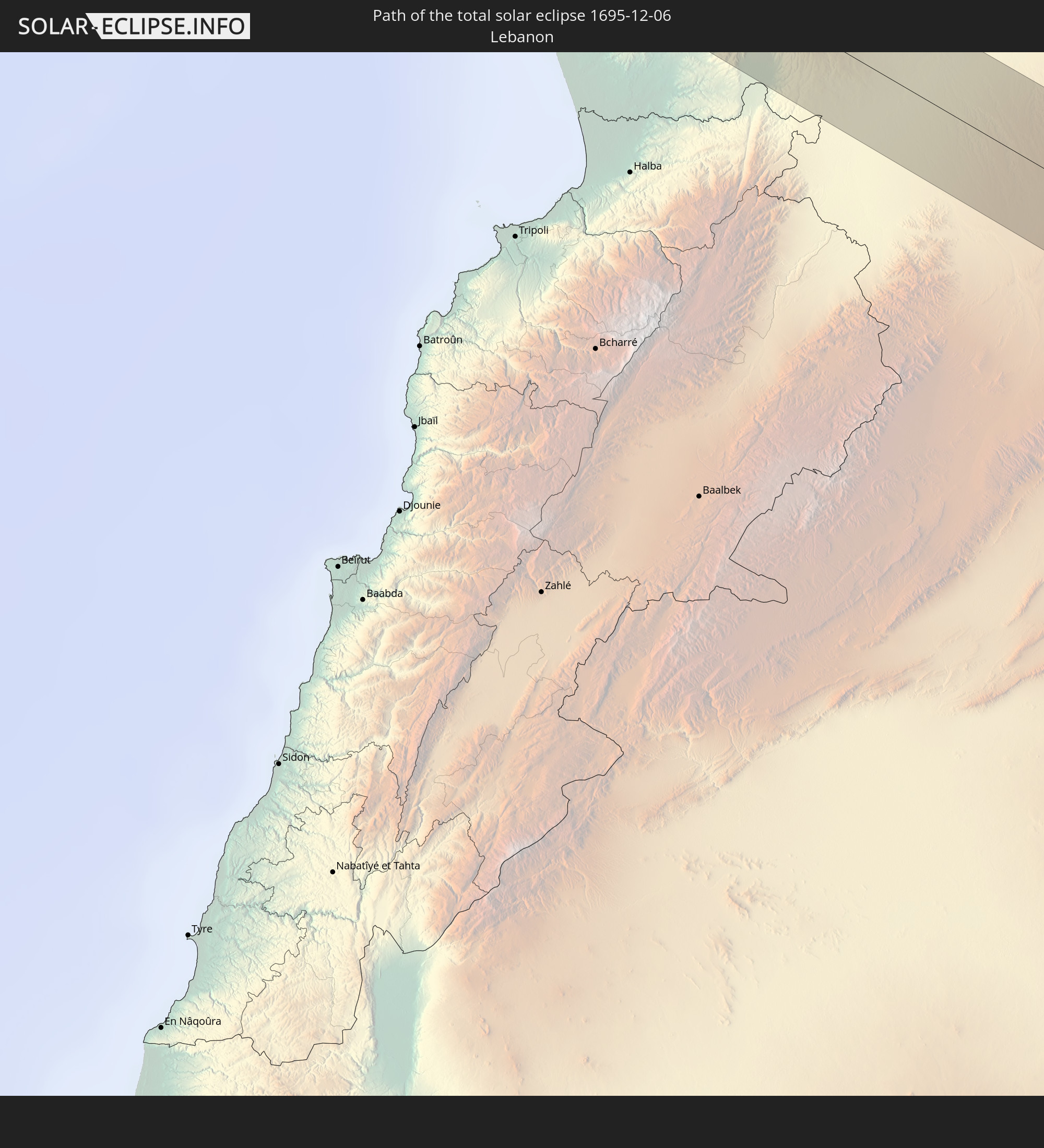 Lebanon
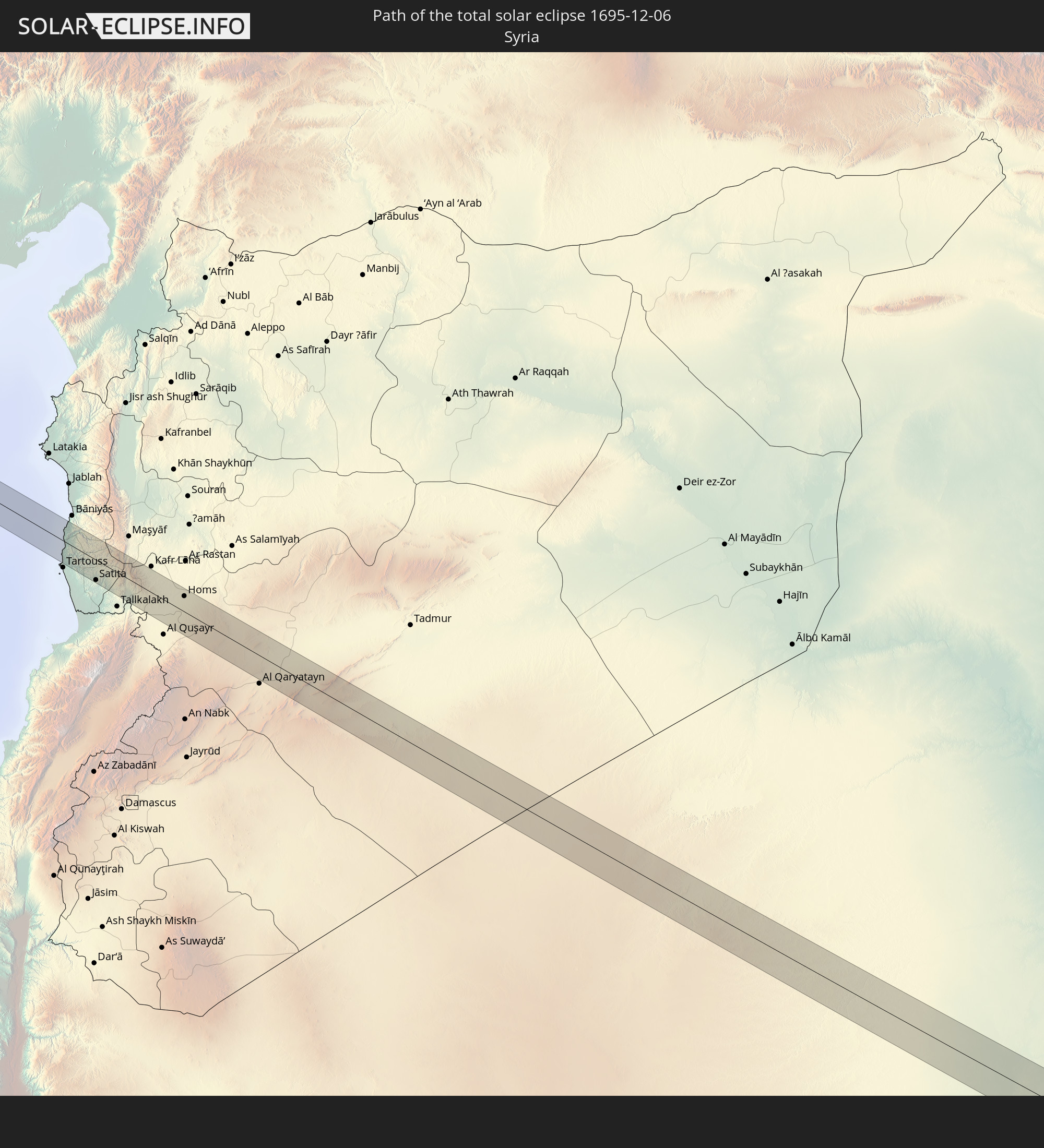 Syria
Syria
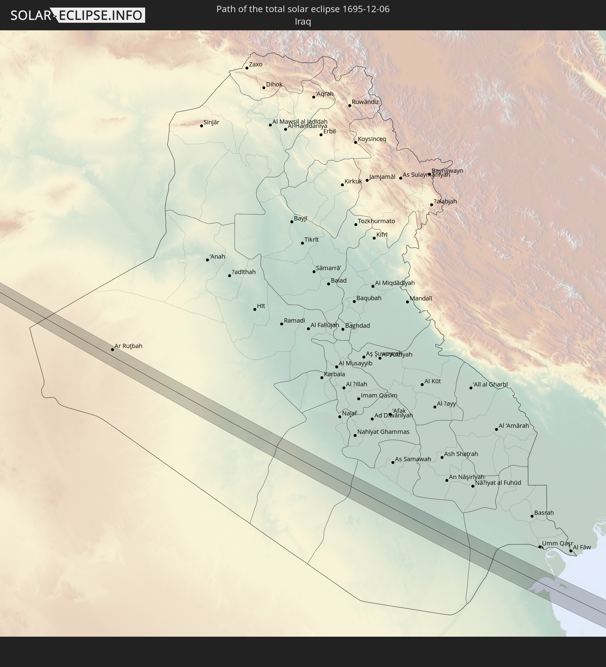 Iraq
Iraq
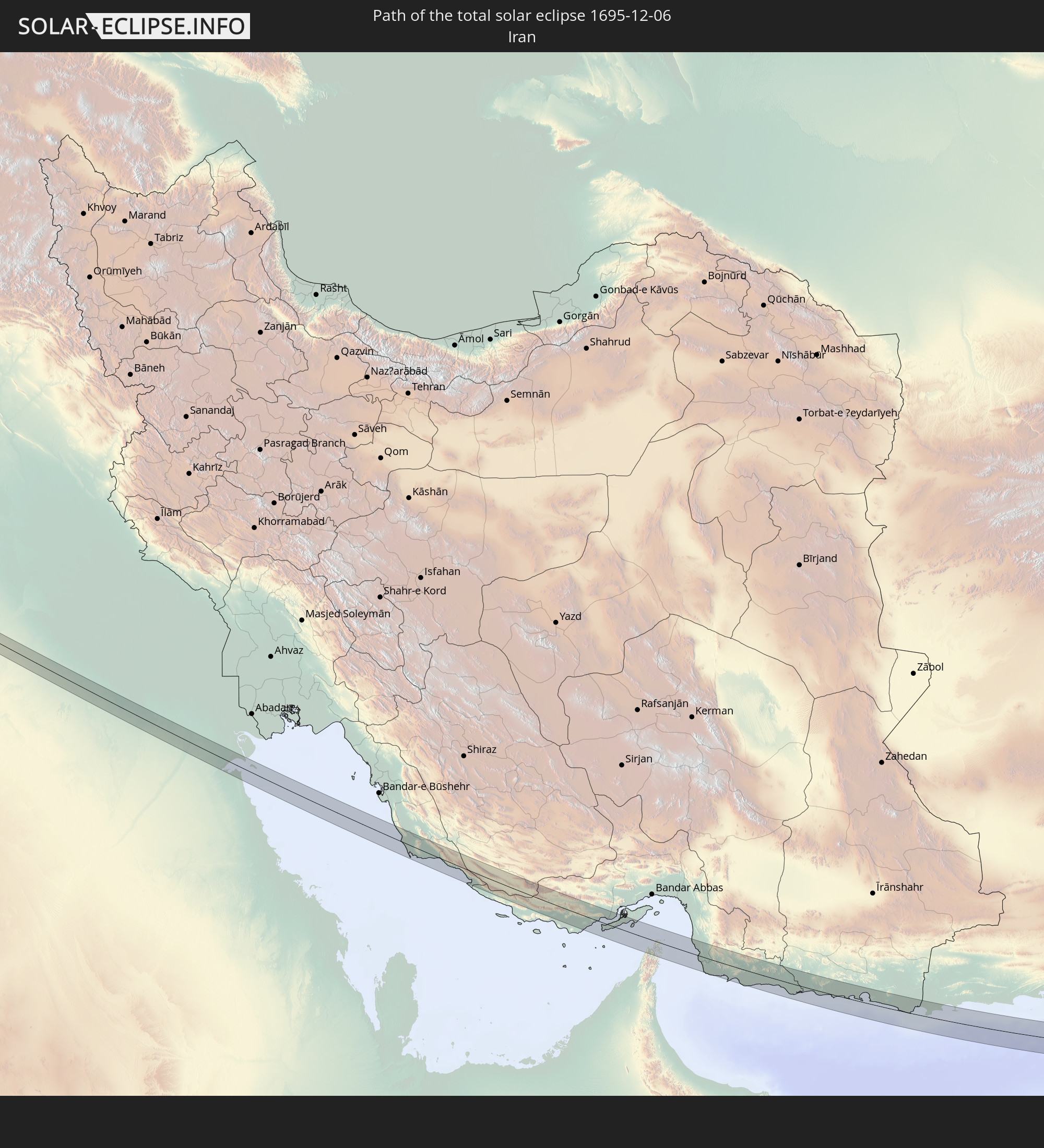 Iran
Iran
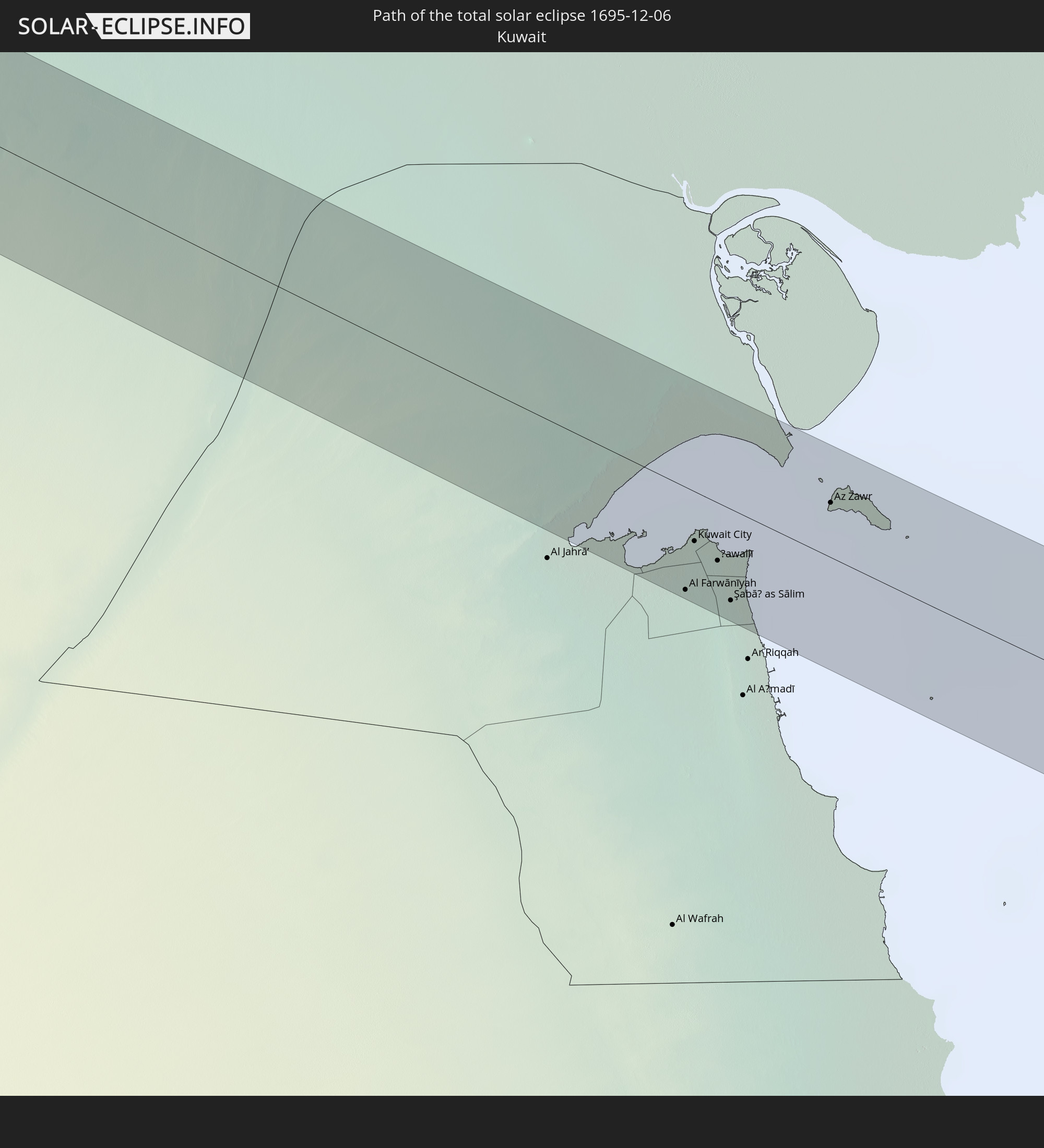 Kuwait
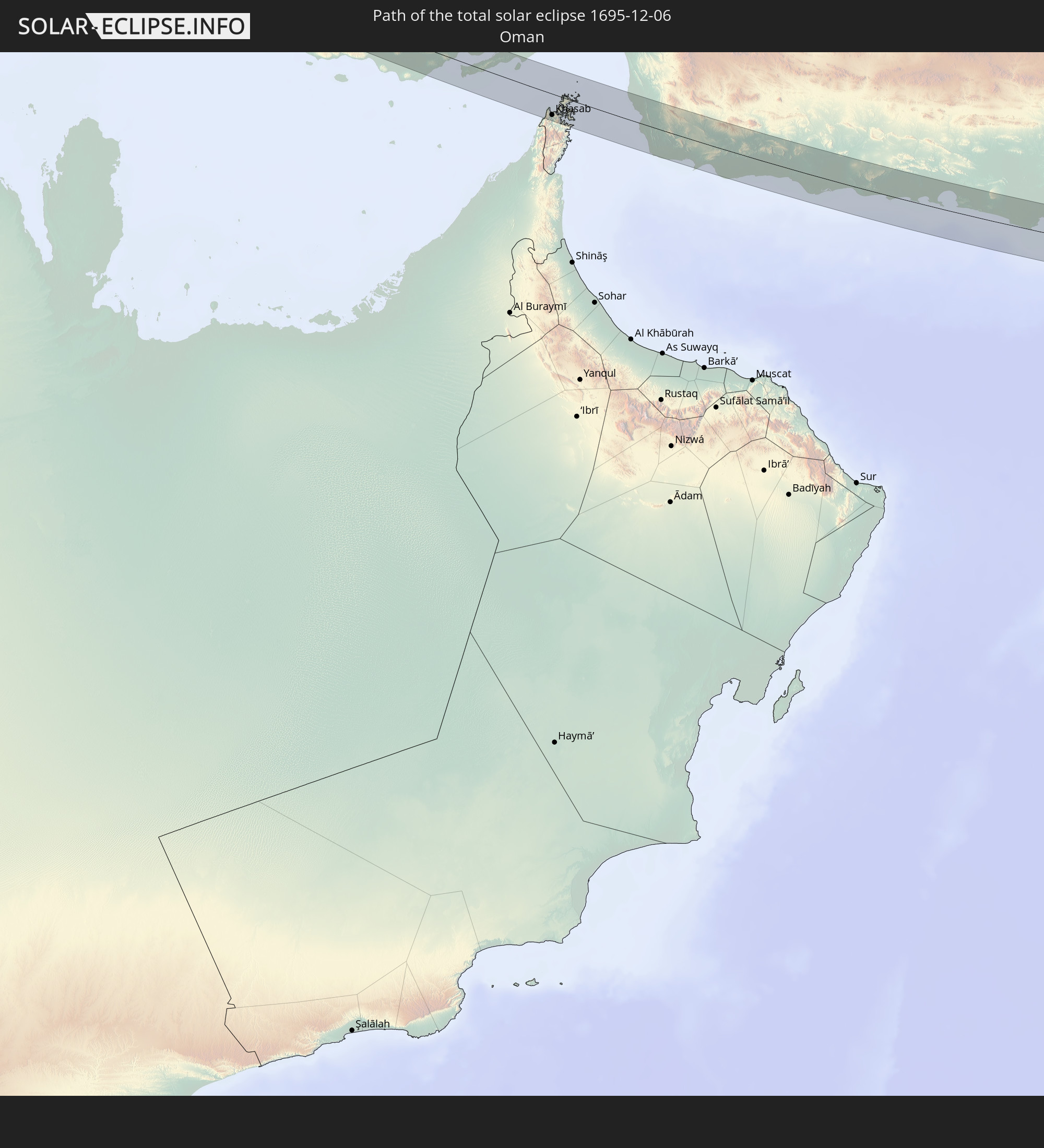 Oman
Oman
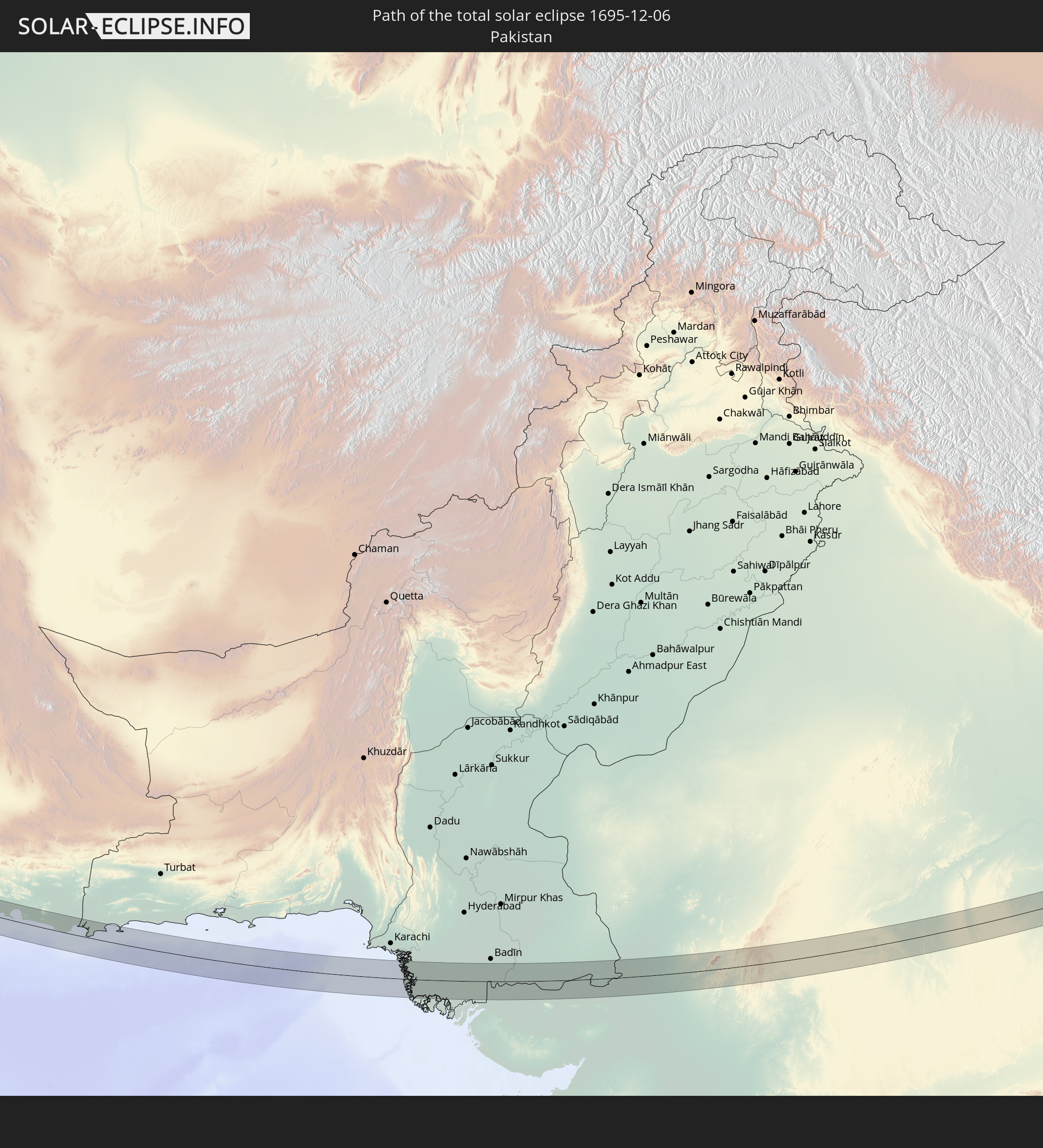 Pakistan
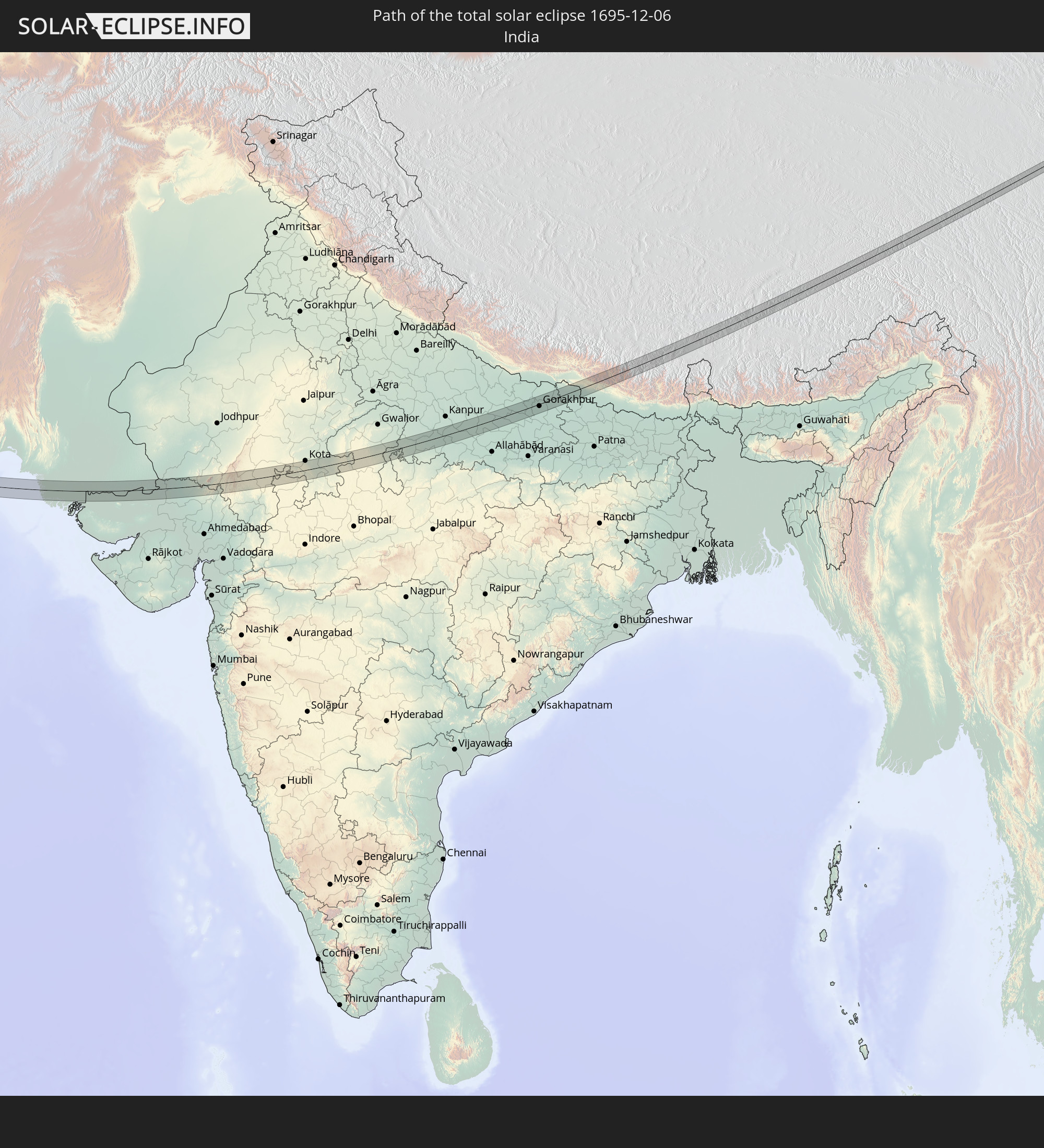 India
India
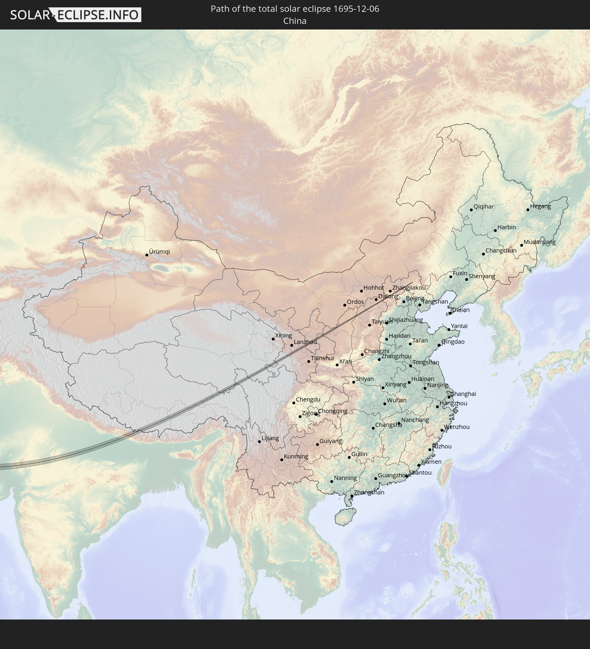 China
China
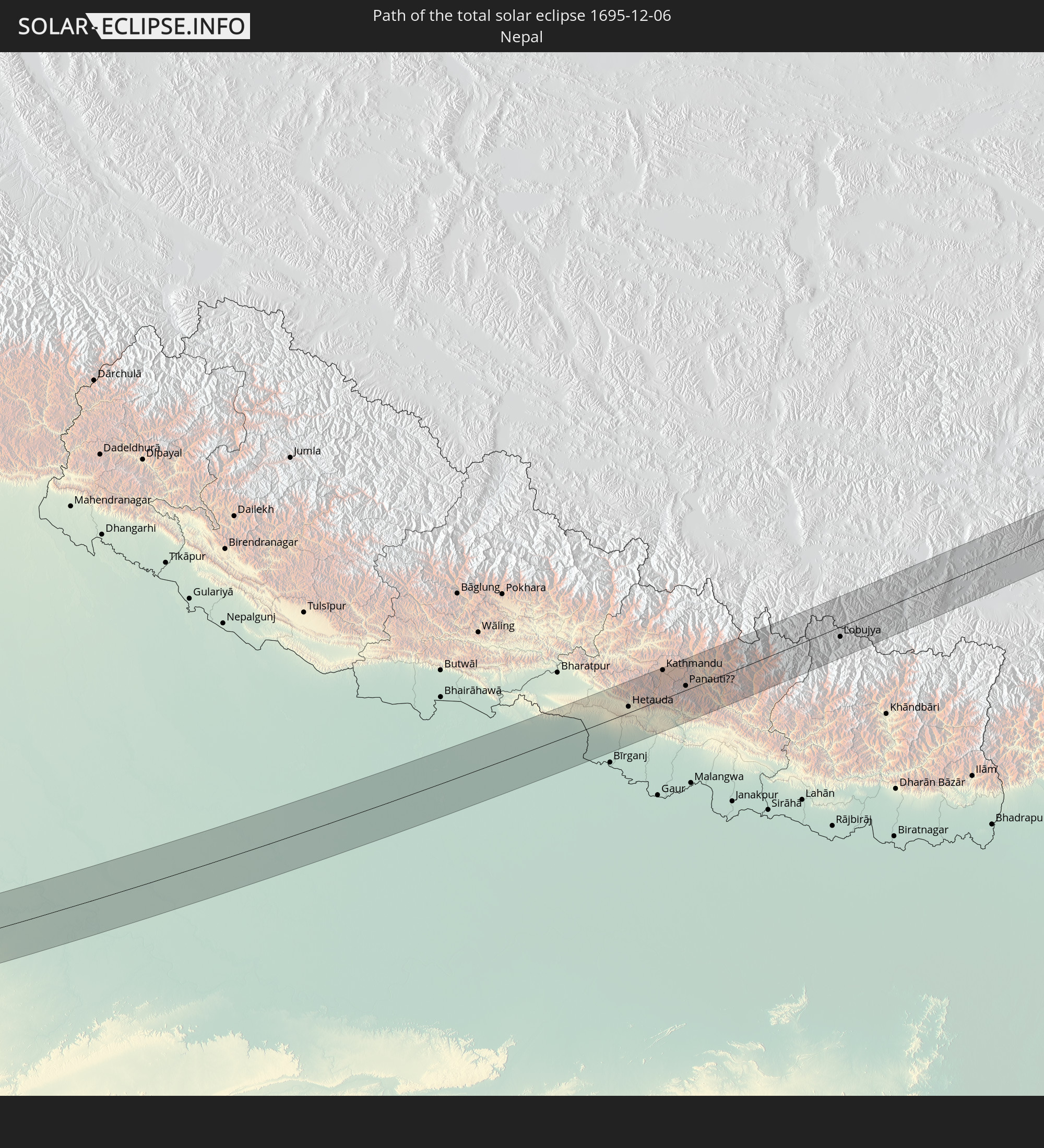 Nepal
Nepal
In den folgenden Ländern ist die Sonnenfinsternis partiell zu sehen
 Russia
 Algeria
 Niger
Niger
 Nigeria
 Italy
Italy
 Cameroon
 Libya
Libya
 Democratic Republic of the Congo
 Chad
Chad
 Croatia
 Poland
 Central African Republic
 Bosnia and Herzegovina
 Hungary
 Slovakia
 Montenegro
 Serbia
 Albania
 Greece
 Romania
 Republic of Macedonia
 Latvia
 Sudan
Sudan
 Ukraine
 Bulgaria
 Belarus
 Egypt
Egypt
 Turkey
 Moldova
 Tanzania
 Uganda
 Cyprus
 Ethiopia
 Kenya
Kenya
 State of Palestine
 Israel
 Saudi Arabia
 Jordan
 Lebanon
 Syria
Syria
 Eritrea
 Iraq
Iraq
 Georgia
 Somalia
 Djibouti
 Yemen
Yemen
 Armenia
 Iran
Iran
 Azerbaijan
 Seychelles
 Kazakhstan
 Kuwait
 Bahrain
 Qatar
Qatar
 United Arab Emirates
 Oman
Oman
 Turkmenistan
 Uzbekistan
 Mauritius
 Afghanistan
 Pakistan
 Tajikistan
 India
India
 Kyrgyzstan
 British Indian Ocean Territory
 Maldives
 China
China
 Sri Lanka
 Nepal
Nepal
 Mongolia
 Bangladesh
 Bhutan
 Myanmar
 Indonesia
 Thailand
 Malaysia
 Laos
Laos
 Vietnam
 Cambodia
 Singapore
 Macau
Macau
 Hong Kong
 Brunei
 Taiwan
 Philippines
 Japan
Japan
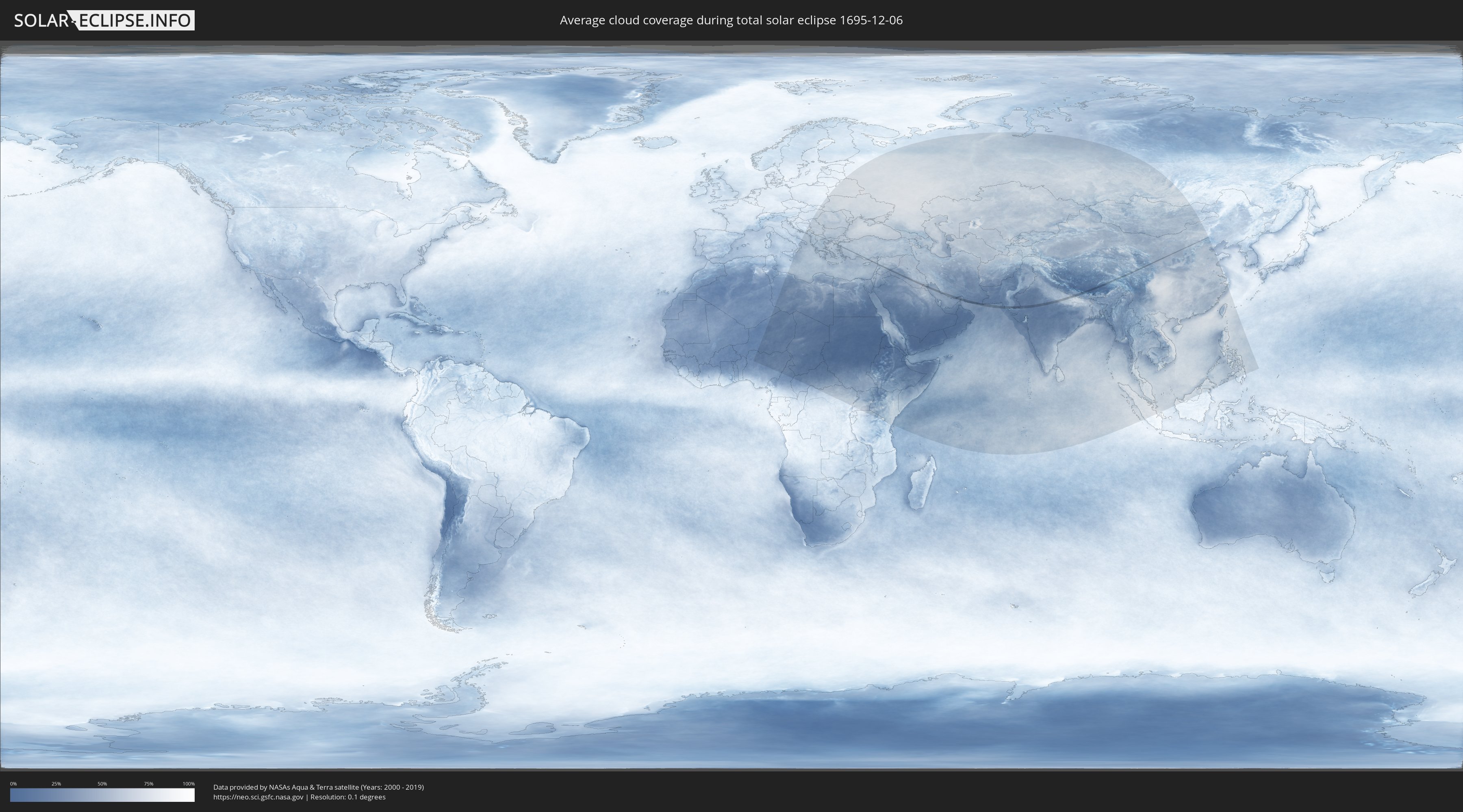
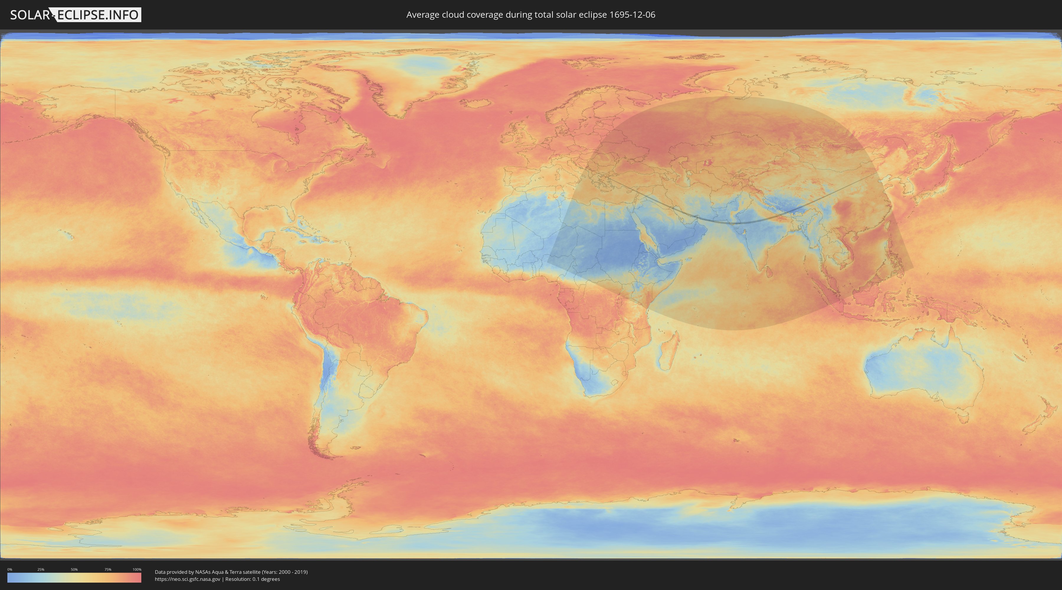
How will be the weather during the total solar eclipse on 12/06/1695?
Where is the best place to see the total solar eclipse of 12/06/1695?
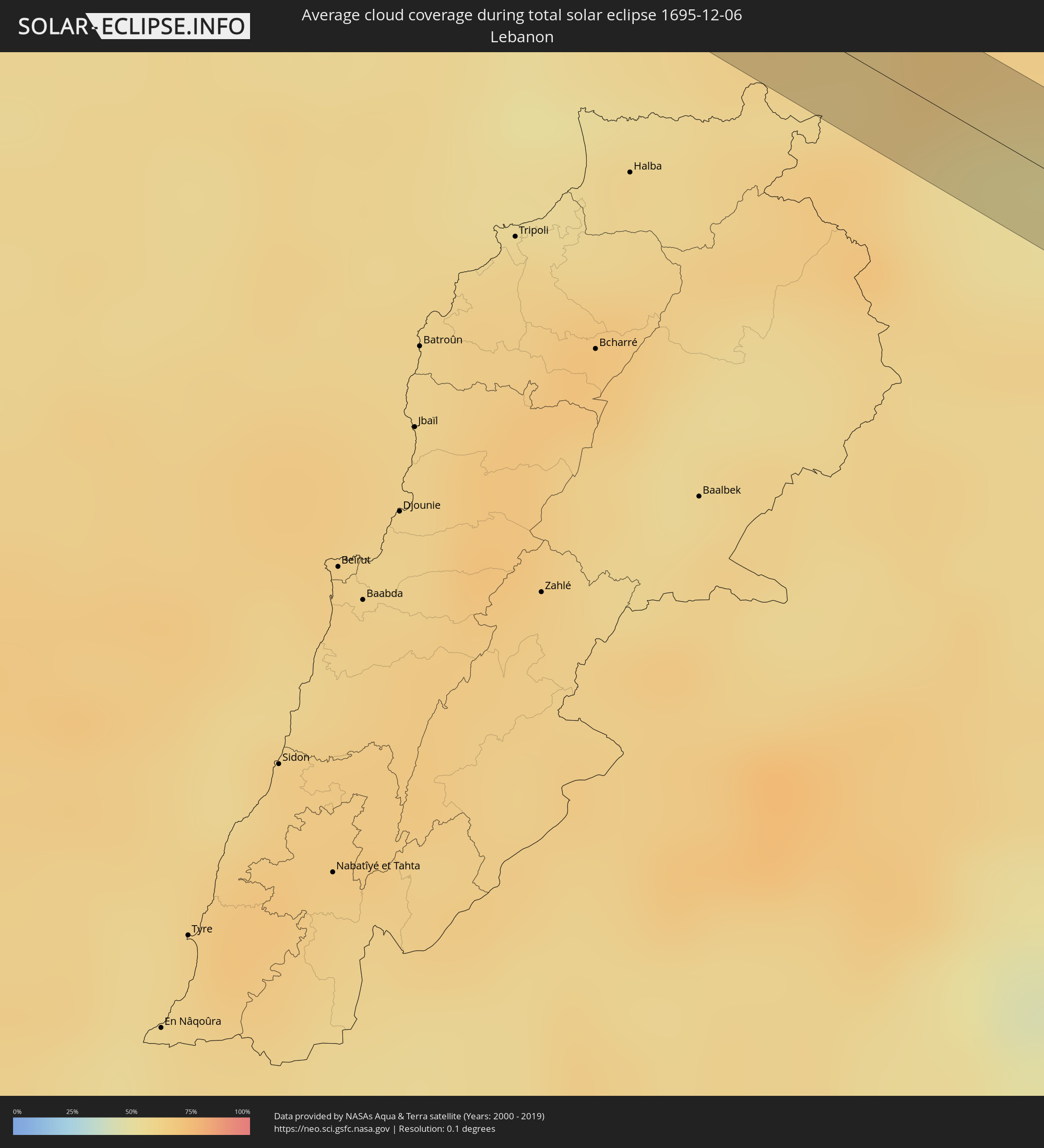
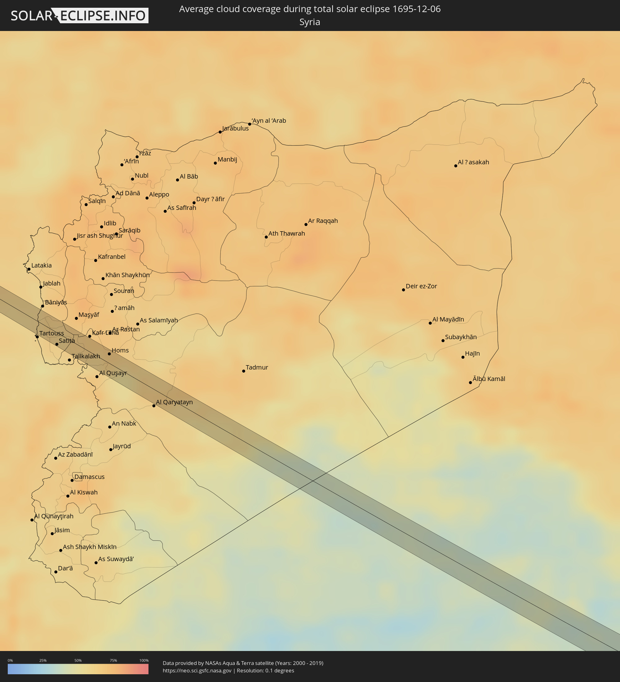
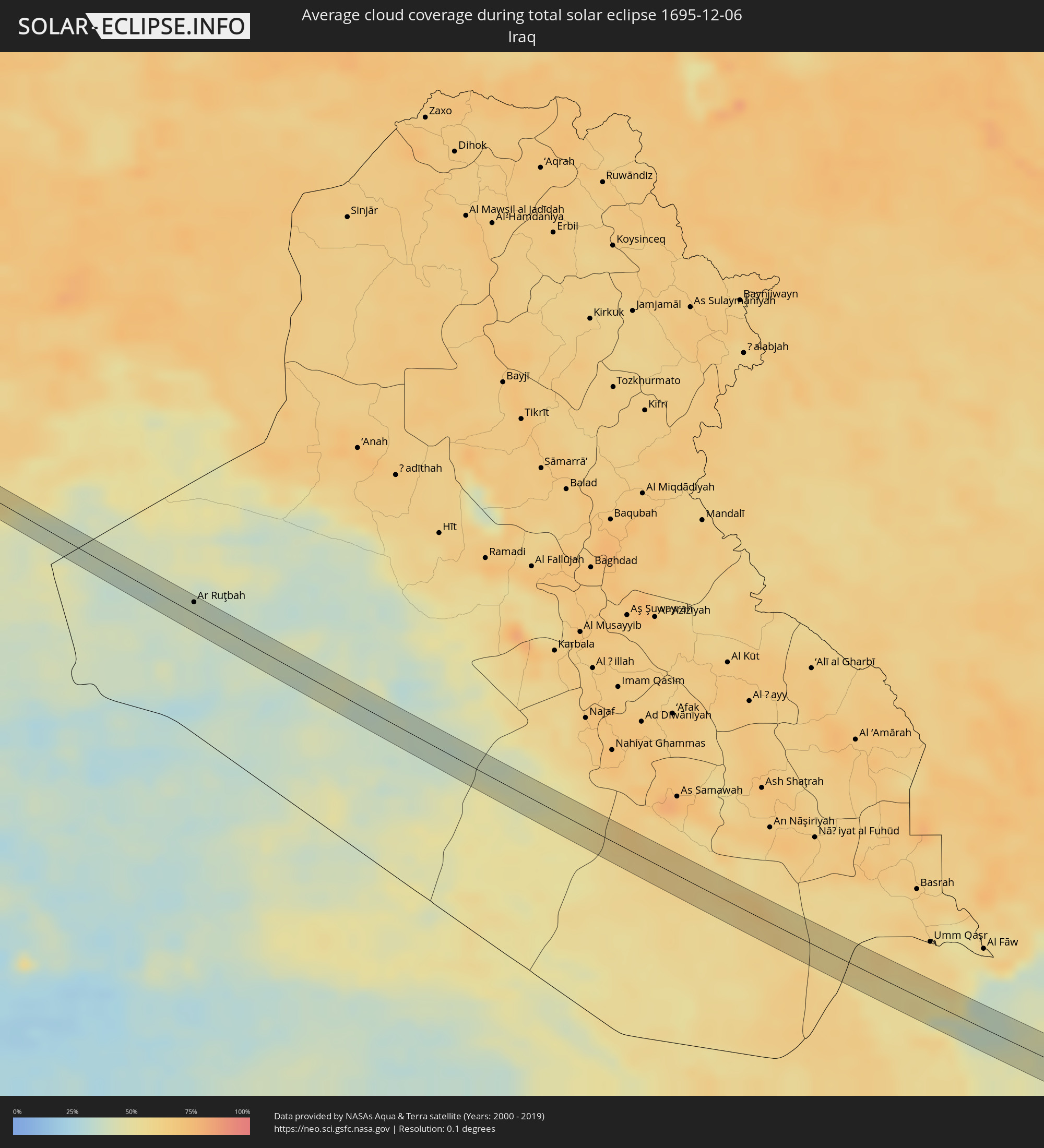
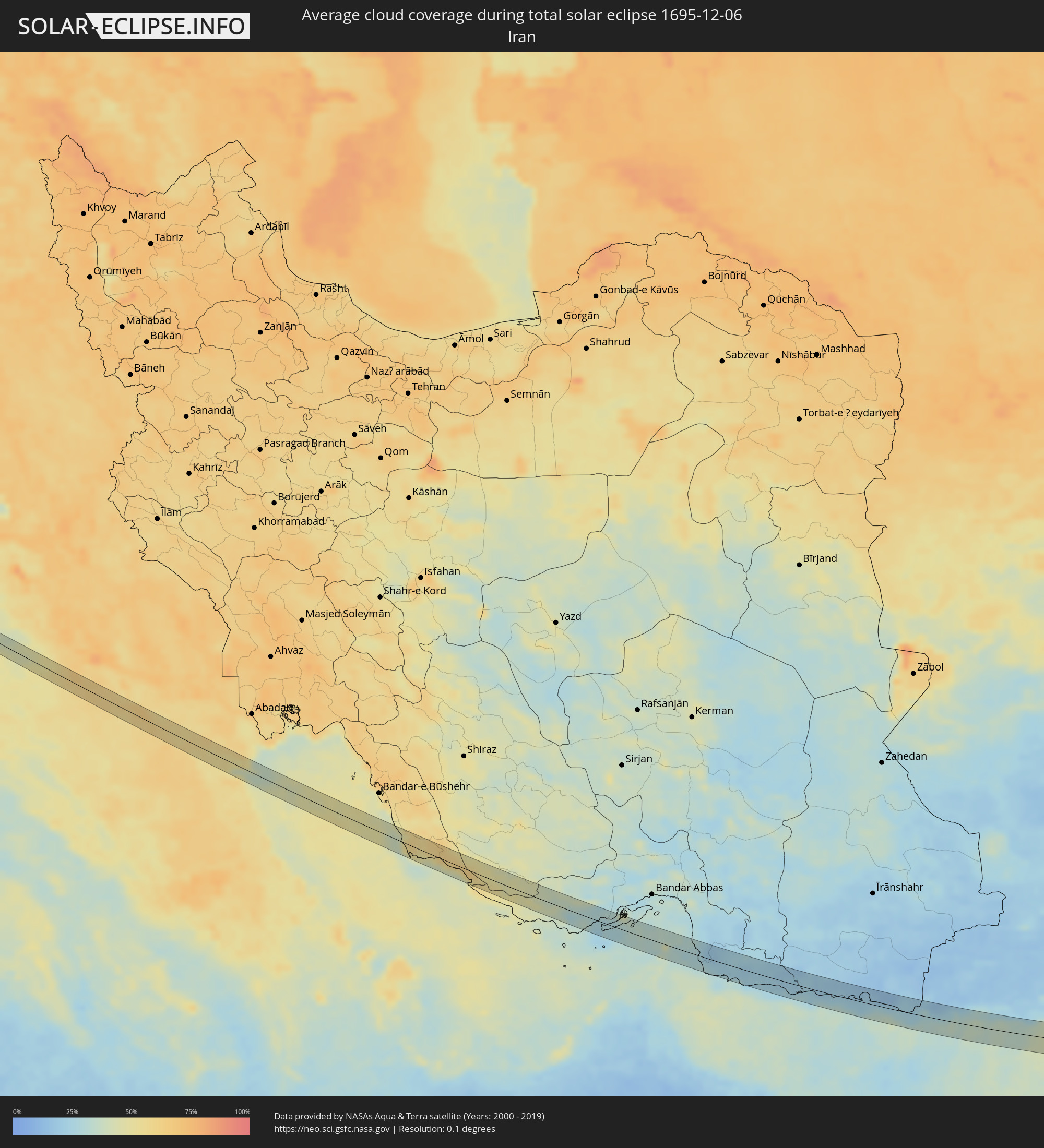
The following maps show the average cloud coverage for the day of the total solar eclipse.
With the help of these maps, it is possible to find the place along the eclipse path, which has the best
chance of a cloudless sky.
Nevertheless, you should consider local circumstances and inform about the weather of your chosen
observation site.
The data is provided by NASAs satellites
AQUA and TERRA.
The cloud maps are averaged over a period of 19 years (2000 - 2019).
Detailed country maps
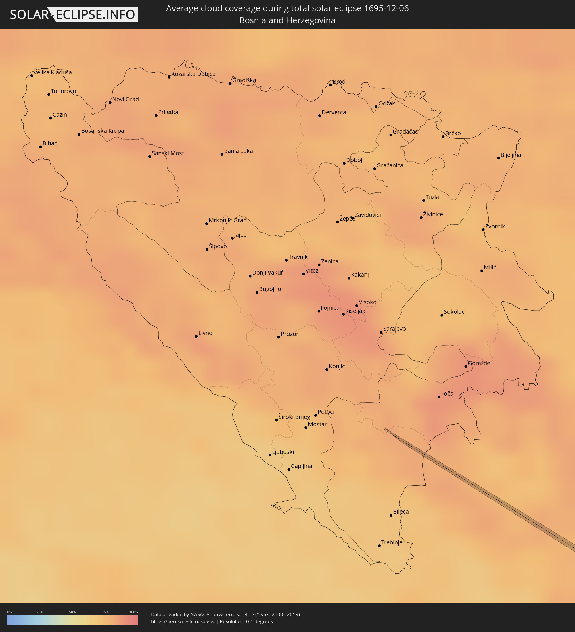 Bosnia and Herzegovina
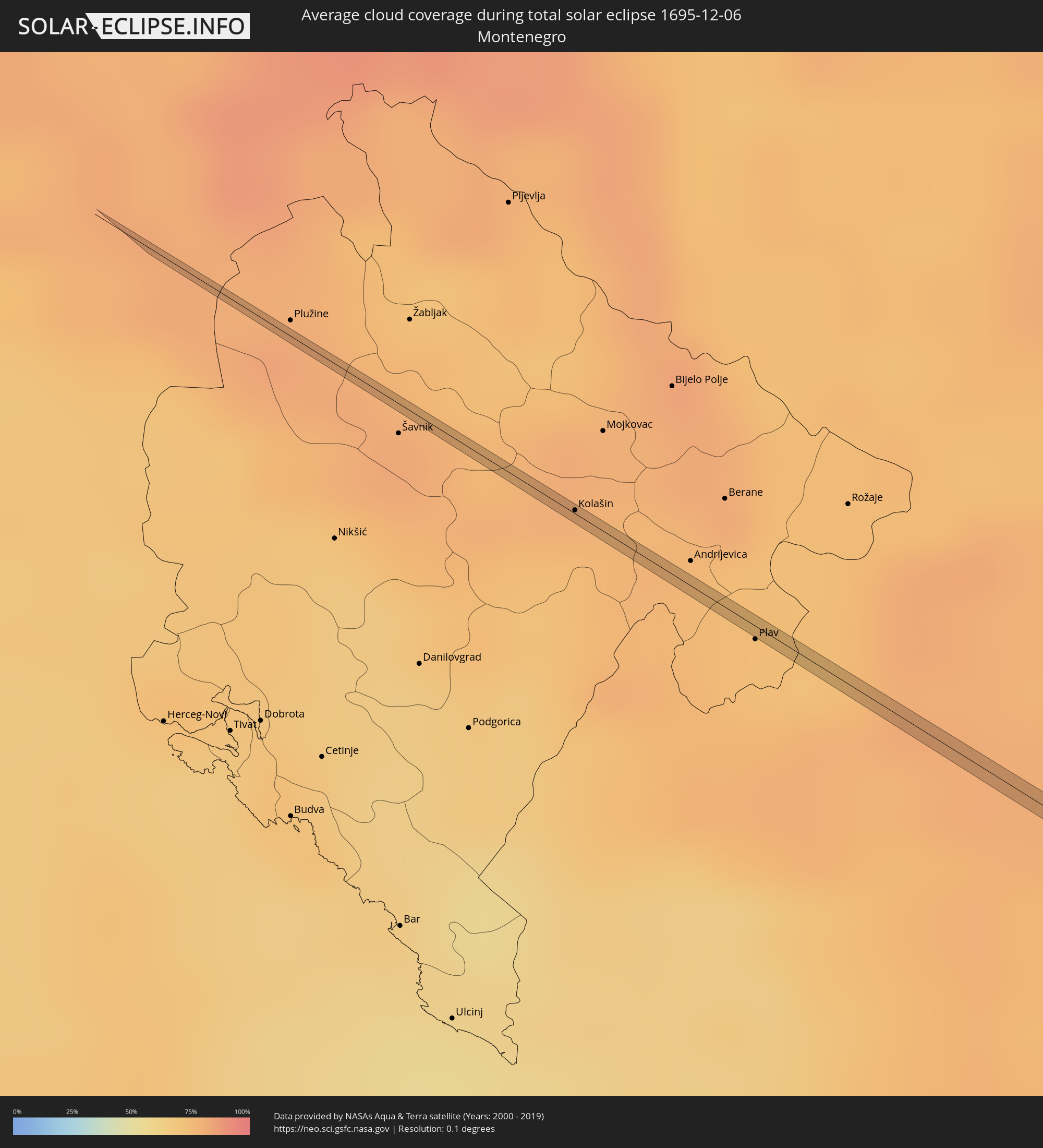 Montenegro
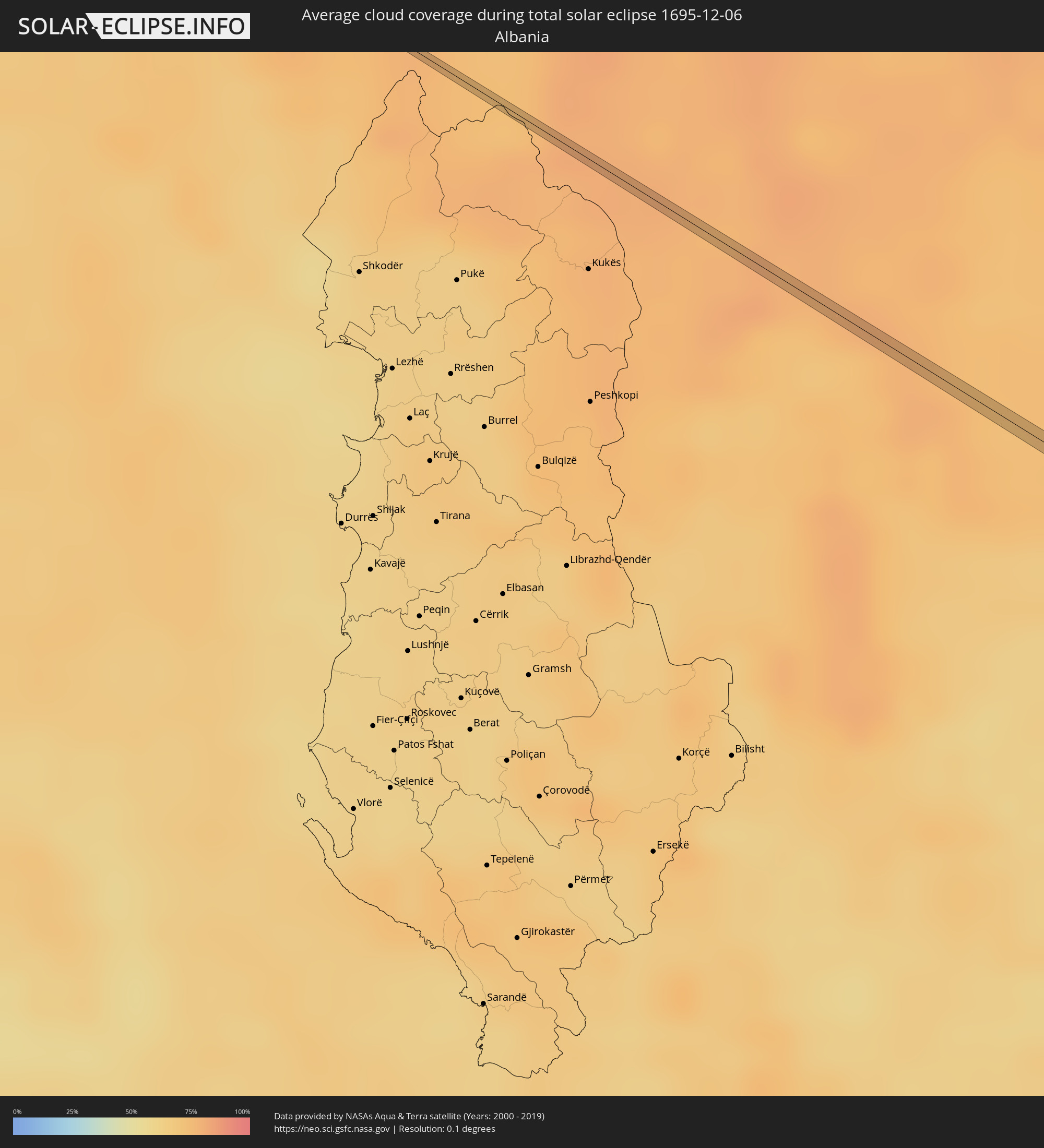 Albania
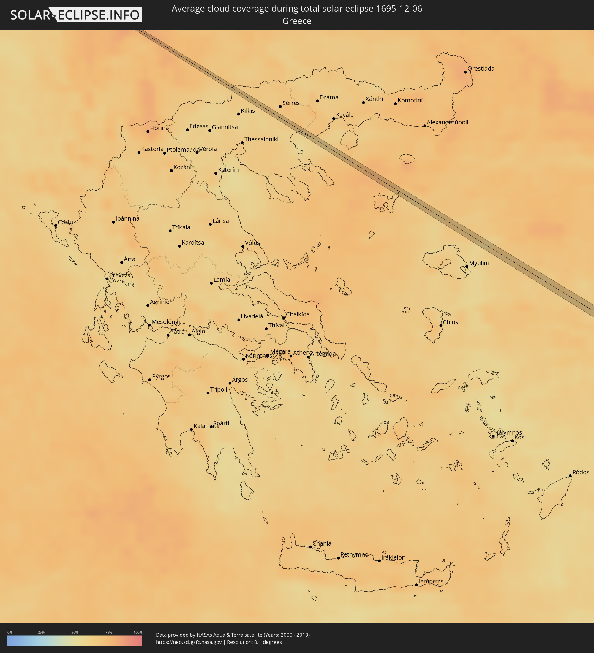 Greece
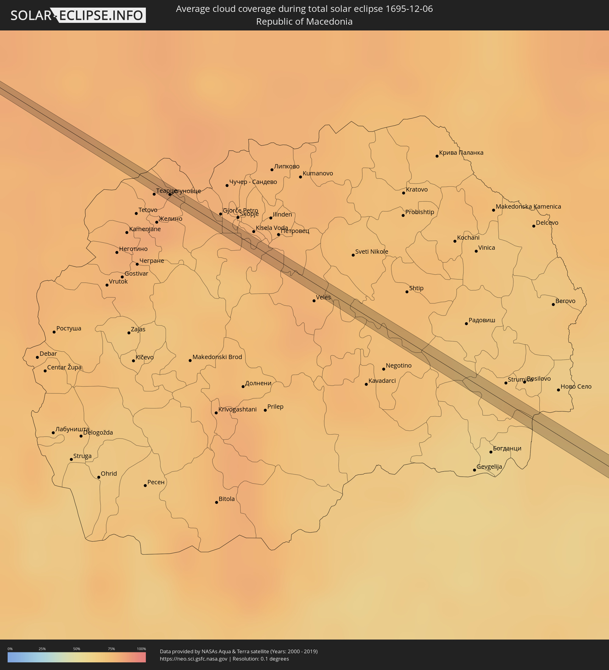 Republic of Macedonia
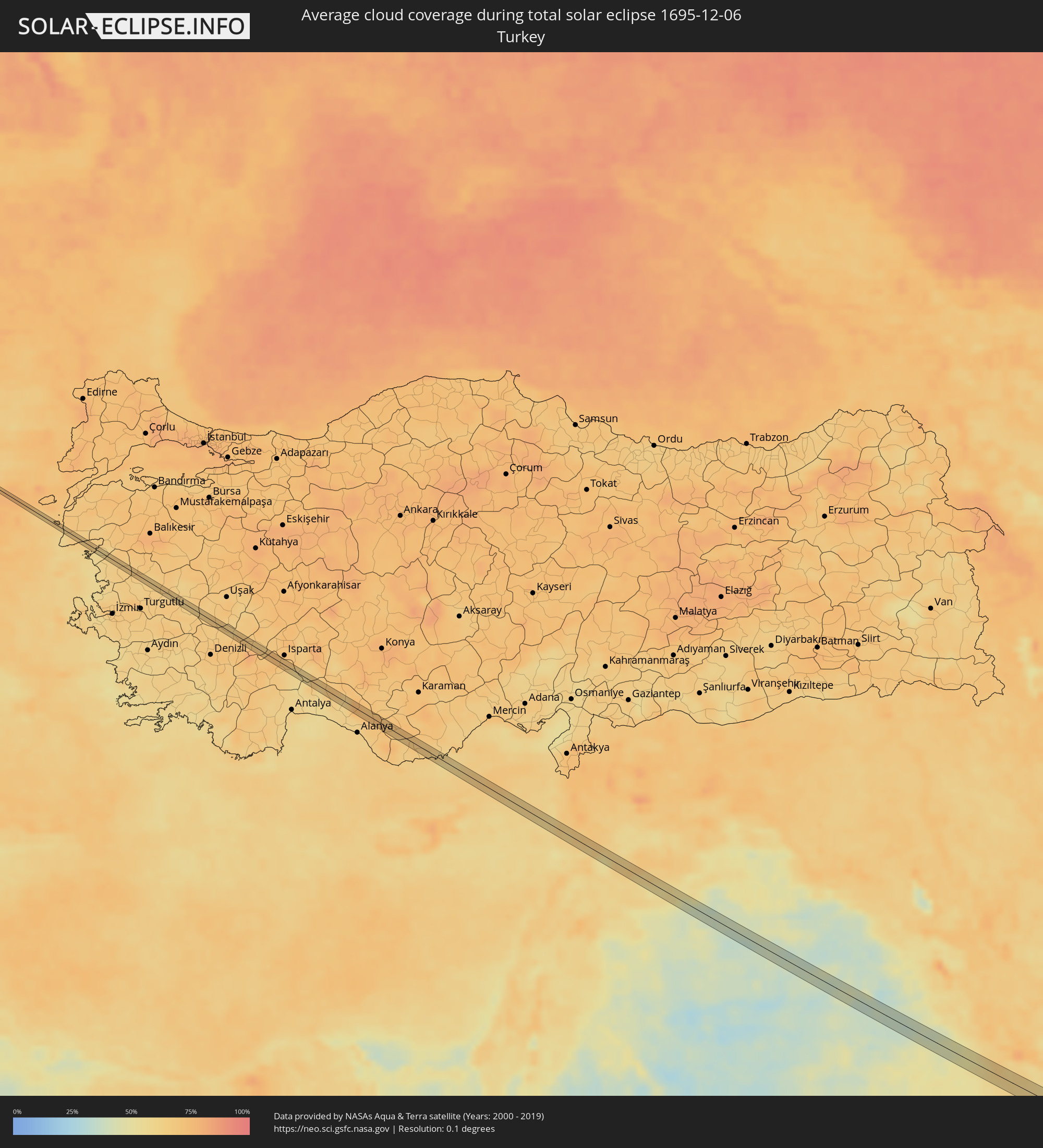 Turkey
 Lebanon
 Syria
Syria
 Iraq
Iraq
 Iran
Iran
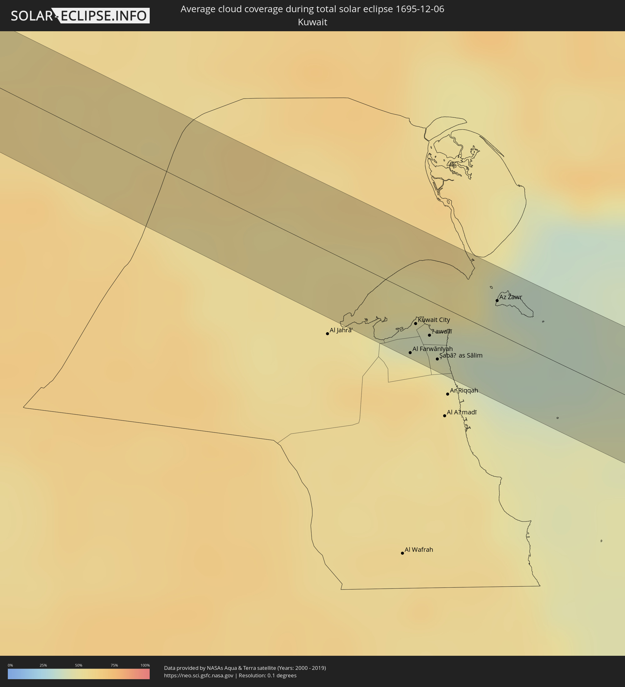 Kuwait
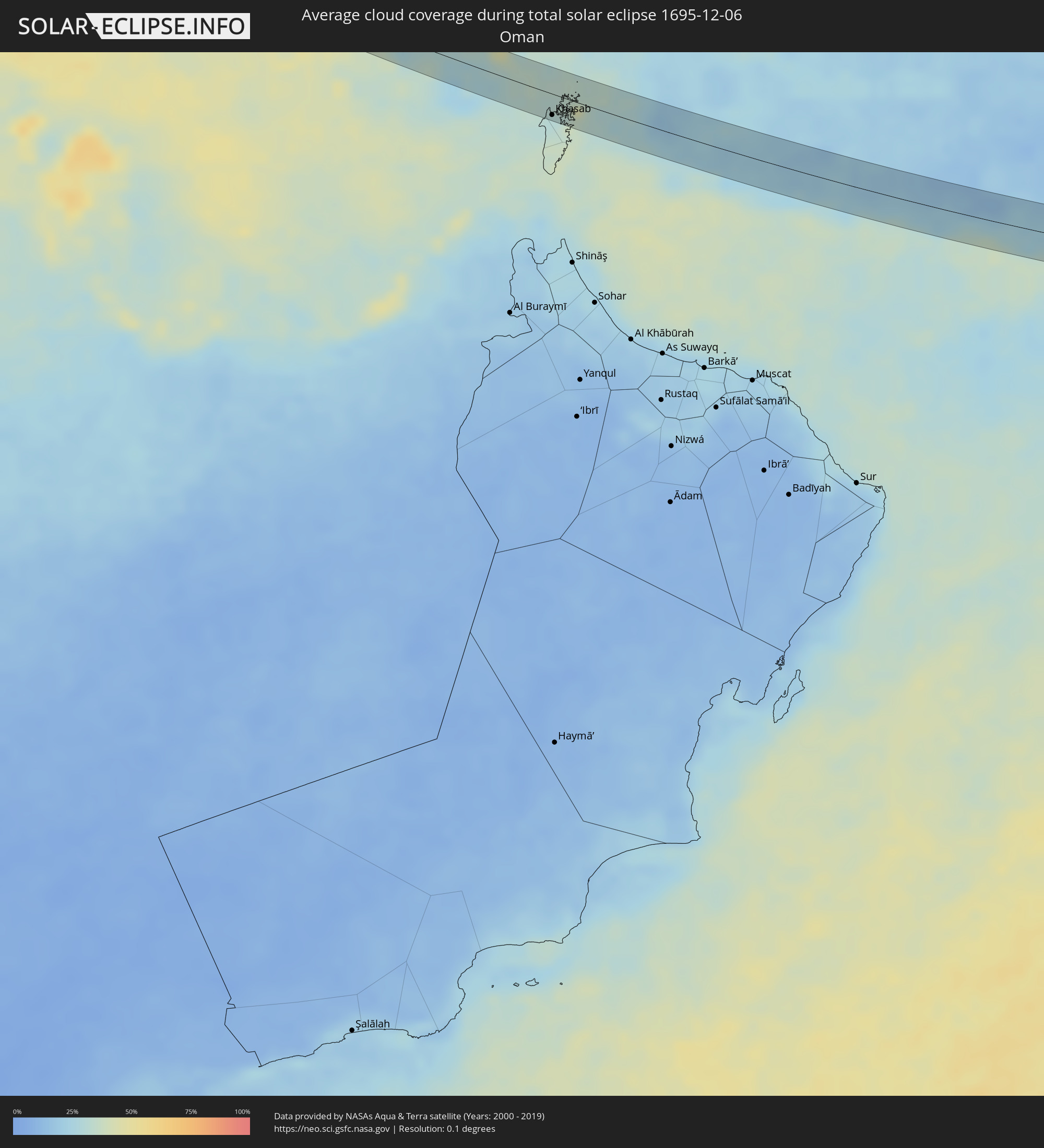 Oman
Oman
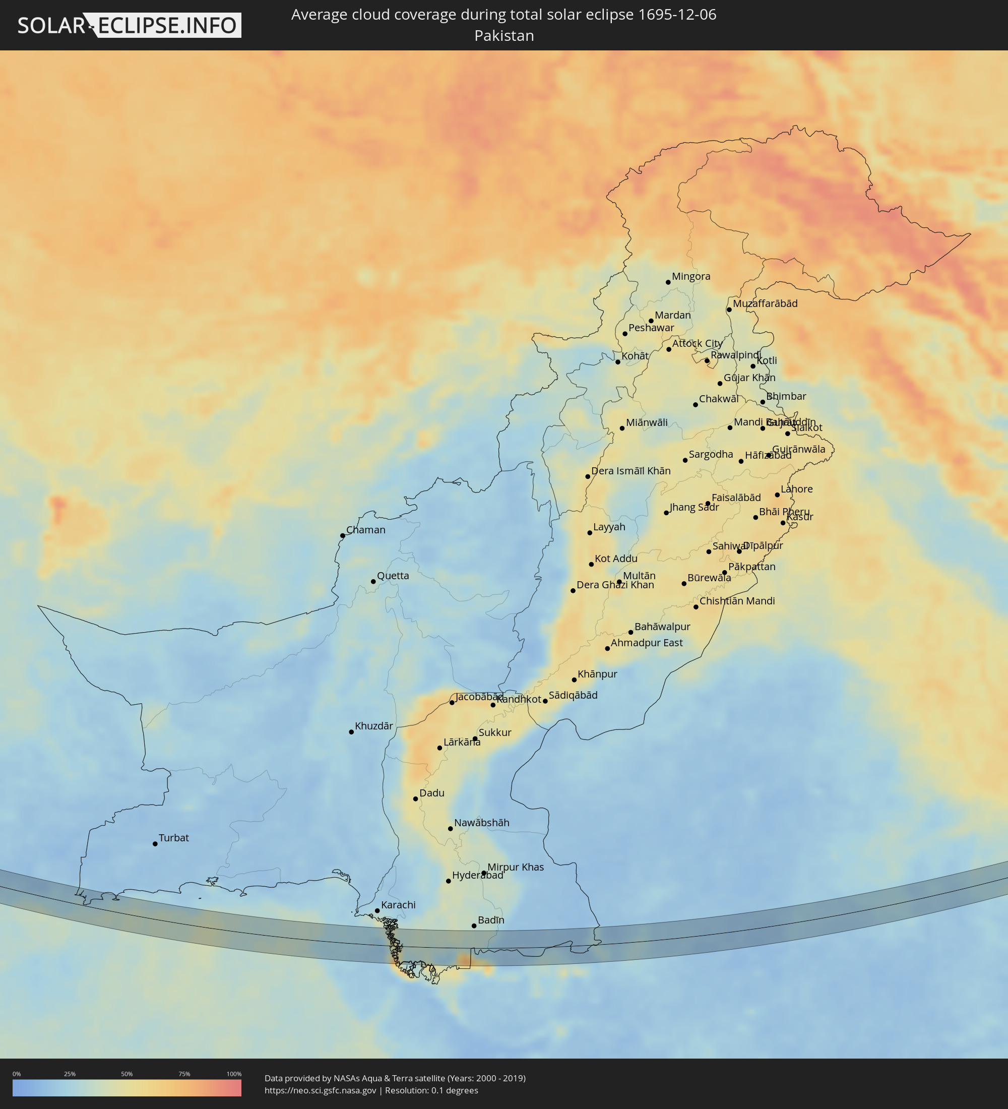 Pakistan
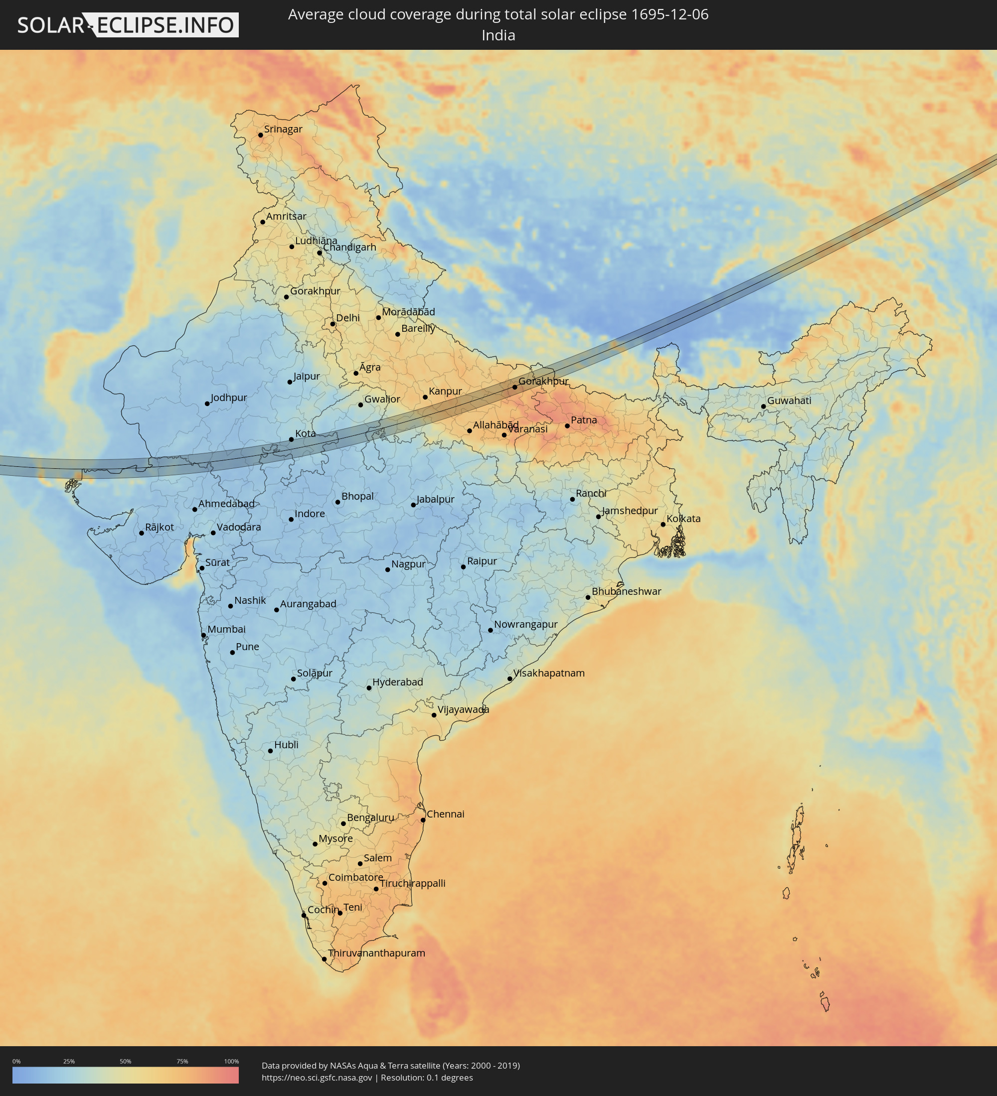 India
India
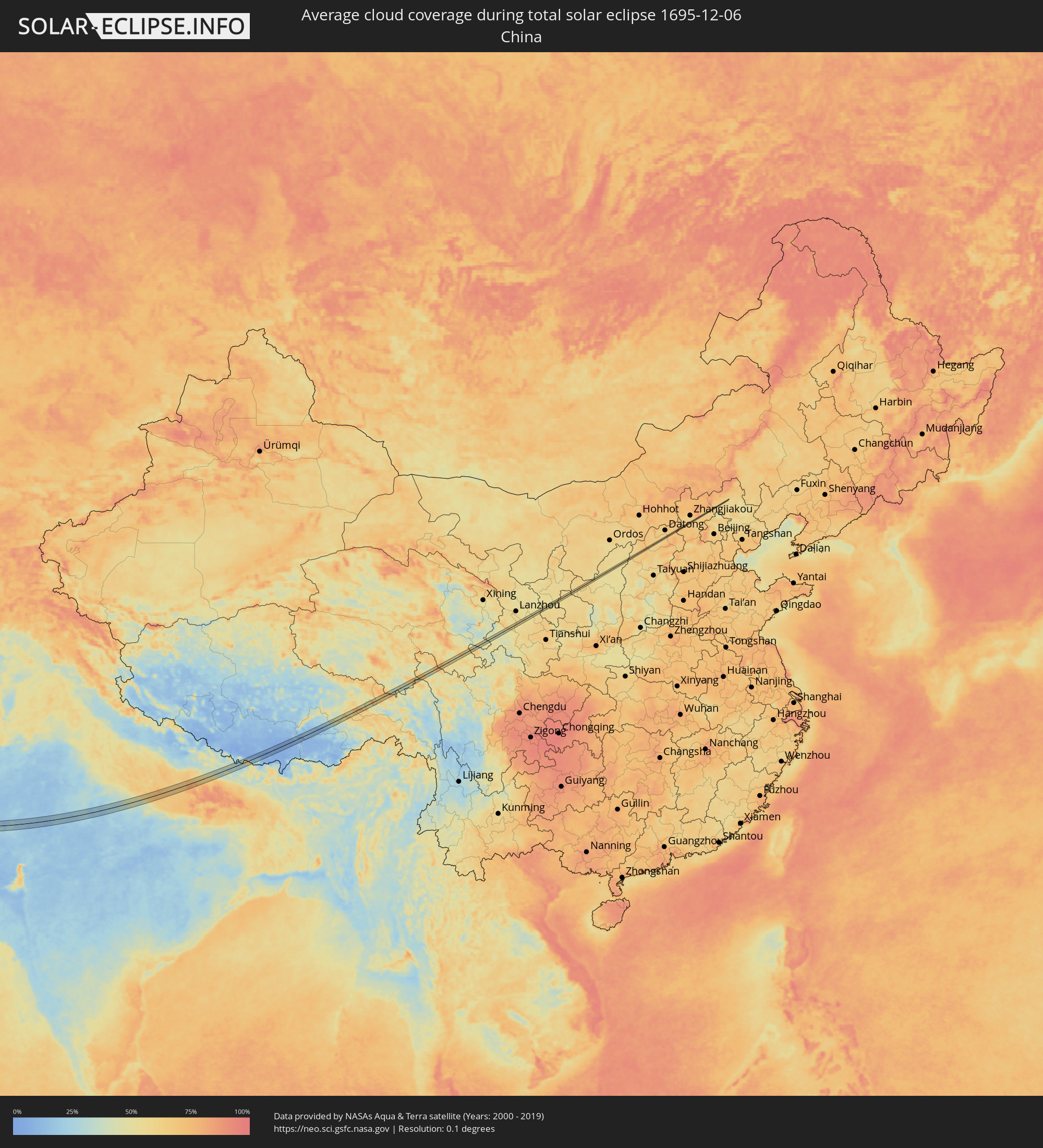 China
China
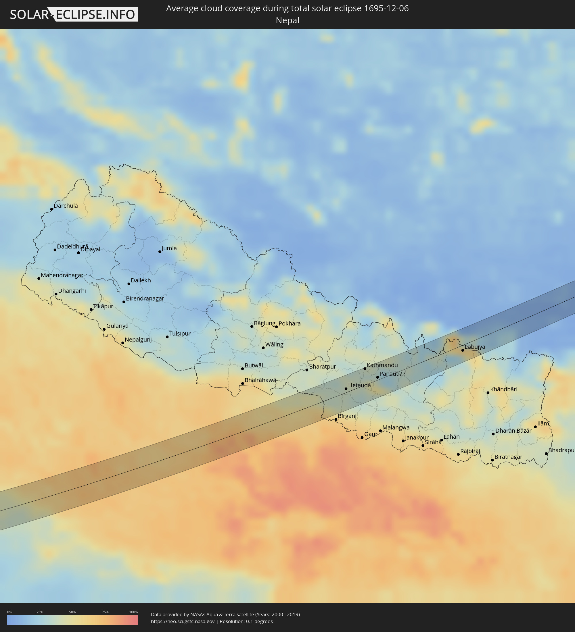 Nepal
Nepal
Cities inside the path of the eclipse
The following table shows all locations with a population of more than 5,000 inside the eclipse path. Cities which have more than 100,000 inhabitants are marked bold. A click at the locations opens a detailed map.
| City | Type | Eclipse duration | Local time of max. eclipse | Distance to central line | Ø Cloud coverage |
|
Kolašin, Opština Kolašin
|
total | - | 07:10:37 UTC+01:00 | 1 km | 74% |
|
Јегуновце, Jegunovce
|
total | - | 07:10:43 UTC+01:00 | 1 km | 81% |
|
Кондово
|
total | - | 07:10:46 UTC+01:00 | 2 km | 72% |
|
Сарај, Saraj Municipality
|
total | - | 07:10:46 UTC+01:00 | 2 km | 72% |
|
Сопиште, Sopište
|
total | - | 07:10:47 UTC+01:00 | 2 km | 76% |
|
Студеничани, Studeničani
|
total | - | 07:10:48 UTC+01:00 | 3 km | 72% |
|
Зелениково, Zelenikovo
|
total | - | 07:10:48 UTC+01:00 | 2 km | 76% |
|
Konče, Konče
|
total | - | 07:10:53 UTC+01:00 | 0 km | 67% |
|
Ayvacık, Çanakkale Province
|
total | - | 08:08:47 UTC+01:56 | 0 km | 64% |
|
Kınık, İzmir
|
total | - | 08:09:05 UTC+01:56 | 4 km | 66% |
|
Akhisar, Manisa
|
total | - | 08:09:18 UTC+01:56 | 0 km | 66% |
|
Kula, Manisa
|
total | - | 08:09:40 UTC+01:56 | 2 km | 68% |
|
Eşme, Uşak
|
total | - | 08:09:48 UTC+01:56 | 2 km | 66% |
|
Dazkırı, Afyonkarahisar
|
total | - | 08:10:11 UTC+01:56 | 3 km | 78% |
|
Başmakçı, Afyonkarahisar
|
total | - | 08:10:19 UTC+01:56 | 2 km | 72% |
|
Burdur, Burdur
|
total | - | 08:10:25 UTC+01:56 | 2 km | 73% |
|
İbradı, Antalya
|
total | - | 08:11:10 UTC+01:56 | 1 km | 61% |
|
Akseki, Antalya
|
total | - | 08:11:19 UTC+01:56 | 3 km | 64% |
|
Sarıveliler, Karaman
|
total | - | 08:11:53 UTC+01:56 | 7 km | 71% |
|
Gülnar, Mersin
|
total | - | 08:12:27 UTC+01:56 | 10 km | 65% |
|
Satita, Tartus
|
total | - | 08:42:42 UTC+02:25 | 11 km | 57% |
|
Duraykīsh, Tartus
|
total | - | 08:42:47 UTC+02:25 | 3 km | 60% |
|
Homs, Homs
|
total | - | 08:43:24 UTC+02:25 | 8 km | 63% |
|
Ar Ruţbah, Anbar
|
total | - | 09:19:32 UTC+02:57 | 9 km | 39% |
|
Ar Rābiyah, Al Asimah
|
total | - | 09:39:55 UTC+03:06 | 19 km | 61% |
|
Al Farwānīyah, Al Farwaniyah
|
total | - | 09:39:58 UTC+03:06 | 20 km | 59% |
|
Ash Shāmīyah, Al Asimah
|
total | - | 09:40:00 UTC+03:06 | 12 km | 59% |
|
Janūb as Surrah, Al Farwaniyah
|
total | - | 09:40:00 UTC+03:06 | 20 km | 59% |
|
Kuwait City, Al Asimah
|
total | - | 09:40:03 UTC+03:06 | 9 km | 51% |
|
Ad Dasmah, Al Asimah
|
total | - | 09:40:05 UTC+03:06 | 9 km | 51% |
|
Ḩawallī, Hawalli
|
total | - | 09:40:08 UTC+03:06 | 11 km | 59% |
|
Bayān, Hawalli
|
total | - | 09:40:09 UTC+03:06 | 13 km | 59% |
|
Şabāḩ as Sālim, Mubārak al Kabīr
|
total | - | 09:40:09 UTC+03:06 | 17 km | 52% |
|
Ar Rumaythīyah, Hawalli
|
total | - | 09:40:13 UTC+03:06 | 11 km | 52% |
|
As Sālimīyah, Hawalli
|
total | - | 09:40:13 UTC+03:06 | 9 km | 52% |
|
Salwá, Hawalli
|
total | - | 09:40:13 UTC+03:06 | 13 km | 52% |
|
Az Zawr, Al Asimah
|
total | - | 09:40:40 UTC+03:06 | 10 km | 37% |
|
Khasab, Musandam
|
total | - | 10:32:00 UTC+03:41 | 22 km | 30% |
|
Chabahar, Sistan and Baluchestan
|
total | - | 10:28:00 UTC+03:25 | 7 km | 24% |
|
Jīwani, Balochistān
|
total | - | 11:33:31 UTC+04:28 | 5 km | 30% |
|
Gwadar, Balochistān
|
total | - | 11:35:08 UTC+04:28 | 25 km | 31% |
|
Mīrpur Sakro, Sindh
|
total | - | 11:50:25 UTC+04:28 | 25 km | 31% |
|
Chuhar Jamāli, Sindh
|
total | - | 11:51:30 UTC+04:28 | 9 km | 33% |
|
Jāti, Sindh
|
total | - | 11:52:19 UTC+04:28 | 5 km | 31% |
|
Kadhan, Sindh
|
total | - | 11:54:24 UTC+04:28 | 20 km | 31% |
|
Diplo, Sindh
|
total | - | 11:56:09 UTC+04:28 | 18 km | 16% |
|
Dīsa, Gujarat
|
total | - | 12:56:40 UTC+05:21 | 20 km | 20% |
|
Pālanpur, Gujarat
|
total | - | 12:57:26 UTC+05:21 | 32 km | 20% |
|
Udaipur, Rajasthan
|
total | - | 13:00:55 UTC+05:21 | 2 km | 17% |
|
Chittaurgarh, Rajasthan
|
total | - | 13:03:28 UTC+05:21 | 19 km | 20% |
|
Kota, Rajasthan
|
total | - | 13:06:46 UTC+05:21 | 30 km | 23% |
|
Bārān, Rajasthan
|
total | - | 13:08:37 UTC+05:21 | 7 km | 27% |
|
Shivpuri, Madhya Pradesh
|
total | - | 13:11:36 UTC+05:21 | 17 km | 21% |
|
Datia, Madhya Pradesh
|
total | - | 13:13:37 UTC+05:21 | 24 km | 25% |
|
Jhānsi, Uttar Pradesh
|
total | - | 13:14:00 UTC+05:21 | 2 km | 30% |
|
Rāth, Uttar Pradesh
|
total | - | 13:16:29 UTC+05:21 | 13 km | 37% |
|
Fatehpur, Uttar Pradesh
|
total | - | 13:19:30 UTC+05:21 | 13 km | 66% |
|
Raebareli, Uttar Pradesh
|
total | - | 13:20:25 UTC+05:21 | 6 km | 70% |
|
Sultānpur, Uttar Pradesh
|
total | - | 13:22:26 UTC+05:21 | 17 km | 66% |
|
Tāndā, Uttar Pradesh
|
total | - | 13:23:43 UTC+05:21 | 5 km | 69% |
|
Bastī, Uttar Pradesh
|
total | - | 13:23:45 UTC+05:21 | 18 km | 62% |
|
Gorakhpur, Uttar Pradesh
|
total | - | 13:25:16 UTC+05:21 | 6 km | 75% |
|
Bagaha, Bihar
|
total | - | 13:26:46 UTC+05:21 | 4 km | 60% |
|
Hetauda, Central Region
|
total | - | 13:48:49 UTC+05:41 | 5 km | 38% |
|
Kirtipur, Central Region
|
total | - | 13:49:14 UTC+05:41 | 22 km | 34% |
|
Pātan, Central Region
|
total | - | 13:49:19 UTC+05:41 | 20 km | 34% |
|
Kathmandu, Central Region
|
total | - | 13:49:19 UTC+05:41 | 22 km | 34% |
|
Hari Bdr Tamang House, Central Region
|
total | - | 13:49:39 UTC+05:41 | 10 km | 42% |
|
kankrabari Dovan, Central Region
|
total | - | 13:49:39 UTC+05:41 | 10 km | 42% |
|
Panauti̇̄, Central Region
|
total | - | 13:49:48 UTC+05:41 | 3 km | 42% |
|
Banepā, Central Region
|
total | - | 13:49:47 UTC+05:41 | 8 km | 42% |
|
Lobujya, Eastern Region
|
total | - | 13:52:22 UTC+05:41 | 8 km | 31% |
|
Jiangzi, Tibet Autonomous Region
|
total | - | 16:16:05 UTC+08:00 | 18 km | 7% |
|
Lhasa, Tibet Autonomous Region
|
total | - | 16:18:24 UTC+08:00 | 6 km | 12% |
|
Zhangjiakou Shi Xuanhua Qu, Hebei
|
total | - | 16:35:37 UTC+08:00 | 4 km | 64% |