Hybrid solar eclipse of 07/24/1702
| Day of week: | Monday |
| Maximum duration of eclipse: | 00m01s |
| Maximum width of eclipse path: | 1 km |
| Saros cycle: | 131 |
| Coverage: | 100% |
| Magnitude: | 1.0001 |
| Gamma: | 0.316 |
Wo kann man die Sonnenfinsternis vom 07/24/1702 sehen?
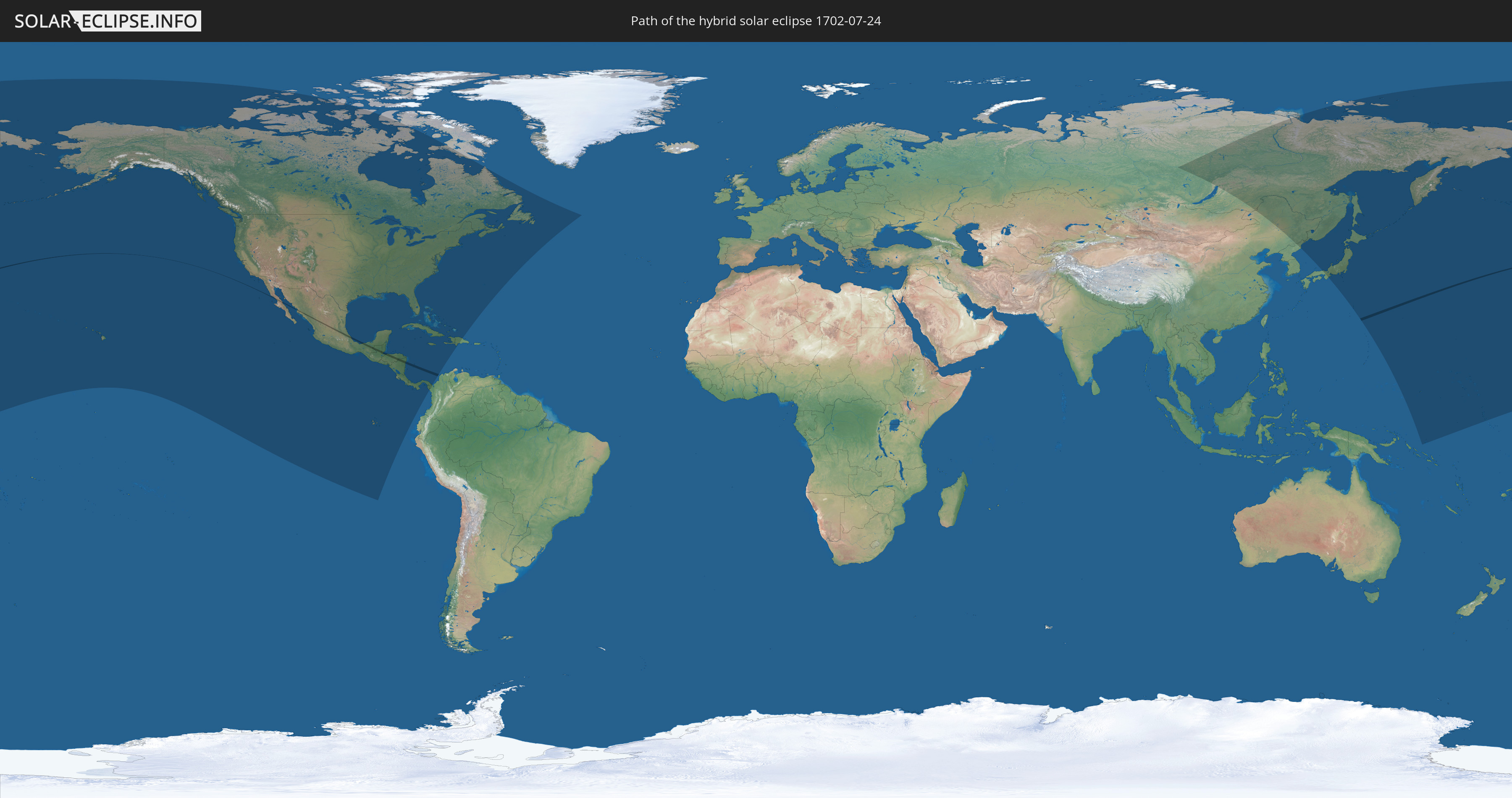
Die Sonnenfinsternis am 07/24/1702 kann man in 32 Ländern als partielle Sonnenfinsternis beobachten.
Der Finsternispfad verläuft durch 5 Länder. Nur in diesen Ländern ist sie als hybrid Sonnenfinsternis zu sehen.
In den folgenden Ländern ist die Sonnenfinsternis hybrid zu sehen
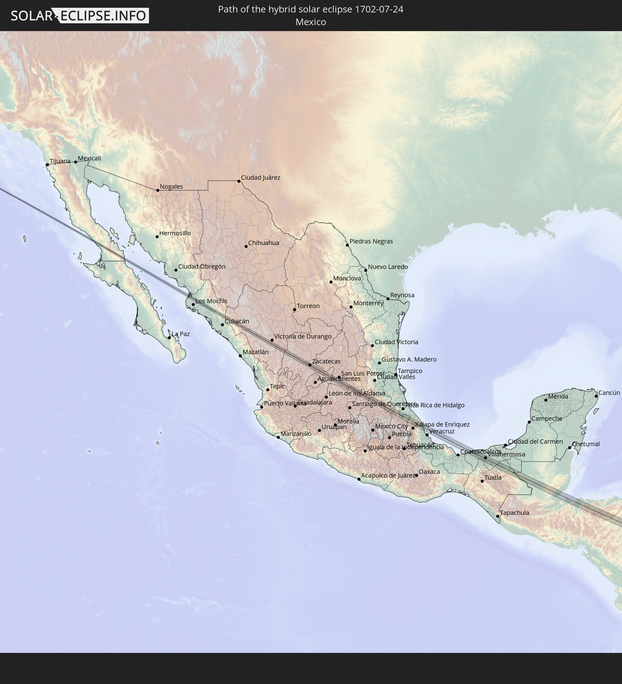 Mexico
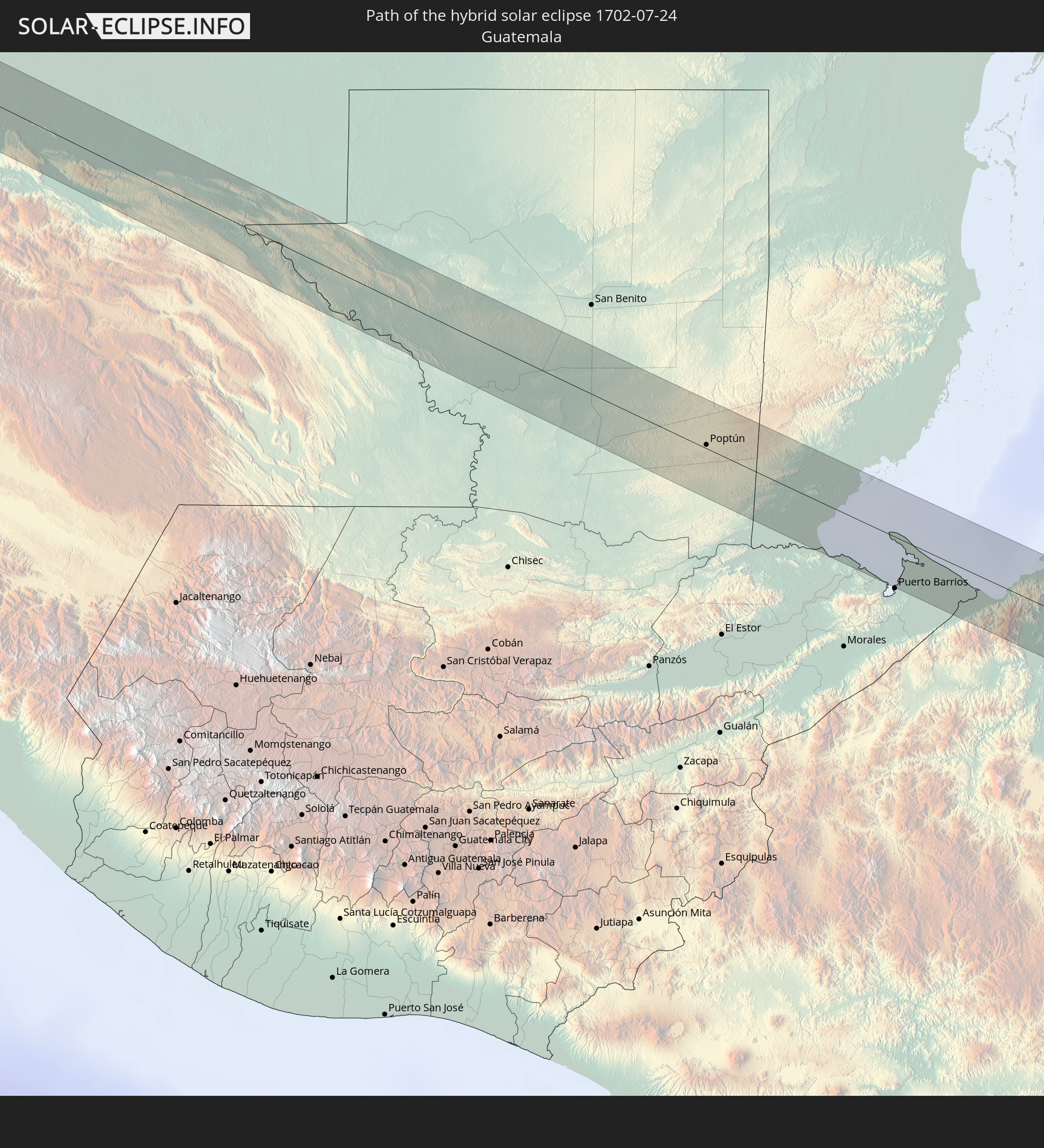 Guatemala
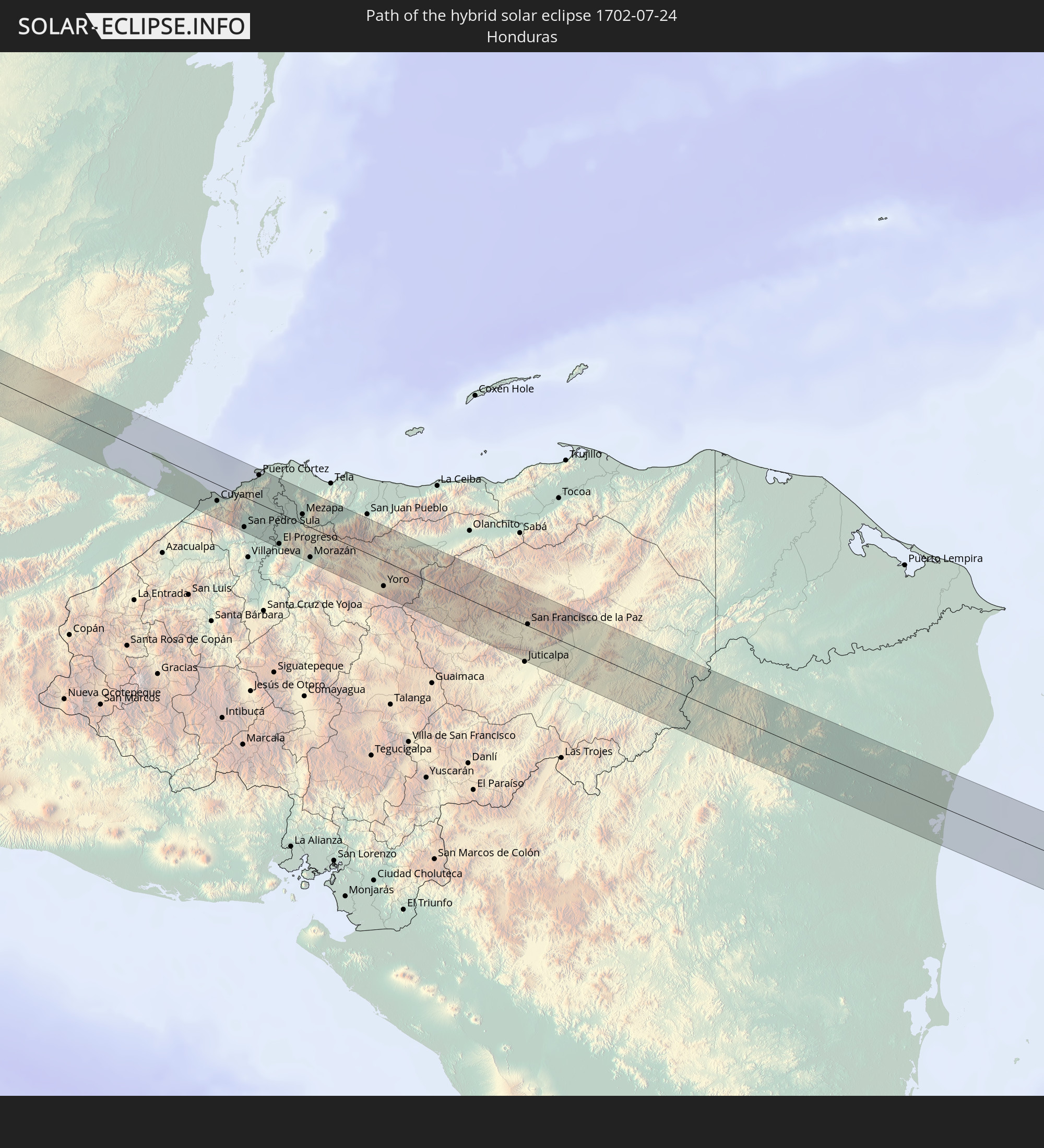 Honduras
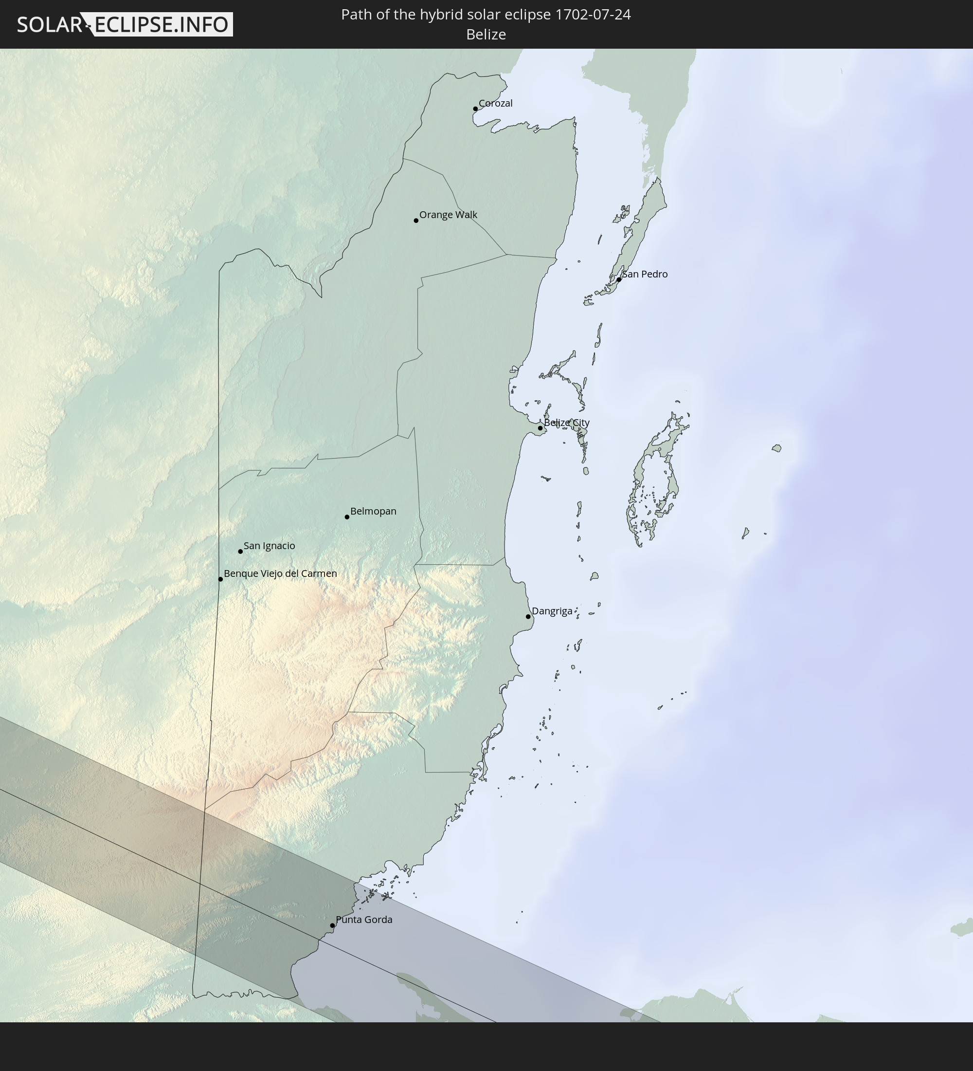 Belize
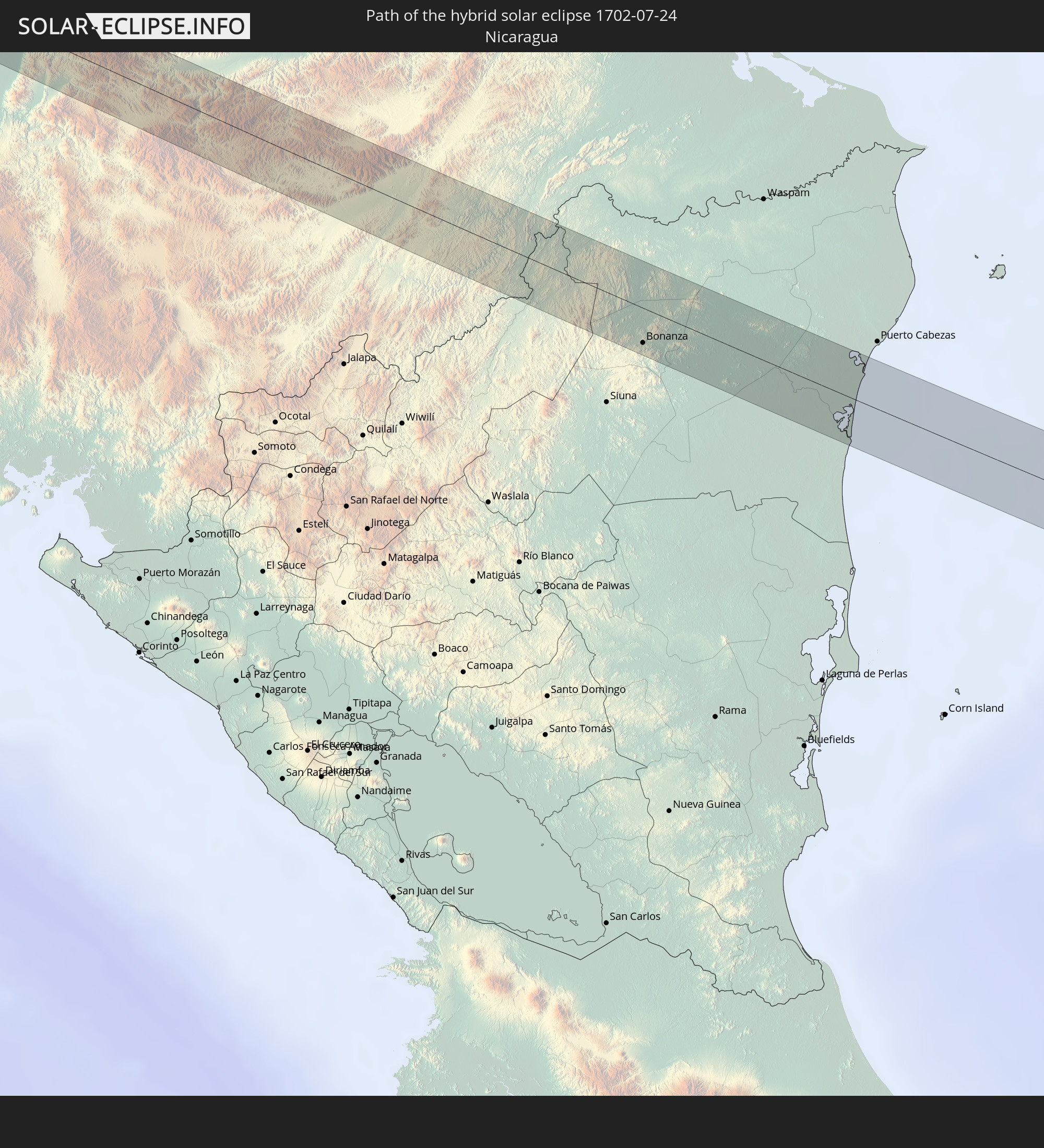 Nicaragua
In den folgenden Ländern ist die Sonnenfinsternis partiell zu sehen
 Russia
 United States
 United States Minor Outlying Islands
 Kiribati
 Canada
 Mexico
 Greenland
 Guatemala
 Ecuador
 El Salvador
 Honduras
 Belize
 Nicaragua
 Costa Rica
 Cuba
Cuba
 Panama
 Colombia
 Cayman Islands
 The Bahamas
 Jamaica
 Haiti
Haiti
 Turks and Caicos Islands
 Dominican Republic
 Bermuda
 Saint Pierre and Miquelon
 China
China
 Japan
Japan
 North Korea
 Federated States of Micronesia
 Solomon Islands
 Marshall Islands
 Nauru
Nauru
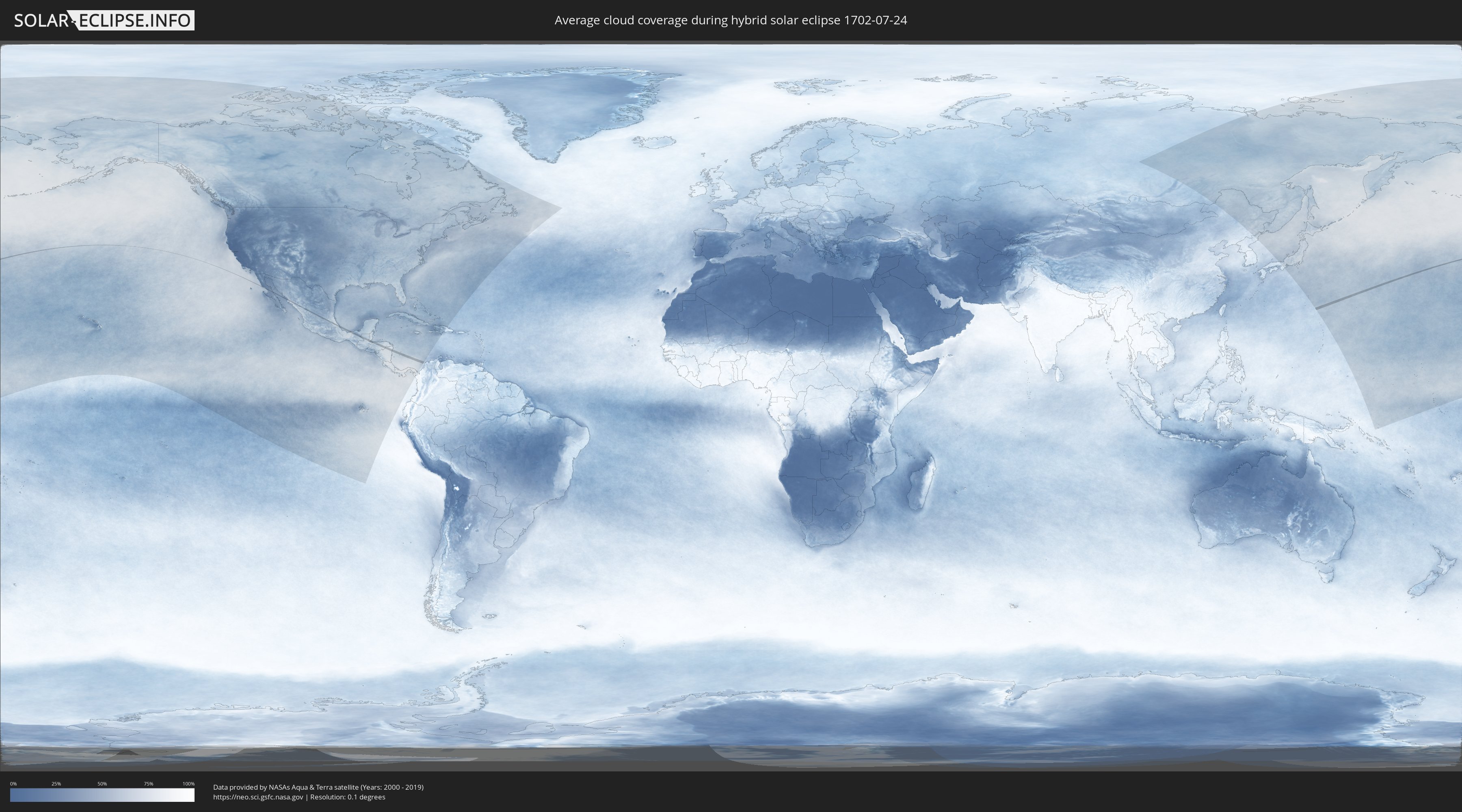
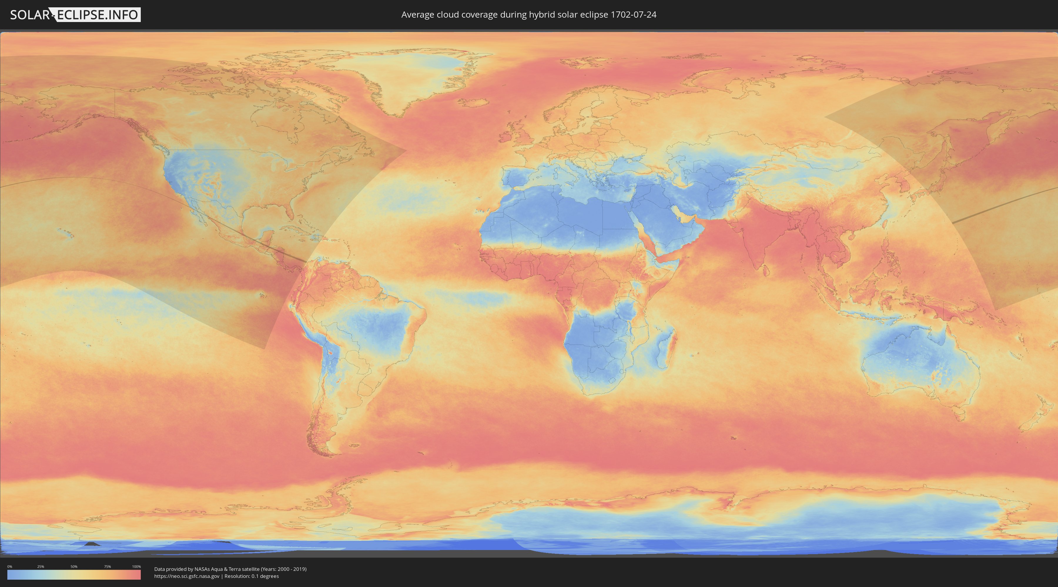
How will be the weather during the hybrid solar eclipse on 07/24/1702?
Where is the best place to see the hybrid solar eclipse of 07/24/1702?
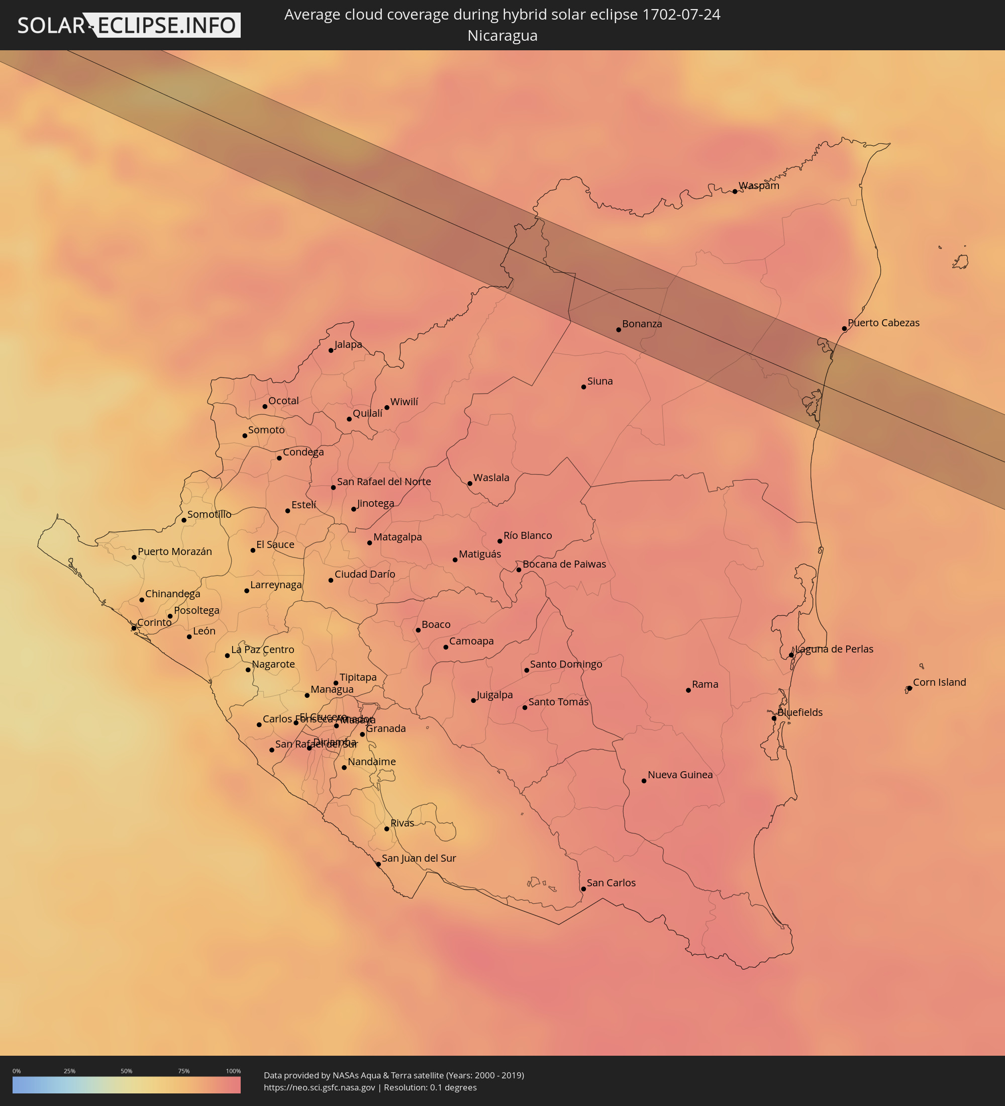
The following maps show the average cloud coverage for the day of the hybrid solar eclipse.
With the help of these maps, it is possible to find the place along the eclipse path, which has the best
chance of a cloudless sky.
Nevertheless, you should consider local circumstances and inform about the weather of your chosen
observation site.
The data is provided by NASAs satellites
AQUA and TERRA.
The cloud maps are averaged over a period of 19 years (2000 - 2019).
Detailed country maps
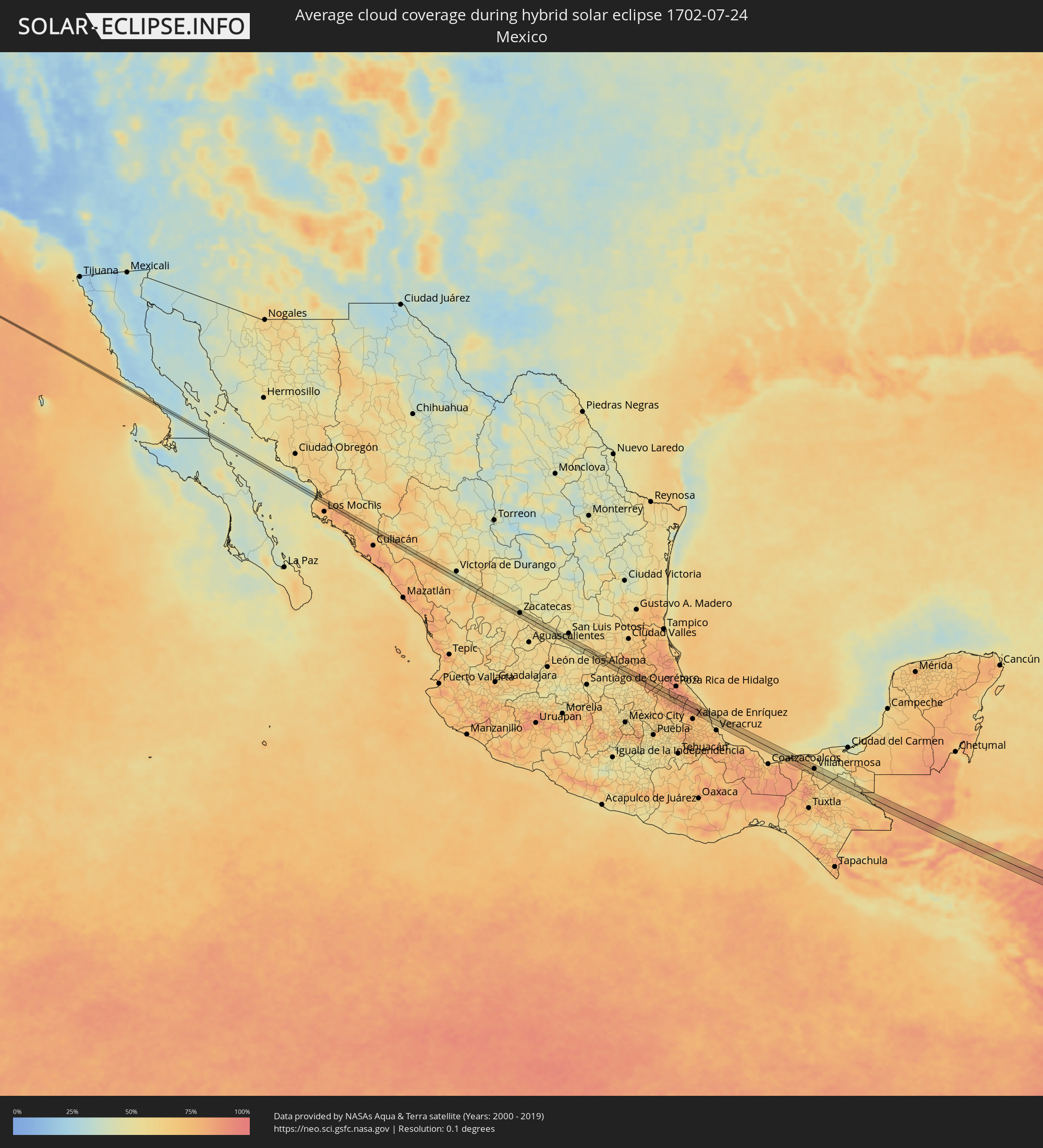 Mexico
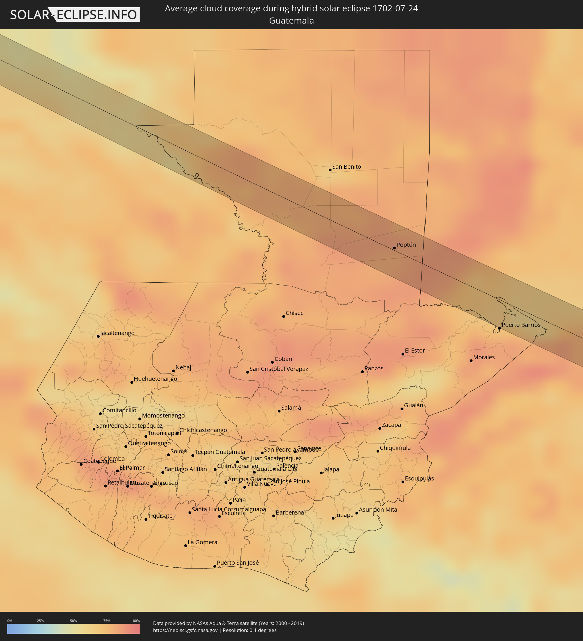 Guatemala
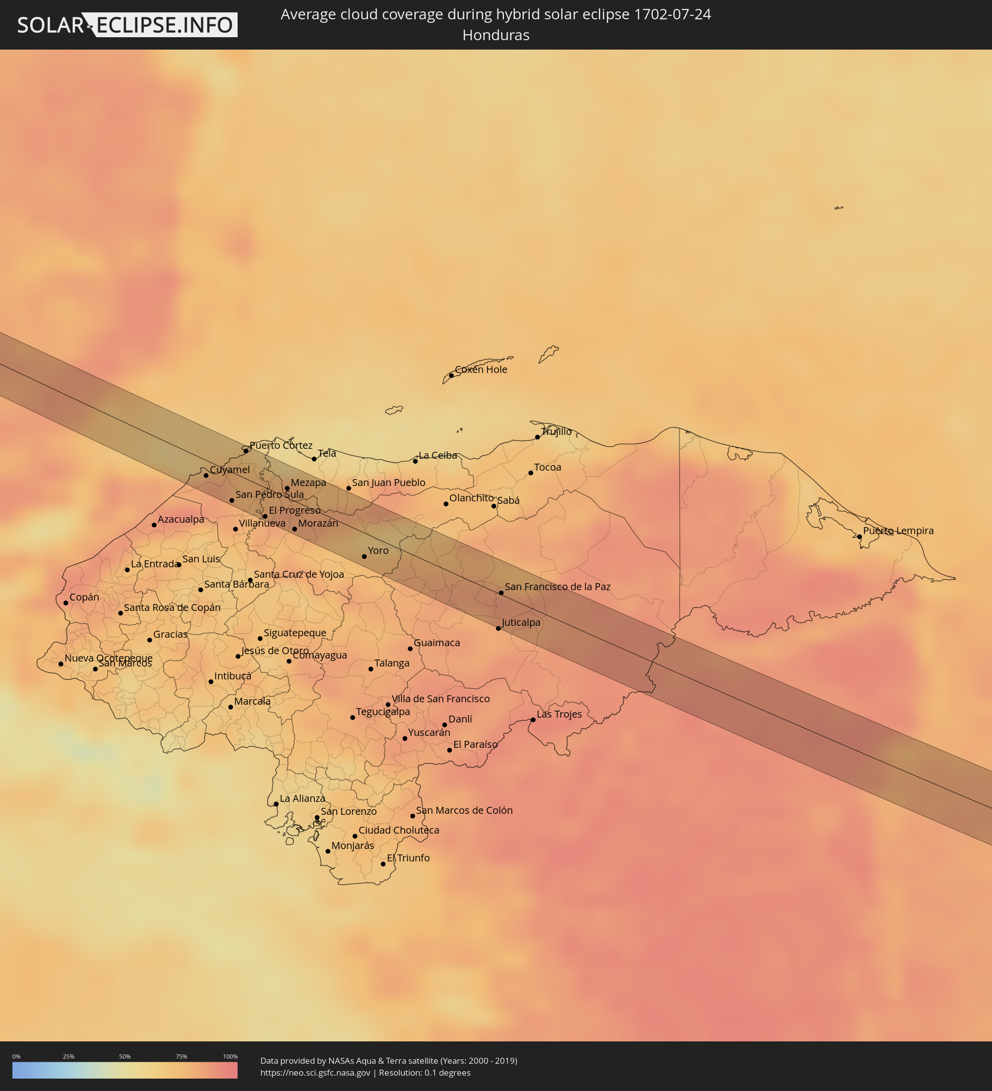 Honduras
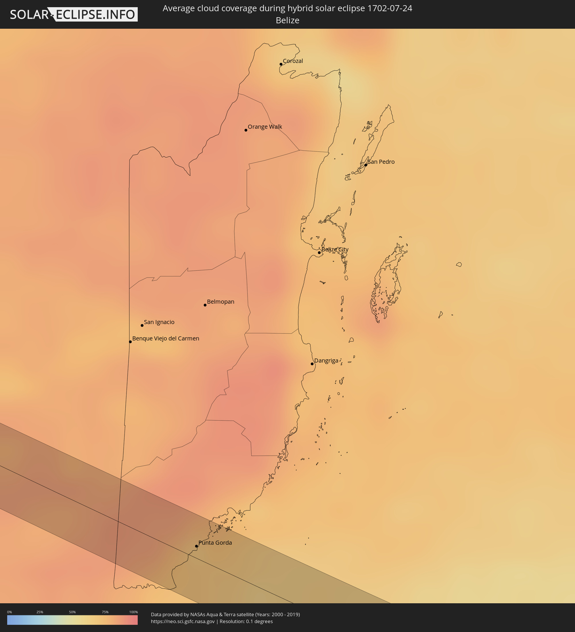 Belize
 Nicaragua
Cities inside the path of the eclipse
The following table shows all locations with a population of more than 5,000 inside the eclipse path. Cities which have more than 100,000 inhabitants are marked bold. A click at the locations opens a detailed map.
| City | Type | Eclipse duration | Local time of max. eclipse | Distance to central line | Ø Cloud coverage |
|
Mocorito, Sinaloa
|
annular | - | 15:51:49 UTC-07:05 | 5 km | 73% |
|
Morelos, Zacatecas
|
annular | - | 16:29:32 UTC-06:36 | 9 km | 53% |
|
Zacatecas, Zacatecas
|
annular | - | 16:29:41 UTC-06:36 | 1 km | 54% |
|
Trancoso, Zacatecas
|
annular | - | 16:29:54 UTC-06:36 | 9 km | 57% |
|
Villa González Ortega, Zacatecas
|
annular | - | 16:30:32 UTC-06:36 | 10 km | 55% |
|
Villa de Reyes, San Luis Potosí
|
annular | - | 16:32:13 UTC-06:36 | 10 km | 52% |
|
Santa María del Río, San Luis Potosí
|
annular | - | 16:32:21 UTC-06:36 | 1 km | 50% |
|
Tierra Nueva, San Luis Potosí
|
annular | - | 16:32:38 UTC-06:36 | 5 km | 47% |
|
Jalpan, Querétaro
|
annular | - | 16:33:56 UTC-06:36 | 6 km | 63% |
|
Zacualtipán, Hidalgo
|
annular | - | 16:35:11 UTC-06:36 | 10 km | 70% |
|
Tlaxco, Puebla
|
annular | - | 16:35:49 UTC-06:36 | 1 km | 77% |
|
Xicotepec de Juárez, Puebla
|
annular | - | 16:36:03 UTC-06:36 | 12 km | 77% |
|
Filomeno Mata, Puebla
|
annular | - | 16:36:17 UTC-06:36 | 7 km | 77% |
|
Mecatlán, Veracruz
|
annular | - | 16:36:17 UTC-06:36 | 5 km | 77% |
|
Coyutla, Veracruz
|
annular | - | 16:36:14 UTC-06:36 | 0 km | 77% |
|
Hueytamalco, Puebla
|
annular | - | 16:36:49 UTC-06:36 | 12 km | 85% |
|
Tlapacoyan, Veracruz
|
annular | - | 16:36:50 UTC-06:36 | 6 km | 83% |
|
Martínez de la Torre, Veracruz
|
annular | - | 16:36:46 UTC-06:36 | 12 km | 85% |
|
Santa Cruz Hidalgo, Veracruz
|
annular | - | 16:36:59 UTC-06:36 | 10 km | 83% |
|
Misantla, Veracruz
|
annular | - | 16:37:03 UTC-06:36 | 8 km | 87% |
|
Cárdenas, Tabasco
|
annular | - | 16:40:48 UTC-06:36 | 16 km | 74% |
|
Santa Rosalía, Tabasco
|
annular | - | 16:40:43 UTC-06:36 | 6 km | 79% |
|
Villa Tecolutilla, Tabasco
|
annular | - | 16:40:29 UTC-06:36 | 14 km | 77% |
|
Miguel Hidalgo, Tabasco
|
annular | - | 16:40:31 UTC-06:36 | 13 km | 77% |
|
Comalcalco, Tabasco
|
annular | - | 16:40:32 UTC-06:36 | 18 km | 74% |
|
Cunduacán, Tabasco
|
annular | - | 16:40:48 UTC-06:36 | 1 km | 66% |
|
Luis Gil Pérez, Tabasco
|
annular | - | 16:41:03 UTC-06:36 | 14 km | 71% |
|
Jalpa de Méndez, Tabasco
|
annular | - | 16:40:42 UTC-06:36 | 17 km | 72% |
|
Nacajuca, Tabasco
|
annular | - | 16:40:43 UTC-06:36 | 18 km | 67% |
|
La Selva, Tabasco
|
annular | - | 16:40:54 UTC-06:36 | 6 km | 67% |
|
Bosque de Saloya, Tabasco
|
annular | - | 16:40:55 UTC-06:36 | 6 km | 67% |
|
La Lima, Tabasco
|
annular | - | 16:41:03 UTC-06:36 | 4 km | 65% |
|
Pomoca, Tabasco
|
annular | - | 16:40:53 UTC-06:36 | 10 km | 60% |
|
Villahermosa, Tabasco
|
annular | - | 16:40:58 UTC-06:36 | 4 km | 60% |
|
Río de Teapa, Tabasco
|
annular | - | 16:41:13 UTC-06:36 | 15 km | 67% |
|
Belén, Tabasco
|
annular | - | 16:41:17 UTC-06:36 | 1 km | 61% |
|
Macuspana, Tabasco
|
annular | - | 16:41:20 UTC-06:36 | 3 km | 61% |
|
Ciudad Pemex, Tabasco
|
annular | - | 16:41:13 UTC-06:36 | 15 km | 52% |
|
Palenque, Chiapas
|
annular | - | 16:41:47 UTC-06:36 | 1 km | 59% |
|
Frontera Corozal, Chiapas
|
annular | - | 16:42:50 UTC-06:36 | 17 km | 70% |
|
Sayaxché, Petén
|
annular | - | 17:17:51 UTC-06:02 | 14 km | 78% |
|
La Libertad, Petén
|
annular | - | 17:17:34 UTC-06:02 | 15 km | 79% |
|
San Luis, Petén
|
annular | - | 17:18:20 UTC-06:02 | 13 km | 84% |
|
Poptún, Petén
|
annular | - | 17:18:11 UTC-06:02 | 2 km | 81% |
|
Dolores, Petén
|
annular | - | 17:17:59 UTC-06:02 | 20 km | 84% |
|
Punta Gorda, Toledo
|
annular | - | 17:27:48 UTC-05:52 | 6 km | 71% |
|
Lívingston, Izabal
|
annular | - | 17:18:50 UTC-06:02 | 19 km | 77% |
|
Cuyamel, Cortés
|
annular | - | 17:32:16 UTC-05:48 | 10 km | 82% |
|
San Pedro Sula, Cortés
|
annular | - | 17:32:27 UTC-05:48 | 19 km | 81% |
|
Choloma, Cortés
|
annular | - | 17:32:21 UTC-05:48 | 5 km | 82% |
|
Puerto Cortez, Cortés
|
annular | - | 17:32:08 UTC-05:48 | 18 km | 74% |
|
La Lima, Cortés
|
annular | - | 17:32:32 UTC-05:48 | 21 km | 74% |
|
Baracoa, Cortés
|
annular | - | 17:32:12 UTC-05:48 | 16 km | 74% |
|
El Progreso, Yoro
|
annular | - | 17:32:35 UTC-05:48 | 19 km | 81% |
|
Mezapa, Atlántida
|
annular | - | 17:32:25 UTC-05:48 | 6 km | 82% |
|
Morazán, Yoro
|
annular | - | 17:32:42 UTC-05:48 | 19 km | 80% |
|
Santa Rita, Yoro
|
annular | - | 17:32:52 UTC-05:48 | 20 km | 71% |
|
Yoro, Yoro
|
annular | - | 17:32:55 UTC-05:48 | 16 km | 78% |
|
San Francisco de la Paz, Olancho
|
annular | - | 17:33:13 UTC-05:48 | 1 km | 85% |
|
Bonanza, Atlántico Norte (RAAN)
|
annular | - | 17:37:46 UTC-05:45 | 18 km | 92% |