Annular solar eclipse of 12/18/1778
| Day of week: | Friday |
| Maximum duration of eclipse: | 07m44s |
| Maximum width of eclipse path: | 450 km |
| Saros cycle: | 138 |
| Coverage: | 91.4% |
| Magnitude: | 0.9137 |
| Gamma: | -0.6788 |
Wo kann man die Sonnenfinsternis vom 12/18/1778 sehen?
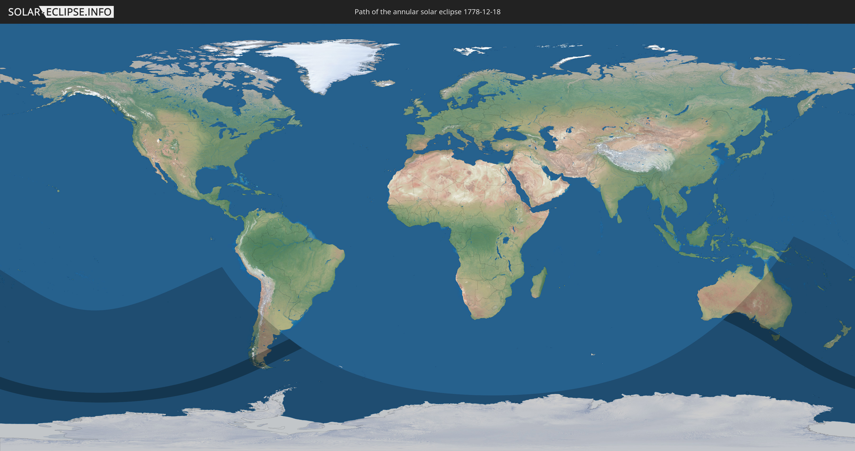
Die Sonnenfinsternis am 12/18/1778 kann man in 14 Ländern als partielle Sonnenfinsternis beobachten.
Der Finsternispfad verläuft durch 3 Länder. Nur in diesen Ländern ist sie als annular Sonnenfinsternis zu sehen.
In den folgenden Ländern ist die Sonnenfinsternis annular zu sehen
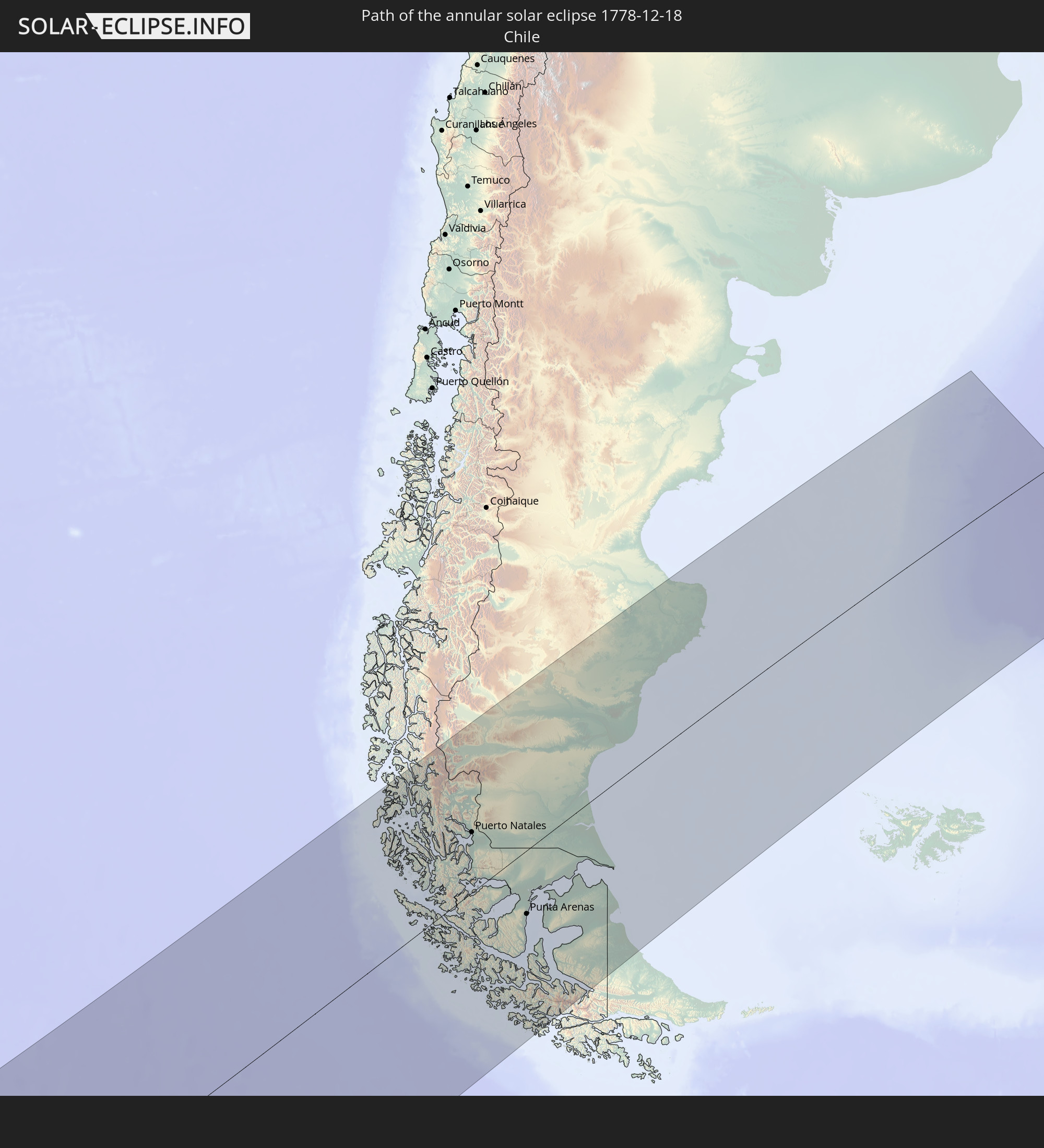 Chile
Chile
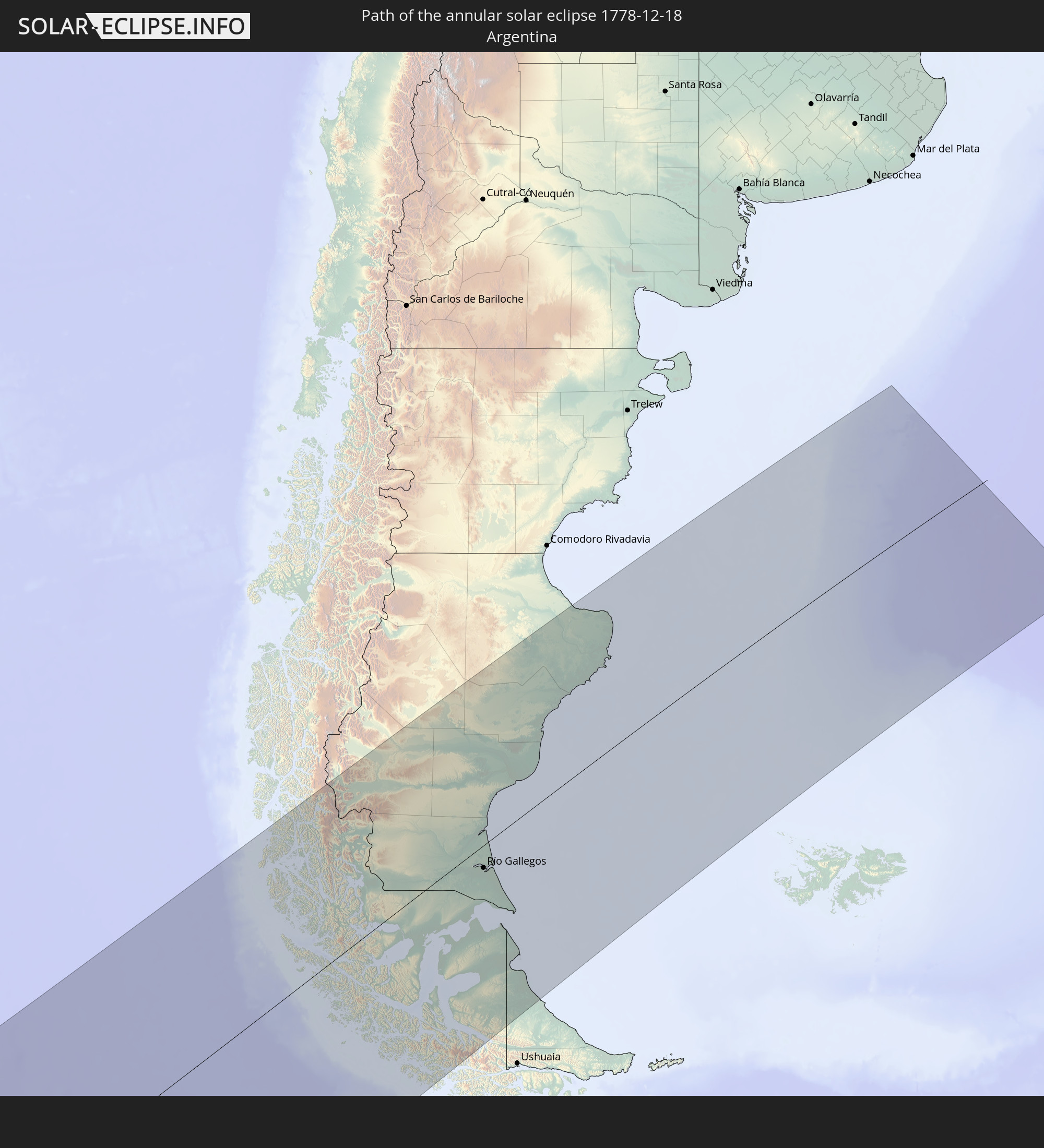 Argentina
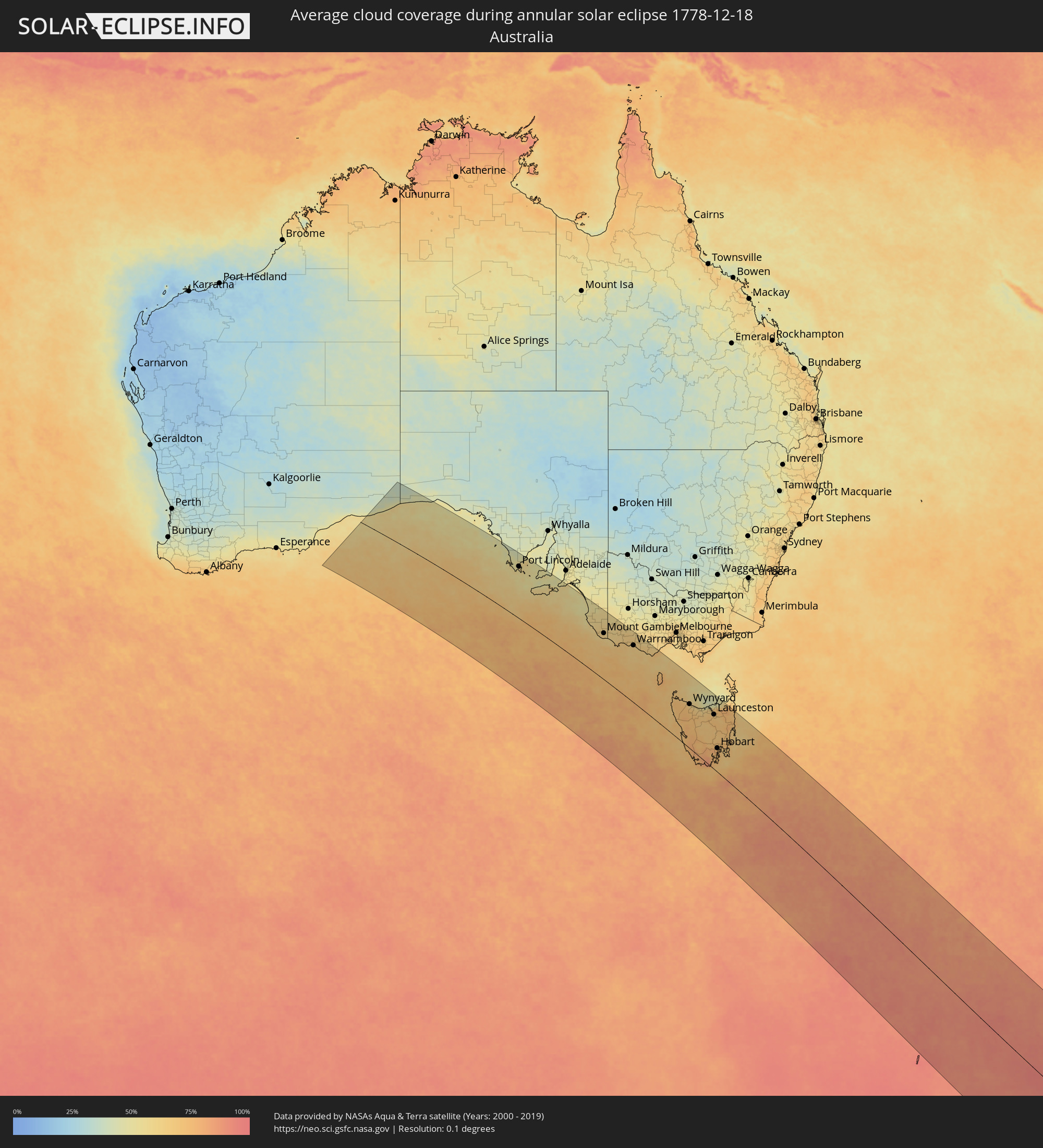
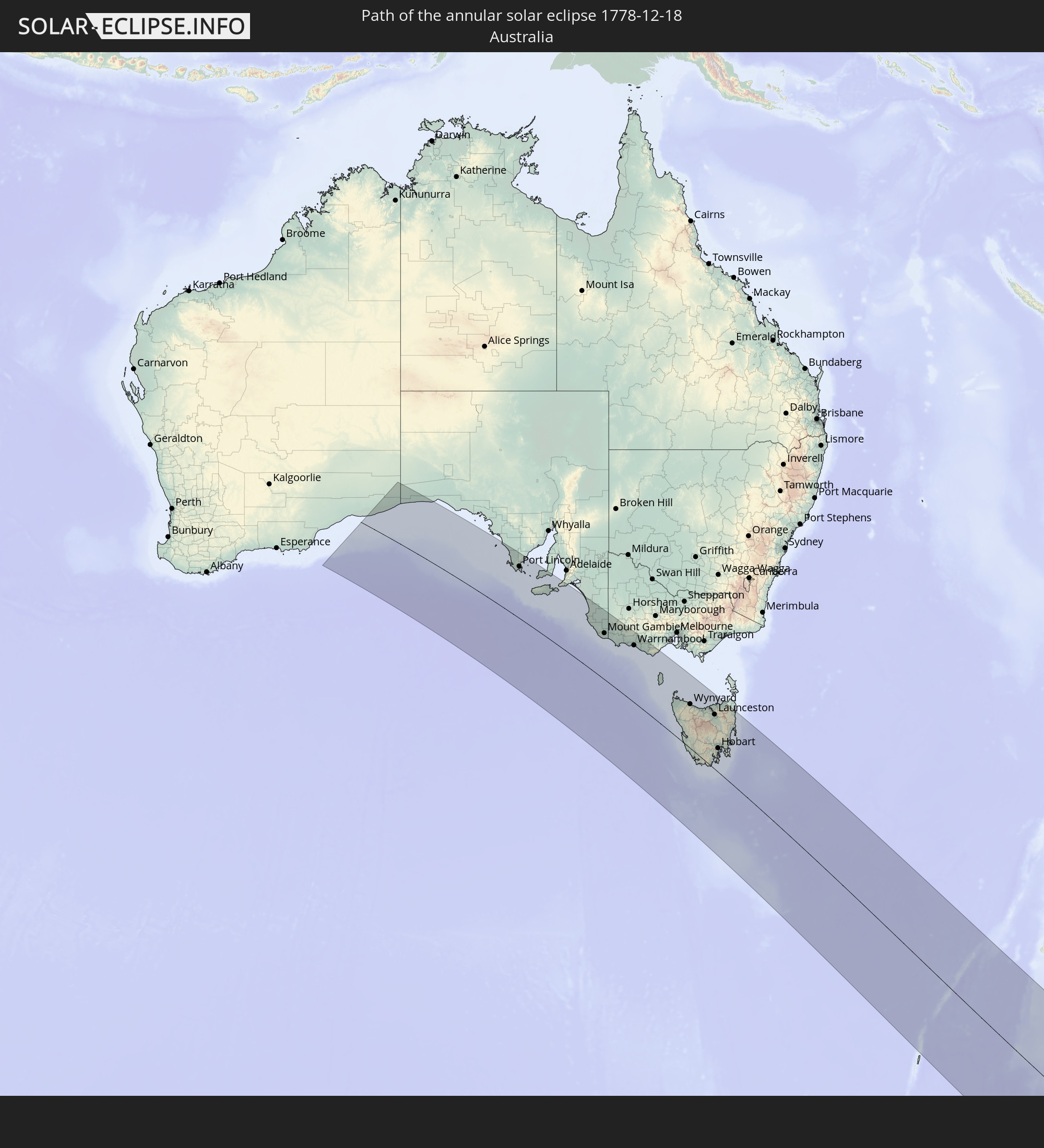 Australia
In den folgenden Ländern ist die Sonnenfinsternis partiell zu sehen


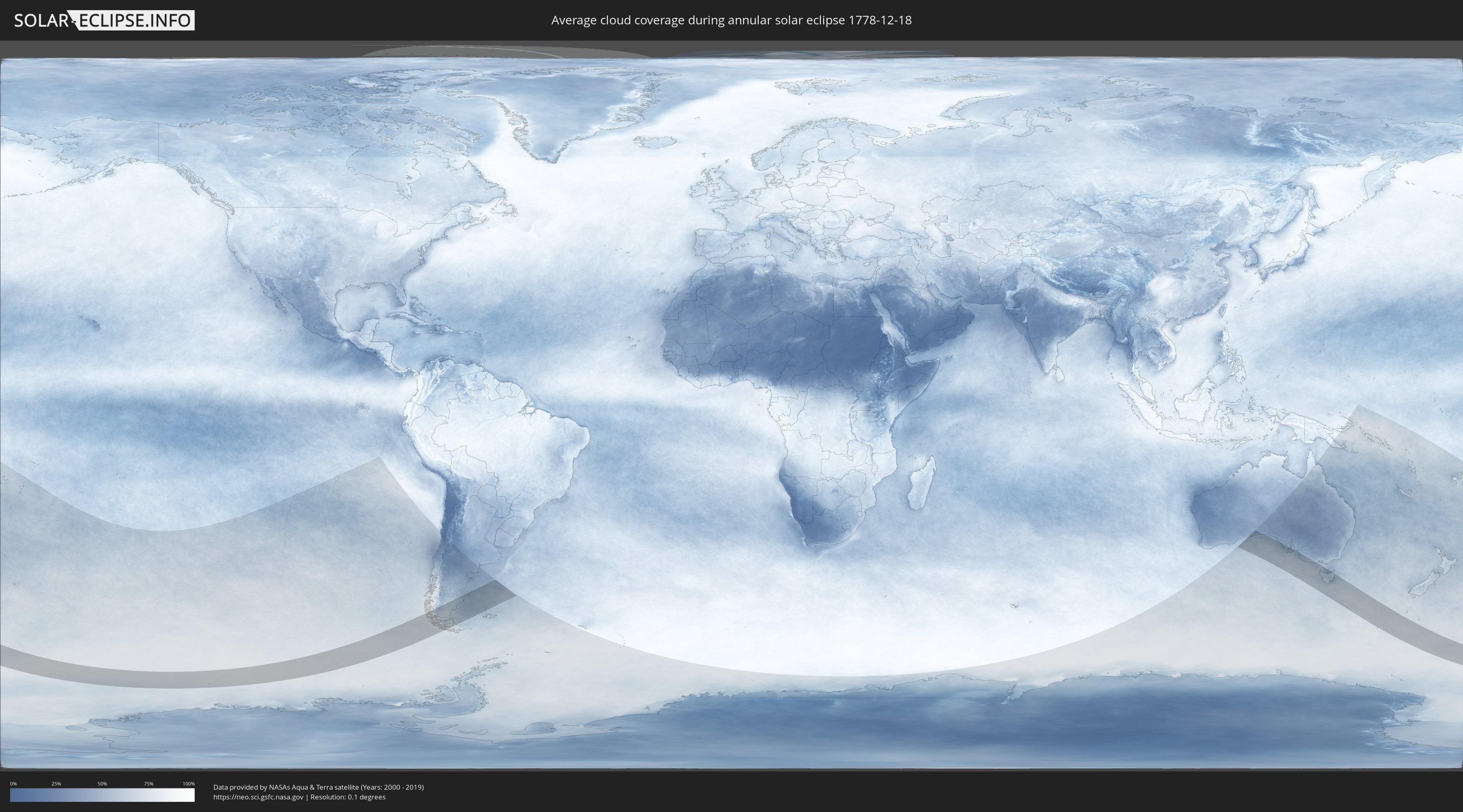
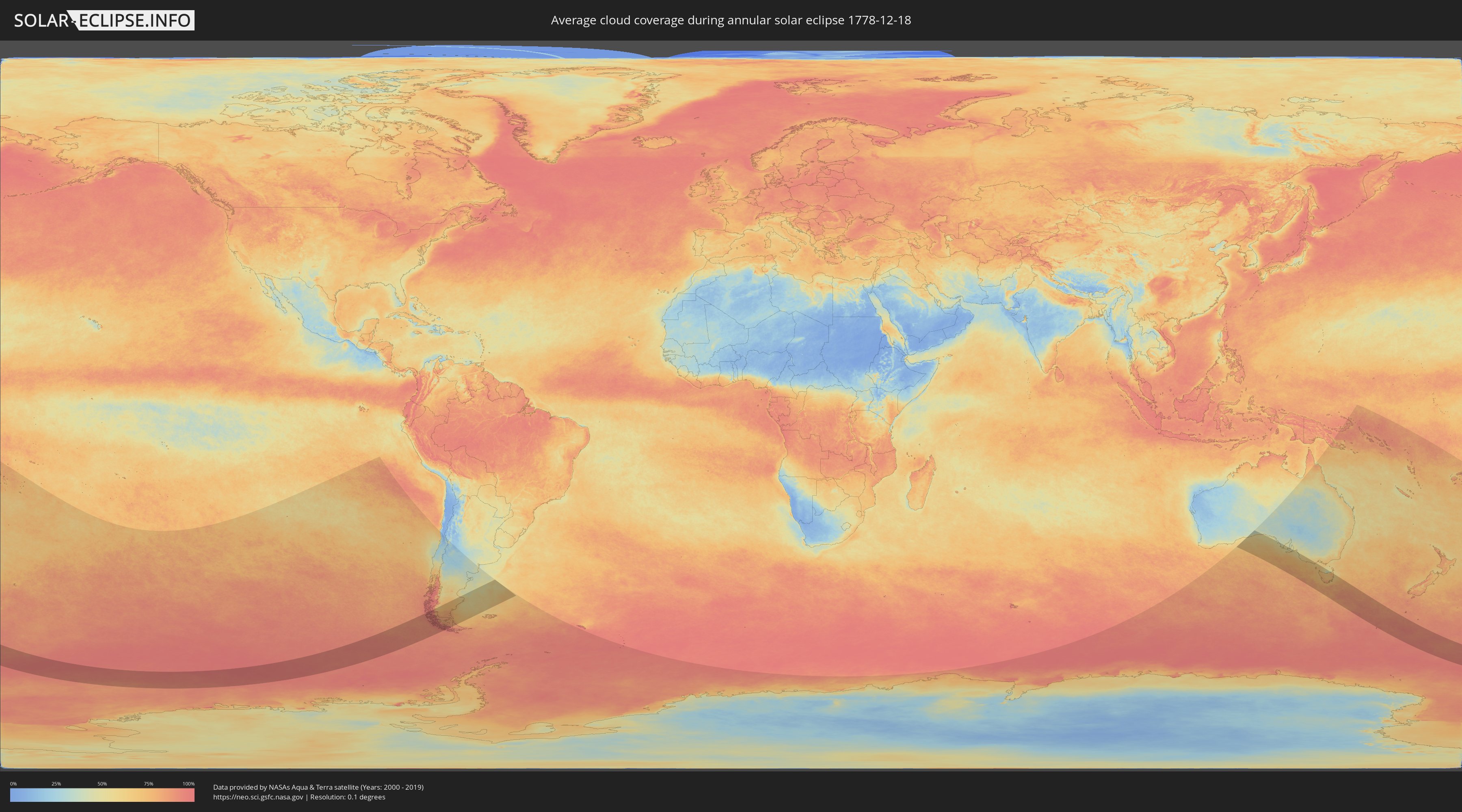
How will be the weather during the annular solar eclipse on 12/18/1778?
Where is the best place to see the annular solar eclipse of 12/18/1778?
The following maps show the average cloud coverage for the day of the annular solar eclipse.
With the help of these maps, it is possible to find the place along the eclipse path, which has the best
chance of a cloudless sky.
Nevertheless, you should consider local circumstances and inform about the weather of your chosen
observation site.
The data is provided by NASAs satellites
AQUA and TERRA.
The cloud maps are averaged over a period of 19 years (2000 - 2019).
Detailed country maps
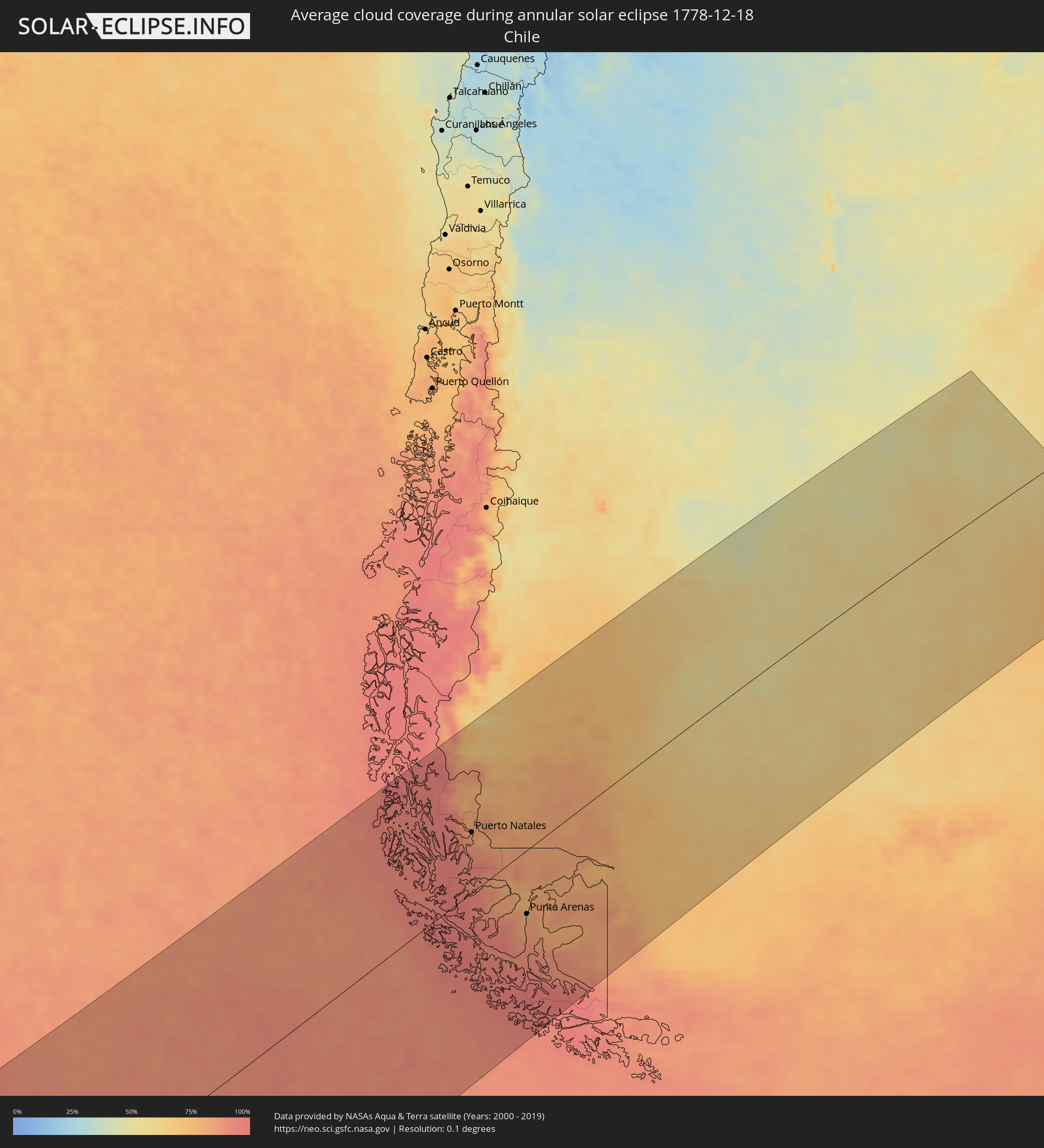 Chile
Chile
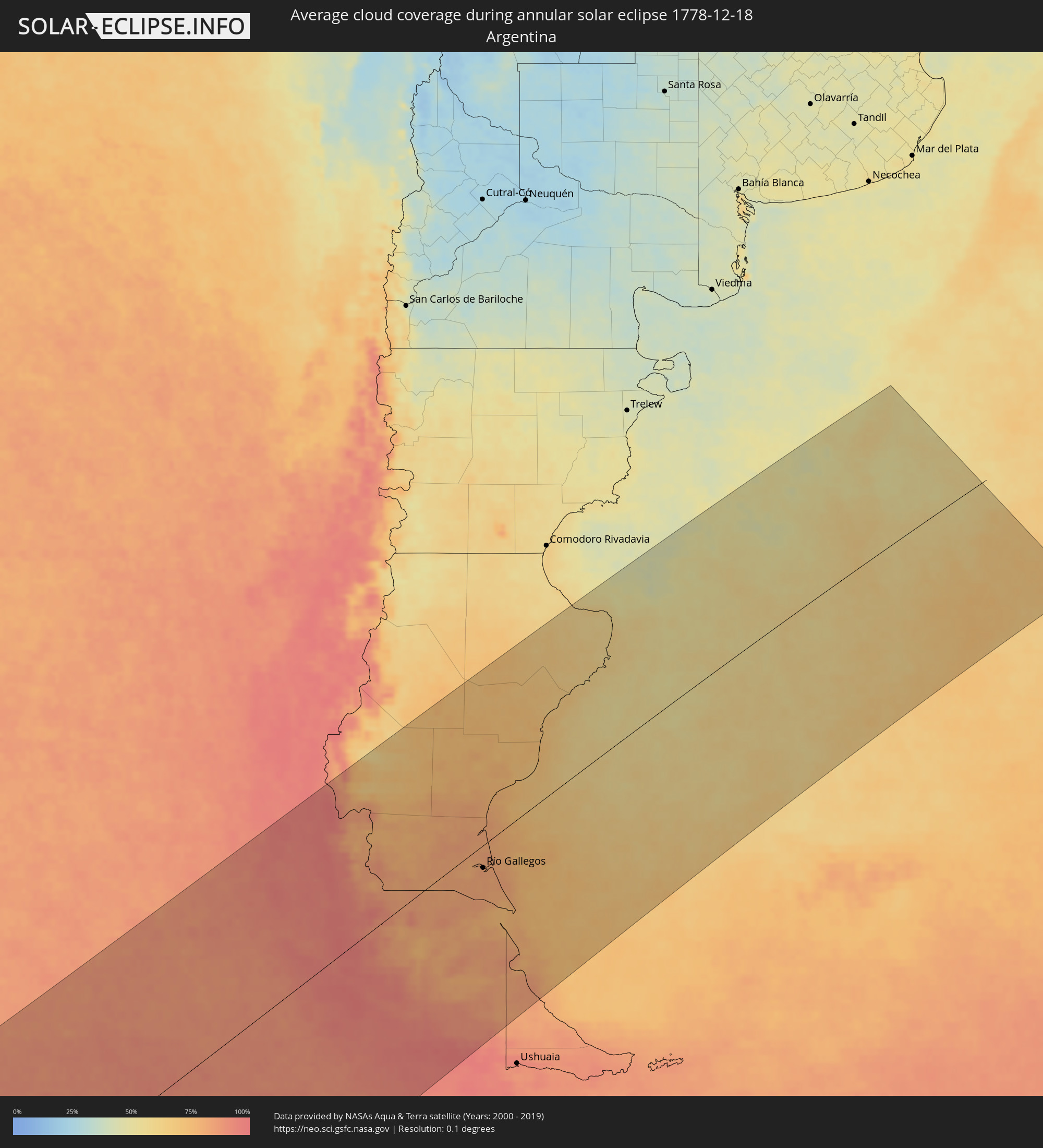 Argentina
 Australia
Cities inside the path of the eclipse
The following table shows all locations with a population of more than 5,000 inside the eclipse path. Cities which have more than 100,000 inhabitants are marked bold. A click at the locations opens a detailed map.
| City | Type | Eclipse duration | Local time of max. eclipse | Distance to central line | Ø Cloud coverage |
 Puerto Natales, Magallanes
|
annular | - | 18:34:41 UTC-04:42 | 95 km | 85% |
 Yacimiento Río Turbio, Santa Cruz Province
|
annular | - | 19:00:52 UTC-04:16 | 102 km | 85% |
|
Río Turbio, Santa Cruz Province
|
annular | - | 19:00:56 UTC-04:16 | 105 km | 86% |
|
El Calafate, Santa Cruz Province
|
annular | - | 19:02:46 UTC-04:16 | 209 km | 74% |
|
Punta Arenas, Magallanes
|
annular | - | 18:32:09 UTC-04:42 | 99 km | 83% |
|
Río Gallegos, Santa Cruz Province
|
annular | - | 19:00:10 UTC-04:16 | 34 km | 83% |
|
San Julián, Santa Cruz Province
|
annular | - | 19:03:14 UTC-04:16 | 110 km | 71% |
|
Puerto Deseado, Santa Cruz Province
|
annular | - | 19:04:51 UTC-04:16 | 169 km | 58% |
 Port Lincoln, South Australia
|
annular | - | 05:54:44 UTC+09:30 | 225 km | 58% |
|
Millicent, South Australia
|
annular | - | 05:57:39 UTC+09:30 | 186 km | 60% |
|
Naracoorte, South Australia
|
annular | - | 05:56:34 UTC+09:30 | 263 km | 58% |
|
Mount Gambier, South Australia
|
annular | - | 05:57:55 UTC+09:30 | 186 km | 62% |
|
Portland, Victoria
|
annular | - | 06:28:34 UTC+10:00 | 183 km | 67% |
|
Hamilton, Victoria
|
annular | - | 06:27:32 UTC+10:00 | 259 km | 61% |
|
Warrnambool, Victoria
|
annular | - | 06:28:28 UTC+10:00 | 225 km | 64% |
|
Wynyard, Tasmania
|
annular | - | 06:32:25 UTC+10:00 | 163 km | 64% |
|
Burnie, Tasmania
|
annular | - | 06:32:32 UTC+10:00 | 167 km | 64% |
|
Ulverstone, Tasmania
|
annular | - | 06:32:42 UTC+10:00 | 173 km | 64% |
|
Devonport, Tasmania
|
annular | - | 06:32:43 UTC+10:00 | 180 km | 60% |
|
New Norfolk, Tasmania
|
annular | - | 06:35:31 UTC+10:00 | 79 km | 77% |
|
Newnham, Tasmania
|
annular | - | 06:33:04 UTC+10:00 | 202 km | 67% |
|
Launceston, Tasmania
|
annular | - | 06:33:09 UTC+10:00 | 198 km | 67% |
|
Bridgewater, Tasmania
|
annular | - | 06:35:26 UTC+10:00 | 91 km | 70% |
|
Claremont, Tasmania
|
annular | - | 06:35:31 UTC+10:00 | 89 km | 72% |
|
Glenorchy, Tasmania
|
annular | - | 06:35:36 UTC+10:00 | 86 km | 72% |
|
West Moonah, Tasmania
|
annular | - | 06:35:38 UTC+10:00 | 85 km | 72% |
|
Moonah, Tasmania
|
annular | - | 06:35:38 UTC+10:00 | 86 km | 72% |
|
Kingston, Tasmania
|
annular | - | 06:35:52 UTC+10:00 | 75 km | 71% |
|
New Town, Tasmania
|
annular | - | 06:35:39 UTC+10:00 | 85 km | 75% |
|
Blackmans Bay, Tasmania
|
annular | - | 06:35:55 UTC+10:00 | 74 km | 71% |
|
Sandy Bay, Tasmania
|
annular | - | 06:35:43 UTC+10:00 | 83 km | 75% |
|
Hobart, Tasmania
|
annular | - | 06:35:41 UTC+10:00 | 85 km | 75% |
|
Lindisfarne, Tasmania
|
annular | - | 06:35:38 UTC+10:00 | 89 km | 70% |
|
Howrah, Tasmania
|
annular | - | 06:35:42 UTC+10:00 | 88 km | 73% |