Annular solar eclipse of 05/16/1817
| Day of week: | Friday |
| Maximum duration of eclipse: | 06m30s |
| Maximum width of eclipse path: | 194 km |
| Saros cycle: | 125 |
| Coverage: | 94.8% |
| Magnitude: | 0.9483 |
| Gamma: | -0.2049 |
Wo kann man die Sonnenfinsternis vom 05/16/1817 sehen?
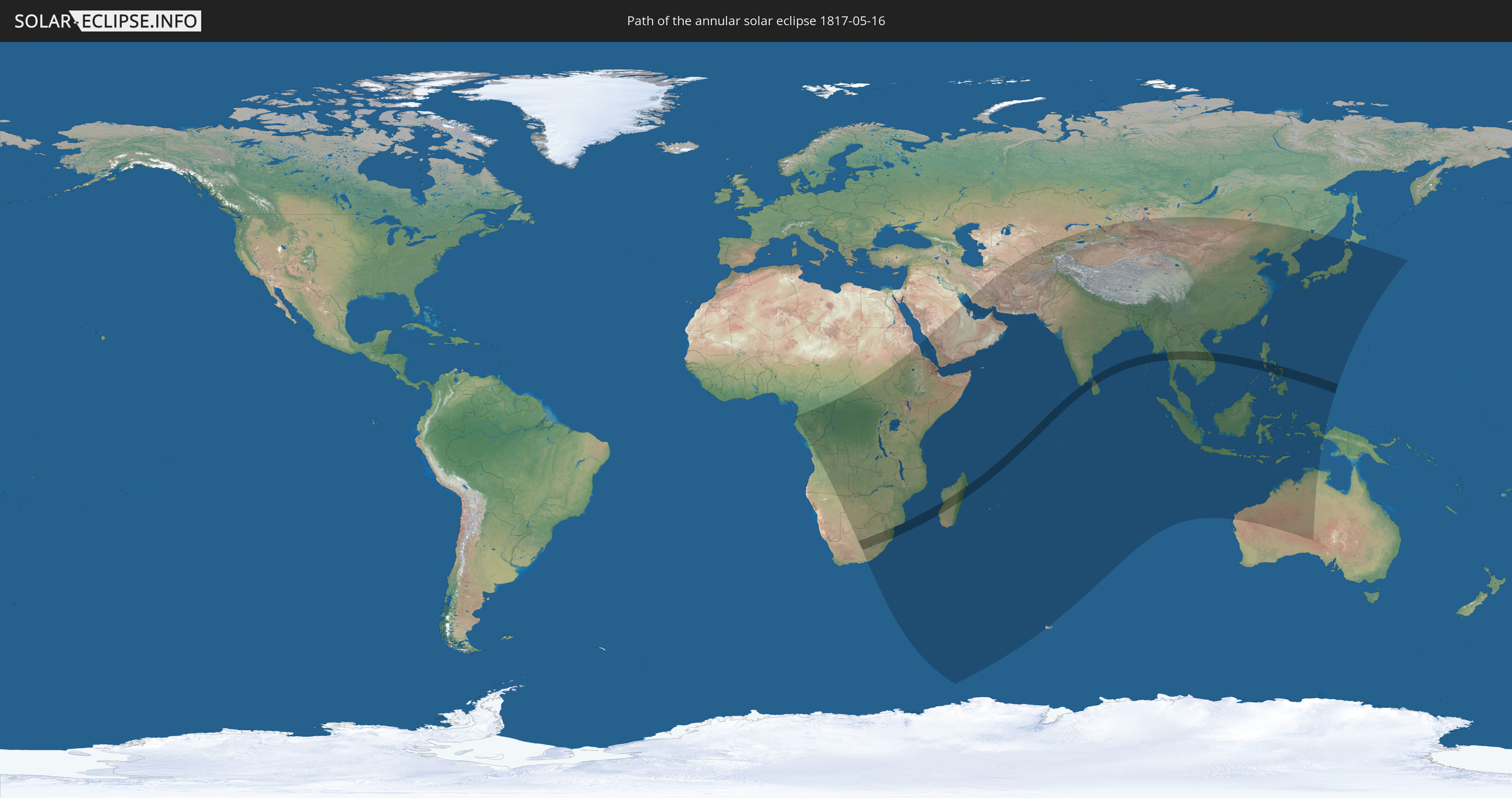
Die Sonnenfinsternis am 05/16/1817 kann man in 79 Ländern als partielle Sonnenfinsternis beobachten.
Der Finsternispfad verläuft durch 16 Länder. Nur in diesen Ländern ist sie als annular Sonnenfinsternis zu sehen.
In den folgenden Ländern ist die Sonnenfinsternis annular zu sehen
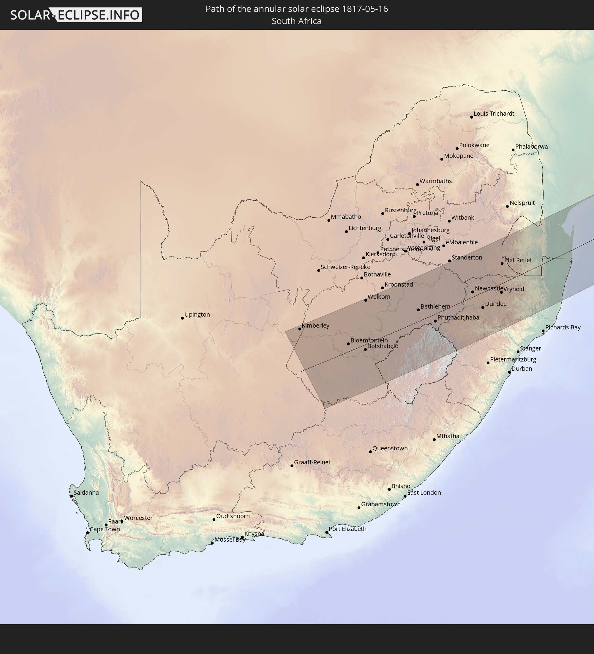 South Africa
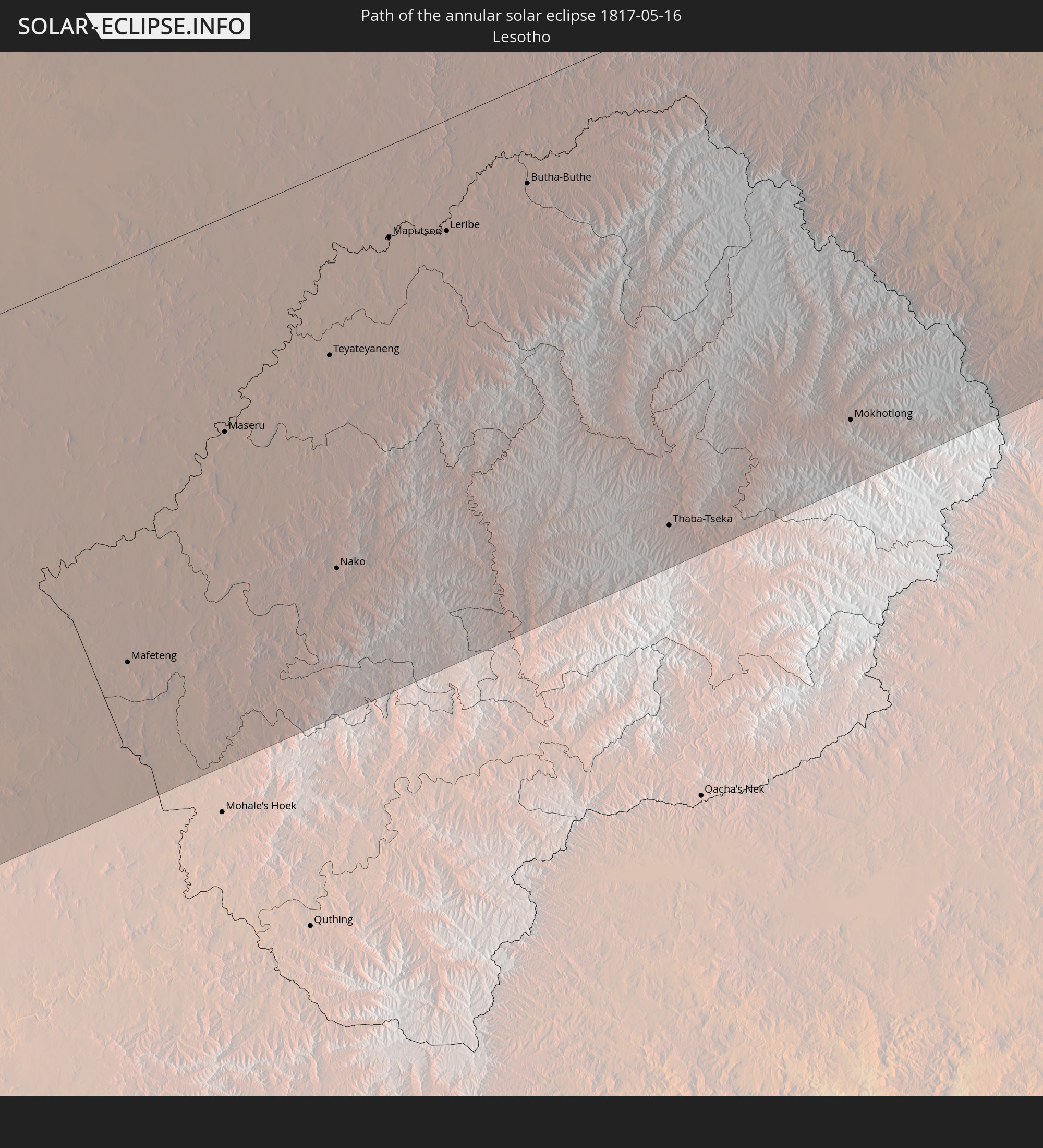 Lesotho
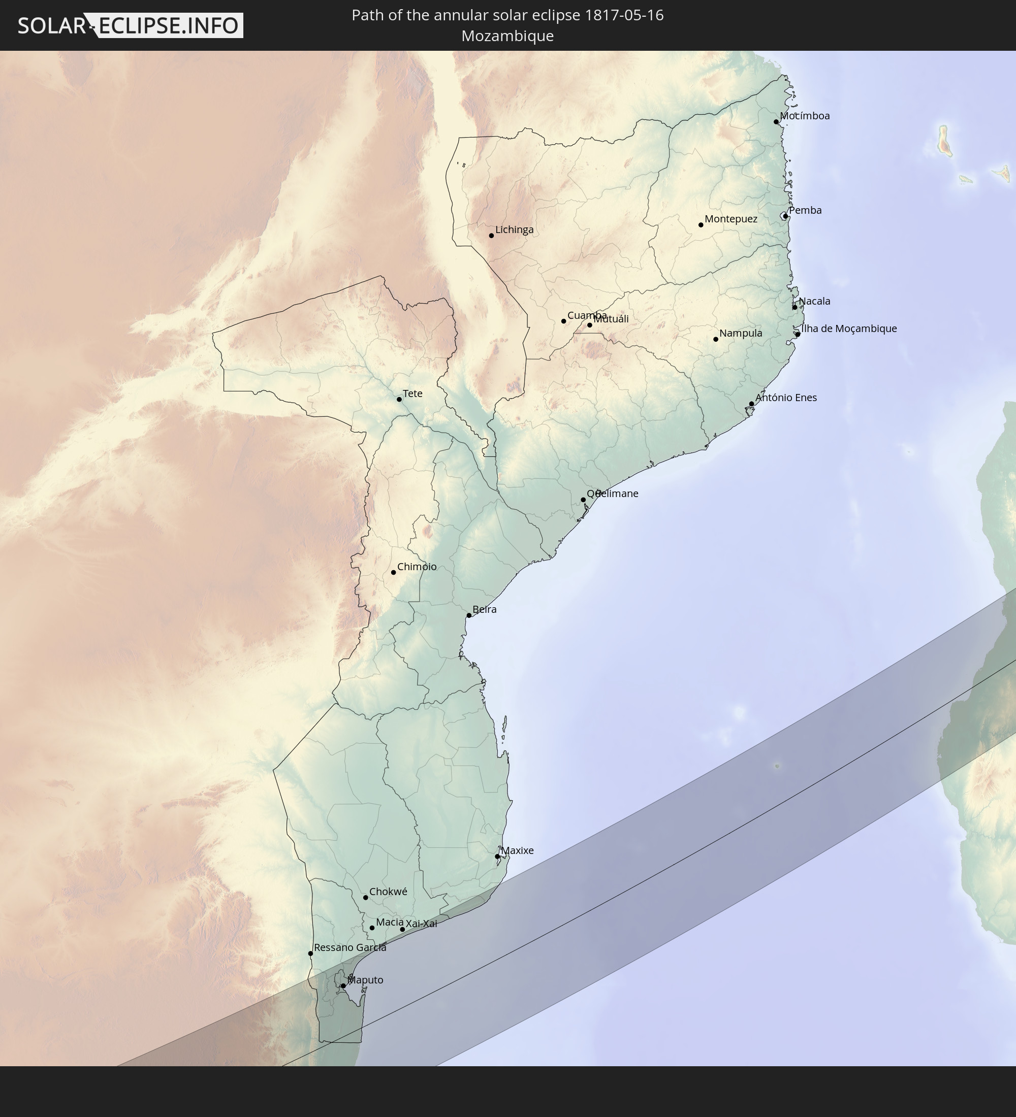 Mozambique
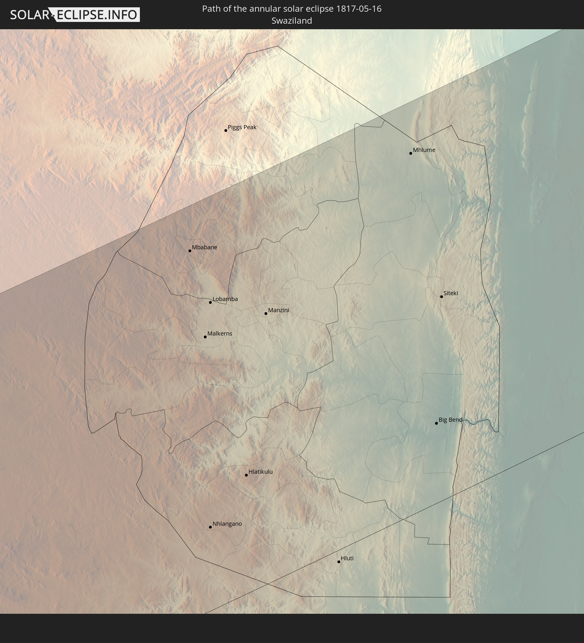 Swaziland
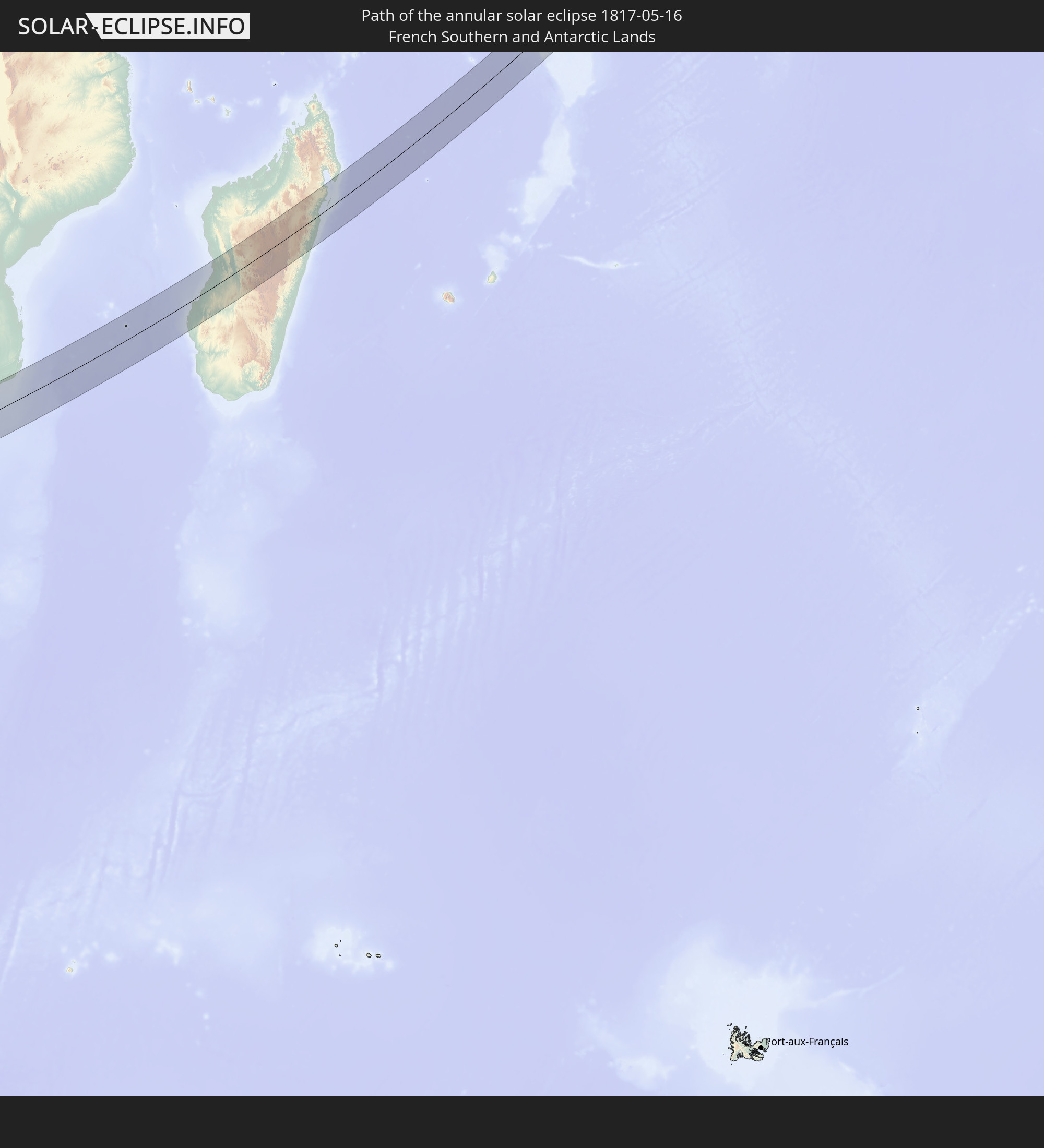 French Southern and Antarctic Lands
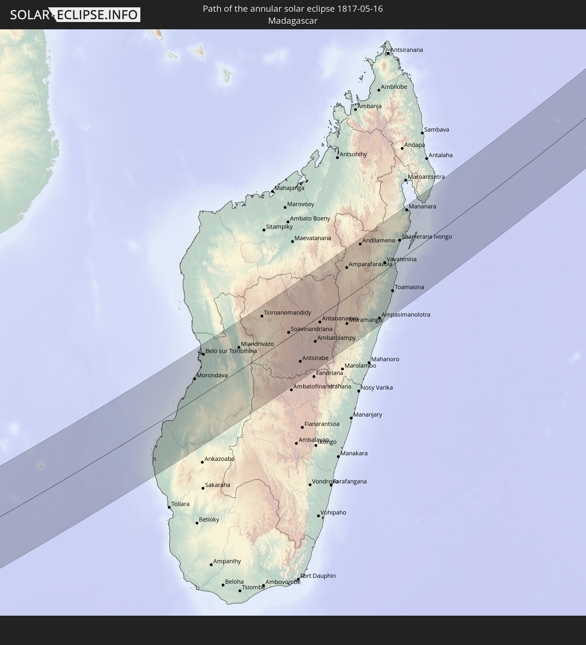 Madagascar
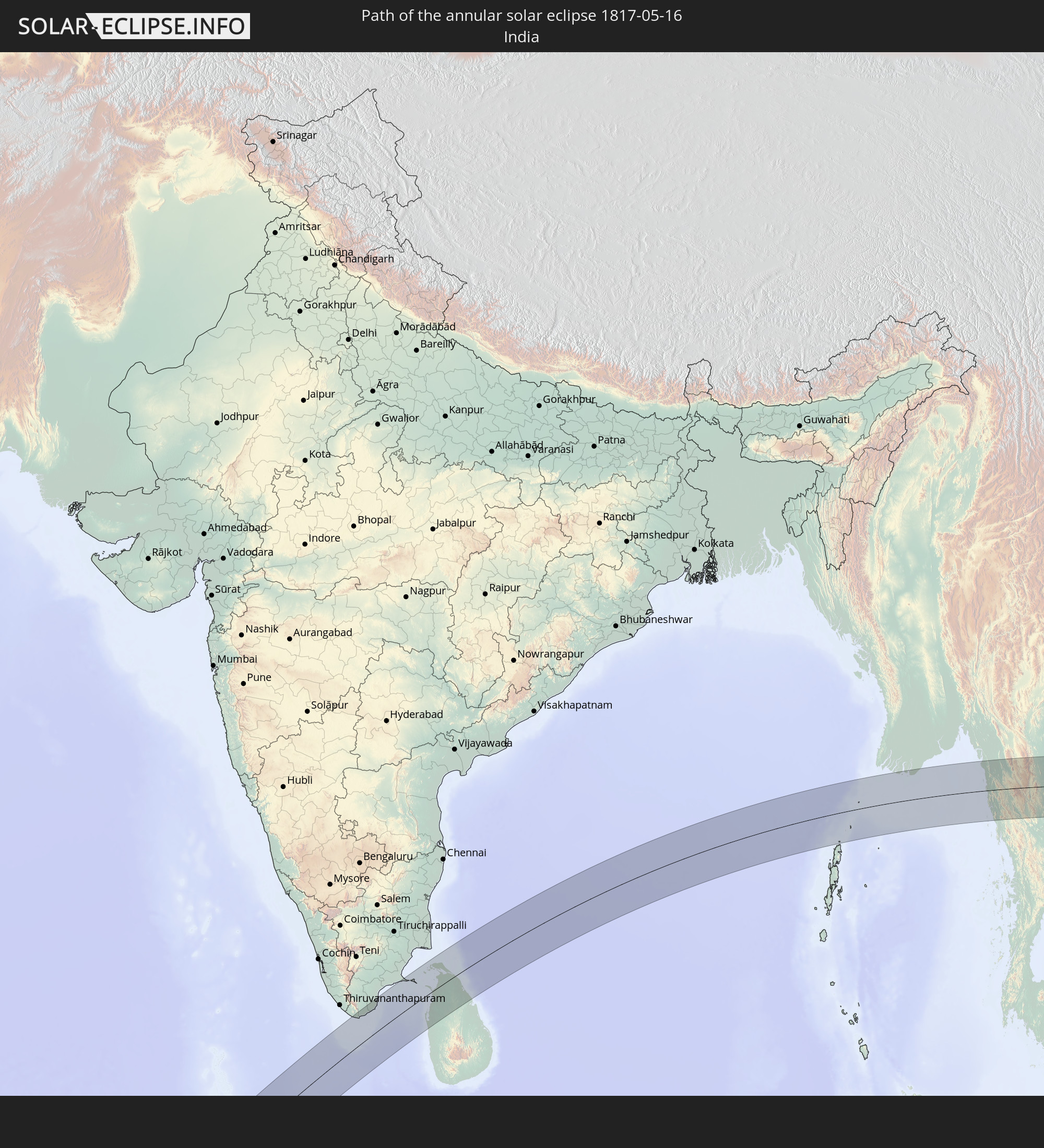 India
India
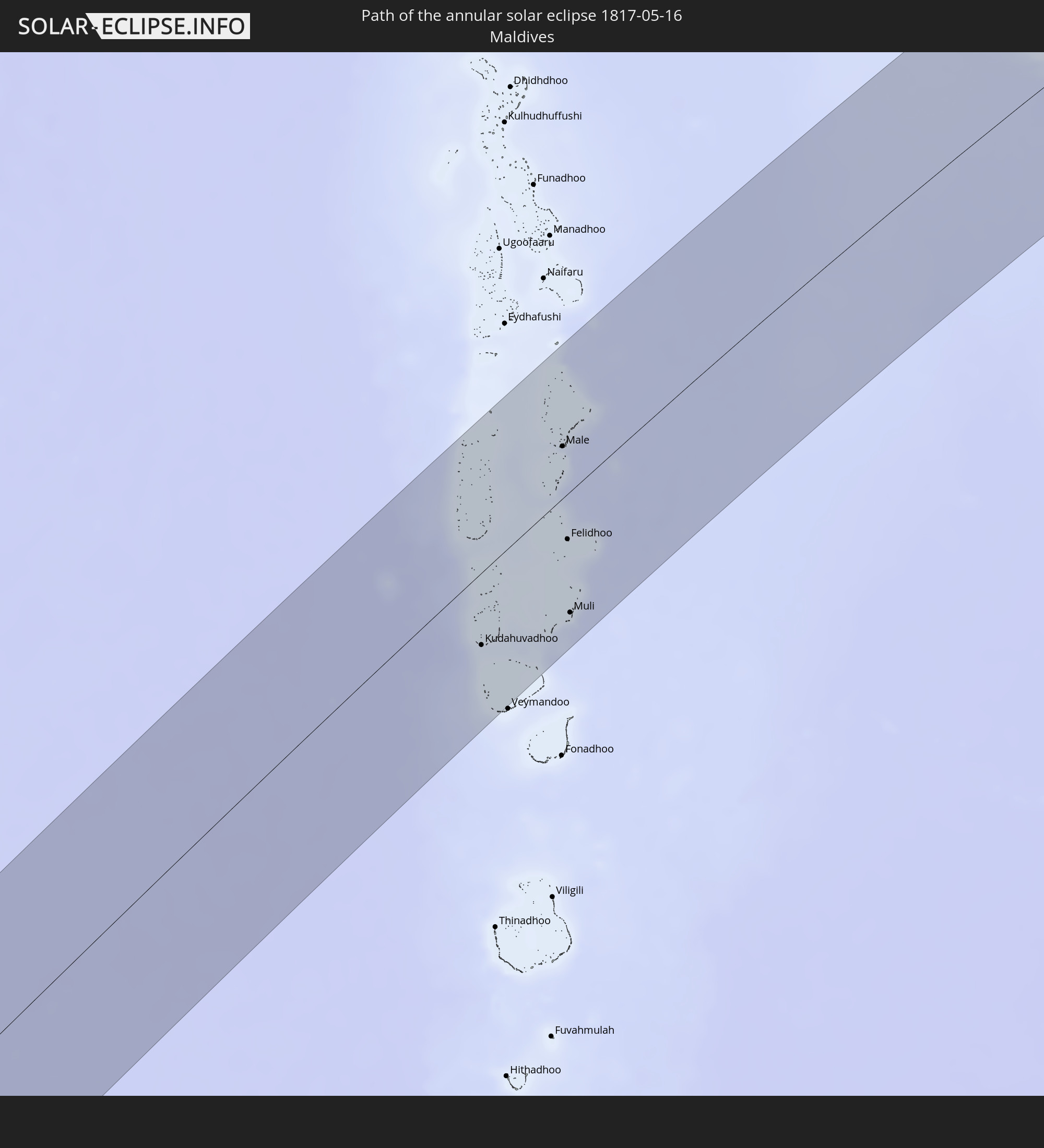 Maldives
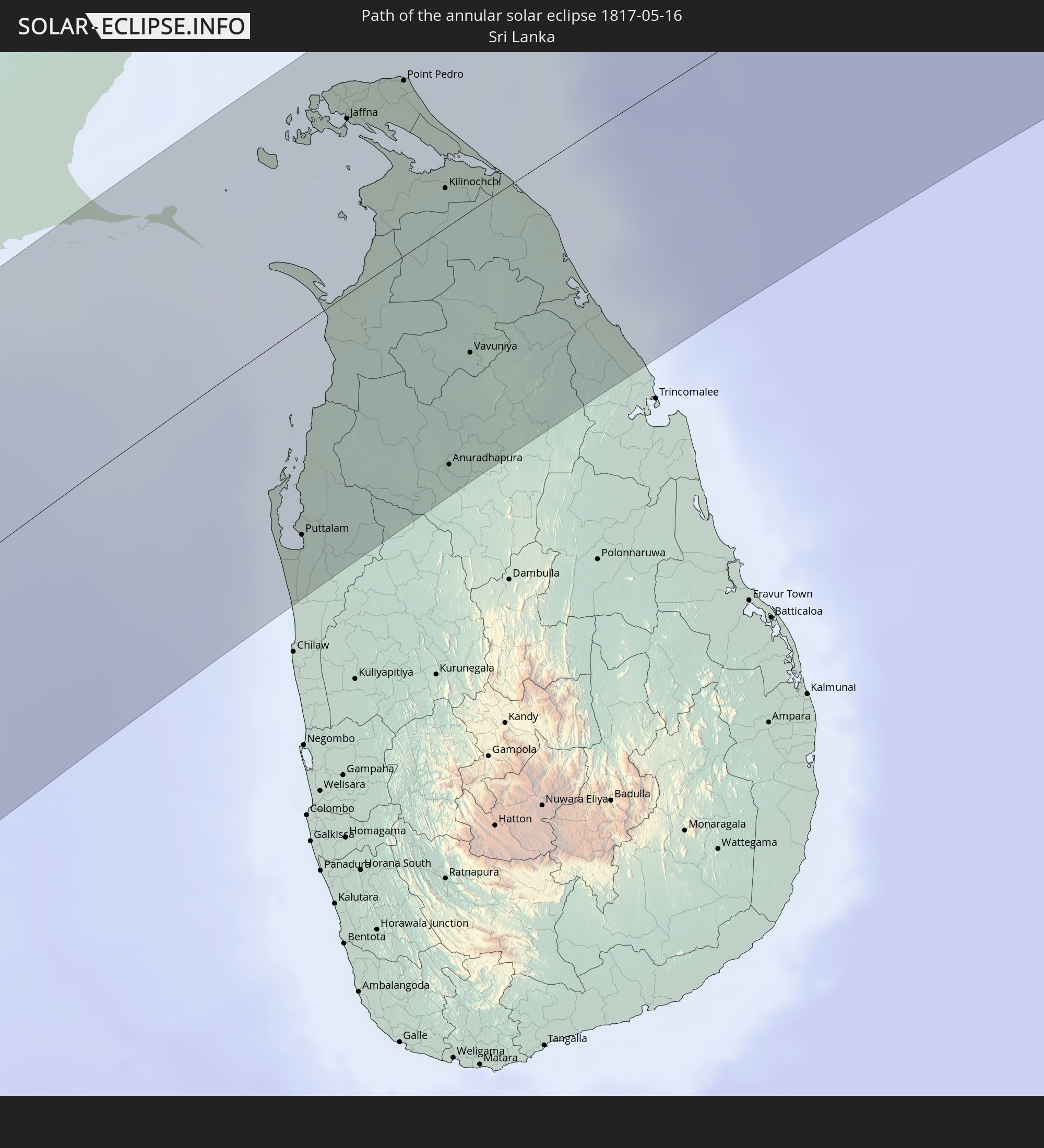 Sri Lanka
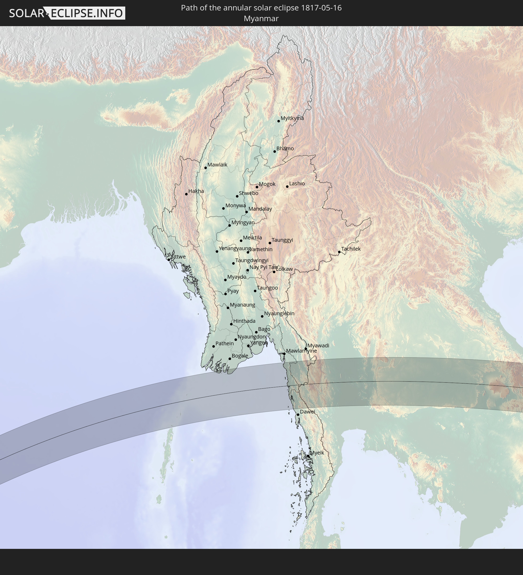 Myanmar
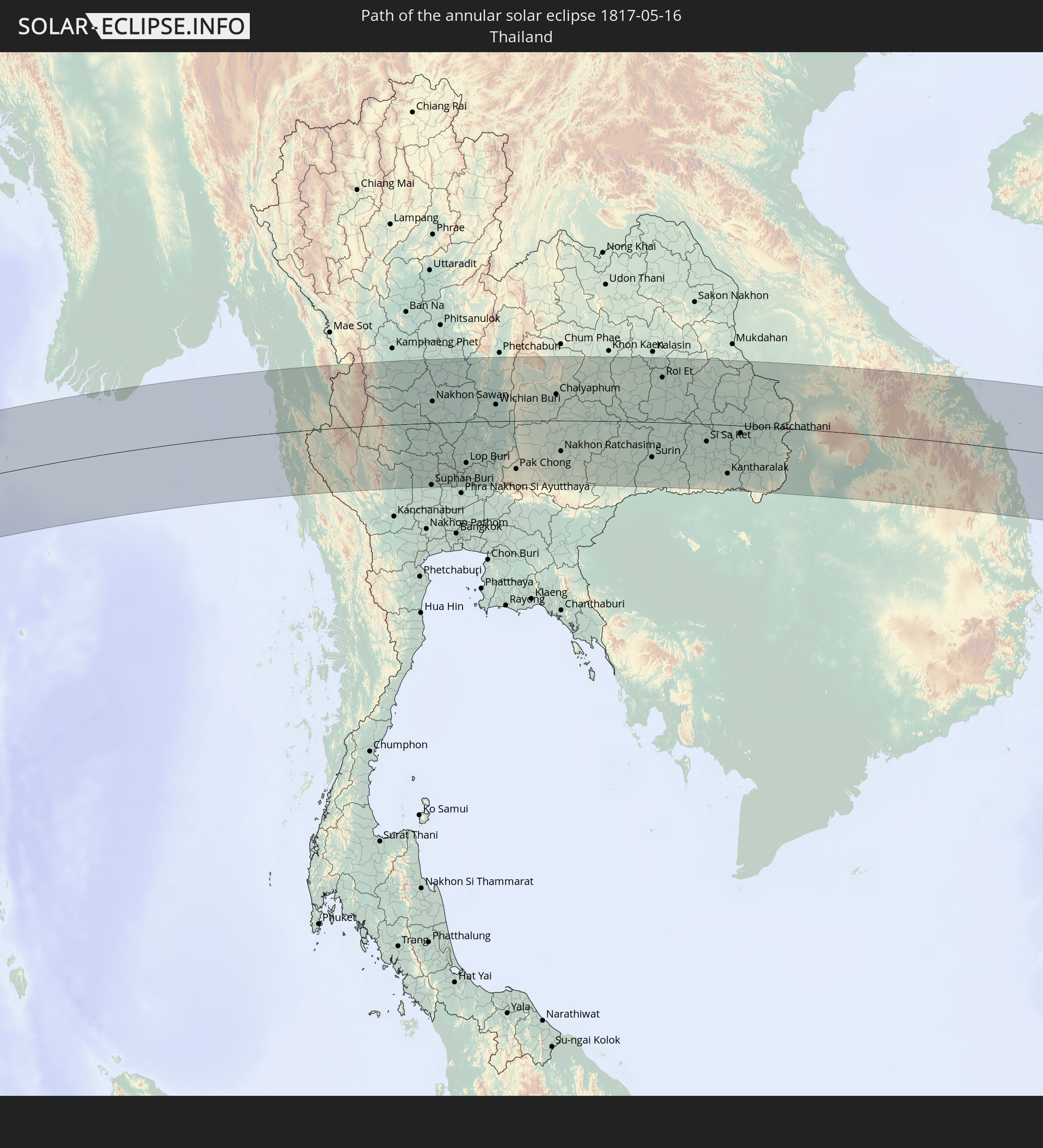 Thailand
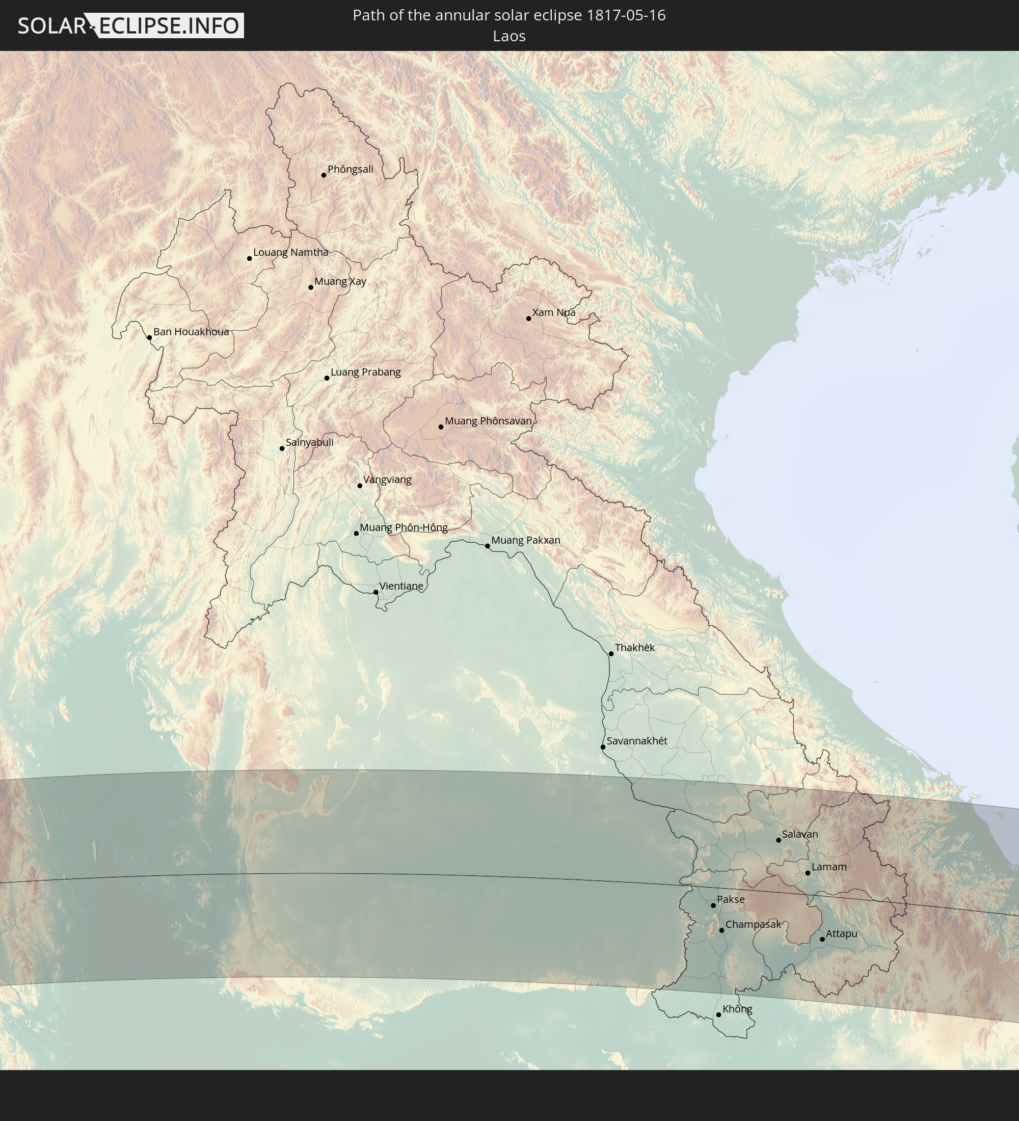 Laos
Laos
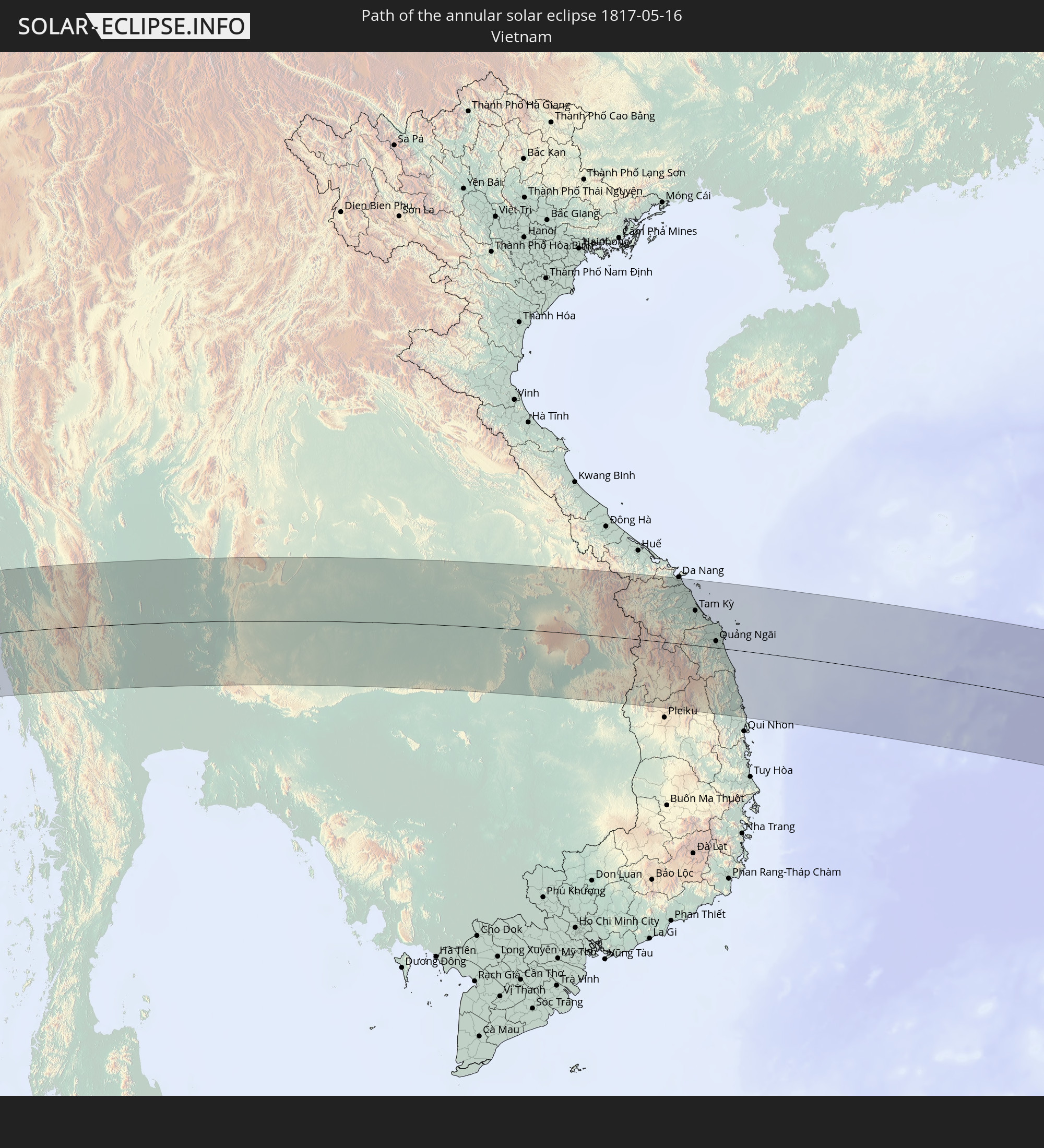 Vietnam
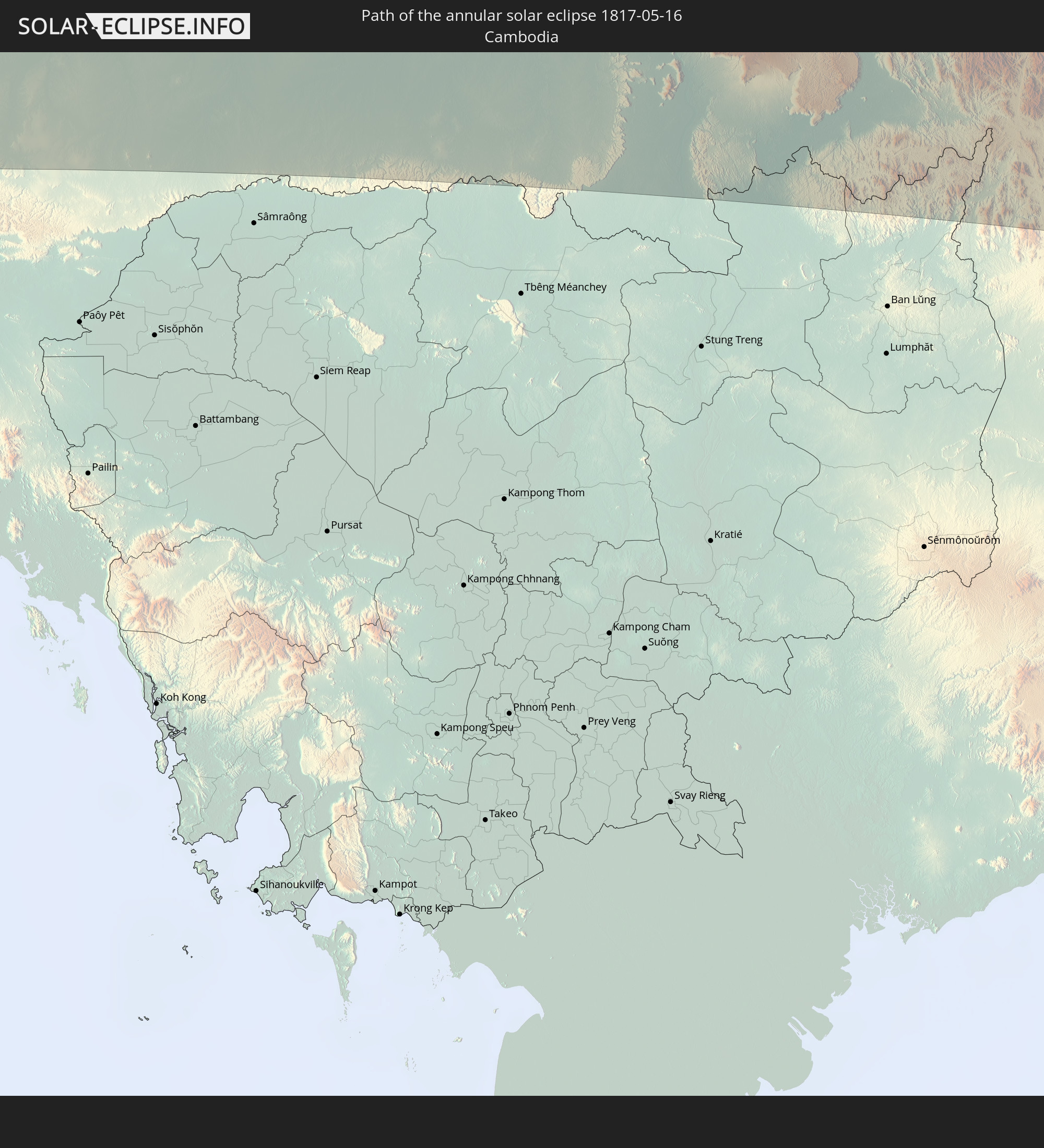 Cambodia
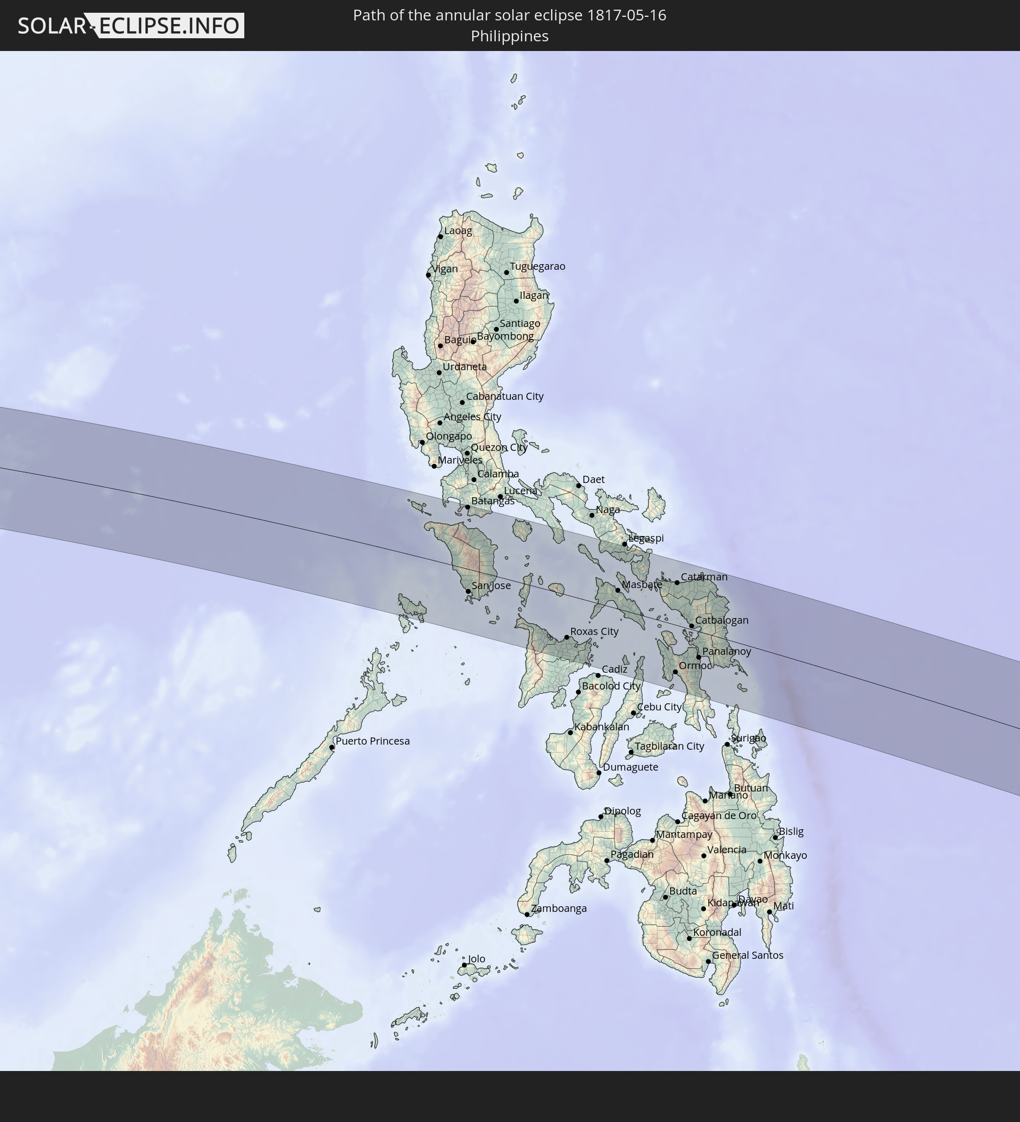 Philippines
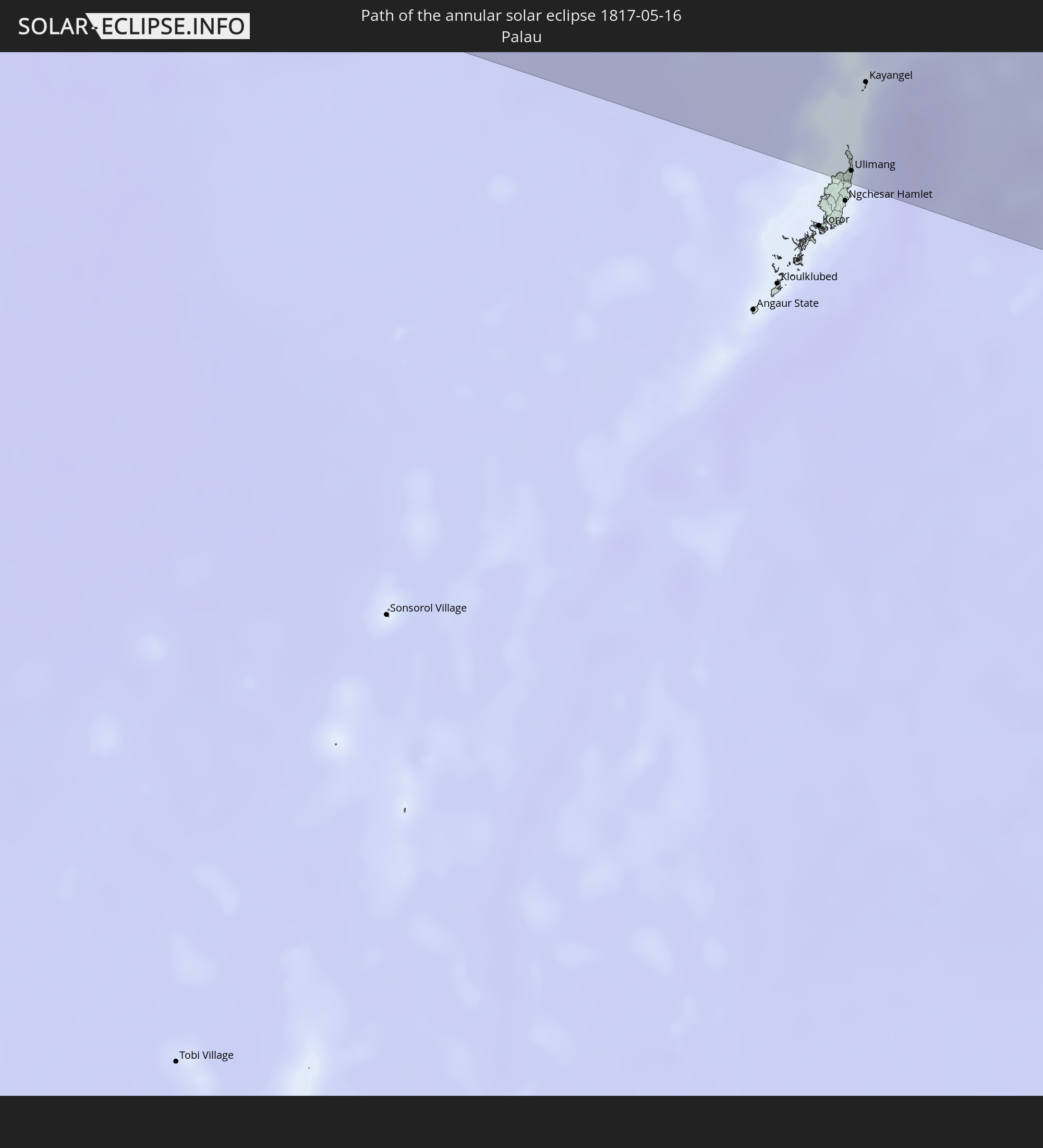 Palau
Palau
In den folgenden Ländern ist die Sonnenfinsternis partiell zu sehen
 Russia
 Equatorial Guinea
 Cameroon
 Gabon
Gabon
 Republic of the Congo
 Angola
 Namibia
 Democratic Republic of the Congo
 Central African Republic
 South Africa
 Botswana
 Sudan
Sudan
 Zambia
 Zimbabwe
 Lesotho
 Rwanda
 Burundi
 Tanzania
 Uganda
 Mozambique
 Swaziland
 Malawi
 Ethiopia
 Kenya
Kenya
 Saudi Arabia
 Eritrea
 French Southern and Antarctic Lands
 Somalia
 Djibouti
 Yemen
Yemen
 Madagascar
 Comoros
 Iran
Iran
 Mayotte
 Seychelles
 Kazakhstan
 Bahrain
 Qatar
Qatar
 United Arab Emirates
 Oman
Oman
 Turkmenistan
 Réunion
 Uzbekistan
 Mauritius
 Afghanistan
 Pakistan
 Tajikistan
 India
India
 Kyrgyzstan
 British Indian Ocean Territory
 Maldives
 China
China
 Sri Lanka
 Nepal
Nepal
 Mongolia
 Bangladesh
 Bhutan
 Myanmar
 Indonesia
 Cocos Islands
 Thailand
 Malaysia
 Laos
Laos
 Vietnam
 Cambodia
 Singapore
 Christmas Island
 Australia
 Macau
Macau
 Hong Kong
 Brunei
 Taiwan
 Philippines
 Japan
Japan
 East Timor
 North Korea
 South Korea
 Palau
Palau
 Federated States of Micronesia
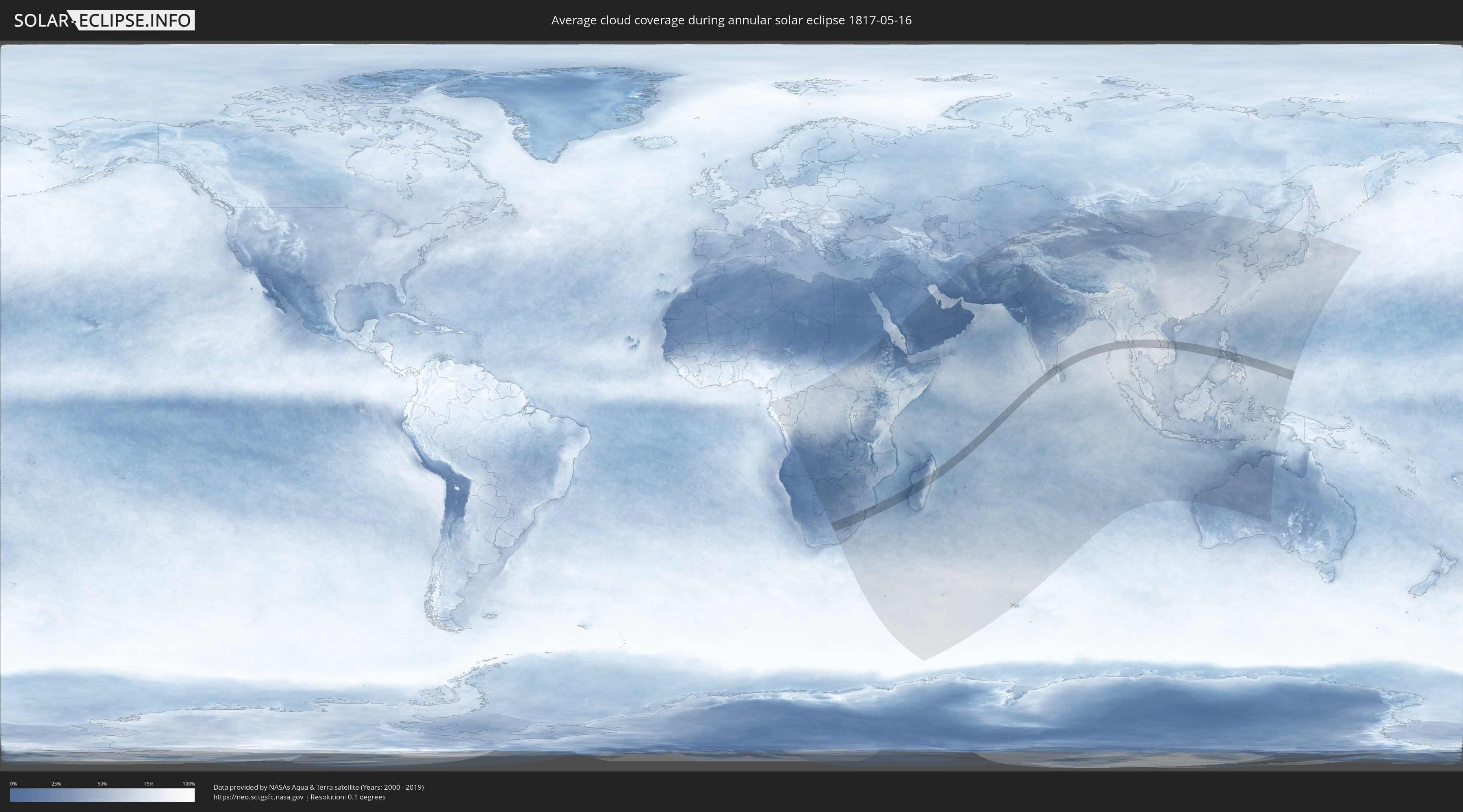
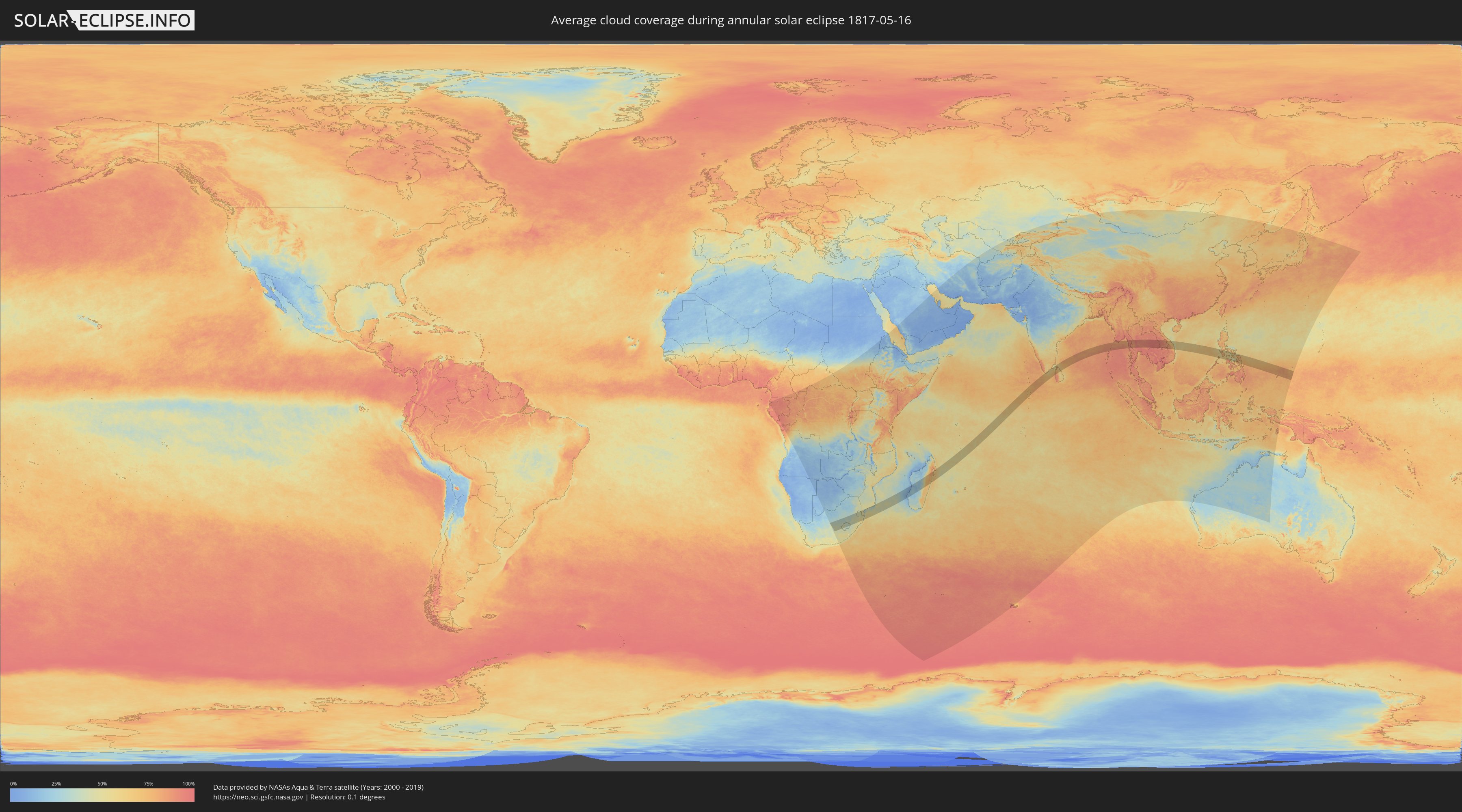
How will be the weather during the annular solar eclipse on 05/16/1817?
Where is the best place to see the annular solar eclipse of 05/16/1817?
The following maps show the average cloud coverage for the day of the annular solar eclipse.
With the help of these maps, it is possible to find the place along the eclipse path, which has the best
chance of a cloudless sky.
Nevertheless, you should consider local circumstances and inform about the weather of your chosen
observation site.
The data is provided by NASAs satellites
AQUA and TERRA.
The cloud maps are averaged over a period of 19 years (2000 - 2019).
Detailed country maps
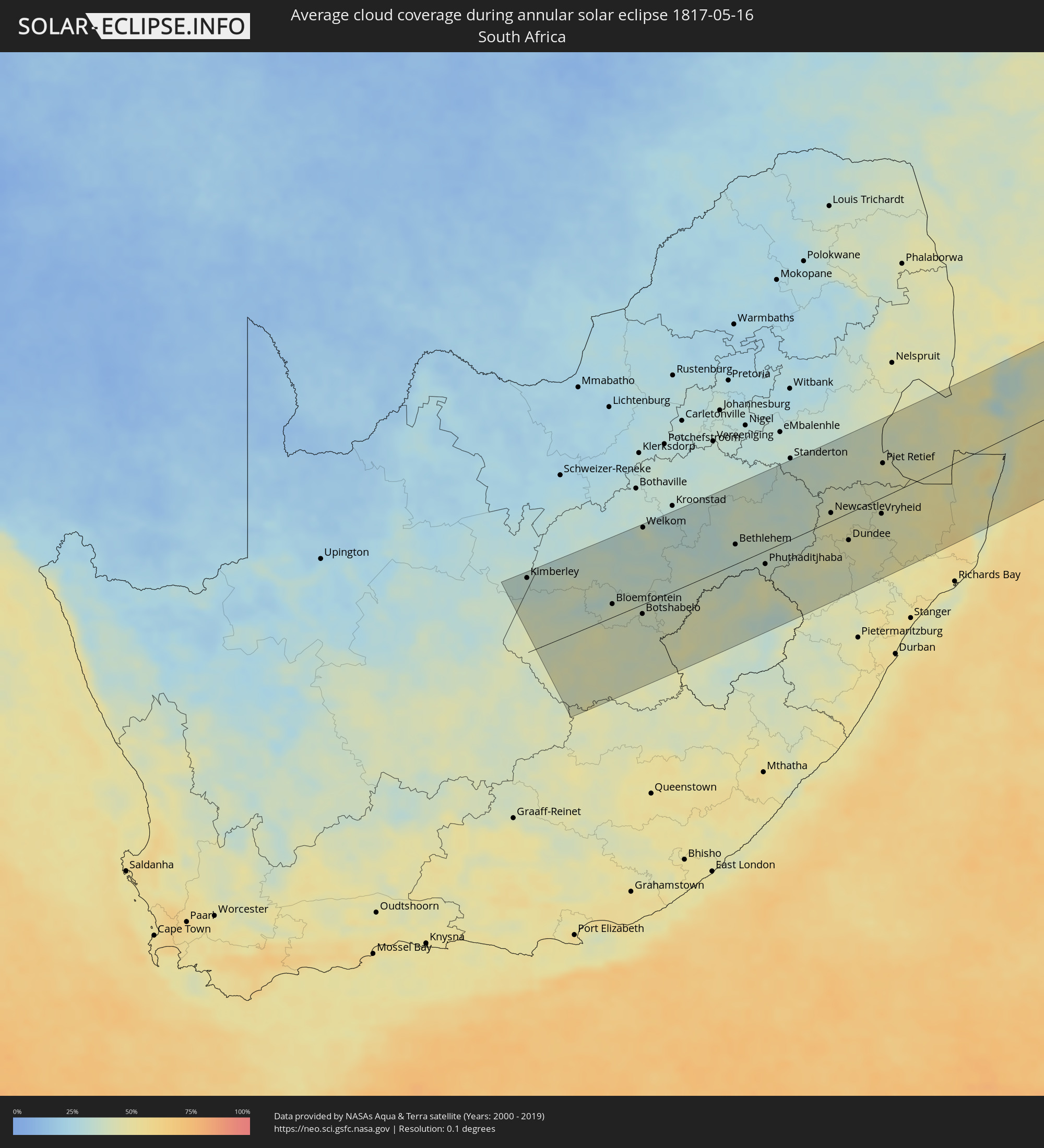 South Africa
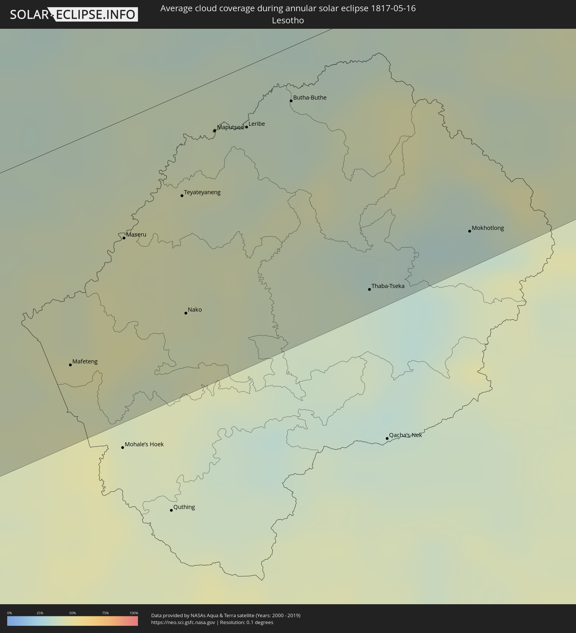 Lesotho
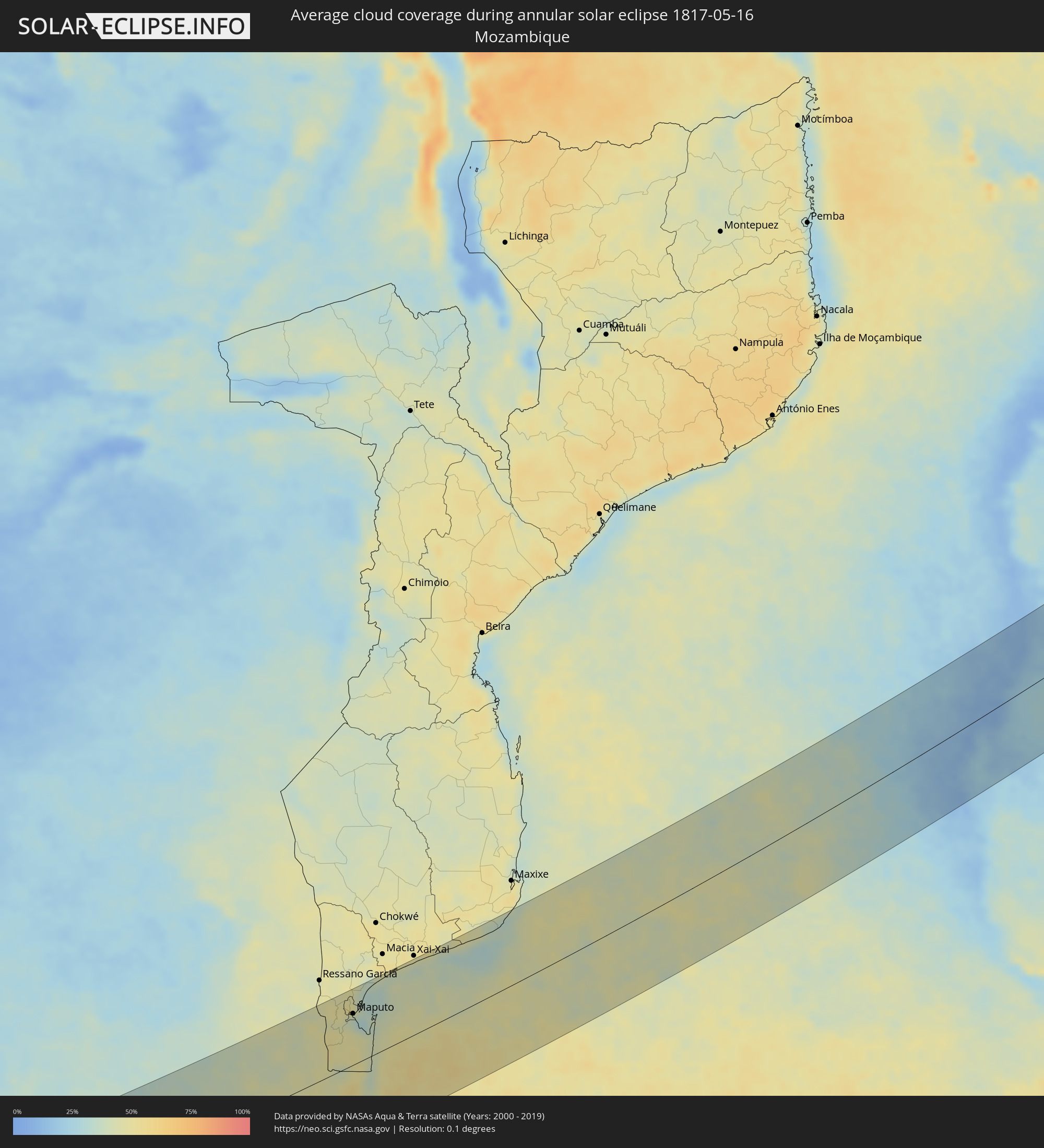 Mozambique
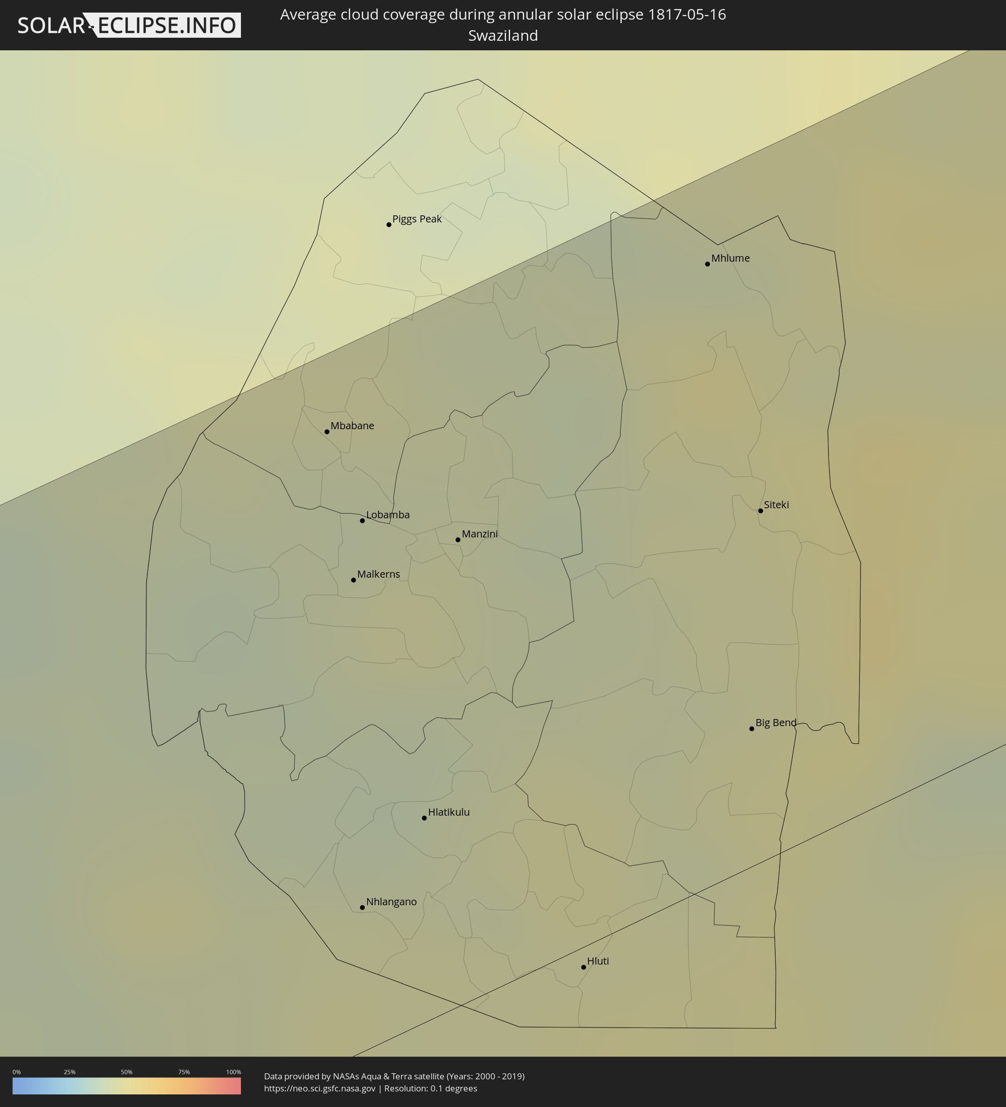 Swaziland
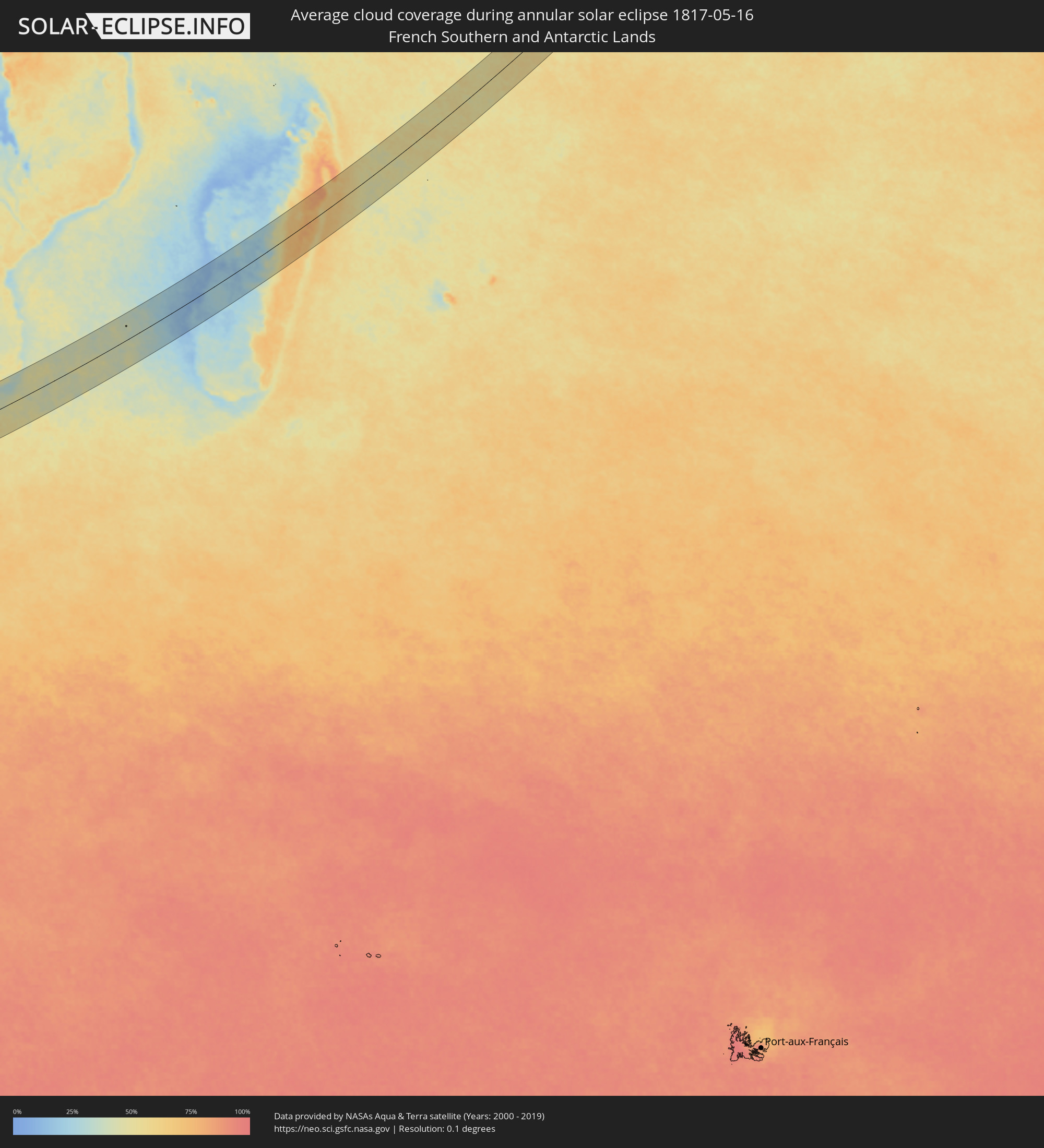 French Southern and Antarctic Lands
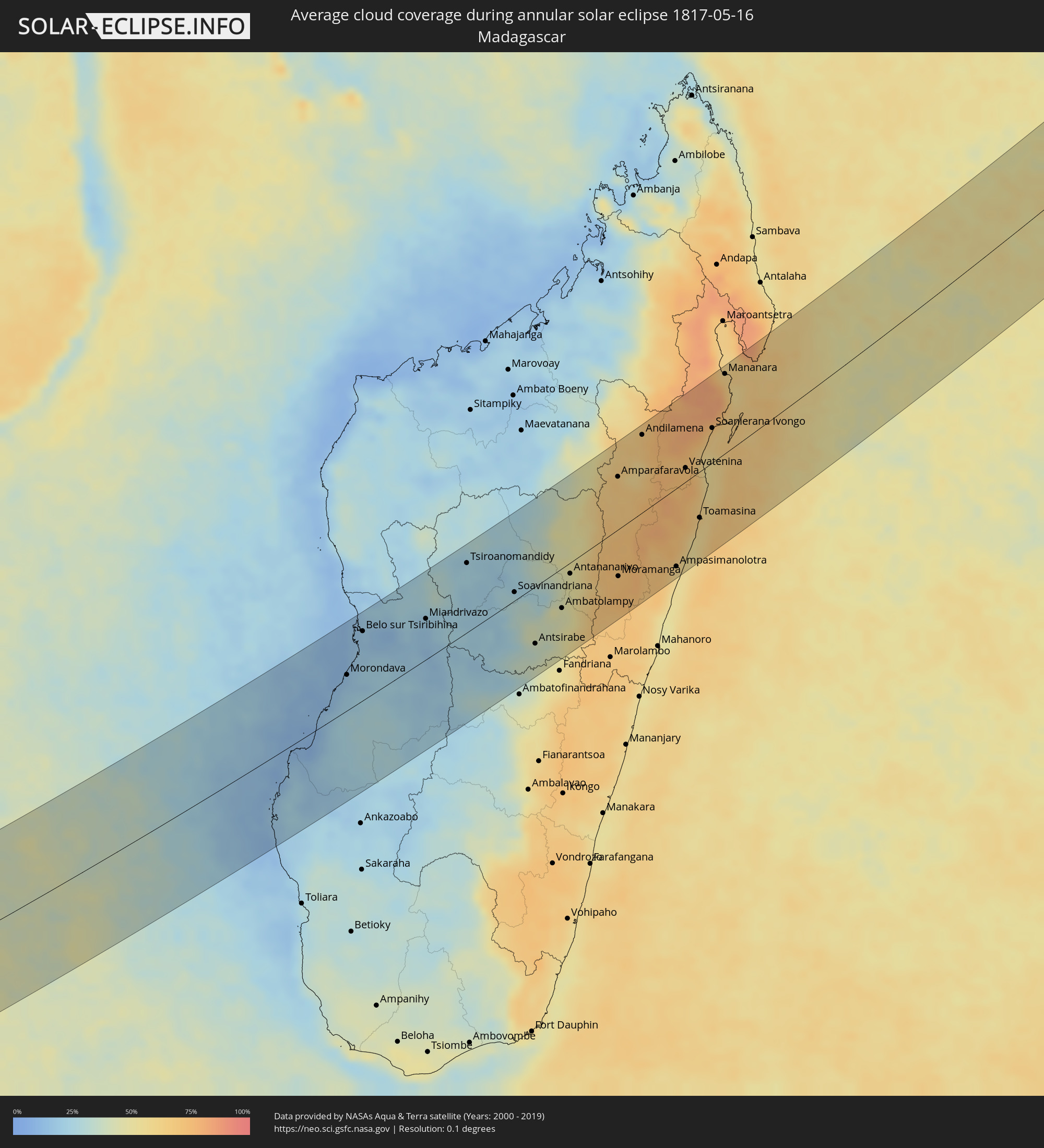 Madagascar
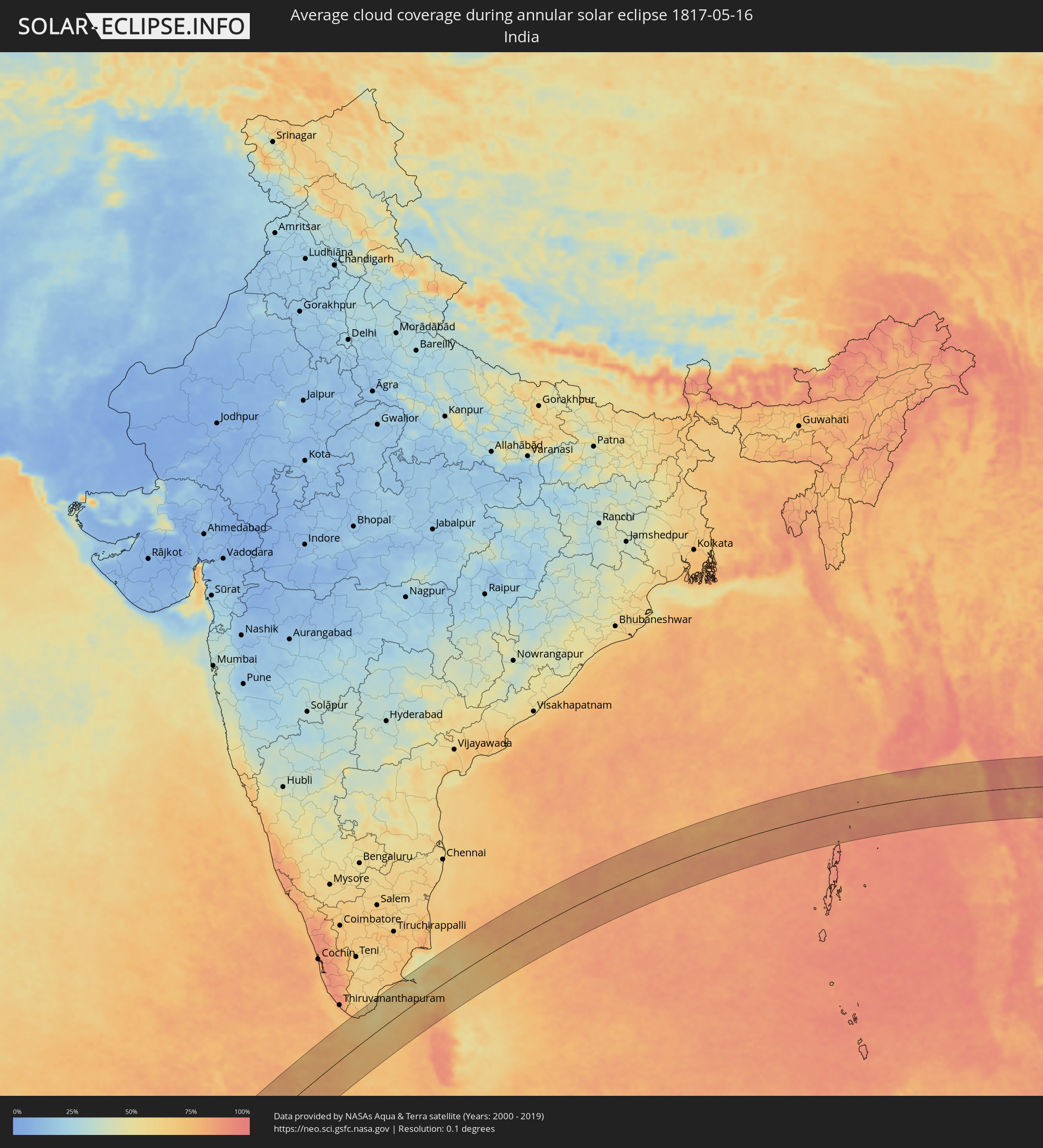 India
India
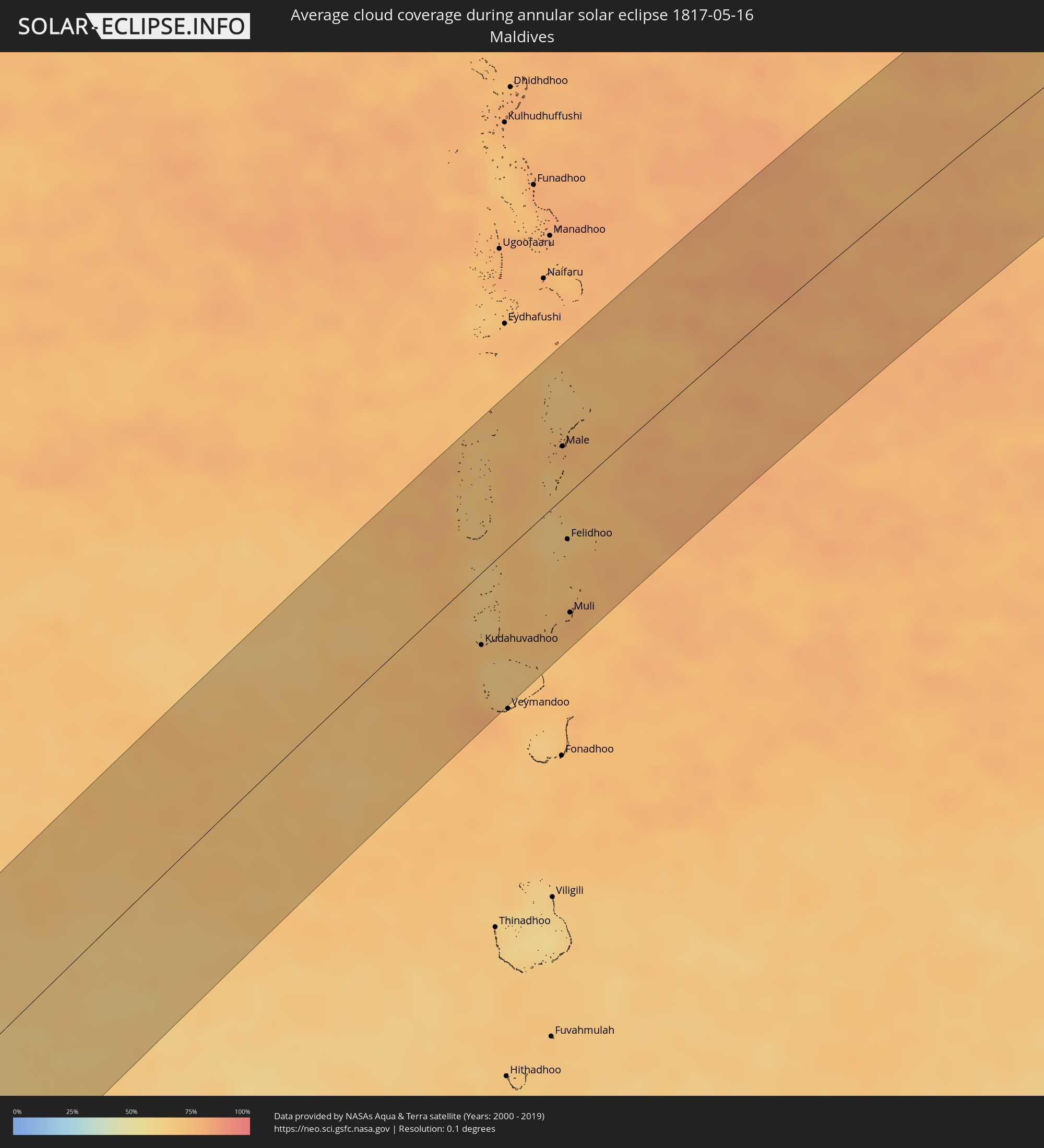 Maldives
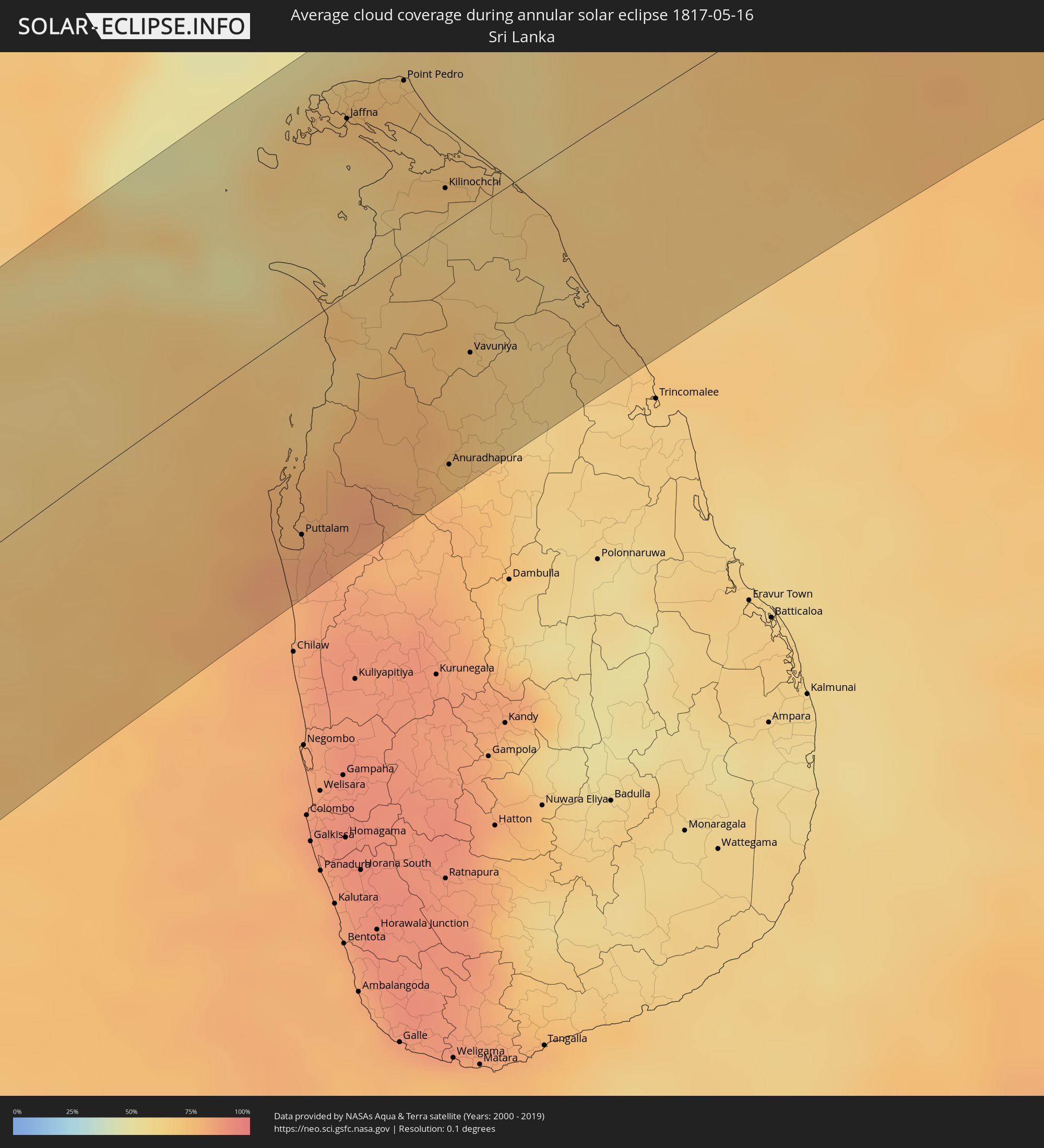 Sri Lanka
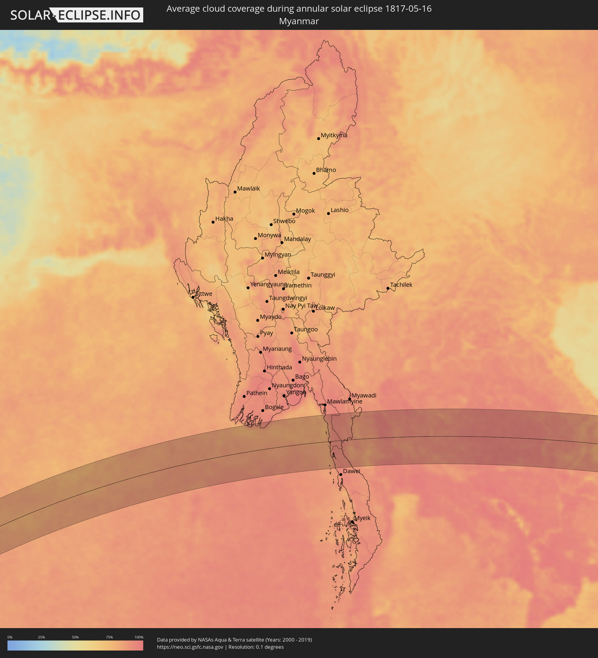 Myanmar
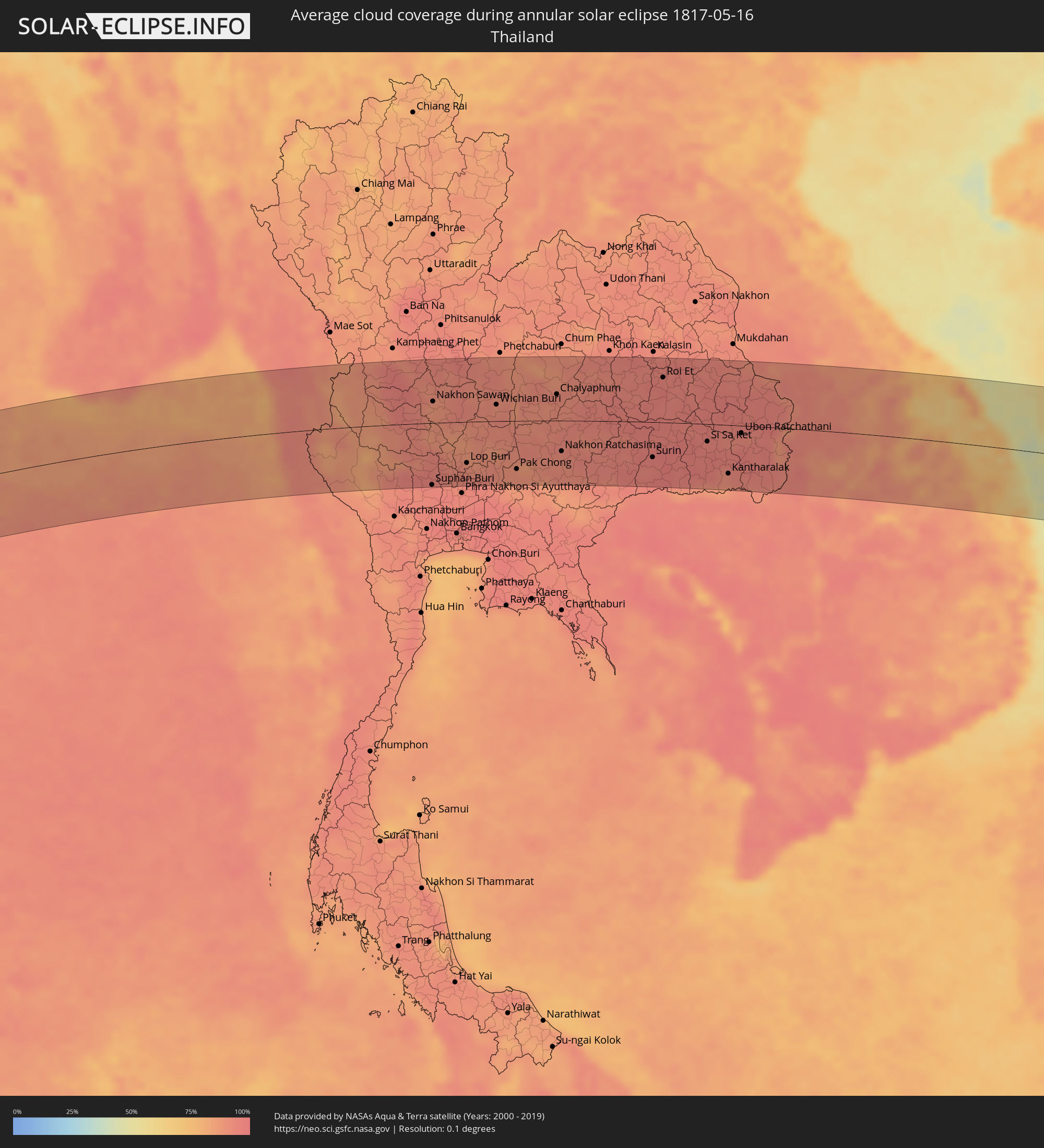 Thailand
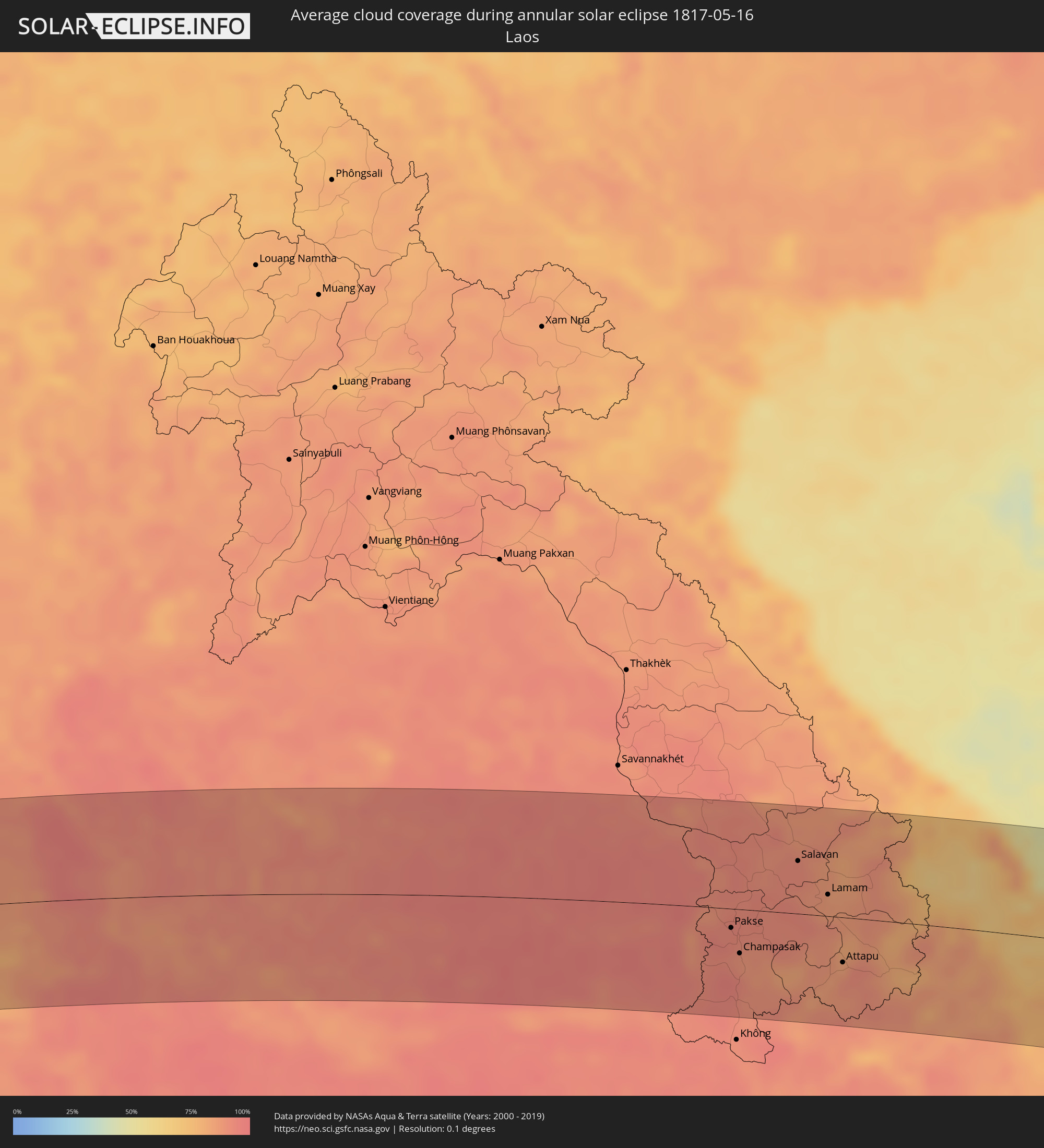 Laos
Laos
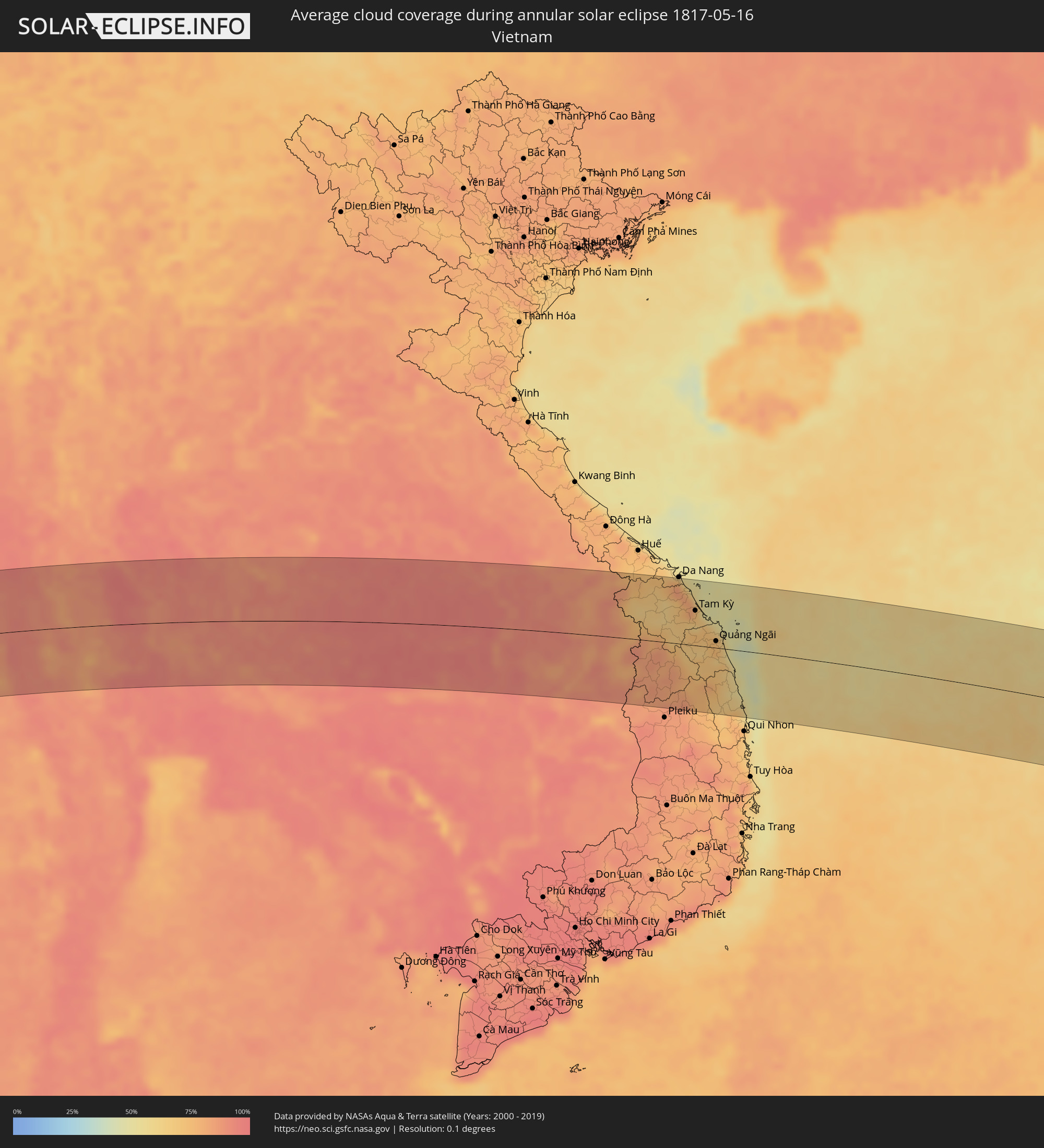 Vietnam
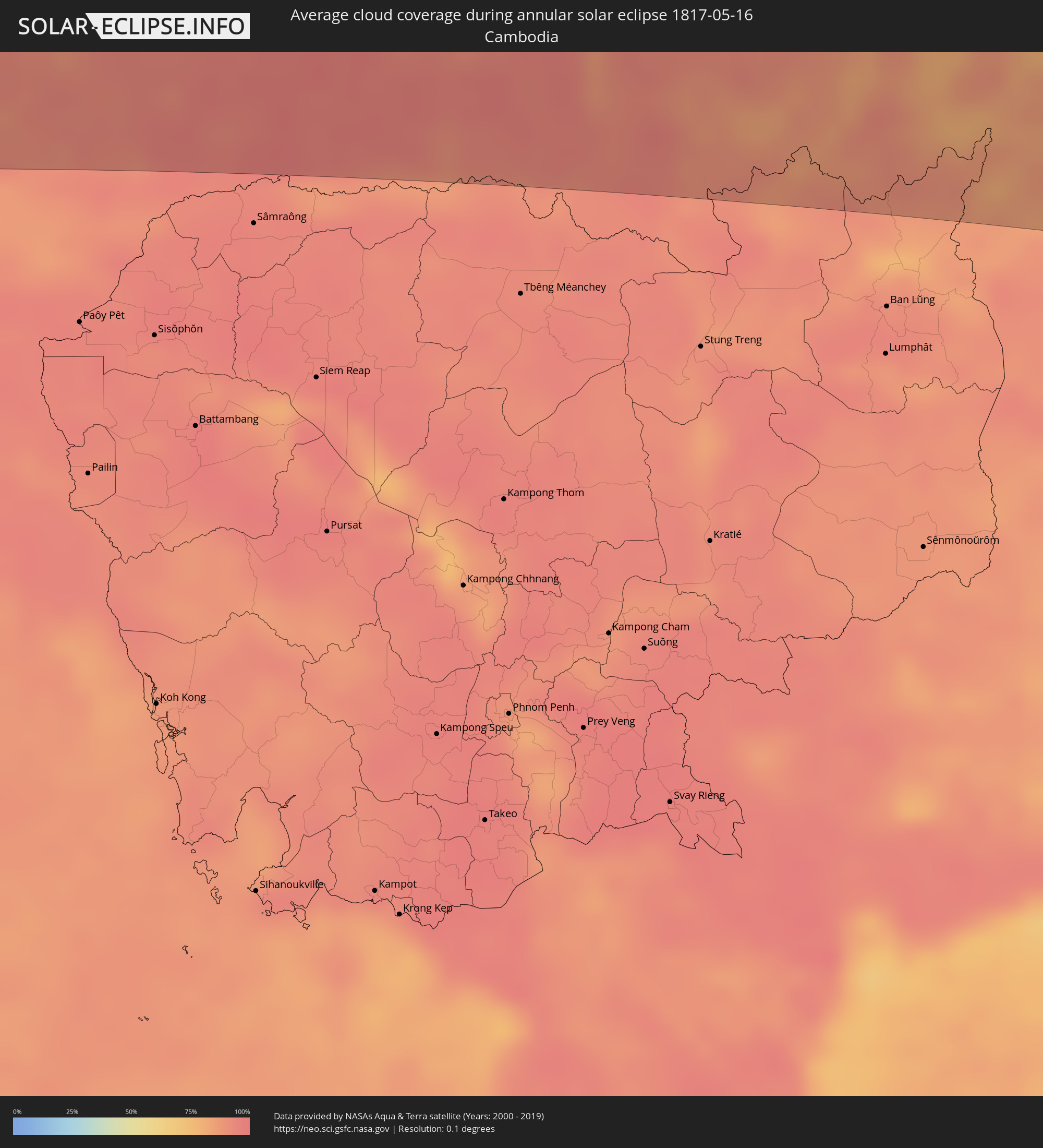 Cambodia
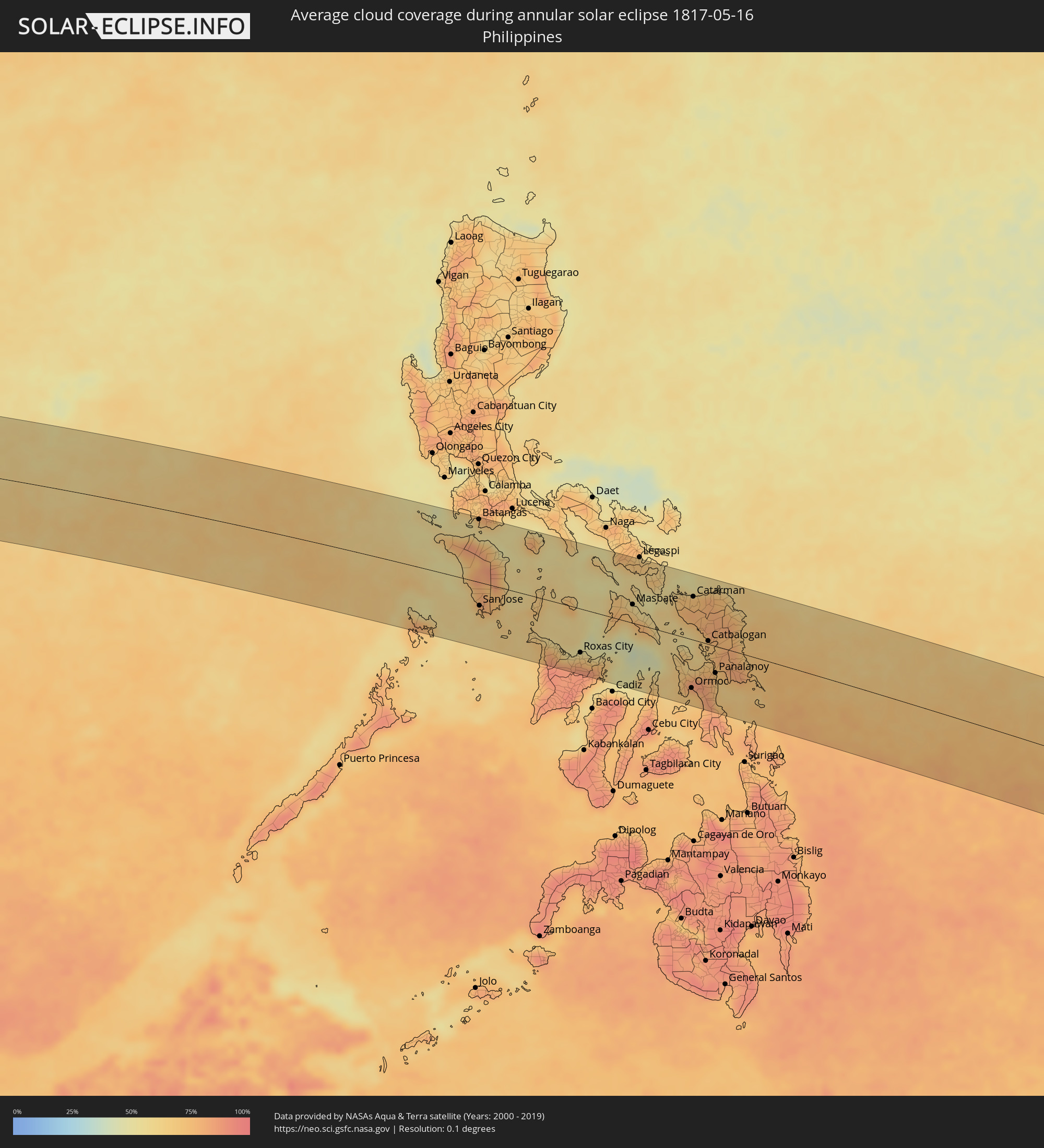 Philippines
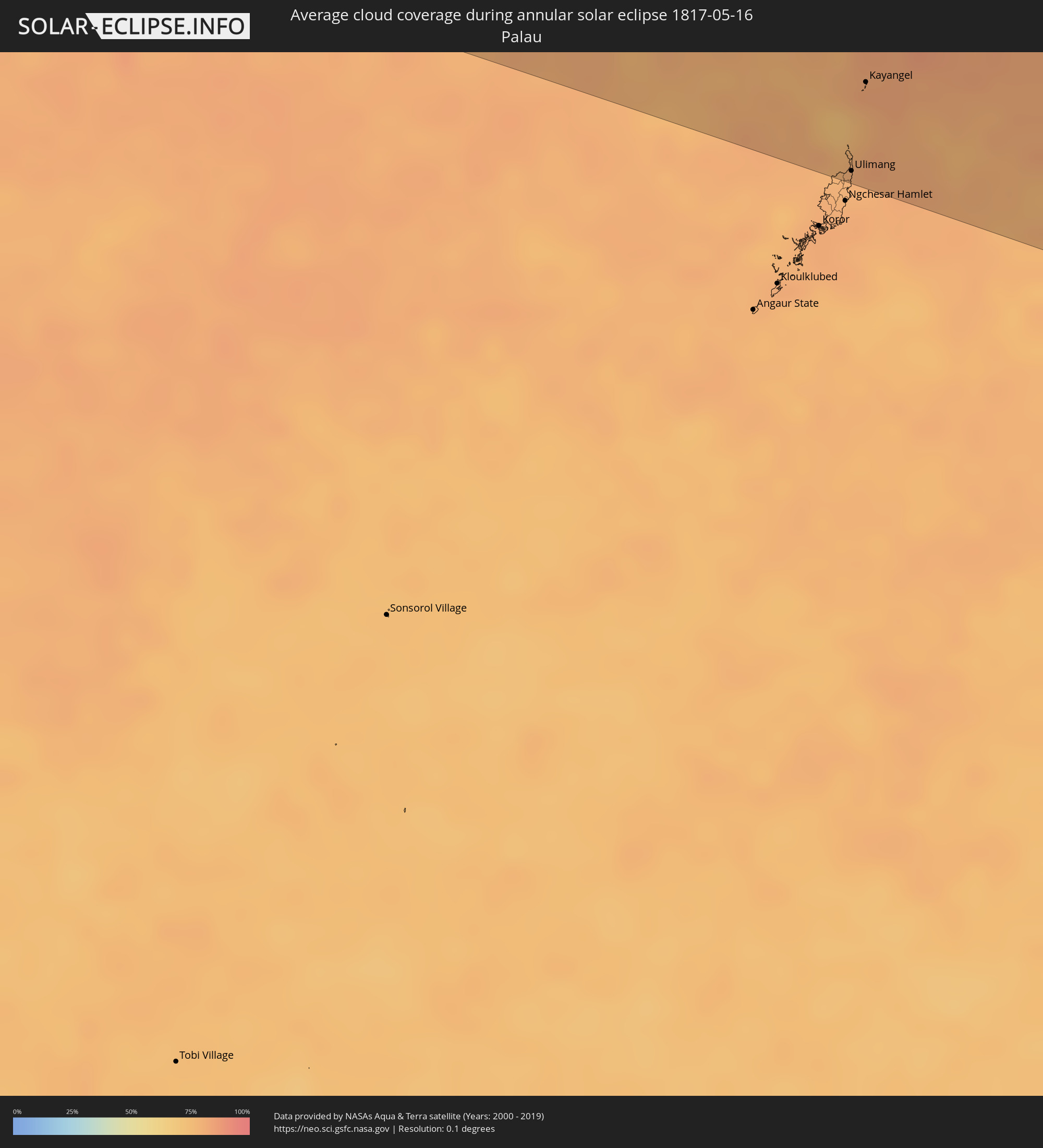 Palau
Palau
Cities inside the path of the eclipse
The following table shows all locations with a population of more than 5,000 inside the eclipse path. Cities which have more than 100,000 inhabitants are marked bold. A click at the locations opens a detailed map.
| City | Type | Eclipse duration | Local time of max. eclipse | Distance to central line | Ø Cloud coverage |
|
Kimberley, Northern Cape
|
annular | - | 06:32:29 UTC+01:30 | 114 km | 33% |
|
Bloemfontein, Orange Free State
|
annular | - | 06:32:34 UTC+01:30 | 20 km | 40% |
|
Botshabelo, Orange Free State
|
annular | - | 06:32:36 UTC+01:30 | 15 km | 39% |
|
Welkom, Orange Free State
|
annular | - | 06:32:35 UTC+01:30 | 117 km | 38% |
|
Virginia, Orange Free State
|
annular | - | 06:32:36 UTC+01:30 | 99 km | 37% |
|
Mafeteng, Mafeteng
|
annular | - | 06:32:41 UTC+01:30 | 91 km | 42% |
|
Maseru, Maseru
|
annular | - | 06:32:40 UTC+01:30 | 49 km | 44% |
|
Senekal, Orange Free State
|
annular | - | 06:32:40 UTC+01:30 | 48 km | 34% |
|
Teyateyaneng, Berea
|
annular | - | 06:32:42 UTC+01:30 | 42 km | 43% |
|
Nako, Maseru
|
annular | - | 06:32:43 UTC+01:30 | 90 km | 41% |
|
Maputsoe, Leribe
|
annular | - | 06:32:42 UTC+01:30 | 21 km | 41% |
|
Leribe, Leribe
|
annular | - | 06:32:43 UTC+01:30 | 25 km | 39% |
|
Butha-Buthe, Butha-Buthe
|
annular | - | 06:32:45 UTC+01:30 | 22 km | 37% |
|
Bethlehem, Orange Free State
|
annular | - | 06:32:45 UTC+01:30 | 30 km | 36% |
|
Thaba-Tseka, Thaba-Tseka
|
annular | - | 06:32:48 UTC+01:30 | 113 km | 36% |
|
Phuthaditjhaba, Orange Free State
|
annular | - | 06:32:49 UTC+01:30 | 20 km | 38% |
|
Mokhotlong, Mokhotlong
|
annular | - | 06:32:51 UTC+01:30 | 108 km | 33% |
|
Harrismith, Orange Free State
|
annular | - | 06:32:52 UTC+01:30 | 7 km | 37% |
|
Volksrust, Mpumalanga
|
annular | - | 06:33:01 UTC+01:30 | 54 km | 41% |
|
Newcastle, KwaZulu-Natal
|
annular | - | 06:33:00 UTC+01:30 | 12 km | 44% |
|
Dundee, KwaZulu-Natal
|
annular | - | 06:33:02 UTC+01:30 | 41 km | 44% |
|
Mondlo, KwaZulu-Natal
|
annular | - | 06:33:08 UTC+01:30 | 43 km | 43% |
|
Vryheid, KwaZulu-Natal
|
annular | - | 06:33:10 UTC+01:30 | 24 km | 43% |
|
Piet Retief, Mpumalanga
|
annular | - | 06:33:13 UTC+01:30 | 52 km | 46% |
|
Mbabane, Hhohho
|
annular | - | 06:33:21 UTC+01:30 | 108 km | 42% |
|
Malkerns, Manzini
|
annular | - | 06:33:20 UTC+01:30 | 80 km | 42% |
|
Nhlangano, Shiselweni
|
annular | - | 06:33:17 UTC+01:30 | 24 km | 45% |
|
Lobamba, Hhohho
|
annular | - | 06:33:21 UTC+01:30 | 90 km | 43% |
|
Hlatikulu, Shiselweni
|
annular | - | 06:33:19 UTC+01:30 | 34 km | 44% |
|
Manzini, Manzini
|
annular | - | 06:33:23 UTC+01:30 | 79 km | 44% |
|
Hluti, Shiselweni
|
annular | - | 06:33:22 UTC+01:30 | 4 km | 47% |
|
Mhlume, Lubombo
|
annular | - | 06:33:33 UTC+01:30 | 105 km | 47% |
|
Big Bend, Lubombo
|
annular | - | 06:33:29 UTC+01:30 | 23 km | 46% |
|
Siteki, Lubombo
|
annular | - | 06:33:31 UTC+01:30 | 59 km | 46% |
|
Matola, Maputo
|
annular | - | 07:14:03 UTC+02:10 | 86 km | 41% |
|
Maputo, Maputo City
|
annular | - | 07:14:05 UTC+02:10 | 80 km | 37% |
|
Morondava, Menabe
|
annular | - | 07:38:29 UTC+02:27 | 45 km | 17% |
|
Soavinandriana, Itasy
|
annular | - | 07:40:59 UTC+02:27 | 11 km | 29% |
|
Betafo, Vakinankaratra
|
annular | - | 07:40:38 UTC+02:27 | 58 km | 33% |
|
Faratsiho, Vakinankaratra
|
annular | - | 07:41:00 UTC+02:27 | 24 km | 34% |
|
Antsirabe, Vakinankaratra
|
annular | - | 07:40:45 UTC+02:27 | 72 km | 36% |
|
Antanifotsy, Vakinankaratra
|
annular | - | 07:41:07 UTC+02:27 | 68 km | 40% |
|
Antananarivo, Analamanga
|
annular | - | 07:41:49 UTC+02:27 | 14 km | 47% |
|
Manjakandriana, Analamanga
|
annular | - | 07:42:02 UTC+02:27 | 30 km | 60% |
|
Amparafaravola, Alaotra Mangoro
|
annular | - | 07:43:23 UTC+02:27 | 66 km | 68% |
|
Moramanga, Alaotra Mangoro
|
annular | - | 07:42:22 UTC+02:27 | 59 km | 71% |
|
Ambatondrazaka, Alaotra Mangoro
|
annular | - | 07:43:22 UTC+02:27 | 32 km | 67% |
|
Vavatenina, Analanjirofo
|
annular | - | 07:44:22 UTC+02:27 | 17 km | 73% |
|
Toamasina, Atsinanana
|
annular | - | 07:44:00 UTC+02:27 | 57 km | 60% |
|
Soanierana Ivongo, Analanjirofo
|
annular | - | 07:45:11 UTC+02:27 | 43 km | 63% |
|
Mananara, Analanjirofo
|
annular | - | 07:46:01 UTC+02:27 | 99 km | 65% |
|
Kudahuvadhoo, Dhaalu Atholhu
|
annular | - | 11:24:01 UTC+04:54 | 45 km | 72% |
|
Male, Kaafu Atoll
|
annular | - | 11:29:05 UTC+04:54 | 33 km | 77% |
|
Felidhoo, Vaavu Atholhu
|
annular | - | 11:27:35 UTC+04:54 | 28 km | 68% |
|
Muli, Meemu Atholhu
|
annular | - | 11:26:22 UTC+04:54 | 75 km | 77% |
|
Nāgercoil, Tamil Nadu
|
annular | - | 12:16:31 UTC+05:21 | 94 km | 73% |
|
Suchindram, Tamil Nadu
|
annular | - | 12:16:34 UTC+05:21 | 90 km | 71% |
|
Kanniyākumāri, Tamil Nadu
|
annular | - | 12:16:38 UTC+05:21 | 80 km | 69% |
|
Tisaiyanvilai, Tamil Nadu
|
annular | - | 12:18:09 UTC+05:21 | 79 km | 60% |
|
Sathankulam, Tamil Nadu
|
annular | - | 12:18:32 UTC+05:21 | 86 km | 60% |
|
Eral, Tamil Nadu
|
annular | - | 12:19:16 UTC+05:21 | 95 km | 59% |
|
Udankudi, Tamil Nadu
|
annular | - | 12:18:52 UTC+05:21 | 77 km | 60% |
|
Arumuganeri, Tamil Nadu
|
annular | - | 12:19:21 UTC+05:21 | 85 km | 61% |
|
Tiruchchendur, Tamil Nadu
|
annular | - | 12:19:17 UTC+05:21 | 77 km | 60% |
|
Kayalpattinam, Tamil Nadu
|
annular | - | 12:19:27 UTC+05:21 | 84 km | 61% |
|
Periyapattinam, Tamil Nadu
|
annular | - | 12:23:21 UTC+05:21 | 96 km | 67% |
|
Mandapam, Tamil Nadu
|
annular | - | 12:24:01 UTC+05:21 | 82 km | 61% |
|
Rameswaram, Tamil Nadu
|
annular | - | 12:24:38 UTC+05:21 | 72 km | 66% |
|
Puttalam, North Western
|
annular | - | 12:21:54 UTC+05:19 | 75 km | 83% |
|
Jaffna, Northern Province
|
annular | - | 12:25:57 UTC+05:19 | 63 km | 70% |
|
Valvedditturai, Northern Province
|
annular | - | 12:26:45 UTC+05:19 | 67 km | 72% |
|
Point Pedro, Northern Province
|
annular | - | 12:26:58 UTC+05:19 | 63 km | 72% |
|
Kilinochchi, Northern Province
|
annular | - | 12:26:36 UTC+05:19 | 14 km | 66% |
|
Anuradhapura, North Central
|
annular | - | 12:24:20 UTC+05:19 | 87 km | 76% |
|
Vavuniya, Northern Province
|
annular | - | 12:25:32 UTC+05:19 | 51 km | 68% |
|
Kyaikkami, Mon
|
annular | - | 14:33:30 UTC+06:24 | 95 km | 86% |
|
Suphan Buri, Suphan Buri
|
annular | - | 14:56:03 UTC+06:42 | 102 km | 94% |
|
Nakhon Sawan, Nakhon Sawan
|
annular | - | 14:56:47 UTC+06:42 | 35 km | 87% |
|
Lop Buri, Lop Buri
|
annular | - | 14:57:30 UTC+06:42 | 67 km | 90% |
|
Phra Phutthabat, Sara Buri
|
annular | - | 14:57:47 UTC+06:42 | 76 km | 92% |
|
Saraburi, Sara Buri
|
annular | - | 14:57:58 UTC+06:42 | 98 km | 94% |
|
Wichian Buri, Phetchabun
|
annular | - | 14:58:59 UTC+06:42 | 27 km | 89% |
|
Pak Chong, Nakhon Ratchasima
|
annular | - | 14:59:13 UTC+06:42 | 79 km | 90% |
|
Chaiyaphum, Chaiyaphum
|
annular | - | 15:01:06 UTC+06:42 | 43 km | 92% |
|
Nakhon Ratchasima, Nakhon Ratchasima
|
annular | - | 15:00:53 UTC+06:42 | 50 km | 91% |
|
Maha Sarakham, Maha Sarakham
|
annular | - | 15:03:57 UTC+06:42 | 87 km | 94% |
|
Surin, Surin
|
annular | - | 15:03:52 UTC+06:42 | 58 km | 95% |
|
Roi Et, Roi Et
|
annular | - | 15:04:38 UTC+06:42 | 74 km | 93% |
|
Si Sa Ket, Sisaket
|
annular | - | 15:05:41 UTC+06:42 | 29 km | 96% |
|
Kantharalak, Sisaket
|
annular | - | 15:06:09 UTC+06:42 | 80 km | 90% |
|
Ubon Ratchathani, Changwat Ubon Ratchathani
|
annular | - | 15:06:46 UTC+06:42 | 12 km | 94% |
|
Pakse, Champasak
|
annular | - | 15:08:34 UTC+06:42 | 19 km | 92% |
|
Champasak, Champasak
|
annular | - | 15:08:39 UTC+06:42 | 44 km | 88% |
|
Salavan, Salavan
|
annular | - | 15:09:53 UTC+06:42 | 52 km | 91% |
|
Lamam, Xékong
|
annular | - | 15:10:19 UTC+06:42 | 21 km | 86% |
|
Attapu, Attapu
|
annular | - | 15:10:25 UTC+06:42 | 45 km | 89% |
|
Kon Tum, Kon Tum
|
annular | - | 15:37:01 UTC+07:06 | 83 km | 83% |
|
Hội An, Quảng Nam
|
annular | - | 15:37:53 UTC+07:06 | 89 km | 81% |
|
Tam Kỳ, Quảng Nam
|
annular | - | 15:38:04 UTC+07:06 | 57 km | 70% |
|
Quảng Ngãi, Quảng Ngãi
|
annular | - | 15:38:31 UTC+07:06 | 11 km | 75% |
|
Sablayan, Mimaropa
|
annular | - | 16:46:36 UTC+08:00 | 3 km | 65% |
|
Batangas, Calabarzon
|
annular | - | 16:46:49 UTC+08:00 | 110 km | 77% |
|
San Jose, Mimaropa
|
annular | - | 16:46:51 UTC+08:00 | 41 km | 76% |
|
Calapan, Mimaropa
|
annular | - | 16:46:56 UTC+08:00 | 76 km | 66% |
|
Pinamalayan, Mimaropa
|
annular | - | 16:47:10 UTC+08:00 | 44 km | 59% |
|
Pandan, Western Visayas
|
annular | - | 16:47:41 UTC+08:00 | 78 km | 71% |
|
Kalibo (poblacion), Western Visayas
|
annular | - | 16:47:53 UTC+08:00 | 75 km | 64% |
|
Roxas City, Western Visayas
|
annular | - | 16:48:10 UTC+08:00 | 77 km | 67% |
|
Masbate, Bicol
|
annular | - | 16:48:48 UTC+08:00 | 32 km | 62% |
|
Sorsogon, Bicol
|
annular | - | 16:49:02 UTC+08:00 | 108 km | 64% |
|
Calbayog City, Eastern Visayas
|
annular | - | 16:49:27 UTC+08:00 | 28 km | 66% |
|
Ormoc, Eastern Visayas
|
annular | - | 16:49:27 UTC+08:00 | 85 km | 72% |
|
Catarman, Eastern Visayas
|
annular | - | 16:49:28 UTC+08:00 | 76 km | 72% |
|
Catbalogan, Eastern Visayas
|
annular | - | 16:49:38 UTC+08:00 | 5 km | 70% |
|
Panalanoy, Eastern Visayas
|
annular | - | 16:49:42 UTC+08:00 | 47 km | 71% |
|
Ngardmau, Ngardmau
|
annular | - | 17:53:15 UTC+09:00 | 119 km | 78% |
|
Mengellang, Ngarchelong
|
annular | - | 17:53:16 UTC+09:00 | 108 km | 78% |
|
Ulimang, Ngaraard
|
annular | - | 17:53:16 UTC+09:00 | 115 km | 78% |
|
Kayangel, Kayangel
|
annular | - | 17:53:19 UTC+09:00 | 64 km | 81% |