Annular solar eclipse of 12/24/2364
| Day of week: | Thursday |
| Maximum duration of eclipse: | 03m48s |
| Maximum width of eclipse path: | 139 km |
| Saros cycle: | 157 |
| Coverage: | 96.8% |
| Magnitude: | 0.9683 |
| Gamma: | 0.5752 |
Wo kann man die Sonnenfinsternis vom 12/24/2364 sehen?
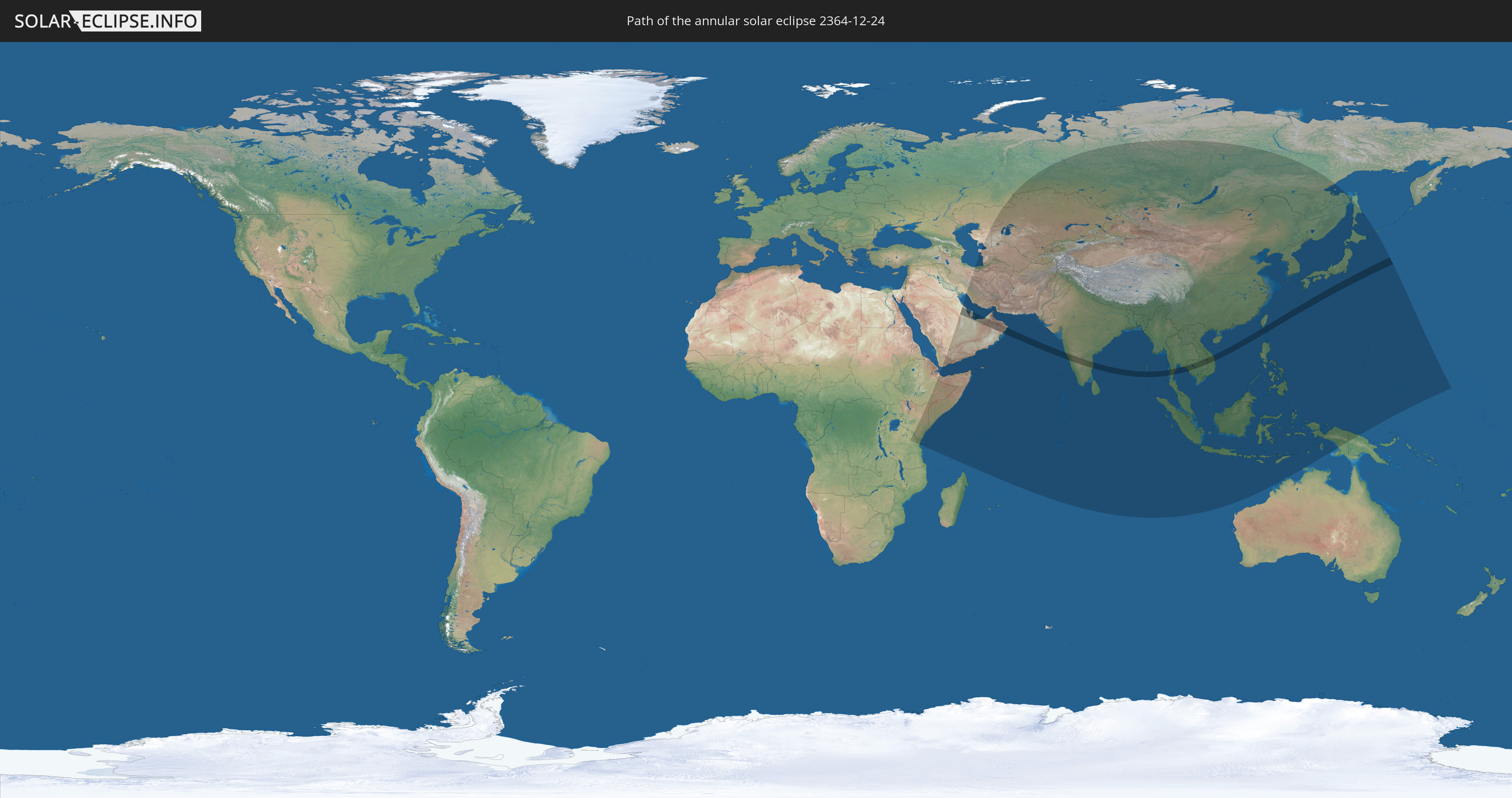
Die Sonnenfinsternis am 12/24/2364 kann man in 56 Ländern als partielle Sonnenfinsternis beobachten.
Der Finsternispfad verläuft durch 13 Länder. Nur in diesen Ländern ist sie als annular Sonnenfinsternis zu sehen.
In den folgenden Ländern ist die Sonnenfinsternis annular zu sehen
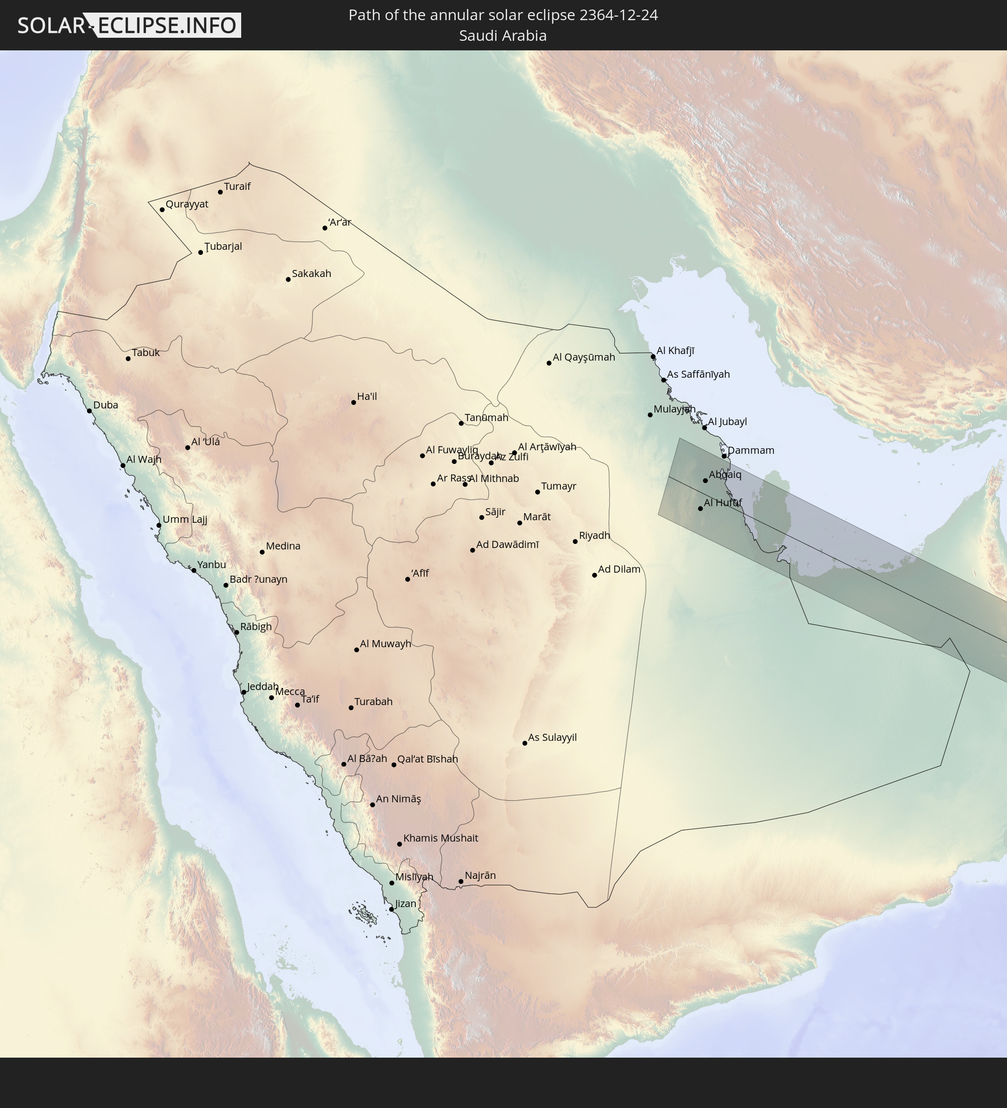 Saudi Arabia
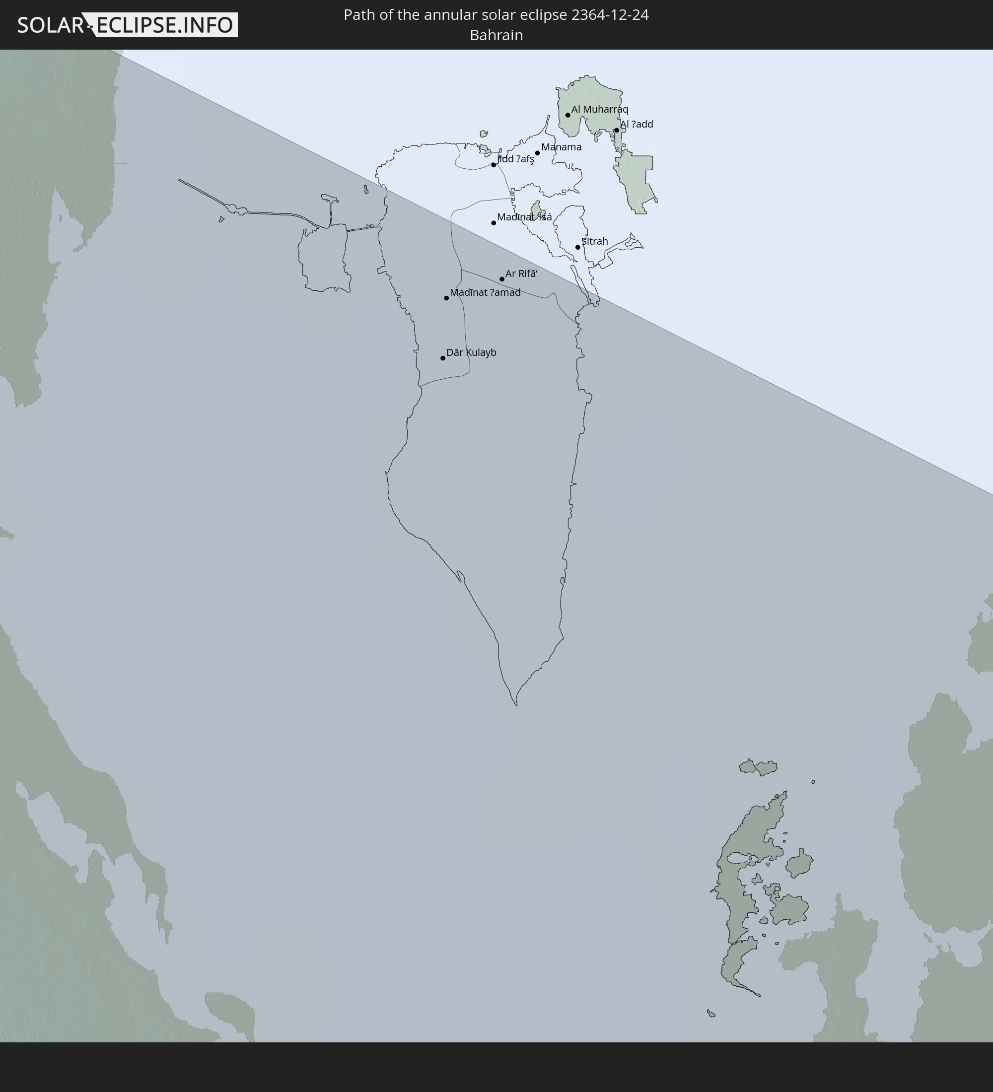 Bahrain
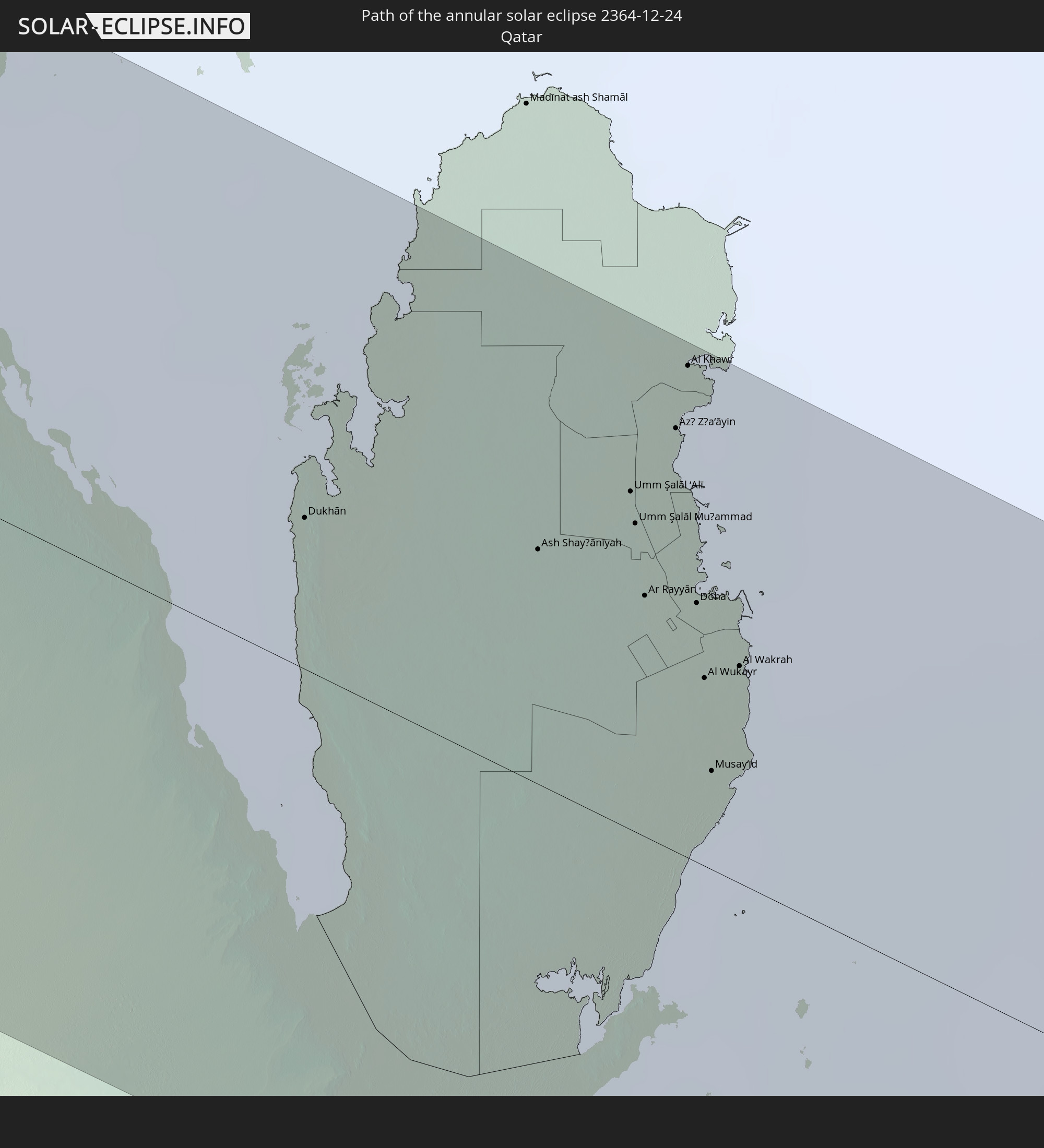 Qatar
Qatar
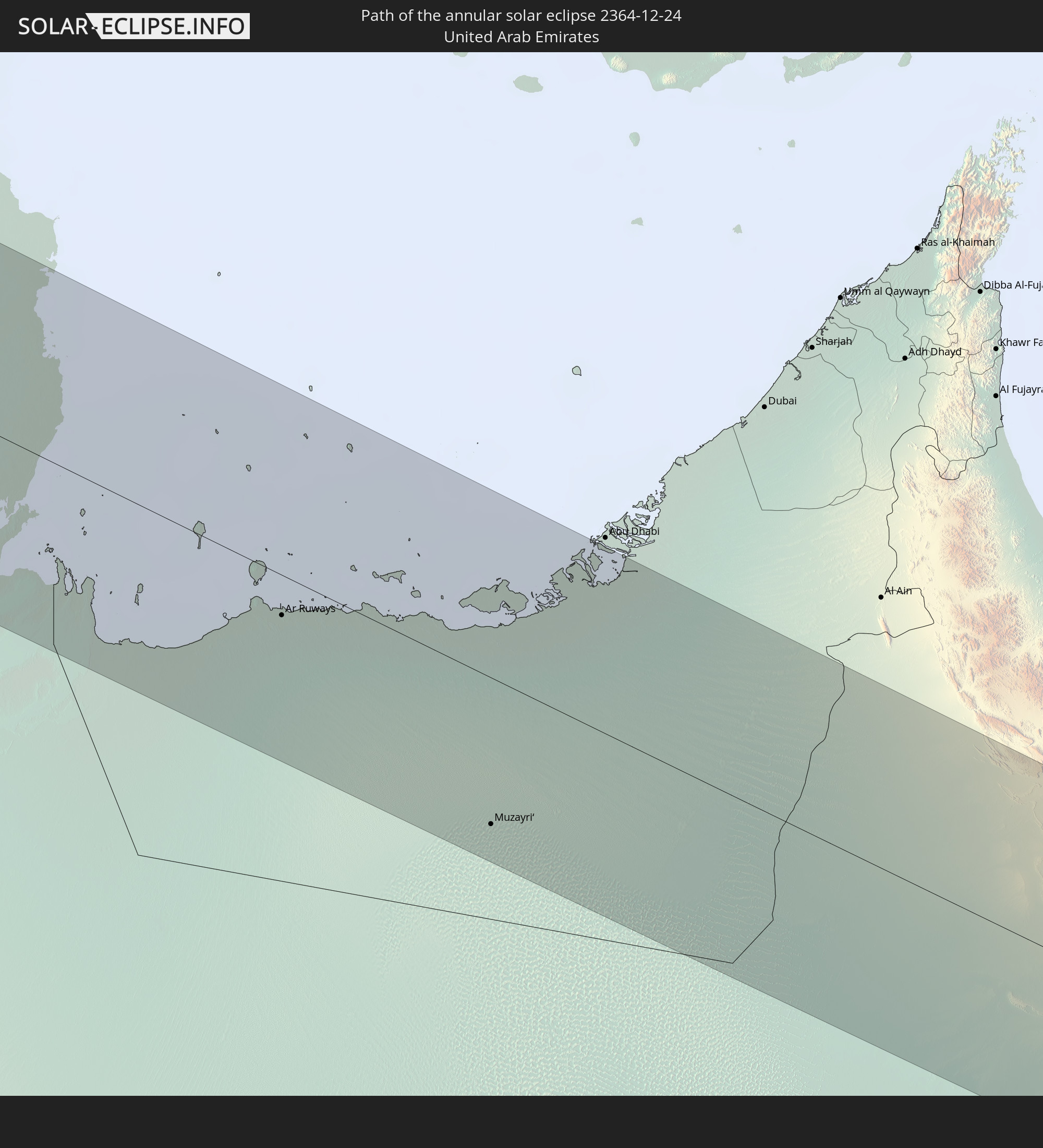 United Arab Emirates
 Oman
Oman
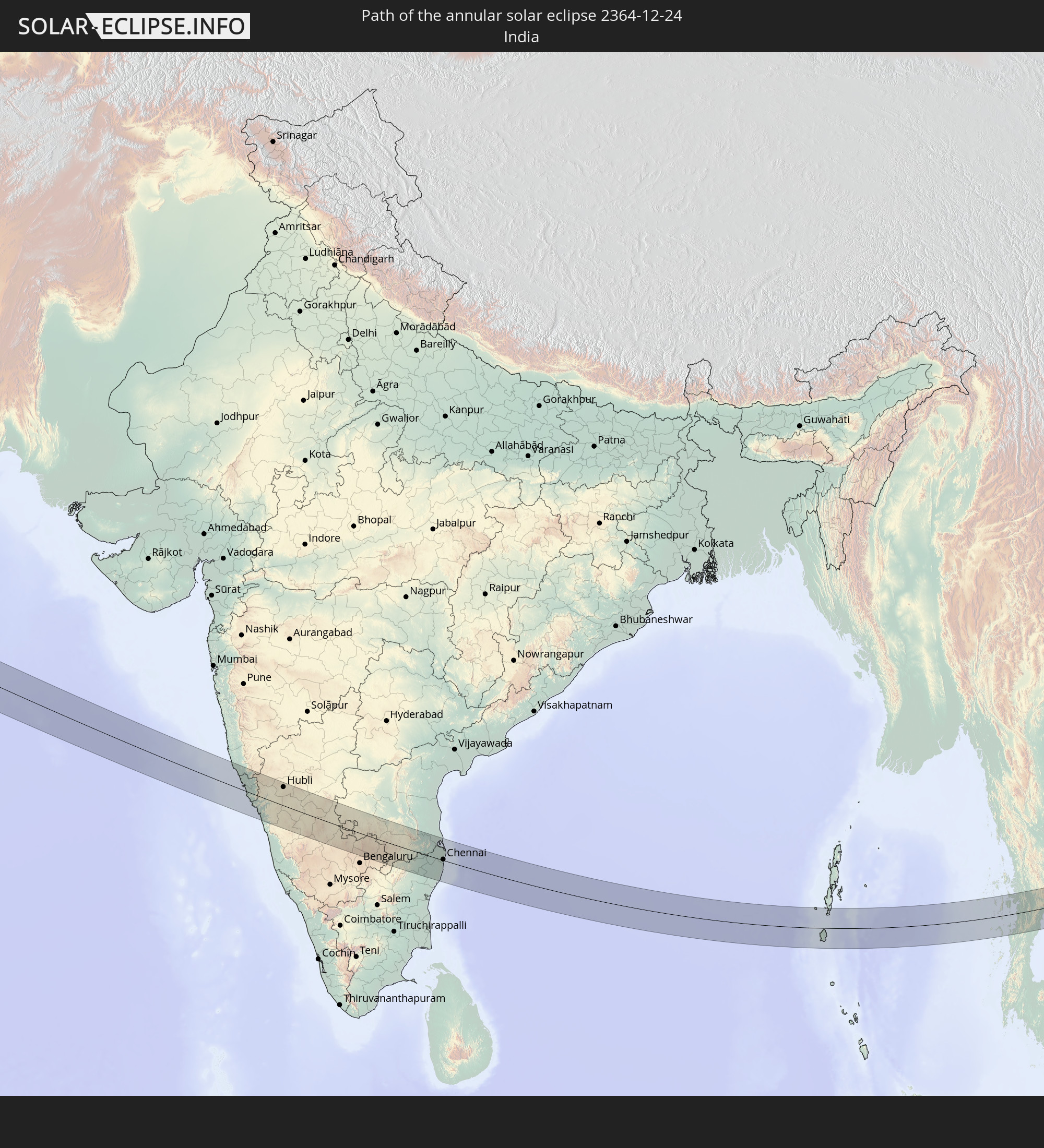 India
India
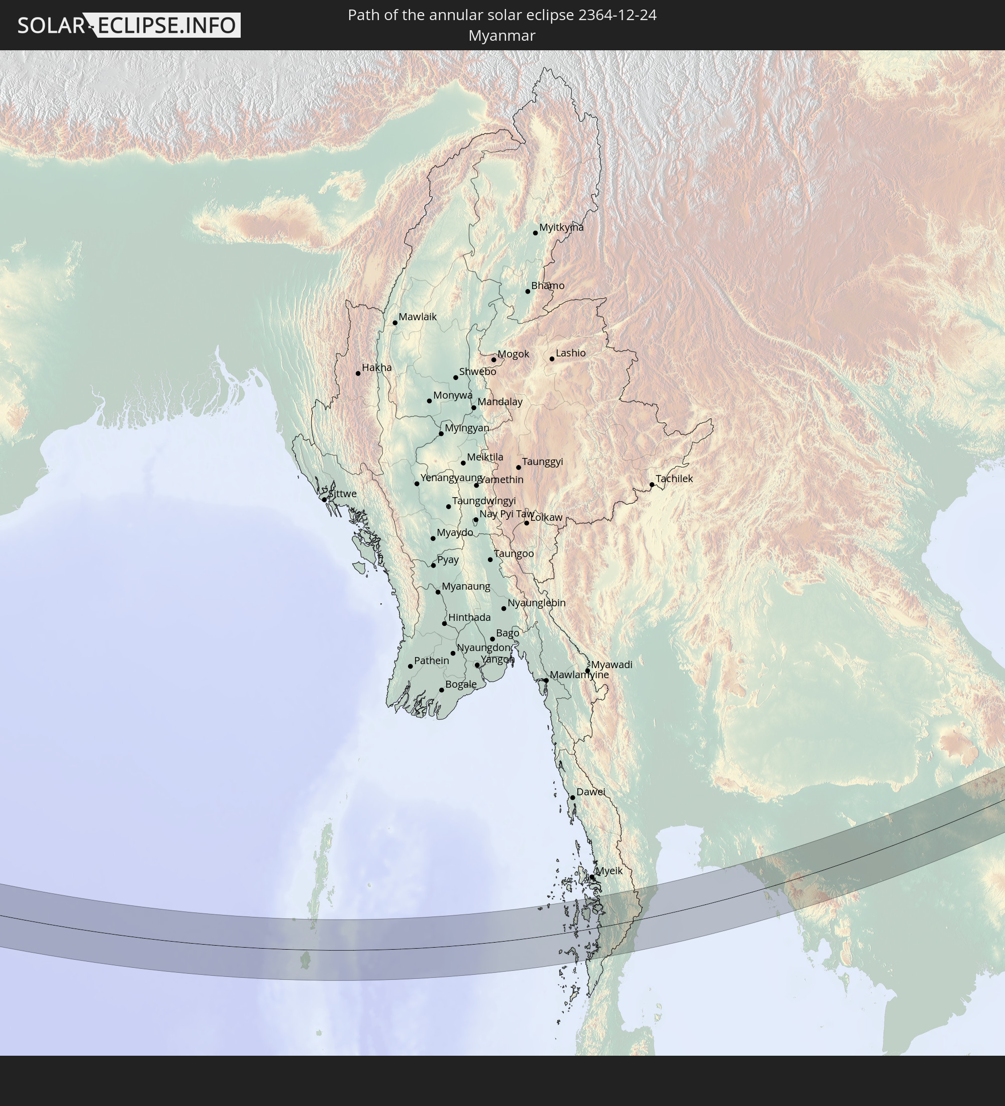 Myanmar
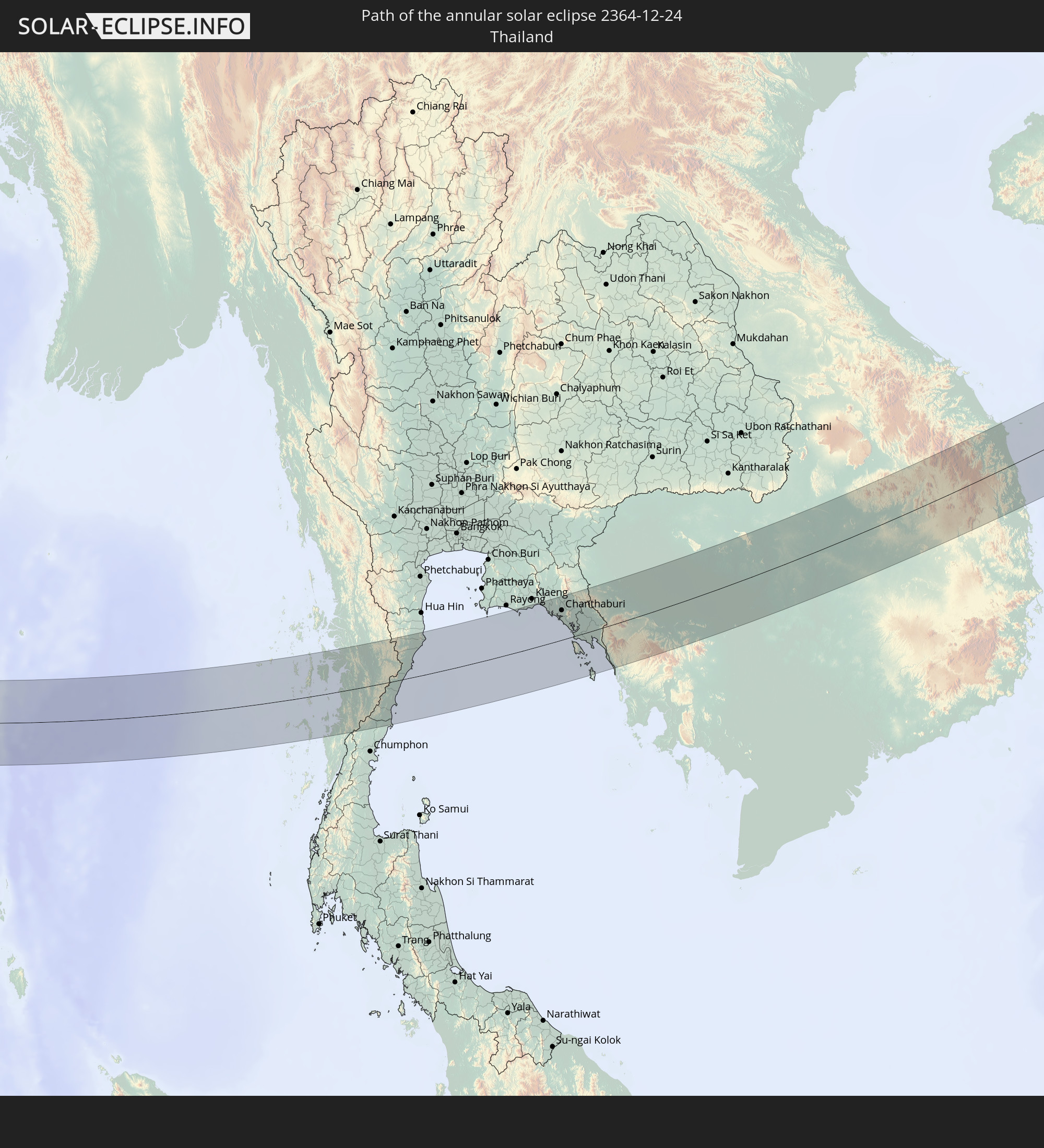 Thailand
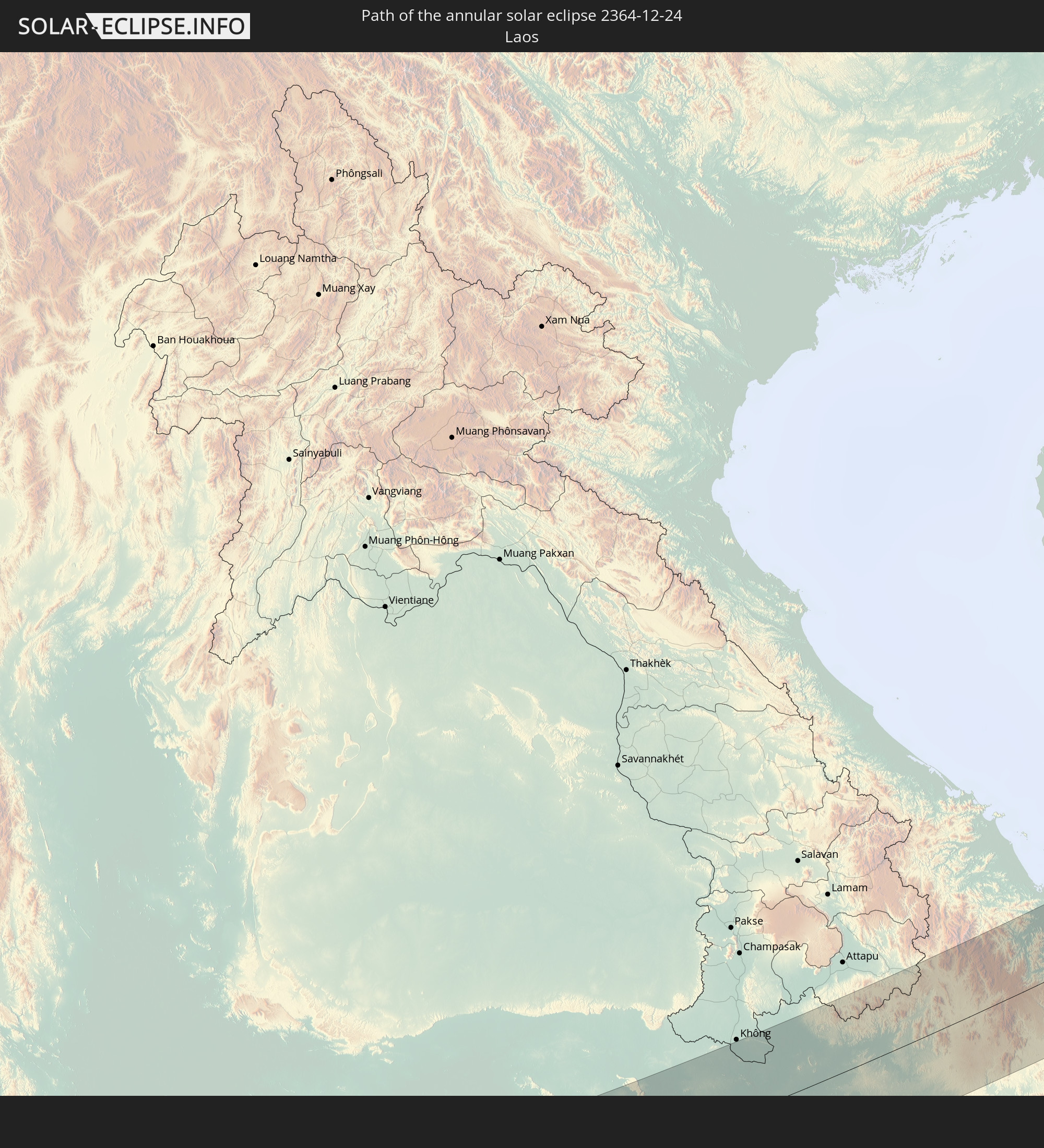 Laos
Laos
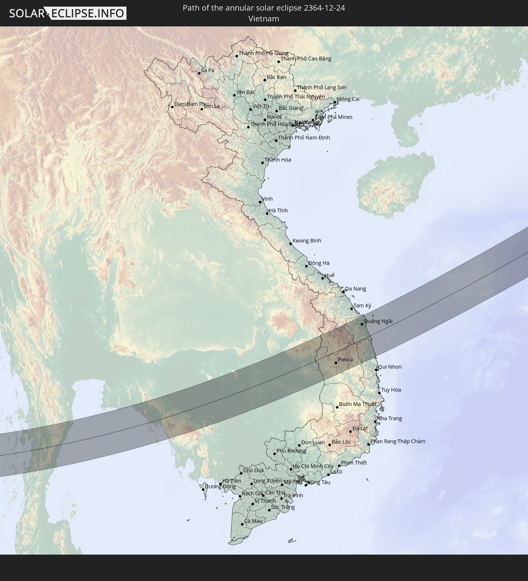 Vietnam
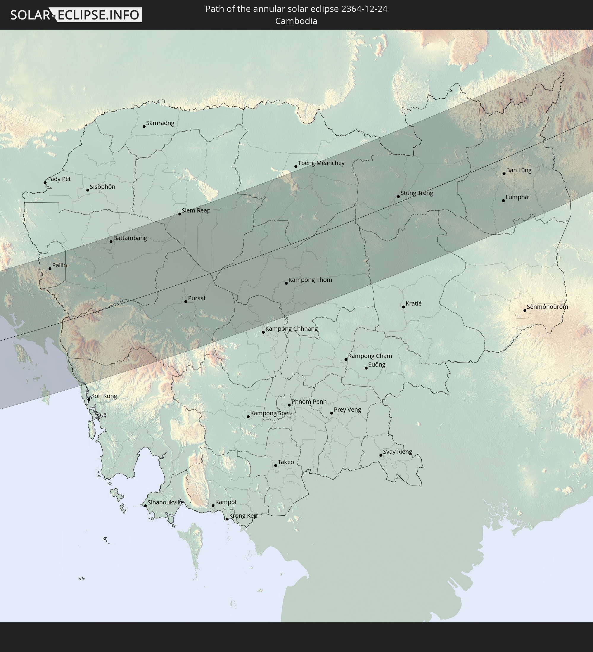 Cambodia
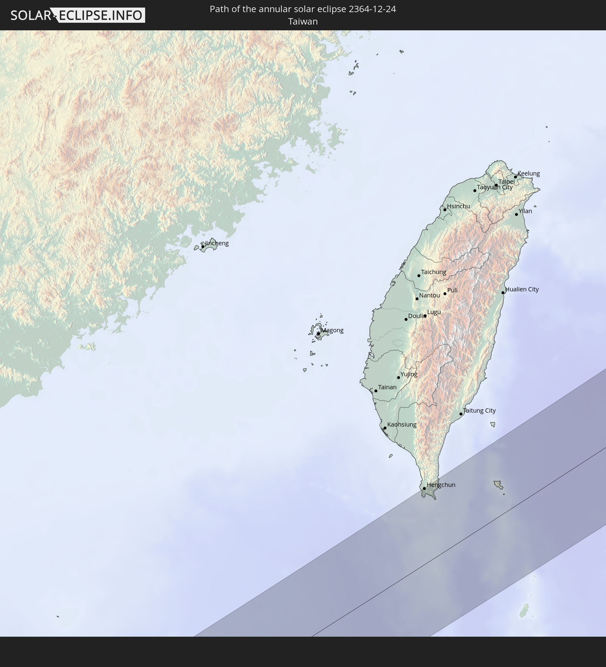 Taiwan
 Japan
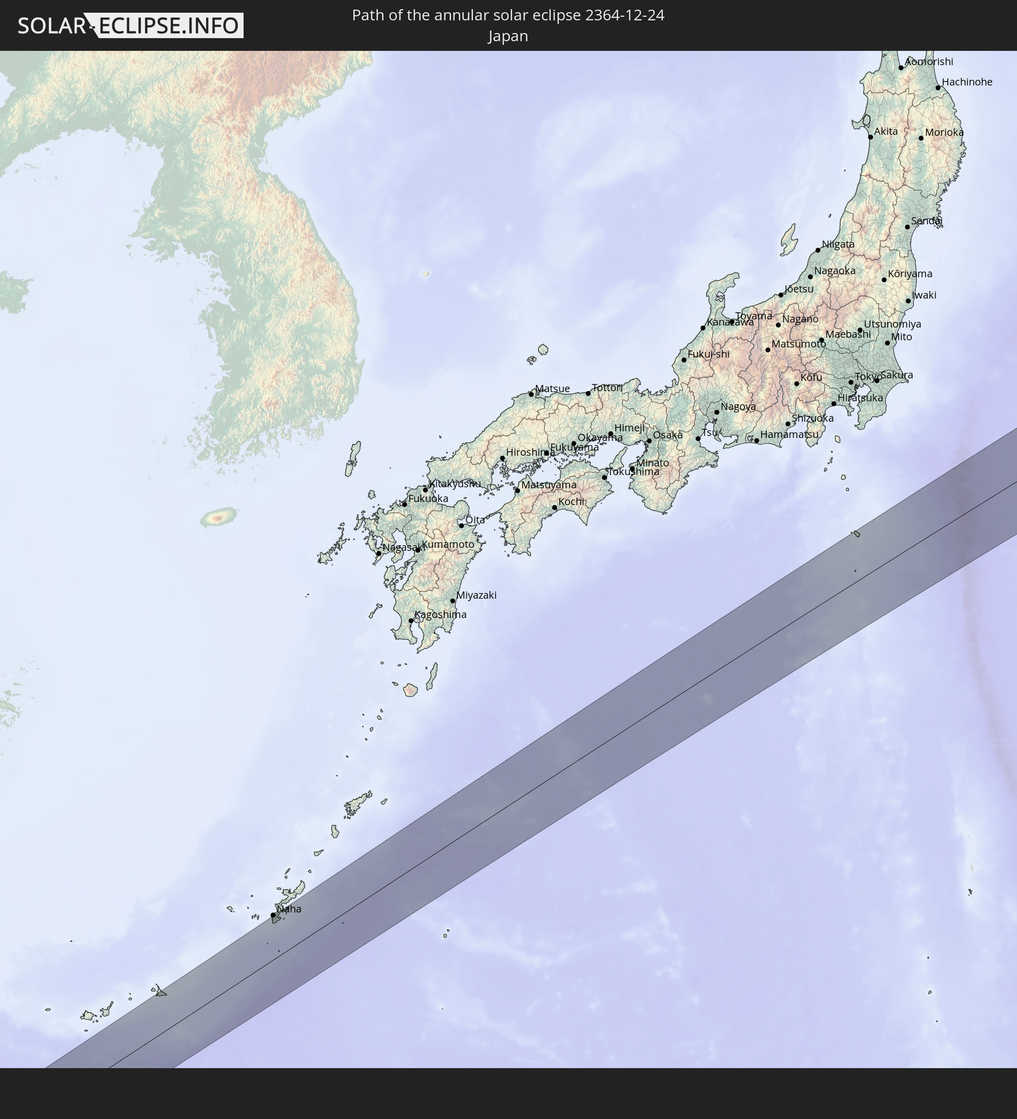
Japan
In den folgenden Ländern ist die Sonnenfinsternis partiell zu sehen
 Russia
 Tanzania
 Ethiopia
 Kenya
Kenya
 Saudi Arabia
 Somalia
 Yemen
Yemen
 Iran
Iran
 Seychelles
 Kazakhstan
 Bahrain
 Qatar
Qatar
 United Arab Emirates
 Oman
Oman
 Turkmenistan
 Uzbekistan
 Mauritius
 Afghanistan
 Pakistan
 Tajikistan
 India
India
 Kyrgyzstan
 British Indian Ocean Territory
 Maldives
 China
China
 Sri Lanka
 Nepal
Nepal
 Mongolia
 Bangladesh
 Bhutan
 Myanmar
 Indonesia
 Cocos Islands
 Thailand
 Malaysia
 Laos
Laos
 Vietnam
 Cambodia
 Singapore
 Christmas Island
 Australia
 Macau
Macau
 Hong Kong
 Brunei
 Taiwan
 Philippines
 Japan
Japan
 East Timor
 North Korea
 South Korea
 Palau
Palau
 Federated States of Micronesia
 Papua New Guinea
 Guam
Guam
 Northern Mariana Islands
 Marshall Islands
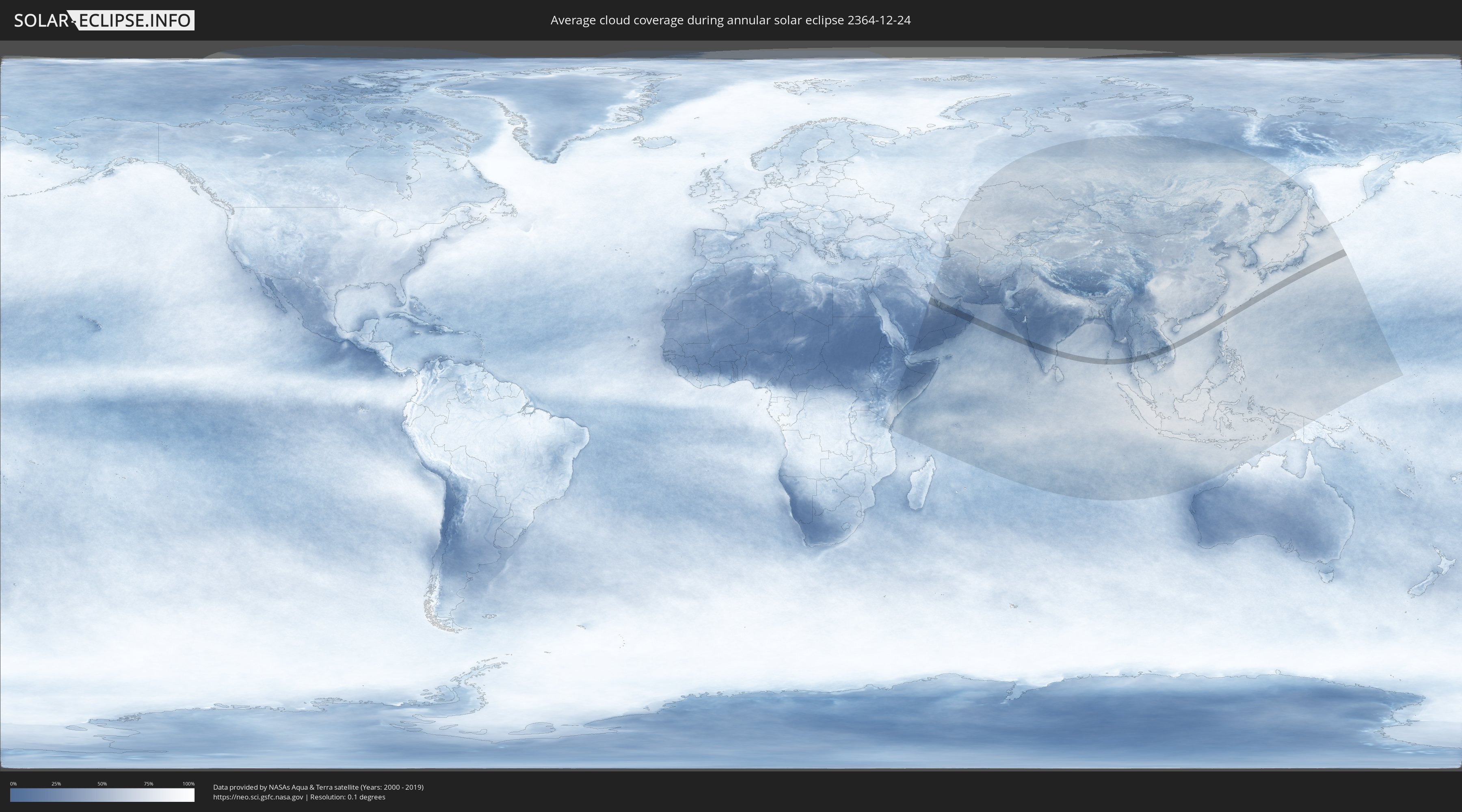
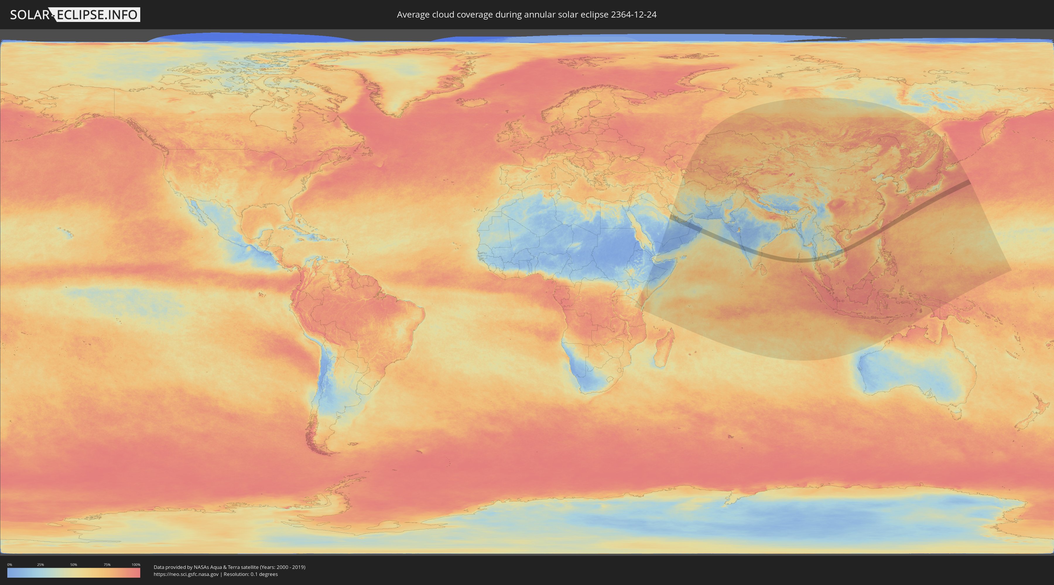
How will be the weather during the annular solar eclipse on 12/24/2364?
Where is the best place to see the annular solar eclipse of 12/24/2364?
The following maps show the average cloud coverage for the day of the annular solar eclipse.
With the help of these maps, it is possible to find the place along the eclipse path, which has the best
chance of a cloudless sky.
Nevertheless, you should consider local circumstances and inform about the weather of your chosen
observation site.
The data is provided by NASAs satellites
AQUA and TERRA.
The cloud maps are averaged over a period of 19 years (2000 - 2019).
Detailed country maps
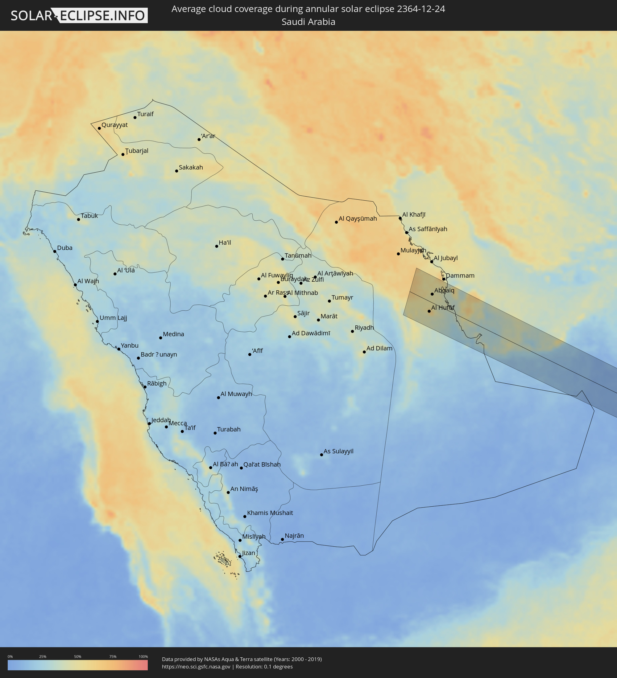 Saudi Arabia
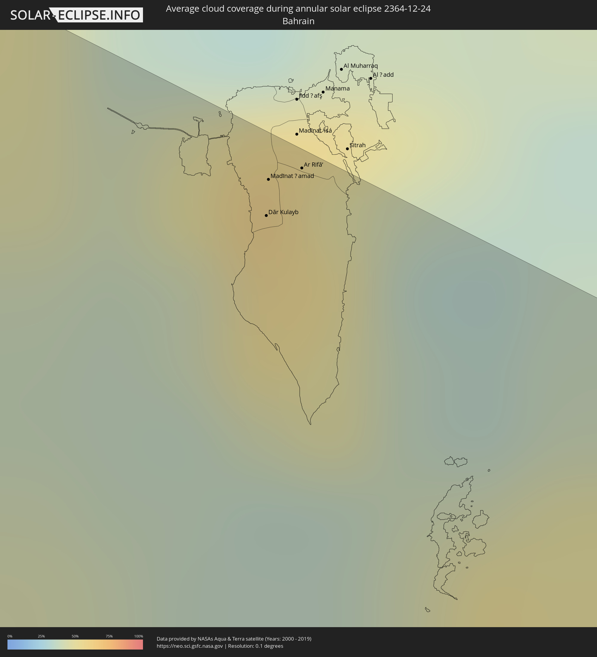 Bahrain
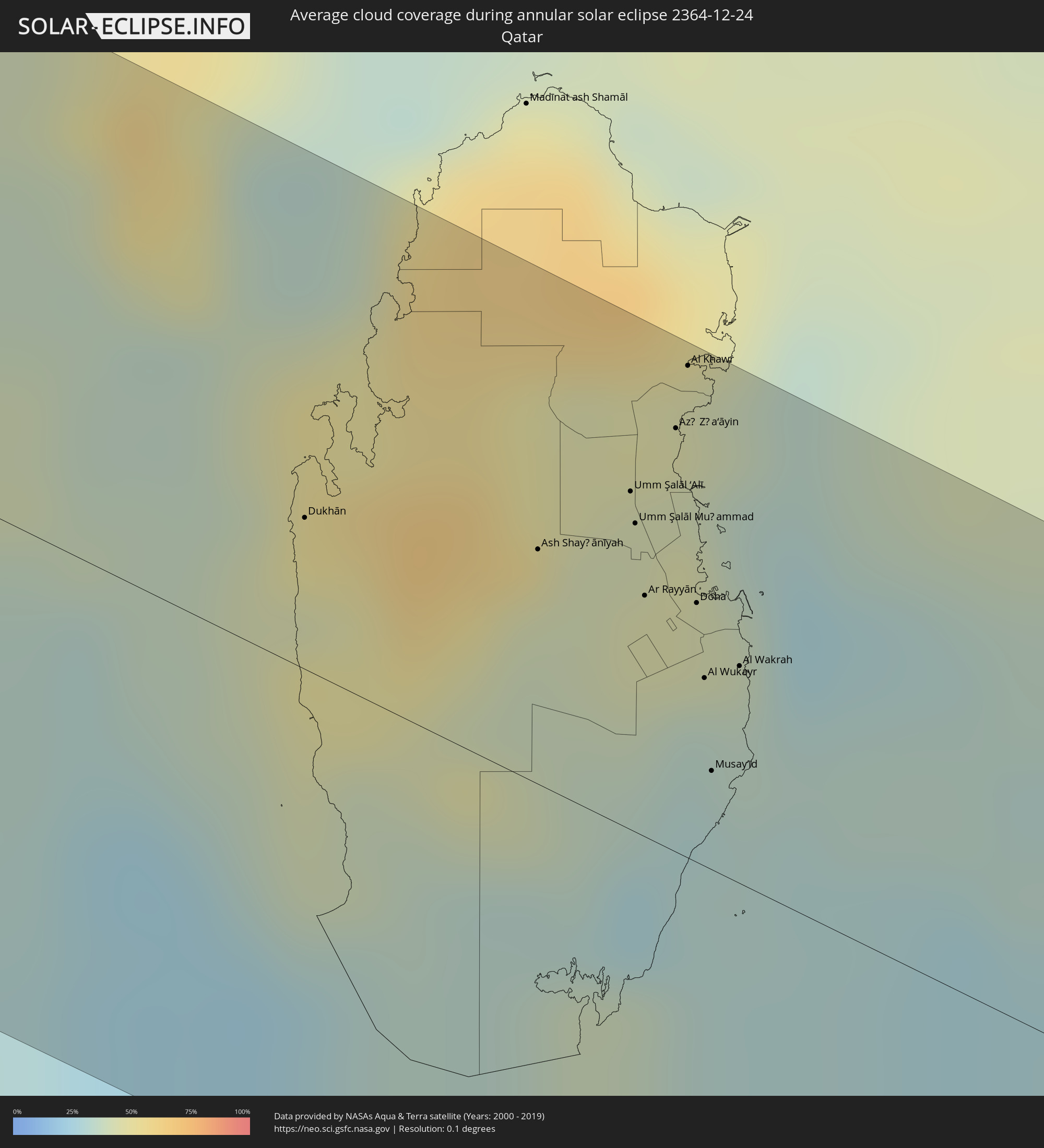 Qatar
Qatar
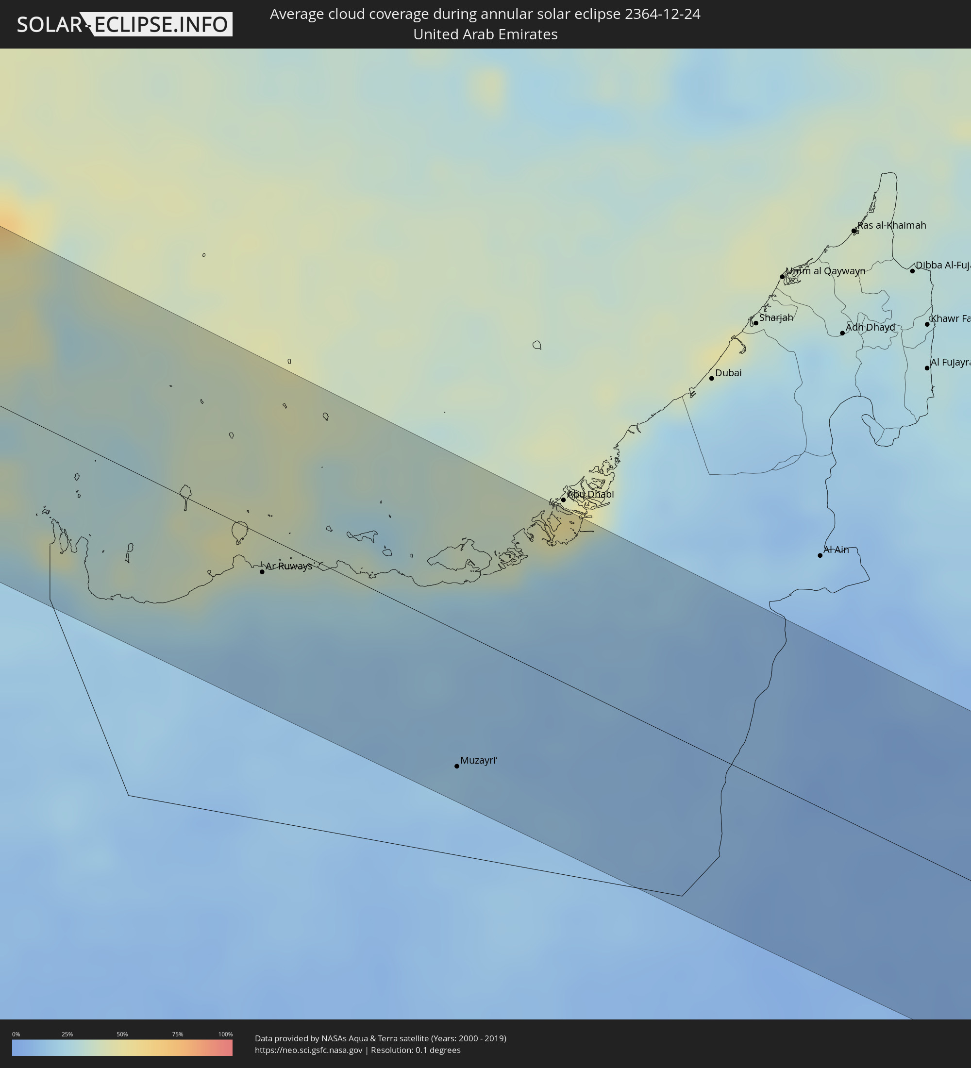 United Arab Emirates
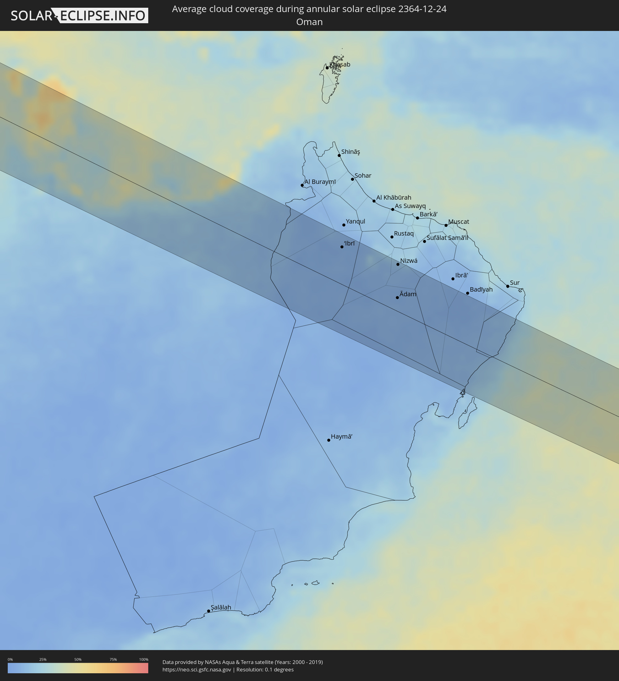 Oman
Oman
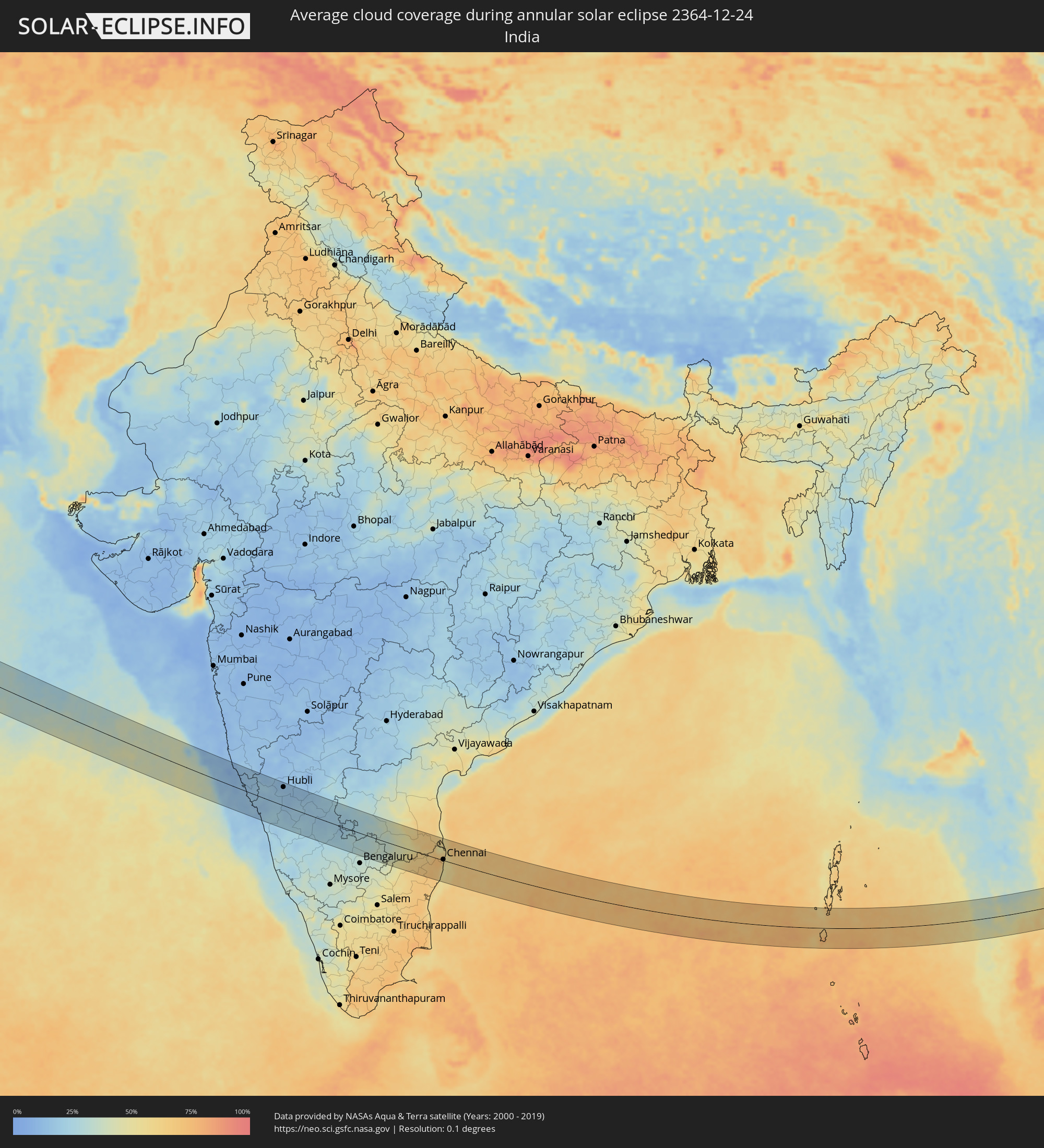 India
India
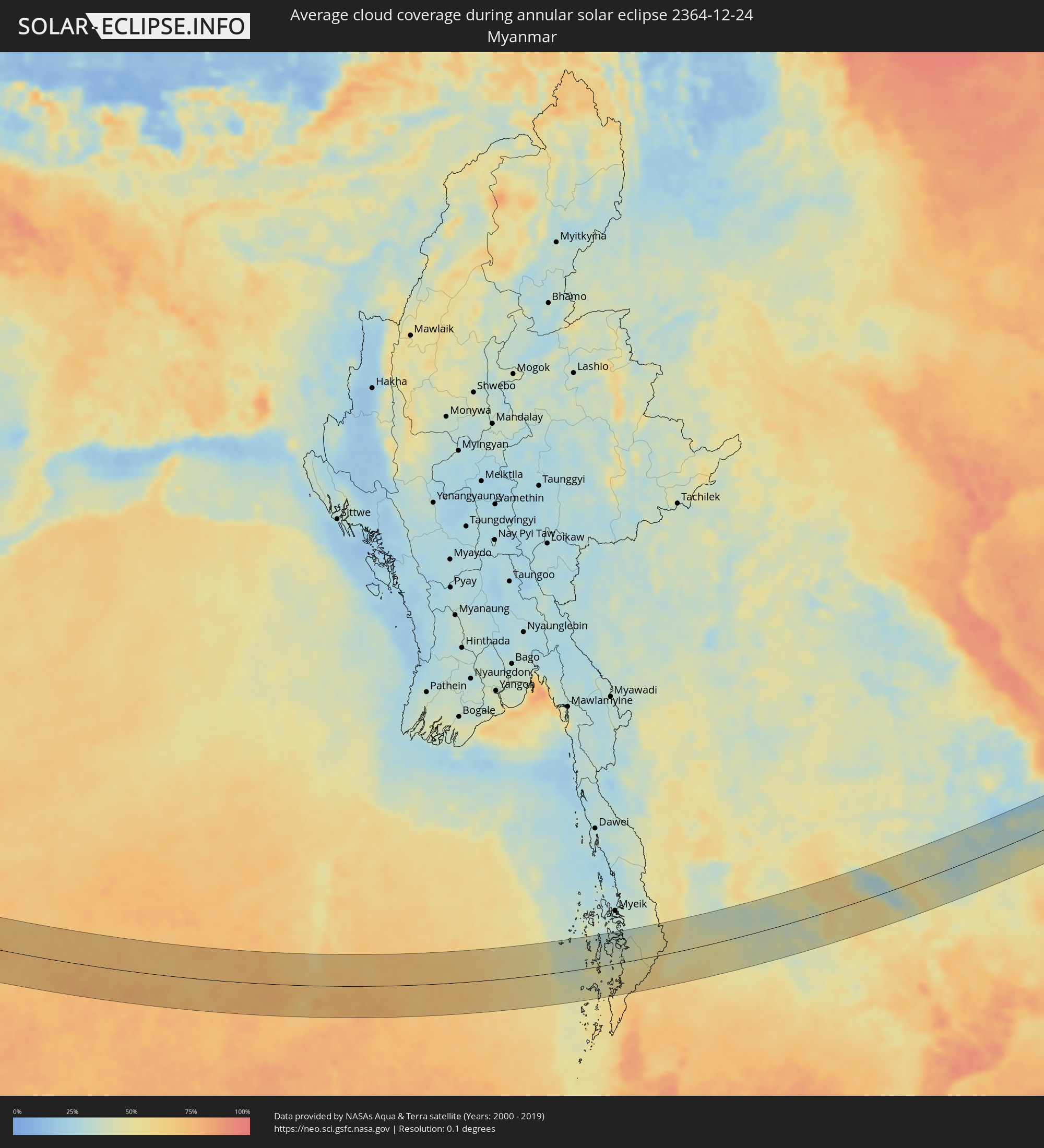 Myanmar
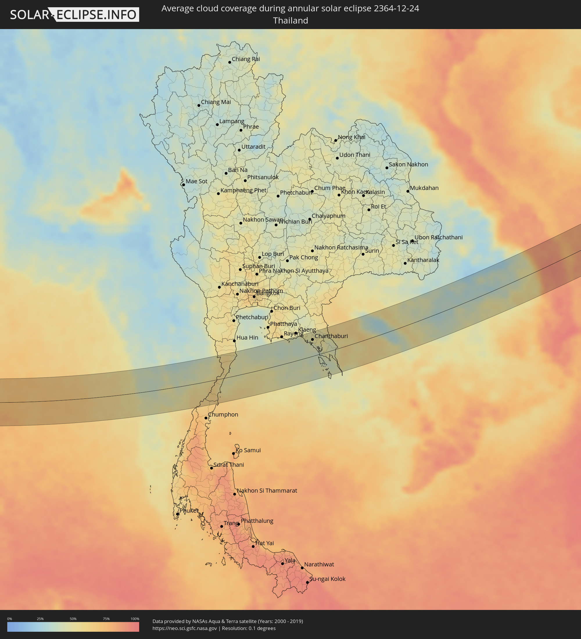 Thailand
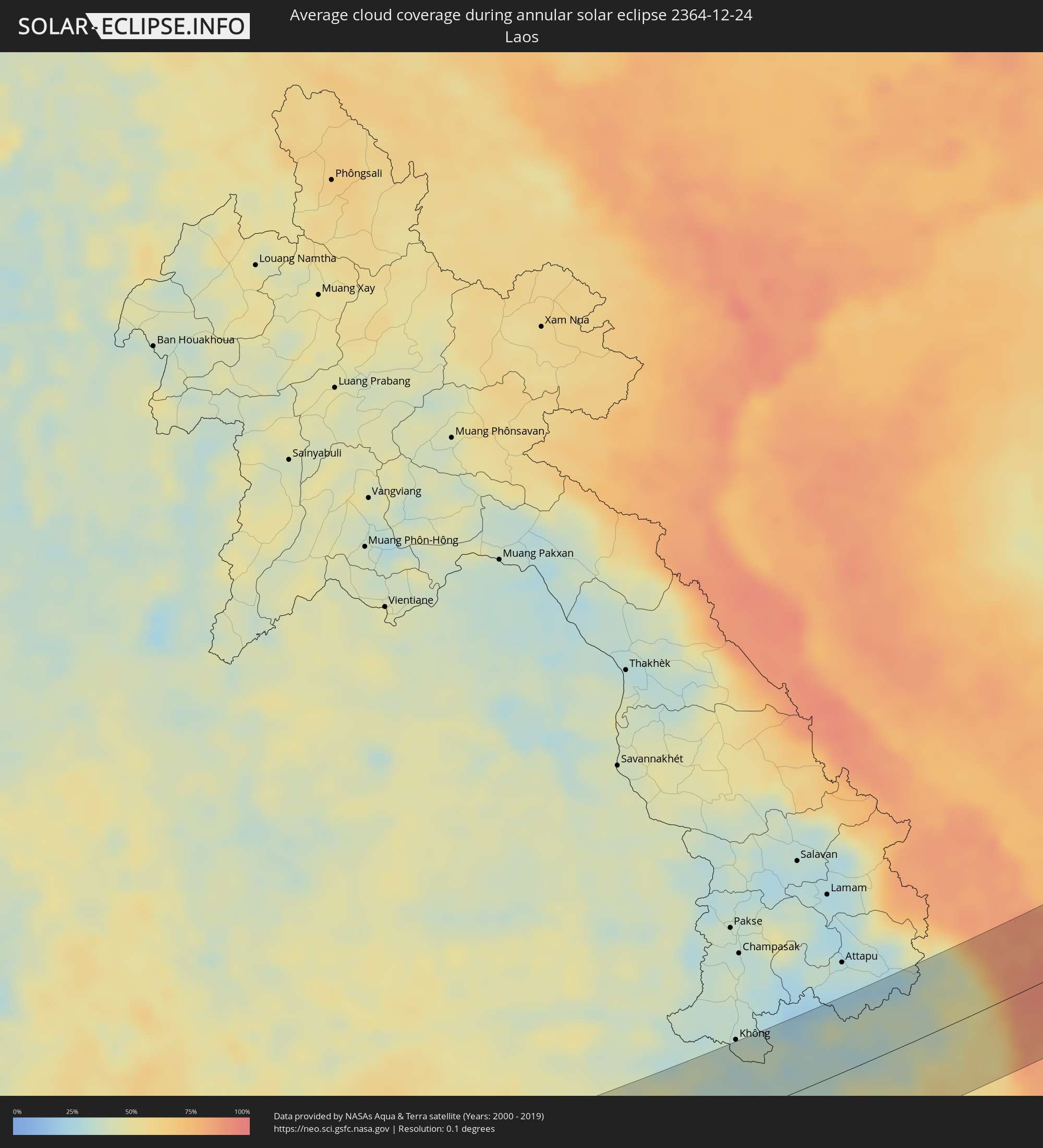 Laos
Laos
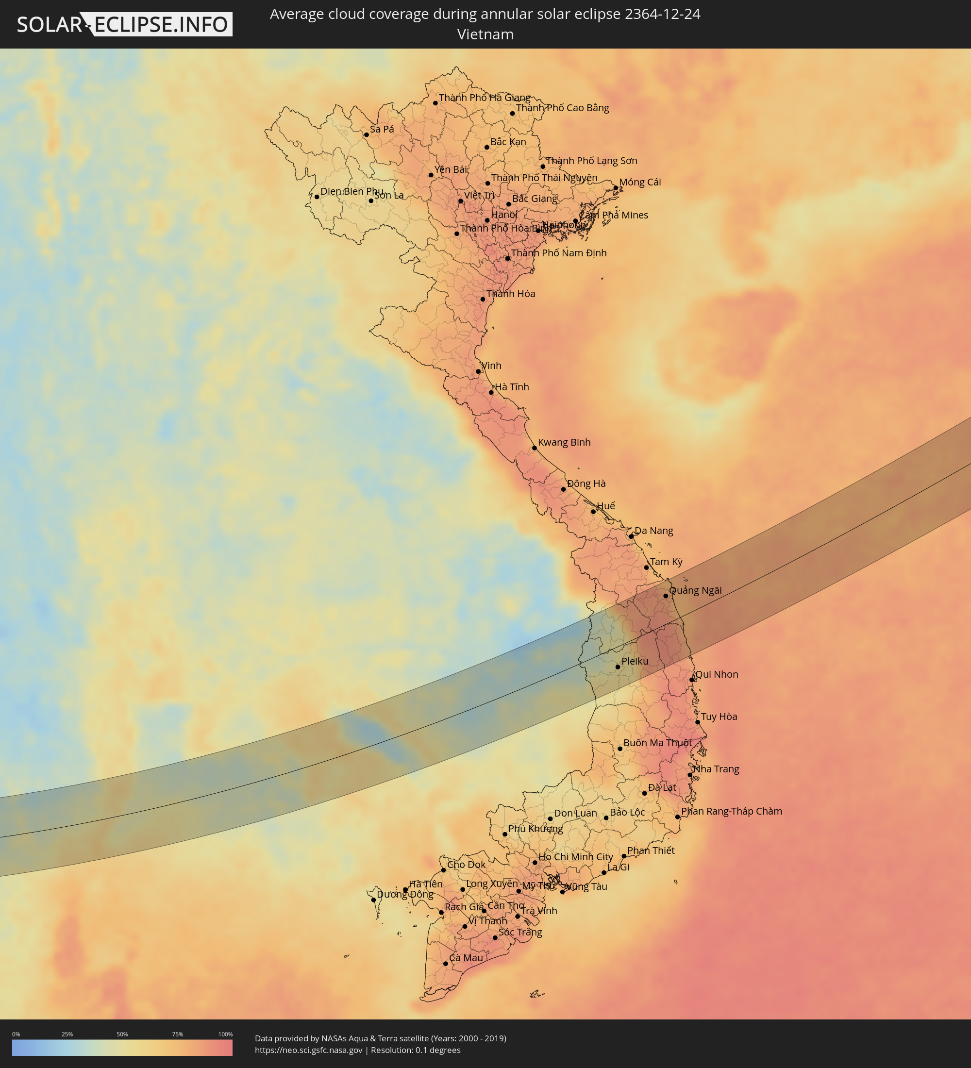 Vietnam
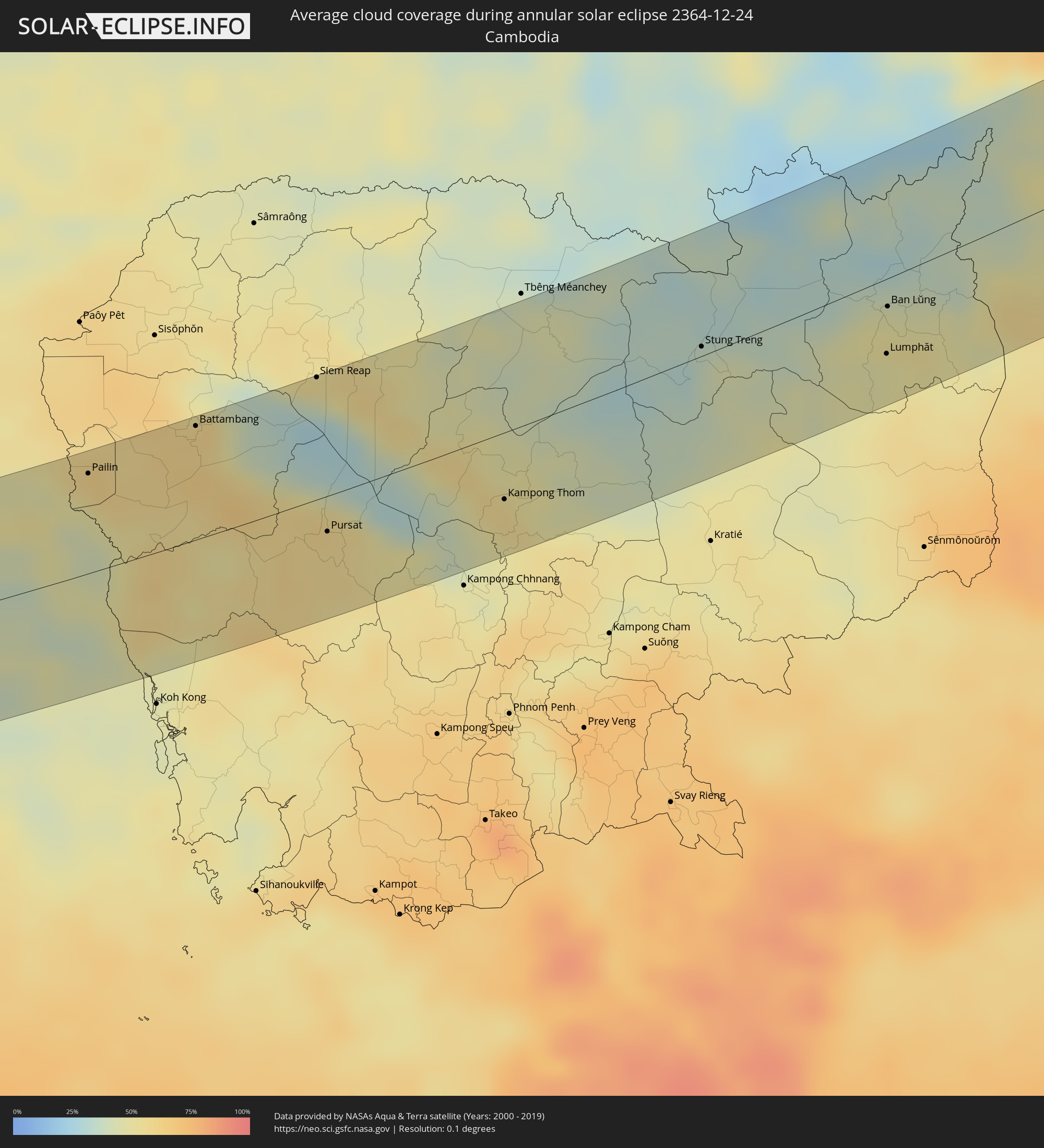 Cambodia
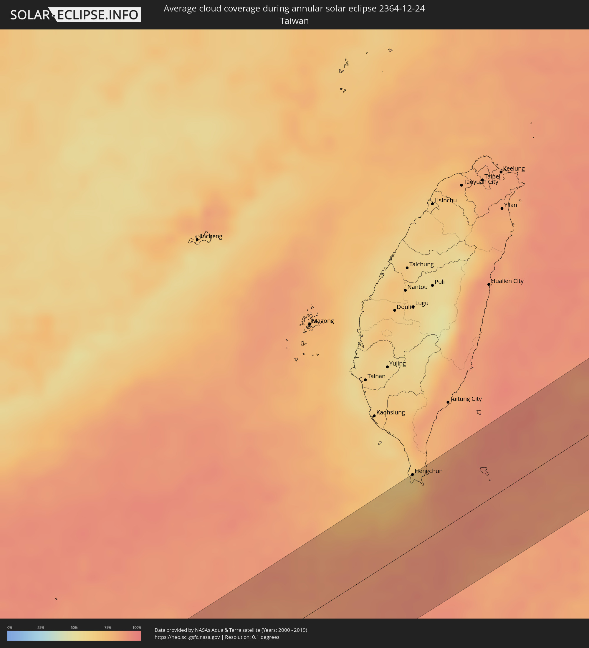 Taiwan
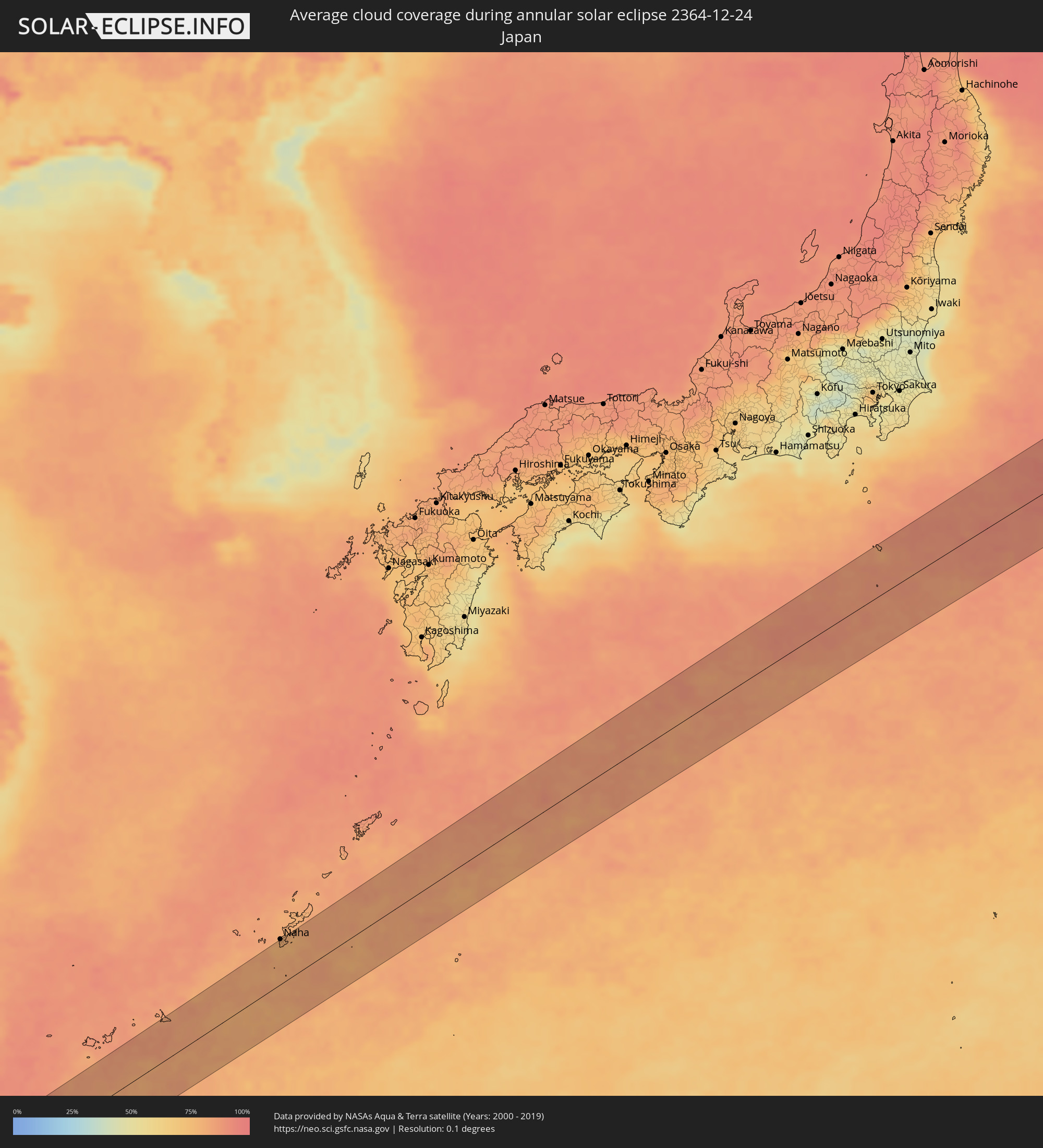 Japan
Japan
Cities inside the path of the eclipse
The following table shows all locations with a population of more than 5,000 inside the eclipse path. Cities which have more than 100,000 inhabitants are marked bold. A click at the locations opens a detailed map.
| City | Type | Eclipse duration | Local time of max. eclipse | Distance to central line | Ø Cloud coverage |
|
Al Muţayrifī, Eastern Province
|
annular | - | 06:31:55 UTC+03:00 | 23 km | 62% |
|
Al Hufūf, Eastern Province
|
annular | - | 06:31:50 UTC+03:00 | 34 km | 54% |
|
Al Mubarraz, Eastern Province
|
annular | - | 06:31:52 UTC+03:00 | 29 km | 54% |
|
Julayjilah, Eastern Province
|
annular | - | 06:31:57 UTC+03:00 | 19 km | 62% |
|
Al Qurayn, Eastern Province
|
annular | - | 06:31:56 UTC+03:00 | 21 km | 62% |
|
Al Baţţālīyah, Eastern Province
|
annular | - | 06:31:55 UTC+03:00 | 24 km | 54% |
|
Al Jubayl, Eastern Province
|
annular | - | 06:31:54 UTC+03:00 | 27 km | 56% |
|
Al Qārah, Eastern Province
|
annular | - | 06:31:55 UTC+03:00 | 25 km | 56% |
|
Al Munayzilah, Eastern Province
|
annular | - | 06:31:53 UTC+03:00 | 28 km | 56% |
|
Abqaiq, Eastern Province
|
annular | - | 06:32:20 UTC+03:00 | 28 km | 47% |
|
Al Jafr, Eastern Province
|
annular | - | 06:31:54 UTC+03:00 | 26 km | 56% |
|
Aţ Ţaraf, Eastern Province
|
annular | - | 06:31:54 UTC+03:00 | 27 km | 56% |
|
Al Markaz, Eastern Province
|
annular | - | 06:31:56 UTC+03:00 | 23 km | 56% |
|
Dhahran, Eastern Province
|
annular | - | 06:32:49 UTC+03:00 | 82 km | 51% |
|
Khobar, Eastern Province
|
annular | - | 06:32:51 UTC+03:00 | 85 km | 46% |
|
Dār Kulayb, Southern Governorate
|
annular | - | 06:32:48 UTC+03:00 | 78 km | 55% |
|
Madīnat Ḩamad, Central Governorate
|
annular | - | 06:32:50 UTC+03:00 | 82 km | 55% |
|
Ar Rifā‘, Southern Governorate
|
annular | - | 06:32:52 UTC+03:00 | 86 km | 51% |
|
Dukhān, Baladīyat ar Rayyān
|
annular | - | 06:32:23 UTC+03:00 | 26 km | 44% |
|
Ash Shayḩānīyah, Baladīyat ar Rayyān
|
annular | - | 06:32:32 UTC+03:00 | 40 km | 43% |
|
Umm Şalāl ‘Alī, Baladīyat Umm Şalāl
|
annular | - | 06:32:42 UTC+03:00 | 58 km | 42% |
|
Umm Şalāl Muḩammad, Baladīyat Umm Şalāl
|
annular | - | 06:32:40 UTC+03:00 | 53 km | 44% |
|
Ar Rayyān, Baladīyat ar Rayyān
|
annular | - | 06:32:34 UTC+03:00 | 41 km | 44% |
|
Az̧ Z̧a‘āyin, Baladīyat az̧ Z̧a‘āyin
|
annular | - | 06:32:50 UTC+03:00 | 72 km | 41% |
|
Al Khawr, Al Khawr
|
annular | - | 06:32:56 UTC+03:00 | 84 km | 44% |
|
Doha, Baladīyat ad Dawḩah
|
annular | - | 06:32:36 UTC+03:00 | 44 km | 43% |
|
Al Wukayr, Al Wakrah
|
annular | - | 06:32:31 UTC+03:00 | 32 km | 35% |
|
Musay‘īd, Al Wakrah
|
annular | - | 06:32:23 UTC+03:00 | 17 km | 32% |
|
Al Wakrah, Al Wakrah
|
annular | - | 06:32:34 UTC+03:00 | 37 km | 35% |
|
Ar Ruways, Abu Dhabi
|
annular | - | 07:32:17 UTC+04:00 | 19 km | 26% |
|
Muzayri‘, Abu Dhabi
|
annular | - | 07:32:08 UTC+04:00 | 68 km | 16% |
|
‘Ibrī, Az̧ Z̧āhirah
|
annular | - | 07:33:55 UTC+04:00 | 63 km | 7% |
|
Bahlā’, Muḩāfaz̧at ad Dākhilīyah
|
annular | - | 07:34:17 UTC+04:00 | 72 km | 9% |
|
Ādam, Muḩāfaz̧at ad Dākhilīyah
|
annular | - | 07:34:01 UTC+04:00 | 23 km | 8% |
|
Nizwá, Muḩāfaz̧at ad Dākhilīyah
|
annular | - | 07:34:26 UTC+04:00 | 79 km | 9% |
|
Marmagao, Goa
|
annular | - | 09:19:50 UTC+05:30 | 14 km | 17% |
|
Madgaon, Goa
|
annular | - | 09:20:05 UTC+05:30 | 7 km | 17% |
|
Hubli, Karnataka
|
annular | - | 09:22:19 UTC+05:30 | 60 km | 17% |
|
Shimoga, Karnataka
|
annular | - | 09:22:30 UTC+05:30 | 72 km | 24% |
|
Rānībennur, Karnataka
|
annular | - | 09:22:56 UTC+05:30 | 3 km | 20% |
|
Chitradurga, Karnataka
|
annular | - | 09:24:17 UTC+05:30 | 10 km | 21% |
|
Hindupur, Andhra Pradesh
|
annular | - | 09:26:22 UTC+05:30 | 13 km | 29% |
|
Dharmavaram, Andhra Pradesh
|
annular | - | 09:27:08 UTC+05:30 | 57 km | 26% |
|
Kolār, Karnataka
|
annular | - | 09:27:27 UTC+05:30 | 63 km | 34% |
|
Kadiri, Andhra Pradesh
|
annular | - | 09:27:57 UTC+05:30 | 41 km | 34% |
|
Madanapalle, Andhra Pradesh
|
annular | - | 09:28:27 UTC+05:30 | 7 km | 34% |
|
Rāyachoti, Andhra Pradesh
|
annular | - | 09:29:14 UTC+05:30 | 55 km | 44% |
|
Gudiyatham, Tamil Nadu
|
annular | - | 09:29:01 UTC+05:30 | 58 km | 52% |
|
Vellore, Tamil Nadu
|
annular | - | 09:29:35 UTC+05:30 | 52 km | 60% |
|
Tirupati, Andhra Pradesh
|
annular | - | 09:30:33 UTC+05:30 | 33 km | 56% |
|
Kānchipuram, Tamil Nadu
|
annular | - | 09:30:51 UTC+05:30 | 43 km | 68% |
|
Āvadi, Tamil Nadu
|
annular | - | 09:31:56 UTC+05:30 | 0 km | 72% |
|
Pallāvaram, Tamil Nadu
|
annular | - | 09:31:58 UTC+05:30 | 14 km | 66% |
|
Chennai, Tamil Nadu
|
annular | - | 09:32:19 UTC+05:30 | 3 km | 56% |
|
Bang Saphan, Prachuap Khiri Khan
|
annular | - | 12:02:03 UTC+07:00 | 36 km | 60% |
|
Prachuap Khiri Khan, Prachuap Khiri Khan
|
annular | - | 12:03:25 UTC+07:00 | 24 km | 49% |
|
Kui Buri, Prachuap Khiri Khan
|
annular | - | 12:03:50 UTC+07:00 | 51 km | 50% |
|
Tha Mai, Chanthaburi
|
annular | - | 12:11:49 UTC+07:00 | 51 km | 43% |
|
Laem Sing, Chanthaburi
|
annular | - | 12:11:58 UTC+07:00 | 34 km | 42% |
|
Chanthaburi, Chanthaburi
|
annular | - | 12:12:10 UTC+07:00 | 47 km | 45% |
|
Khlung, Chanthaburi
|
annular | - | 12:12:29 UTC+07:00 | 27 km | 43% |
|
Trat, Trat
|
annular | - | 12:13:22 UTC+07:00 | 5 km | 42% |
|
Bo Rai, Trat
|
annular | - | 12:13:40 UTC+07:00 | 30 km | 43% |
|
Pailin, Pailin
|
annular | - | 12:14:06 UTC+07:00 | 57 km | 54% |
|
Battambang, Battambang
|
annular | - | 12:16:19 UTC+07:00 | 64 km | 60% |
|
Siem Reap, Siem Reap
|
annular | - | 12:18:46 UTC+07:00 | 69 km | 54% |
|
Pursat, Pursat
|
annular | - | 12:18:25 UTC+07:00 | 20 km | 57% |
|
Kampong Thom, Kampong Thom
|
annular | - | 12:21:50 UTC+07:00 | 37 km | 57% |
|
Stung Treng, Stung Treng
|
annular | - | 12:25:58 UTC+07:00 | 5 km | 39% |
|
Lumphăt, Ratanakiri
|
annular | - | 12:29:15 UTC+07:00 | 41 km | 48% |
|
Ban Lŭng, Ratanakiri
|
annular | - | 12:29:26 UTC+07:00 | 15 km | 49% |
|
Pleiku, Gia Lai
|
annular | - | 12:32:49 UTC+07:00 | 35 km | 56% |
|
Kon Tum, Kon Tum
|
annular | - | 12:33:04 UTC+07:00 | 3 km | 50% |
|
Quảng Ngãi, Quảng Ngãi
|
annular | - | 12:35:58 UTC+07:00 | 44 km | 85% |
|
Hengchun, Taiwan
|
annular | - | 14:08:49 UTC+08:00 | 72 km | 66% |
|
Itoman, Okinawa
|
annular | - | 15:20:44 UTC+09:00 | 69 km | 78% |
|
Tomigusuku, Okinawa
|
annular | - | 15:20:45 UTC+09:00 | 74 km | 78% |
|
Naha, Okinawa
|
annular | - | 15:20:44 UTC+09:00 | 76 km | 78% |
|
Ginowan, Okinawa
|
annular | - | 15:20:51 UTC+09:00 | 76 km | 78% |
|
Katsuren-haebaru, Okinawa
|
annular | - | 15:21:00 UTC+09:00 | 77 km | 78% |