Annular solar eclipse of 02/05/2372
| Day of week: | Saturday |
| Maximum duration of eclipse: | 06m50s |
| Maximum width of eclipse path: | 422 km |
| Saros cycle: | 156 |
| Coverage: | 92.4% |
| Magnitude: | 0.9237 |
| Gamma: | -0.7301 |
Wo kann man die Sonnenfinsternis vom 02/05/2372 sehen?
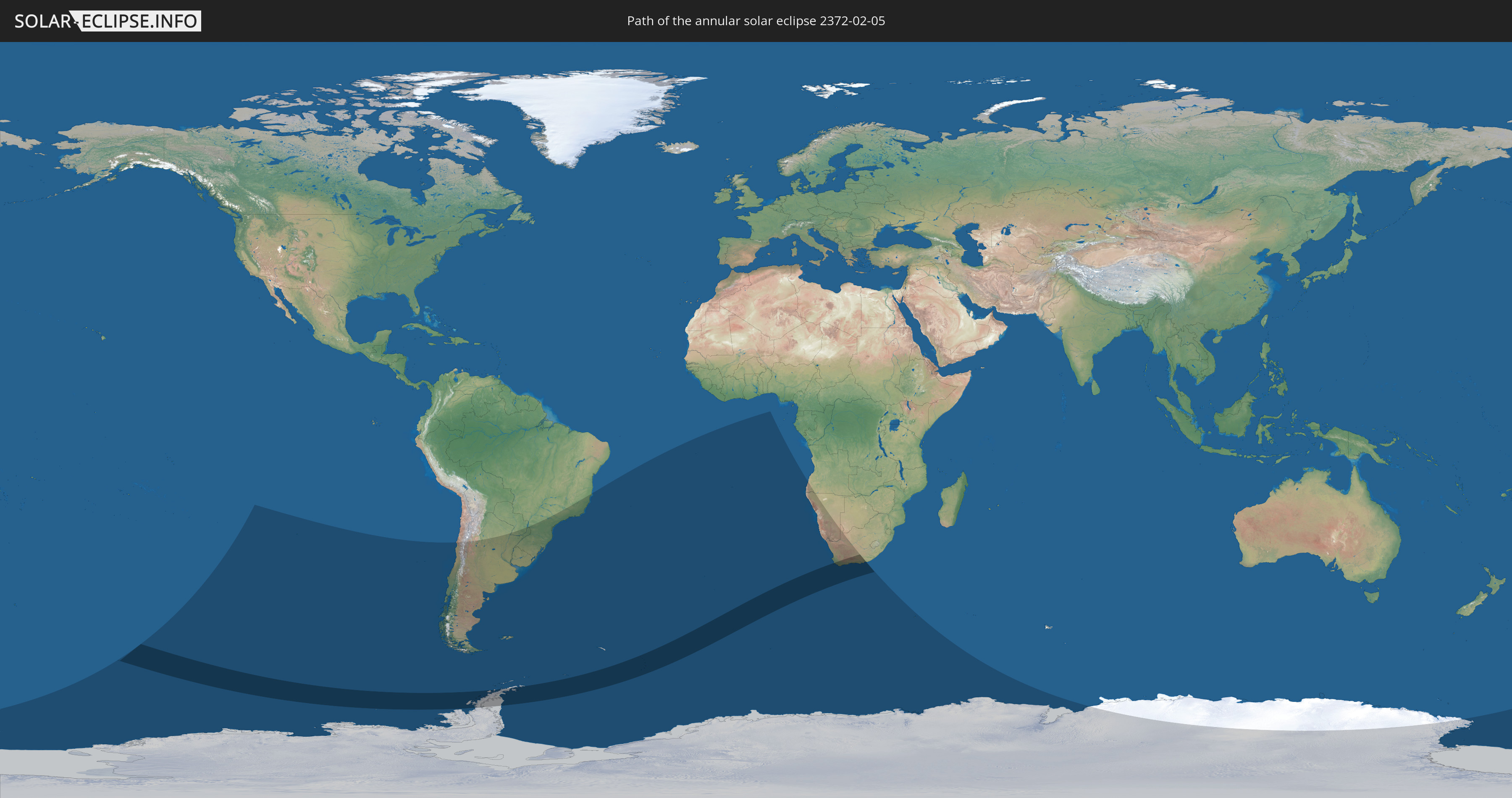
Die Sonnenfinsternis am 02/05/2372 kann man in 14 Ländern als partielle Sonnenfinsternis beobachten.
Der Finsternispfad verläuft durch 3 Länder. Nur in diesen Ländern ist sie als annular Sonnenfinsternis zu sehen.
In den folgenden Ländern ist die Sonnenfinsternis annular zu sehen
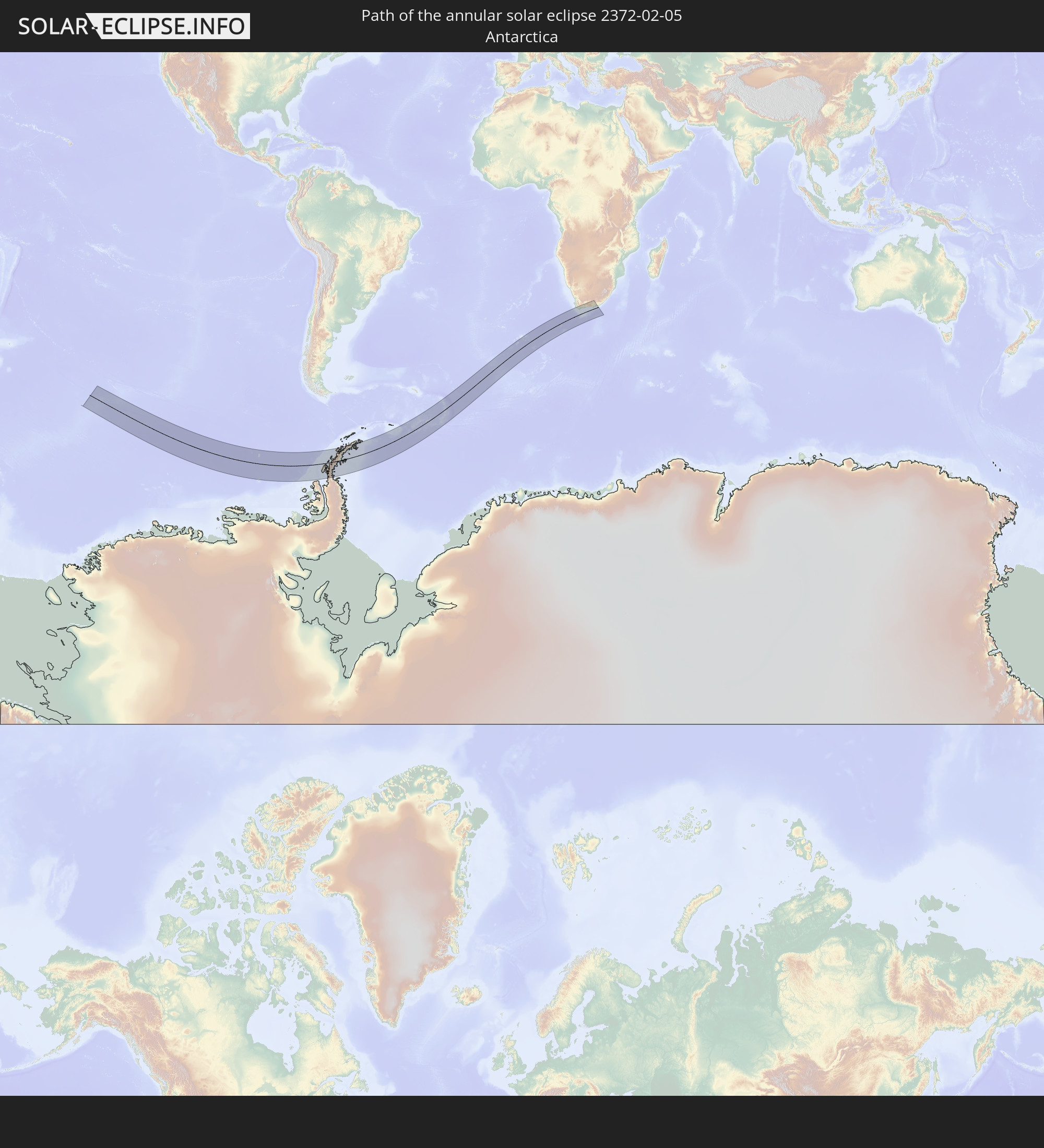 Antarctica
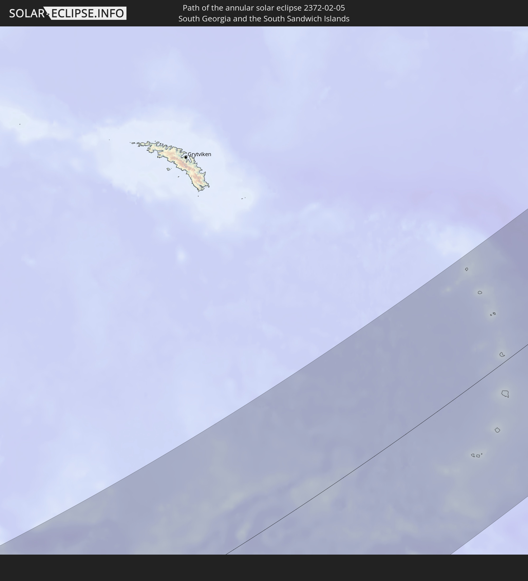 South Georgia and the South Sandwich Islands
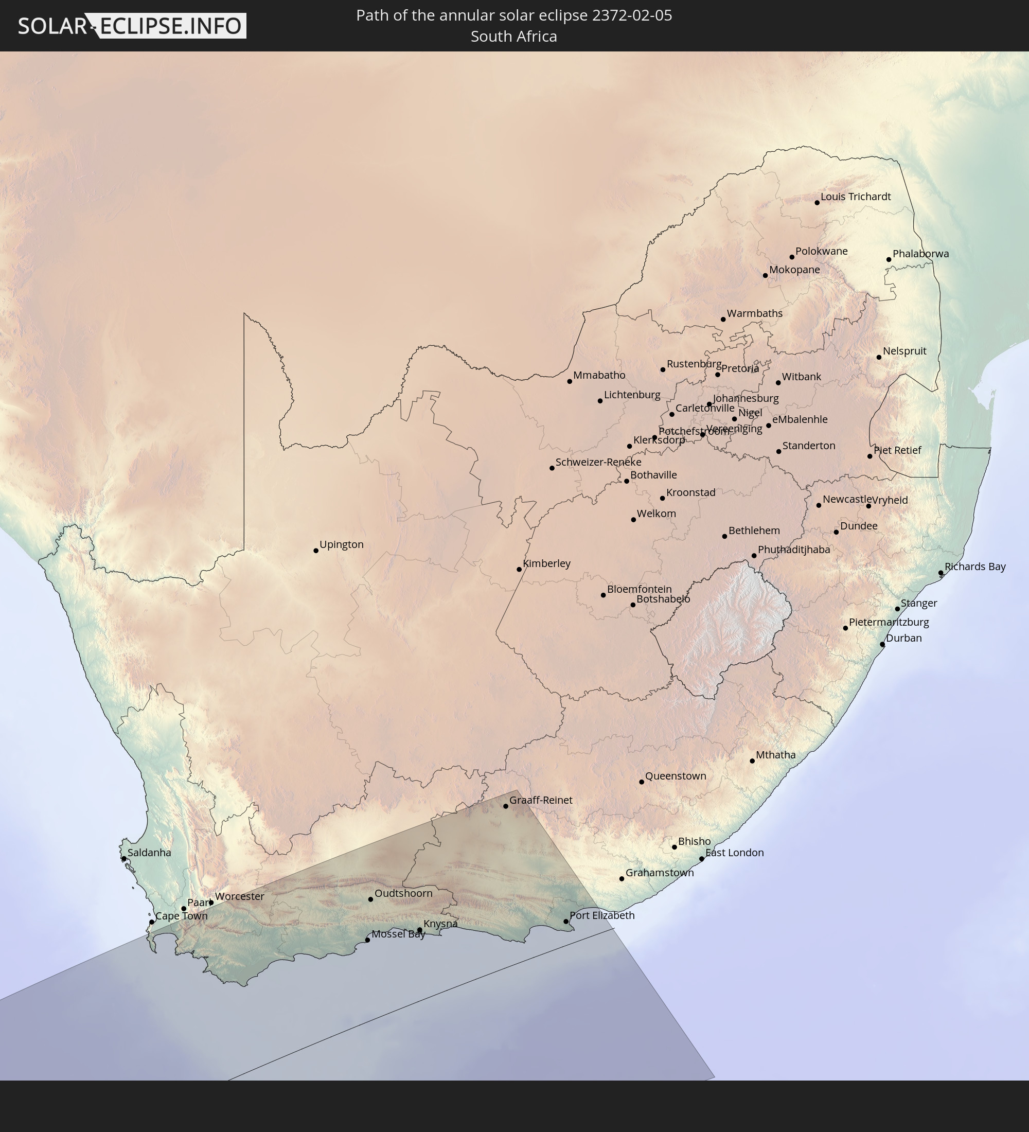 South Africa
In den folgenden Ländern ist die Sonnenfinsternis partiell zu sehen


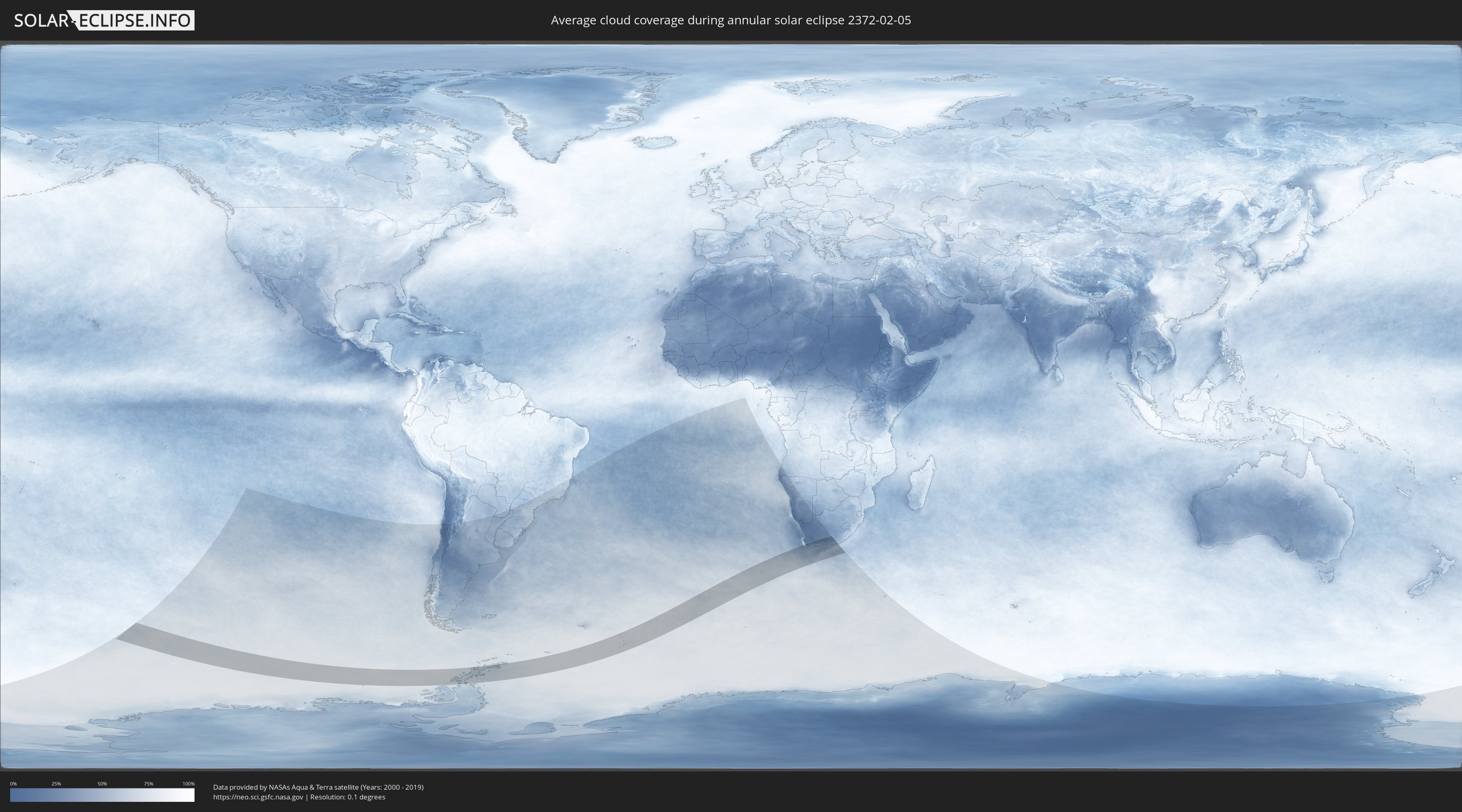
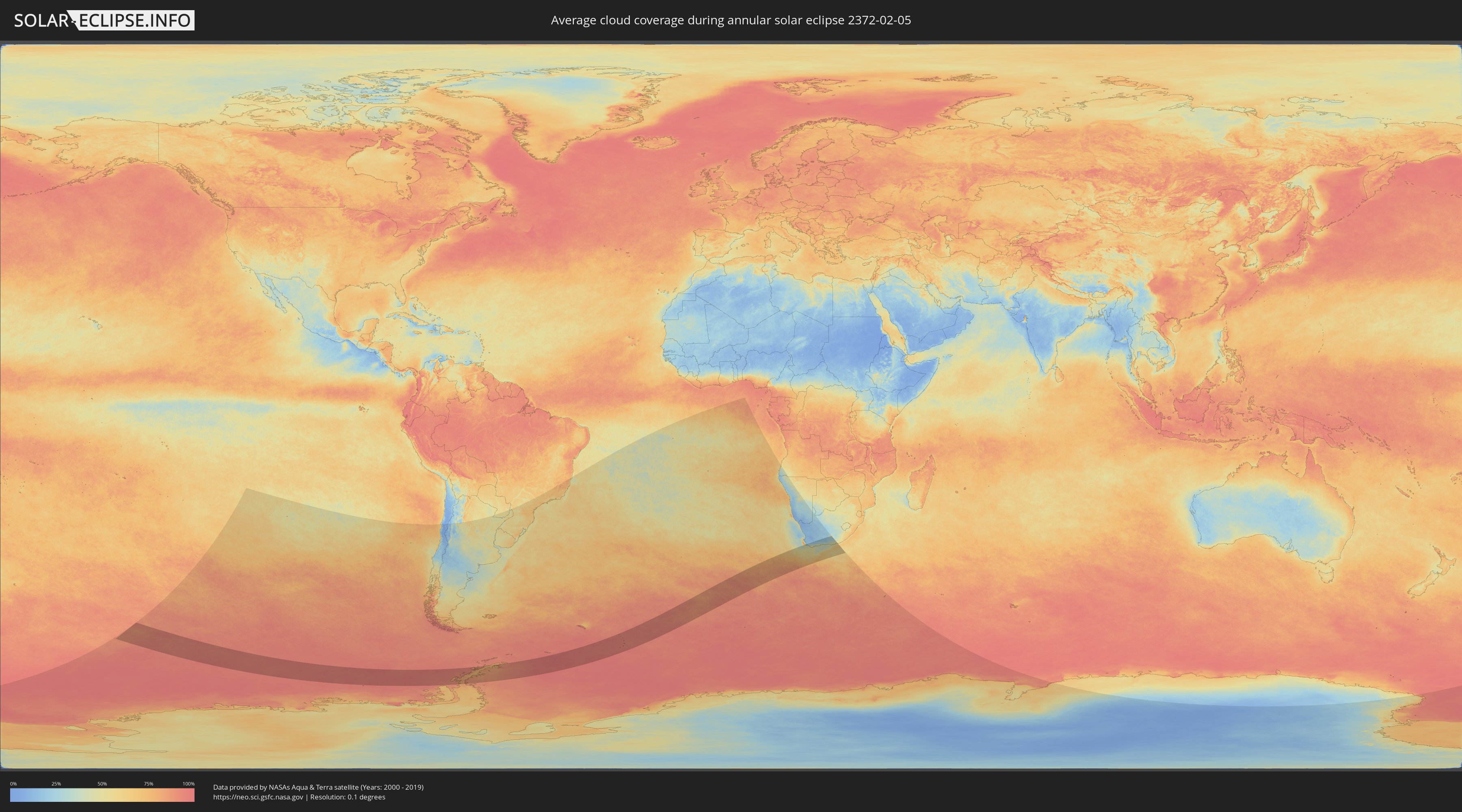
How will be the weather during the annular solar eclipse on 02/05/2372?
Where is the best place to see the annular solar eclipse of 02/05/2372?
The following maps show the average cloud coverage for the day of the annular solar eclipse.
With the help of these maps, it is possible to find the place along the eclipse path, which has the best
chance of a cloudless sky.
Nevertheless, you should consider local circumstances and inform about the weather of your chosen
observation site.
The data is provided by NASAs satellites
AQUA and TERRA.
The cloud maps are averaged over a period of 19 years (2000 - 2019).
Detailed country maps
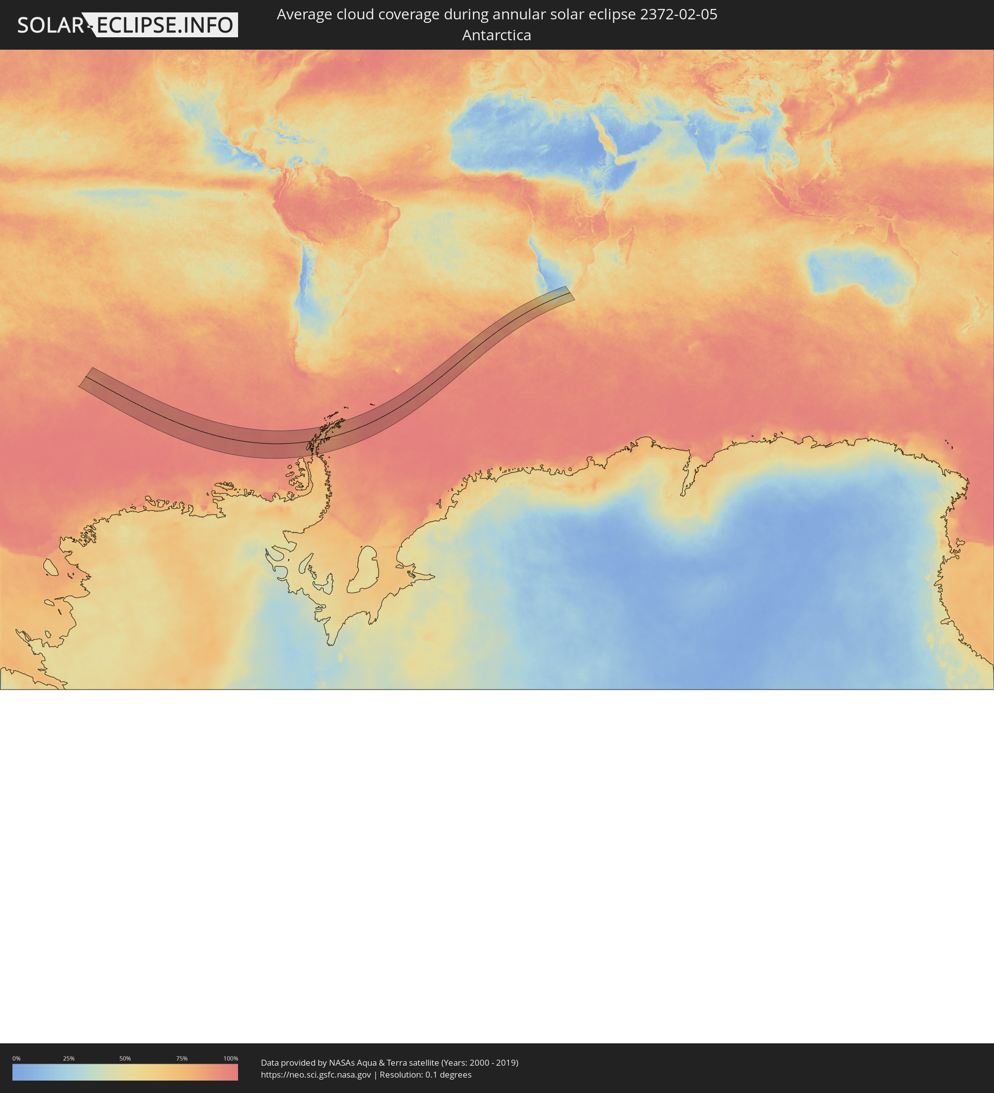 Antarctica
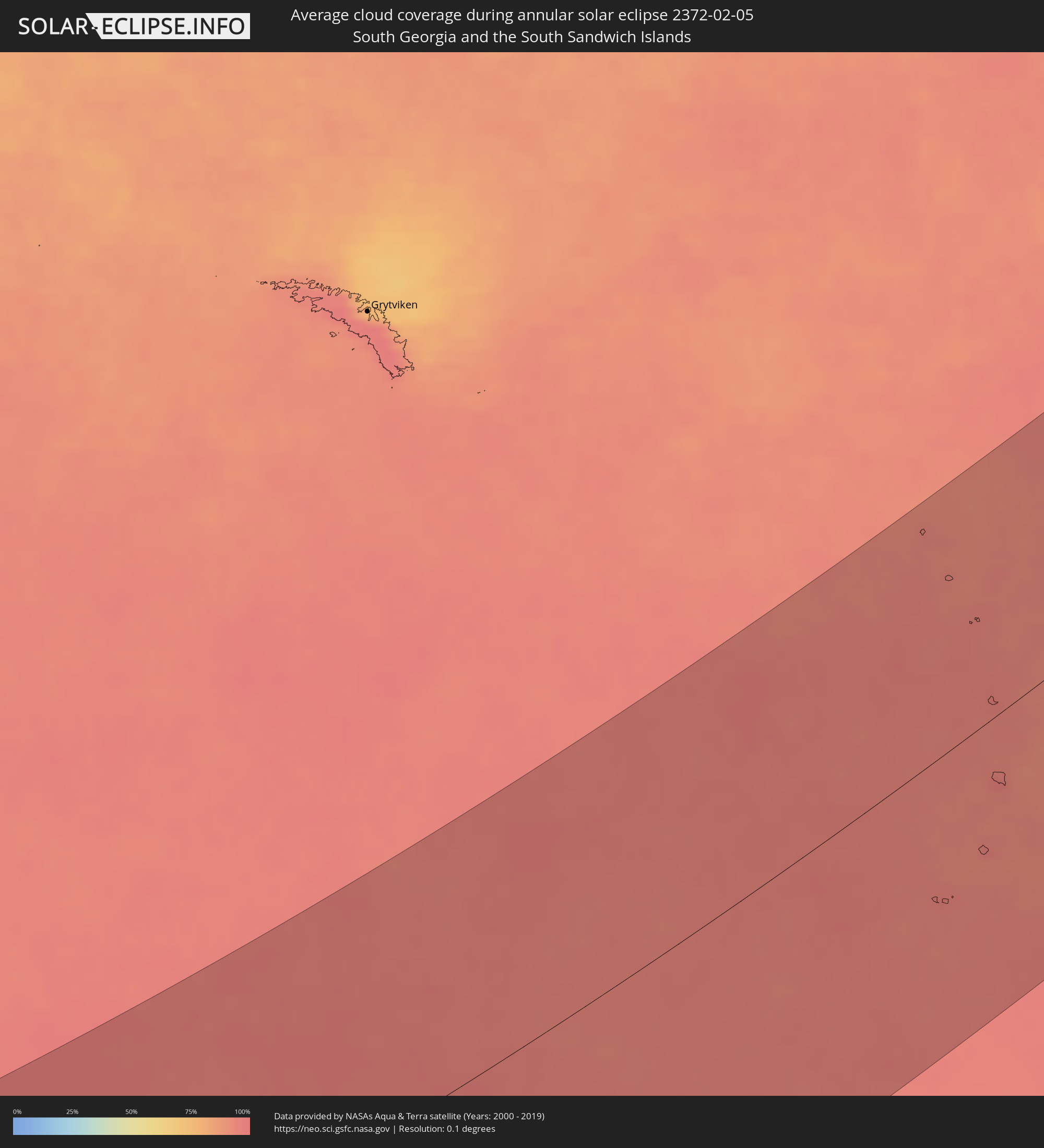 South Georgia and the South Sandwich Islands
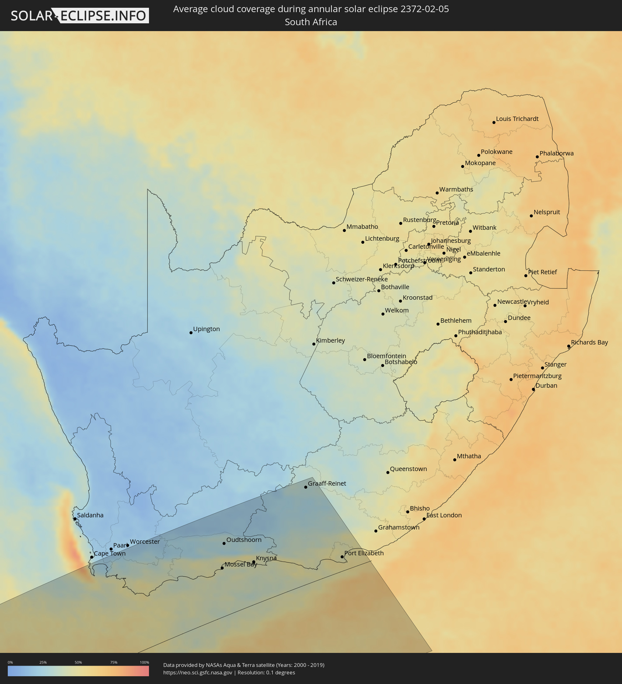 South Africa
Cities inside the path of the eclipse
The following table shows all locations with a population of more than 5,000 inside the eclipse path. Cities which have more than 100,000 inhabitants are marked bold. A click at the locations opens a detailed map.
| City | Type | Eclipse duration | Local time of max. eclipse | Distance to central line | Ø Cloud coverage |
 Retreat, Western Cape
|
annular | - | 19:14:47 UTC+02:00 | 260 km | 29% |
|
Stellenbosch, Western Cape
|
annular | - | 19:14:52 UTC+02:00 | 258 km | 22% |
|
Grabouw, Western Cape
|
annular | - | 19:14:30 UTC+02:00 | 230 km | 35% |
|
Hermanus, Western Cape
|
annular | - | 19:14:03 UTC+02:00 | 195 km | 46% |
|
Bredasdorp, Western Cape
|
annular | - | 19:13:40 UTC+02:00 | 156 km | 49% |
|
Swellendam, Western Cape
|
annular | - | 19:14:18 UTC+02:00 | 195 km | 38% |
|
Hardys Memories of Africa, Western Cape
|
annular | - | 19:14:24 UTC+02:00 | 196 km | 35% |
|
Riversdale, Western Cape
|
annular | - | 19:13:58 UTC+02:00 | 158 km | 42% |
|
Ladismith, Western Cape
|
annular | - | 19:14:50 UTC+02:00 | 220 km | 25% |
|
Albertina, Western Cape
|
annular | - | 19:13:42 UTC+02:00 | 136 km | 44% |
|
Prince Albert, Western Cape
|
annular | - | 19:14:58 UTC+02:00 | 222 km | 18% |
|
Mossel Bay, Western Cape
|
annular | - | 19:13:33 UTC+02:00 | 118 km | 42% |
|
Oudtshoorn, Western Cape
|
annular | - | 19:14:23 UTC+02:00 | 177 km | 28% |
|
George, Western Cape
|
annular | - | 19:13:46 UTC+02:00 | 130 km | 45% |
|
Knysna, Western Cape
|
annular | - | 19:13:28 UTC+02:00 | 103 km | 42% |
|
Plettenberg Bay, Western Cape
|
annular | - | 19:13:20 UTC+02:00 | 91 km | 41% |
|
Willowmore, Eastern Cape
|
annular | - | 19:14:22 UTC+02:00 | 166 km | 27% |
|
Graaff-Reinet, Eastern Cape
|
annular | - | 19:15:25 UTC+02:00 | 242 km | 29% |
|
Kruisfontein, Eastern Cape
|
annular | - | 19:12:55 UTC+02:00 | 52 km | 45% |
|
Jeffrey’s Bay, Eastern Cape
|
annular | - | 19:12:47 UTC+02:00 | 42 km | 45% |
|
Uitenhage, Eastern Cape
|
annular | - | 19:13:00 UTC+02:00 | 57 km | 46% |
|
Kirkwood, Eastern Cape
|
annular | - | 19:13:29 UTC+02:00 | 95 km | 41% |
|
Port Elizabeth, Eastern Cape
|
annular | - | 19:12:43 UTC+02:00 | 34 km | 44% |