Annular solar eclipse of 11/21/2682
| Day of week: | Tuesday |
| Maximum duration of eclipse: | 01m32s |
| Maximum width of eclipse path: | 48 km |
| Saros cycle: | 163 |
| Coverage: | 98.7% |
| Magnitude: | 0.9866 |
| Gamma: | 0.1351 |
Wo kann man die Sonnenfinsternis vom 11/21/2682 sehen?
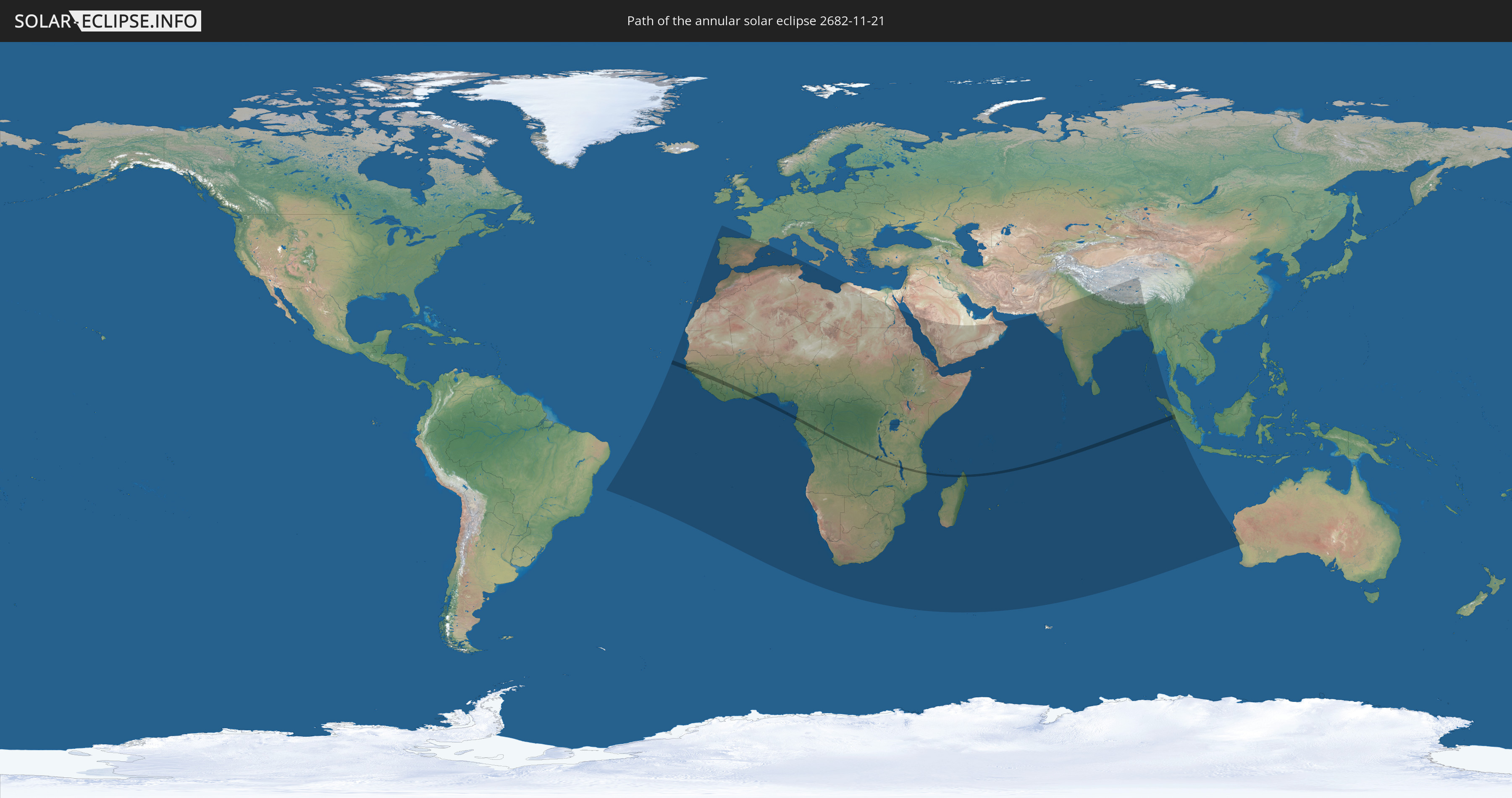
Die Sonnenfinsternis am 11/21/2682 kann man in 79 Ländern als partielle Sonnenfinsternis beobachten.
Der Finsternispfad verläuft durch 18 Länder. Nur in diesen Ländern ist sie als annular Sonnenfinsternis zu sehen.
In den folgenden Ländern ist die Sonnenfinsternis annular zu sehen
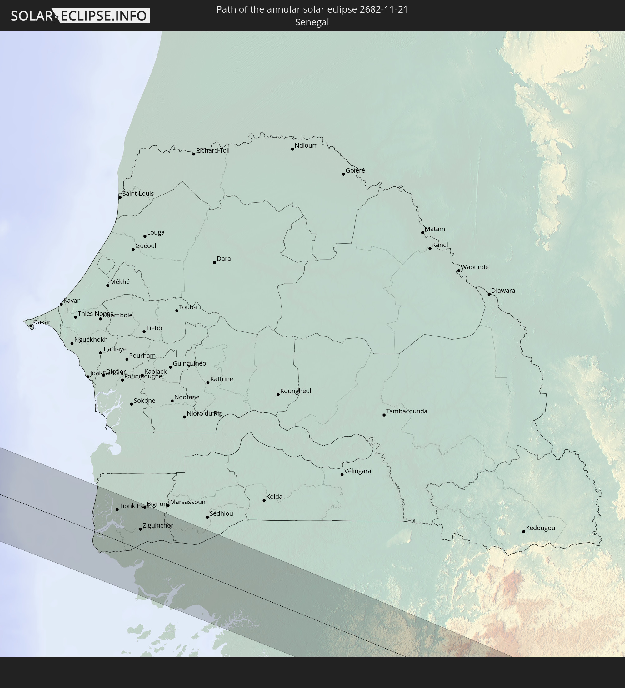 Senegal
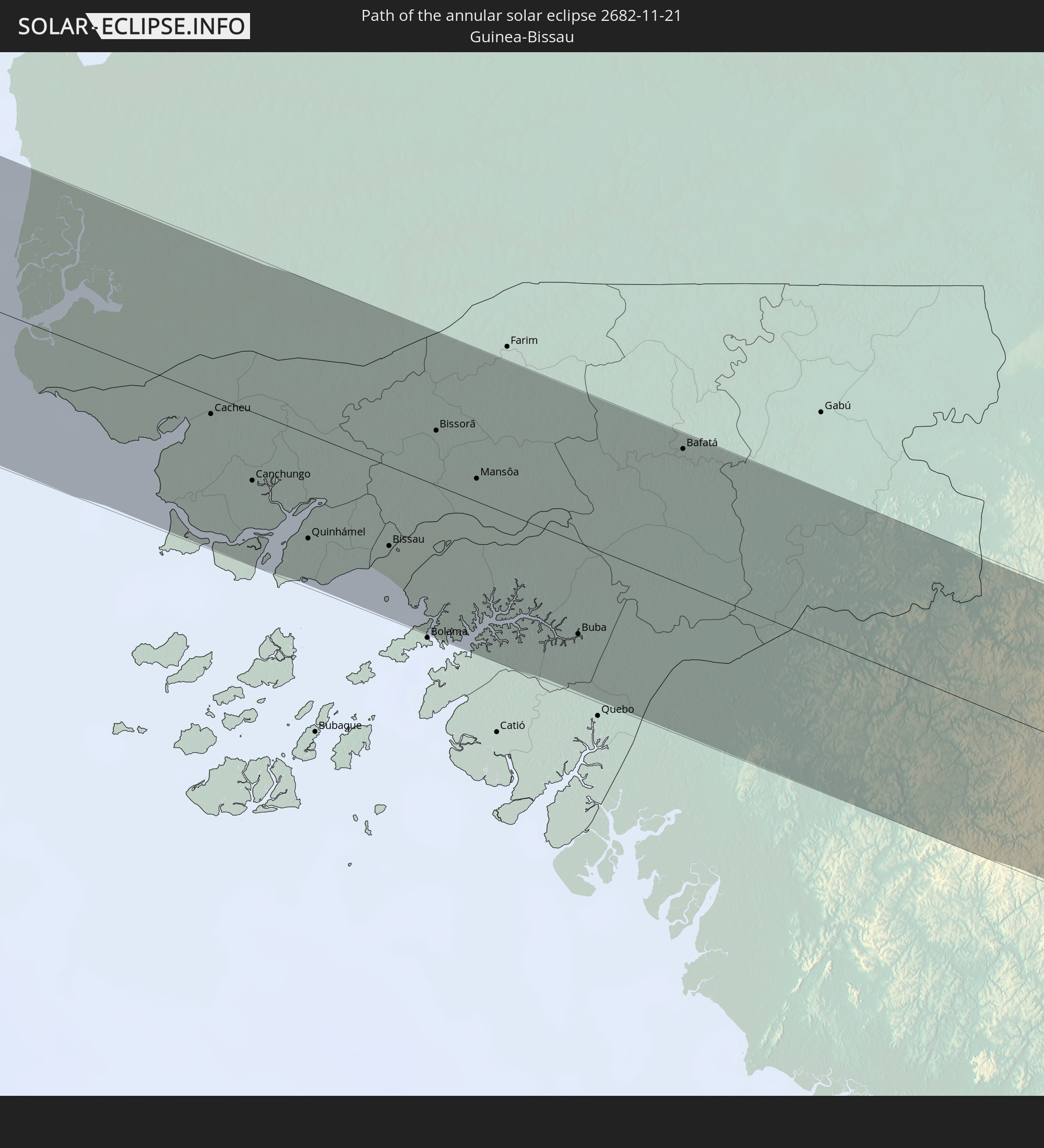 Guinea-Bissau
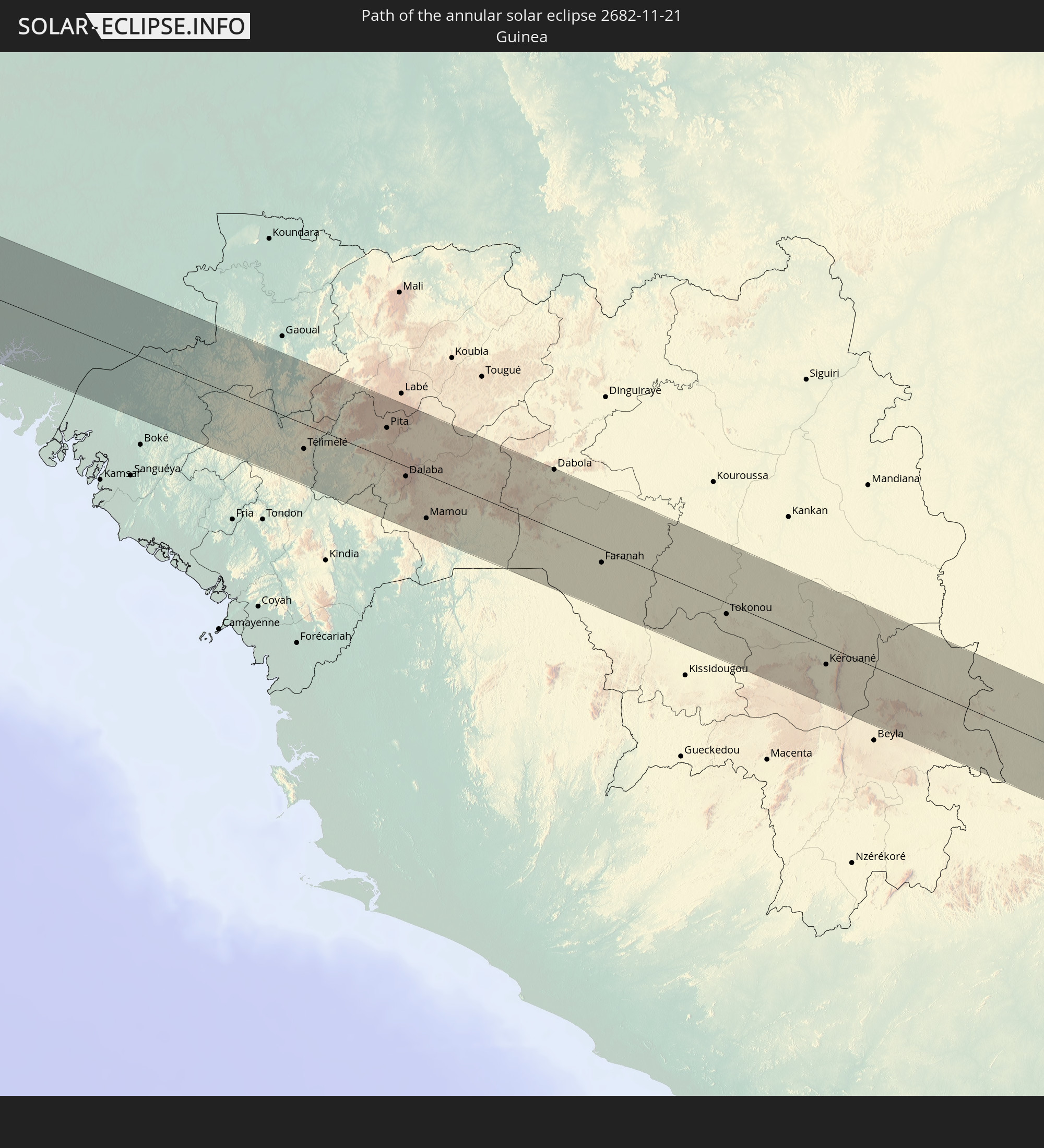 Guinea
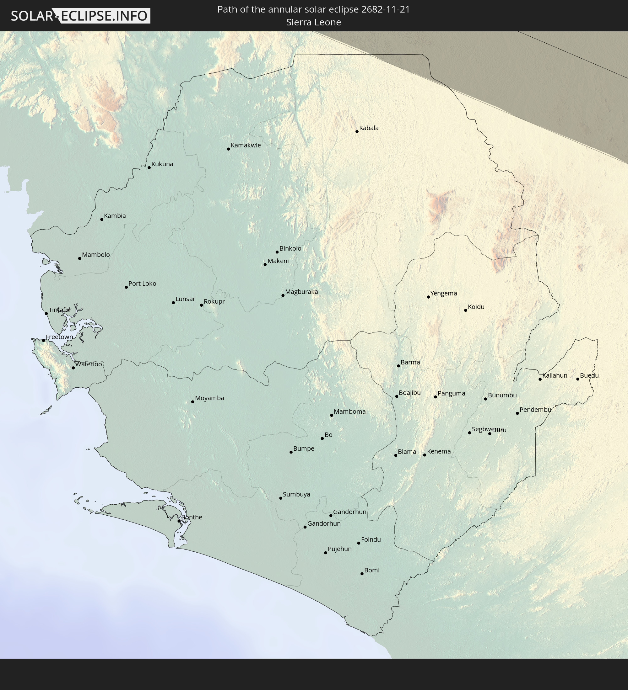 Sierra Leone
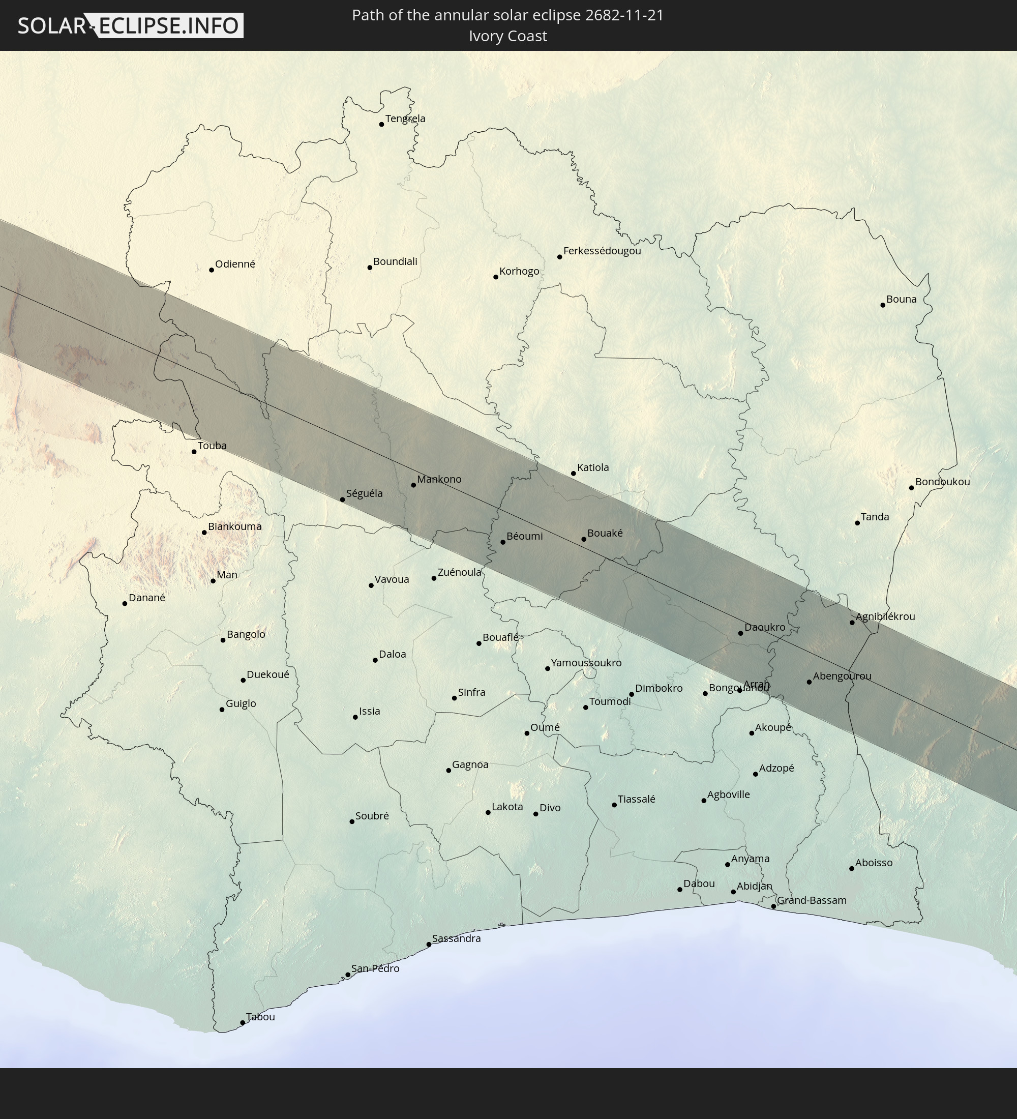 Ivory Coast
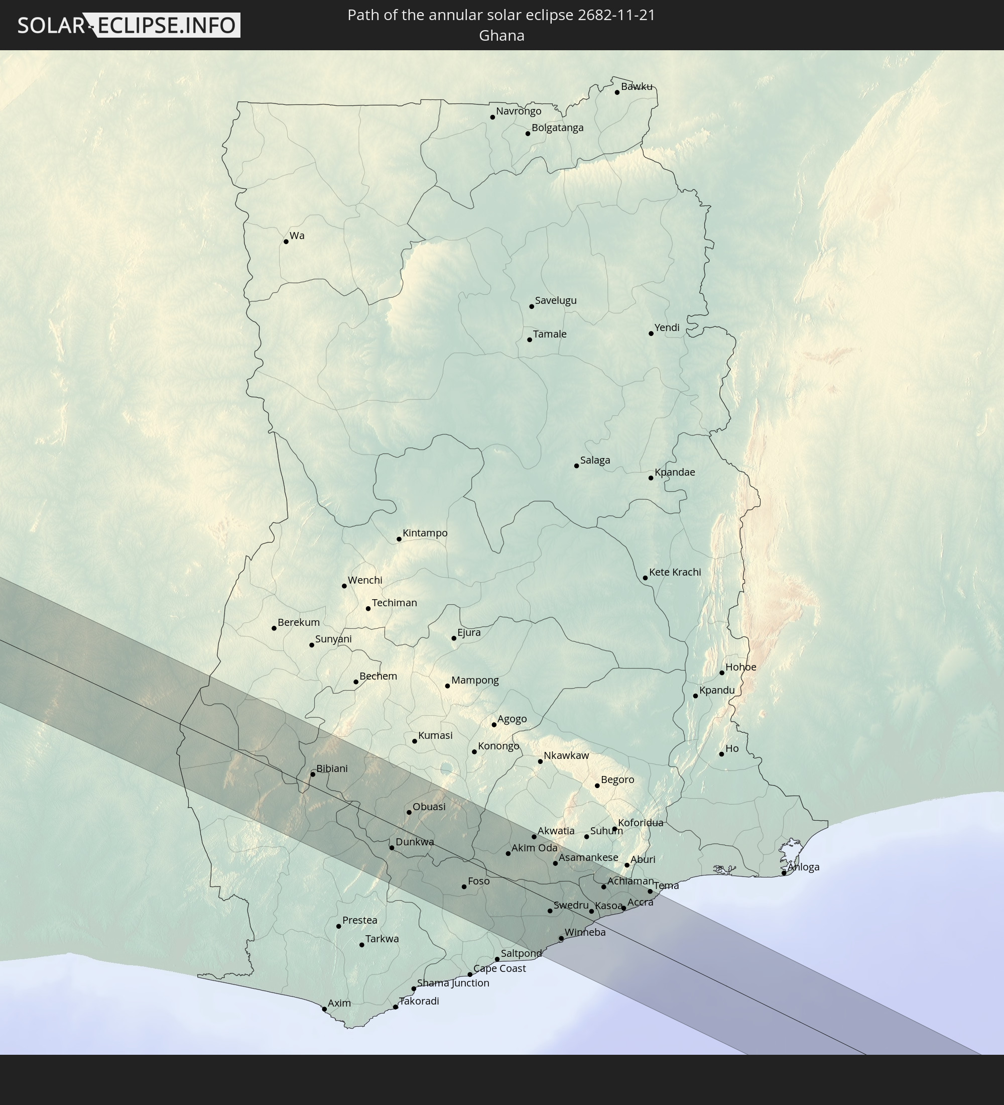 Ghana
Ghana
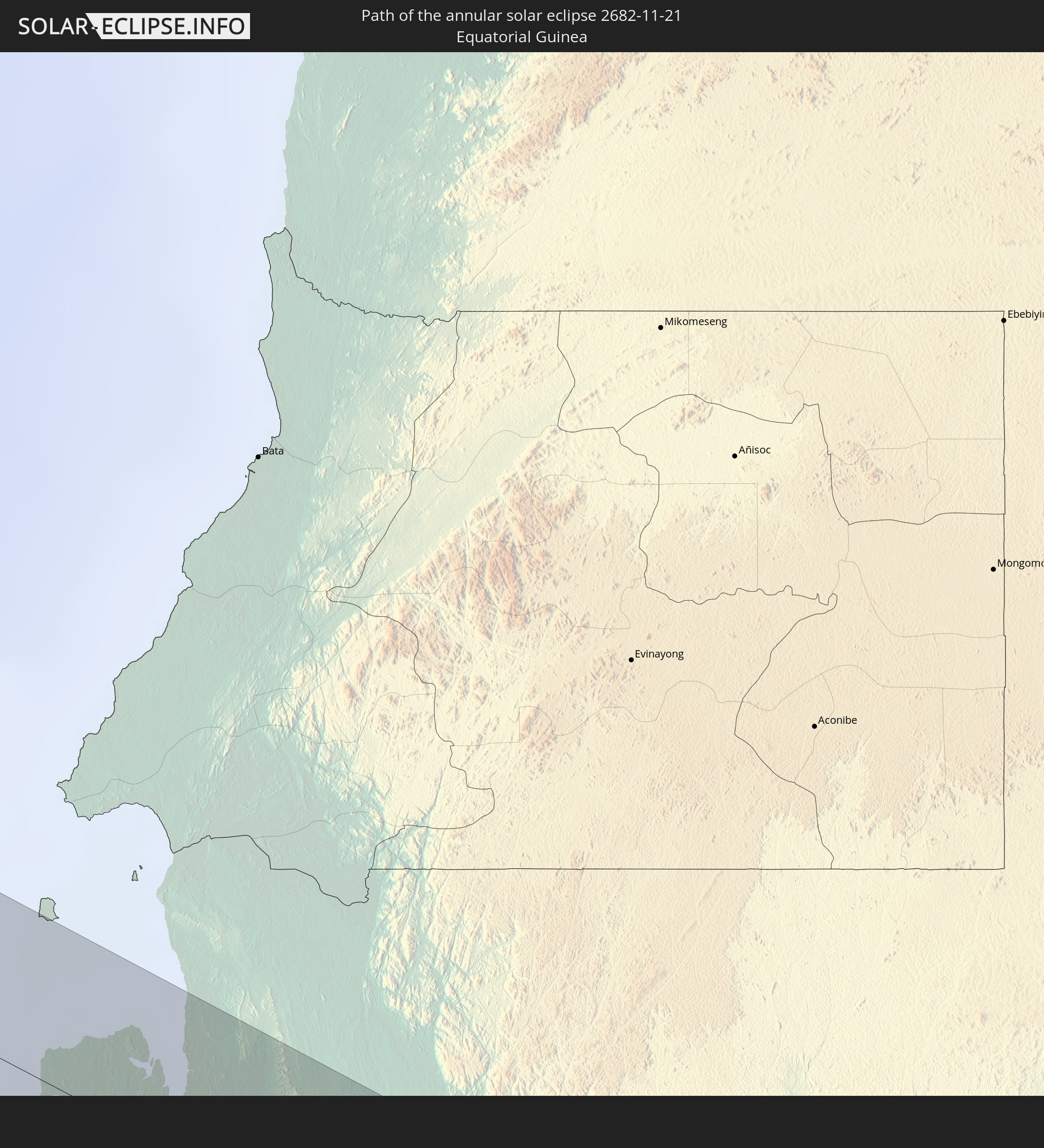 Equatorial Guinea
 São Tomé and Príncipe
 Gabon
Gabon
 Republic of the Congo
 Democratic Republic of the Congo
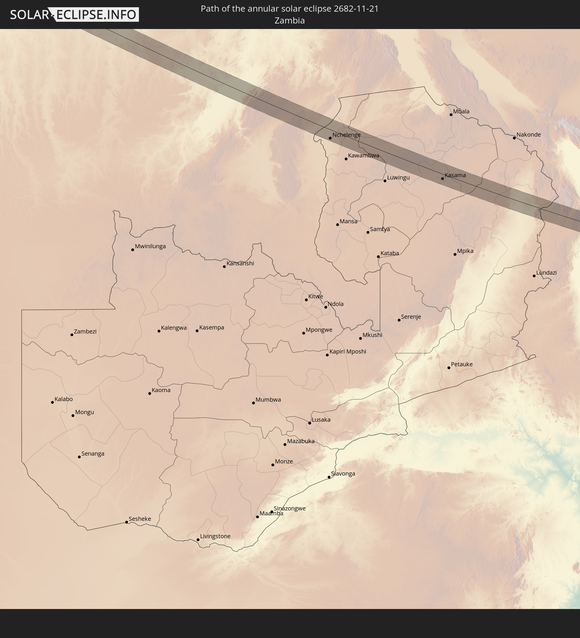 Zambia
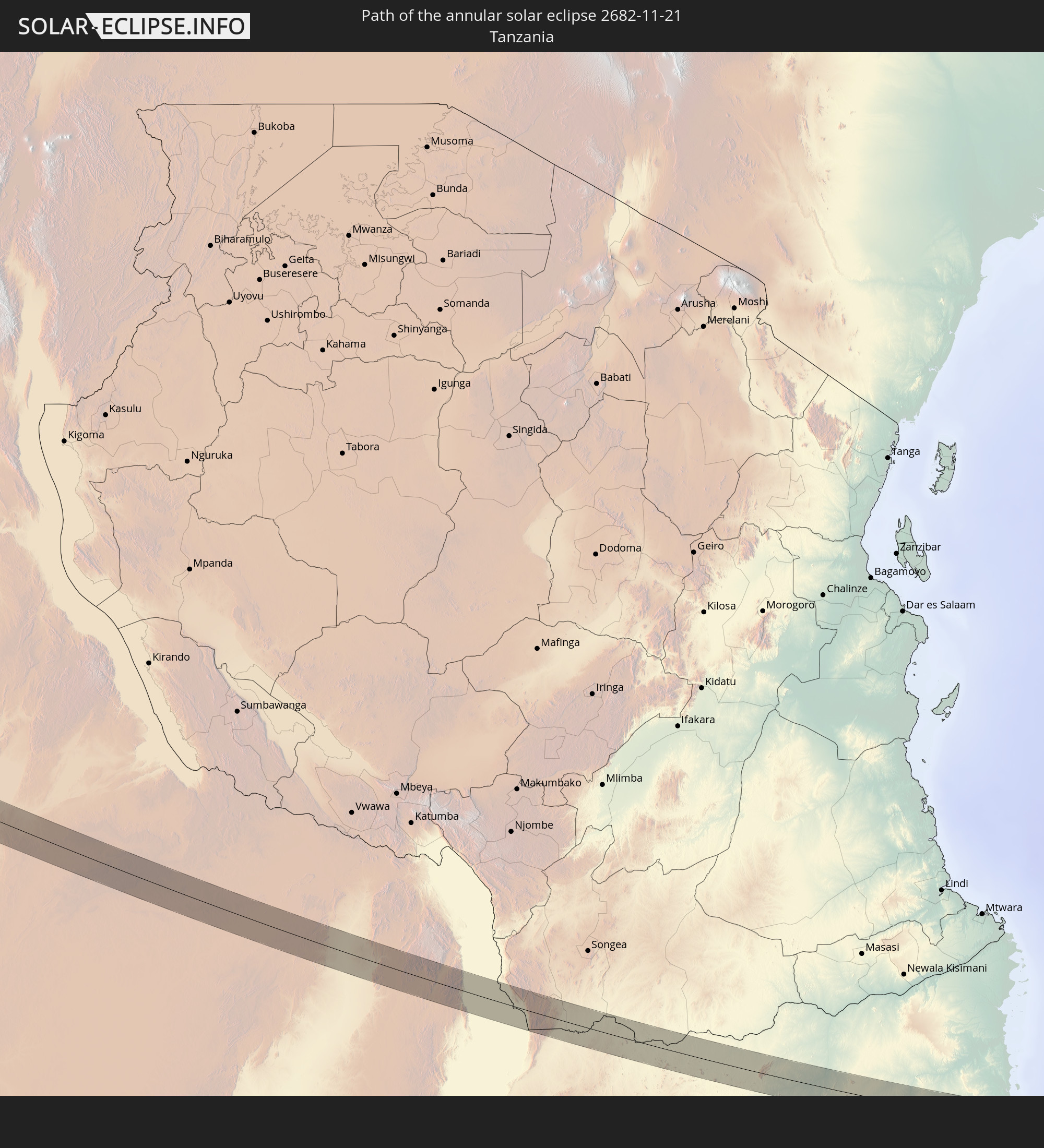 Tanzania
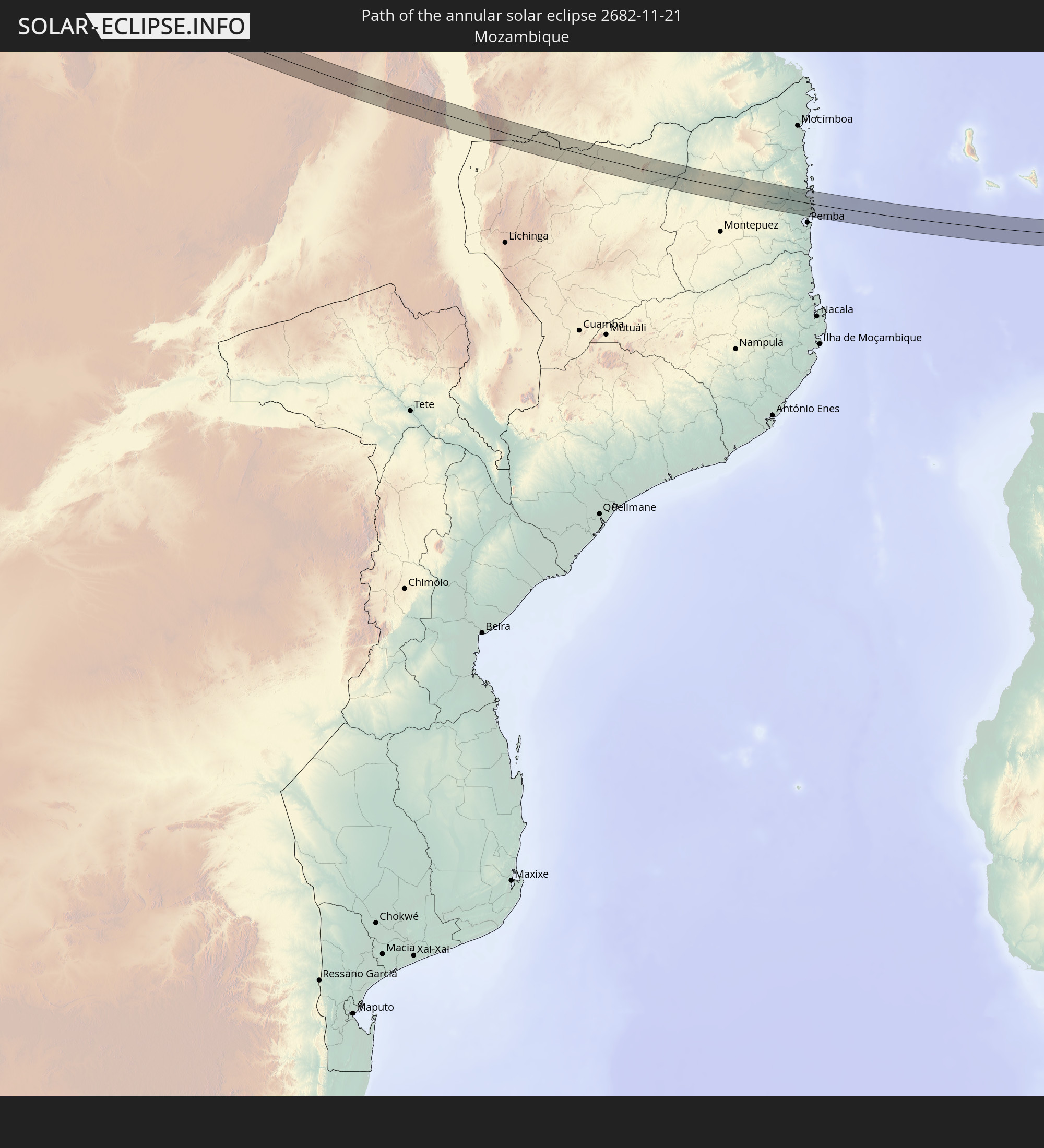 Mozambique
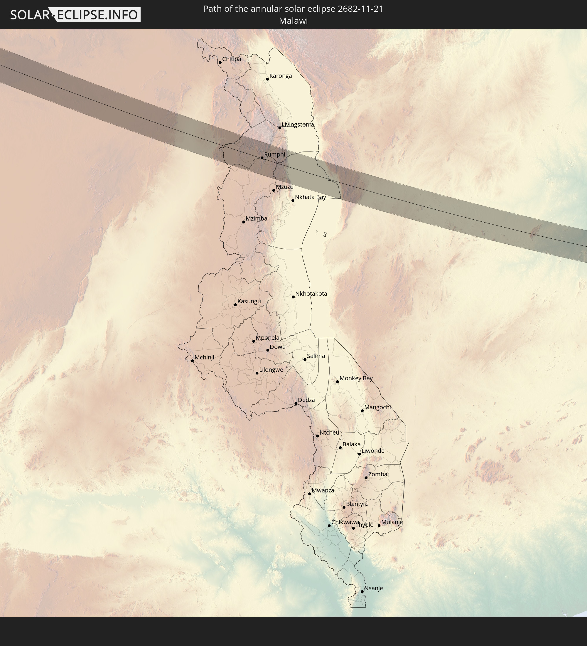 Malawi
 Madagascar
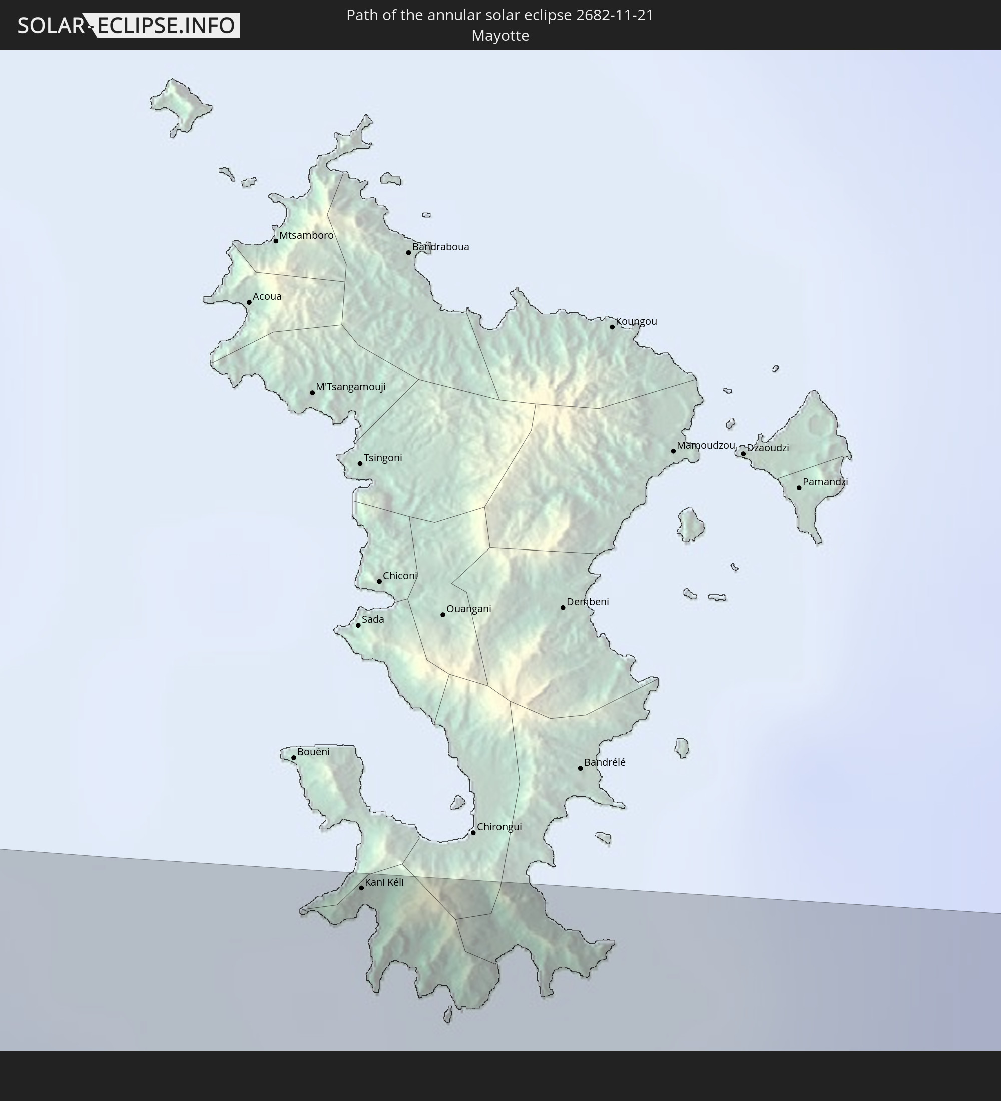 Mayotte
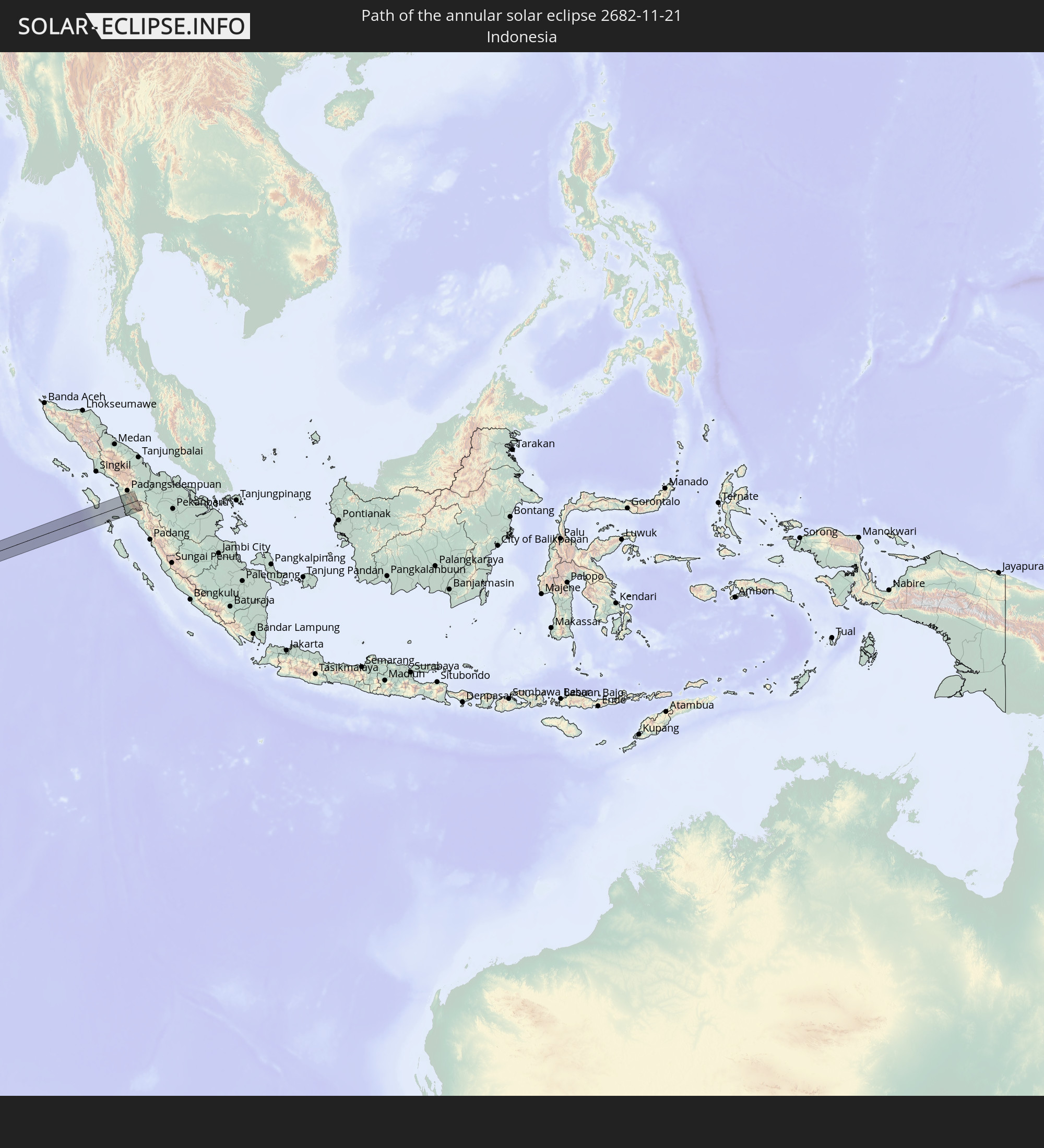 Indonesia
In den folgenden Ländern ist die Sonnenfinsternis partiell zu sehen
 Portugal
 Spain
Spain
 Senegal
 Mauritania
 The Gambia
 Guinea-Bissau
 Guinea
 Saint Helena, Ascension and Tristan da Cunha
 Sierra Leone
 Morocco
 Mali
Mali
 Liberia
 Algeria
 Ivory Coast
 Burkina Faso
 Gibraltar
 France
 Ghana
Ghana
 Togo
Togo
 Niger
Niger
 Benin
Benin
 Nigeria
 Equatorial Guinea
 São Tomé and Príncipe
 Italy
Italy
 Tunisia
 Cameroon
 Gabon
Gabon
 Libya
Libya
 Republic of the Congo
 Angola
 Namibia
 Democratic Republic of the Congo
 Chad
Chad
 Malta
Malta
 Central African Republic
 South Africa
 Botswana
 Sudan
Sudan
 Zambia
 Egypt
Egypt
 Zimbabwe
 Lesotho
 Rwanda
 Burundi
 Tanzania
 Uganda
 Mozambique
 Swaziland
 Malawi
 Ethiopia
 Kenya
Kenya
 Saudi Arabia
 Eritrea
 French Southern and Antarctic Lands
 Somalia
 Djibouti
 Yemen
Yemen
 Madagascar
 Comoros
 Mayotte
 Seychelles
 United Arab Emirates
 Oman
Oman
 Réunion
 Mauritius
 Pakistan
 India
India
 British Indian Ocean Territory
 Maldives
 China
China
 Sri Lanka
 Nepal
Nepal
 Bangladesh
 Bhutan
 Myanmar
 Indonesia
 Cocos Islands
 Australia
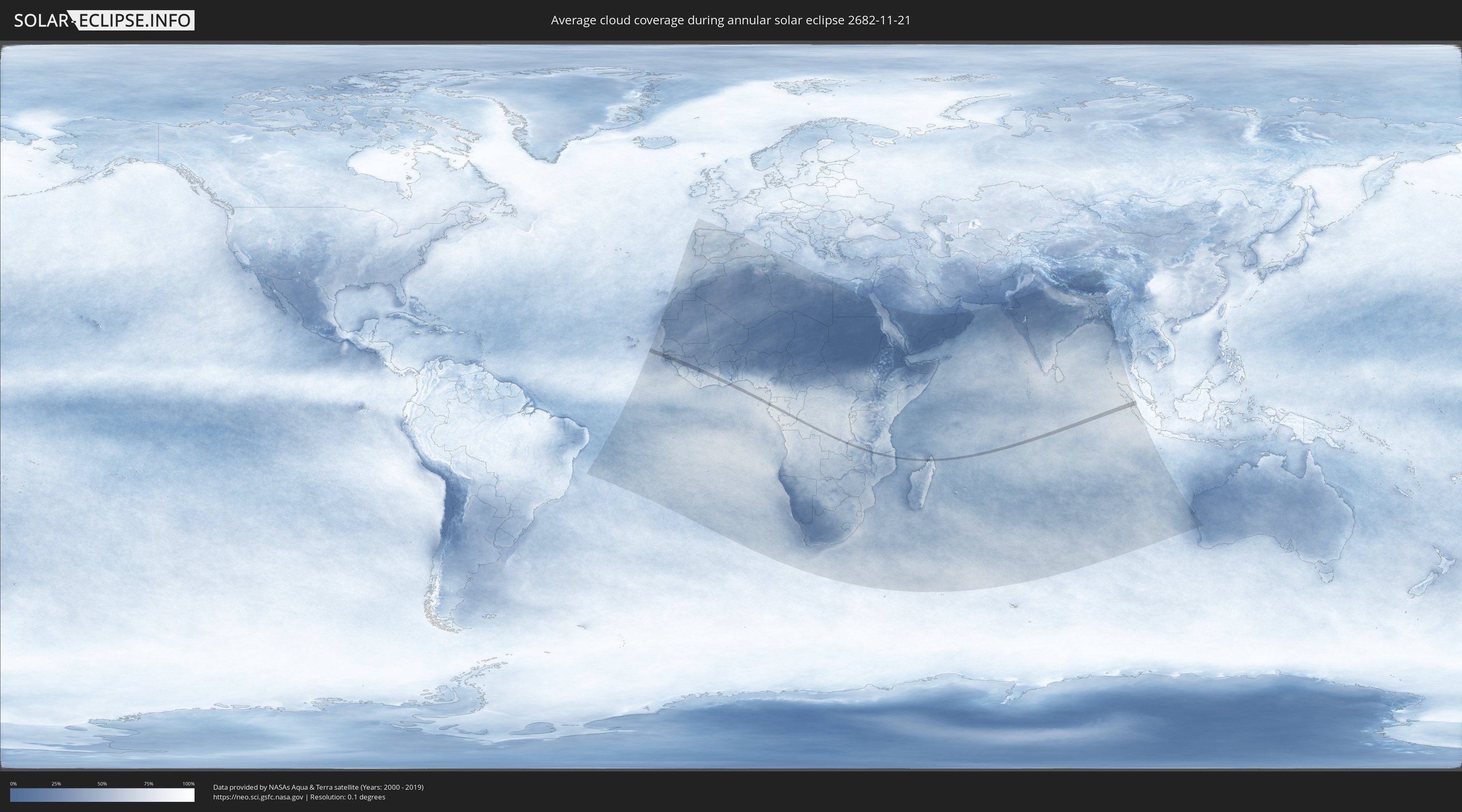
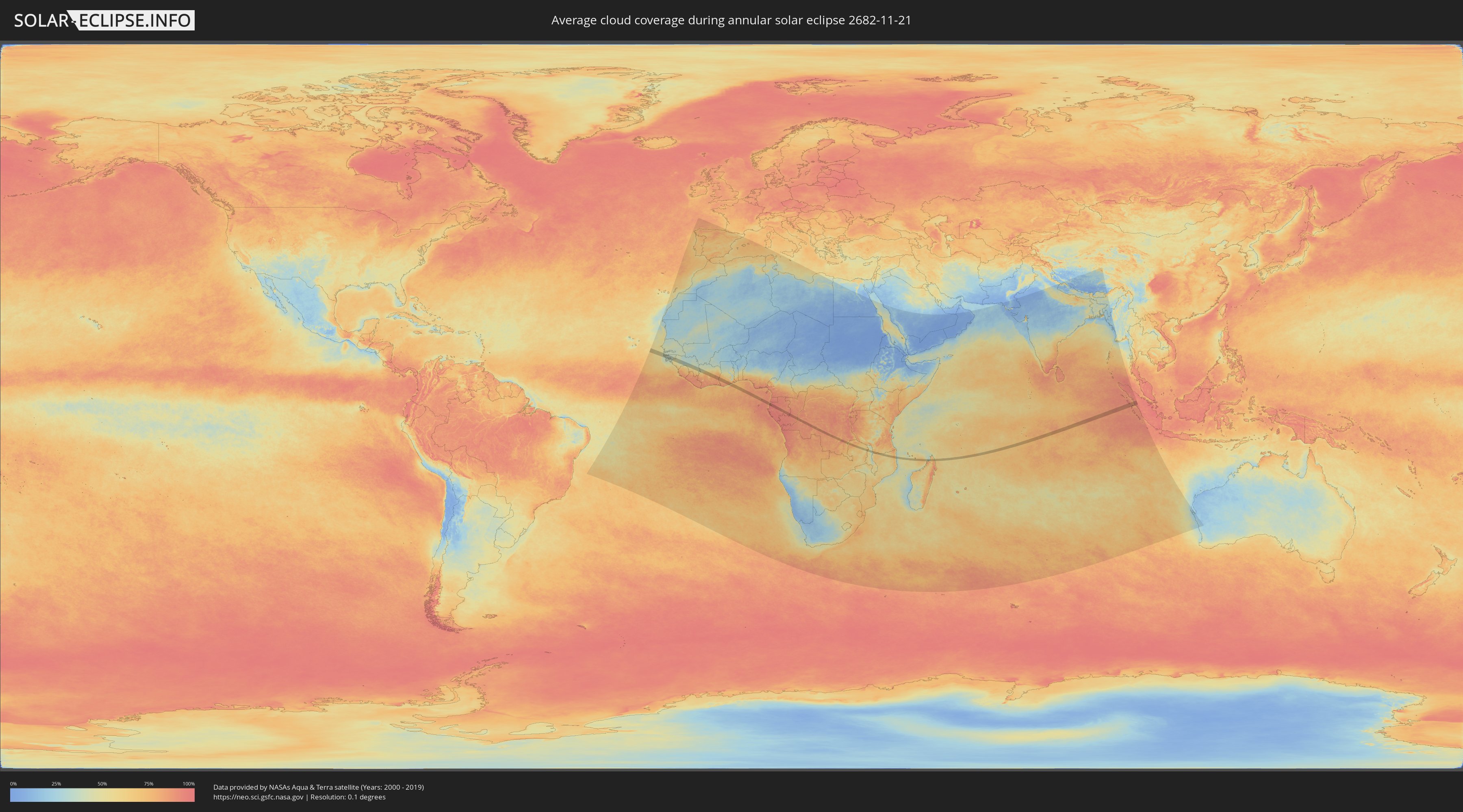
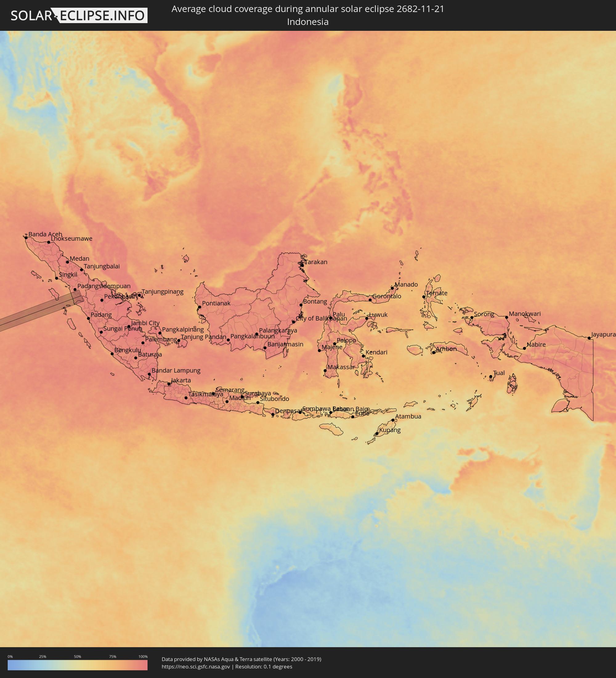
How will be the weather during the annular solar eclipse on 11/21/2682?
Where is the best place to see the annular solar eclipse of 11/21/2682?
The following maps show the average cloud coverage for the day of the annular solar eclipse.
With the help of these maps, it is possible to find the place along the eclipse path, which has the best
chance of a cloudless sky.
Nevertheless, you should consider local circumstances and inform about the weather of your chosen
observation site.
The data is provided by NASAs satellites
AQUA and TERRA.
The cloud maps are averaged over a period of 19 years (2000 - 2019).
Detailed country maps
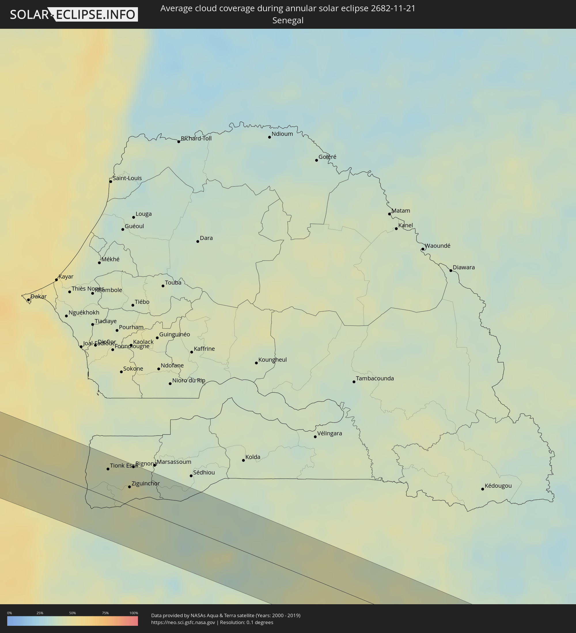 Senegal
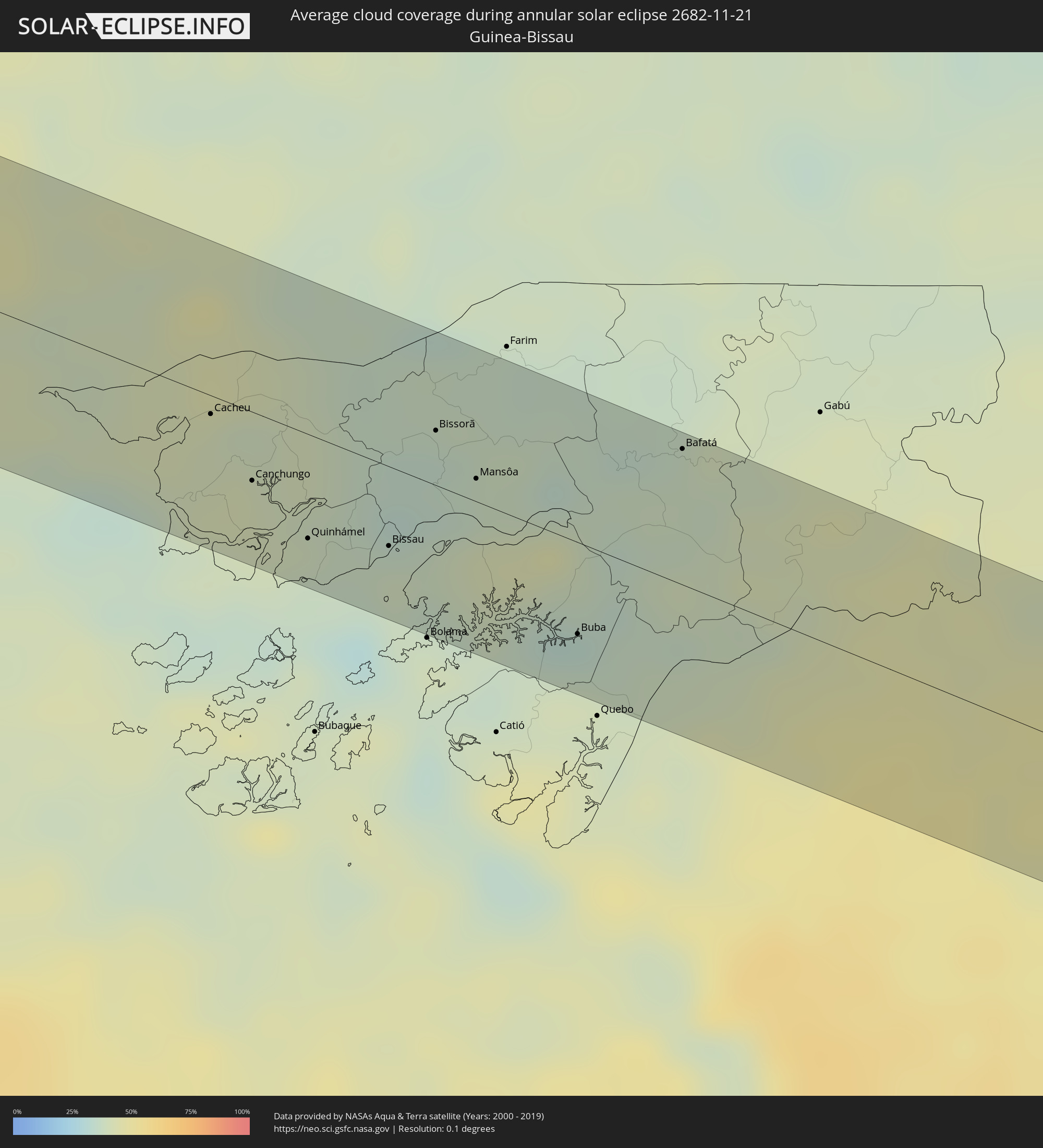 Guinea-Bissau
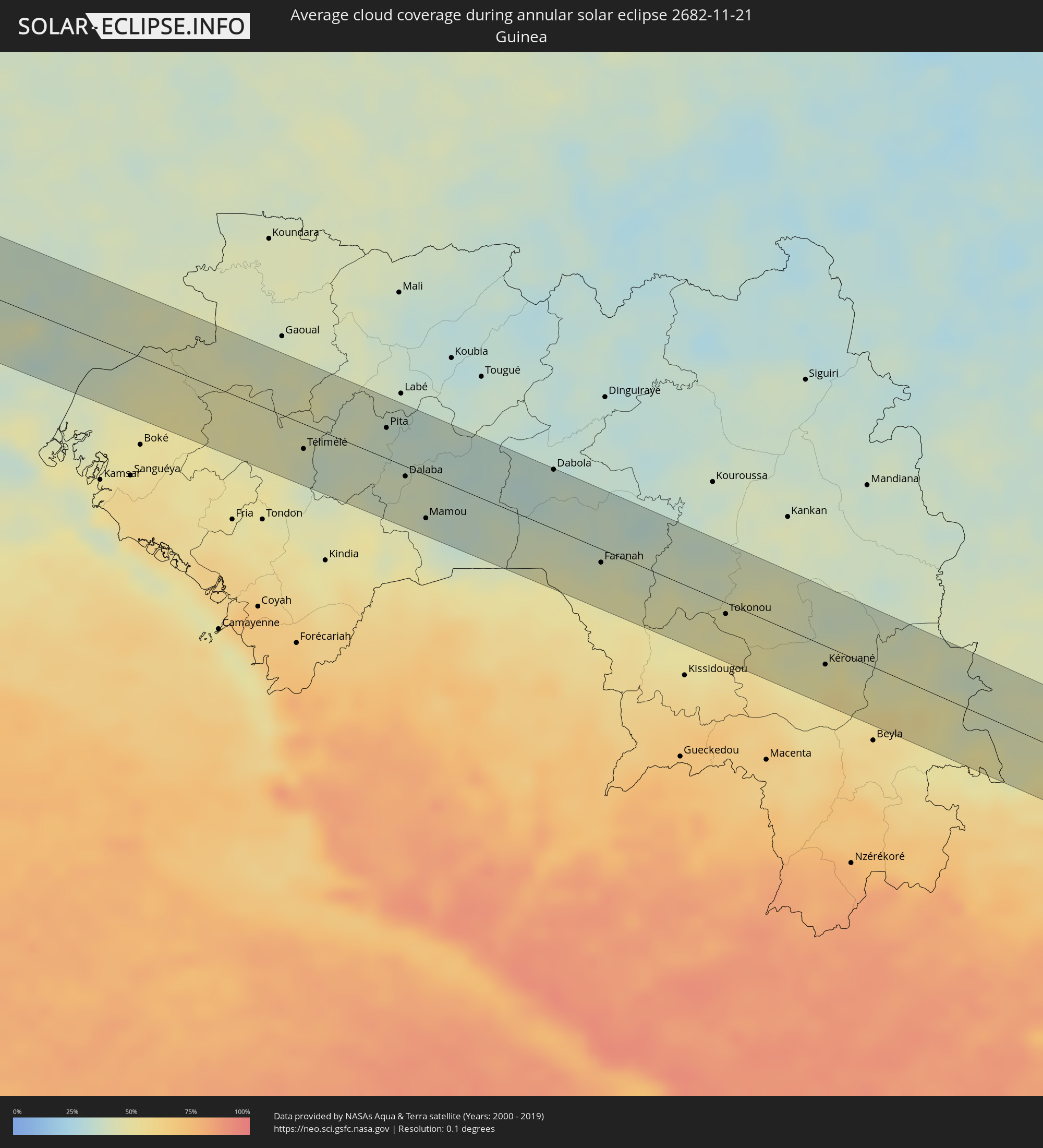 Guinea
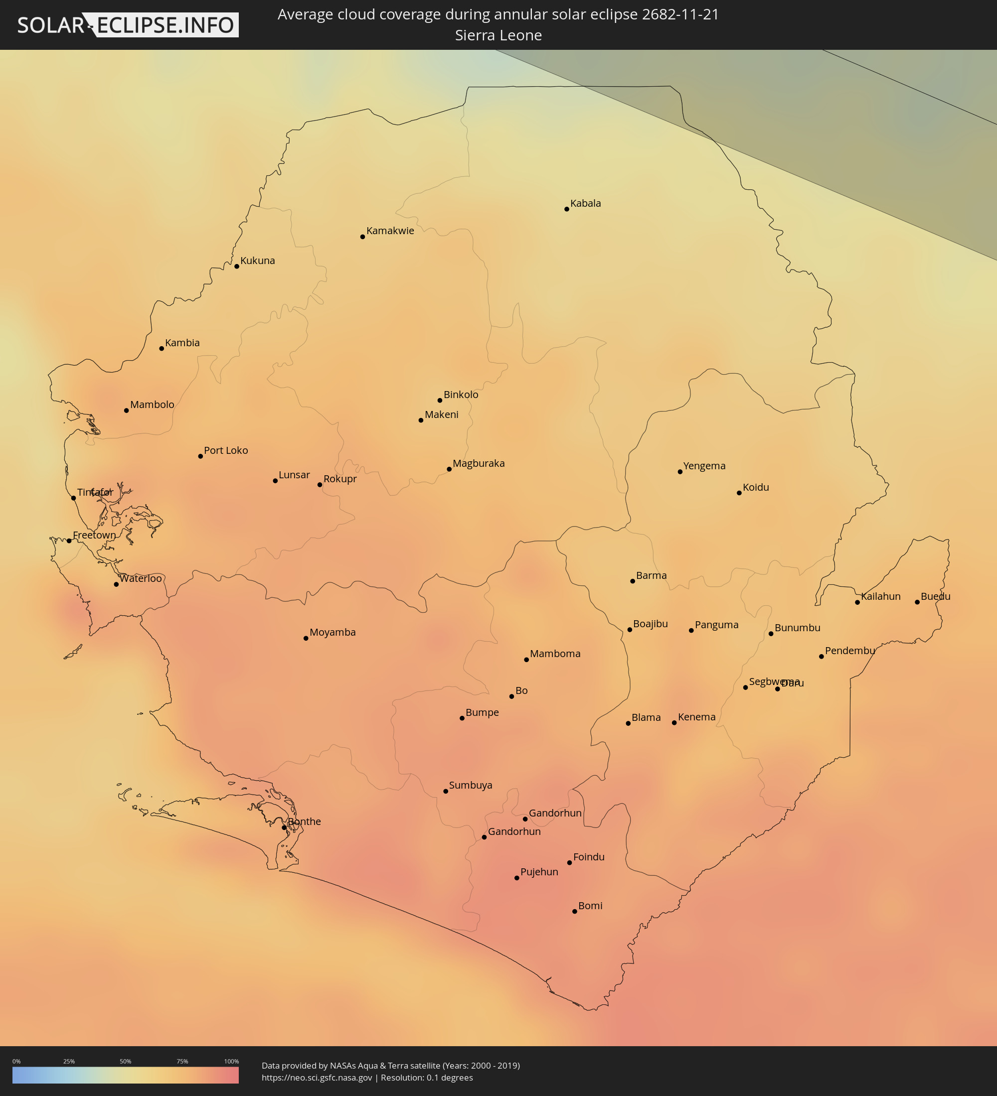 Sierra Leone
 Ivory Coast
 Ghana
Ghana
 Equatorial Guinea
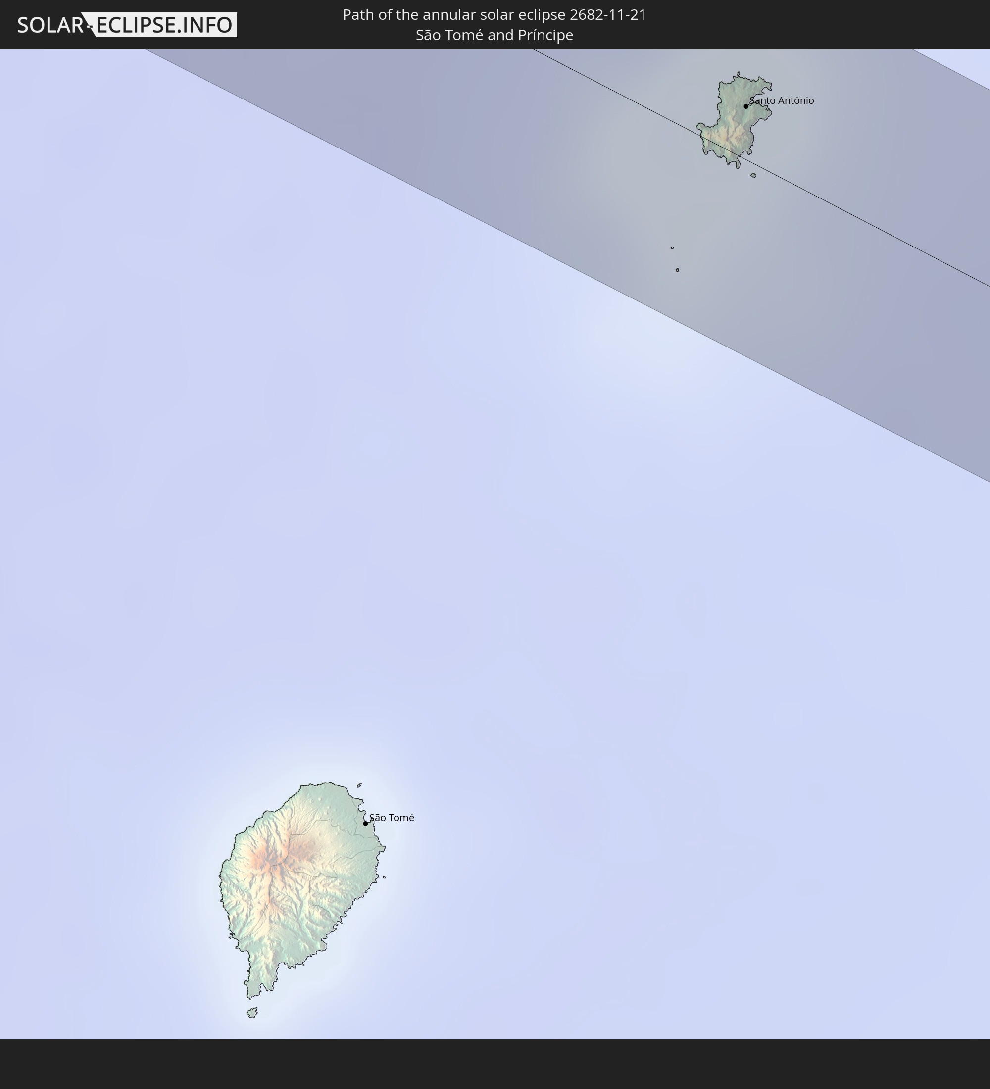
 São Tomé and Príncipe
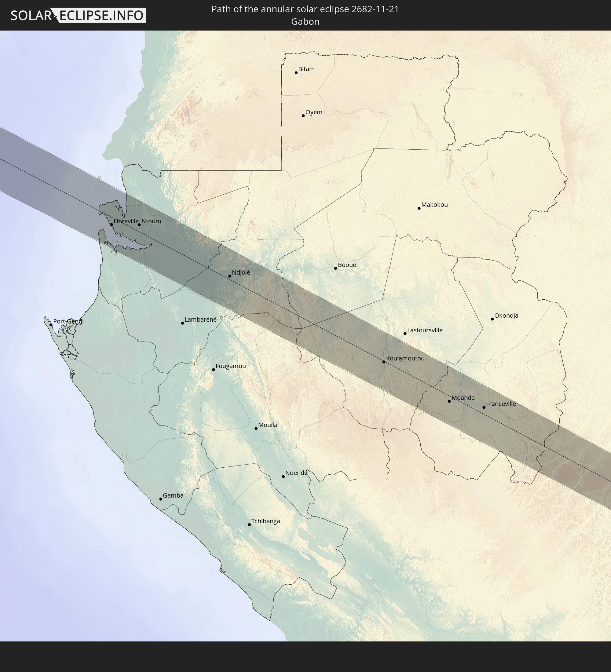
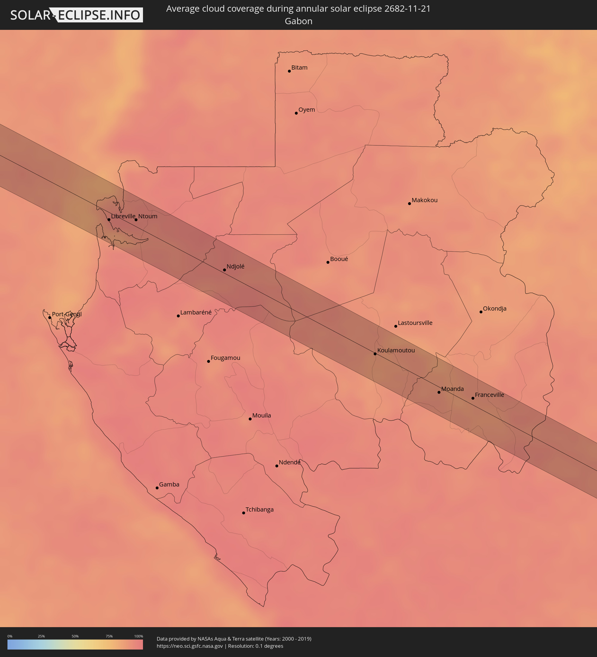 Gabon
Gabon
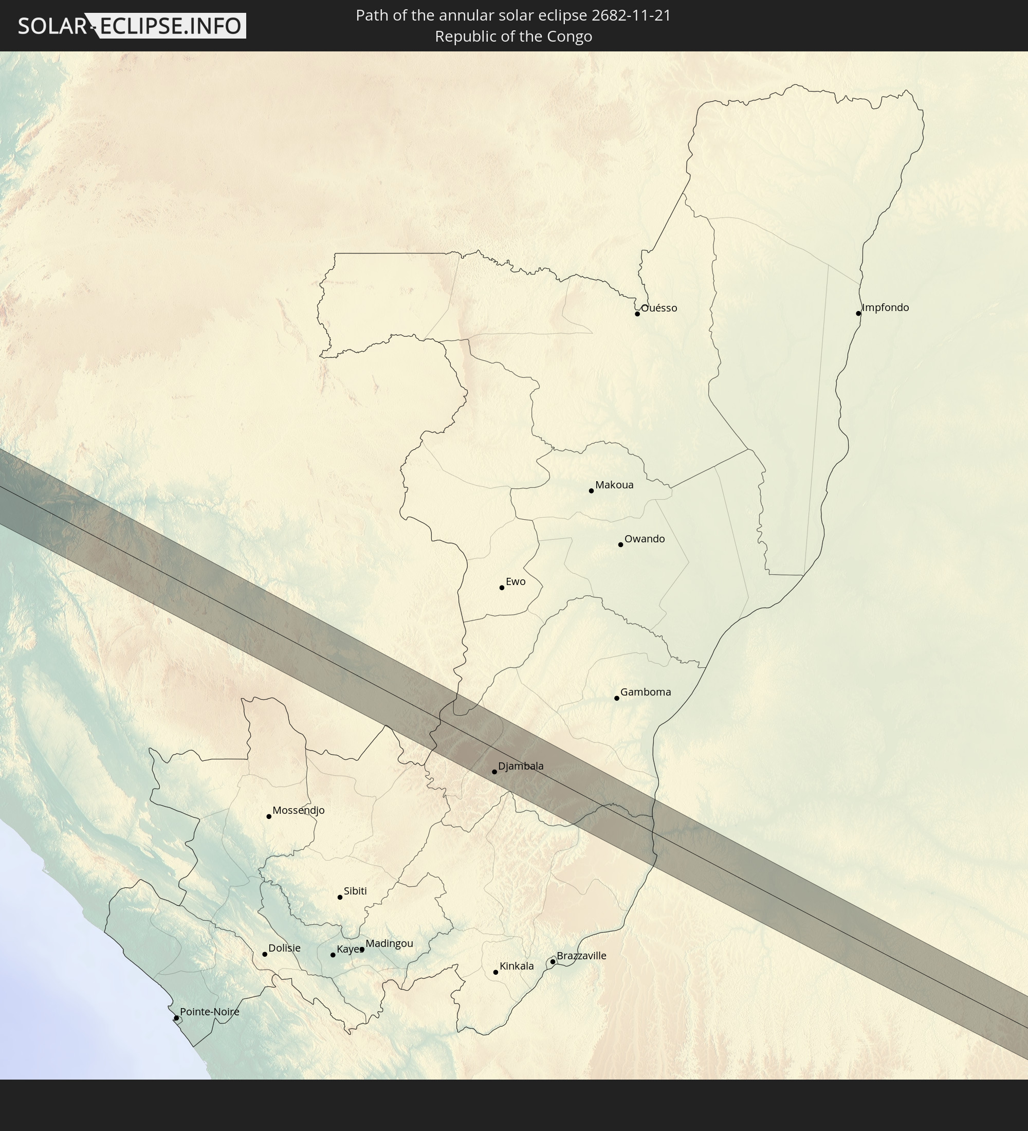
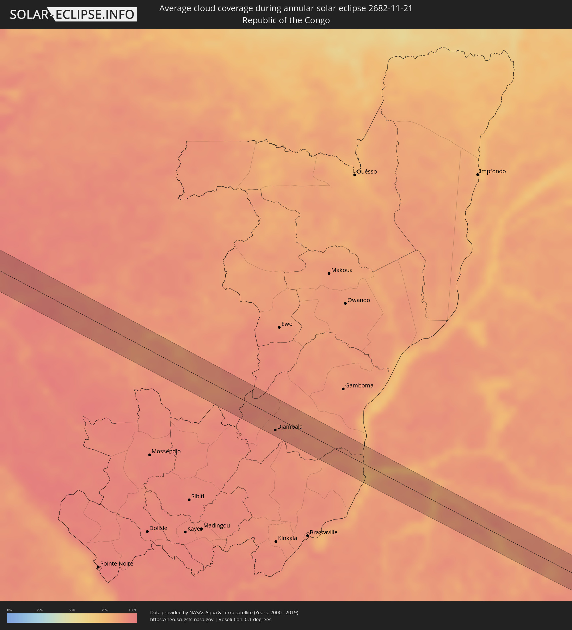 Republic of the Congo
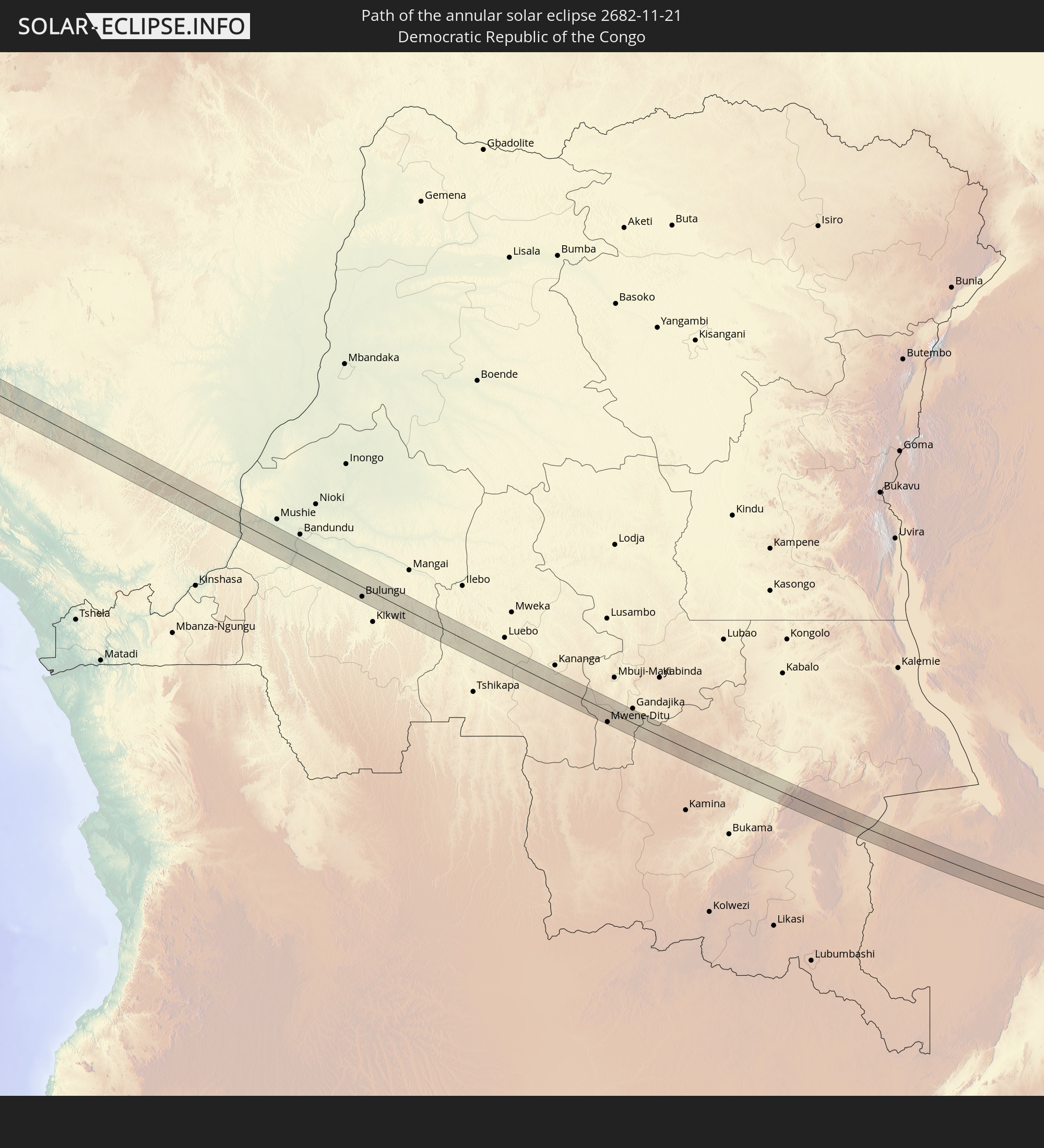
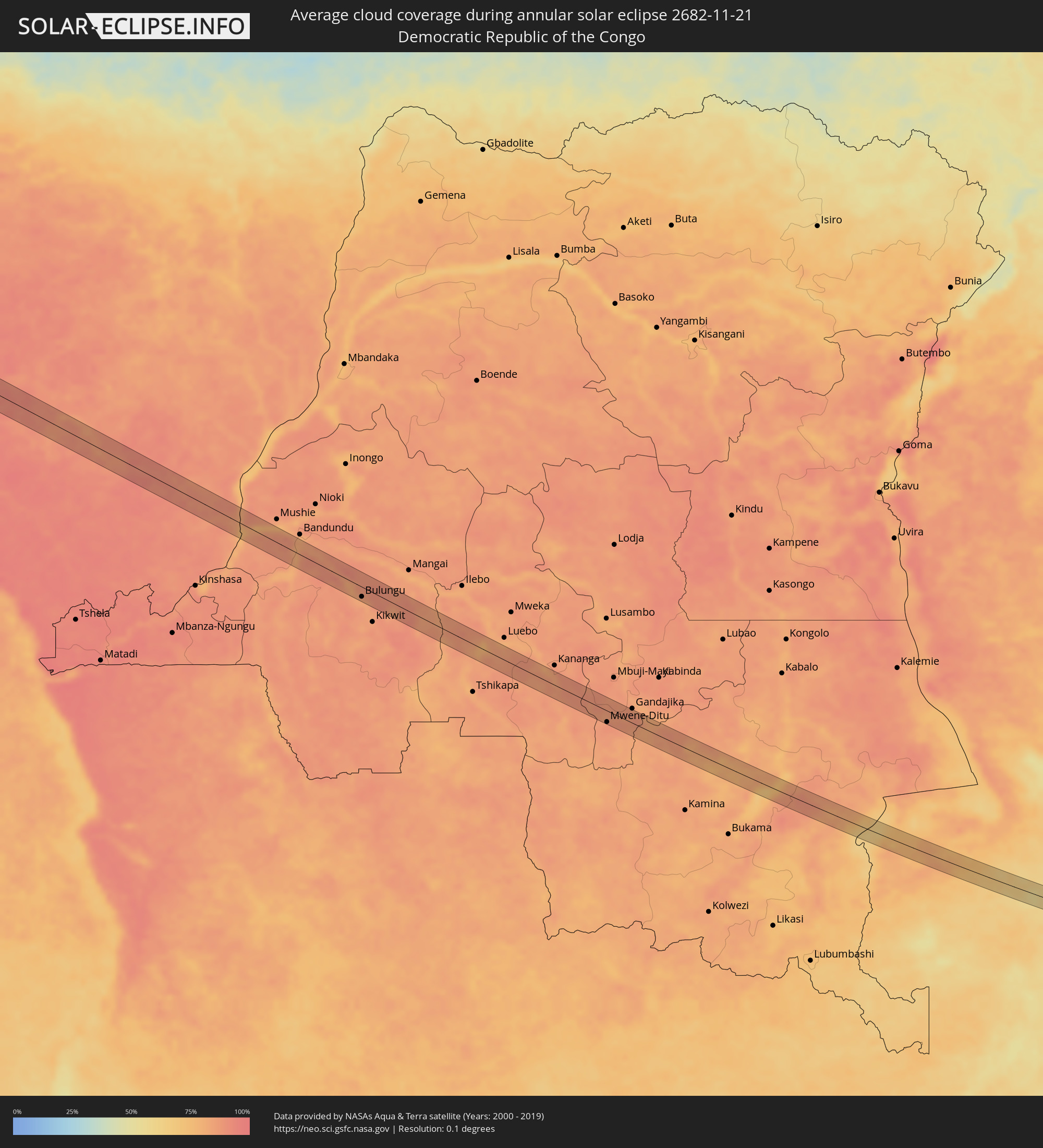 Democratic Republic of the Congo
 Zambia
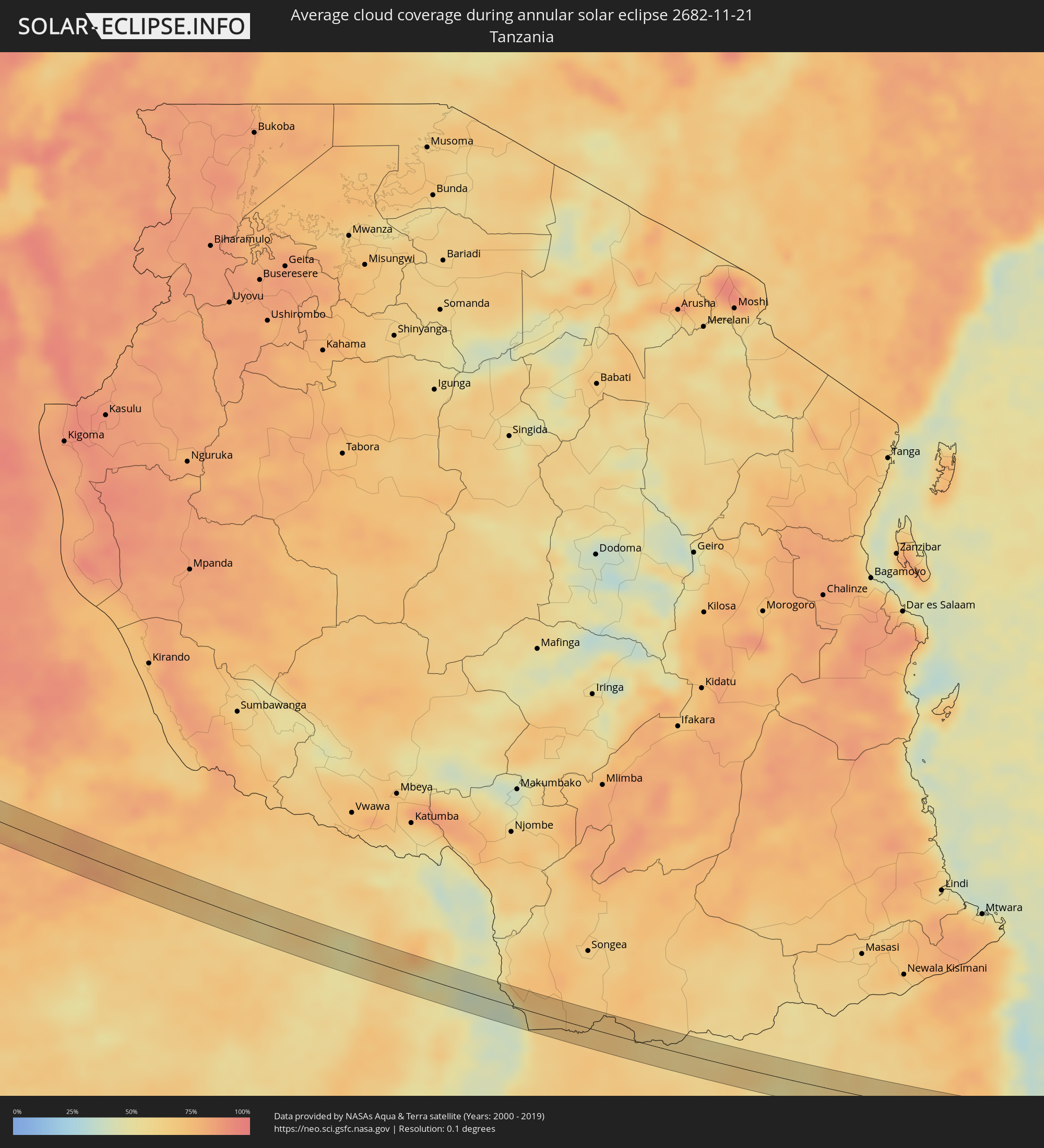 Tanzania
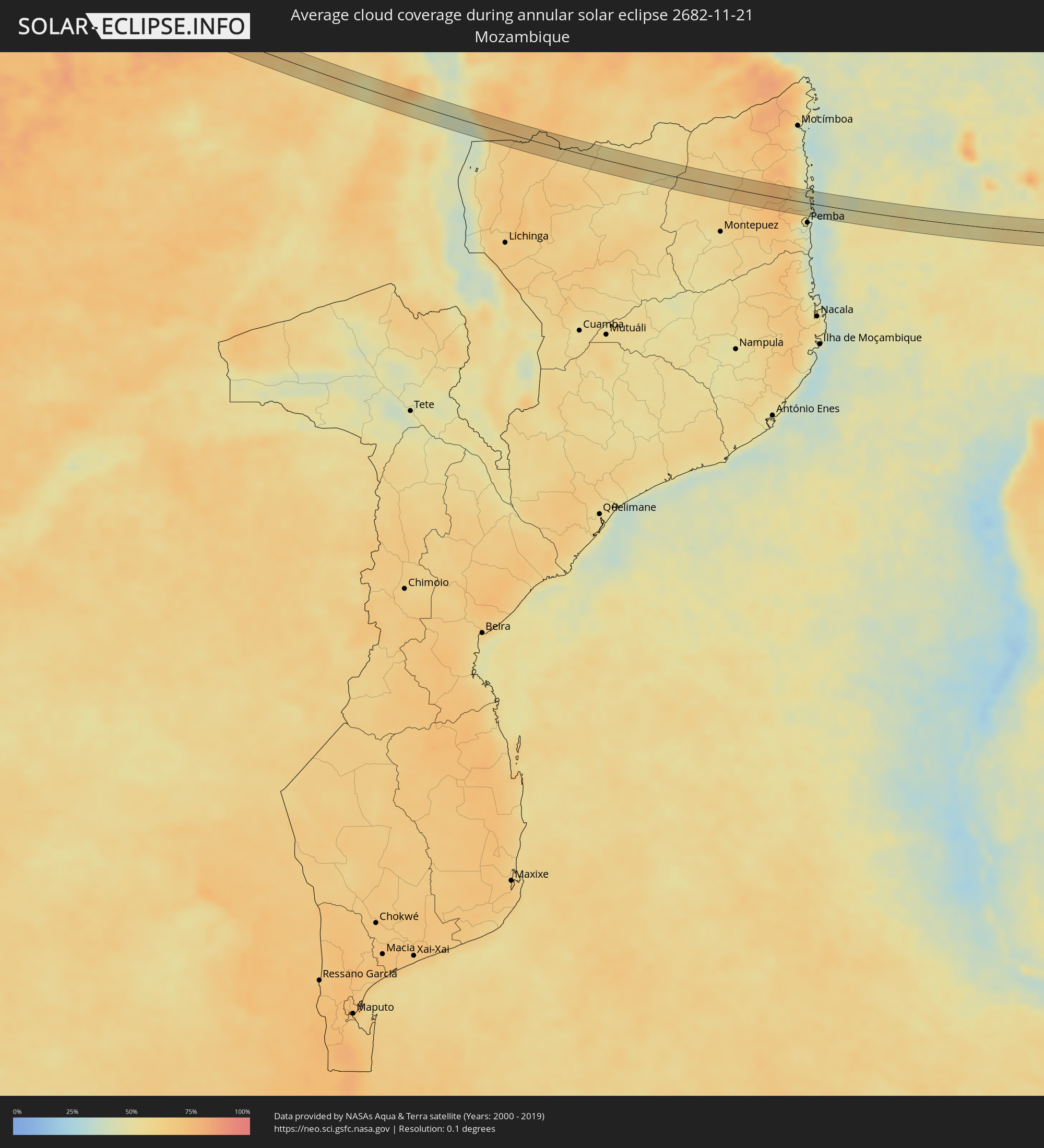 Mozambique
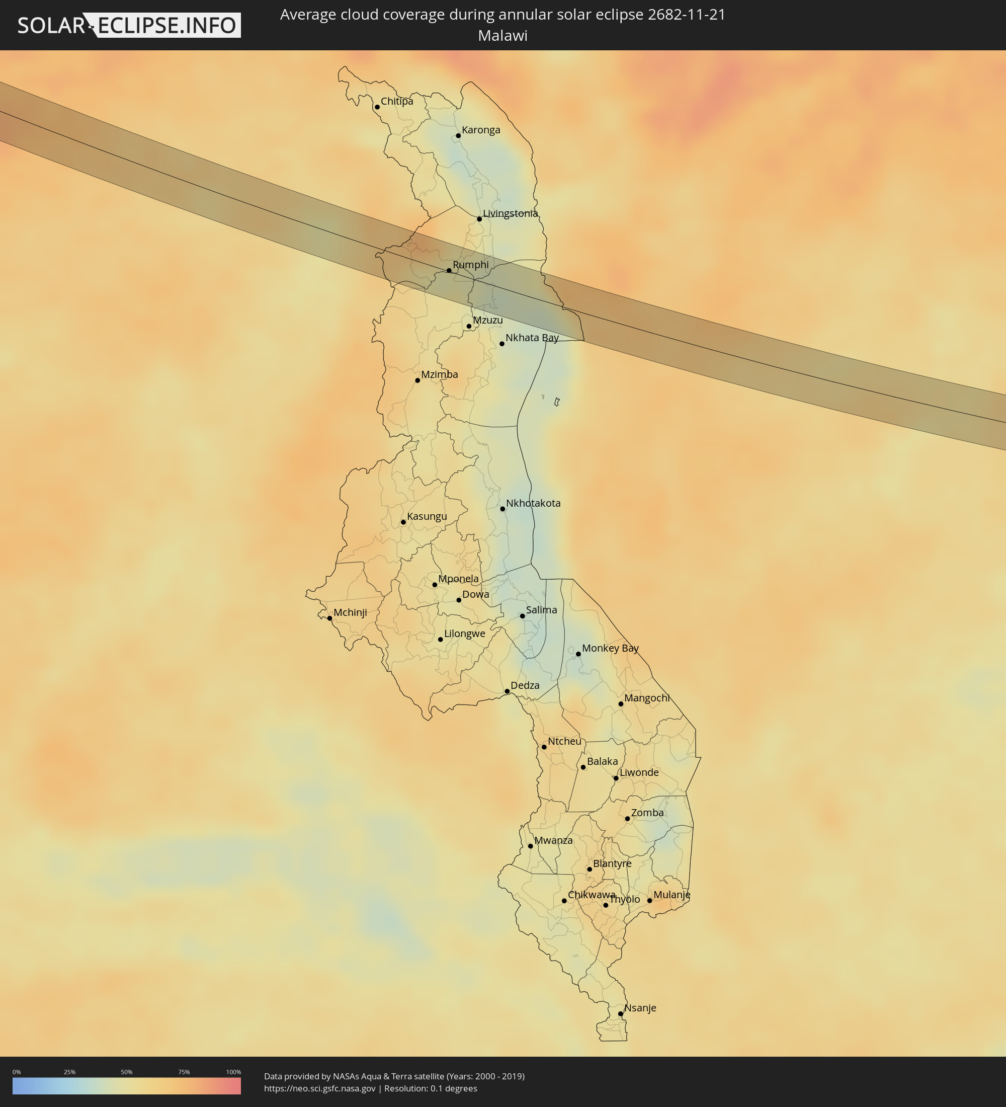 Malawi
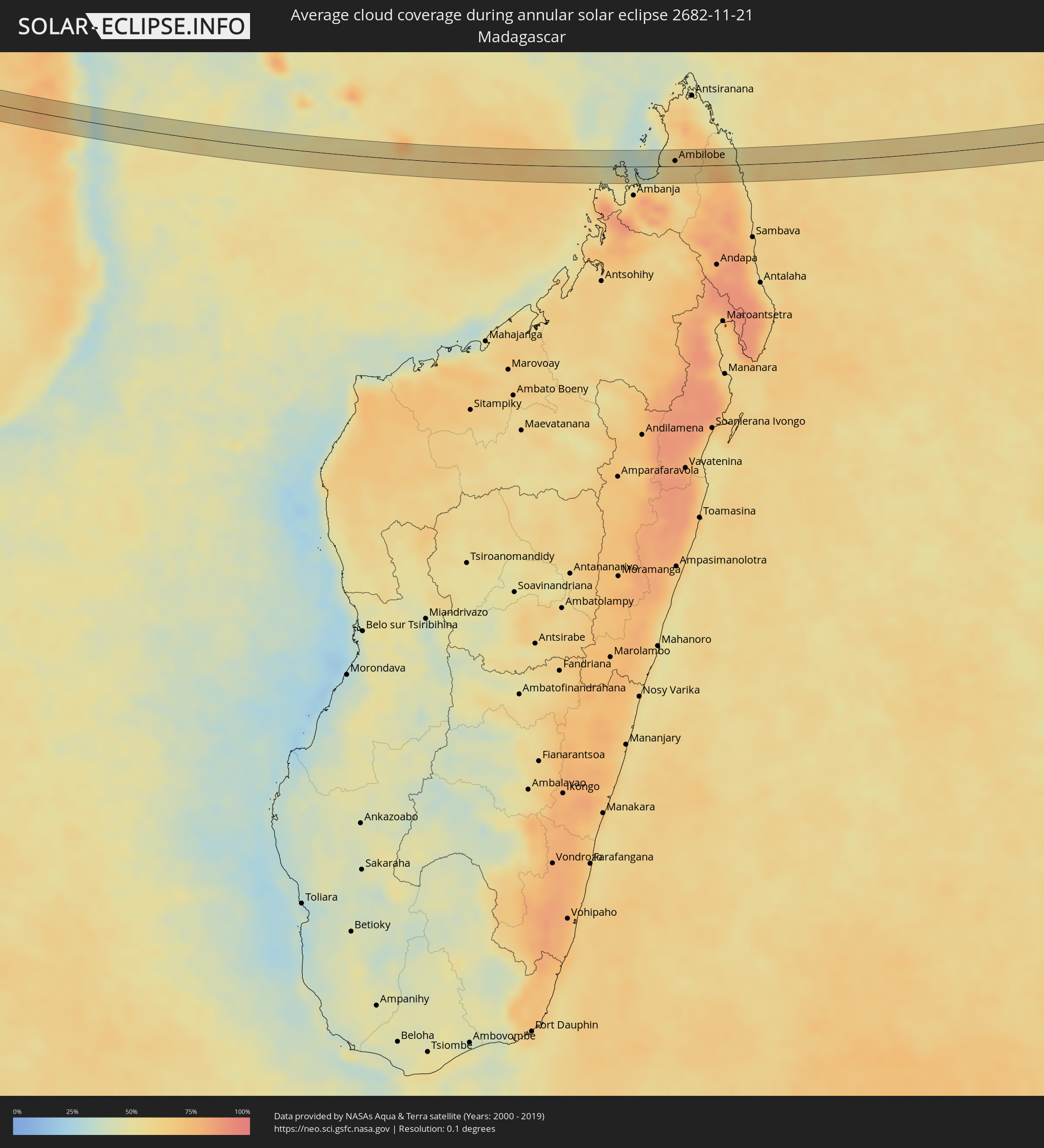 Madagascar
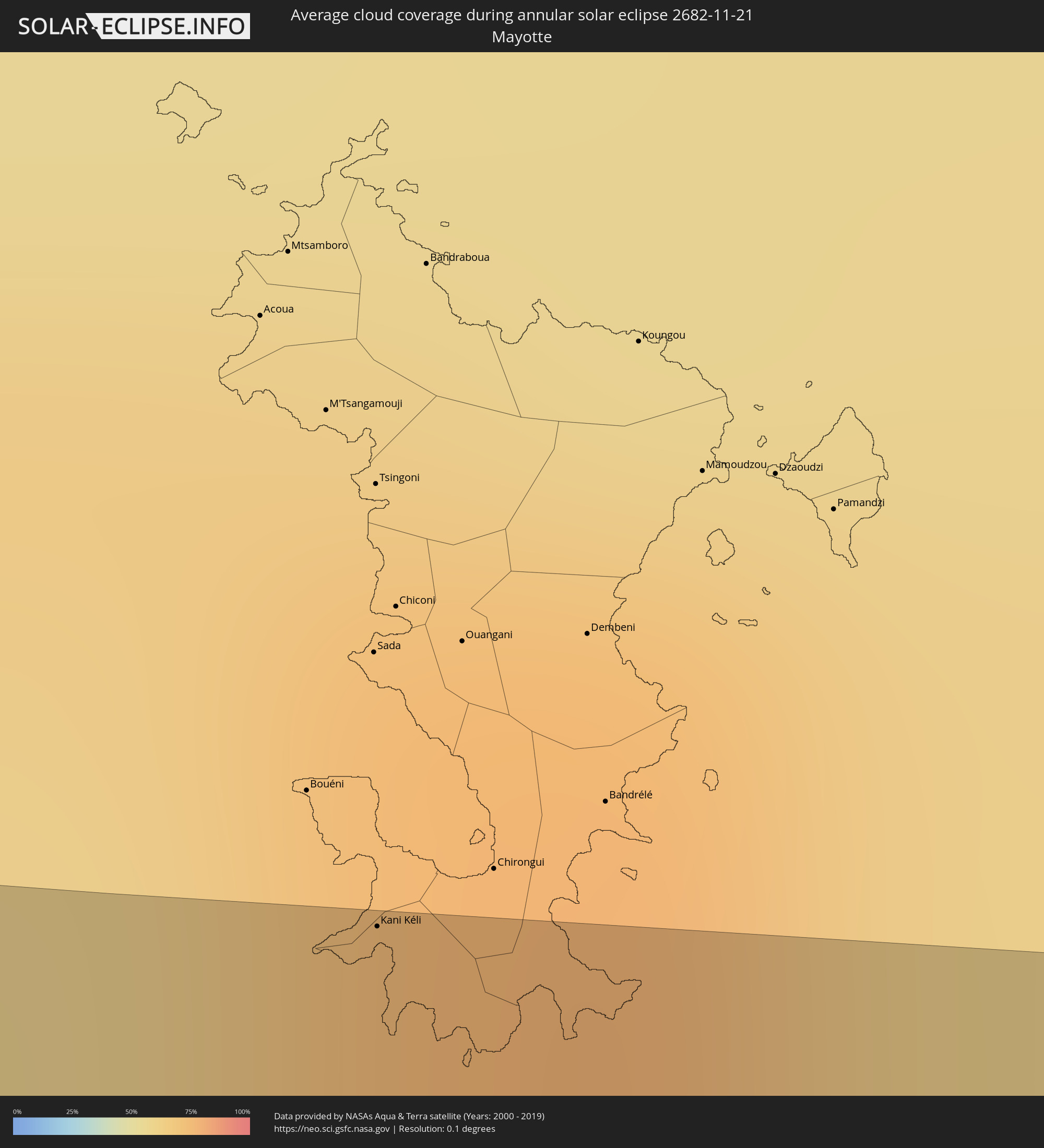 Mayotte
 Indonesia
Cities inside the path of the eclipse
The following table shows all locations with a population of more than 5,000 inside the eclipse path. Cities which have more than 100,000 inhabitants are marked bold. A click at the locations opens a detailed map.
| City | Type | Eclipse duration | Local time of max. eclipse | Distance to central line | Ø Cloud coverage |
|
Tionk Essil, Ziguinchor
|
annular | - | 07:25:54 UTC+00:00 | 33 km | 41% |
|
Ziguinchor, Ziguinchor
|
annular | - | 07:25:57 UTC+00:00 | 22 km | 44% |
|
Bignona, Ziguinchor
|
annular | - | 07:25:55 UTC+00:00 | 47 km | 42% |
|
Cacheu, Cacheu
|
annular | - | 07:25:59 UTC+00:00 | 6 km | 40% |
|
Canchungo, Cacheu
|
annular | - | 07:26:02 UTC+00:00 | 22 km | 40% |
|
Quinhámel, Biombo
|
annular | - | 07:26:04 UTC+00:00 | 34 km | 37% |
|
Bissau, Bissau
|
annular | - | 07:26:07 UTC+00:00 | 26 km | 39% |
|
Bissorã, Oio
|
annular | - | 07:26:05 UTC+00:00 | 18 km | 36% |
|
Mansôa, Oio
|
annular | - | 07:26:07 UTC+00:00 | 7 km | 38% |
|
Buba, Quinara
|
annular | - | 07:26:14 UTC+00:00 | 30 km | 36% |
|
Bafatá, Bafatá
|
annular | - | 07:26:12 UTC+00:00 | 44 km | 38% |
|
Télimélé, Kindia
|
annular | - | 07:26:42 UTC+00:00 | 19 km | 40% |
|
Pita, Mamou
|
annular | - | 07:26:49 UTC+00:00 | 24 km | 38% |
|
Dalaba, Mamou
|
annular | - | 07:26:56 UTC+00:00 | 8 km | 39% |
|
Mamou, Mamou
|
annular | - | 07:27:02 UTC+00:00 | 34 km | 41% |
|
Dabola, Faranah
|
annular | - | 07:27:13 UTC+00:00 | 46 km | 35% |
|
Faranah, Faranah
|
annular | - | 07:27:29 UTC+00:00 | 10 km | 44% |
|
Tokonou, Kankan
|
annular | - | 07:27:54 UTC+00:00 | 9 km | 47% |
|
Kérouané, Kankan
|
annular | - | 07:28:16 UTC+00:00 | 14 km | 46% |
|
Séguéla, Woroba
|
annular | - | 07:29:41 UTC+00:00 | 43 km | 71% |
|
Mankono, Woroba
|
annular | - | 07:29:53 UTC+00:00 | 11 km | 68% |
|
Béoumi, Vallée du Bandama
|
annular | - | 07:30:20 UTC+00:00 | 22 km | 67% |
|
Botro, Vallée du Bandama
|
annular | - | 07:30:24 UTC+00:00 | 9 km | 75% |
|
Sakassou, Vallée du Bandama
|
annular | - | 07:30:34 UTC+00:00 | 31 km | 80% |
|
Bouaké, Vallée du Bandama
|
annular | - | 07:30:37 UTC+00:00 | 5 km | 71% |
|
Bocanda, Lacs
|
annular | - | 07:31:09 UTC+00:00 | 34 km | 79% |
|
Daoukro, Lacs
|
annular | - | 07:31:28 UTC+00:00 | 9 km | 82% |
|
Abengourou, Comoé
|
annular | - | 07:31:54 UTC+00:00 | 21 km | 82% |
|
Agnibilékrou, Comoé
|
annular | - | 07:31:55 UTC+00:00 | 33 km | 80% |
|
Dunkwa, Central
|
annular | - | 07:33:23 UTC+00:00 | 16 km | 80% |
|
Obuasi, Ashanti
|
annular | - | 07:33:21 UTC+00:00 | 13 km | 75% |
|
Akim Oda, Eastern
|
annular | - | 07:33:59 UTC+00:00 | 18 km | 82% |
|
Akwatia, Eastern
|
annular | - | 07:34:03 UTC+00:00 | 38 km | 82% |
|
Apam, Central
|
annular | - | 07:34:29 UTC+00:00 | 35 km | 61% |
|
Swedru, Central
|
annular | - | 07:34:23 UTC+00:00 | 8 km | 80% |
|
Asamankese, Eastern
|
annular | - | 07:34:15 UTC+00:00 | 27 km | 80% |
|
Winneba, Central
|
annular | - | 07:34:32 UTC+00:00 | 23 km | 67% |
|
Kasoa, Central
|
annular | - | 07:34:36 UTC+00:00 | 6 km | 64% |
|
Nsawam, Eastern
|
annular | - | 07:34:31 UTC+00:00 | 36 km | 80% |
|
Achiaman, Greater Accra
|
annular | - | 07:34:35 UTC+00:00 | 26 km | 84% |
|
Gbawe, Greater Accra
|
annular | - | 07:34:40 UTC+00:00 | 15 km | 75% |
|
Dome, Greater Accra
|
annular | - | 07:34:41 UTC+00:00 | 26 km | 81% |
|
Accra, Greater Accra
|
annular | - | 07:34:46 UTC+00:00 | 19 km | 70% |
|
Tema, Greater Accra
|
annular | - | 07:34:51 UTC+00:00 | 39 km | 69% |
|
Santo António, Príncipe
|
annular | - | 07:44:55 UTC+00:00 | 9 km | 91% |
|
Libreville, Estuaire
|
annular | - | 08:48:35 UTC+01:00 | 8 km | 92% |
|
Ntoum, Estuaire
|
annular | - | 08:49:01 UTC+01:00 | 7 km | 94% |
|
Ndjolé, Moyen-Ogooué
|
annular | - | 08:50:58 UTC+01:00 | 3 km | 92% |
|
Koulamoutou, Ogooué-Lolo
|
annular | - | 08:54:28 UTC+01:00 | 1 km | 87% |
|
Mounana, Haut-Ogooué
|
annular | - | 08:55:51 UTC+01:00 | 7 km | 89% |
|
Moanda, Haut-Ogooué
|
annular | - | 08:56:04 UTC+01:00 | 6 km | 90% |
|
Franceville, Haut-Ogooué
|
annular | - | 08:56:46 UTC+01:00 | 7 km | 88% |
|
Djambala, Plateaux
|
annular | - | 08:59:43 UTC+01:00 | 21 km | 91% |
|
Bulungu, Bandundu
|
annular | - | 09:09:21 UTC+01:00 | 19 km | 82% |
|
Mwene-Ditu, Kasaï-Oriental
|
annular | - | 10:23:28 UTC+02:00 | 22 km | 89% |
|
Nchelenge, Luapula
|
annular | - | 10:40:47 UTC+02:00 | 19 km | 67% |
|
Kasama, Northern
|
annular | - | 10:49:15 UTC+02:00 | 11 km | 65% |
|
Mungwi, Northern
|
annular | - | 10:49:48 UTC+02:00 | 1 km | 64% |
|
Rumphi, Northern Region
|
annular | - | 10:58:44 UTC+02:00 | 1 km | 48% |
|
Liuli, Ruvuma
|
annular | - | 11:01:22 UTC+02:00 | 19 km | 44% |
|
Mbamba Bay, Ruvuma
|
annular | - | 11:02:01 UTC+02:00 | 2 km | 47% |
|
Tingi, Ruvuma
|
annular | - | 12:02:55 UTC+03:00 | 8 km | 67% |
|
Kani Kéli, Kani-Kéli
|
annular | - | 12:38:46 UTC+03:00 | 24 km | 60% |
|
Hell-Ville, Diana
|
annular | - | 12:49:20 UTC+03:00 | 14 km | 54% |
|
Antsohimbondrona, Diana
|
annular | - | 12:51:10 UTC+03:00 | 21 km | 54% |
|
Ambarakaraka, Diana
|
annular | - | 12:51:16 UTC+03:00 | 25 km | 64% |
|
Ambilobe, Diana
|
annular | - | 12:51:49 UTC+03:00 | 8 km | 61% |