Total solar eclipse of 04/24/2935
| Day of week: | Sunday |
| Maximum duration of eclipse: | 03m20s |
| Maximum width of eclipse path: | 124 km |
| Saros cycle: | 163 |
| Coverage: | 100% |
| Magnitude: | 1.0368 |
| Gamma: | -0.0964 |
Wo kann man die Sonnenfinsternis vom 04/24/2935 sehen?
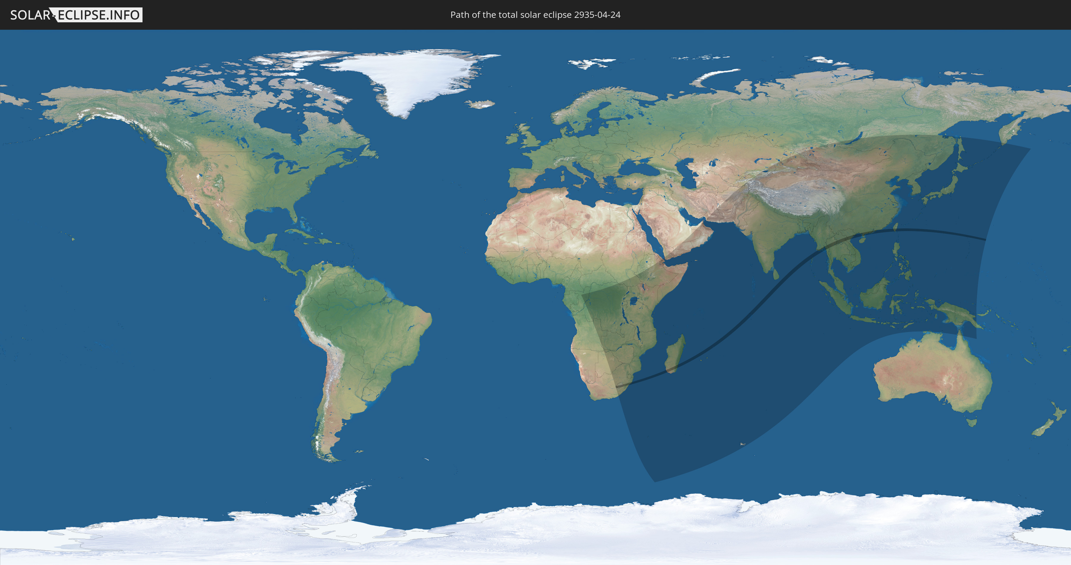
Die Sonnenfinsternis am 04/24/2935 kann man in 73 Ländern als partielle Sonnenfinsternis beobachten.
Der Finsternispfad verläuft durch 15 Länder. Nur in diesen Ländern ist sie als total Sonnenfinsternis zu sehen.
In den folgenden Ländern ist die Sonnenfinsternis total zu sehen
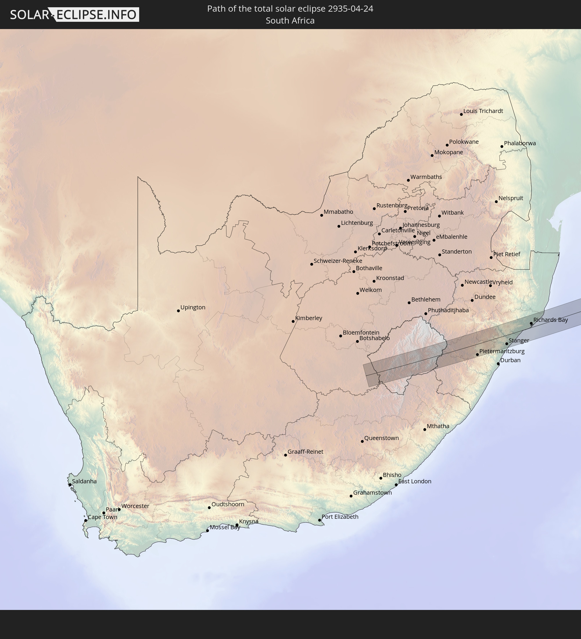 South Africa
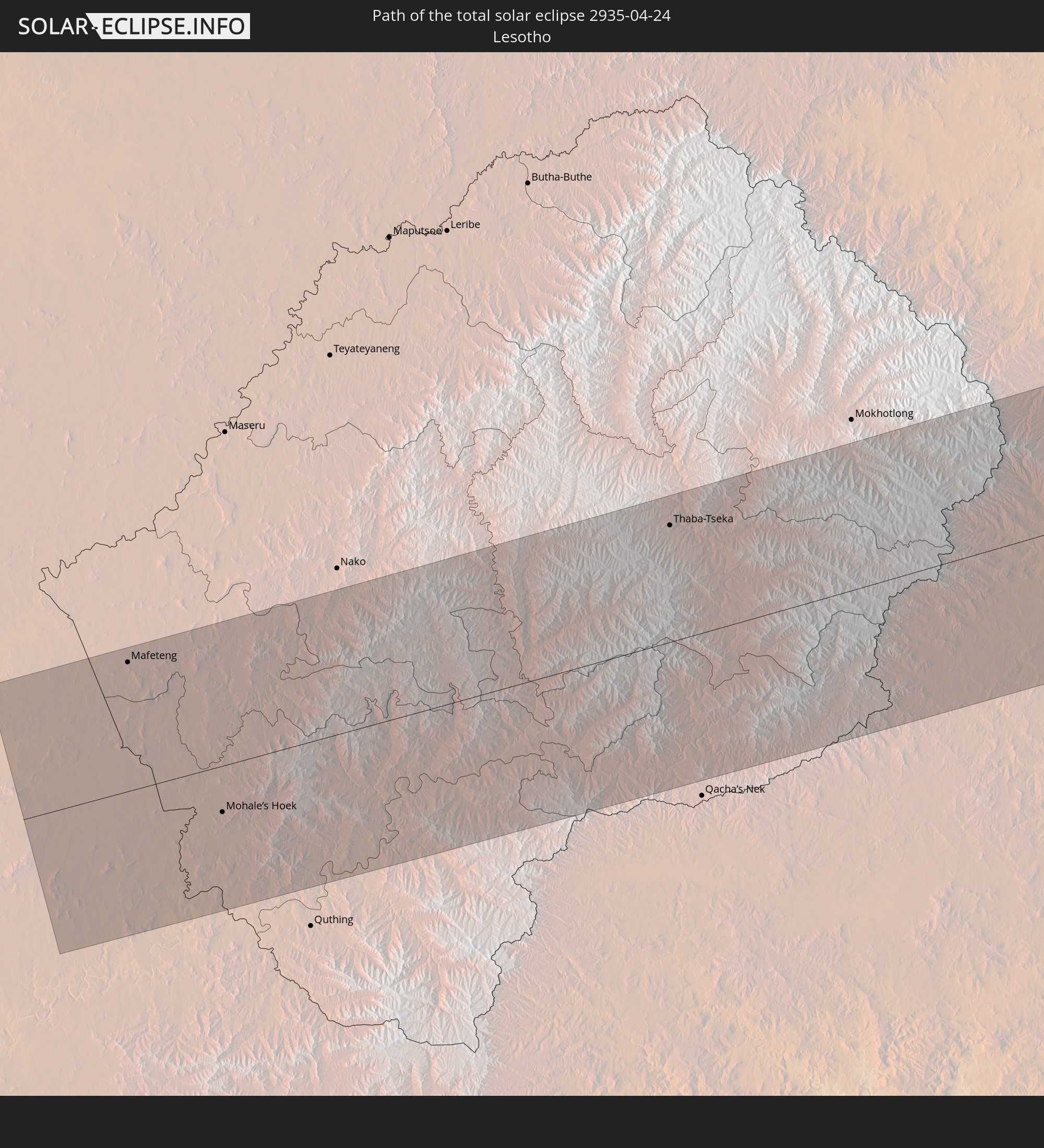 Lesotho
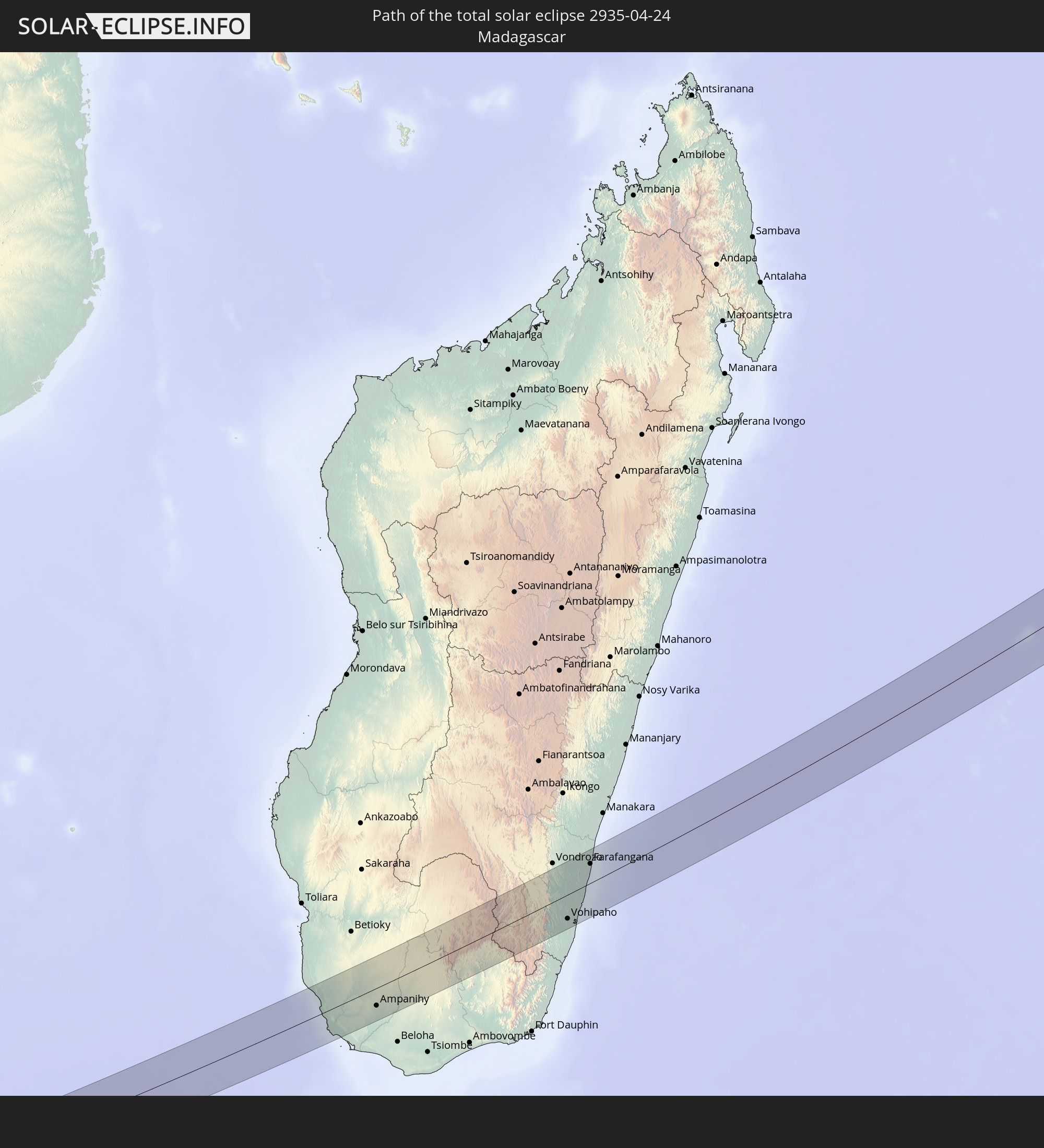 Madagascar
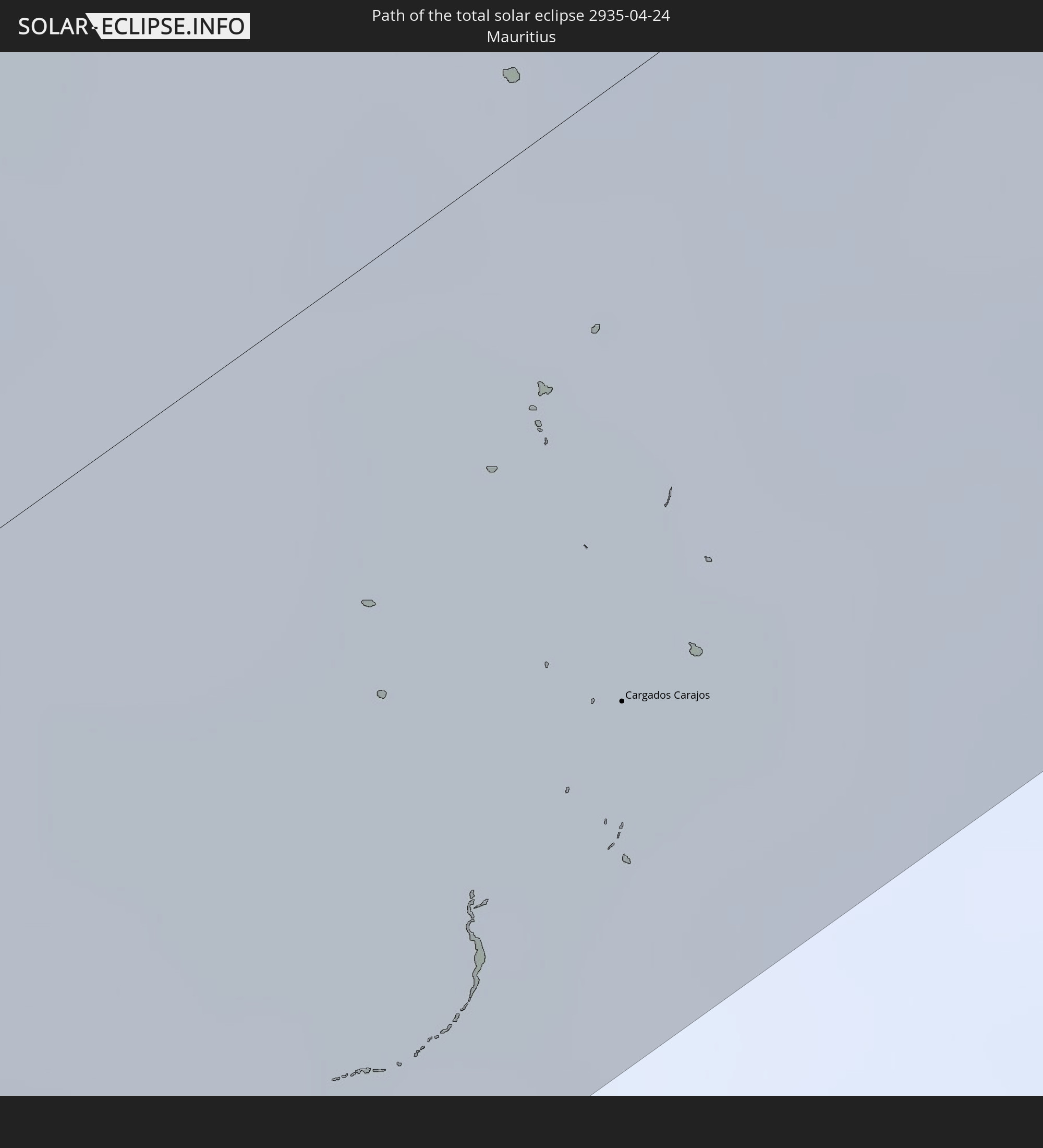 Mauritius
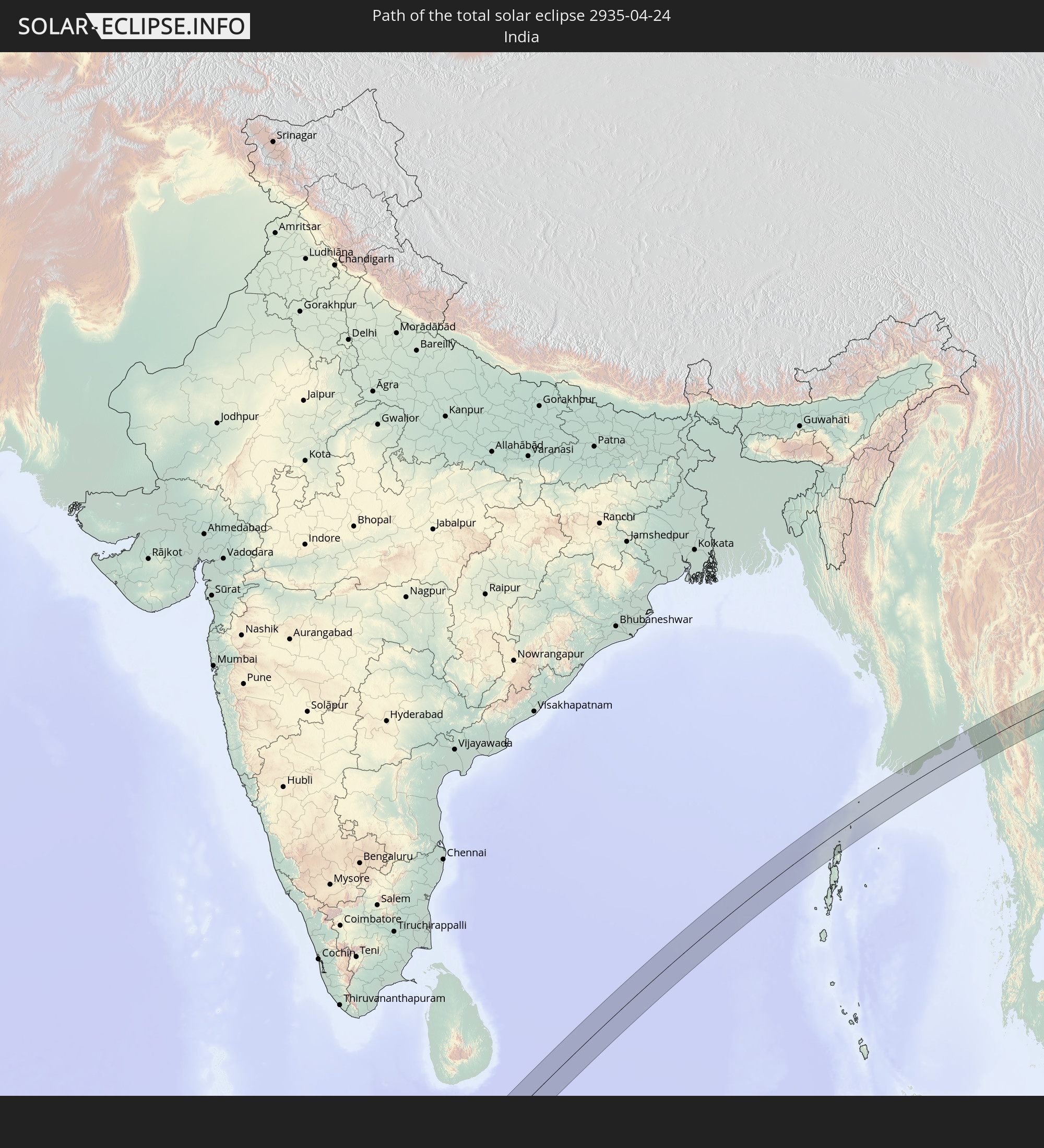 India
India
 British Indian Ocean Territory
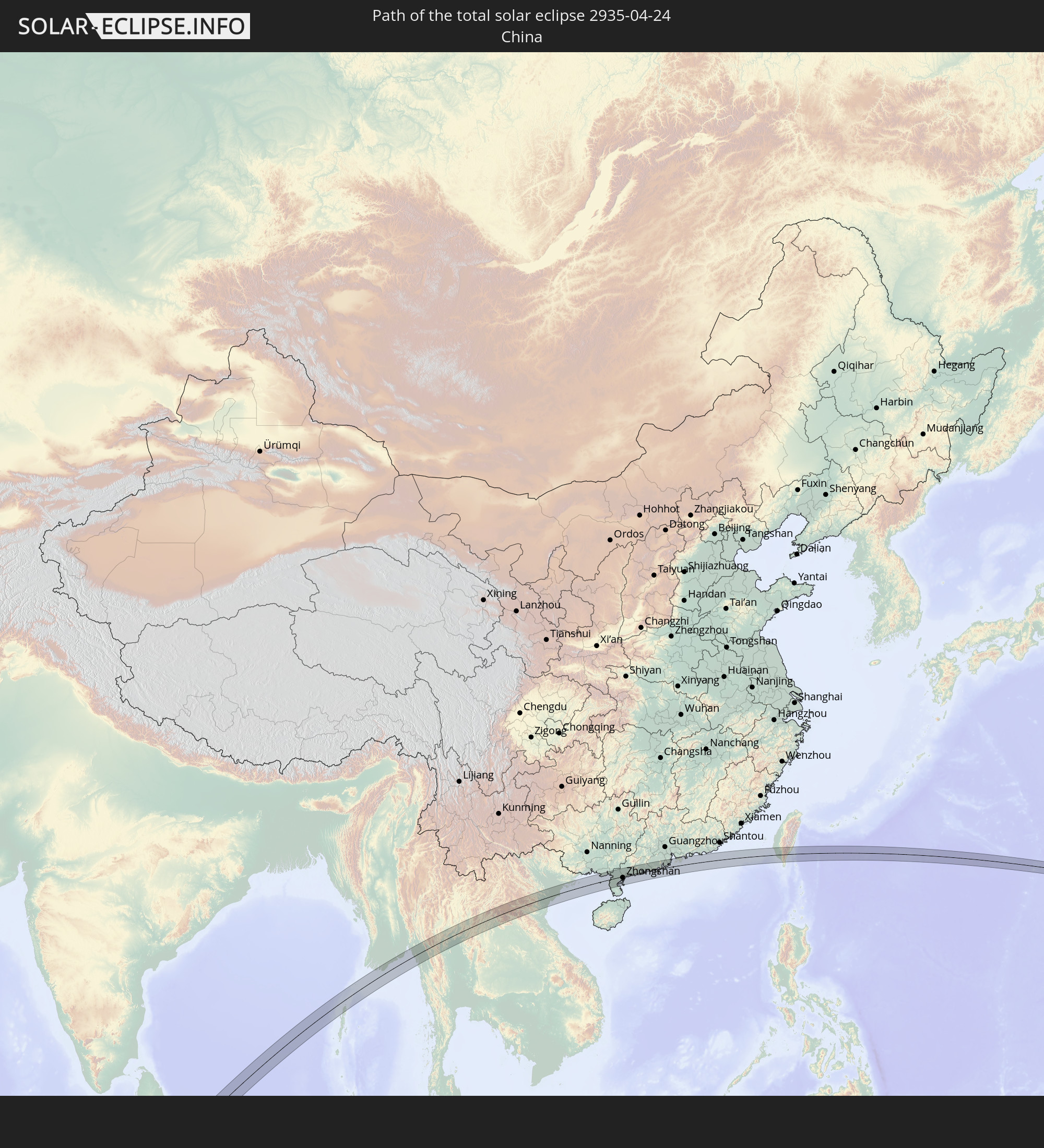 China
China
 Myanmar
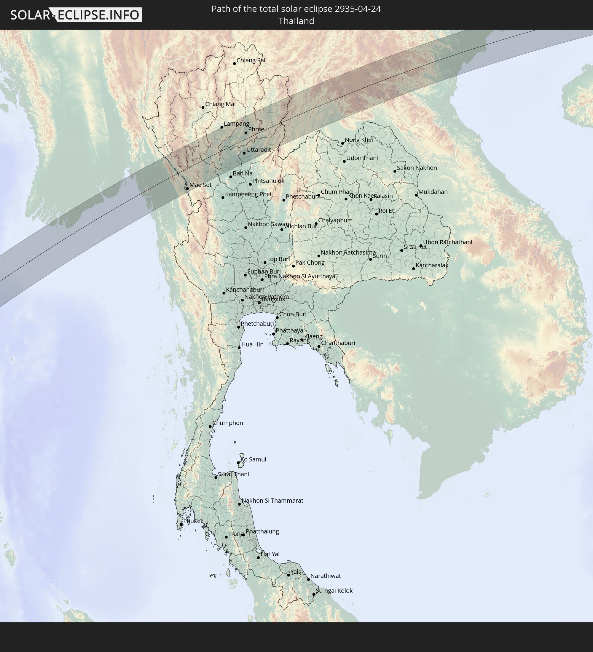 Thailand
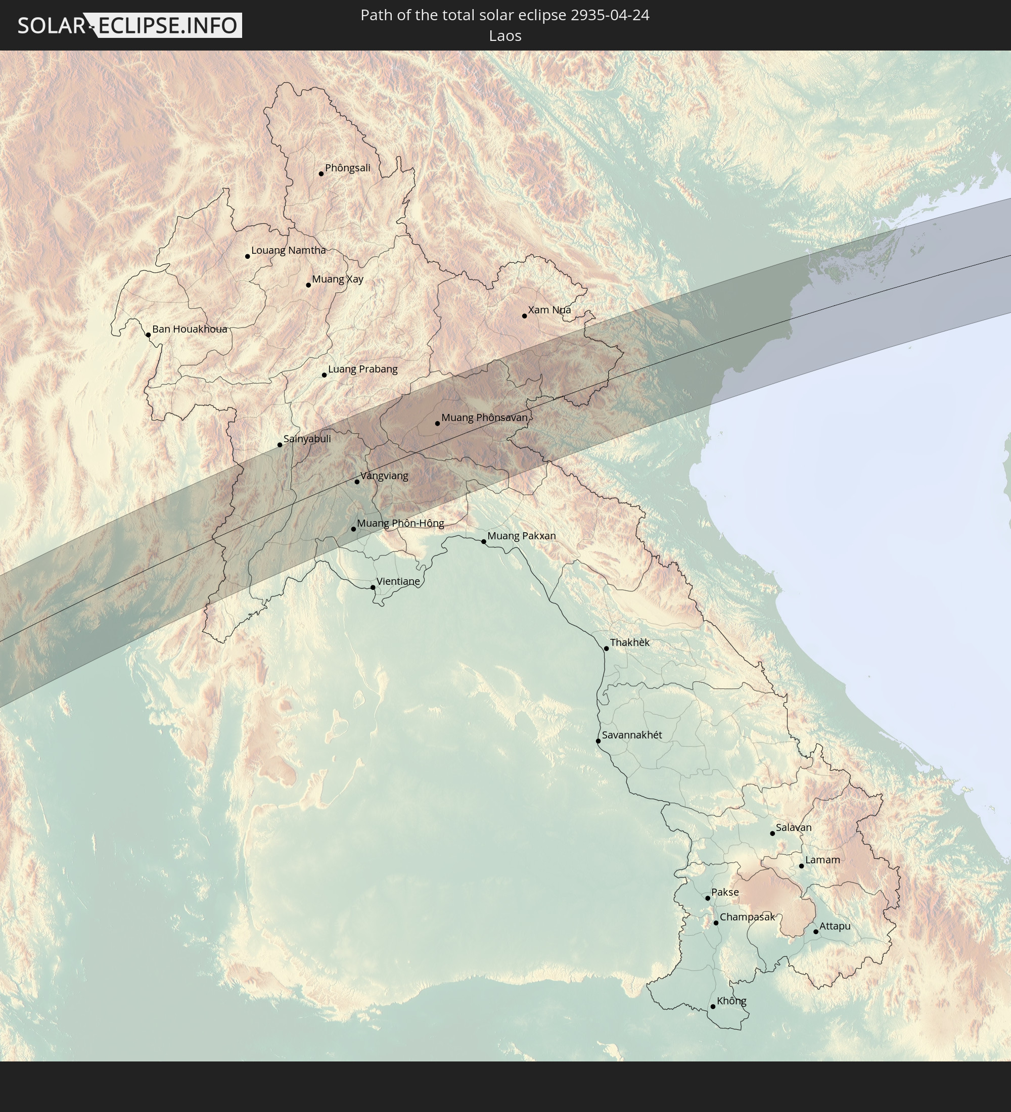 Laos
Laos
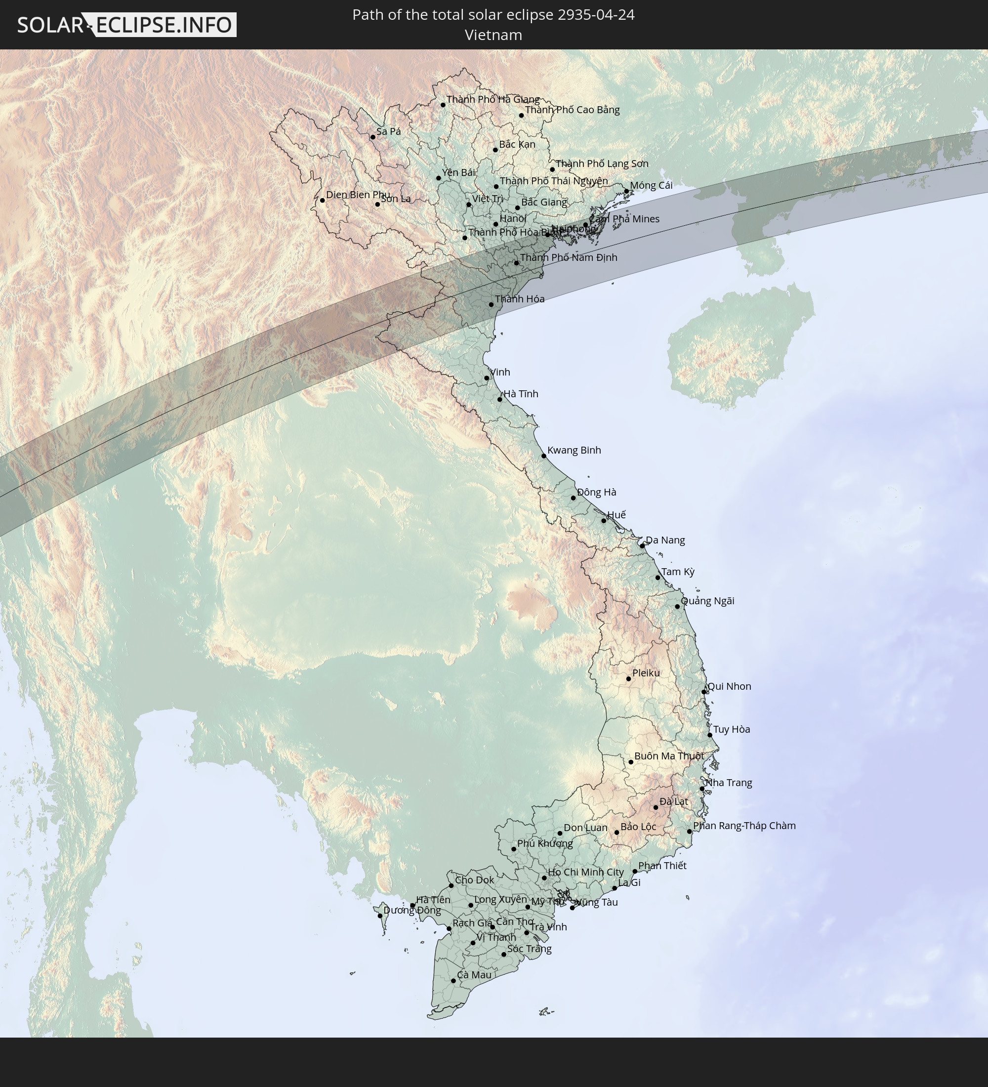 Vietnam
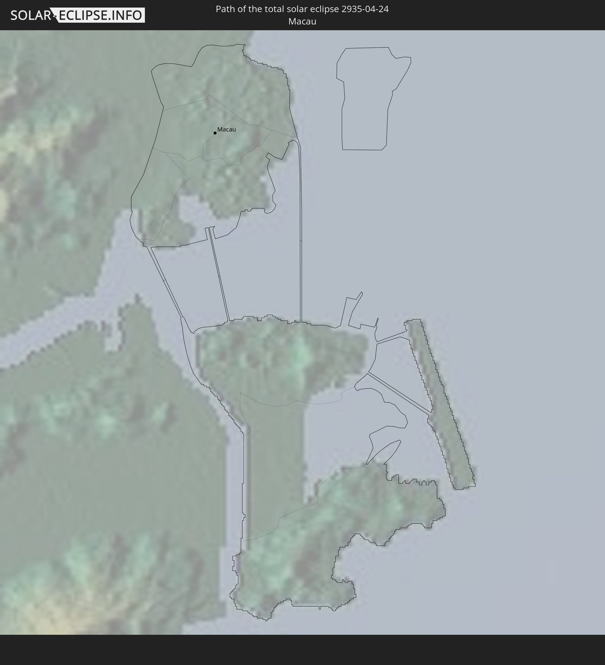 Macau
Macau
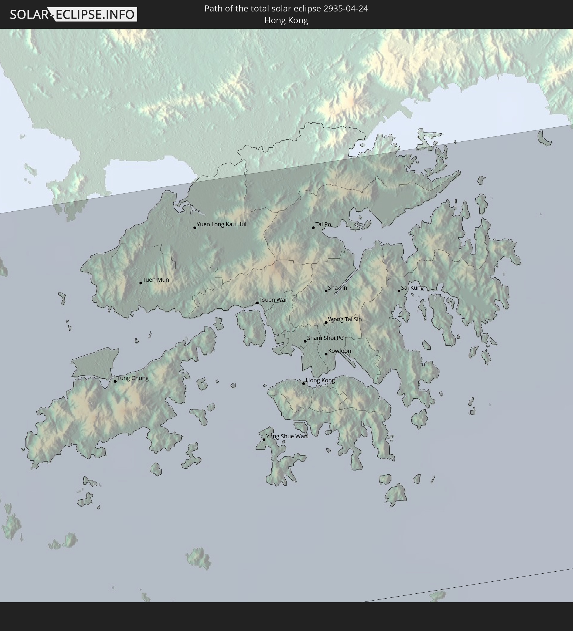 Hong Kong
 Taiwan
 Northern Mariana Islands
In den folgenden Ländern ist die Sonnenfinsternis partiell zu sehen
 Russia
 Republic of the Congo
 Angola
 Namibia
 Democratic Republic of the Congo
 South Africa
 Botswana
 Zambia
 Zimbabwe
 Lesotho
 Rwanda
 Burundi
 Tanzania
 Uganda
 Mozambique
 Swaziland
 Malawi
 Ethiopia
 Kenya
Kenya
 Saudi Arabia
 Eritrea
 French Southern and Antarctic Lands
 Somalia
 Djibouti
 Yemen
Yemen
 Madagascar
 Comoros
 Iran
Iran
 Mayotte
 Seychelles
 Kazakhstan
 United Arab Emirates
 Oman
Oman
 Réunion
 Mauritius
 Afghanistan
 Pakistan
 Tajikistan
 India
India
 Kyrgyzstan
 British Indian Ocean Territory
 Maldives
 China
China
 Sri Lanka
 Nepal
Nepal
 Mongolia
 Bangladesh
 Bhutan
 Myanmar
 Indonesia
 Cocos Islands
 Thailand
 Malaysia
 Laos
Laos
 Vietnam
 Cambodia
 Singapore
 Christmas Island
 Australia
 Macau
Macau
 Hong Kong
 Brunei
 Taiwan
 Philippines
 Japan
Japan
 East Timor
 North Korea
 South Korea
 Palau
Palau
 Federated States of Micronesia
 Papua New Guinea
 Guam
Guam
 Northern Mariana Islands
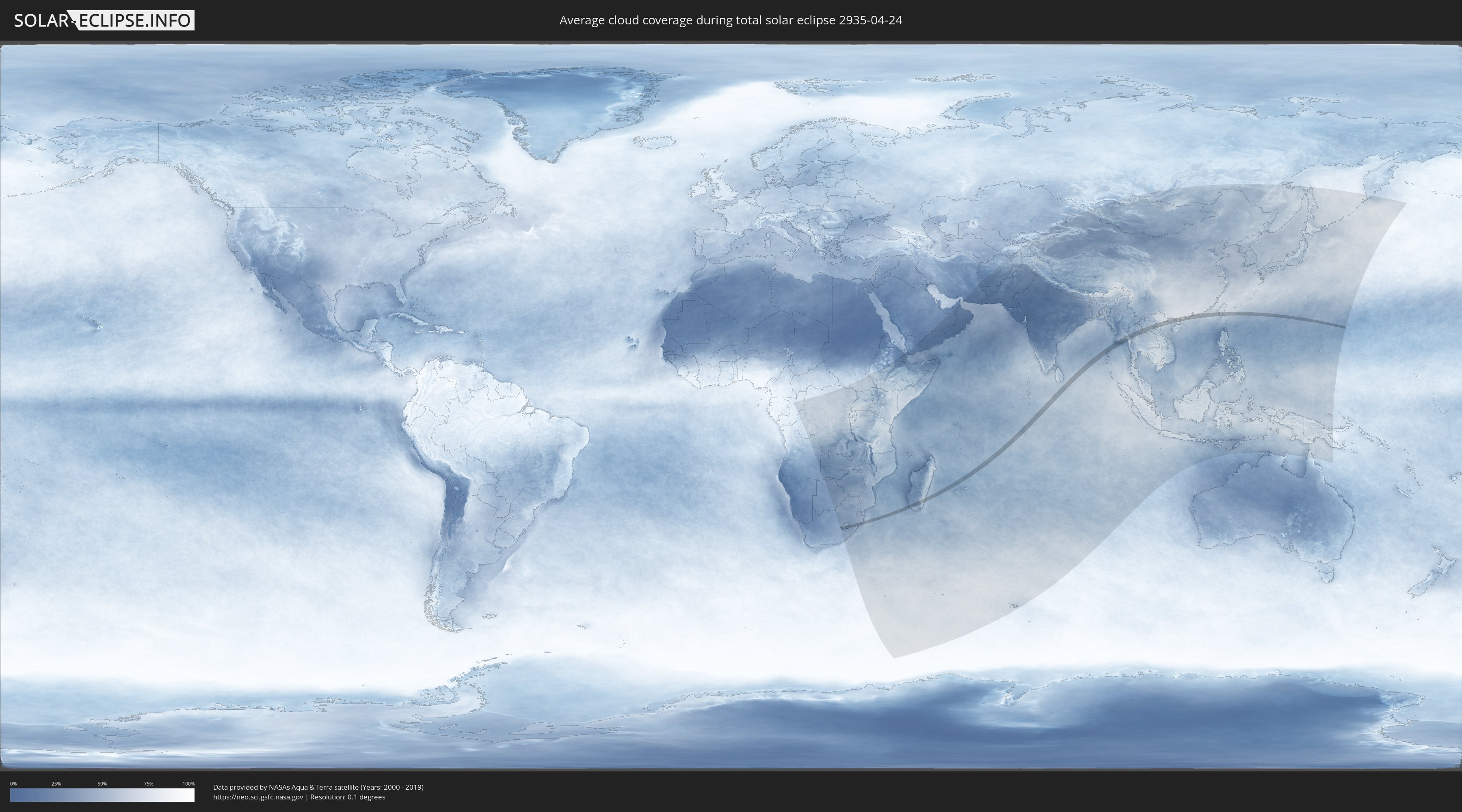
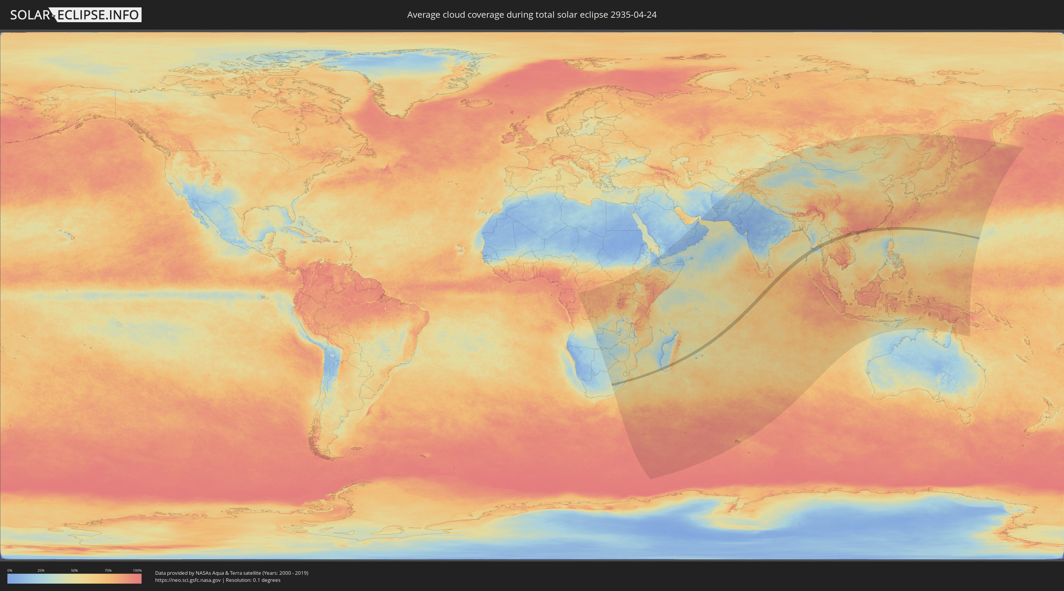
How will be the weather during the total solar eclipse on 04/24/2935?
Where is the best place to see the total solar eclipse of 04/24/2935?
The following maps show the average cloud coverage for the day of the total solar eclipse.
With the help of these maps, it is possible to find the place along the eclipse path, which has the best
chance of a cloudless sky.
Nevertheless, you should consider local circumstances and inform about the weather of your chosen
observation site.
The data is provided by NASAs satellites
AQUA and TERRA.
The cloud maps are averaged over a period of 19 years (2000 - 2019).
Detailed country maps
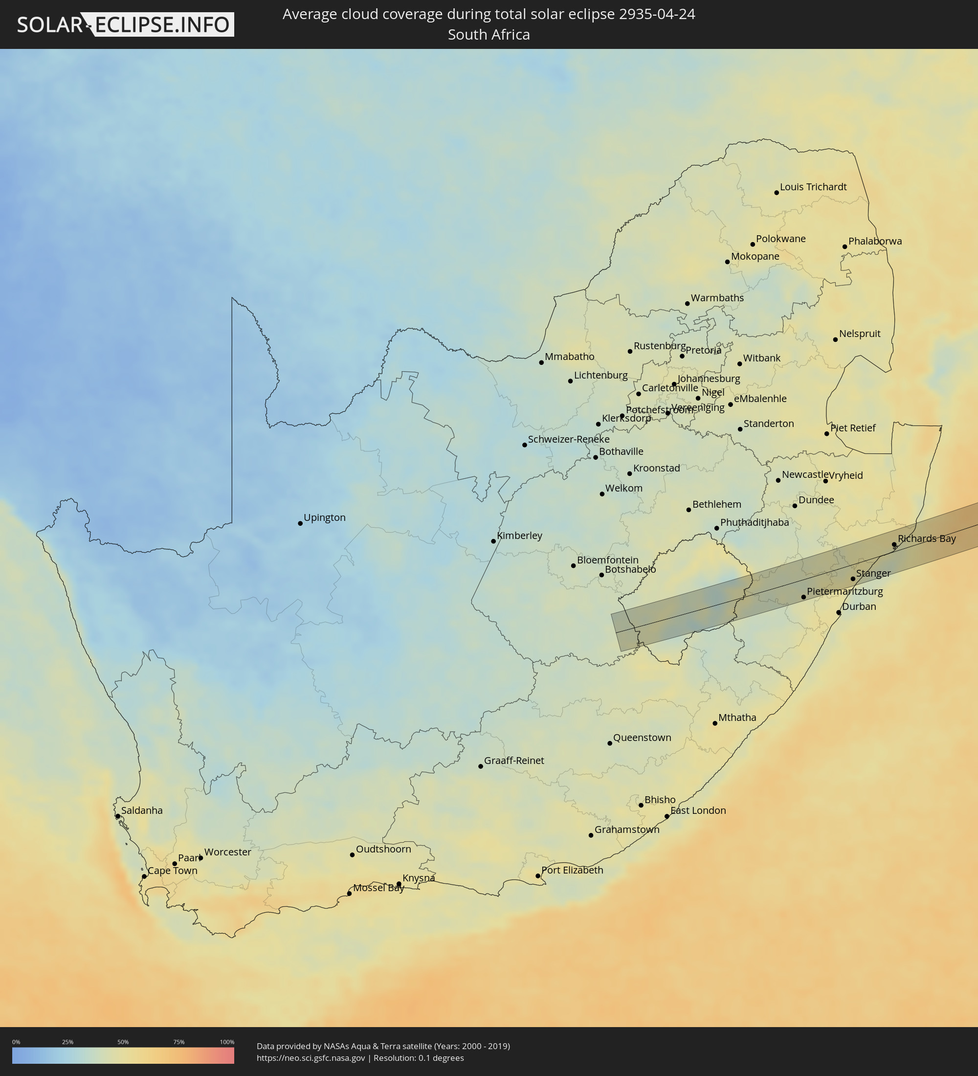 South Africa
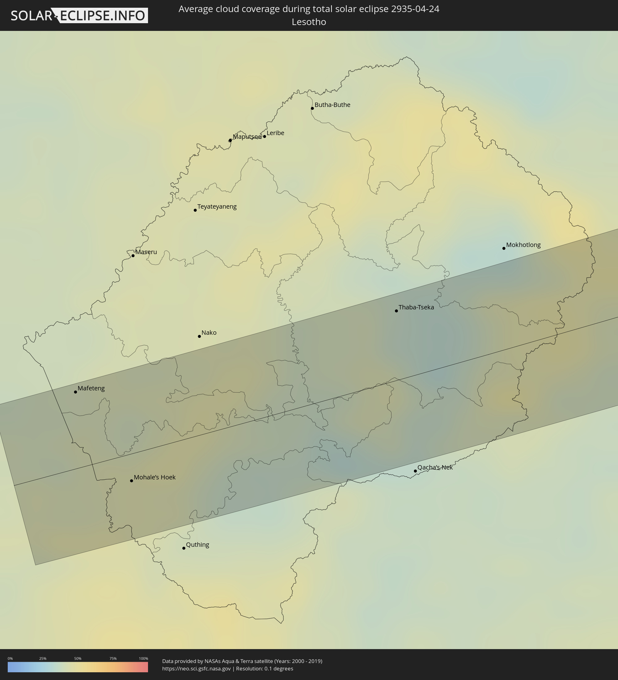 Lesotho
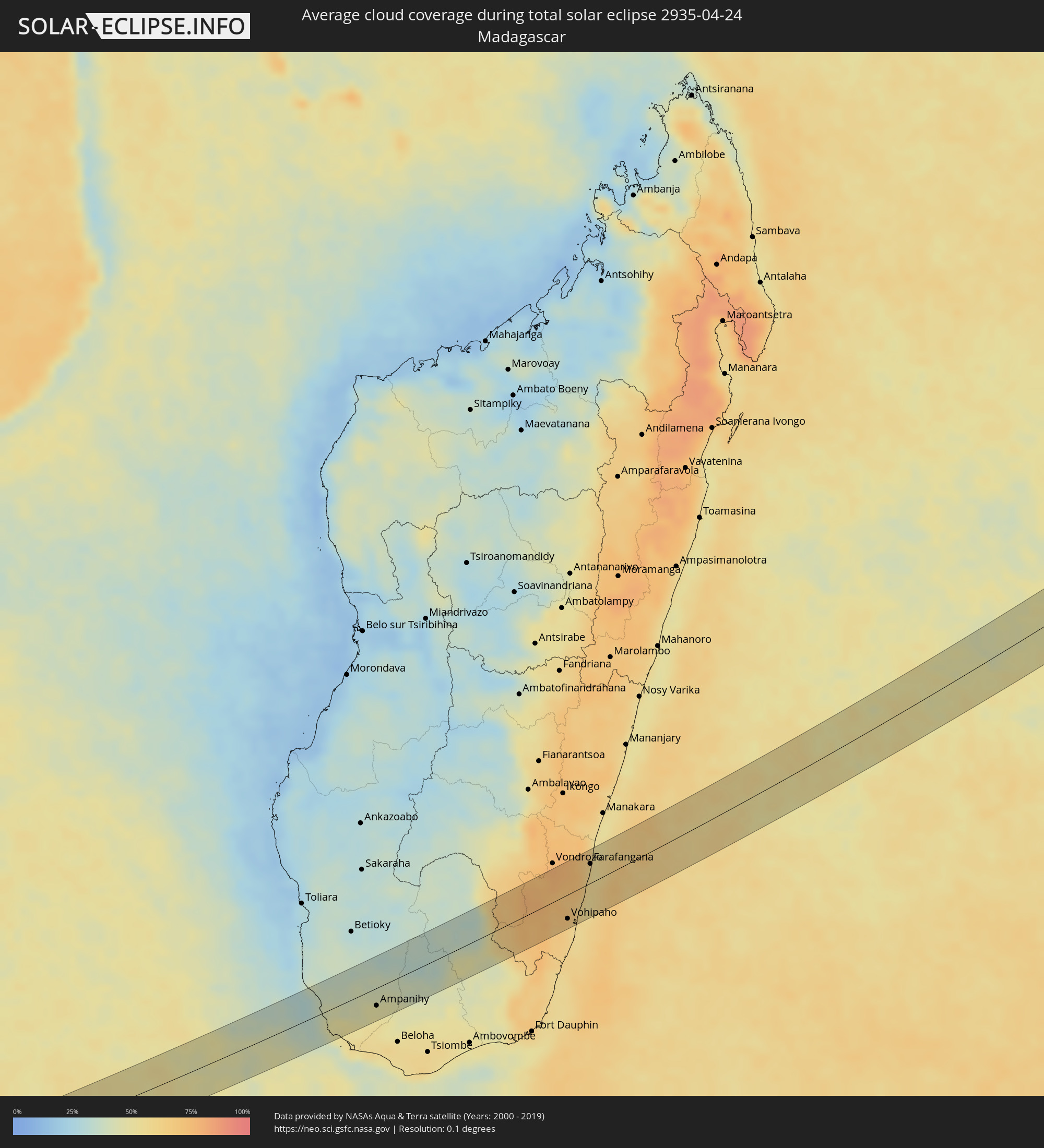 Madagascar
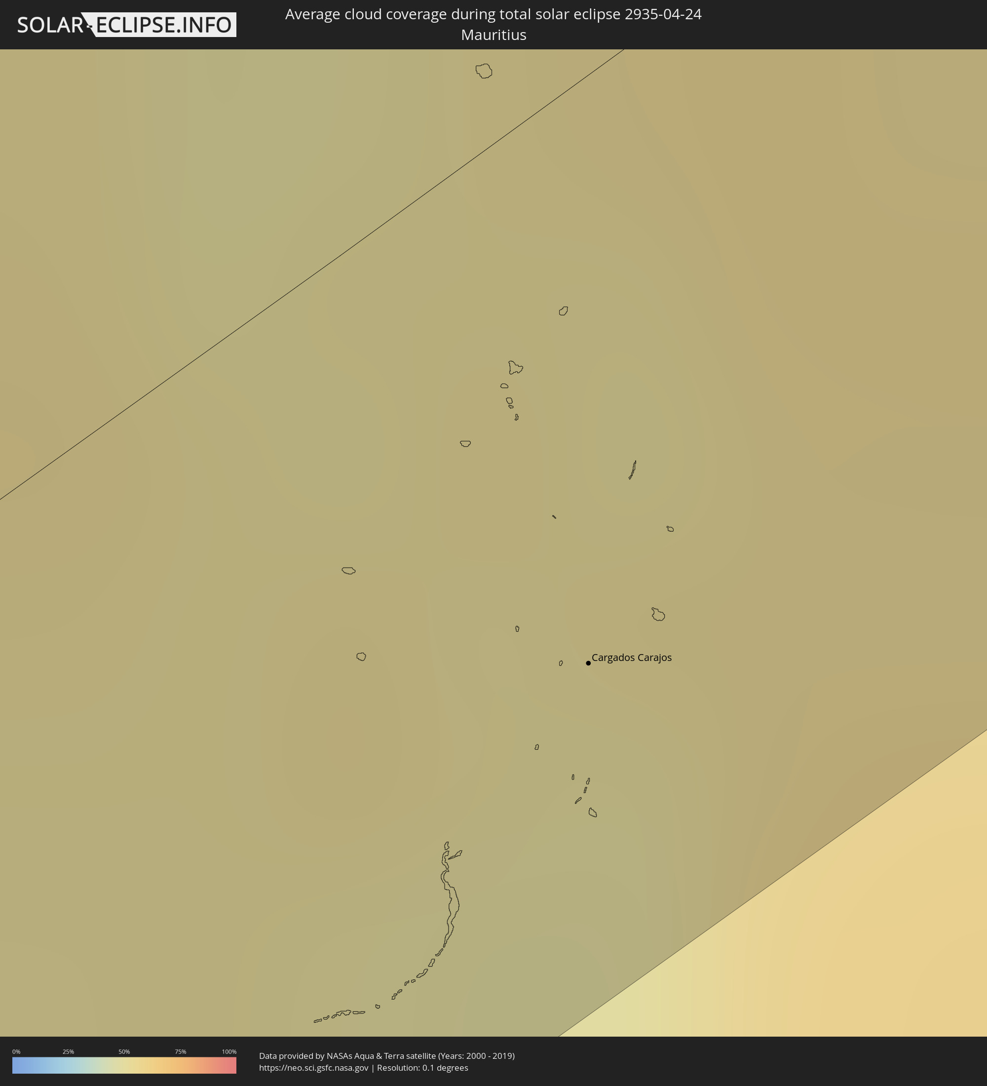 Mauritius
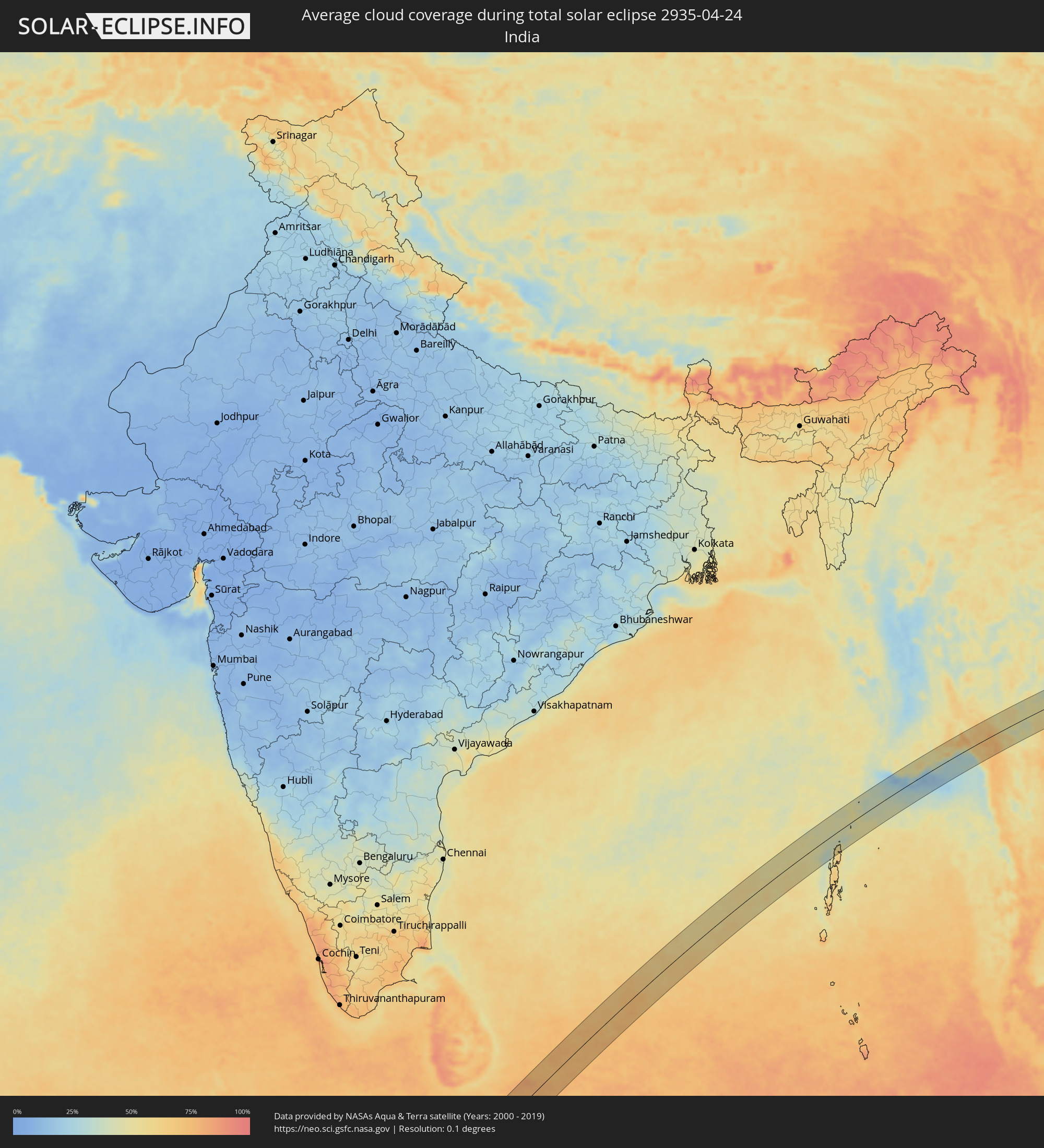 India
India
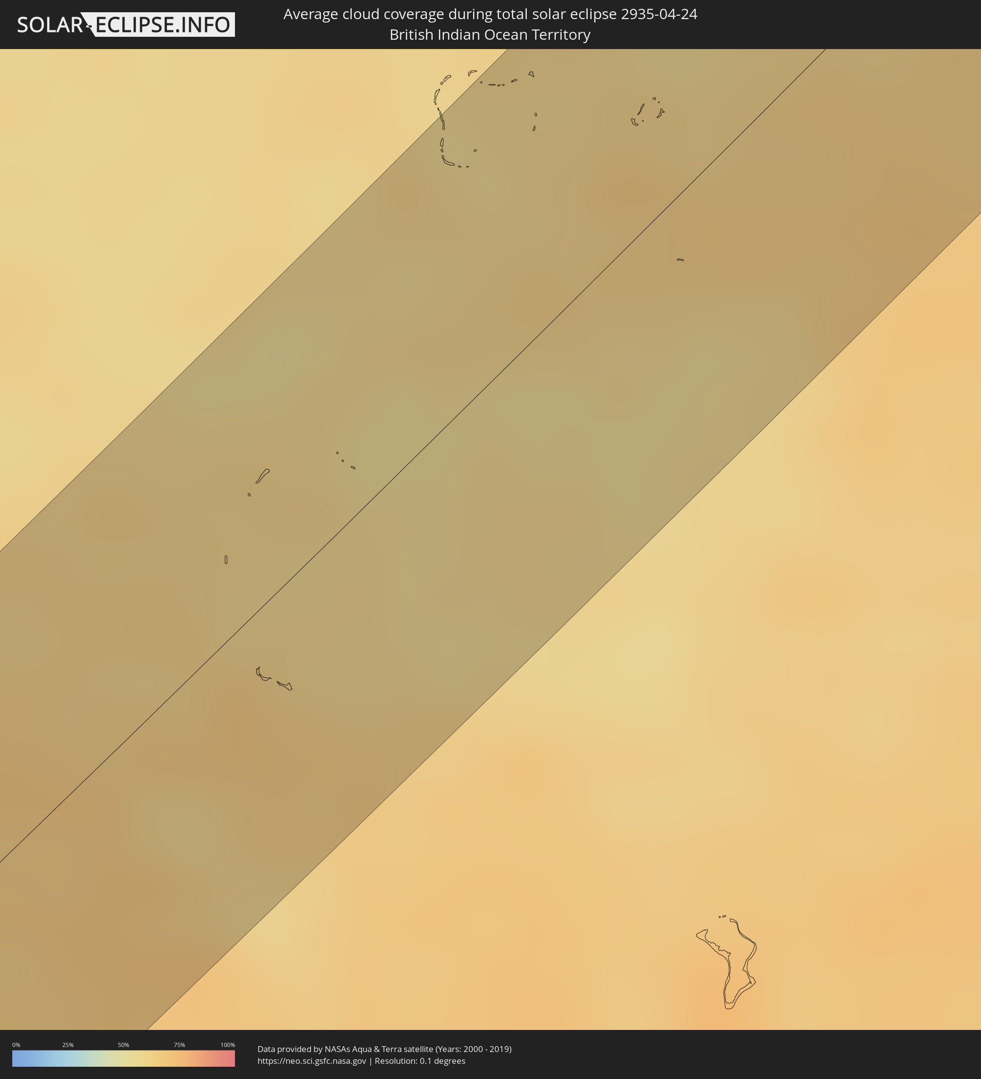 British Indian Ocean Territory
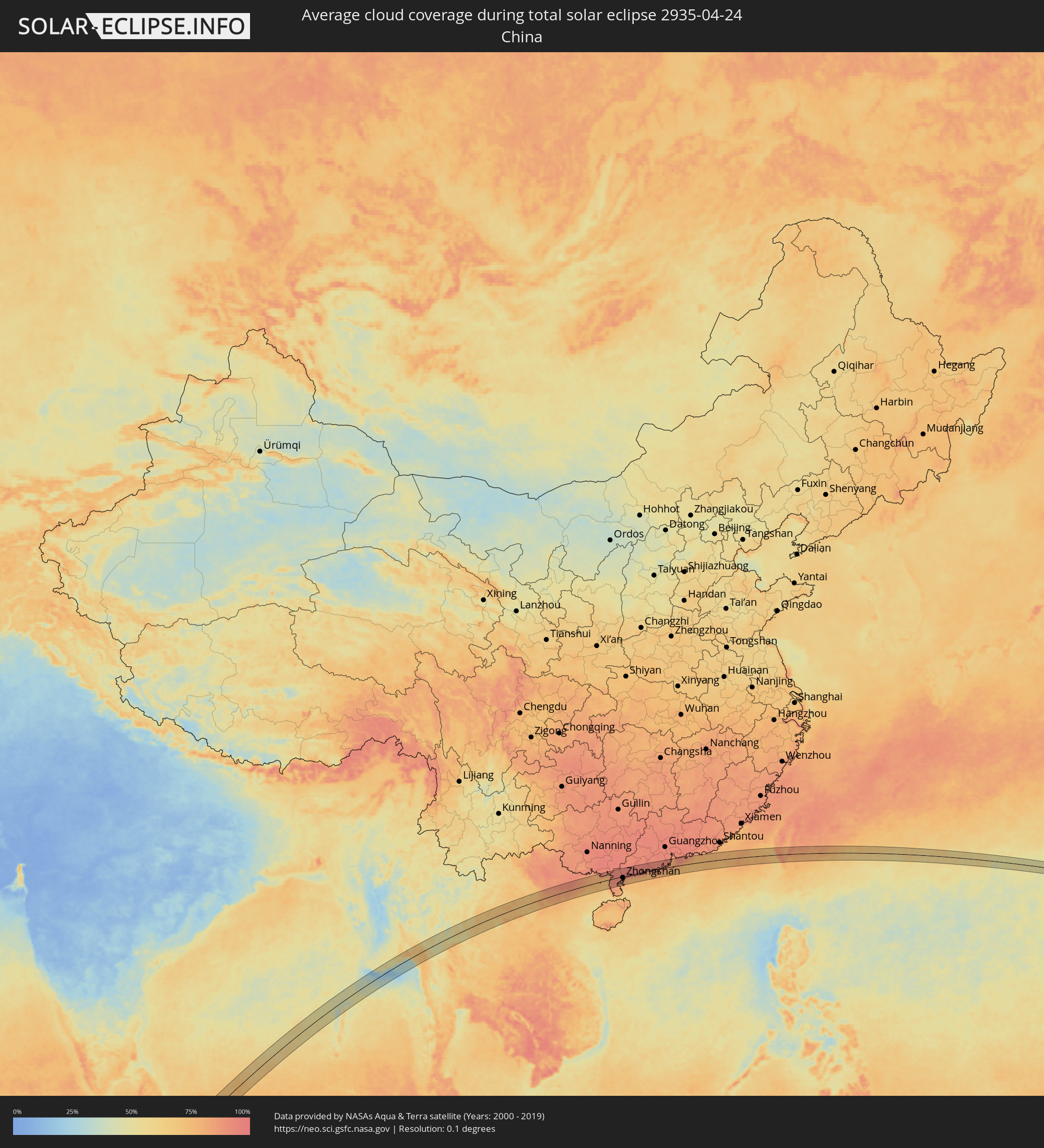 China
China
 Myanmar
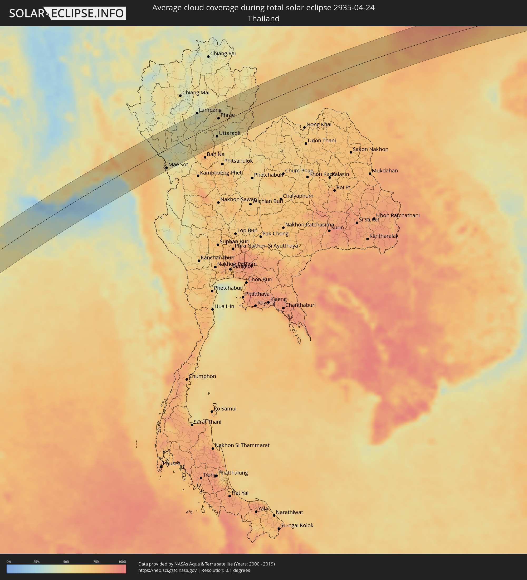 Thailand
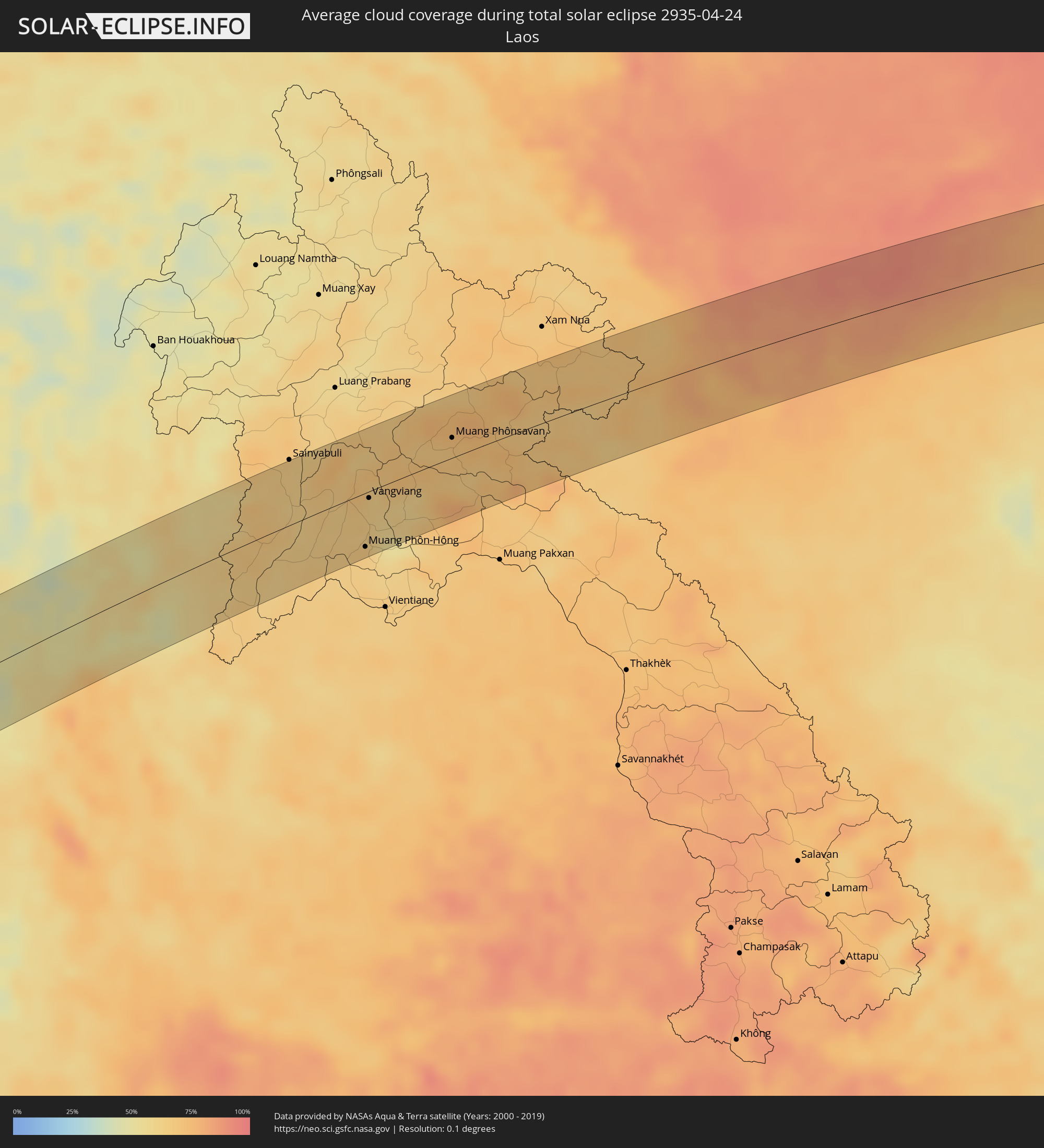 Laos
Laos
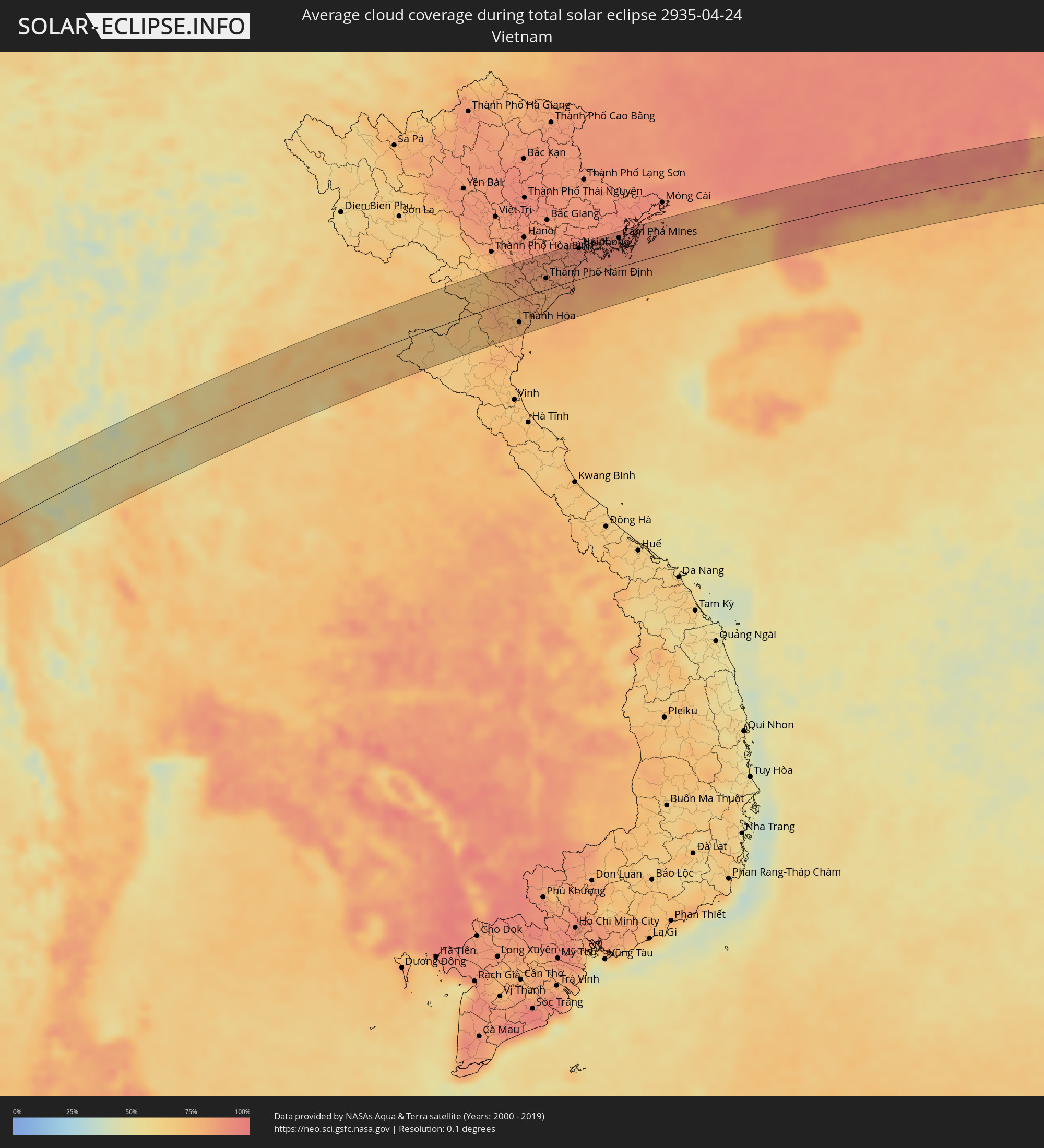 Vietnam
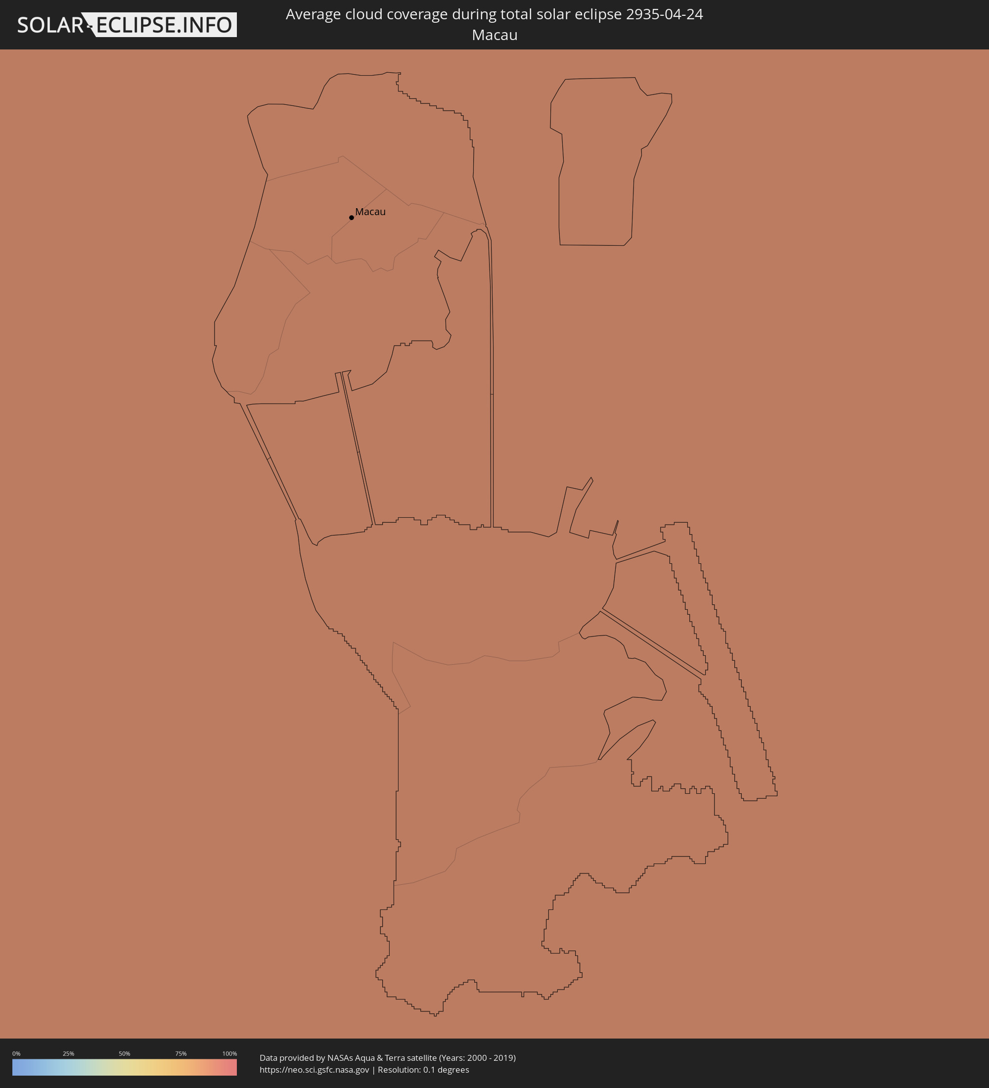 Macau
Macau
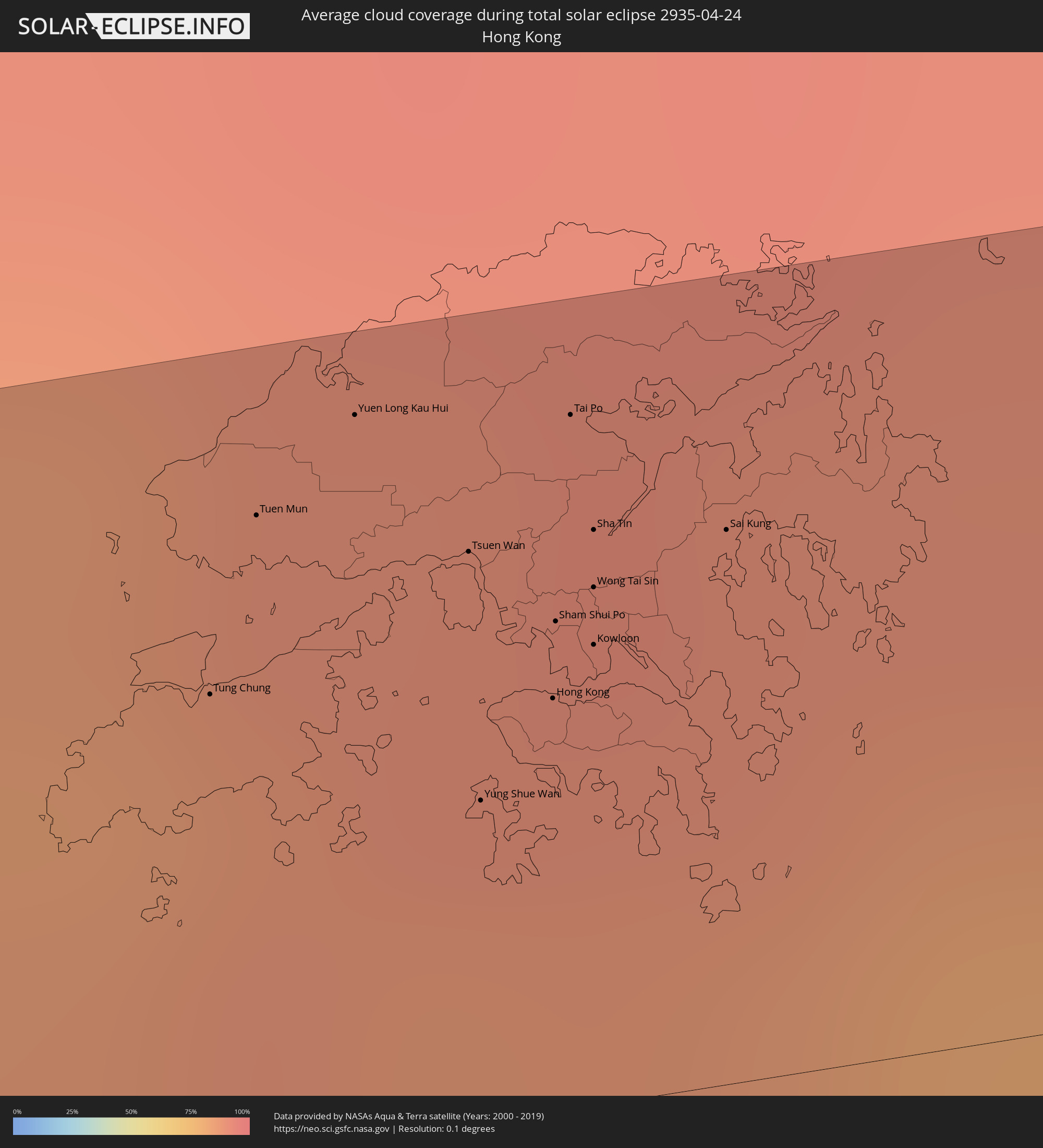 Hong Kong
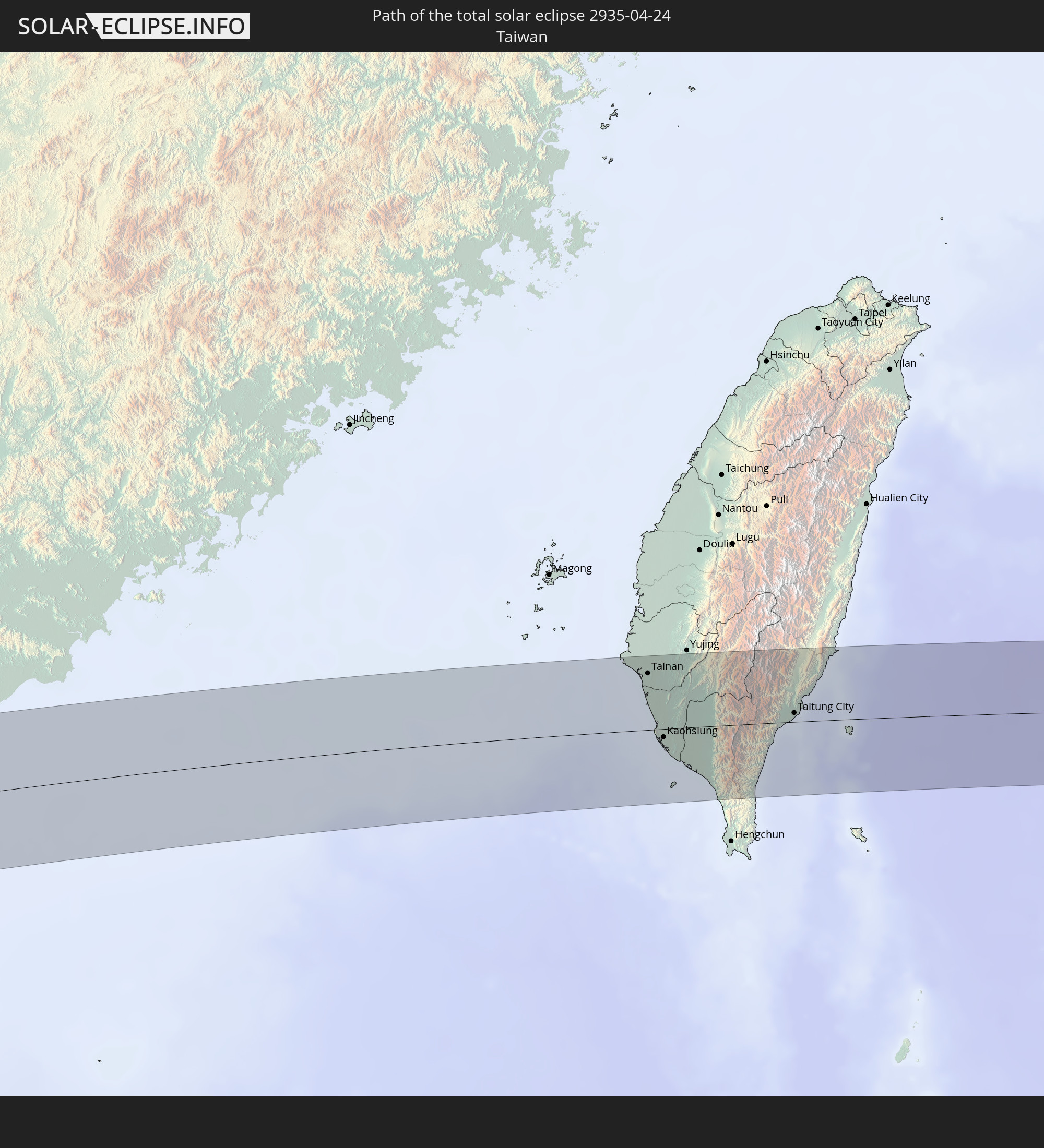
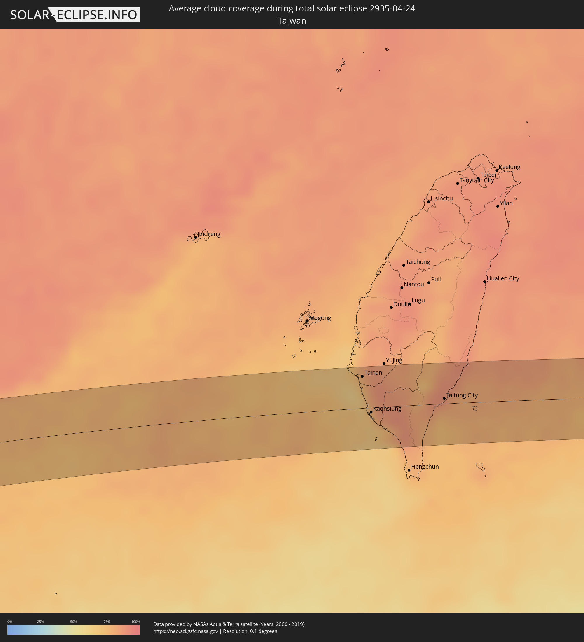 Taiwan
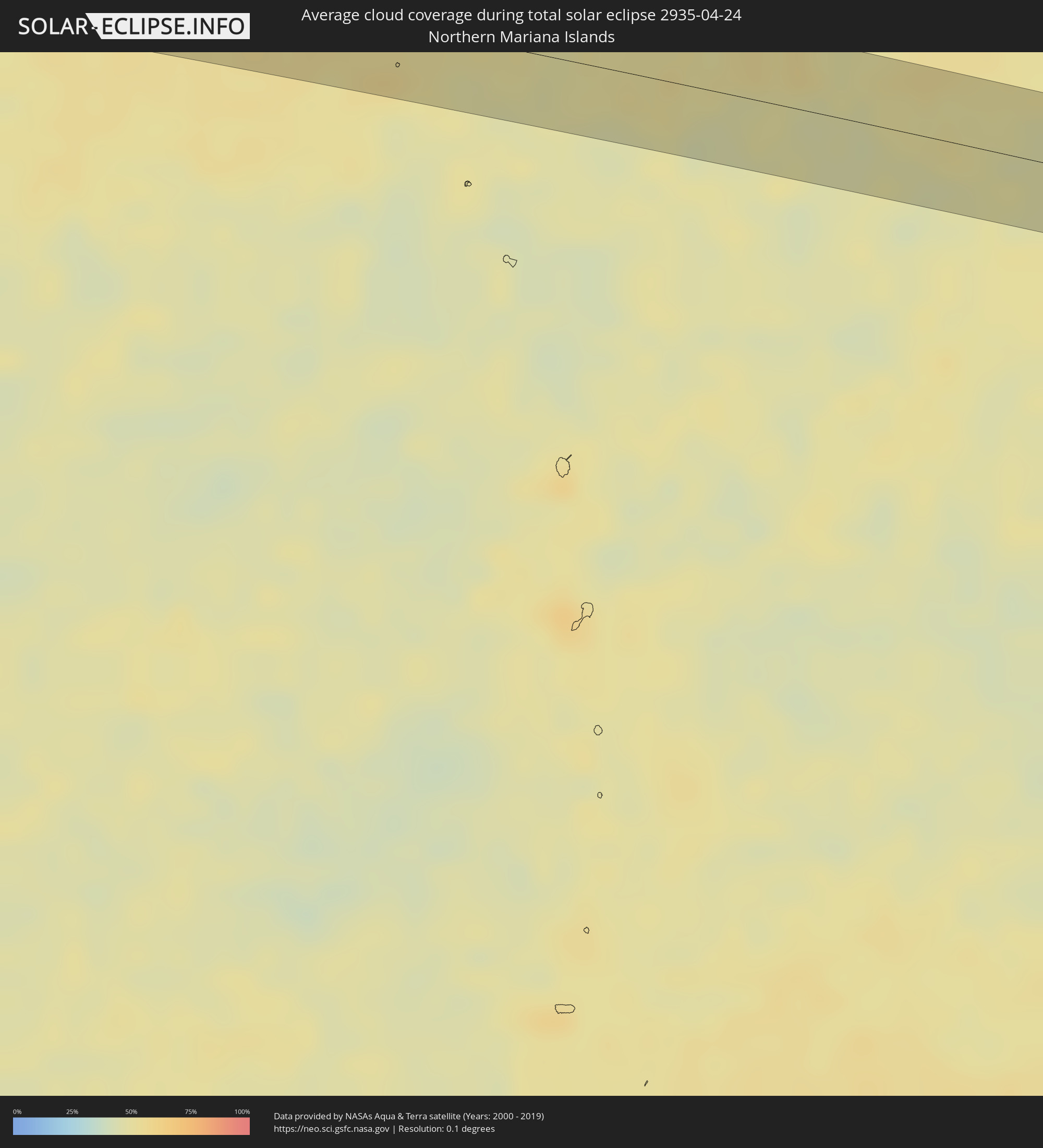 Northern Mariana Islands
Cities inside the path of the eclipse
The following table shows all locations with a population of more than 5,000 inside the eclipse path. Cities which have more than 100,000 inhabitants are marked bold. A click at the locations opens a detailed map.
| City | Type | Eclipse duration | Local time of max. eclipse | Distance to central line | Ø Cloud coverage |
|
Zastron, Orange Free State
|
total | - | 06:41:11 UTC+02:00 | 18 km | 41% |
|
Mafeteng, Mafeteng
|
total | - | 06:41:11 UTC+02:00 | 30 km | 39% |
|
Mohale’s Hoek, Mohaleʼs Hoek
|
total | - | 06:41:11 UTC+02:00 | 11 km | 44% |
|
Thaba-Tseka, Thaba-Tseka
|
total | - | 06:41:13 UTC+02:00 | 27 km | 36% |
|
Mooirivier, KwaZulu-Natal
|
total | - | 06:41:19 UTC+02:00 | 24 km | 40% |
|
Mpophomeni, KwaZulu-Natal
|
total | - | 06:41:18 UTC+02:00 | 20 km | 43% |
|
Howick, KwaZulu-Natal
|
total | - | 06:41:19 UTC+02:00 | 12 km | 42% |
|
Pietermaritzburg, KwaZulu-Natal
|
total | - | 06:41:19 UTC+02:00 | 31 km | 46% |
|
Greytown, KwaZulu-Natal
|
total | - | 06:41:22 UTC+02:00 | 22 km | 46% |
|
Stanger, KwaZulu-Natal
|
total | - | 06:41:25 UTC+02:00 | 26 km | 49% |
|
Sundumbili, KwaZulu-Natal
|
total | - | 06:41:26 UTC+02:00 | 8 km | 47% |
|
Eshowe, KwaZulu-Natal
|
total | - | 06:41:28 UTC+02:00 | 16 km | 50% |
|
Empangeni, KwaZulu-Natal
|
total | - | 06:41:31 UTC+02:00 | 17 km | 46% |
|
eSikhawini, KwaZulu-Natal
|
total | - | 06:41:31 UTC+02:00 | 5 km | 41% |
|
Richards Bay, KwaZulu-Natal
|
total | - | 06:41:32 UTC+02:00 | 11 km | 44% |
|
Ampanihy, Atsimo-Andrefana
|
total | - | 07:46:12 UTC+03:00 | 23 km | 49% |
|
Beteza, Androy
|
total | - | 07:46:28 UTC+03:00 | 15 km | 44% |
|
Vohipaho, Atsimo-Atsinanana
|
total | - | 07:48:07 UTC+03:00 | 32 km | 63% |
|
Vangaindrano, Atsimo-Atsinanana
|
total | - | 07:48:16 UTC+03:00 | 16 km | 66% |
|
Farafangana, Atsimo-Atsinanana
|
total | - | 07:48:40 UTC+03:00 | 25 km | 59% |
|
Cargados Carajos, Cargados Carajos
|
total | - | 09:02:49 UTC+04:00 | 32 km | 48% |
|
Pyapon, Ayeyarwady
|
total | - | 13:34:38 UTC+06:30 | 58 km | 51% |
|
Thongwa, Yangon
|
total | - | 13:37:12 UTC+06:30 | 57 km | 63% |
|
Thaton, Mon
|
total | - | 13:39:16 UTC+06:30 | 28 km | 68% |
|
Martaban, Mon
|
total | - | 13:39:13 UTC+06:30 | 23 km | 65% |
|
Mawlamyine, Mon
|
total | - | 13:39:12 UTC+06:30 | 27 km | 65% |
|
Hpa-an, Kayin
|
total | - | 13:39:47 UTC+06:30 | 11 km | 69% |
|
Mudon, Mon
|
total | - | 13:39:03 UTC+06:30 | 55 km | 60% |
|
Myawadi, Kayin
|
total | - | 13:41:23 UTC+06:30 | 53 km | 55% |
|
Mae Ramat, Tak
|
total | - | 14:11:49 UTC+07:00 | 24 km | 61% |
|
Mae Sot, Tak
|
total | - | 14:11:33 UTC+07:00 | 53 km | 54% |
|
Ban Tak, Tak
|
total | - | 14:13:07 UTC+07:00 | 46 km | 50% |
|
Thoen, Lampang
|
total | - | 14:14:11 UTC+07:00 | 4 km | 51% |
|
Lampang, Lampang
|
total | - | 14:15:40 UTC+07:00 | 59 km | 40% |
|
Si Satchanalai, Sukhothai
|
total | - | 14:15:12 UTC+07:00 | 31 km | 69% |
|
Long, Phrae
|
total | - | 14:16:06 UTC+07:00 | 21 km | 49% |
|
Sawankhalok, Sukhothai
|
total | - | 14:15:05 UTC+07:00 | 55 km | 70% |
|
Den Chai, Phrae
|
total | - | 14:16:26 UTC+07:00 | 2 km | 54% |
|
Uttaradit, Uttaradit
|
total | - | 14:16:03 UTC+07:00 | 36 km | 60% |
|
Phrae, Phrae
|
total | - | 14:16:50 UTC+07:00 | 14 km | 58% |
|
Rong Kwang, Phrae
|
total | - | 14:17:27 UTC+07:00 | 26 km | 55% |
|
Nan, Nan
|
total | - | 14:18:58 UTC+07:00 | 50 km | 54% |
|
Muang Phôn-Hông, Vientiane Province
|
total | - | 14:21:57 UTC+07:00 | 48 km | 66% |
|
Vangviang, Vientiane Province
|
total | - | 14:22:31 UTC+07:00 | 6 km | 65% |
|
Muang Phônsavan, Xiangkhoang
|
total | - | 14:24:39 UTC+07:00 | 18 km | 69% |
|
Thanh Hóa, Thanh Hóa
|
total | - | 14:29:57 UTC+07:00 | 37 km | 76% |
|
Bỉm Sơn, Thanh Hóa
|
total | - | 14:30:23 UTC+07:00 | 10 km | 81% |
|
Thành Phố Phủ Lý, Hà Nam
|
total | - | 14:30:55 UTC+07:00 | 37 km | 85% |
|
Thành Phố Ninh Bình, Ninh Bình
|
total | - | 14:30:47 UTC+07:00 | 5 km | 81% |
|
Hưng Yên, Hưng Yên
|
total | - | 14:31:16 UTC+07:00 | 44 km | 84% |
|
Thành Phố Nam Định, Nam Định
|
total | - | 14:31:19 UTC+07:00 | 17 km | 82% |
|
Thành Phố Thái Bình, Thái Bình
|
total | - | 14:31:38 UTC+07:00 | 14 km | 84% |
|
Haiphong, Hải Phòng
|
total | - | 14:32:38 UTC+07:00 | 47 km | 91% |
|
Cát Bà, Hải Phòng
|
total | - | 14:33:11 UTC+07:00 | 21 km | 84% |
|
Thành Phố Hạ Long, Quảng Ninh
|
total | - | 14:33:25 UTC+07:00 | 44 km | 92% |
|
Cẩm Phả Mines, Quảng Ninh
|
total | - | 14:33:53 UTC+07:00 | 45 km | 91% |
|
Beihai, Guangxi Zhuang Autonomous Region
|
total | - | 15:37:25 UTC+08:00 | 45 km | 84% |
|
Lianjiang, Guangdong
|
total | - | 15:39:32 UTC+08:00 | 34 km | 93% |
|
Zhanjiang, Guangdong
|
total | - | 15:39:22 UTC+08:00 | 8 km | 93% |
|
Zhongshan, Guangdong
|
total | - | 15:39:47 UTC+08:00 | 9 km | 87% |
|
Huazhou, Guangdong
|
total | - | 15:40:01 UTC+08:00 | 25 km | 96% |
|
Wuchuan, Guangdong
|
total | - | 15:40:12 UTC+08:00 | 2 km | 92% |
|
Gaozhou, Guangdong
|
total | - | 15:40:40 UTC+08:00 | 52 km | 94% |
|
Tangping, Guangdong
|
total | - | 15:42:28 UTC+08:00 | 39 km | 93% |
|
Yangjiang, Guangdong
|
total | - | 15:42:24 UTC+08:00 | 19 km | 92% |
|
Encheng, Guangdong
|
total | - | 15:43:09 UTC+08:00 | 49 km | 93% |
|
Taishan, Guangdong
|
total | - | 15:43:56 UTC+08:00 | 47 km | 95% |
|
Macau, Macau
|
total | - | 15:45:04 UTC+08:00 | 27 km | 90% |
|
Zhuhai, Guangdong
|
total | - | 15:45:09 UTC+08:00 | 35 km | 87% |
|
Tung Chung, Islands
|
total | - | 15:45:43 UTC+08:00 | 30 km | 85% |
|
Tuen Mun, Tuen Mun
|
total | - | 15:45:49 UTC+08:00 | 41 km | 87% |
|
Yuen Long Kau Hui, Yuen Long
|
total | - | 15:45:56 UTC+08:00 | 47 km | 89% |
|
Tsuen Wan, Tsuen Wan
|
total | - | 15:46:00 UTC+08:00 | 37 km | 90% |
|
Yung Shue Wan
|
total | - | 15:45:56 UTC+08:00 | 21 km | 80% |
|
Hong Kong, Central and Western
|
total | - | 15:46:02 UTC+08:00 | 26 km | 87% |
|
Central, Central and Western
|
total | - | 15:46:02 UTC+08:00 | 26 km | 87% |
|
Sham Shui Po, Sham Shui Po
|
total | - | 15:46:04 UTC+08:00 | 31 km | 87% |
|
Tai Po, Tai Po
|
total | - | 15:46:08 UTC+08:00 | 44 km | 91% |
|
Wan Chai, Wanchai
|
total | - | 15:46:03 UTC+08:00 | 26 km | 87% |
|
Kowloon, Kowloon City
|
total | - | 15:46:05 UTC+08:00 | 29 km | 87% |
|
Wong Tai Sin, Wong Tai Sin
|
total | - | 15:46:06 UTC+08:00 | 33 km | 89% |
|
Sha Tin, Sha Tin
|
total | - | 15:46:07 UTC+08:00 | 37 km | 89% |
|
Sai Kung, Sai Kung
|
total | - | 15:46:15 UTC+08:00 | 35 km | 89% |
|
Tainan, Taiwan
|
total | - | 15:54:28 UTC+08:00 | 37 km | 75% |
|
Kaohsiung, Takao
|
total | - | 15:54:28 UTC+08:00 | 5 km | 70% |
|
Taitung City, Taiwan
|
total | - | 15:55:30 UTC+08:00 | 6 km | 87% |