Totale Sonnenfinsternis vom 04.11.1119
| Wochentag: | Dienstag |
| Maximale Dauer der Verfinsterung: | 03m14s |
| Maximale Breite des Finsternispfades: | 113 km |
| Saroszyklus: | 109 |
| Bedeckungsgrad: | 100% |
| Magnitude: | 1.0336 |
| Gamma: | 0.0194 |
Wo kann man die Sonnenfinsternis vom 04.11.1119 sehen?
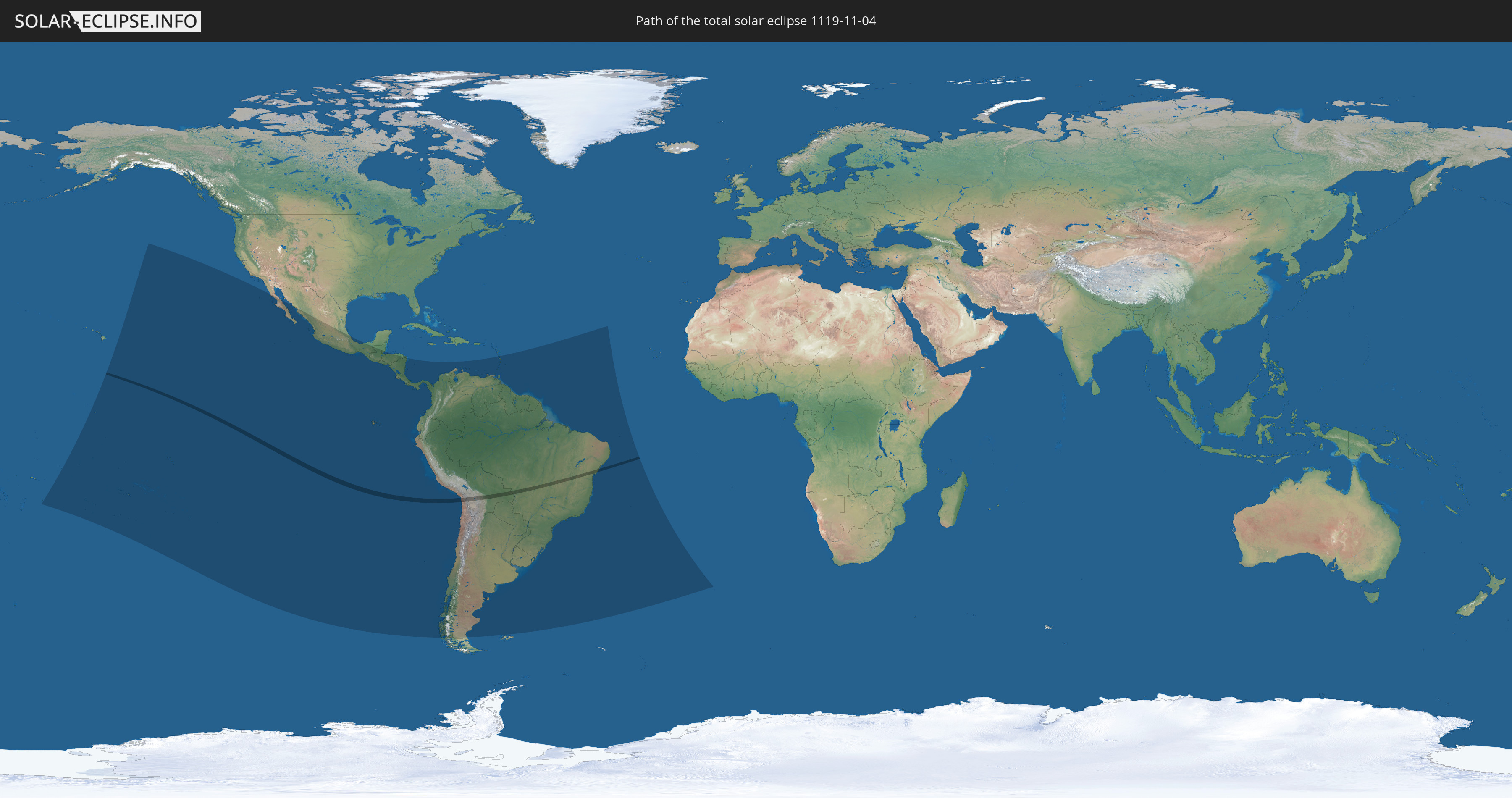
Die Sonnenfinsternis am 04.11.1119 kann man in 34 Ländern als partielle Sonnenfinsternis beobachten.
Der Finsternispfad verläuft durch 3 Länder. Nur in diesen Ländern ist sie als totale Sonnenfinsternis zu sehen.
In den folgenden Ländern ist die Sonnenfinsternis total zu sehen
 Chile
Chile
 Brasilien
 Bolivien
In den folgenden Ländern ist die Sonnenfinsternis partiell zu sehen
 Kiribati
 Cookinseln
 Französisch-Polynesien
 Pitcairninseln
 Mexiko
 Chile
Chile
 Guatemala
 Ecuador
 El Salvador
 Honduras
 Belize
 Nicaragua
 Costa Rica
 Panama
 Kolumbien
 Peru
Peru
 Brasilien
 Argentinien
 Venezuela
 Aruba
Aruba
 Bolivien
 Paraguay
 Trinidad und Tobago
 Grenada
 St. Vincent und die Grenadinen
 Falklandinseln
 Guyana
 Martinique
 St. Lucia
 Barbados
 Uruguay
 Suriname
 Französisch-Guayana
 St. Helena
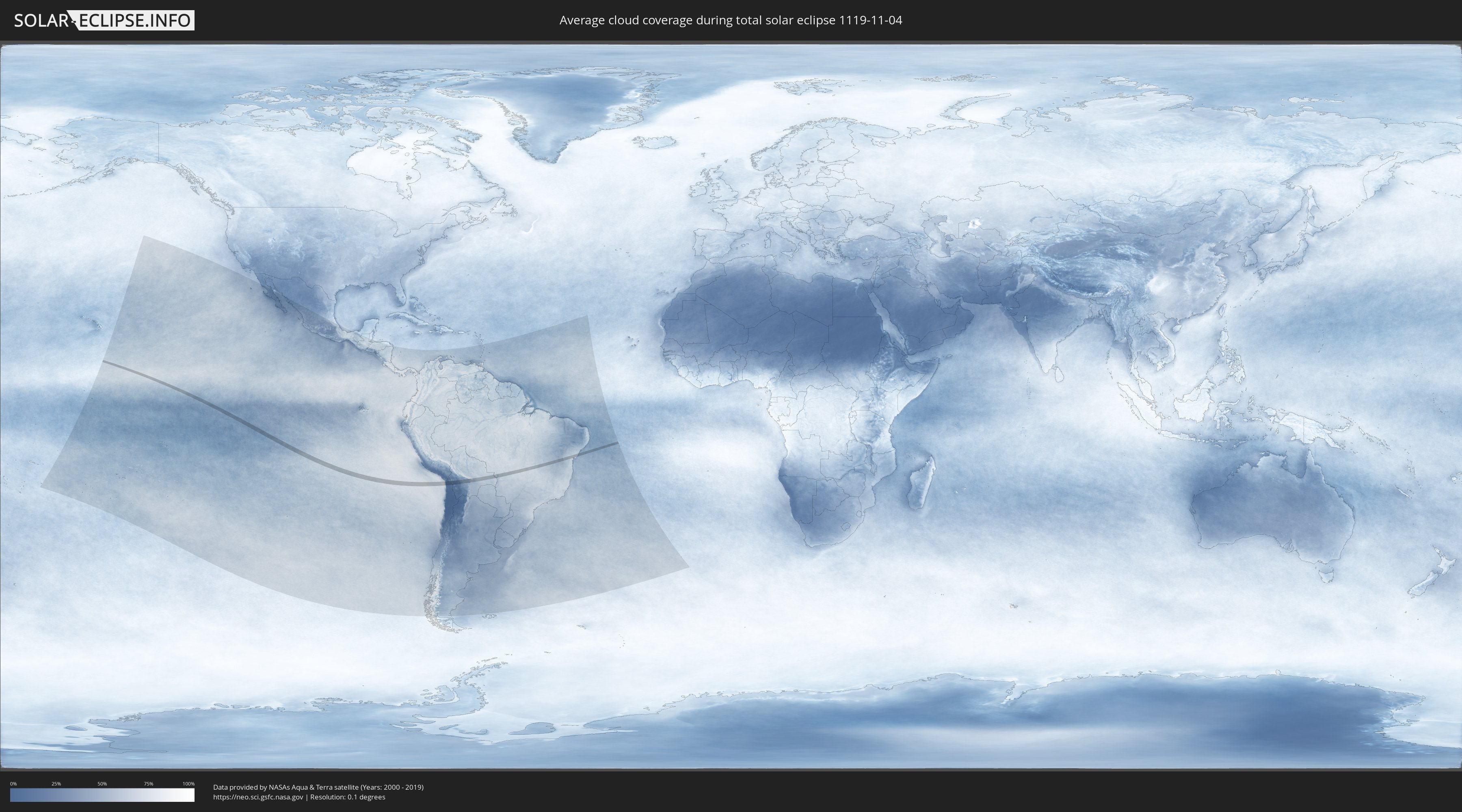
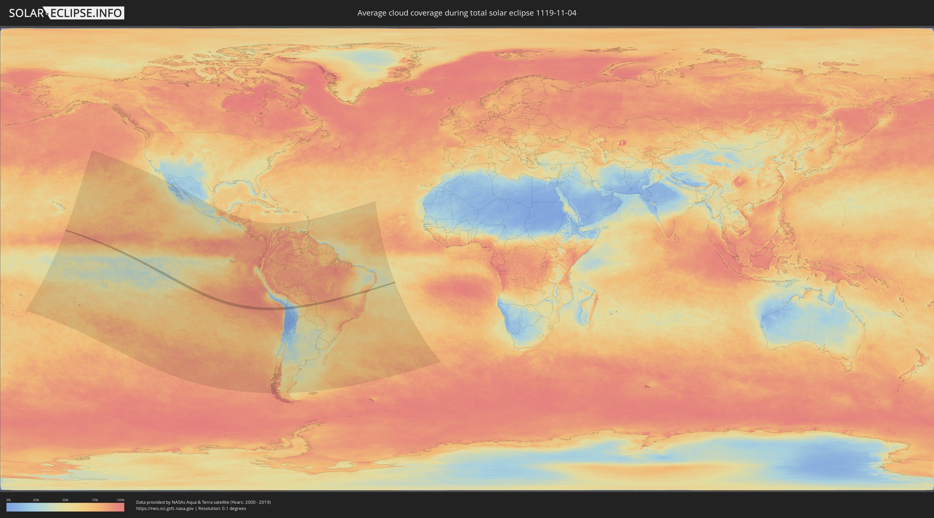
Wie wird das Wetter während der totalen Sonnenfinsternis am 04.11.1119?
Wo ist der beste Ort, um die totale Sonnenfinsternis vom 04.11.1119 zu beobachten?
Die folgenden Karten zeigen die durchschnittliche Bewölkung für den Tag, an dem die totale Sonnenfinsternis
stattfindet. Mit Hilfe der Karten lässt sich der Ort entlang des Finsternispfades eingrenzen,
der die besten Aussichen auf einen klaren wolkenfreien Himmel bietet.
Trotzdem muss man immer lokale Gegenenheiten beachten und sollte sich genau über das Wetter an seinem
gewählten Beobachtungsort informieren.
Die Daten stammen von den beiden NASA-Satelliten
AQUA und TERRA
und wurden über einen Zeitraum von 19 Jahren (2000 - 2019) gemittelt.
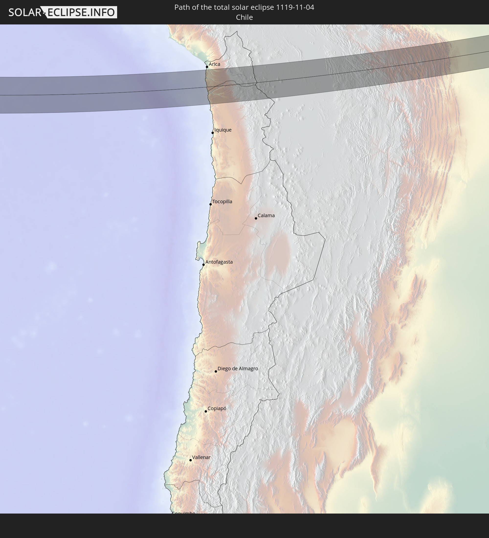
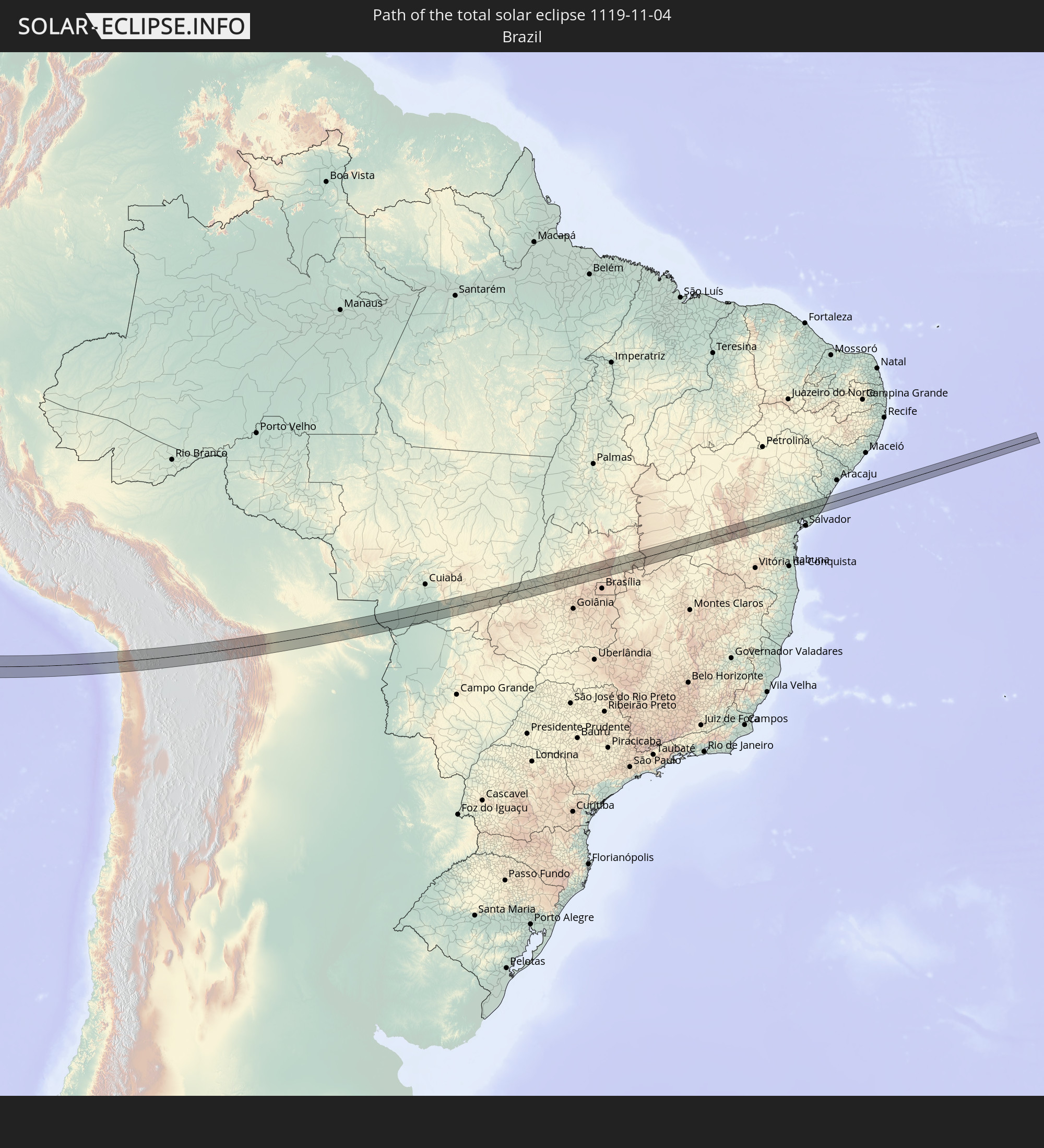
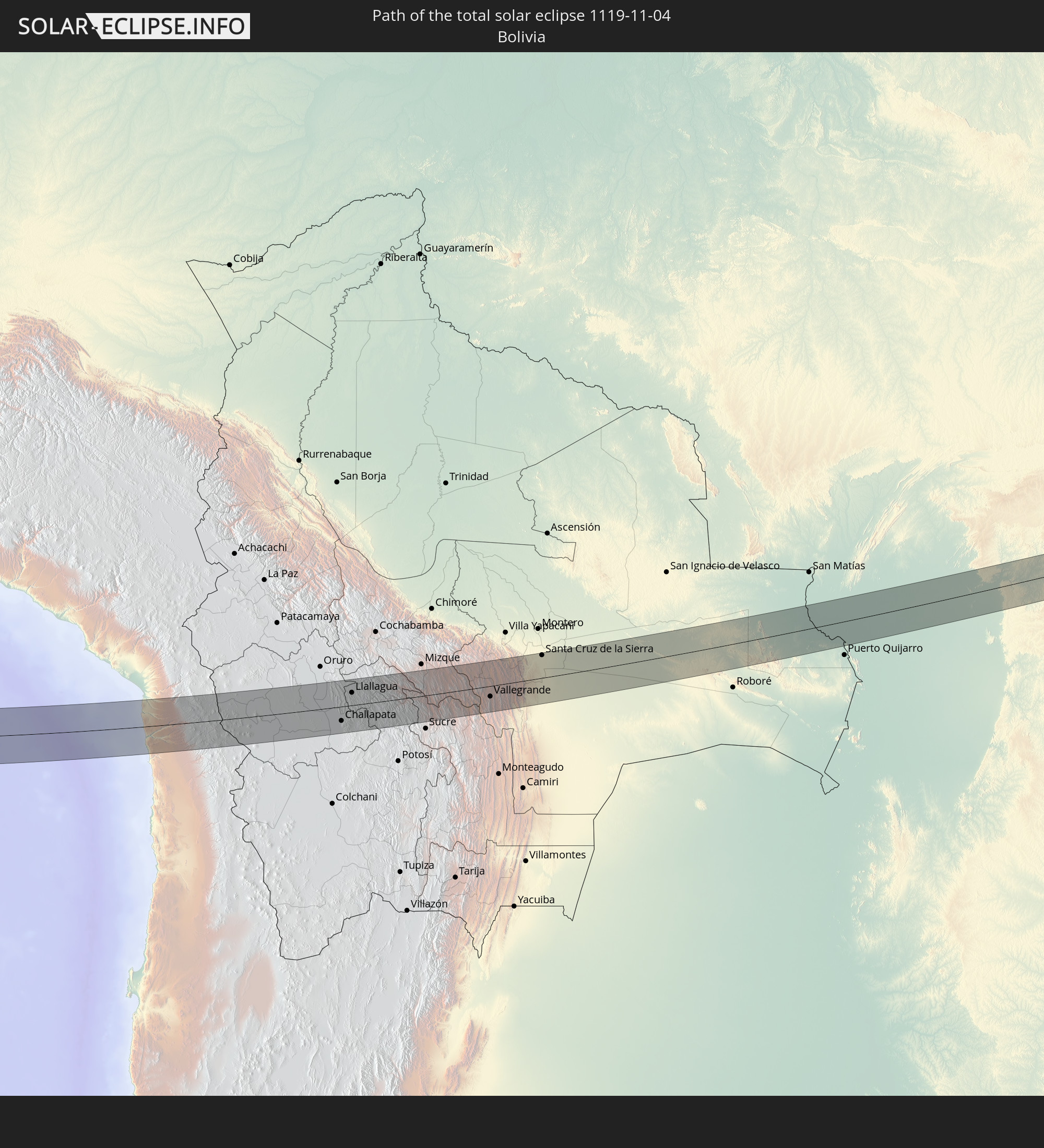
Detaillierte Länderkarten
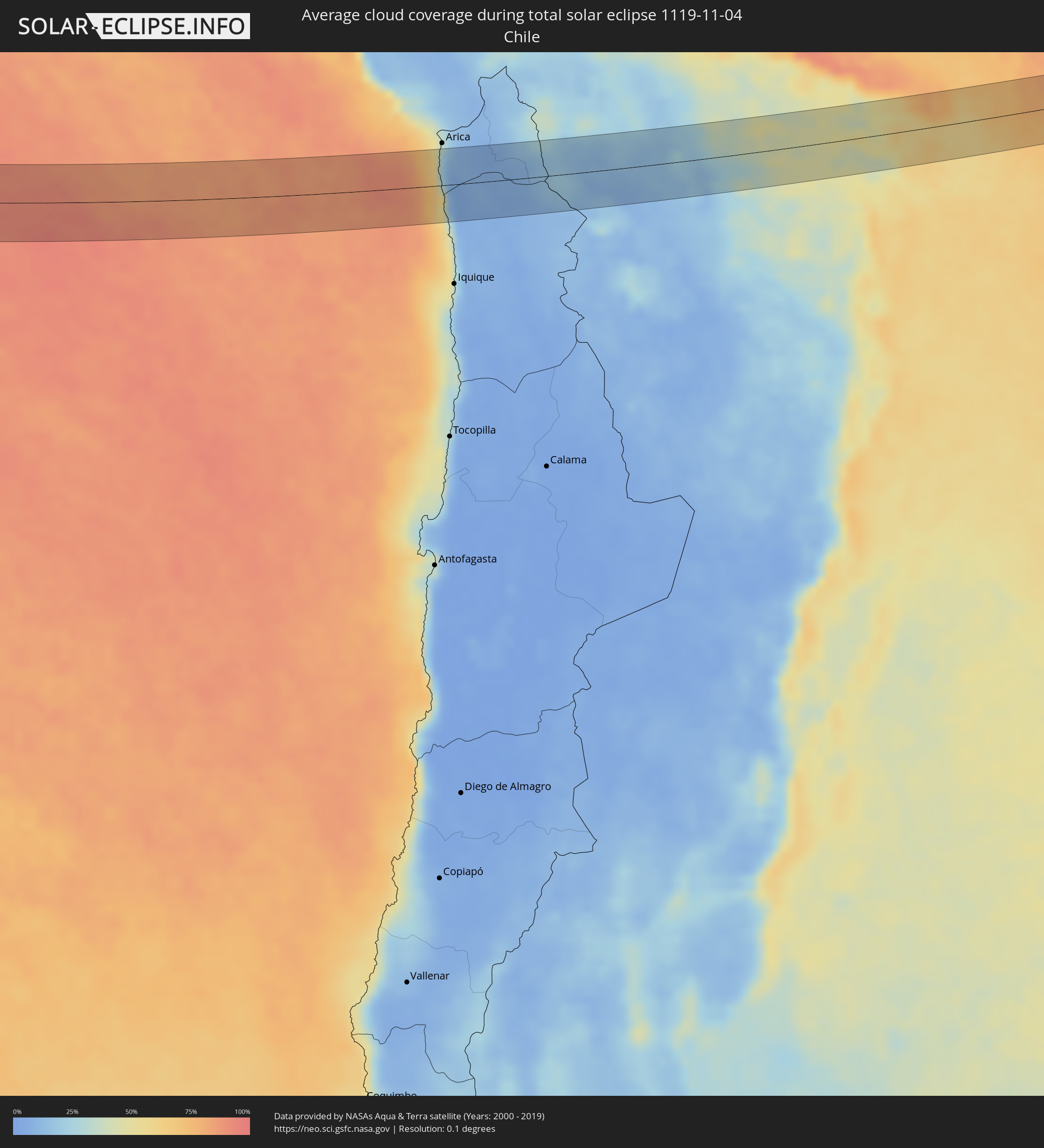 Chile
Chile
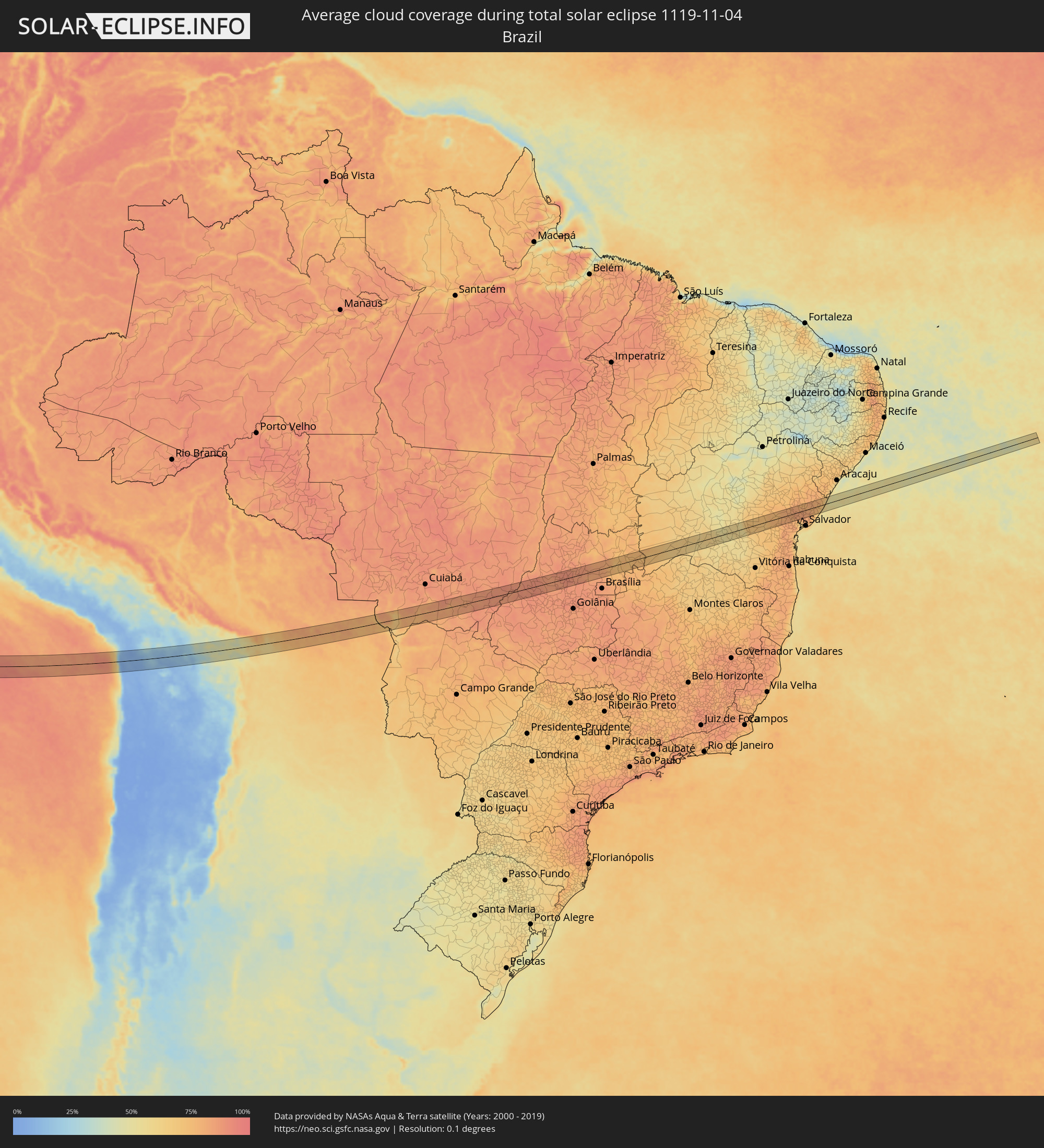 Brasilien
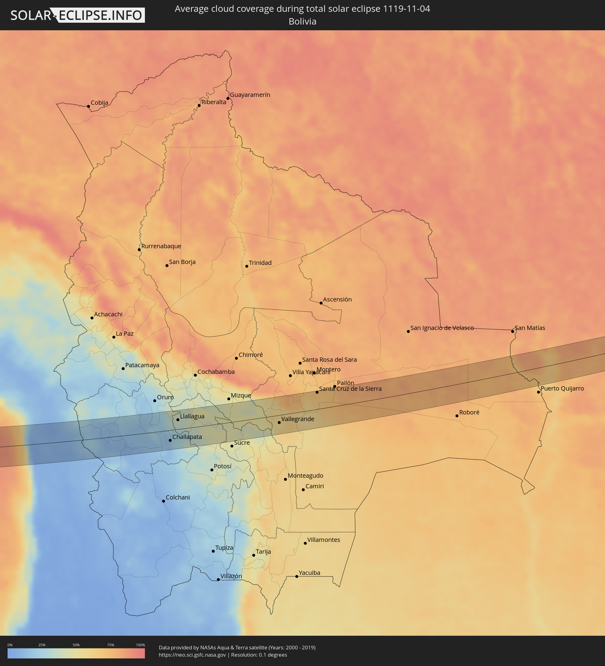 Bolivien
Orte im Finsternispfad
Die nachfolgene Tabelle zeigt Städte und Orte mit mehr als 5.000 Einwohnern, die sich im Finsternispfad befinden. Städte mit mehr als 100.000 Einwohnern sind dick gekennzeichnet. Mit einem Klick auf den Ort öffnet sich eine Detailkarte die die Lage des jeweiligen Ortes zusammen mit dem Verlauf der zentralen Finsternis präsentiert.
| Ort | Typ | Dauer der Verfinsterung | Ortszeit bei maximaler Verfinsterung | Entfernung zur Zentrallinie | Ø Bewölkung |
|
Huanuni, Oruro
|
total | - | 14:42:07 UTC-04:32 | 42 km | 33% |
|
Challapata, Oruro
|
total | - | 14:42:04 UTC-04:32 | 27 km | 17% |
|
Llallagua, Potosí
|
total | - | 14:42:32 UTC-04:32 | 24 km | 35% |
|
Aiquile, Cochabamba
|
total | - | 14:45:05 UTC-04:32 | 28 km | 46% |
|
Vallegrande, Santa Cruz
|
total | - | 14:46:48 UTC-04:32 | 20 km | 57% |
|
Santiago del Torno, Santa Cruz
|
total | - | 14:48:09 UTC-04:32 | 24 km | 58% |
|
Santa Cruz de la Sierra, Santa Cruz
|
total | - | 14:48:32 UTC-04:32 | 42 km | 72% |
|
Cotoca, Santa Cruz
|
total | - | 14:48:44 UTC-04:32 | 37 km | 69% |
|
San Julian, Santa Cruz
|
total | - | 14:49:02 UTC-04:32 | 37 km | 70% |
|
Rondonópolis, Mato Grosso
|
total | - | 15:54:36 UTC-03:38 | 8 km | 82% |
|
Guiratinga, Mato Grosso
|
total | - | 15:55:34 UTC-03:38 | 0 km | 87% |
|
Barra do Garças, Mato Grosso
|
total | - | 15:57:15 UTC-03:38 | 11 km | 86% |
|
Aragarças, Goiás
|
total | - | 15:57:15 UTC-03:38 | 10 km | 86% |
|
Itapirapuã, Goiás
|
total | - | 16:30:47 UTC-03:06 | 25 km | 88% |
|
Itapuranga, Goiás
|
total | - | 16:31:27 UTC-03:06 | 15 km | 86% |
|
Rubiataba, Goiás
|
total | - | 16:31:44 UTC-03:06 | 24 km | 88% |
|
Carmo do Rio Verde, Goiás
|
total | - | 16:31:44 UTC-03:06 | 1 km | 90% |
|
Uruana, Goiás
|
total | - | 16:31:42 UTC-03:06 | 16 km | 88% |
|
Ceres, Goiás
|
total | - | 16:31:50 UTC-03:06 | 3 km | 90% |
|
Rialma, Goiás
|
total | - | 16:31:51 UTC-03:06 | 2 km | 90% |
|
Goianésia, Goiás
|
total | - | 16:32:13 UTC-03:06 | 11 km | 85% |
|
Barro Alto, Goiás
|
total | - | 16:32:31 UTC-03:06 | 21 km | 87% |
|
Padre Bernardo, Goiás
|
total | - | 16:32:56 UTC-03:06 | 18 km | 82% |
|
Riacho de Santana, Bahia
|
total | - | 17:09:18 UTC-02:34 | 7 km | 61% |
|
Paramirim, Bahia
|
total | - | 17:09:42 UTC-02:34 | 11 km | 55% |
|
Itaberaba, Bahia
|
total | - | 17:10:51 UTC-02:34 | 27 km | 75% |
|
Iaçu, Bahia
|
total | - | 17:10:48 UTC-02:34 | 1 km | 75% |
|
Castro Alves, Bahia
|
total | - | 17:11:05 UTC-02:34 | 25 km | 82% |
|
Santo Estêvão, Bahia
|
total | - | 17:11:16 UTC-02:34 | 5 km | 80% |
|
Anguera, Bahia
|
total | - | 17:11:21 UTC-02:34 | 34 km | 81% |
|
Cruz das Almas, Bahia
|
total | - | 17:11:14 UTC-02:34 | 26 km | 79% |
|
Conceição da Feira, Bahia
|
total | - | 17:11:19 UTC-02:34 | 11 km | 80% |
|
Feira de Santana, Bahia
|
total | - | 17:11:24 UTC-02:34 | 13 km | 83% |
|
São Gonçalo dos Campos, Bahia
|
total | - | 17:11:21 UTC-02:34 | 5 km | 83% |
|
Cachoeira, Bahia
|
total | - | 17:11:18 UTC-02:34 | 23 km | 77% |
|
Irará, Bahia
|
total | - | 17:11:32 UTC-02:34 | 30 km | 78% |
|
Conceição do Jacuípe, Bahia
|
total | - | 17:11:27 UTC-02:34 | 2 km | 82% |
|
Coração de Maria, Bahia
|
total | - | 17:11:29 UTC-02:34 | 10 km | 80% |
|
Santo Amaro, Bahia
|
total | - | 17:11:24 UTC-02:34 | 25 km | 82% |
|
São Sebastião do Passé, Bahia
|
total | - | 17:11:29 UTC-02:34 | 28 km | 81% |
|
Alagoinhas, Bahia
|
total | - | 17:11:38 UTC-02:34 | 10 km | 78% |
|
Catu, Bahia
|
total | - | 17:11:34 UTC-02:34 | 15 km | 82% |
|
Entre Rios, Bahia
|
total | - | 17:11:47 UTC-02:34 | 20 km | 78% |
|
Esplanada, Bahia
|
total | - | 17:11:52 UTC-02:34 | 31 km | 78% |
|
Conde, Bahia
|
total | - | 17:11:58 UTC-02:34 | 18 km | 59% |