Totale Sonnenfinsternis vom 26.12.2410
| Wochentag: | Sonntag |
| Maximale Dauer der Verfinsterung: | 03m50s |
| Maximale Breite des Finsternispfades: | 134 km |
| Saroszyklus: | 148 |
| Bedeckungsgrad: | 100% |
| Magnitude: | 1.0395 |
| Gamma: | 0.1613 |
Wo kann man die Sonnenfinsternis vom 26.12.2410 sehen?
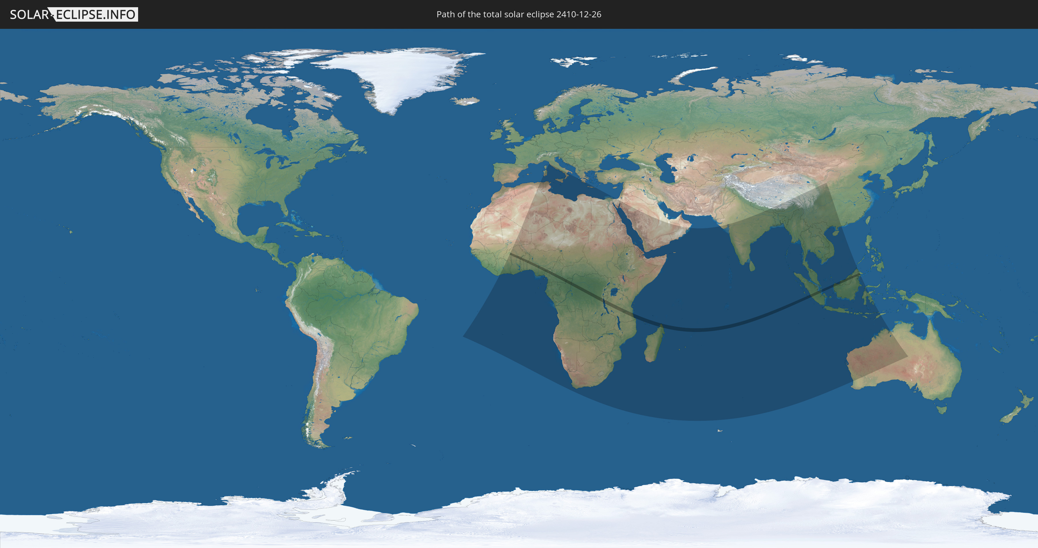
Die Sonnenfinsternis am 26.12.2410 kann man in 78 Ländern als partielle Sonnenfinsternis beobachten.
Der Finsternispfad verläuft durch 16 Länder. Nur in diesen Ländern ist sie als totale Sonnenfinsternis zu sehen.
In den folgenden Ländern ist die Sonnenfinsternis total zu sehen
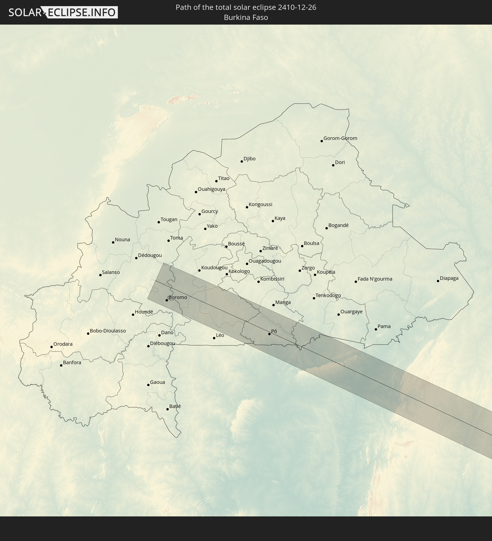 Burkina Faso
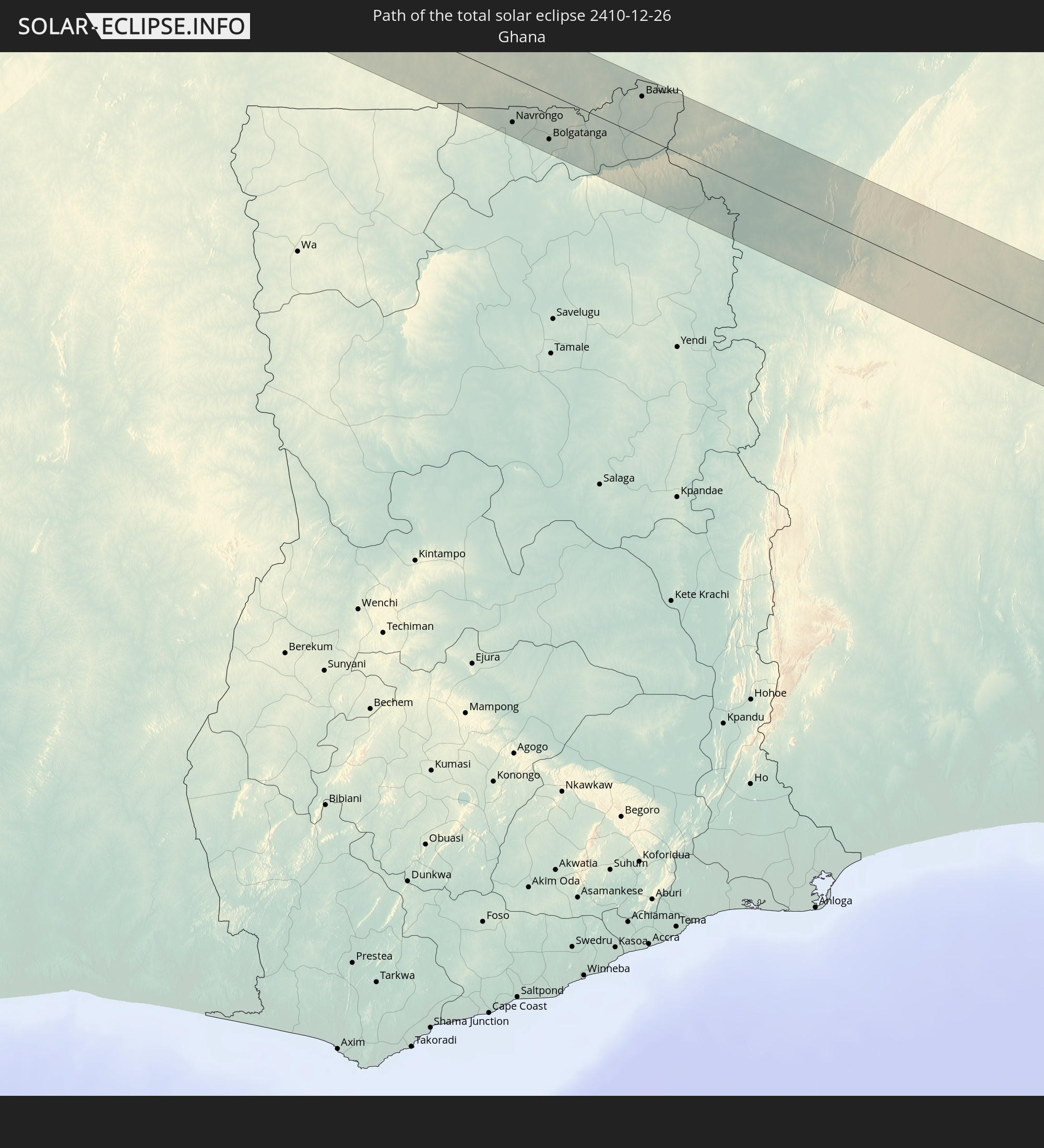 Ghana
Ghana
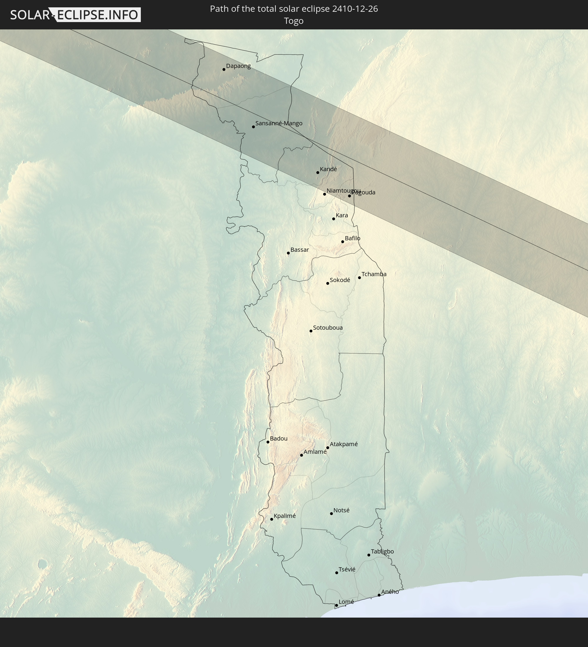 Togo
Togo
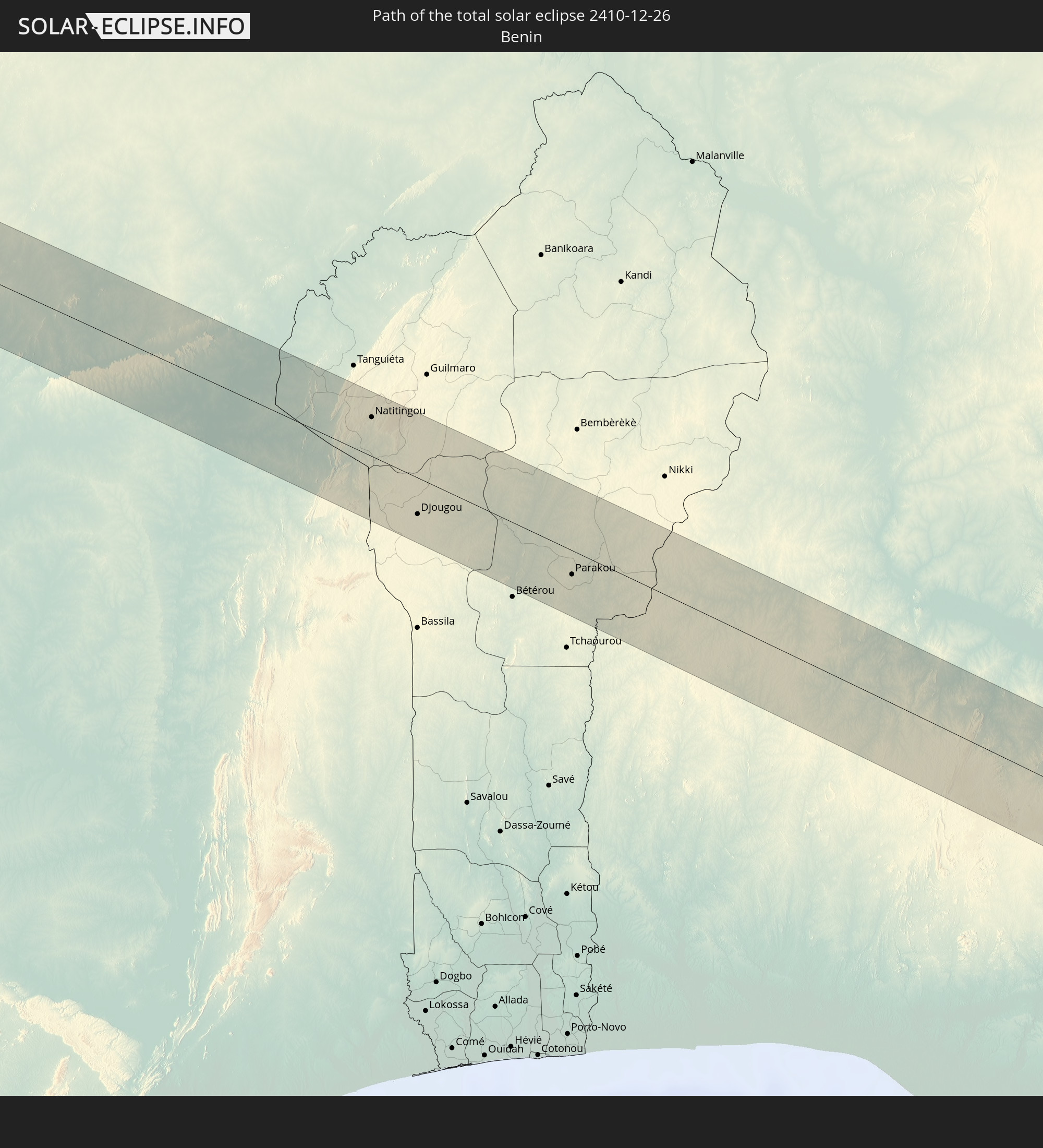 Benin
Benin
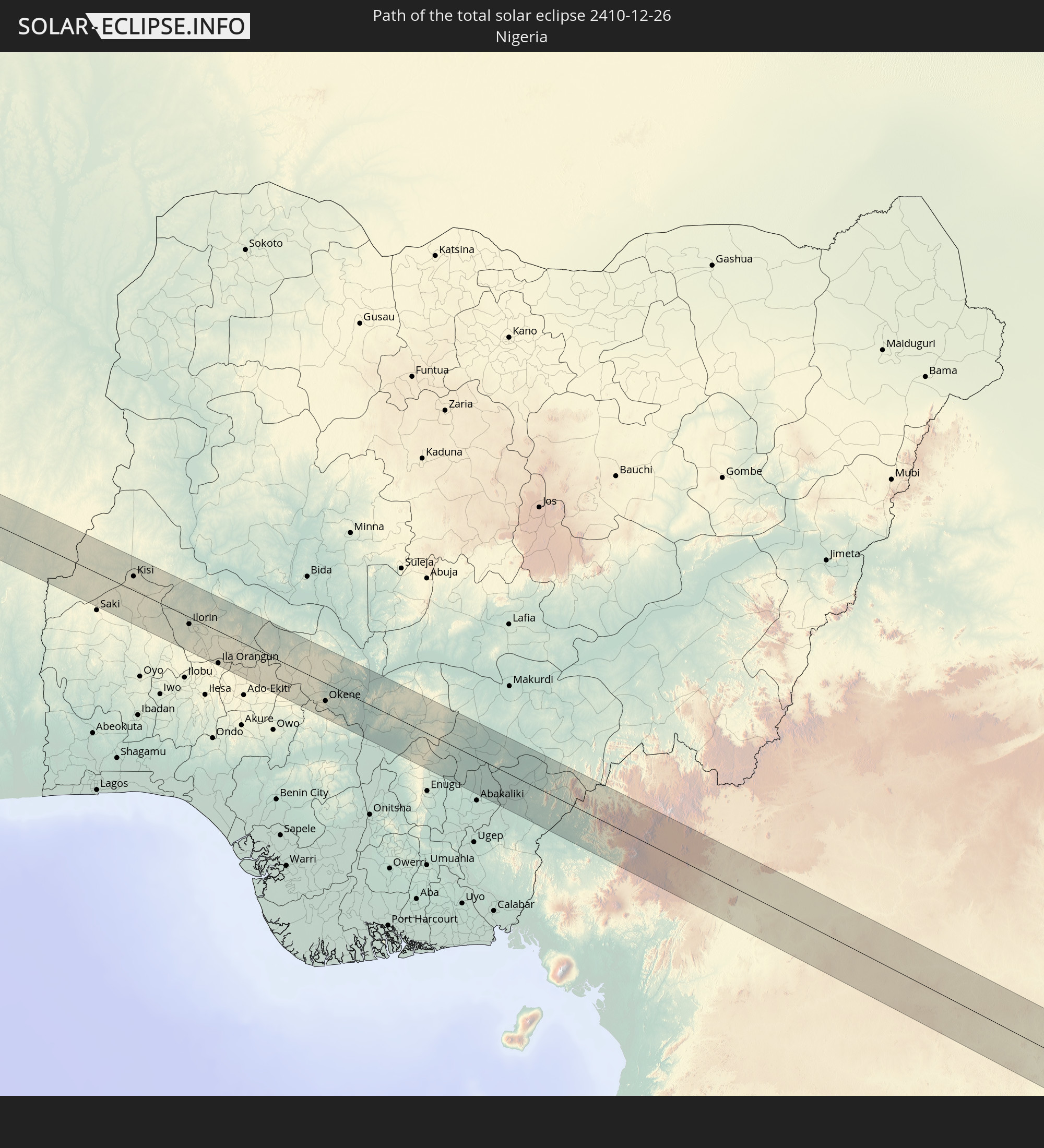 Nigeria
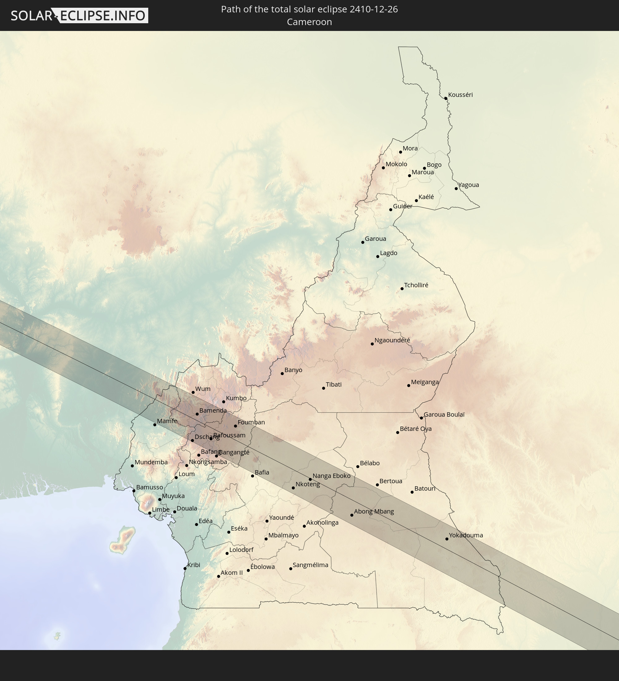 Kamerun
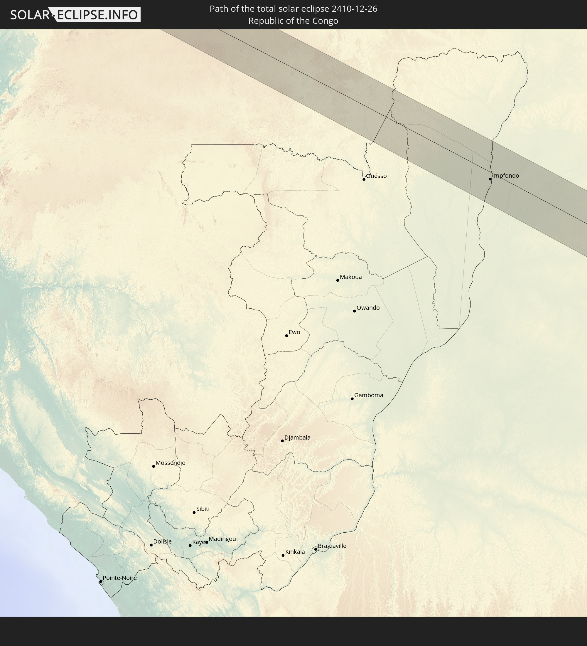 Republik Kongo
 Demokratische Republik Kongo
 Zentralafrikanische Republik
 Burundi
 Tansania
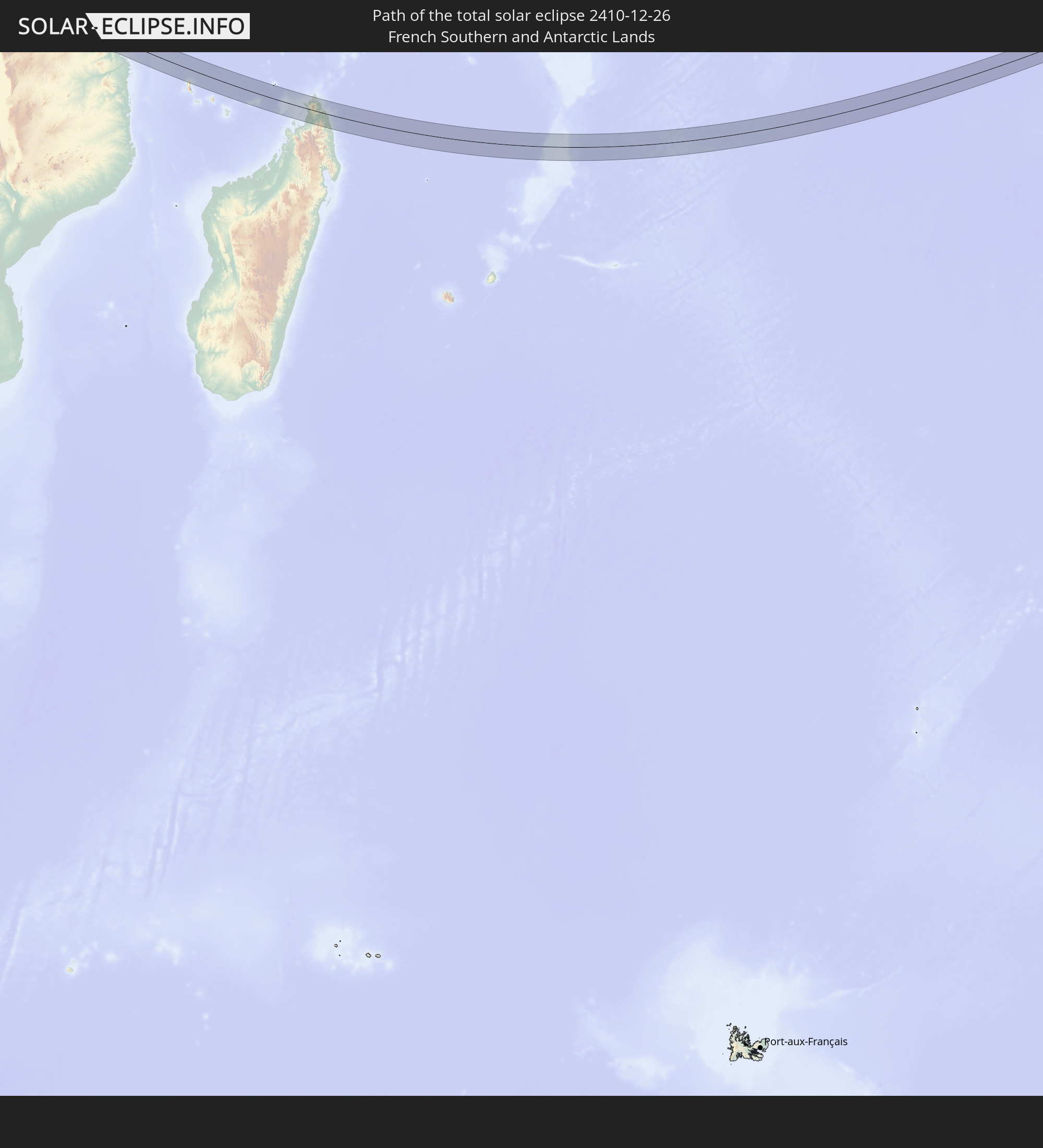 Französische Süd- und Antarktisgebiete
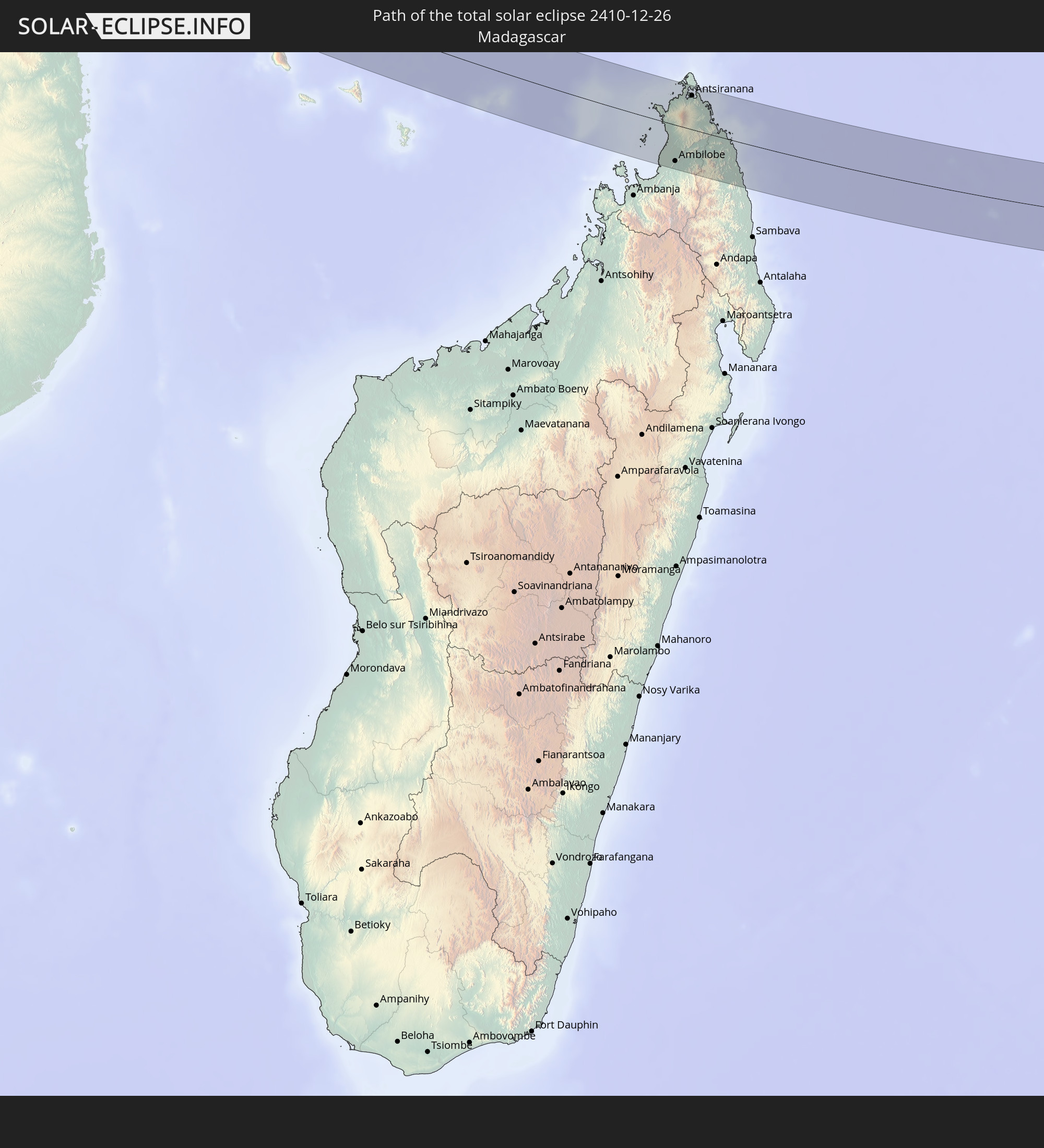 Madagaskar
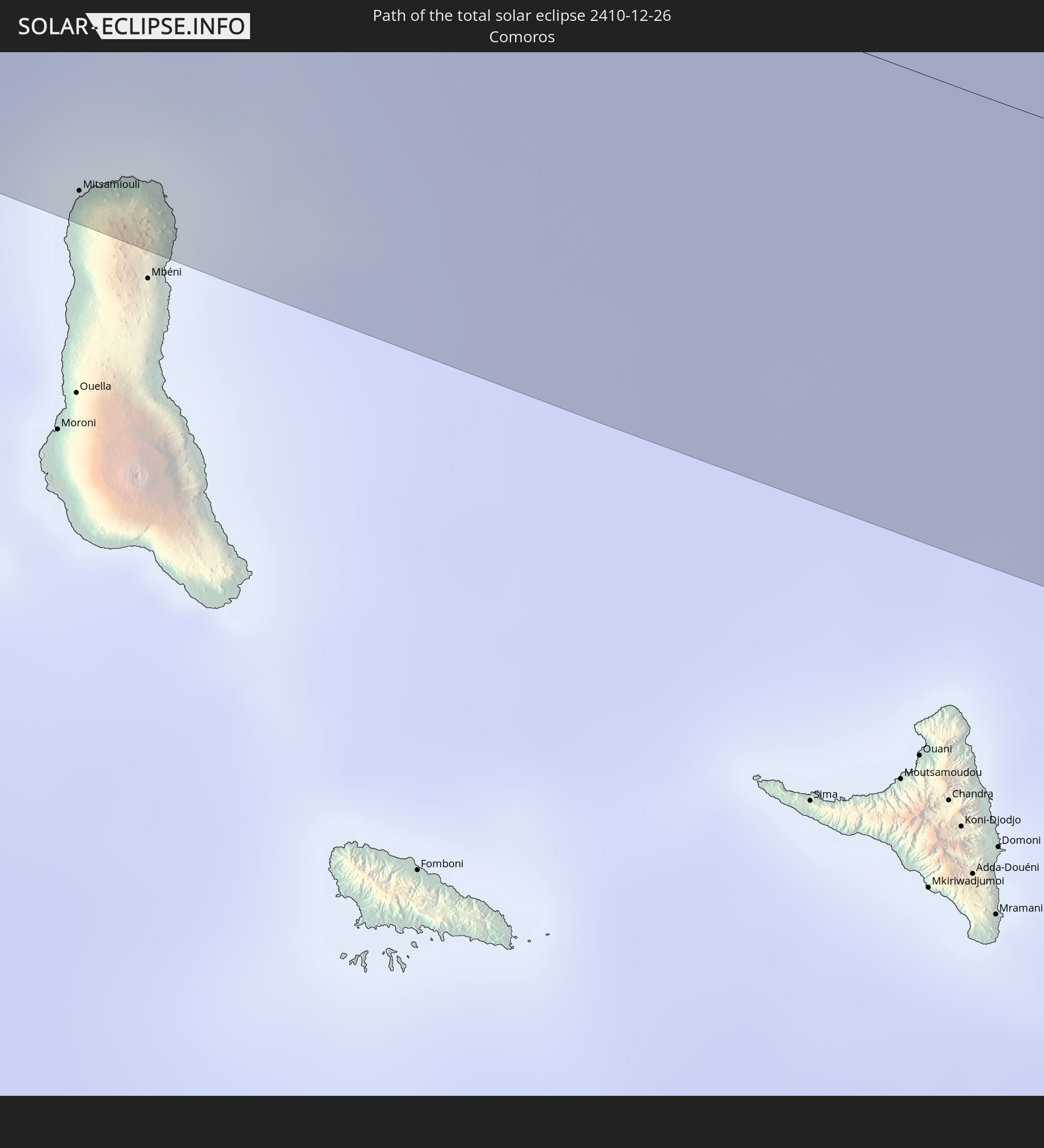 Komoren
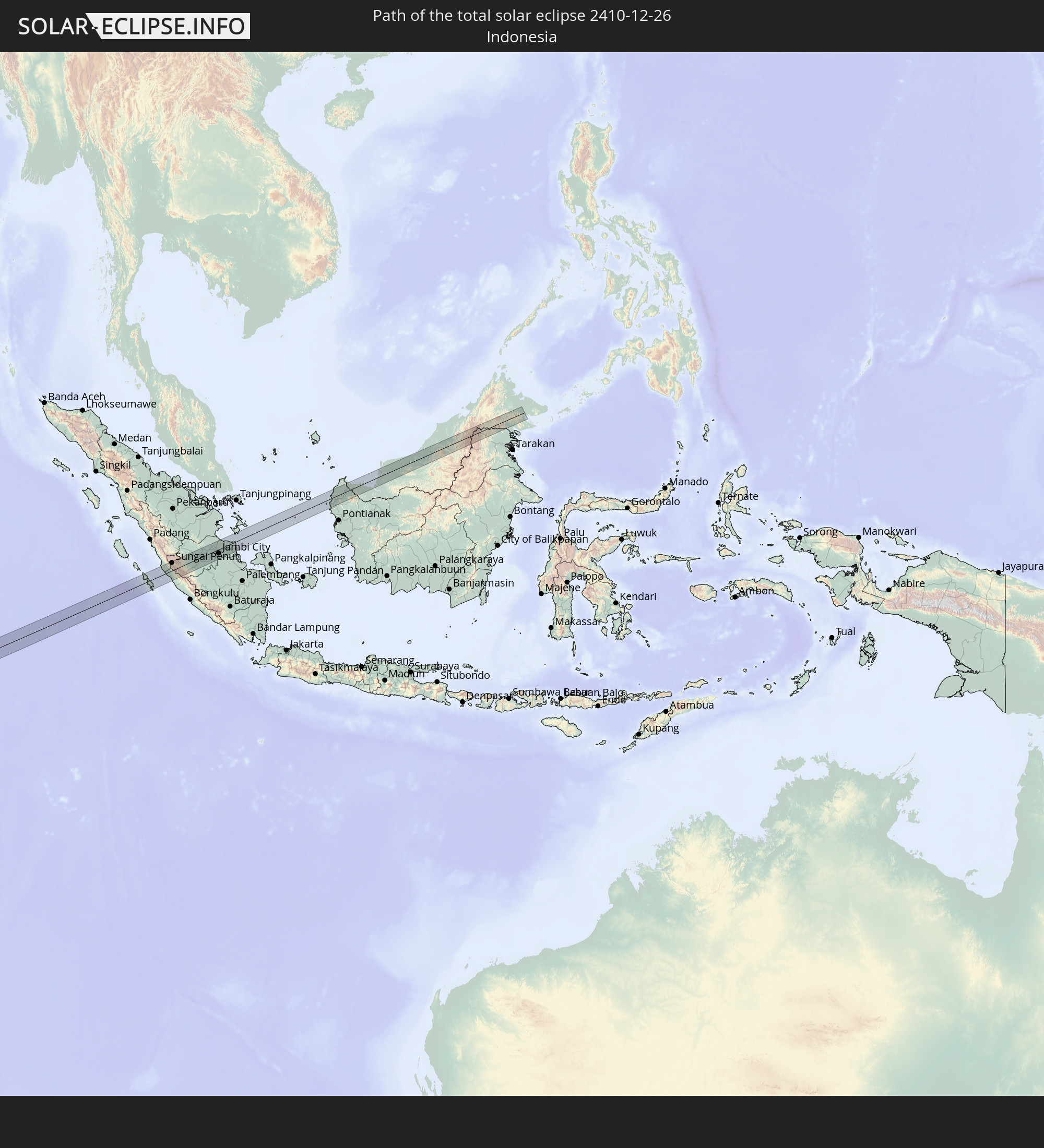 Indonesien
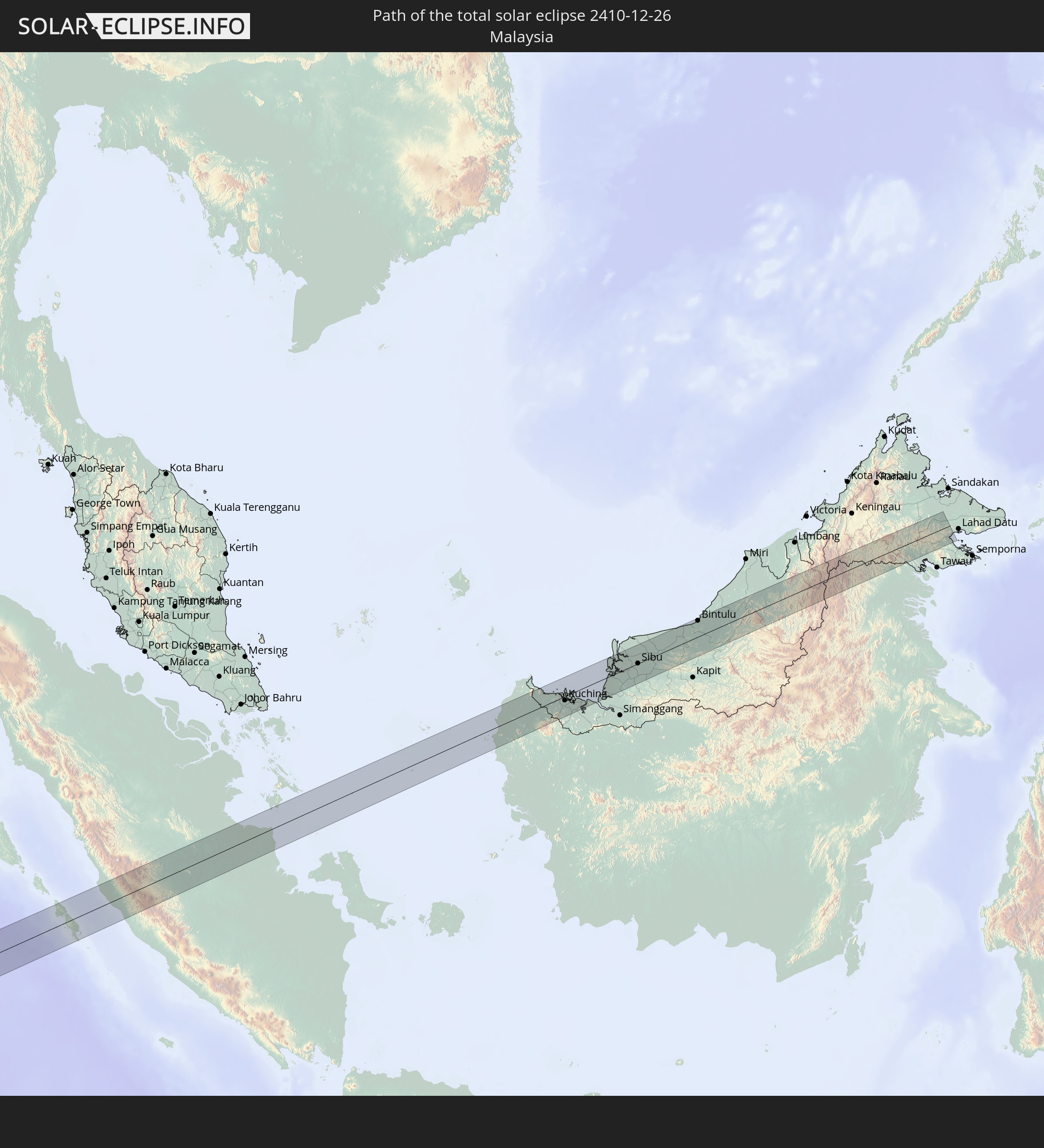 Malaysia
In den folgenden Ländern ist die Sonnenfinsternis partiell zu sehen
 St. Helena
 Mali
Mali
 Algerien
 Elfenbeinküste
 Burkina Faso
 Ghana
Ghana
 Togo
Togo
 Niger
Niger
 Benin
Benin
 Nigeria
 Äquatorialguinea
 São Tomé und Príncipe
 Italien
 Tunesien
 Kamerun
 Gabun
Gabun
 Libyen
 Republik Kongo
 Angola
 Namibia
 Demokratische Republik Kongo
 Vatikanstadt
 Tschad
 Malta
Malta
 Zentralafrikanische Republik
 Südafrika
 Griechenland
 Botswana
 Sudan
Sudan
 Sambia
 Ägypten
 Simbabwe
 Lesotho
 Ruanda
 Burundi
 Tansania
 Uganda
 Mosambik
 Swasiland
 Malawi
 Äthiopien
 Kenia
Kenia
 Israel
 Saudi-Arabien
 Jordanien
 Eritrea
 Französische Süd- und Antarktisgebiete
 Somalia
 Dschibuti
 Jemen
Jemen
 Madagaskar
 Komoren
 Mayotte
 Seychellen
 Oman
Oman
 Réunion
 Mauritius
 Indien
 Britisches Territorium im Indischen Ozean
 Malediven
 Volksrepublik China
 Sri Lanka
 Nepal
Nepal
 Bangladesch
 Bhutan
 Myanmar
 Indonesien
 Kokosinseln
 Thailand
 Malaysia
 Laos
Laos
 Vietnam
 Kambodscha
 Singapur
 Weihnachtsinsel
 Australien
 Brunei
 Osttimor
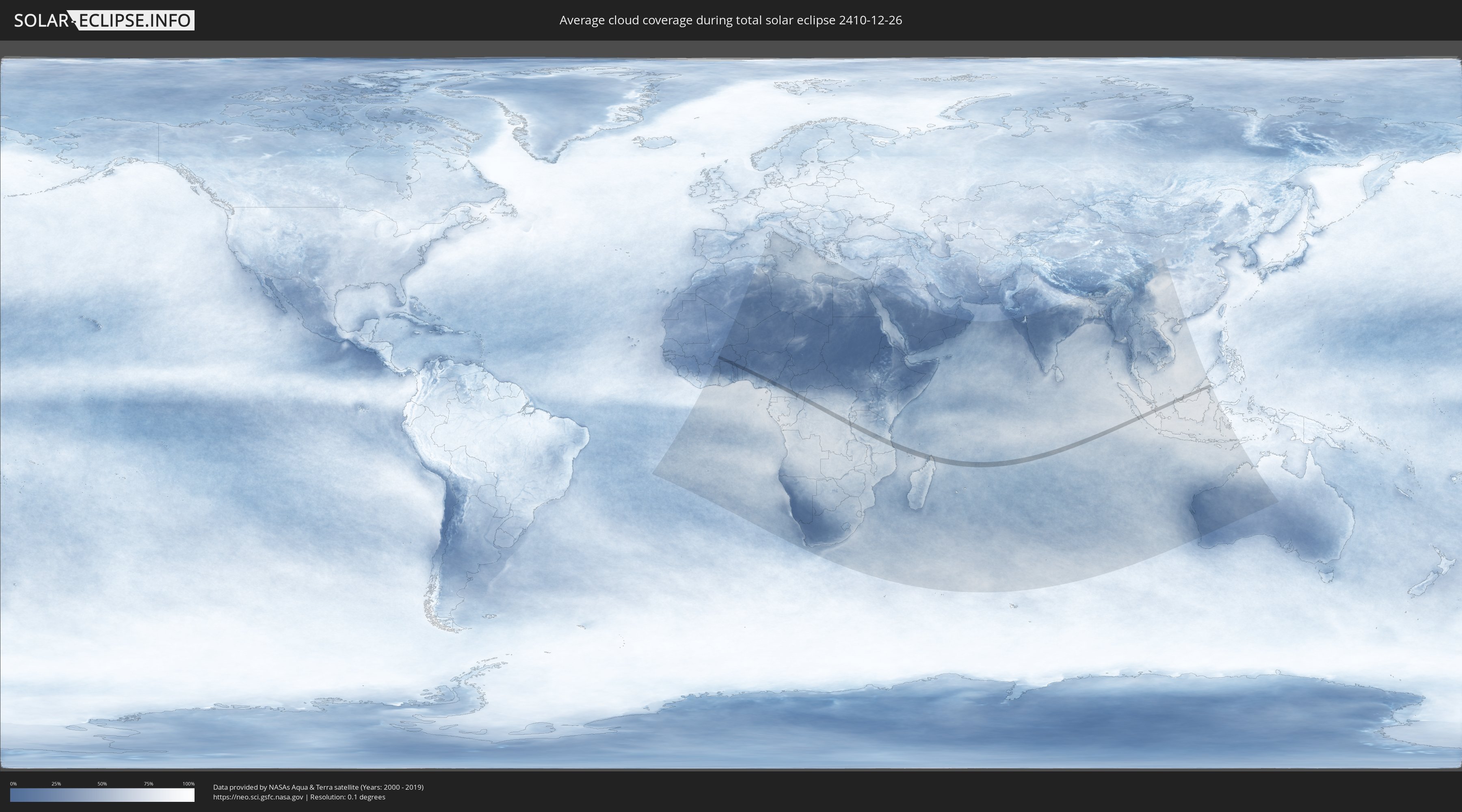
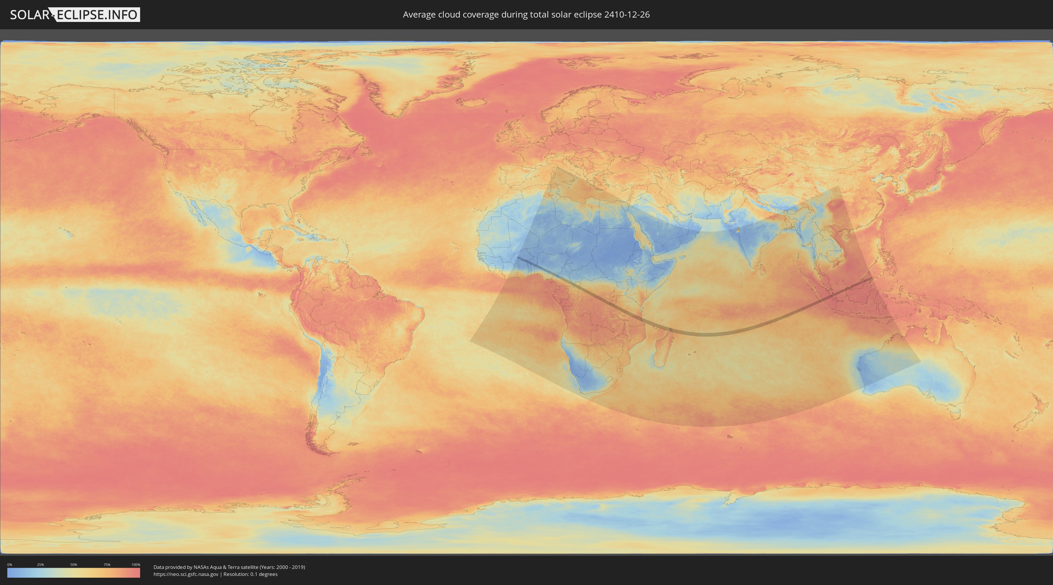
Wie wird das Wetter während der totalen Sonnenfinsternis am 26.12.2410?
Wo ist der beste Ort, um die totale Sonnenfinsternis vom 26.12.2410 zu beobachten?
Die folgenden Karten zeigen die durchschnittliche Bewölkung für den Tag, an dem die totale Sonnenfinsternis
stattfindet. Mit Hilfe der Karten lässt sich der Ort entlang des Finsternispfades eingrenzen,
der die besten Aussichen auf einen klaren wolkenfreien Himmel bietet.
Trotzdem muss man immer lokale Gegenenheiten beachten und sollte sich genau über das Wetter an seinem
gewählten Beobachtungsort informieren.
Die Daten stammen von den beiden NASA-Satelliten
AQUA und TERRA
und wurden über einen Zeitraum von 19 Jahren (2000 - 2019) gemittelt.
Detaillierte Länderkarten
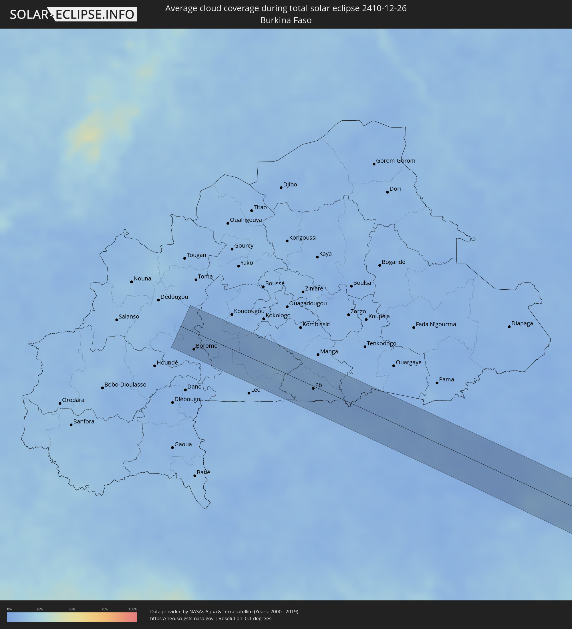 Burkina Faso
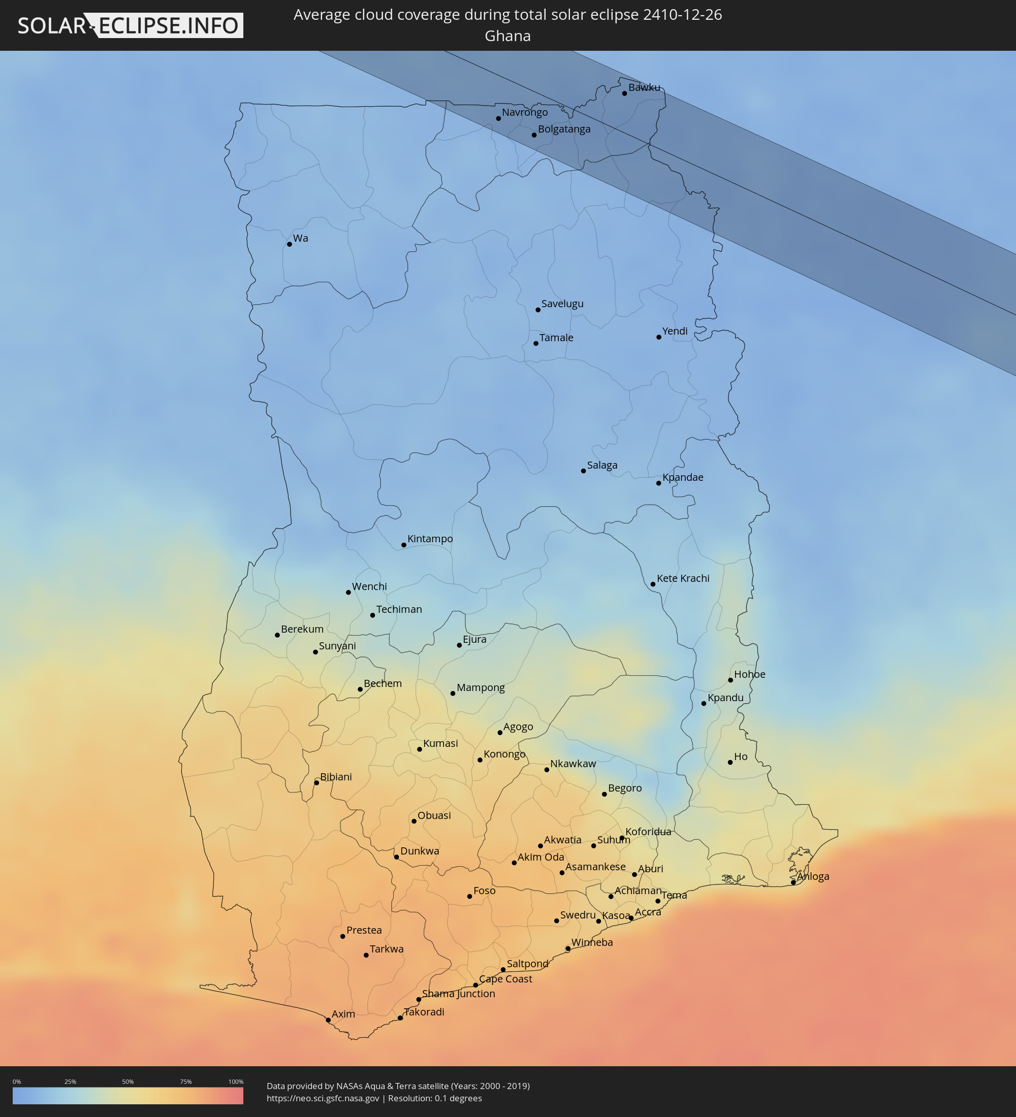 Ghana
Ghana
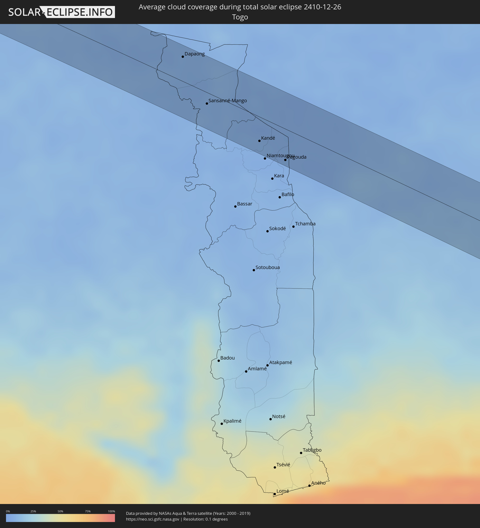 Togo
Togo
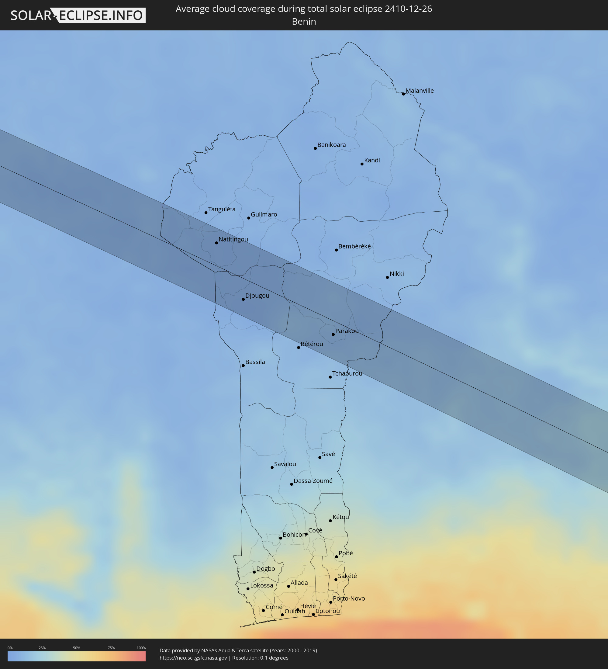 Benin
Benin
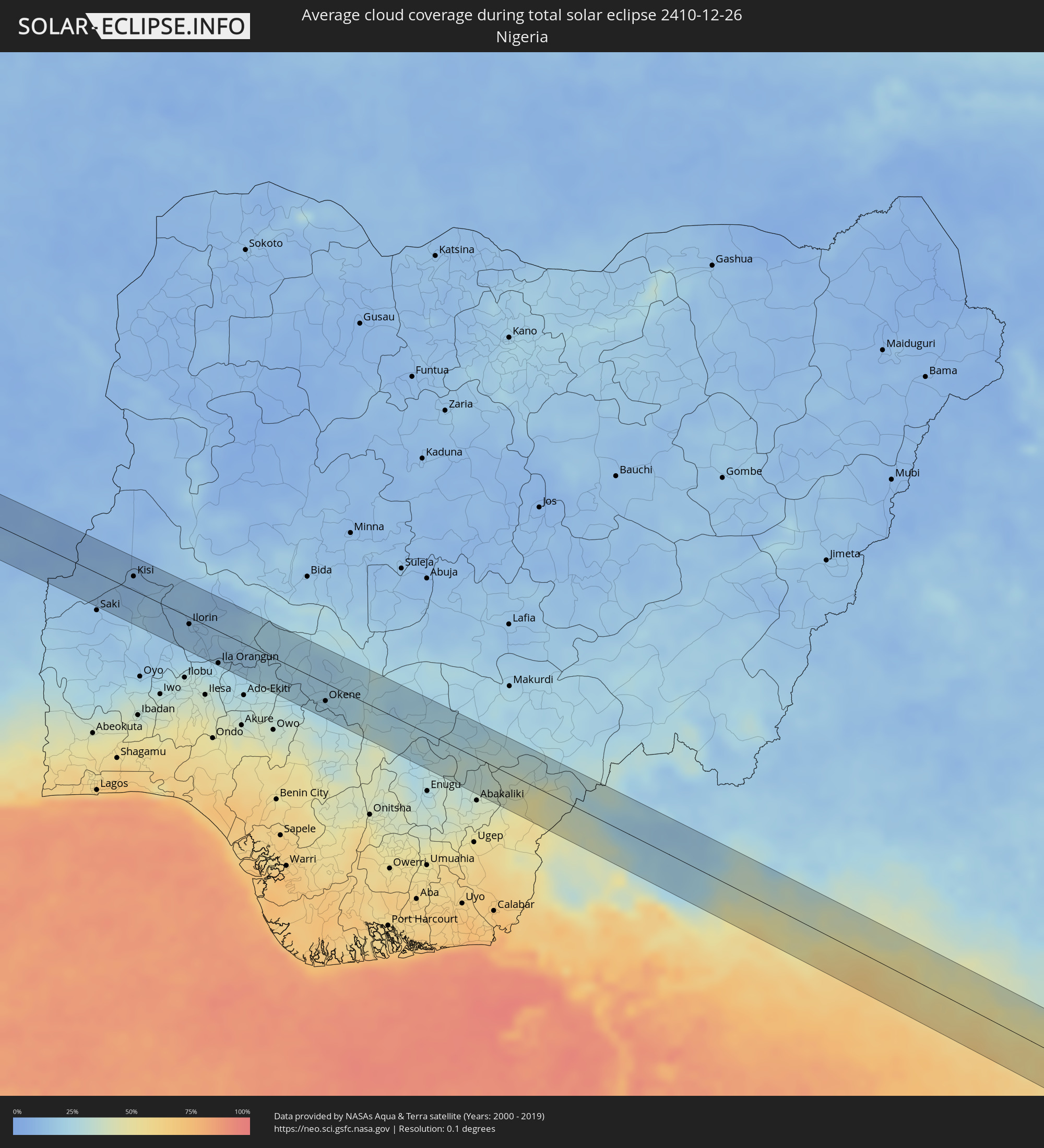 Nigeria
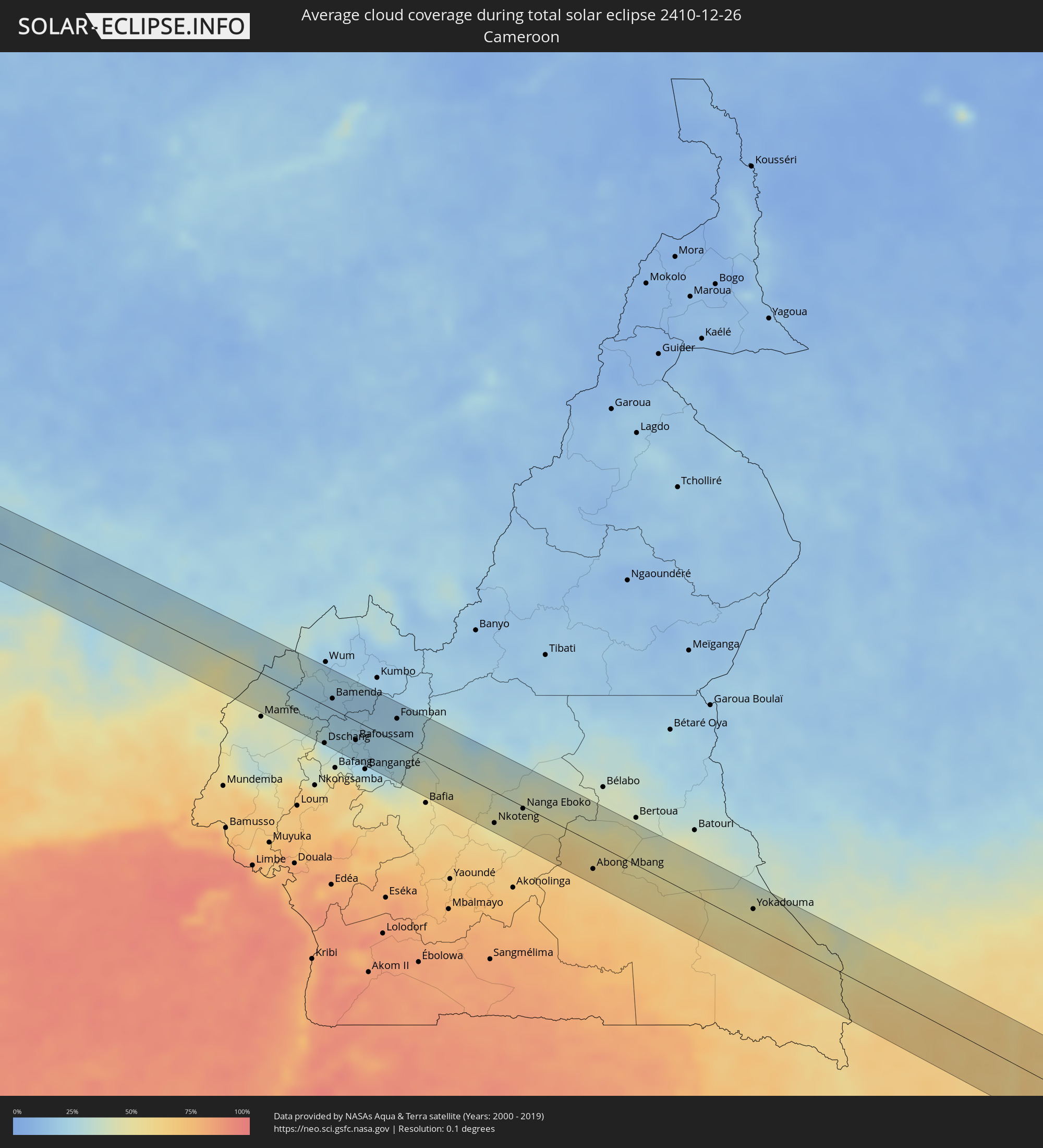 Kamerun
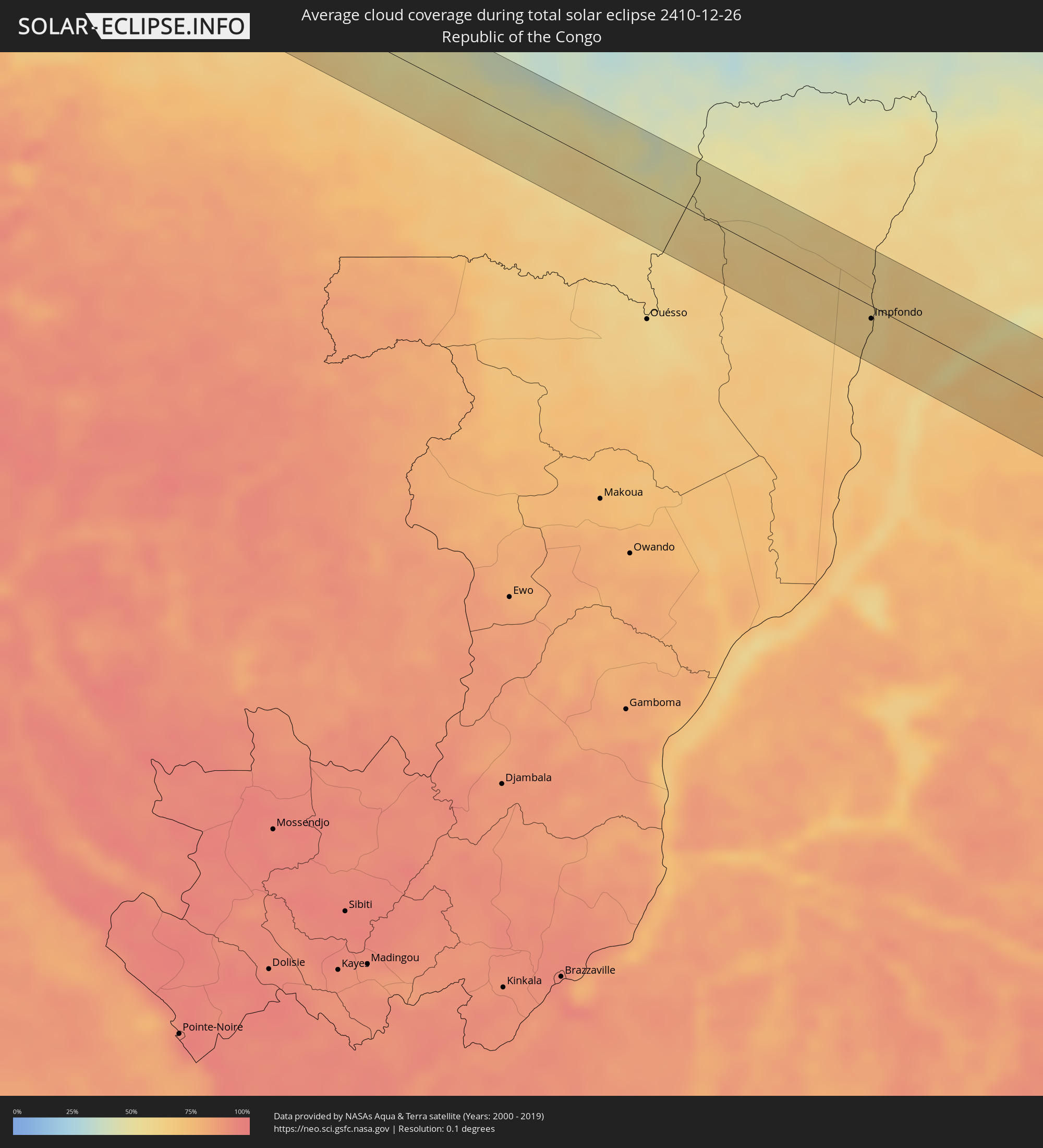 Republik Kongo
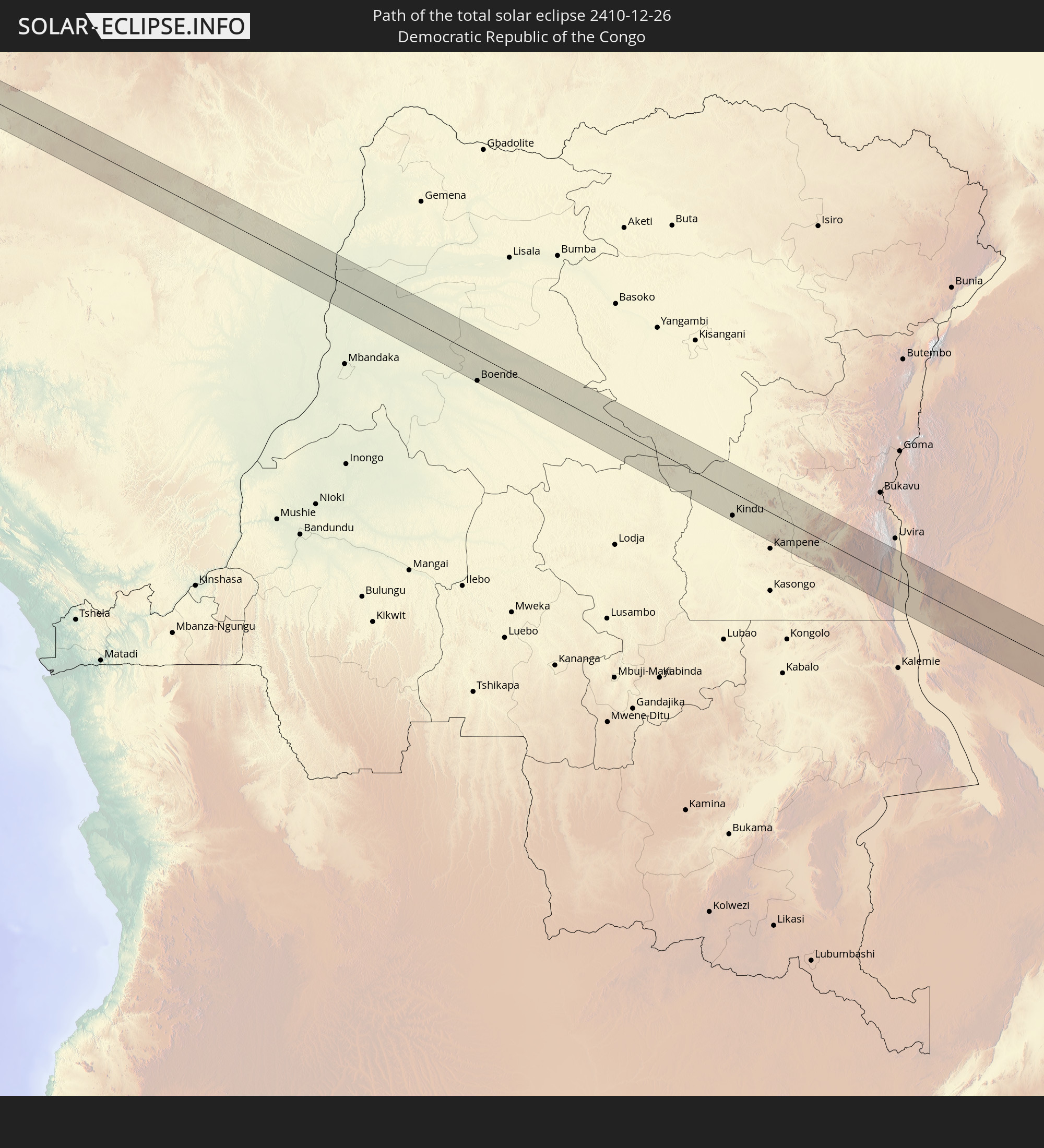
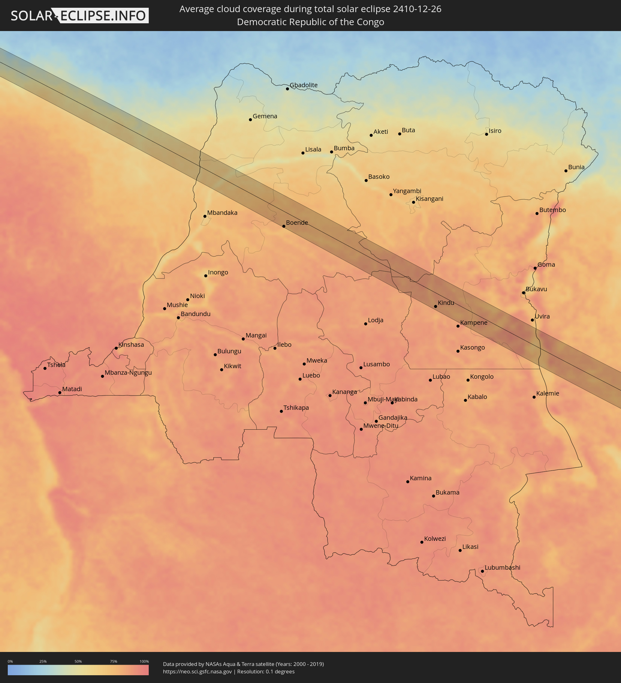 Demokratische Republik Kongo
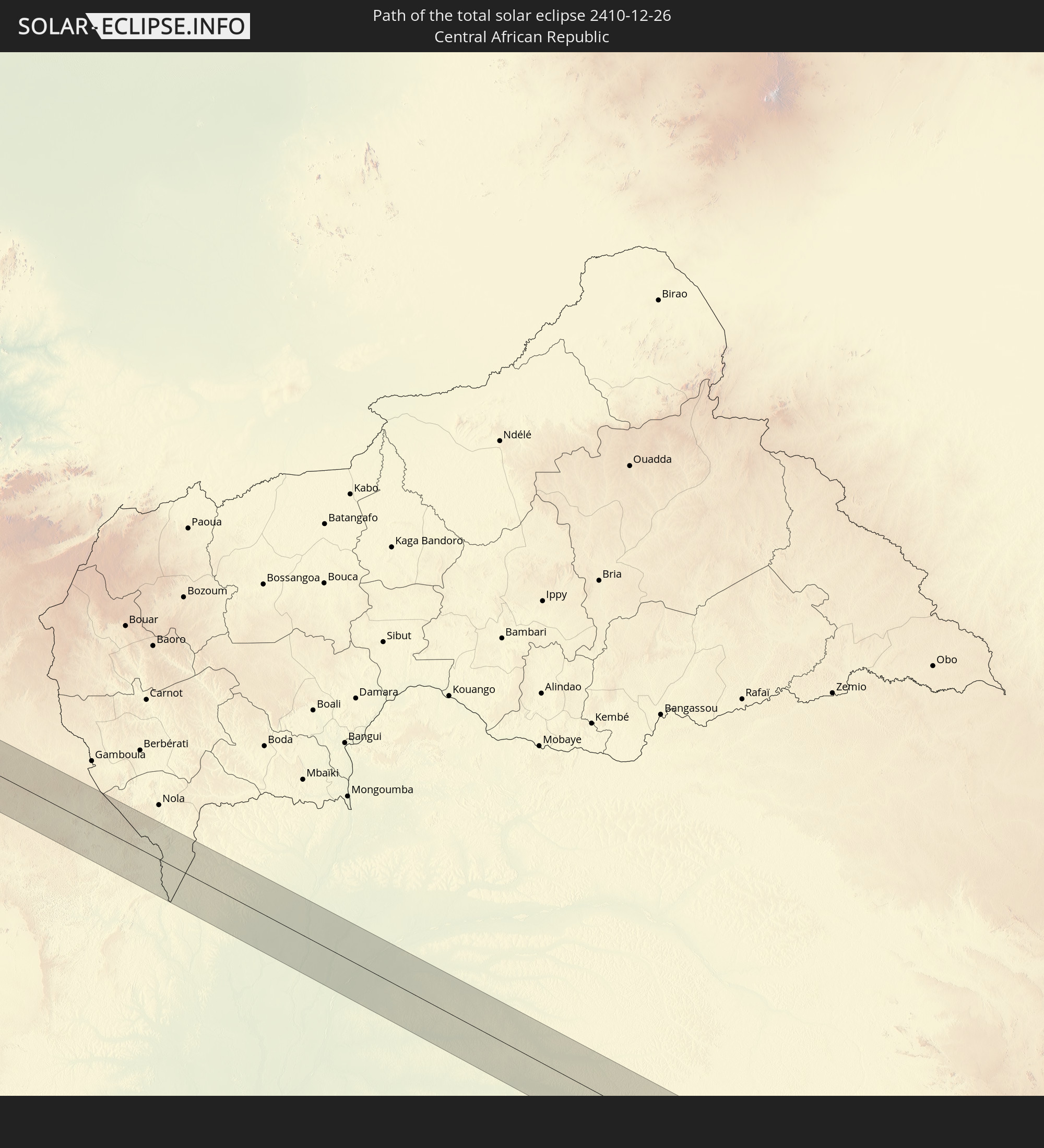
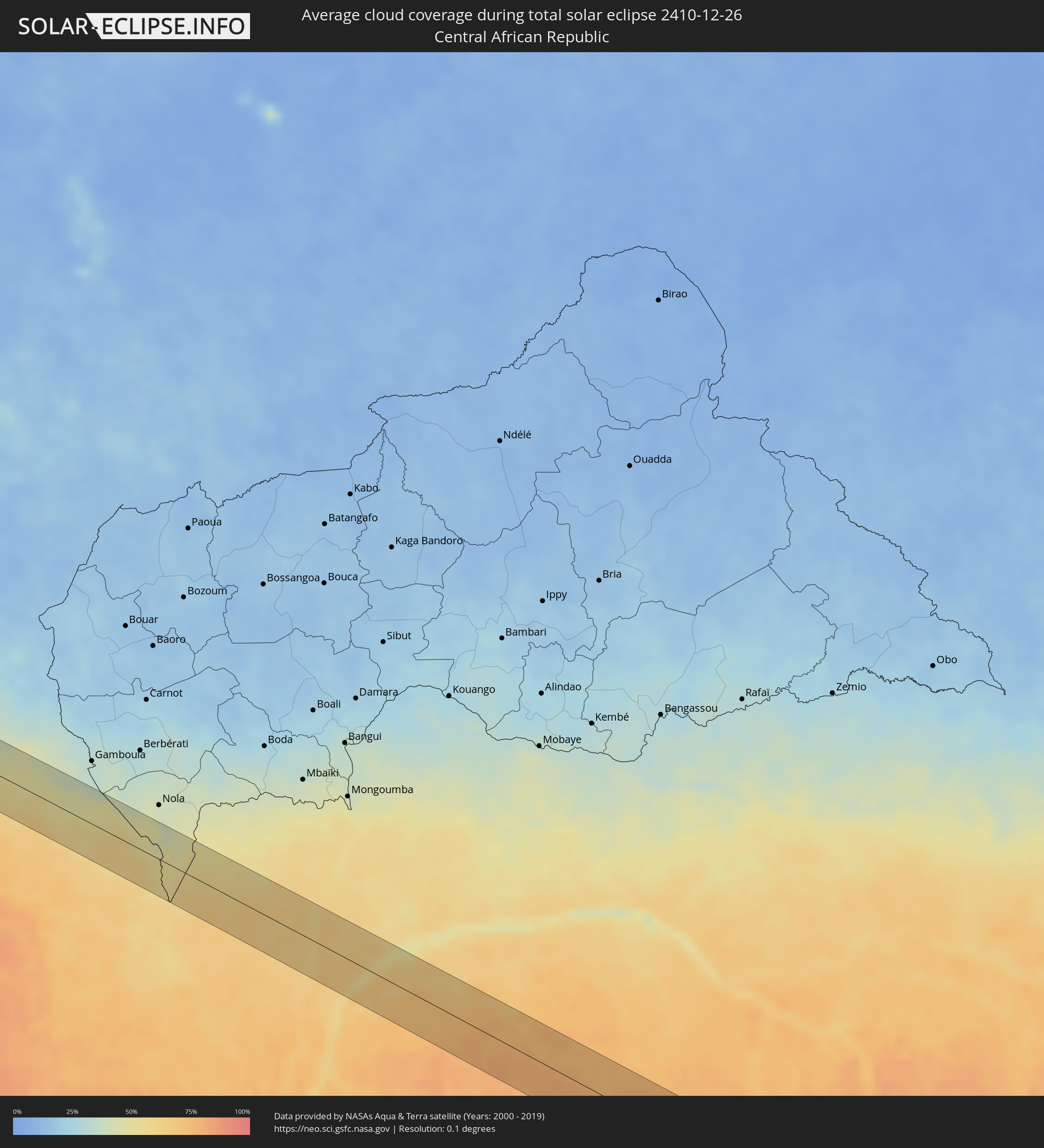 Zentralafrikanische Republik
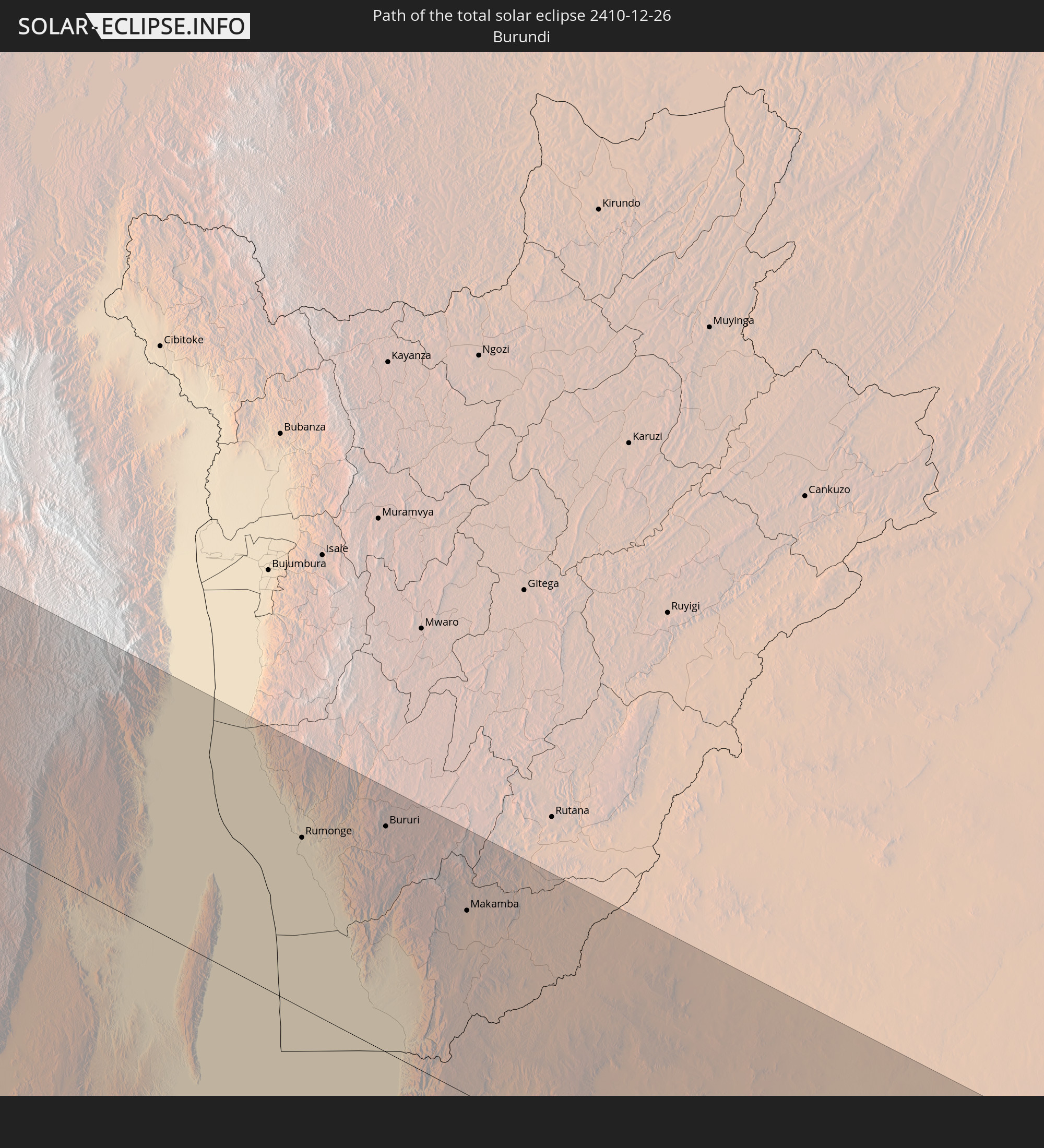
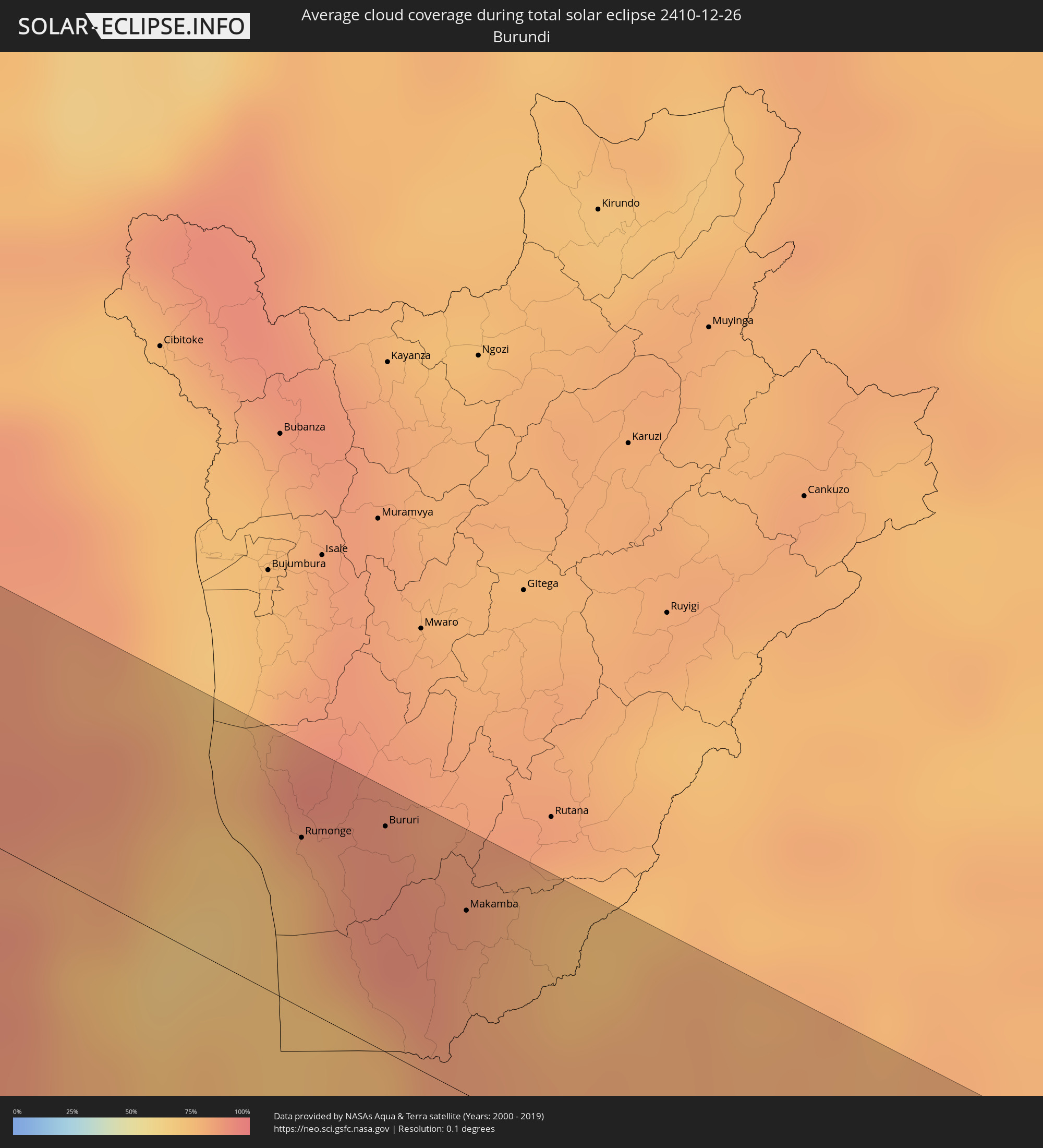 Burundi
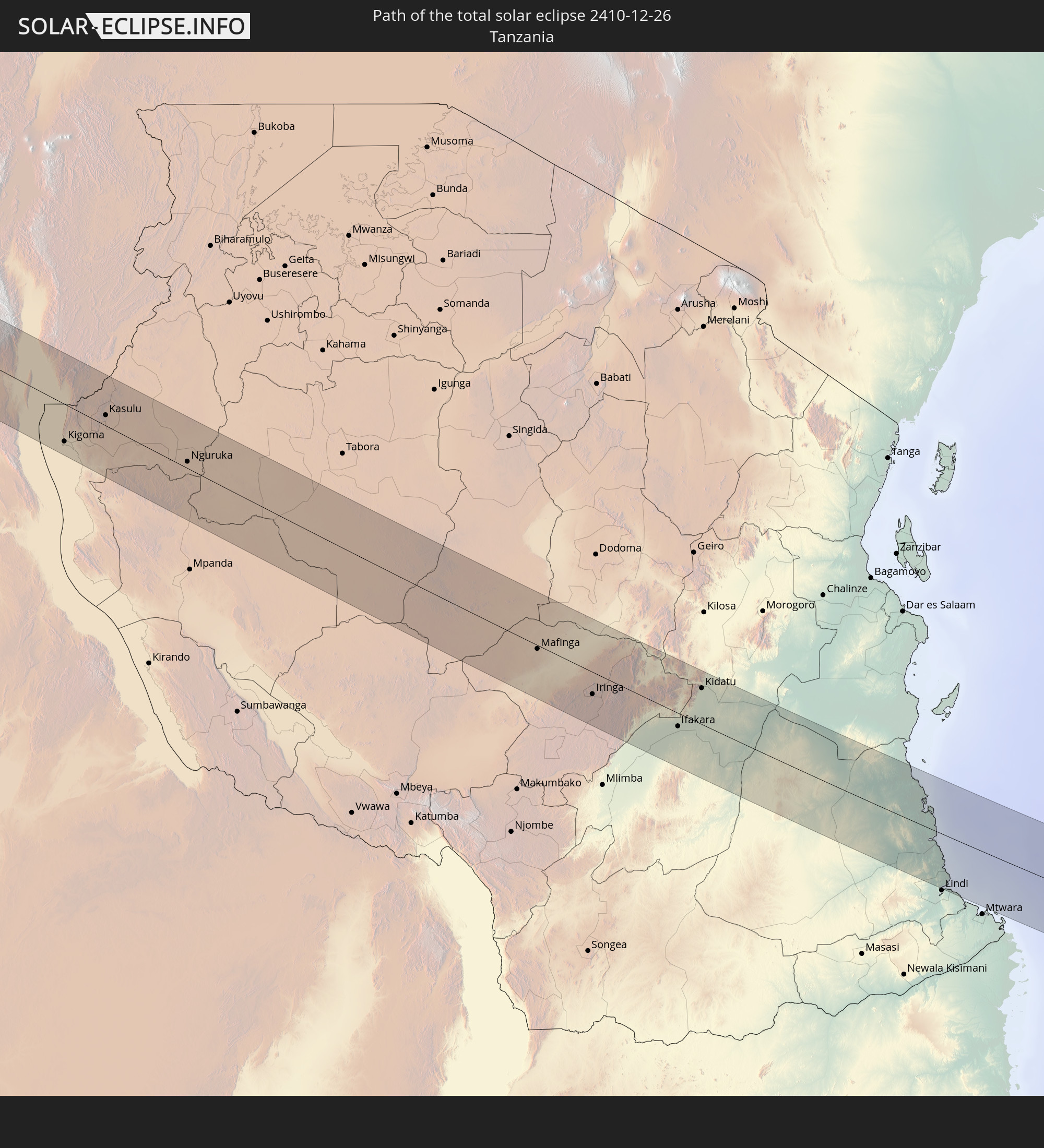
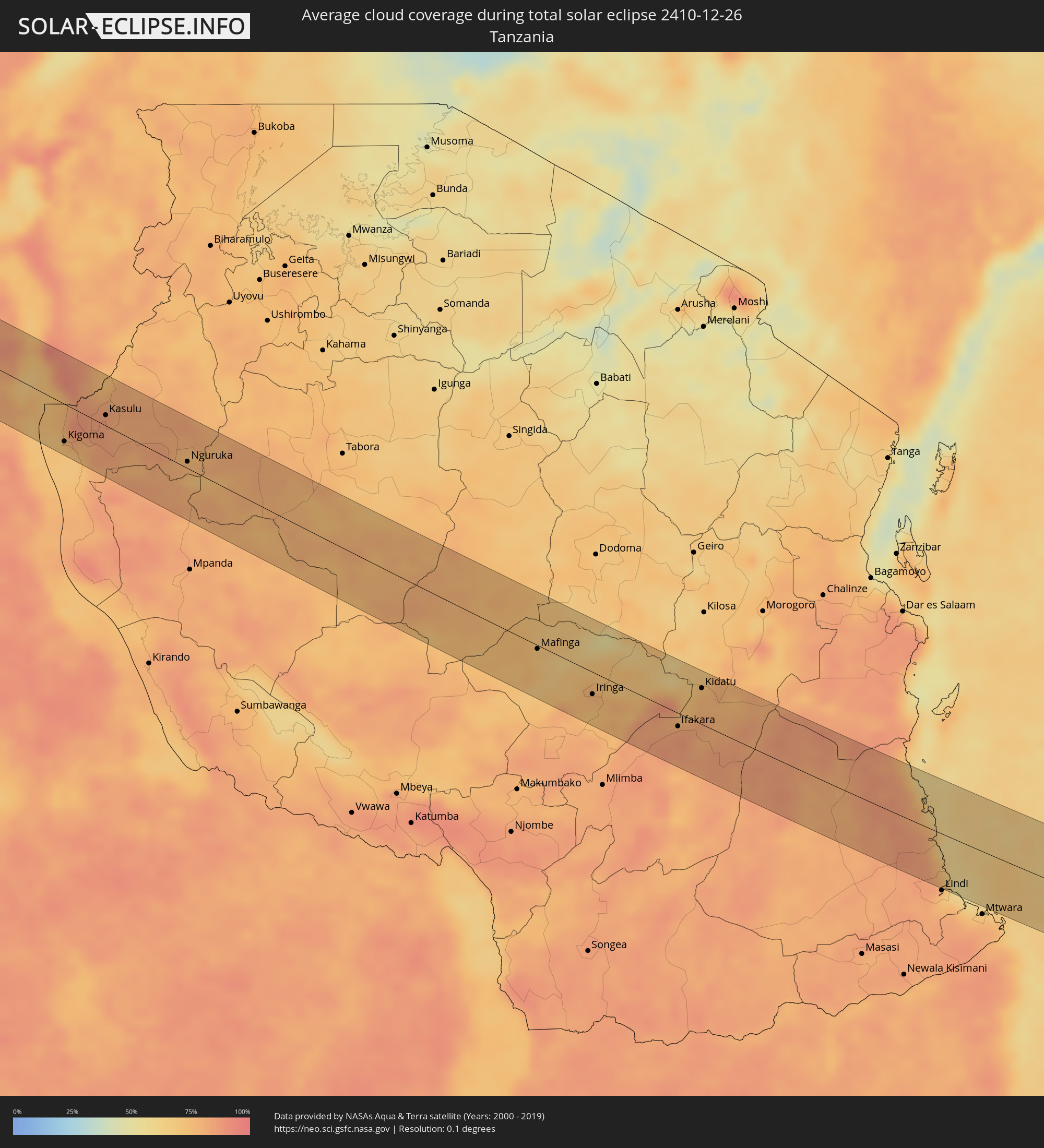 Tansania
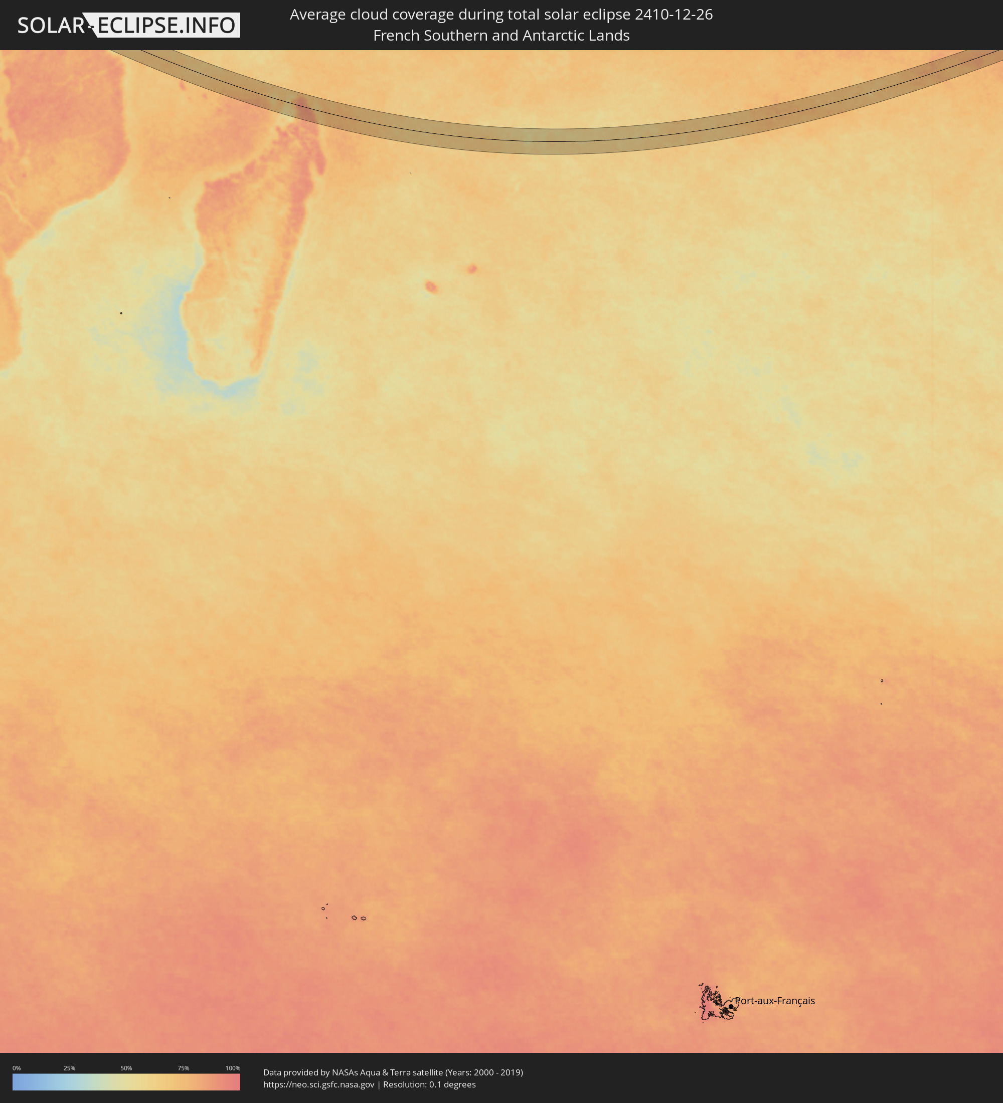 Französische Süd- und Antarktisgebiete
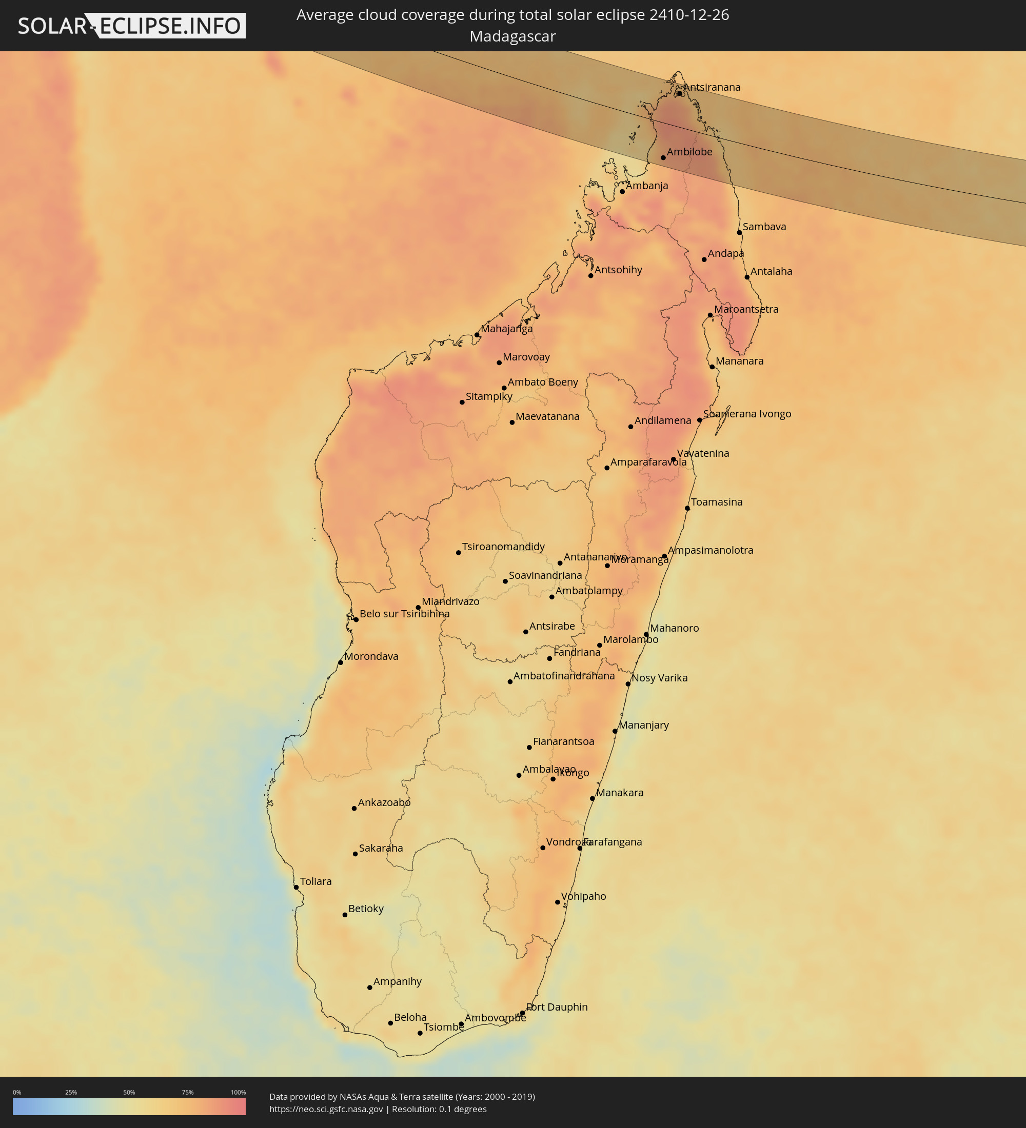 Madagaskar
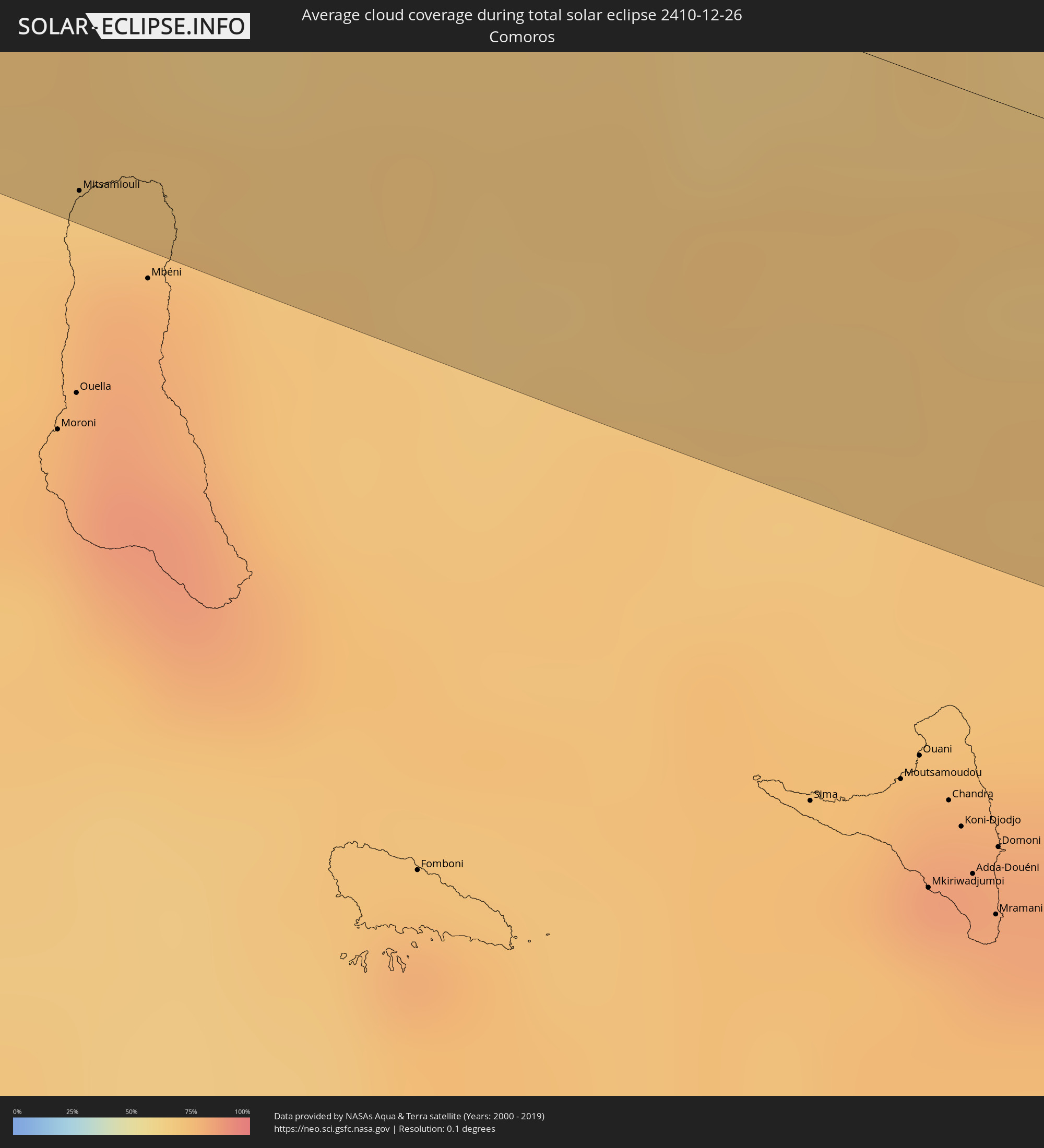 Komoren
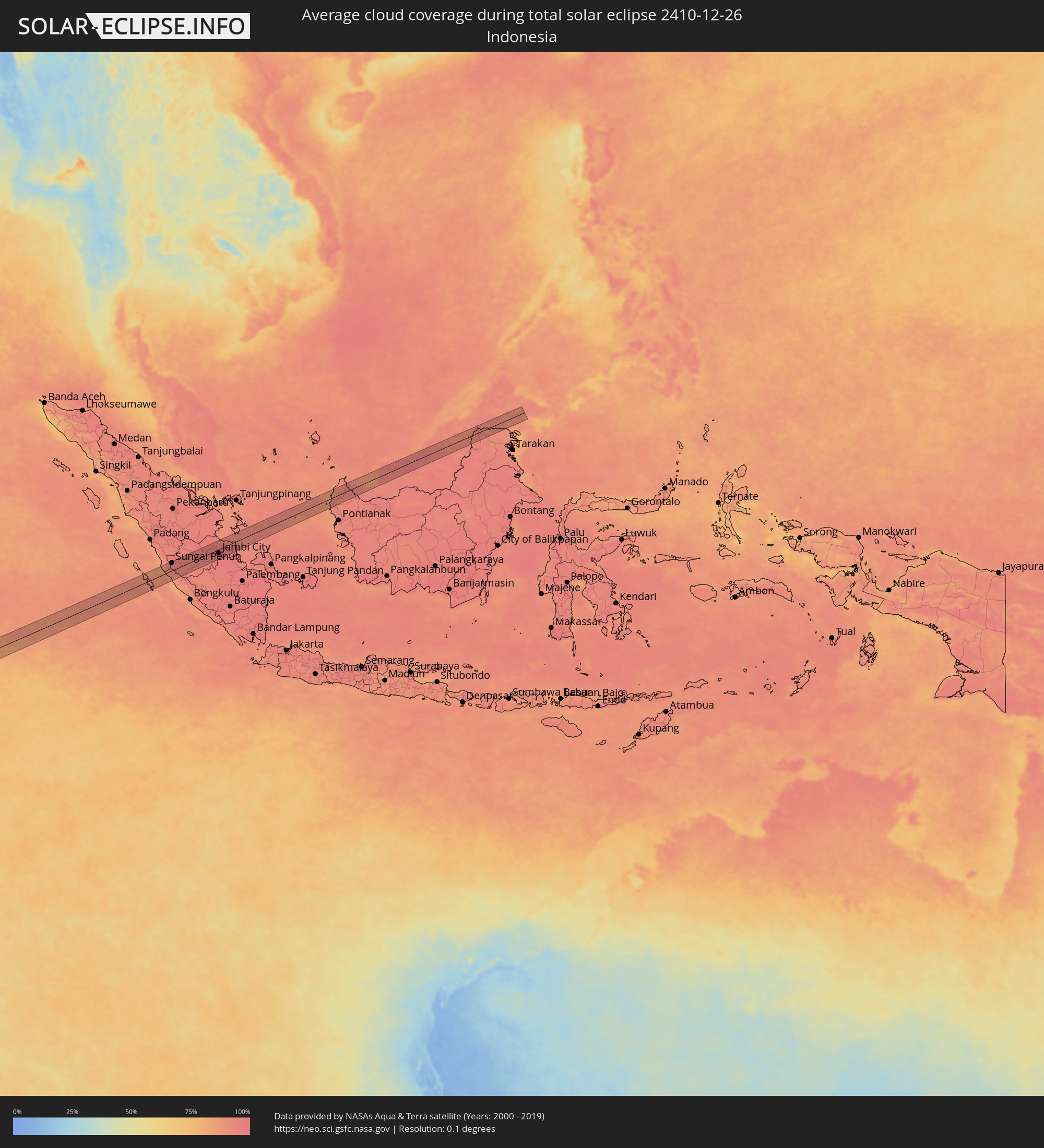 Indonesien
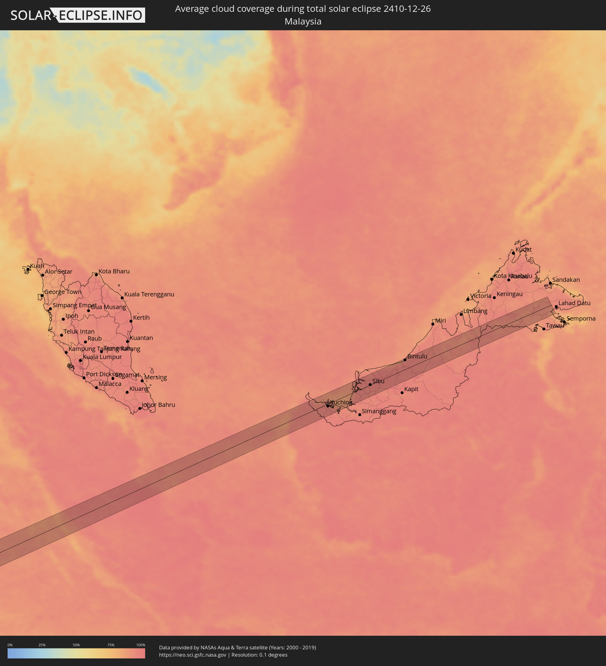 Malaysia
Orte im Finsternispfad
Die nachfolgene Tabelle zeigt Städte und Orte mit mehr als 5.000 Einwohnern, die sich im Finsternispfad befinden. Städte mit mehr als 100.000 Einwohnern sind dick gekennzeichnet. Mit einem Klick auf den Ort öffnet sich eine Detailkarte die die Lage des jeweiligen Ortes zusammen mit dem Verlauf der zentralen Finsternis präsentiert.
| Ort | Typ | Dauer der Verfinsterung | Ortszeit bei maximaler Verfinsterung | Entfernung zur Zentrallinie | Ø Bewölkung |
|
Boromo, Boucle du Mouhoun
|
total | - | 06:33:16 UTC+00:00 | 32 km | 7% |
|
Pô, Centre-Sud
|
total | - | 06:33:20 UTC+00:00 | 4 km | 8% |
|
Navrongo, Upper East
|
total | - | 06:33:22 UTC+00:00 | 29 km | 9% |
|
Bolgatanga, Upper East
|
total | - | 06:33:23 UTC+00:00 | 30 km | 8% |
|
Bawku, Upper East
|
total | - | 06:33:24 UTC+00:00 | 26 km | 6% |
|
Dapaong, Savanes
|
total | - | 06:33:27 UTC+00:00 | 27 km | 6% |
|
Sansanné-Mango, Savanes
|
total | - | 06:33:31 UTC+00:00 | 12 km | 6% |
|
Kandé, Kara
|
total | - | 06:33:38 UTC+00:00 | 26 km | 6% |
|
Pagouda, Kara
|
total | - | 06:33:41 UTC+00:00 | 34 km | 5% |
|
Natitingou, Atakora
|
total | - | 07:33:38 UTC+01:00 | 24 km | 4% |
|
Djougou, Donga
|
total | - | 07:33:44 UTC+01:00 | 23 km | 4% |
|
Parakou, Borgou
|
total | - | 07:33:56 UTC+01:00 | 15 km | 10% |
|
Igboho, Oyo
|
total | - | 07:34:13 UTC+01:00 | 12 km | 13% |
|
Kisi, Oyo
|
total | - | 07:34:12 UTC+01:00 | 17 km | 11% |
|
Ilorin, Kwara
|
total | - | 07:34:27 UTC+01:00 | 9 km | 14% |
|
Offa, Kwara
|
total | - | 07:34:34 UTC+01:00 | 35 km | 21% |
|
Ila Orangun, Osun
|
total | - | 07:34:38 UTC+01:00 | 39 km | 25% |
|
Ode, Ondo
|
total | - | 07:34:54 UTC+01:00 | 23 km | 24% |
|
Kabba, Kogi
|
total | - | 07:35:00 UTC+01:00 | 2 km | 21% |
|
Okene, Kogi
|
total | - | 07:35:06 UTC+01:00 | 22 km | 21% |
|
Idah, Kogi
|
total | - | 07:35:21 UTC+01:00 | 41 km | 34% |
|
Lokoja, Kogi
|
total | - | 07:35:12 UTC+01:00 | 27 km | 25% |
|
Nsukka, Enugu
|
total | - | 07:35:38 UTC+01:00 | 35 km | 25% |
|
Eha Amufu, Enugu
|
total | - | 07:35:49 UTC+01:00 | 37 km | 33% |
|
Effium, Ebonyi
|
total | - | 07:35:56 UTC+01:00 | 25 km | 33% |
|
Ezza-Ohu, Ebonyi
|
total | - | 07:36:00 UTC+01:00 | 42 km | 37% |
|
Ogoja, Cross River
|
total | - | 07:36:13 UTC+01:00 | 15 km | 33% |
|
Batibo, North-West
|
total | - | 07:36:53 UTC+01:00 | 15 km | 31% |
|
Mbengwi, North-West
|
total | - | 07:36:54 UTC+01:00 | 11 km | 20% |
|
Bali, North-West
|
total | - | 07:36:57 UTC+01:00 | 2 km | 23% |
|
Dschang, West
|
total | - | 07:37:06 UTC+01:00 | 44 km | 33% |
|
Bamenda, North-West
|
total | - | 07:36:59 UTC+01:00 | 12 km | 20% |
|
Belo, North-West
|
total | - | 07:36:59 UTC+01:00 | 35 km | 19% |
|
Babanki, North-West
|
total | - | 07:36:59 UTC+01:00 | 33 km | 19% |
|
Mbouda, West
|
total | - | 07:37:08 UTC+01:00 | 16 km | 24% |
|
Bafoussam, West
|
total | - | 07:37:15 UTC+01:00 | 22 km | 22% |
|
Foumbot, West
|
total | - | 07:37:21 UTC+01:00 | 8 km | 21% |
|
Foumban, West
|
total | - | 07:37:24 UTC+01:00 | 27 km | 20% |
|
Nkoteng, Centre
|
total | - | 07:38:24 UTC+01:00 | 36 km | 49% |
|
Nanga Eboko, Centre
|
total | - | 07:38:31 UTC+01:00 | 3 km | 45% |
|
Abong Mbang, East
|
total | - | 07:39:15 UTC+01:00 | 30 km | 61% |
|
Yokadouma, East
|
total | - | 07:40:37 UTC+01:00 | 20 km | 49% |
|
Impfondo, Likouala
|
total | - | 07:43:46 UTC+01:00 | 11 km | 58% |
|
Boende, Équateur
|
total | - | 07:47:24 UTC+01:00 | 50 km | 75% |
|
Kindu, Maniema
|
total | - | 08:54:55 UTC+02:00 | 45 km | 82% |
|
Rumonge, Rumonge
|
total | - | 09:00:40 UTC+02:00 | 37 km | 75% |
|
Bururi, Bururi
|
total | - | 09:00:56 UTC+02:00 | 49 km | 90% |
|
Kigoma, Kigoma
|
total | - | 10:01:40 UTC+03:00 | 42 km | 70% |
|
Mwandiga, Kigoma
|
total | - | 10:01:41 UTC+03:00 | 36 km | 79% |
|
Makamba, Makamba
|
total | - | 09:01:21 UTC+02:00 | 40 km | 83% |
|
Kasulu, Kigoma
|
total | - | 10:02:10 UTC+03:00 | 12 km | 83% |
|
Uvinza, Kigoma
|
total | - | 10:03:03 UTC+03:00 | 25 km | 77% |
|
Nguruka, Kigoma
|
total | - | 10:04:07 UTC+03:00 | 7 km | 77% |
|
Kaliua, Tabora
|
total | - | 10:05:20 UTC+03:00 | 51 km | 81% |
|
Sikonge, Tabora
|
total | - | 10:07:30 UTC+03:00 | 43 km | 77% |
|
Mafinga, Iringa
|
total | - | 10:13:10 UTC+03:00 | 4 km | 67% |
|
Iringa, Iringa
|
total | - | 10:14:52 UTC+03:00 | 25 km | 75% |
|
Izazi, Iringa
|
total | - | 10:14:26 UTC+03:00 | 33 km | 62% |
|
Ilula, Iringa
|
total | - | 10:15:28 UTC+03:00 | 0 km | 73% |
|
Lupiro, Morogoro
|
total | - | 10:17:23 UTC+03:00 | 41 km | 84% |
|
Ifakara, Morogoro
|
total | - | 10:17:11 UTC+03:00 | 15 km | 84% |
|
Kidatu, Morogoro
|
total | - | 10:17:22 UTC+03:00 | 41 km | 77% |
|
Kidodi, Morogoro
|
total | - | 10:17:23 UTC+03:00 | 53 km | 74% |
|
Mitsamiouli, Grande Comore
|
total | - | 10:35:19 UTC+03:00 | 60 km | 79% |
|
Antsohimbondrona, Diana
|
total | - | 10:51:45 UTC+03:00 | 48 km | 73% |
|
Ambilobe, Diana
|
total | - | 10:52:25 UTC+03:00 | 55 km | 78% |
|
Antsiranana, Diana
|
total | - | 10:52:28 UTC+03:00 | 51 km | 80% |
|
Sadjoavato, Diana
|
total | - | 10:52:52 UTC+03:00 | 17 km | 87% |
|
Sungai Penuh, Jambi
|
total | - | 16:52:04 UTC+07:00 | 37 km | 95% |
|
Bejubang Dua, Jambi
|
total | - | 16:53:19 UTC+07:00 | 25 km | 97% |
|
Mendaha, Jambi
|
total | - | 16:53:41 UTC+07:00 | 41 km | 96% |
|
Jambi City, Jambi
|
total | - | 16:53:32 UTC+07:00 | 19 km | 98% |
|
Simpang, Jambi
|
total | - | 16:53:53 UTC+07:00 | 7 km | 97% |
|
Sungai Raya, West Kalimantan
|
total | - | 16:56:20 UTC+07:00 | 29 km | 89% |
|
Pemangkat, West Kalimantan
|
total | - | 16:56:27 UTC+07:00 | 15 km | 91% |
|
Singkawang, West Kalimantan
|
total | - | 16:56:24 UTC+07:00 | 12 km | 94% |
|
Kuching, Sarawak
|
total | - | 17:56:54 UTC+08:00 | 8 km | 94% |
|
Sarikei, Sarawak
|
total | - | 17:57:16 UTC+08:00 | 5 km | 96% |
|
Sibu, Sarawak
|
total | - | 17:57:21 UTC+08:00 | 0 km | 95% |
|
Bintulu, Sarawak
|
total | - | 17:57:41 UTC+08:00 | 33 km | 94% |