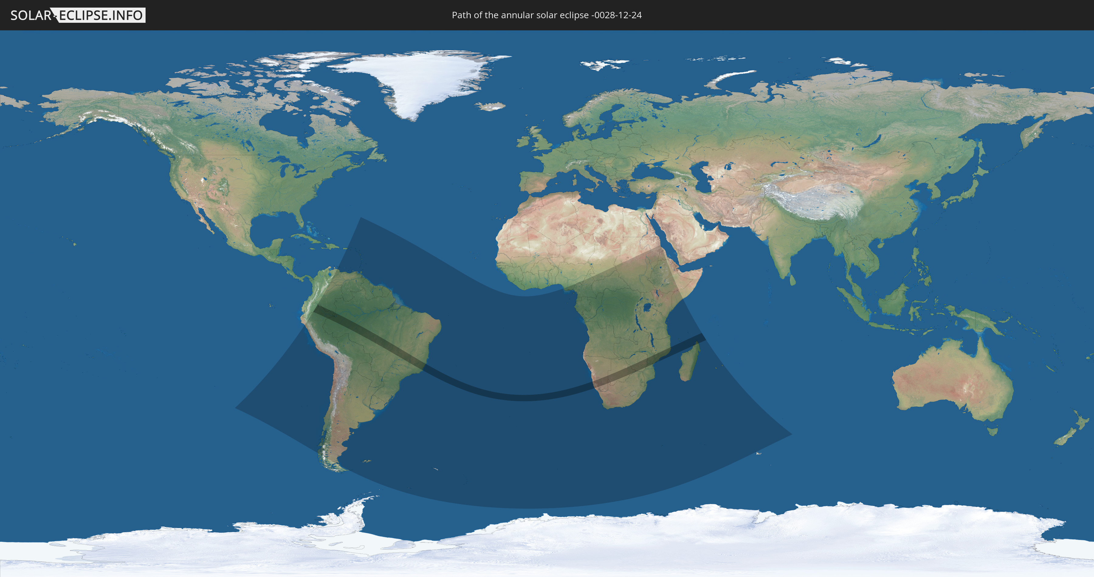
Annular solar eclipse of 12/24/-0028
| Day of week: | Saturday |
| Maximum duration of eclipse: | 07m08s |
| Maximum width of eclipse path: | 224 km |
| Saros cycle: | 70 |
| Coverage: | 94% |
| Magnitude: | 0.94 |
| Gamma: | -0.1161 |
Wo kann man die Sonnenfinsternis vom 12/24/-0028 sehen?
Die Sonnenfinsternis am 12/24/-0028 kann man in 70 Ländern als partielle Sonnenfinsternis beobachten.
Der Finsternispfad verläuft durch 14 Länder. Nur in diesen Ländern ist sie als annular Sonnenfinsternis zu sehen.
In den folgenden Ländern ist die Sonnenfinsternis annular zu sehen
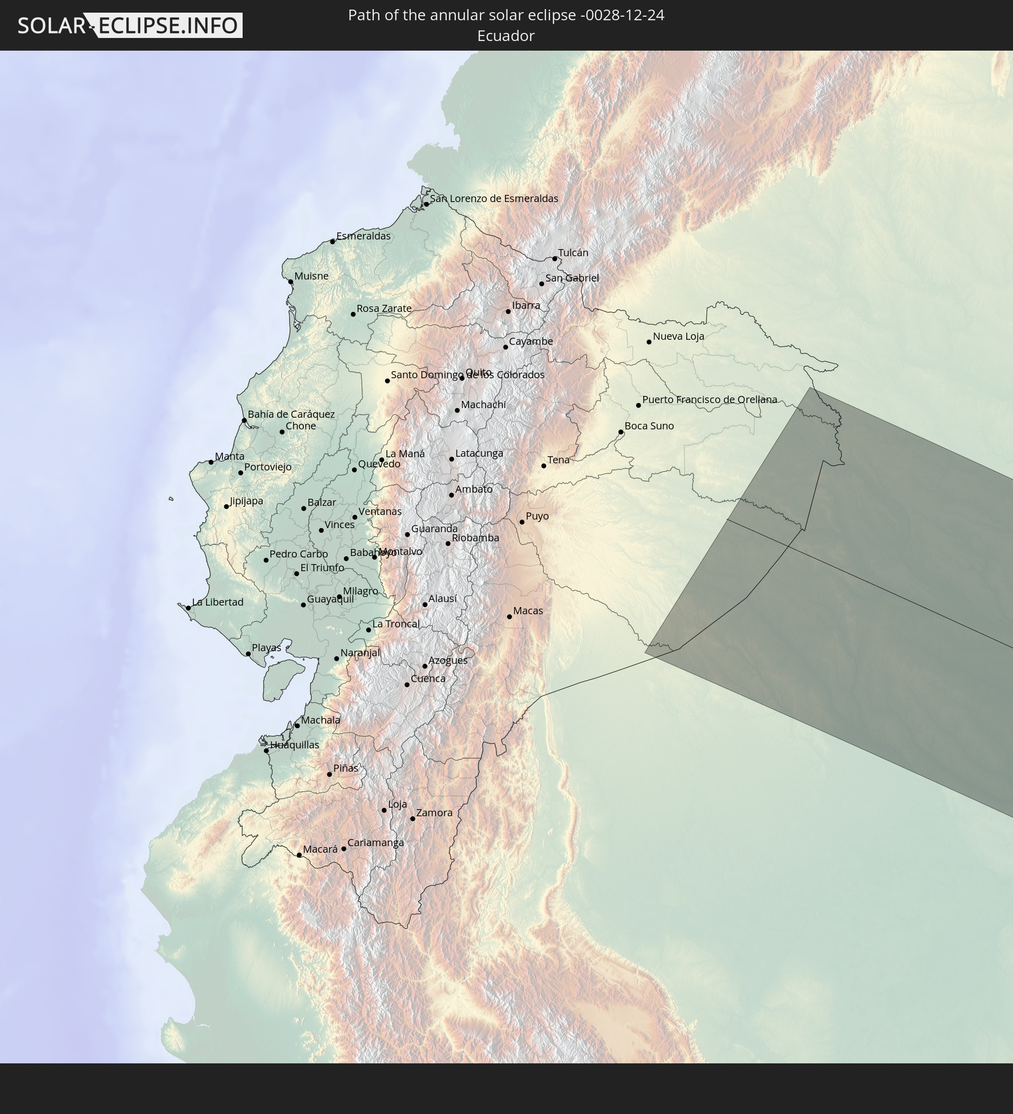 Ecuador
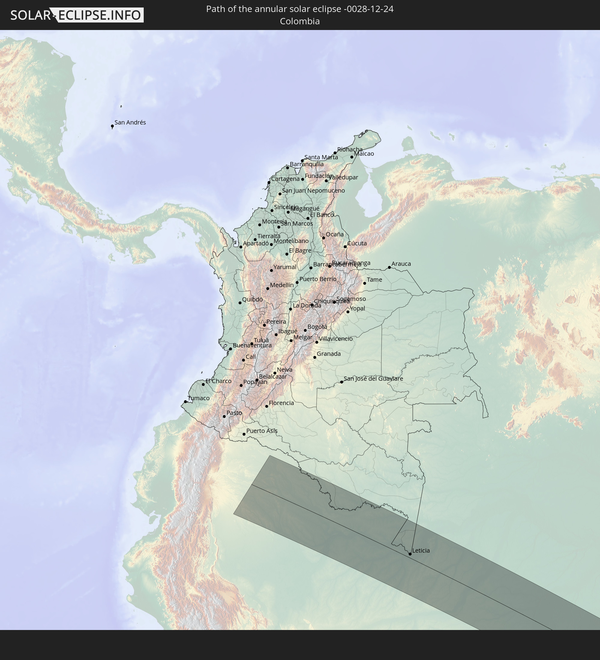 Colombia
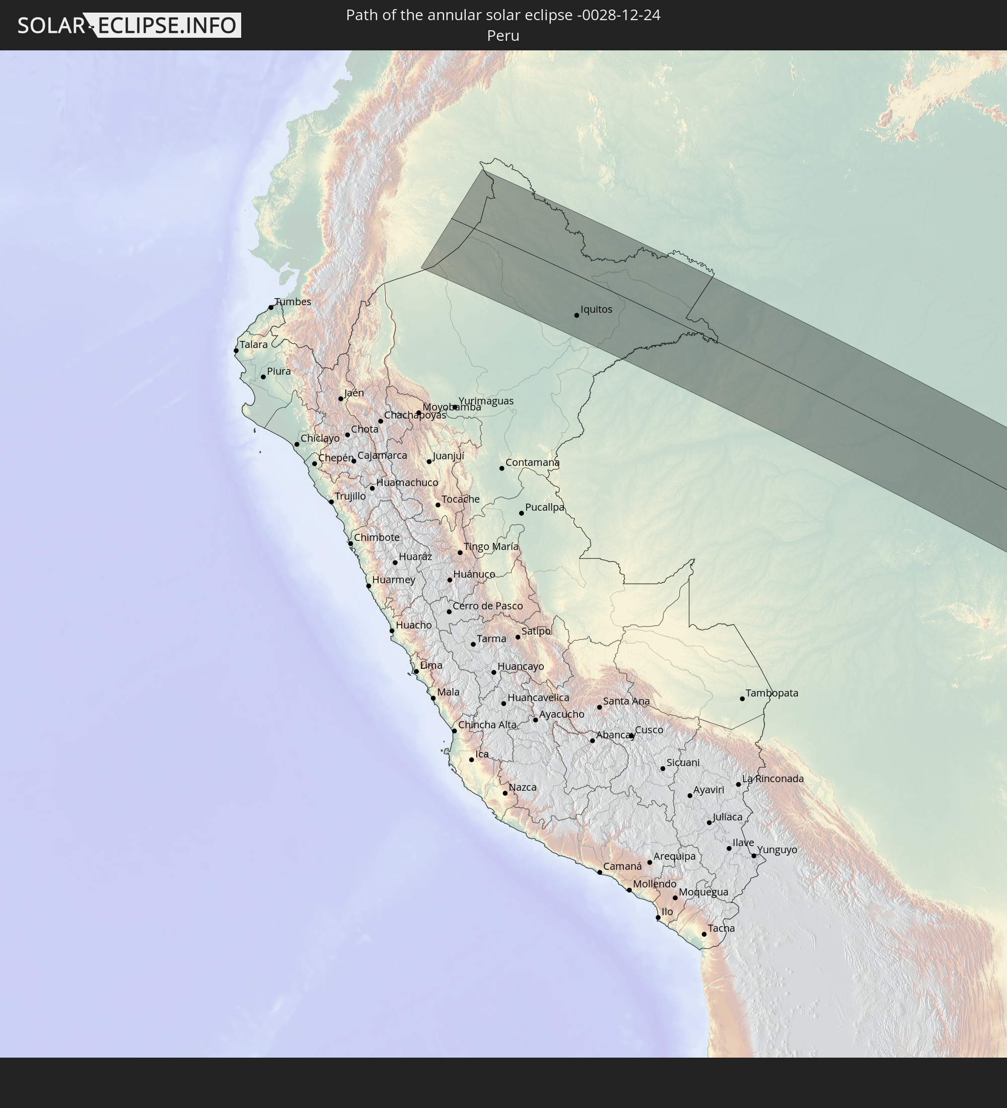 Peru
Peru
 Brazil
 Namibia
 South Africa
 Botswana
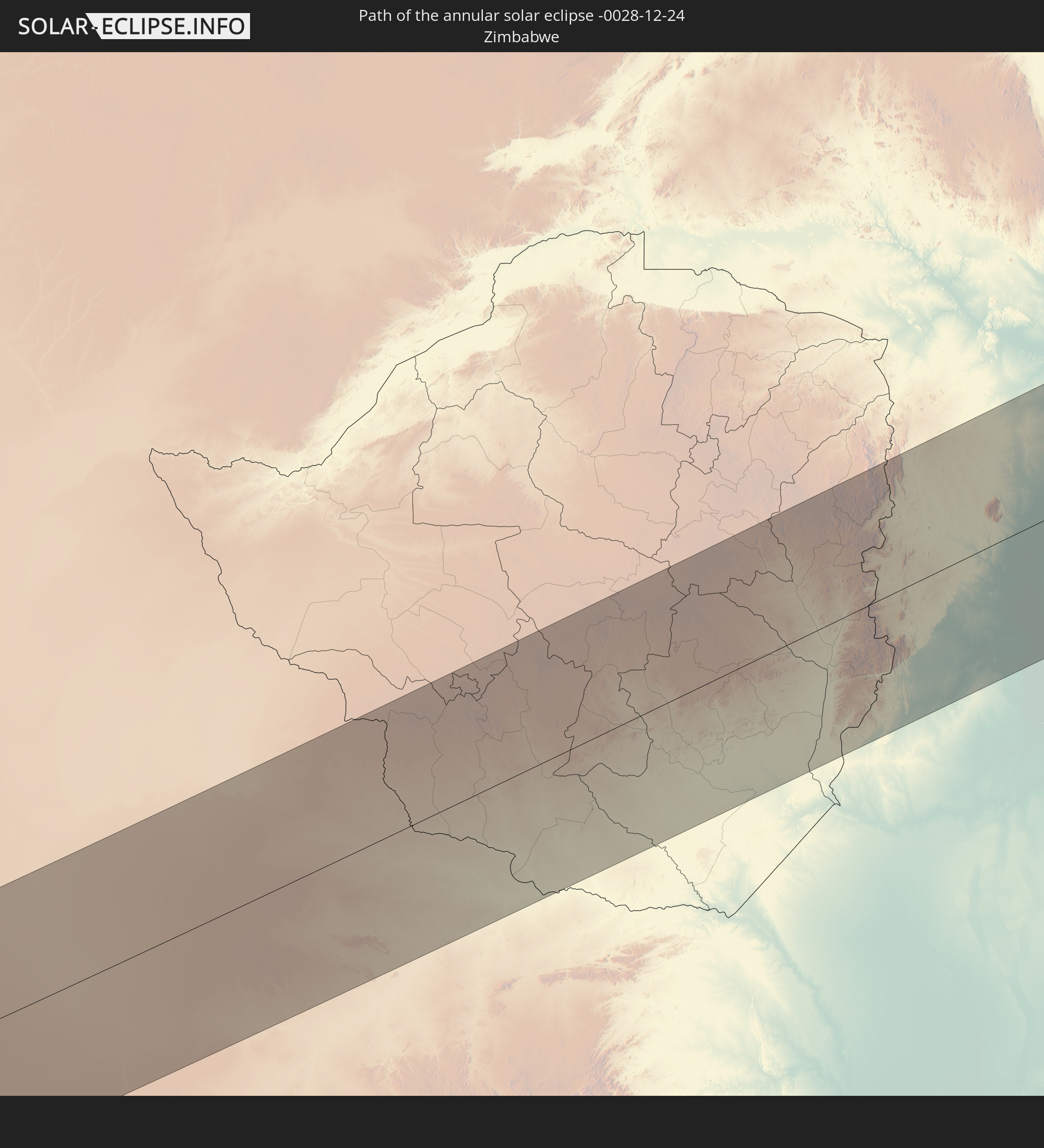 Zimbabwe
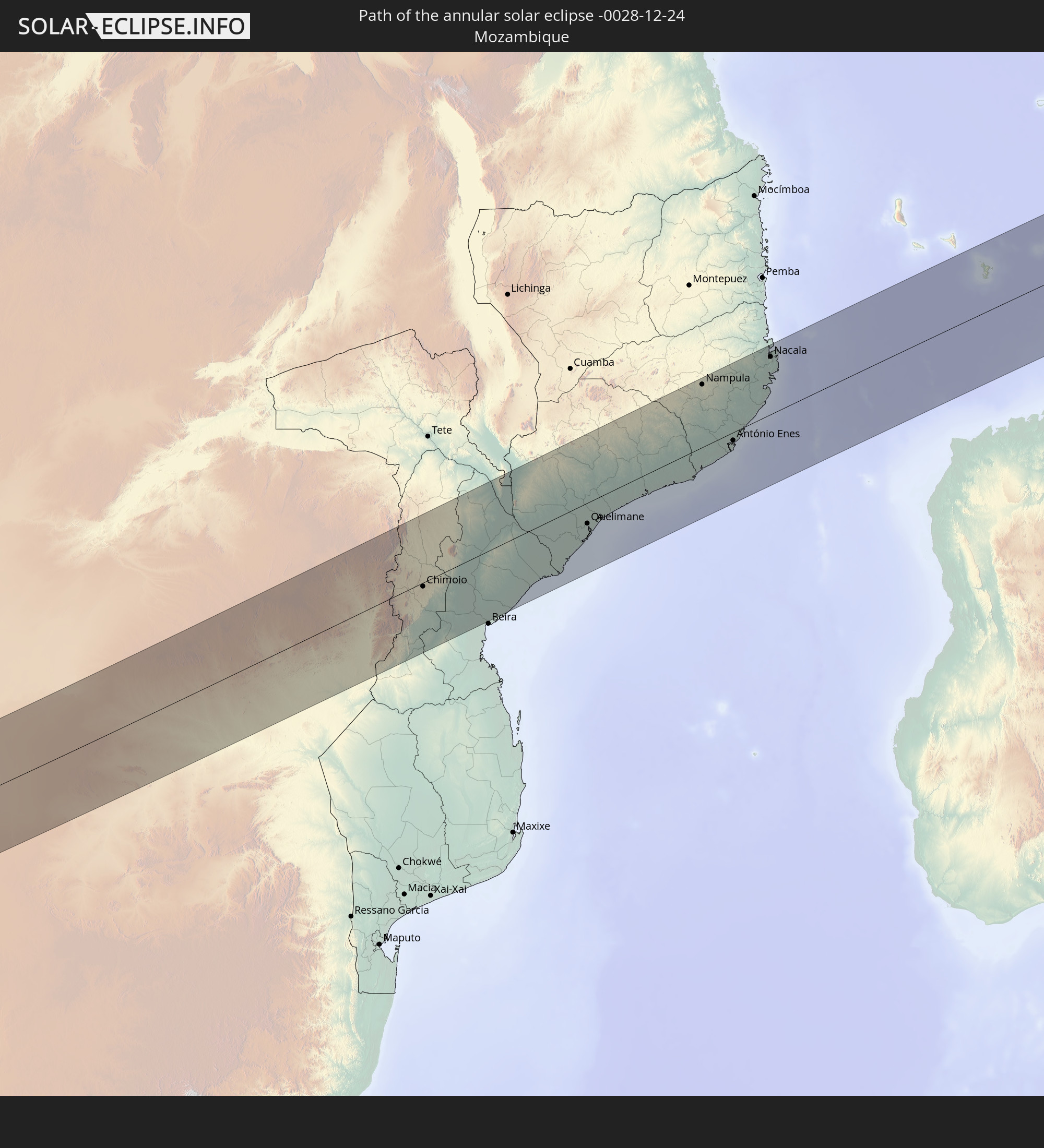 Mozambique
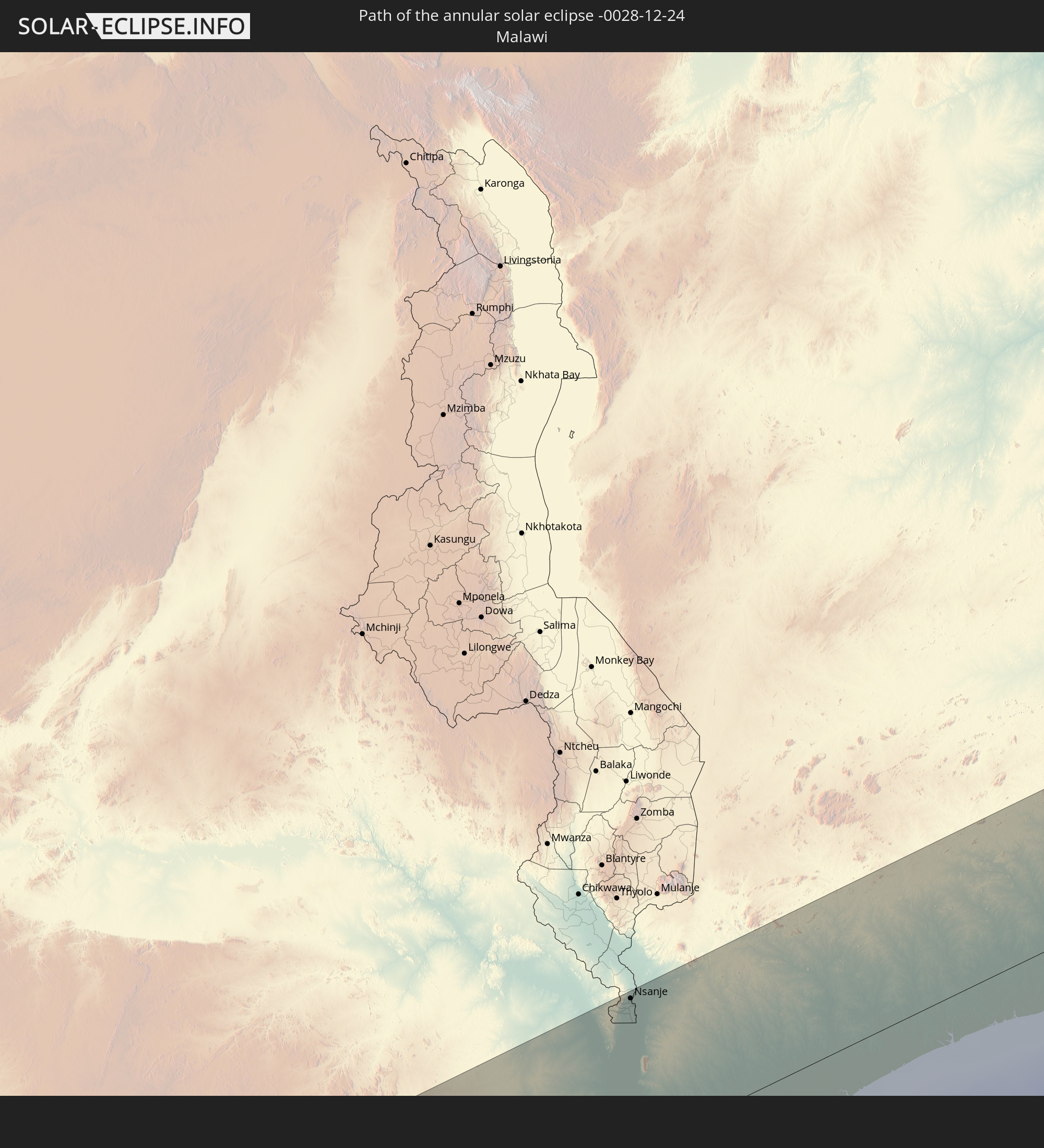 Malawi
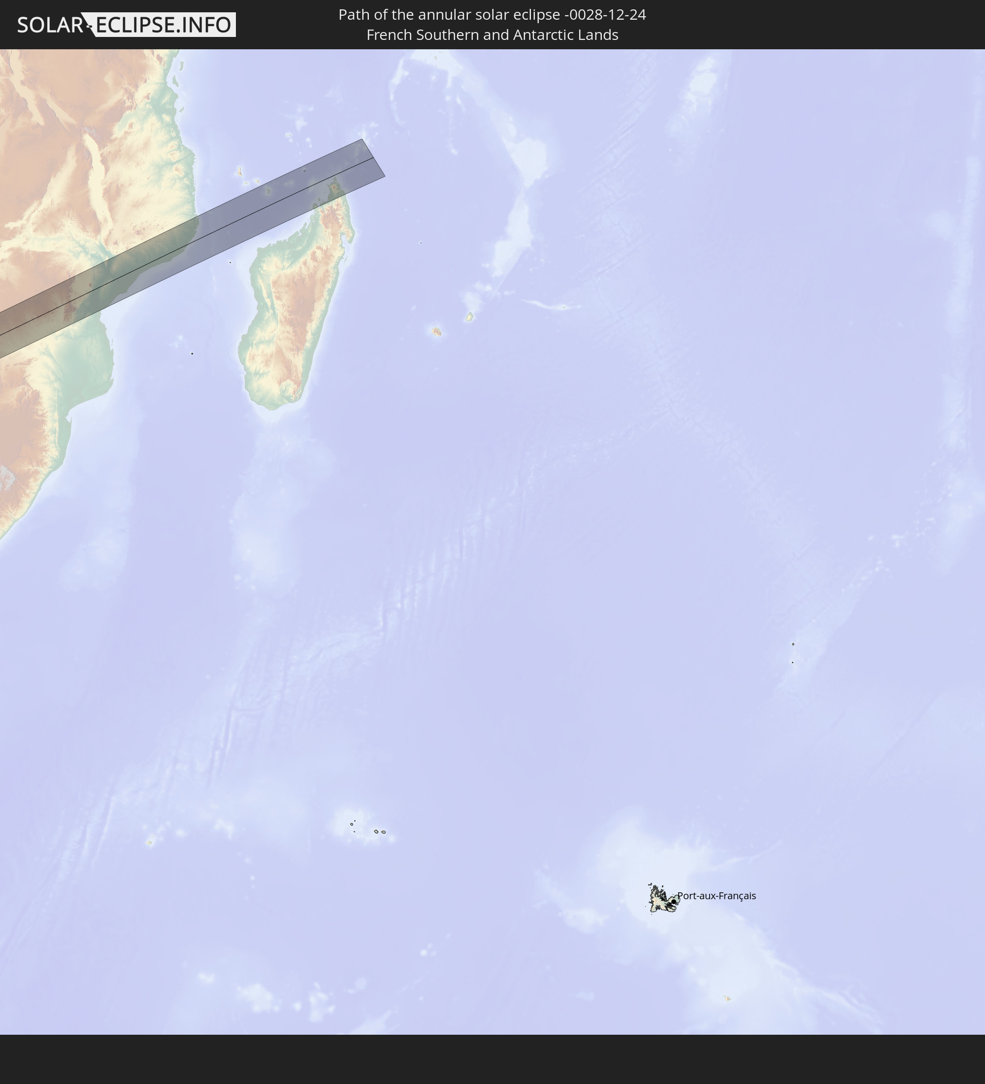 French Southern and Antarctic Lands
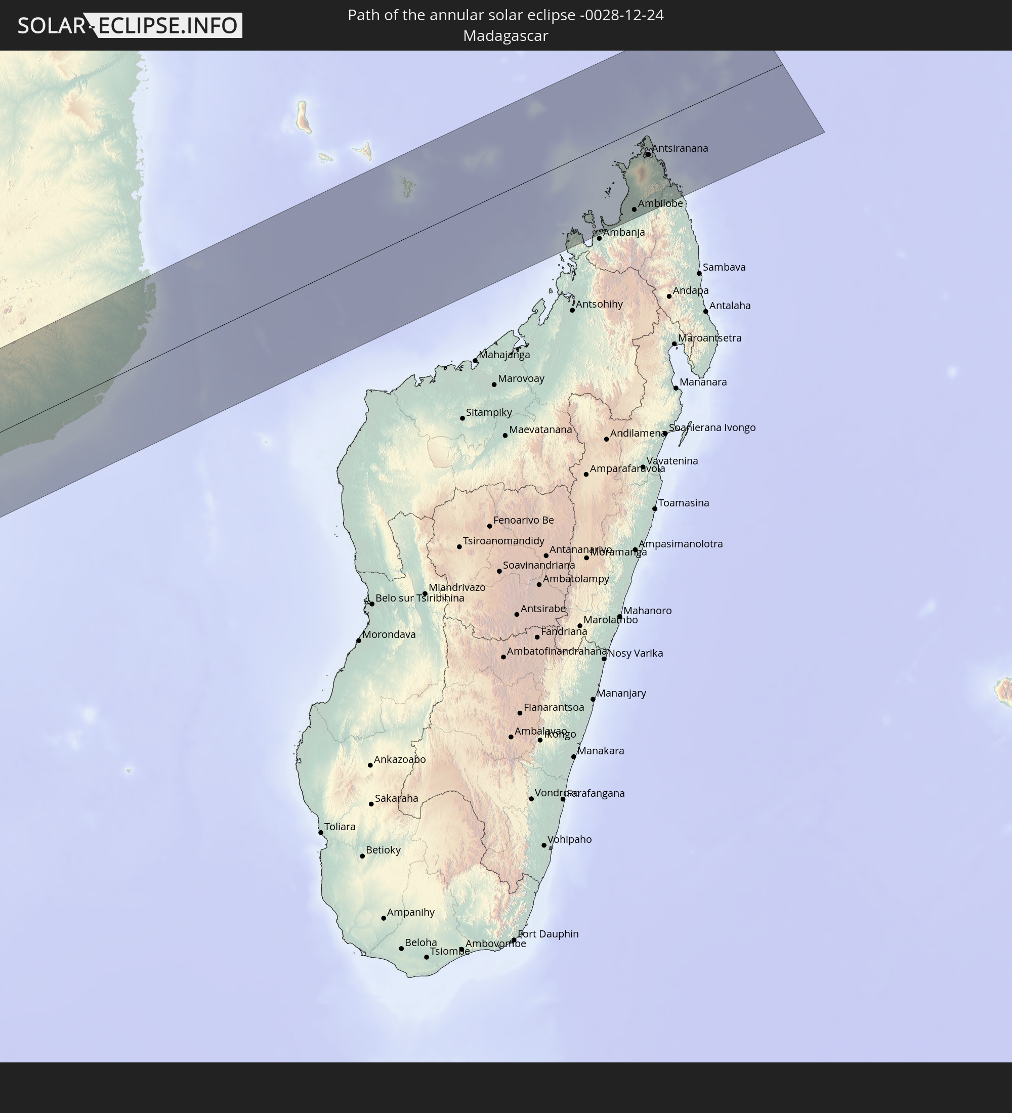 Madagascar
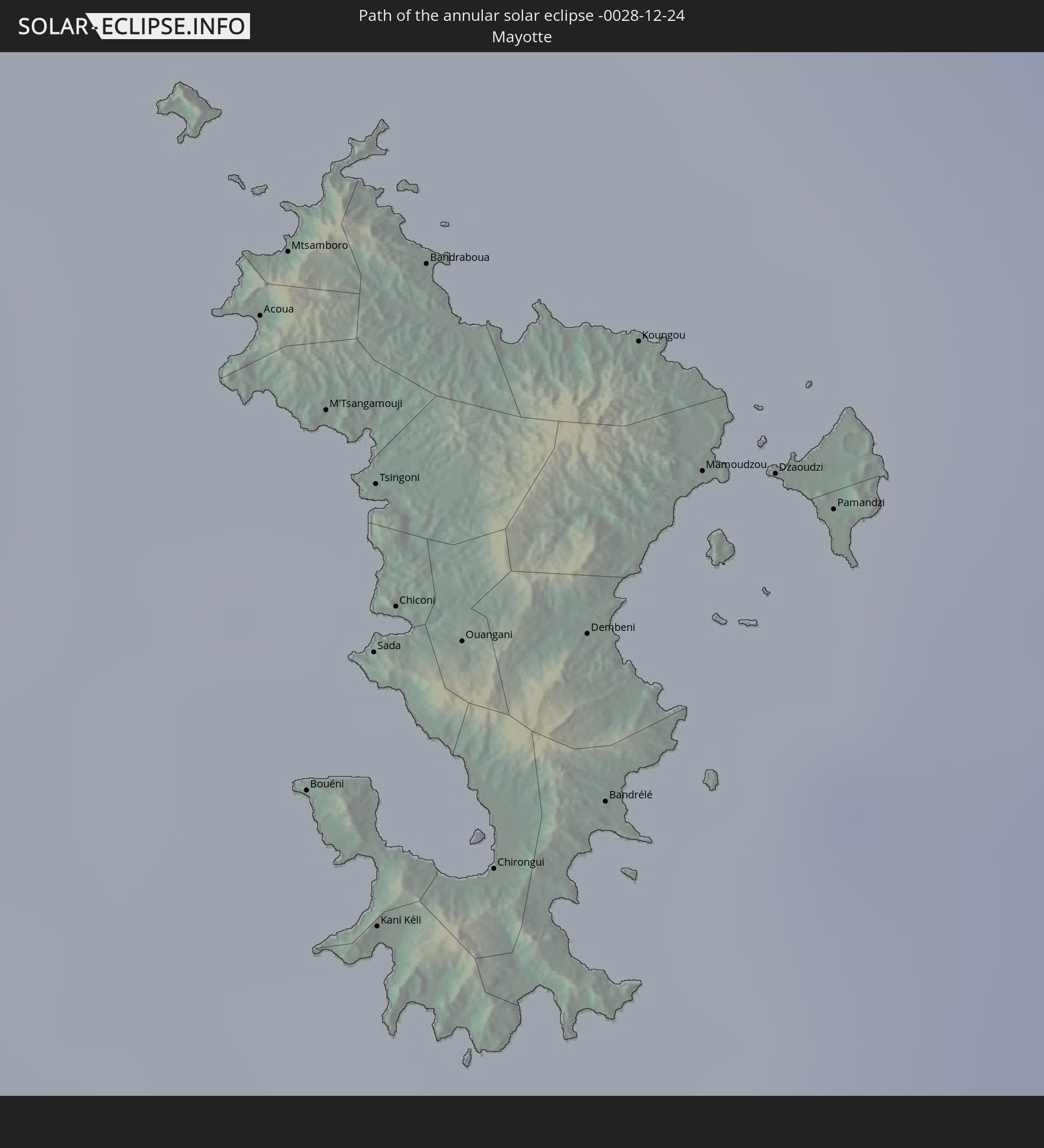 Mayotte
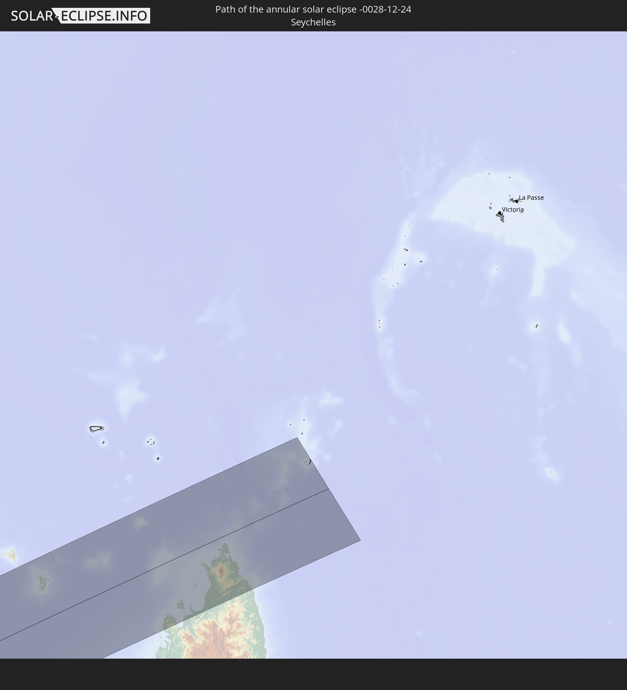 Seychelles
In den folgenden Ländern ist die Sonnenfinsternis partiell zu sehen
 Antarctica
 Chile
Chile
 Ecuador
 Colombia
 Peru
Peru
 Brazil
 Argentina
 Venezuela
 Bolivia
 Puerto Rico
 United States Virgin Islands
 British Virgin Islands
 Anguilla
 Collectivity of Saint Martin
 Saint Barthélemy
 Saint Kitts and Nevis
 Paraguay
 Antigua and Barbuda
 Montserrat
 Trinidad and Tobago
 Guadeloupe
 Grenada
 Dominica
 Saint Vincent and the Grenadines
 Falkland Islands
 Guyana
 Martinique
 Saint Lucia
 Barbados
 Uruguay
 Suriname
 French Guiana
 South Georgia and the South Sandwich Islands
 Saint Helena, Ascension and Tristan da Cunha
 Nigeria
 Bouvet Island
 Equatorial Guinea
 São Tomé and Príncipe
 Cameroon
 Gabon
Gabon
 Republic of the Congo
 Angola
 Namibia
 Democratic Republic of the Congo
 Chad
Chad
 Central African Republic
 South Africa
 Botswana
 Sudan
Sudan
 Zambia
 Zimbabwe
 Lesotho
 Rwanda
 Burundi
 Tanzania
 Uganda
 Mozambique
 Swaziland
 Malawi
 Ethiopia
 Kenya
Kenya
 Eritrea
 French Southern and Antarctic Lands
 Somalia
 Madagascar
 Comoros
 Mayotte
 Seychelles
 Réunion
 Mauritius
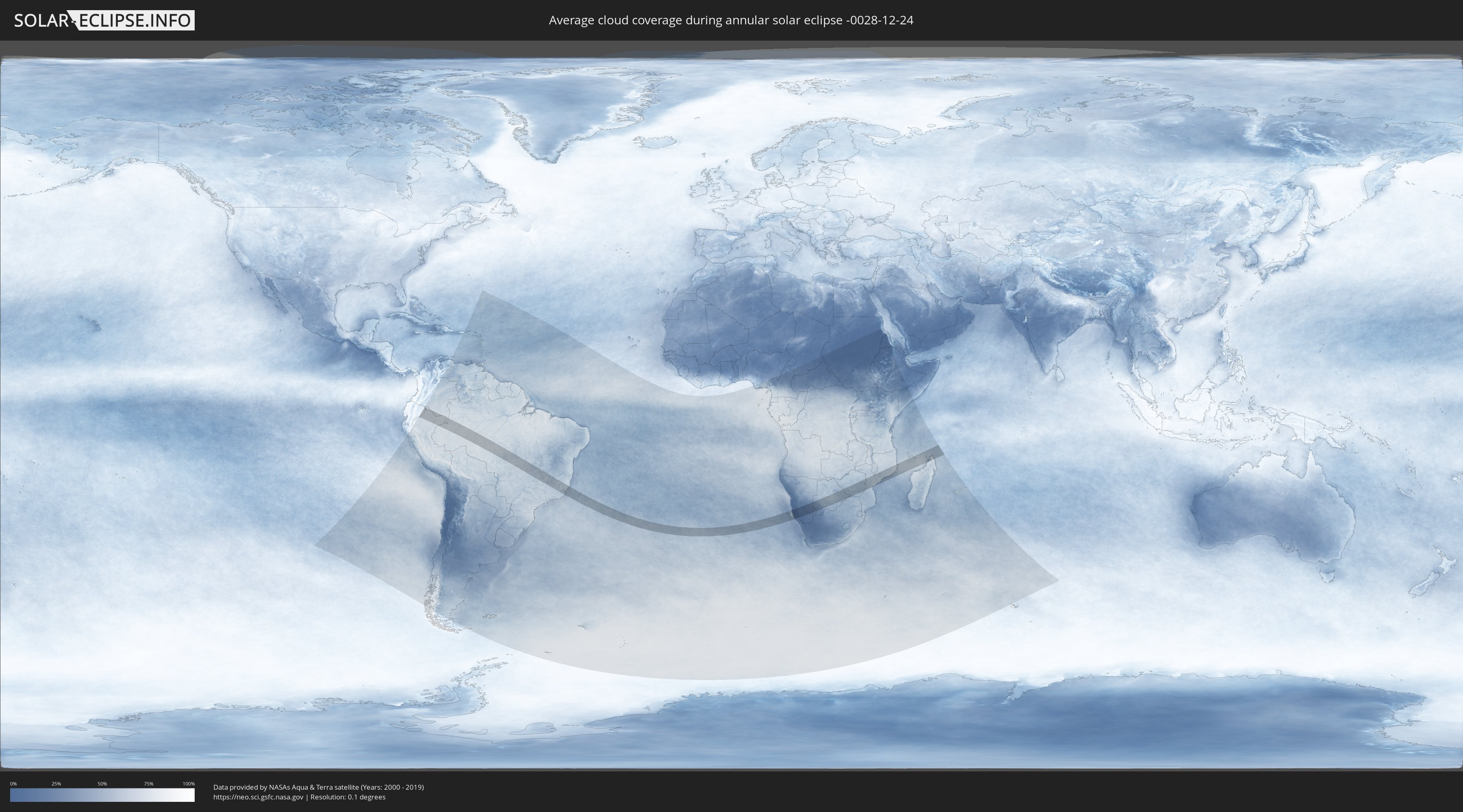
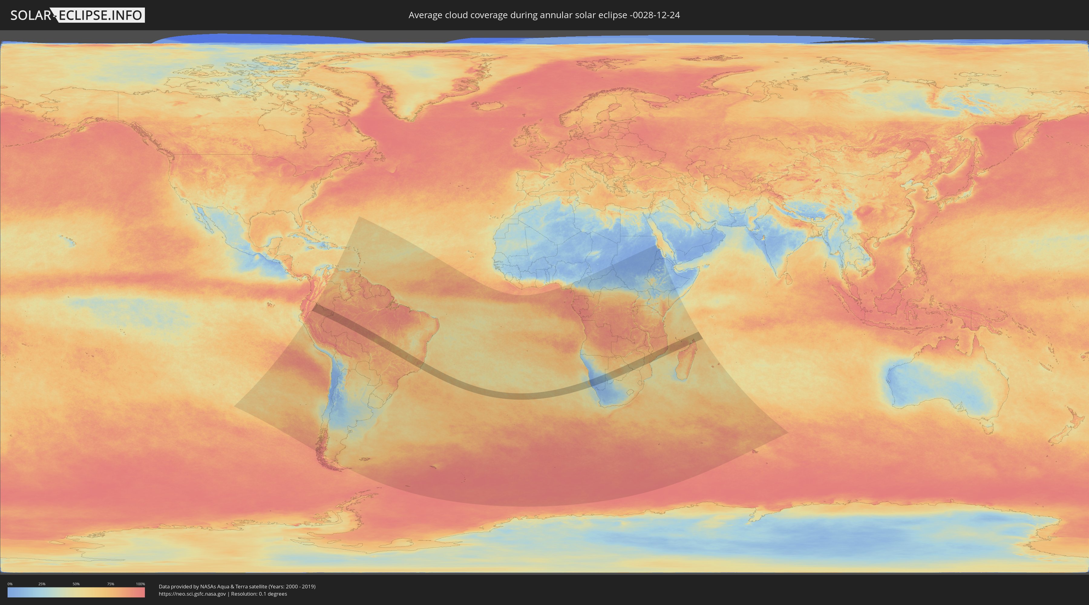
How will be the weather during the annular solar eclipse on 12/24/-0028?
Where is the best place to see the annular solar eclipse of 12/24/-0028?
The following maps show the average cloud coverage for the day of the annular solar eclipse.
With the help of these maps, it is possible to find the place along the eclipse path, which has the best
chance of a cloudless sky.
Nevertheless, you should consider local circumstances and inform about the weather of your chosen
observation site.
The data is provided by NASAs satellites
AQUA and TERRA.
The cloud maps are averaged over a period of 19 years (2000 - 2019).
Detailed country maps
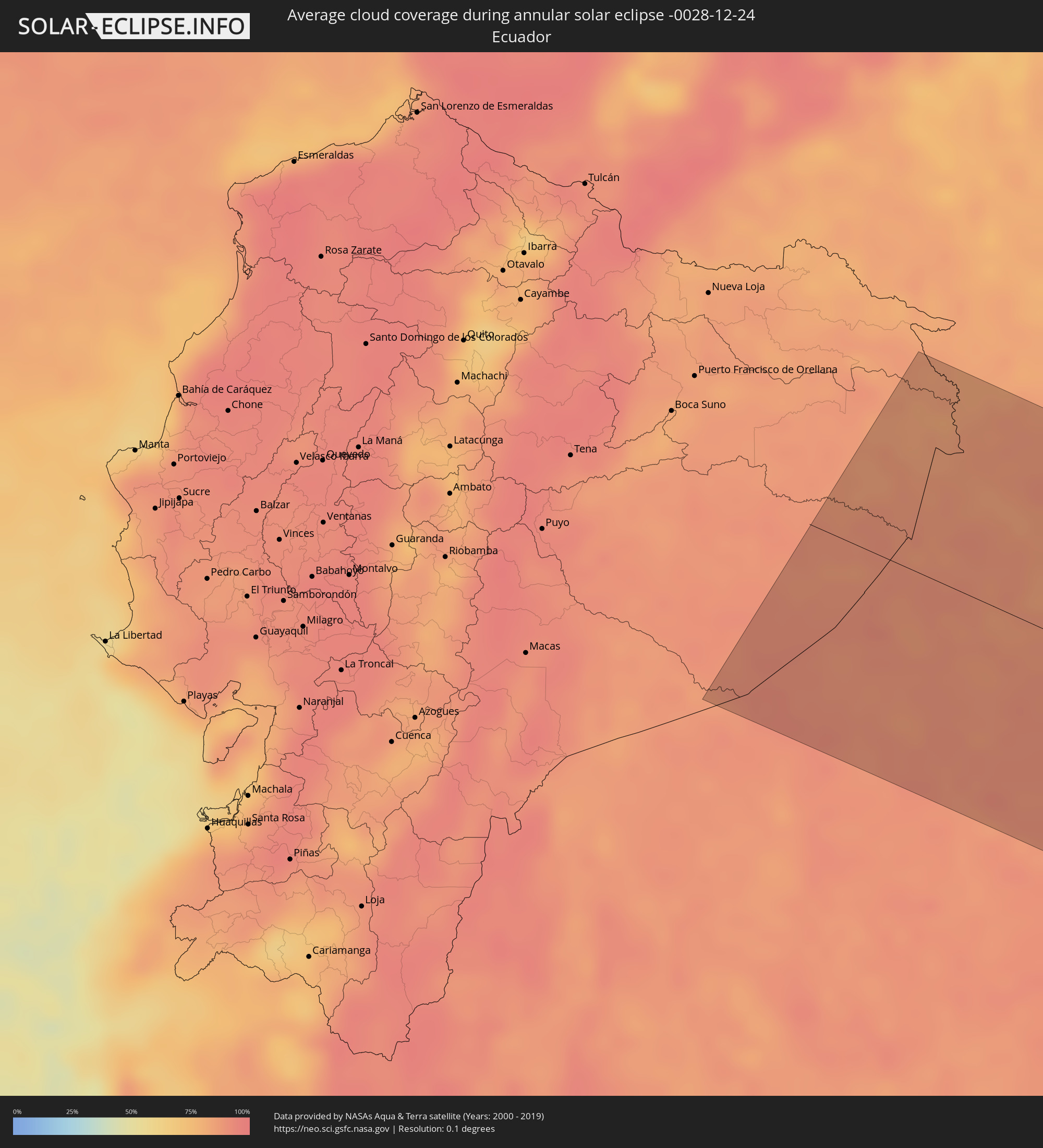 Ecuador
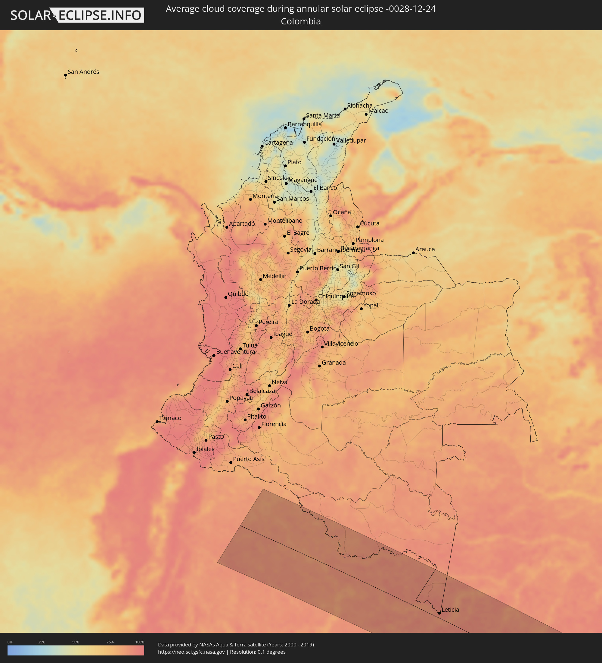 Colombia
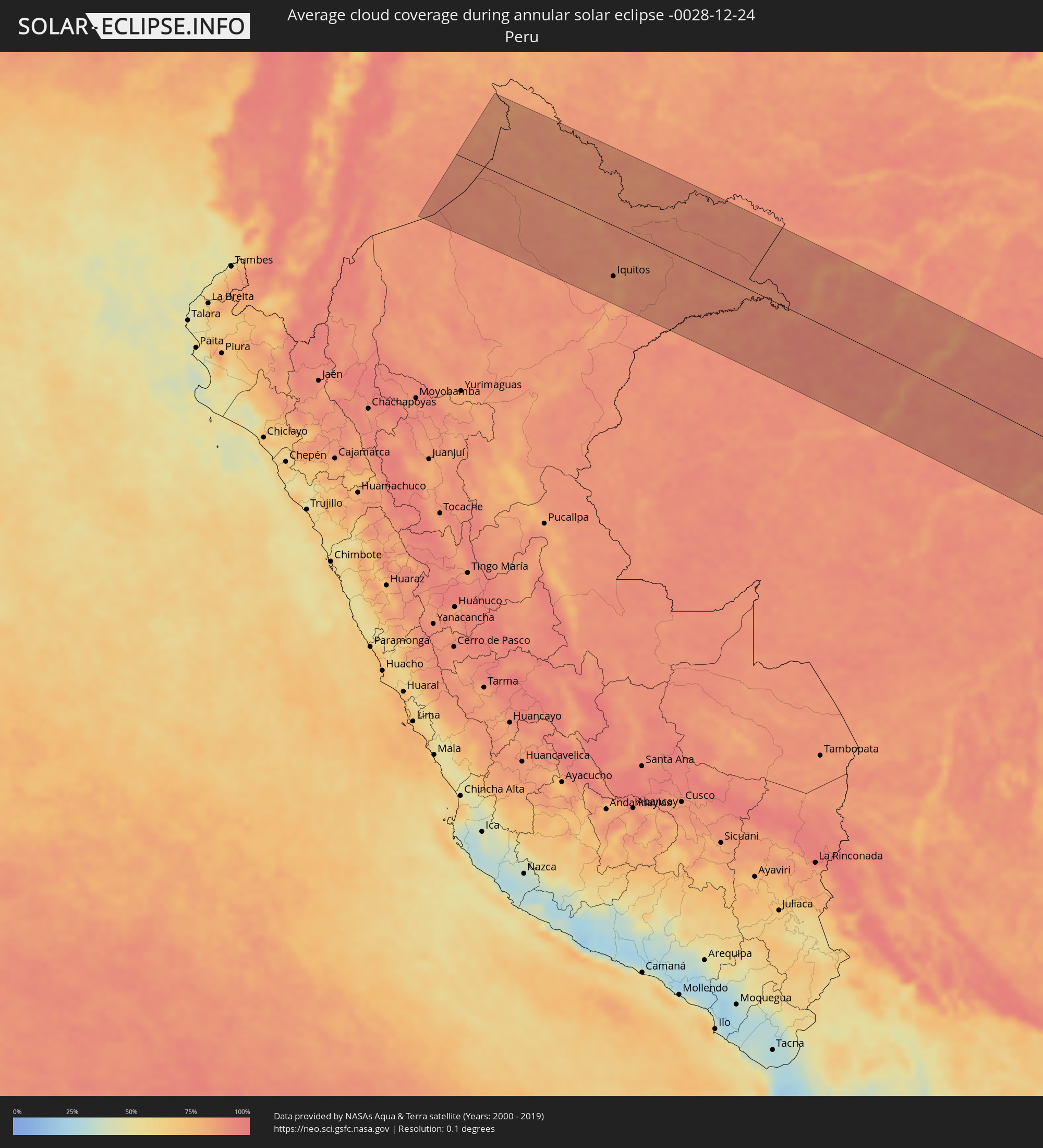 Peru
Peru
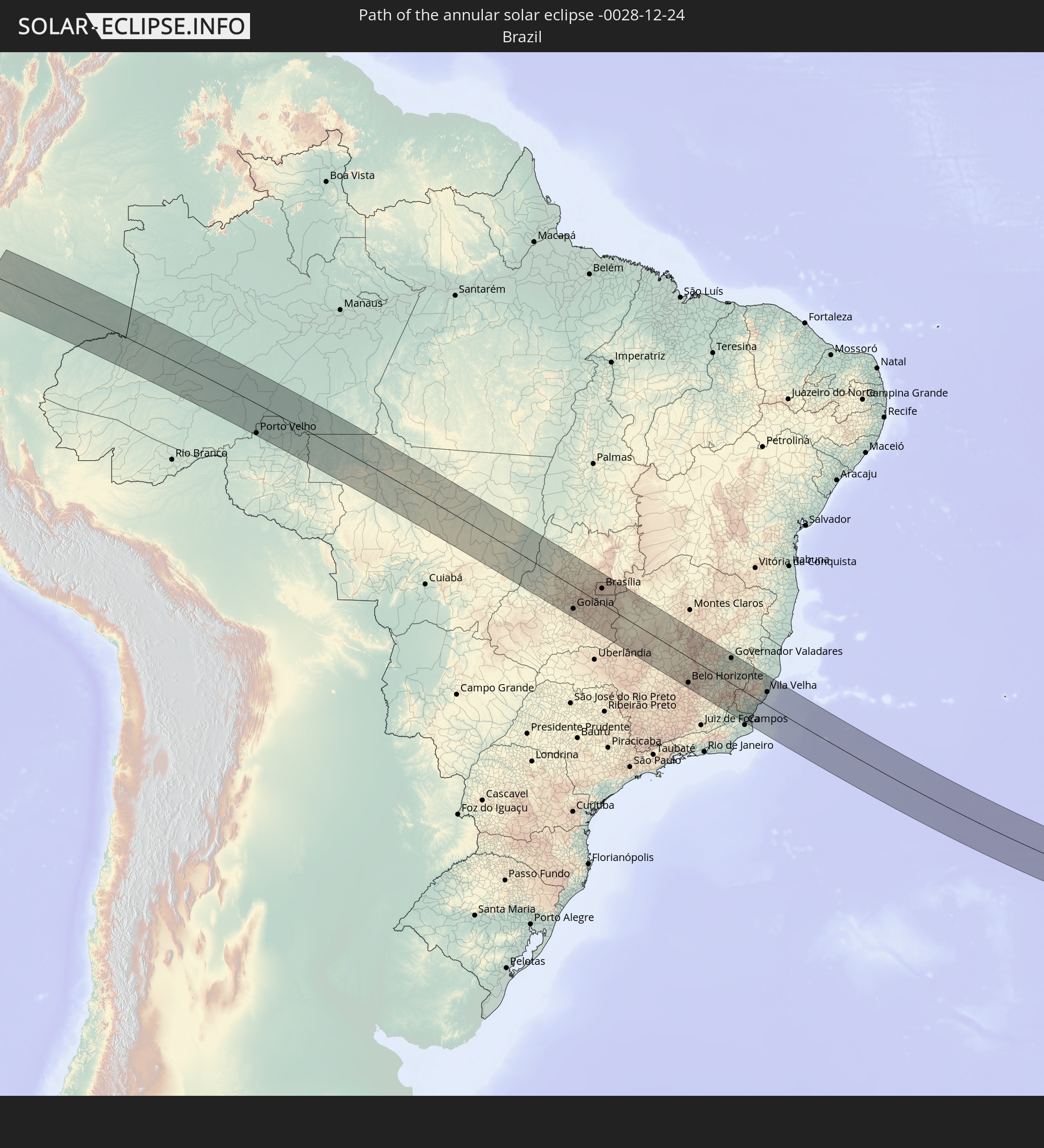
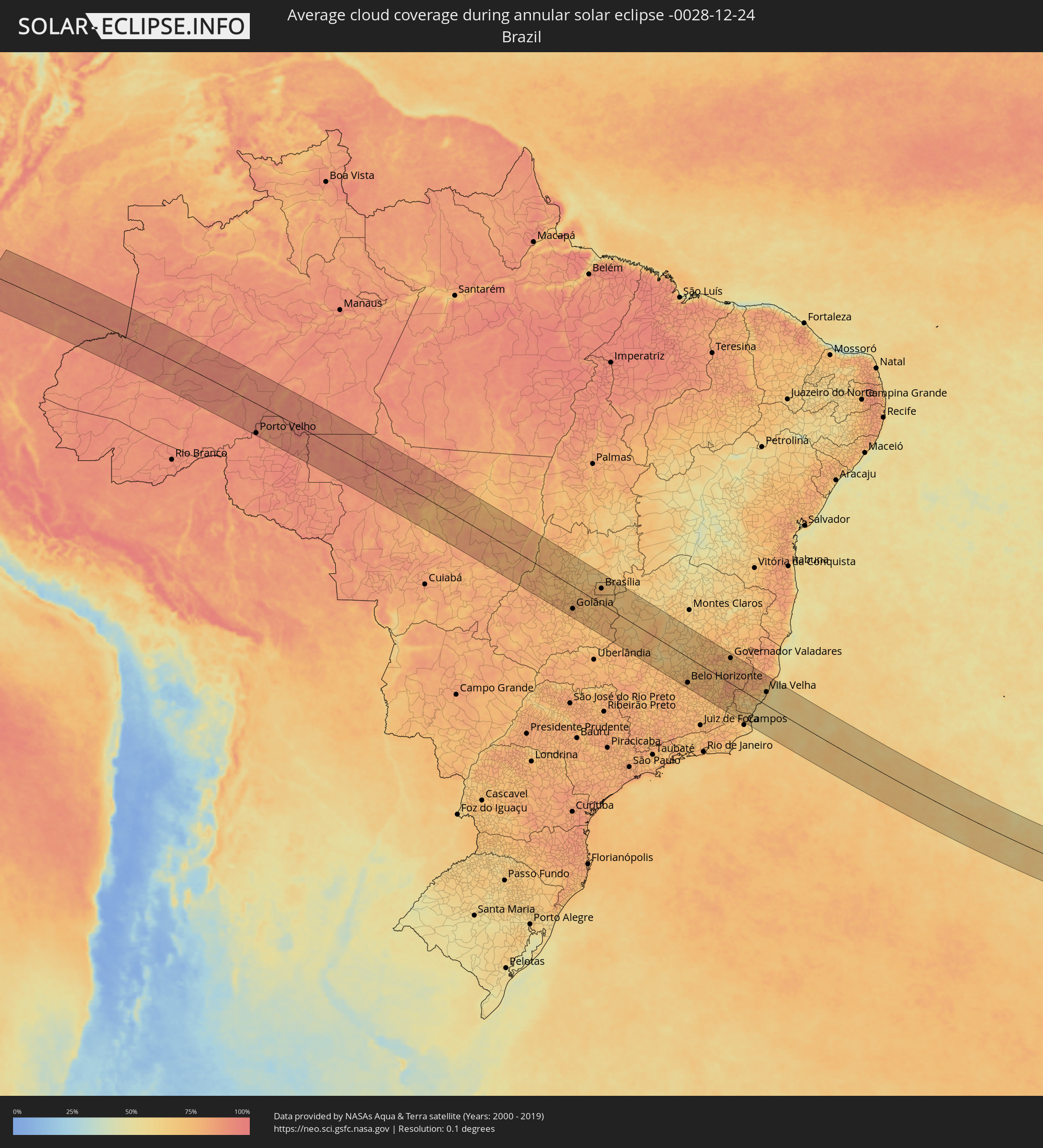 Brazil
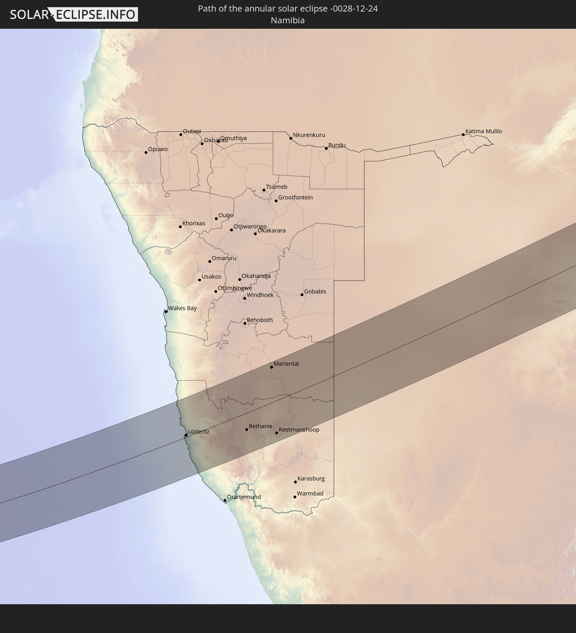
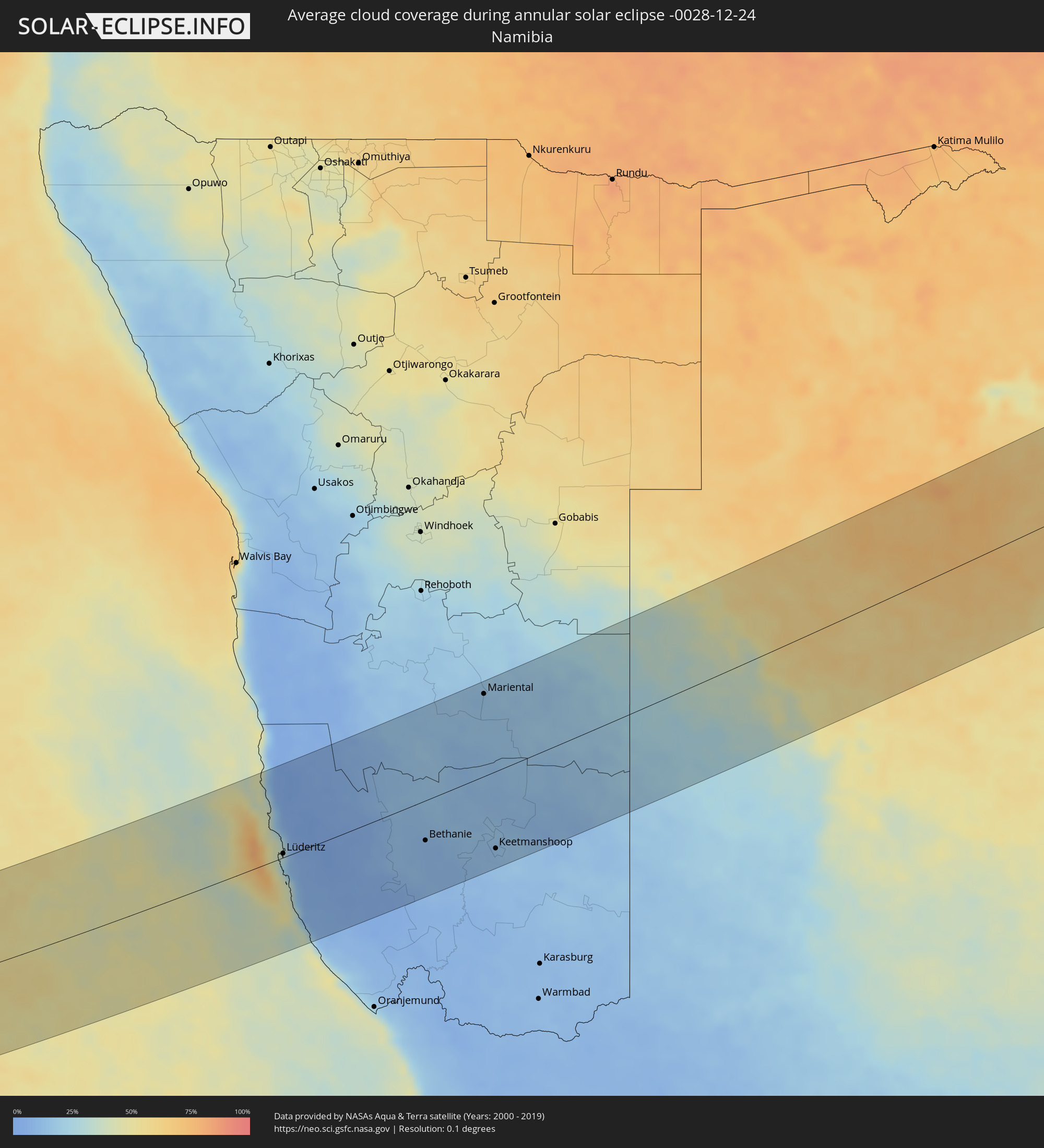 Namibia
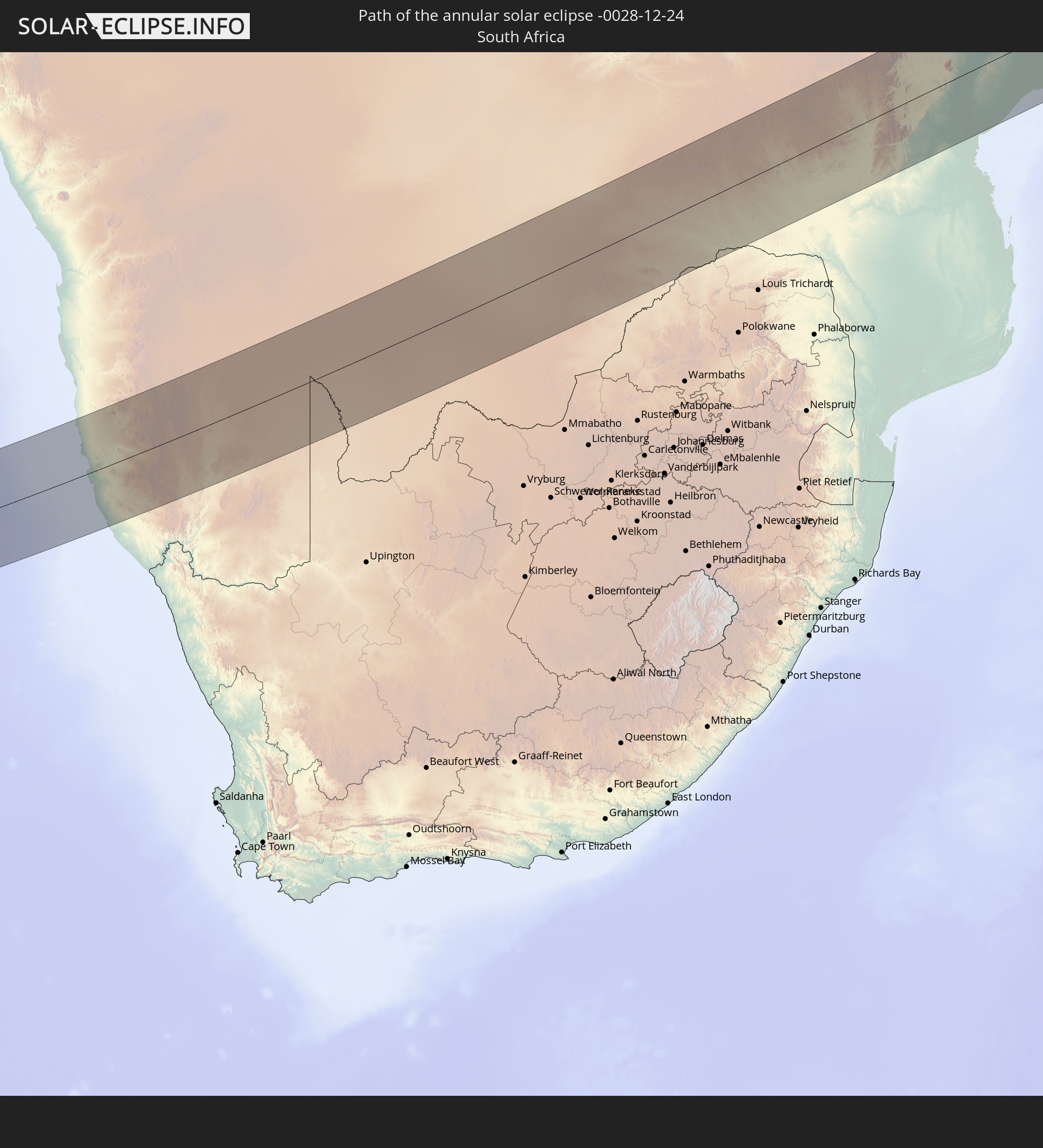
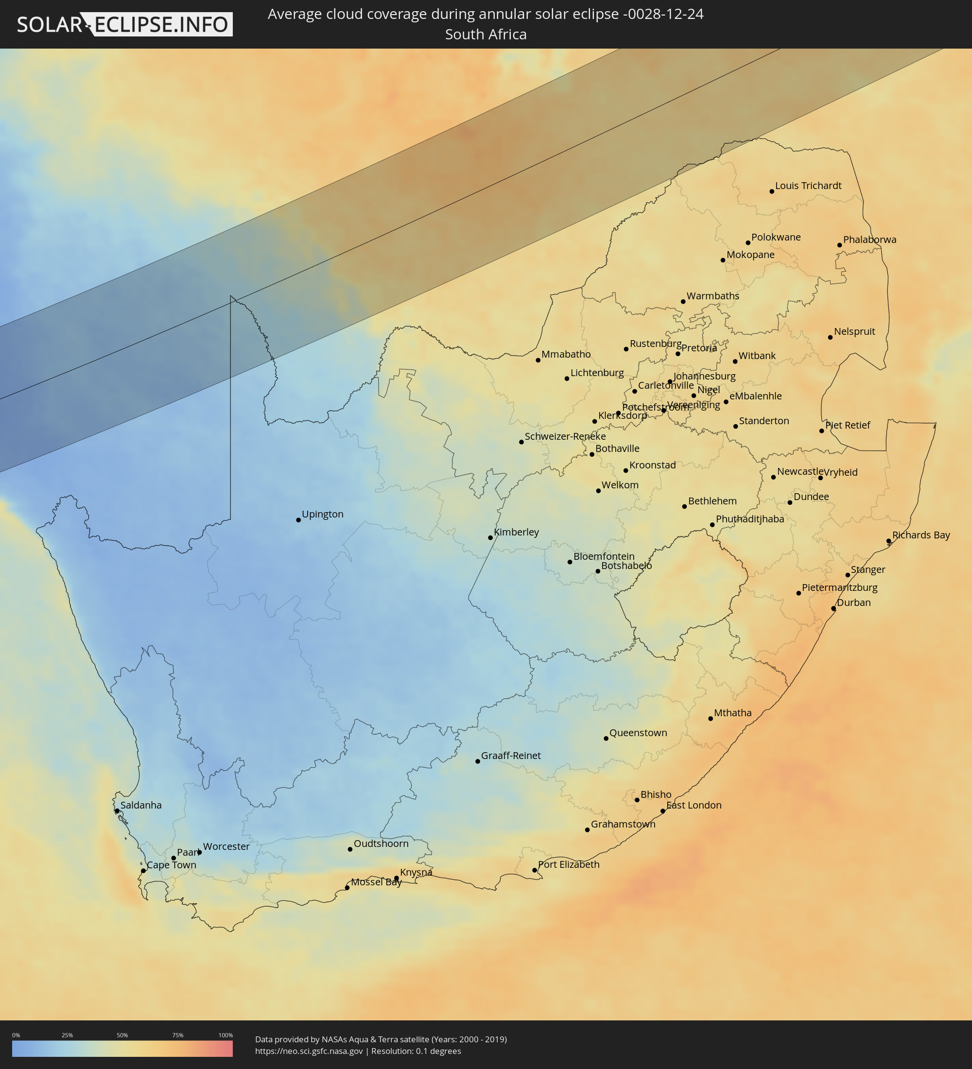 South Africa
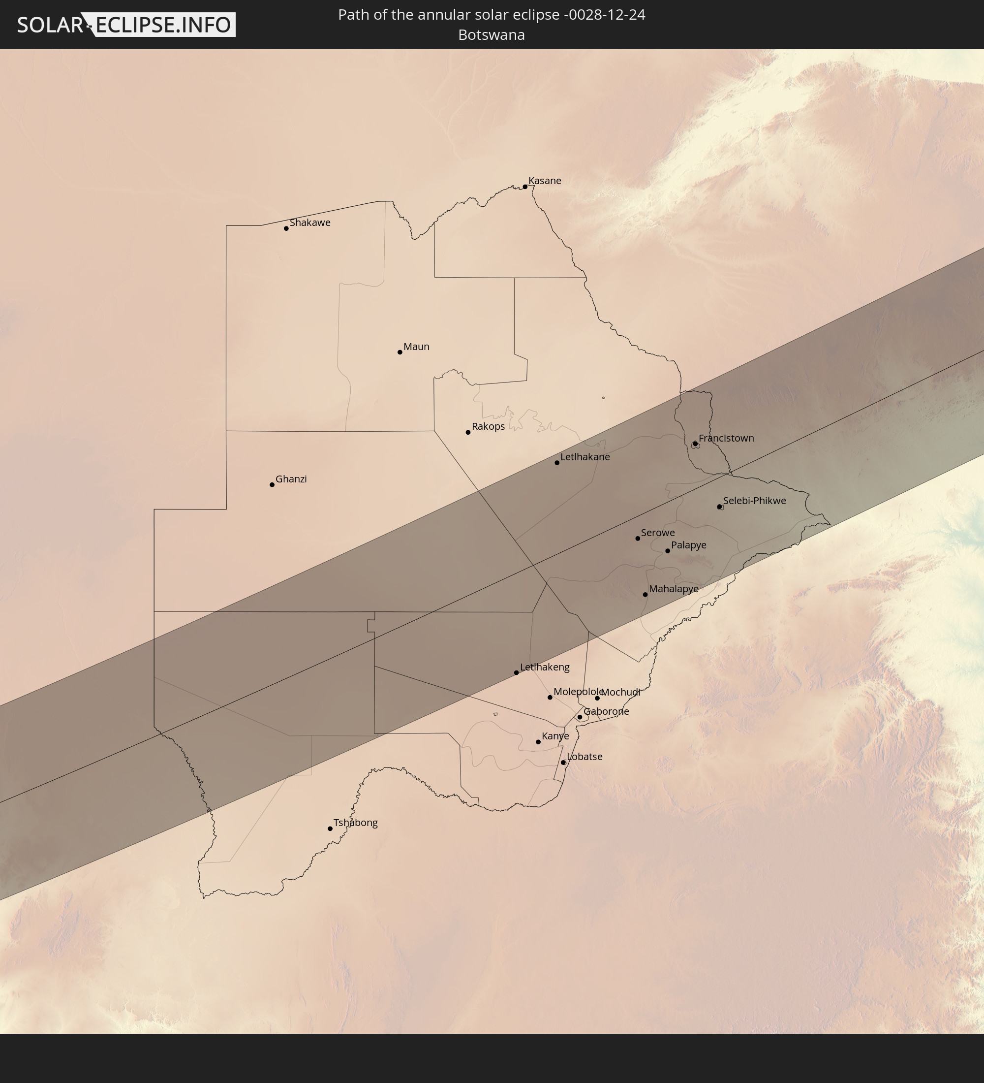
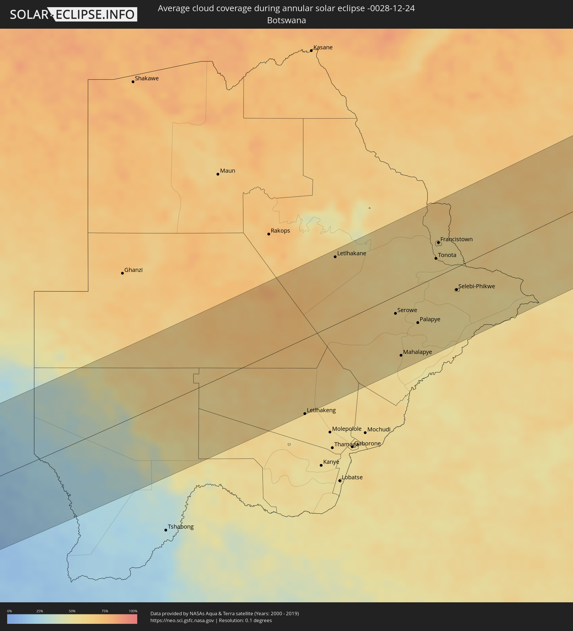 Botswana
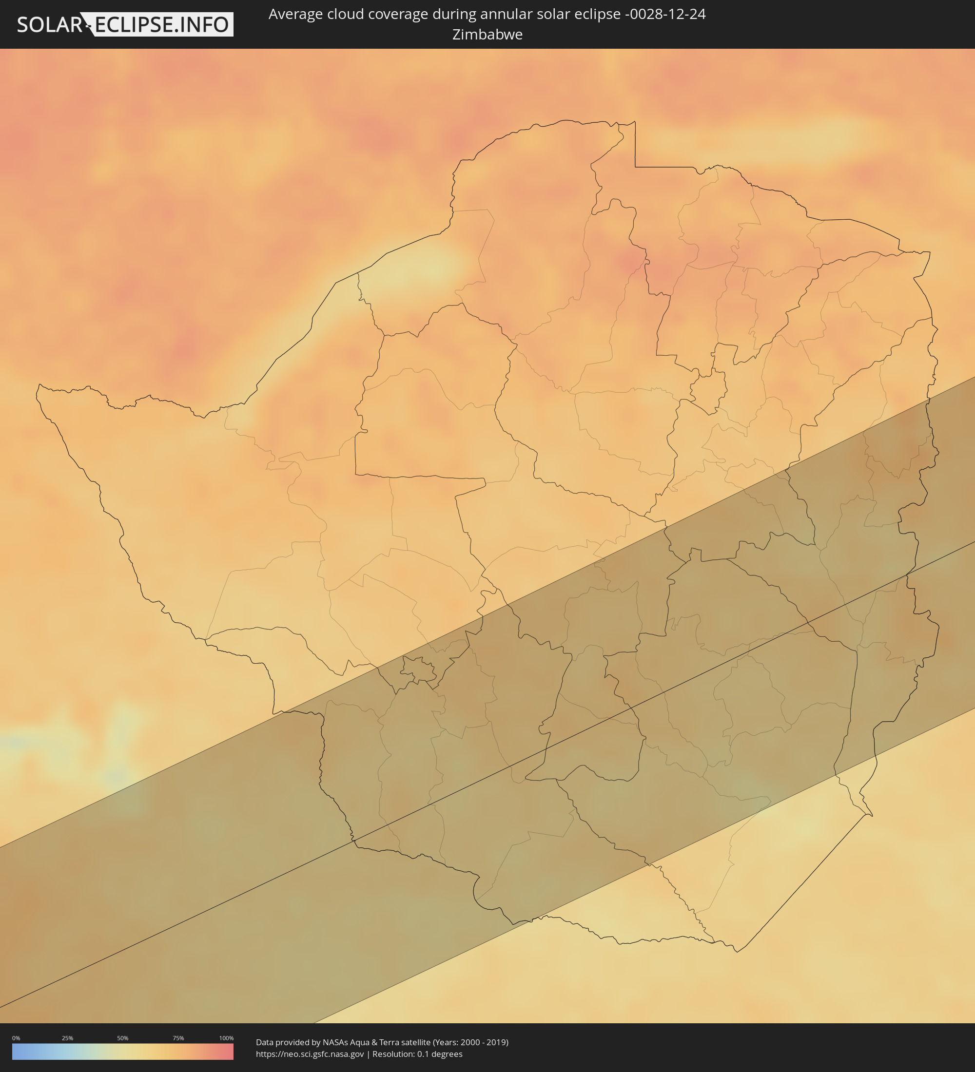 Zimbabwe
 Mozambique
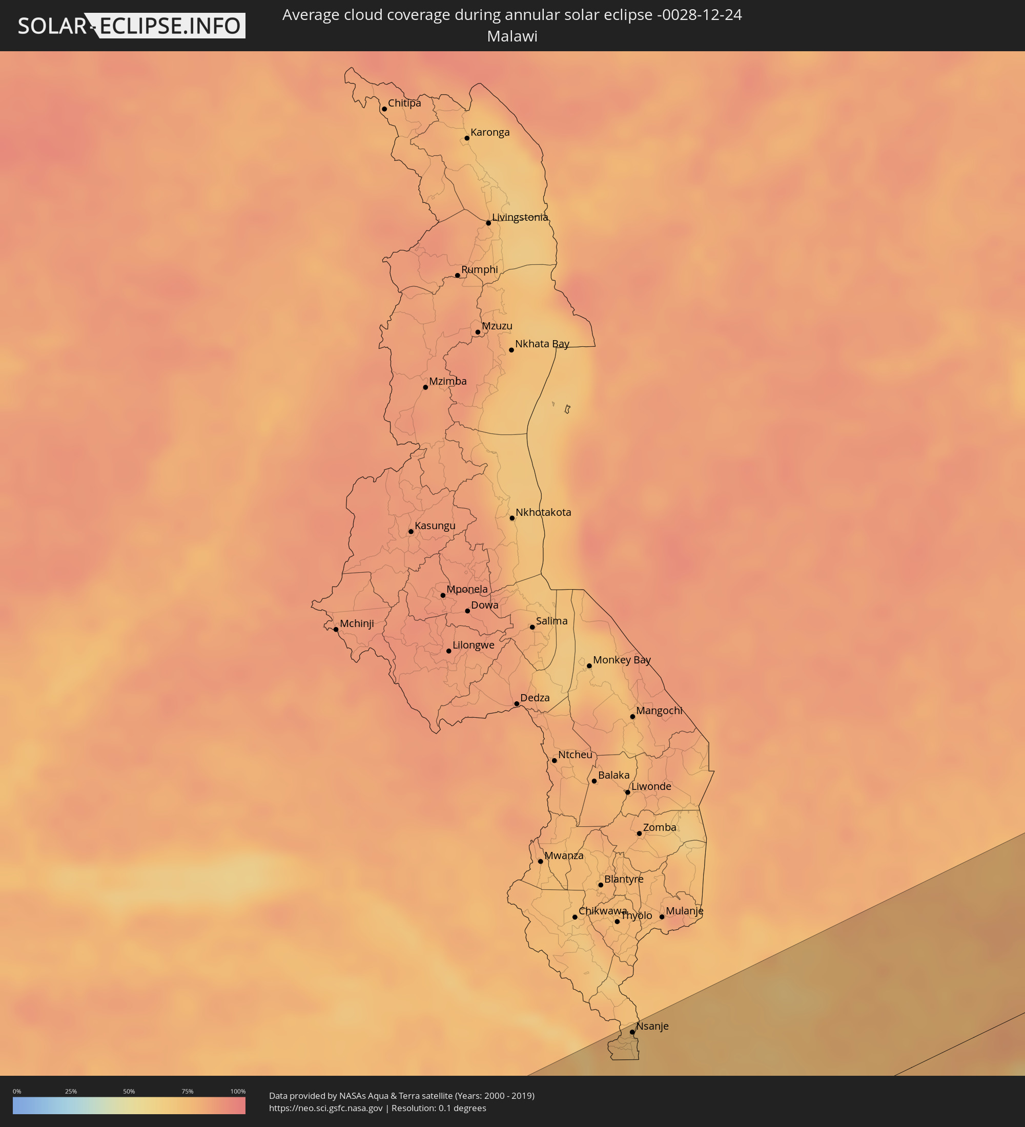 Malawi
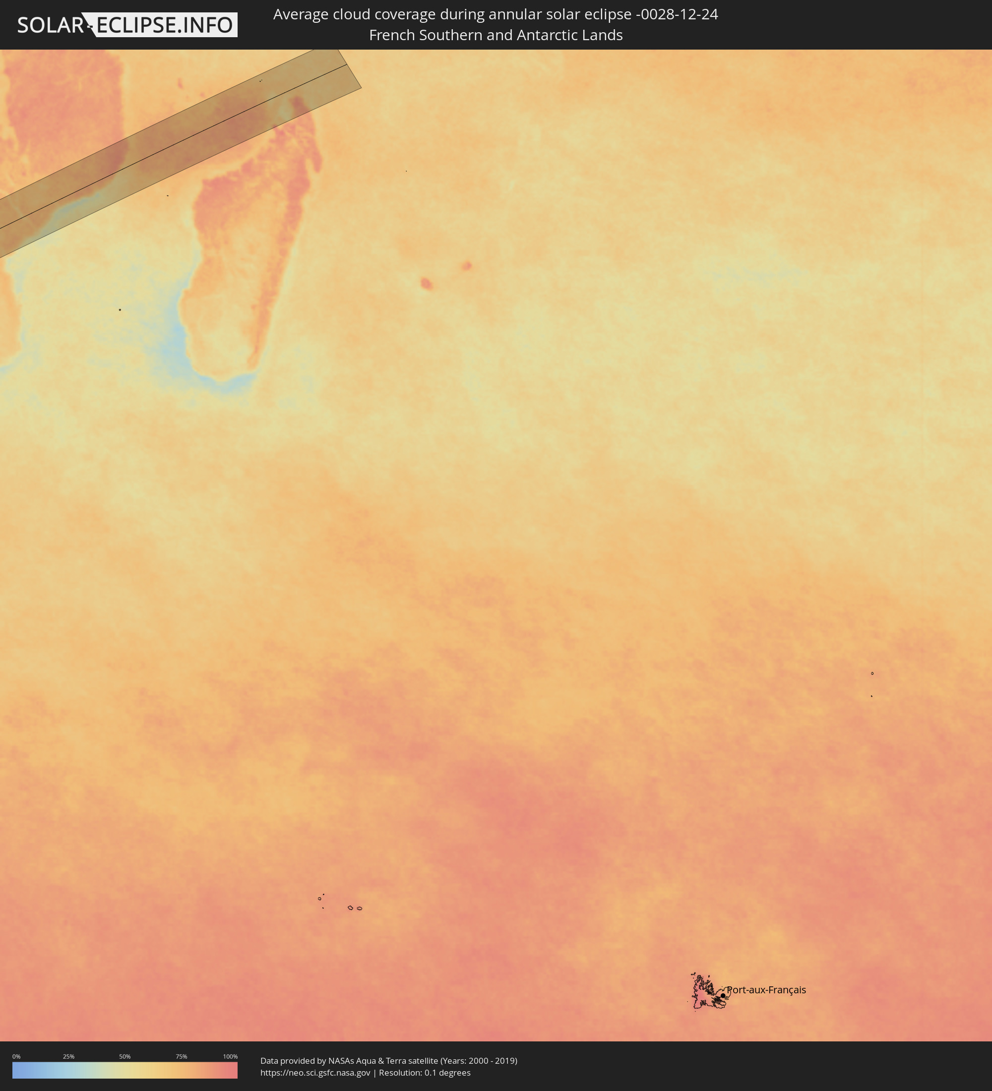 French Southern and Antarctic Lands
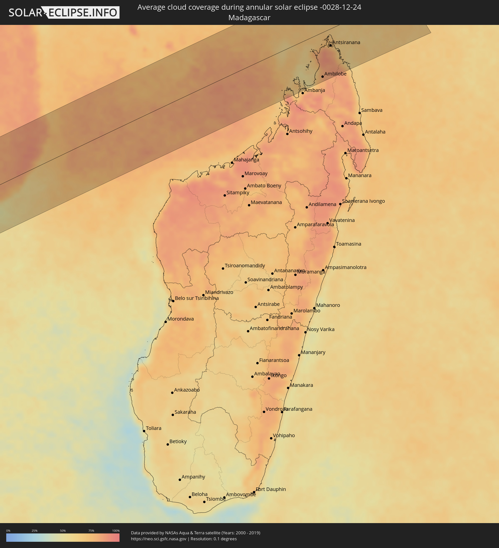 Madagascar
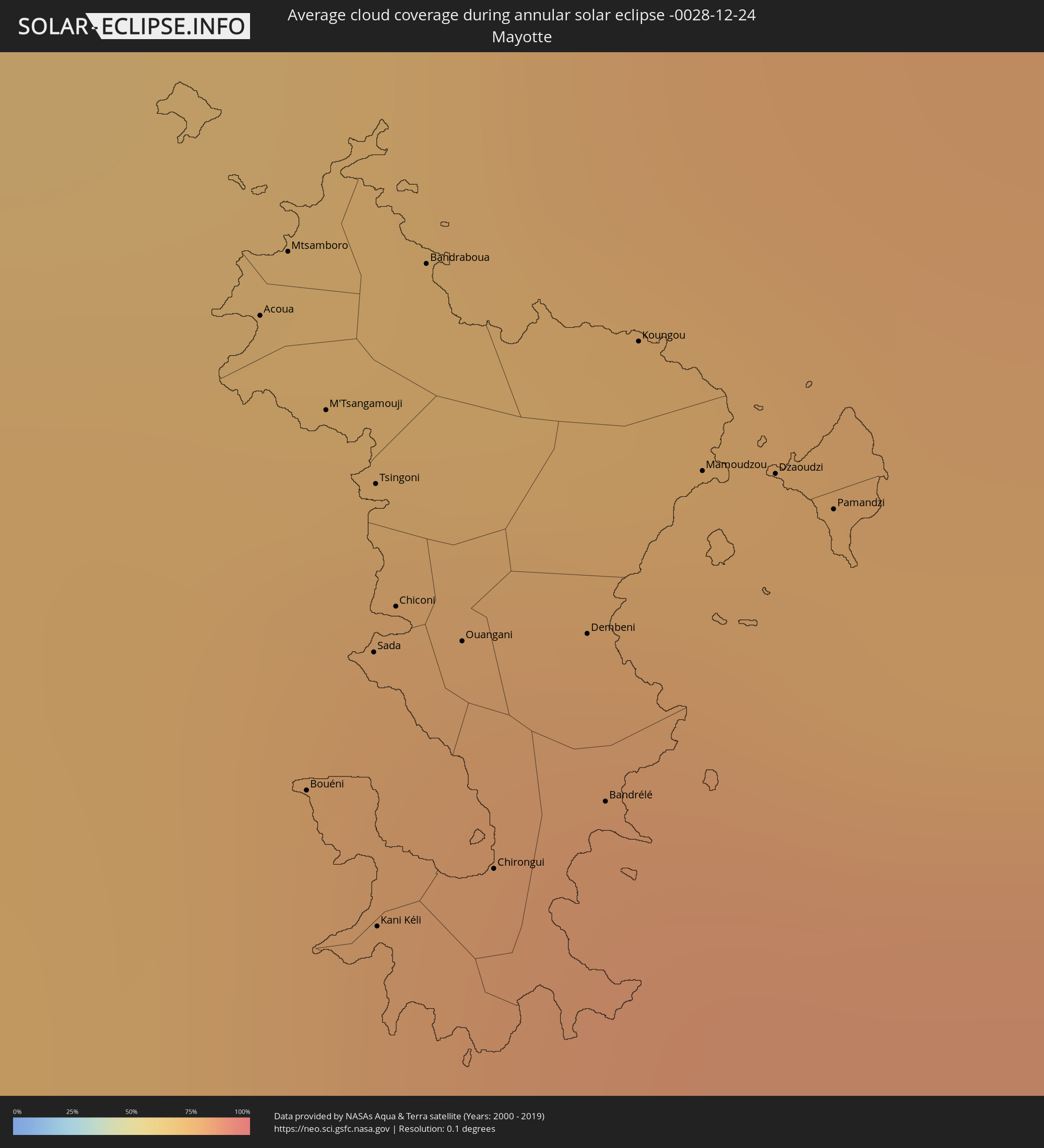 Mayotte
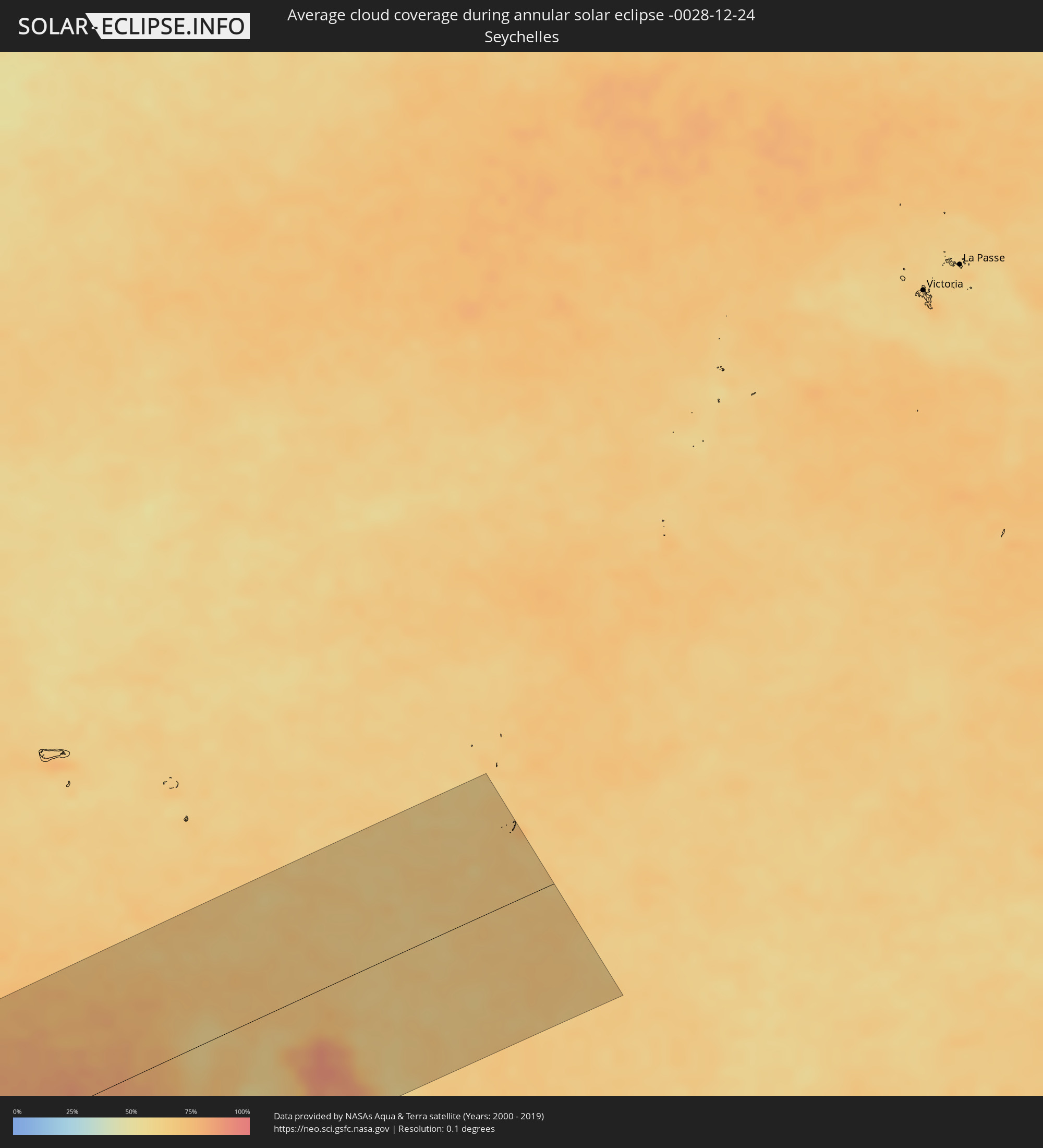 Seychelles
Cities inside the path of the eclipse
The following table shows all locations with a population of more than 5,000 inside the eclipse path. Cities which have more than 100,000 inhabitants are marked bold. A click at the locations opens a detailed map.
| City | Type | Eclipse duration | Local time of max. eclipse | Distance to central line | Ø Cloud coverage |
|
Iquitos, Loreto
|
annular | - | 05:58:36 UTC-05:08 | 97 km | 87% |
|
Ramón Castilla, Loreto
|
annular | - | 05:58:38 UTC-05:08 | 9 km | 87% |
|
Leticia, Amazonas
|
annular | - | 07:04:32 UTC-04:02 | 15 km | 89% |
|
Porto Velho, Rondônia
|
annular | - | 07:08:39 UTC-04:02 | 133 km | 91% |
|
Sinop, Mato Grosso
|
annular | - | 07:39:17 UTC-03:38 | 17 km | 81% |
|
Goiânia, Goiás
|
annular | - | 08:22:08 UTC-03:06 | 94 km | 80% |
|
Aparecida de Goiânia, Goiás
|
annular | - | 08:22:21 UTC-03:06 | 107 km | 78% |
|
Anápolis, Goiás
|
annular | - | 08:21:57 UTC-03:06 | 44 km | 77% |
|
Luziânia, Goiás
|
annular | - | 08:22:51 UTC-03:06 | 19 km | 72% |
|
Brasília, Federal District
|
annular | - | 08:22:13 UTC-03:06 | 65 km | 75% |
|
Planaltina, Federal District
|
annular | - | 08:22:18 UTC-03:06 | 96 km | 72% |
|
Patos de Minas, Minas Gerais
|
annular | - | 08:27:43 UTC-03:06 | 121 km | 77% |
|
Esmeraldas, Minas Gerais
|
annular | - | 08:32:11 UTC-03:06 | 111 km | 75% |
|
Sete Lagoas, Minas Gerais
|
annular | - | 08:31:49 UTC-03:06 | 79 km | 74% |
|
Betim, Minas Gerais
|
annular | - | 08:32:39 UTC-03:06 | 124 km | 77% |
|
Ribeirão das Neves, Minas Gerais
|
annular | - | 08:32:29 UTC-03:06 | 99 km | 76% |
|
Ibirité, Minas Gerais
|
annular | - | 08:32:55 UTC-03:06 | 121 km | 76% |
|
Belo Horizonte, Minas Gerais
|
annular | - | 08:32:55 UTC-03:06 | 105 km | 74% |
|
Santa Luzia, Minas Gerais
|
annular | - | 08:32:48 UTC-03:06 | 86 km | 74% |
|
Ipatinga, Minas Gerais
|
annular | - | 08:34:09 UTC-03:06 | 15 km | 68% |
|
Governador Valadares, Minas Gerais
|
annular | - | 08:34:03 UTC-03:06 | 106 km | 76% |
|
Cachoeiro de Itapemirim, Espírito Santo
|
annular | - | 08:38:22 UTC-03:06 | 39 km | 64% |
|
Colatina, Espírito Santo
|
annular | - | 08:37:04 UTC-03:06 | 112 km | 79% |
|
Guarapari, Espírito Santo
|
annular | - | 08:39:00 UTC-03:06 | 13 km | 61% |
|
Serra, Espírito Santo
|
annular | - | 08:38:29 UTC-03:06 | 73 km | 65% |
|
Vila Velha, Espírito Santo
|
annular | - | 08:38:50 UTC-03:06 | 55 km | 68% |
|
Lüderitz, Karas
|
annular | - | 15:52:19 UTC+01:30 | 5 km | 11% |
|
Bethanie, Karas
|
annular | - | 15:55:33 UTC+01:30 | 52 km | 9% |
|
Mariental, Hardap
|
annular | - | 15:58:53 UTC+01:30 | 107 km | 15% |
|
Keetmanshoop, Karas
|
annular | - | 15:56:50 UTC+01:30 | 99 km | 12% |
|
Letlhakeng, Kweneng
|
annular | - | 16:48:07 UTC+02:10 | 129 km | 57% |
|
Letlhakane, Central
|
annular | - | 16:51:37 UTC+02:10 | 117 km | 66% |
|
Serowe, Central
|
annular | - | 16:51:33 UTC+02:10 | 30 km | 58% |
|
Mahalapye, Central
|
annular | - | 16:50:51 UTC+02:10 | 107 km | 58% |
|
Palapye, Central
|
annular | - | 16:51:43 UTC+02:10 | 64 km | 58% |
|
Tonota, Central
|
annular | - | 16:53:11 UTC+02:10 | 32 km | 57% |
|
Francistown, North-East
|
annular | - | 16:53:31 UTC+02:10 | 57 km | 57% |
|
Selebi-Phikwe, Central
|
annular | - | 16:52:55 UTC+02:10 | 39 km | 56% |
|
Chimoio, Manica
|
annular | - | 16:59:22 UTC+02:10 | 8 km | 67% |
|
Dondo, Sofala
|
annular | - | 16:59:27 UTC+02:10 | 115 km | 70% |
|
Nsanje, Southern Region
|
annular | - | 17:02:07 UTC+02:10 | 130 km | 68% |
|
Quelimane, Zambézia
|
annular | - | 17:01:51 UTC+02:10 | 41 km | 68% |
|
Nampula, Nampula
|
annular | - | 17:04:46 UTC+02:10 | 126 km | 81% |
|
António Enes, Nampula
|
annular | - | 17:04:00 UTC+02:10 | 16 km | 74% |
|
Nacala, Nampula
|
annular | - | 17:05:25 UTC+02:10 | 115 km | 85% |
|
Ilha de Moçambique, Nampula
|
annular | - | 17:05:04 UTC+02:10 | 66 km | 78% |
|
Acoua, Acoua
|
annular | - | 17:23:53 UTC+02:27 | 98 km | 78% |
|
Mtsamboro, Mtsamboro
|
annular | - | 17:23:54 UTC+02:27 | 100 km | 78% |
|
Bouéni, Bouéni
|
annular | - | 17:23:46 UTC+02:27 | 79 km | 80% |
|
M'Tsangamouji, M'Tsangamouji
|
annular | - | 17:23:51 UTC+02:27 | 93 km | 80% |
|
Sada, Sada
|
annular | - | 17:23:48 UTC+02:27 | 83 km | 80% |
|
Tsingoni, Tsingoni
|
annular | - | 17:23:50 UTC+02:27 | 90 km | 80% |
|
Kani Kéli, Kani-Kéli
|
annular | - | 17:23:44 UTC+02:27 | 73 km | 80% |
|
Chiconi, Chiconi
|
annular | - | 17:23:48 UTC+02:27 | 85 km | 80% |
|
Bandraboua, Bandraboua
|
annular | - | 17:23:53 UTC+02:27 | 97 km | 78% |
|
Ouangani, Ouangani
|
annular | - | 17:23:48 UTC+02:27 | 82 km | 80% |
|
Chirongui, Chirongui
|
annular | - | 17:23:44 UTC+02:27 | 73 km | 80% |
|
Dembeni, Dembeni
|
annular | - | 17:23:48 UTC+02:27 | 80 km | 83% |
|
Bandrélé, Bandrele
|
annular | - | 17:23:45 UTC+02:27 | 74 km | 81% |
|
Koungou, Koungou
|
annular | - | 17:23:52 UTC+02:27 | 90 km | 79% |
|
Mamoudzou, Mamoudzou
|
annular | - | 17:23:50 UTC+02:27 | 84 km | 83% |
|
Dzaoudzi, Dzaoudzi
|
annular | - | 17:23:50 UTC+02:27 | 83 km | 83% |
|
Pamandzi, Pamandzi
|
annular | - | 17:23:49 UTC+02:27 | 81 km | 83% |
|
Hell-Ville, Diana
|
annular | - | 17:23:11 UTC+02:27 | 117 km | 68% |
|
Antsohimbondrona, Diana
|
annular | - | 17:23:19 UTC+02:27 | 112 km | 71% |
|
Ambilobe, Diana
|
annular | - | 17:23:13 UTC+02:27 | 133 km | 78% |
|
Antsiranana, Diana
|
annular | - | 17:23:45 UTC+02:27 | 51 km | 77% |
|
Sadjoavato, Diana
|
annular | - | 17:23:32 UTC+02:27 | 88 km | 85% |