Annular solar eclipse of 02/19/-0830
| Day of week: | Wednesday |
| Maximum duration of eclipse: | 07m48s |
| Maximum width of eclipse path: | 269 km |
| Saros cycle: | 46 |
| Coverage: | 93.3% |
| Magnitude: | 0.9327 |
| Gamma: | -0.3612 |
Wo kann man die Sonnenfinsternis vom 02/19/-0830 sehen?
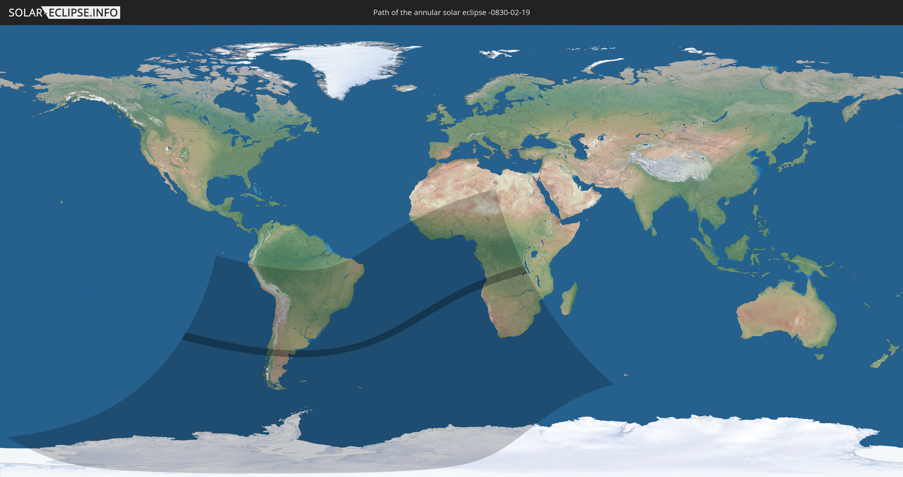
Die Sonnenfinsternis am 02/19/-0830 kann man in 47 Ländern als partielle Sonnenfinsternis beobachten.
Der Finsternispfad verläuft durch 5 Länder. Nur in diesen Ländern ist sie als annular Sonnenfinsternis zu sehen.
In den folgenden Ländern ist die Sonnenfinsternis annular zu sehen
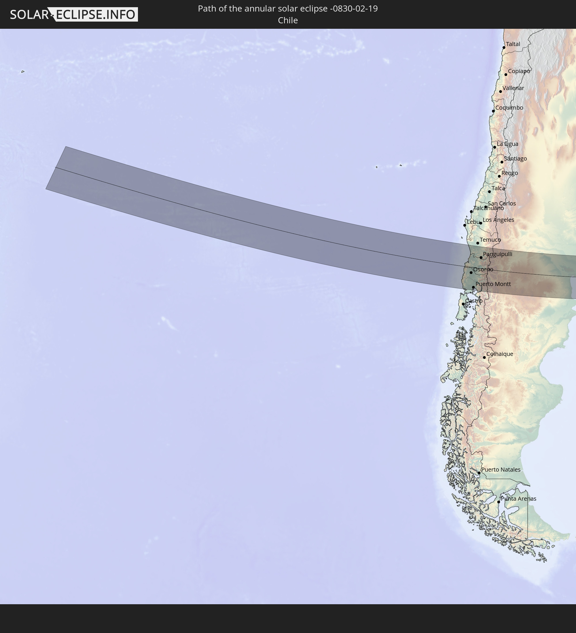 Chile
Chile
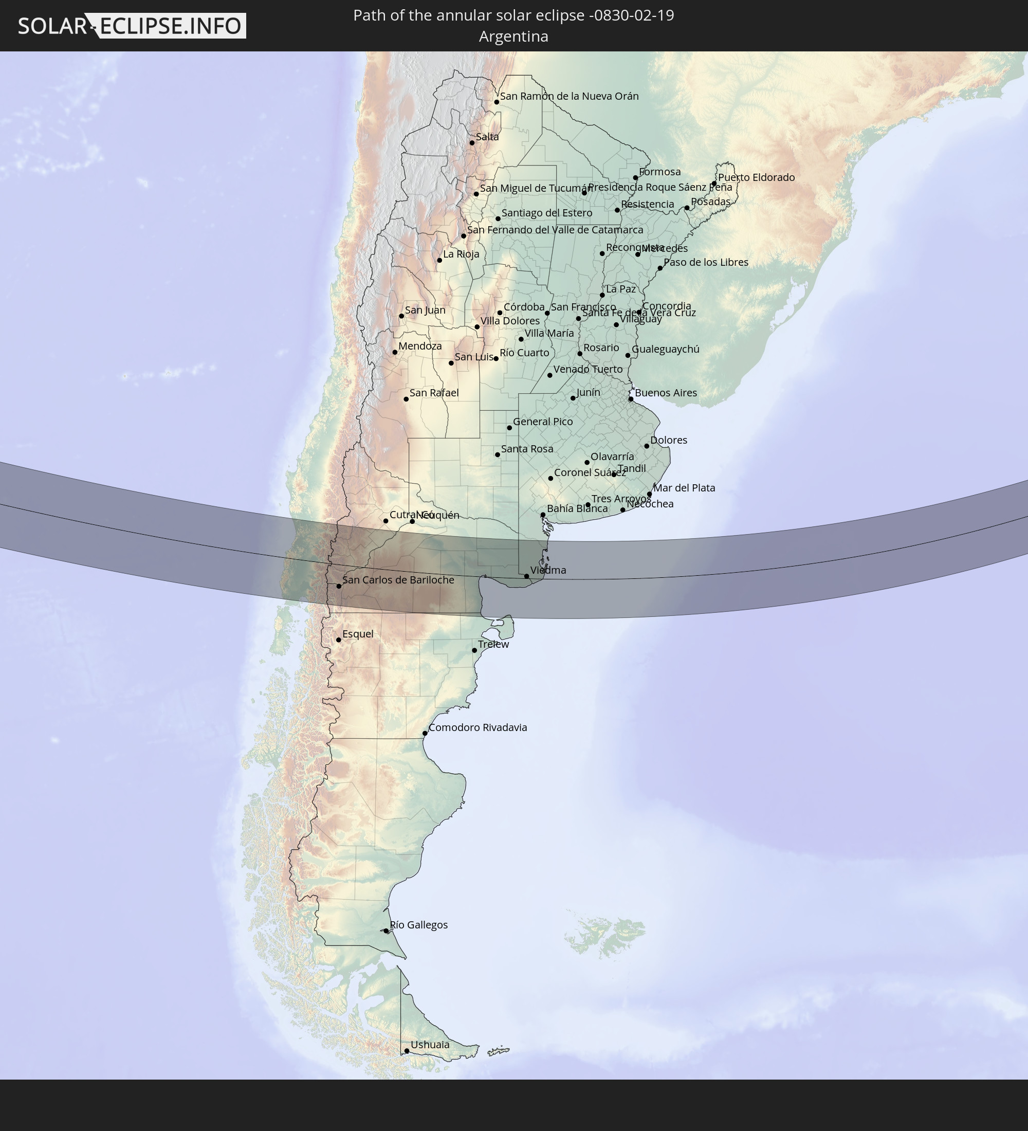 Argentina
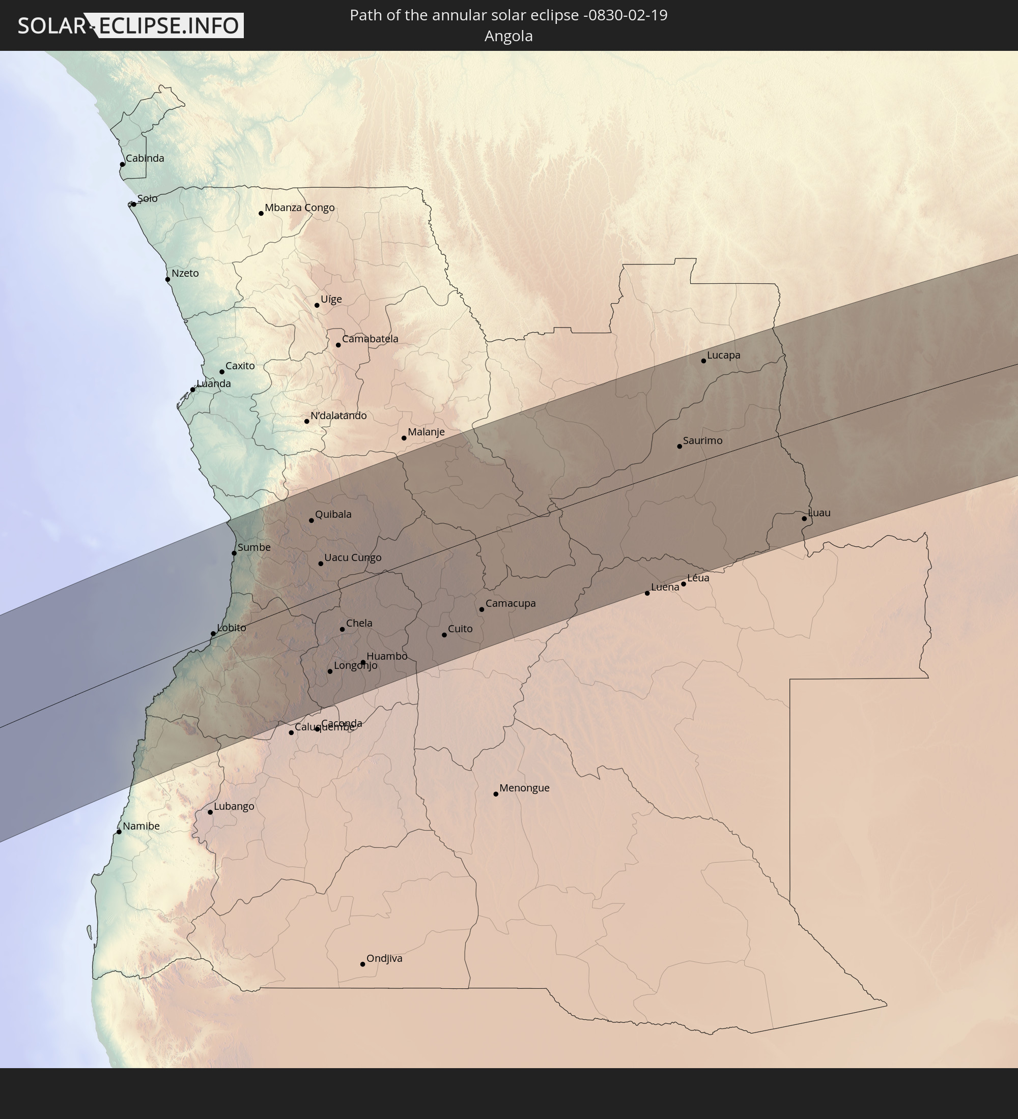 Angola
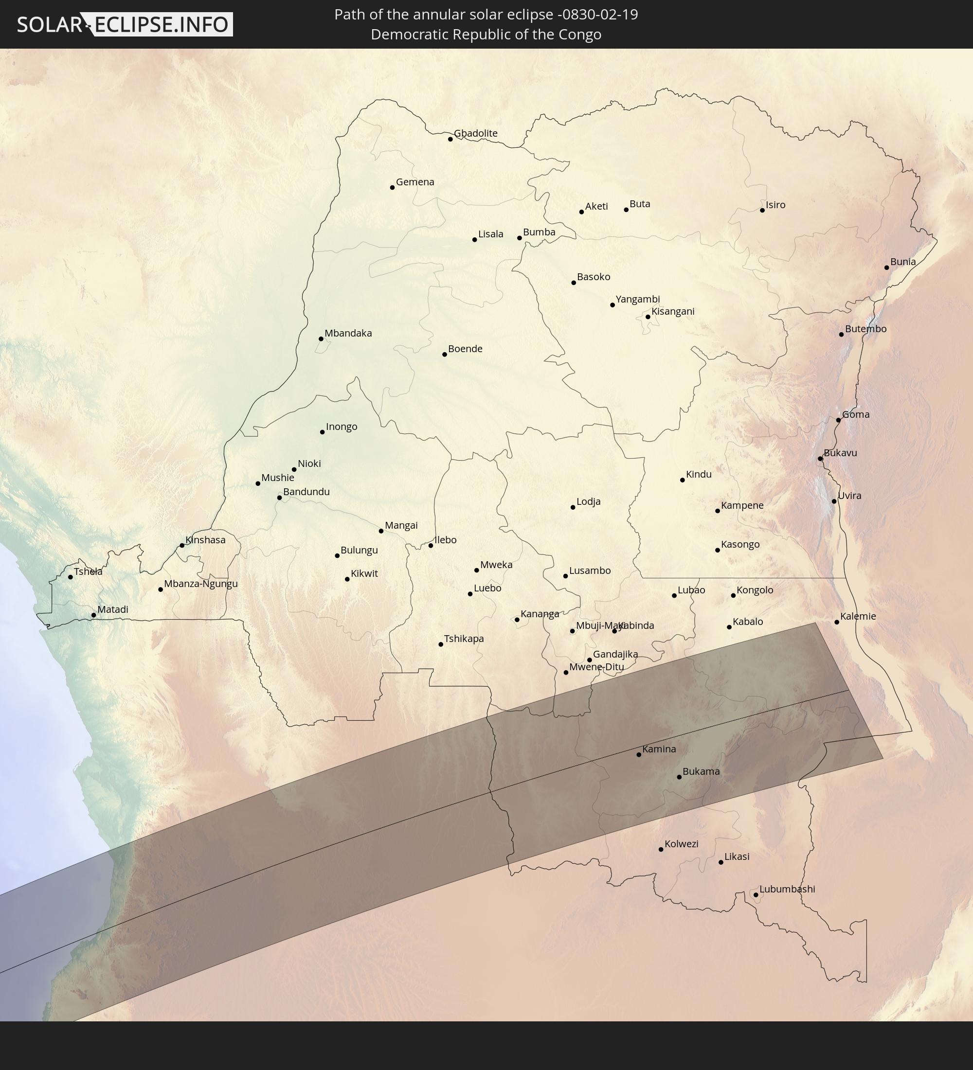 Democratic Republic of the Congo
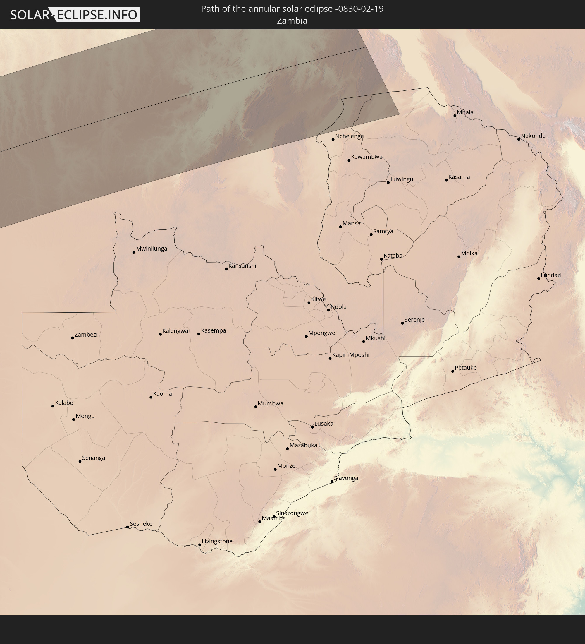 Zambia
In den folgenden Ländern ist die Sonnenfinsternis partiell zu sehen
 Antarctica
 Chile
Chile
 Peru
Peru
 Brazil
 Argentina
 Bolivia
 Paraguay
 Falkland Islands
 Uruguay
 South Georgia and the South Sandwich Islands
 Senegal
 Mauritania
 Guinea-Bissau
 Guinea
 Saint Helena, Ascension and Tristan da Cunha
 Sierra Leone
 Mali
Mali
 Liberia
 Algeria
 Ivory Coast
 Burkina Faso
 Ghana
Ghana
 Togo
Togo
 Niger
Niger
 Benin
Benin
 Nigeria
 Bouvet Island
 Equatorial Guinea
 São Tomé and Príncipe
 Cameroon
 Gabon
Gabon
 Libya
Libya
 Republic of the Congo
 Angola
 Namibia
 Democratic Republic of the Congo
 Chad
Chad
 Central African Republic
 South Africa
 Botswana
 Zambia
 Zimbabwe
 Lesotho
 Mozambique
 Swaziland
 Malawi
 French Southern and Antarctic Lands
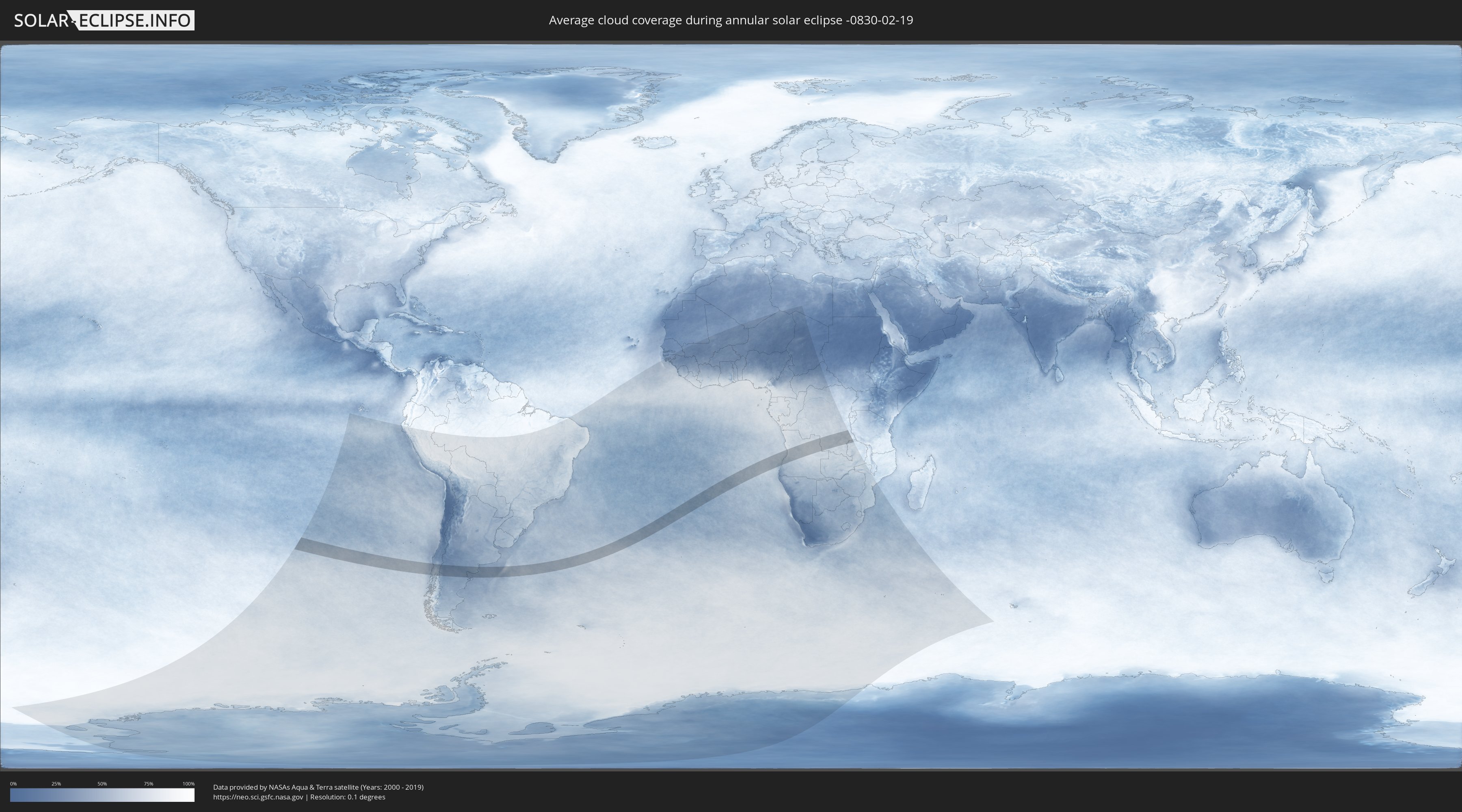
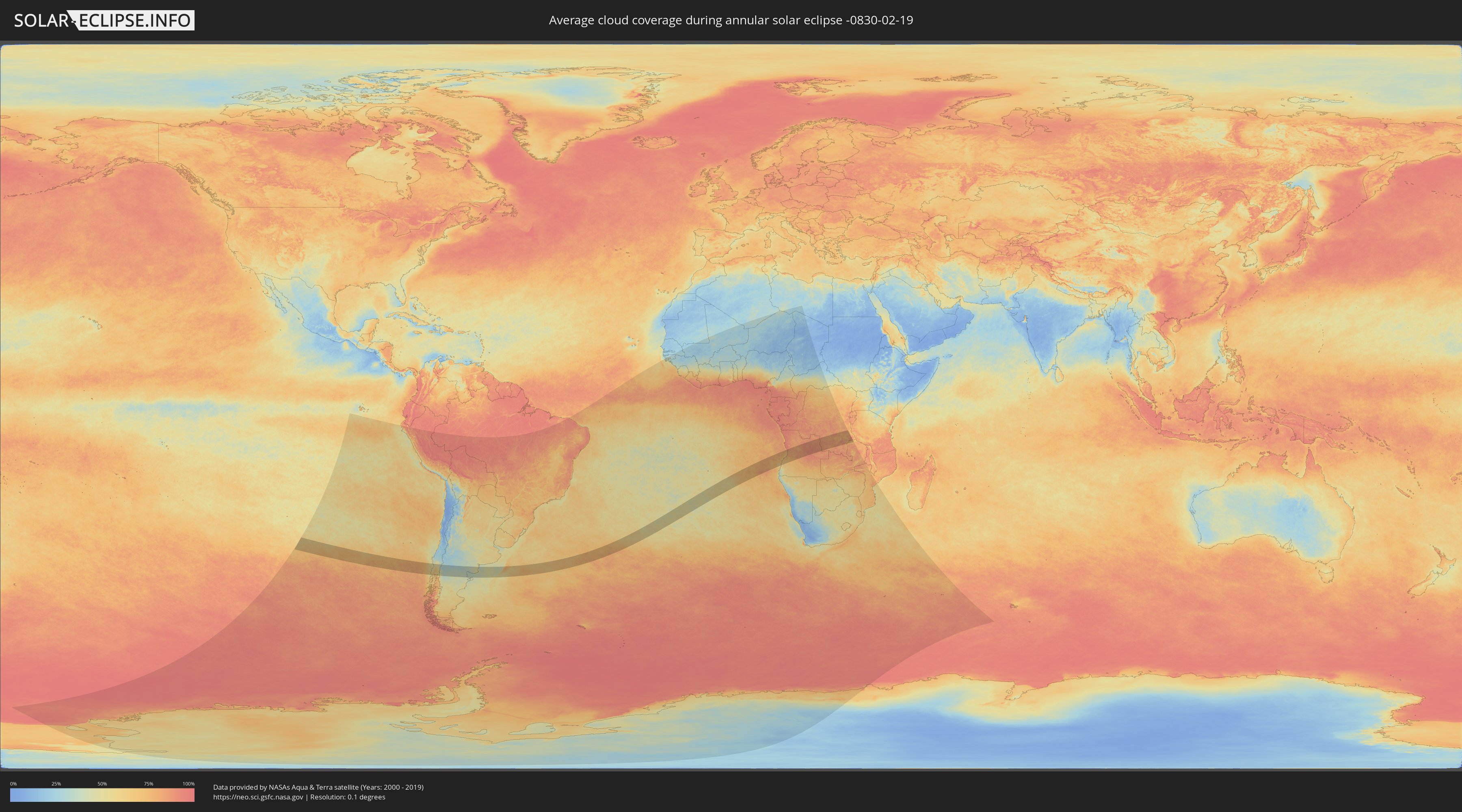
How will be the weather during the annular solar eclipse on 02/19/-0830?
Where is the best place to see the annular solar eclipse of 02/19/-0830?
The following maps show the average cloud coverage for the day of the annular solar eclipse.
With the help of these maps, it is possible to find the place along the eclipse path, which has the best
chance of a cloudless sky.
Nevertheless, you should consider local circumstances and inform about the weather of your chosen
observation site.
The data is provided by NASAs satellites
AQUA and TERRA.
The cloud maps are averaged over a period of 19 years (2000 - 2019).
Detailed country maps
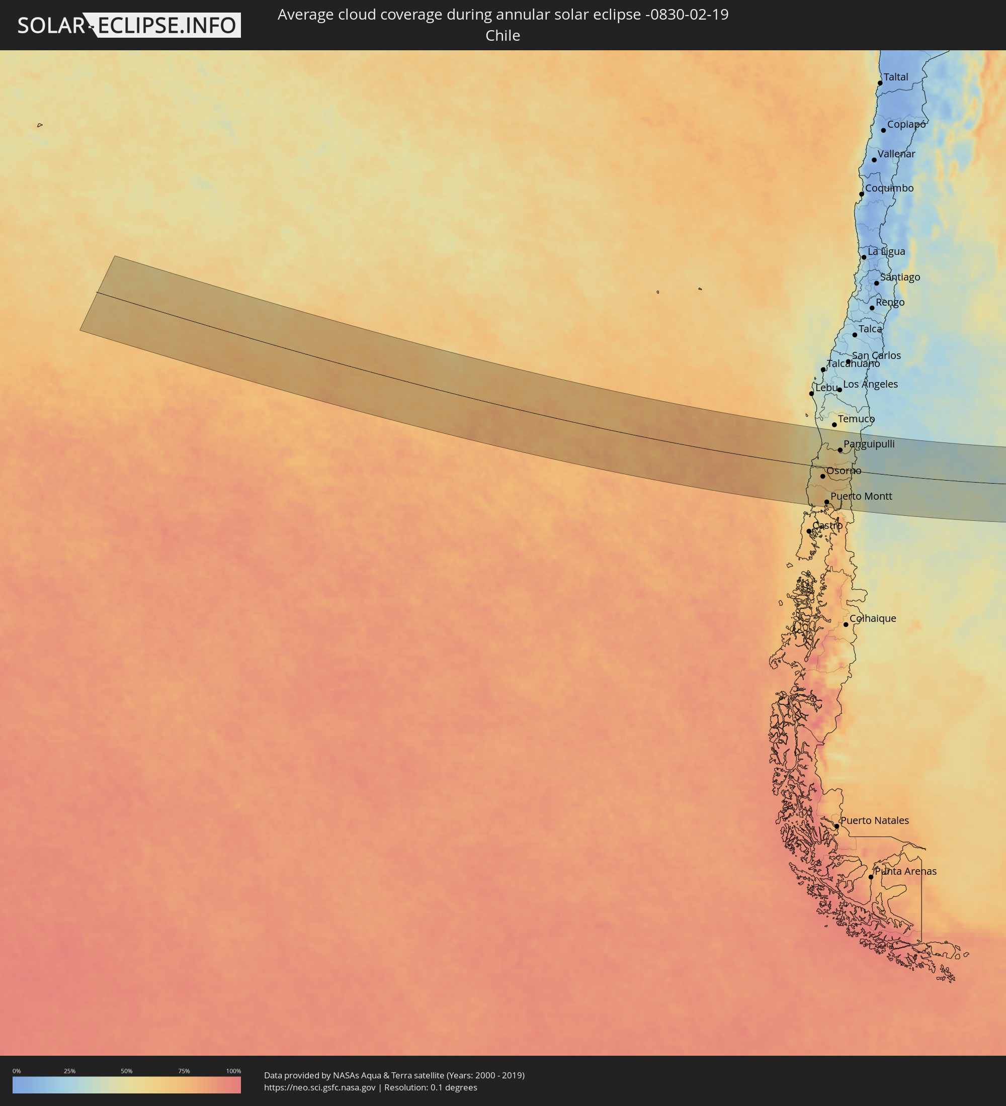 Chile
Chile
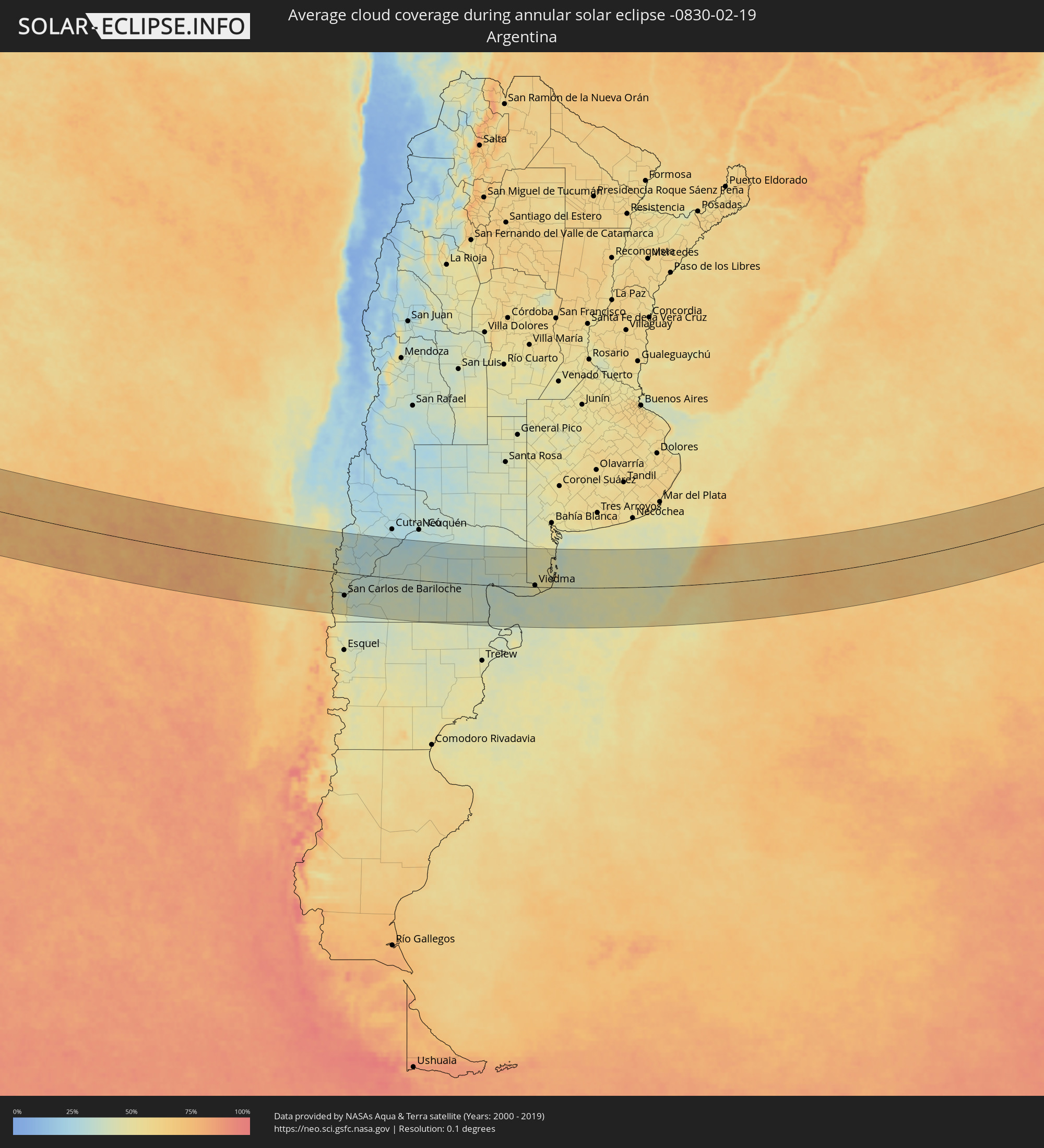 Argentina
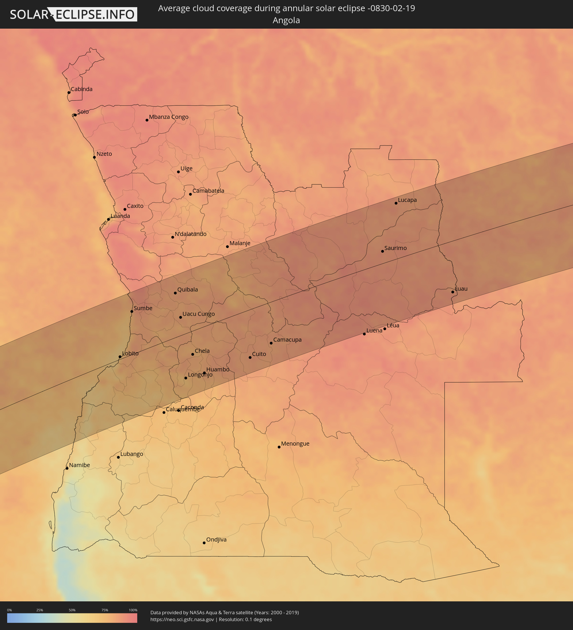 Angola
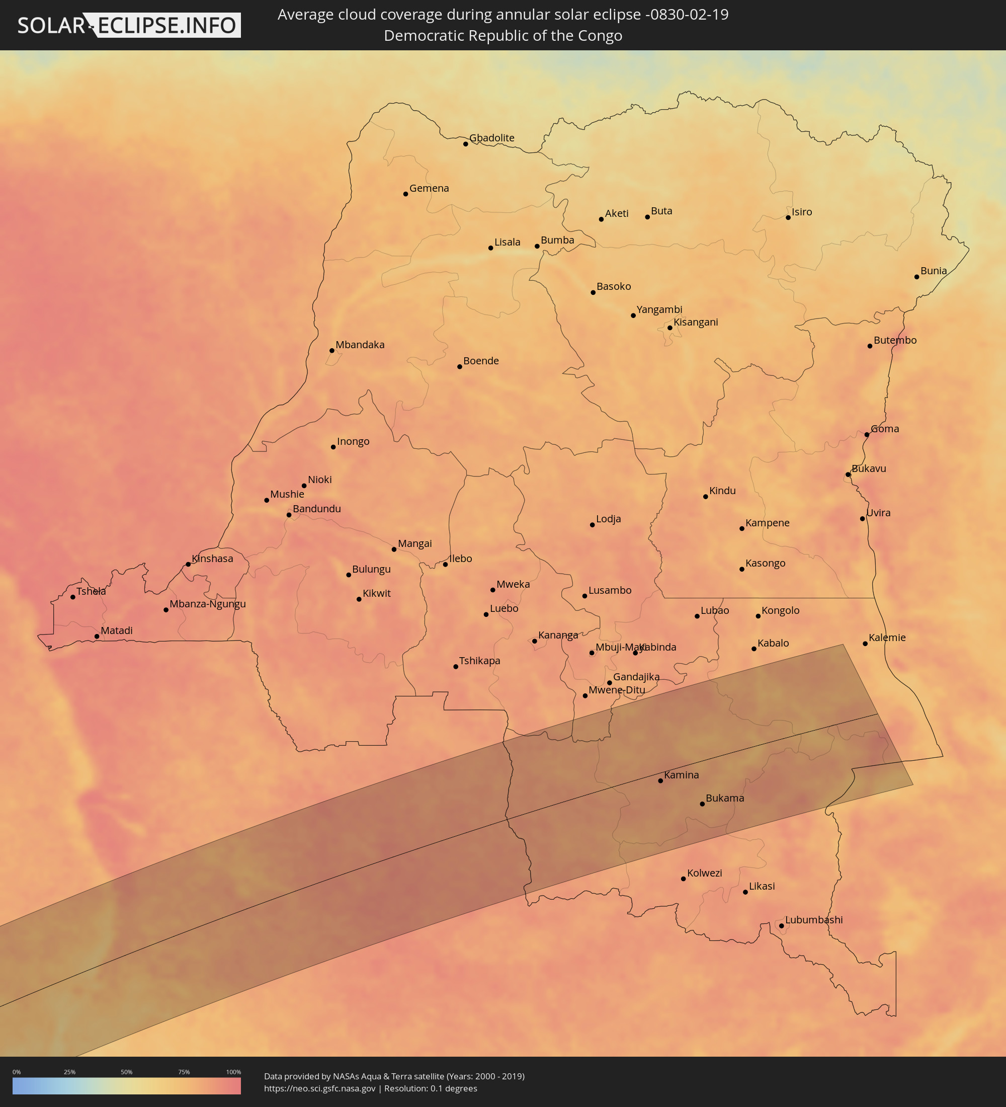 Democratic Republic of the Congo
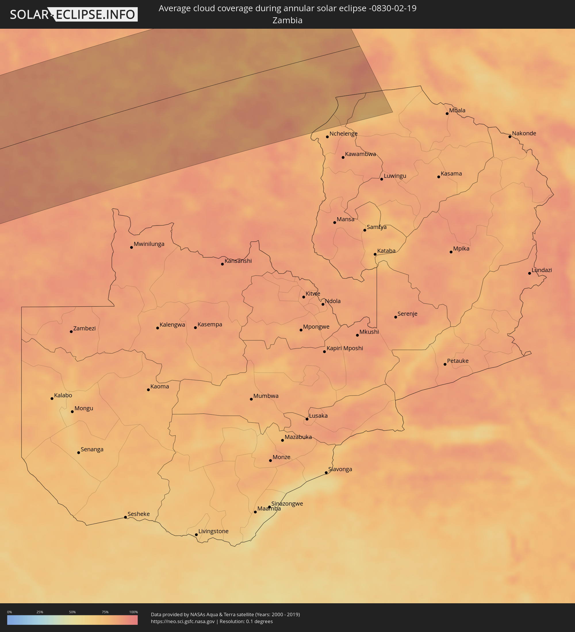 Zambia
Cities inside the path of the eclipse
The following table shows all locations with a population of more than 5,000 inside the eclipse path. Cities which have more than 100,000 inhabitants are marked bold. A click at the locations opens a detailed map.
| City | Type | Eclipse duration | Local time of max. eclipse | Distance to central line | Ø Cloud coverage |
|
Valdivia, Los Ríos
|
annular | - | 08:21:39 UTC-04:42 | 44 km | 51% |
|
Las Animas, Los Lagos
|
annular | - | 08:21:41 UTC-04:42 | 45 km | 51% |
|
Purranque, Los Lagos
|
annular | - | 08:22:54 UTC-04:42 | 76 km | 67% |
|
Osorno, Los Lagos
|
annular | - | 08:22:34 UTC-04:42 | 38 km | 64% |
|
La Unión, Los Ríos
|
annular | - | 08:22:19 UTC-04:42 | 7 km | 64% |
|
Frutillar, Los Lagos
|
annular | - | 08:23:14 UTC-04:42 | 98 km | 63% |
|
Puerto Varas, Los Lagos
|
annular | - | 08:23:30 UTC-04:42 | 119 km | 68% |
|
Río Bueno, Los Ríos
|
annular | - | 08:22:30 UTC-04:42 | 10 km | 69% |
|
Puerto Montt, Los Lagos
|
annular | - | 08:23:42 UTC-04:42 | 135 km | 70% |
|
Pitrufquén, Araucanía
|
annular | - | 08:21:26 UTC-04:42 | 142 km | 51% |
|
Loncoche, Araucanía
|
annular | - | 08:21:50 UTC-04:42 | 100 km | 49% |
|
Freire, Araucanía
|
annular | - | 08:21:25 UTC-04:42 | 146 km | 51% |
|
Panguipulli, Araucanía
|
annular | - | 08:22:25 UTC-04:42 | 73 km | 50% |
|
Villarrica, Araucanía
|
annular | - | 08:22:10 UTC-04:42 | 114 km | 48% |
|
Pucón, Araucanía
|
annular | - | 08:22:28 UTC-04:42 | 117 km | 47% |
|
Villa La Angostura, Neuquén Province
|
annular | - | 08:50:16 UTC-04:16 | 43 km | 41% |
|
San Martín de los Andes, Neuquén Province
|
annular | - | 08:49:58 UTC-04:16 | 26 km | 41% |
|
San Carlos de Bariloche, Río Negro Province
|
annular | - | 08:51:02 UTC-04:16 | 82 km | 38% |
|
Junín de los Andes, Neuquén Province
|
annular | - | 08:50:04 UTC-04:16 | 52 km | 31% |
|
Ingeniero Jacobacci, Río Negro Province
|
annular | - | 08:53:11 UTC-04:16 | 87 km | 39% |
|
Sierra Grande, Río Negro Province
|
annular | - | 08:58:43 UTC-04:16 | 91 km | 38% |
|
San Antonio Oeste, Río Negro Province
|
annular | - | 08:58:30 UTC-04:16 | 8 km | 38% |
|
General Conesa, Río Negro Province
|
annular | - | 08:58:42 UTC-04:16 | 81 km | 41% |
|
Viedma, Río Negro Province
|
annular | - | 09:01:24 UTC-04:16 | 6 km | 47% |
|
Benguela, Benguela Province
|
annular | - | 16:35:24 UTC+00:13 | 11 km | 72% |
|
Lobito, Benguela Province
|
annular | - | 16:35:43 UTC+00:13 | 6 km | 76% |
|
Catumbela, Benguela Province
|
annular | - | 16:35:38 UTC+00:13 | 2 km | 76% |
|
Sumbe, Kwanza Sul
|
annular | - | 16:37:16 UTC+00:13 | 113 km | 77% |
|
Quibala, Kwanza Sul
|
annular | - | 16:38:11 UTC+00:13 | 118 km | 83% |
|
Uacu Cungo, Kwanza Sul
|
annular | - | 16:37:28 UTC+00:13 | 47 km | 80% |
|
Longonjo, Huambo
|
annular | - | 16:35:34 UTC+00:13 | 119 km | 73% |
|
Chela, Huambo
|
annular | - | 16:36:23 UTC+00:13 | 63 km | 81% |
|
Caála, Huambo
|
annular | - | 16:35:44 UTC+00:13 | 125 km | 77% |
|
Huambo, Huambo
|
annular | - | 16:35:52 UTC+00:13 | 124 km | 77% |
|
Cuito, Bíe
|
annular | - | 16:36:40 UTC+00:13 | 129 km | 83% |
|
Catabola, Bíe
|
annular | - | 16:37:01 UTC+00:13 | 118 km | 84% |
|
Chissamba, Bíe
|
annular | - | 16:37:01 UTC+00:13 | 122 km | 84% |
|
Camacupa, Bíe
|
annular | - | 16:37:13 UTC+00:13 | 112 km | 82% |
|
Saurimo, Lunda Sul
|
annular | - | 16:40:18 UTC+00:13 | 32 km | 86% |
|
Lucapa, Luanda Norte
|
annular | - | 16:41:38 UTC+00:13 | 151 km | 87% |
|
Luau, Moxico
|
annular | - | 16:39:15 UTC+00:13 | 141 km | 88% |
|
Kamina, Katanga
|
annular | - | 18:37:58 UTC+02:10 | 19 km | 85% |
|
Bukama, Katanga
|
annular | - | 18:37:25 UTC+02:10 | 96 km | 79% |