Annular solar eclipse of 03/30/-0972
| Day of week: | Friday |
| Maximum duration of eclipse: | 02m08s |
| Maximum width of eclipse path: | 79 km |
| Saros cycle: | 33 |
| Coverage: | 97.9% |
| Magnitude: | 0.9787 |
| Gamma: | -0.3046 |
Wo kann man die Sonnenfinsternis vom 03/30/-0972 sehen?
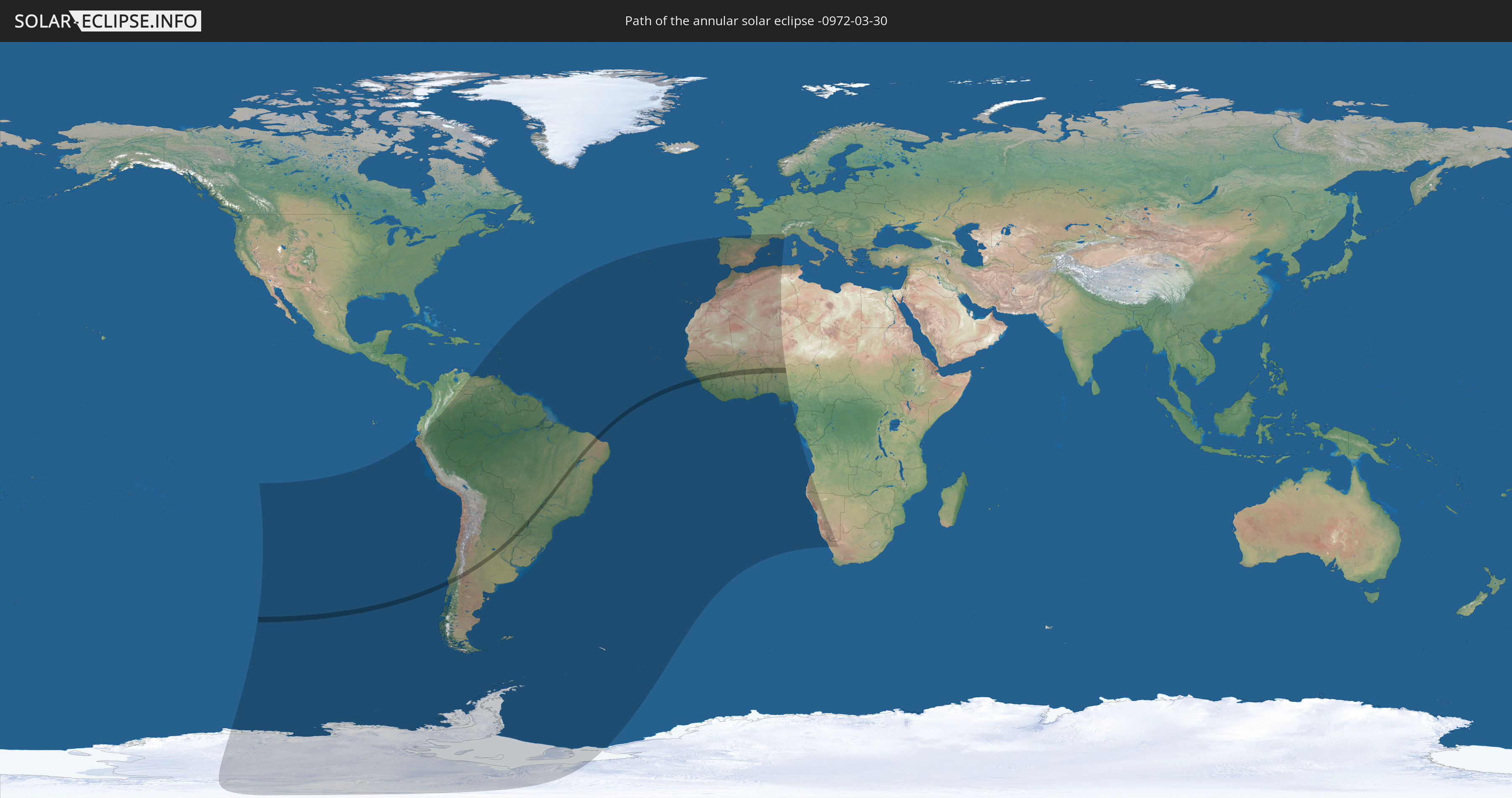
Die Sonnenfinsternis am 03/30/-0972 kann man in 57 Ländern als partielle Sonnenfinsternis beobachten.
Der Finsternispfad verläuft durch 14 Länder. Nur in diesen Ländern ist sie als annular Sonnenfinsternis zu sehen.
In den folgenden Ländern ist die Sonnenfinsternis annular zu sehen
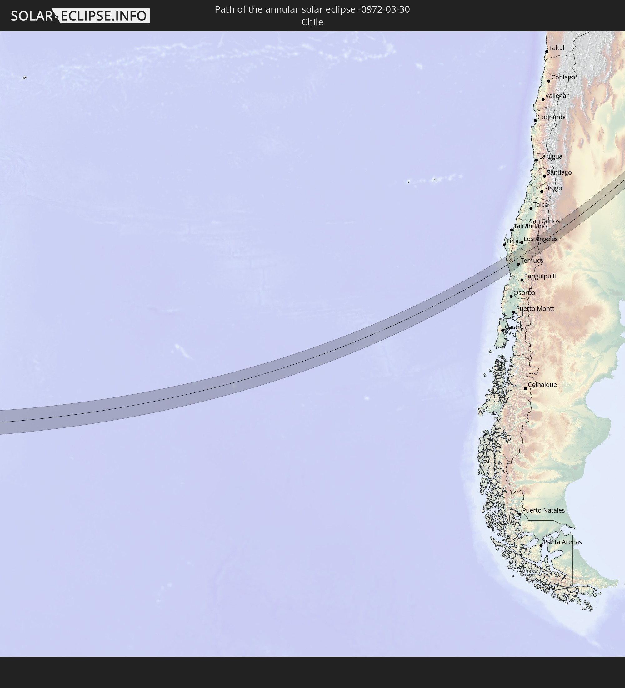 Chile
Chile
 Brazil
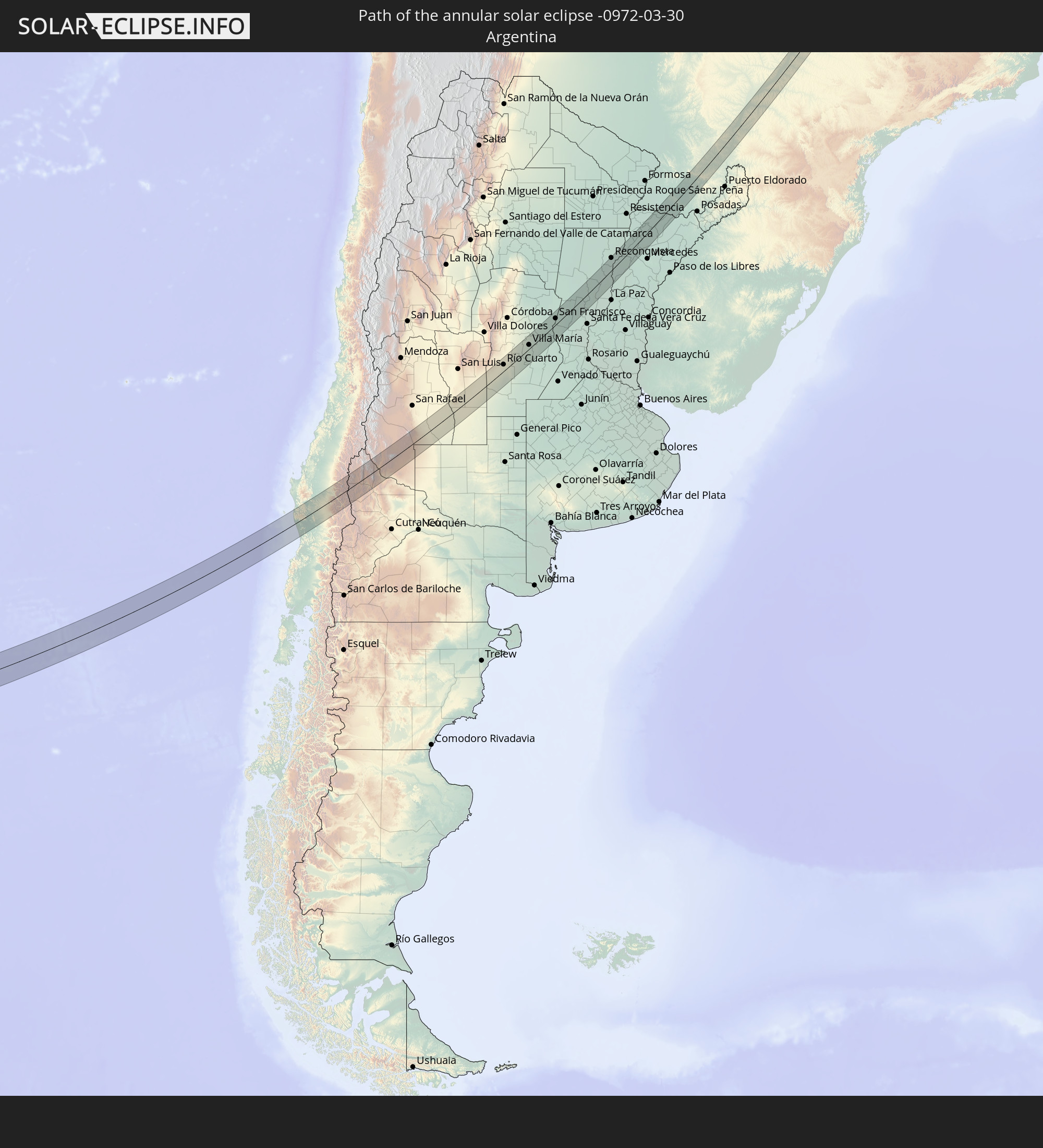 Argentina
 Paraguay
 Guinea
 Sierra Leone
 Mali
Mali
 Ivory Coast
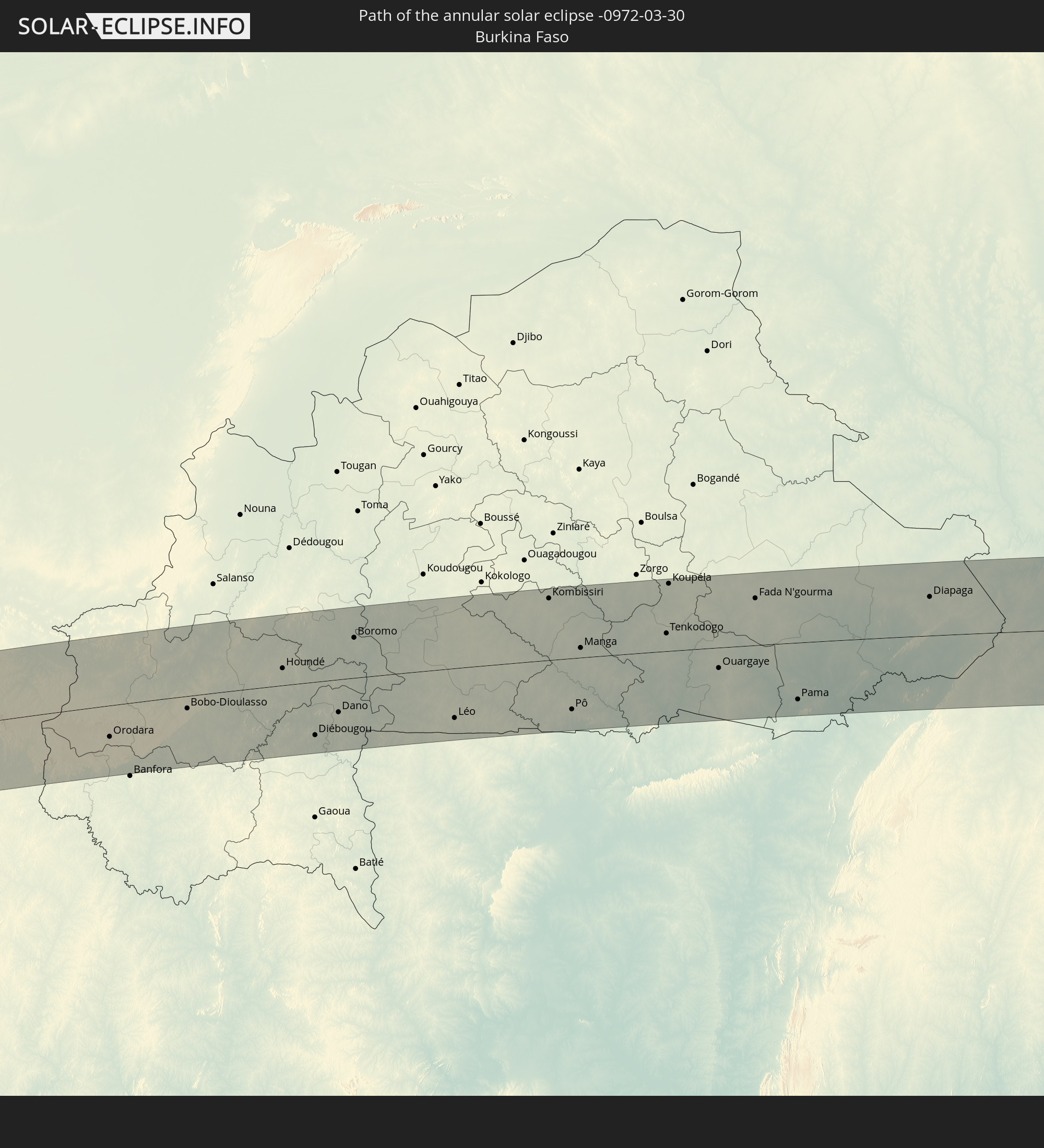 Burkina Faso
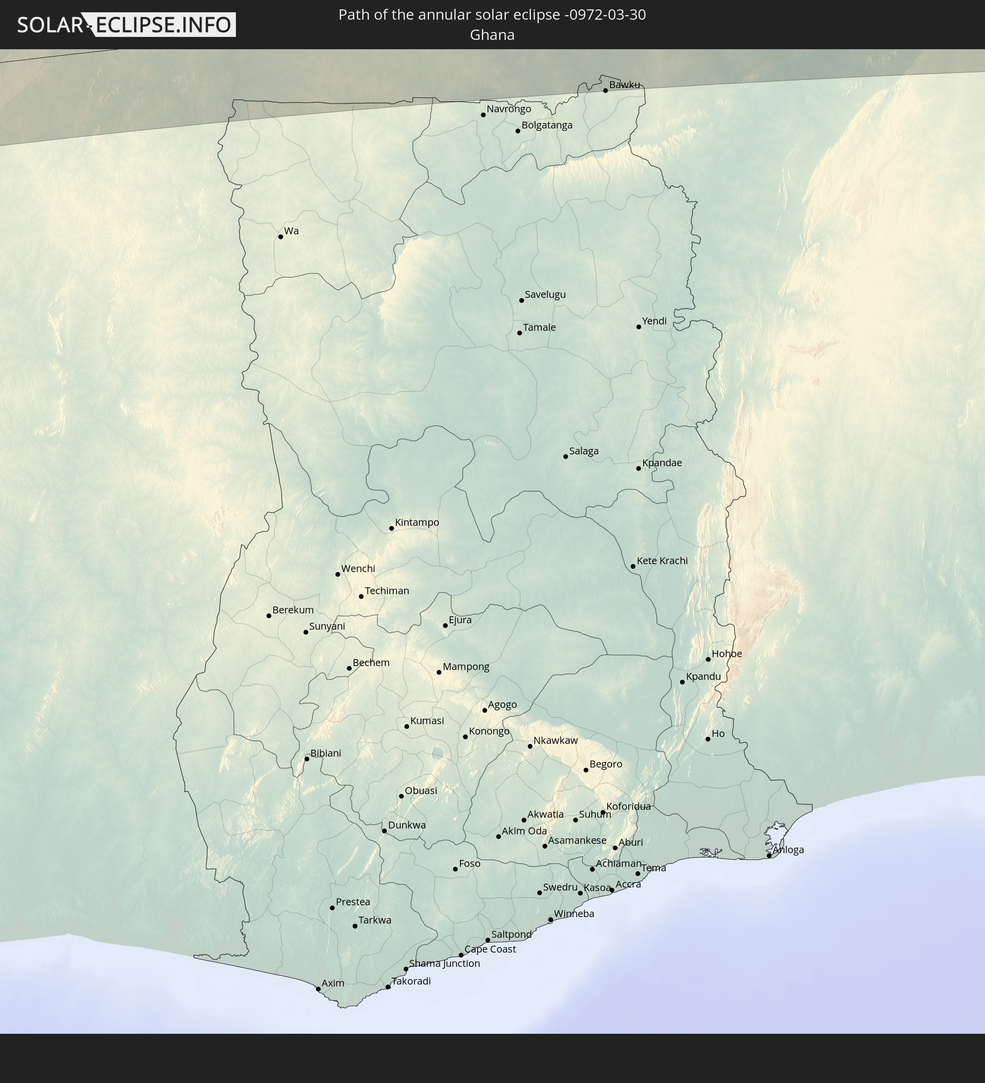 Ghana
Ghana
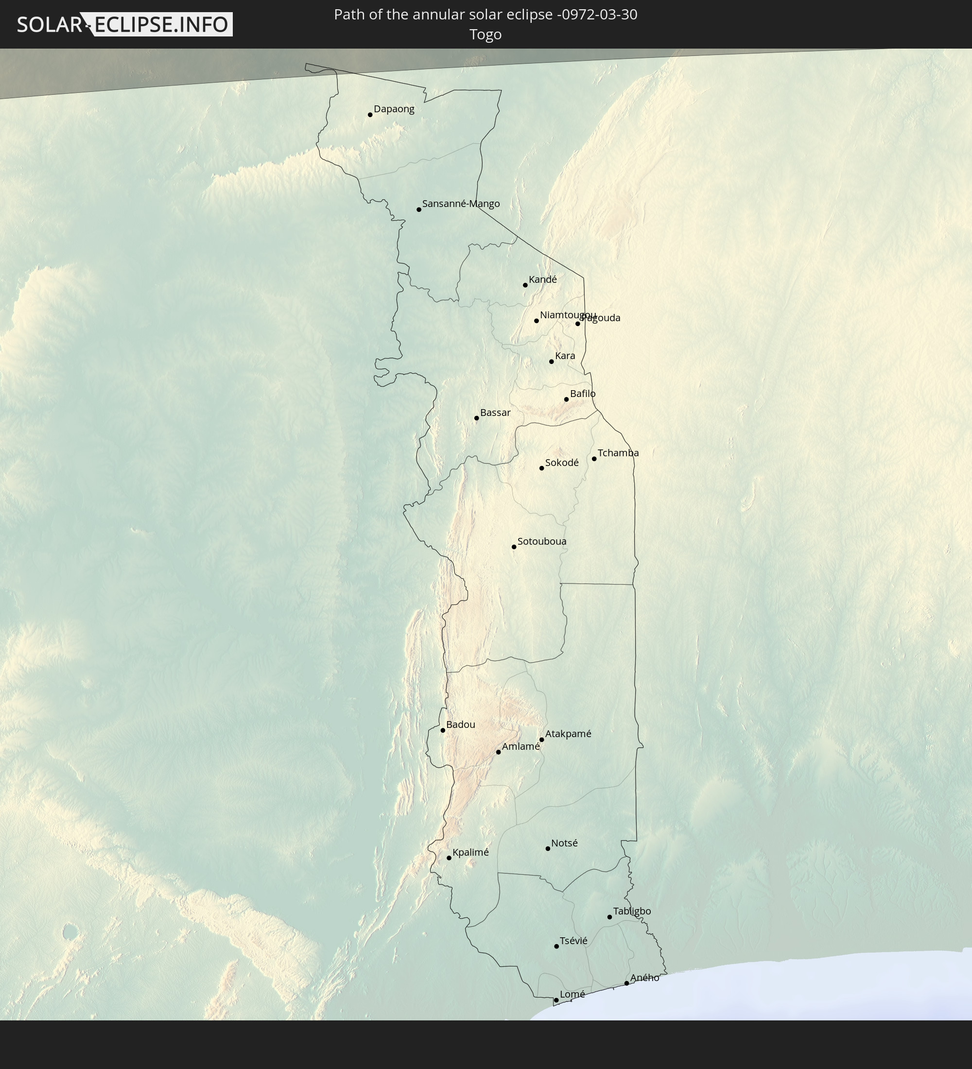 Togo
Togo
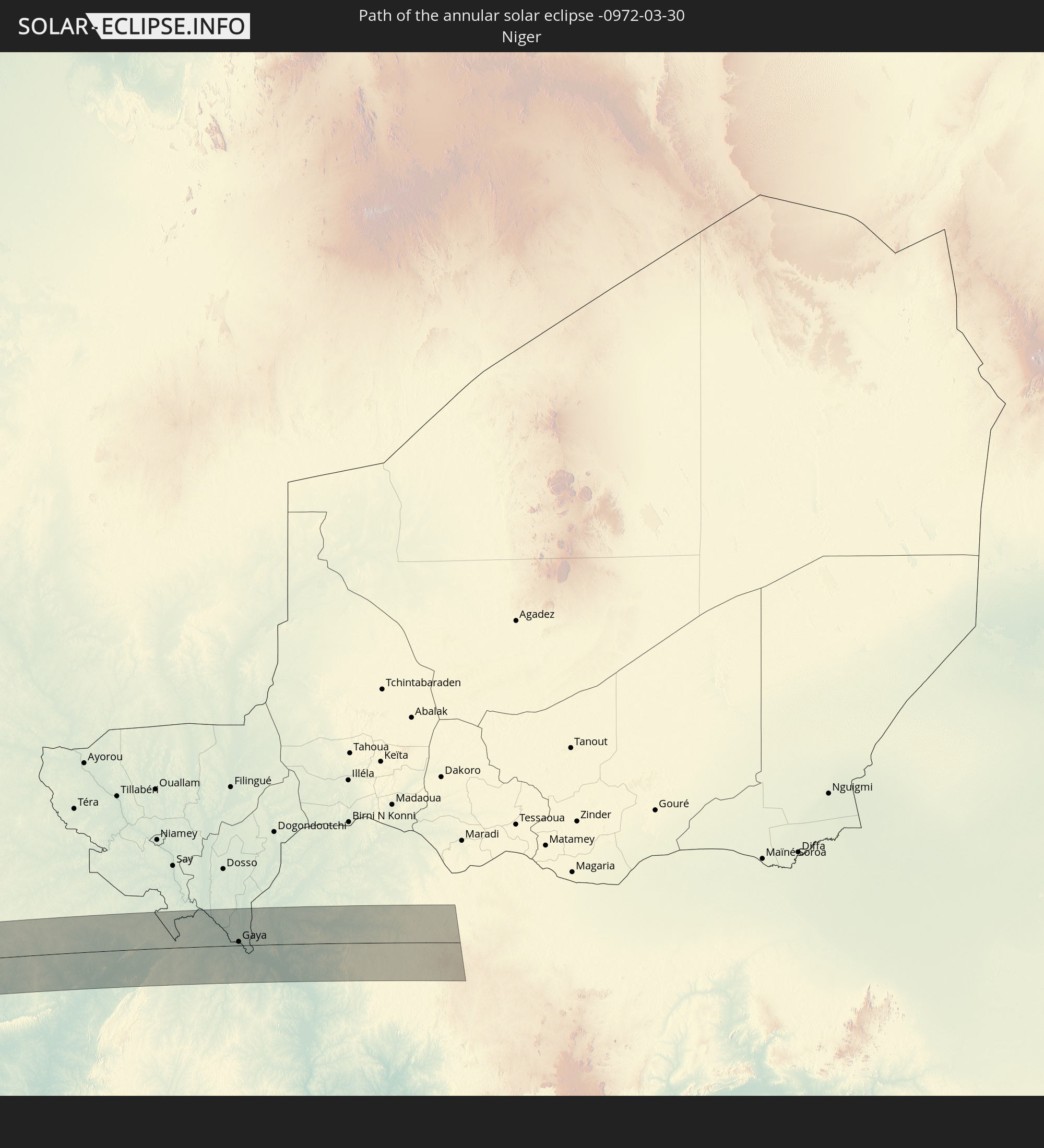 Niger
Niger
 Benin
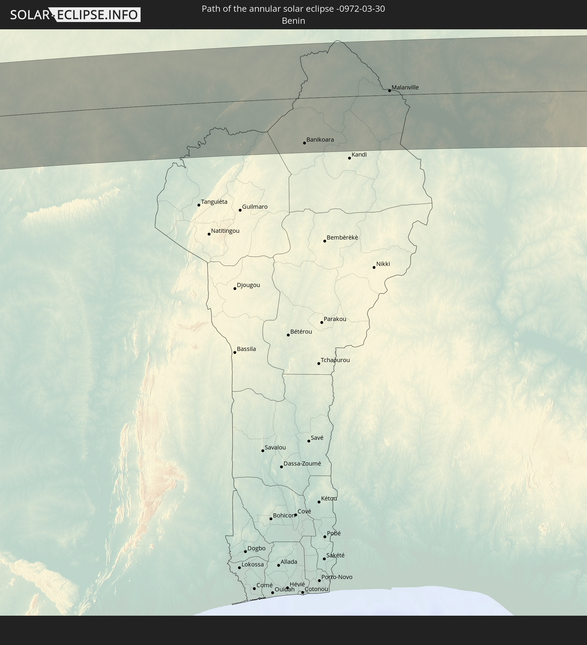
Benin
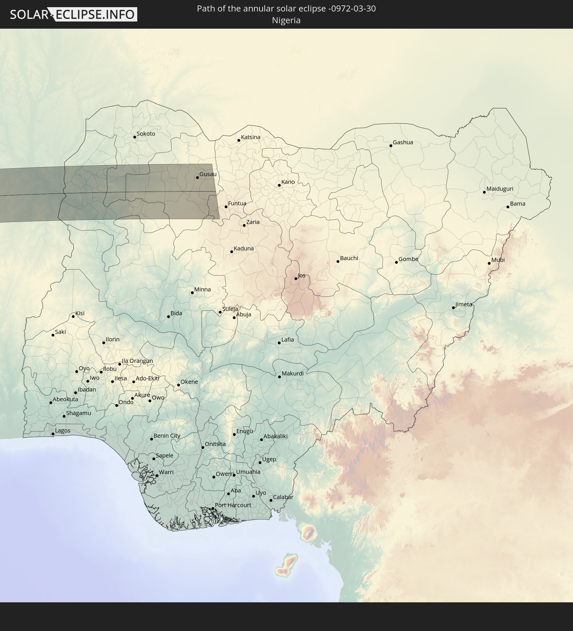 Nigeria
In den folgenden Ländern ist die Sonnenfinsternis partiell zu sehen
 Antarctica
 Chile
Chile
 Ecuador
 Colombia
 Peru
Peru
 Brazil
 Argentina
 Venezuela
 Bolivia
 Saint Kitts and Nevis
 Paraguay
 Antigua and Barbuda
 Montserrat
 Trinidad and Tobago
 Guadeloupe
 Grenada
 Dominica
 Saint Vincent and the Grenadines
 Falkland Islands
 Guyana
 Martinique
 Saint Lucia
 Barbados
 Uruguay
 Suriname
 French Guiana
 South Georgia and the South Sandwich Islands
 Portugal
 Cabo Verde
 Spain
Spain
 Senegal
 Mauritania
 The Gambia
 Guinea-Bissau
 Guinea
 Saint Helena, Ascension and Tristan da Cunha
 Sierra Leone
 Morocco
 Mali
Mali
 Liberia
 Algeria
 Ivory Coast
 Burkina Faso
 Gibraltar
 France
 Ghana
Ghana
 Togo
Togo
 Niger
Niger
 Benin
Benin
 Andorra
 Nigeria
 Equatorial Guinea
 São Tomé and Príncipe
 Gabon
Gabon
 Angola
 Namibia
 South Africa
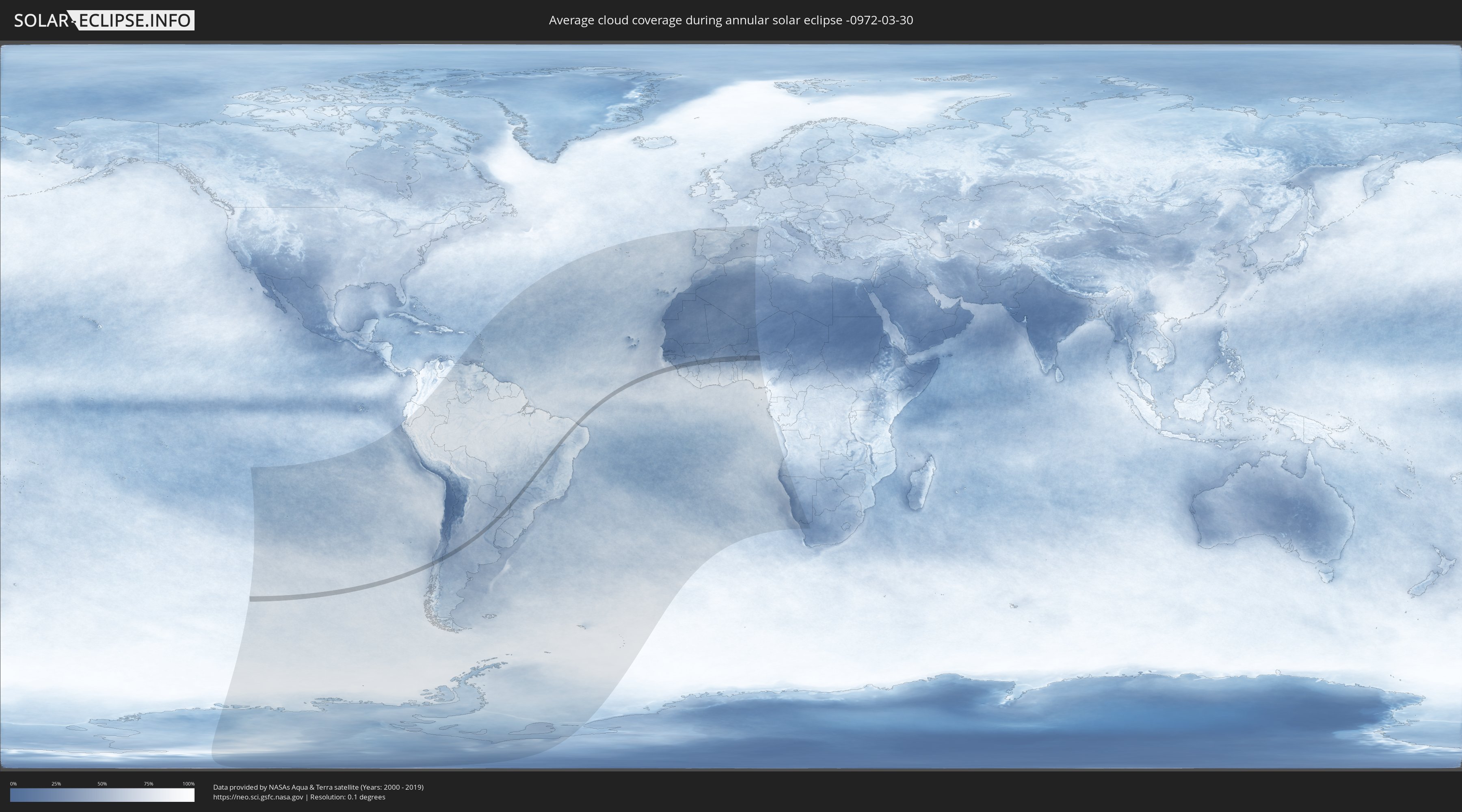
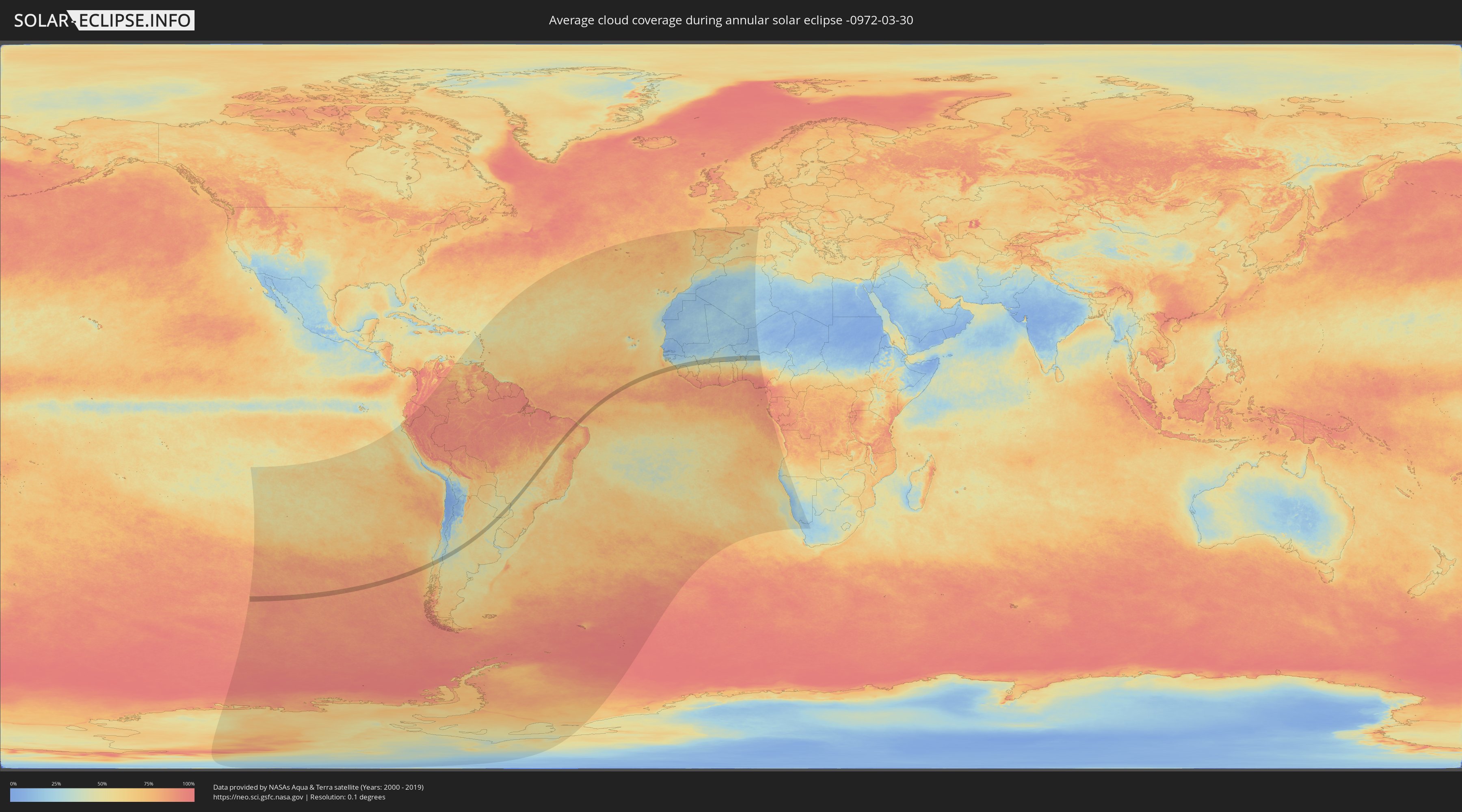
How will be the weather during the annular solar eclipse on 03/30/-0972?
Where is the best place to see the annular solar eclipse of 03/30/-0972?
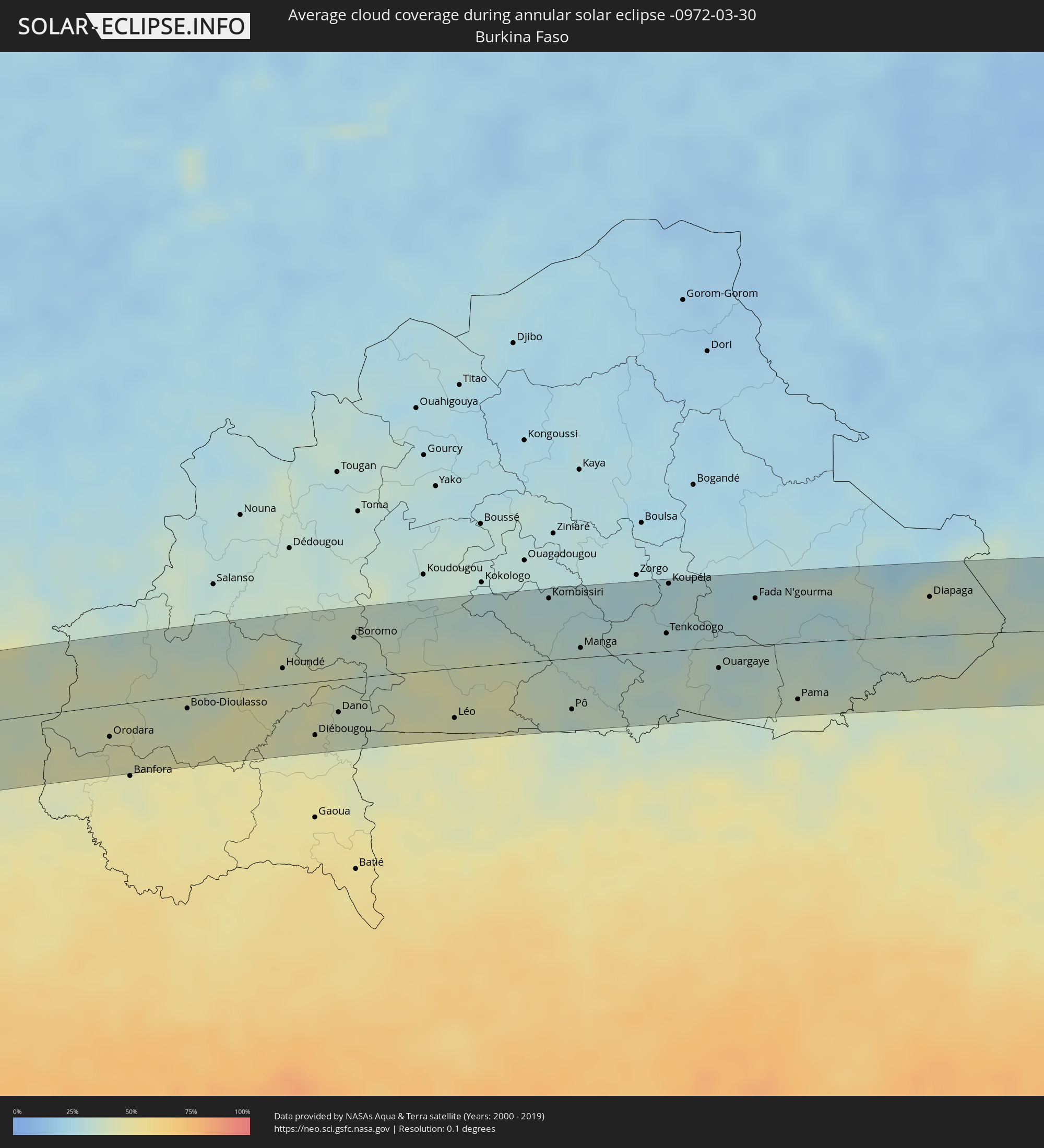
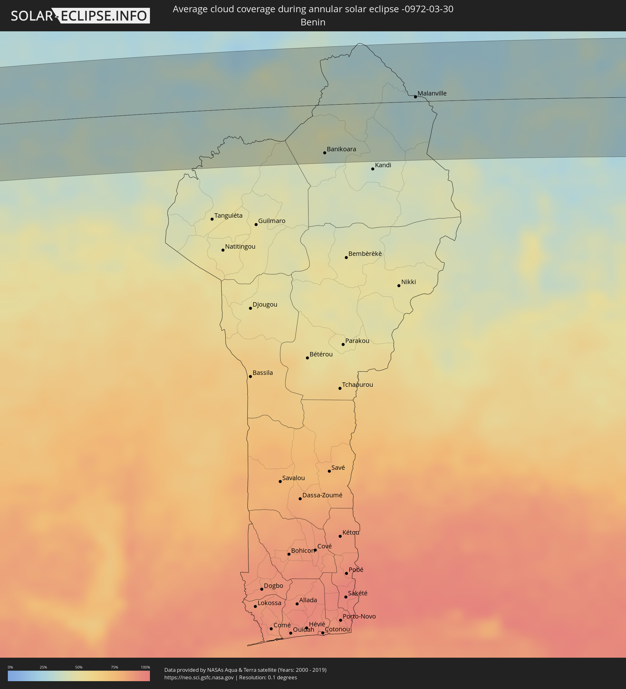
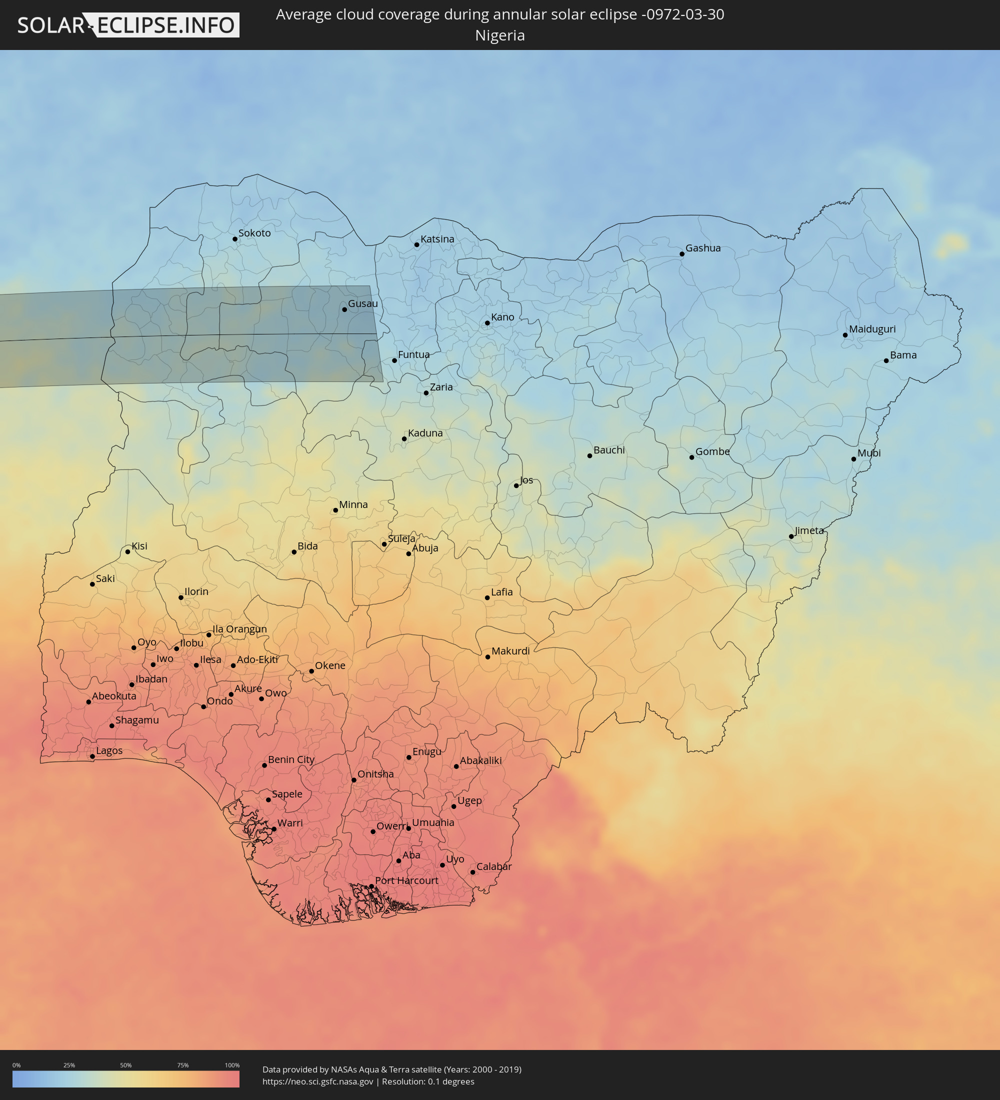
The following maps show the average cloud coverage for the day of the annular solar eclipse.
With the help of these maps, it is possible to find the place along the eclipse path, which has the best
chance of a cloudless sky.
Nevertheless, you should consider local circumstances and inform about the weather of your chosen
observation site.
The data is provided by NASAs satellites
AQUA and TERRA.
The cloud maps are averaged over a period of 19 years (2000 - 2019).
Detailed country maps
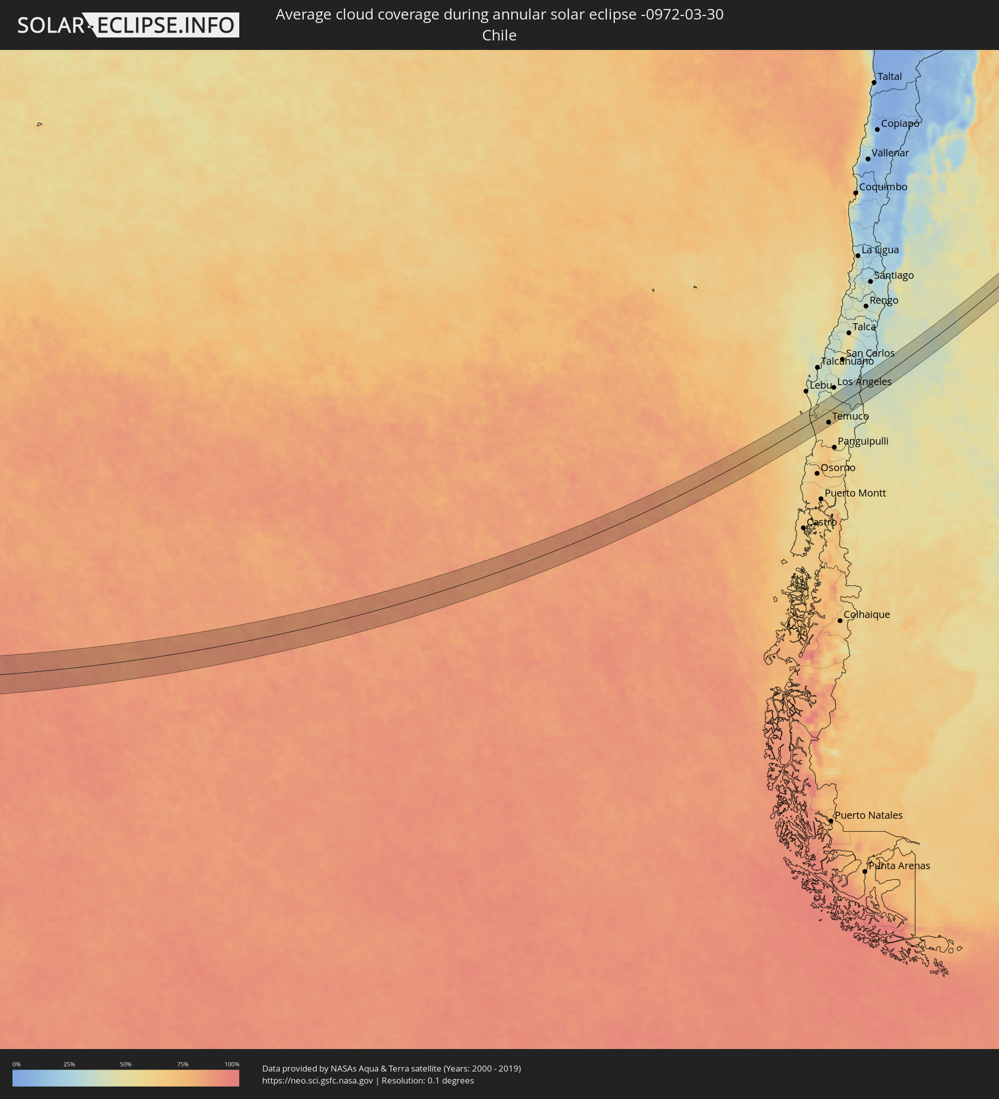 Chile
Chile
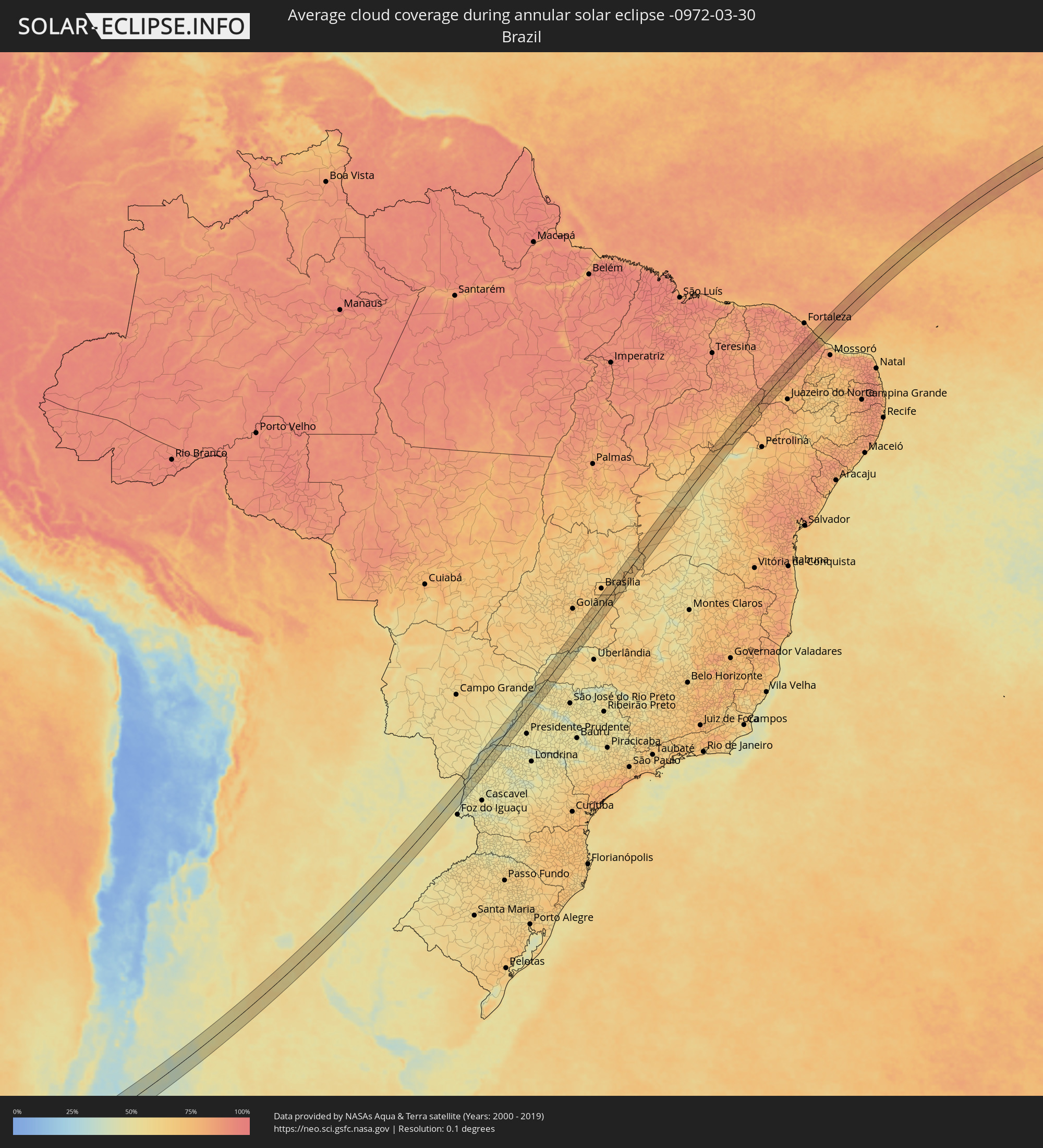 Brazil
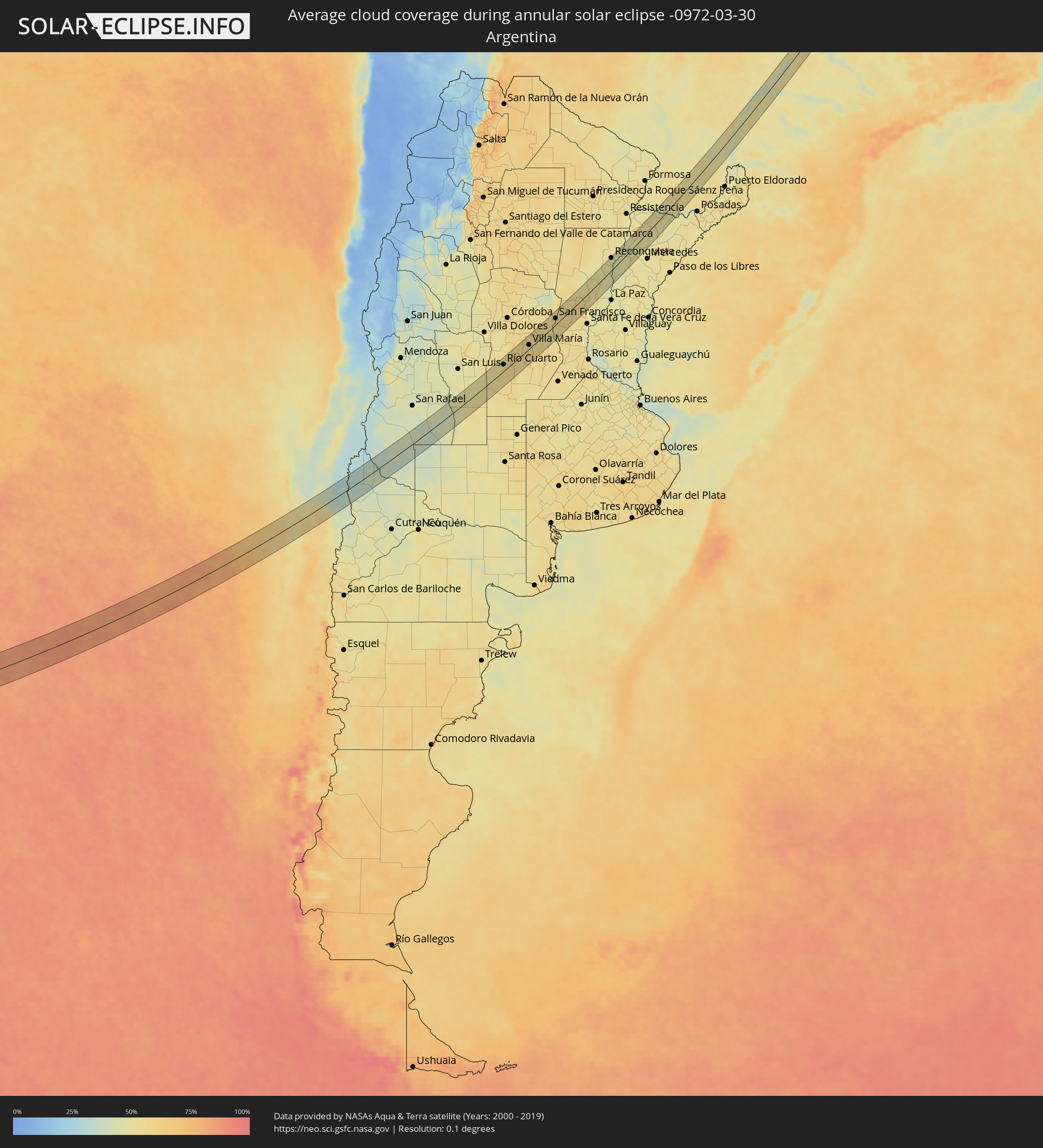 Argentina
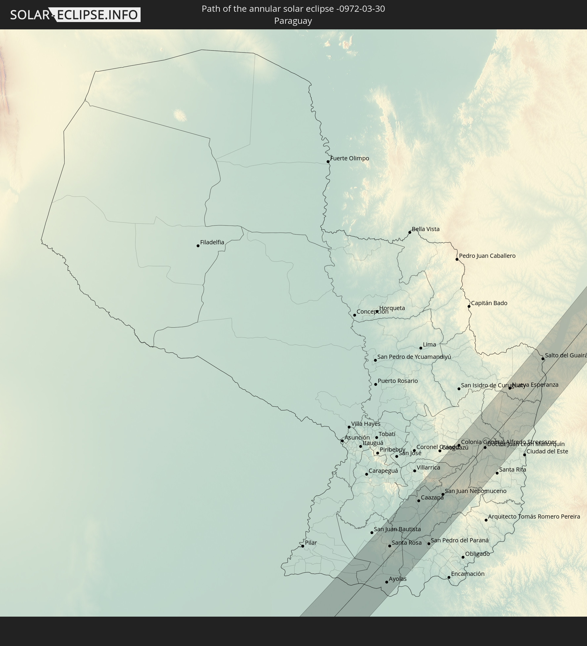
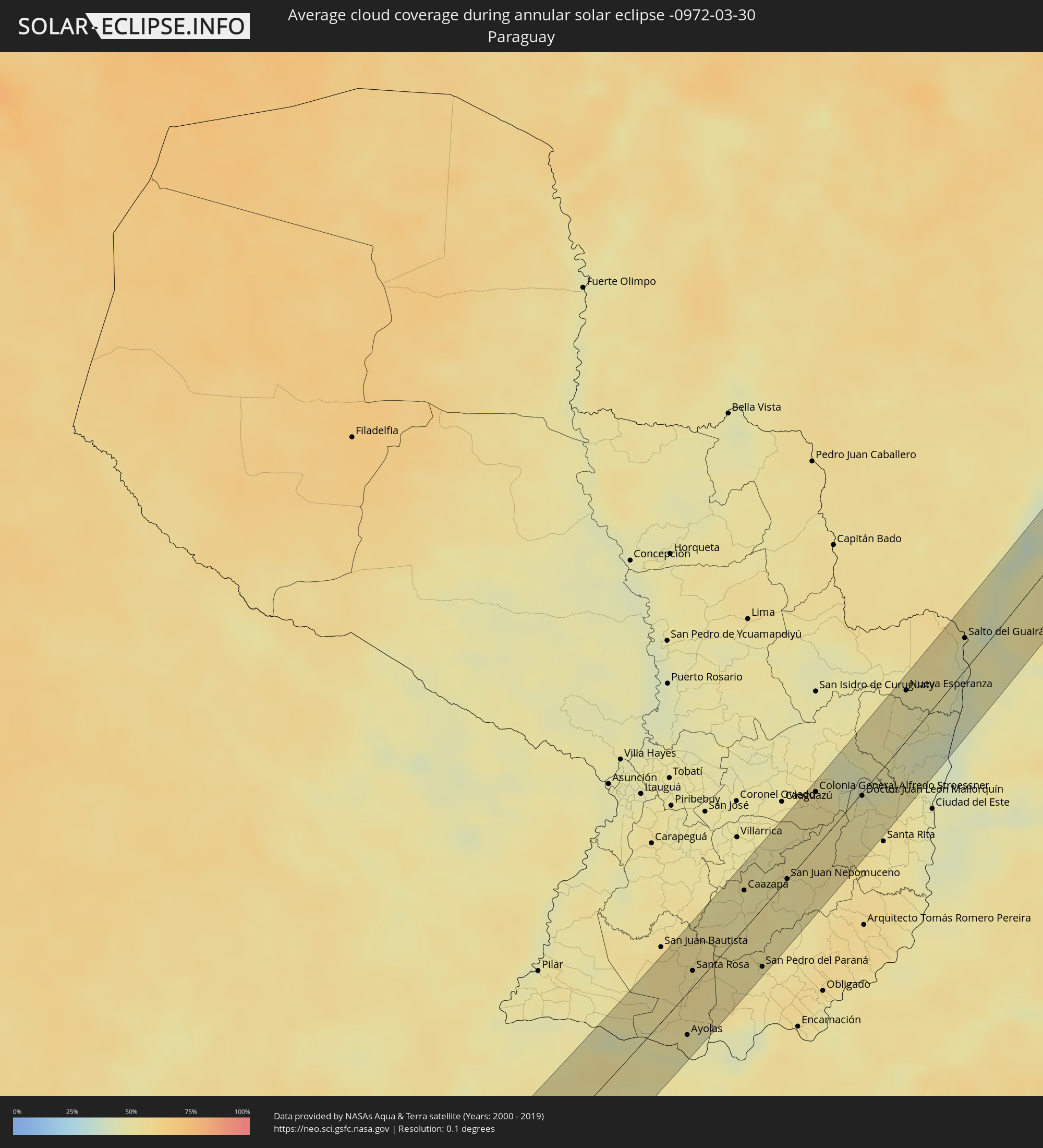 Paraguay
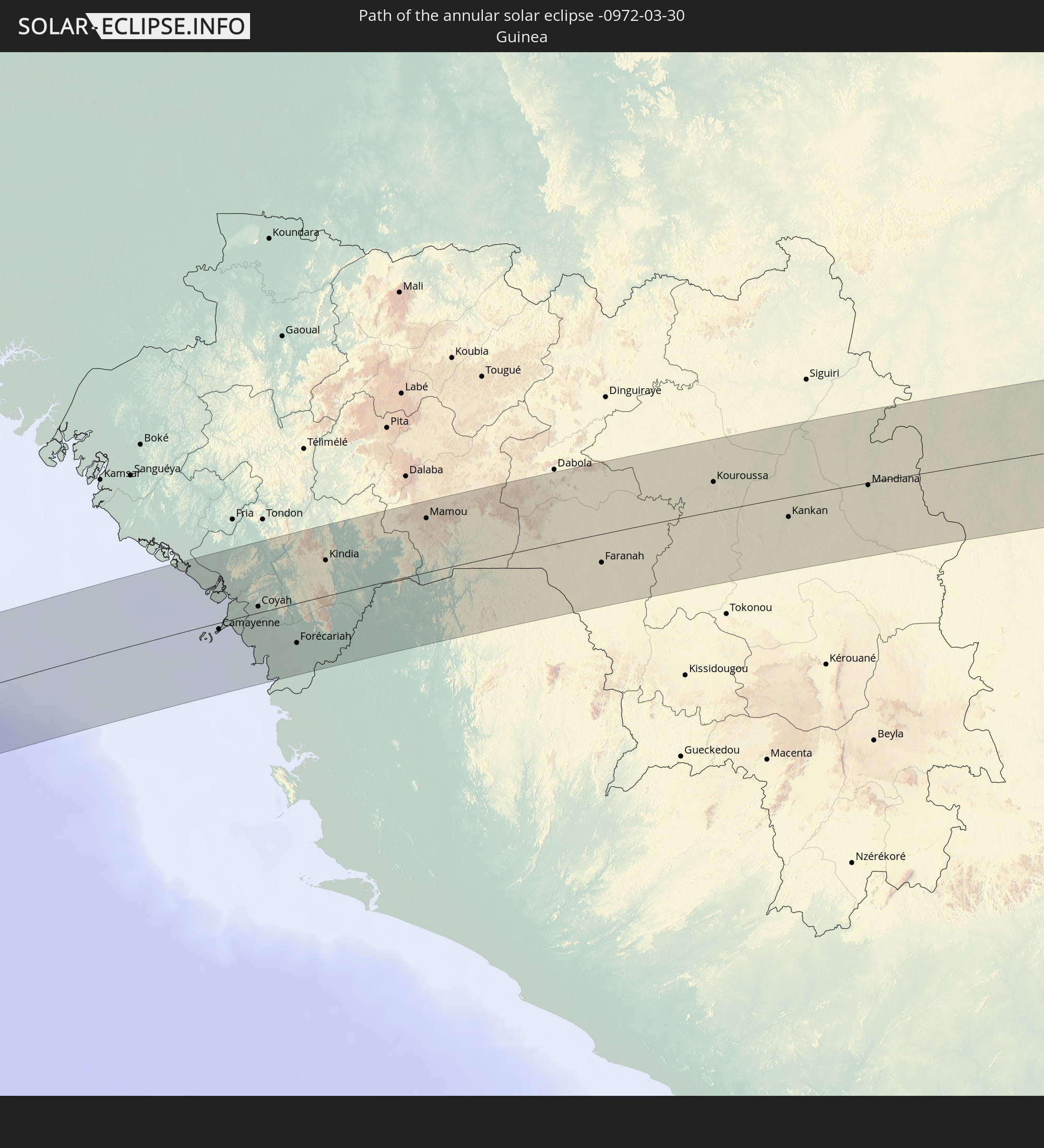
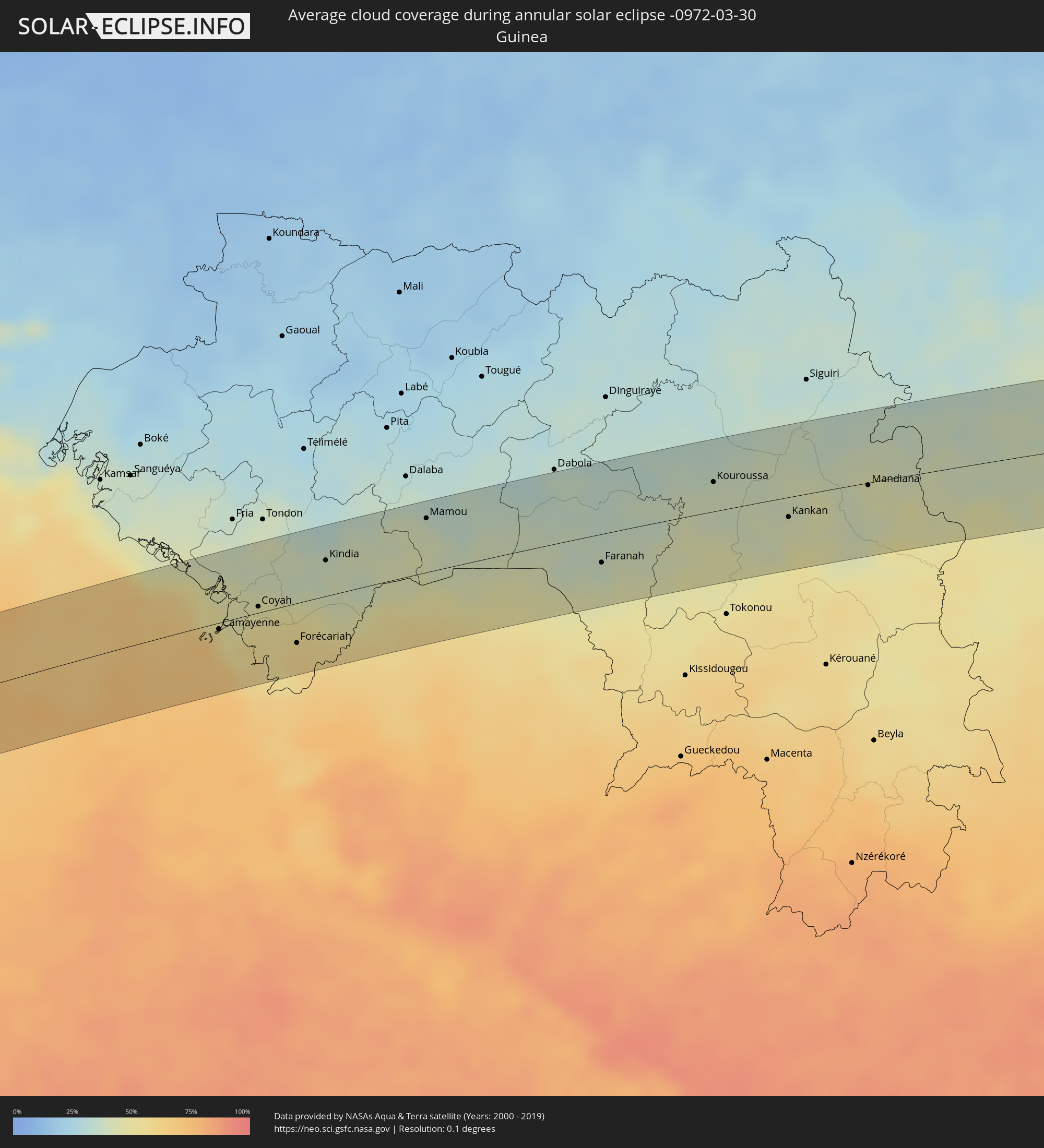 Guinea
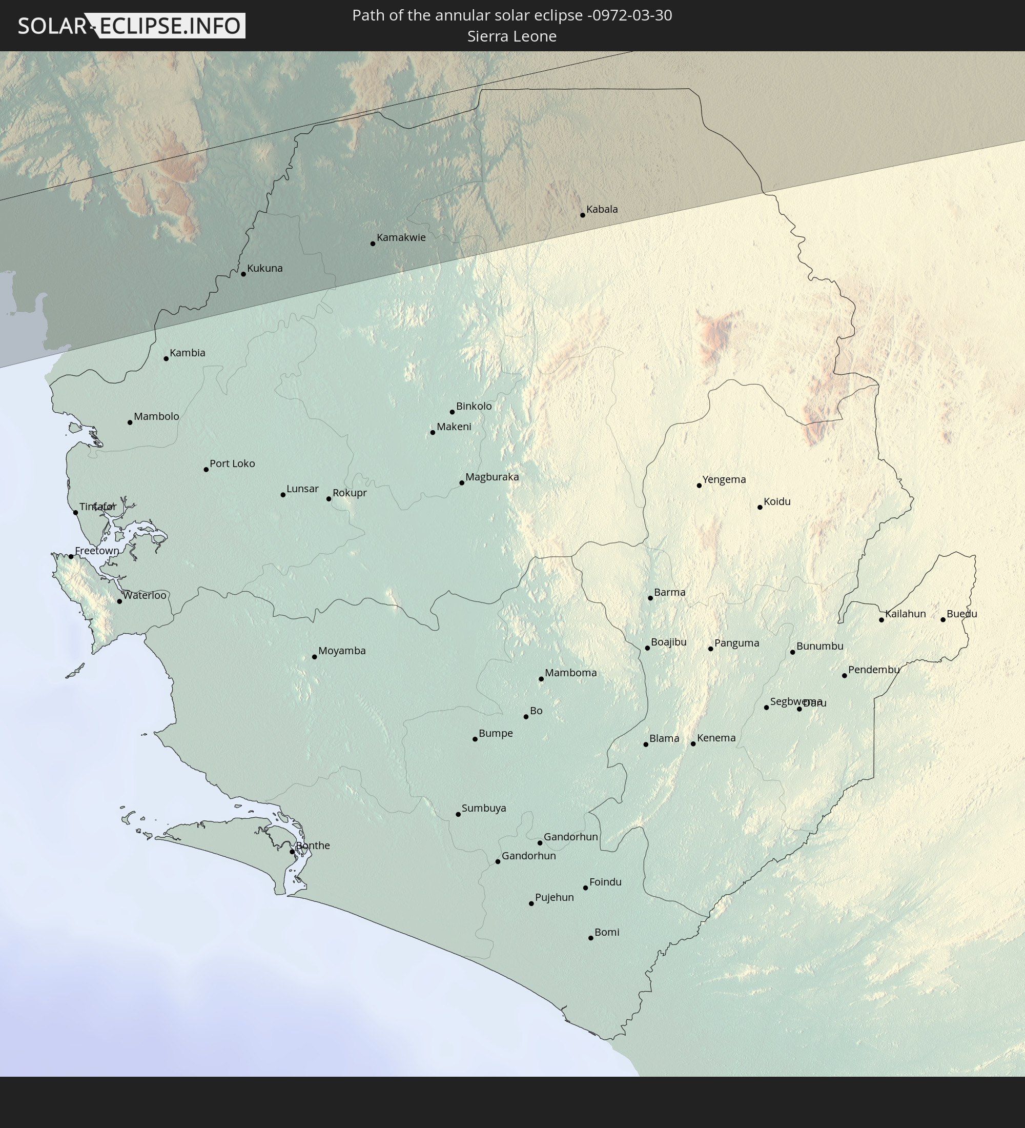
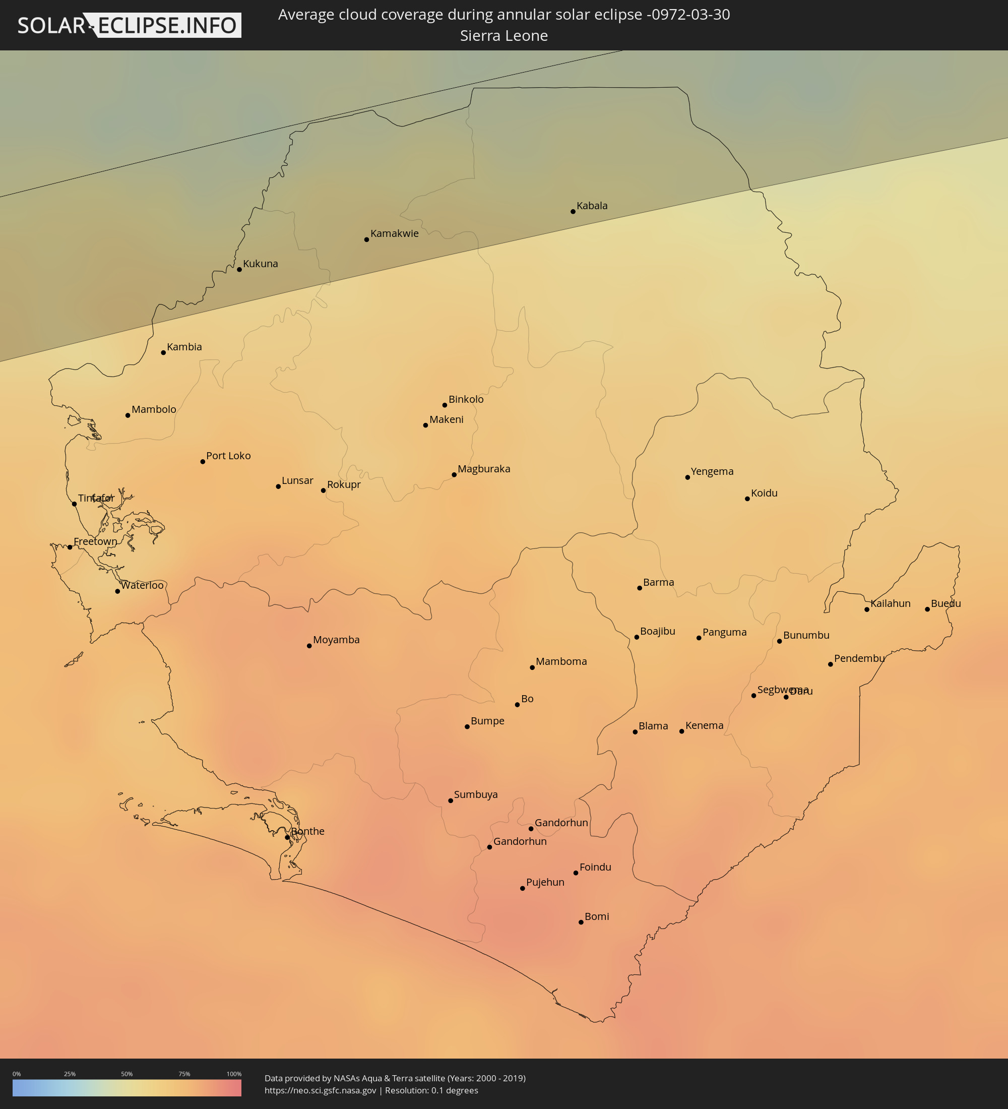 Sierra Leone
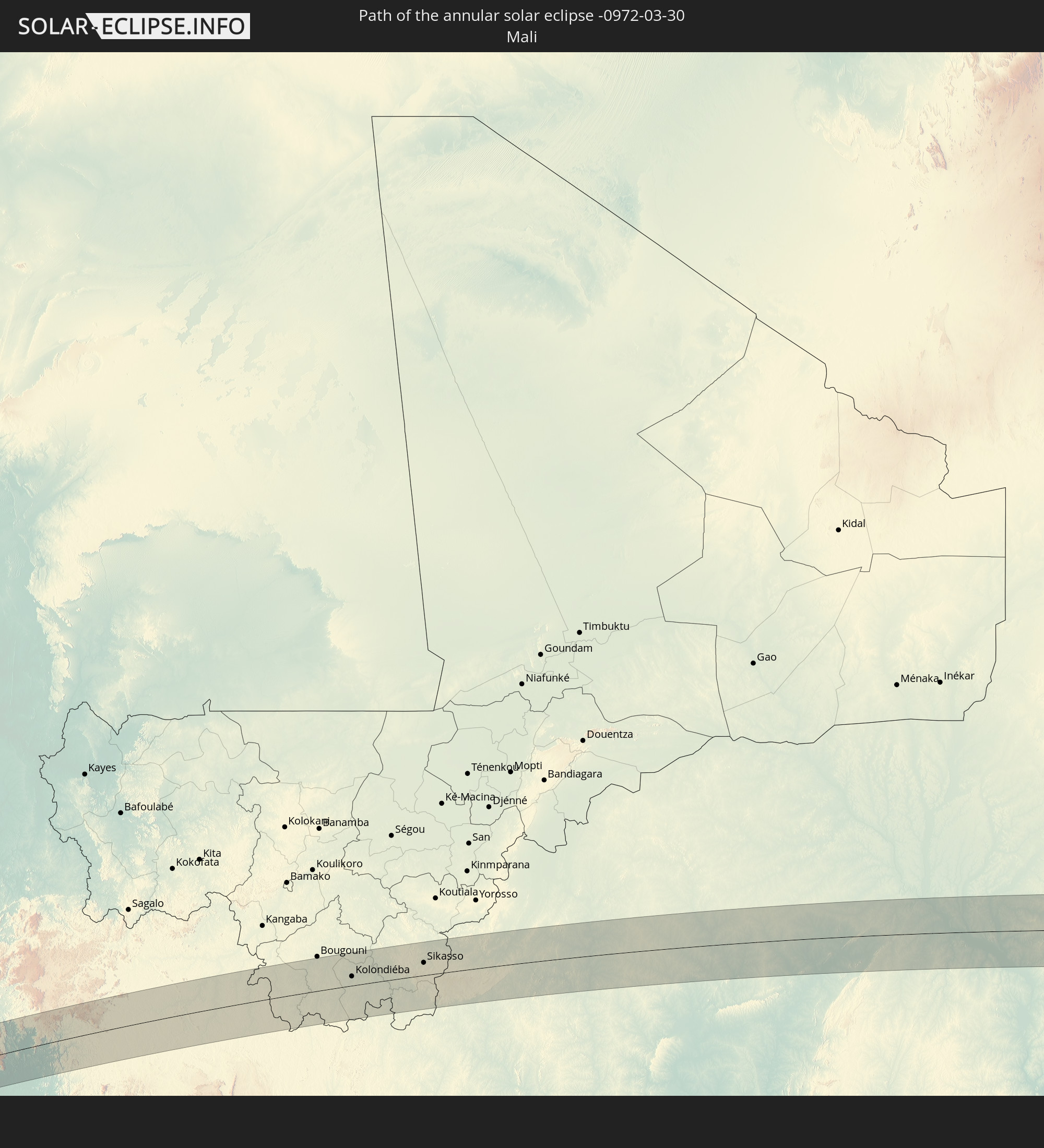
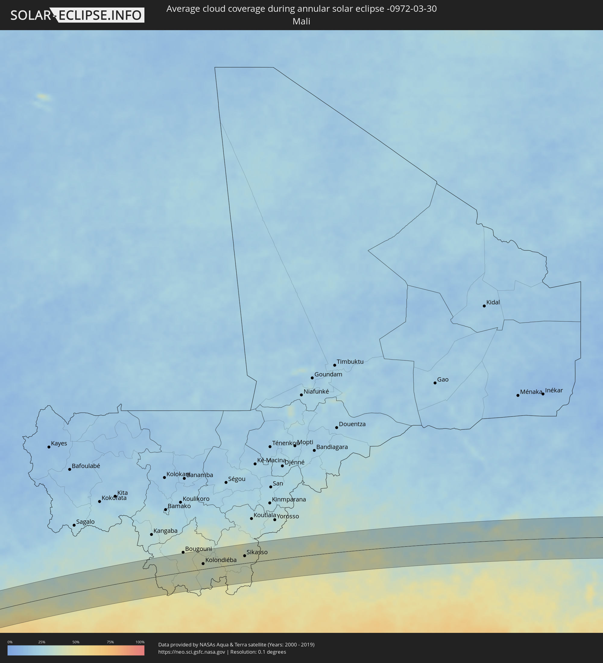 Mali
Mali
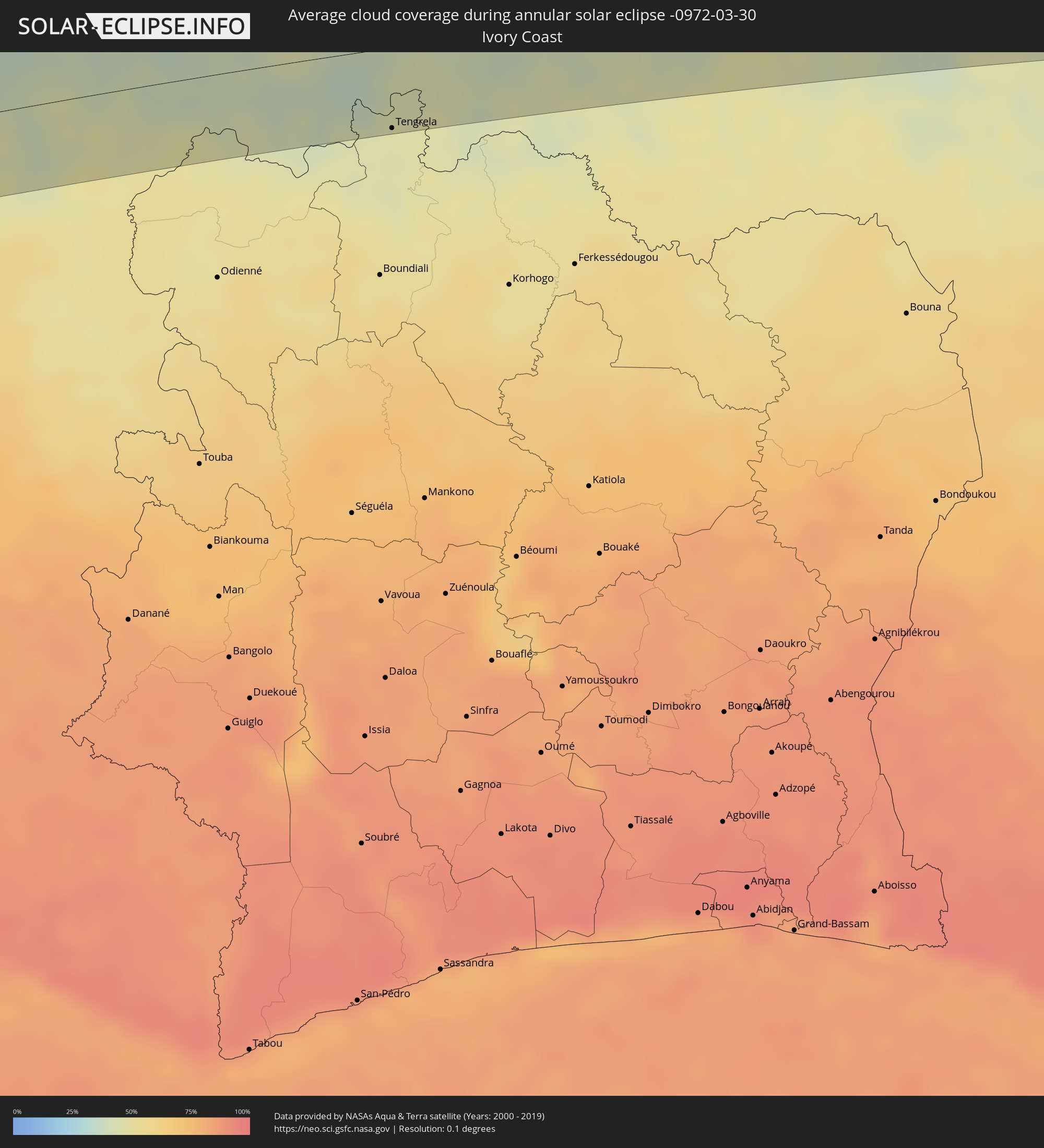 Ivory Coast
 Burkina Faso
 Ghana
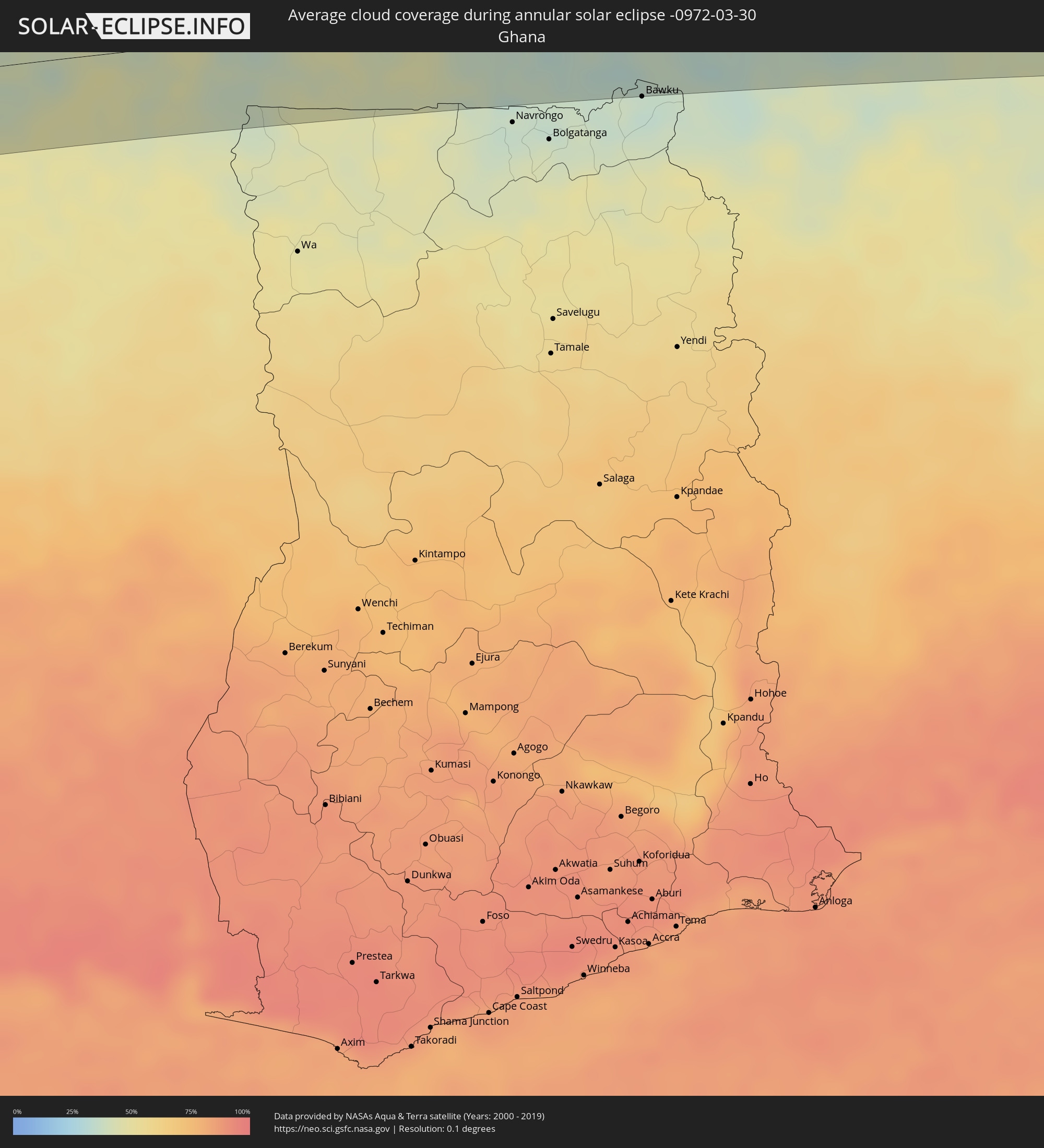
Ghana
 Togo
Togo
 Niger
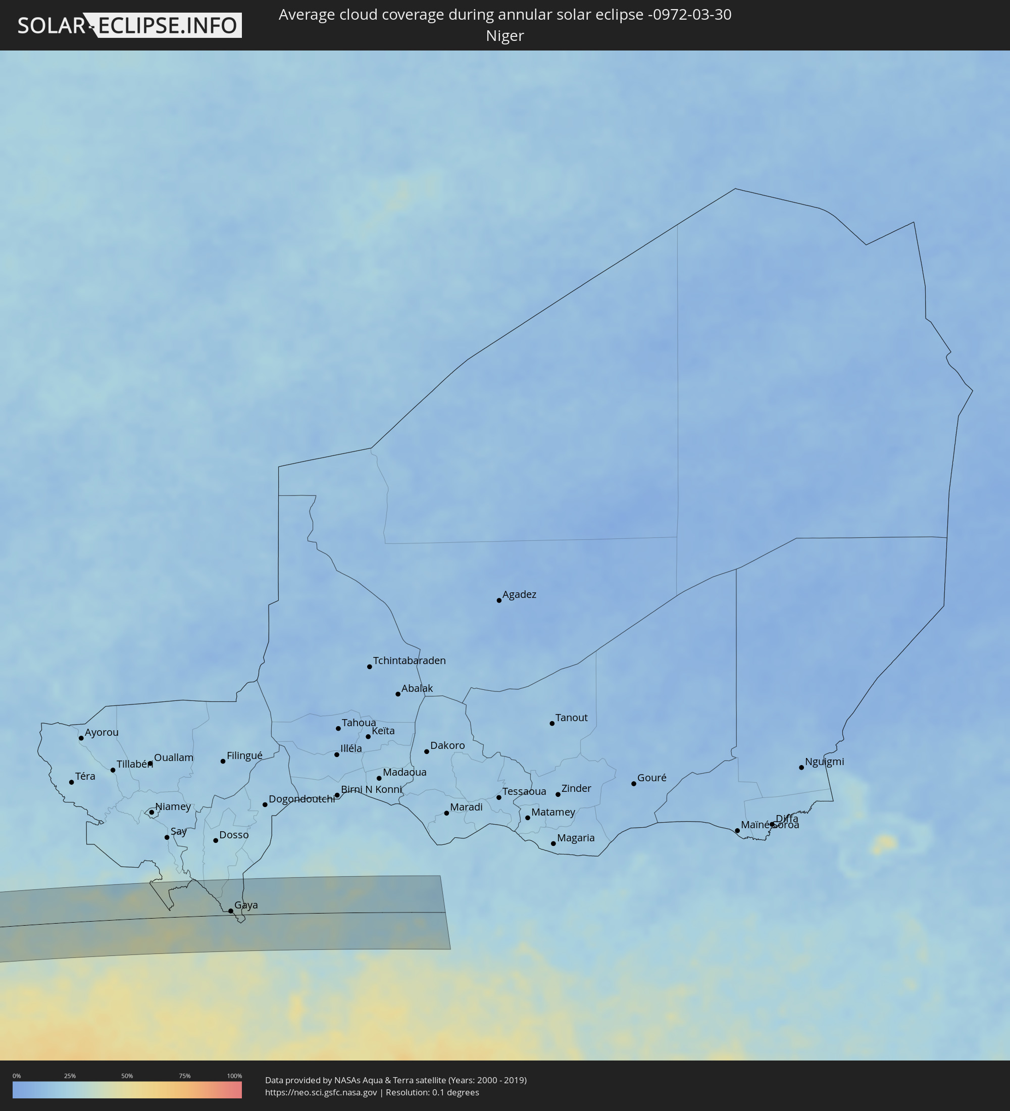
Niger
 Benin
Benin
 Nigeria
Cities inside the path of the eclipse
The following table shows all locations with a population of more than 5,000 inside the eclipse path. Cities which have more than 100,000 inhabitants are marked bold. A click at the locations opens a detailed map.
| City | Type | Eclipse duration | Local time of max. eclipse | Distance to central line | Ø Cloud coverage |
|
Carahue, Araucanía
|
annular | - | 09:45:26 UTC-04:42 | 10 km | 57% |
|
Nueva Imperial, Araucanía
|
annular | - | 09:45:40 UTC-04:42 | 23 km | 61% |
|
Traiguén, Araucanía
|
annular | - | 09:46:19 UTC-04:42 | 10 km | 52% |
|
Temuco, Araucanía
|
annular | - | 09:46:06 UTC-04:42 | 39 km | 57% |
|
Lautaro, Araucanía
|
annular | - | 09:46:26 UTC-04:42 | 27 km | 60% |
|
Collipulli, Araucanía
|
annular | - | 09:46:49 UTC-04:42 | 27 km | 47% |
|
Victoria, Araucanía
|
annular | - | 09:46:45 UTC-04:42 | 4 km | 53% |
|
Mulchén, Biobío
|
annular | - | 09:47:13 UTC-04:42 | 40 km | 41% |
|
Chos Malal, Neuquén Province
|
annular | - | 10:15:59 UTC-04:16 | 25 km | 35% |
|
Villa Mercedes, San Luis Province
|
annular | - | 10:26:19 UTC-04:16 | 40 km | 50% |
|
Río Cuarto, Cordoba Province
|
annular | - | 10:28:39 UTC-04:16 | 20 km | 58% |
|
Hernando, Cordoba Province
|
annular | - | 10:30:29 UTC-04:16 | 42 km | 59% |
|
Villa María, Cordoba Province
|
annular | - | 10:31:17 UTC-04:16 | 12 km | 57% |
|
Las Varillas, Cordoba Province
|
annular | - | 10:32:48 UTC-04:16 | 24 km | 56% |
|
Bell Ville, Cordoba Province
|
annular | - | 10:31:51 UTC-04:16 | 40 km | 58% |
|
San Francisco, Cordoba Province
|
annular | - | 10:34:26 UTC-04:16 | 19 km | 58% |
|
San Jorge, Santa Fe Province
|
annular | - | 10:34:08 UTC-04:16 | 33 km | 57% |
|
Sunchales, Santa Fe Province
|
annular | - | 10:35:58 UTC-04:16 | 24 km | 55% |
|
Rafaela, Santa Fe Province
|
annular | - | 10:35:38 UTC-04:16 | 5 km | 55% |
|
San Justo, Santa Fe Province
|
annular | - | 10:37:46 UTC-04:16 | 28 km | 54% |
|
Reconquista, Santa Fe Province
|
annular | - | 10:41:52 UTC-04:16 | 37 km | 50% |
|
Esquina, Corrientes Province
|
annular | - | 10:40:42 UTC-04:16 | 39 km | 45% |
|
Goya, Corrientes Province
|
annular | - | 10:42:31 UTC-04:16 | 11 km | 50% |
|
Santa Lucía, Corrientes Province
|
annular | - | 10:43:03 UTC-04:16 | 12 km | 46% |
|
Saladas, Corrientes Province
|
annular | - | 10:45:05 UTC-04:16 | 34 km | 51% |
|
Ayolas, Misiones
|
annular | - | 11:15:40 UTC-03:50 | 26 km | 48% |
|
Santa Rosa, Misiones
|
annular | - | 11:16:43 UTC-03:50 | 10 km | 54% |
|
Caazapá, Caazapá
|
annular | - | 11:18:48 UTC-03:50 | 23 km | 50% |
|
San Pedro del Paraná, Itapúa
|
annular | - | 11:17:55 UTC-03:50 | 36 km | 51% |
|
San Juan Nepomuceno, Caazapá
|
annular | - | 11:19:41 UTC-03:50 | 1 km | 51% |
|
Repatriación, Caaguazú
|
annular | - | 11:20:47 UTC-03:50 | 40 km | 53% |
|
Colonia General Alfredo Stroessner, Caaguazú
|
annular | - | 11:21:33 UTC-03:50 | 33 km | 53% |
|
Doctor Juan León Mallorquín, Alto Paraná
|
annular | - | 11:22:15 UTC-03:50 | 2 km | 49% |
|
Nueva Esperanza, Canindeyú
|
annular | - | 11:24:45 UTC-03:50 | 30 km | 49% |
|
Salto del Guairá, Canindeyú
|
annular | - | 11:26:37 UTC-03:50 | 19 km | 46% |
|
Marechal Cândido Rondon, Paraná
|
annular | - | 12:10:17 UTC-03:06 | 35 km | 46% |
|
Umuarama, Paraná
|
annular | - | 12:13:12 UTC-03:06 | 37 km | 52% |
|
Presidente Epitácio, São Paulo
|
annular | - | 12:19:38 UTC-03:06 | 4 km | 48% |
|
Três Lagoas, Mato Grosso do Sul
|
annular | - | 11:50:32 UTC-03:38 | 37 km | 49% |
|
Andradina, São Paulo
|
annular | - | 12:22:54 UTC-03:06 | 3 km | 53% |
|
Jales, São Paulo
|
annular | - | 12:25:50 UTC-03:06 | 24 km | 56% |
|
Ituiutaba, Minas Gerais
|
annular | - | 12:30:48 UTC-03:06 | 28 km | 58% |
|
Itumbiara, Goiás
|
annular | - | 12:32:33 UTC-03:06 | 12 km | 47% |
|
Caldas Novas, Goiás
|
annular | - | 12:35:13 UTC-03:06 | 17 km | 57% |
|
Luziânia, Goiás
|
annular | - | 12:40:02 UTC-03:06 | 24 km | 66% |
|
Formosa, Goiás
|
annular | - | 12:42:54 UTC-03:06 | 18 km | 64% |
|
Araripina, Pernambuco
|
annular | - | 14:01:56 UTC-02:19 | 27 km | 77% |
|
Iguatu, Ceará
|
annular | - | 13:52:37 UTC-02:34 | 38 km | 81% |
|
Quixadá, Ceará
|
annular | - | 13:56:24 UTC-02:34 | 43 km | 85% |
|
Morada Nova, Ceará
|
annular | - | 13:57:14 UTC-02:34 | 20 km | 84% |
|
Russas, Ceará
|
annular | - | 13:58:19 UTC-02:34 | 39 km | 87% |
|
Aracati, Ceará
|
annular | - | 13:59:33 UTC-02:34 | 27 km | 83% |
|
Camayenne, Conakry
|
annular | - | 17:13:32 UTC-00:16 | 5 km | 62% |
|
Conakry, Conakry
|
annular | - | 17:13:32 UTC-00:16 | 5 km | 62% |
|
Dubréka, Kindia
|
annular | - | 17:13:55 UTC-00:16 | 18 km | 46% |
|
Coyah, Kindia
|
annular | - | 17:13:56 UTC-00:16 | 5 km | 49% |
|
Forécariah, Kindia
|
annular | - | 17:13:51 UTC-00:16 | 33 km | 60% |
|
Kindia, Kindia
|
annular | - | 17:14:40 UTC-00:16 | 29 km | 39% |
|
Kukuna, Northern Province
|
annular | - | 17:14:08 UTC-00:16 | 47 km | 58% |
|
Kamakwie, Northern Province
|
annular | - | 17:14:32 UTC-00:16 | 47 km | 60% |
|
Mamou, Mamou
|
annular | - | 17:15:31 UTC-00:16 | 44 km | 41% |
|
Kabala, Northern Province
|
annular | - | 17:15:06 UTC-00:16 | 54 km | 54% |
|
Faranah, Faranah
|
annular | - | 17:16:04 UTC-00:16 | 24 km | 41% |
|
Kouroussa, Kankan
|
annular | - | 17:17:10 UTC-00:16 | 24 km | 39% |
|
Kankan, Kankan
|
annular | - | 17:17:16 UTC-00:16 | 16 km | 43% |
|
Mandiana, Kankan
|
annular | - | 17:17:49 UTC-00:16 | 2 km | 43% |
|
Kolondiéba, Sikasso
|
annular | - | 17:19:08 UTC-00:16 | 17 km | 41% |
|
Tengrela, Savanes
|
annular | - | 17:18:51 UTC-00:16 | 58 km | 45% |
|
Sikasso, Sikasso
|
annular | - | 17:19:53 UTC-00:16 | 23 km | 39% |
|
Orodara, Hauts-Bassins
|
annular | - | 17:19:53 UTC-00:16 | 28 km | 45% |
|
Bobo-Dioulasso, Hauts-Bassins
|
annular | - | 17:20:19 UTC-00:16 | 11 km | 39% |
|
Houndé, Hauts-Bassins
|
annular | - | 17:20:51 UTC-00:16 | 15 km | 39% |
|
Diébougou, Sud-Ouest
|
annular | - | 17:20:31 UTC-00:16 | 47 km | 42% |
|
Dano, Sud-Ouest
|
annular | - | 17:20:44 UTC-00:16 | 29 km | 41% |
|
Boromo, Boucle du Mouhoun
|
annular | - | 17:21:14 UTC-00:16 | 36 km | 39% |
|
Léo, Centre-Ouest
|
annular | - | 17:21:00 UTC-00:16 | 44 km | 44% |
|
Kombissiri, Centre-Sud
|
annular | - | 17:21:55 UTC-00:16 | 55 km | 30% |
|
Pô, Centre-Sud
|
annular | - | 17:21:20 UTC-00:16 | 46 km | 33% |
|
Manga, Centre-Sud
|
annular | - | 17:21:43 UTC-00:16 | 9 km | 33% |
|
Garango, Centre-Est
|
annular | - | 17:21:56 UTC-00:16 | 19 km | 31% |
|
Tenkodogo, Centre-Est
|
annular | - | 17:21:58 UTC-00:16 | 16 km | 31% |
|
Koupéla, Centre-Est
|
annular | - | 17:22:15 UTC-00:16 | 60 km | 28% |
|
Ouargaye, Centre-Est
|
annular | - | 17:21:52 UTC-00:16 | 18 km | 32% |
|
Fada N'gourma, Est
|
annular | - | 17:22:19 UTC-00:16 | 42 km | 30% |
|
Pama, Est
|
annular | - | 17:21:50 UTC-00:16 | 51 km | 42% |
|
Diapaga, Est
|
annular | - | 17:22:36 UTC-00:16 | 35 km | 35% |
|
Banikoara, Alibori
|
annular | - | 17:51:54 UTC+00:13 | 55 km | 42% |
|
Malanville, Atakora
|
annular | - | 17:52:24 UTC+00:13 | 5 km | 31% |
|
Gaya, Dosso
|
annular | - | 17:52:25 UTC+00:13 | 6 km | 31% |
|
Kamba, Kebbi
|
annular | - | 17:52:25 UTC+00:13 | 2 km | 29% |
|
Bunza, Kebbi
|
annular | - | 17:52:36 UTC+00:13 | 27 km | 27% |
|
Dakingari, Kebbi
|
annular | - | 17:52:20 UTC+00:13 | 22 km | 31% |
|
Maiyama, Kebbi
|
annular | - | 17:52:38 UTC+00:13 | 26 km | 30% |
|
Jega, Kebbi
|
annular | - | 17:52:43 UTC+00:13 | 41 km | 31% |
|
Tambuwal, Sokoto
|
annular | - | 17:52:51 UTC+00:13 | 61 km | 29% |
|
Mahuta, Kebbi
|
annular | - | 17:52:21 UTC+00:13 | 34 km | 30% |
|
Gummi, Zamfara
|
annular | - | 17:52:43 UTC+00:13 | 31 km | 32% |
|
Zuru, Kebbi
|
annular | - | 17:52:17 UTC+00:13 | 48 km | 35% |
|
Wasagu, Kebbi
|
annular | - | 17:52:17 UTC+00:13 | 55 km | 31% |
|
Anka, Zamfara
|
annular | - | 17:52:44 UTC+00:13 | 27 km | 26% |
|
Bena, Kebbi
|
annular | - | 17:52:14 UTC+00:13 | 65 km | 35% |
|
Maru, Zamfara
|
annular | - | 17:52:53 UTC+00:13 | 51 km | 24% |
|
Gusau, Zamfara
|
annular | - | 17:52:47 UTC+00:13 | 33 km | 24% |
|
Sauri, Zamfara
|
annular | - | 17:52:31 UTC+00:13 | 29 km | 29% |
|
Kwatarkwashi, Zamfara
|
annular | - | 17:52:46 UTC+00:13 | 36 km | 22% |
|
Tsafe, Zamfara
|
annular | - | 17:52:40 UTC+00:13 | 13 km | 25% |