Hybrid solar eclipse of 08/13/-0979
| Day of week: | Saturday |
| Maximum duration of eclipse: | 01m48s |
| Maximum width of eclipse path: | 59 km |
| Saros cycle: | 39 |
| Coverage: | 100% |
| Magnitude: | 1.0168 |
| Gamma: | -0.2387 |
Wo kann man die Sonnenfinsternis vom 08/13/-0979 sehen?
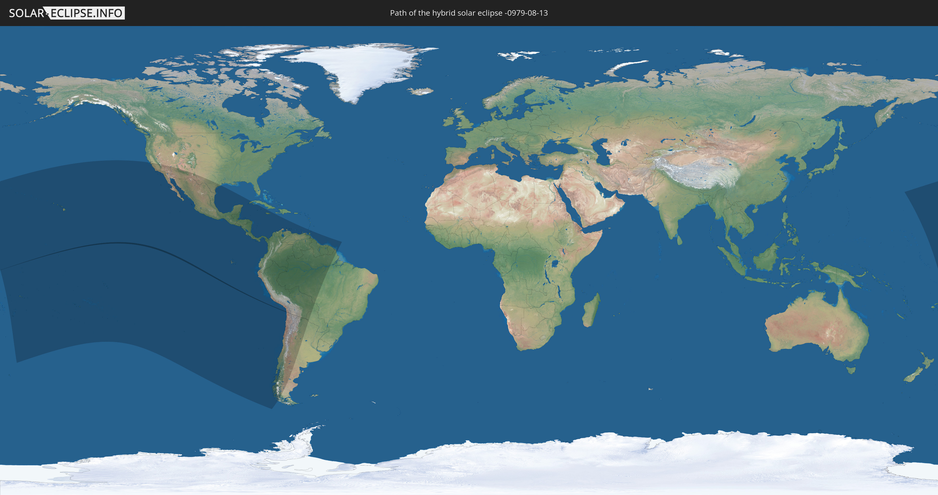
Die Sonnenfinsternis am 08/13/-0979 kann man in 37 Ländern als partielle Sonnenfinsternis beobachten.
Der Finsternispfad verläuft durch 4 Länder. Nur in diesen Ländern ist sie als hybrid Sonnenfinsternis zu sehen.
In den folgenden Ländern ist die Sonnenfinsternis hybrid zu sehen
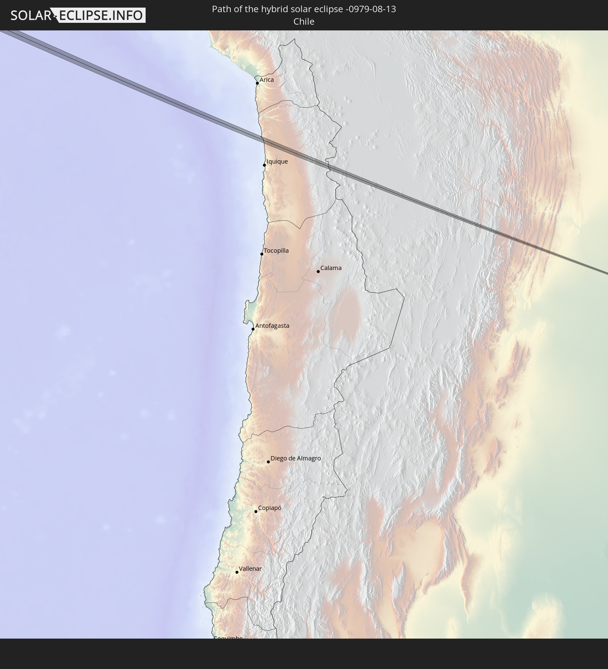 Chile
Chile
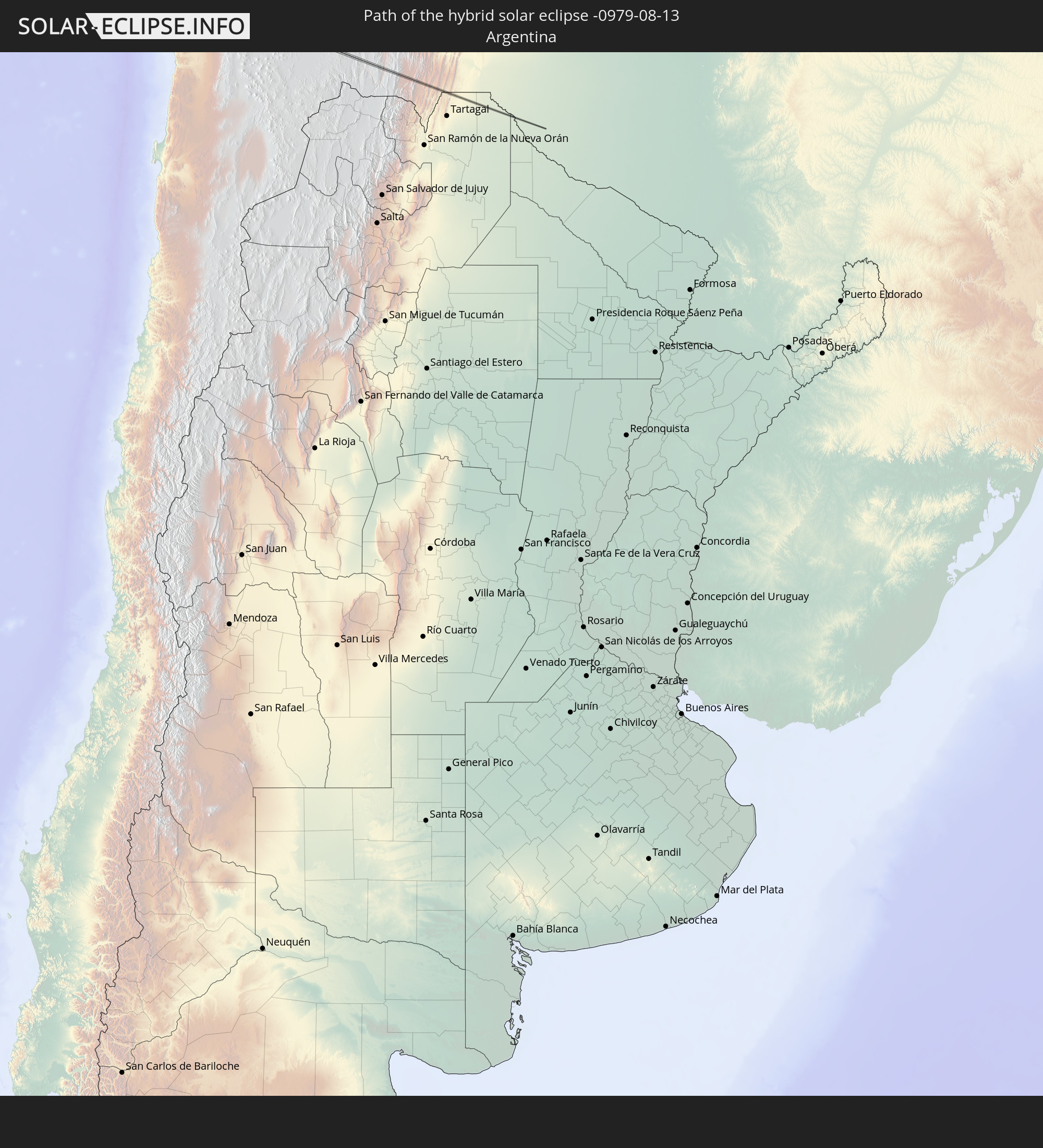 Argentina
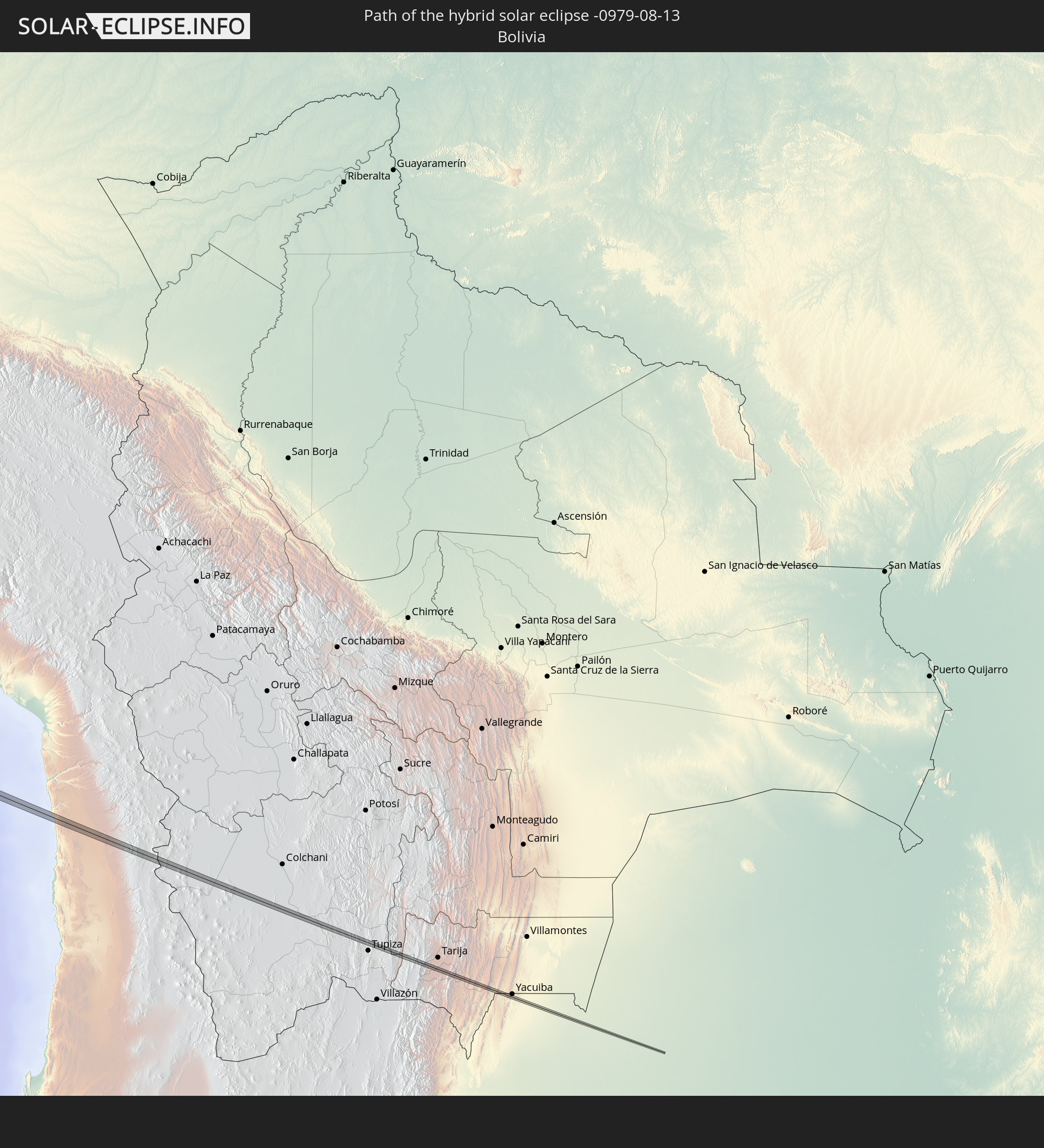 Bolivia
 Paraguay
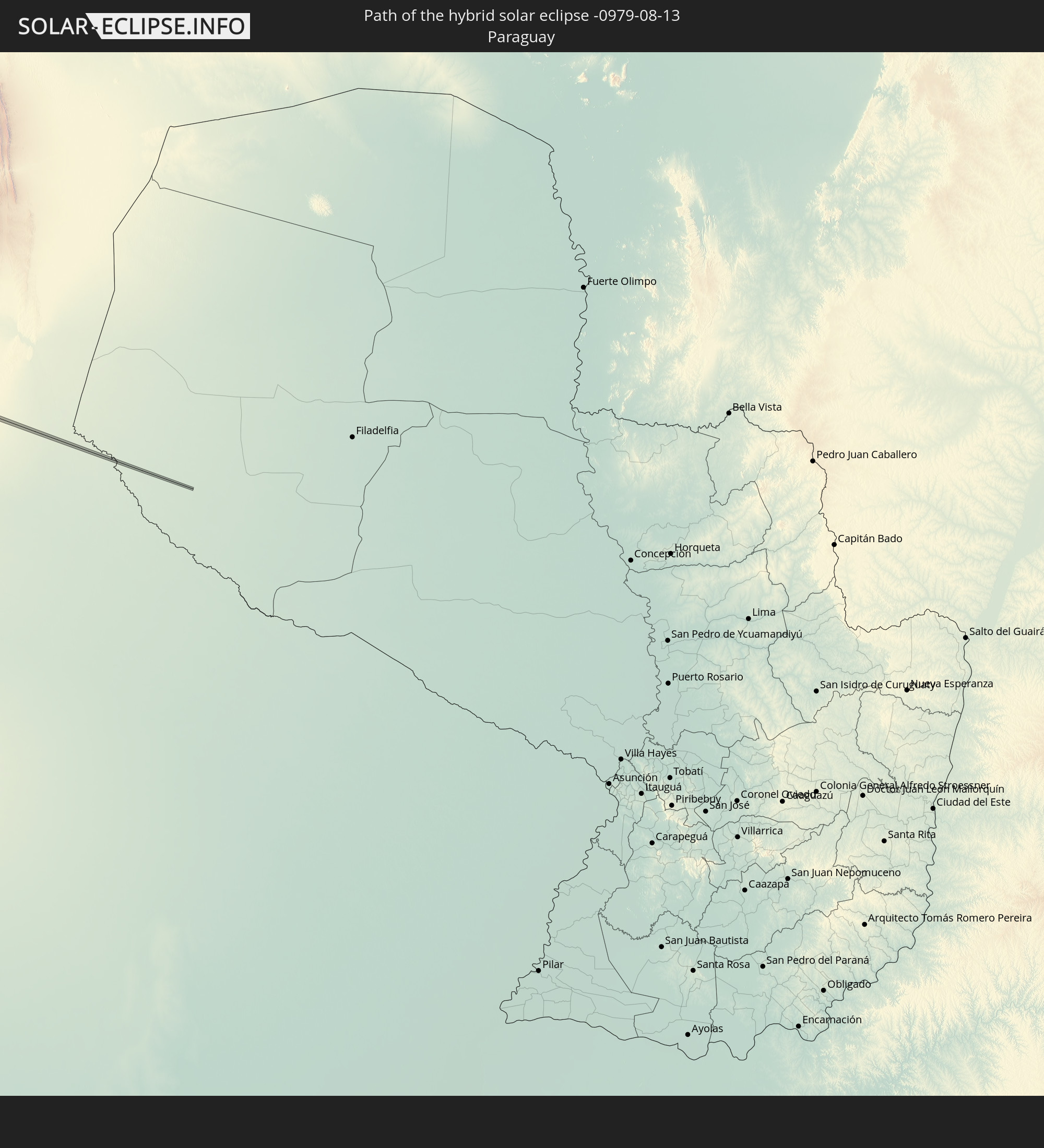
In den folgenden Ländern ist die Sonnenfinsternis partiell zu sehen
 United States
 United States Minor Outlying Islands
 Wallis and Futuna
 Tonga
Tonga
 Kiribati
 Samoa
Samoa
 Tokelau
 American Samoa
 Niue
Niue
 Cook Islands
 French Polynesia
 Pitcairn Islands
 Mexico
 Chile
Chile
 Guatemala
 Ecuador
 El Salvador
 Honduras
 Belize
 Nicaragua
 Costa Rica
 Cuba
Cuba
 Panama
 Colombia
 Cayman Islands
 Peru
Peru
 Jamaica
 Brazil
 Argentina
 Venezuela
 Aruba
Aruba
 Bolivia
 Paraguay
 Trinidad and Tobago
 Guyana
 Suriname
 French Guiana
How will be the weather during the hybrid solar eclipse on 08/13/-0979?
Where is the best place to see the hybrid solar eclipse of 08/13/-0979?
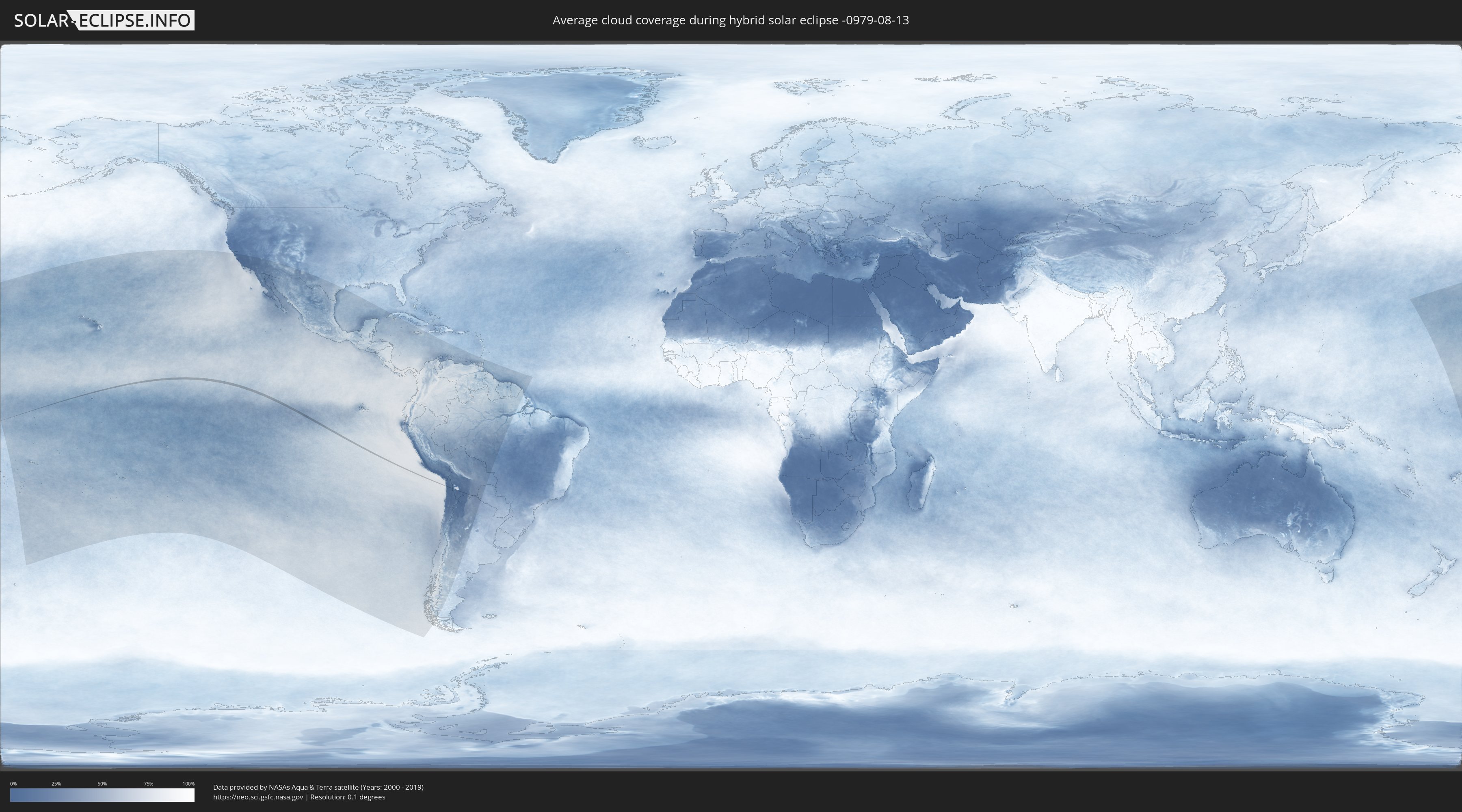
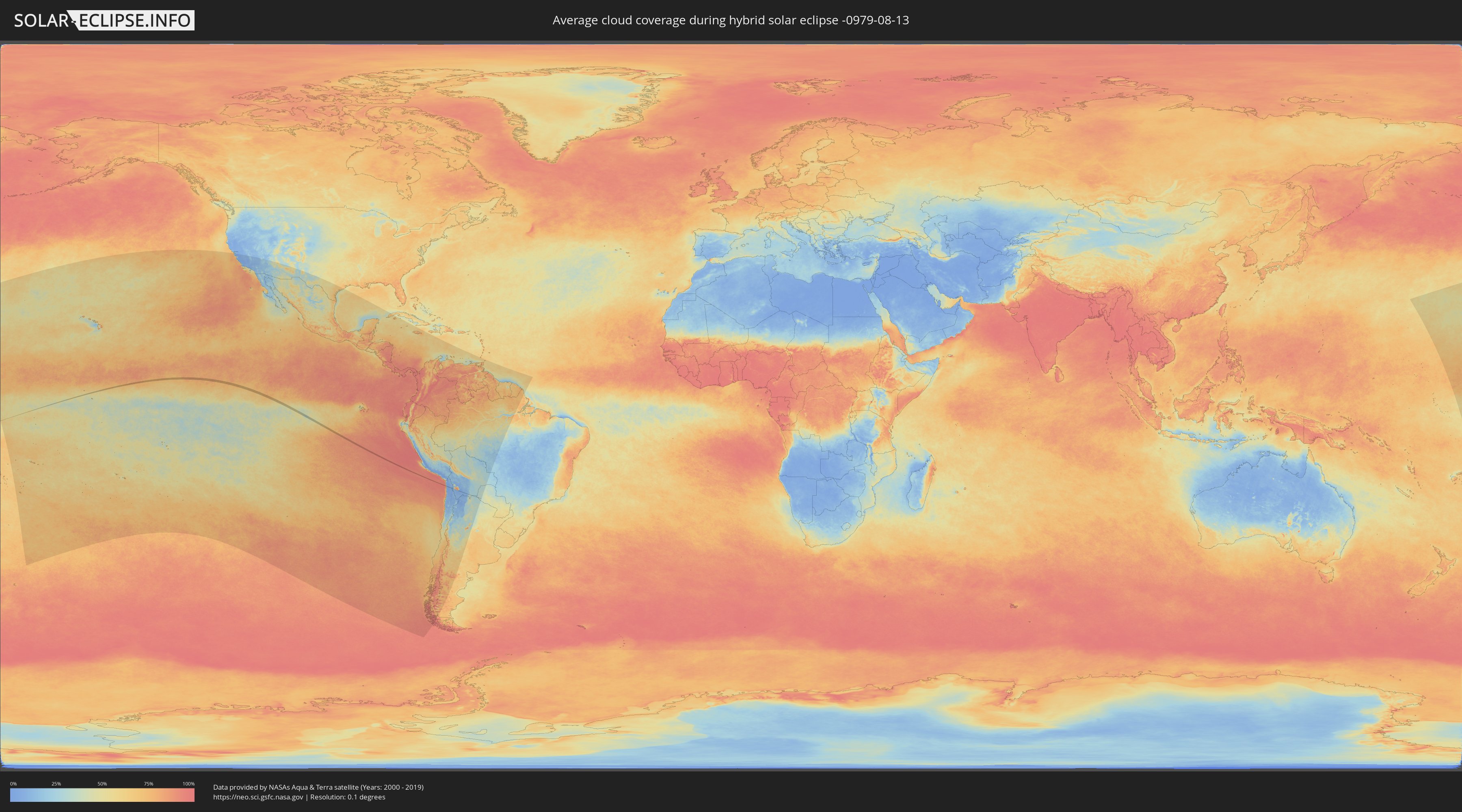
The following maps show the average cloud coverage for the day of the hybrid solar eclipse.
With the help of these maps, it is possible to find the place along the eclipse path, which has the best
chance of a cloudless sky.
Nevertheless, you should consider local circumstances and inform about the weather of your chosen
observation site.
The data is provided by NASAs satellites
AQUA and TERRA.
The cloud maps are averaged over a period of 19 years (2000 - 2019).
Detailed country maps
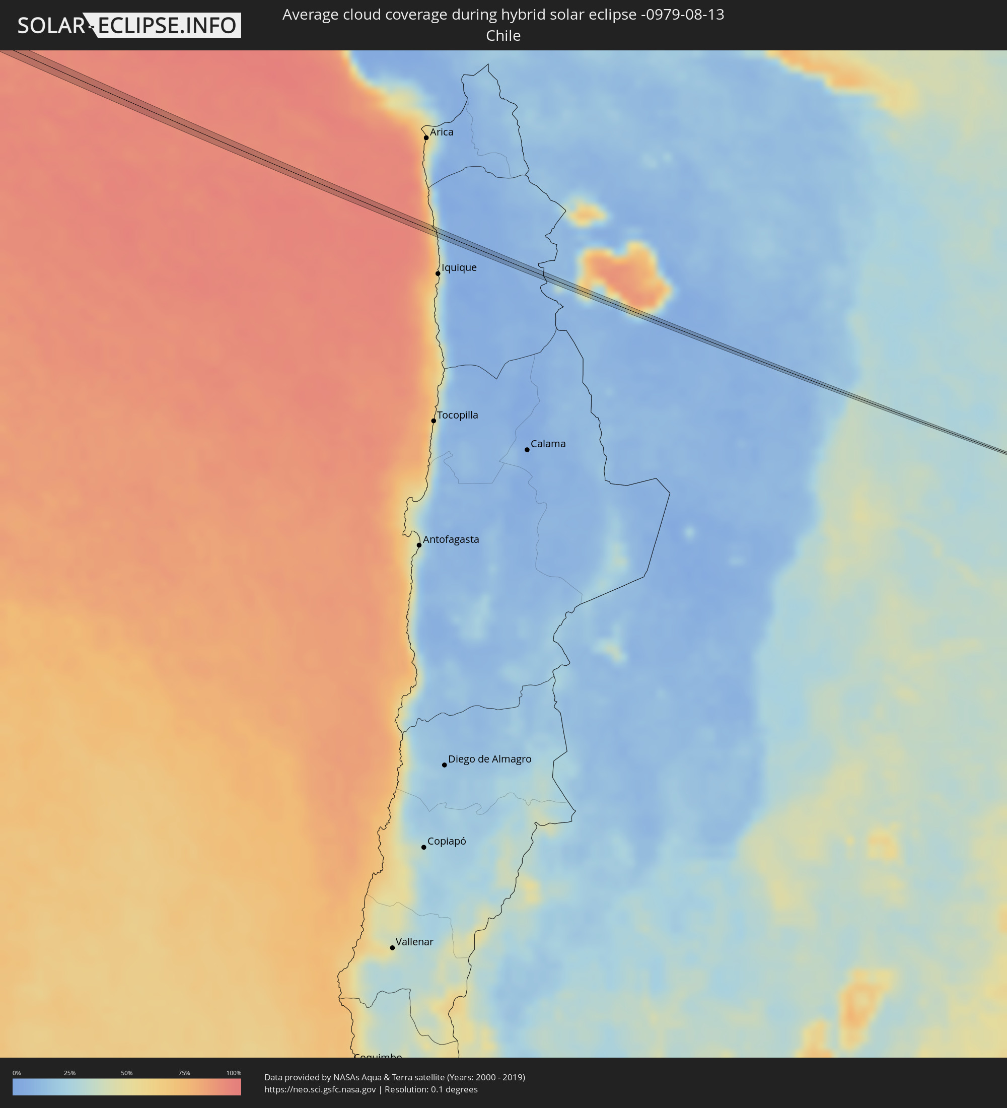 Chile
Chile
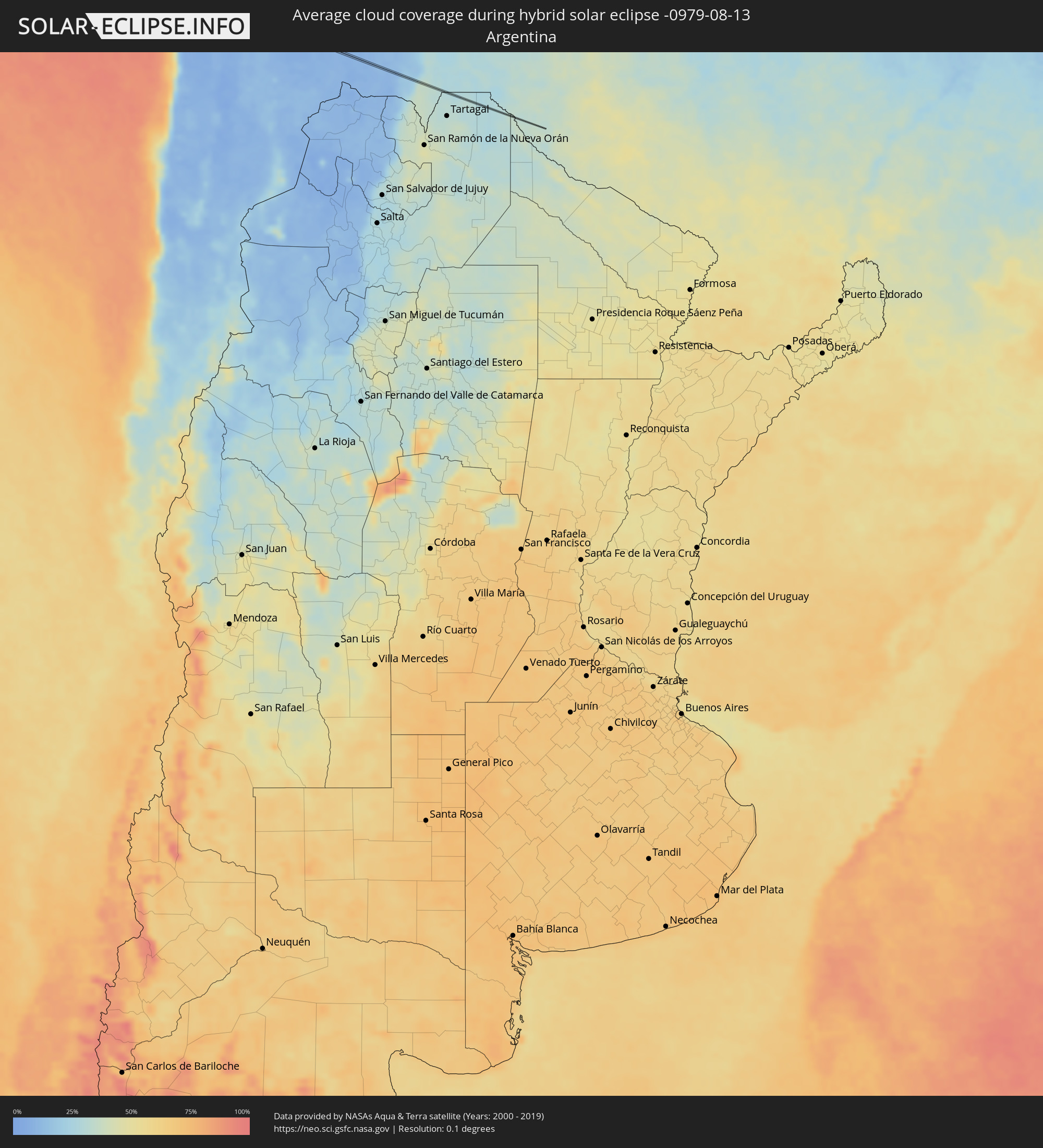 Argentina
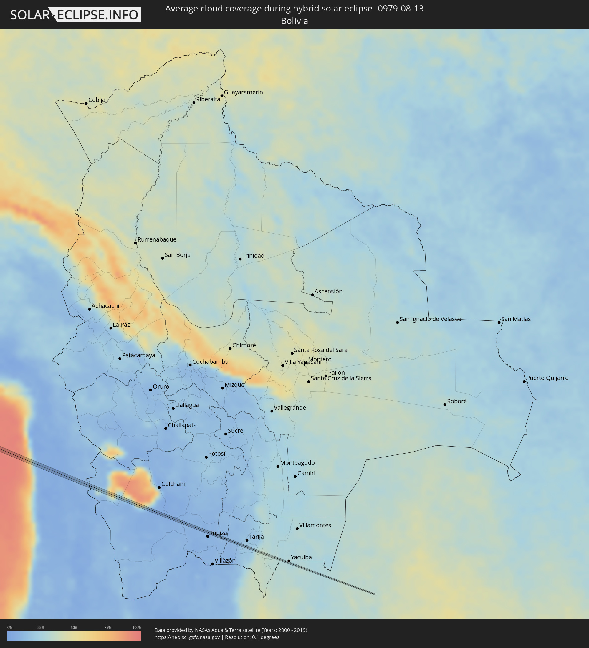 Bolivia
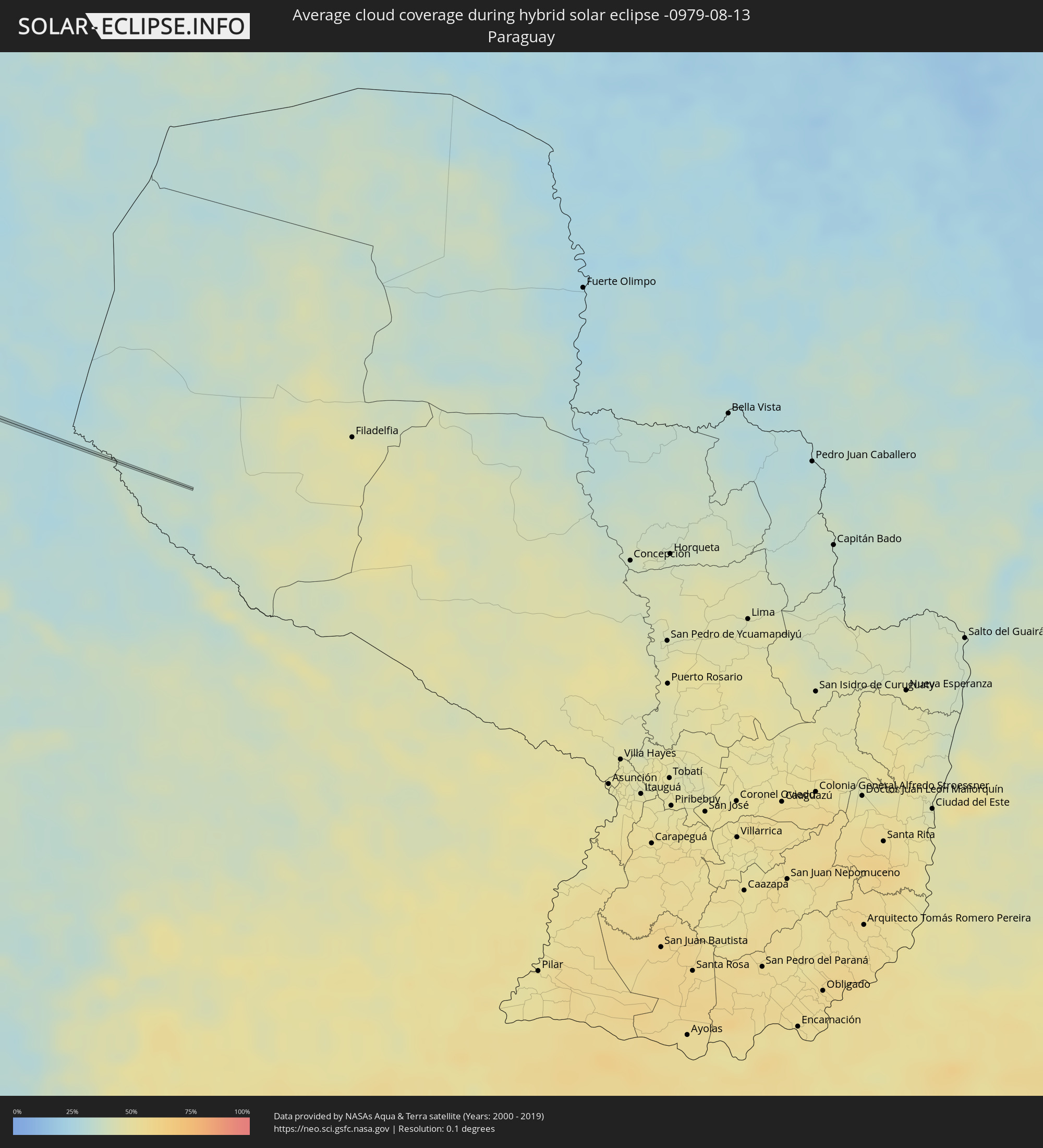 Paraguay