Total solar eclipse of 06/28/-1116
| Day of week: | Monday |
| Maximum duration of eclipse: | 04m16s |
| Maximum width of eclipse path: | 146 km |
| Saros cycle: | 38 |
| Coverage: | 100% |
| Magnitude: | 1.0436 |
| Gamma: | -0.0367 |
Wo kann man die Sonnenfinsternis vom 06/28/-1116 sehen?
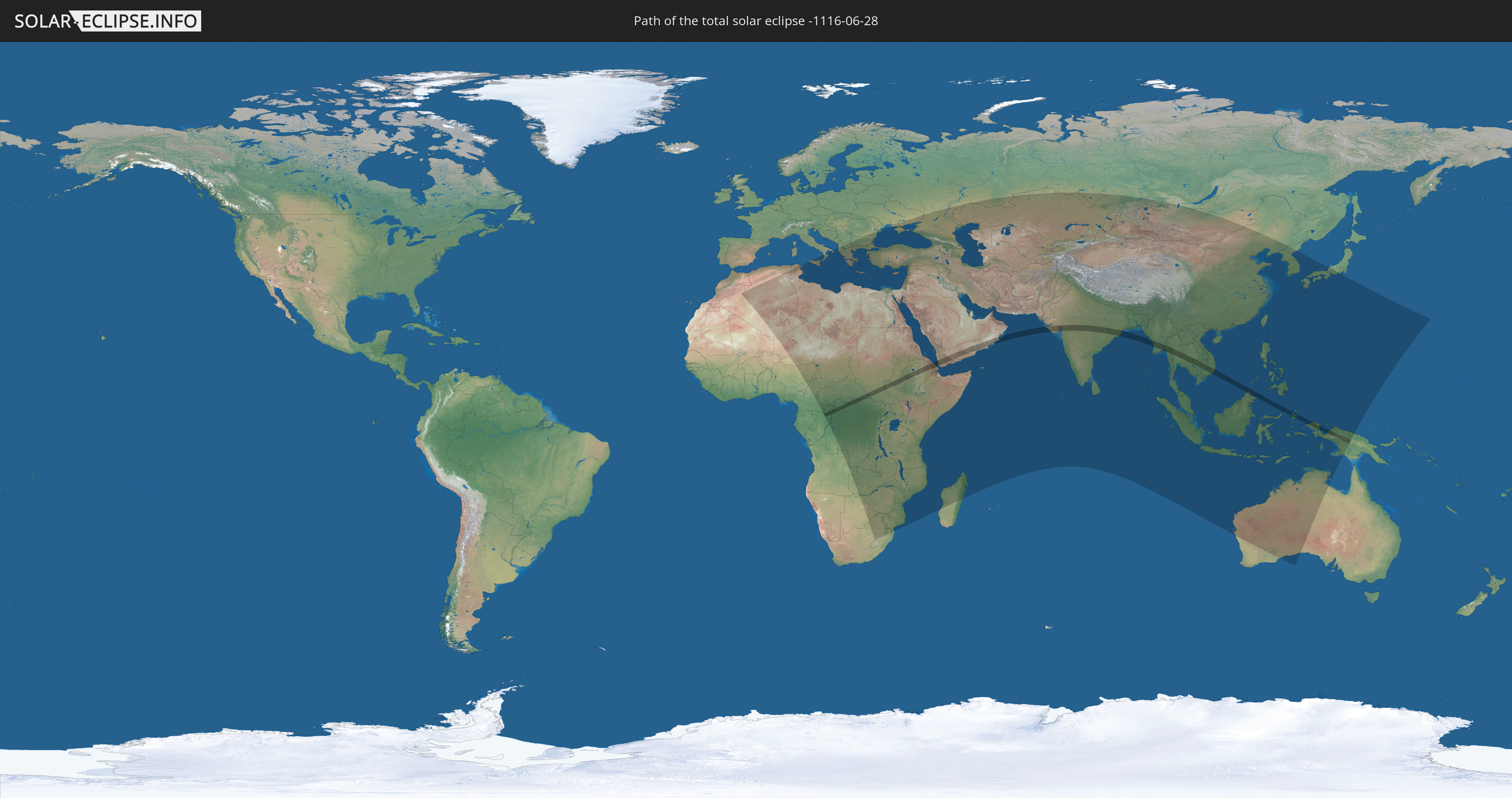
Die Sonnenfinsternis am 06/28/-1116 kann man in 105 Ländern als partielle Sonnenfinsternis beobachten.
Der Finsternispfad verläuft durch 18 Länder. Nur in diesen Ländern ist sie als total Sonnenfinsternis zu sehen.
In den folgenden Ländern ist die Sonnenfinsternis total zu sehen
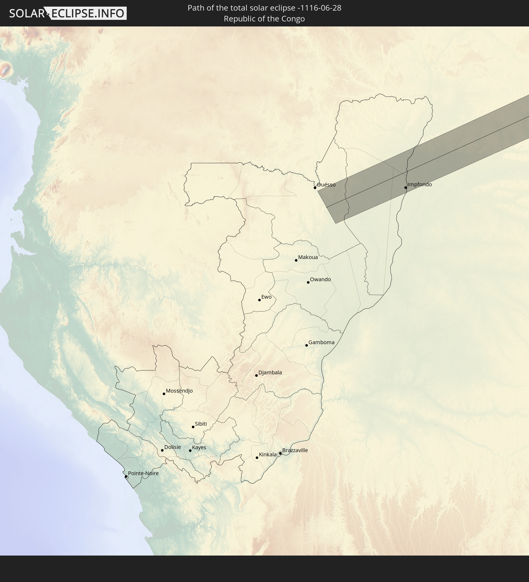 Republic of the Congo
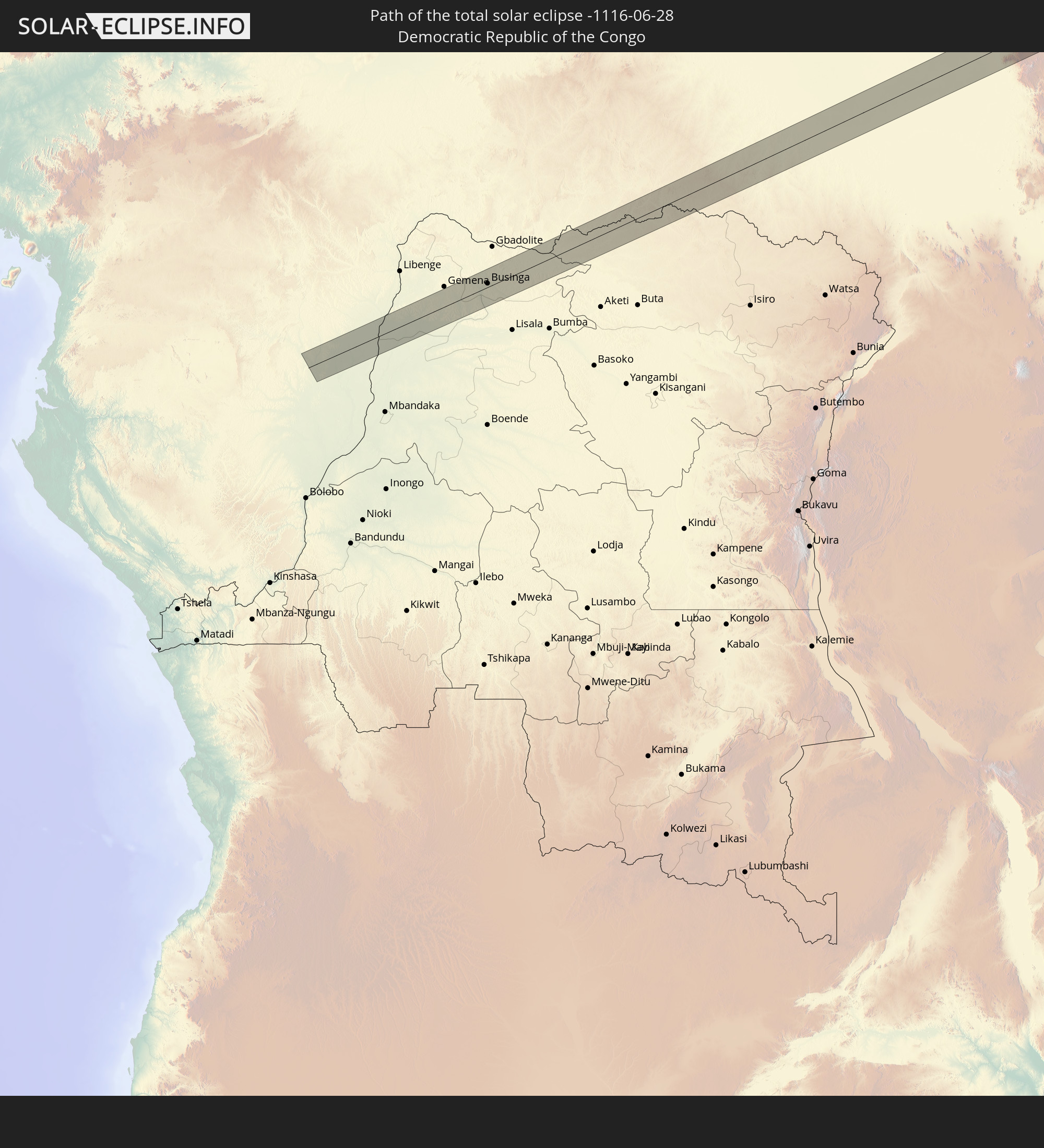 Democratic Republic of the Congo
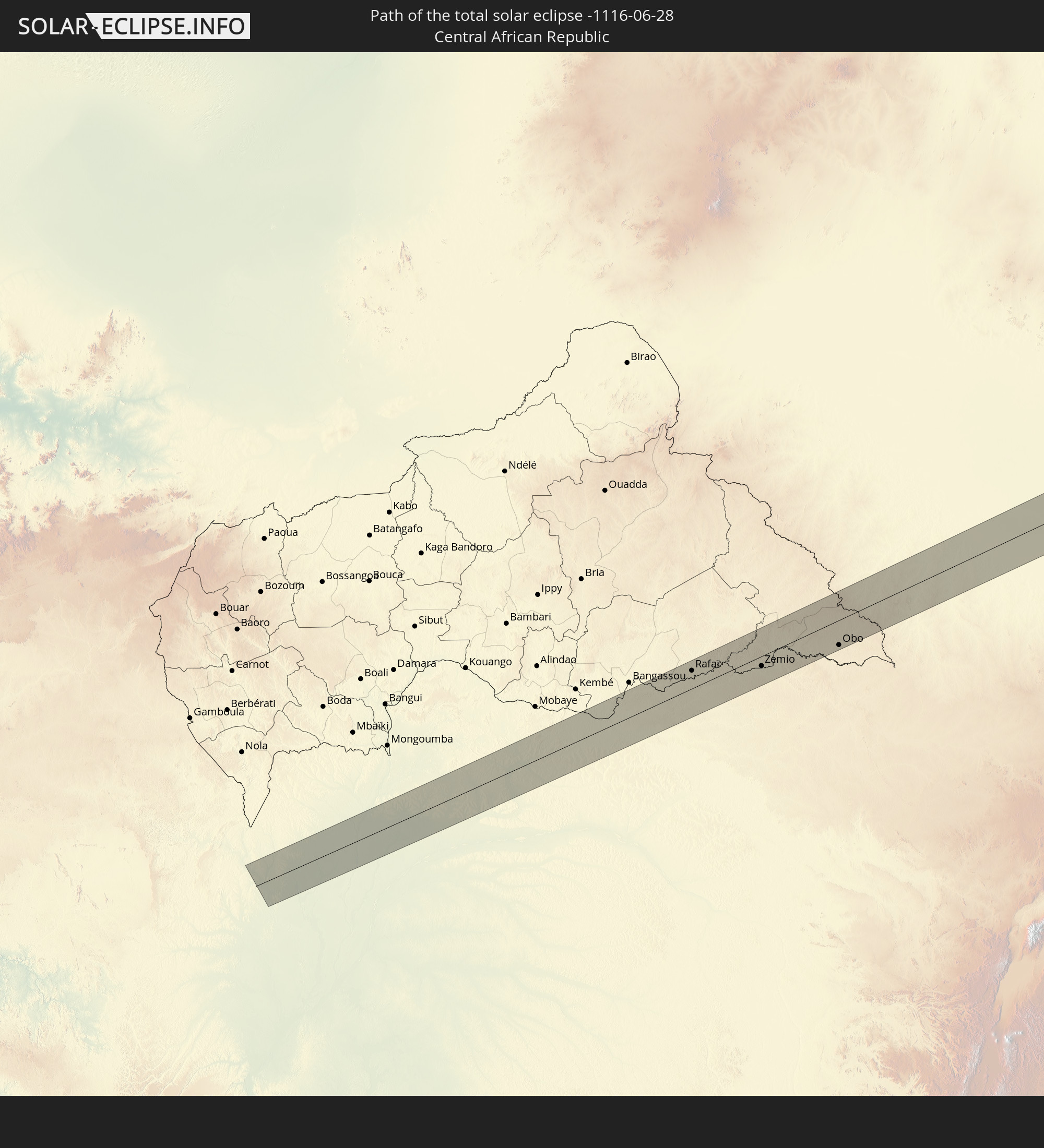 Central African Republic
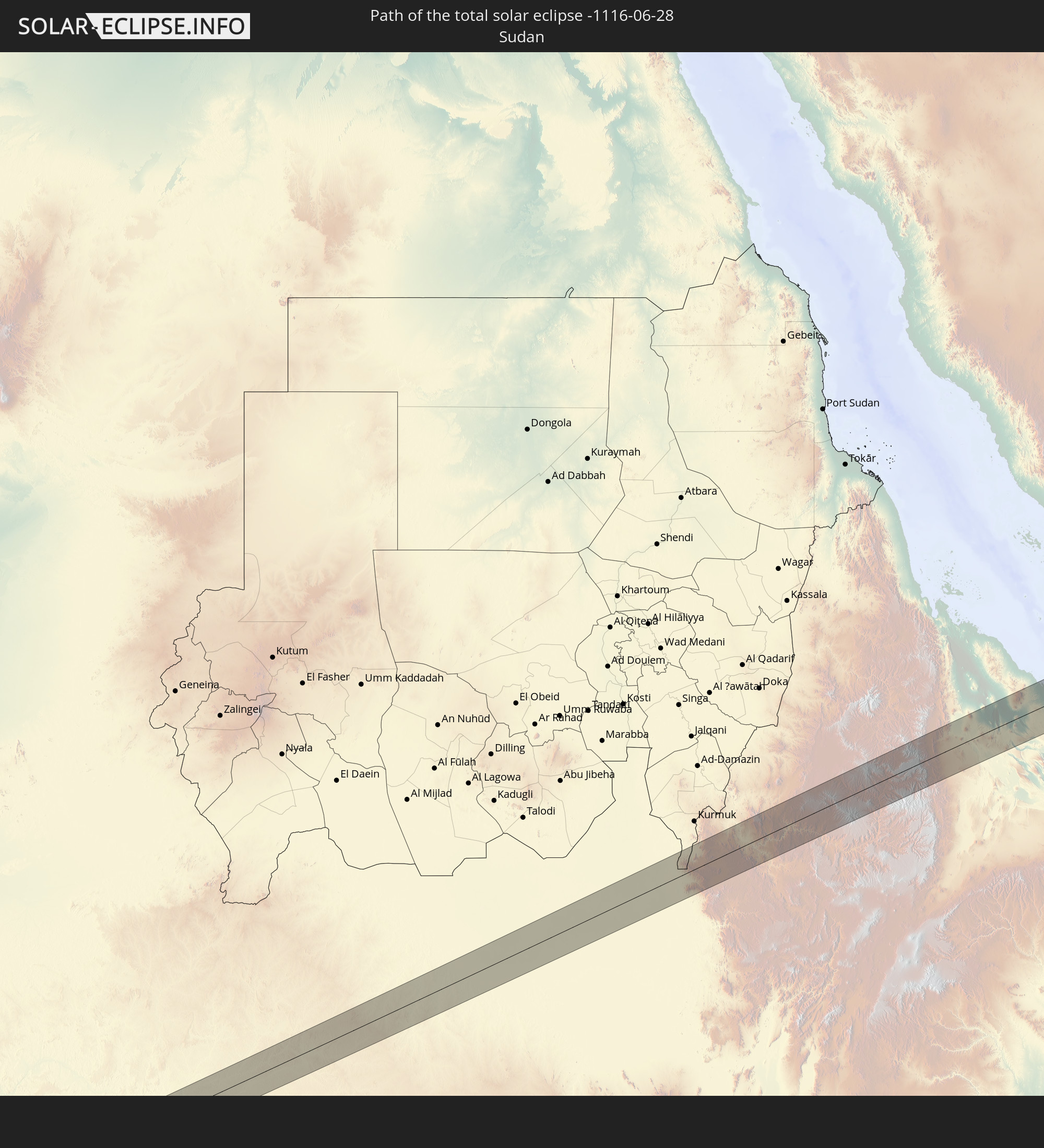 Sudan
Sudan
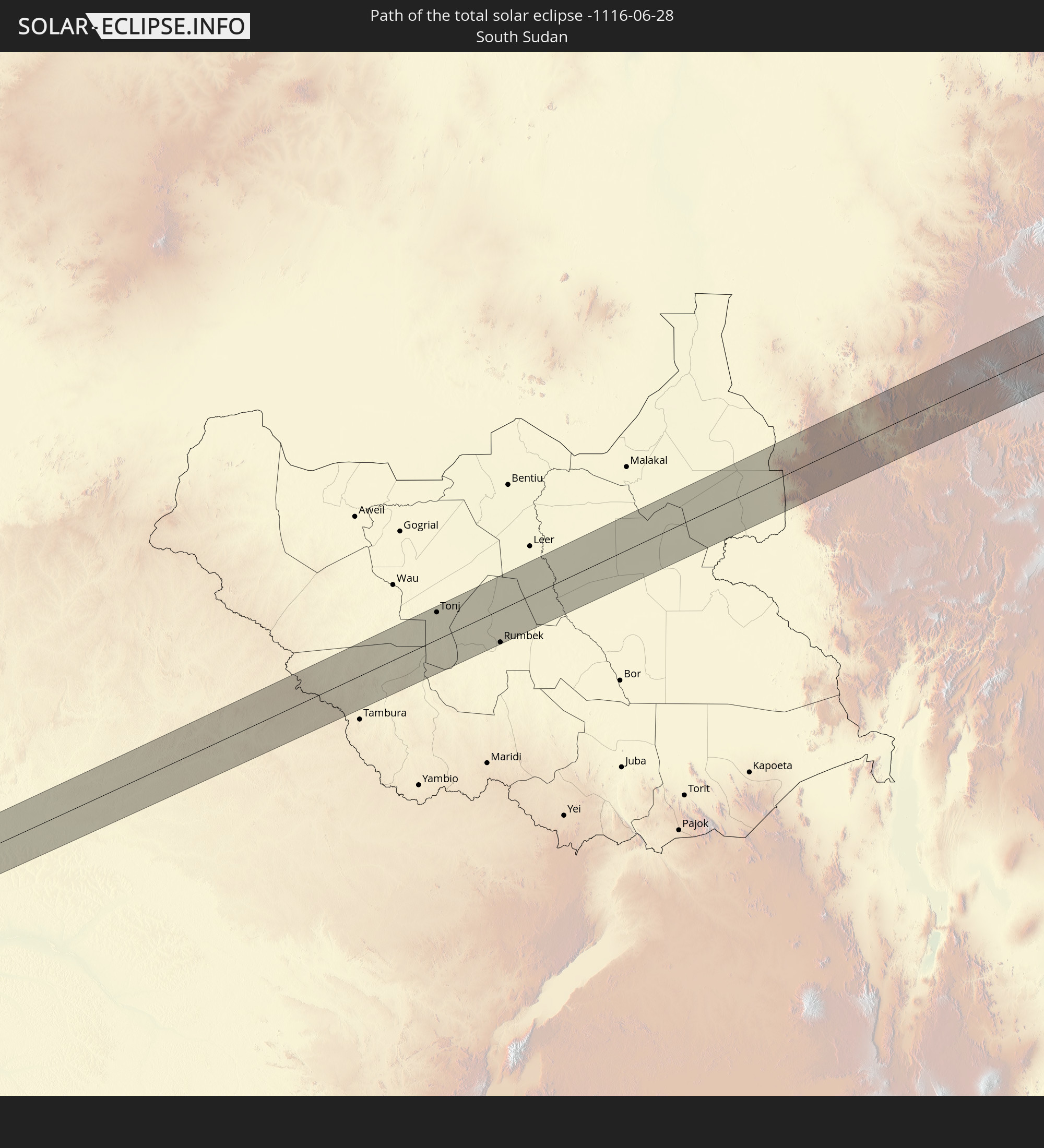 South Sudan
 Ethiopia
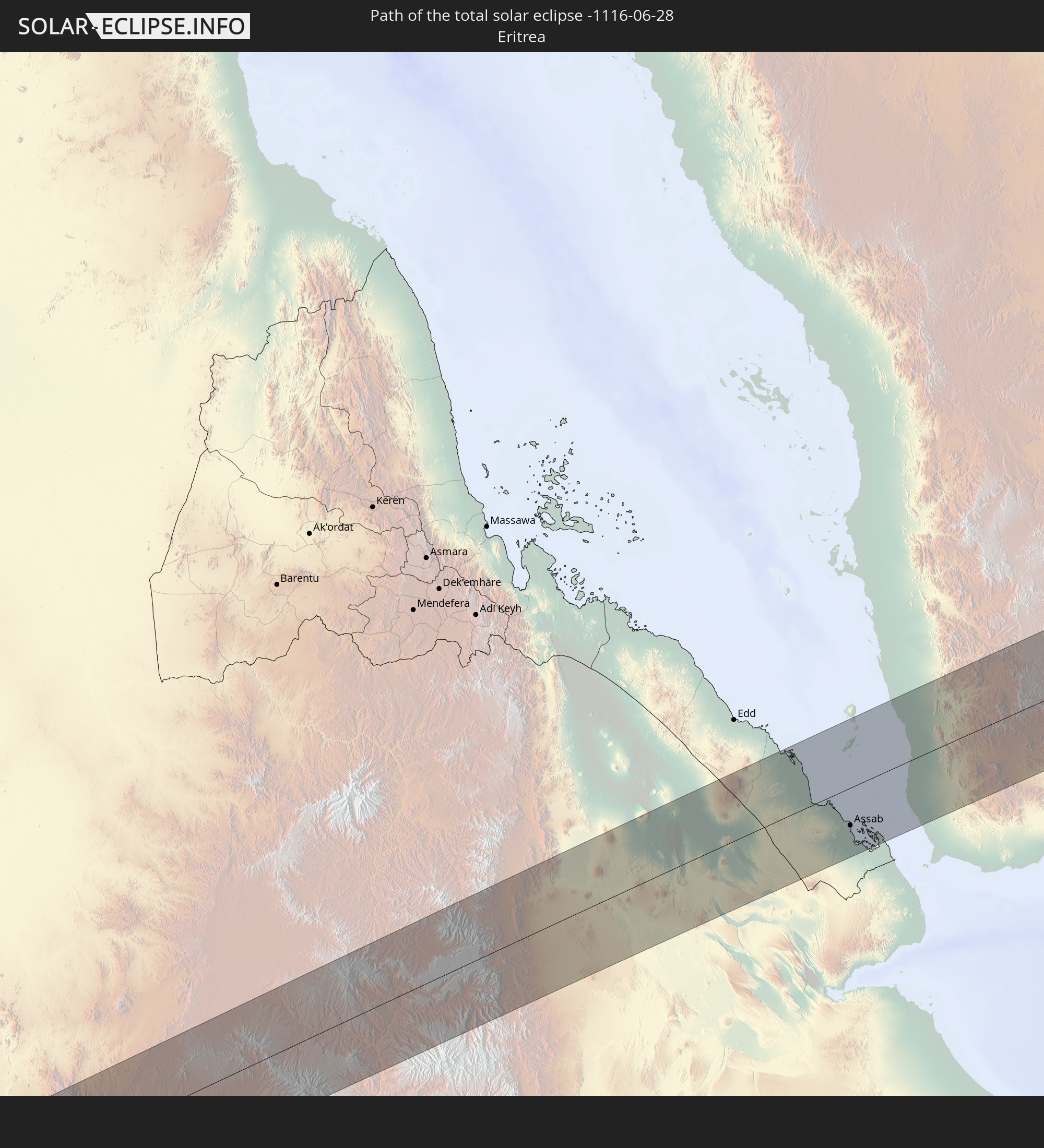 Eritrea
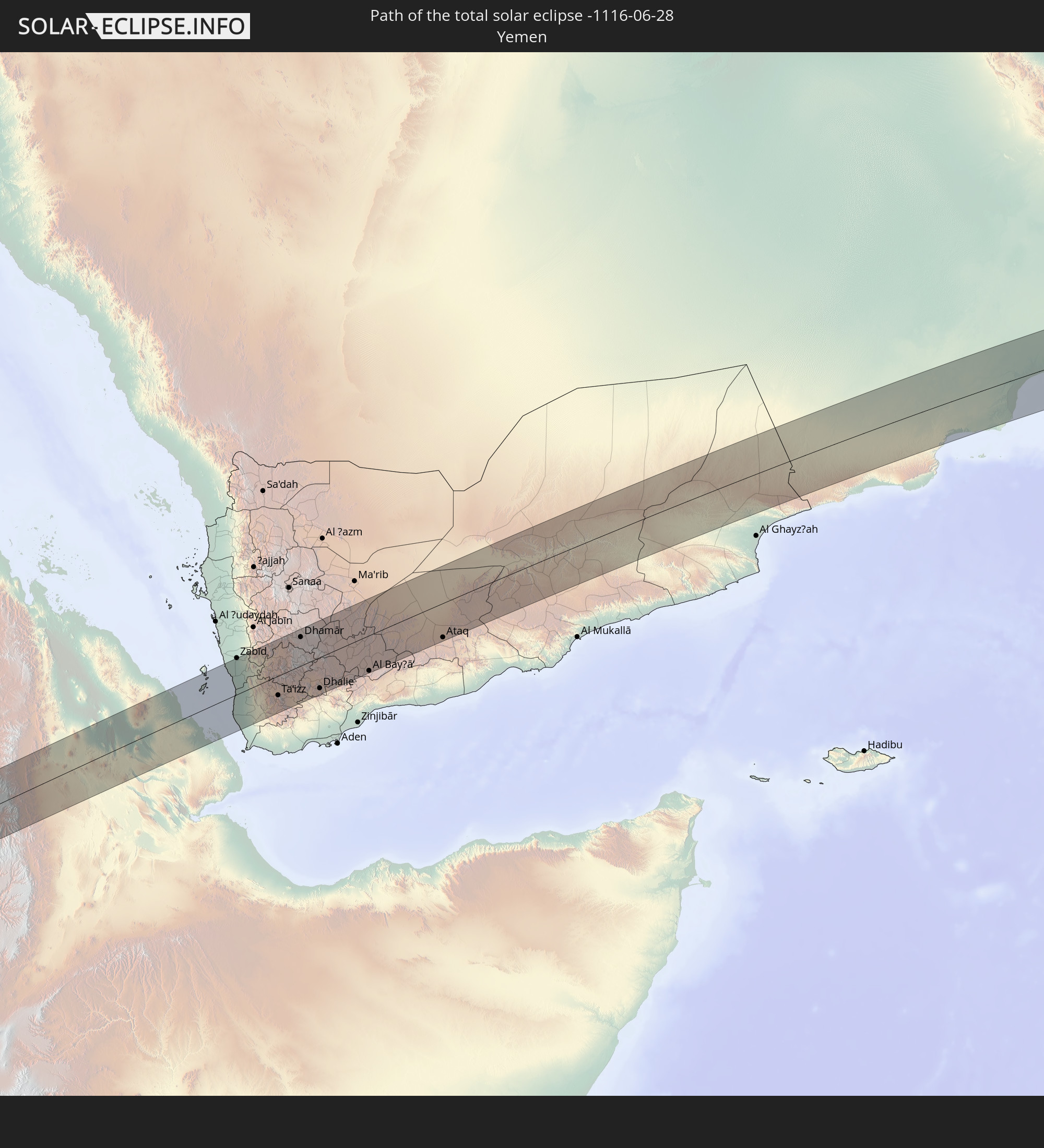 Yemen
Yemen
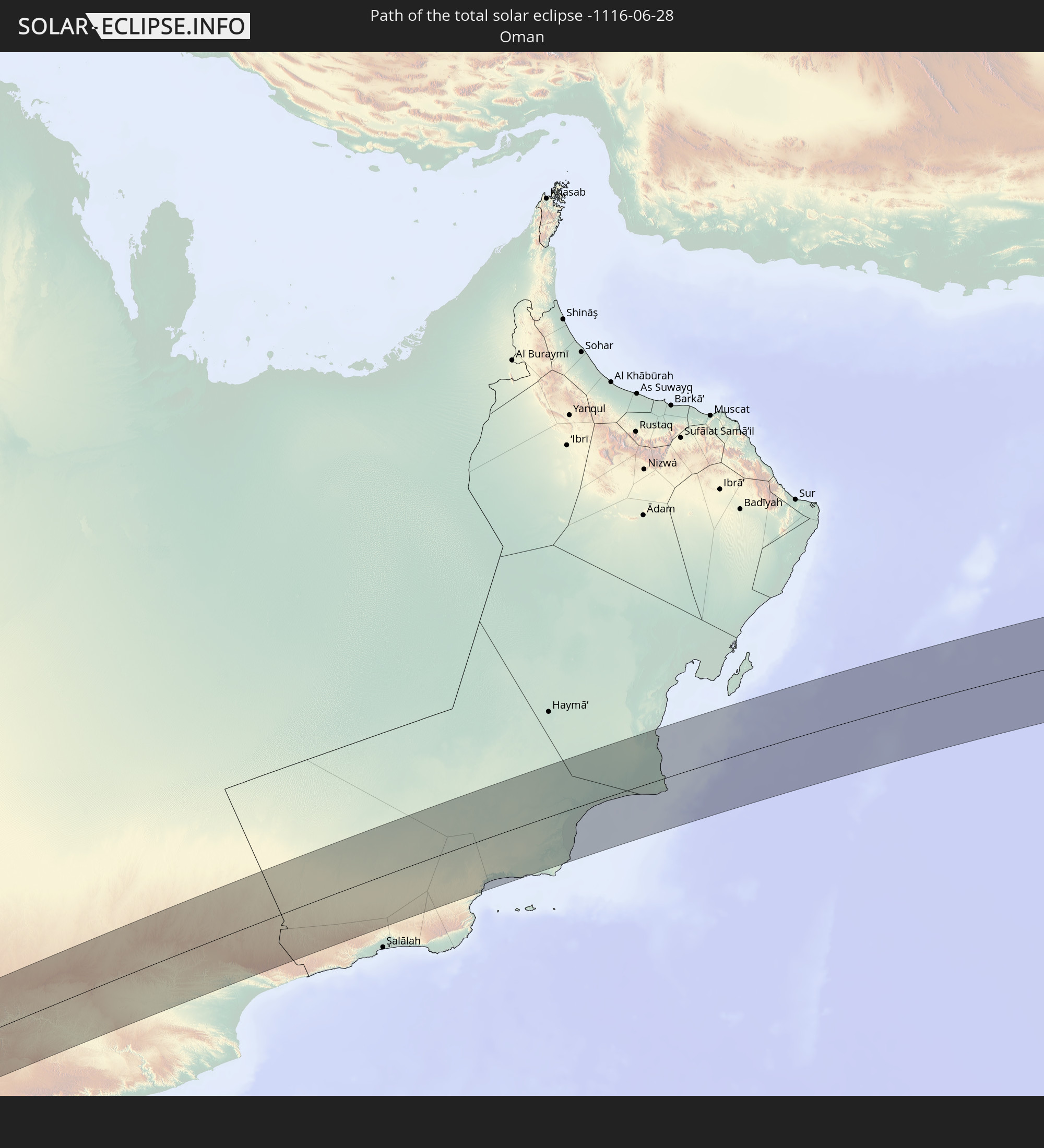 Oman
Oman
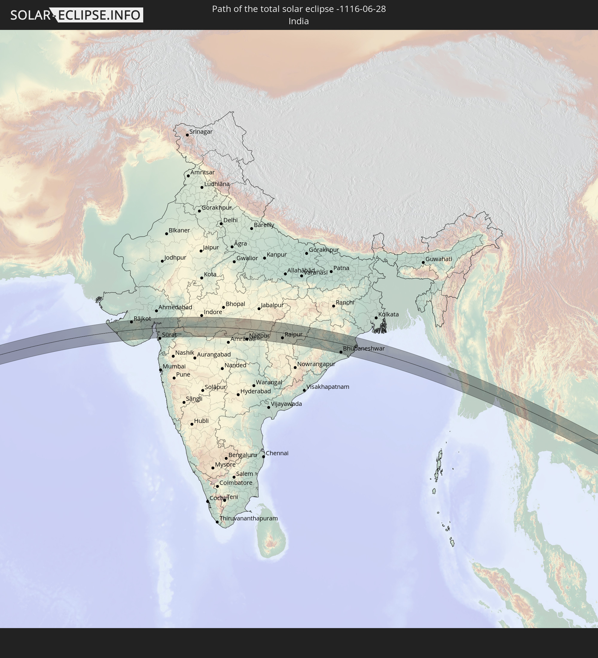 India
India
 Myanmar
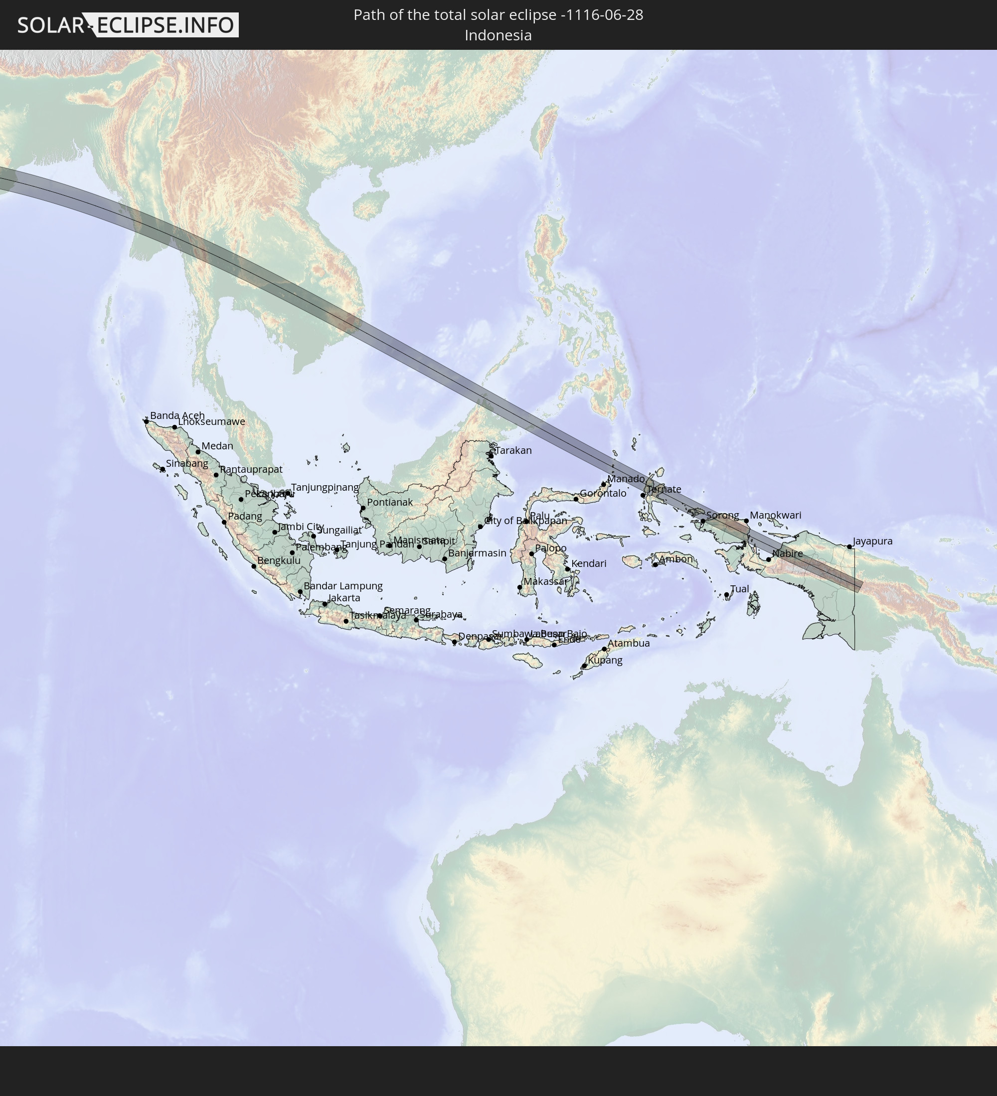 Indonesia
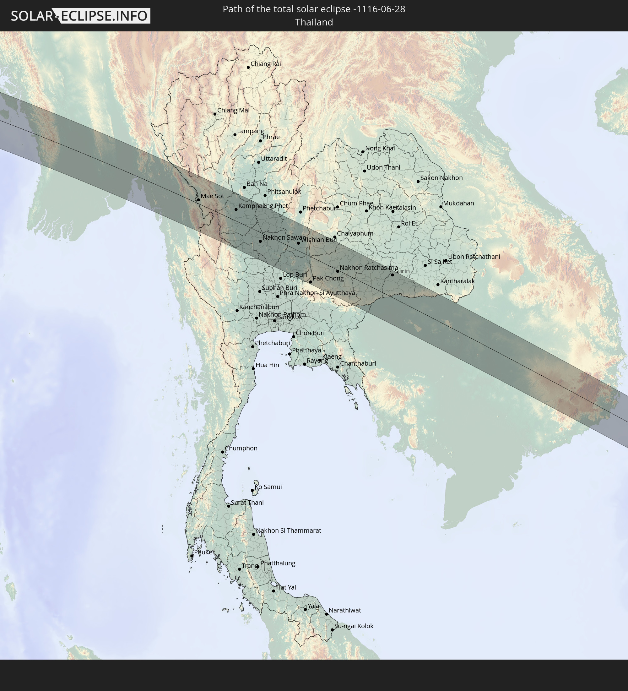 Thailand
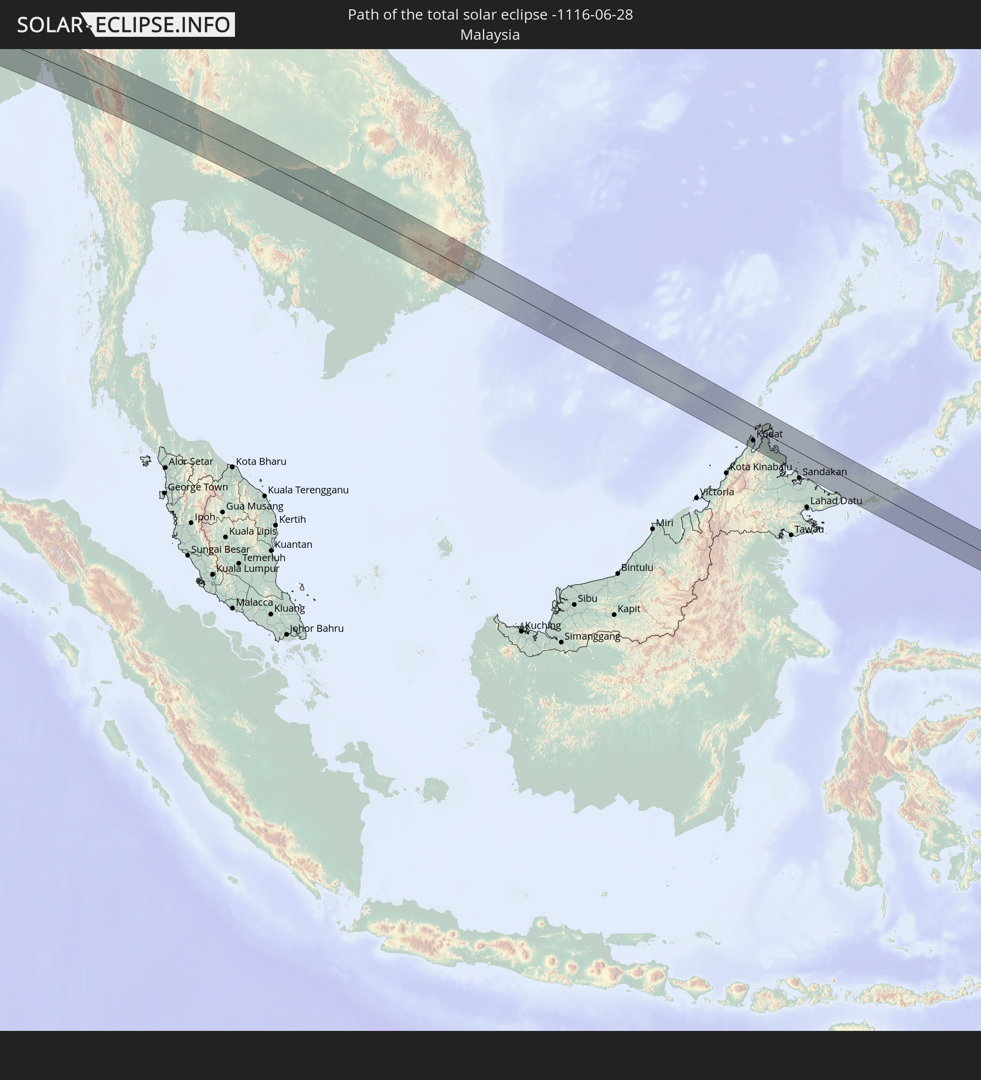 Malaysia
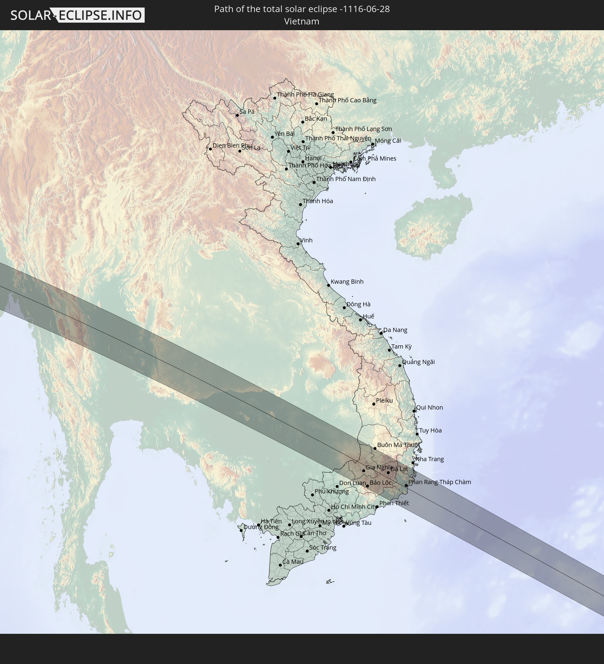 Vietnam
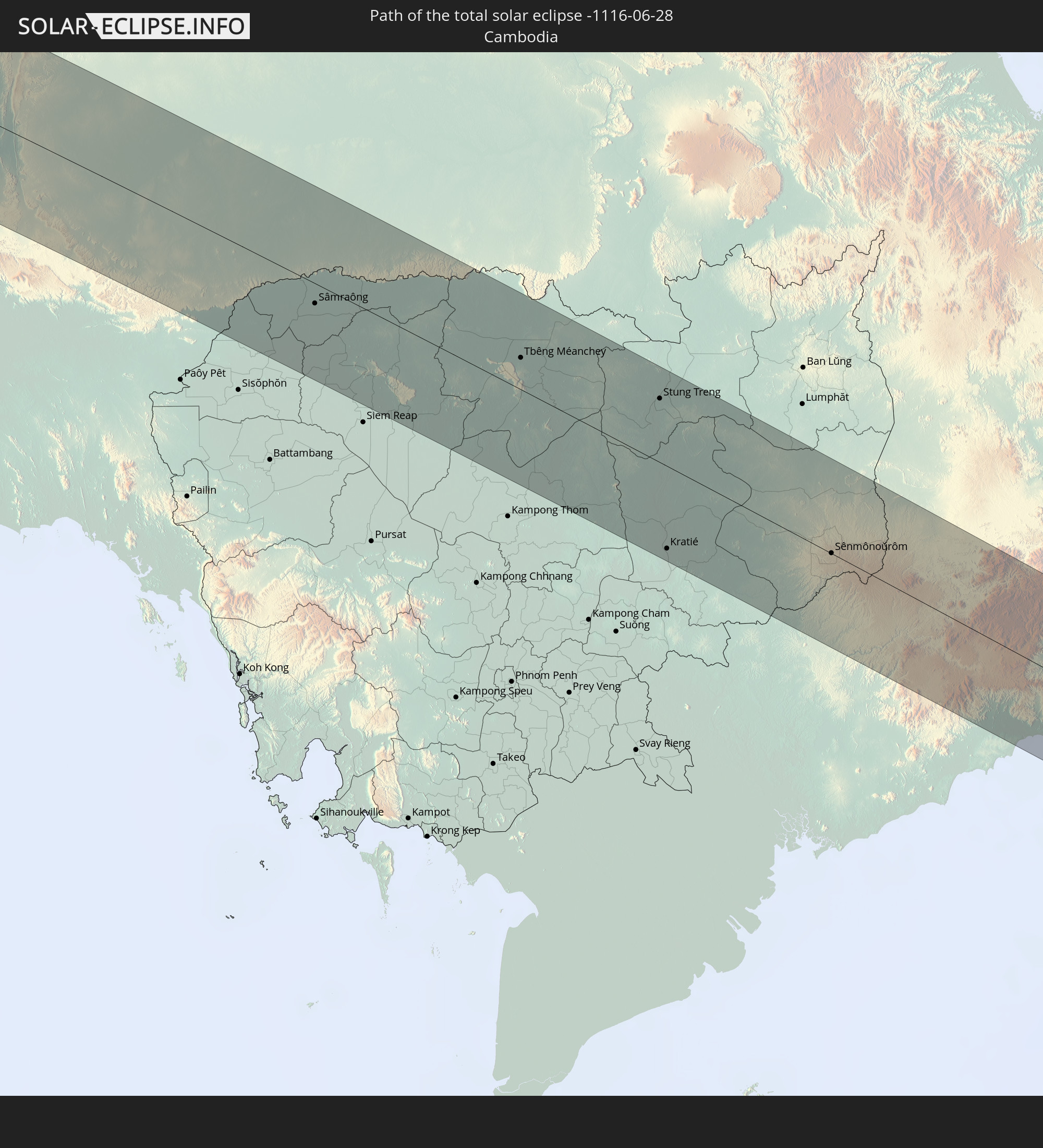 Cambodia
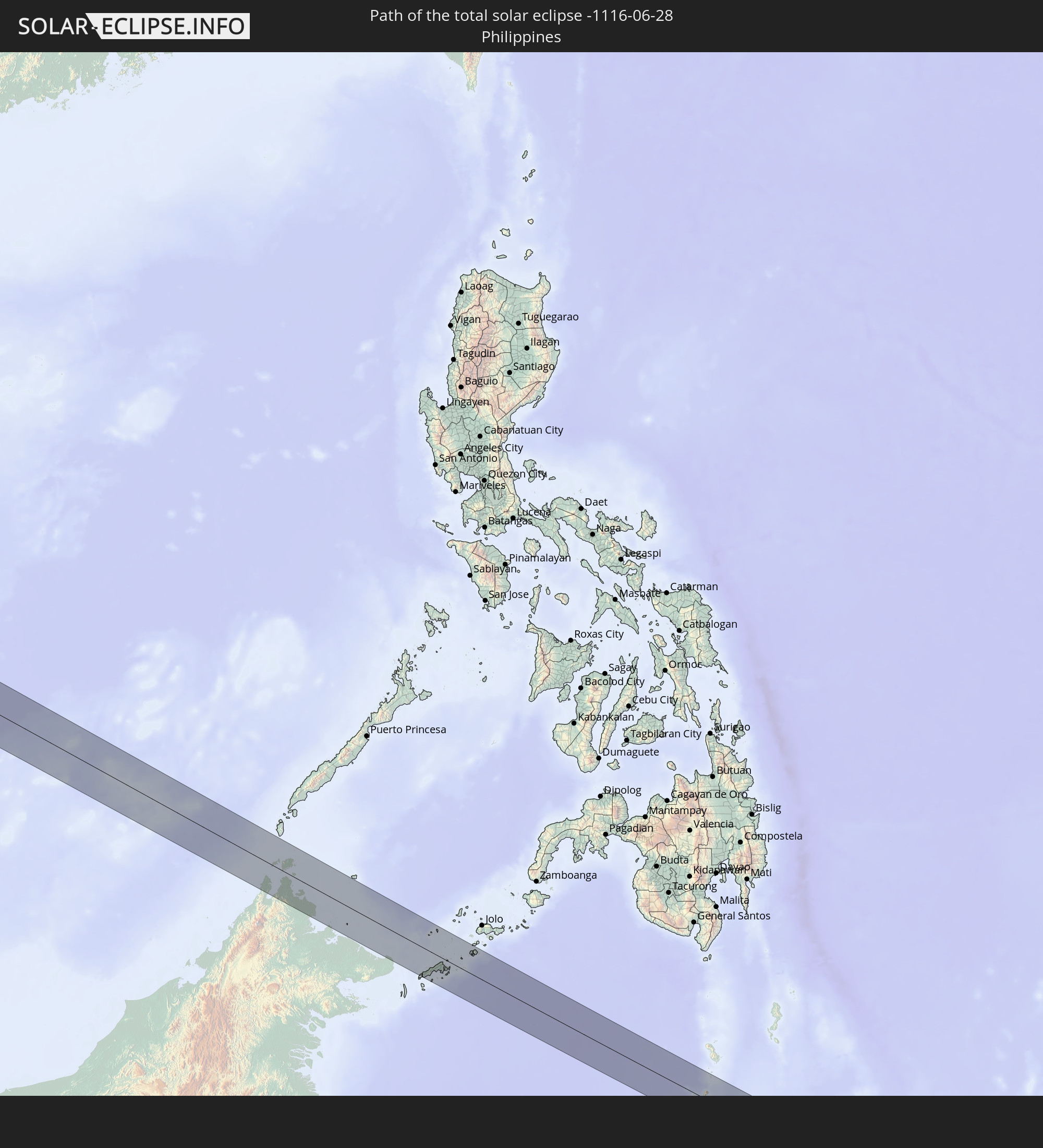 Philippines
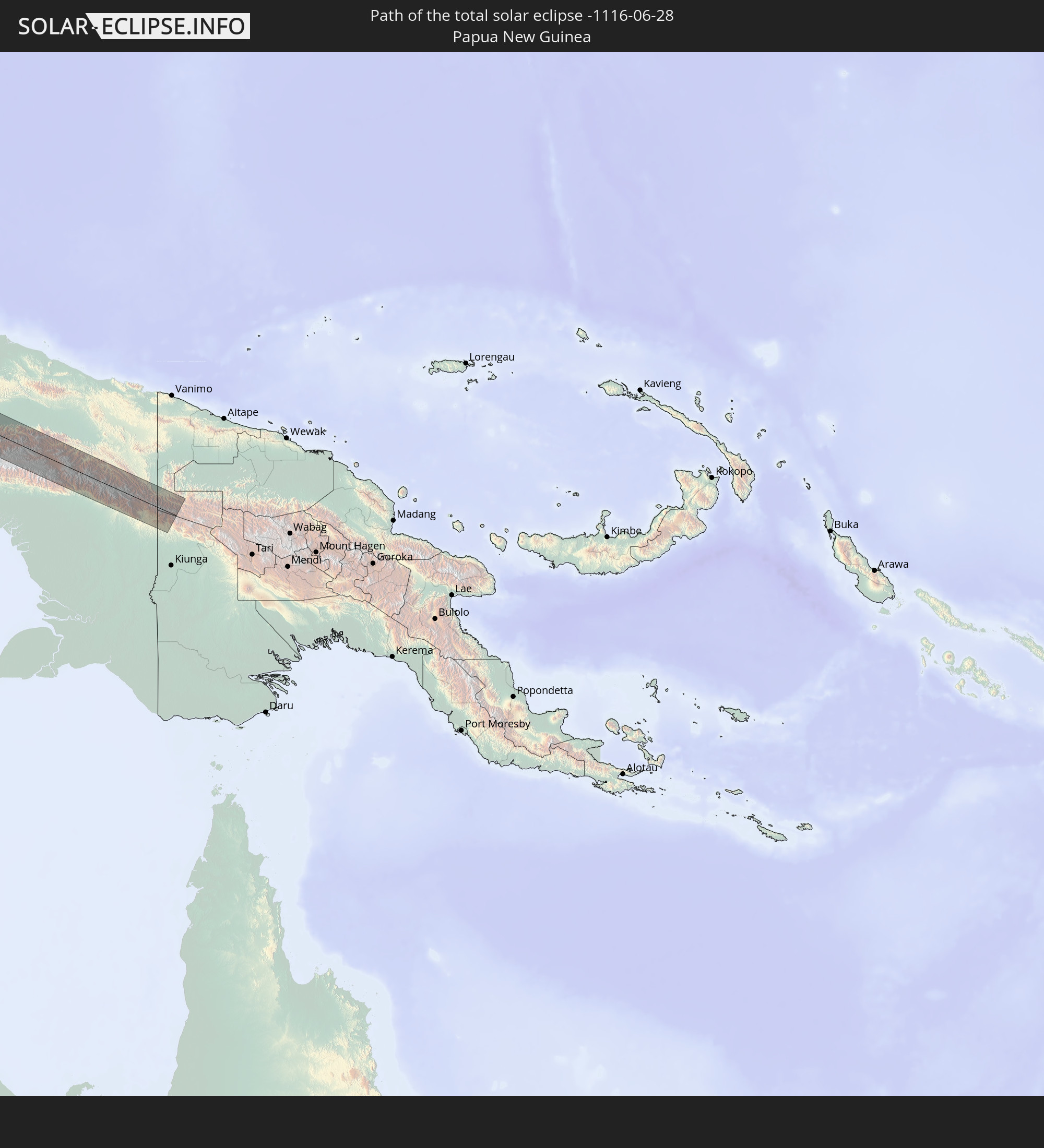 Papua New Guinea
In den folgenden Ländern ist die Sonnenfinsternis partiell zu sehen
 Russia
 Algeria
 Niger
Niger
 Nigeria
 Italy
Italy
 Tunisia
 Cameroon
 Libya
Libya
 Republic of the Congo
 Angola
 Namibia
 Democratic Republic of the Congo
 Chad
Chad
 Malta
Malta
 Central African Republic
 South Africa
 Albania
 Greece
 Botswana
 Romania
 Republic of Macedonia
 Sudan
Sudan
 Zambia
 Ukraine
 Bulgaria
 Egypt
Egypt
 Zimbabwe
 Turkey
 Rwanda
 Burundi
 Tanzania
 Uganda
 Mozambique
 Swaziland
 Cyprus
 Malawi
 Ethiopia
 Kenya
Kenya
 State of Palestine
 Israel
 Saudi Arabia
 Jordan
 Lebanon
 Syria
Syria
 Eritrea
 Iraq
Iraq
 Georgia
 French Southern and Antarctic Lands
 Somalia
 Djibouti
 Yemen
Yemen
 Madagascar
 Comoros
 Armenia
 Iran
Iran
 Azerbaijan
 Mayotte
 Seychelles
 Kazakhstan
 Kuwait
 Bahrain
 Qatar
Qatar
 United Arab Emirates
 Oman
Oman
 Turkmenistan
 Uzbekistan
 Mauritius
 Afghanistan
 Pakistan
 Tajikistan
 India
India
 Kyrgyzstan
 British Indian Ocean Territory
 Maldives
 China
China
 Sri Lanka
 Nepal
Nepal
 Mongolia
 Bangladesh
 Bhutan
 Myanmar
 Indonesia
 Cocos Islands
 Thailand
 Malaysia
 Laos
Laos
 Vietnam
 Cambodia
 Singapore
 Christmas Island
 Australia
 Macau
Macau
 Hong Kong
 Brunei
 Taiwan
 Philippines
 Japan
Japan
 East Timor
 North Korea
 South Korea
 Palau
Palau
 Federated States of Micronesia
 Papua New Guinea
 Guam
Guam
 Northern Mariana Islands
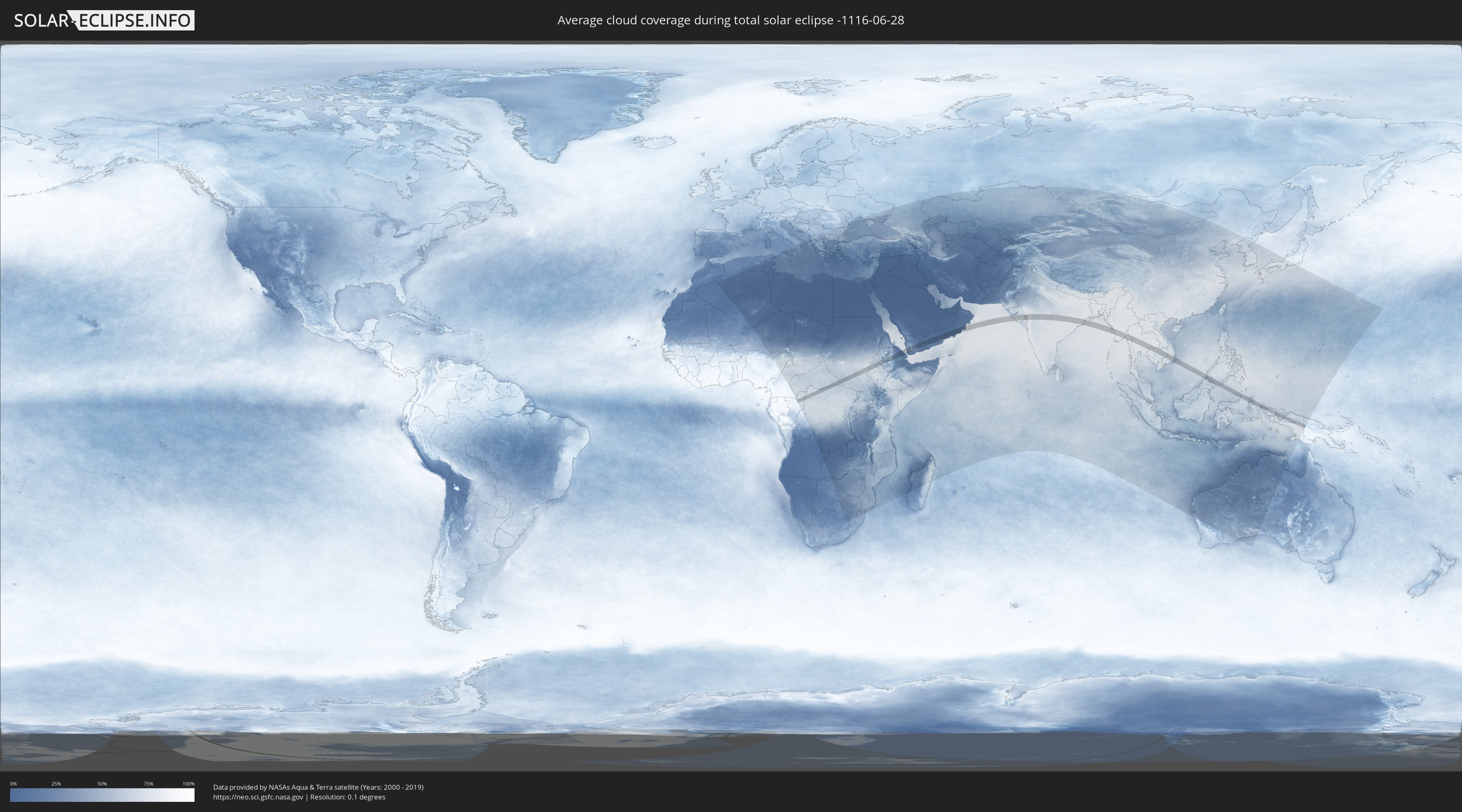
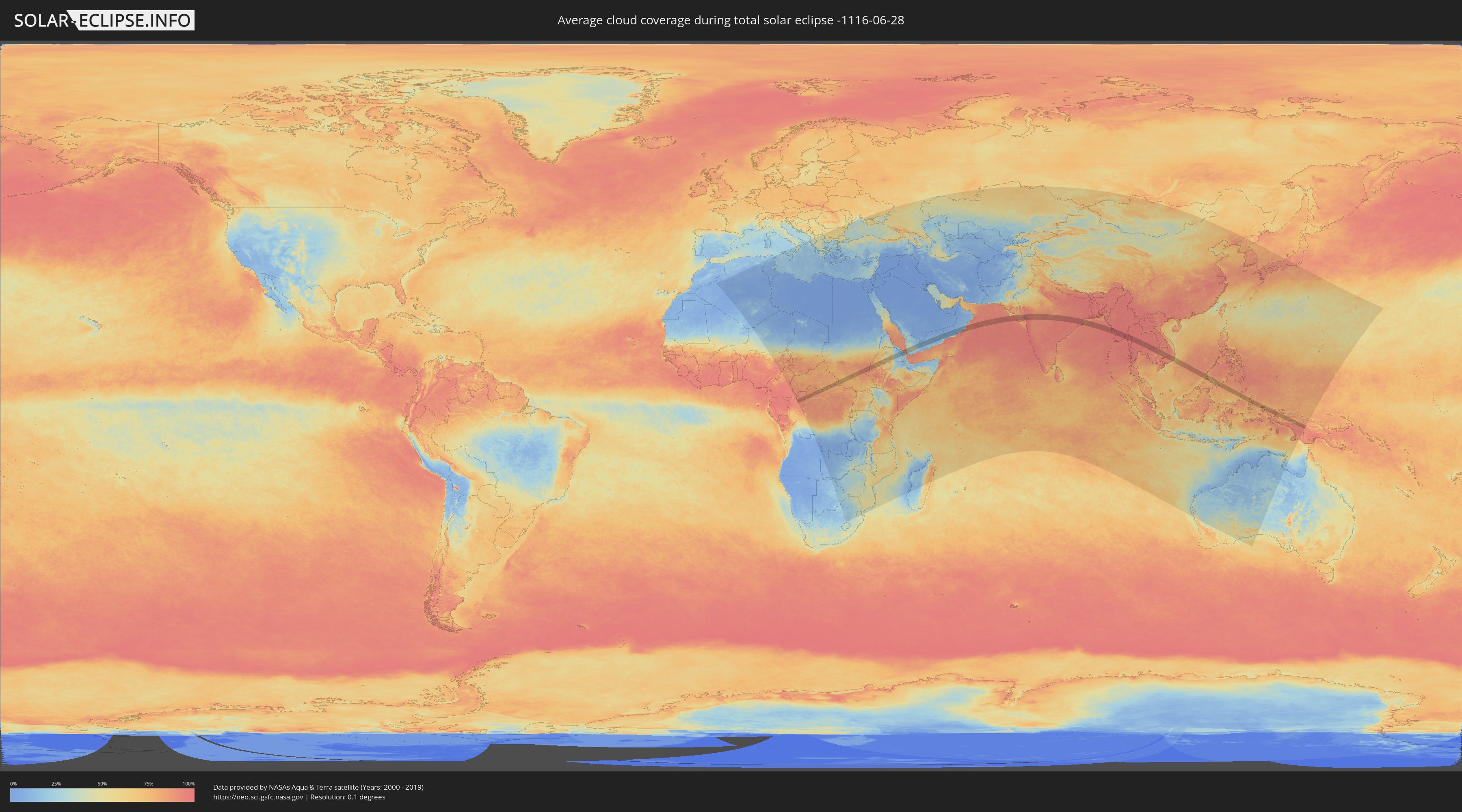
How will be the weather during the total solar eclipse on 06/28/-1116?
Where is the best place to see the total solar eclipse of 06/28/-1116?
The following maps show the average cloud coverage for the day of the total solar eclipse.
With the help of these maps, it is possible to find the place along the eclipse path, which has the best
chance of a cloudless sky.
Nevertheless, you should consider local circumstances and inform about the weather of your chosen
observation site.
The data is provided by NASAs satellites
AQUA and TERRA.
The cloud maps are averaged over a period of 19 years (2000 - 2019).
Detailed country maps
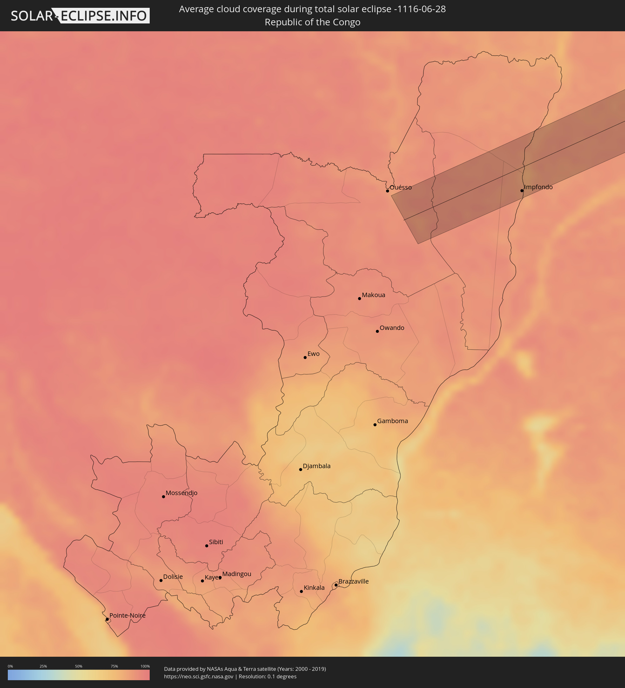 Republic of the Congo
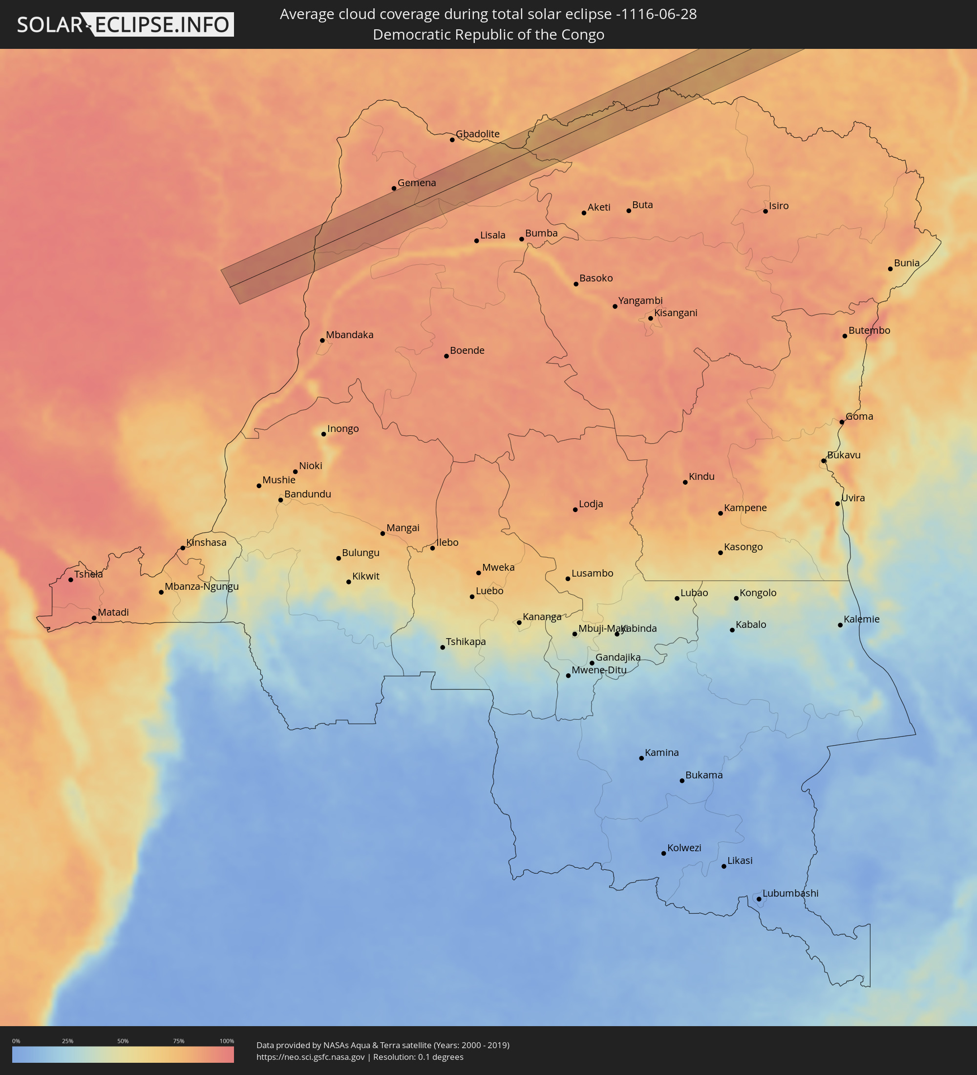 Democratic Republic of the Congo
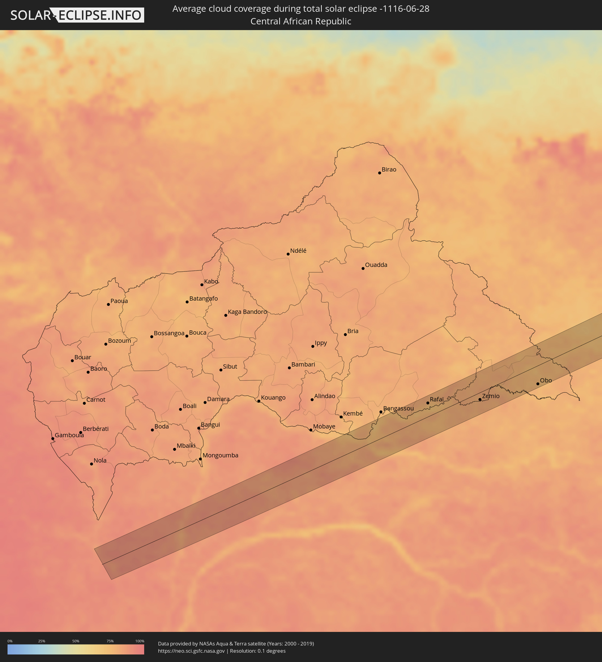 Central African Republic
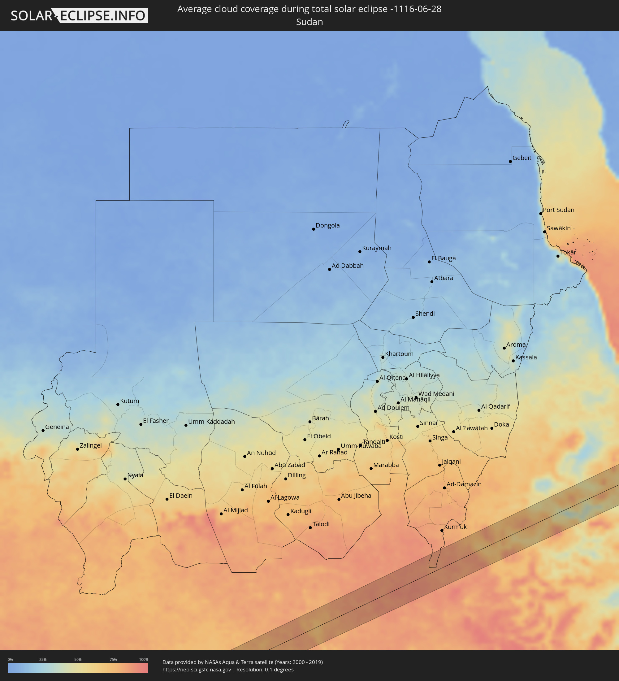 Sudan
Sudan
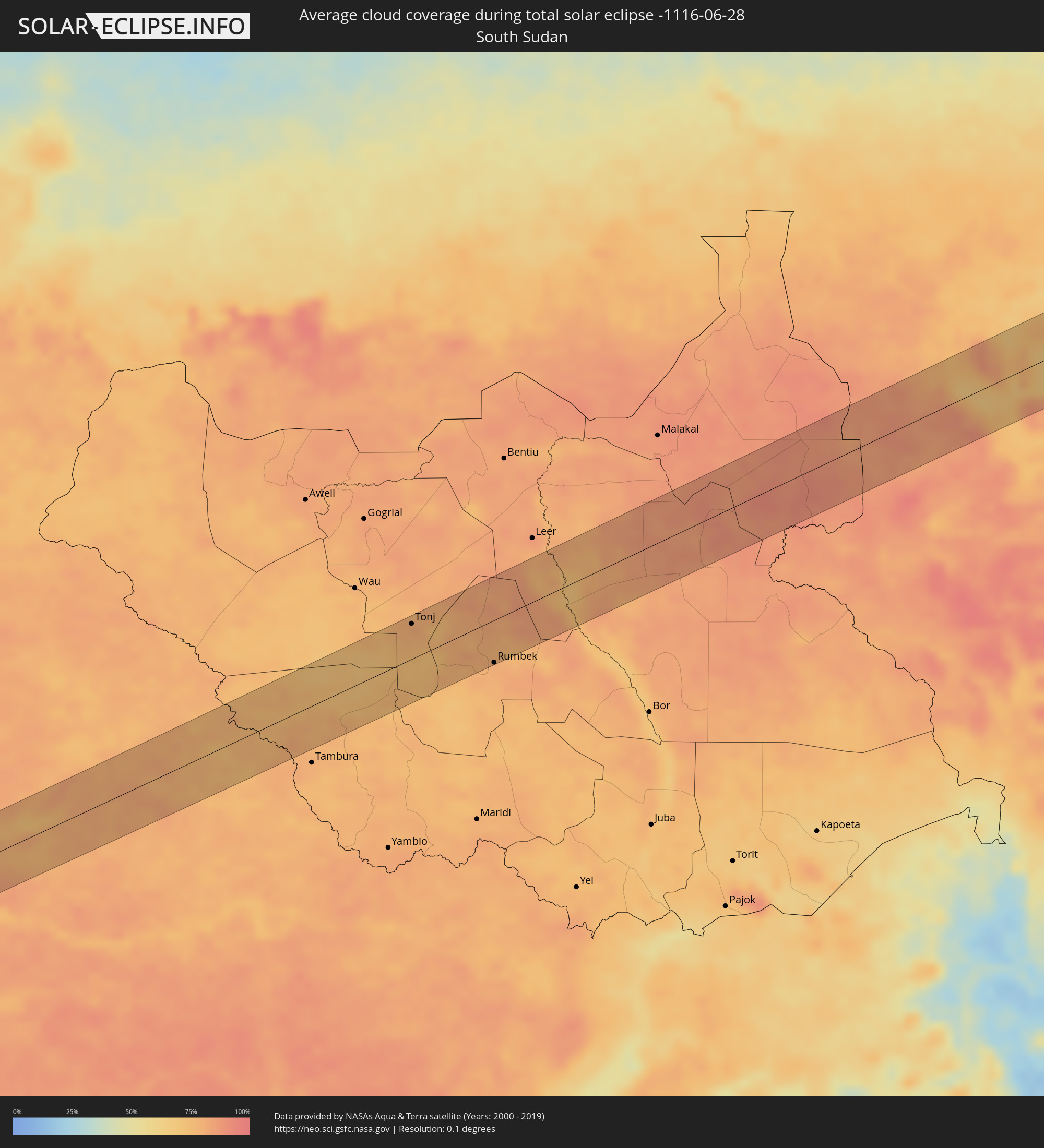 South Sudan
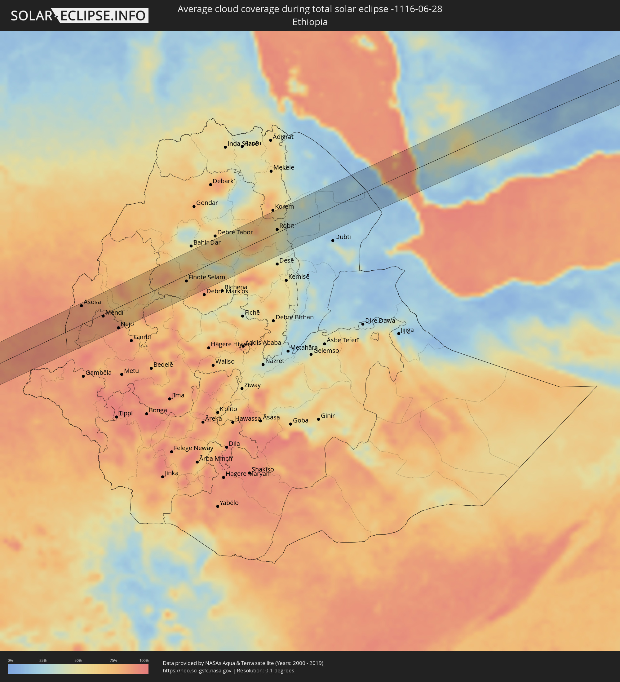 Ethiopia
 Eritrea
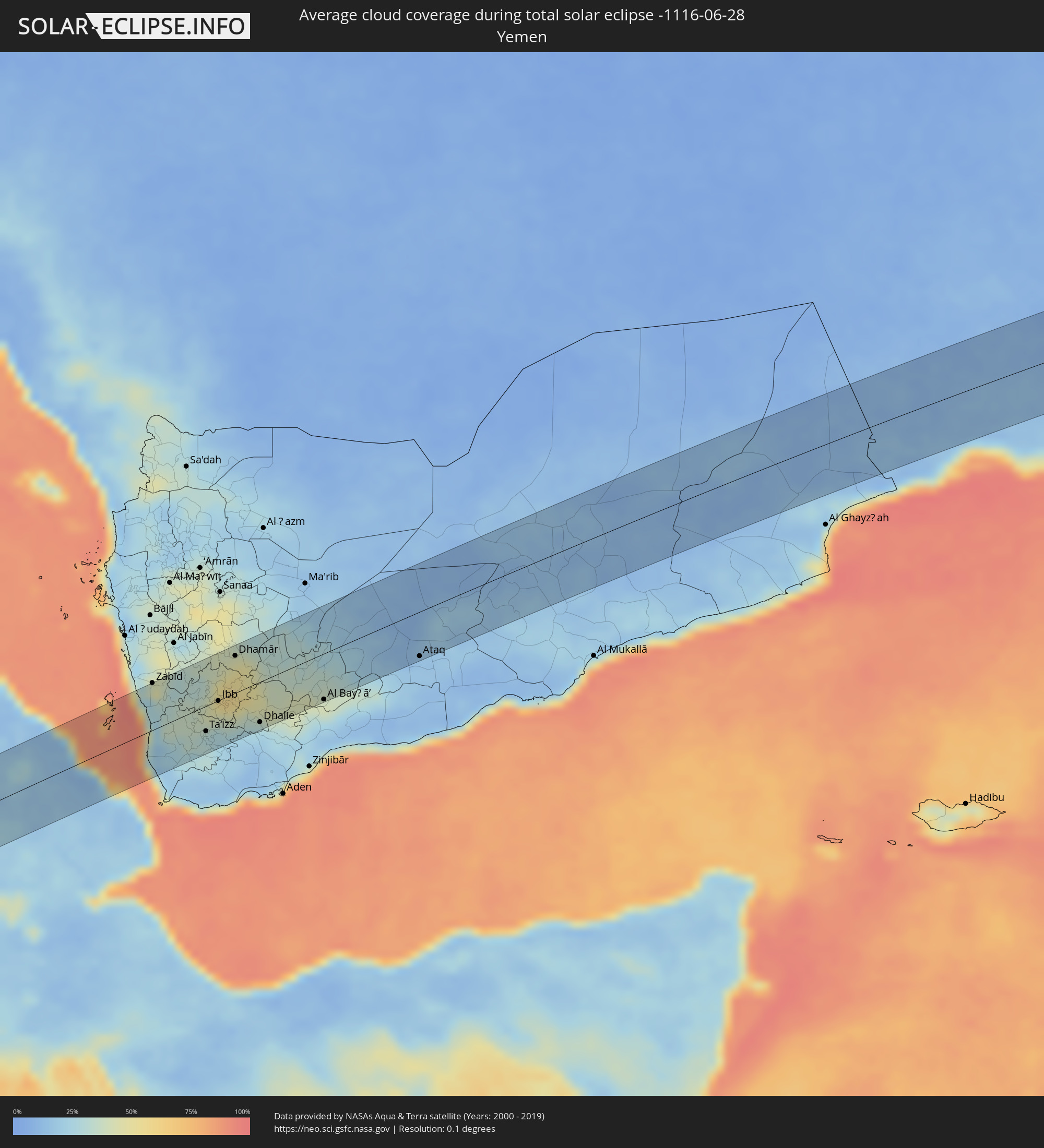 Yemen
Yemen
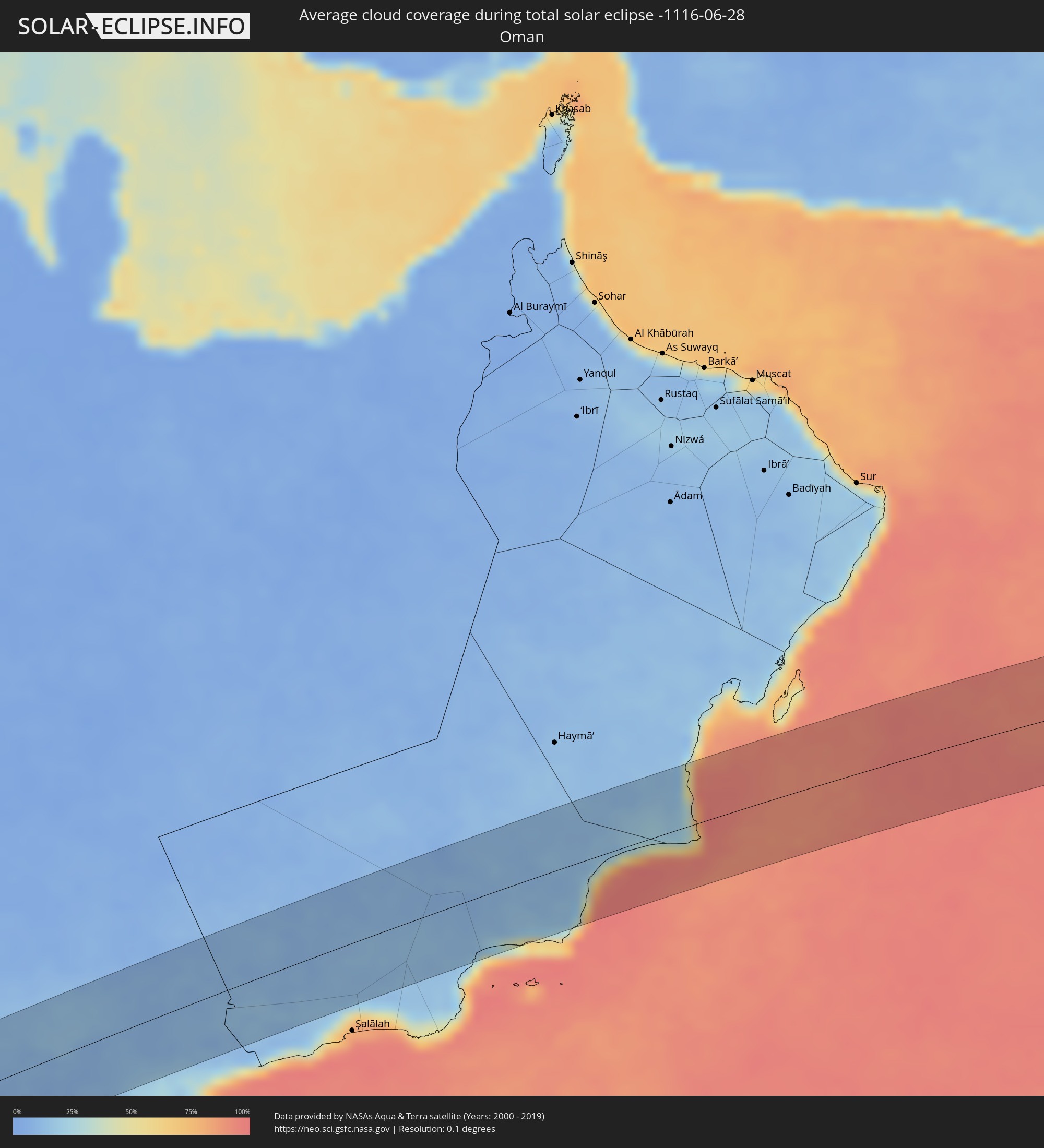 Oman
Oman
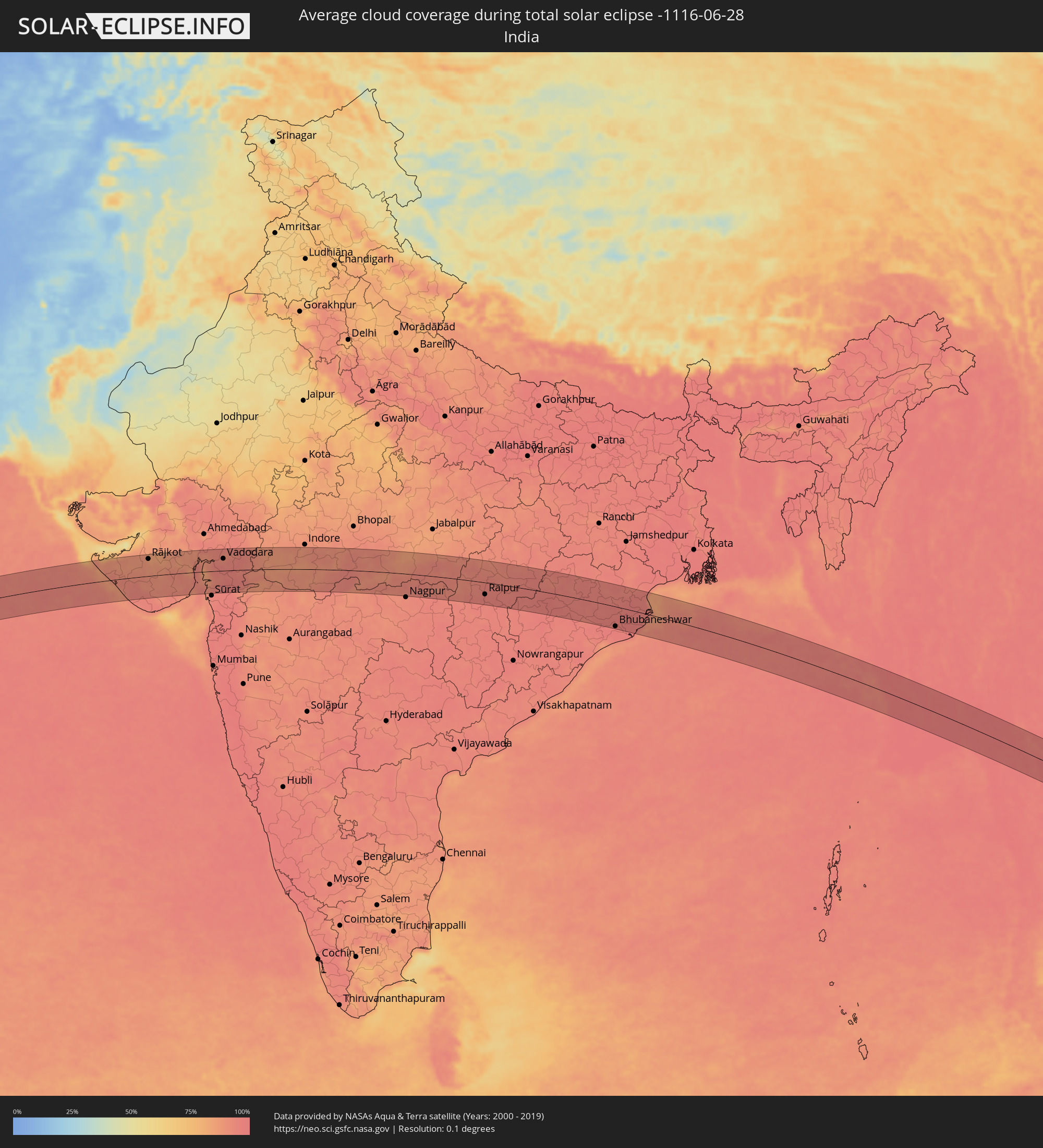 India
India
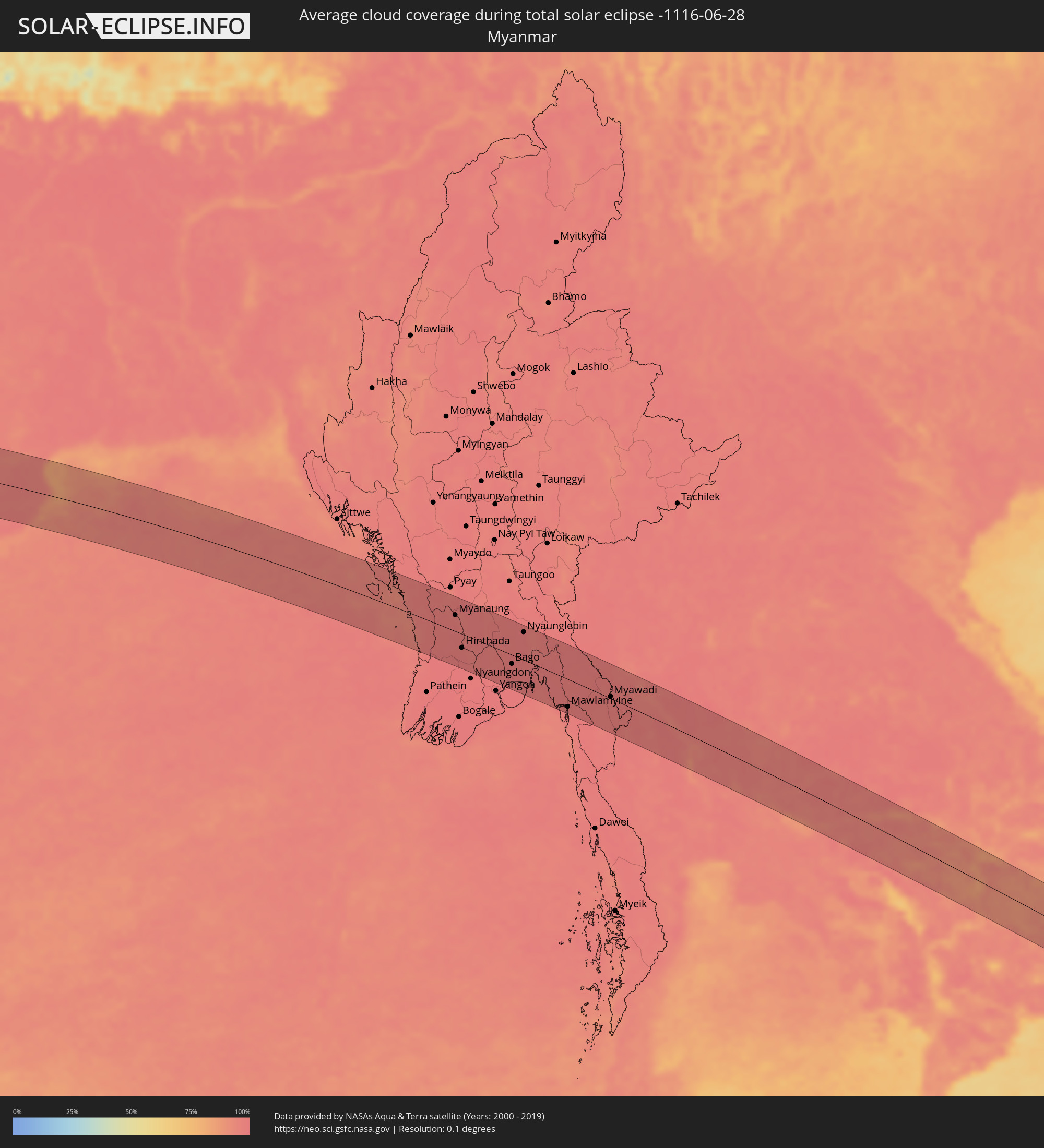 Myanmar
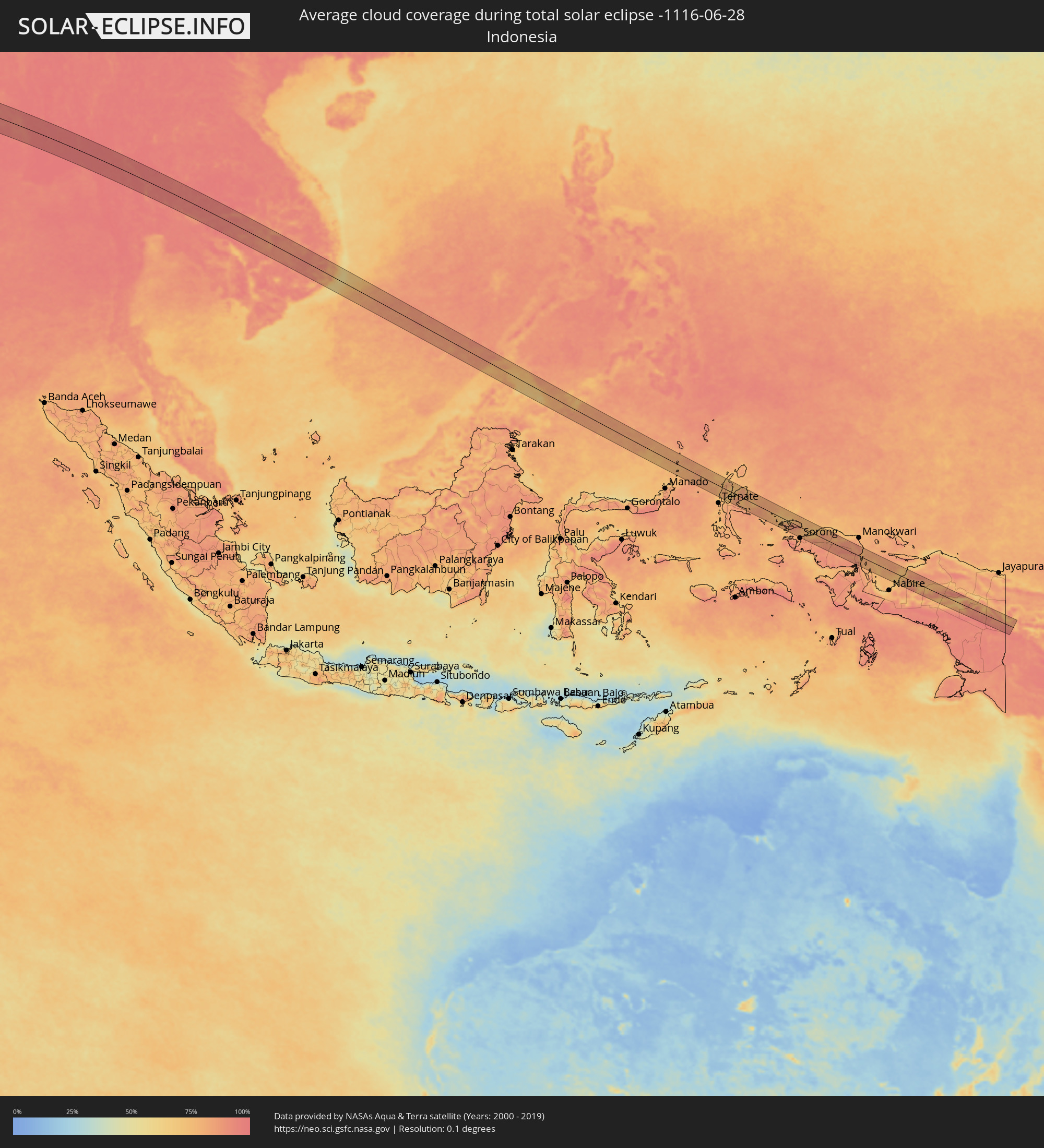 Indonesia
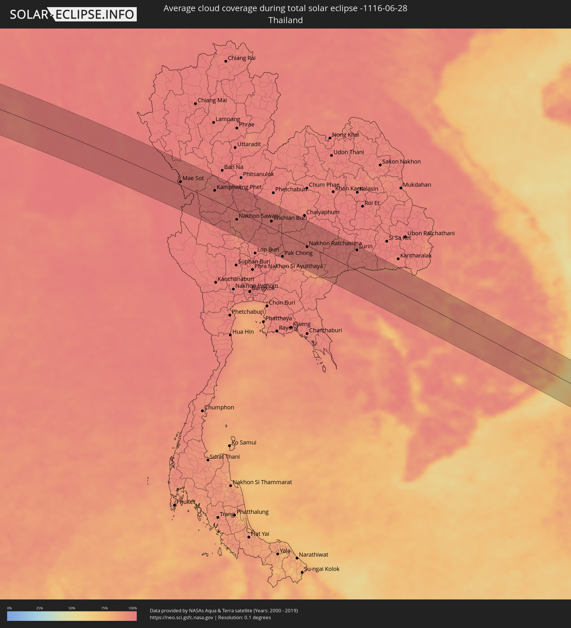 Thailand
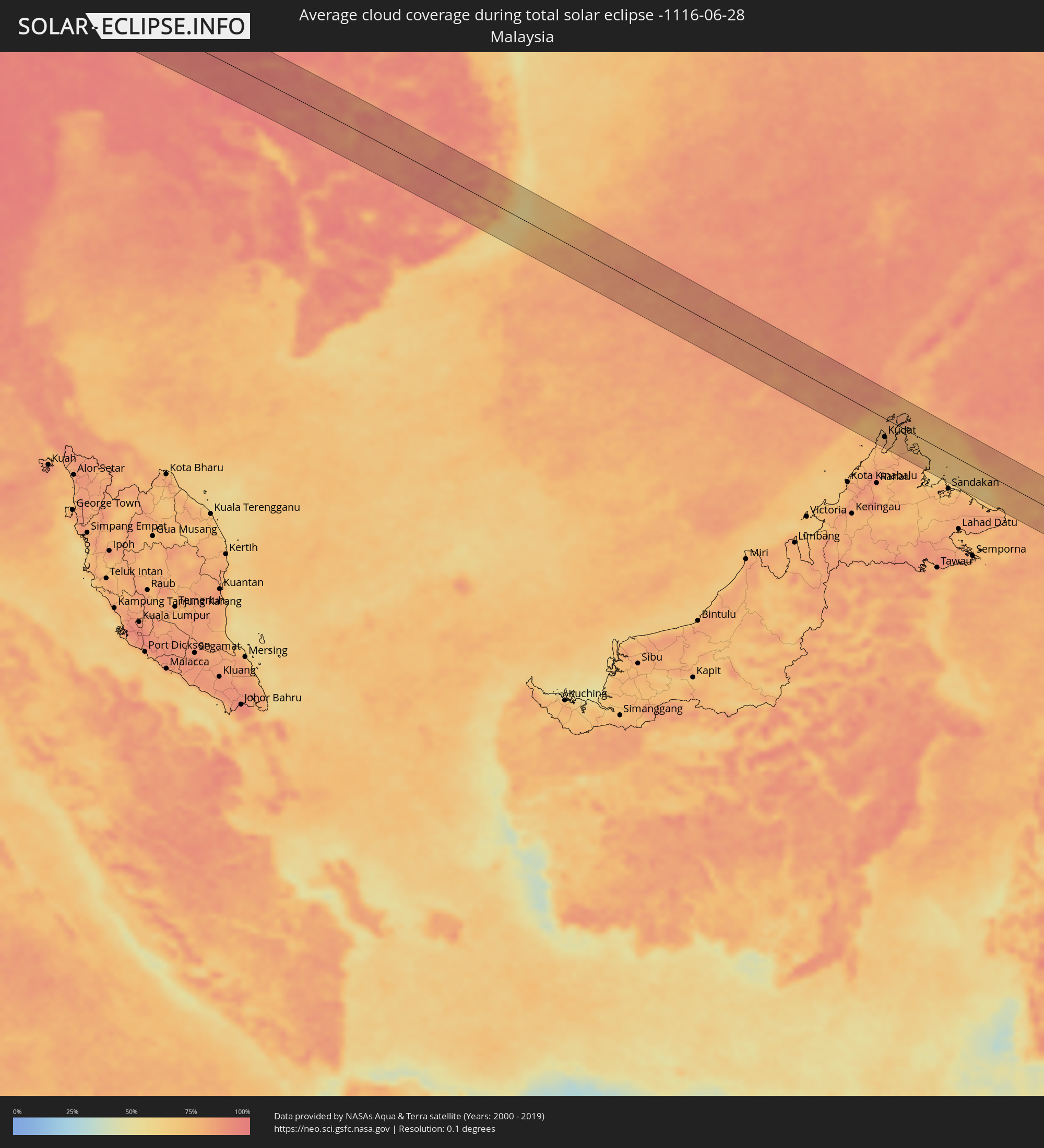 Malaysia
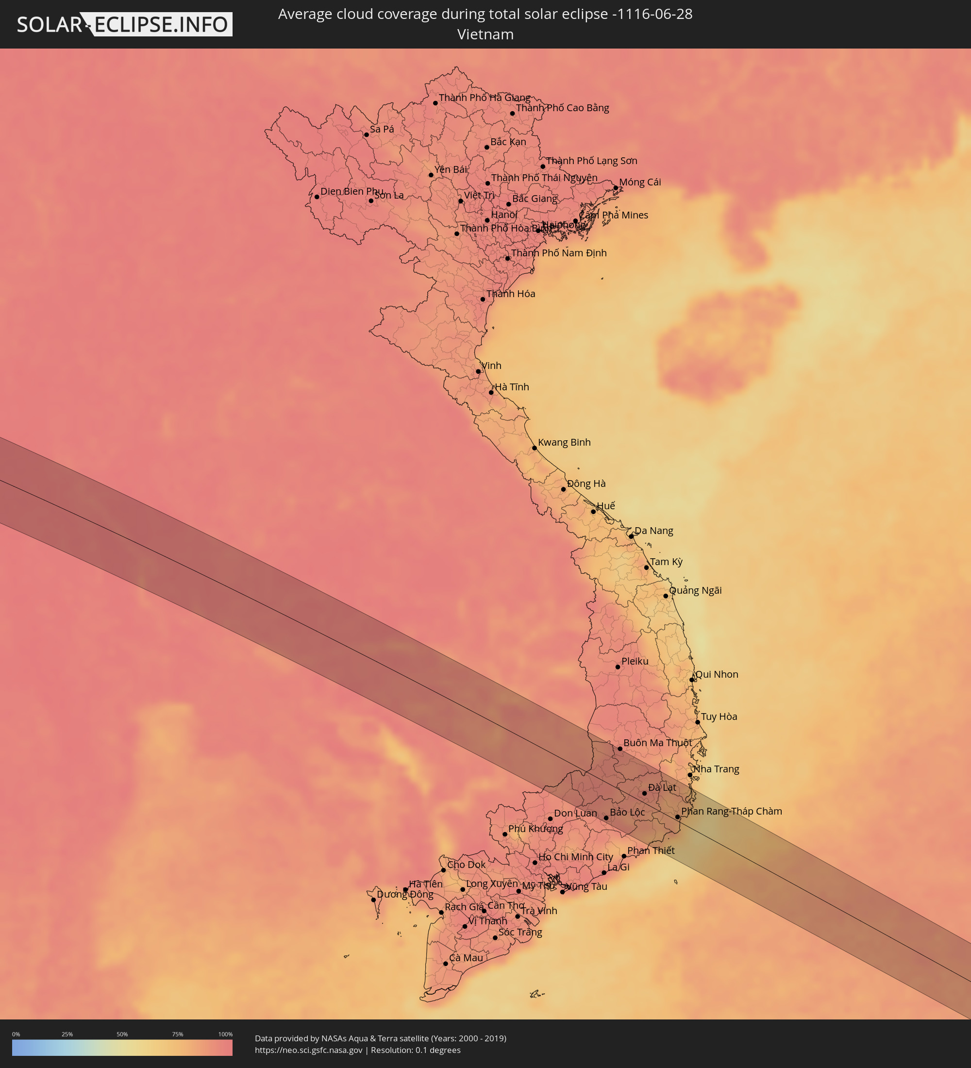 Vietnam
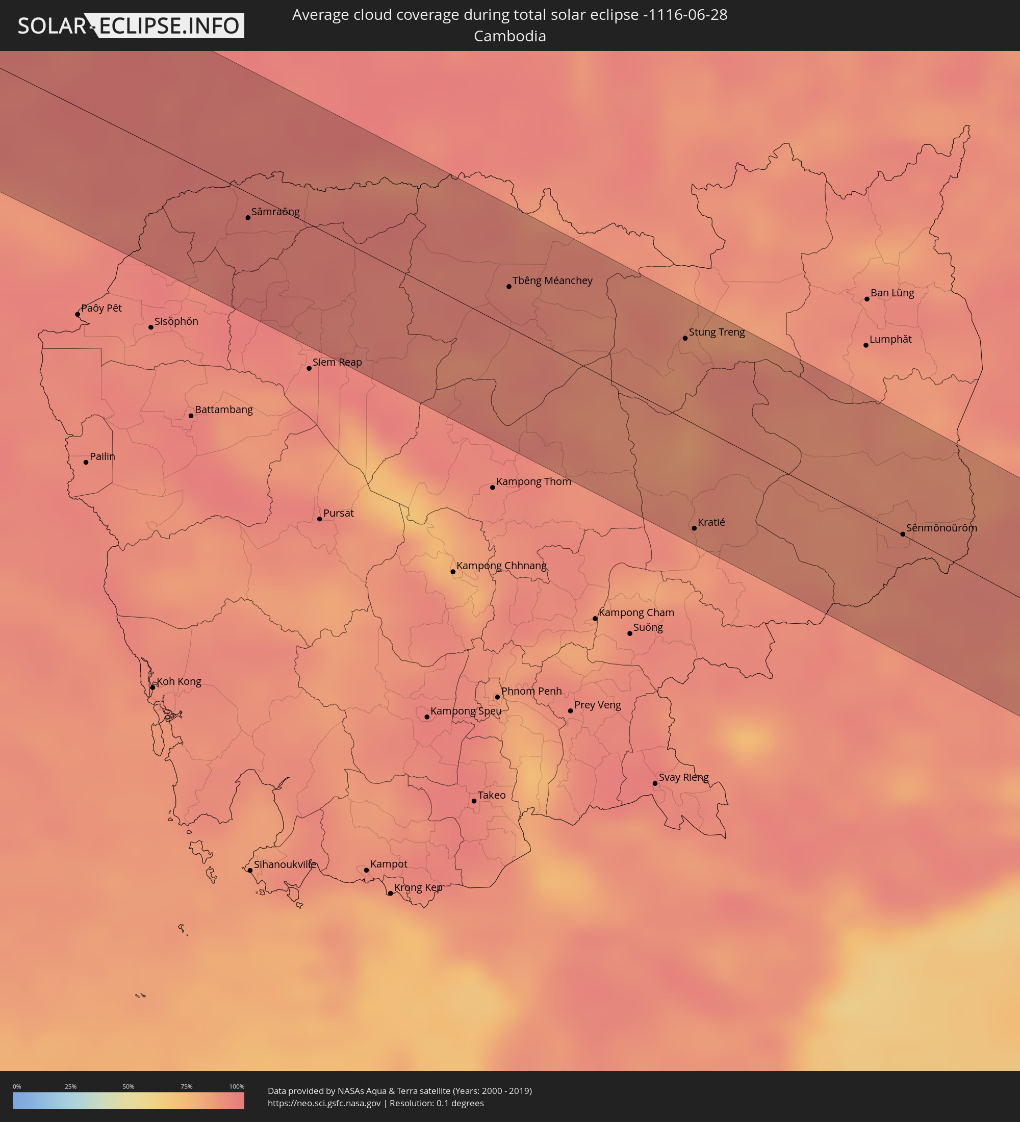 Cambodia
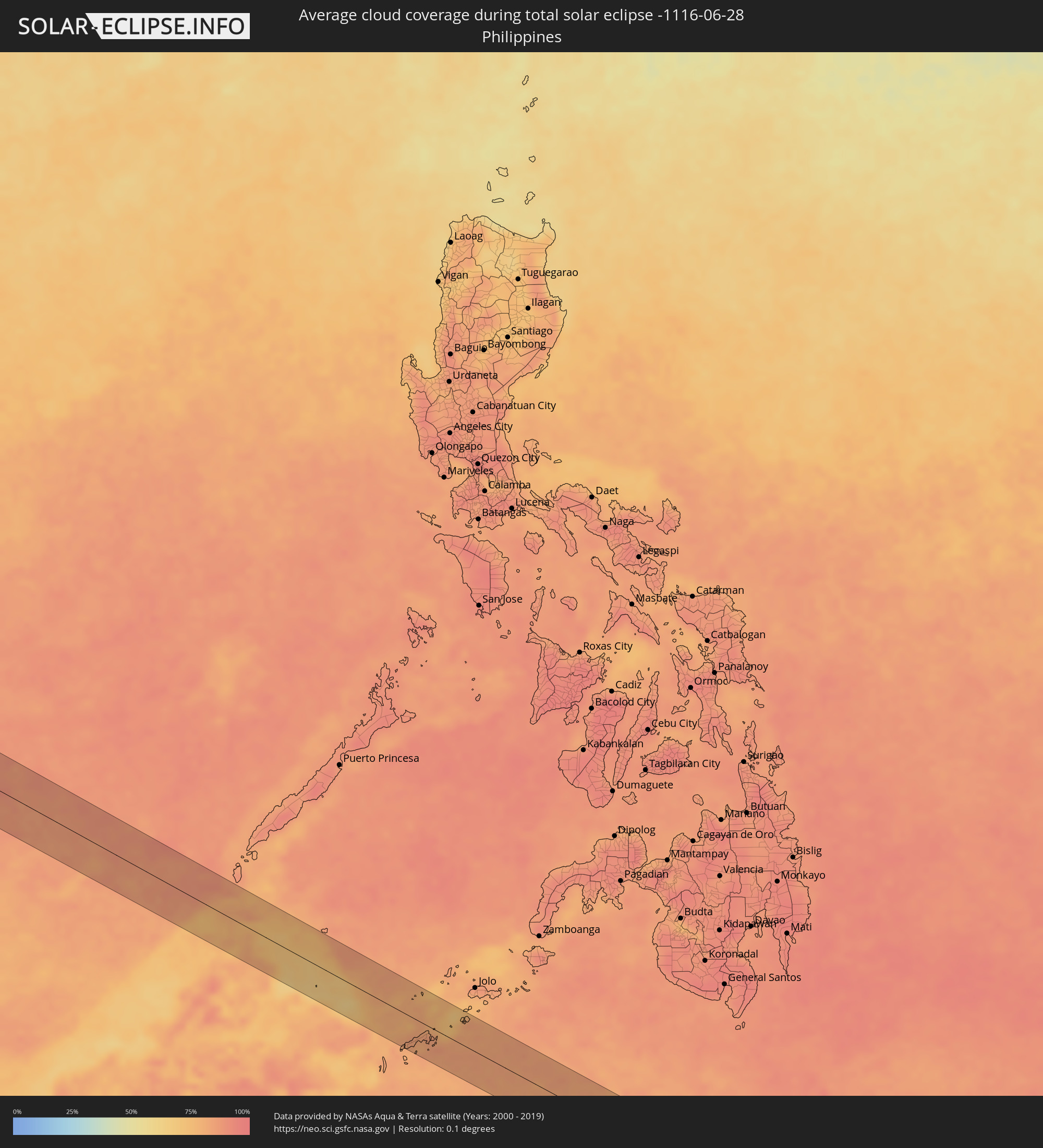 Philippines
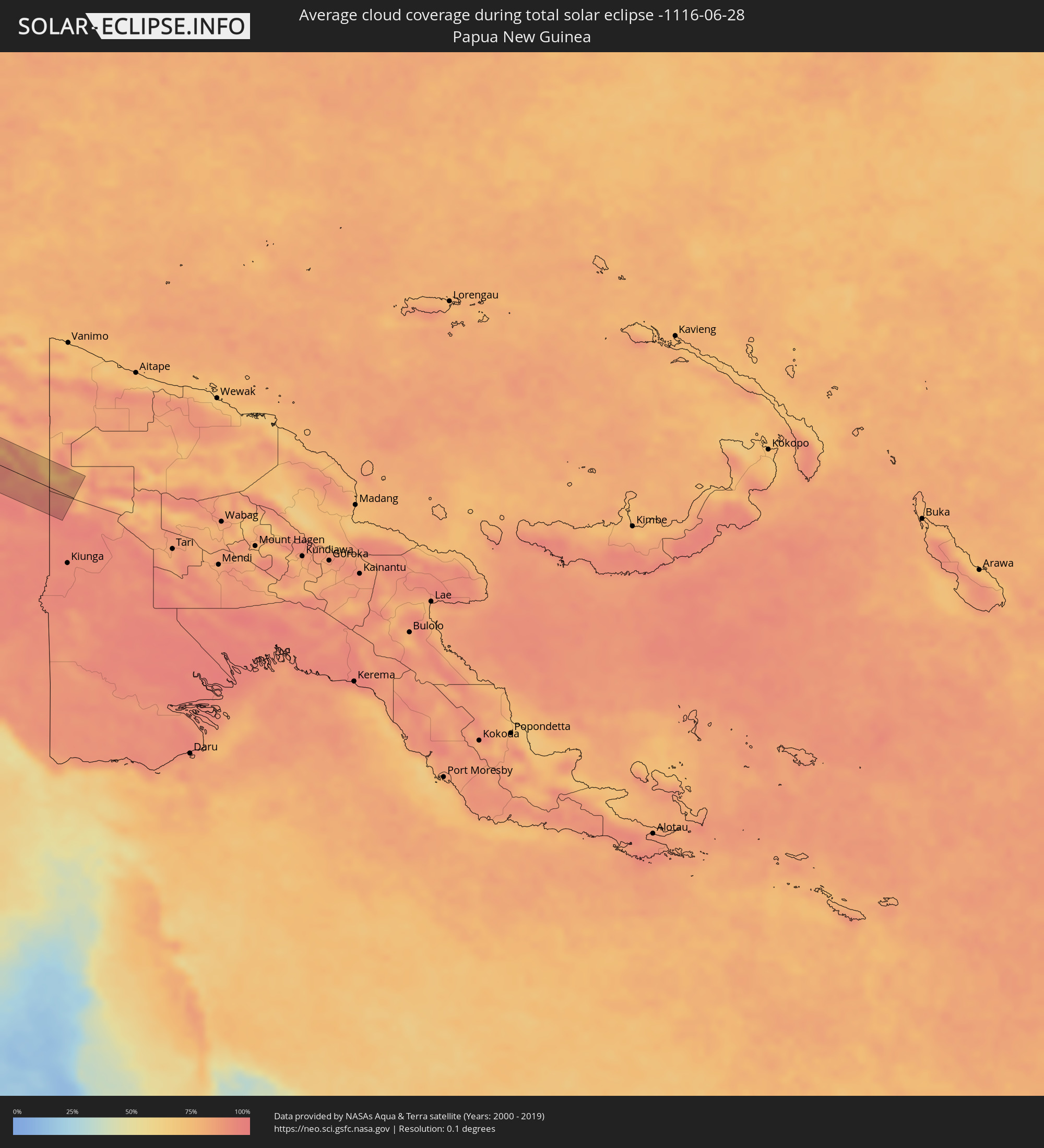 Papua New Guinea
Cities inside the path of the eclipse
The following table shows all locations with a population of more than 5,000 inside the eclipse path. Cities which have more than 100,000 inhabitants are marked bold. A click at the locations opens a detailed map.
| City | Type | Eclipse duration | Local time of max. eclipse | Distance to central line | Ø Cloud coverage |
|
Impfondo, Likouala
|
total | - | 05:00:35 UTC+00:13 | 36 km | 82% |
|
Businga, Équateur
|
total | - | 05:01:04 UTC+00:13 | 9 km | 84% |
|
Rafaï, Mbomou
|
total | - | 05:01:57 UTC+00:13 | 31 km | 73% |
|
Zemio, Haut-Mbomou
|
total | - | 05:02:11 UTC+00:13 | 17 km | 80% |
|
Obo, Haut-Mbomou
|
total | - | 05:02:38 UTC+00:13 | 44 km | 75% |
 Tonj, Warrap
|
total | - | 06:57:01 UTC+02:06 | 43 km | 81% |
|
Rumbek, Lakes
|
total | - | 06:57:09 UTC+02:06 | 52 km | 79% |
|
Āsosa, Bīnshangul Gumuz
|
total | - | 07:22:09 UTC+02:27 | 48 km | 85% |
|
Mendī, Oromiya
|
total | - | 07:22:20 UTC+02:27 | 5 km | 87% |
|
Nejo, Oromiya
|
total | - | 07:22:24 UTC+02:27 | 54 km | 86% |
|
Burē, Amhara
|
total | - | 07:24:15 UTC+02:27 | 7 km | 69% |
|
Finote Selam, Amhara
|
total | - | 07:24:24 UTC+02:27 | 16 km | 63% |
|
Addiet Canna, Amhara
|
total | - | 07:24:56 UTC+02:27 | 31 km | 60% |
|
Lalībela, Amhara
|
total | - | 07:26:43 UTC+02:27 | 36 km | 59% |
|
Robīt, Amhara
|
total | - | 07:27:12 UTC+02:27 | 7 km | 55% |
|
Assab, Southern Red Sea
|
total | - | 07:30:55 UTC+02:27 | 33 km | 27% |
|
Zabīd, Muḩāfaz̧at al Ḩudaydah
|
total | - | 08:12:02 UTC+03:06 | 61 km | 36% |
|
Ta‘izz, Ta‘izz
|
total | - | 08:12:21 UTC+03:06 | 33 km | 30% |
|
Dhī as Sufāl, Ibb
|
total | - | 08:12:39 UTC+03:06 | 11 km | 38% |
|
Ibb, Ibb
|
total | - | 08:12:50 UTC+03:06 | 1 km | 49% |
|
Yarīm, Ibb
|
total | - | 08:13:18 UTC+03:06 | 24 km | 54% |
|
Dhamār, Dhamār
|
total | - | 08:13:32 UTC+03:06 | 48 km | 47% |
|
Dhalie, Aḑ Ḑāli‘
|
total | - | 08:13:15 UTC+03:06 | 52 km | 27% |
|
Al Bayḑā’, Al Bayḑāʼ
|
total | - | 08:14:29 UTC+03:06 | 60 km | 41% |
|
Ataq, Shabwah
|
total | - | 08:16:31 UTC+03:06 | 58 km | 16% |
|
Jūnāgadh, Gujarat
|
total | - | 11:25:54 UTC+05:21 | 26 km | 95% |
|
Rājkot, Gujarat
|
total | - | 11:27:04 UTC+05:21 | 57 km | 88% |
|
Bhāvnagar, Gujarat
|
total | - | 11:30:49 UTC+05:21 | 12 km | 91% |
|
Vadodara, Gujarat
|
total | - | 11:33:58 UTC+05:21 | 40 km | 93% |
|
Māndu, Madhya Pradesh
|
total | - | 11:40:21 UTC+05:21 | 42 km | 86% |
|
Khandwa, Madhya Pradesh
|
total | - | 11:43:16 UTC+05:21 | 17 km | 90% |
|
Punāsa, Madhya Pradesh
|
total | - | 11:43:21 UTC+05:21 | 29 km | 88% |
|
Durg, Chhattisgarh
|
total | - | 11:58:21 UTC+05:21 | 49 km | 94% |
|
Bhilai, Chhattisgarh
|
total | - | 11:58:48 UTC+05:21 | 45 km | 94% |
|
Raipur, Chhattisgarh
|
total | - | 11:59:25 UTC+05:21 | 39 km | 95% |
|
Bilāspur, Chhattisgarh
|
total | - | 12:00:35 UTC+05:21 | 62 km | 92% |
|
Sambalpur, Odisha
|
total | - | 12:06:17 UTC+05:21 | 26 km | 95% |
|
Bhubaneshwar, Odisha
|
total | - | 12:12:29 UTC+05:21 | 64 km | 96% |
|
Cuttack, Odisha
|
total | - | 12:12:29 UTC+05:21 | 42 km | 95% |
|
Myanaung, Ayeyarwady
|
total | - | 13:43:15 UTC+06:24 | 32 km | 97% |
|
Hinthada, Ayeyarwady
|
total | - | 13:44:15 UTC+06:24 | 28 km | 98% |
|
Letpandan, Bago
|
total | - | 13:44:48 UTC+06:24 | 2 km | 98% |
|
Tharyarwady, Bago
|
total | - | 13:45:02 UTC+06:24 | 14 km | 98% |
|
Thanatpin, Bago
|
total | - | 13:46:42 UTC+06:24 | 38 km | 98% |
|
Bago, Bago
|
total | - | 13:46:59 UTC+06:24 | 18 km | 98% |
|
Kayan, Yangon
|
total | - | 13:47:38 UTC+06:24 | 58 km | 98% |
|
Nyaunglebin, Bago
|
total | - | 13:46:52 UTC+06:24 | 55 km | 98% |
|
Kyaikto, Mon
|
total | - | 13:48:13 UTC+06:24 | 2 km | 98% |
|
Thaton, Mon
|
total | - | 13:49:27 UTC+06:24 | 23 km | 98% |
|
Martaban, Mon
|
total | - | 13:50:26 UTC+06:24 | 52 km | 97% |
|
Mawlamyine, Mon
|
total | - | 13:50:30 UTC+06:24 | 55 km | 97% |
|
Hpa-an, Kayin
|
total | - | 13:50:05 UTC+06:24 | 14 km | 98% |
|
Myawadi, Kayin
|
total | - | 13:52:12 UTC+06:24 | 3 km | 97% |
|
Mae Sot, Tak
|
total | - | 14:09:35 UTC+06:42 | 9 km | 98% |
|
Tak, Tak
|
total | - | 14:10:37 UTC+06:42 | 49 km | 95% |
|
Kamphaeng Phet, Kamphaeng Phet
|
total | - | 14:11:52 UTC+06:42 | 28 km | 95% |
|
Nakhon Sawan, Nakhon Sawan
|
total | - | 14:14:00 UTC+06:42 | 22 km | 93% |
|
Phichit, Phichit
|
total | - | 14:13:36 UTC+06:42 | 61 km | 97% |
|
Nong Phai, Phetchabun
|
total | - | 14:15:32 UTC+06:42 | 49 km | 97% |
|
Wichian Buri, Phetchabun
|
total | - | 14:15:59 UTC+06:42 | 18 km | 97% |
|
Chai Badan, Lop Buri
|
total | - | 14:16:33 UTC+06:42 | 27 km | 96% |
|
Pak Chong, Nakhon Ratchasima
|
total | - | 14:17:39 UTC+06:42 | 63 km | 95% |
|
Amphoe Sikhiu, Nakhon Ratchasima
|
total | - | 14:18:00 UTC+06:42 | 30 km | 94% |
|
Nakhon Ratchasima, Nakhon Ratchasima
|
total | - | 14:18:40 UTC+06:42 | 4 km | 95% |
|
Chok Chai, Nakhon Ratchasima
|
total | - | 14:19:04 UTC+06:42 | 25 km | 96% |
|
Buriram, Buriram
|
total | - | 14:20:30 UTC+06:42 | 47 km | 95% |
|
Surin, Surin
|
total | - | 14:21:20 UTC+06:42 | 55 km | 95% |
|
Sâmraông, Ŏtâr Méanchey
|
total | - | 14:22:09 UTC+06:42 | 14 km | 96% |
|
Tbêng Méanchey, Preah Vihear
|
total | - | 14:25:07 UTC+06:42 | 22 km | 94% |
|
Stung Treng, Stung Treng
|
total | - | 14:27:03 UTC+06:42 | 43 km | 89% |
|
Kratié, Kratie
|
total | - | 14:28:15 UTC+06:42 | 56 km | 89% |
|
Sênmônoŭrôm, Mondolkiri
|
total | - | 14:30:07 UTC+06:42 | 0 km | 92% |
|
Gia Nghĩa, Ðắk Nông
|
total | - | 14:55:57 UTC+07:06 | 18 km | 92% |
|
Bảo Lộc, Lâm Đồng
|
total | - | 14:56:36 UTC+07:06 | 57 km | 91% |
|
Đinh Văn, Lâm Đồng
|
total | - | 14:56:59 UTC+07:06 | 11 km | 86% |
|
Ðà Lạt, Lâm Đồng
|
total | - | 14:57:07 UTC+07:06 | 15 km | 88% |
|
Phan Rang-Tháp Chàm, Ninh Thuận
|
total | - | 14:58:17 UTC+07:06 | 6 km | 77% |
|
Cam Ranh, Khánh Hòa
|
total | - | 14:58:09 UTC+07:06 | 50 km | 74% |
|
Kudat, Sabah
|
total | - | 15:26:19 UTC+07:21 | 36 km | 80% |
|
Sanga-Sanga, Autonomous Region in Muslim Mindanao
|
total | - | 16:08:52 UTC+08:00 | 57 km | 81% |
|
New Batu Batu, Autonomous Region in Muslim Mindanao
|
total | - | 16:08:56 UTC+08:00 | 52 km | 82% |
|
Balimbing, Autonomous Region in Muslim Mindanao
|
total | - | 16:08:59 UTC+08:00 | 46 km | 80% |
|
Languyan, Autonomous Region in Muslim Mindanao
|
total | - | 16:08:56 UTC+08:00 | 22 km | 84% |
|
Tongouson, Autonomous Region in Muslim Mindanao
|
total | - | 16:09:09 UTC+08:00 | 43 km | 84% |
|
Siasi, Autonomous Region in Muslim Mindanao
|
total | - | 16:09:15 UTC+08:00 | 44 km | 82% |
|
Laminusa, Autonomous Region in Muslim Mindanao
|
total | - | 16:09:18 UTC+08:00 | 50 km | 81% |
|
Tobelo, North Maluku
|
total | - | 17:38:19 UTC+09:22 | 42 km | 74% |