Annular solar eclipse of 11/29/-1282
| Day of week: | Thursday |
| Maximum duration of eclipse: | 05m22s |
| Maximum width of eclipse path: | 299 km |
| Saros cycle: | 41 |
| Coverage: | 95.1% |
| Magnitude: | 0.9512 |
| Gamma: | 0.8014 |
Wo kann man die Sonnenfinsternis vom 11/29/-1282 sehen?
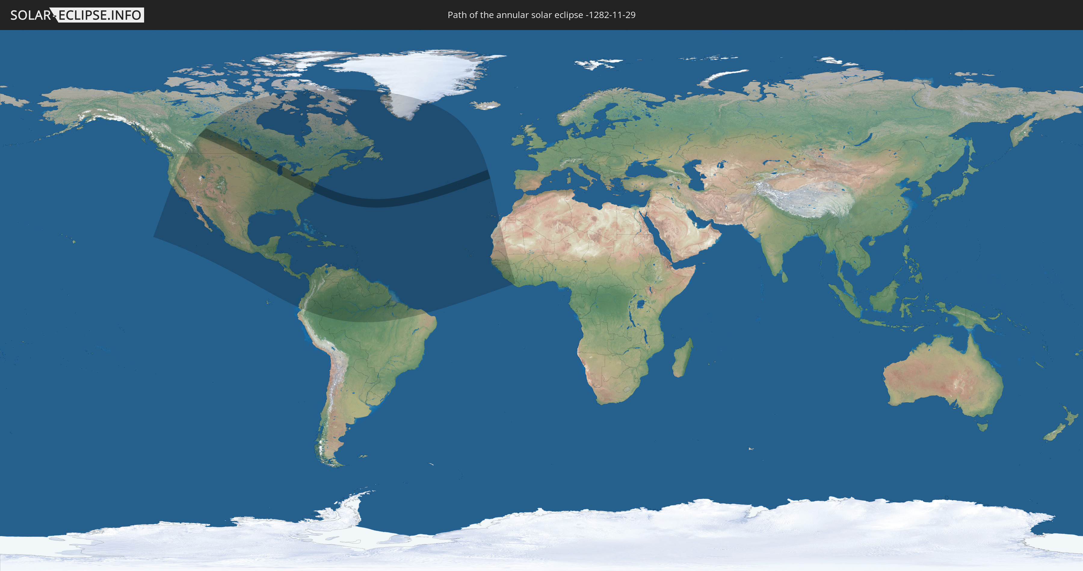
Die Sonnenfinsternis am 11/29/-1282 kann man in 58 Ländern als partielle Sonnenfinsternis beobachten.
Der Finsternispfad verläuft durch 4 Länder. Nur in diesen Ländern ist sie als annular Sonnenfinsternis zu sehen.
In den folgenden Ländern ist die Sonnenfinsternis annular zu sehen
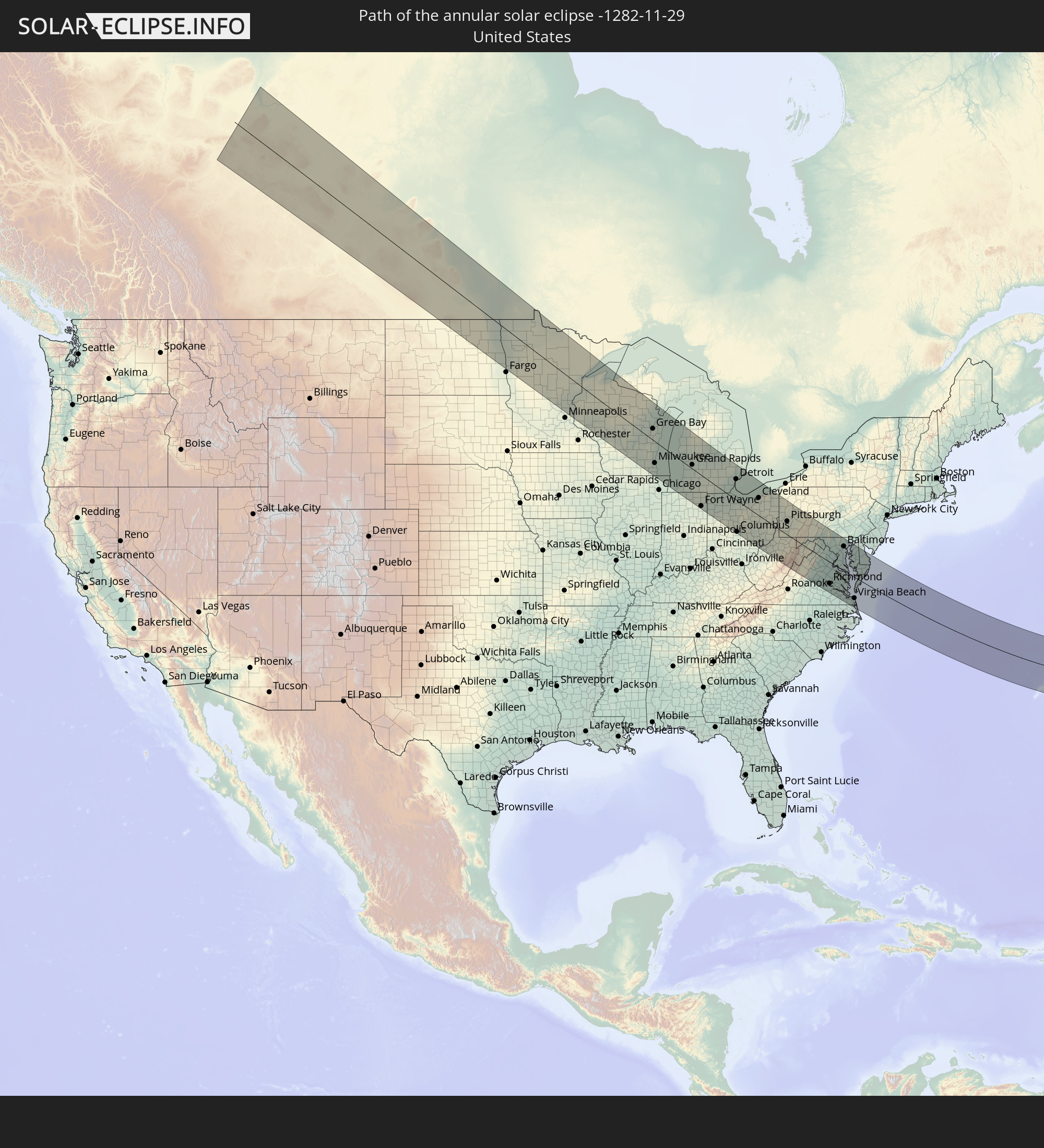 United States
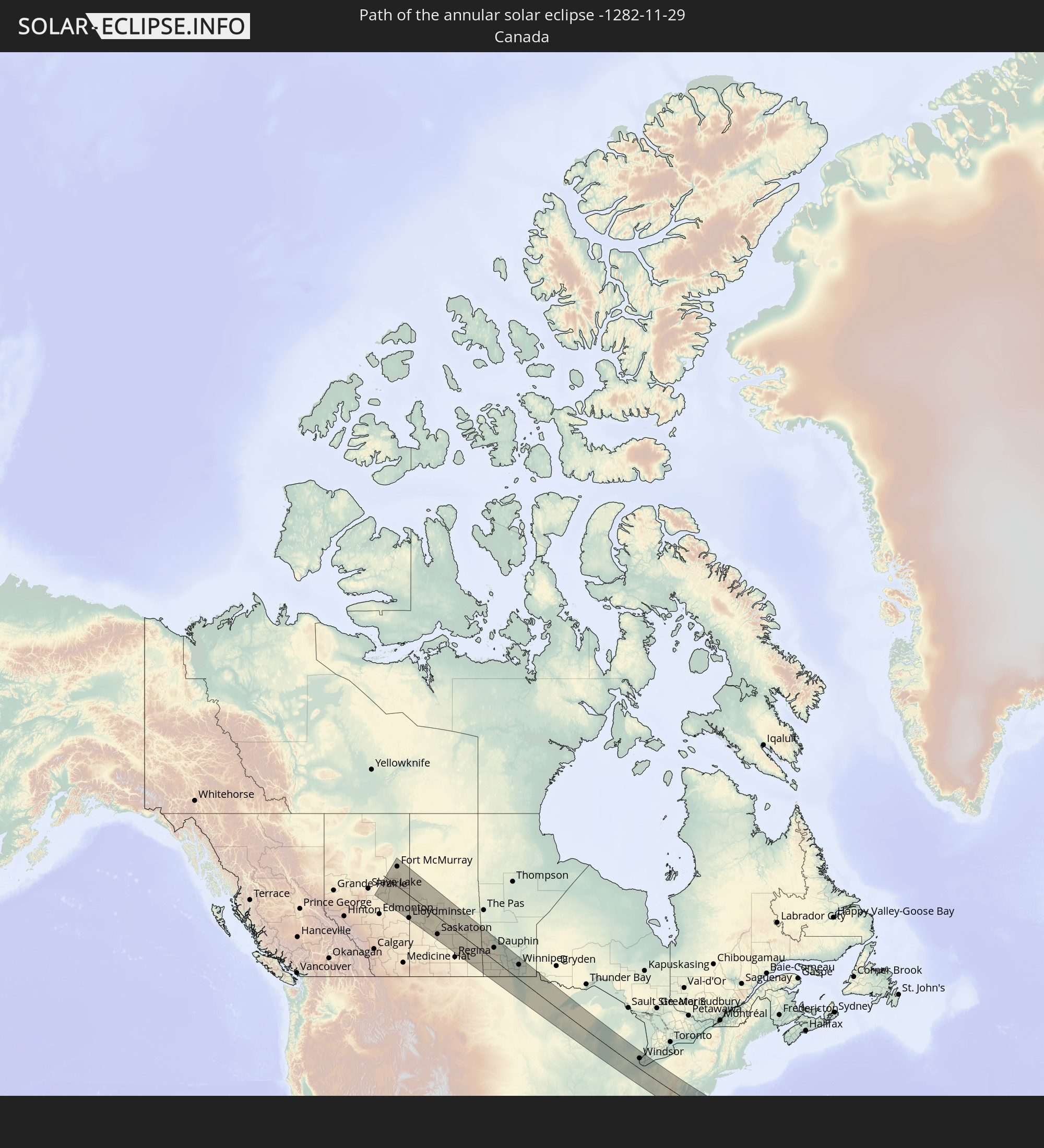 Canada
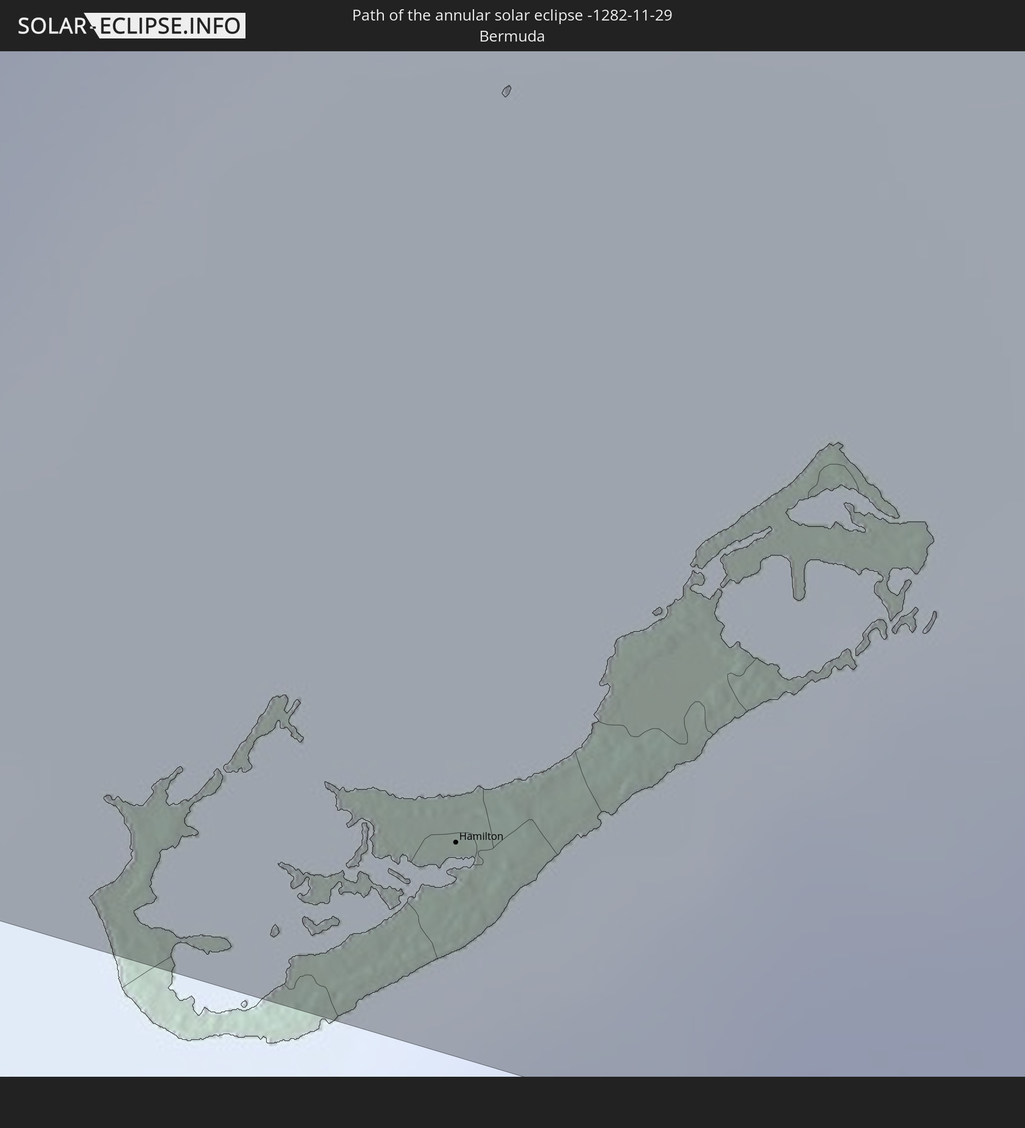 Bermuda
 Portugal
In den folgenden Ländern ist die Sonnenfinsternis partiell zu sehen
 United States
 United States Minor Outlying Islands
 Canada
 Mexico
 Greenland
 Guatemala
 Ecuador
 El Salvador
 Honduras
 Belize
 Nicaragua
 Costa Rica
 Cuba
Cuba
 Panama
 Colombia
 Cayman Islands
 Peru
Peru
 The Bahamas
 Jamaica
 Haiti
Haiti
 Brazil
 Venezuela
 Turks and Caicos Islands
 Dominican Republic
 Aruba
Aruba
 Puerto Rico
 United States Virgin Islands
 Bermuda
 British Virgin Islands
 Anguilla
 Collectivity of Saint Martin
 Saint Barthélemy
 Saint Kitts and Nevis
 Antigua and Barbuda
 Montserrat
 Trinidad and Tobago
 Guadeloupe
 Grenada
 Dominica
 Saint Vincent and the Grenadines
 Guyana
 Martinique
 Saint Lucia
 Barbados
 Suriname
 Saint Pierre and Miquelon
 French Guiana
 Portugal
 Cabo Verde
 Spain
Spain
 Senegal
 Mauritania
 The Gambia
 Guinea-Bissau
 Guinea
 Sierra Leone
 Mali
Mali
 Liberia
How will be the weather during the annular solar eclipse on 11/29/-1282?
Where is the best place to see the annular solar eclipse of 11/29/-1282?
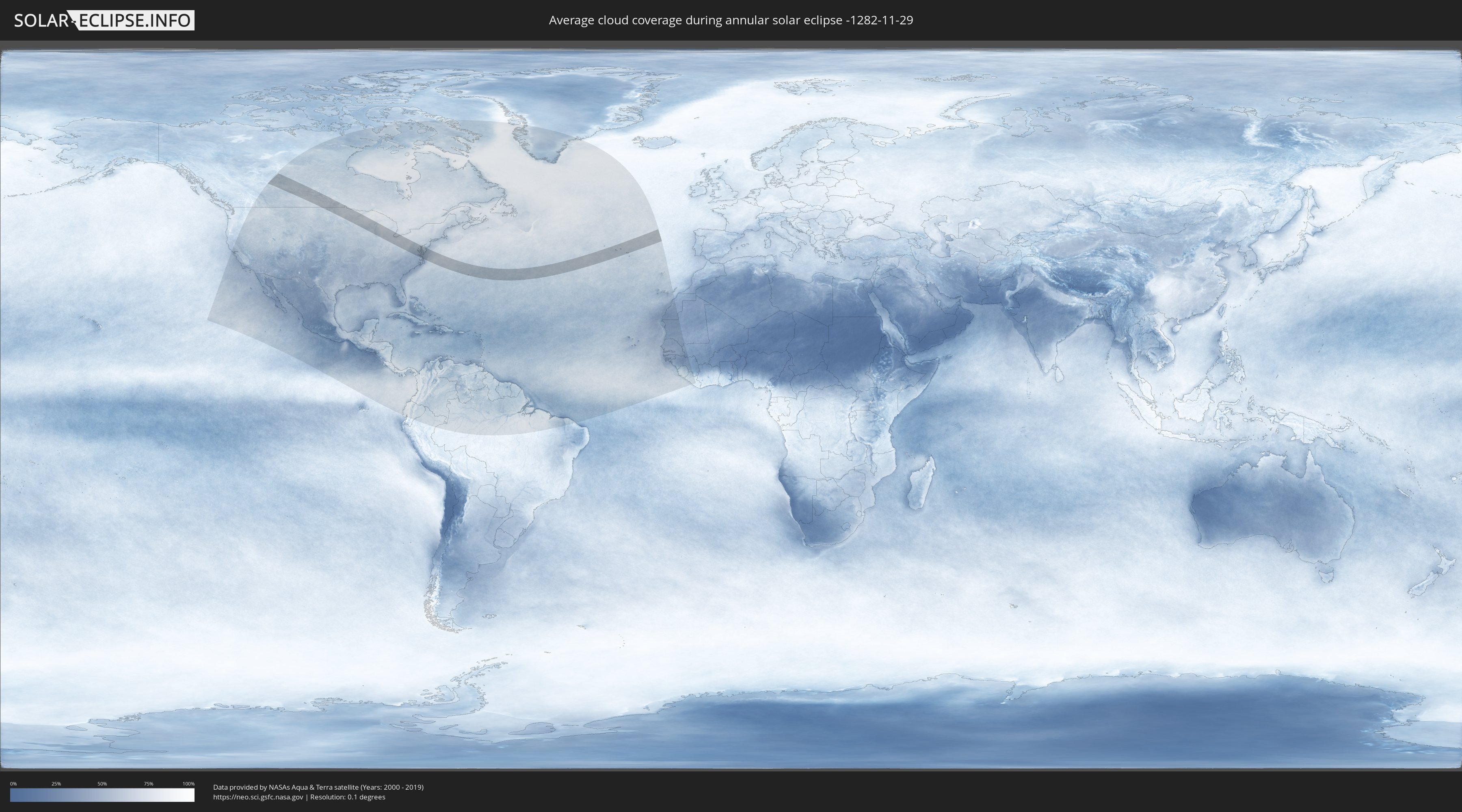
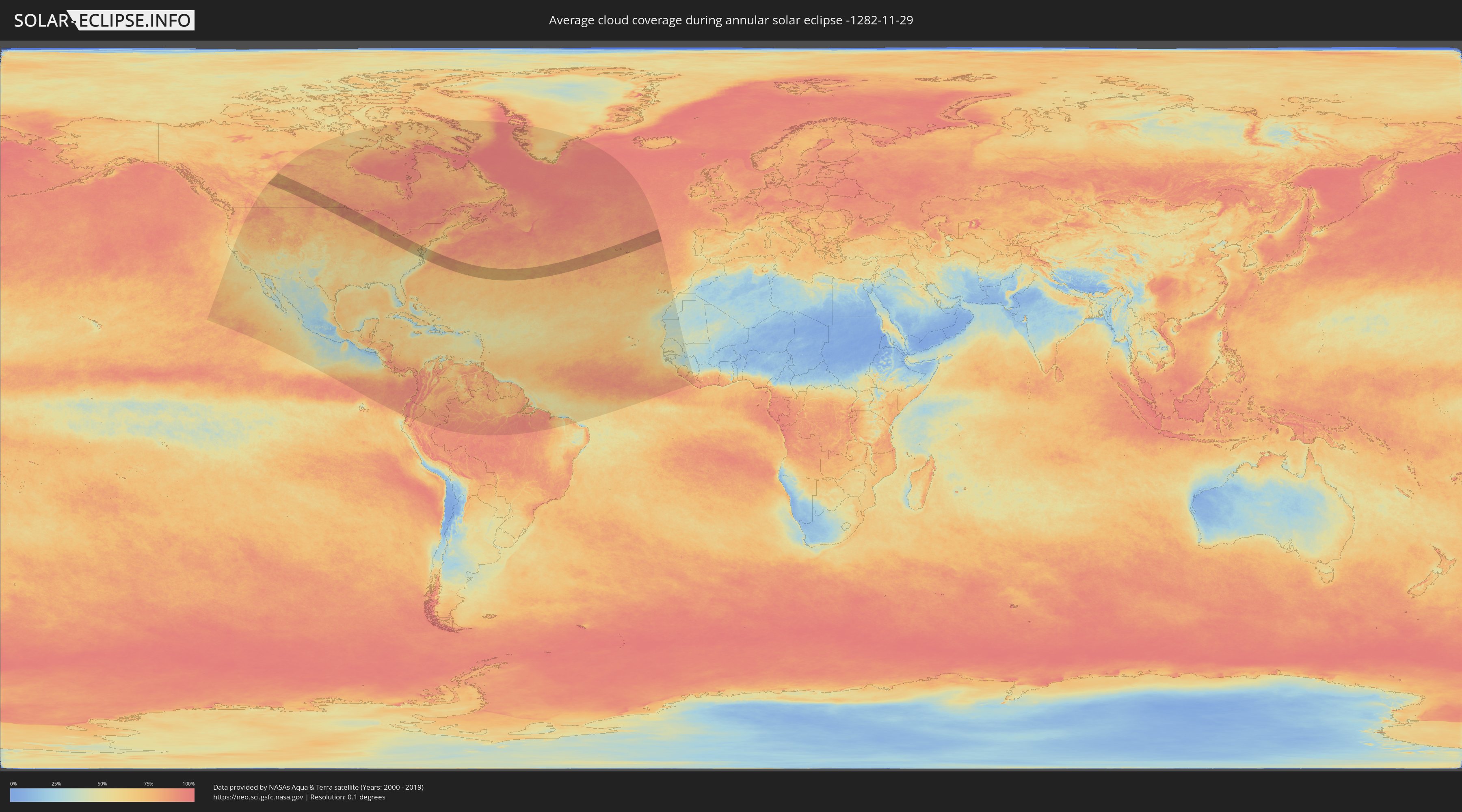
The following maps show the average cloud coverage for the day of the annular solar eclipse.
With the help of these maps, it is possible to find the place along the eclipse path, which has the best
chance of a cloudless sky.
Nevertheless, you should consider local circumstances and inform about the weather of your chosen
observation site.
The data is provided by NASAs satellites
AQUA and TERRA.
The cloud maps are averaged over a period of 19 years (2000 - 2019).
Detailed country maps
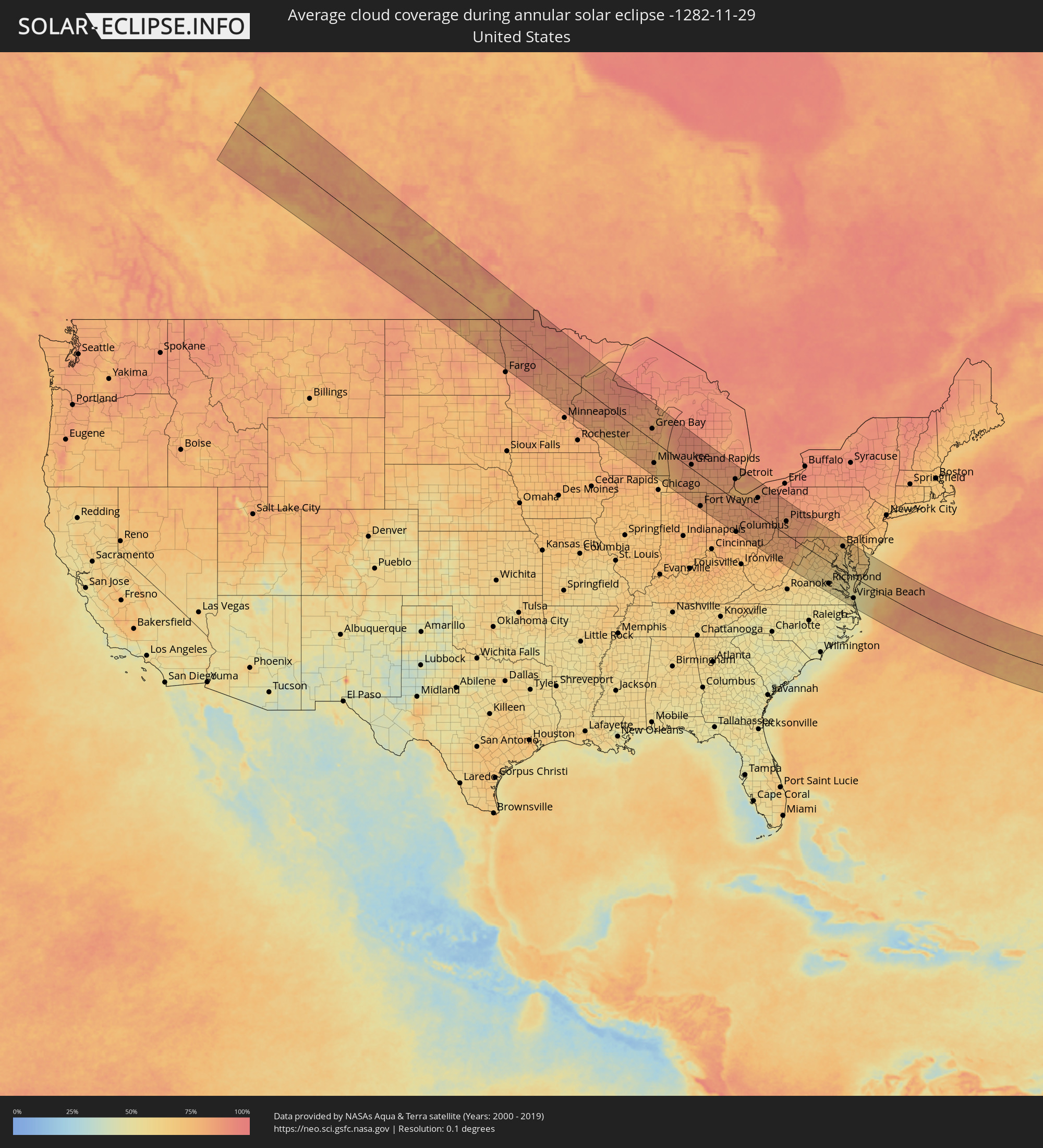 United States
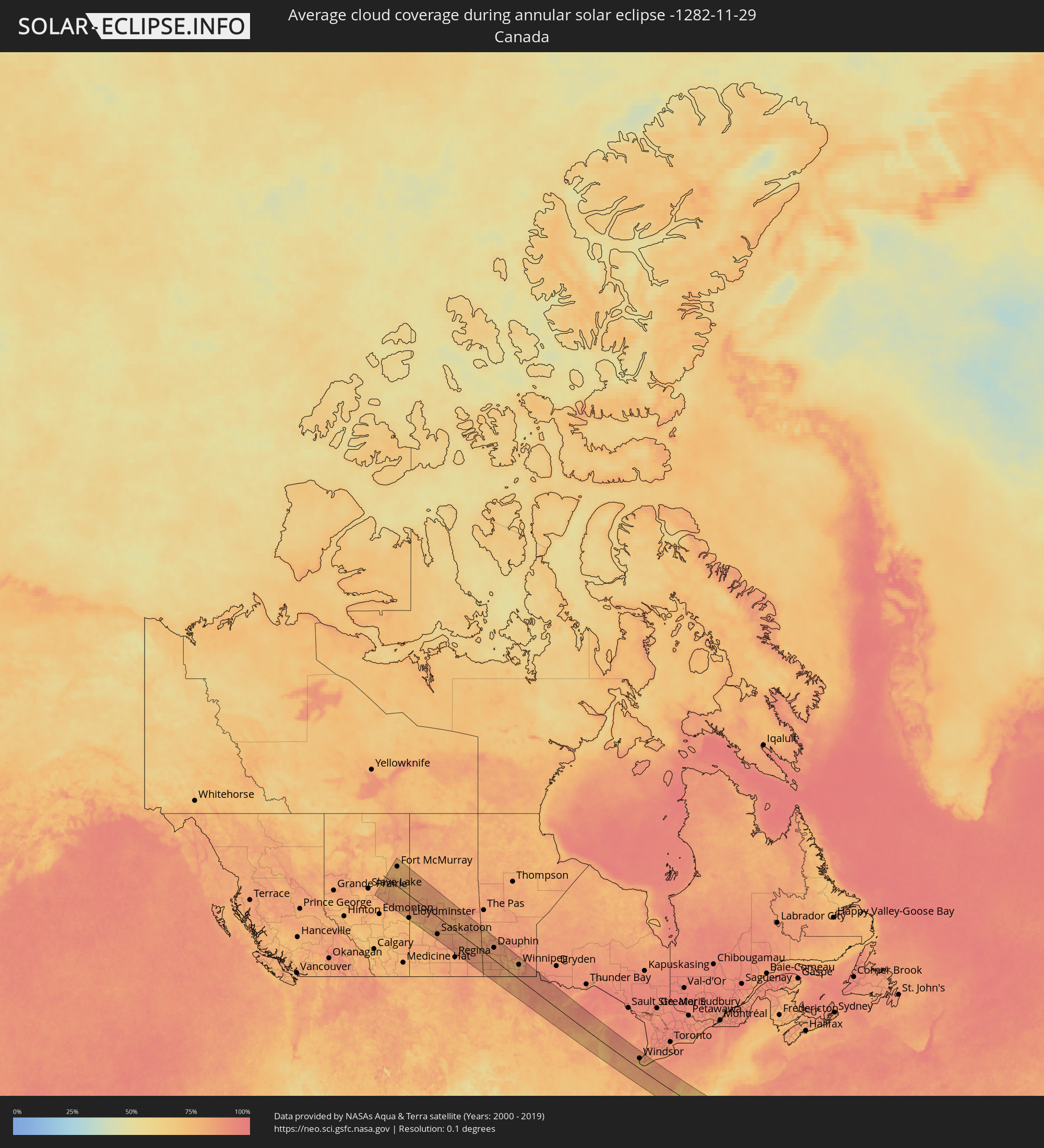 Canada
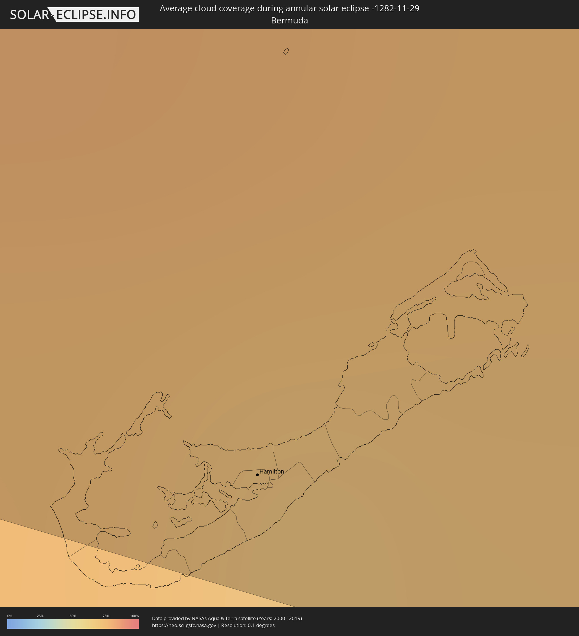 Bermuda
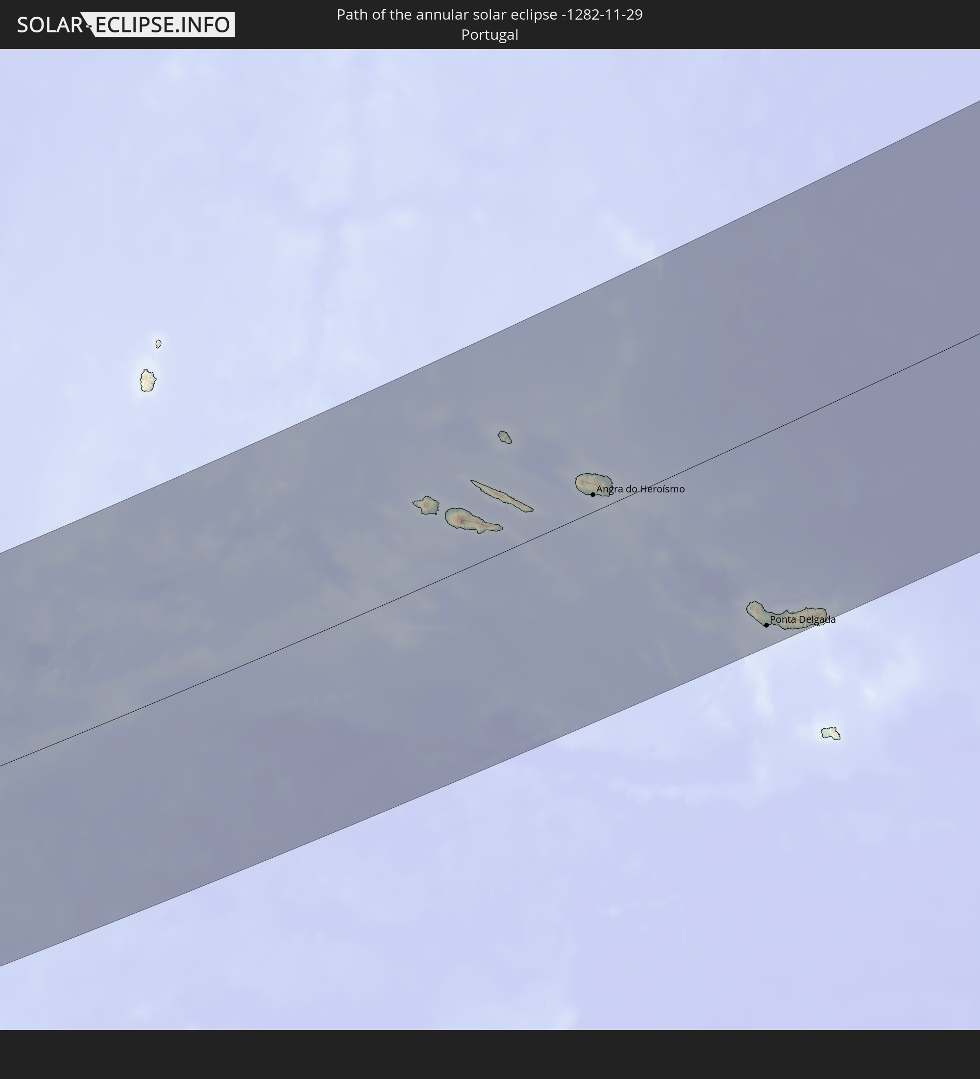
 Portugal
Cities inside the path of the eclipse
The following table shows all locations with a population of more than 5,000 inside the eclipse path. Cities which have more than 100,000 inhabitants are marked bold. A click at the locations opens a detailed map.
| City | Type | Eclipse duration | Local time of max. eclipse | Distance to central line | Ø Cloud coverage |
|
Fort McMurray, Alberta
|
annular | - | 08:00:26 UTC-07:33 | 113 km | 80% |
|
Bonnyville, Alberta
|
annular | - | 07:57:38 UTC-07:33 | 80 km | 81% |
|
Cold Lake, Alberta
|
annular | - | 07:58:14 UTC-07:33 | 41 km | 81% |
|
Lloydminster, Saskatchewan
|
annular | - | 07:56:54 UTC-07:33 | 140 km | 73% |
|
North Battleford, Saskatchewan
|
annular | - | 08:32:43 UTC-06:58 | 117 km | 77% |
|
Saskatoon, Saskatchewan
|
annular | - | 08:33:10 UTC-06:58 | 109 km | 83% |
|
Prince Albert, Saskatchewan
|
annular | - | 08:35:07 UTC-06:58 | 22 km | 81% |
|
Melfort, Saskatchewan
|
annular | - | 08:35:39 UTC-06:58 | 40 km | 76% |
|
Yorkton, Saskatchewan
|
annular | - | 08:35:40 UTC-06:58 | 16 km | 82% |
|
Dauphin, Manitoba
|
annular | - | 09:36:29 UTC-06:00 | 81 km | 82% |
|
Brandon, Manitoba
|
annular | - | 09:35:15 UTC-06:00 | 29 km | 83% |
|
Portage la Prairie, Manitoba
|
annular | - | 09:37:06 UTC-06:00 | 54 km | 80% |
|
Morden, Manitoba
|
annular | - | 09:36:34 UTC-06:00 | 6 km | 78% |
|
Winkler, Manitoba
|
annular | - | 09:36:44 UTC-06:00 | 0 km | 80% |
|
Winnipeg, Manitoba
|
annular | - | 09:38:15 UTC-06:00 | 97 km | 83% |
|
Grand Forks, North Dakota
|
annular | - | 09:36:36 UTC-06:00 | 71 km | 85% |
|
Selkirk, Manitoba
|
annular | - | 09:38:47 UTC-06:00 | 131 km | 83% |
|
Steinbach, Manitoba
|
annular | - | 09:38:26 UTC-06:00 | 86 km | 85% |
|
Duluth, Minnesota
|
annular | - | 09:41:48 UTC-06:00 | 53 km | 84% |
|
Eau Claire, Wisconsin
|
annular | - | 09:41:16 UTC-06:00 | 95 km | 80% |
|
Oshkosh, Wisconsin
|
annular | - | 09:45:12 UTC-06:00 | 26 km | 76% |
|
Appleton, Wisconsin
|
annular | - | 09:45:32 UTC-06:00 | 2 km | 81% |
|
Waukesha, Wisconsin
|
annular | - | 09:45:09 UTC-06:00 | 102 km | 80% |
|
Green Bay, Wisconsin
|
annular | - | 09:46:17 UTC-06:00 | 43 km | 84% |
|
Milwaukee, Wisconsin
|
annular | - | 09:45:41 UTC-06:00 | 84 km | 79% |
|
Kenosha, Wisconsin
|
annular | - | 09:45:36 UTC-06:00 | 121 km | 71% |
|
Racine, Wisconsin
|
annular | - | 09:45:43 UTC-06:00 | 107 km | 72% |
|
South Bend, Indiana
|
annular | - | 10:47:49 UTC-05:00 | 128 km | 83% |
|
Grand Rapids, Michigan
|
annular | - | 10:49:22 UTC-05:00 | 16 km | 85% |
|
Kalamazoo, Michigan
|
annular | - | 10:49:13 UTC-05:00 | 41 km | 79% |
|
Battle Creek, Michigan
|
annular | - | 10:49:56 UTC-05:00 | 19 km | 81% |
|
Fort Wayne, Indiana
|
annular | - | 10:49:34 UTC-05:00 | 125 km | 80% |
|
Lansing, Michigan
|
annular | - | 10:51:12 UTC-05:00 | 48 km | 83% |
|
Ann Arbor, Michigan
|
annular | - | 10:52:29 UTC-05:00 | 46 km | 82% |
|
Flint, Michigan
|
annular | - | 10:52:51 UTC-05:00 | 115 km | 88% |
|
Toledo, Ohio
|
annular | - | 10:52:36 UTC-05:00 | 1 km | 82% |
|
Novi, Michigan
|
annular | - | 10:53:02 UTC-05:00 | 77 km | 85% |
|
Waterford, Michigan
|
annular | - | 10:53:13 UTC-05:00 | 99 km | 86% |
|
Livonia, Michigan
|
annular | - | 10:53:13 UTC-05:00 | 73 km | 83% |
|
Taylor, Michigan
|
annular | - | 10:53:19 UTC-05:00 | 65 km | 84% |
|
Southfield, Michigan
|
annular | - | 10:53:29 UTC-05:00 | 88 km | 82% |
|
Troy, Michigan
|
annular | - | 10:53:40 UTC-05:00 | 104 km | 85% |
|
Amherstburg, Ontario
|
annular | - | 10:53:41 UTC-05:00 | 64 km | 81% |
|
Detroit, Michigan
|
annular | - | 10:53:46 UTC-05:00 | 84 km | 85% |
|
Warren, Michigan
|
annular | - | 10:53:51 UTC-05:00 | 98 km | 83% |
|
Windsor, Ontario
|
annular | - | 10:53:48 UTC-05:00 | 83 km | 85% |
|
Columbus, Ohio
|
annular | - | 10:53:09 UTC-05:00 | 131 km | 79% |
|
Clinton, Michigan
|
annular | - | 10:54:05 UTC-05:00 | 113 km | 83% |
|
Lorain, Ohio
|
annular | - | 10:55:07 UTC-05:00 | 45 km | 80% |
|
Cleveland, Ohio
|
annular | - | 10:56:03 UTC-05:00 | 73 km | 84% |
|
Akron, Ohio
|
annular | - | 10:56:17 UTC-05:00 | 43 km | 85% |
|
Canton, Ohio
|
annular | - | 10:56:30 UTC-05:00 | 24 km | 84% |
|
Youngstown, Ohio
|
annular | - | 10:58:00 UTC-05:00 | 86 km | 83% |
|
Pittsburgh, Pennsylvania
|
annular | - | 10:59:11 UTC-05:00 | 56 km | 82% |
|
Richmond, Virginia
|
annular | - | 11:04:23 UTC-05:00 | 96 km | 60% |
|
Centreville, Virginia
|
annular | - | 11:04:27 UTC-05:00 | 28 km | 66% |
|
Frederick, Maryland
|
annular | - | 11:04:31 UTC-05:00 | 82 km | 76% |
|
Reston, Virginia
|
annular | - | 11:04:39 UTC-05:00 | 44 km | 68% |
|
Dale City, Virginia
|
annular | - | 11:04:43 UTC-05:00 | 14 km | 64% |
|
Germantown, Maryland
|
annular | - | 11:04:48 UTC-05:00 | 66 km | 72% |
|
Washington, D.C., Washington, D.C.
|
annular | - | 11:05:19 UTC-05:00 | 51 km | 69% |
|
Waldorf, Maryland
|
annular | - | 11:05:32 UTC-05:00 | 30 km | 64% |
|
Columbia, Maryland
|
annular | - | 11:05:45 UTC-05:00 | 92 km | 72% |
|
Bowie, Maryland
|
annular | - | 11:06:00 UTC-05:00 | 69 km | 67% |
|
Baltimore, Maryland
|
annular | - | 11:06:16 UTC-05:00 | 108 km | 71% |
|
Suffolk, Virginia
|
annular | - | 11:06:25 UTC-05:00 | 135 km | 50% |
|
Newport News, Virginia
|
annular | - | 11:06:40 UTC-05:00 | 96 km | 54% |
|
Norfolk, Virginia
|
annular | - | 11:07:06 UTC-05:00 | 110 km | 54% |
|
Virginia Beach, Virginia
|
annular | - | 11:07:49 UTC-05:00 | 96 km | 51% |
|
Hamilton, Hamilton city
|
annular | - | 12:19:14 UTC-04:19 | 141 km | 69% |
|
Ribeira Grande, Azores
|
annular | - | 17:43:59 UTC+00:00 | 51 km | 80% |
|
Horta, Azores
|
annular | - | 15:49:30 UTC-01:54 | 50 km | 81% |
|
Madalena, Azores
|
annular | - | 15:49:36 UTC-01:54 | 47 km | 80% |
|
Lagoa, Azores
|
annular | - | 15:49:26 UTC-01:54 | 80 km | 79% |
|
Angra do Heroísmo, Azores
|
annular | - | 15:50:45 UTC-01:54 | 12 km | 82% |
|
Praia da Vitória, Azores
|
annular | - | 15:50:46 UTC-01:54 | 15 km | 82% |
|
Arrifes, Azores
|
annular | - | 15:53:22 UTC-01:54 | 132 km | 83% |
|
Ponta Delgada, Azores
|
annular | - | 15:53:26 UTC-01:54 | 137 km | 81% |
|
Rosto de Cão, Azores
|
annular | - | 15:53:26 UTC-01:54 | 136 km | 83% |
|
Rabo de Peixe, Azores
|
annular | - | 15:53:25 UTC-01:54 | 133 km | 84% |
|
Vila Franca do Campo, Azores
|
annular | - | 15:53:40 UTC-01:54 | 147 km | 79% |