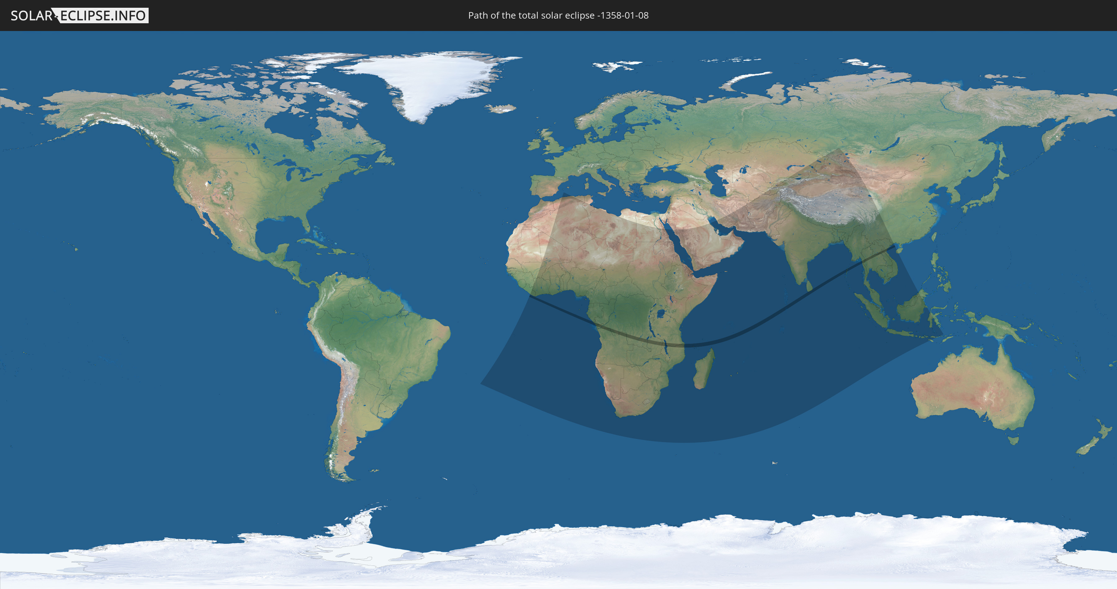
Total solar eclipse of 01/08/-1358
| Day of week: | Thursday |
| Maximum duration of eclipse: | 03m36s |
| Maximum width of eclipse path: | 126 km |
| Saros cycle: | 29 |
| Coverage: | 100% |
| Magnitude: | 1.0365 |
| Gamma: | 0.2376 |
Wo kann man die Sonnenfinsternis vom 01/08/-1358 sehen?
Die Sonnenfinsternis am 01/08/-1358 kann man in 85 Ländern als partielle Sonnenfinsternis beobachten.
Der Finsternispfad verläuft durch 17 Länder. Nur in diesen Ländern ist sie als total Sonnenfinsternis zu sehen.
In den folgenden Ländern ist die Sonnenfinsternis total zu sehen
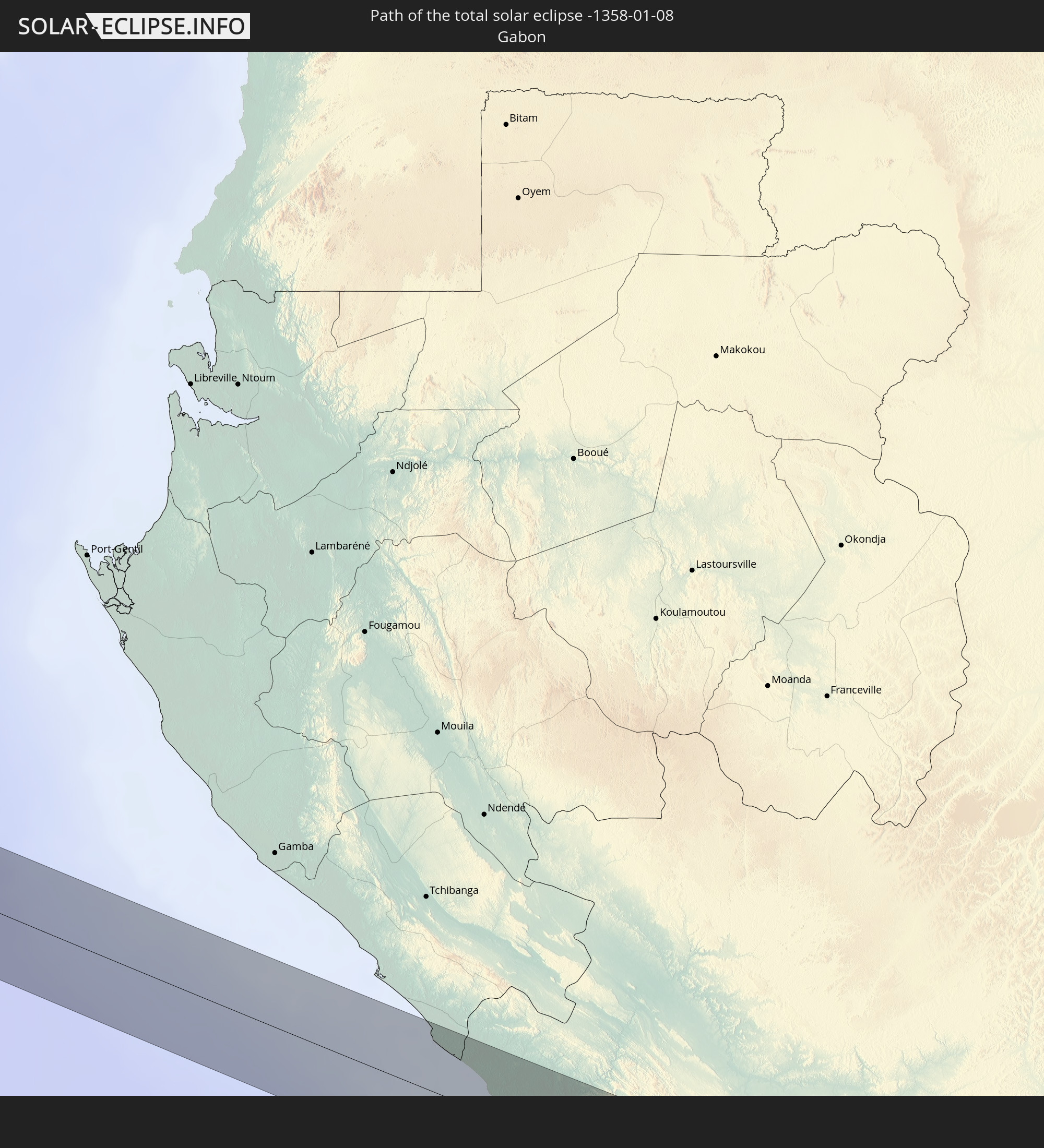 Gabon
Gabon
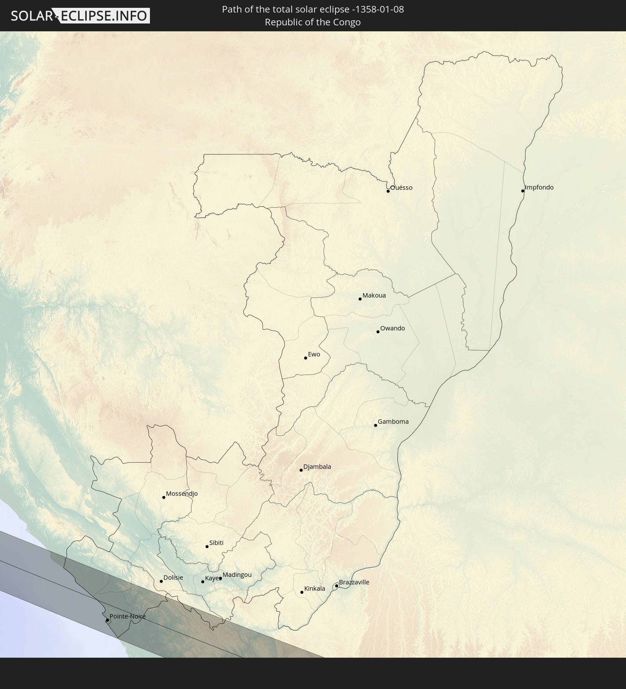 Republic of the Congo
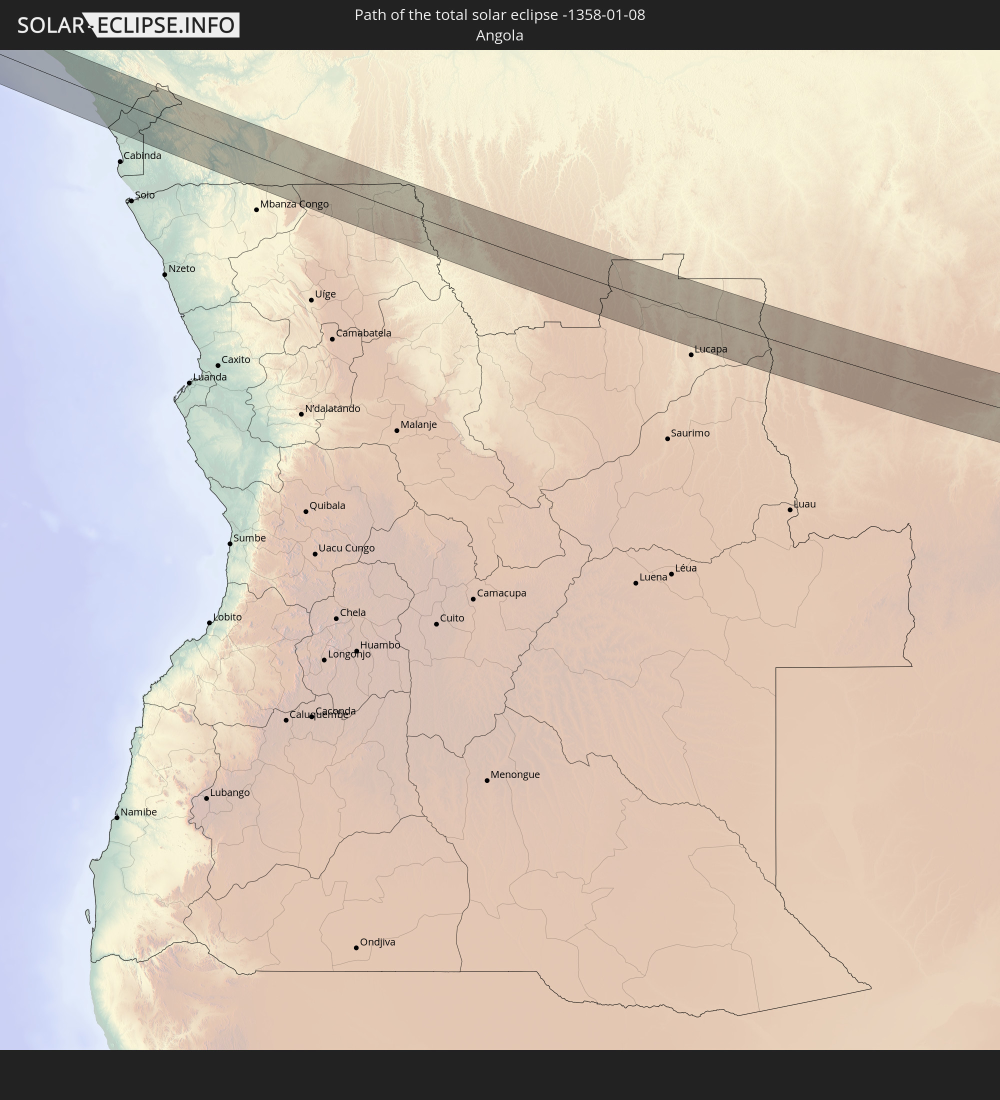 Angola
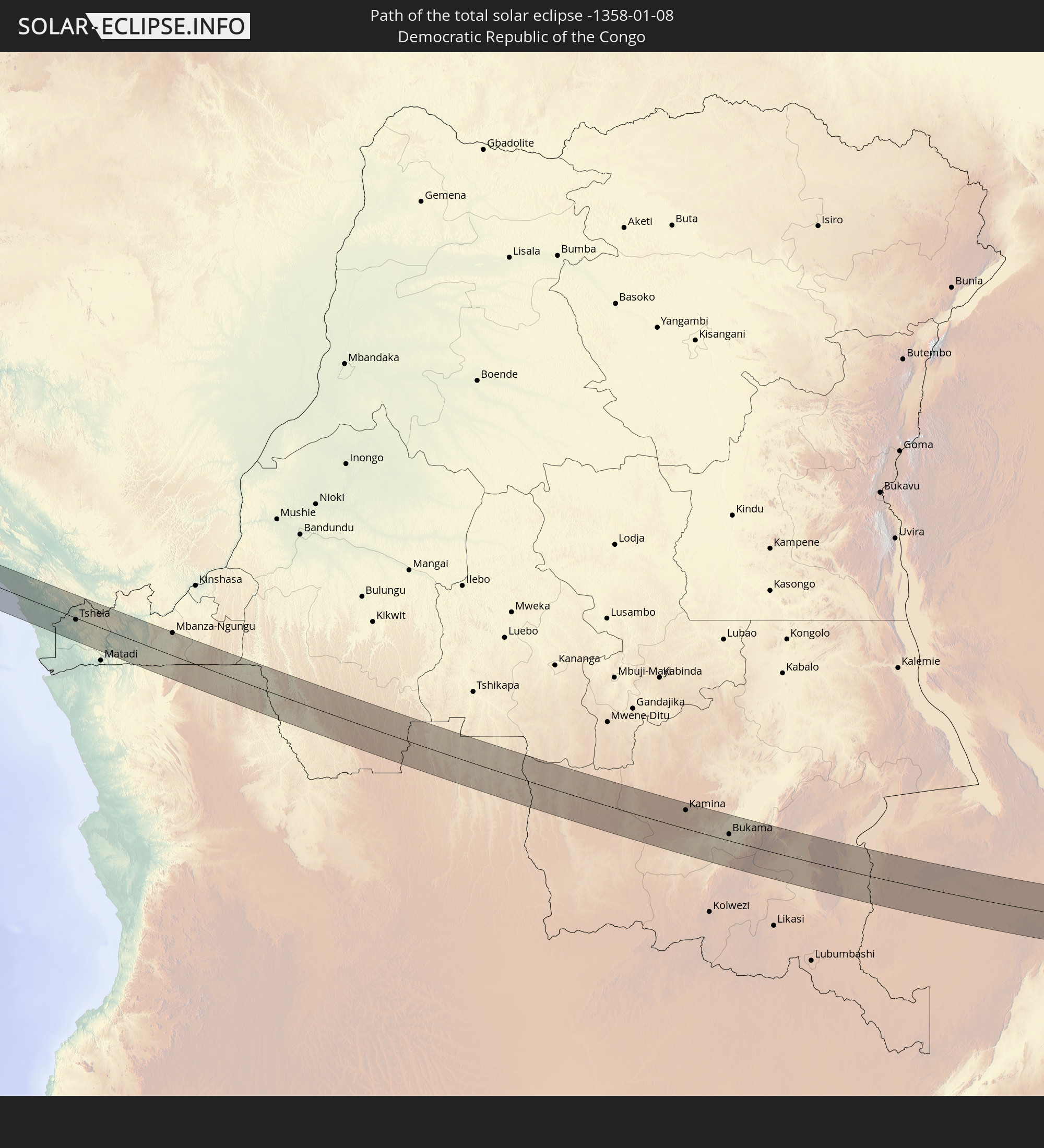 Democratic Republic of the Congo
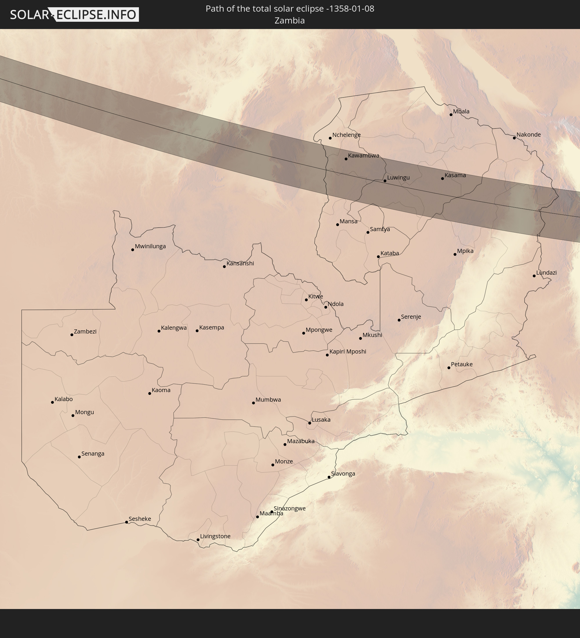 Zambia
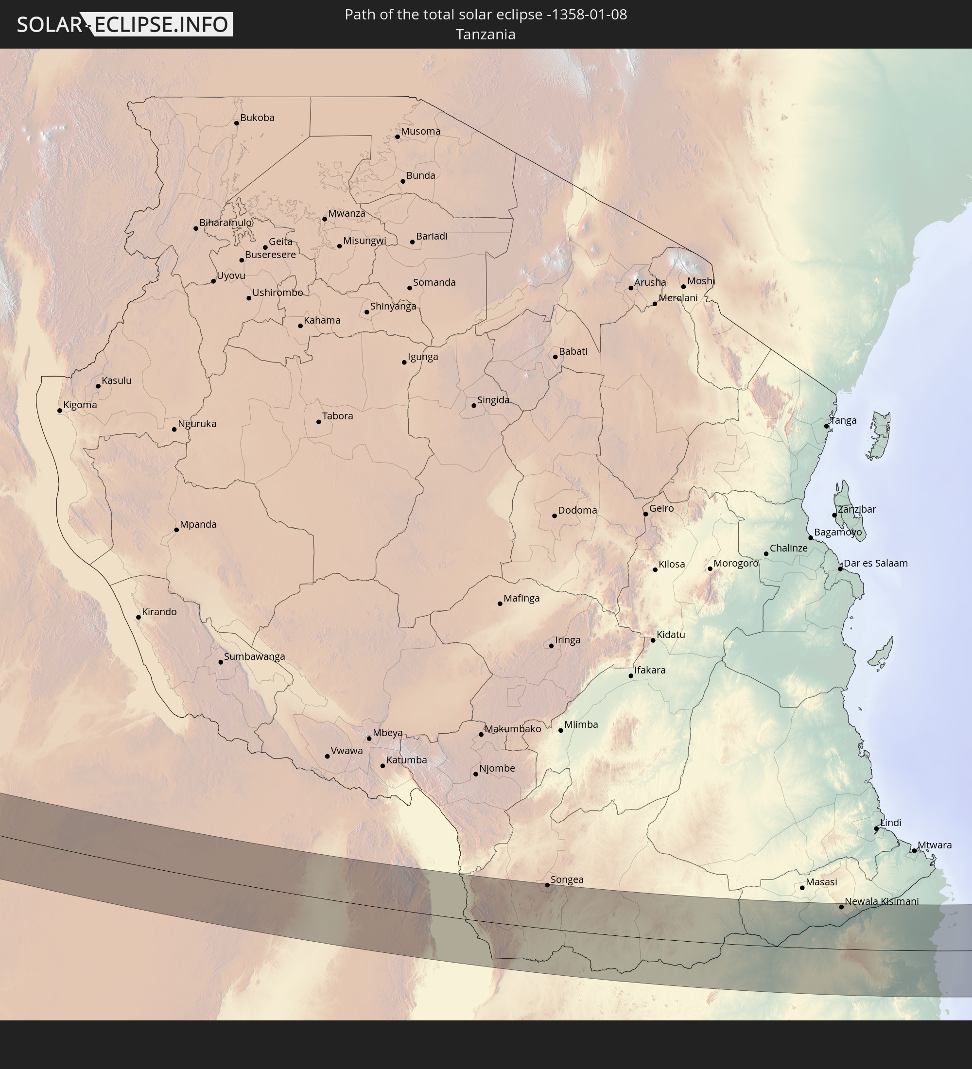 Tanzania
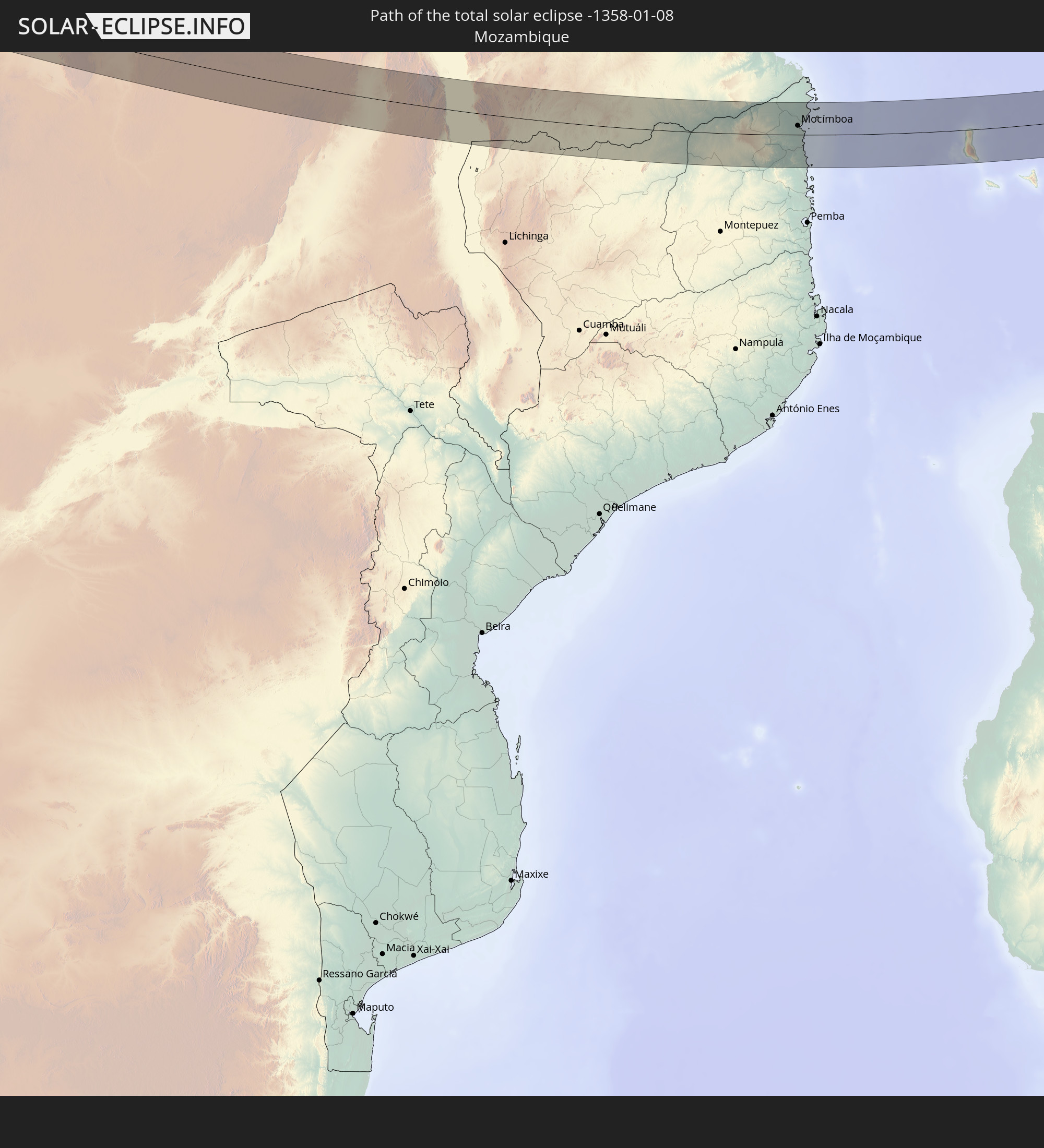 Mozambique
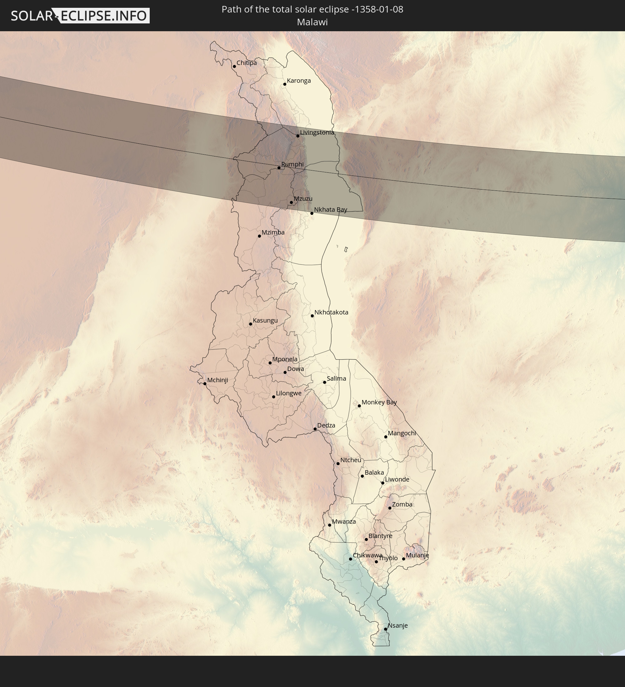 Malawi
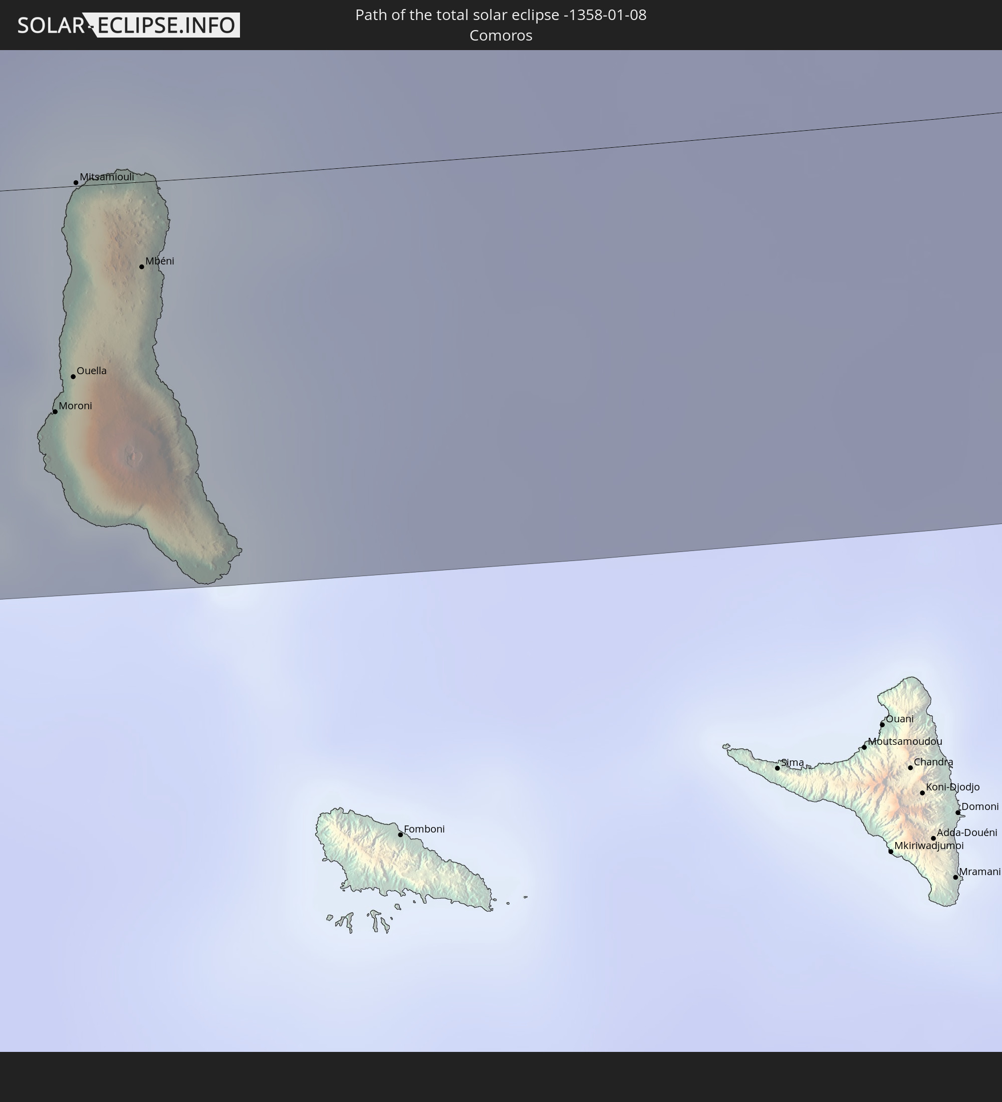 Comoros
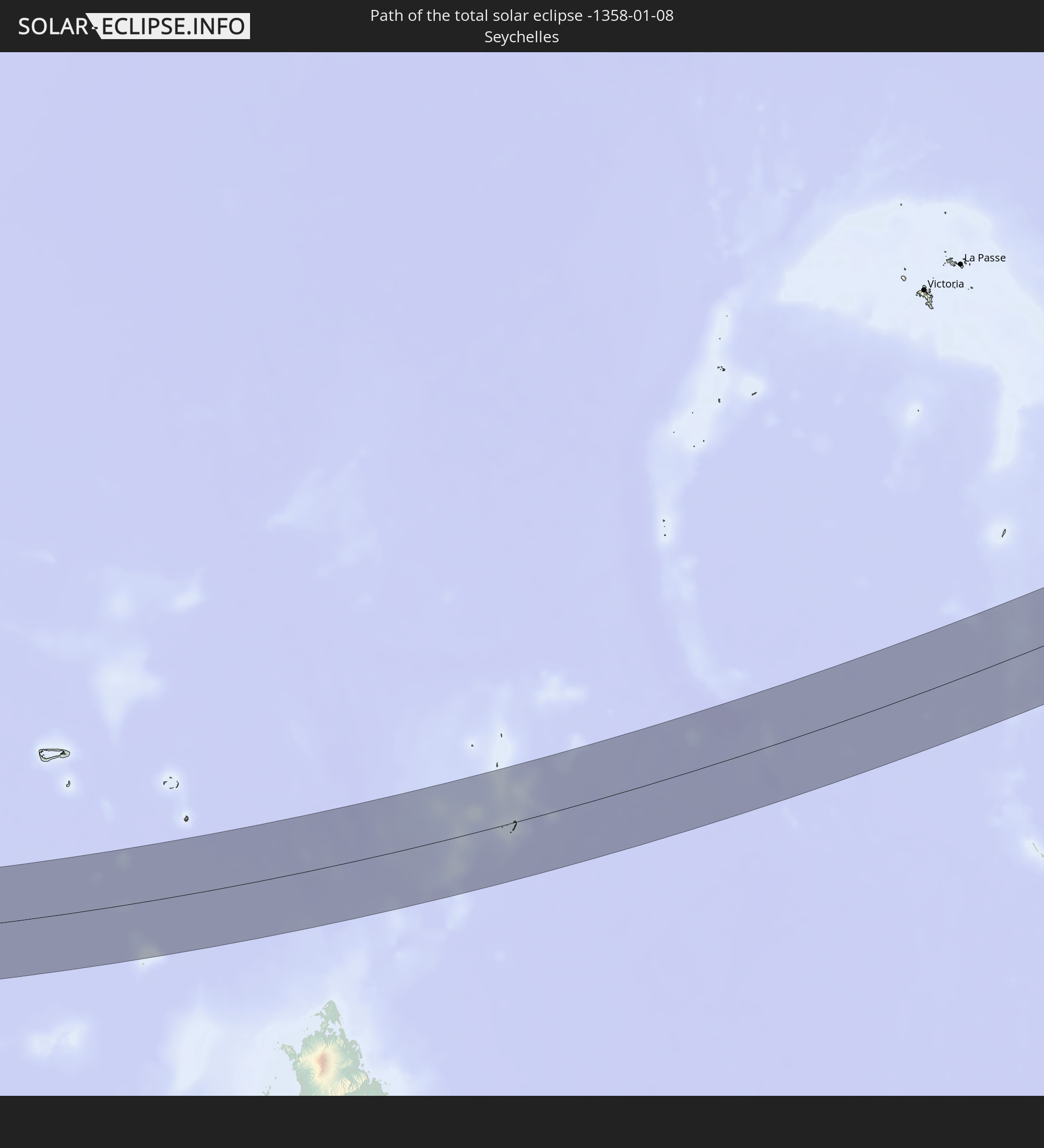 Seychelles
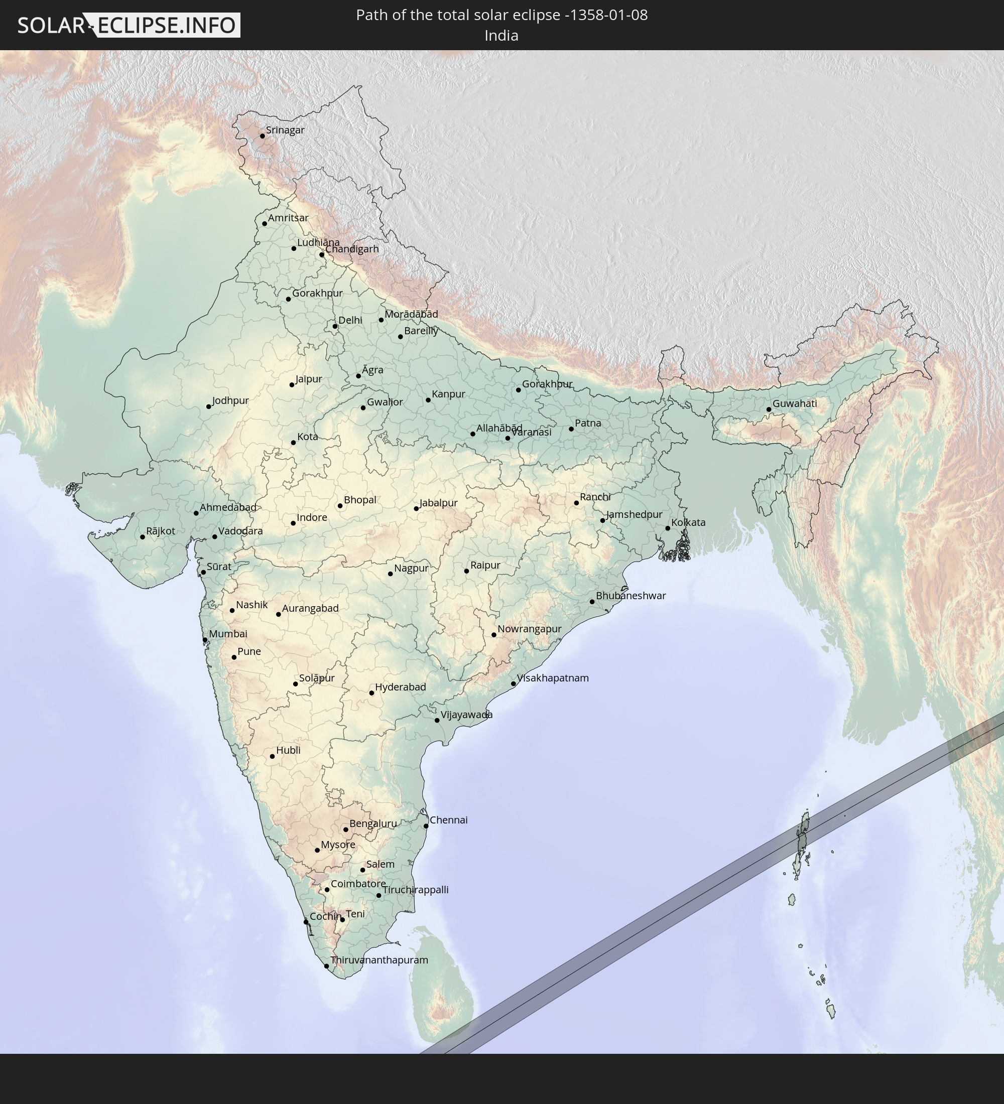 India
India
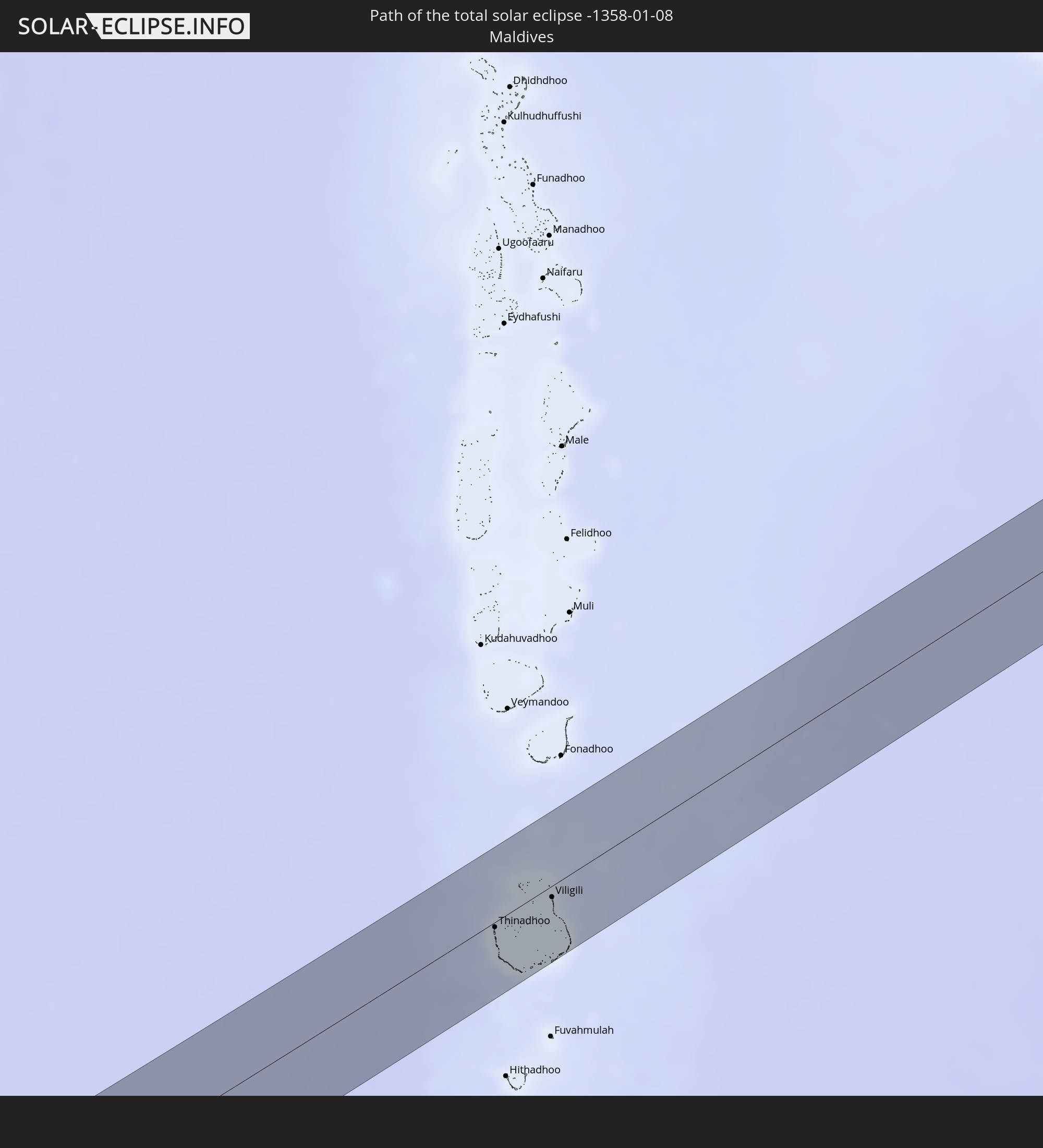 Maldives
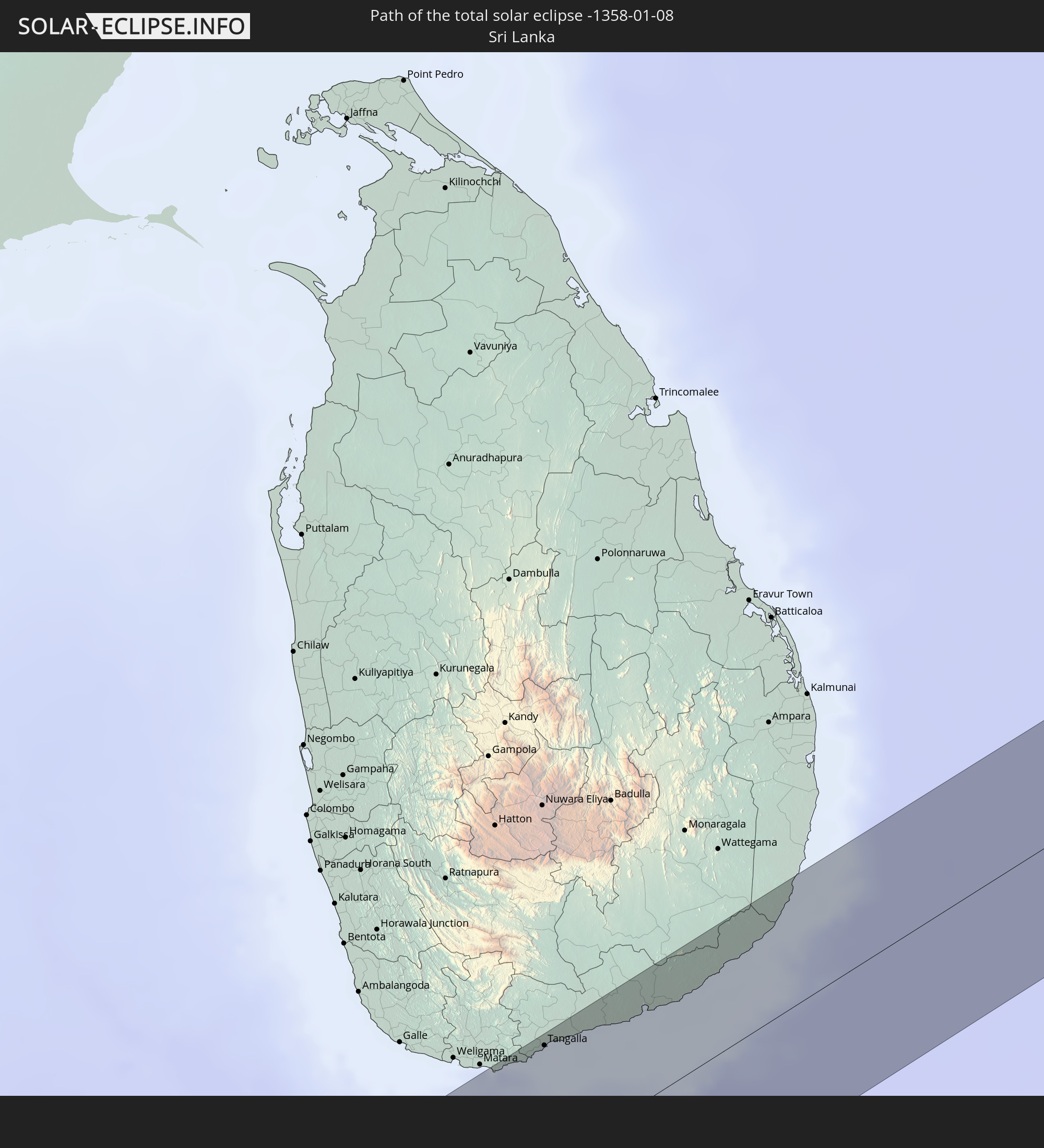 Sri Lanka
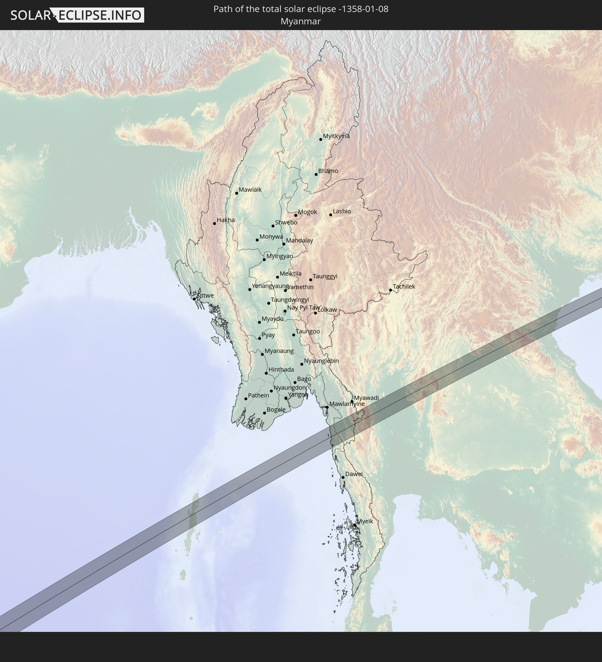 Myanmar
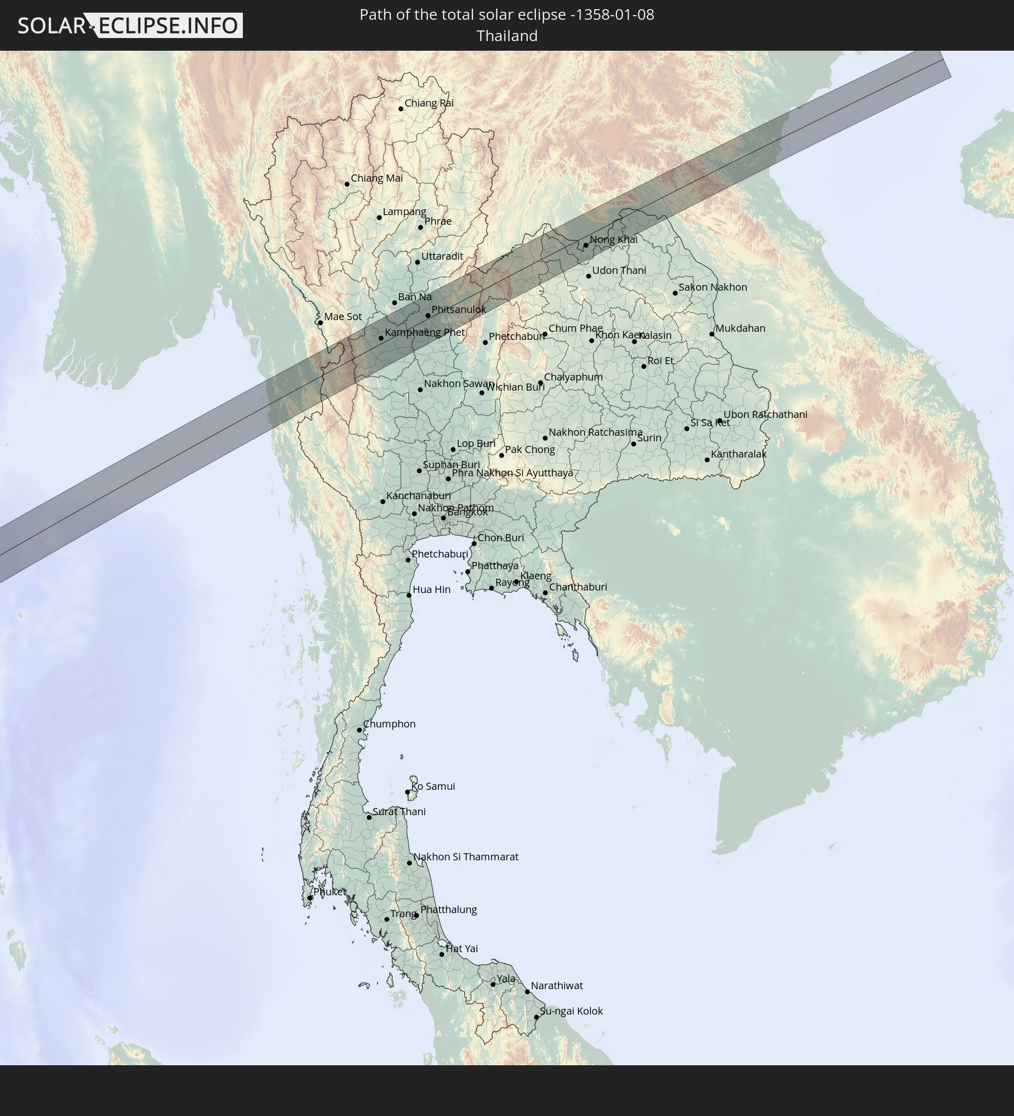 Thailand
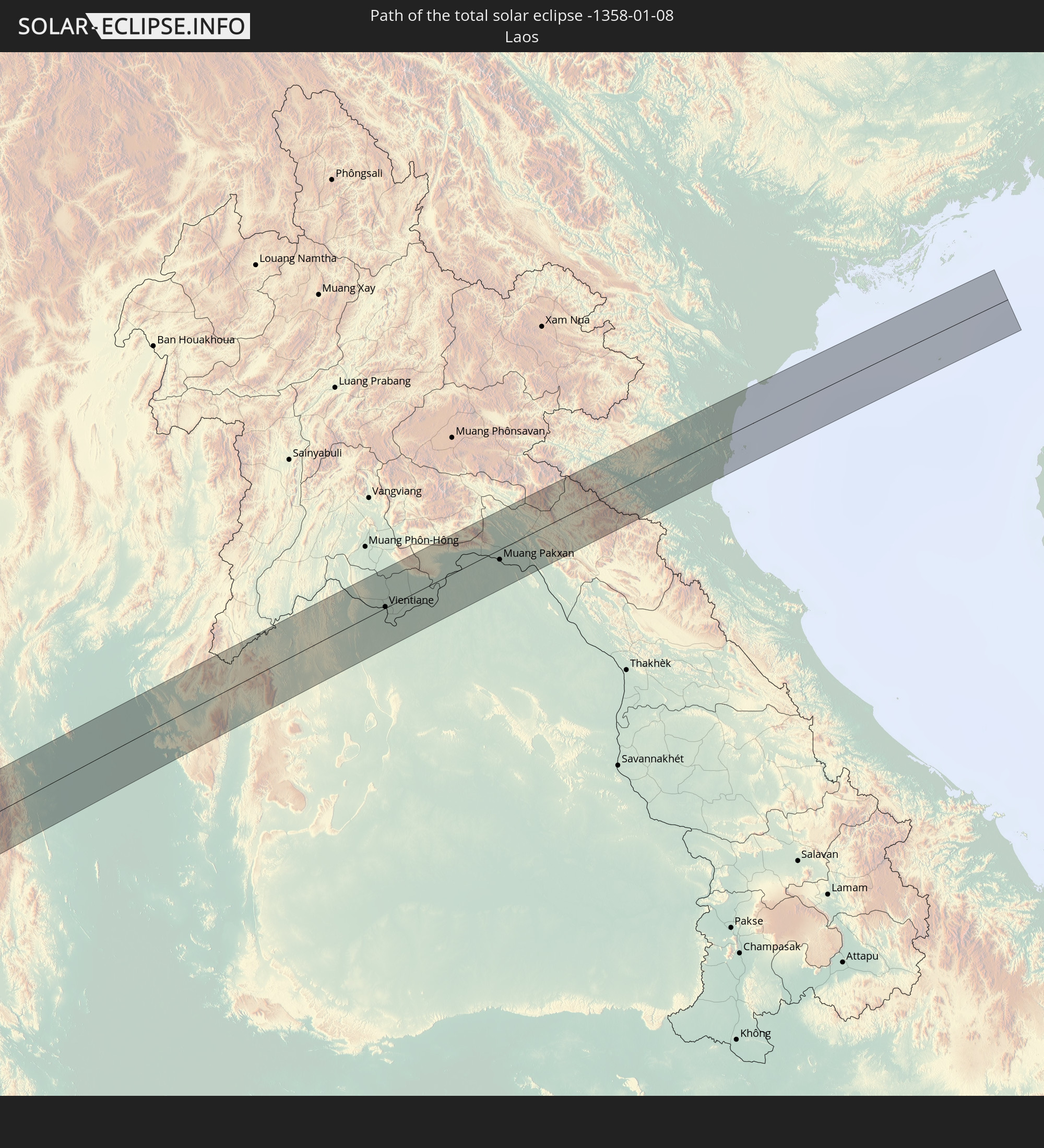 Laos
Laos
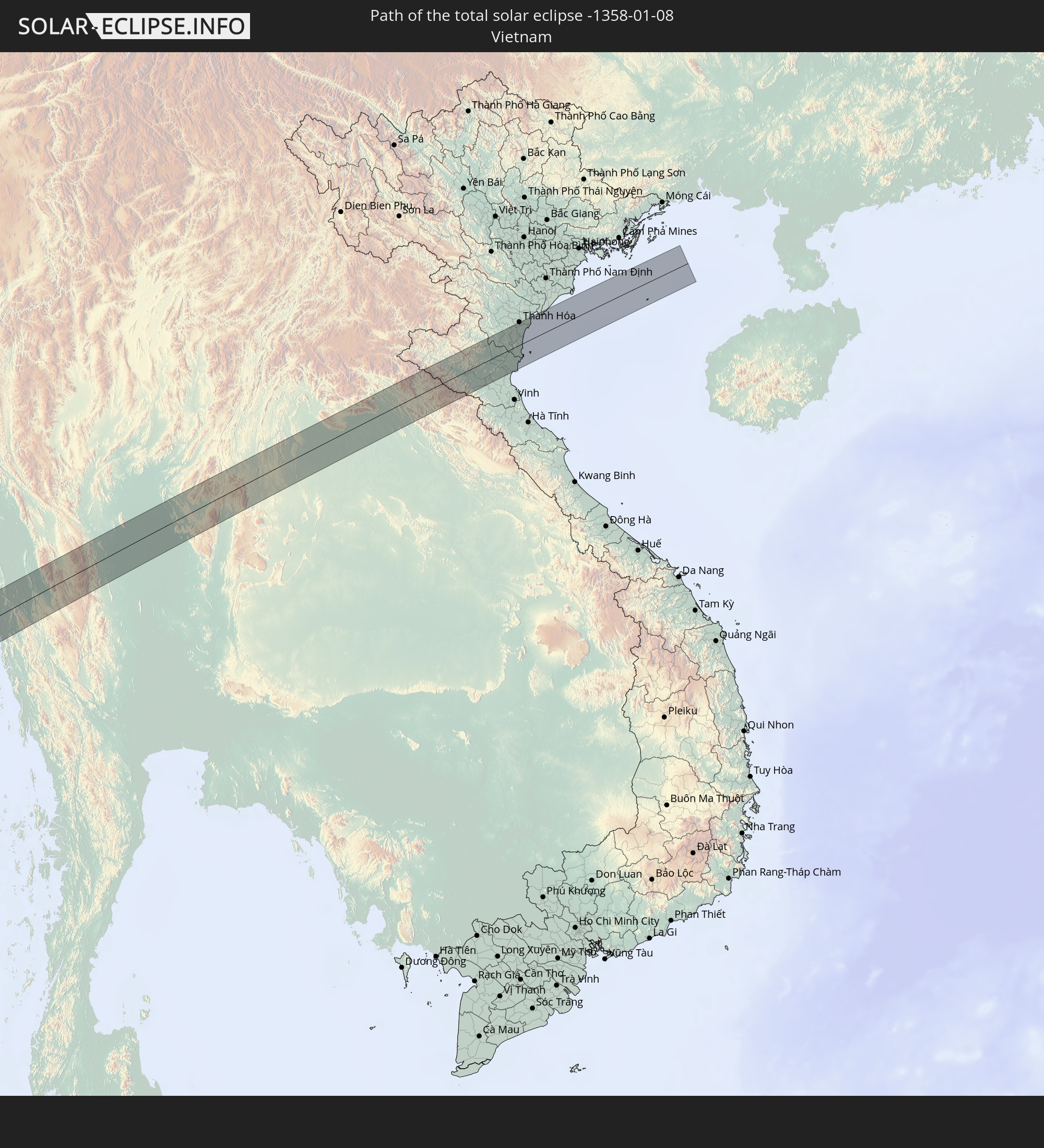 Vietnam
In den folgenden Ländern ist die Sonnenfinsternis partiell zu sehen
 Russia
 Guinea
 Saint Helena, Ascension and Tristan da Cunha
 Mali
Mali
 Liberia
 Algeria
 Ivory Coast
 Burkina Faso
 Ghana
Ghana
 Togo
Togo
 Niger
Niger
 Benin
Benin
 Nigeria
 Equatorial Guinea
 São Tomé and Príncipe
 Tunisia
 Cameroon
 Gabon
Gabon
 Libya
Libya
 Republic of the Congo
 Angola
 Namibia
 Democratic Republic of the Congo
 Chad
Chad
 Central African Republic
 South Africa
 Botswana
 Sudan
Sudan
 Zambia
 Egypt
Egypt
 Zimbabwe
 Lesotho
 Rwanda
 Burundi
 Tanzania
 Uganda
 Mozambique
 Swaziland
 Malawi
 Ethiopia
 Kenya
Kenya
 Saudi Arabia
 Eritrea
 French Southern and Antarctic Lands
 Somalia
 Djibouti
 Yemen
Yemen
 Madagascar
 Comoros
 Iran
Iran
 Mayotte
 Seychelles
 Kazakhstan
 Bahrain
 Qatar
Qatar
 United Arab Emirates
 Oman
Oman
 Turkmenistan
 Réunion
 Uzbekistan
 Mauritius
 Afghanistan
 Pakistan
 Tajikistan
 India
India
 Kyrgyzstan
 British Indian Ocean Territory
 Maldives
 China
China
 Sri Lanka
 Nepal
Nepal
 Mongolia
 Bangladesh
 Bhutan
 Myanmar
 Indonesia
 Cocos Islands
 Thailand
 Malaysia
 Laos
Laos
 Vietnam
 Cambodia
 Singapore
 Christmas Island
 Brunei
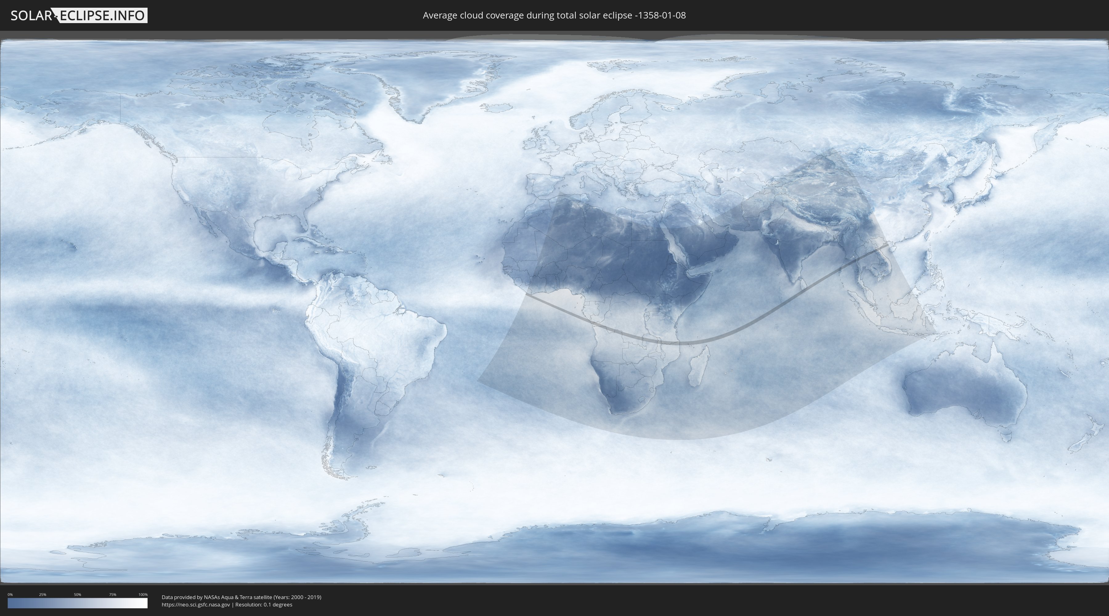
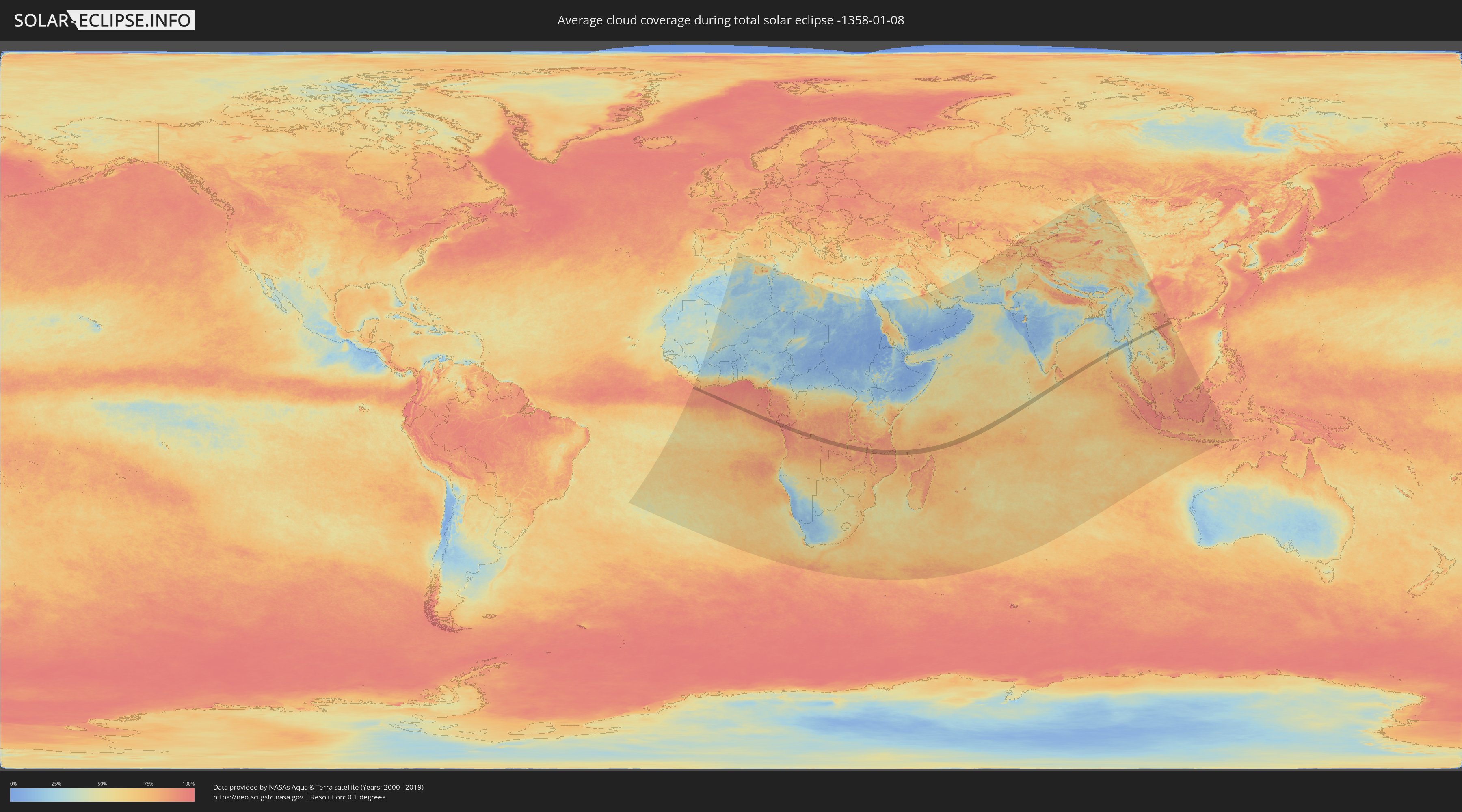
How will be the weather during the total solar eclipse on 01/08/-1358?
Where is the best place to see the total solar eclipse of 01/08/-1358?
The following maps show the average cloud coverage for the day of the total solar eclipse.
With the help of these maps, it is possible to find the place along the eclipse path, which has the best
chance of a cloudless sky.
Nevertheless, you should consider local circumstances and inform about the weather of your chosen
observation site.
The data is provided by NASAs satellites
AQUA and TERRA.
The cloud maps are averaged over a period of 19 years (2000 - 2019).
Detailed country maps
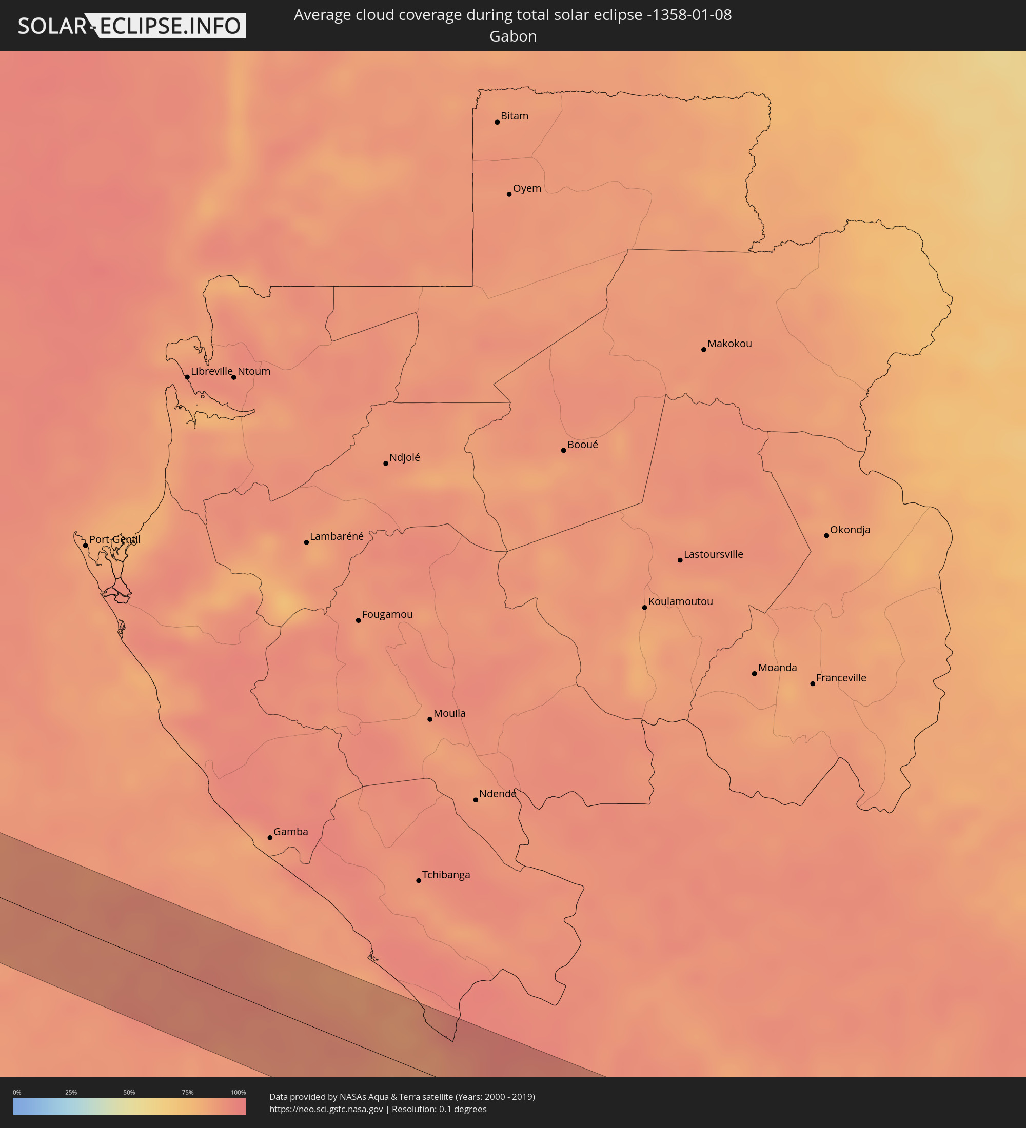 Gabon
Gabon
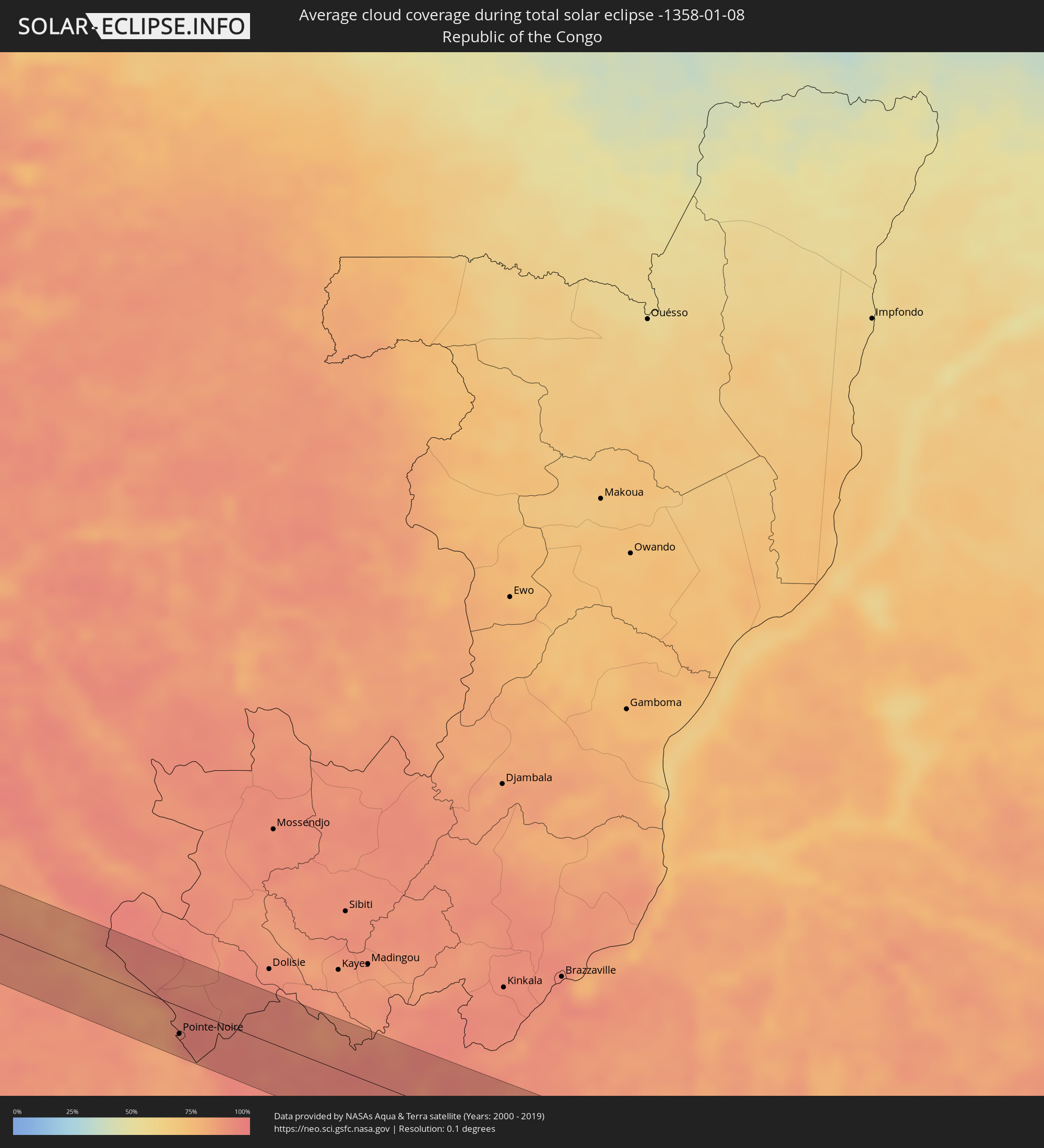 Republic of the Congo
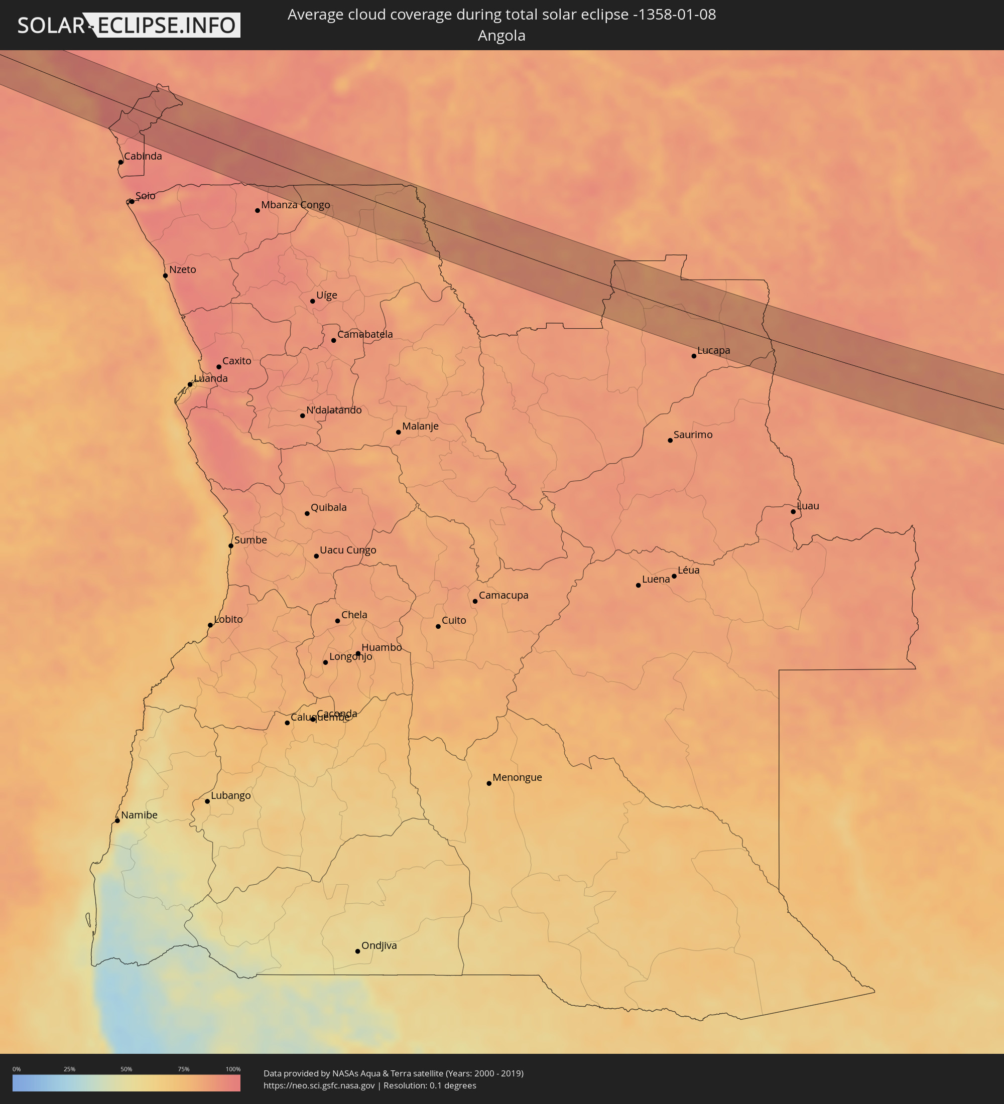 Angola
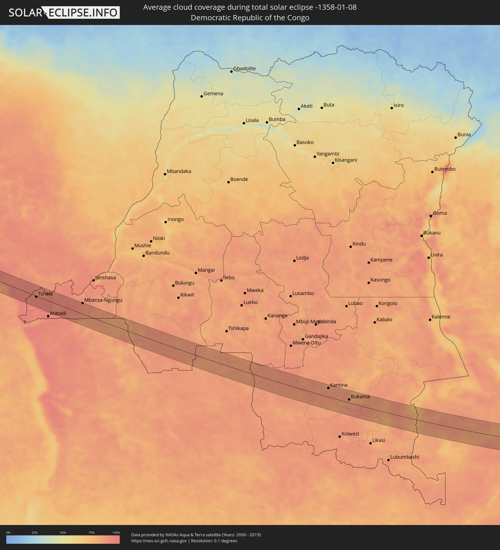 Democratic Republic of the Congo
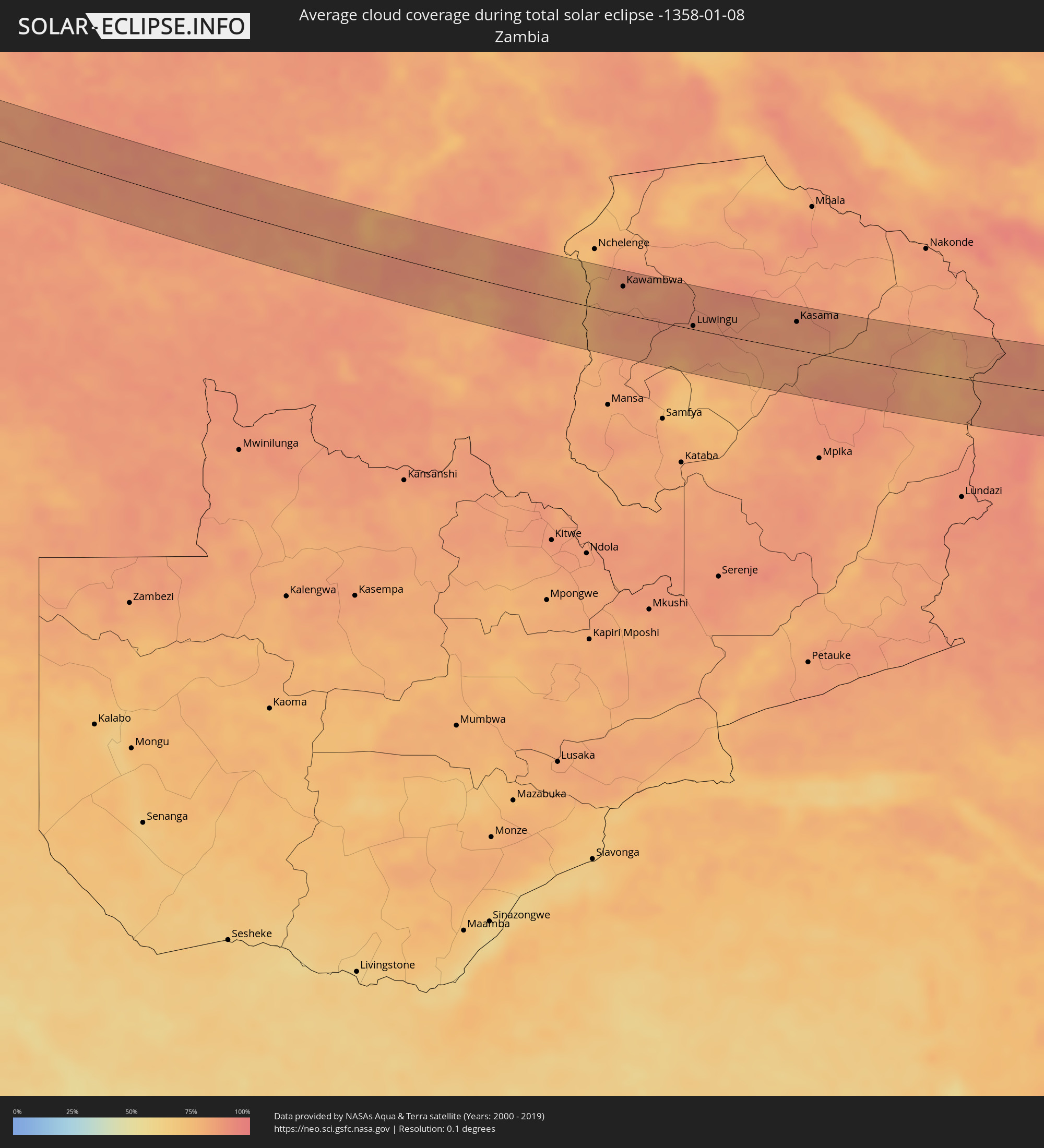 Zambia
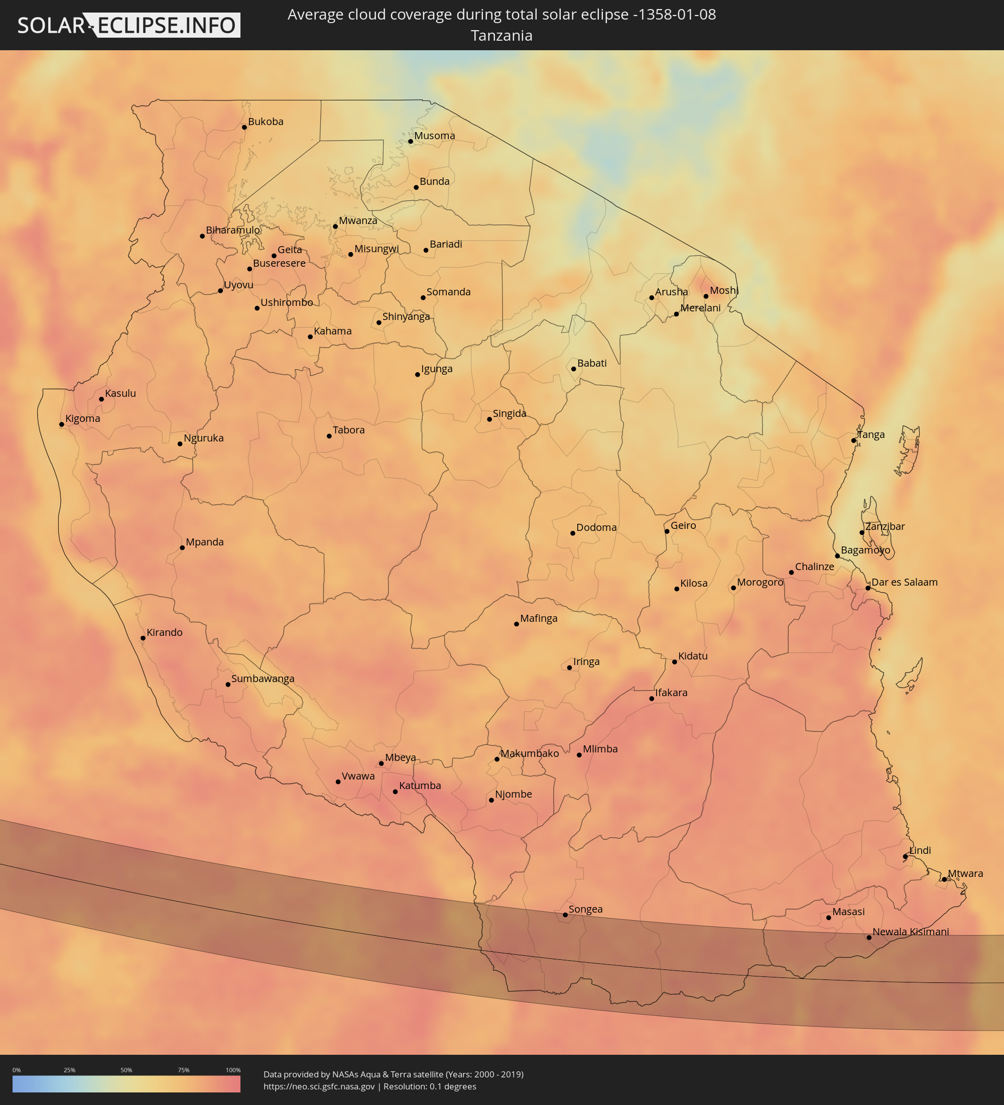 Tanzania
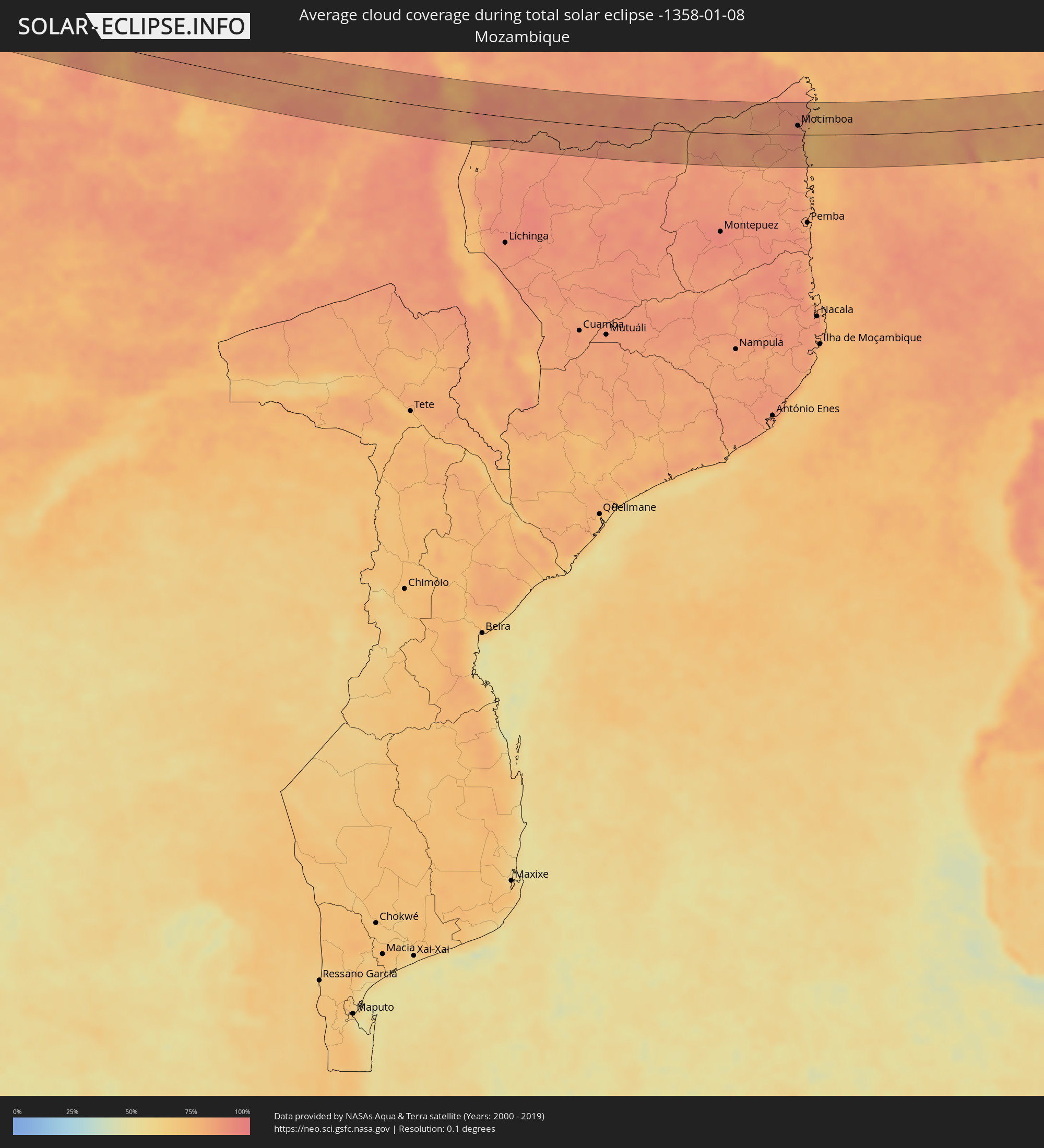 Mozambique
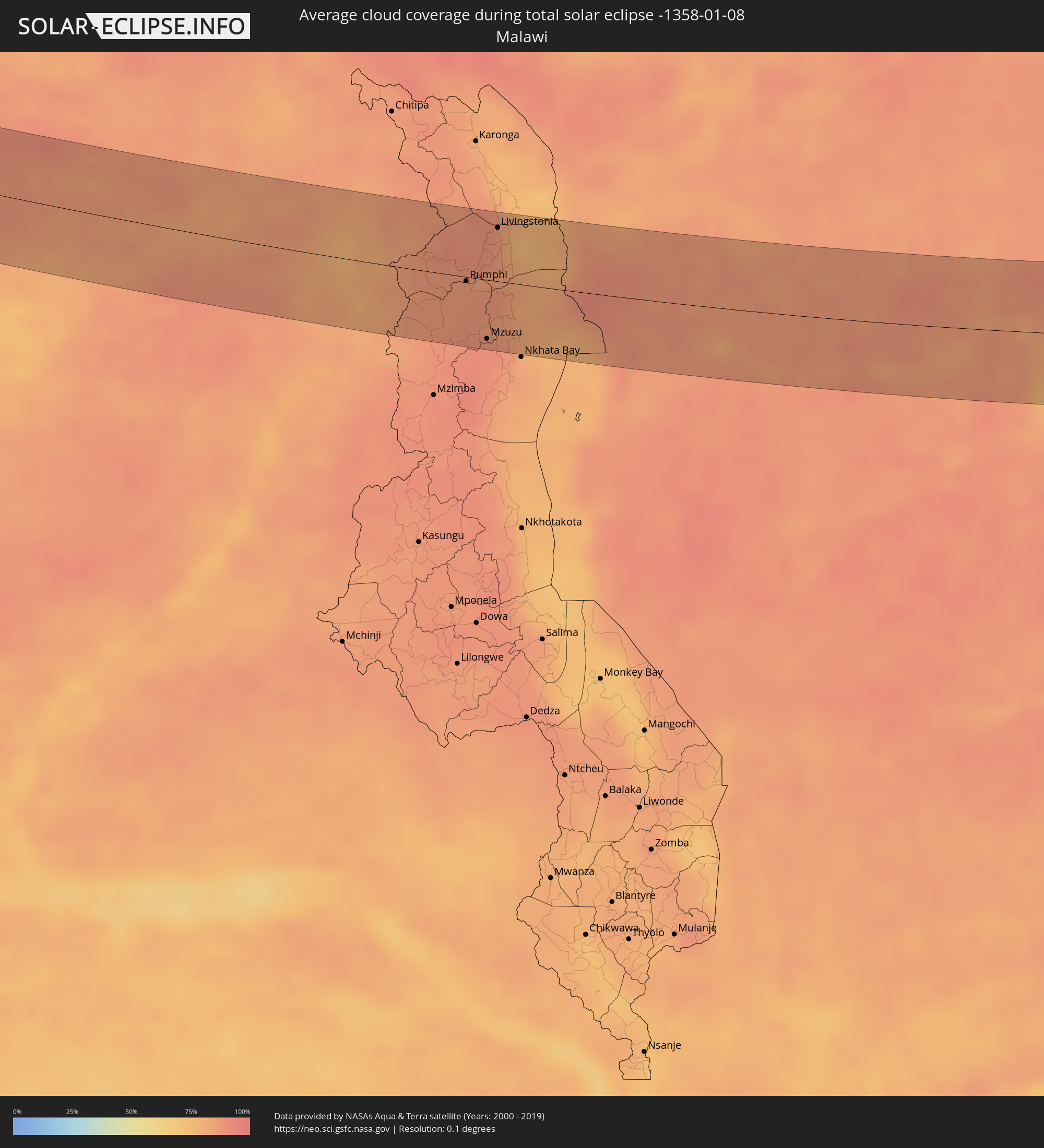 Malawi
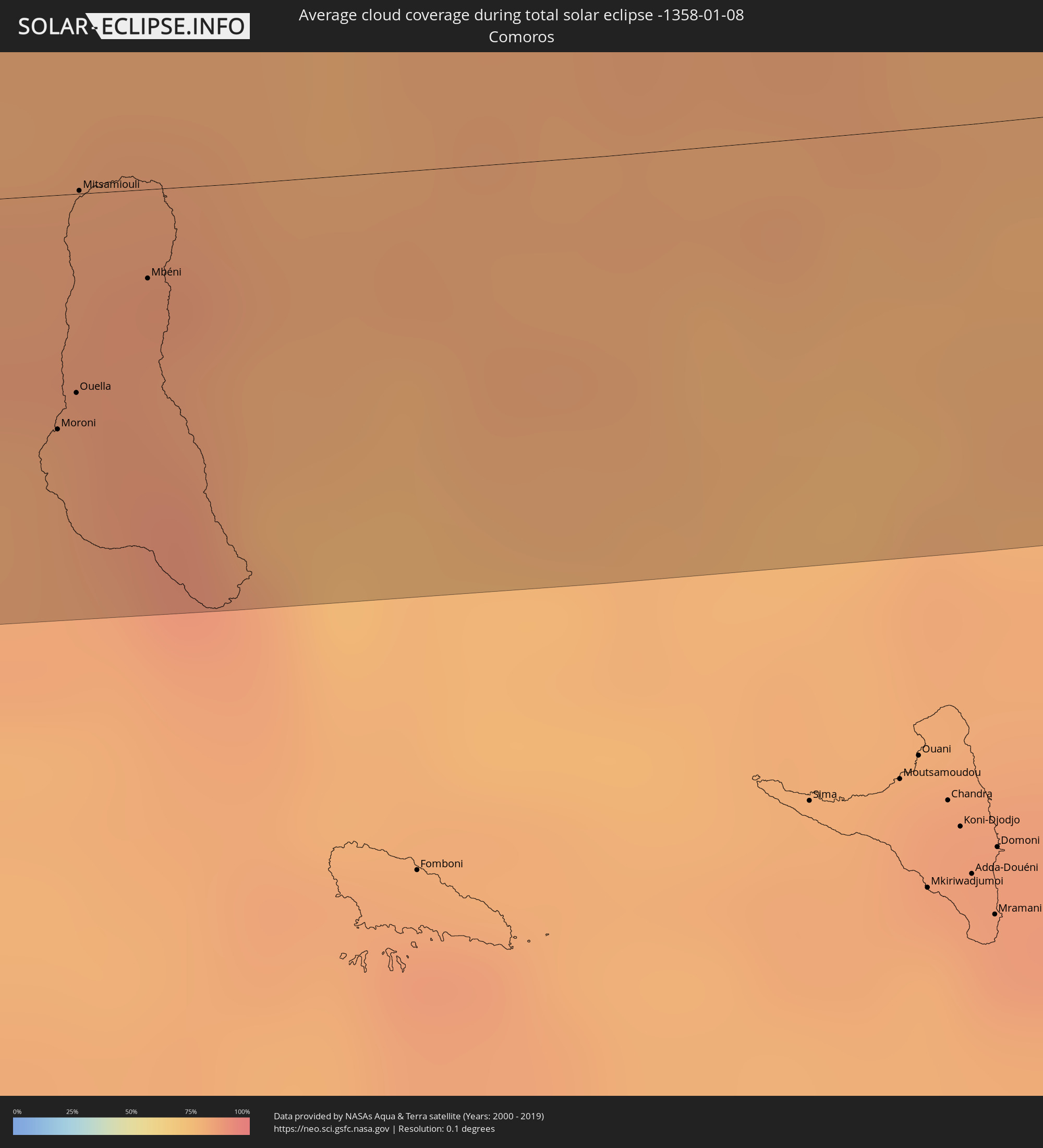 Comoros
 Seychelles
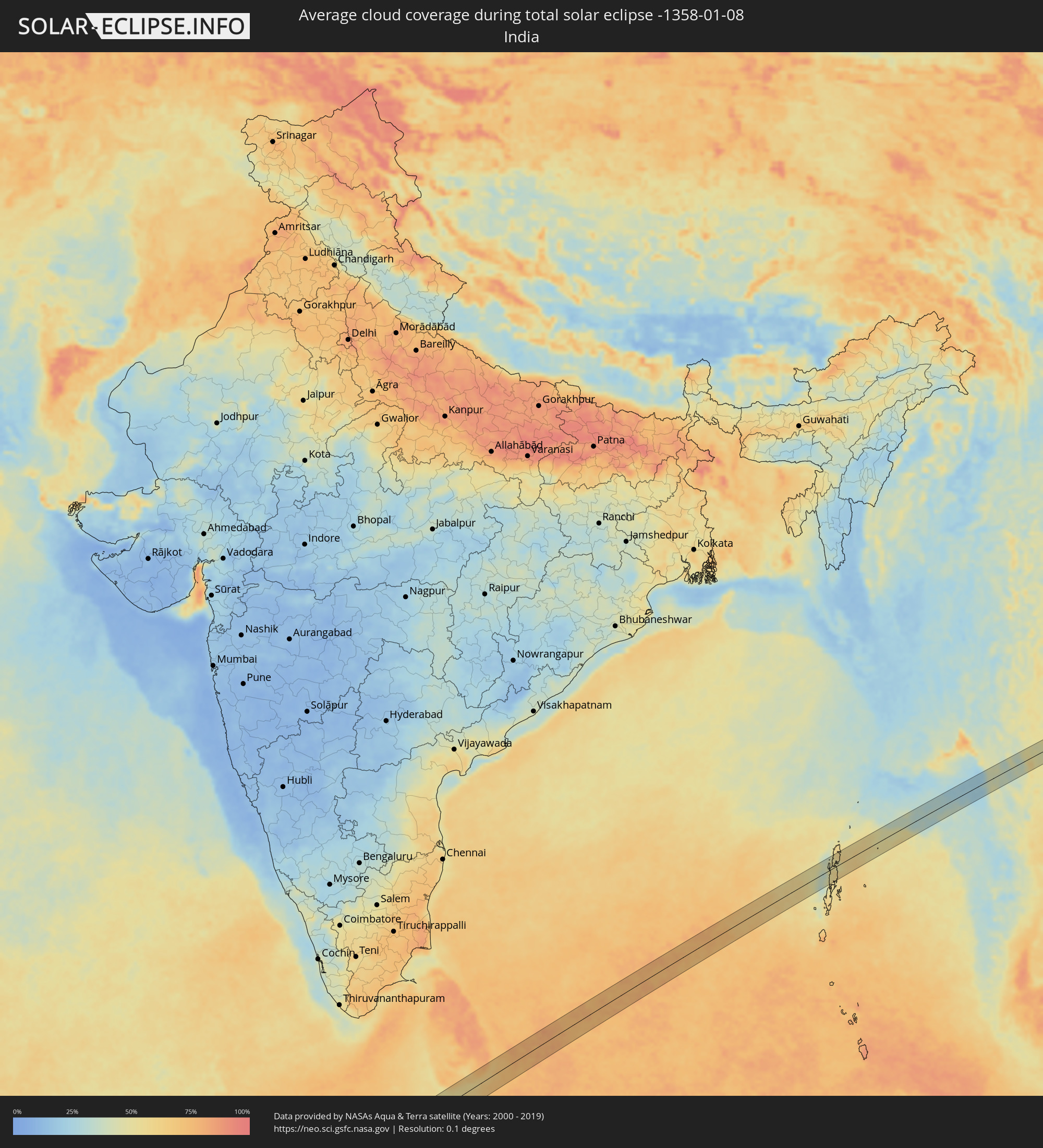 India
India
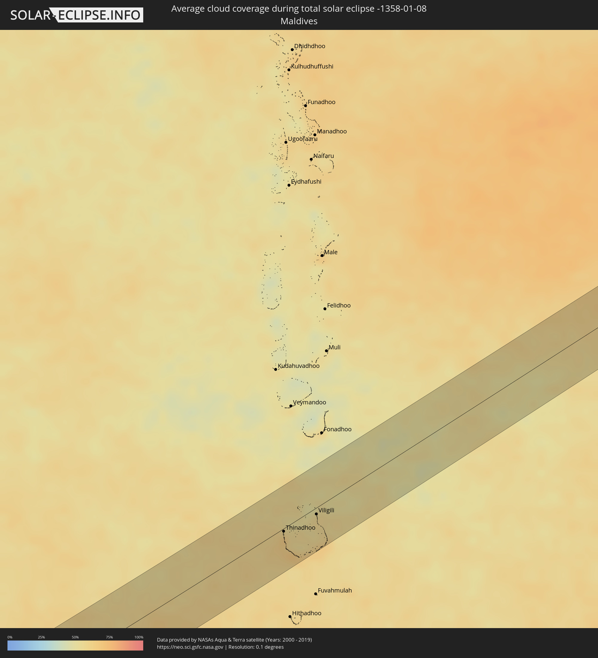 Maldives
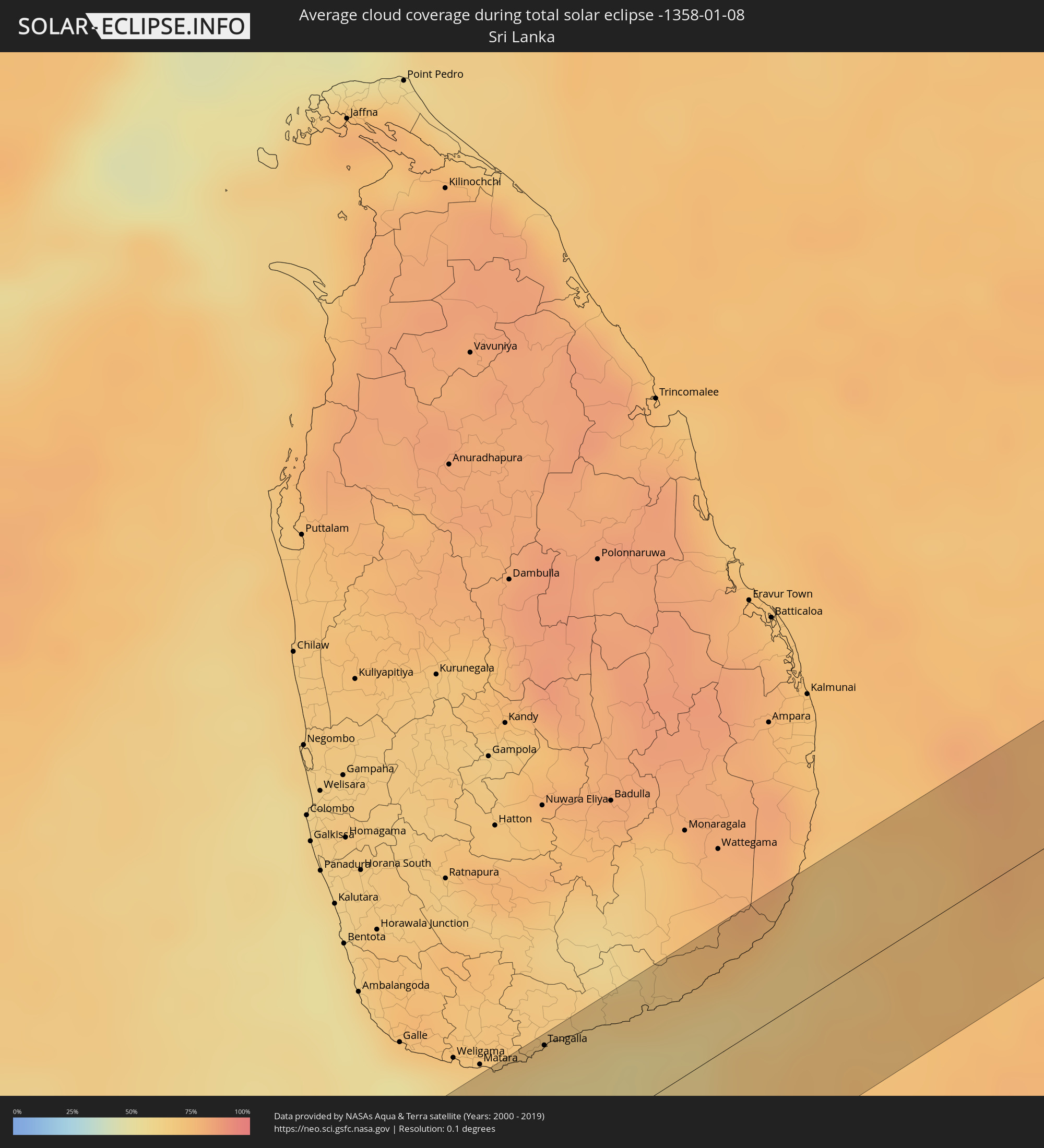 Sri Lanka
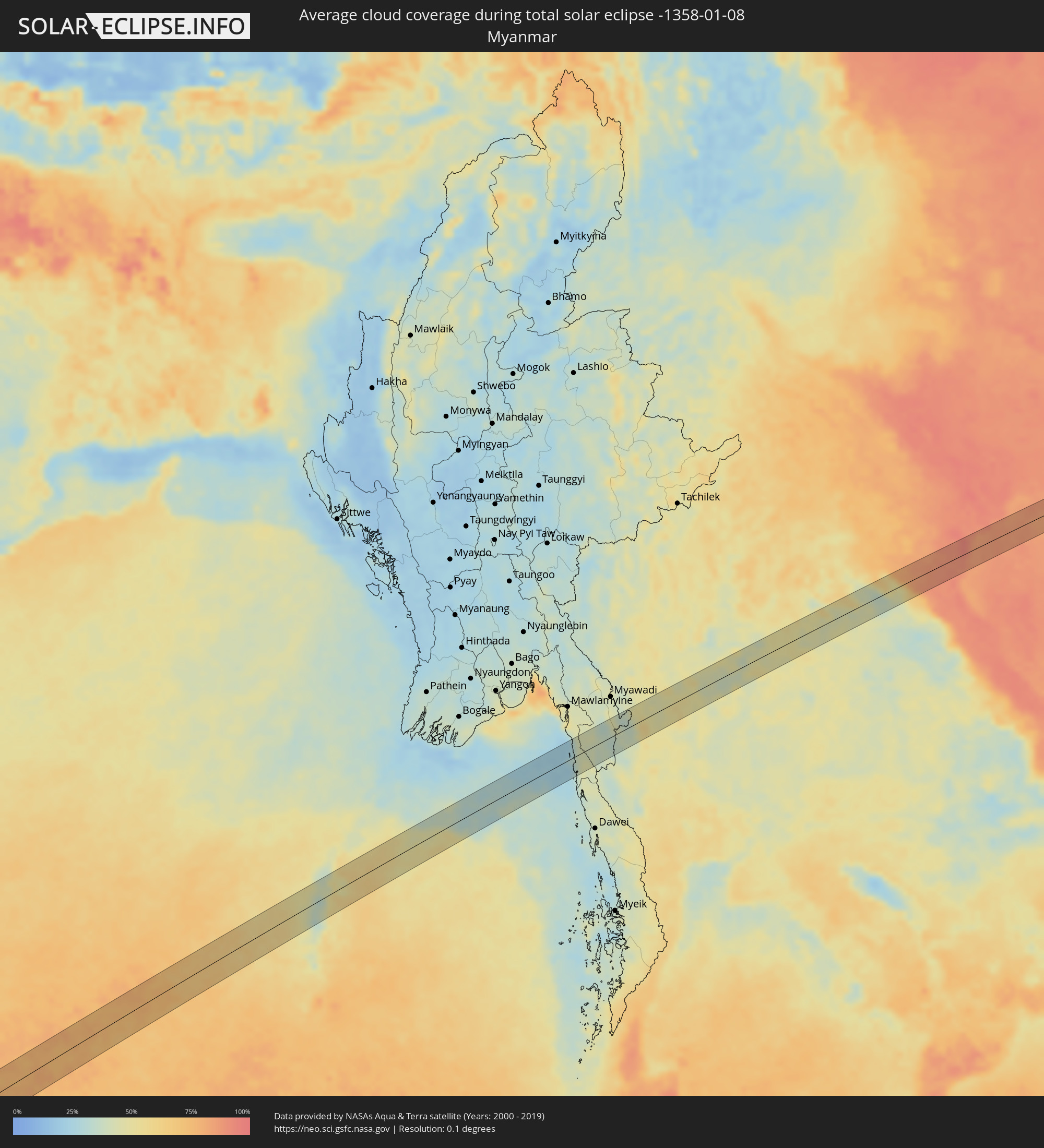 Myanmar
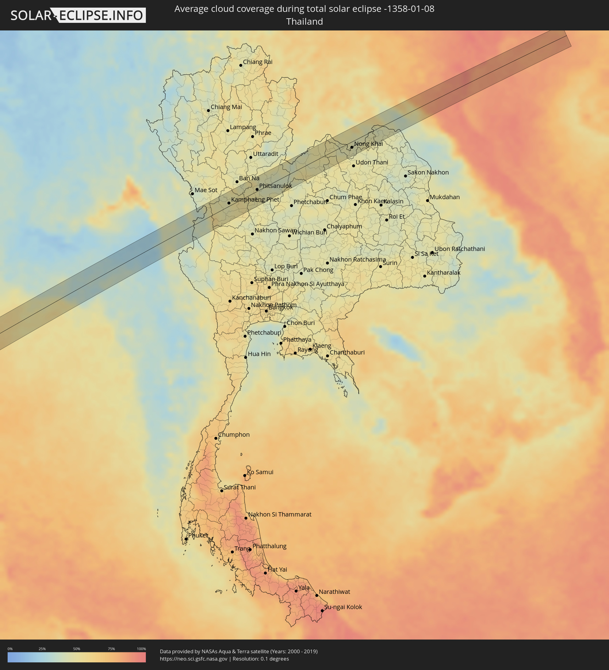 Thailand
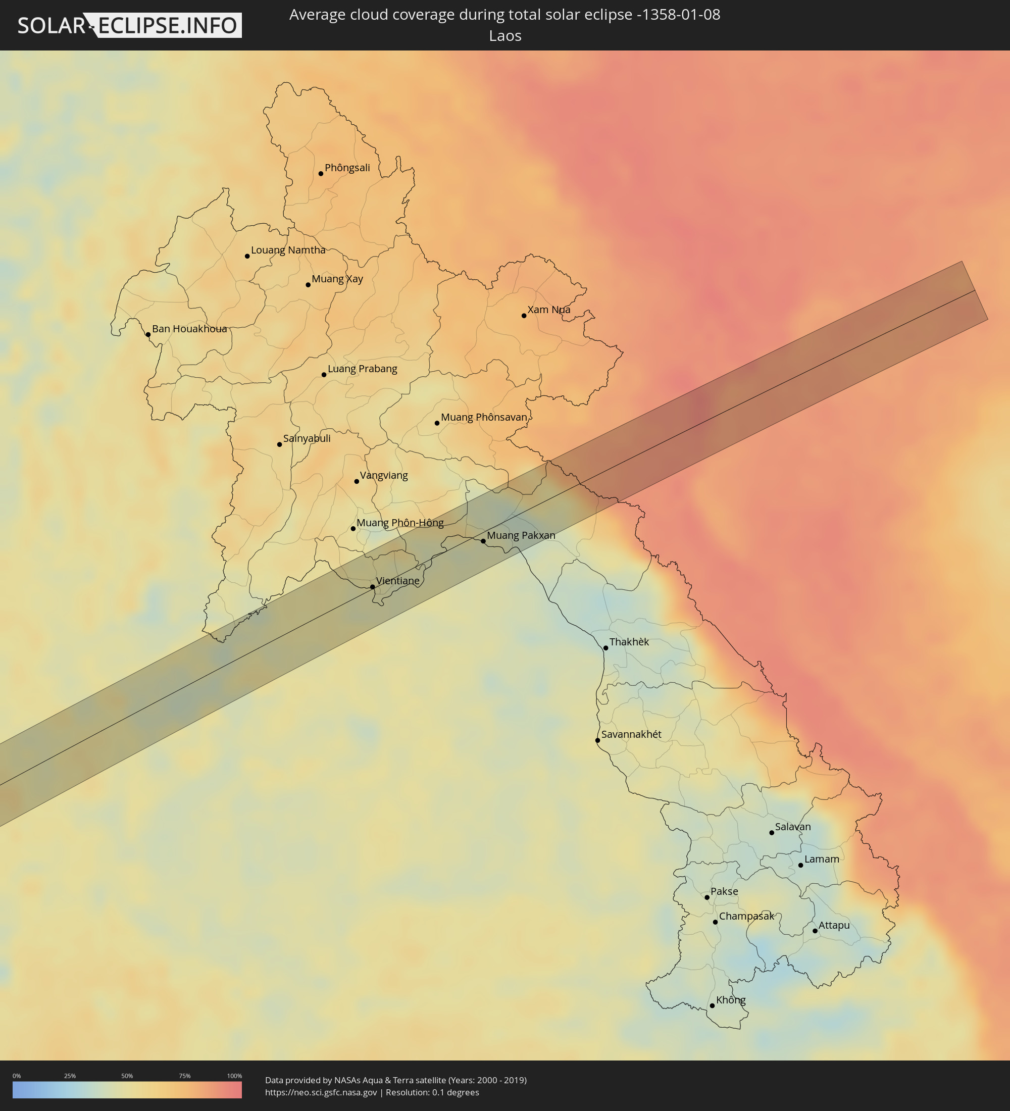 Laos
Laos
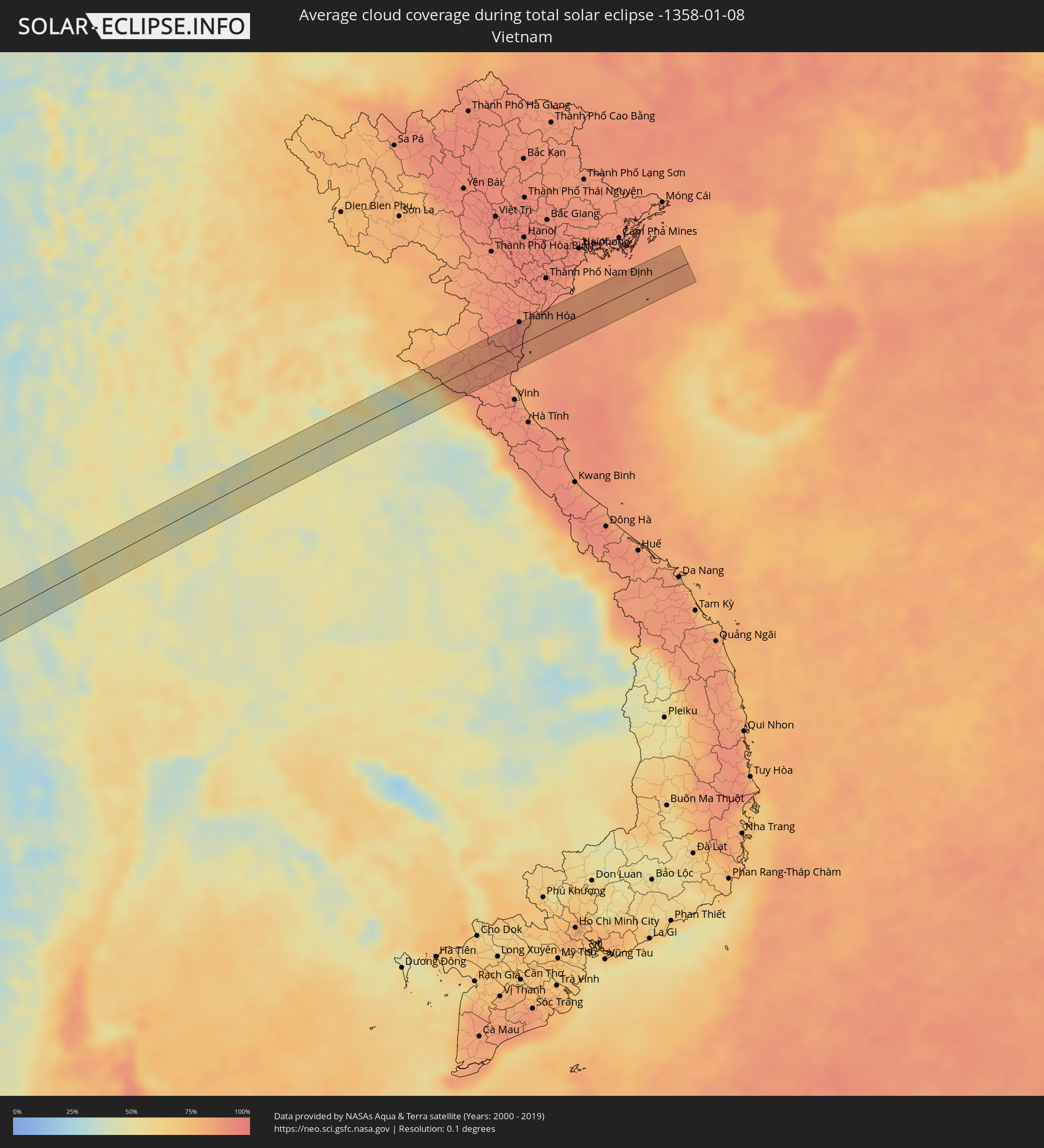 Vietnam
Cities inside the path of the eclipse
The following table shows all locations with a population of more than 5,000 inside the eclipse path. Cities which have more than 100,000 inhabitants are marked bold. A click at the locations opens a detailed map.
| City | Type | Eclipse duration | Local time of max. eclipse | Distance to central line | Ø Cloud coverage |
|
Loango, Kouilou
|
total | - | 07:19:33 UTC+00:13 | 14 km | 89% |
|
Loandjili, Pointe-Noire
|
total | - | 07:19:37 UTC+00:13 | 23 km | 92% |
|
Pointe-Noire, Pointe-Noire
|
total | - | 07:19:37 UTC+00:13 | 25 km | 92% |
|
Tshela, Bas-Congo
|
total | - | 07:20:46 UTC+00:13 | 4 km | 94% |
|
Mbanza-Ngungu, Bas-Congo
|
total | - | 07:22:57 UTC+00:13 | 46 km | 88% |
|
Kasongo-Lunda, Bandundu
|
total | - | 07:25:39 UTC+00:13 | 5 km | 82% |
|
Kamina, Katanga
|
total | - | 09:35:52 UTC+02:10 | 39 km | 86% |
|
Bukama, Katanga
|
total | - | 09:37:36 UTC+02:10 | 13 km | 83% |
|
Kawambwa, Luapula
|
total | - | 09:44:21 UTC+02:10 | 36 km | 85% |
|
Luwingu, Northern
|
total | - | 09:46:18 UTC+02:10 | 4 km | 87% |
|
Kasama, Northern
|
total | - | 09:49:10 UTC+02:10 | 37 km | 86% |
|
Mungwi, Northern
|
total | - | 09:49:36 UTC+02:10 | 45 km | 88% |
|
Rumphi, Northern Region
|
total | - | 09:55:44 UTC+02:10 | 4 km | 87% |
|
Mzuzu, Northern Region
|
total | - | 09:56:10 UTC+02:10 | 50 km | 91% |
|
Livingstonia, Northern Region
|
total | - | 09:56:21 UTC+02:10 | 46 km | 87% |
|
Liuli, Ruvuma
|
total | - | 09:57:42 UTC+02:10 | 1 km | 83% |
|
Mbamba Bay, Ruvuma
|
total | - | 09:58:03 UTC+02:10 | 20 km | 83% |
|
Matiri, Ruvuma
|
total | - | 10:15:20 UTC+02:27 | 41 km | 90% |
|
Mbinga, Ruvuma
|
total | - | 10:15:38 UTC+02:27 | 22 km | 90% |
|
Tingi, Ruvuma
|
total | - | 10:15:40 UTC+02:27 | 18 km | 90% |
|
Kigonsera, Ruvuma
|
total | - | 10:15:43 UTC+02:27 | 38 km | 90% |
|
Songea, Ruvuma
|
total | - | 10:17:18 UTC+02:27 | 58 km | 85% |
|
Masuguru, Mtwara
|
total | - | 10:24:50 UTC+02:27 | 6 km | 81% |
|
Nangomba, Mtwara
|
total | - | 10:25:08 UTC+02:27 | 58 km | 88% |
|
Namalenga, Mtwara
|
total | - | 10:26:50 UTC+02:27 | 55 km | 85% |
|
Newala Kisimani, Mtwara
|
total | - | 10:27:22 UTC+02:27 | 56 km | 85% |
|
Luchingu, Mtwara
|
total | - | 10:27:31 UTC+02:27 | 62 km | 89% |
|
Mocímboa, Cabo Delgado
|
total | - | 10:13:27 UTC+02:10 | 17 km | 87% |
|
Moroni, Grande Comore
|
total | - | 10:38:55 UTC+02:27 | 35 km | 86% |
|
Ouella, Grande Comore
|
total | - | 10:39:01 UTC+02:27 | 29 km | 86% |
|
Mitsamiouli, Grande Comore
|
total | - | 10:39:07 UTC+02:27 | 1 km | 86% |
|
Mbéni, Grande Comore
|
total | - | 10:39:22 UTC+02:27 | 13 km | 84% |
|
Thinadhoo, Gaafu Dhaalu Atholhu
|
total | - | 14:37:39 UTC+04:54 | 4 km | 65% |
|
Viligili, Gaafu Alifu Atholhu
|
total | - | 14:38:38 UTC+04:54 | 8 km | 55% |
|
Tangalla, Southern
|
total | - | 15:19:07 UTC+05:19 | 44 km | 57% |
|
Kamphaeng Phet, Kamphaeng Phet
|
total | - | 16:59:06 UTC+06:42 | 7 km | 45% |
|
Khiri Mat, Sukhothai
|
total | - | 16:59:13 UTC+06:42 | 27 km | 50% |
|
Lan Krabue, Kamphaeng Phet
|
total | - | 16:59:13 UTC+06:42 | 2 km | 54% |
|
Bang Rakam, Phitsanulok
|
total | - | 16:59:19 UTC+06:42 | 4 km | 49% |
|
Phitsanulok, Phitsanulok
|
total | - | 16:59:22 UTC+06:42 | 3 km | 48% |
|
Bang Krathum, Phitsanulok
|
total | - | 16:59:21 UTC+06:42 | 23 km | 48% |
|
Nakhon Thai, Phitsanulok
|
total | - | 16:59:33 UTC+06:42 | 2 km | 39% |
|
Loei, Loei
|
total | - | 16:59:48 UTC+06:42 | 4 km | 46% |
|
Wang Saphung, Loei
|
total | - | 16:59:48 UTC+06:42 | 24 km | 49% |
|
Nam Som, Changwat Udon Thani
|
total | - | 16:59:55 UTC+06:42 | 2 km | 51% |
|
Tha Bo, Nong Khai
|
total | - | 17:00:00 UTC+06:42 | 10 km | 45% |
|
Si Chiang Mai, Nong Khai
|
total | - | 17:00:01 UTC+06:42 | 1 km | 46% |
|
Vientiane, Vientiane
|
total | - | 17:00:01 UTC+06:42 | 1 km | 46% |
|
Nong Khai, Nong Khai
|
total | - | 17:00:03 UTC+06:42 | 15 km | 46% |
|
Phon Charoen, Nong Khai
|
total | - | 17:00:08 UTC+06:42 | 20 km | 48% |
|
Bueng Kan, Changwat Bueng Kan
|
total | - | 17:00:14 UTC+06:42 | 10 km | 44% |
|
Muang Pakxan, Bolikhamsai Province
|
total | - | 17:00:14 UTC+06:42 | 9 km | 44% |
|
Thanh Hóa, Thanh Hóa
|
total | - | 17:25:06 UTC+07:06 | 33 km | 91% |