Total solar eclipse of 11/19/-1756
| Day of week: | Sunday |
| Maximum duration of eclipse: | 01m10s |
| Maximum width of eclipse path: | 73 km |
| Saros cycle: | 24 |
| Coverage: | 100% |
| Magnitude: | 1.0162 |
| Gamma: | -0.6516 |
Wo kann man die Sonnenfinsternis vom 11/19/-1756 sehen?
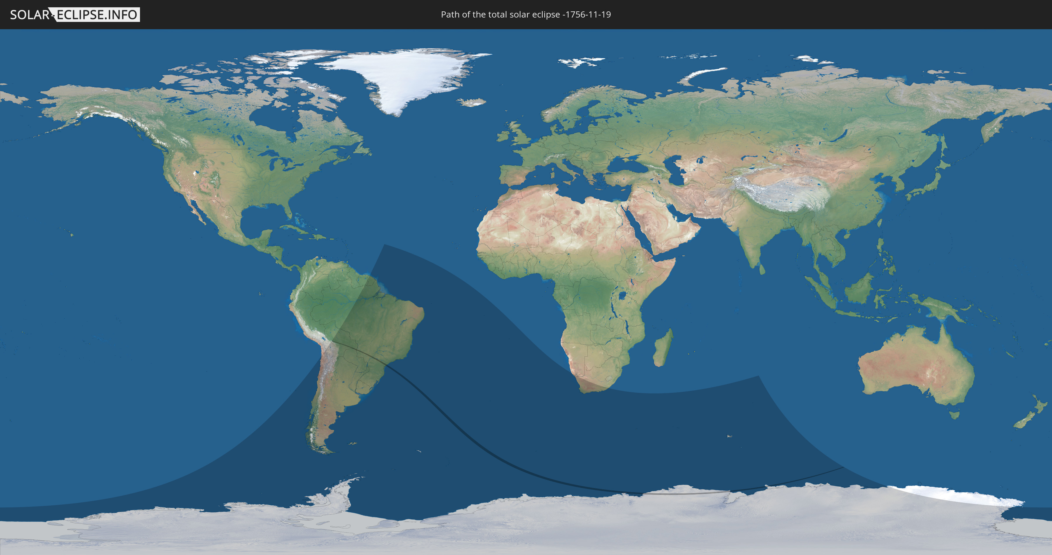
Die Sonnenfinsternis am 11/19/-1756 kann man in 17 Ländern als partielle Sonnenfinsternis beobachten.
Der Finsternispfad verläuft durch 3 Länder. Nur in diesen Ländern ist sie als total Sonnenfinsternis zu sehen.
In den folgenden Ländern ist die Sonnenfinsternis total zu sehen
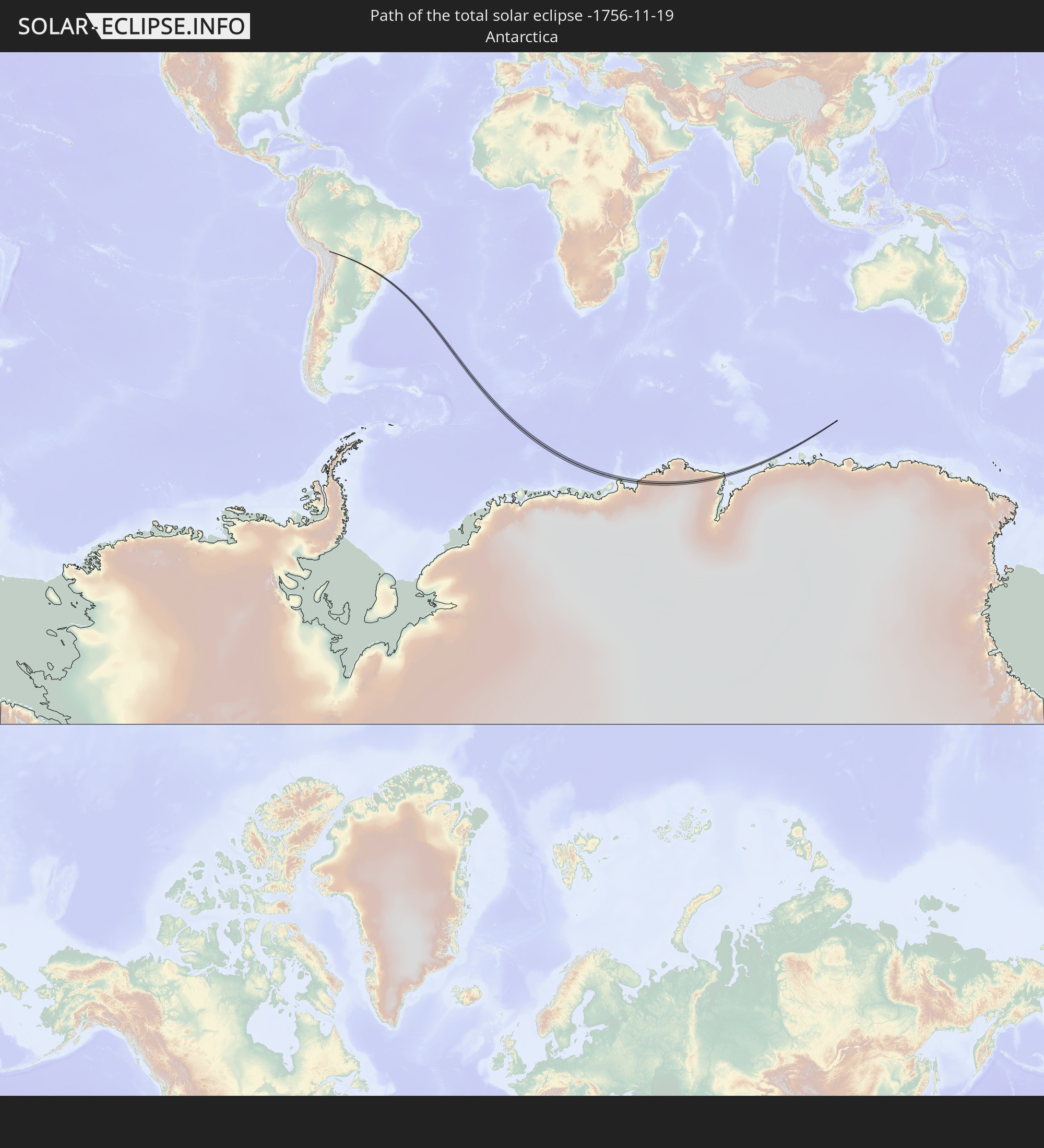 Antarctica
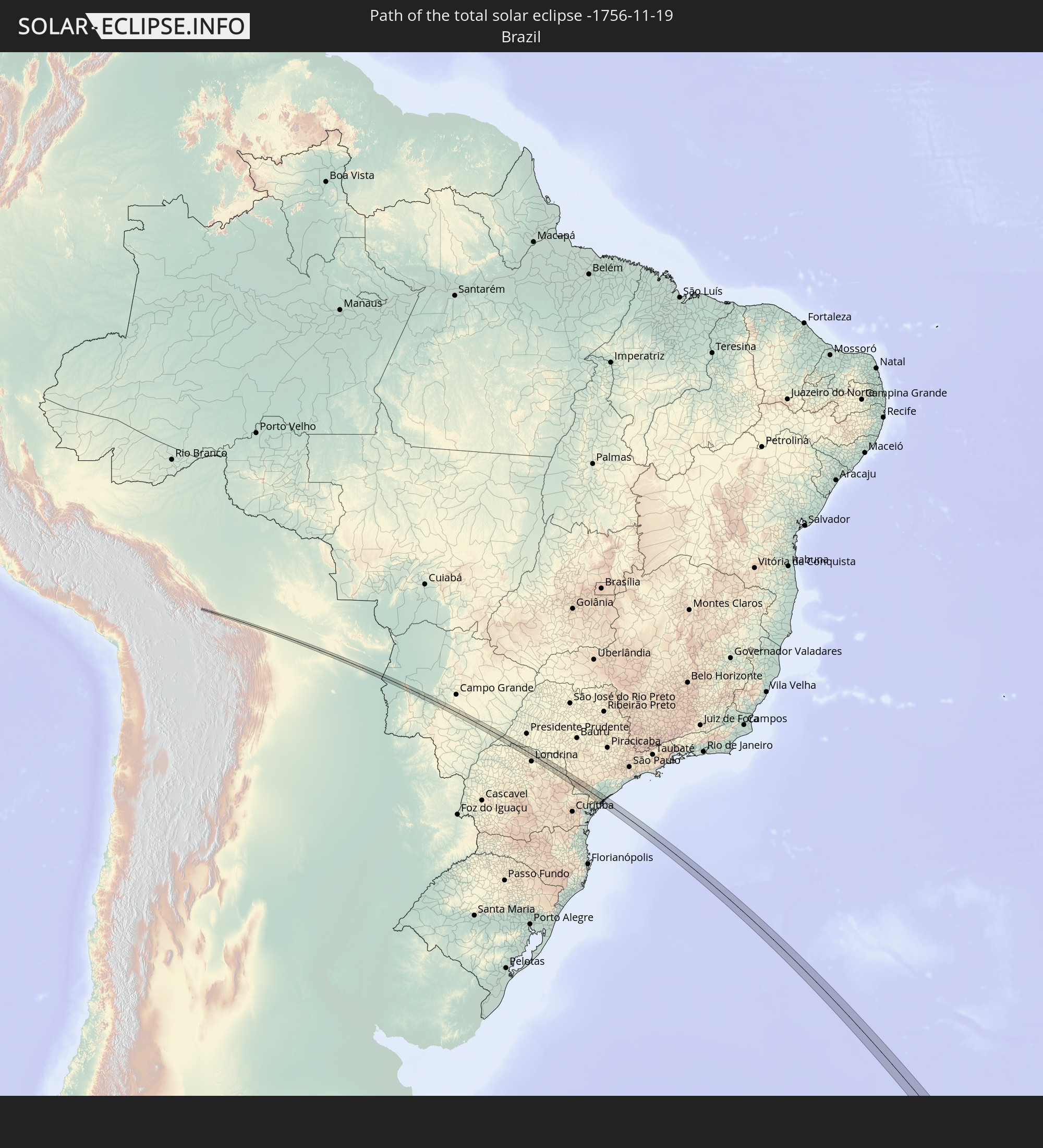 Brazil
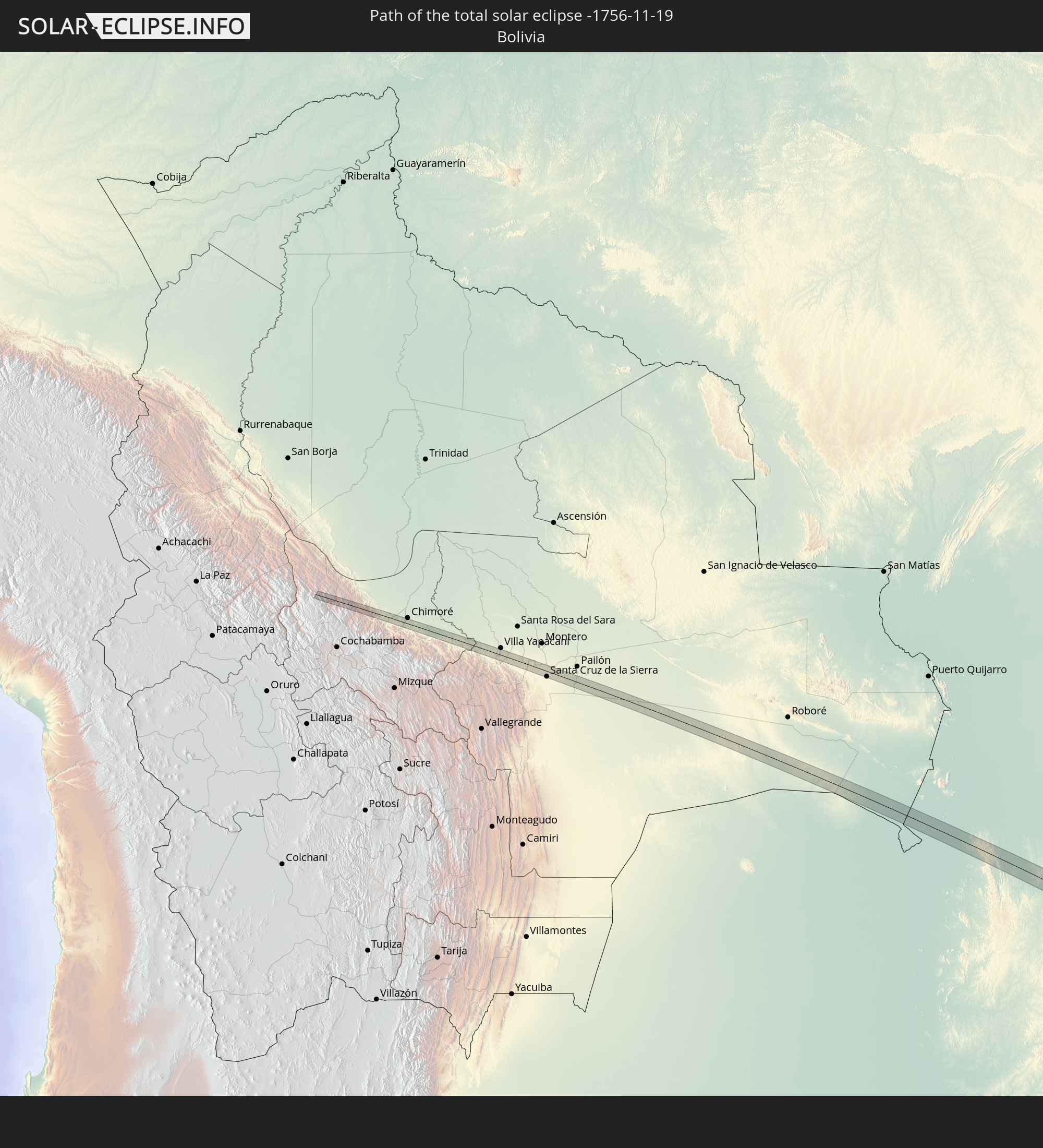 Bolivia
In den folgenden Ländern ist die Sonnenfinsternis partiell zu sehen
 Antarctica
 Chile
Chile
 Brazil
 Argentina
 Bolivia
 Paraguay
 Falkland Islands
 Uruguay
 Suriname
 French Guiana
 South Georgia and the South Sandwich Islands
 Saint Helena, Ascension and Tristan da Cunha
 Bouvet Island
 Namibia
 South Africa
 French Southern and Antarctic Lands
 Heard Island and McDonald Islands
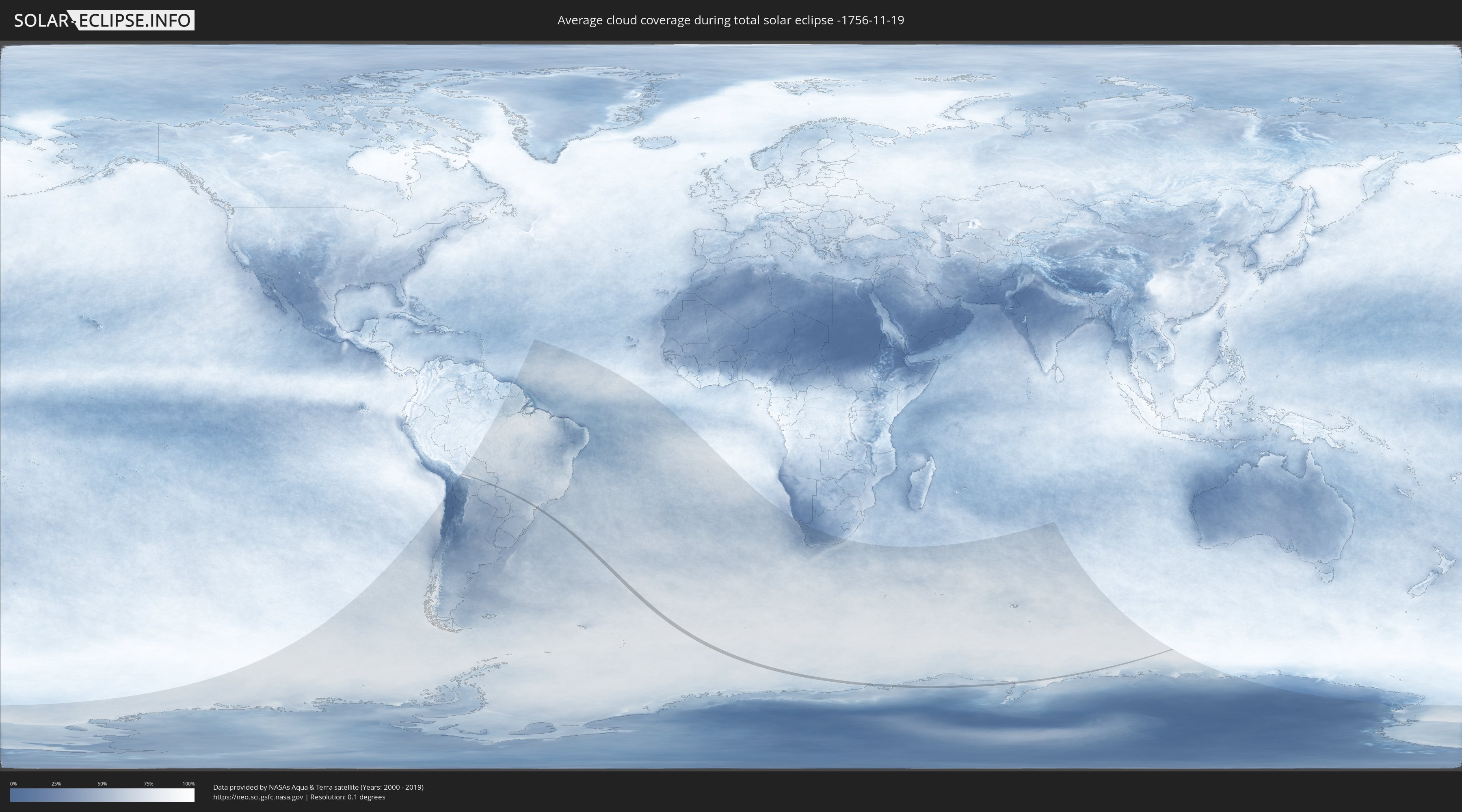
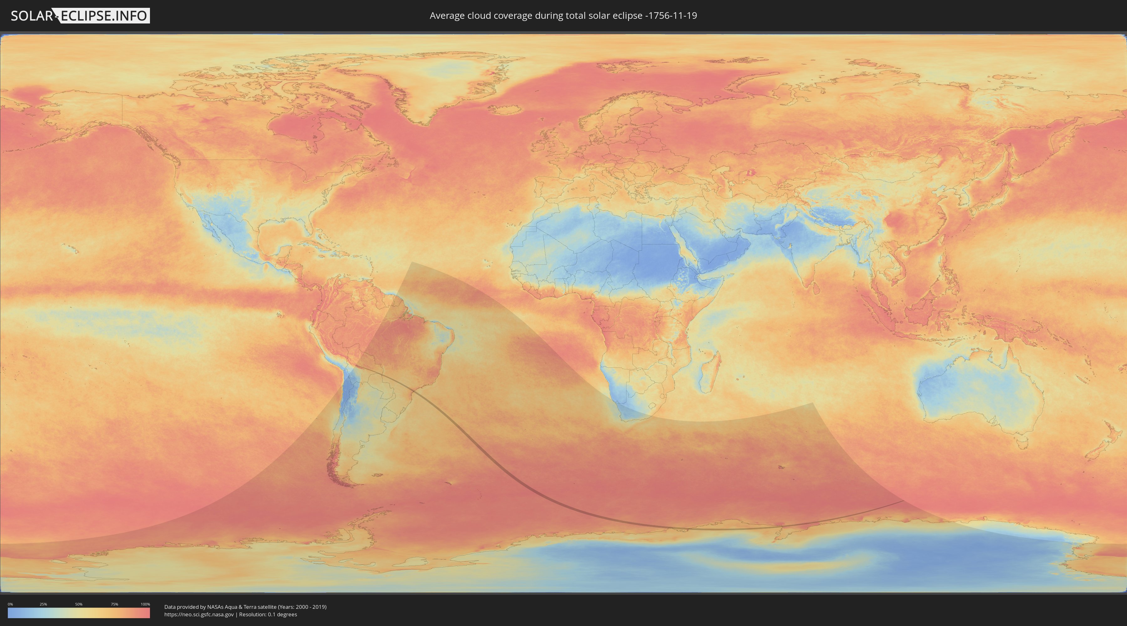
How will be the weather during the total solar eclipse on 11/19/-1756?
Where is the best place to see the total solar eclipse of 11/19/-1756?
The following maps show the average cloud coverage for the day of the total solar eclipse.
With the help of these maps, it is possible to find the place along the eclipse path, which has the best
chance of a cloudless sky.
Nevertheless, you should consider local circumstances and inform about the weather of your chosen
observation site.
The data is provided by NASAs satellites
AQUA and TERRA.
The cloud maps are averaged over a period of 19 years (2000 - 2019).
Detailed country maps
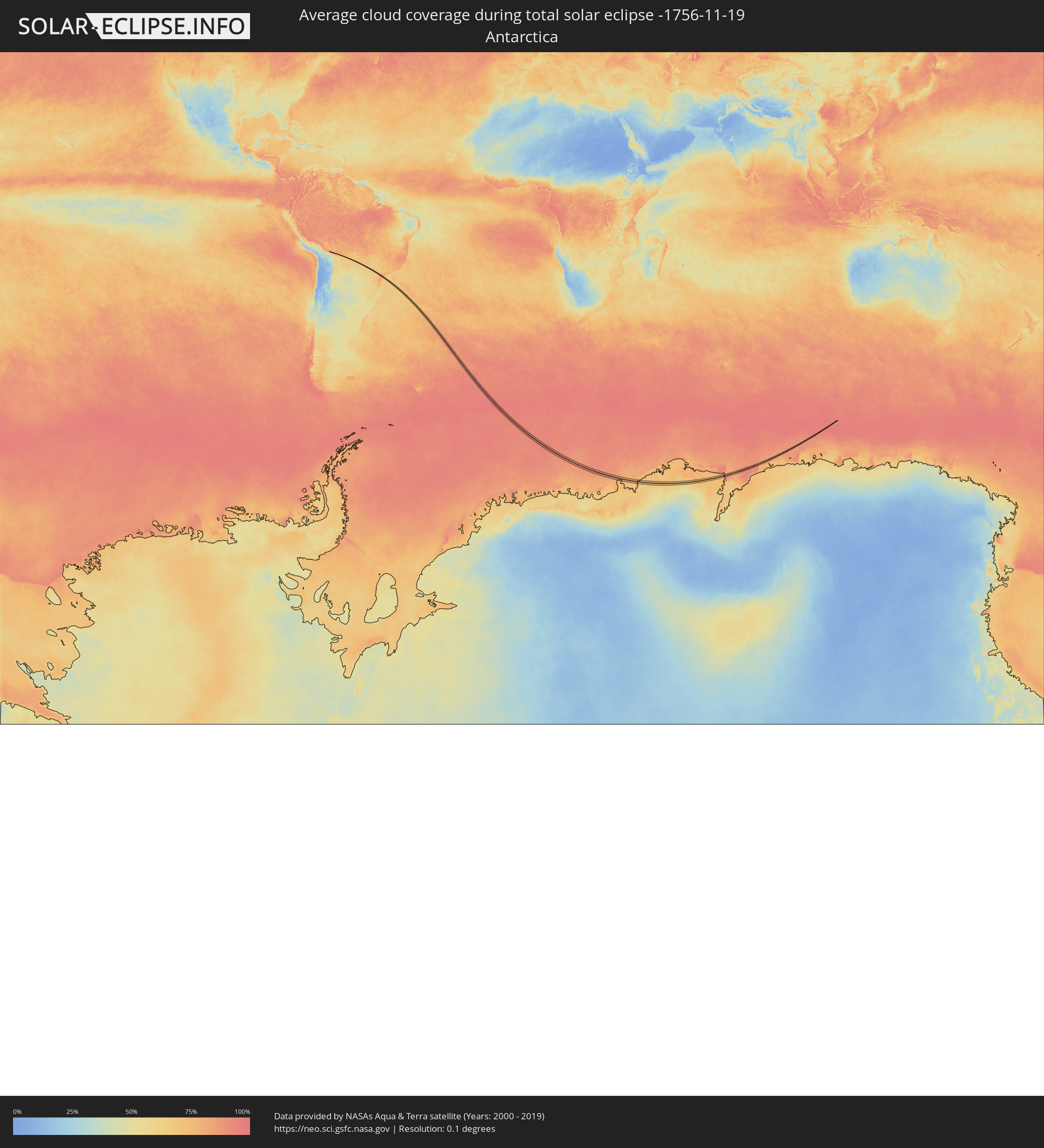 Antarctica
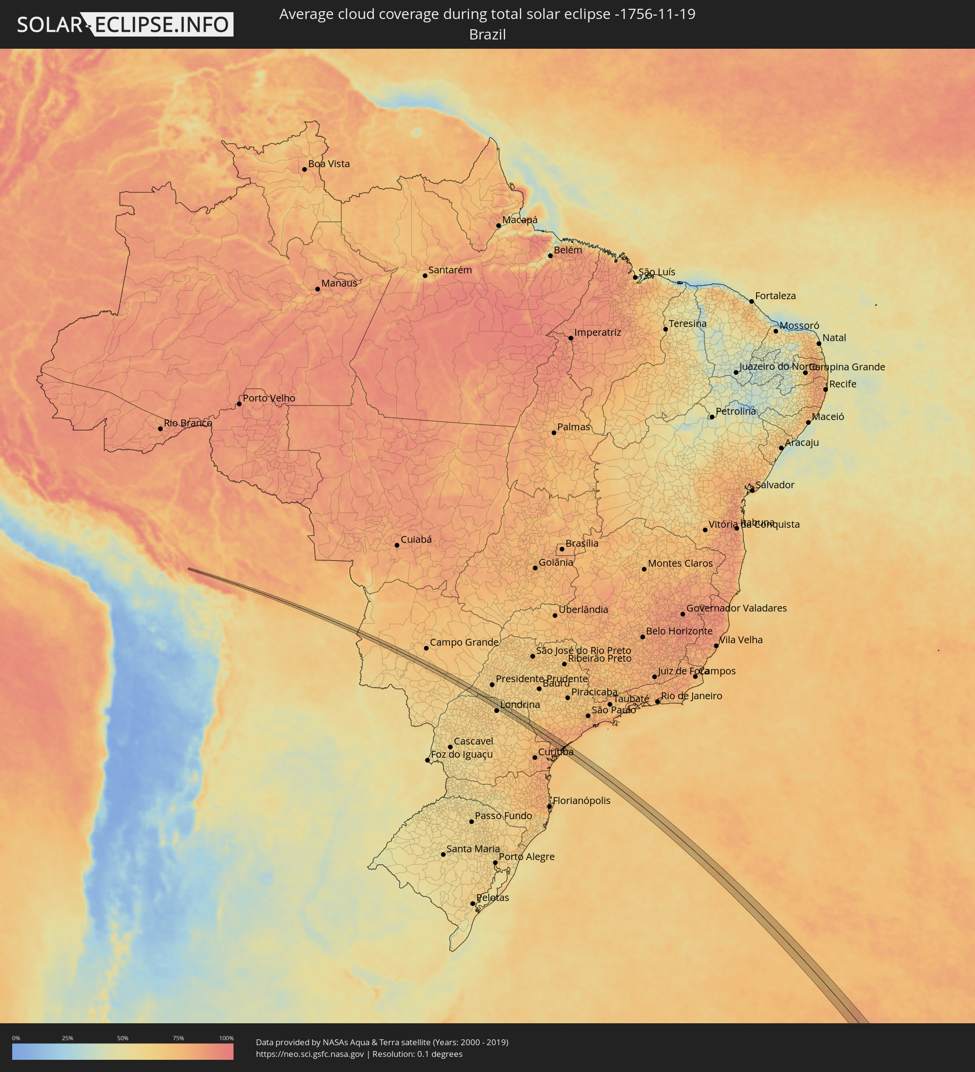 Brazil
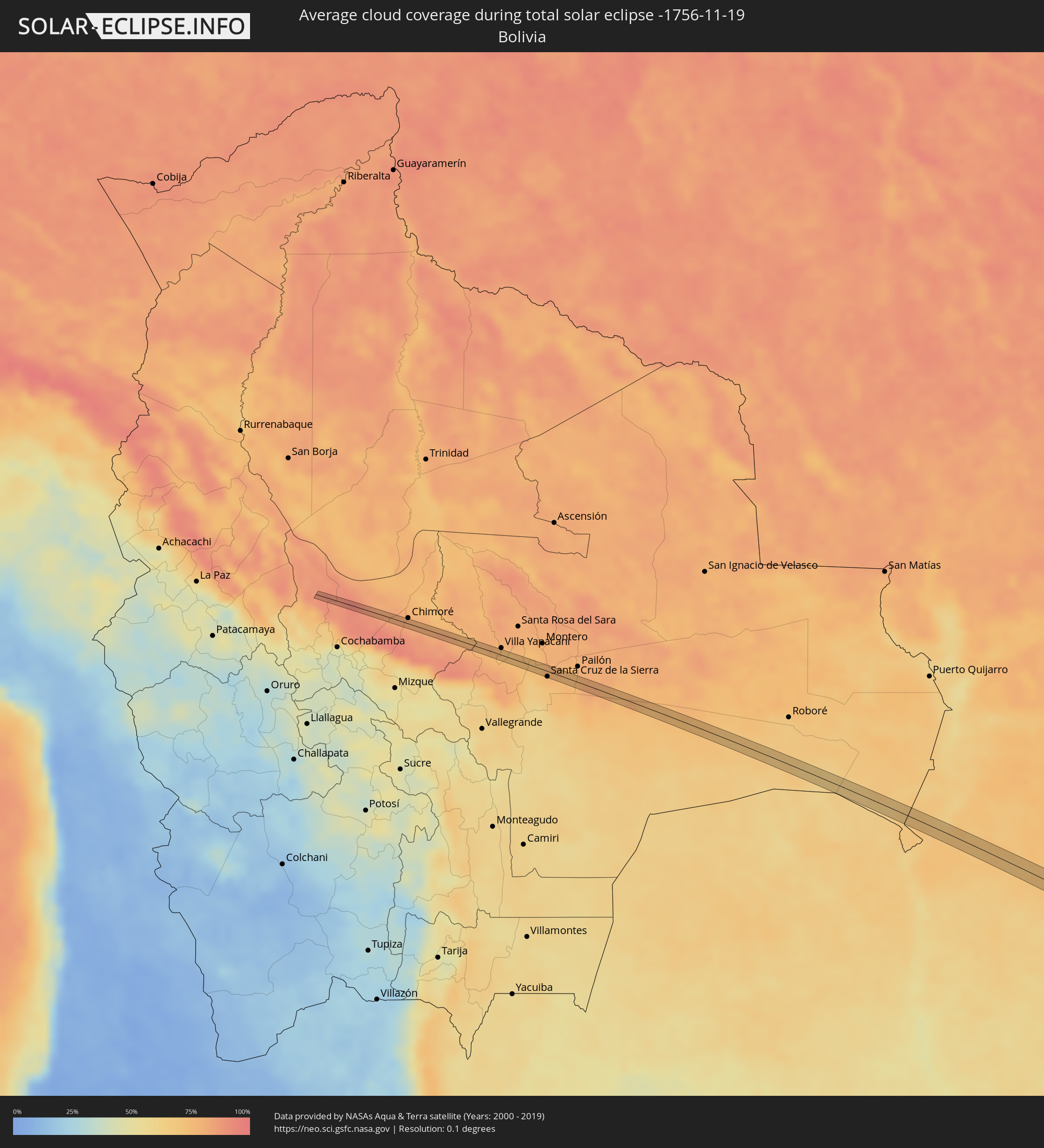 Bolivia
Cities inside the path of the eclipse
The following table shows all locations with a population of more than 5,000 inside the eclipse path. Cities which have more than 100,000 inhabitants are marked bold. A click at the locations opens a detailed map.
| City | Type | Eclipse duration | Local time of max. eclipse | Distance to central line | Ø Cloud coverage |
|
Santa Cruz de la Sierra, Santa Cruz
|
total | - | 05:25:23 UTC-04:32 | 19 km | 75% |
|
Cotoca, Santa Cruz
|
total | - | 05:25:23 UTC-04:32 | 7 km | 76% |
|
San Julian, Santa Cruz
|
total | - | 05:25:17 UTC-04:32 | 14 km | 75% |
|
Sidrolândia, Mato Grosso do Sul
|
total | - | 06:22:18 UTC-03:38 | 12 km | 68% |
|
Teodoro Sampaio, São Paulo
|
total | - | 06:56:34 UTC-03:06 | 17 km | 56% |
|
Centenário do Sul, Paraná
|
total | - | 06:57:01 UTC-03:06 | 10 km | 63% |
|
Florestópolis, Paraná
|
total | - | 06:57:05 UTC-03:06 | 12 km | 61% |
|
Porecatu, Paraná
|
total | - | 06:56:55 UTC-03:06 | 14 km | 61% |
|
Bela Vista do Paraíso, Paraná
|
total | - | 06:57:17 UTC-03:06 | 23 km | 61% |
|
Ibiporã, Paraná
|
total | - | 06:57:43 UTC-03:06 | 20 km | 63% |
|
Sertanópolis, Paraná
|
total | - | 06:57:24 UTC-03:06 | 6 km | 62% |
|
Jataizinho, Paraná
|
total | - | 06:57:42 UTC-03:06 | 18 km | 63% |
|
Assaí, Paraná
|
total | - | 06:57:53 UTC-03:06 | 35 km | 63% |
|
Cornélio Procópio, Paraná
|
total | - | 06:57:36 UTC-03:06 | 27 km | 62% |
|
Terra Roxa, Paraná
|
total | - | 06:58:41 UTC-03:06 | 21 km | 67% |
|
Siqueira Campos, Paraná
|
total | - | 06:58:27 UTC-03:06 | 17 km | 69% |
|
Wenceslau Braz, Paraná
|
total | - | 06:58:44 UTC-03:06 | 31 km | 67% |
|
Sengés, Paraná
|
total | - | 06:59:08 UTC-03:06 | 18 km | 69% |
|
Itararé, São Paulo
|
total | - | 06:59:09 UTC-03:06 | 24 km | 69% |
|
Apiaí, São Paulo
|
total | - | 06:59:50 UTC-03:06 | 32 km | 80% |
|
Ribeirão Branco, São Paulo
|
total | - | 06:59:23 UTC-03:06 | 24 km | 76% |
|
Cajati, São Paulo
|
total | - | 07:00:17 UTC-03:06 | 19 km | 81% |
|
Jacupiranga, São Paulo
|
total | - | 07:00:14 UTC-03:06 | 20 km | 80% |
|
Cananéia, São Paulo
|
total | - | 07:00:45 UTC-03:06 | 18 km | 75% |
|
Pariquera Açu, São Paulo
|
total | - | 07:00:17 UTC-03:06 | 21 km | 79% |