Total solar eclipse of 11/30/-1776
| Day of week: | Sunday |
| Maximum duration of eclipse: | 01m24s |
| Maximum width of eclipse path: | 73 km |
| Saros cycle: | 4 |
| Coverage: | 100% |
| Magnitude: | 1.0151 |
| Gamma: | 0.7115 |
Wo kann man die Sonnenfinsternis vom 11/30/-1776 sehen?
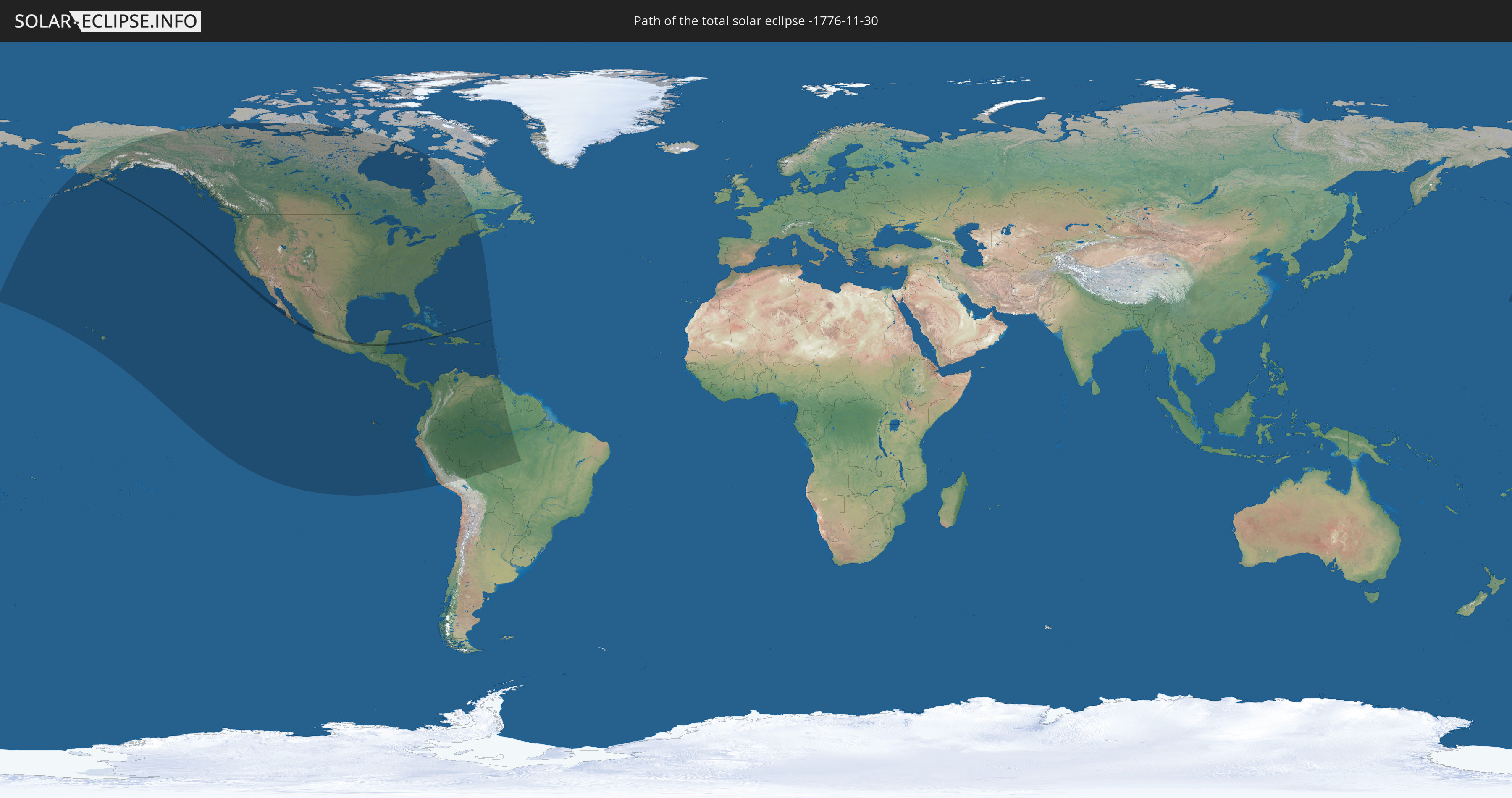
Die Sonnenfinsternis am 11/30/-1776 kann man in 39 Ländern als partielle Sonnenfinsternis beobachten.
Der Finsternispfad verläuft durch 6 Länder. Nur in diesen Ländern ist sie als total Sonnenfinsternis zu sehen.
In den folgenden Ländern ist die Sonnenfinsternis total zu sehen
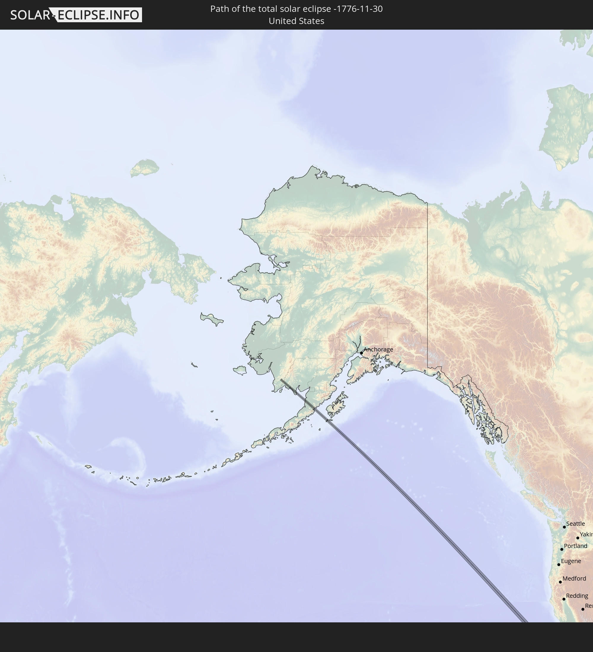 United States
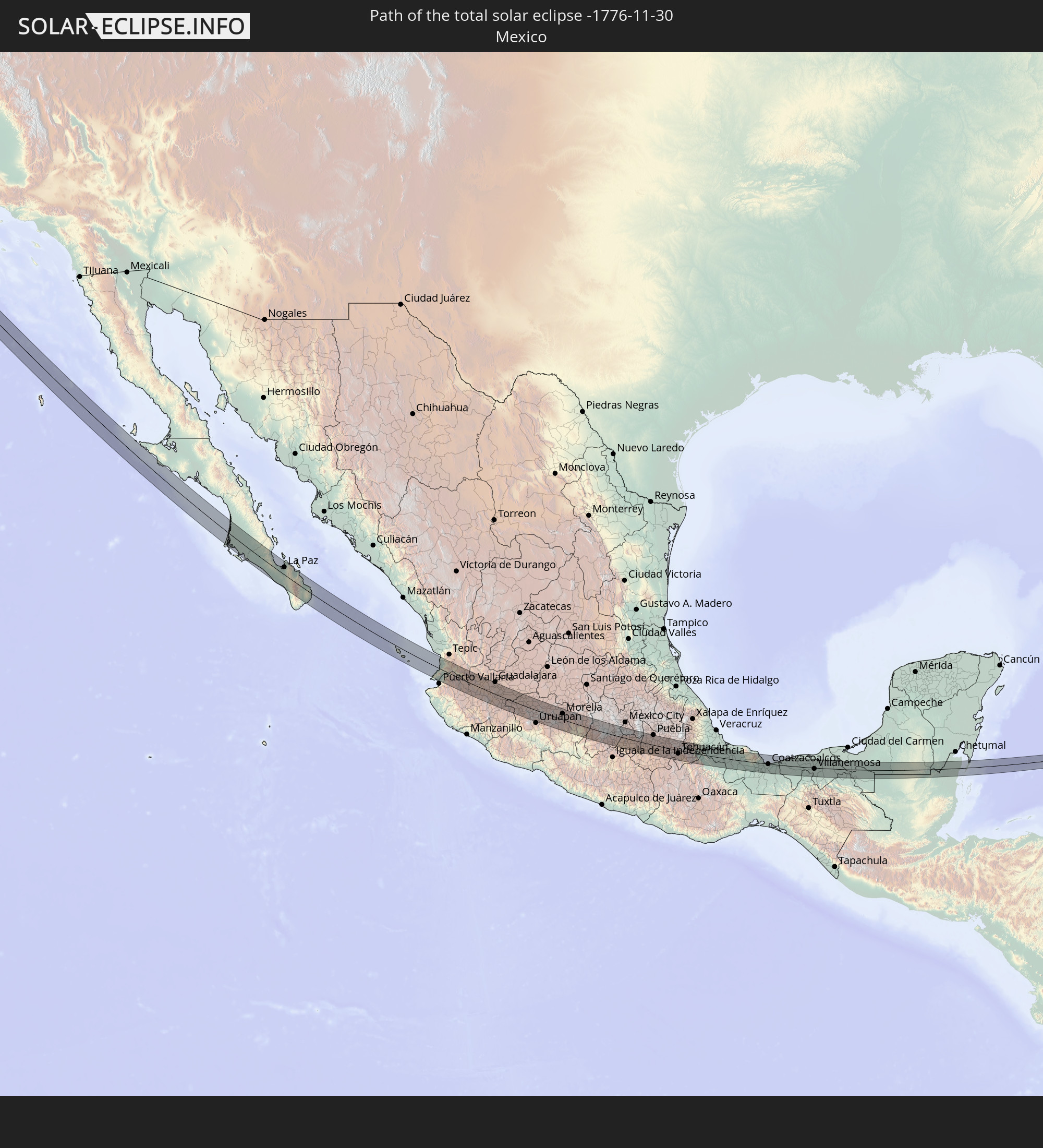 Mexico
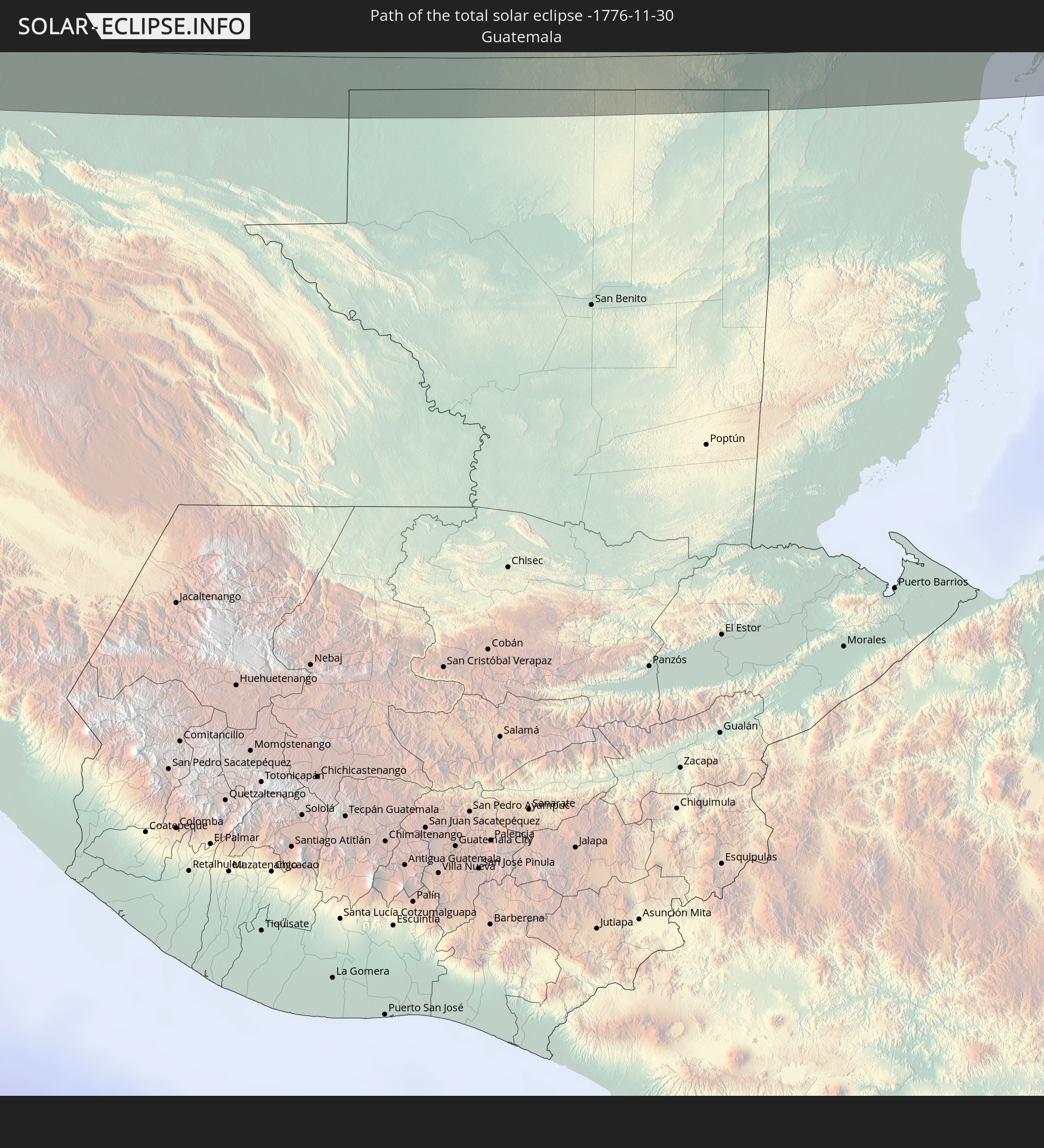 Guatemala
 Belize
 Cuba
Cuba
 Turks and Caicos Islands
In den folgenden Ländern ist die Sonnenfinsternis partiell zu sehen
 United States
 United States Minor Outlying Islands
 Canada
 Mexico
 Greenland
 Guatemala
 Ecuador
 El Salvador
 Honduras
 Belize
 Nicaragua
 Costa Rica
 Cuba
Cuba
 Panama
 Colombia
 Cayman Islands
 Peru
Peru
 The Bahamas
 Jamaica
 Haiti
Haiti
 Brazil
 Venezuela
 Turks and Caicos Islands
 Dominican Republic
 Aruba
Aruba
 Bolivia
 Puerto Rico
 United States Virgin Islands
 Bermuda
 British Virgin Islands
 Anguilla
 Collectivity of Saint Martin
 Saint Barthélemy
 Saint Kitts and Nevis
 Antigua and Barbuda
 Montserrat
 Trinidad and Tobago
 Grenada
 Guyana
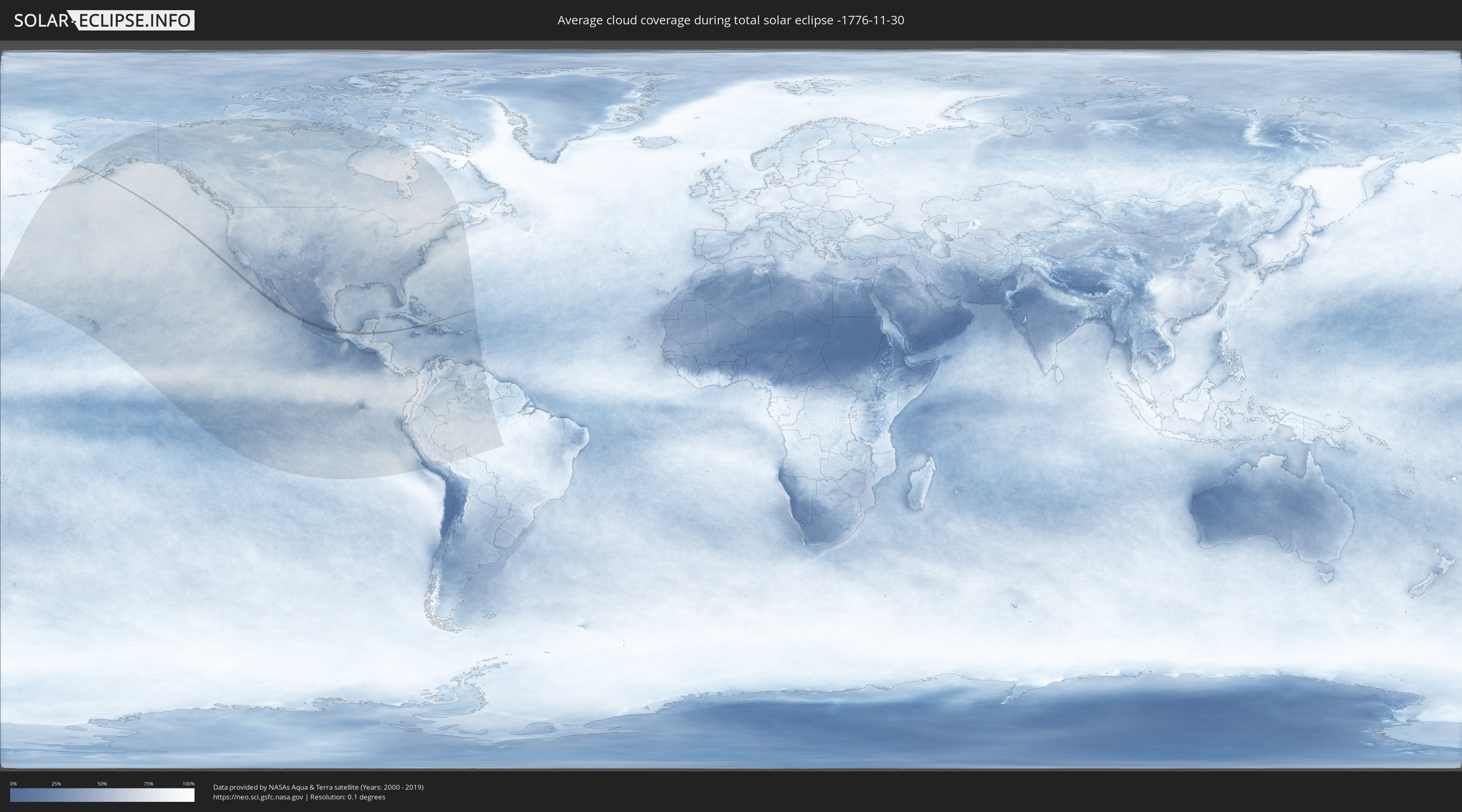
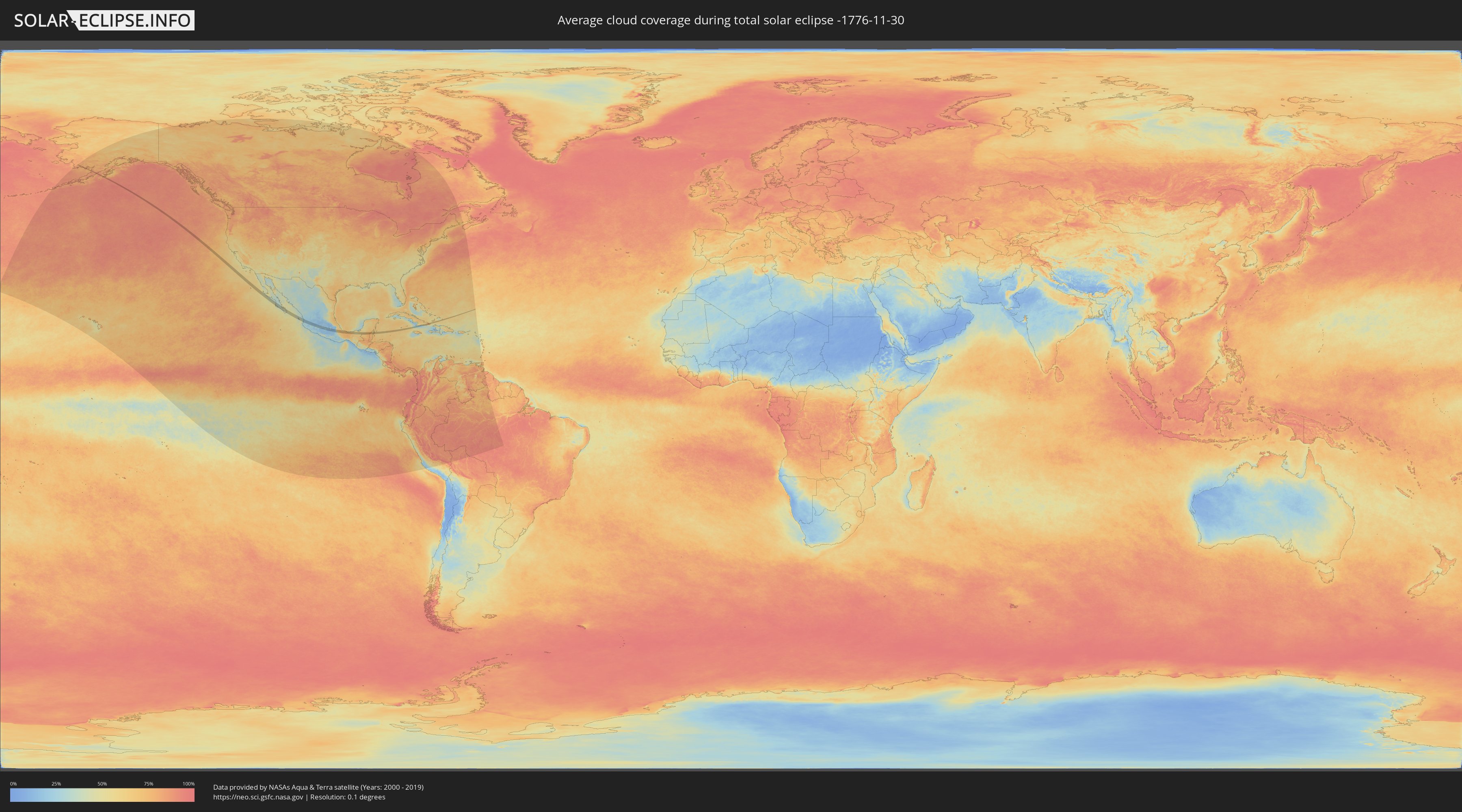
How will be the weather during the total solar eclipse on 11/30/-1776?
Where is the best place to see the total solar eclipse of 11/30/-1776?
The following maps show the average cloud coverage for the day of the total solar eclipse.
With the help of these maps, it is possible to find the place along the eclipse path, which has the best
chance of a cloudless sky.
Nevertheless, you should consider local circumstances and inform about the weather of your chosen
observation site.
The data is provided by NASAs satellites
AQUA and TERRA.
The cloud maps are averaged over a period of 19 years (2000 - 2019).
Detailed country maps
 United States
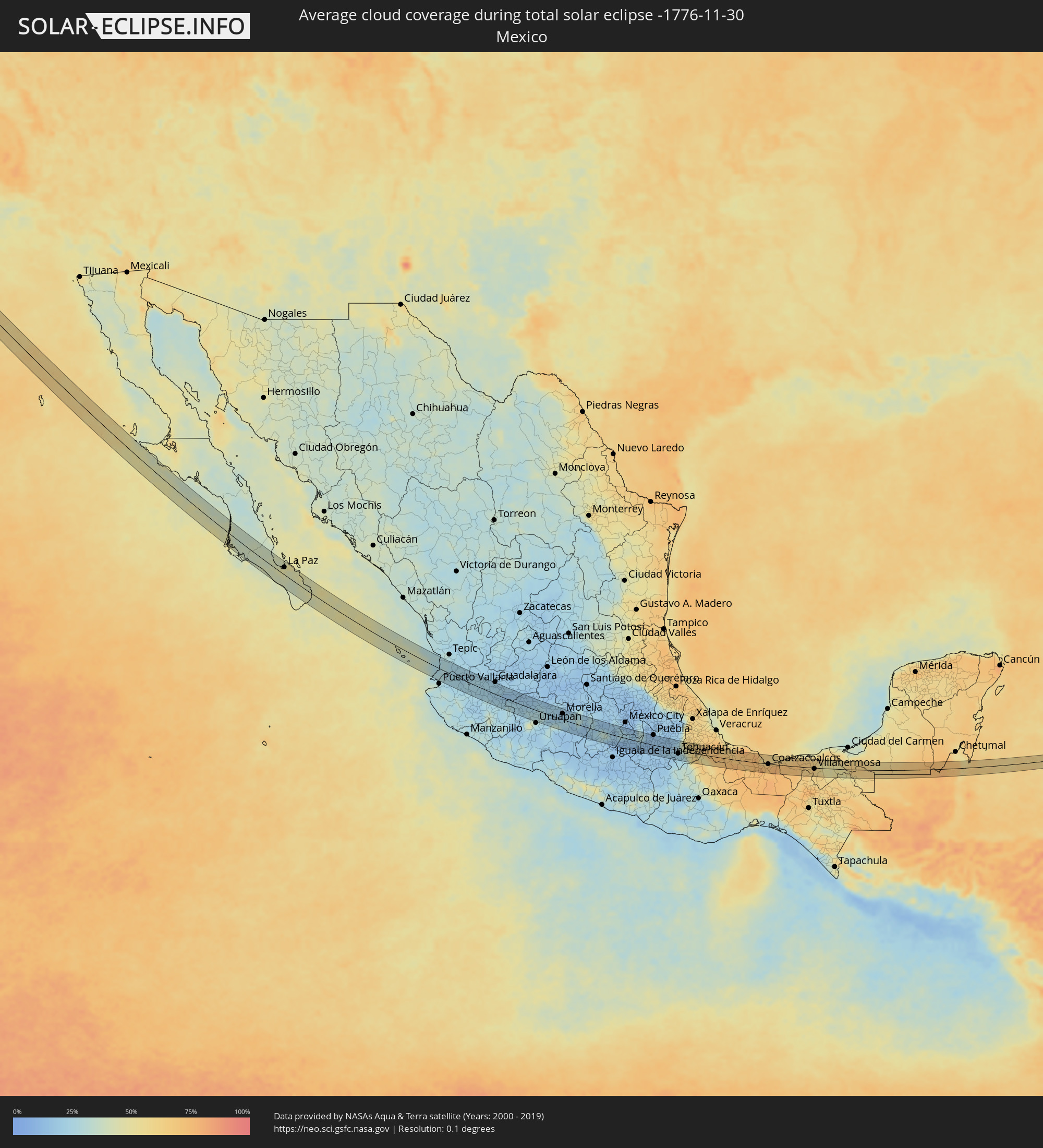 Mexico
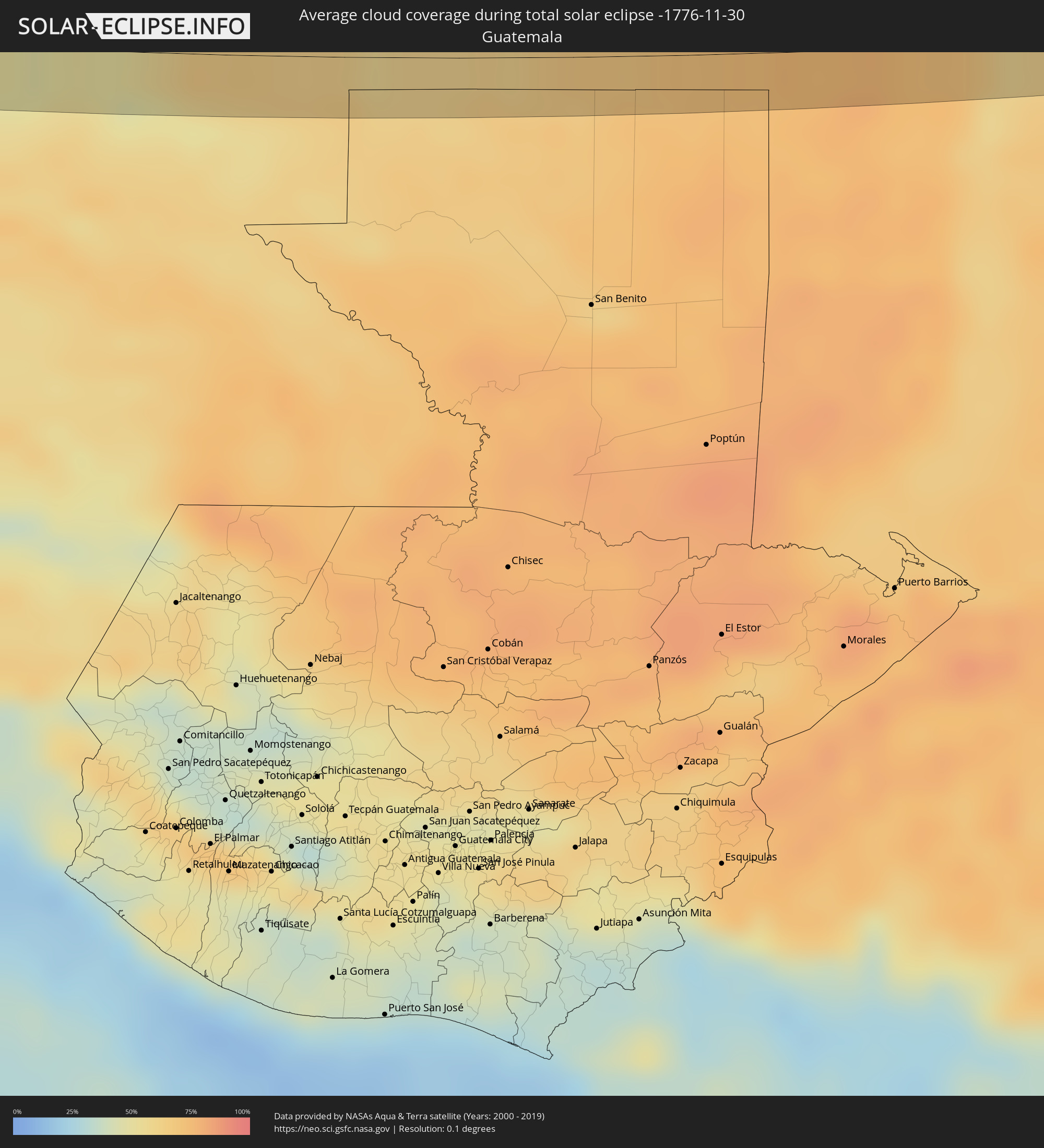 Guatemala
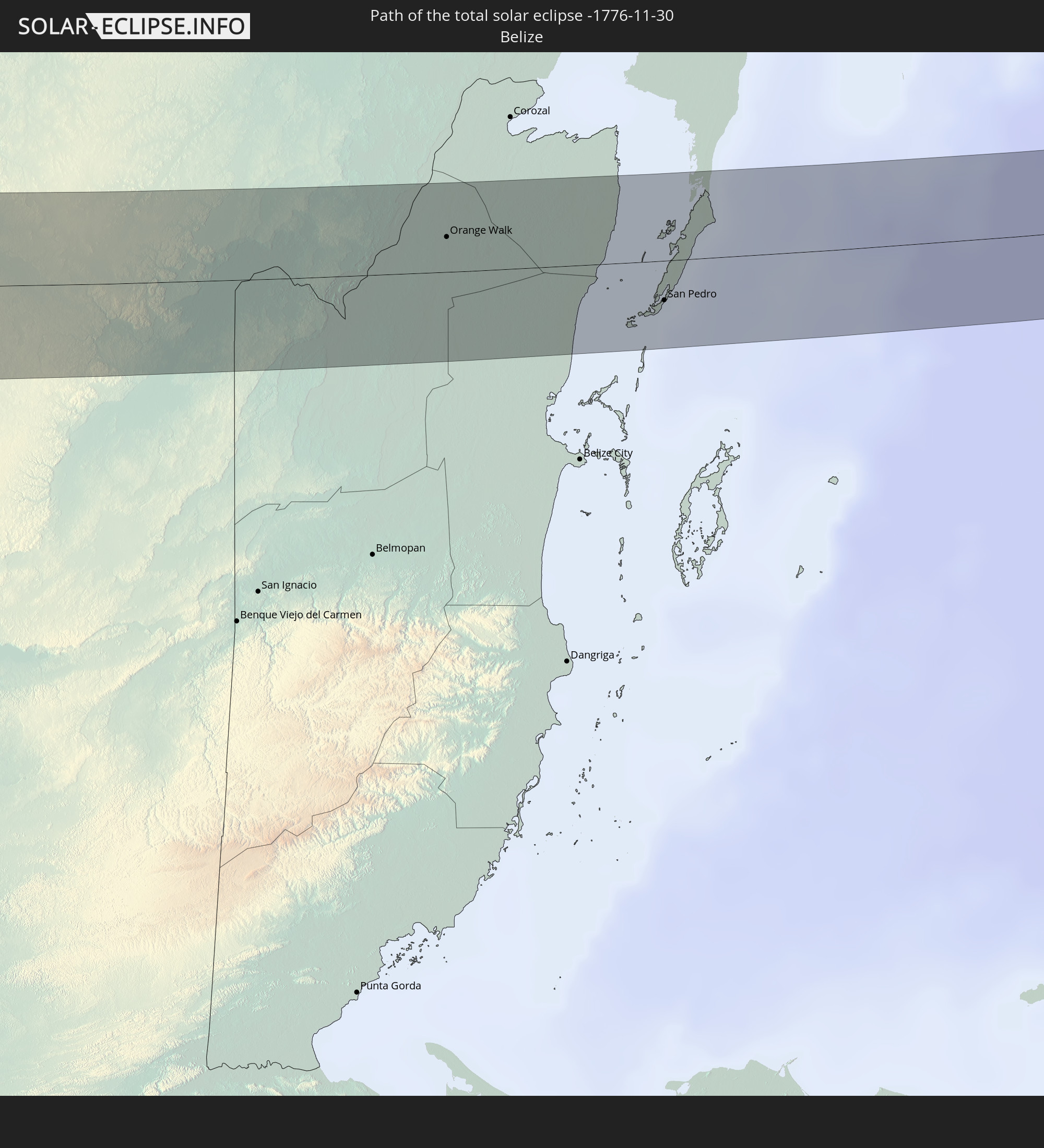
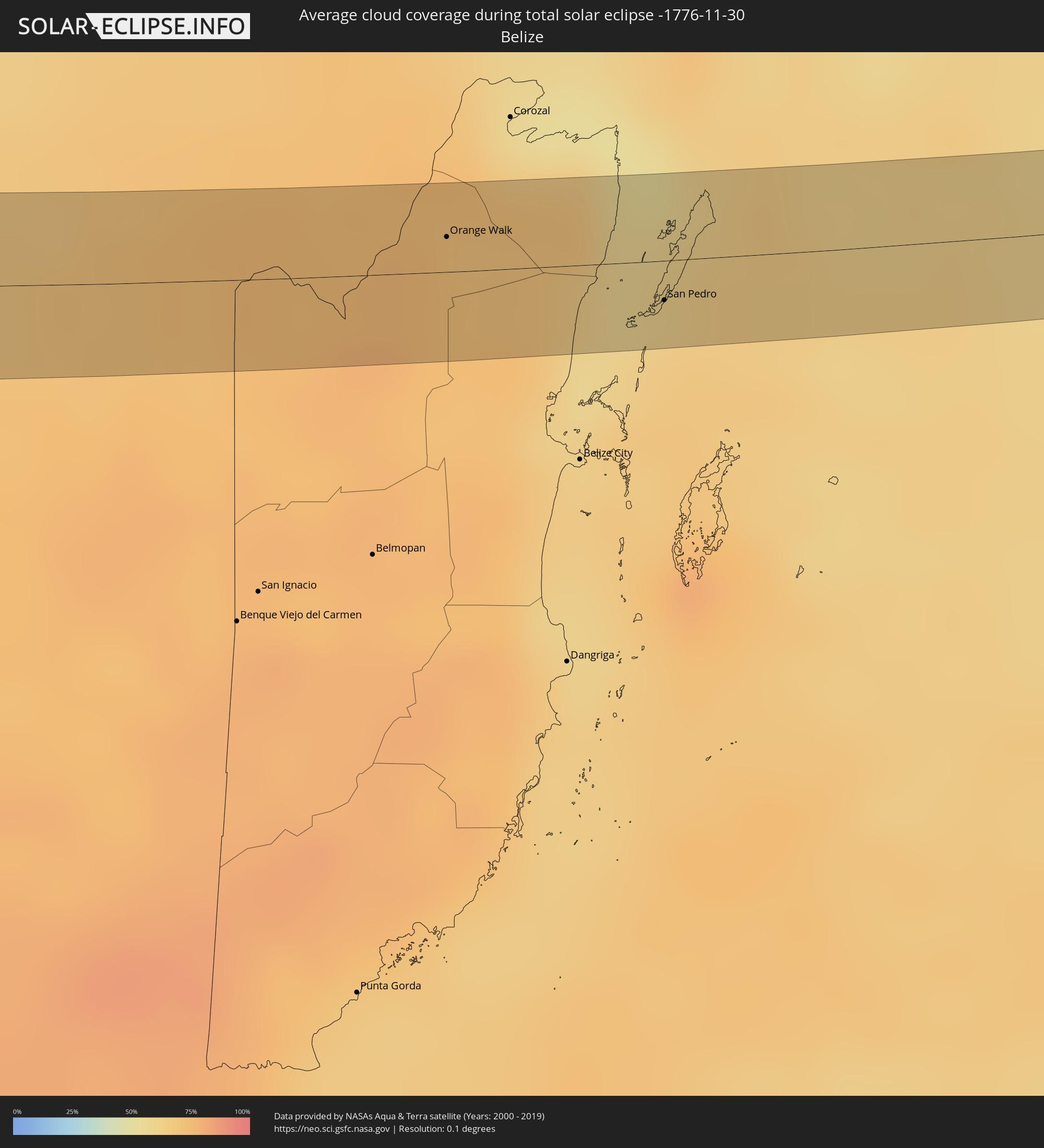 Belize
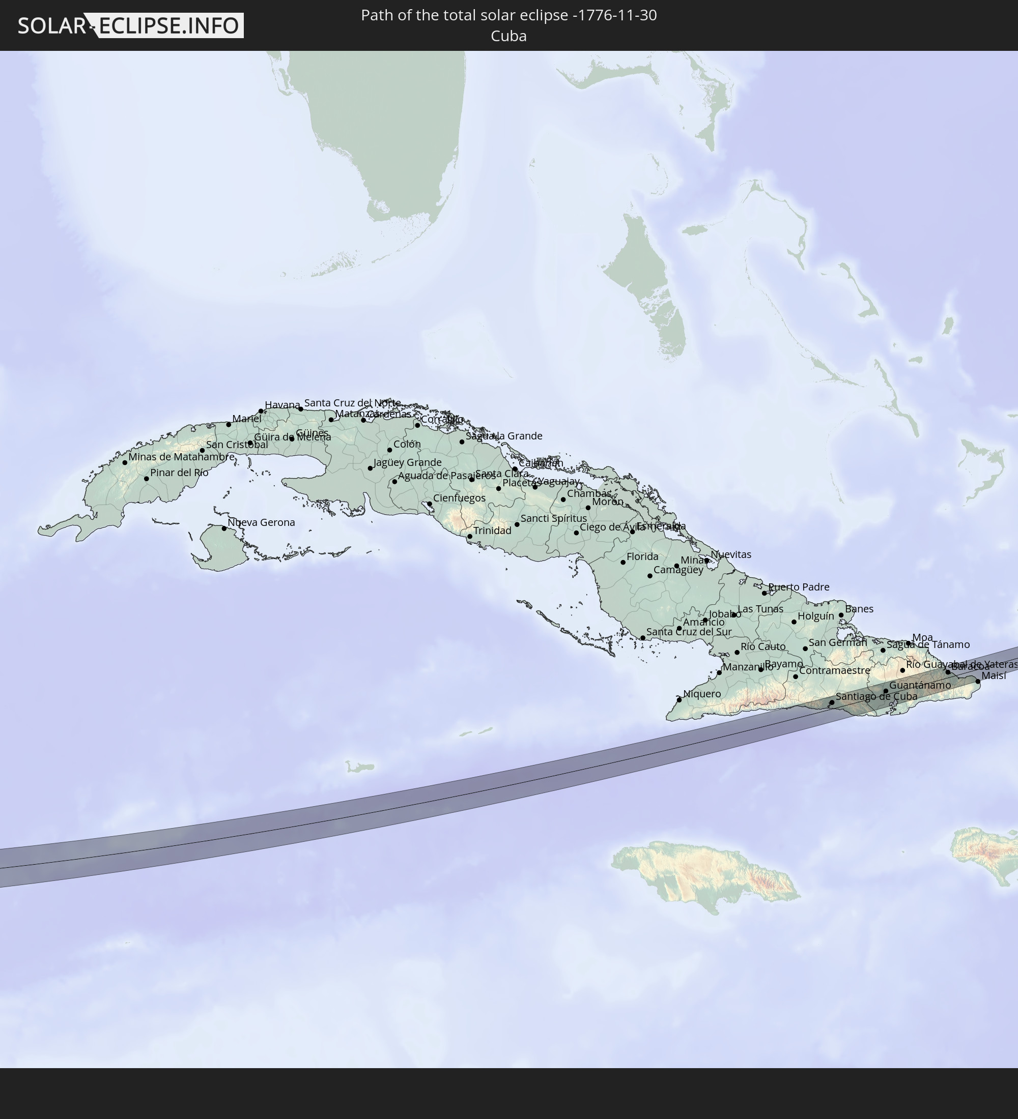
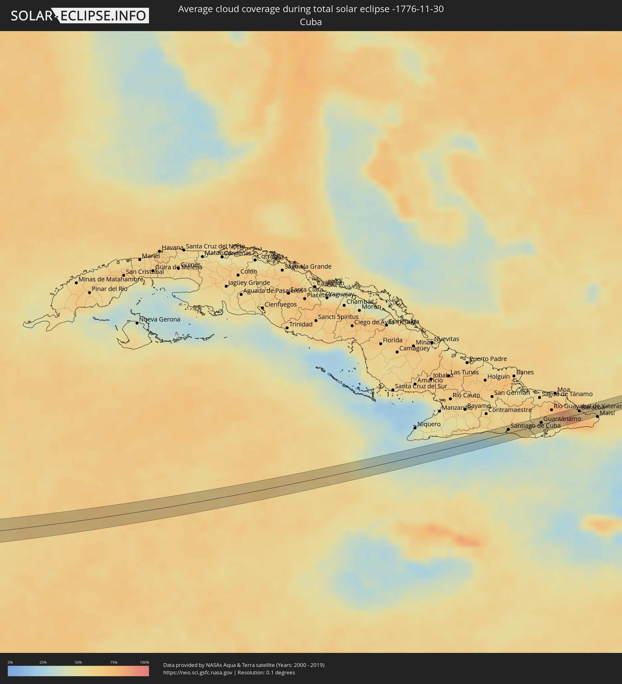 Cuba
Cuba
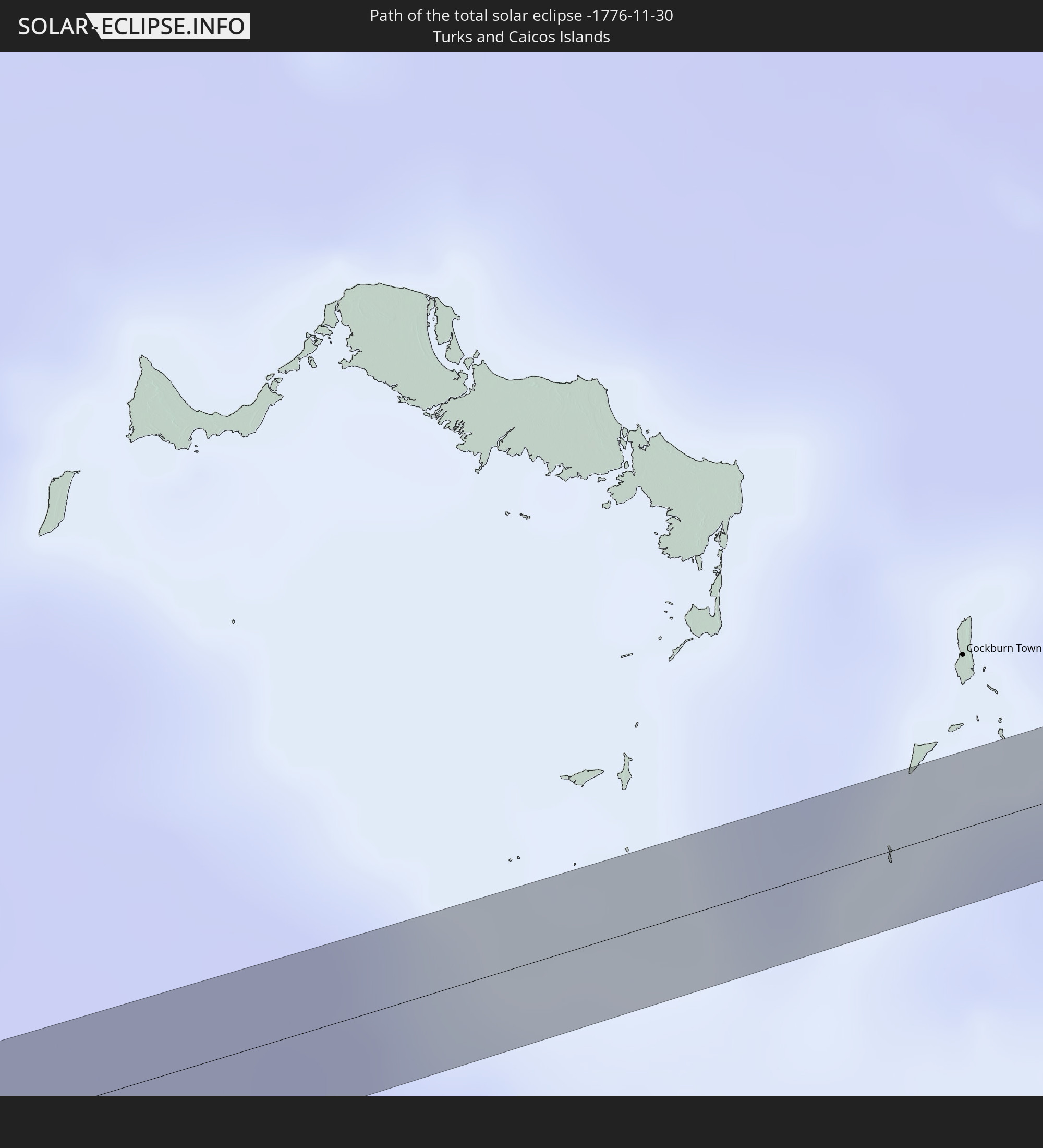
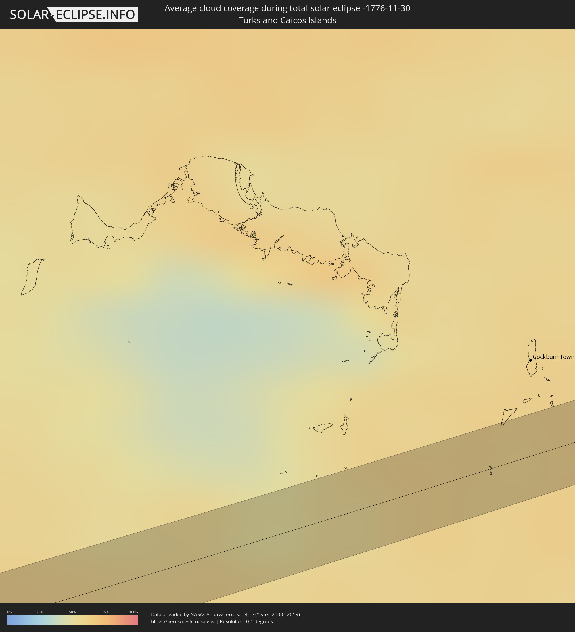 Turks and Caicos Islands
Cities inside the path of the eclipse
The following table shows all locations with a population of more than 5,000 inside the eclipse path. Cities which have more than 100,000 inhabitants are marked bold. A click at the locations opens a detailed map.
| City | Type | Eclipse duration | Local time of max. eclipse | Distance to central line | Ø Cloud coverage |
|
Ciudad Constitución, Baja California Sur
|
total | - | 13:04:30 UTC-07:05 | 17 km | 35% |
|
La Paz, Baja California Sur
|
total | - | 13:08:58 UTC-07:05 | 20 km | 46% |
|
Ixtapa, Jalisco
|
total | - | 13:55:20 UTC-06:36 | 36 km | 27% |
|
Compostela, Nayarit
|
total | - | 13:26:15 UTC-07:05 | 30 km | 25% |
|
Ixtlán del Río, Nayarit
|
total | - | 13:27:49 UTC-07:05 | 34 km | 23% |
|
Ameca, Jalisco
|
total | - | 13:58:24 UTC-06:36 | 2 km | 24% |
|
Ahualulco de Mercado, Jalisco
|
total | - | 13:58:20 UTC-06:36 | 17 km | 24% |
|
Cocula, Jalisco
|
total | - | 13:59:12 UTC-06:36 | 11 km | 22% |
|
Tala, Jalisco
|
total | - | 13:59:04 UTC-06:36 | 24 km | 24% |
|
Zacoalco de Torres, Jalisco
|
total | - | 14:00:01 UTC-06:36 | 14 km | 25% |
|
Jocotepec, Jalisco
|
total | - | 14:00:16 UTC-06:36 | 3 km | 20% |
|
Hacienda Santa Fe, Jalisco
|
total | - | 14:00:02 UTC-06:36 | 23 km | 23% |
|
Centro de Readaptación Social, Jalisco
|
total | - | 14:00:26 UTC-06:36 | 34 km | 20% |
|
Chapala, Jalisco
|
total | - | 14:00:49 UTC-06:36 | 8 km | 17% |
|
Tizapán el Alto, Jalisco
|
total | - | 14:01:22 UTC-06:36 | 0 km | 20% |
|
Ocotlán, Jalisco
|
total | - | 14:01:44 UTC-06:36 | 30 km | 17% |
|
Sahuayo de Morelos, Michoacán
|
total | - | 14:02:18 UTC-06:36 | 2 km | 21% |
|
Cotija de la Paz, Michoacán
|
total | - | 14:02:42 UTC-06:36 | 23 km | 24% |
|
La Barca, Jalisco
|
total | - | 14:02:23 UTC-06:36 | 32 km | 16% |
|
Zamora, Michoacán
|
total | - | 14:03:26 UTC-06:36 | 11 km | 20% |
|
Paracho de Verduzco, Michoacán
|
total | - | 14:04:30 UTC-06:36 | 16 km | 31% |
|
Puréparo de Echaíz, Michoacán
|
total | - | 14:04:13 UTC-06:36 | 13 km | 25% |
|
Zacapú, Michoacán
|
total | - | 14:04:52 UTC-06:36 | 11 km | 24% |
|
Pátzcuaro, Michoacán
|
total | - | 14:05:44 UTC-06:36 | 14 km | 26% |
|
Quiroga, Michoacán
|
total | - | 14:05:43 UTC-06:36 | 4 km | 23% |
|
Morelia, Michoacán
|
total | - | 14:06:27 UTC-06:36 | 20 km | 18% |
|
Heróica Zitácuaro, Michoacán
|
total | - | 14:08:46 UTC-06:36 | 18 km | 18% |
|
Tejupilco de Hidalgo, México
|
total | - | 14:10:01 UTC-06:36 | 32 km | 19% |
|
Valle de Bravo, México
|
total | - | 14:09:38 UTC-06:36 | 1 km | 24% |
|
Ixtapan de la Sal, México
|
total | - | 14:11:12 UTC-06:36 | 25 km | 13% |
|
Toluca, México
|
total | - | 14:10:36 UTC-06:36 | 23 km | 20% |
|
Tenancingo, México
|
total | - | 14:11:13 UTC-06:36 | 10 km | 20% |
|
Tenango de Arista, México
|
total | - | 14:11:01 UTC-06:36 | 5 km | 21% |
|
Ocoyoacac, México
|
total | - | 14:11:05 UTC-06:36 | 27 km | 17% |
|
Cuernavaca, Morelos
|
total | - | 14:12:06 UTC-06:36 | 4 km | 13% |
|
Zacatepec, Morelos
|
total | - | 14:12:35 UTC-06:36 | 33 km | 12% |
|
Yautepec, Morelos
|
total | - | 14:12:32 UTC-06:36 | 5 km | 14% |
|
Milpa Alta, Mexico City
|
total | - | 14:12:11 UTC-06:36 | 30 km | 18% |
|
Cuautla Morelos, Morelos
|
total | - | 14:12:55 UTC-06:36 | 10 km | 12% |
|
Amecameca, México
|
total | - | 14:12:51 UTC-06:36 | 29 km | 18% |
|
Izúcar de Matamoros, Puebla
|
total | - | 14:14:18 UTC-06:36 | 20 km | 16% |
|
Atlixco, Puebla
|
total | - | 14:13:55 UTC-06:36 | 14 km | 13% |
|
Puebla, Puebla
|
total | - | 14:14:15 UTC-06:36 | 34 km | 15% |
|
Tepeaca, Puebla
|
total | - | 14:15:01 UTC-06:36 | 33 km | 14% |
|
Tecamachalco, Puebla
|
total | - | 14:15:31 UTC-06:36 | 27 km | 15% |
|
Tehuacán, Puebla
|
total | - | 14:16:52 UTC-06:36 | 11 km | 24% |
|
Ajalpan, Puebla
|
total | - | 14:17:16 UTC-06:36 | 18 km | 24% |
|
Ciudad Mendoza, Veracruz
|
total | - | 14:16:50 UTC-06:36 | 31 km | 47% |
|
La Isla, Veracruz
|
total | - | 14:19:21 UTC-06:36 | 27 km | 72% |
|
Tuxtepec, Oaxaca
|
total | - | 14:20:08 UTC-06:36 | 29 km | 67% |
|
Cosamaloapan de Carpio, Veracruz
|
total | - | 14:20:26 UTC-06:36 | 7 km | 69% |
|
Juan Rodríguez Clara, Veracruz
|
total | - | 14:21:47 UTC-06:36 | 28 km | 76% |
|
San Andres Tuxtla, Veracruz
|
total | - | 14:21:33 UTC-06:36 | 24 km | 72% |
|
Acayucan, Veracruz
|
total | - | 14:22:52 UTC-06:36 | 27 km | 72% |
|
Minatitlan, Veracruz
|
total | - | 14:23:32 UTC-06:36 | 17 km | 74% |
|
Coatzacoalcos, Veracruz
|
total | - | 14:23:35 UTC-06:36 | 1 km | 74% |
|
Agua Dulce, Veracruz
|
total | - | 14:24:10 UTC-06:36 | 3 km | 73% |
|
Las Choapas, Veracruz
|
total | - | 14:24:35 UTC-06:36 | 22 km | 74% |
|
Huimanguillo, Tabasco
|
total | - | 14:26:06 UTC-06:36 | 24 km | 63% |
|
Cárdenas, Tabasco
|
total | - | 14:25:54 UTC-06:36 | 5 km | 67% |
|
Comalcalco, Tabasco
|
total | - | 14:25:51 UTC-06:36 | 25 km | 64% |
|
Cunduacán, Tabasco
|
total | - | 14:26:13 UTC-06:36 | 3 km | 65% |
|
Jalpa de Méndez, Tabasco
|
total | - | 14:26:17 UTC-06:36 | 16 km | 66% |
|
Villahermosa, Tabasco
|
total | - | 14:26:48 UTC-06:36 | 4 km | 60% |
|
Río de Teapa, Tabasco
|
total | - | 14:27:08 UTC-06:36 | 26 km | 61% |
|
Macuspana, Tabasco
|
total | - | 14:27:46 UTC-06:36 | 27 km | 57% |
|
Emiliano Zapata, Chiapas
|
total | - | 14:29:23 UTC-06:36 | 25 km | 57% |
|
Orange Walk, Orange Walk
|
total | - | 15:18:29 UTC-05:52 | 10 km | 73% |
|
San Pedro, Belize
|
total | - | 15:19:42 UTC-05:52 | 11 km | 63% |
|
Santiago de Cuba, Santiago de Cuba
|
total | - | 15:56:16 UTC-05:29 | 7 km | 42% |
|
Guantánamo, Guantánamo
|
total | - | 15:56:43 UTC-05:29 | 3 km | 49% |
|
Baracoa, Guantánamo
|
total | - | 15:57:09 UTC-05:29 | 5 km | 81% |