Total solar eclipse of 04/01/-1949
| Day of week: | Thursday |
| Maximum duration of eclipse: | 04m39s |
| Maximum width of eclipse path: | 248 km |
| Saros cycle: | -2 |
| Coverage: | 100% |
| Magnitude: | 1.0576 |
| Gamma: | 0.6496 |
Wo kann man die Sonnenfinsternis vom 04/01/-1949 sehen?
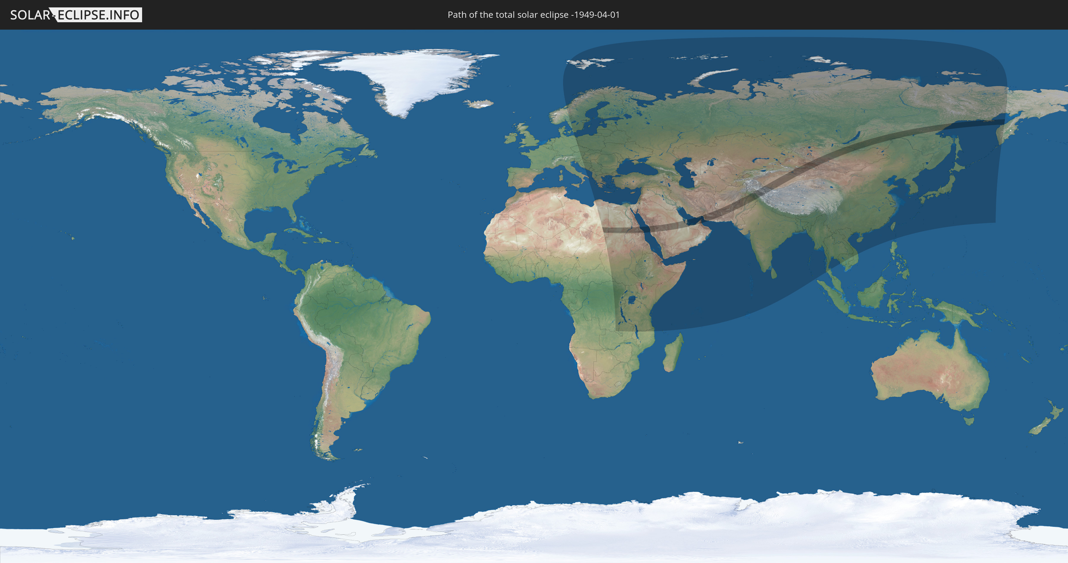
Die Sonnenfinsternis am 04/01/-1949 kann man in 97 Ländern als partielle Sonnenfinsternis beobachten.
Der Finsternispfad verläuft durch 15 Länder. Nur in diesen Ländern ist sie als total Sonnenfinsternis zu sehen.
In den folgenden Ländern ist die Sonnenfinsternis total zu sehen
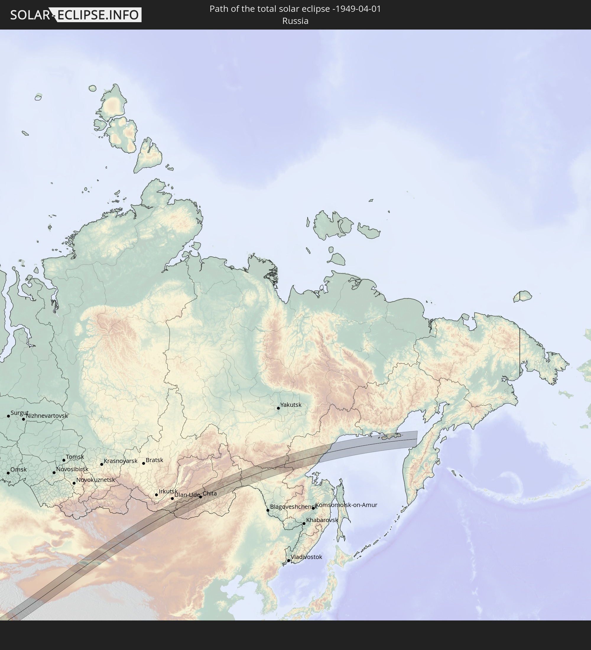 Russia
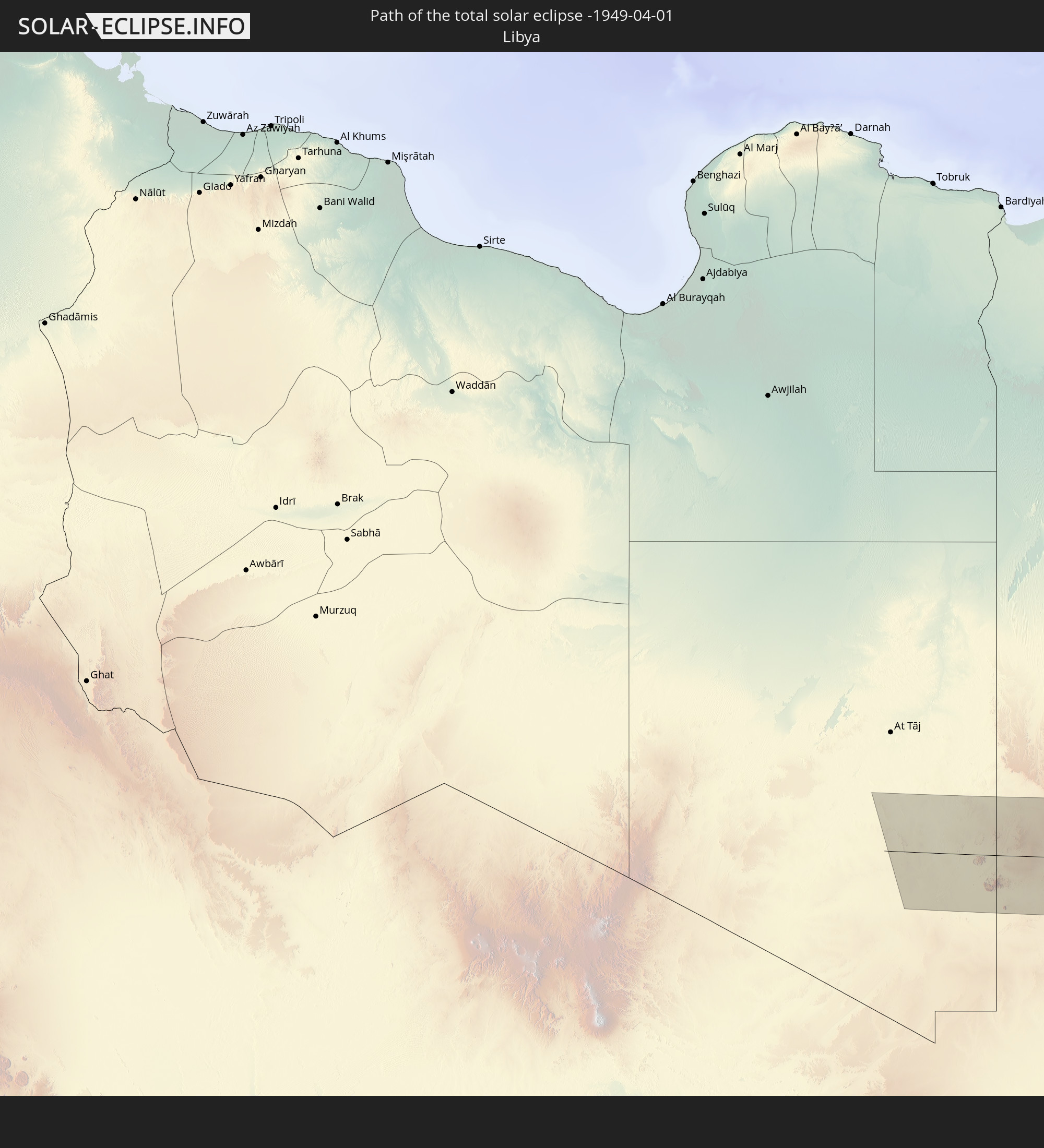 Libya
Libya
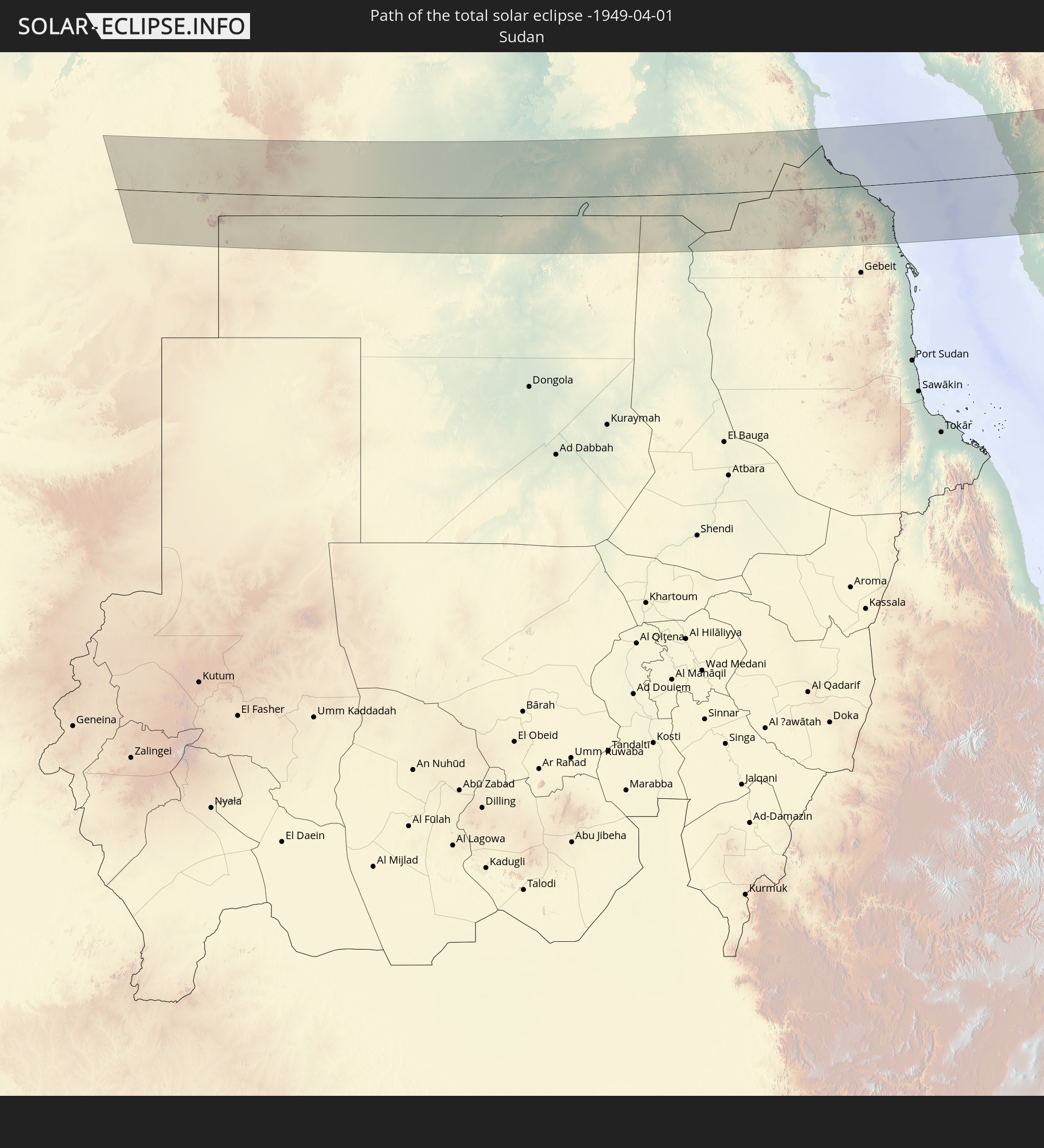 Sudan
Sudan
 Egypt
Egypt
 Saudi Arabia
 Iran
Iran
 Bahrain
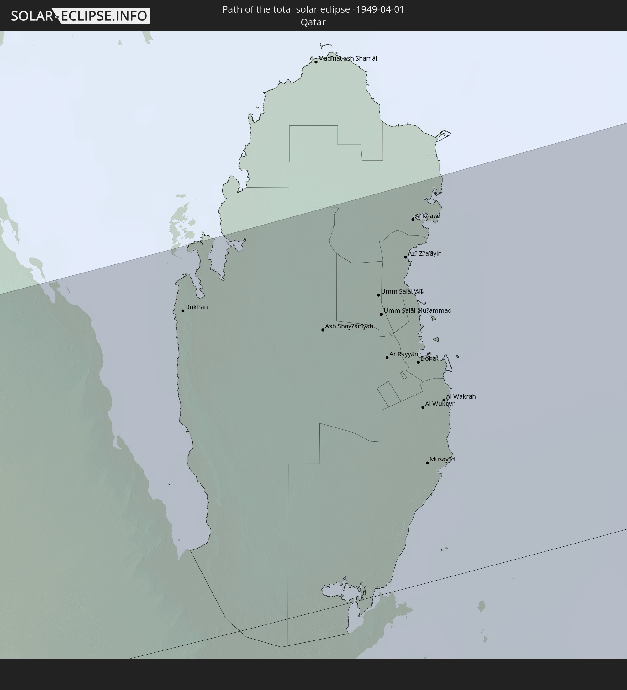 Qatar
Qatar
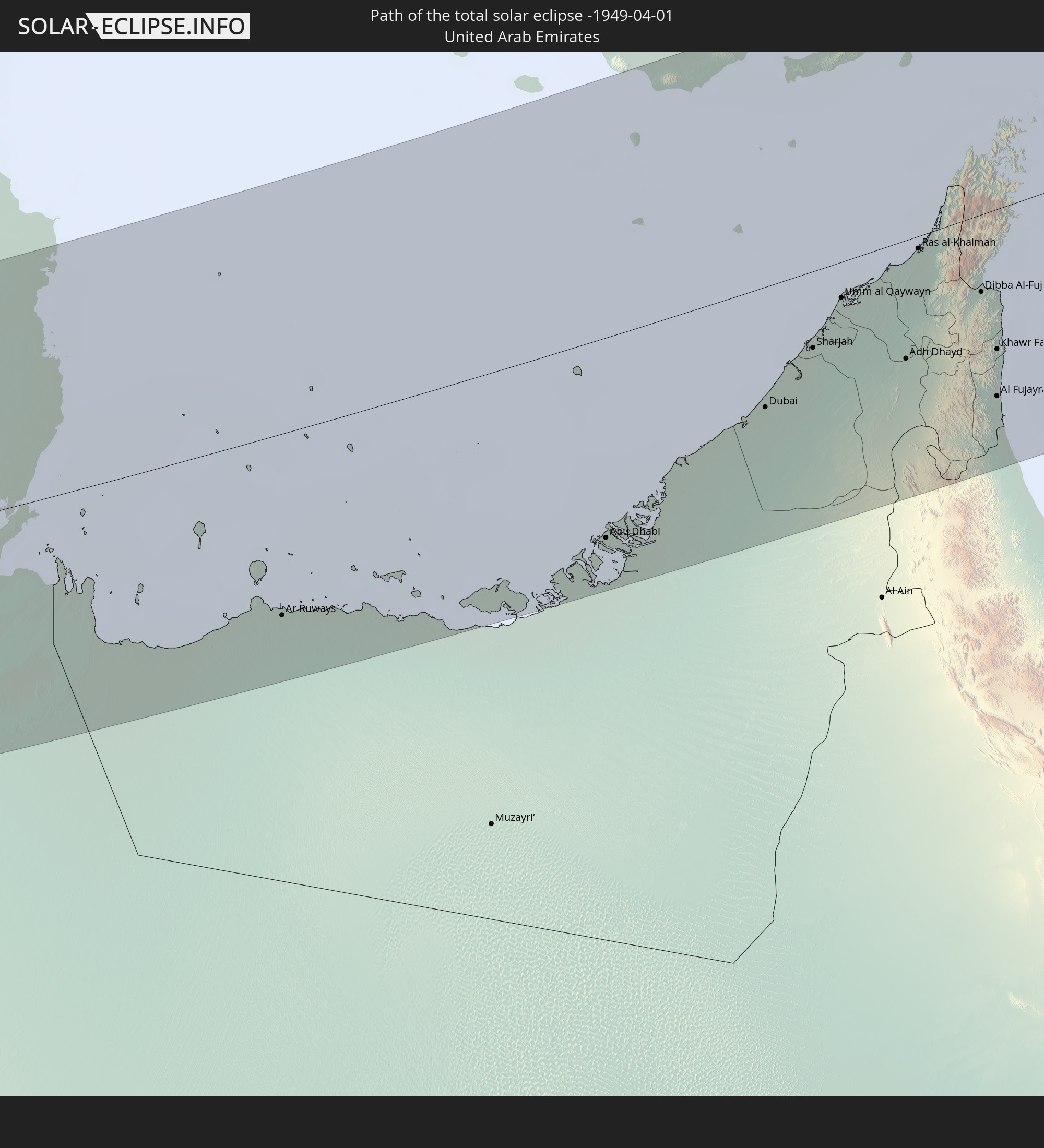 United Arab Emirates
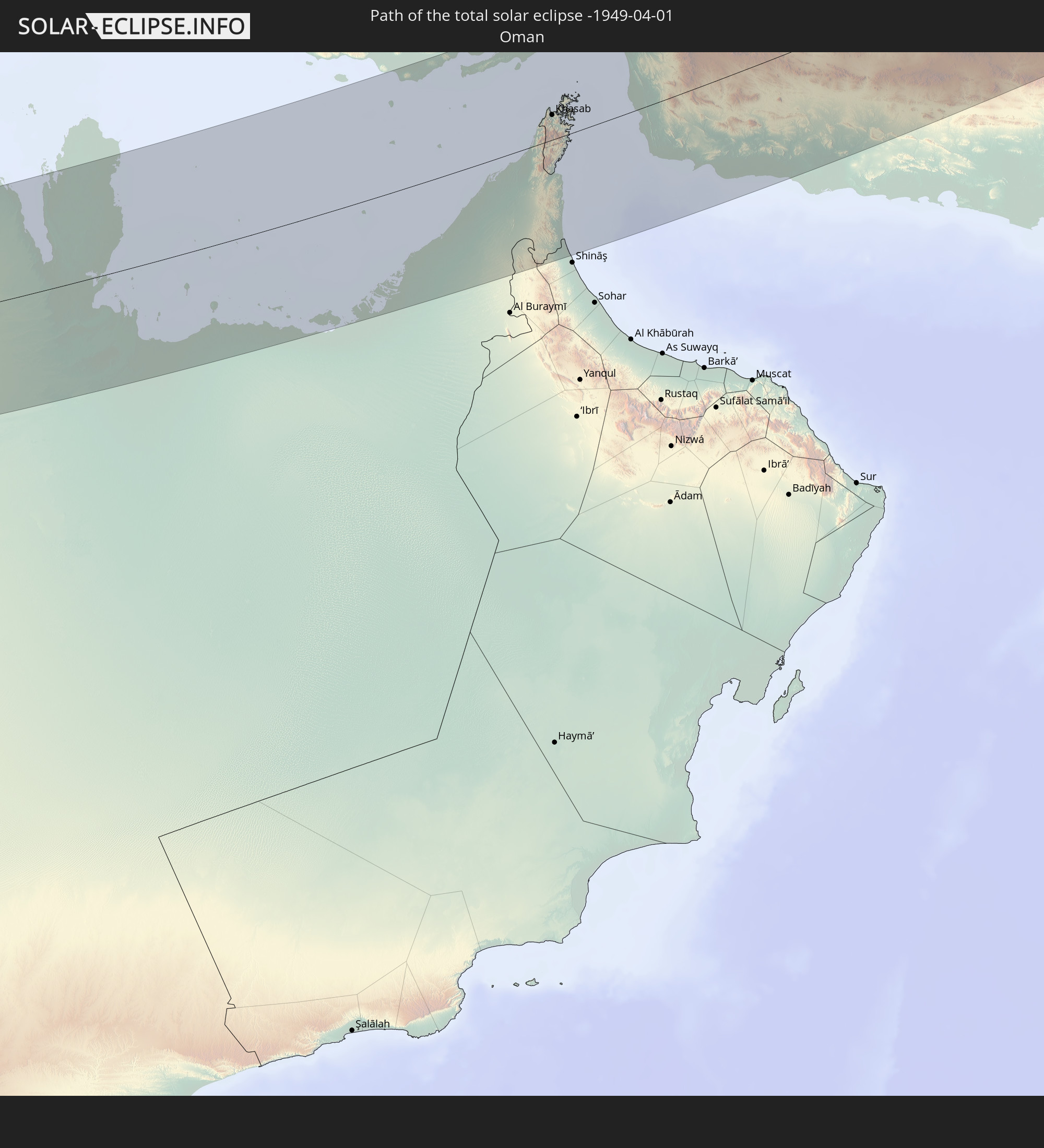 Oman
Oman
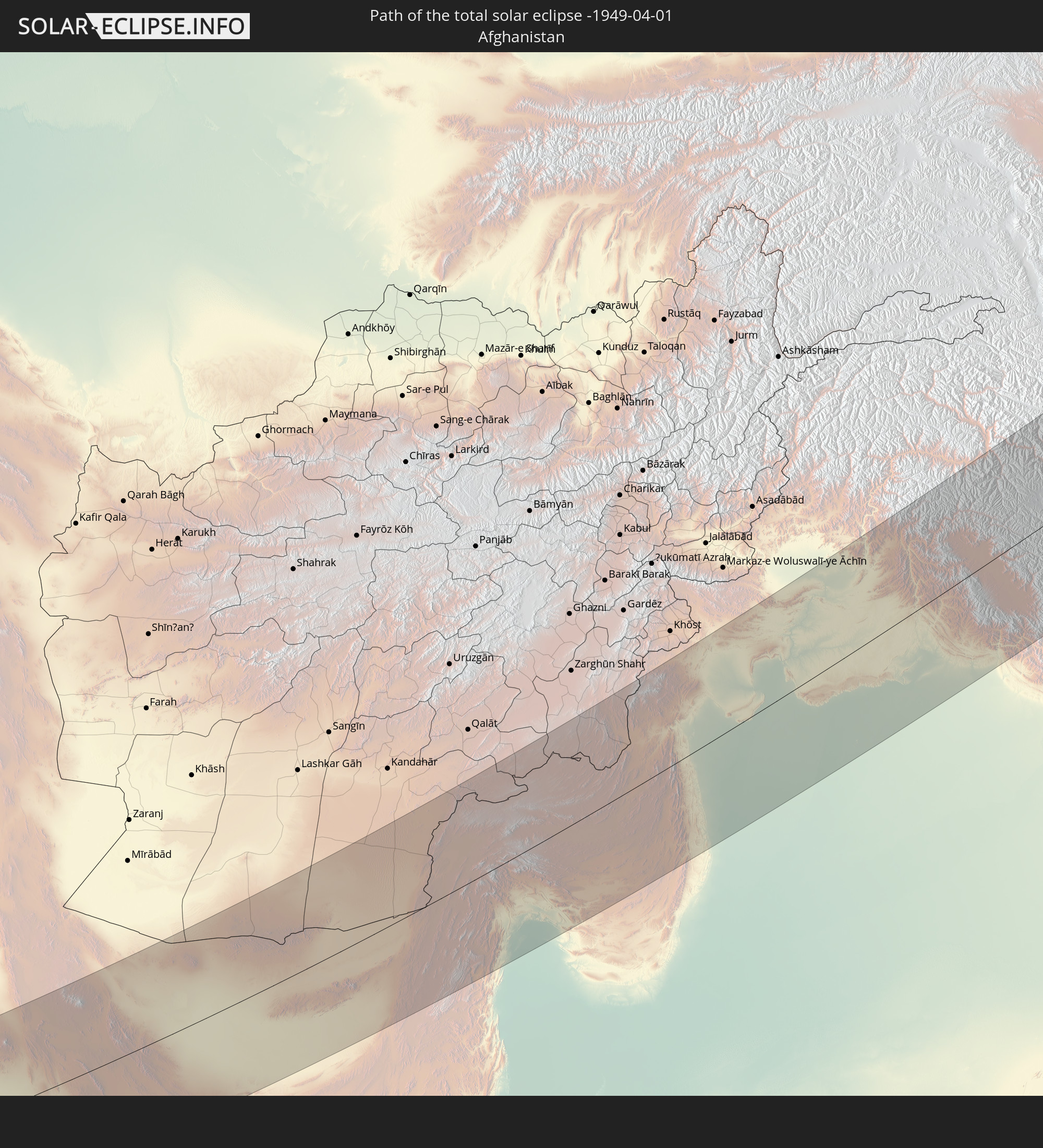 Afghanistan
 Pakistan
 India
India
 China
China
 Mongolia
In den folgenden Ländern ist die Sonnenfinsternis partiell zu sehen
 Russia
 Svalbard and Jan Mayen
 Norway
 Germany
 Italy
Italy
 Denmark
 Libya
Libya
 Austria
 Sweden
 Czechia
 Democratic Republic of the Congo
 Slovenia
 Chad
Chad
 Croatia
 Poland
 Central African Republic
 Bosnia and Herzegovina
 Hungary
 Slovakia
 Montenegro
 Serbia
 Albania
 Åland Islands
 Greece
 Romania
 Republic of Macedonia
 Finland
 Lithuania
 Latvia
 Estonia
 Sudan
Sudan
 Zambia
 Ukraine
 Bulgaria
 Belarus
 Egypt
Egypt
 Turkey
 Moldova
 Rwanda
 Burundi
 Tanzania
 Uganda
 Mozambique
 Cyprus
 Malawi
 Ethiopia
 Kenya
Kenya
 State of Palestine
 Israel
 Saudi Arabia
 Jordan
 Lebanon
 Syria
Syria
 Eritrea
 Iraq
Iraq
 Georgia
 Somalia
 Djibouti
 Yemen
Yemen
 Comoros
 Armenia
 Iran
Iran
 Azerbaijan
 Seychelles
 Kazakhstan
 Kuwait
 Bahrain
 Qatar
Qatar
 United Arab Emirates
 Oman
Oman
 Turkmenistan
 Uzbekistan
 Afghanistan
 Pakistan
 Tajikistan
 India
India
 Kyrgyzstan
 British Indian Ocean Territory
 Maldives
 China
China
 Sri Lanka
 Nepal
Nepal
 Mongolia
 Bangladesh
 Bhutan
 Myanmar
 Thailand
 Laos
Laos
 Vietnam
 Cambodia
 Macau
Macau
 Hong Kong
 Taiwan
 Philippines
 Japan
Japan
 North Korea
 South Korea
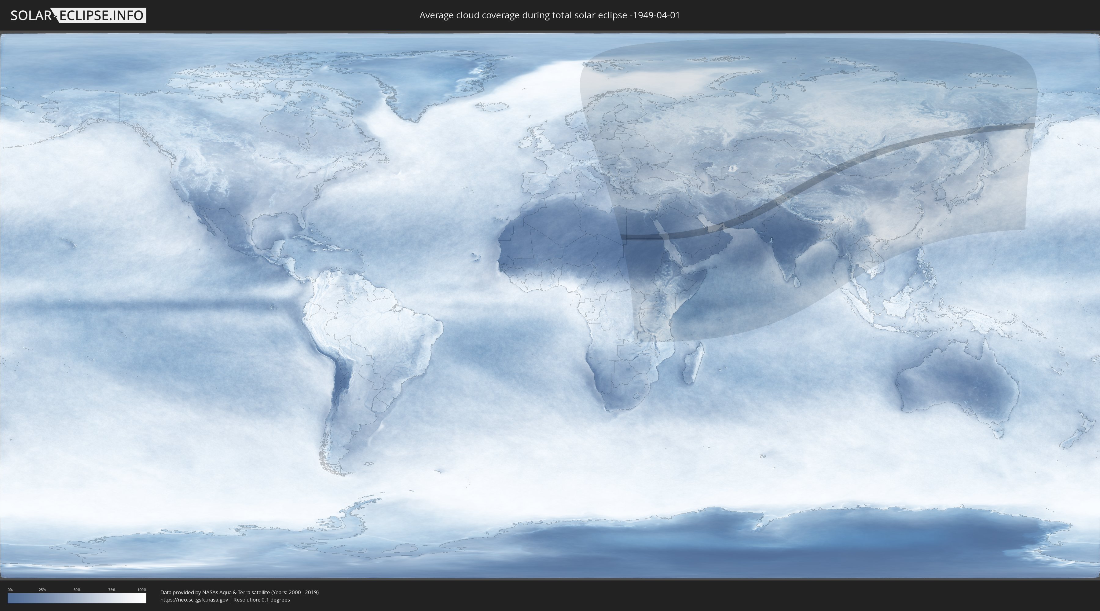
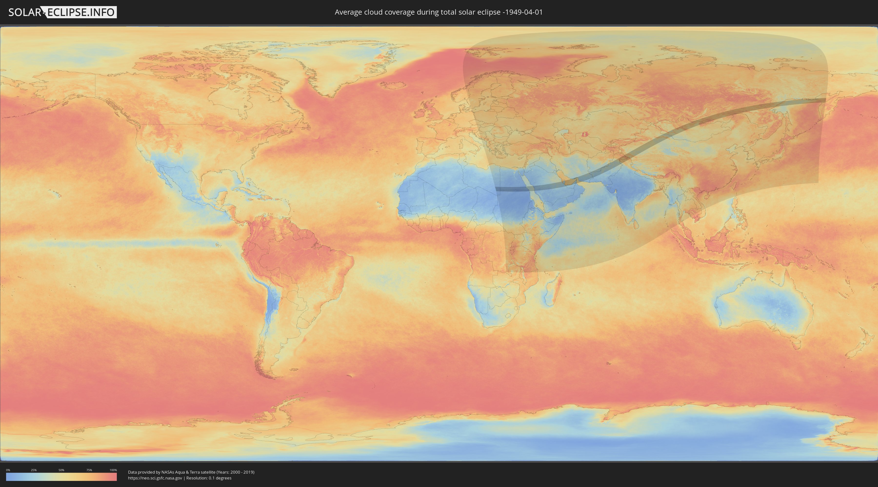
How will be the weather during the total solar eclipse on 04/01/-1949?
Where is the best place to see the total solar eclipse of 04/01/-1949?
The following maps show the average cloud coverage for the day of the total solar eclipse.
With the help of these maps, it is possible to find the place along the eclipse path, which has the best
chance of a cloudless sky.
Nevertheless, you should consider local circumstances and inform about the weather of your chosen
observation site.
The data is provided by NASAs satellites
AQUA and TERRA.
The cloud maps are averaged over a period of 19 years (2000 - 2019).
Detailed country maps
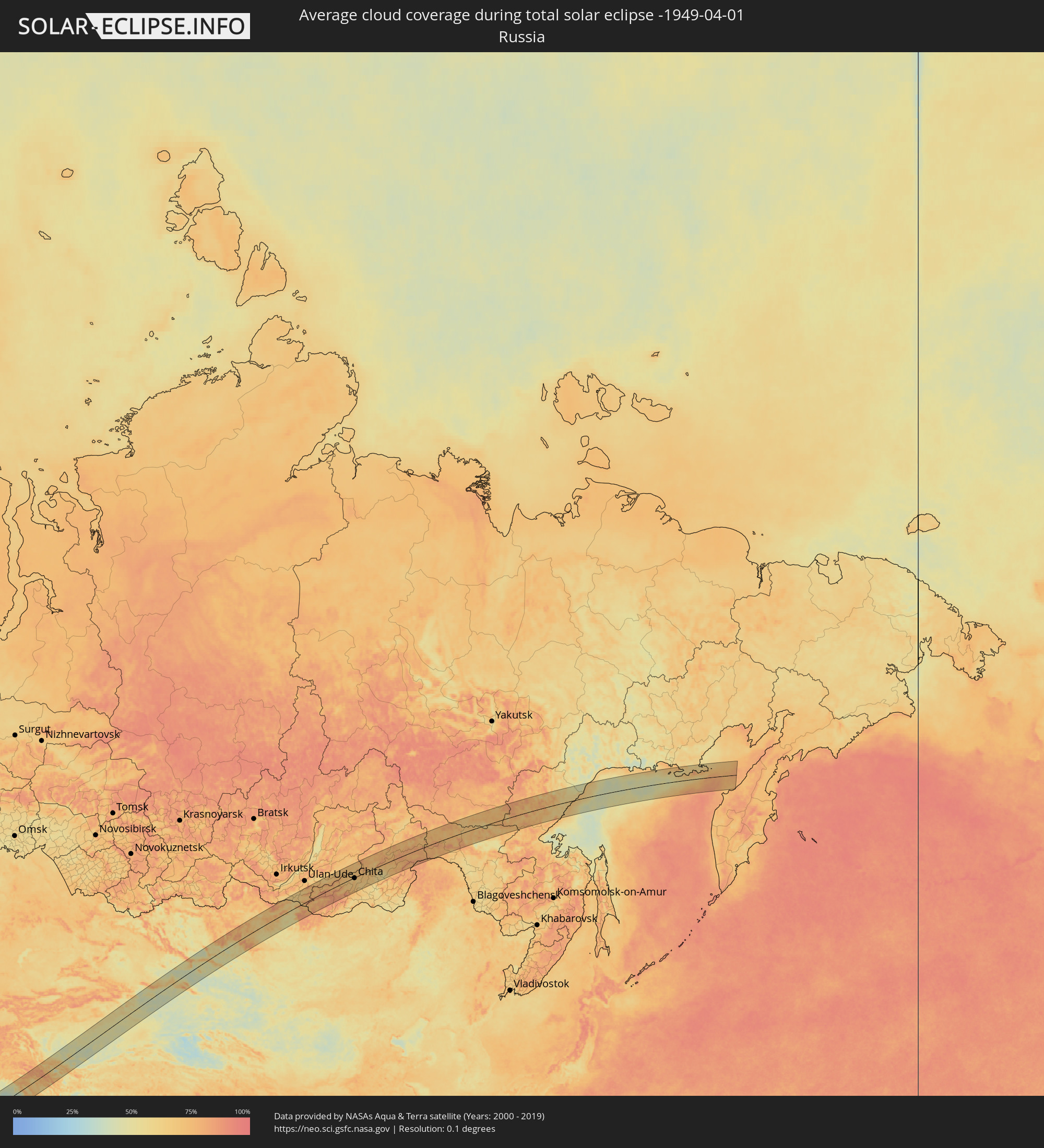 Russia
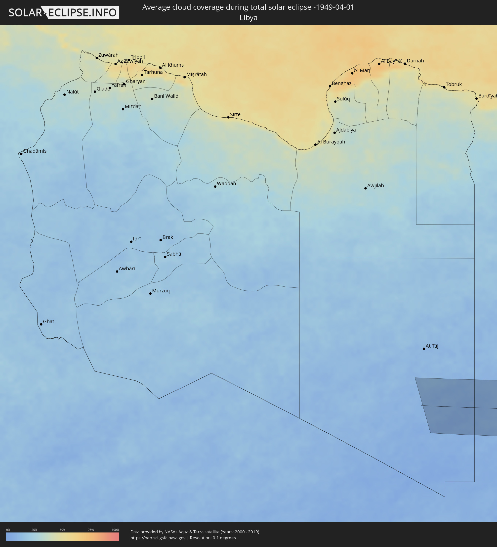 Libya
Libya
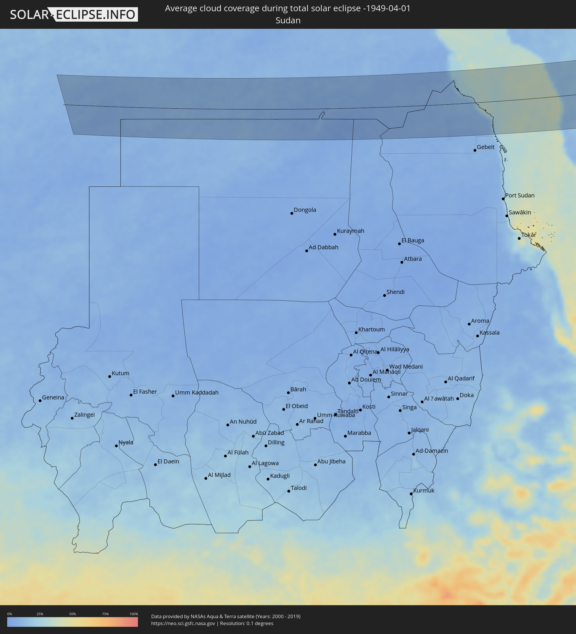 Sudan
Sudan
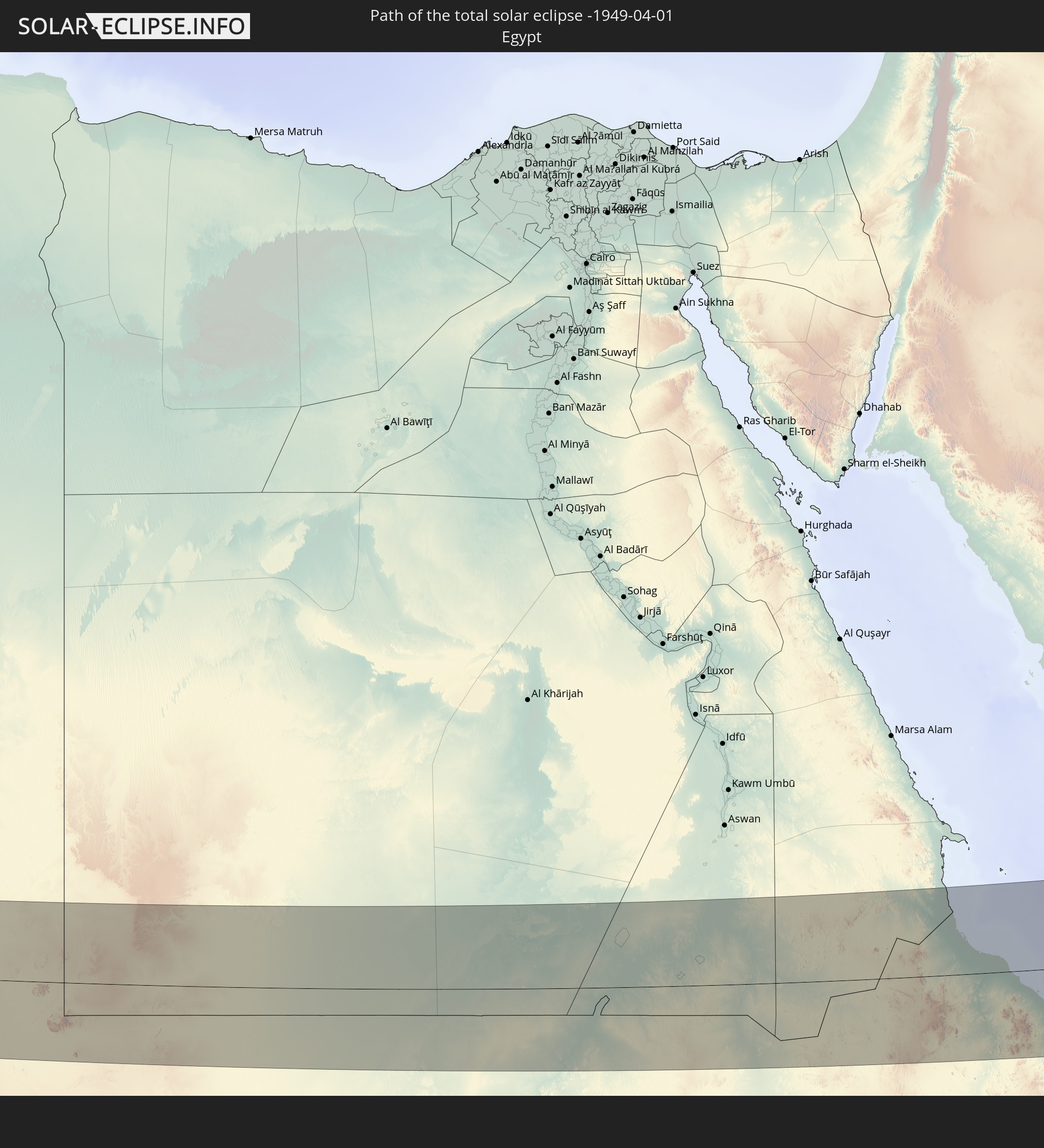
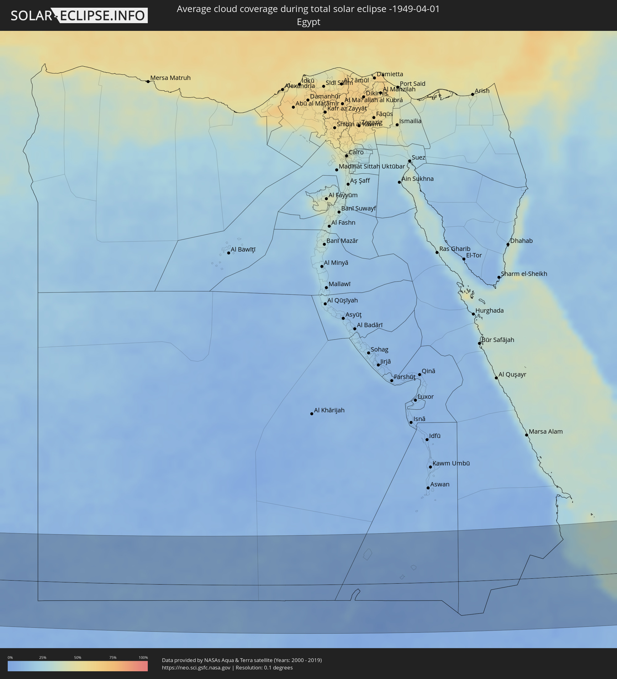 Egypt
Egypt
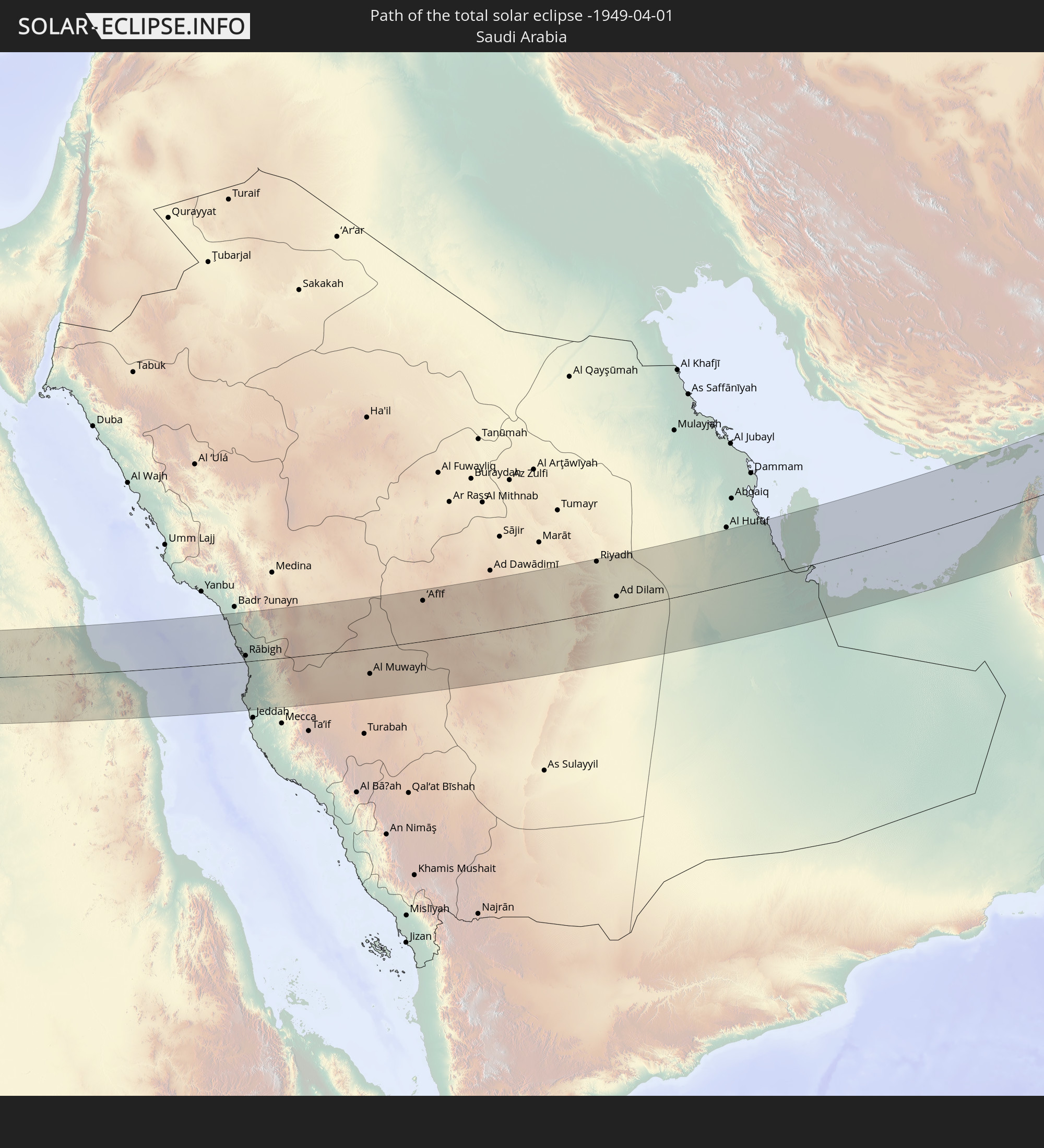
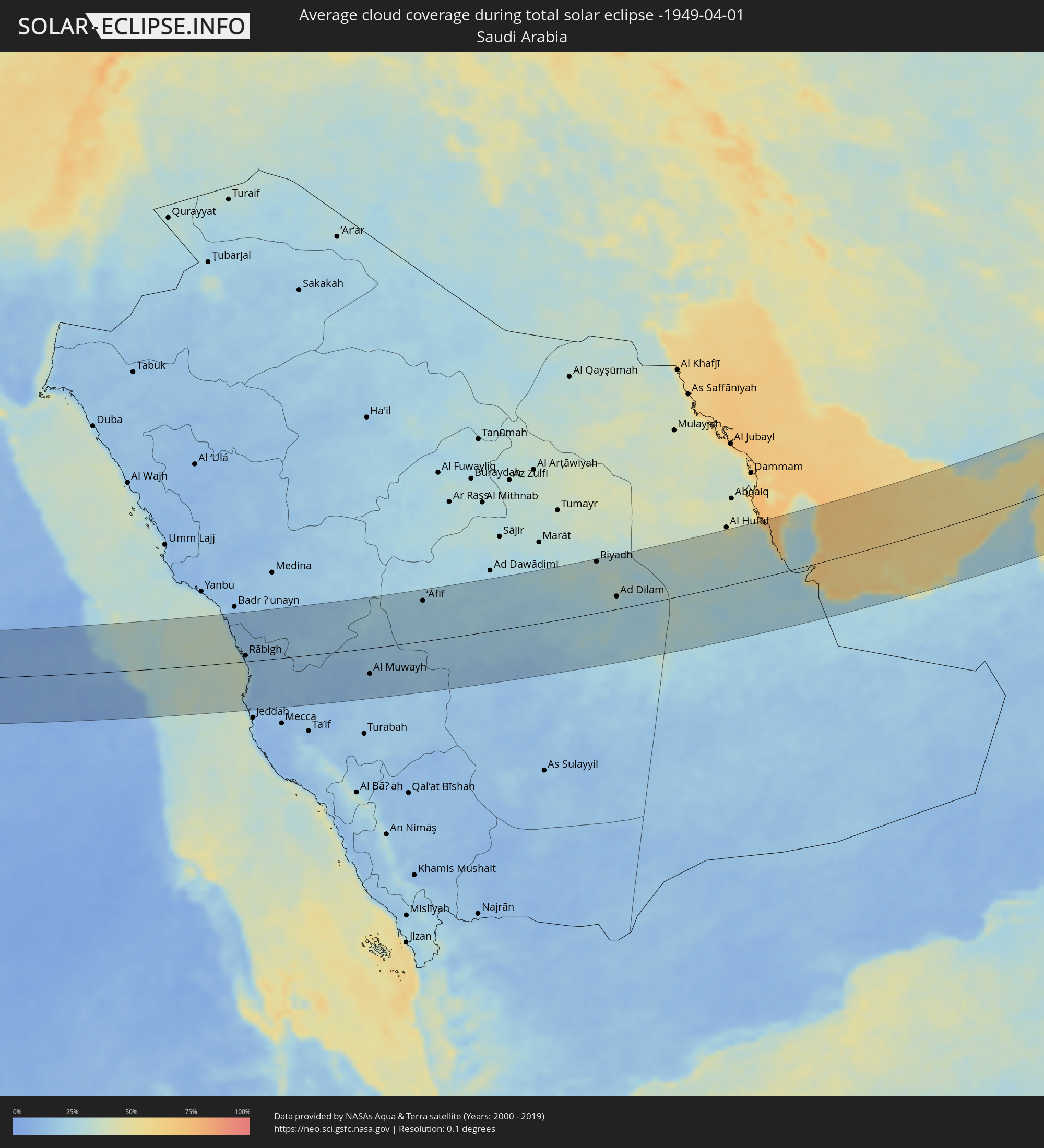 Saudi Arabia
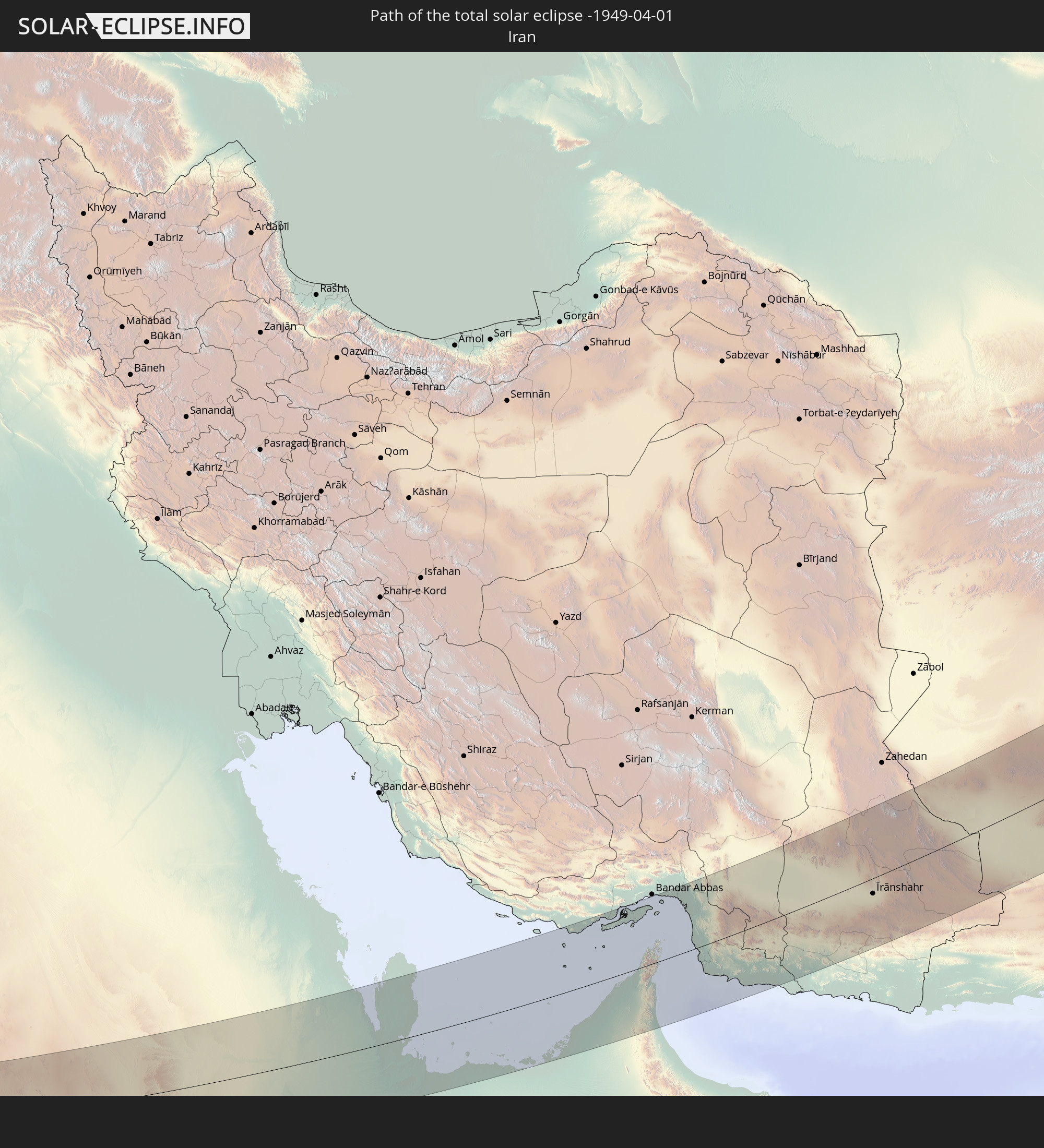
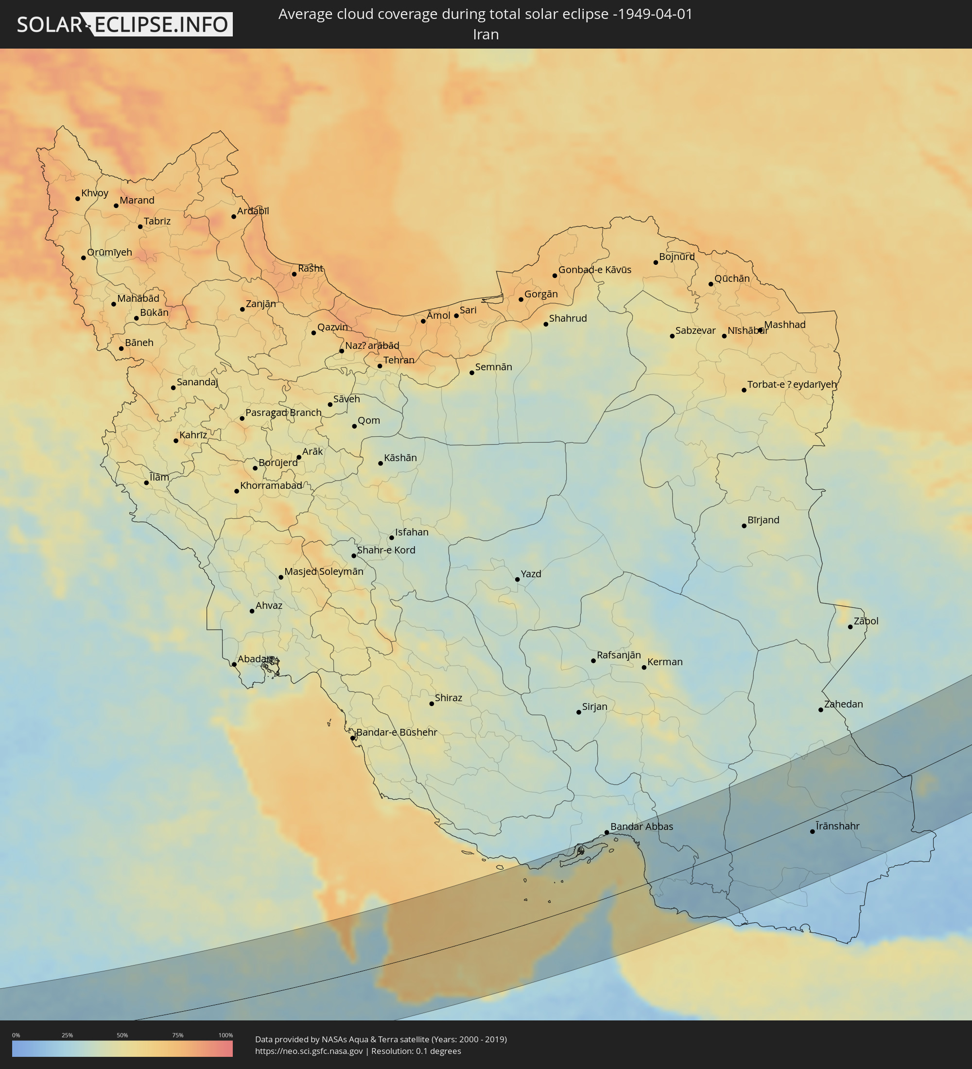 Iran
Iran
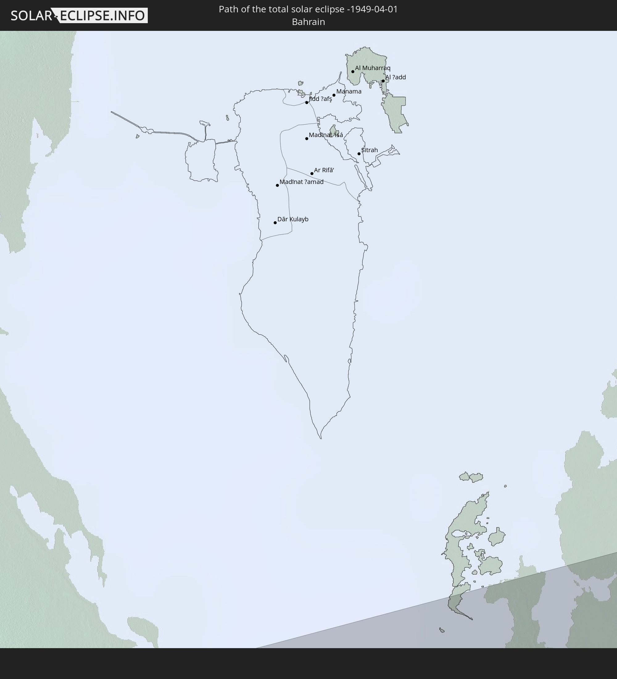
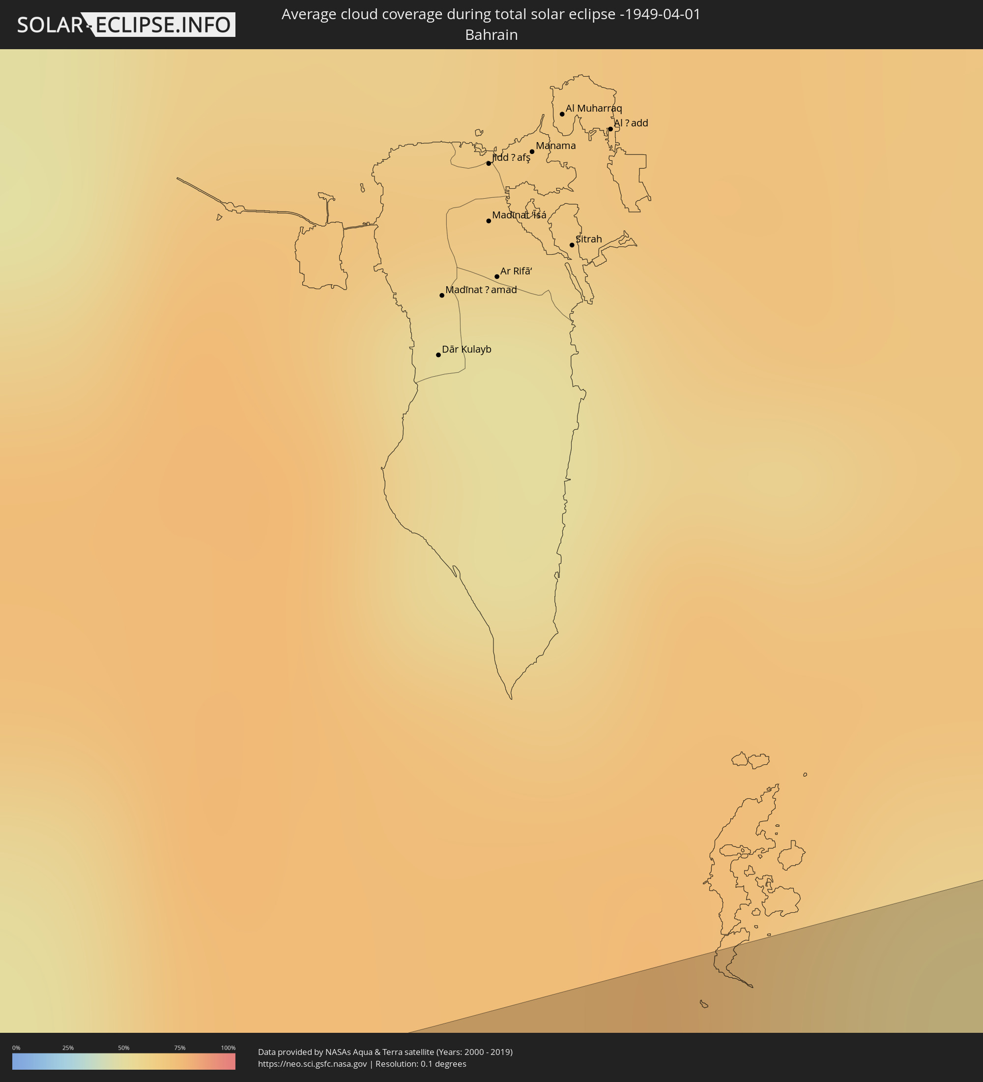 Bahrain
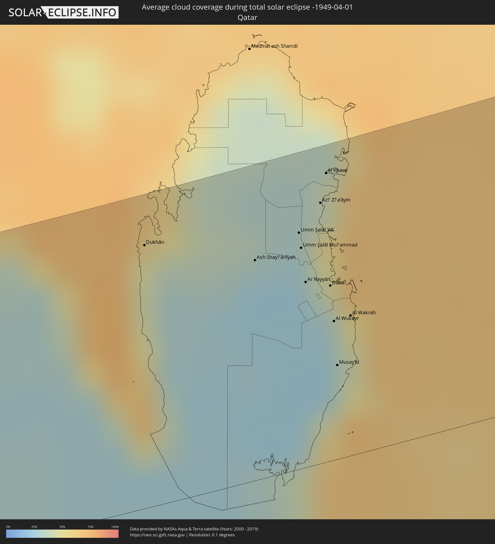 Qatar
Qatar
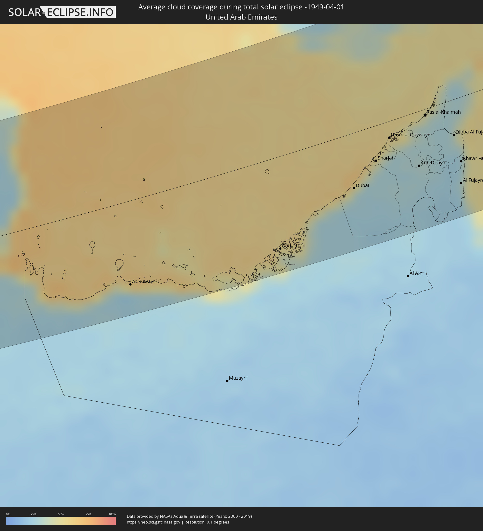 United Arab Emirates
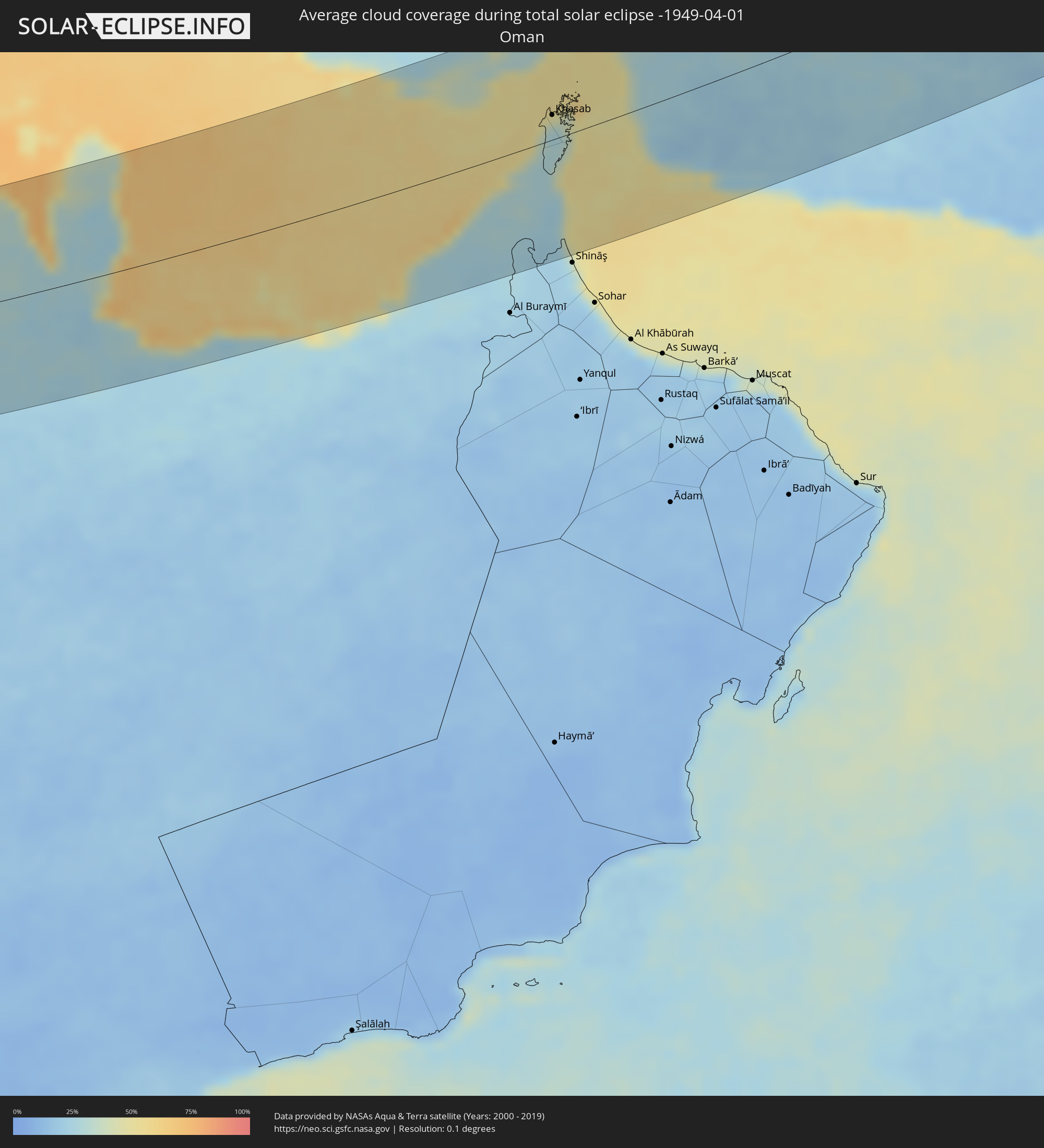 Oman
Oman
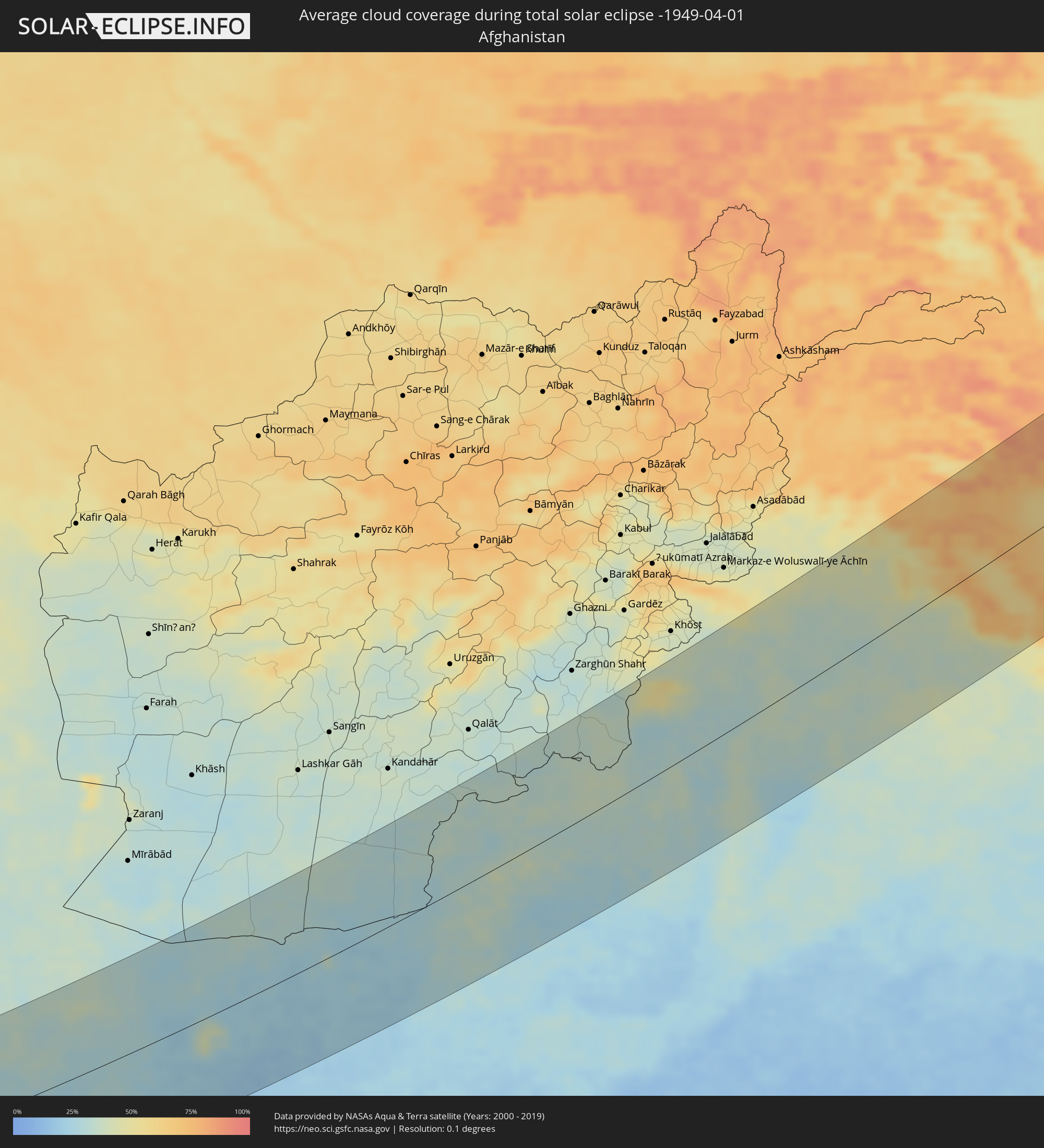 Afghanistan
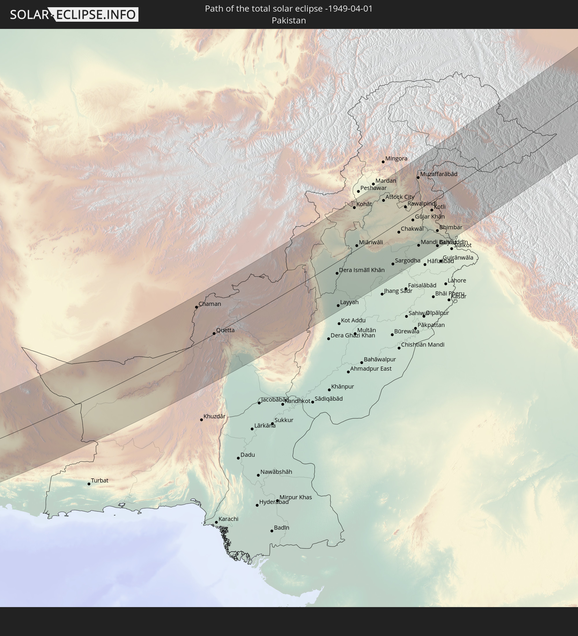
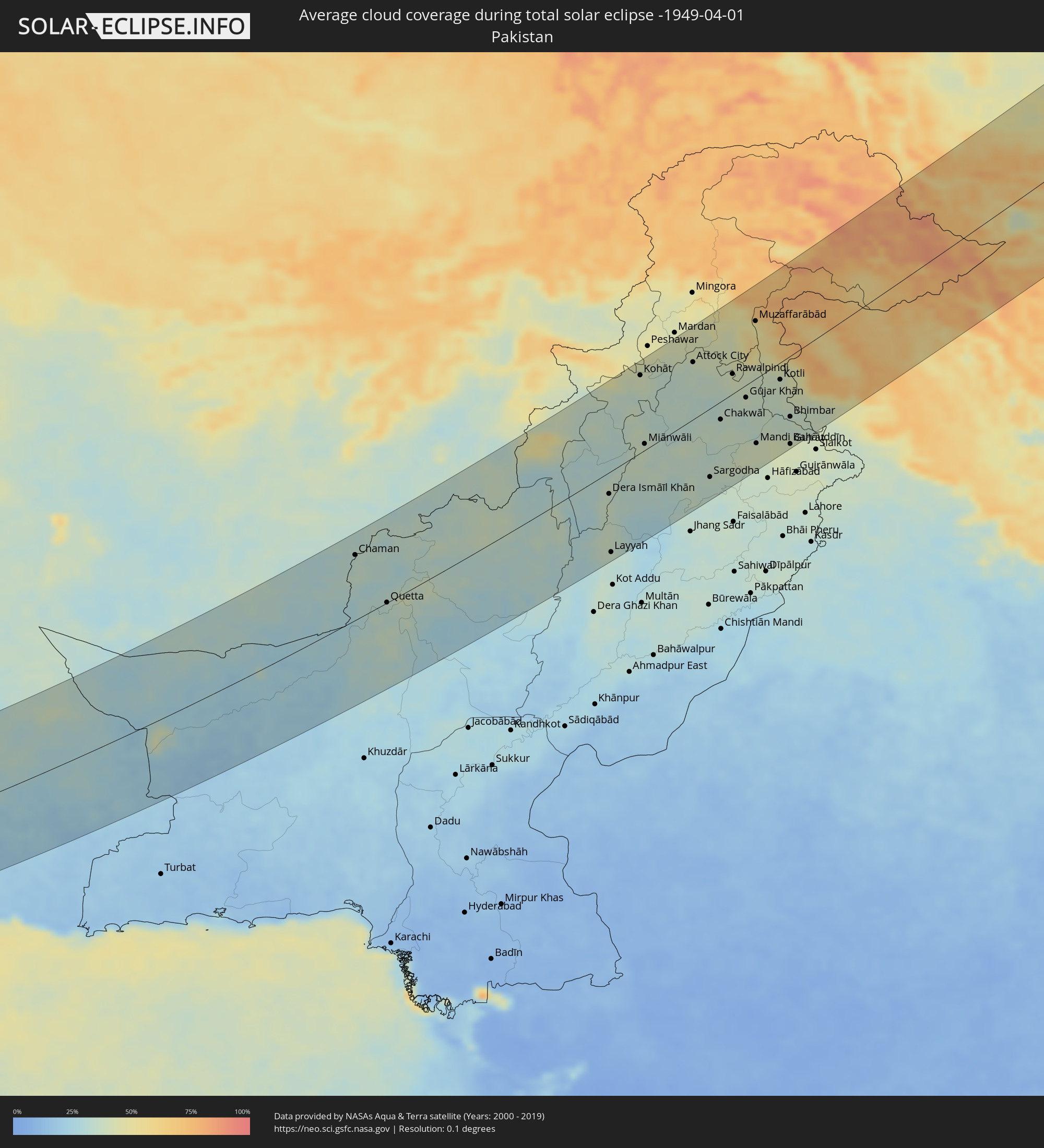 Pakistan
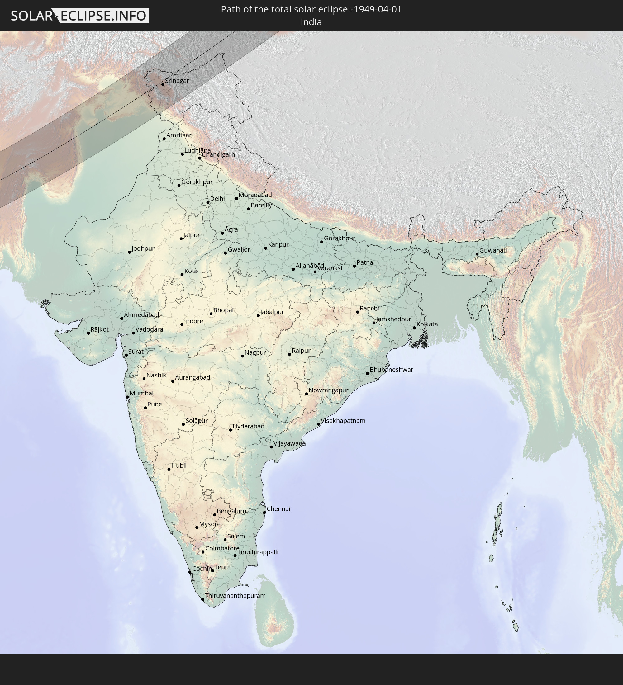
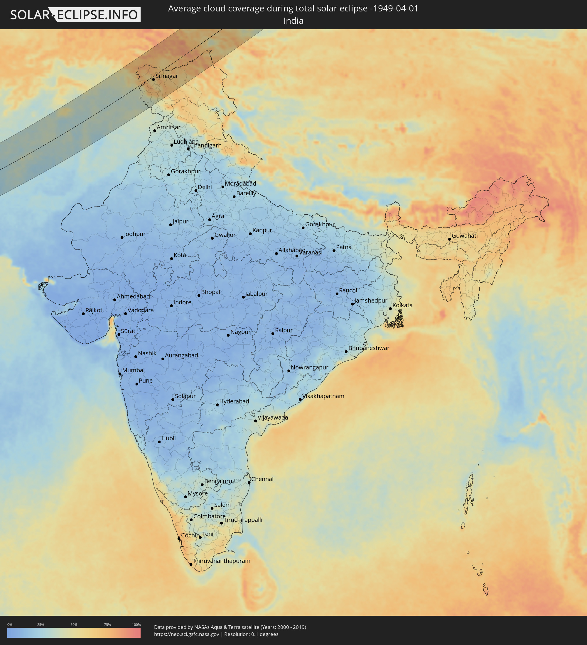 India
India
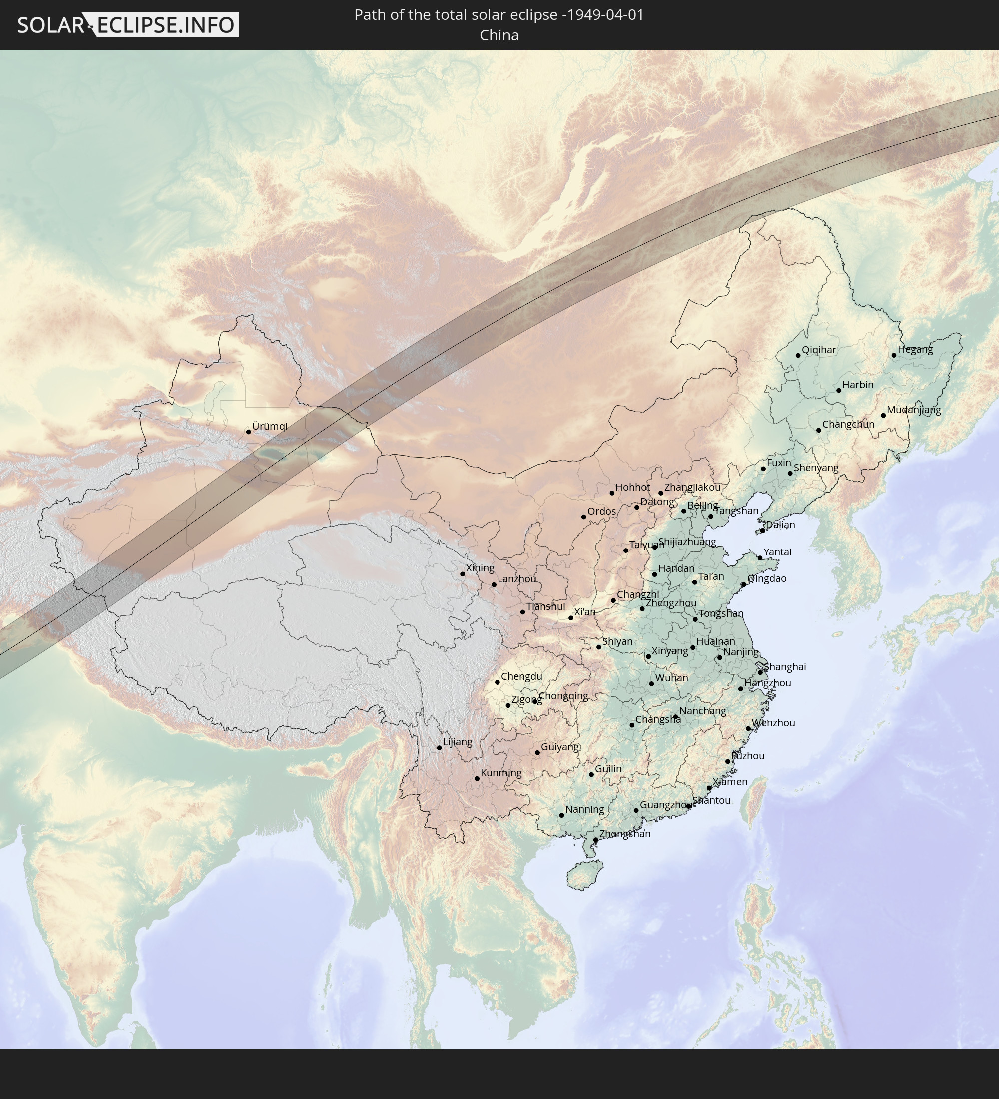
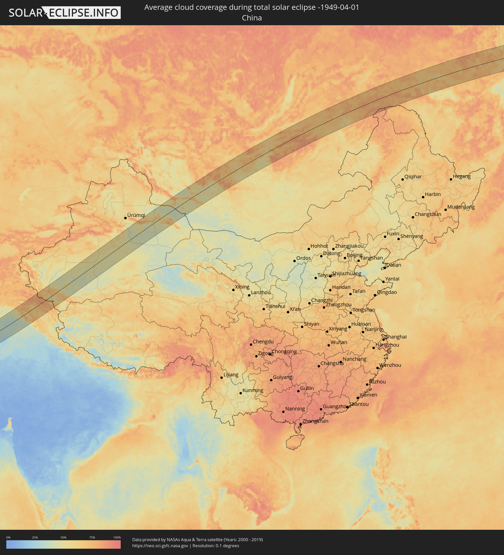 China
China
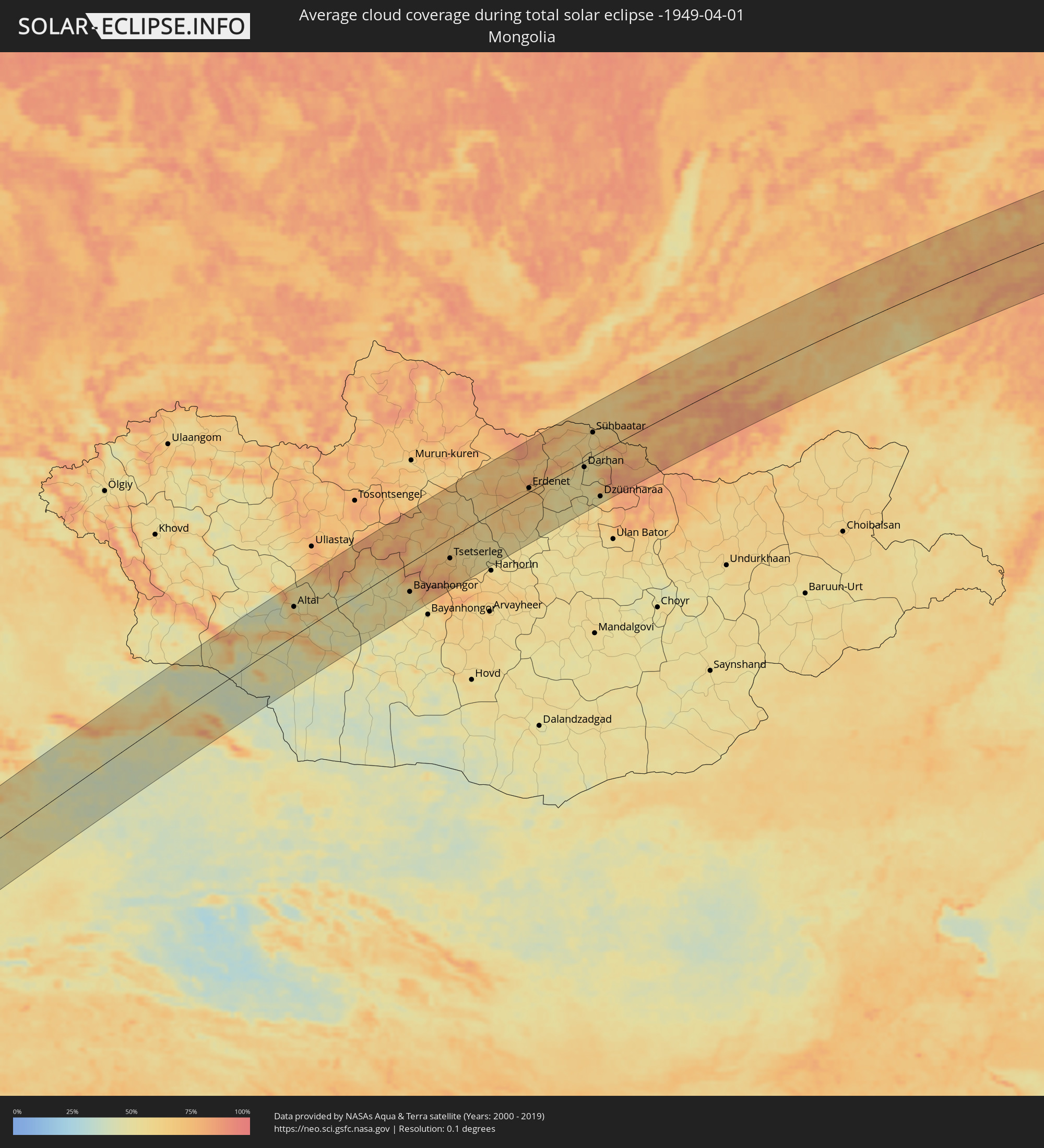 Mongolia
Cities inside the path of the eclipse
The following table shows all locations with a population of more than 5,000 inside the eclipse path. Cities which have more than 100,000 inhabitants are marked bold. A click at the locations opens a detailed map.
| City | Type | Eclipse duration | Local time of max. eclipse | Distance to central line | Ø Cloud coverage |
|
Rābigh, Makkah
|
total | - | 07:52:49 UTC+03:06 | 13 km | 25% |
|
Al Muwayh, Makkah
|
total | - | 07:54:04 UTC+03:06 | 57 km | 14% |
|
‘Afīf, Ar Riyāḑ
|
total | - | 07:57:00 UTC+03:06 | 90 km | 21% |
|
Riyadh, Ar Riyāḑ
|
total | - | 08:01:22 UTC+03:06 | 112 km | 32% |
|
Ad Dilam, Ar Riyāḑ
|
total | - | 08:00:44 UTC+03:06 | 28 km | 28% |
|
Aţ Ţaraf, Eastern Province
|
total | - | 08:05:23 UTC+03:06 | 122 km | 44% |
|
Dukhān, Baladīyat ar Rayyān
|
total | - | 08:25:53 UTC+03:26 | 103 km | 45% |
|
Ash Shayḩānīyah, Baladīyat ar Rayyān
|
total | - | 08:26:18 UTC+03:26 | 86 km | 26% |
|
Umm Şalāl ‘Alī, Baladīyat Umm Şalāl
|
total | - | 08:26:39 UTC+03:26 | 92 km | 29% |
|
Umm Şalāl Muḩammad, Baladīyat Umm Şalāl
|
total | - | 08:26:34 UTC+03:26 | 86 km | 27% |
|
Ar Rayyān, Baladīyat ar Rayyān
|
total | - | 08:26:24 UTC+03:26 | 72 km | 26% |
|
Az̧ Z̧a‘āyin, Baladīyat az̧ Z̧a‘āyin
|
total | - | 08:26:55 UTC+03:26 | 101 km | 52% |
|
Al Khawr, Al Khawr
|
total | - | 08:27:06 UTC+03:26 | 112 km | 41% |
|
Doha, Baladīyat ad Dawḩah
|
total | - | 08:26:30 UTC+03:26 | 68 km | 32% |
|
Al Wukayr, Al Wakrah
|
total | - | 08:26:19 UTC+03:26 | 54 km | 28% |
|
Musay‘īd, Al Wakrah
|
total | - | 08:26:05 UTC+03:26 | 37 km | 48% |
|
Al Wakrah, Al Wakrah
|
total | - | 08:26:25 UTC+03:26 | 54 km | 45% |
|
Ar Ruways, Abu Dhabi
|
total | - | 08:41:09 UTC+03:41 | 89 km | 25% |
|
Abu Dhabi, Abu Dhabi
|
total | - | 08:43:41 UTC+03:41 | 98 km | 40% |
|
Bandar-e Lengeh, Hormozgan
|
total | - | 08:32:11 UTC+03:25 | 109 km | 39% |
|
Dubai, Dubai
|
total | - | 08:45:39 UTC+03:41 | 58 km | 32% |
|
Sharjah, Ash Shāriqah
|
total | - | 08:46:24 UTC+03:41 | 37 km | 31% |
|
Ajman, Ajman
|
total | - | 08:46:33 UTC+03:41 | 30 km | 41% |
|
Umm al Qaywayn, Umm al Qaywayn
|
total | - | 08:46:57 UTC+03:41 | 17 km | 41% |
|
Adh Dhayd, Ash Shāriqah
|
total | - | 08:46:56 UTC+03:41 | 57 km | 28% |
|
Ras al-Khaimah, Raʼs al Khaymah
|
total | - | 08:47:49 UTC+03:41 | 6 km | 42% |
|
Khasab, Musandam
|
total | - | 08:48:51 UTC+03:41 | 25 km | 34% |
|
Dibba Al-Fujairah, Al Fujayrah
|
total | - | 08:47:56 UTC+03:41 | 37 km | 32% |
|
Qeshm, Hormozgan
|
total | - | 08:34:39 UTC+03:25 | 105 km | 50% |
|
Dibba Al-Hisn, Al Fujayrah
|
total | - | 08:47:59 UTC+03:41 | 35 km | 32% |
|
Al Fujayrah, Al Fujayrah
|
total | - | 08:47:17 UTC+03:41 | 90 km | 27% |
|
Khawr Fakkān, Ash Shāriqah
|
total | - | 08:47:37 UTC+03:41 | 67 km | 28% |
|
Mīnāb, Hormozgan
|
total | - | 08:36:04 UTC+03:25 | 97 km | 29% |
|
Īrānshahr, Sistan and Baluchestan
|
total | - | 08:41:26 UTC+03:25 | 28 km | 24% |
|
Khāsh, Sistan and Baluchestan
|
total | - | 08:43:55 UTC+03:25 | 55 km | 30% |
|
Chaman, Balochistān
|
total | - | 09:59:26 UTC+04:28 | 96 km | 34% |
|
Quetta, Balochistān
|
total | - | 09:59:14 UTC+04:28 | 0 km | 32% |
|
Dera Ismāīl Khān, Khyber Pakhtunkhwa
|
total | - | 10:08:52 UTC+04:28 | 30 km | 37% |
|
Bhakkar, Punjab
|
total | - | 10:08:51 UTC+04:28 | 58 km | 33% |
|
Kohāt, Khyber Pakhtunkhwa
|
total | - | 10:12:35 UTC+04:28 | 107 km | 40% |
|
Miānwāli, Punjab
|
total | - | 10:11:11 UTC+04:28 | 9 km | 38% |
|
Nowshera Cantonment, Khyber Pakhtunkhwa
|
total | - | 10:14:14 UTC+04:28 | 118 km | 39% |
|
Khushāb, Punjab
|
total | - | 10:12:18 UTC+04:28 | 59 km | 34% |
|
Attock City, Punjab
|
total | - | 10:14:35 UTC+04:28 | 78 km | 38% |
|
Swābi, Khyber Pakhtunkhwa
|
total | - | 10:15:17 UTC+04:28 | 106 km | 42% |
|
Sargodha, Punjab
|
total | - | 10:12:34 UTC+04:28 | 95 km | 36% |
|
Chakwāl, Punjab
|
total | - | 10:14:13 UTC+04:28 | 25 km | 35% |
|
Rawalpindi, Punjab
|
total | - | 10:15:37 UTC+04:28 | 27 km | 40% |
|
Abbottābād, Khyber Pakhtunkhwa
|
total | - | 10:16:43 UTC+04:28 | 70 km | 46% |
|
Muzaffarābād, Azad Kashmir
|
total | - | 10:17:31 UTC+04:28 | 78 km | 49% |
|
Mandi Bahāuddīn, Punjab
|
total | - | 10:14:52 UTC+04:28 | 89 km | 40% |
|
Jhelum, Punjab
|
total | - | 10:15:52 UTC+04:28 | 69 km | 38% |
|
Kotli, Azad Kashmir
|
total | - | 10:17:04 UTC+04:28 | 23 km | 38% |
|
Bhimbar, Azad Kashmir
|
total | - | 10:16:36 UTC+04:28 | 83 km | 35% |
|
Gujrāt, Punjab
|
total | - | 10:16:00 UTC+04:28 | 120 km | 40% |
|
Pūnch, Kashmir
|
total | - | 11:10:46 UTC+05:21 | 9 km | 46% |
|
Kupwāra, Kashmir
|
total | - | 11:11:29 UTC+05:21 | 6 km | 76% |
|
Rajaori, Kashmir
|
total | - | 11:10:36 UTC+05:21 | 57 km | 42% |
|
Bāramūla, Kashmir
|
total | - | 11:11:53 UTC+05:21 | 18 km | 68% |
|
Nawānshahr, Kashmir
|
total | - | 11:10:07 UTC+05:21 | 125 km | 38% |
|
Pattan, Kashmir
|
total | - | 11:12:13 UTC+05:21 | 3 km | 56% |
|
Hājan, Kashmir
|
total | - | 11:12:32 UTC+05:21 | 13 km | 59% |
|
Bandipura, Kashmir
|
total | - | 11:12:46 UTC+05:21 | 22 km | 62% |
|
Sumbal, Kashmir
|
total | - | 11:12:30 UTC+05:21 | 5 km | 56% |
|
Tsrār Sharīf, Kashmir
|
total | - | 11:12:11 UTC+05:21 | 35 km | 61% |
|
Gāndarbal, Kashmir
|
total | - | 11:12:44 UTC+05:21 | 2 km | 58% |
|
Srinagar, Kashmir
|
total | - | 11:12:35 UTC+05:21 | 17 km | 56% |
|
Riāsi, Kashmir
|
total | - | 11:11:10 UTC+05:21 | 111 km | 39% |
|
Shupīyan, Kashmir
|
total | - | 11:12:06 UTC+05:21 | 52 km | 72% |
|
Pulwama, Kashmir
|
total | - | 11:12:27 UTC+05:21 | 41 km | 57% |
|
Katra, Kashmir
|
total | - | 11:11:13 UTC+05:21 | 125 km | 39% |
|
Kulgam, Kashmir
|
total | - | 11:12:21 UTC+05:21 | 69 km | 69% |
|
Trāl, Kashmir
|
total | - | 11:12:57 UTC+05:21 | 47 km | 59% |
|
Anantnag, Kashmir
|
total | - | 11:12:44 UTC+05:21 | 68 km | 57% |
|
Kargil, Kashmir
|
total | - | 11:15:47 UTC+05:21 | 41 km | 65% |
|
Zangguy, Xinjiang Uyghur Autonomous Region
|
total | - | 14:03:19 UTC+08:00 | 71 km | 48% |
|
Hotan, Xinjiang Uyghur Autonomous Region
|
total | - | 14:05:18 UTC+08:00 | 5 km | 54% |
|
Korla, Xinjiang Uyghur Autonomous Region
|
total | - | 14:21:44 UTC+08:00 | 101 km | 54% |
|
Sishilichengzi, Xinjiang Uyghur Autonomous Region
|
total | - | 14:22:28 UTC+08:00 | 104 km | 62% |
|
Turpan, Xinjiang Uyghur Autonomous Region
|
total | - | 14:27:57 UTC+08:00 | 63 km | 54% |
|
Altai, Govĭ-Altay
|
total | - | 12:47:48 UTC+06:06 | 62 km | 53% |
|
Bayanhongor, Bayanhongor
|
total | - | 13:54:33 UTC+07:07 | 63 km | 54% |
|
Tsetserleg, Arhangay
|
total | - | 13:56:33 UTC+07:07 | 43 km | 66% |
|
Bulgan, Bulgan
|
total | - | 13:59:25 UTC+07:07 | 7 km | 72% |
|
Erdenet, Orhon
|
total | - | 14:00:07 UTC+07:07 | 8 km | 72% |
|
Darhan, Darhan Uul
|
total | - | 14:02:25 UTC+07:07 | 13 km | 53% |
|
Sühbaatar, Selenge
|
total | - | 14:02:39 UTC+07:07 | 50 km | 58% |
|
Kyakhta, Respublika Buryatiya
|
total | - | 13:52:29 UTC+06:57 | 53 km | 62% |
|
Dzüünharaa, Selenge
|
total | - | 14:03:10 UTC+07:07 | 94 km | 52% |
|
Bichura, Respublika Buryatiya
|
total | - | 13:53:49 UTC+06:57 | 37 km | 68% |
|
Krasnyy Chikoy, Transbaikal Territory
|
total | - | 15:37:06 UTC+08:38 | 23 km | 67% |
|
Petrovsk-Zabaykal’skiy, Transbaikal Territory
|
total | - | 15:36:57 UTC+08:38 | 64 km | 70% |
|
Khilok, Transbaikal Territory
|
total | - | 15:38:45 UTC+08:38 | 21 km | 73% |
|
Domna, Transbaikal Territory
|
total | - | 15:41:24 UTC+08:38 | 9 km | 65% |
|
Chita, Transbaikal Territory
|
total | - | 15:41:42 UTC+08:38 | 5 km | 67% |
|
Atamanovka, Transbaikal Territory
|
total | - | 15:41:53 UTC+08:38 | 19 km | 67% |
|
Novokruchininskiy, Transbaikal Territory
|
total | - | 15:42:06 UTC+08:38 | 38 km | 63% |
|
Darasun, Transbaikal Territory
|
total | - | 15:42:21 UTC+08:38 | 57 km | 62% |
|
Karymskoye, Transbaikal Territory
|
total | - | 15:42:45 UTC+08:38 | 72 km | 64% |
|
Pervomayskiy, Transbaikal Territory
|
total | - | 15:44:00 UTC+08:38 | 103 km | 61% |
|
Shilka, Transbaikal Territory
|
total | - | 15:44:19 UTC+08:38 | 96 km | 61% |
|
Nerchinsk, Transbaikal Territory
|
total | - | 15:44:47 UTC+08:38 | 98 km | 61% |
|
Chernyshevsk, Transbaikal Territory
|
total | - | 15:44:54 UTC+08:38 | 55 km | 57% |
|
Kokuy, Transbaikal Territory
|
total | - | 15:45:34 UTC+08:38 | 102 km | 74% |
|
Sretensk, Transbaikal Territory
|
total | - | 15:45:42 UTC+08:38 | 102 km | 74% |
|
Mogocha, Transbaikal Territory
|
total | - | 15:46:36 UTC+08:38 | 3 km | 75% |
|
Skovorodino, Amur
|
total | - | 15:49:47 UTC+08:38 | 77 km | 77% |
|
Tynda, Amur
|
total | - | 15:49:26 UTC+08:38 | 28 km | 79% |