Total solar eclipse of 03/24/0247
| Day of week: | Wednesday |
| Maximum duration of eclipse: | 04m50s |
| Maximum width of eclipse path: | 185 km |
| Saros cycle: | 72 |
| Coverage: | 100% |
| Magnitude: | 1.0538 |
| Gamma: | 0.2796 |
Wo kann man die Sonnenfinsternis vom 03/24/0247 sehen?
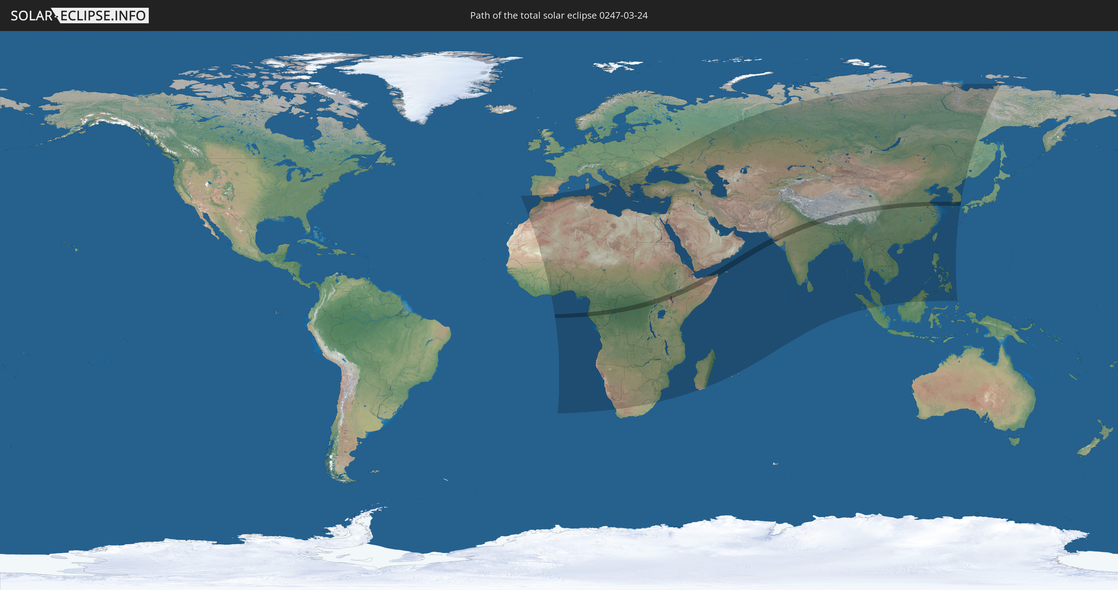
Die Sonnenfinsternis am 03/24/0247 kann man in 114 Ländern als partielle Sonnenfinsternis beobachten.
Der Finsternispfad verläuft durch 16 Länder. Nur in diesen Ländern ist sie als total Sonnenfinsternis zu sehen.
In den folgenden Ländern ist die Sonnenfinsternis total zu sehen
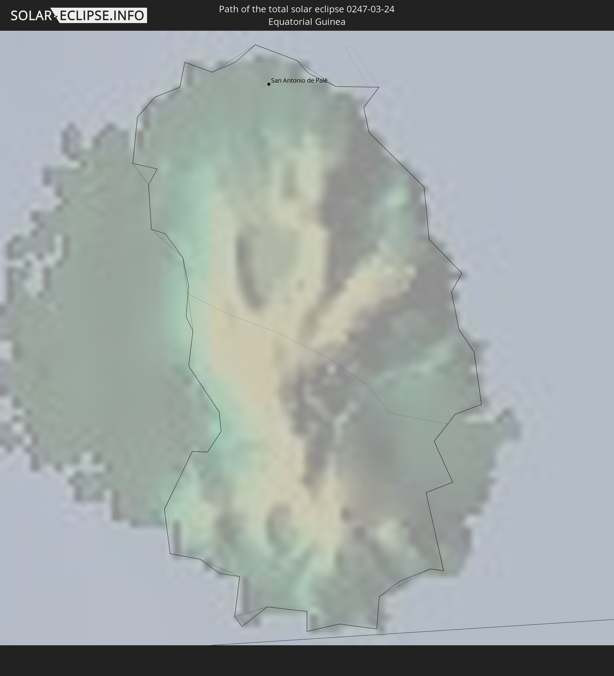 Equatorial Guinea
 Gabon
Gabon
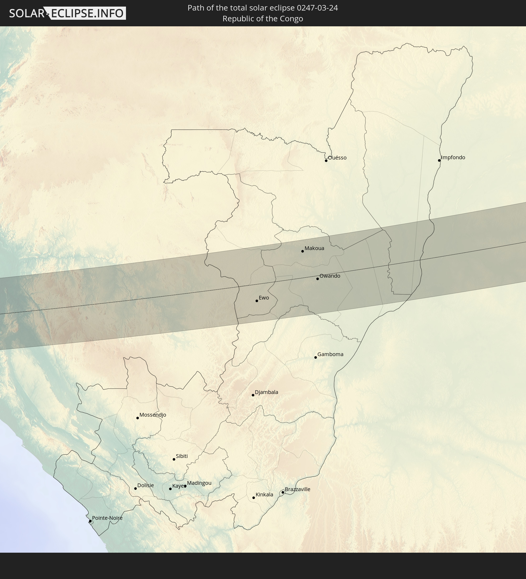 Republic of the Congo
 Democratic Republic of the Congo
 South Sudan
 Uganda
 Ethiopia
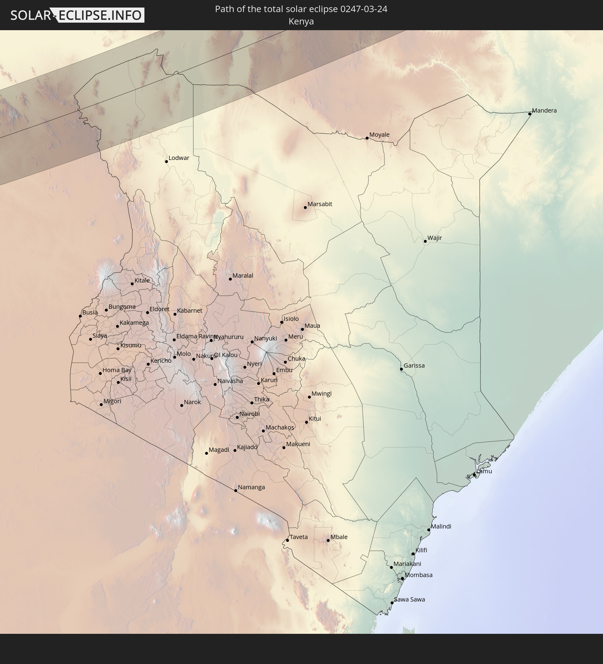 Kenya
Kenya
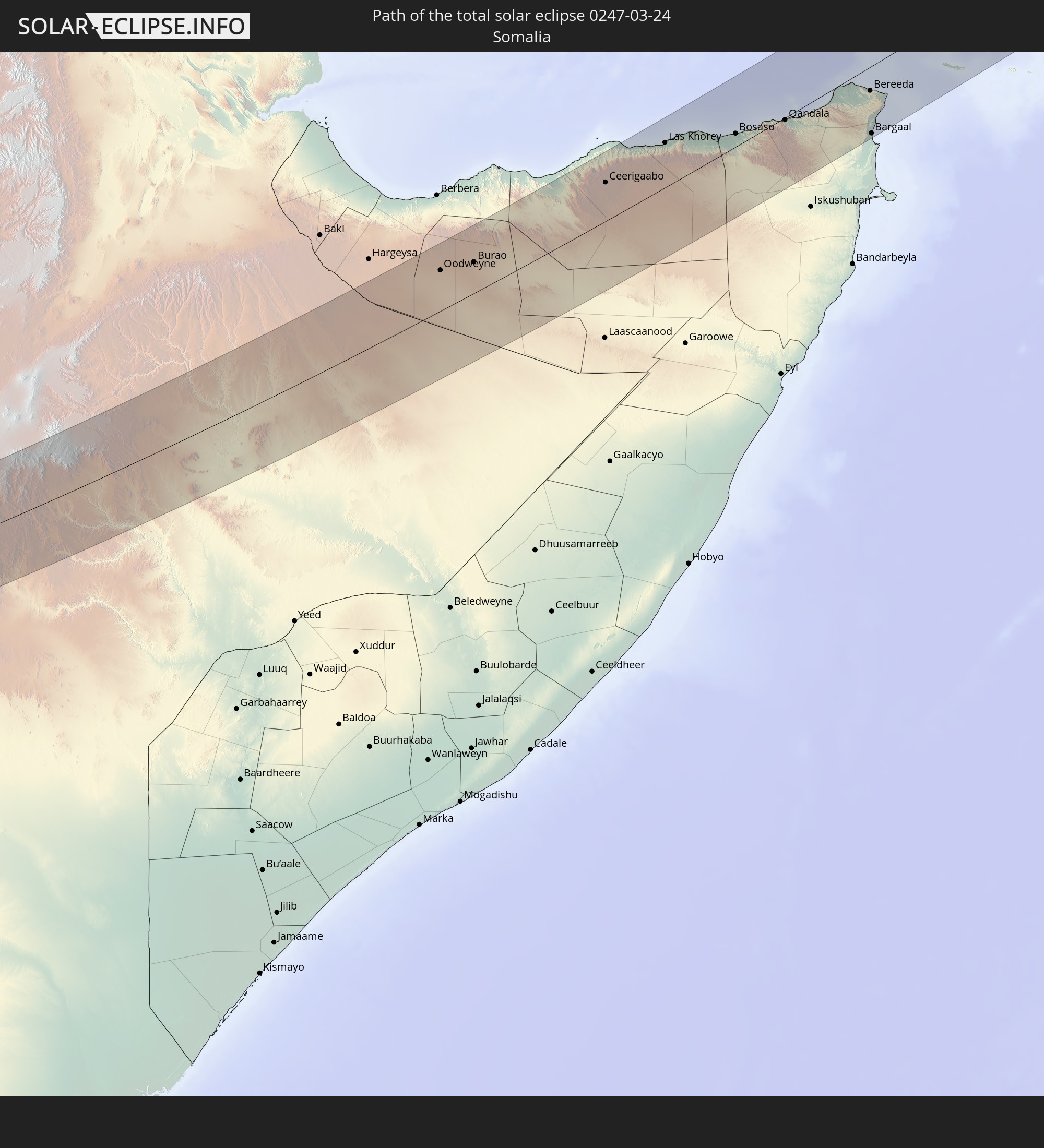 Somalia
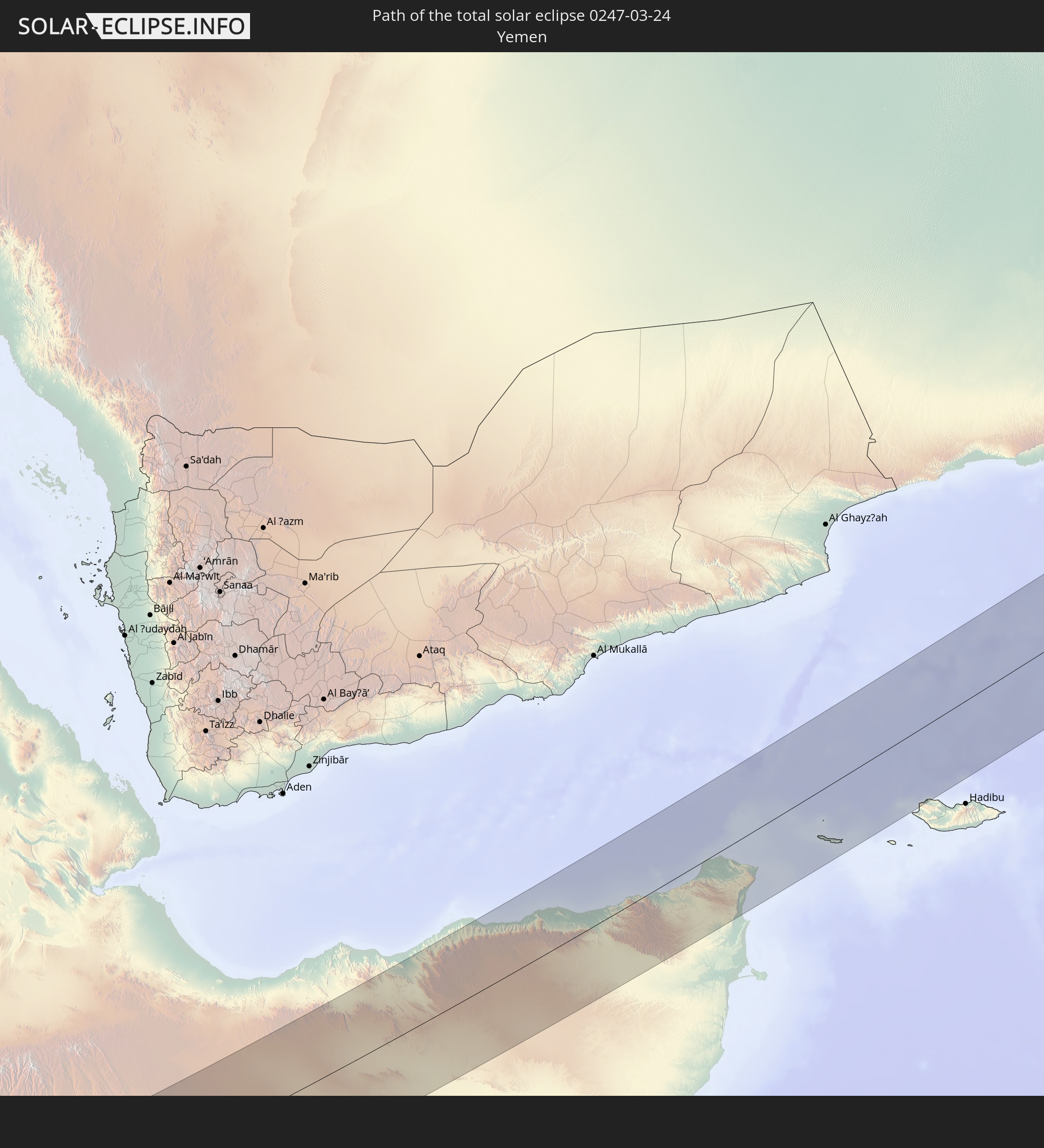 Yemen
Yemen
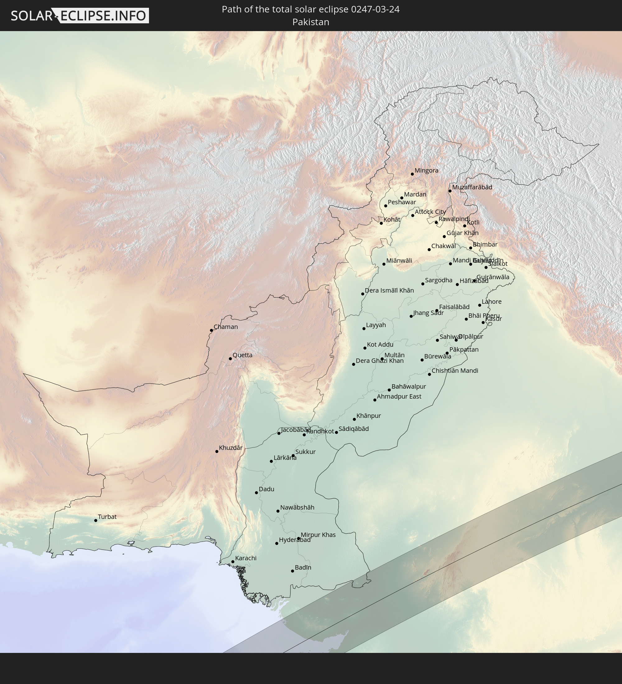 Pakistan
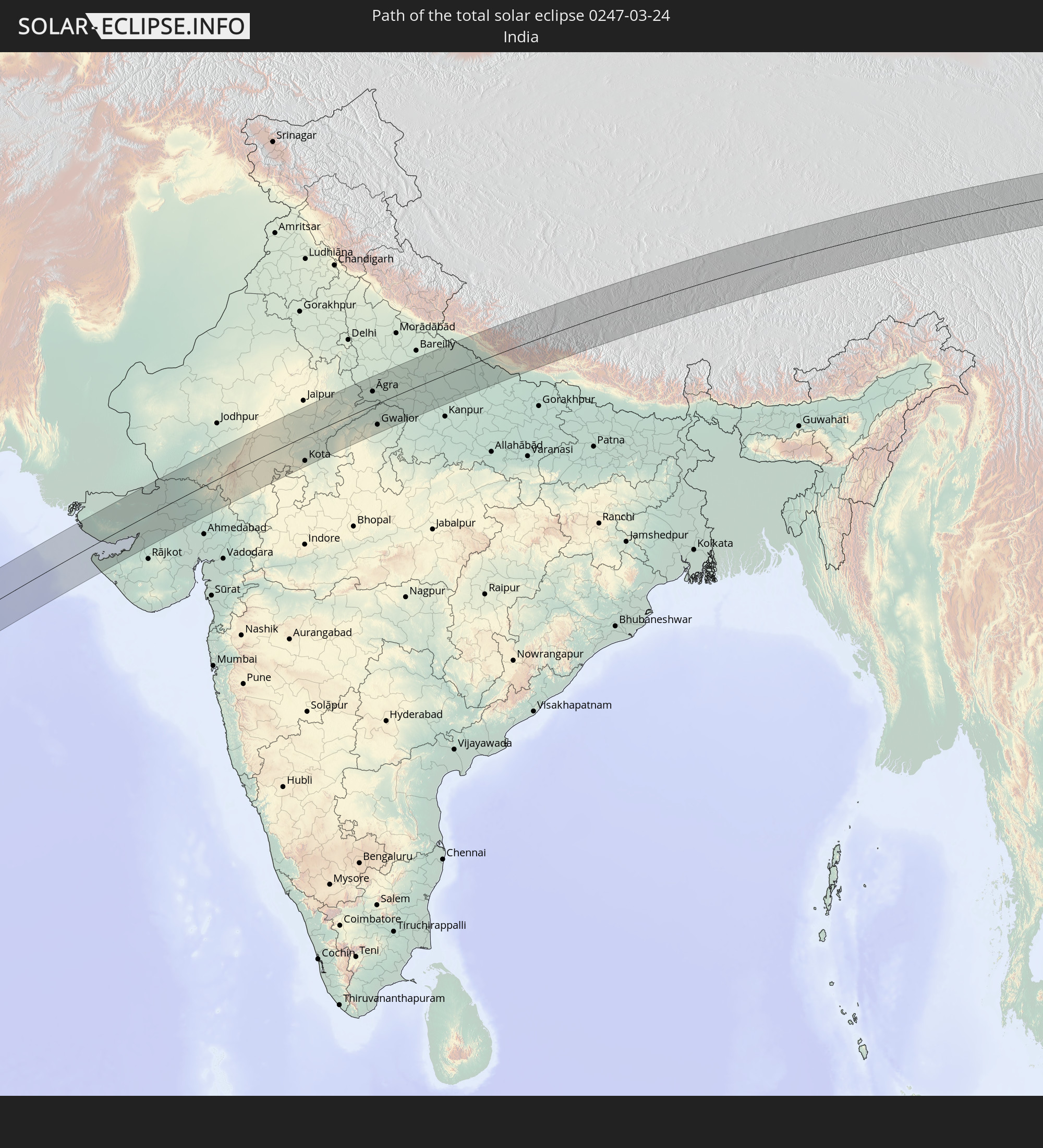 India
India
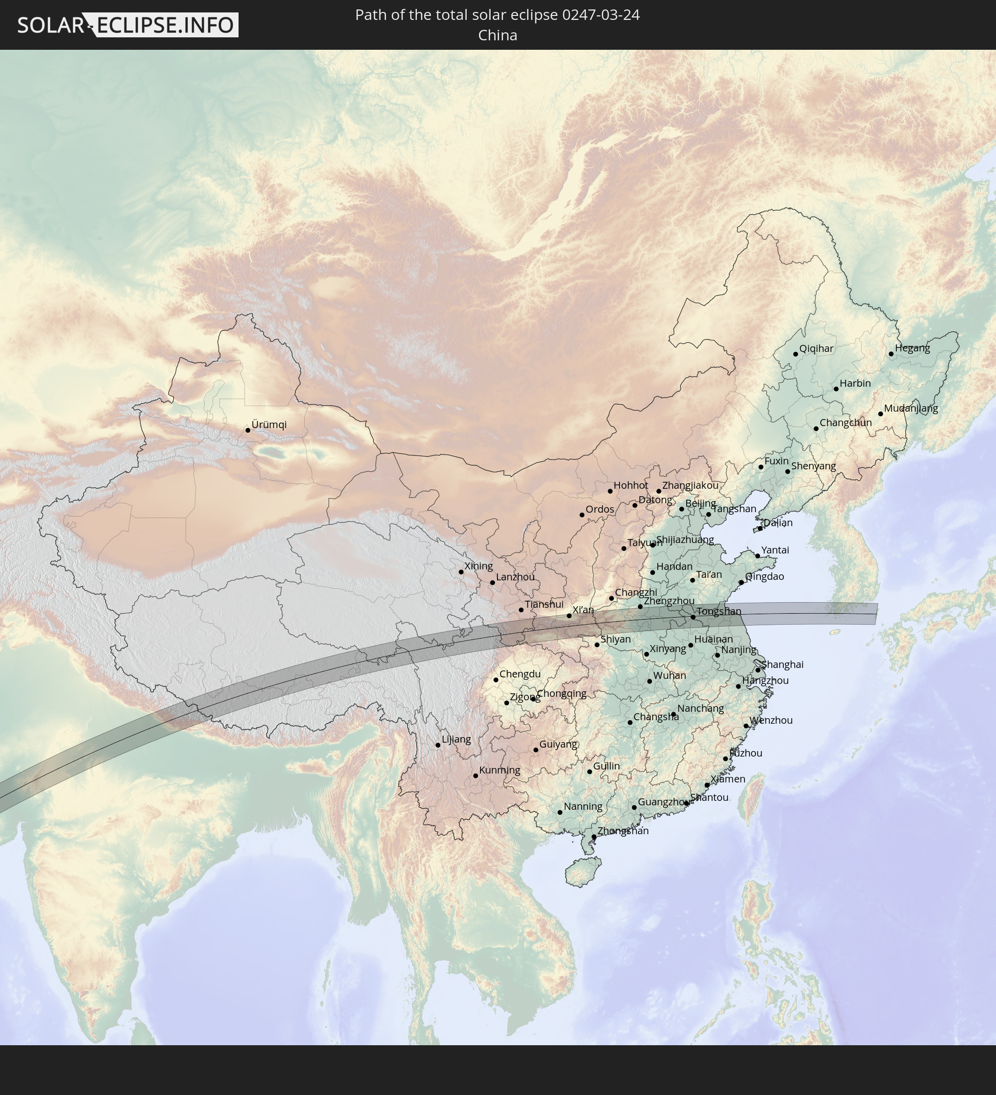 China
China
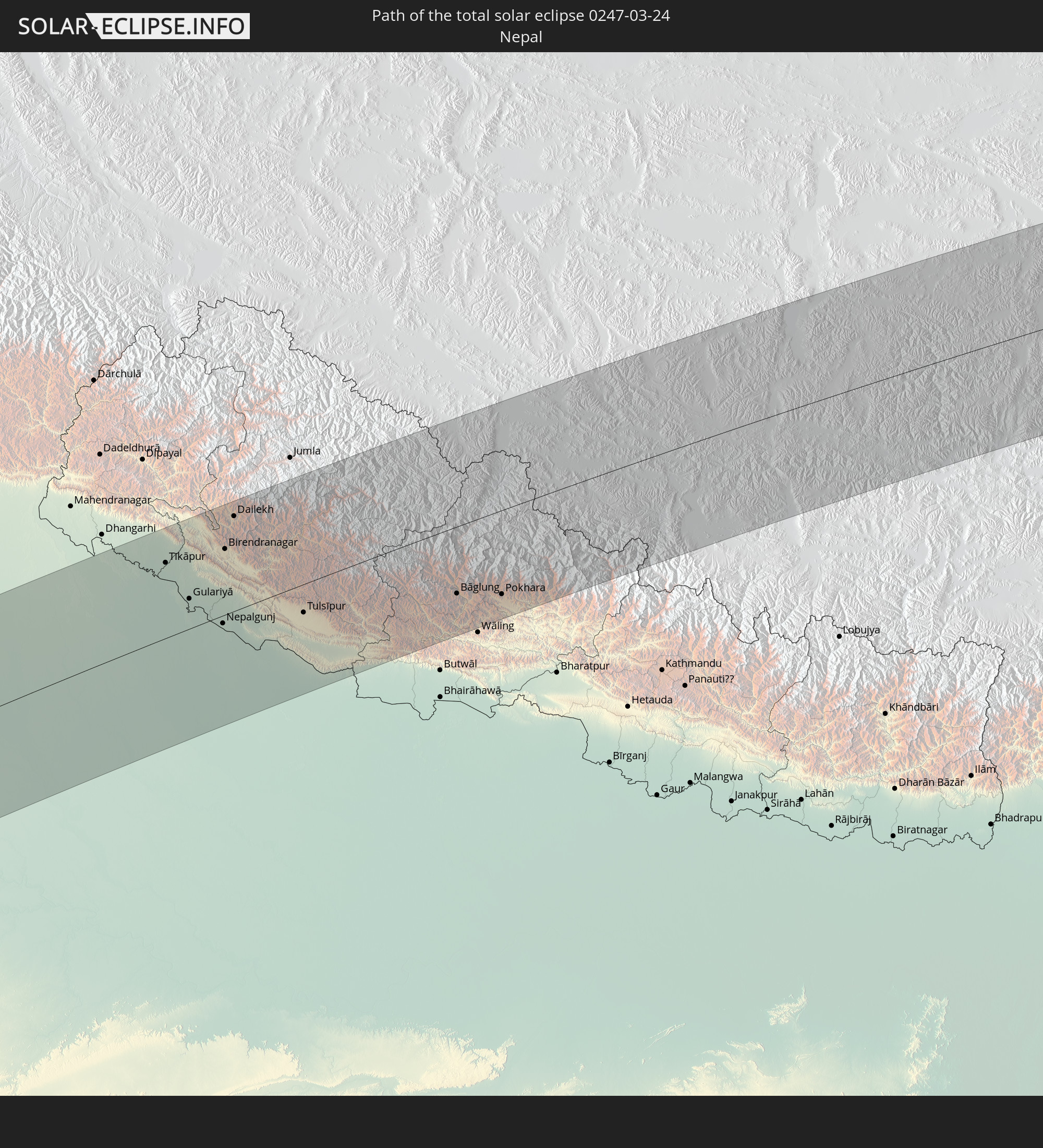 Nepal
Nepal
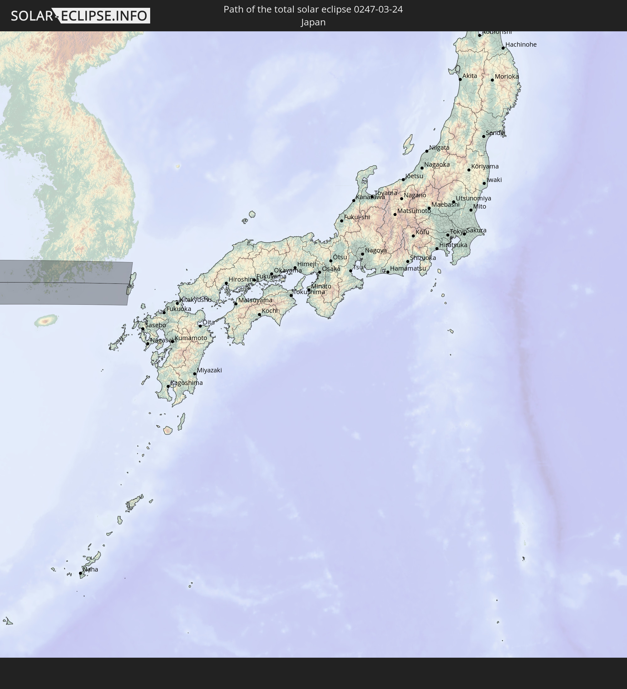 Japan
Japan
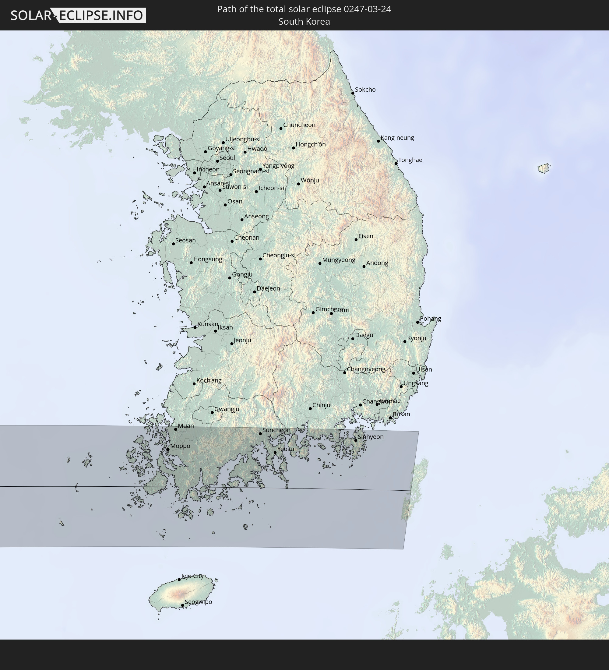 South Korea
In den folgenden Ländern ist die Sonnenfinsternis partiell zu sehen
 Russia
 Portugal
 Spain
Spain
 Mauritania
 Morocco
 Mali
Mali
 Algeria
 Ivory Coast
 Burkina Faso
 Gibraltar
 Ghana
Ghana
 Togo
Togo
 Niger
Niger
 Benin
Benin
 Nigeria
 Equatorial Guinea
 São Tomé and Príncipe
 Italy
Italy
 Tunisia
 Cameroon
 Gabon
Gabon
 Libya
Libya
 Republic of the Congo
 Angola
 Namibia
 Democratic Republic of the Congo
 Chad
Chad
 Malta
Malta
 Central African Republic
 South Africa
 Montenegro
 Serbia
 Albania
 Greece
 Botswana
 Romania
 Republic of Macedonia
 Sudan
Sudan
 Zambia
 Ukraine
 Bulgaria
 Egypt
Egypt
 Zimbabwe
 Turkey
 Moldova
 Lesotho
 Rwanda
 Burundi
 Tanzania
 Uganda
 Mozambique
 Swaziland
 Cyprus
 Malawi
 Ethiopia
 Kenya
Kenya
 State of Palestine
 Israel
 Saudi Arabia
 Jordan
 Lebanon
 Syria
Syria
 Eritrea
 Iraq
Iraq
 Georgia
 French Southern and Antarctic Lands
 Somalia
 Djibouti
 Yemen
Yemen
 Madagascar
 Comoros
 Armenia
 Iran
Iran
 Azerbaijan
 Mayotte
 Seychelles
 Kazakhstan
 Kuwait
 Bahrain
 Qatar
Qatar
 United Arab Emirates
 Oman
Oman
 Turkmenistan
 Réunion
 Uzbekistan
 Mauritius
 Afghanistan
 Pakistan
 Tajikistan
 India
India
 Kyrgyzstan
 British Indian Ocean Territory
 Maldives
 China
China
 Sri Lanka
 Nepal
Nepal
 Mongolia
 Bangladesh
 Bhutan
 Myanmar
 Indonesia
 Thailand
 Malaysia
 Laos
Laos
 Vietnam
 Cambodia
 Macau
Macau
 Hong Kong
 Brunei
 Taiwan
 Philippines
 Japan
Japan
 North Korea
 South Korea
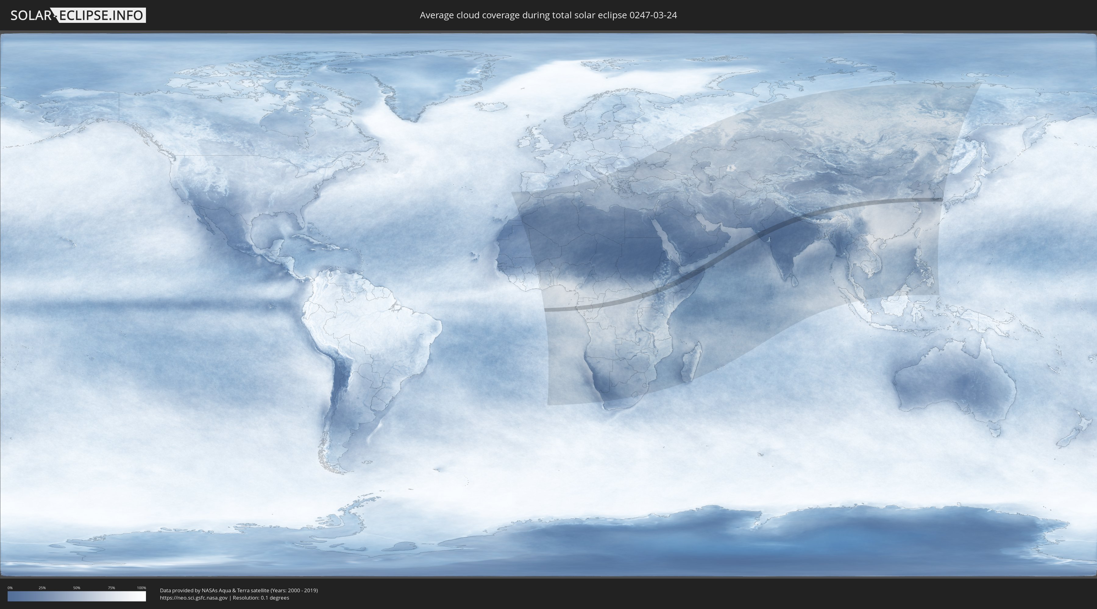
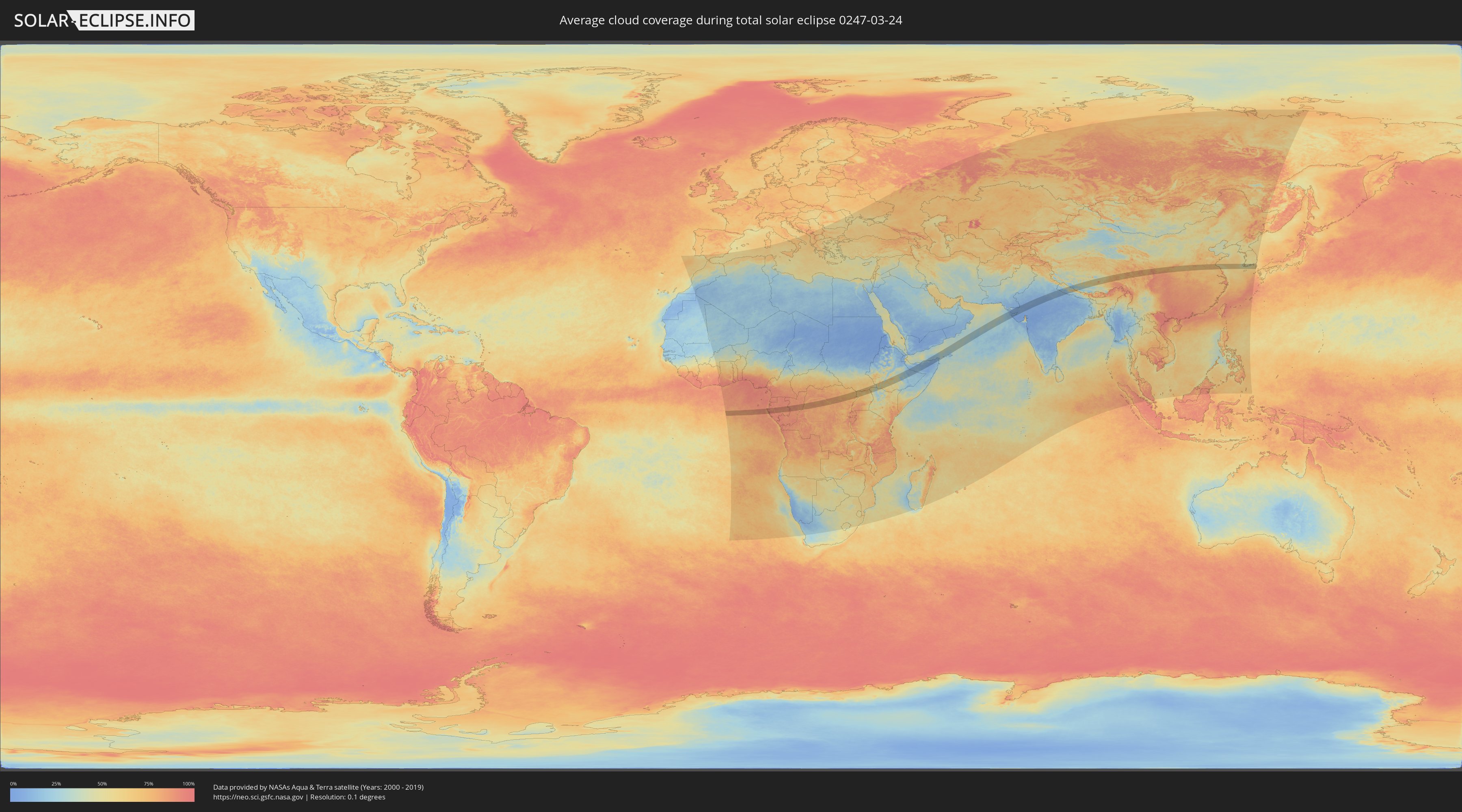
How will be the weather during the total solar eclipse on 03/24/0247?
Where is the best place to see the total solar eclipse of 03/24/0247?
The following maps show the average cloud coverage for the day of the total solar eclipse.
With the help of these maps, it is possible to find the place along the eclipse path, which has the best
chance of a cloudless sky.
Nevertheless, you should consider local circumstances and inform about the weather of your chosen
observation site.
The data is provided by NASAs satellites
AQUA and TERRA.
The cloud maps are averaged over a period of 19 years (2000 - 2019).
Detailed country maps
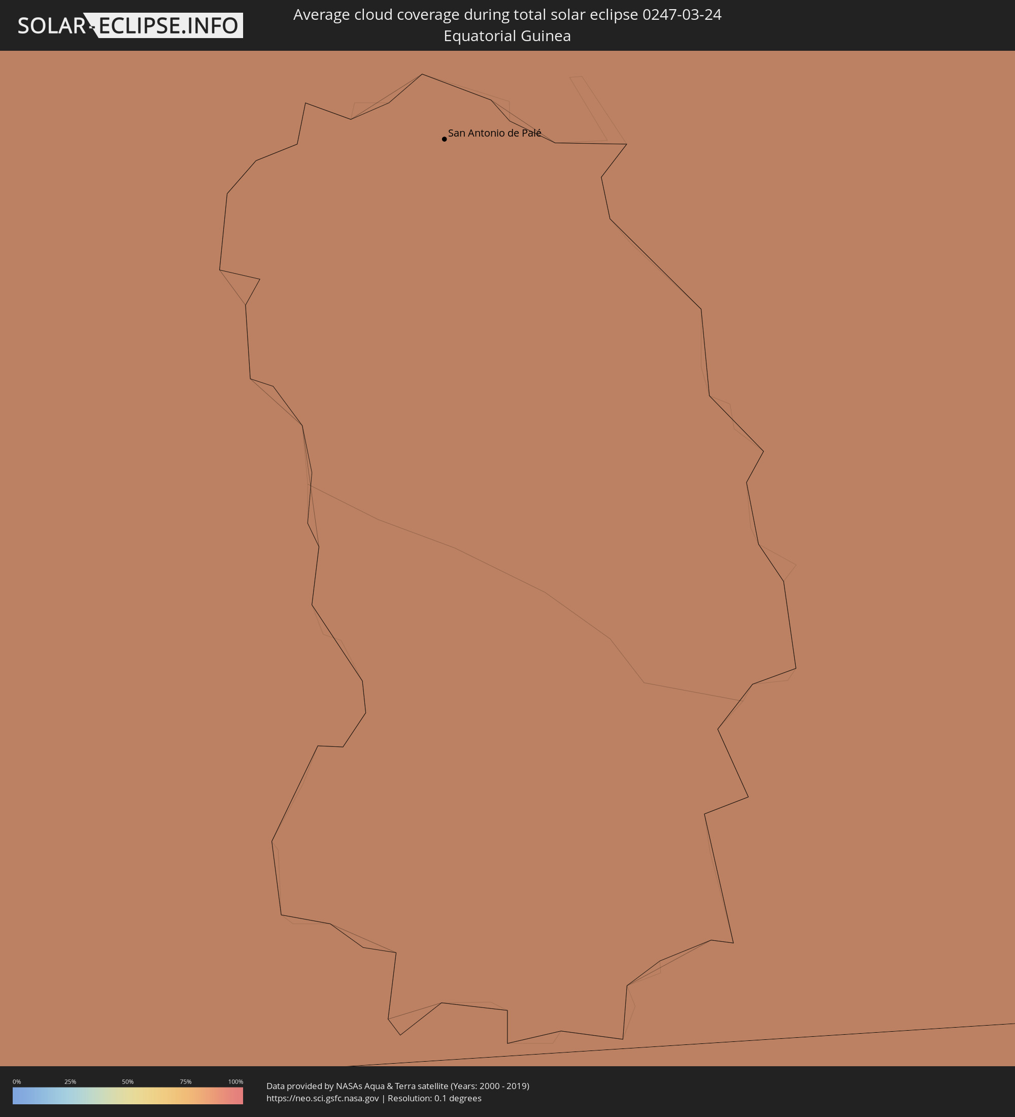 Equatorial Guinea
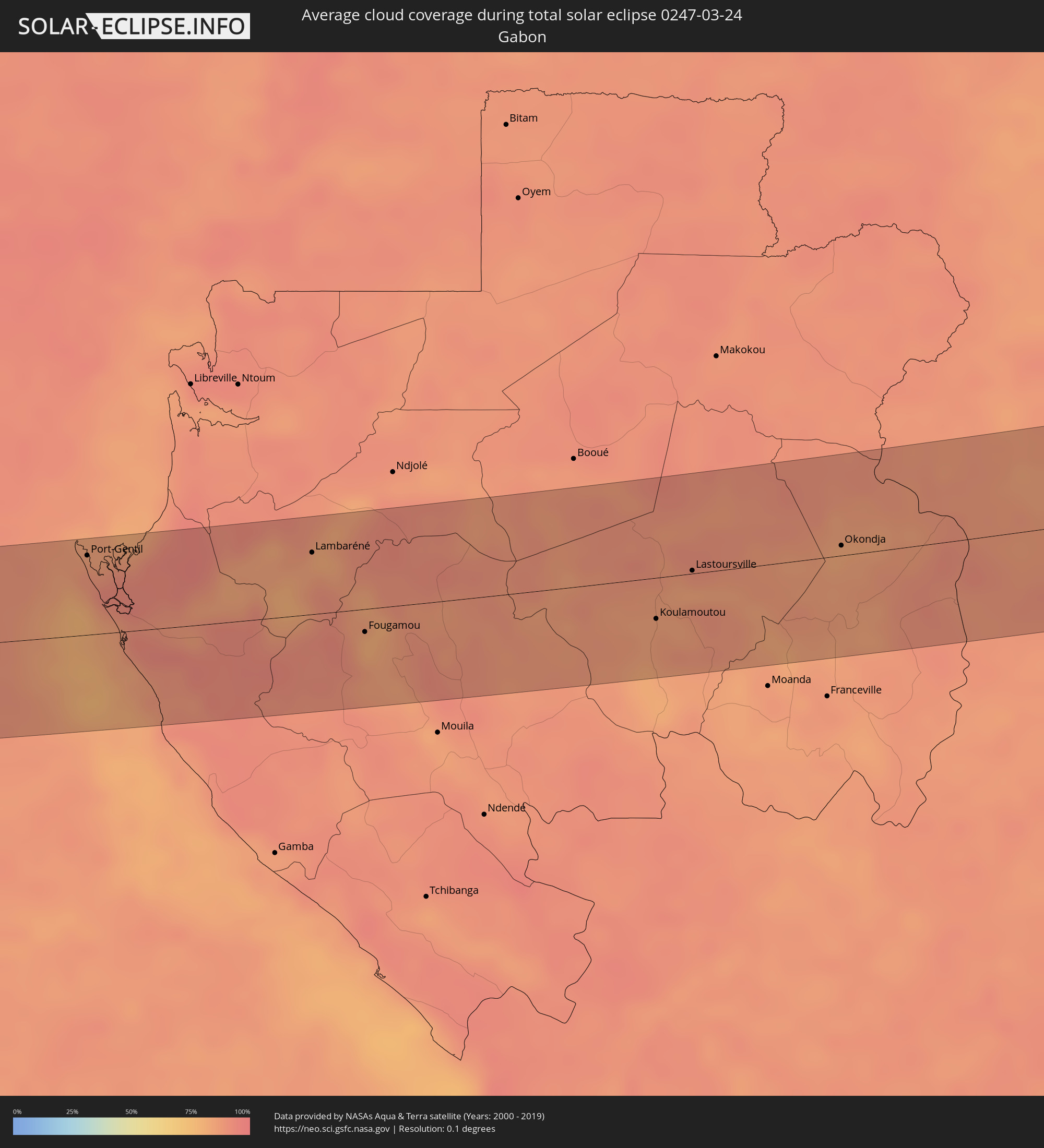 Gabon
Gabon
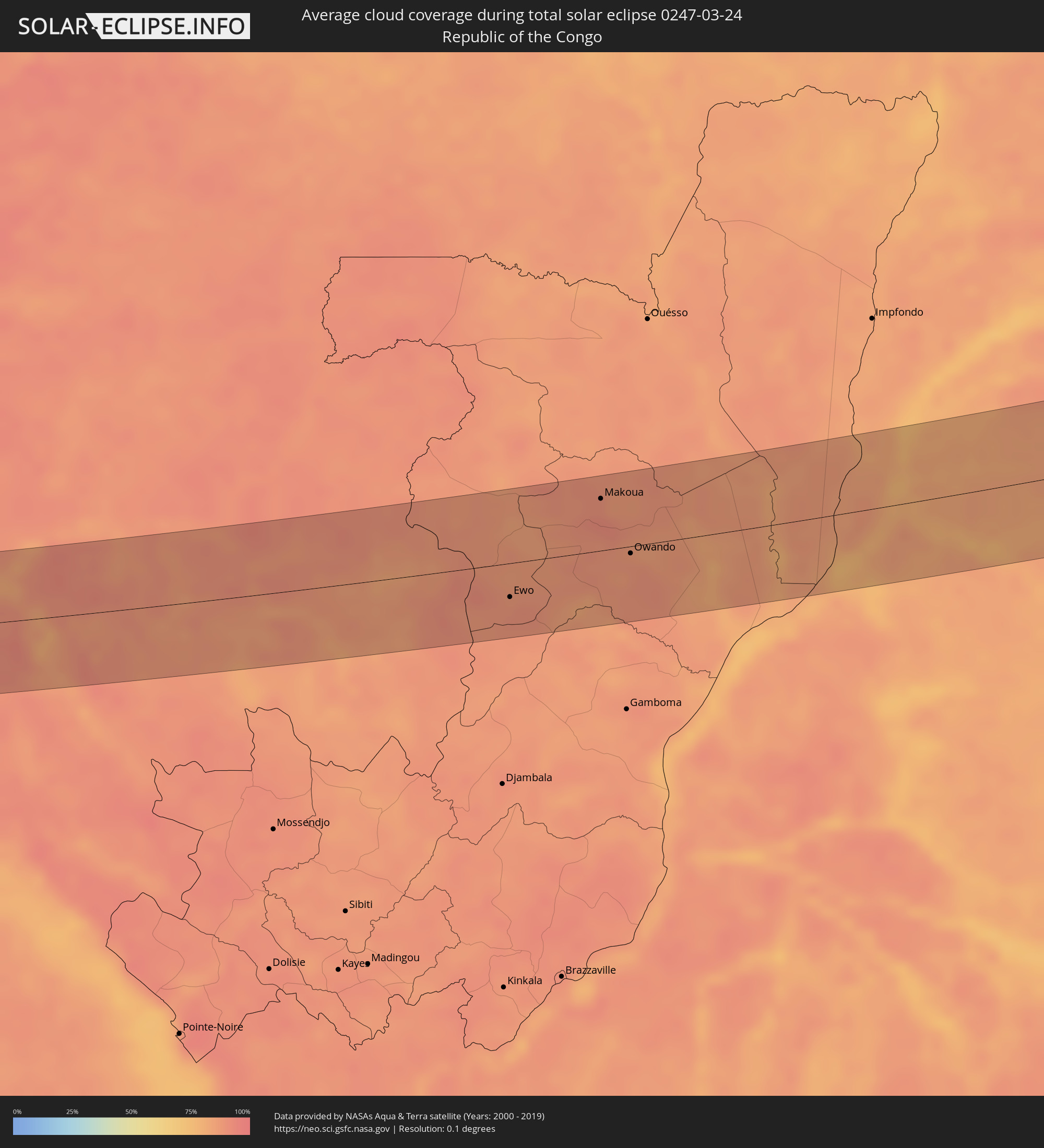 Republic of the Congo
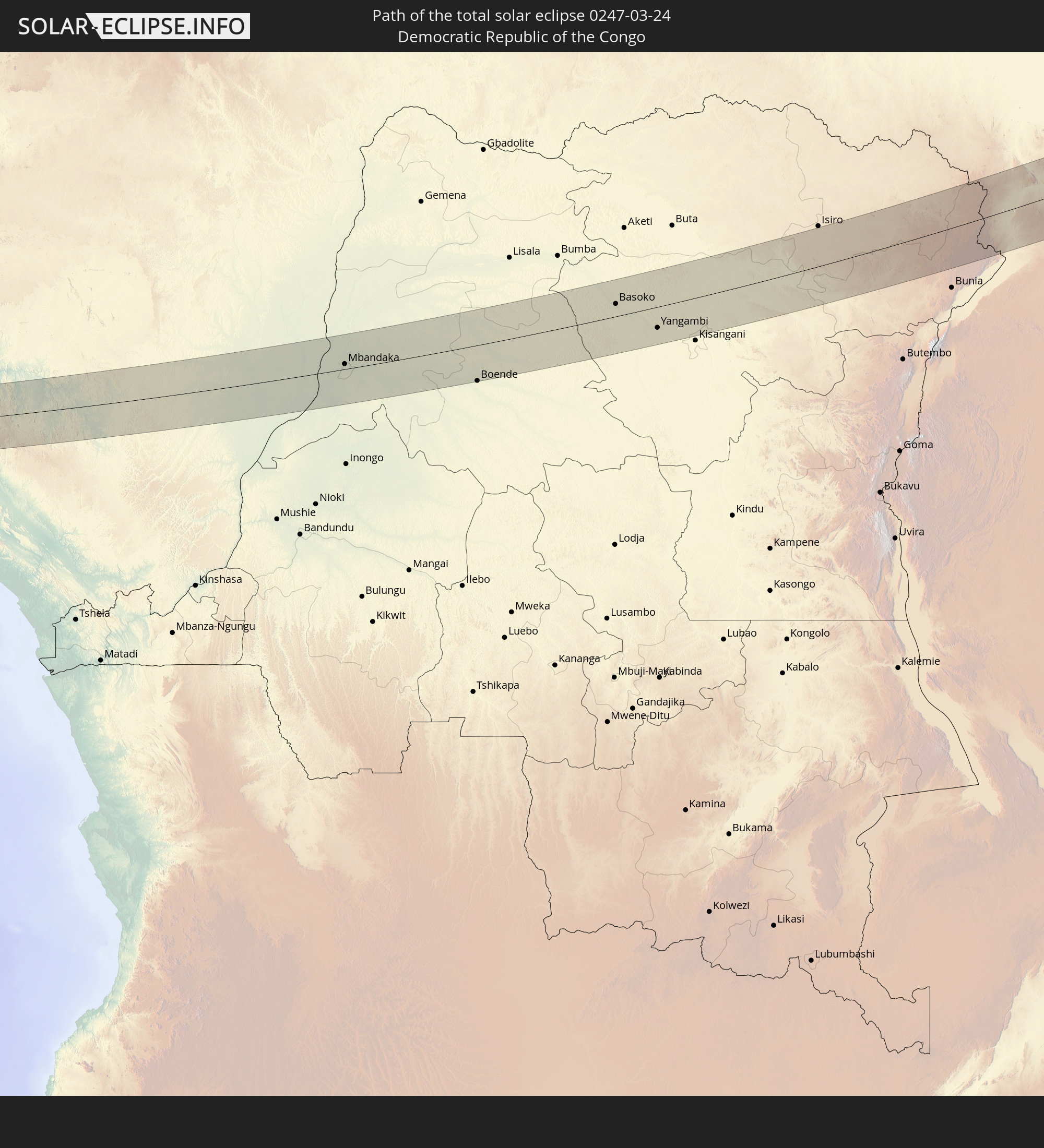
 Democratic Republic of the Congo
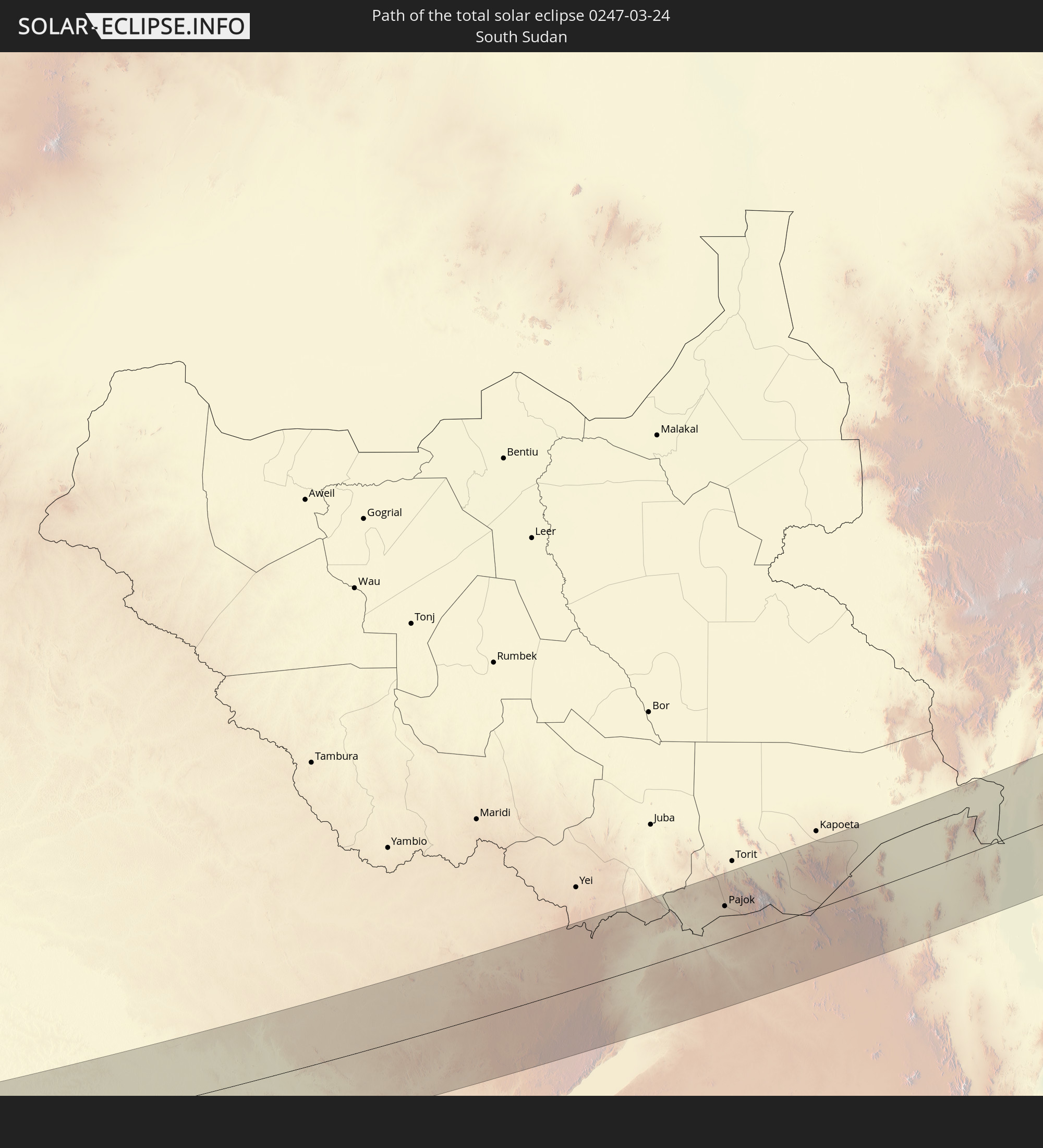
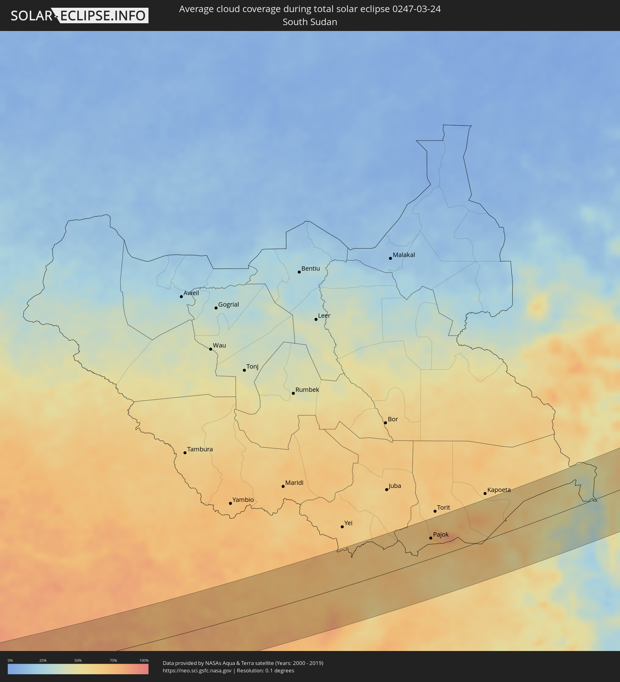 South Sudan
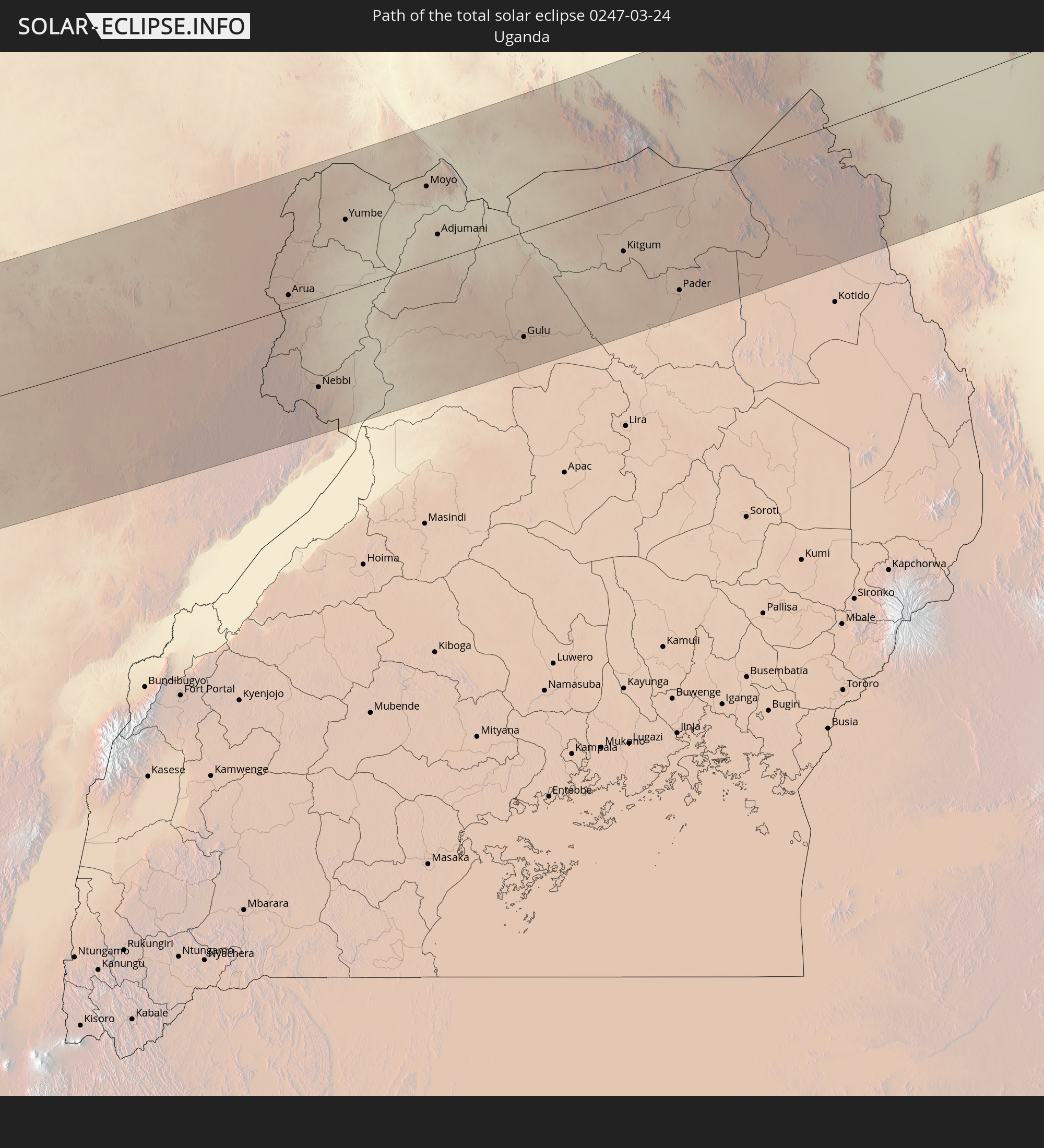
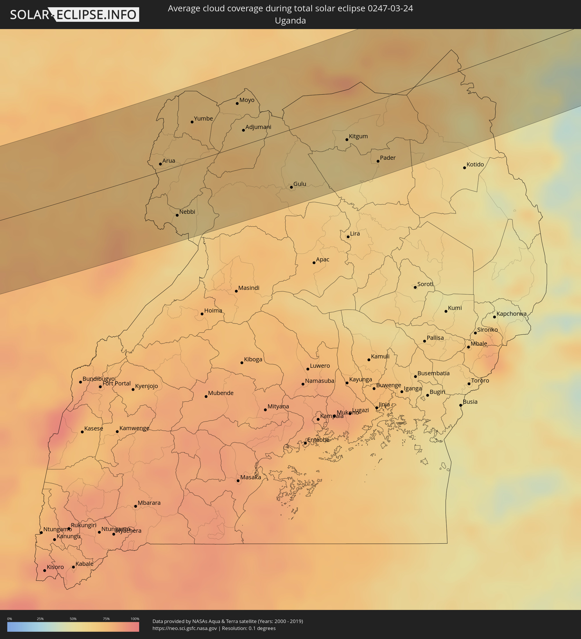 Uganda
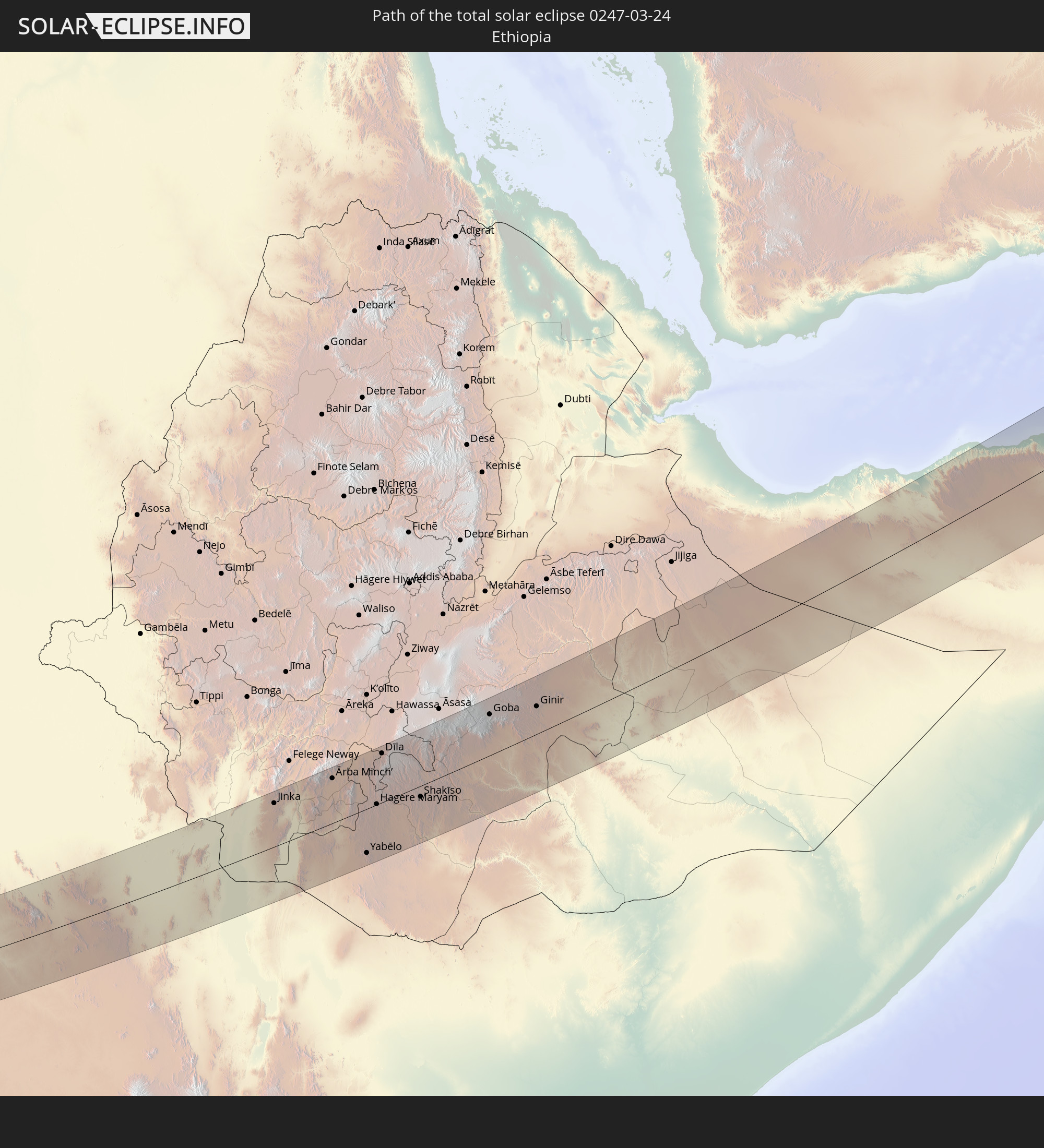
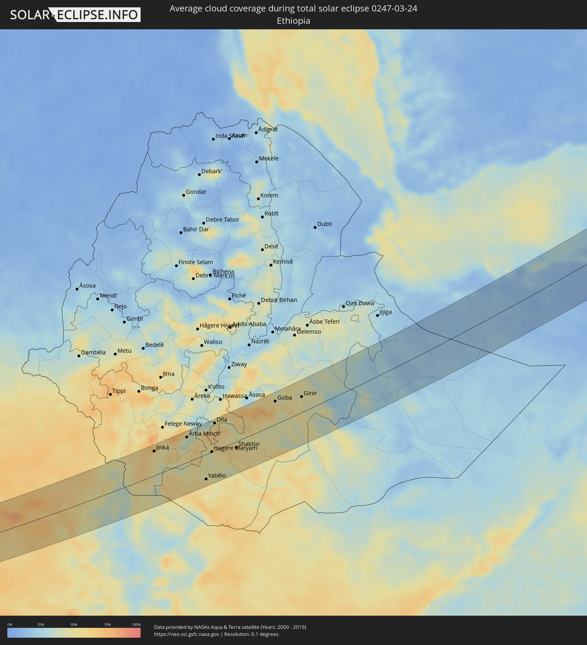 Ethiopia
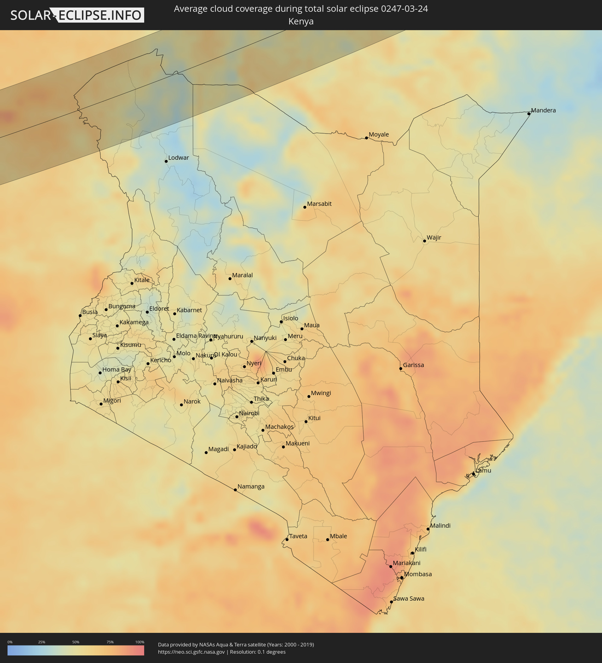 Kenya
Kenya
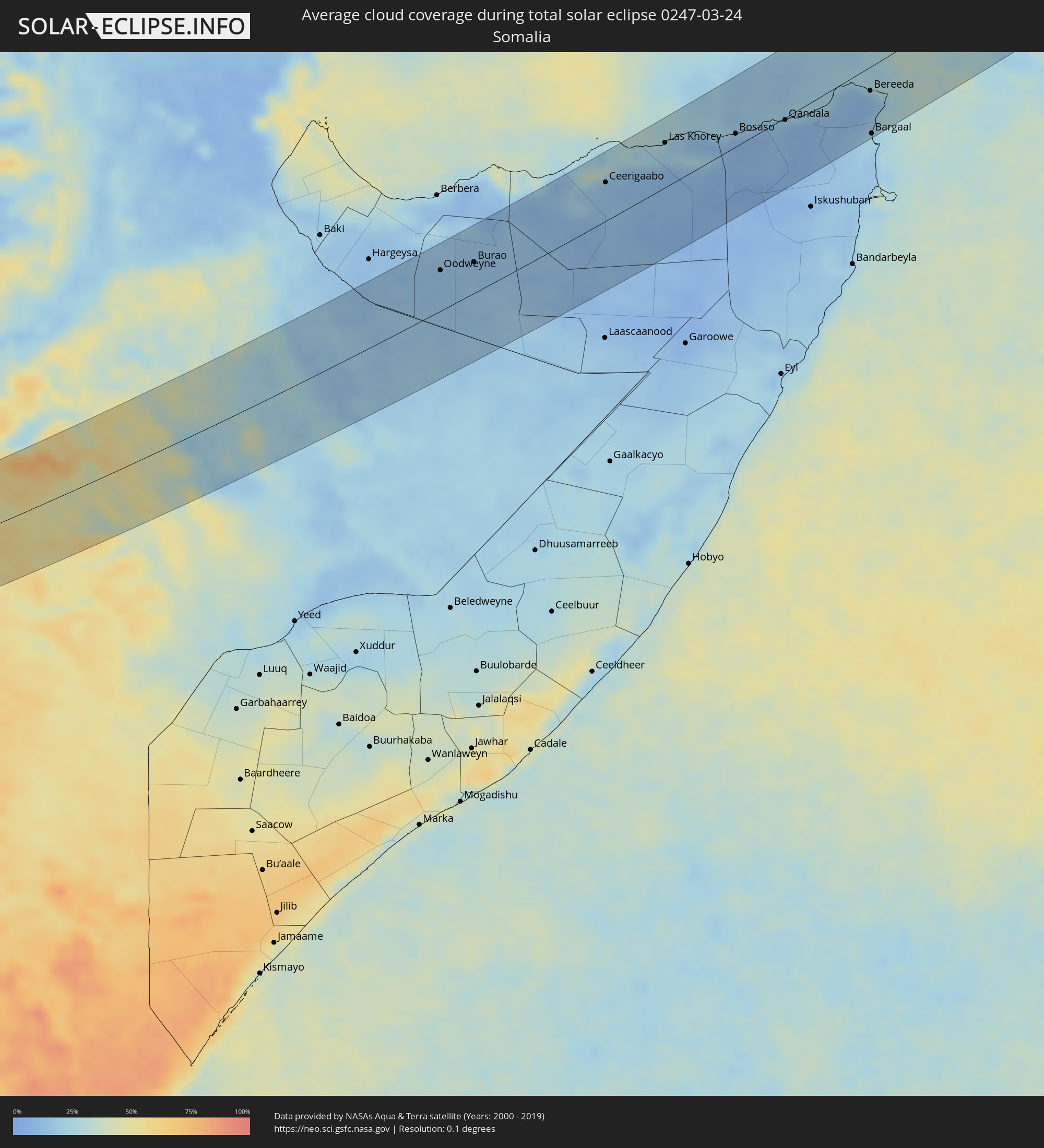 Somalia
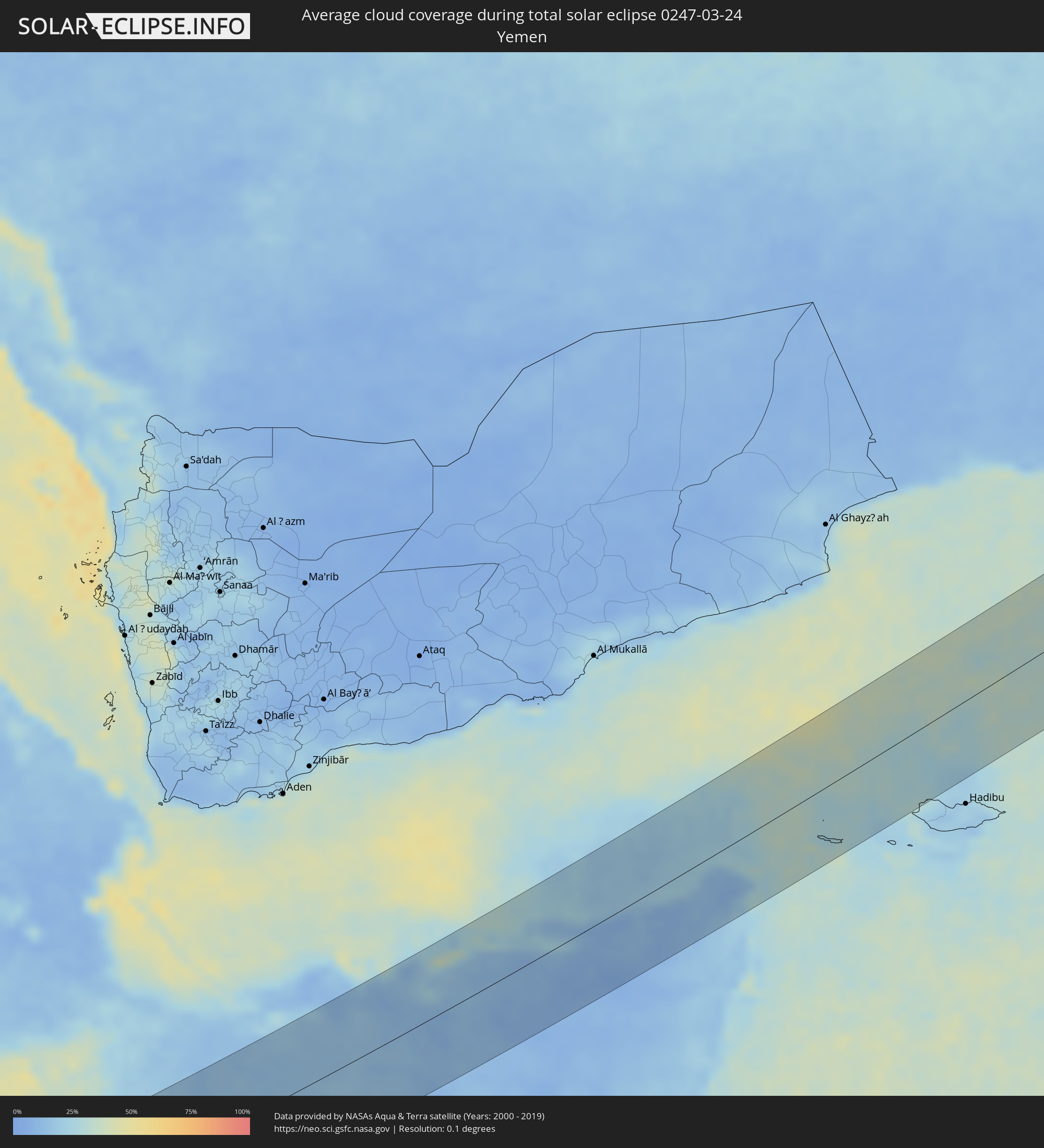 Yemen
Yemen
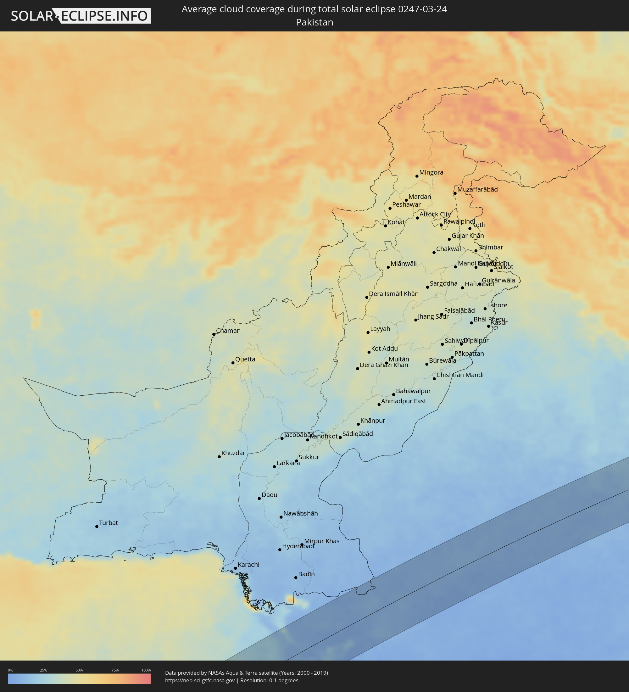 Pakistan
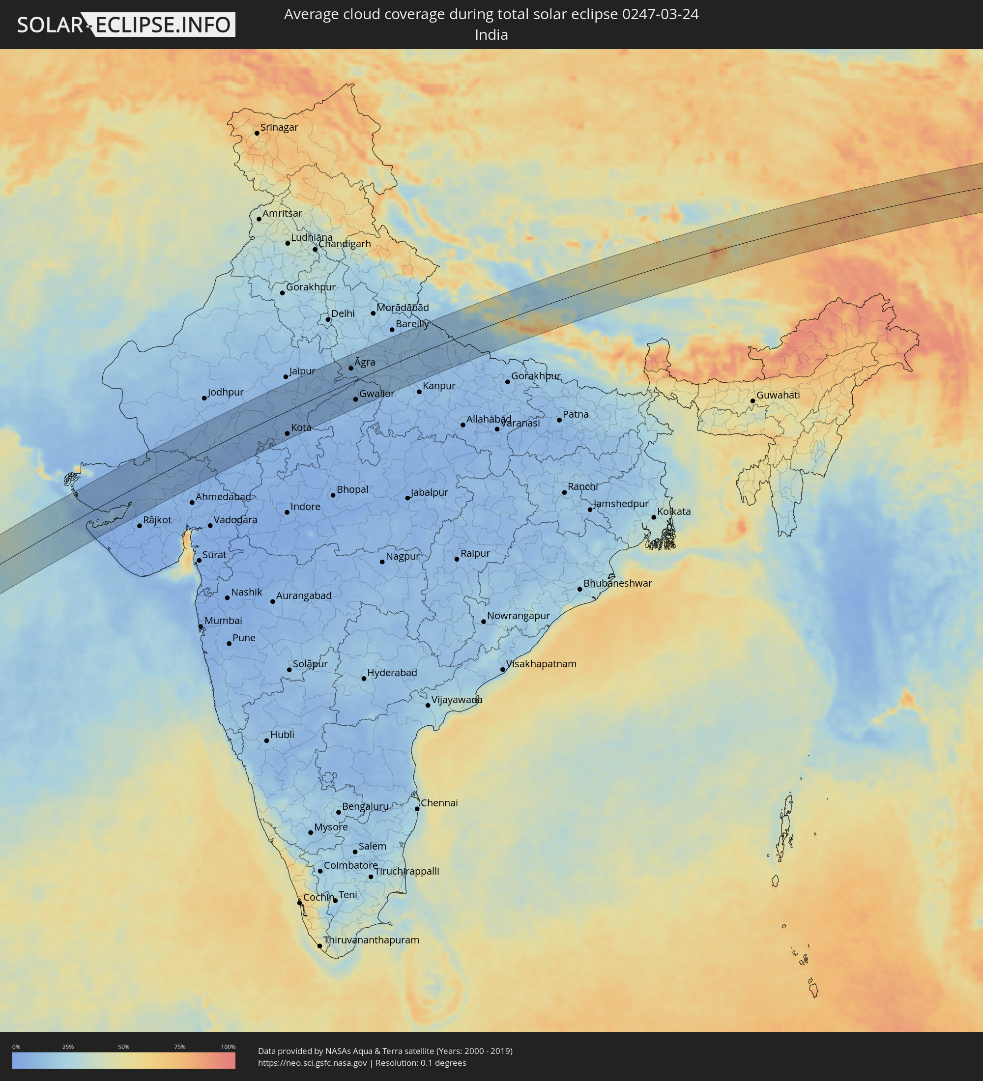 India
India
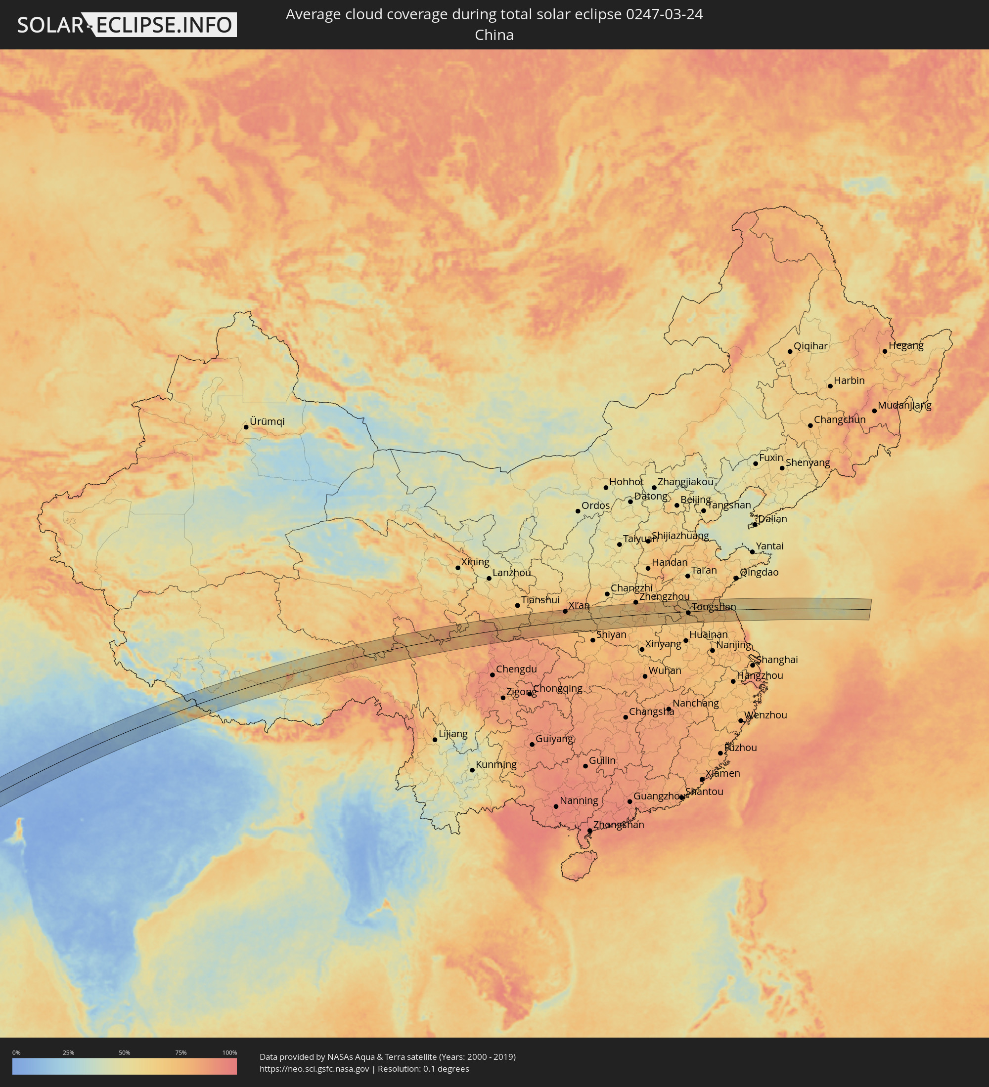 China
China
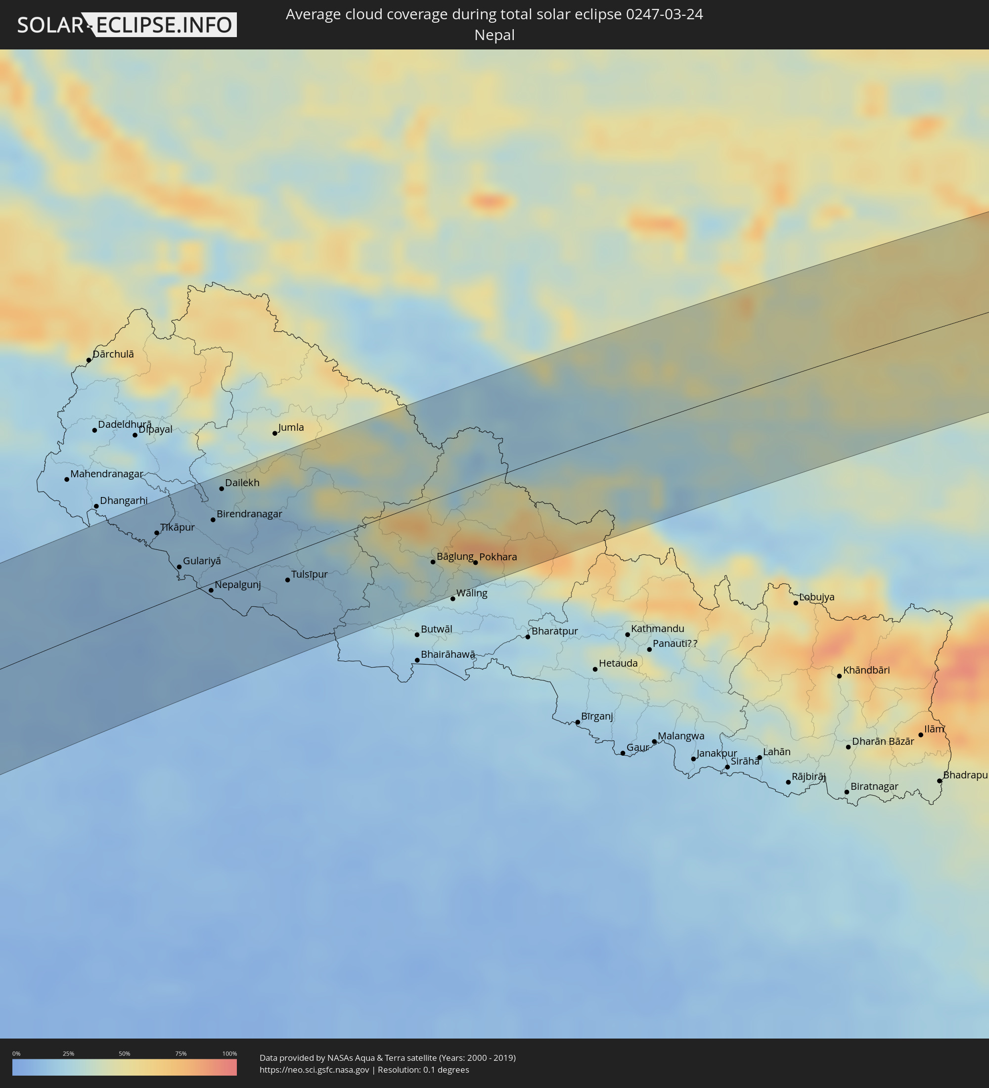 Nepal
Nepal
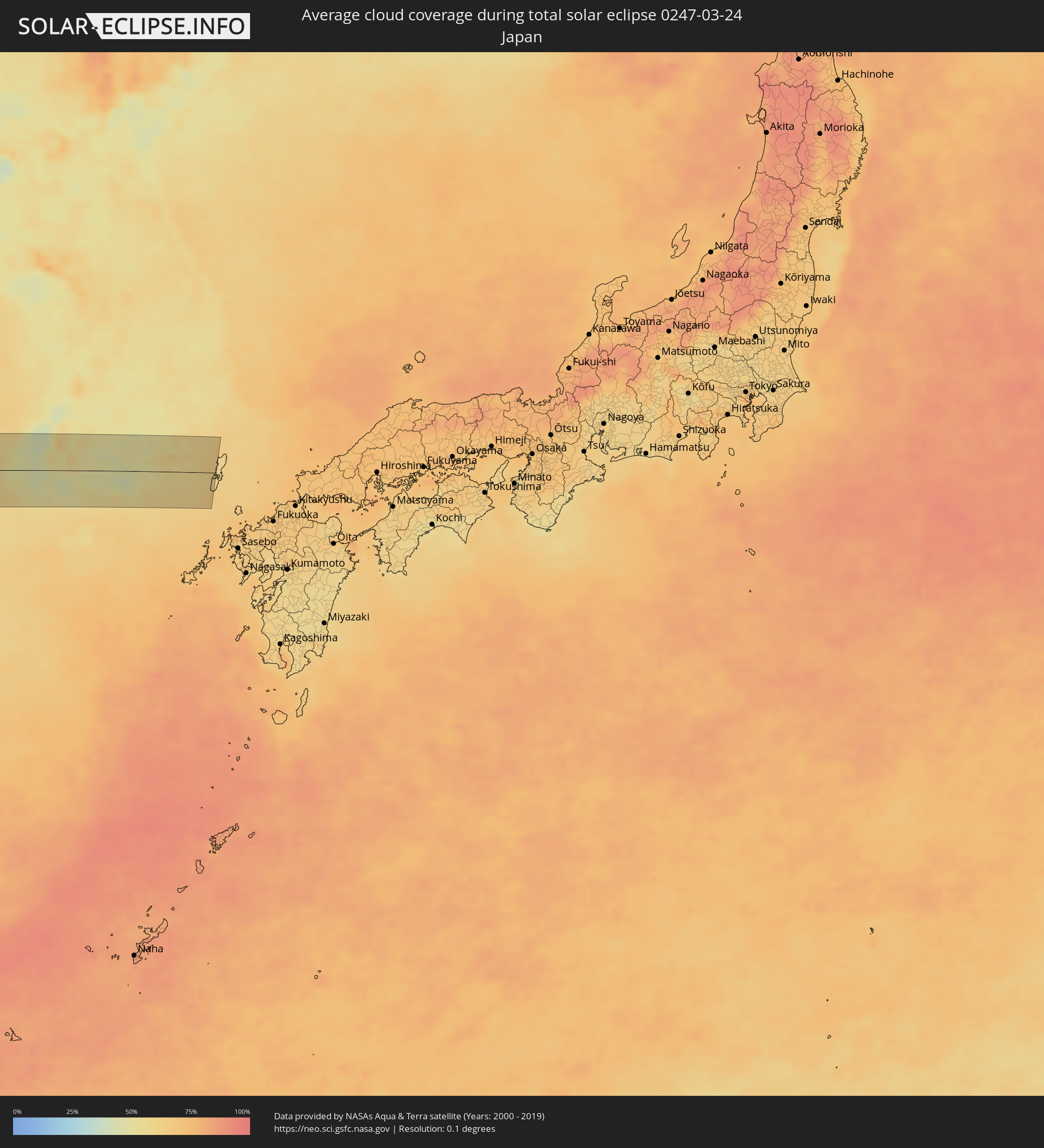 Japan
Japan
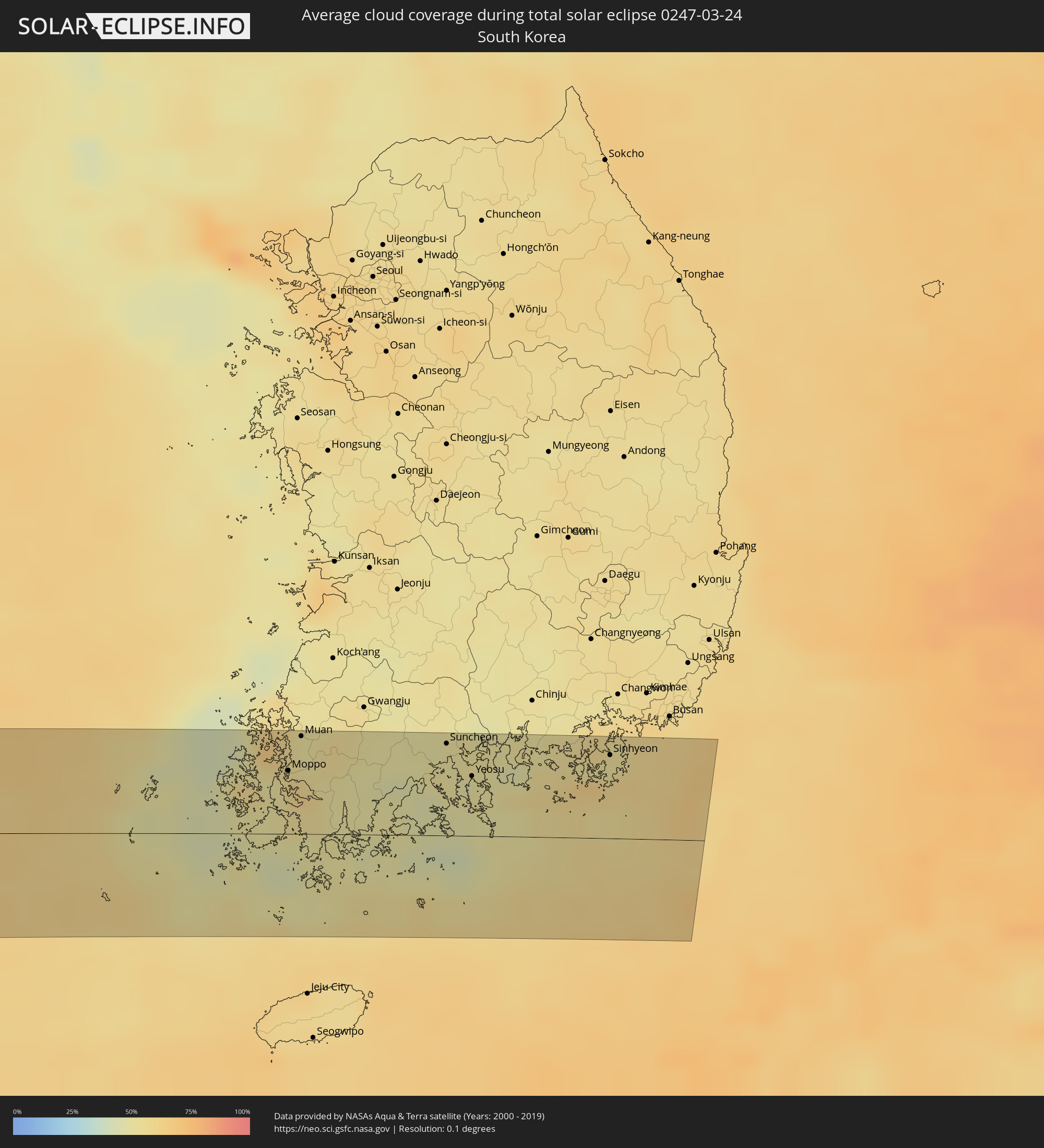 South Korea
Cities inside the path of the eclipse
The following table shows all locations with a population of more than 5,000 inside the eclipse path. Cities which have more than 100,000 inhabitants are marked bold. A click at the locations opens a detailed map.
| City | Type | Eclipse duration | Local time of max. eclipse | Distance to central line | Ø Cloud coverage |
|
San Antonio de Palé, Annobón Province
|
total | - | 06:27:00 UTC+00:13 | 7 km | 86% |
|
Port-Gentil, Ogooué-Maritime
|
total | - | 06:28:18 UTC+00:13 | 57 km | 89% |
|
Lambaréné, Moyen-Ogooué
|
total | - | 06:28:51 UTC+00:13 | 44 km | 84% |
|
Fougamou, Ngouni
|
total | - | 06:28:38 UTC+00:13 | 16 km | 82% |
|
Koulamoutou, Ogooué-Lolo
|
total | - | 06:29:31 UTC+00:13 | 29 km | 86% |
|
Lastoursville, Ogooué-Lolo
|
total | - | 06:29:50 UTC+00:13 | 2 km | 83% |
|
Mounana, Haut-Ogooué
|
total | - | 06:29:39 UTC+00:13 | 69 km | 86% |
|
Okondja, Haut-Ogooué
|
total | - | 06:30:26 UTC+00:13 | 7 km | 85% |
|
Ewo, Cuvette-Ouest
|
total | - | 06:30:54 UTC+00:13 | 33 km | 89% |
|
Makoua, Cuvette
|
total | - | 06:32:02 UTC+00:13 | 51 km | 92% |
|
Owando, Cuvette
|
total | - | 06:31:50 UTC+00:13 | 7 km | 88% |
|
Mbandaka, Équateur
|
total | - | 06:33:49 UTC+00:13 | 11 km | 83% |
|
Boende, Équateur
|
total | - | 06:35:35 UTC+00:13 | 77 km | 84% |
|
Basoko, Orientale
|
total | - | 08:36:09 UTC+02:10 | 27 km | 72% |
|
Yangambi, Orientale
|
total | - | 08:36:32 UTC+02:10 | 45 km | 72% |
|
Wamba, Orientale
|
total | - | 08:41:50 UTC+02:10 | 7 km | 79% |
|
Watsa, Orientale
|
total | - | 08:44:42 UTC+02:10 | 55 km | 72% |
|
Arua, Northern Region
|
total | - | 09:03:27 UTC+02:27 | 8 km | 67% |
|
Paidha, Northern Region
|
total | - | 09:02:52 UTC+02:27 | 58 km | 71% |
|
Nebbi, Northern Region
|
total | - | 09:03:05 UTC+02:27 | 55 km | 64% |
|
Yumbe, Northern Region
|
total | - | 09:04:25 UTC+02:27 | 44 km | 69% |
|
Moyo, Northern Region
|
total | - | 09:05:19 UTC+02:27 | 48 km | 66% |
|
Adjumani, Northern Region
|
total | - | 09:05:05 UTC+02:27 | 16 km | 64% |
|
Gulu, Northern Region
|
total | - | 09:05:06 UTC+02:27 | 65 km | 65% |
 Pajok, Eastern Equatoria
|
total | - | 08:45:51 UTC+02:06 | 43 km | 71% |
|
Kitgum, Northern Region
|
total | - | 09:06:32 UTC+02:27 | 33 km | 61% |
|
Pader, Northern Region
|
total | - | 09:06:45 UTC+02:27 | 69 km | 63% |
|
Bako, Southern Nations, Nationalities, and People's Region
|
total | - | 09:15:29 UTC+02:27 | 87 km | 70% |
|
Jinka, Southern Nations, Nationalities, and People's Region
|
total | - | 09:15:27 UTC+02:27 | 69 km | 56% |
|
Gīdolē, Southern Nations, Nationalities, and People's Region
|
total | - | 09:16:41 UTC+02:27 | 39 km | 47% |
|
Ārba Minch’, Southern Nations, Nationalities, and People's Region
|
total | - | 09:17:31 UTC+02:27 | 71 km | 37% |
|
Yabēlo, Oromiya
|
total | - | 09:16:54 UTC+02:27 | 70 km | 57% |
|
Hagere Maryam, Oromiya
|
total | - | 09:18:10 UTC+02:27 | 1 km | 44% |
|
Dīla, Southern Nations, Nationalities, and People's Region
|
total | - | 09:19:24 UTC+02:27 | 77 km | 52% |
|
Hāgere Selam, Southern Nations, Nationalities, and People's Region
|
total | - | 09:19:51 UTC+02:27 | 75 km | 54% |
|
Shakīso, Oromiya
|
total | - | 09:19:33 UTC+02:27 | 17 km | 60% |
|
Kibre Mengist, Oromiya
|
total | - | 09:19:51 UTC+02:27 | 6 km | 59% |
|
Goba, Oromiya
|
total | - | 09:23:17 UTC+02:27 | 64 km | 58% |
|
Ginir, Oromiya
|
total | - | 09:24:50 UTC+02:27 | 43 km | 49% |
|
Oodweyne, Togdheer
|
total | - | 09:37:04 UTC+02:27 | 55 km | 14% |
|
Burao, Togdheer
|
total | - | 09:38:15 UTC+02:27 | 42 km | 15% |
|
Ceerigaabo, Sanaag
|
total | - | 09:44:00 UTC+02:27 | 51 km | 14% |
|
Las Khorey, Sanaag
|
total | - | 09:46:44 UTC+02:27 | 59 km | 23% |
|
Bosaso, Bari
|
total | - | 09:49:11 UTC+02:27 | 17 km | 12% |
|
Qandala, Bari
|
total | - | 09:51:05 UTC+02:27 | 3 km | 14% |
|
Bereeda, Bari
|
total | - | 09:54:30 UTC+02:27 | 31 km | 17% |
|
Bargaal, Bari
|
total | - | 09:53:36 UTC+02:27 | 88 km | 23% |
|
Jāmnagar, Gujarat
|
total | - | 13:49:55 UTC+05:21 | 74 km | 6% |
|
Gāndhīdhām, Gujarat
|
total | - | 13:50:43 UTC+05:21 | 18 km | 5% |
|
Udaipur, Rajasthan
|
total | - | 13:59:54 UTC+05:21 | 39 km | 7% |
|
Bhīlwāra, Rajasthan
|
total | - | 14:02:31 UTC+05:21 | 3 km | 8% |
|
Kota, Rajasthan
|
total | - | 14:04:51 UTC+05:21 | 72 km | 8% |
|
Bharatpur, Rajasthan
|
total | - | 14:09:29 UTC+05:21 | 66 km | 14% |
|
Morena, Madhya Pradesh
|
total | - | 14:10:01 UTC+05:21 | 28 km | 10% |
|
Āgra, Uttar Pradesh
|
total | - | 14:10:28 UTC+05:21 | 41 km | 11% |
|
Gwalior, Madhya Pradesh
|
total | - | 14:10:12 UTC+05:21 | 62 km | 10% |
|
Fīrozābād, Uttar Pradesh
|
total | - | 14:11:10 UTC+05:21 | 23 km | 13% |
|
Bhind, Madhya Pradesh
|
total | - | 14:11:34 UTC+05:21 | 52 km | 11% |
|
Etāwah, Uttar Pradesh
|
total | - | 14:12:08 UTC+05:21 | 40 km | 14% |
|
Budaun, Uttar Pradesh
|
total | - | 14:13:00 UTC+05:21 | 85 km | 16% |
|
Farrukhābād, Uttar Pradesh
|
total | - | 14:13:30 UTC+05:21 | 2 km | 15% |
|
Shāhjānpur, Uttar Pradesh
|
total | - | 14:14:21 UTC+05:21 | 39 km | 15% |
|
Sītāpur, Uttar Pradesh
|
total | - | 14:15:36 UTC+05:21 | 22 km | 11% |
|
Tīkāpur, Far Western
|
total | - | 14:36:55 UTC+05:41 | 58 km | 17% |
|
Gulariyā, Mid Western
|
total | - | 14:37:09 UTC+05:41 | 23 km | 18% |
|
Bahraigh, Uttar Pradesh
|
total | - | 14:17:14 UTC+05:21 | 55 km | 13% |
|
Nepalgunj, Mid Western
|
total | - | 14:37:34 UTC+05:41 | 6 km | 16% |
|
Birendranagar, Mid Western
|
total | - | 14:37:49 UTC+05:41 | 51 km | 17% |
|
Dailekh, Mid Western
|
total | - | 14:38:03 UTC+05:41 | 73 km | 20% |
|
Tulsīpur, Mid Western
|
total | - | 14:38:47 UTC+05:41 | 22 km | 17% |
|
Besisahar
|
total | - | 14:39:01 UTC+05:41 | 15 km | 17% |
|
Bāglung, Western Region
|
total | - | 14:41:02 UTC+05:41 | 52 km | 30% |
|
Pokhara, Western Region
|
total | - | 14:41:40 UTC+05:41 | 65 km | 34% |
|
Hanzhong, Shaanxi
|
total | - | 17:26:35 UTC+08:00 | 52 km | 84% |
|
Xianyang, Shaanxi
|
total | - | 17:27:08 UTC+08:00 | 70 km | 82% |
|
Xi’an, Shaanxi
|
total | - | 17:27:18 UTC+08:00 | 59 km | 78% |
|
Pingdingshan, Henan
|
total | - | 17:29:48 UTC+08:00 | 37 km | 73% |
|
Yingchuan, Henan
|
total | - | 17:29:41 UTC+08:00 | 9 km | 70% |
|
Jiangguanchi, Henan
|
total | - | 17:29:51 UTC+08:00 | 3 km | 76% |
|
Luohe, Henan
|
total | - | 17:30:12 UTC+08:00 | 61 km | 80% |
|
Zhoukou, Henan
|
total | - | 17:30:25 UTC+08:00 | 58 km | 74% |
|
Shangqiu, Henan
|
total | - | 17:30:26 UTC+08:00 | 27 km | 71% |
|
Bozhou, Anhui
|
total | - | 17:30:45 UTC+08:00 | 37 km | 71% |
|
Huaibei, Anhui
|
total | - | 17:31:04 UTC+08:00 | 32 km | 74% |
|
Xiazhen, Shandong
|
total | - | 17:30:45 UTC+08:00 | 59 km | 68% |
|
Tongshan, Jiangsu
|
total | - | 17:31:05 UTC+08:00 | 10 km | 73% |
|
Zaozhuang, Shandong
|
total | - | 17:30:52 UTC+08:00 | 64 km | 70% |
|
Pizhou, Jiangsu
|
total | - | 17:31:16 UTC+08:00 | 1 km | 72% |
|
Xinpu, Jiangsu
|
total | - | 17:31:28 UTC+08:00 | 28 km | 69% |
|
Hede, Jiangsu
|
total | - | 17:32:09 UTC+08:00 | 67 km | 67% |
|
Sinan, Jeollanam-do
|
total | - | 18:00:22 UTC+08:27 | 44 km | 56% |
|
Moppo, Jeollanam-do
|
total | - | 18:00:24 UTC+08:27 | 40 km | 58% |
|
Muan, Jeollanam-do
|
total | - | 18:00:18 UTC+08:27 | 62 km | 50% |
|
Haenam, Jeollanam-do
|
total | - | 18:00:32 UTC+08:27 | 16 km | 52% |
|
Beolgyo, Jeollanam-do
|
total | - | 18:00:25 UTC+08:27 | 47 km | 49% |
|
Suncheon, Jeollanam-do
|
total | - | 18:00:22 UTC+08:27 | 59 km | 49% |
|
Kwangyang, Jeollanam-do
|
total | - | 18:00:21 UTC+08:27 | 62 km | 52% |
|
Yeosu, Jeollanam-do
|
total | - | 18:00:28 UTC+08:27 | 38 km | 49% |
|
Goseong, Gyeongsangnam-do
|
total | - | 18:00:22 UTC+08:27 | 63 km | 53% |
|
Kyosai, Gyeongsangnam-do
|
total | - | 18:00:27 UTC+08:27 | 49 km | 52% |
|
Sinhyeon, Gyeongsangnam-do
|
total | - | 18:00:25 UTC+08:27 | 53 km | 52% |