Annular solar eclipse of 12/10/0345
| Day of week: | Monday |
| Maximum duration of eclipse: | 09m13s |
| Maximum width of eclipse path: | 322 km |
| Saros cycle: | 86 |
| Coverage: | 91.9% |
| Magnitude: | 0.9191 |
| Gamma: | -0.3003 |
Wo kann man die Sonnenfinsternis vom 12/10/0345 sehen?
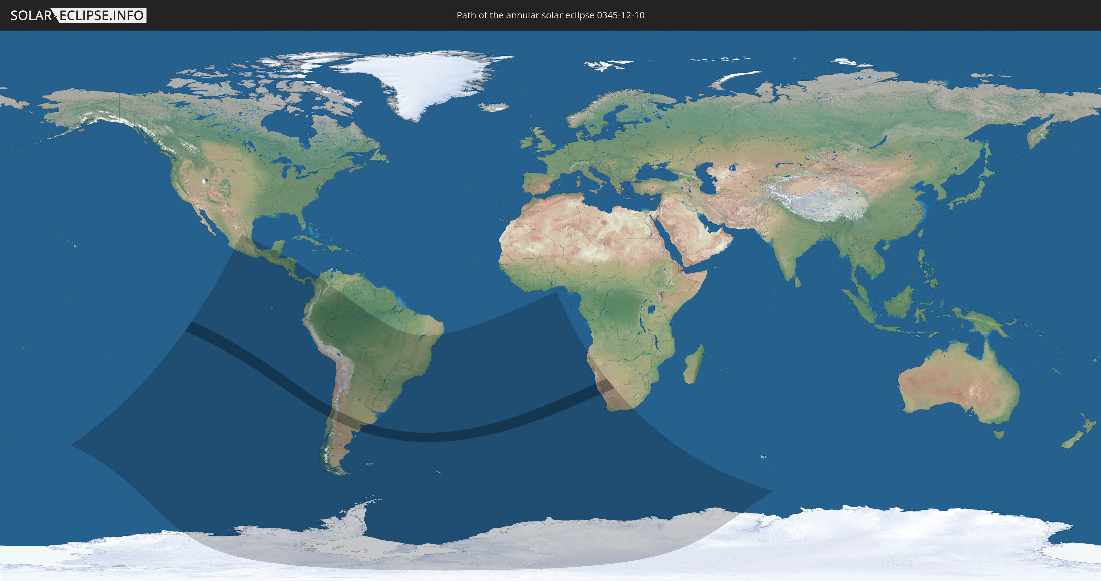
Die Sonnenfinsternis am 12/10/0345 kann man in 28 Ländern als partielle Sonnenfinsternis beobachten.
Der Finsternispfad verläuft durch 6 Länder. Nur in diesen Ländern ist sie als annular Sonnenfinsternis zu sehen.
In den folgenden Ländern ist die Sonnenfinsternis annular zu sehen
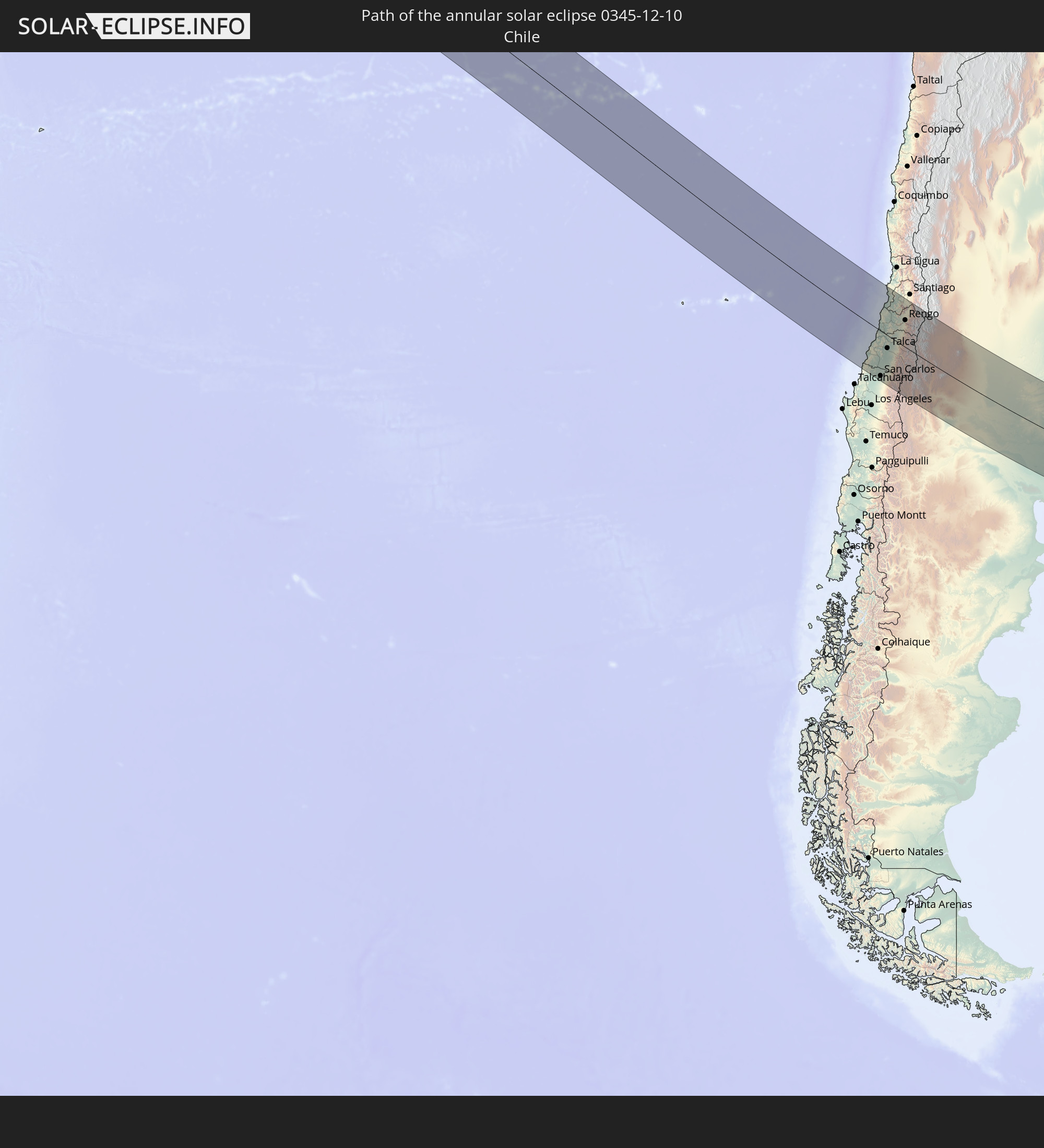 Chile
Chile
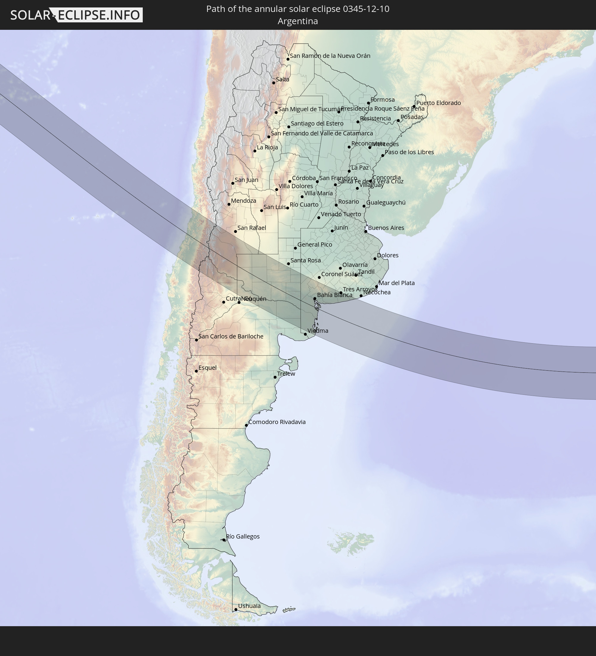 Argentina
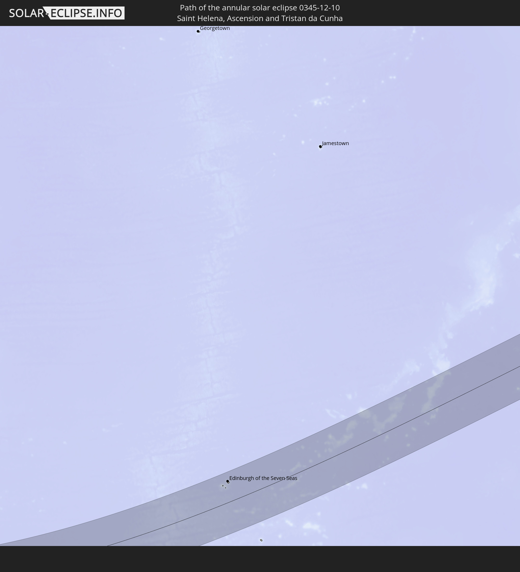 Saint Helena, Ascension and Tristan da Cunha
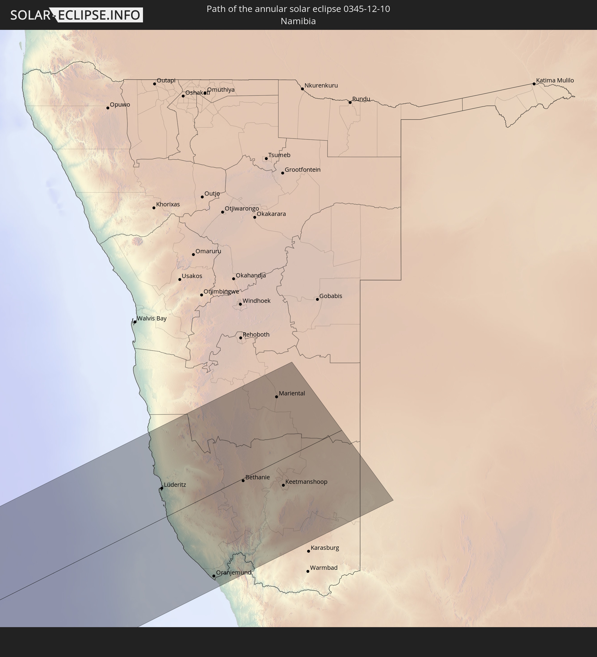 Namibia
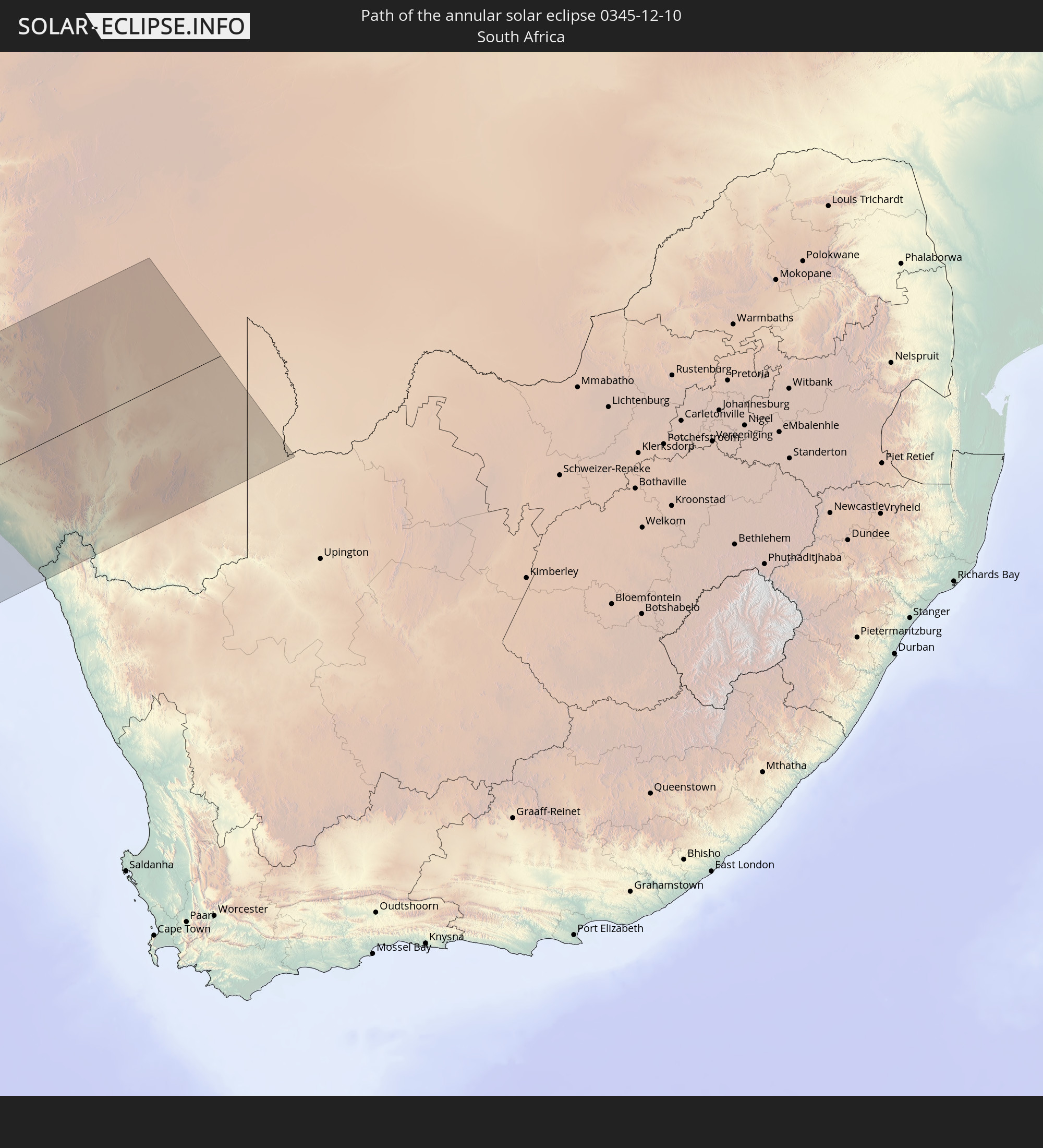 South Africa
 Botswana
In den folgenden Ländern ist die Sonnenfinsternis partiell zu sehen
 Antarctica
 Pitcairn Islands
 Mexico
 Chile
Chile
 Guatemala
 Ecuador
 El Salvador
 Honduras
 Belize
 Nicaragua
 Costa Rica
 Panama
 Colombia
 Peru
Peru
 Brazil
 Argentina
 Venezuela
 Bolivia
 Paraguay
 Falkland Islands
 Uruguay
 South Georgia and the South Sandwich Islands
 Saint Helena, Ascension and Tristan da Cunha
 Bouvet Island
 Angola
 Namibia
 South Africa
 Botswana
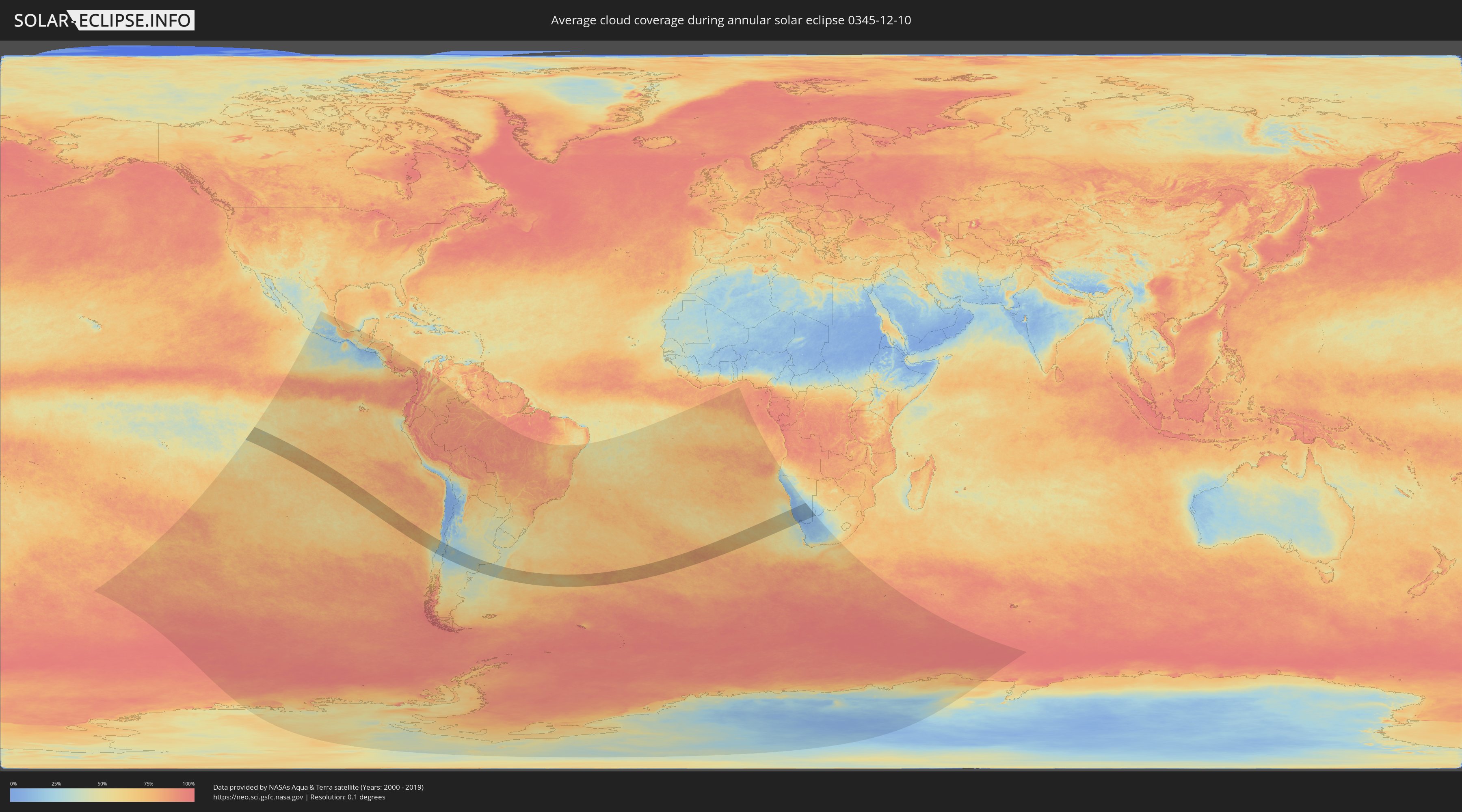
How will be the weather during the annular solar eclipse on 12/10/0345?
Where is the best place to see the annular solar eclipse of 12/10/0345?
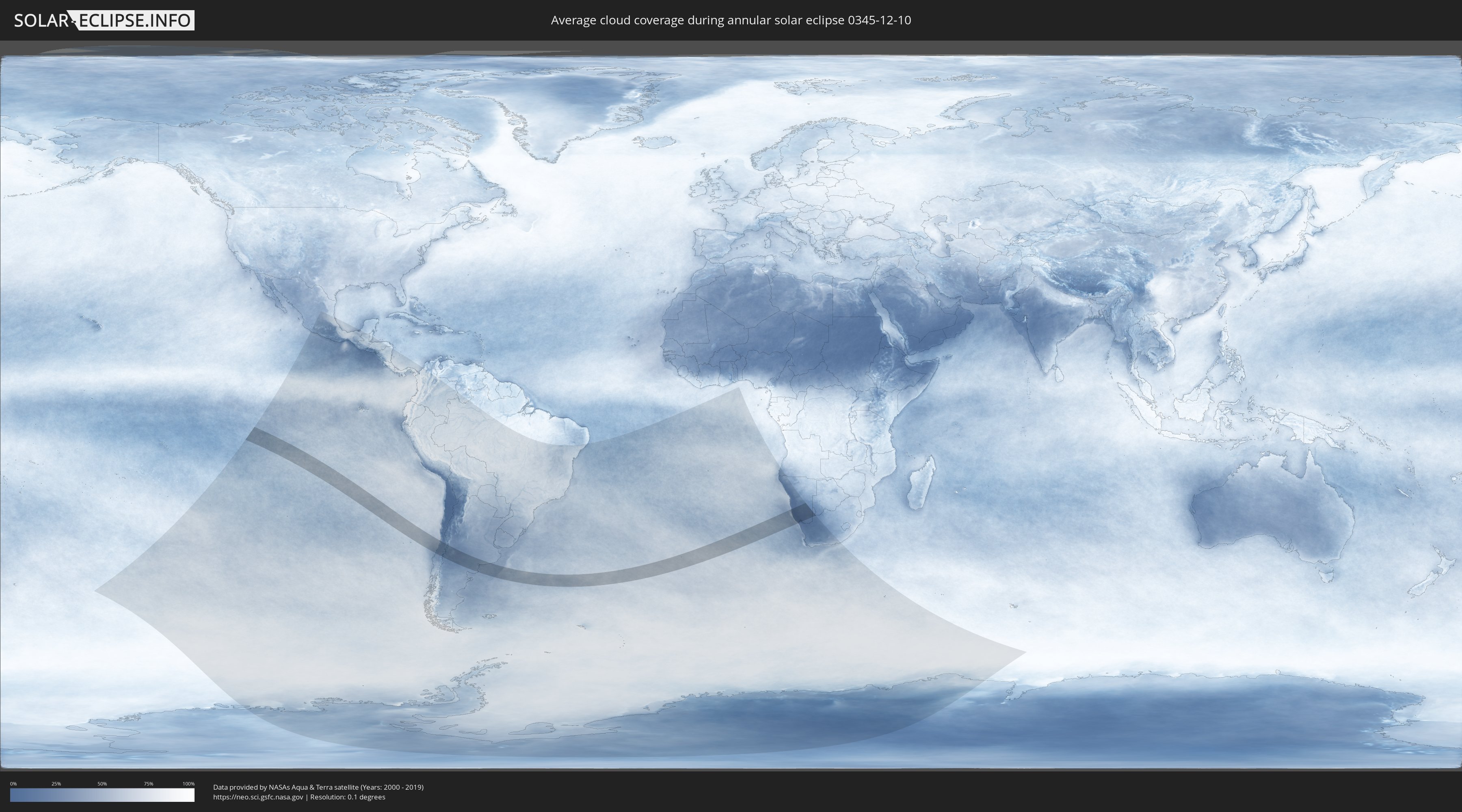
The following maps show the average cloud coverage for the day of the annular solar eclipse.
With the help of these maps, it is possible to find the place along the eclipse path, which has the best
chance of a cloudless sky.
Nevertheless, you should consider local circumstances and inform about the weather of your chosen
observation site.
The data is provided by NASAs satellites
AQUA and TERRA.
The cloud maps are averaged over a period of 19 years (2000 - 2019).
Detailed country maps
 Chile
Chile
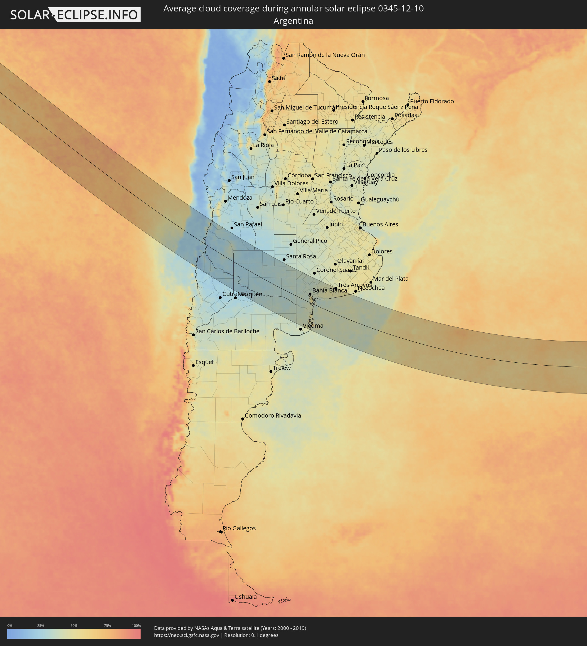 Argentina
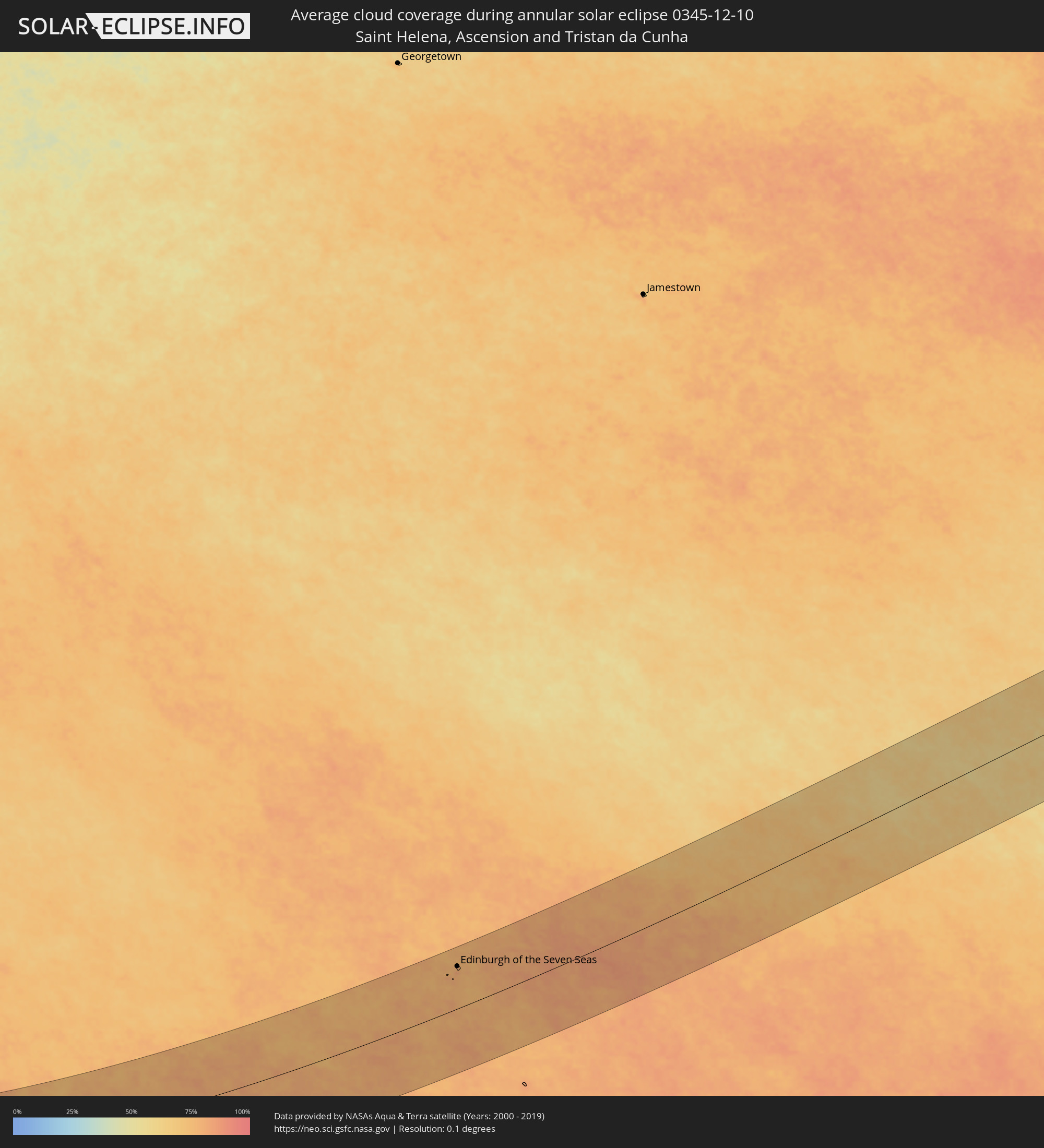 Saint Helena, Ascension and Tristan da Cunha
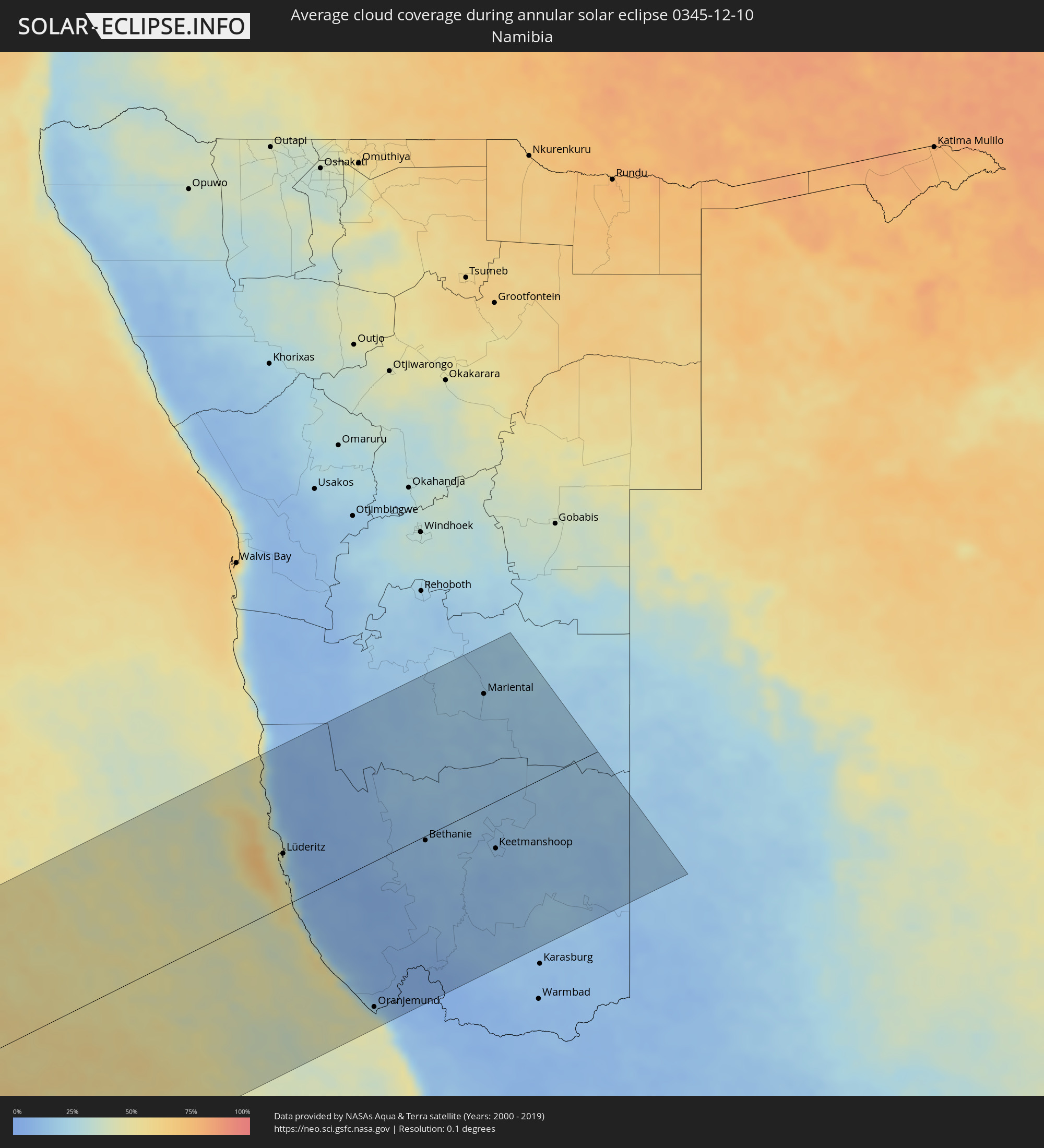 Namibia
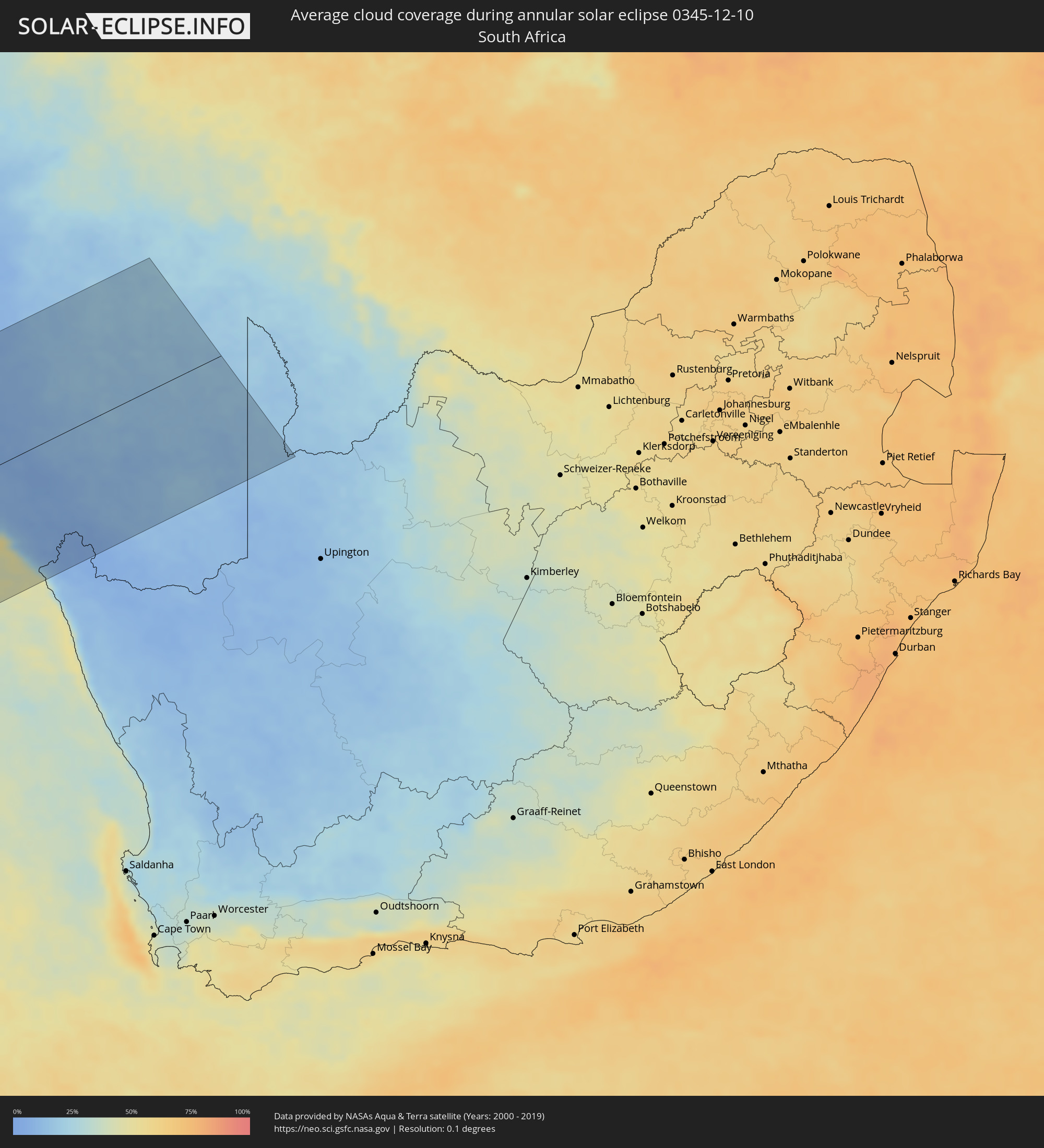 South Africa
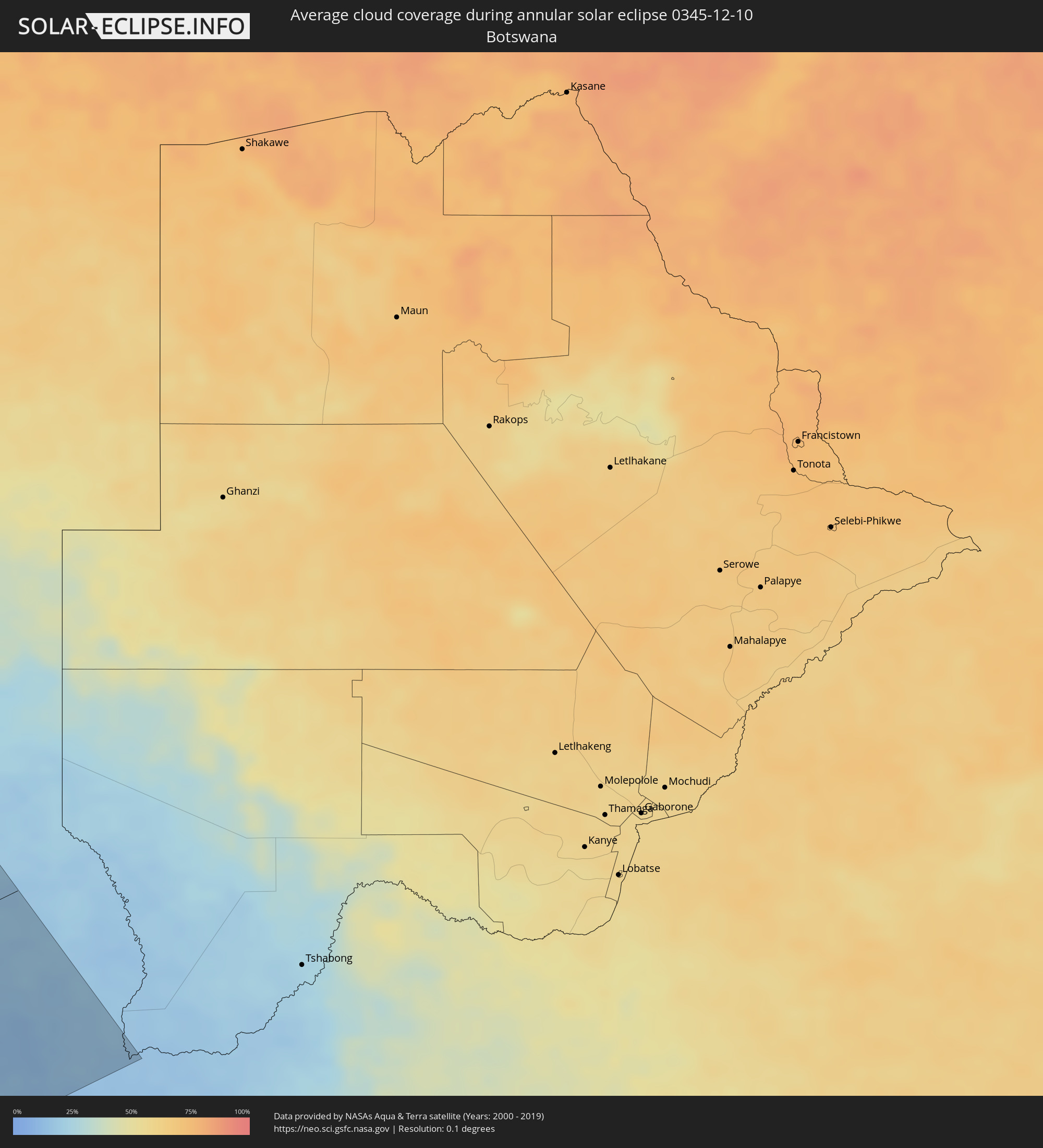 Botswana
Cities inside the path of the eclipse
The following table shows all locations with a population of more than 5,000 inside the eclipse path. Cities which have more than 100,000 inhabitants are marked bold. A click at the locations opens a detailed map.
| City | Type | Eclipse duration | Local time of max. eclipse | Distance to central line | Ø Cloud coverage |
|
Constitución, Maule
|
annular | - | 10:09:53 UTC-04:42 | 73 km | 26% |
|
Cauquenes, Maule
|
annular | - | 10:11:16 UTC-04:42 | 127 km | 24% |
|
San Carlos, Biobío
|
annular | - | 10:12:49 UTC-04:42 | 151 km | 30% |
|
Coihueco, Biobío
|
annular | - | 10:13:27 UTC-04:42 | 163 km | 25% |
|
Parral, Maule
|
annular | - | 10:12:32 UTC-04:42 | 118 km | 28% |
|
San Javier, Maule
|
annular | - | 10:11:40 UTC-04:42 | 62 km | 23% |
|
Longaví, Maule
|
annular | - | 10:12:28 UTC-04:42 | 94 km | 25% |
|
Talca, Maule
|
annular | - | 10:11:29 UTC-04:42 | 43 km | 22% |
|
Cartagena, Valparaíso
|
annular | - | 10:07:57 UTC-04:42 | 133 km | 45% |
|
San Antonio, Valparaíso
|
annular | - | 10:08:02 UTC-04:42 | 129 km | 45% |
|
Linares, Maule
|
annular | - | 10:12:25 UTC-04:42 | 79 km | 24% |
|
San Clemente, Maule
|
annular | - | 10:12:02 UTC-04:42 | 45 km | 22% |
|
Santa Cruz, O'Higgins
|
annular | - | 10:10:32 UTC-04:42 | 45 km | 21% |
|
Rauco, Maule
|
annular | - | 10:11:11 UTC-04:42 | 20 km | 21% |
|
Molina, Maule
|
annular | - | 10:11:37 UTC-04:42 | 5 km | 23% |
|
Curicó, Maule
|
annular | - | 10:11:27 UTC-04:42 | 19 km | 23% |
|
Melipilla, Santiago Metropolitan
|
annular | - | 10:08:59 UTC-04:42 | 141 km | 23% |
|
Teno, Maule
|
annular | - | 10:11:23 UTC-04:42 | 33 km | 23% |
|
San Vicente, O'Higgins
|
annular | - | 10:10:41 UTC-04:42 | 78 km | 21% |
|
San Vicente de Tagua Tagua, O'Higgins
|
annular | - | 10:10:43 UTC-04:42 | 78 km | 21% |
|
Chimbarongo, O'Higgins
|
annular | - | 10:11:19 UTC-04:42 | 54 km | 23% |
|
El Monte, Santiago Metropolitan
|
annular | - | 10:09:25 UTC-04:42 | 153 km | 19% |
|
Talagante, Santiago Metropolitan
|
annular | - | 10:09:30 UTC-04:42 | 158 km | 19% |
|
Peñaflor, Santiago Metropolitan
|
annular | - | 10:09:30 UTC-04:42 | 165 km | 20% |
|
Rengo, O'Higgins
|
annular | - | 10:11:05 UTC-04:42 | 92 km | 22% |
|
Rancagua, O'Higgins
|
annular | - | 10:10:51 UTC-04:42 | 120 km | 19% |
|
Buin, Santiago Metropolitan
|
annular | - | 10:10:01 UTC-04:42 | 160 km | 17% |
|
Paine, Santiago Metropolitan
|
annular | - | 10:10:10 UTC-04:42 | 154 km | 18% |
|
Graneros, O'Higgins
|
annular | - | 10:10:42 UTC-04:42 | 130 km | 21% |
|
Machalí, O'Higgins
|
annular | - | 10:11:04 UTC-04:42 | 123 km | 20% |
|
Chos Malal, Neuquén Province
|
annular | - | 10:43:48 UTC-04:16 | 158 km | 25% |
|
Catriel, Río Negro Province
|
annular | - | 10:49:42 UTC-04:16 | 92 km | 28% |
|
Veinticinco de Mayo, La Pampa Province
|
annular | - | 10:49:41 UTC-04:16 | 78 km | 28% |
|
Fray Luis Beltrán, Río Negro Province
|
annular | - | 10:56:24 UTC-04:16 | 145 km | 33% |
|
Lamarque, Río Negro Province
|
annular | - | 10:56:42 UTC-04:16 | 153 km | 34% |
|
Choele Choel, Río Negro Province
|
annular | - | 10:56:29 UTC-04:16 | 136 km | 35% |
|
General Acha, La Pampa Province
|
annular | - | 10:55:49 UTC-04:16 | 94 km | 32% |
|
Guatraché, La Pampa Province
|
annular | - | 10:58:45 UTC-04:16 | 108 km | 33% |
|
Bahía Blanca, Buenos Aires
|
annular | - | 11:03:17 UTC-04:16 | 51 km | 41% |
|
Punta Alta, Buenos Aires
|
annular | - | 11:03:59 UTC-04:16 | 42 km | 41% |
|
Coronel Dorrego, Buenos Aires
|
annular | - | 11:05:36 UTC-04:16 | 87 km | 44% |
|
Tres Arroyos, Buenos Aires
|
annular | - | 11:07:34 UTC-04:16 | 157 km | 44% |
|
Edinburgh of the Seven Seas, Tristan da Cunha
|
annular | - | 16:50:33 UTC-00:16 | 123 km | 82% |
|
Lüderitz, Karas
|
annular | - | 18:56:25 UTC+01:30 | 66 km | 18% |
|
Oranjemund, Karas
|
annular | - | 18:54:22 UTC+01:30 | 180 km | 41% |
|
Bethanie, Karas
|
annular | - | 18:56:02 UTC+01:30 | 6 km | 12% |
|
Mariental, Hardap
|
annular | - | 18:57:20 UTC+01:30 | 143 km | 19% |
|
Keetmanshoop, Karas
|
annular | - | 18:55:39 UTC+01:30 | 59 km | 12% |