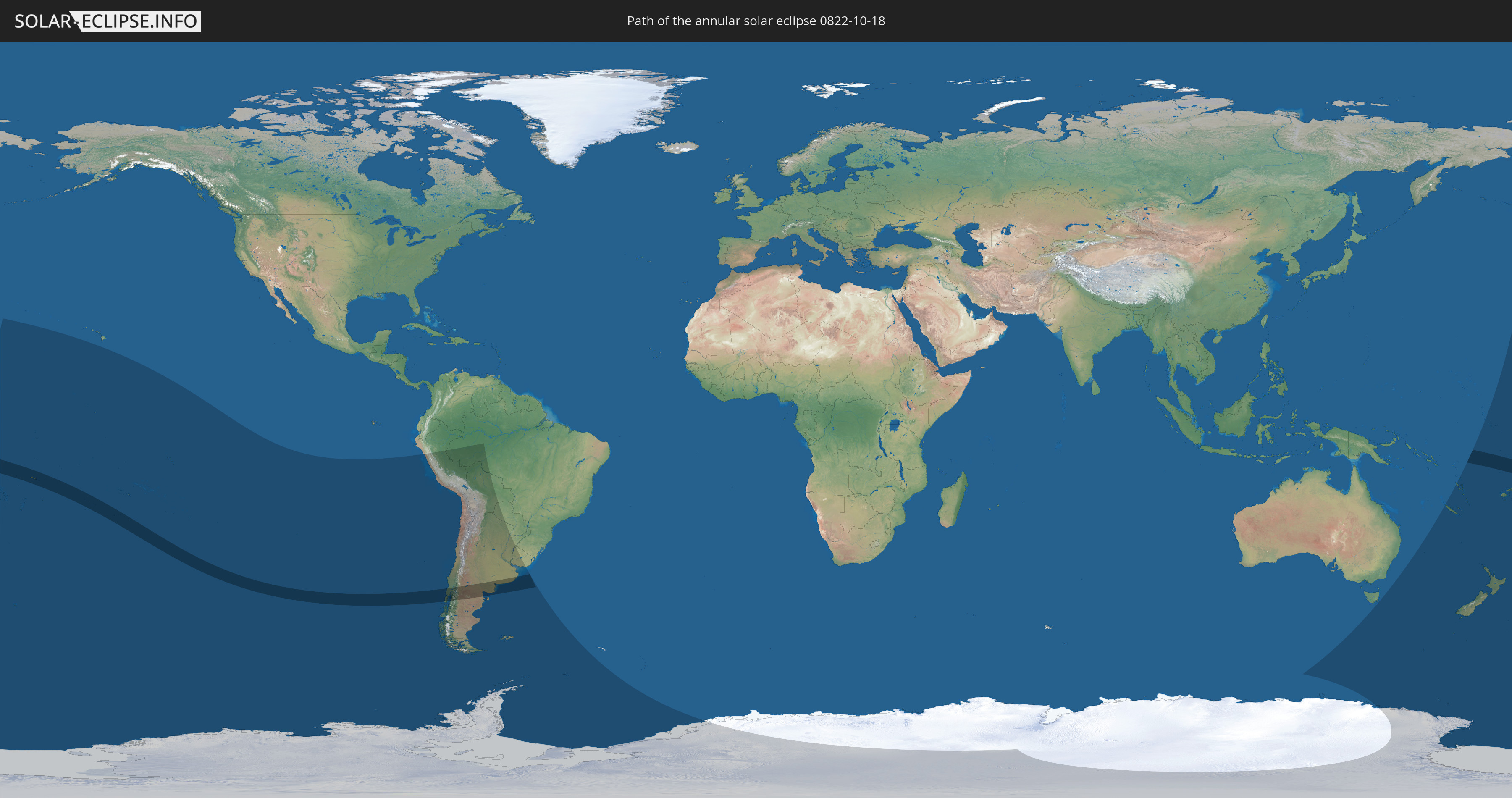
Annular solar eclipse of 10/18/0822
| Day of week: | Tuesday |
| Maximum duration of eclipse: | 07m45s |
| Maximum width of eclipse path: | 278 km |
| Saros cycle: | 95 |
| Coverage: | 93.2% |
| Magnitude: | 0.9318 |
| Gamma: | -0.4031 |
Wo kann man die Sonnenfinsternis vom 10/18/0822 sehen?
Die Sonnenfinsternis am 10/18/0822 kann man in 29 Ländern als partielle Sonnenfinsternis beobachten.
Der Finsternispfad verläuft durch 8 Länder. Nur in diesen Ländern ist sie als annular Sonnenfinsternis zu sehen.
In den folgenden Ländern ist die Sonnenfinsternis annular zu sehen
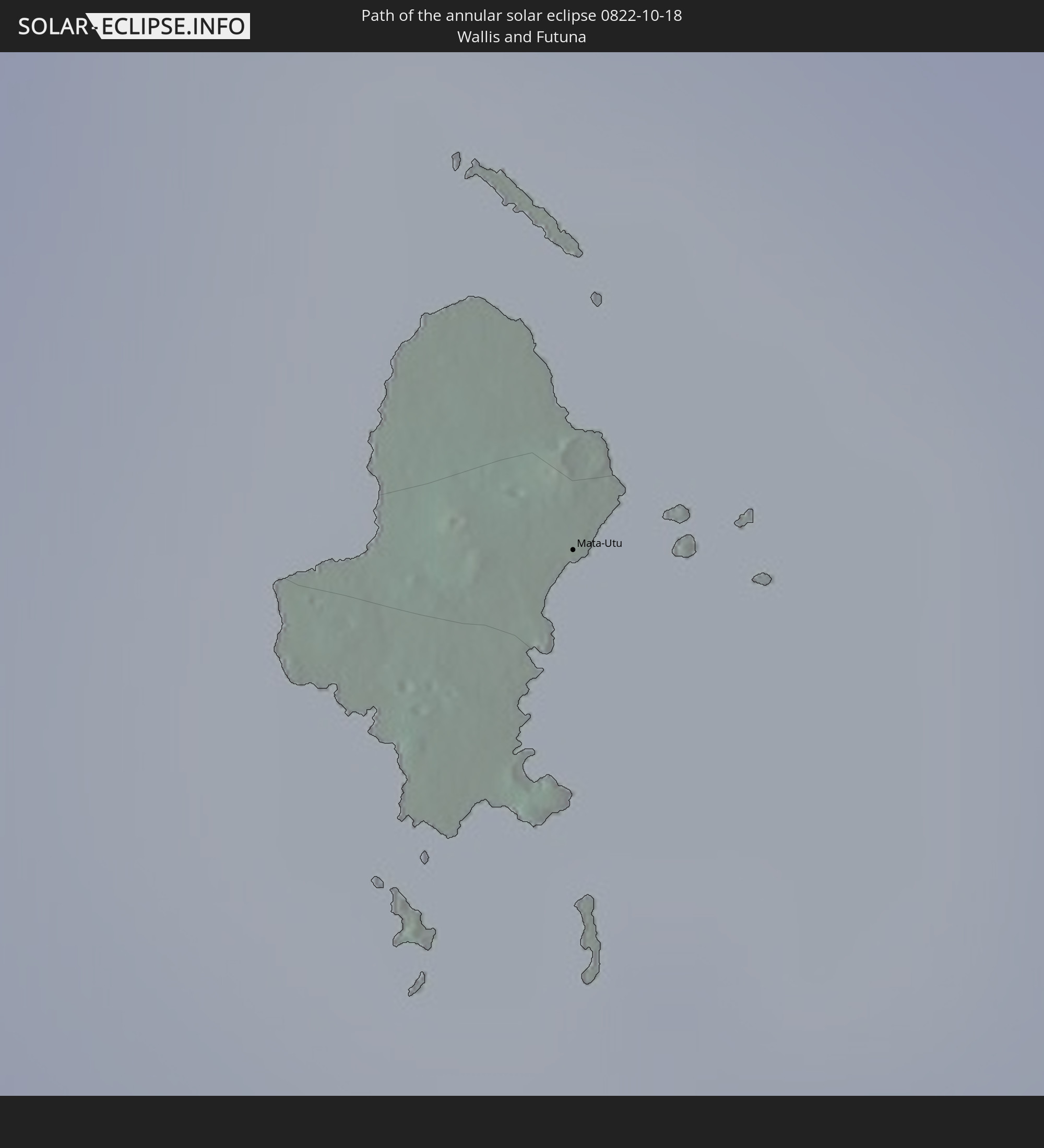 Wallis and Futuna
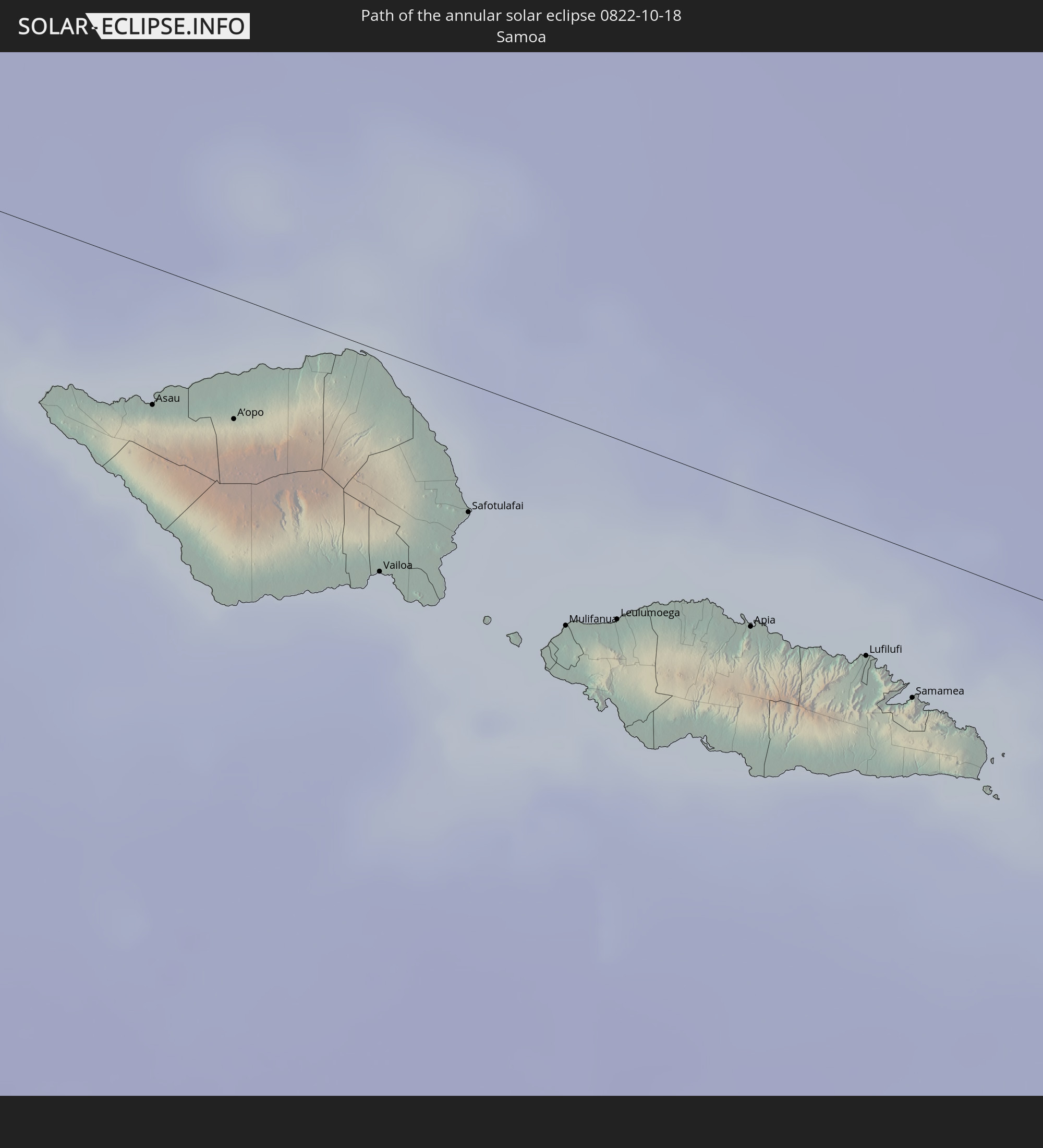 Samoa
Samoa
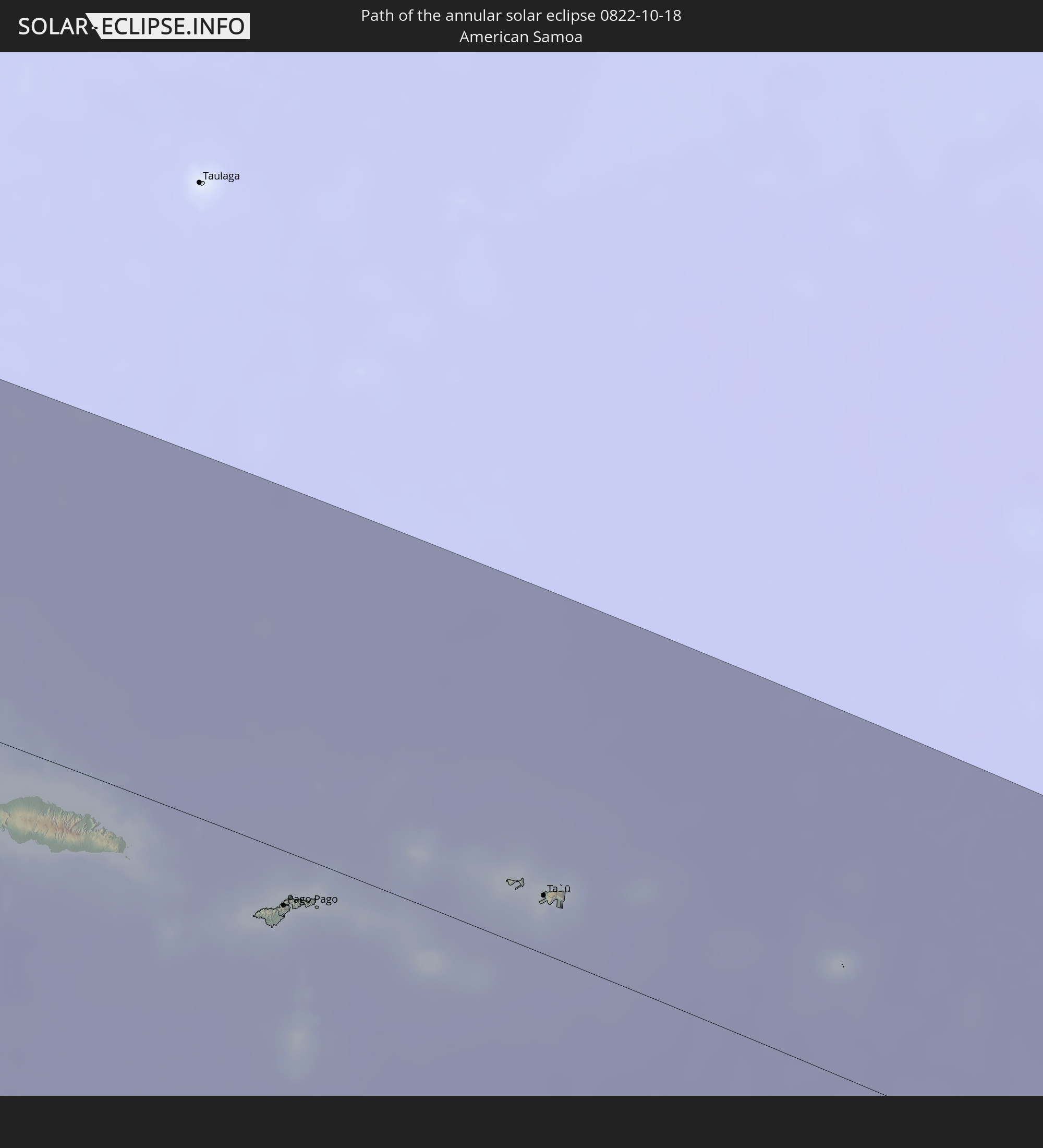 American Samoa
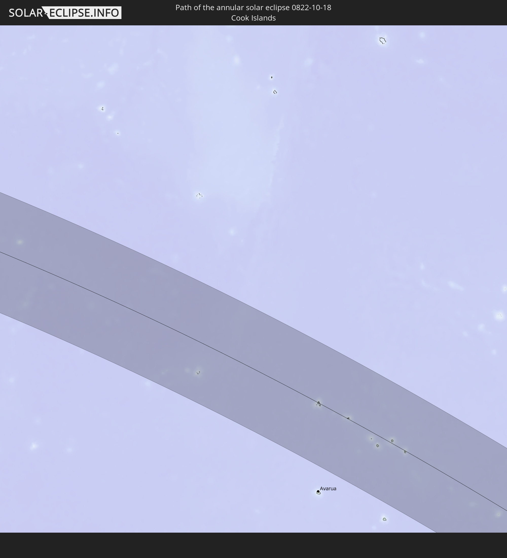 Cook Islands
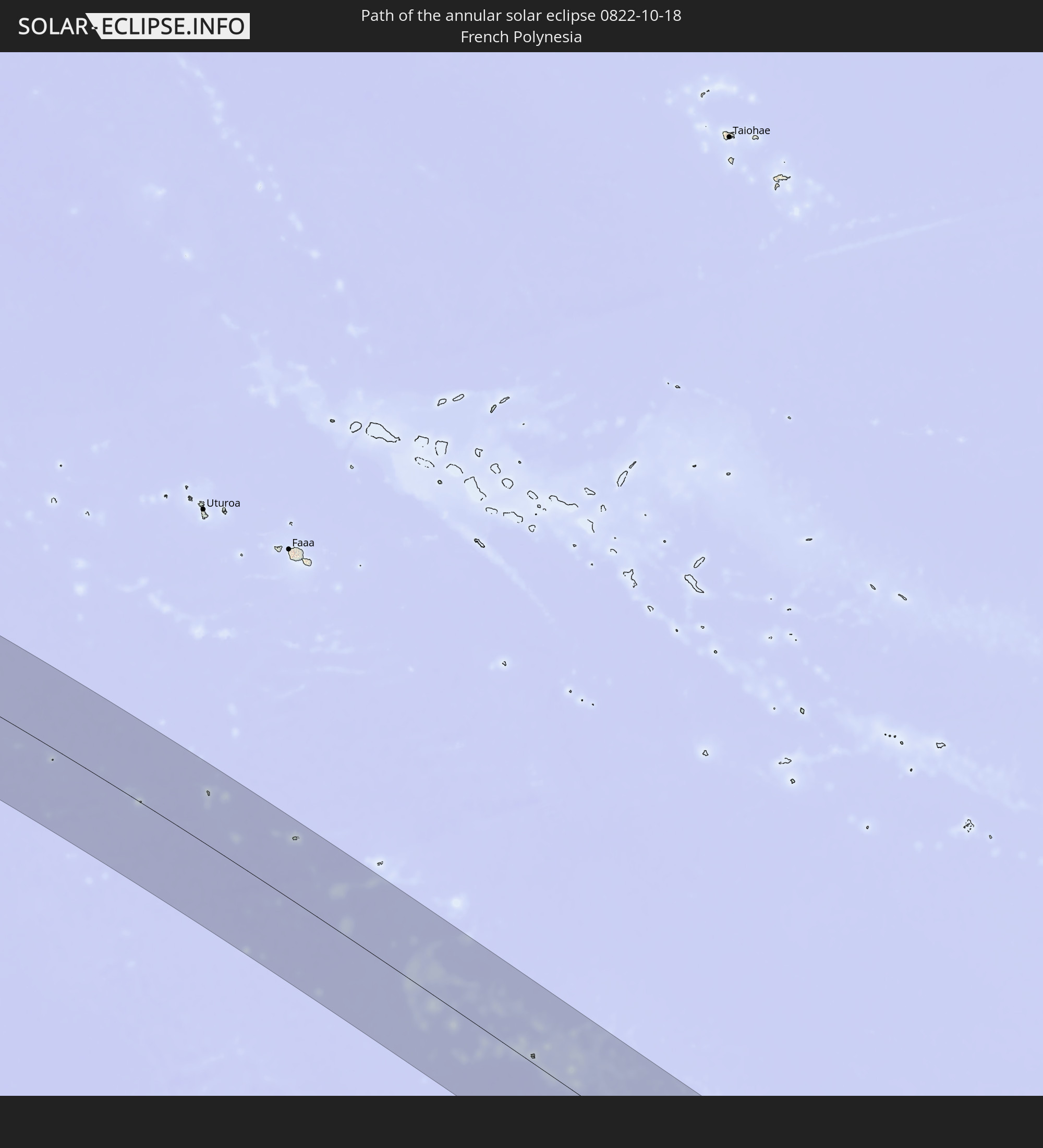 French Polynesia
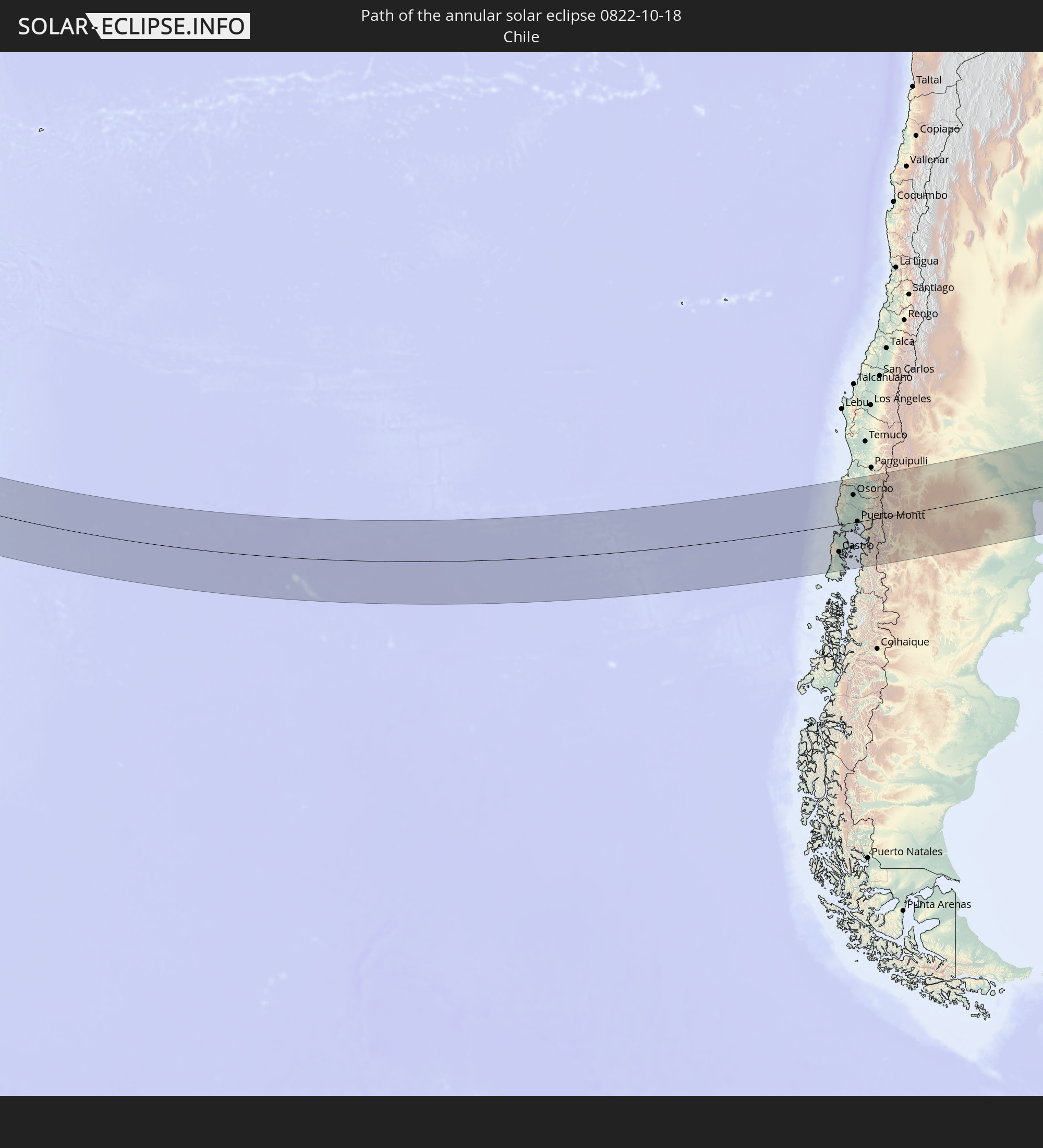 Chile
Chile
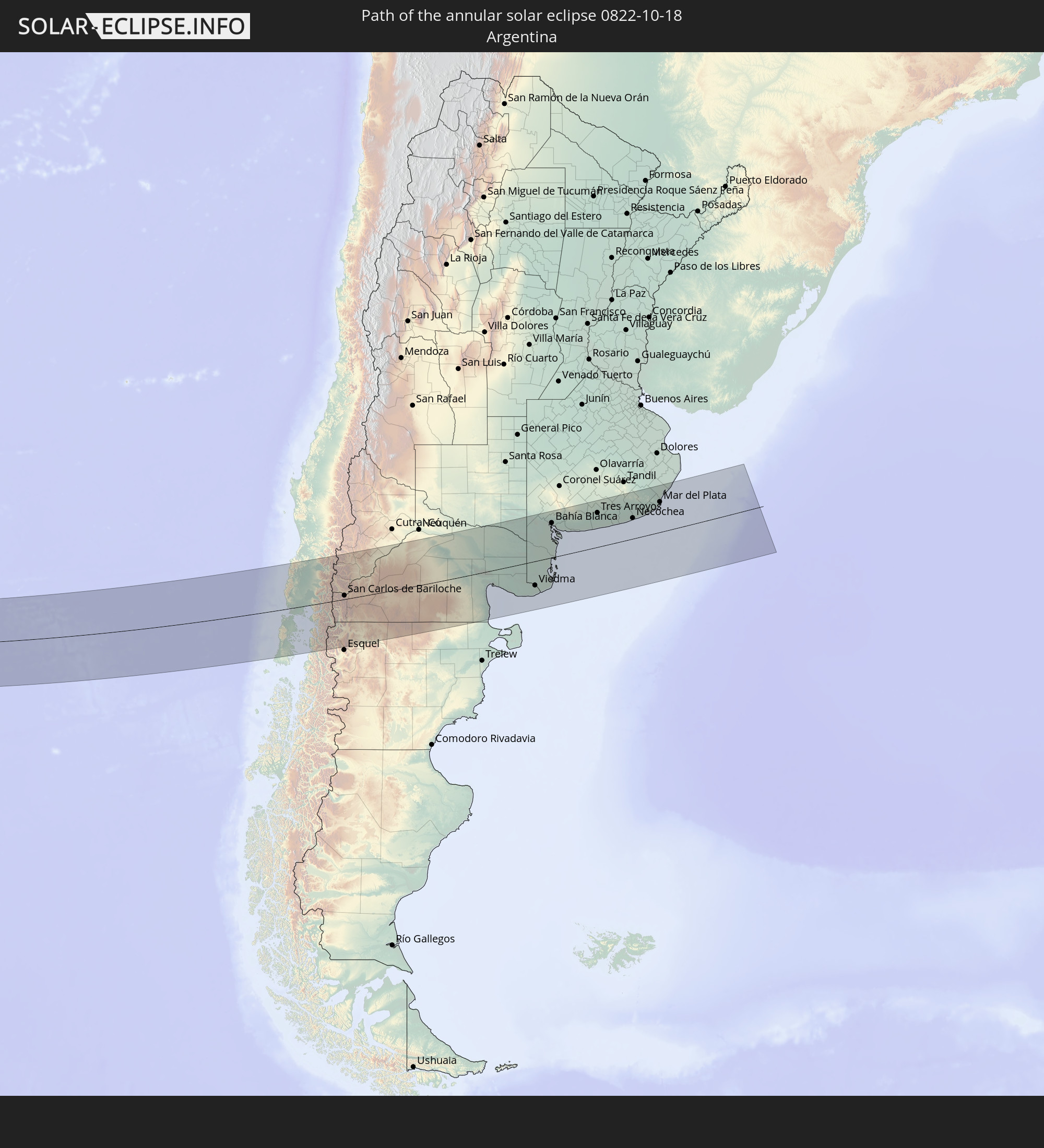 Argentina
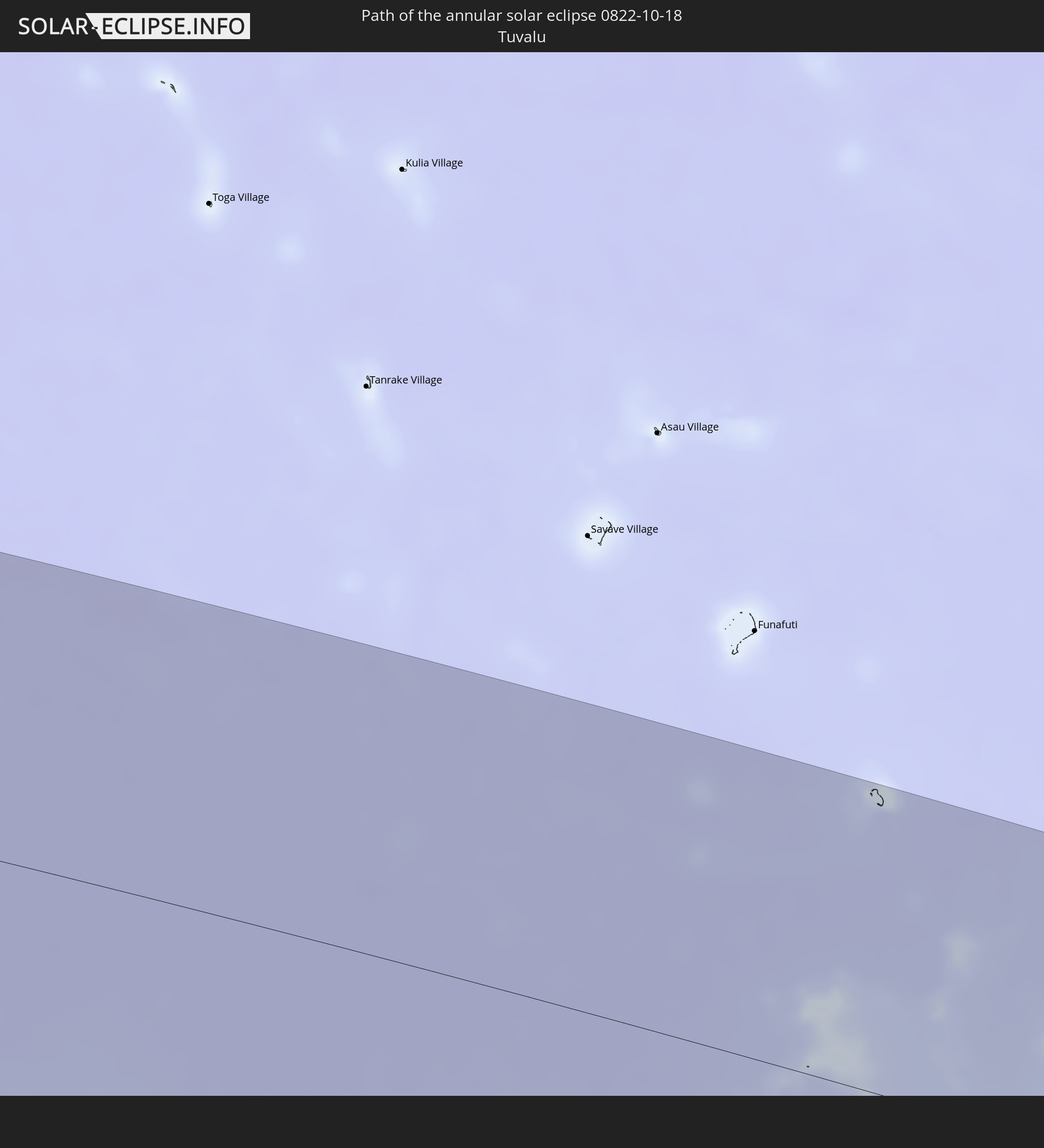 Tuvalu
In den folgenden Ländern ist die Sonnenfinsternis partiell zu sehen
 Antarctica
 Fiji
Fiji
 New Zealand
 United States Minor Outlying Islands
 Wallis and Futuna
 Tonga
Tonga
 Kiribati
 Samoa
Samoa
 Tokelau
 American Samoa
 Niue
Niue
 Cook Islands
 French Polynesia
 Pitcairn Islands
 Chile
Chile
 Peru
Peru
 Brazil
 Argentina
 Bolivia
 Paraguay
 Falkland Islands
 Uruguay
 South Georgia and the South Sandwich Islands
 Australia
 Solomon Islands
 New Caledonia
 Vanuatu
 Norfolk Island
 Tuvalu
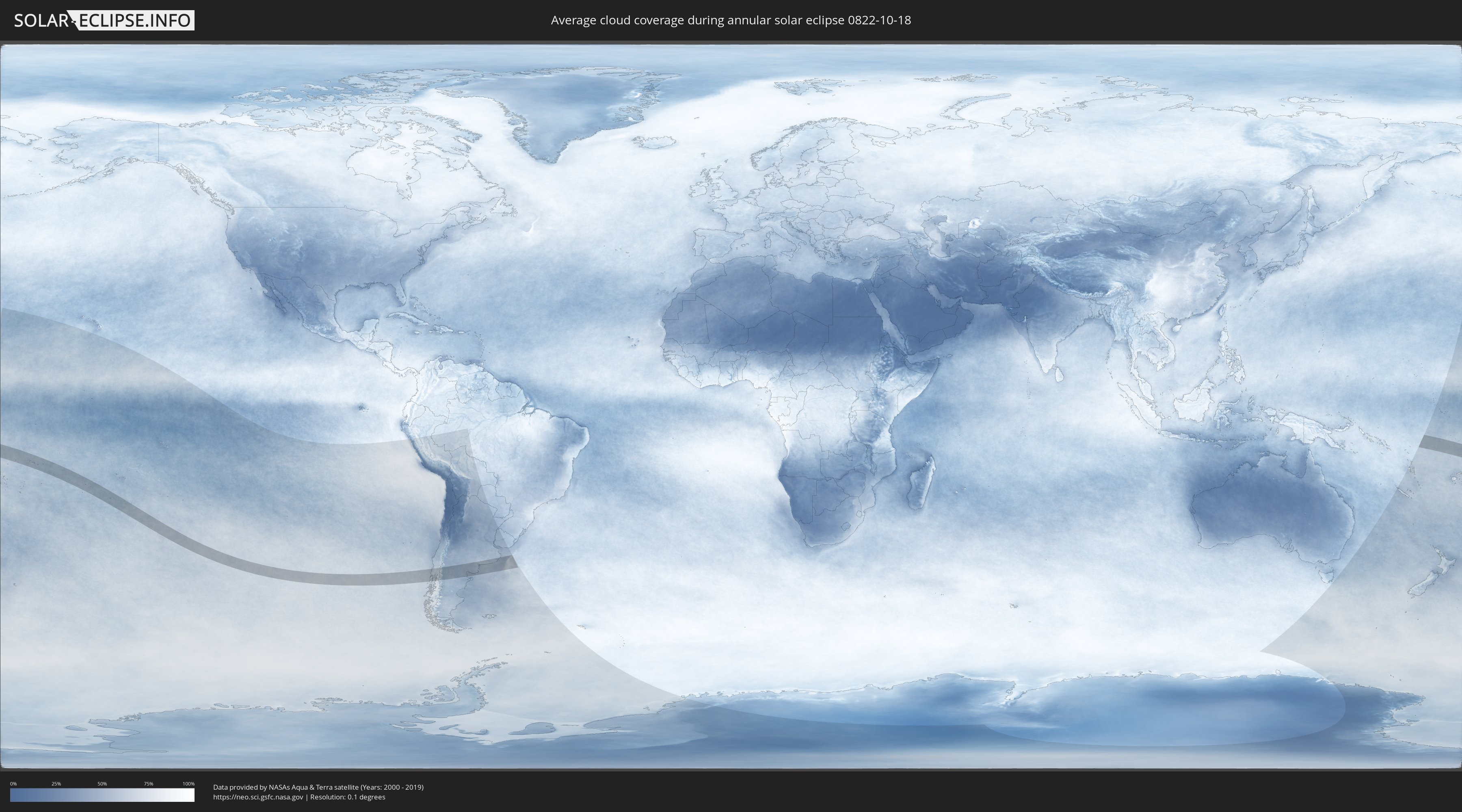
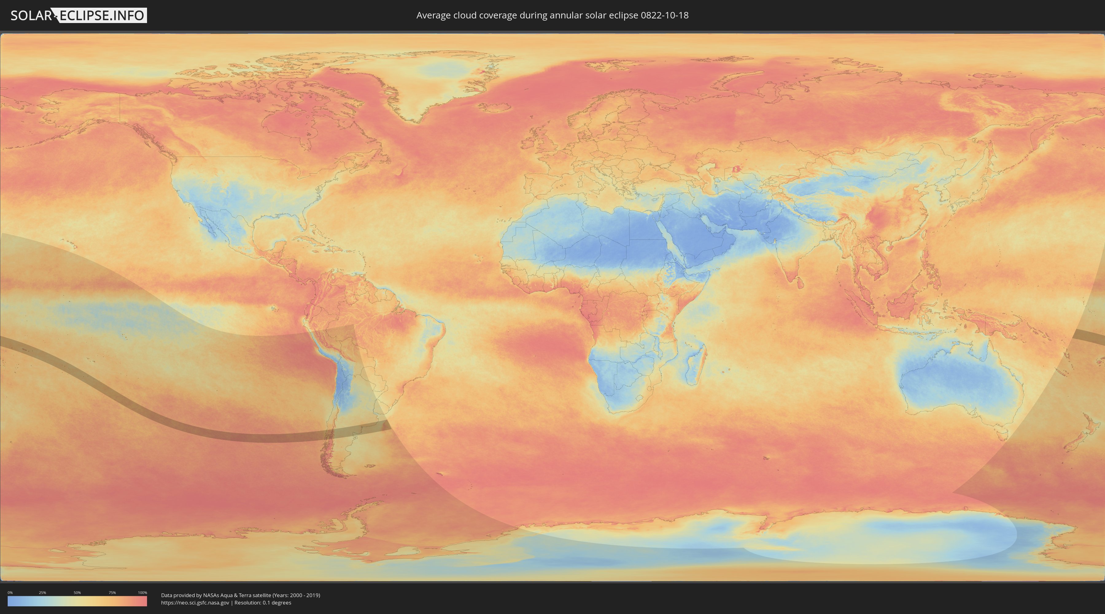
How will be the weather during the annular solar eclipse on 10/18/0822?
Where is the best place to see the annular solar eclipse of 10/18/0822?
The following maps show the average cloud coverage for the day of the annular solar eclipse.
With the help of these maps, it is possible to find the place along the eclipse path, which has the best
chance of a cloudless sky.
Nevertheless, you should consider local circumstances and inform about the weather of your chosen
observation site.
The data is provided by NASAs satellites
AQUA and TERRA.
The cloud maps are averaged over a period of 19 years (2000 - 2019).
Detailed country maps
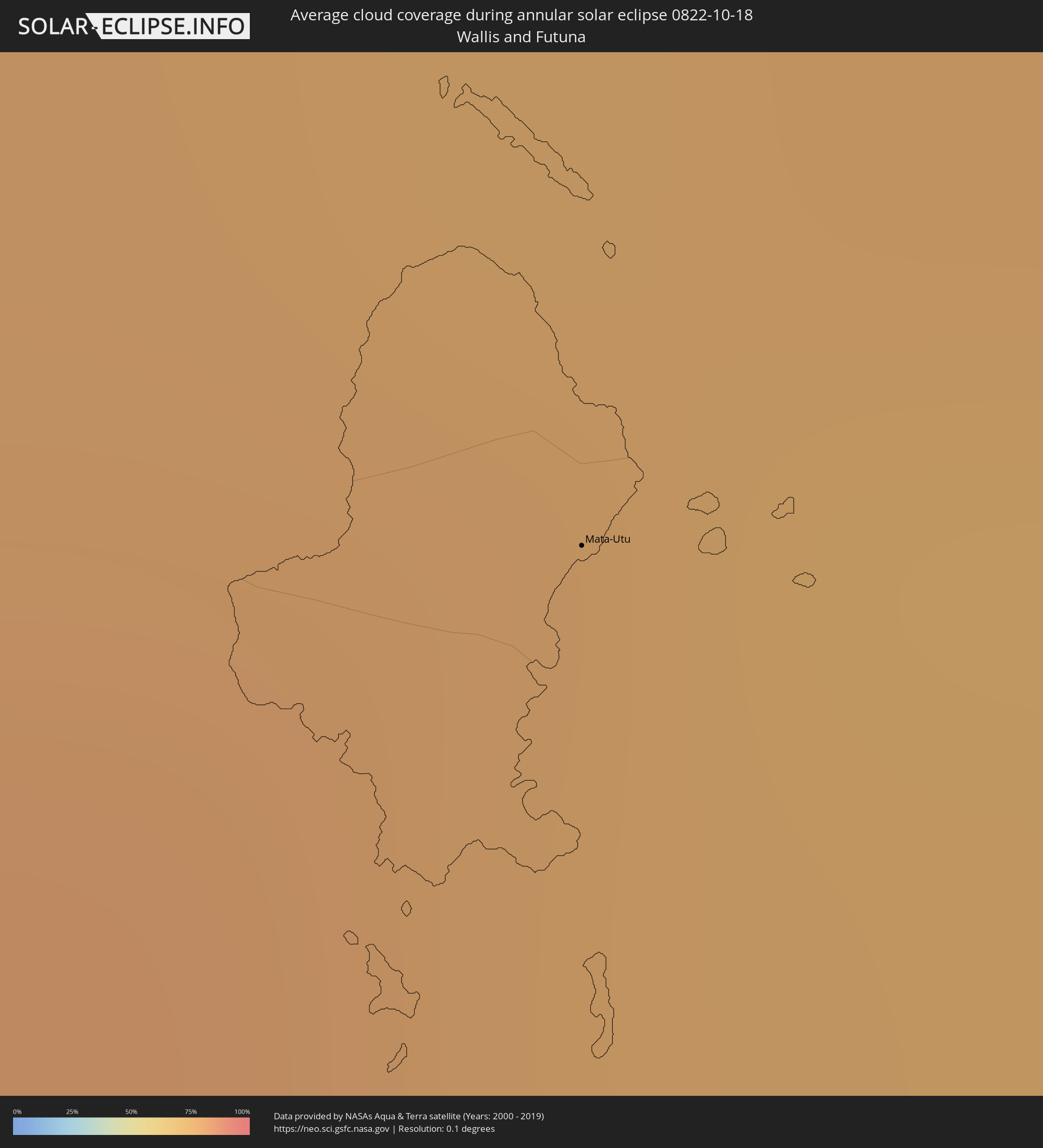 Wallis and Futuna
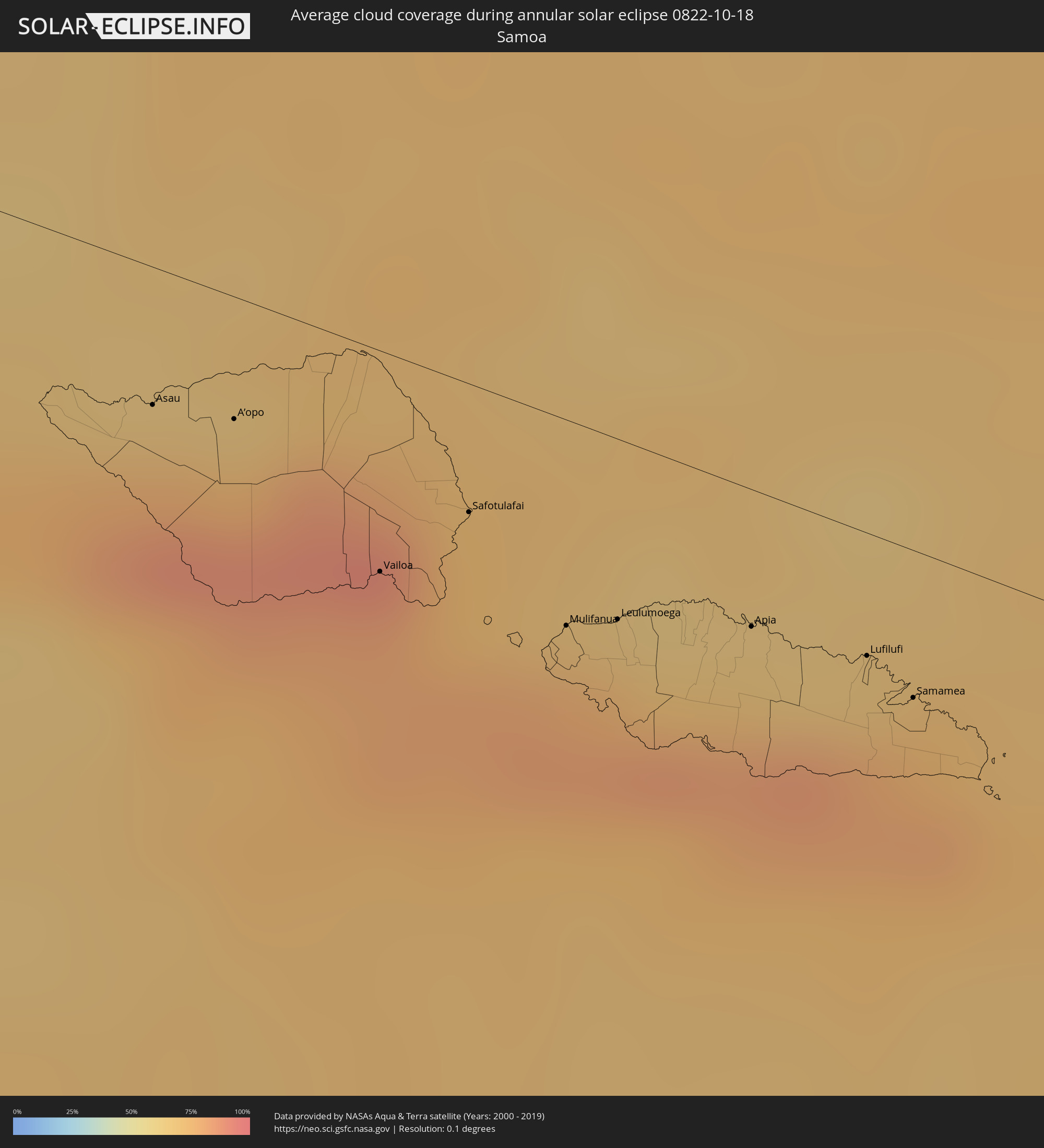 Samoa
Samoa
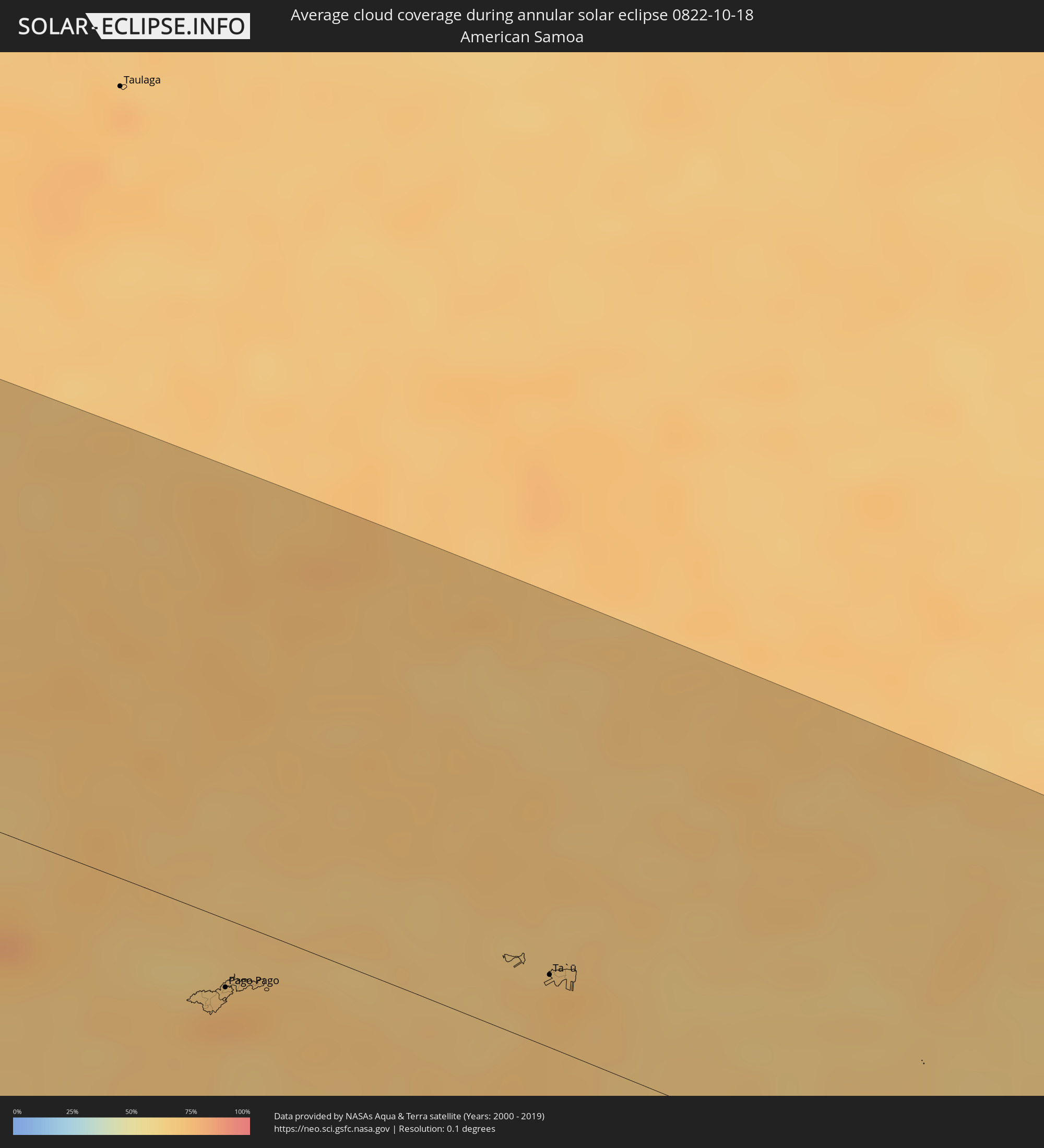 American Samoa
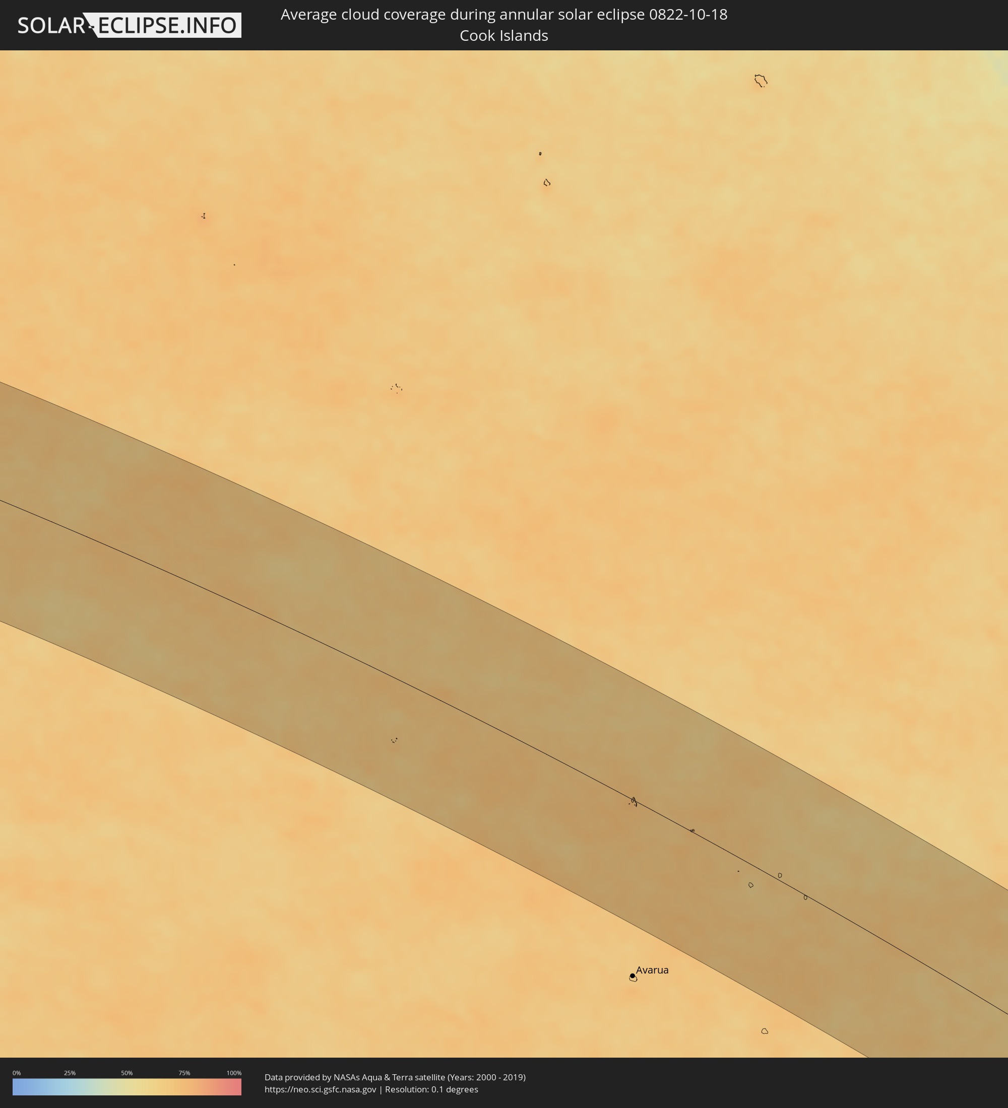 Cook Islands
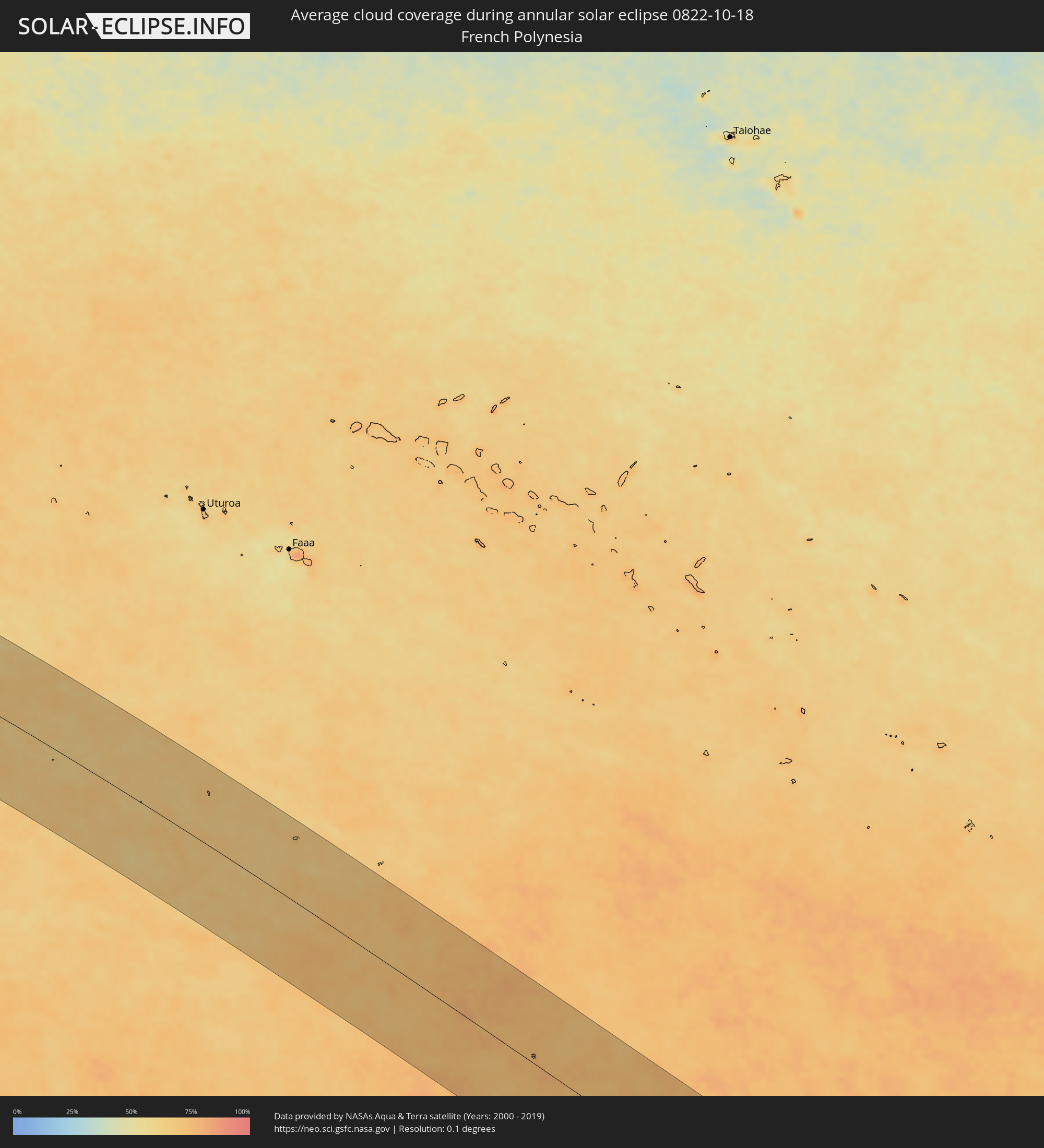 French Polynesia
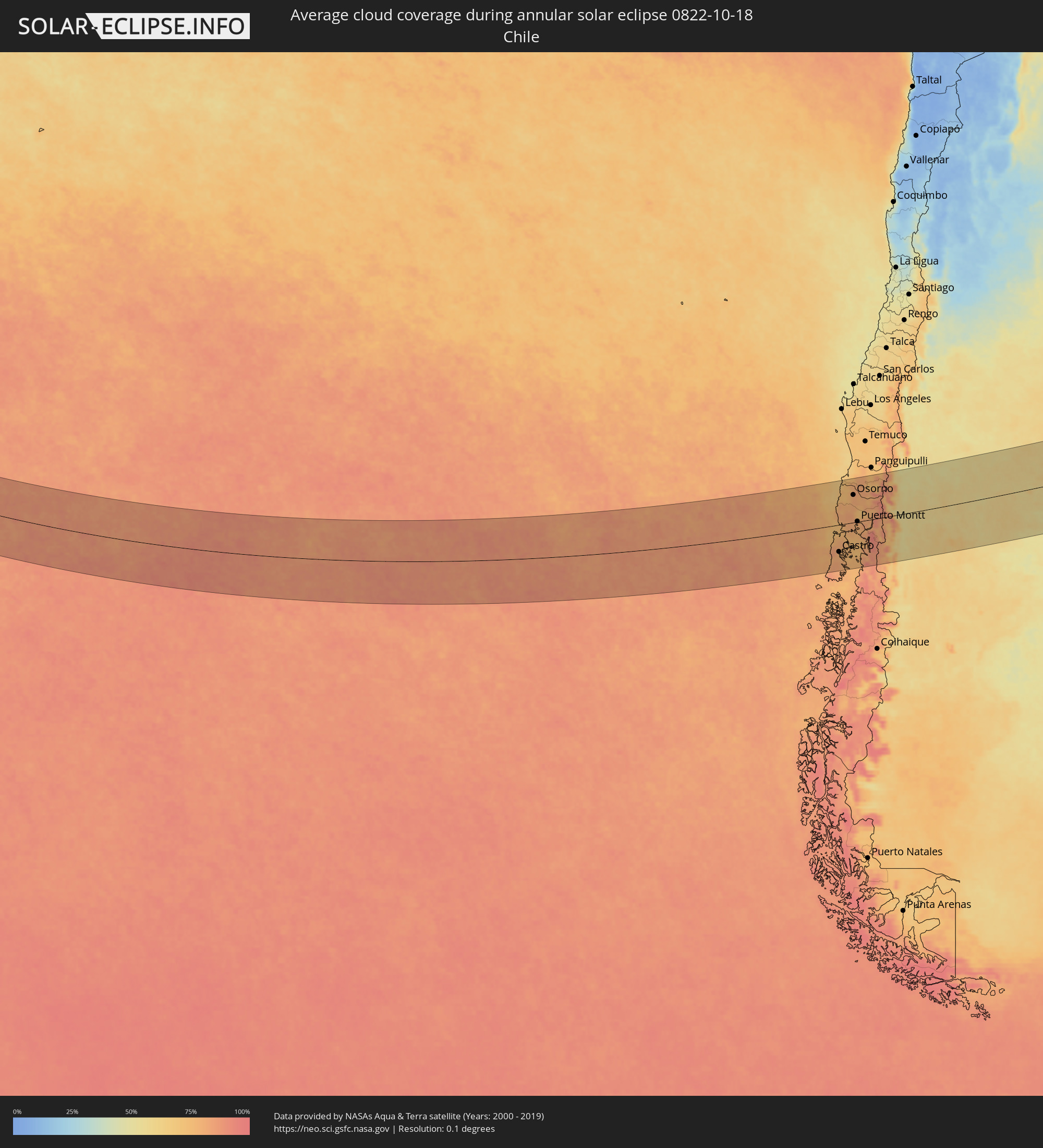 Chile
Chile
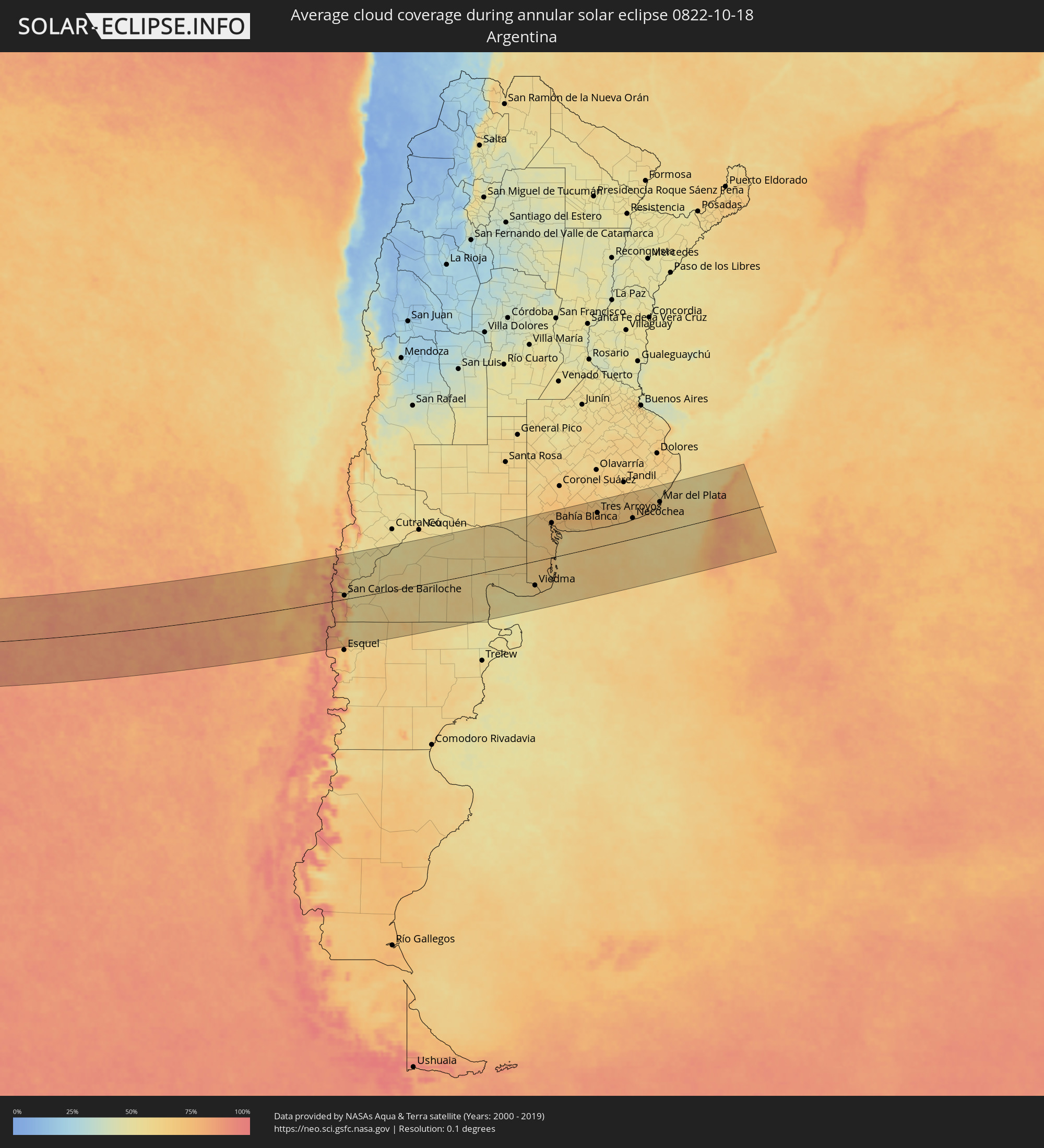 Argentina
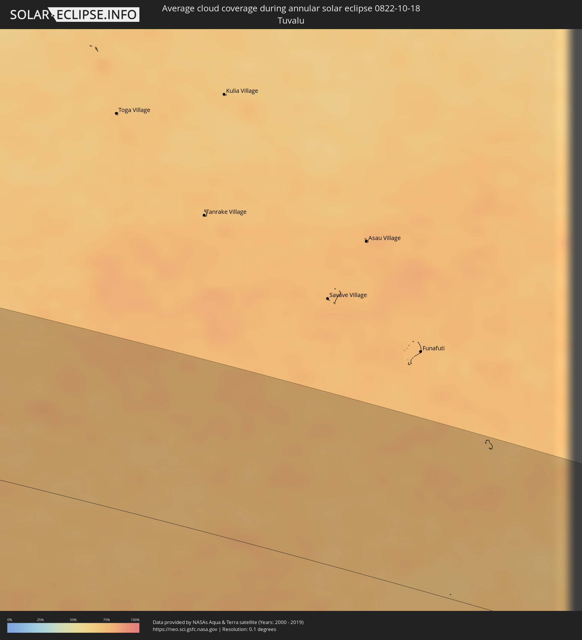 Tuvalu
Cities inside the path of the eclipse
The following table shows all locations with a population of more than 5,000 inside the eclipse path. Cities which have more than 100,000 inhabitants are marked bold. A click at the locations opens a detailed map.
| City | Type | Eclipse duration | Local time of max. eclipse | Distance to central line | Ø Cloud coverage |
|
Mata-Utu, Circonscription d'Uvéa
|
annular | - | 06:24:38 UTC+12:00 | 122 km | 79% |
|
Asau, Vaisigano
|
annular | - | 06:59:23 UTC-11:26 | 20 km | 78% |
|
A’opo, Gagaifomauga
|
annular | - | 06:59:28 UTC-11:26 | 18 km | 76% |
|
Vailoa, Palauli
|
annular | - | 06:59:52 UTC-11:26 | 33 km | 79% |
|
Safotulafai, Fa‘asaleleaga
|
annular | - | 06:59:48 UTC-11:26 | 19 km | 75% |
|
Mulifanua, Aiga-i-le-Tai
|
annular | - | 07:00:06 UTC-11:26 | 30 km | 77% |
|
Leulumoega, A'ana
|
annular | - | 07:00:07 UTC-11:26 | 27 km | 77% |
|
Apia, Tuamasaga
|
annular | - | 07:00:14 UTC-11:26 | 20 km | 70% |
|
Lufilufi, Atua
|
annular | - | 07:00:22 UTC-11:26 | 18 km | 79% |
|
Samamea, Va‘a-o-Fonoti
|
annular | - | 07:00:29 UTC-11:26 | 22 km | 74% |
|
Tāfuna, Western District
|
annular | - | 07:05:37 UTC-11:22 | 32 km | 76% |
|
Pago Pago, Eastern District
|
annular | - | 07:05:33 UTC-11:22 | 25 km | 76% |
|
Ta`ū, Manu'a
|
annular | - | 07:06:09 UTC-11:22 | 27 km | 73% |
|
Ancud, Los Lagos
|
annular | - | 17:05:04 UTC-04:42 | 32 km | 76% |
|
Chonchi, Los Lagos
|
annular | - | 17:04:15 UTC-04:42 | 115 km | 80% |
|
Castro, Los Lagos
|
annular | - | 17:04:25 UTC-04:42 | 98 km | 79% |
|
Purranque, Los Lagos
|
annular | - | 17:06:23 UTC-04:42 | 65 km | 80% |
|
Osorno, Los Lagos
|
annular | - | 17:06:45 UTC-04:42 | 102 km | 80% |
|
Calbuco, Los Lagos
|
annular | - | 17:05:28 UTC-04:42 | 30 km | 78% |
|
La Unión, Los Ríos
|
annular | - | 17:07:04 UTC-04:42 | 132 km | 79% |
|
Frutillar, Los Lagos
|
annular | - | 17:06:12 UTC-04:42 | 40 km | 75% |
|
Puerto Varas, Los Lagos
|
annular | - | 17:06:01 UTC-04:42 | 18 km | 81% |
|
Río Bueno, Los Ríos
|
annular | - | 17:07:05 UTC-04:42 | 125 km | 81% |
|
Puerto Montt, Los Lagos
|
annular | - | 17:05:53 UTC-04:42 | 1 km | 79% |
|
Villa La Angostura, Neuquén Province
|
annular | - | 17:33:07 UTC-04:16 | 60 km | 68% |
|
El Bolsón, Río Negro Province
|
annular | - | 17:31:52 UTC-04:16 | 73 km | 71% |
|
San Martín de los Andes, Neuquén Province
|
annular | - | 17:33:52 UTC-04:16 | 122 km | 78% |
|
San Carlos de Bariloche, Río Negro Province
|
annular | - | 17:32:50 UTC-04:16 | 13 km | 59% |
|
Junín de los Andes, Neuquén Province
|
annular | - | 17:34:11 UTC-04:16 | 141 km | 57% |
|
Ingeniero Jacobacci, Río Negro Province
|
annular | - | 17:33:13 UTC-04:16 | 33 km | 55% |
|
Fray Luis Beltrán, Río Negro Province
|
annular | - | 17:36:14 UTC-04:16 | 125 km | 61% |
|
Lamarque, Río Negro Province
|
annular | - | 17:36:08 UTC-04:16 | 112 km | 60% |
|
Choele Choel, Río Negro Province
|
annular | - | 17:36:18 UTC-04:16 | 129 km | 60% |
|
Sierra Grande, Río Negro Province
|
annular | - | 17:33:54 UTC-04:16 | 132 km | 54% |
|
San Antonio Oeste, Río Negro Province
|
annular | - | 17:34:54 UTC-04:16 | 44 km | 59% |
|
General Conesa, Río Negro Province
|
annular | - | 17:35:38 UTC-04:16 | 16 km | 60% |
|
Viedma, Río Negro Province
|
annular | - | 17:35:03 UTC-04:16 | 88 km | 62% |
|
Bahía Blanca, Buenos Aires
|
annular | - | 17:37:16 UTC-04:16 | 127 km | 71% |
|
Punta Alta, Buenos Aires
|
annular | - | 17:37:07 UTC-04:16 | 106 km | 65% |
|
Coronel Dorrego, Buenos Aires
|
annular | - | 17:37:19 UTC-04:16 | 108 km | 68% |
|
Tres Arroyos, Buenos Aires
|
annular | - | 17:37:40 UTC-04:16 | 126 km | 72% |
|
Necochea, Buenos Aires
|
annular | - | 17:37:28 UTC-04:16 | 76 km | 63% |
|
Mar del Plata, Buenos Aires
|
annular | - | 17:37:56 UTC-04:16 | 111 km | 64% |