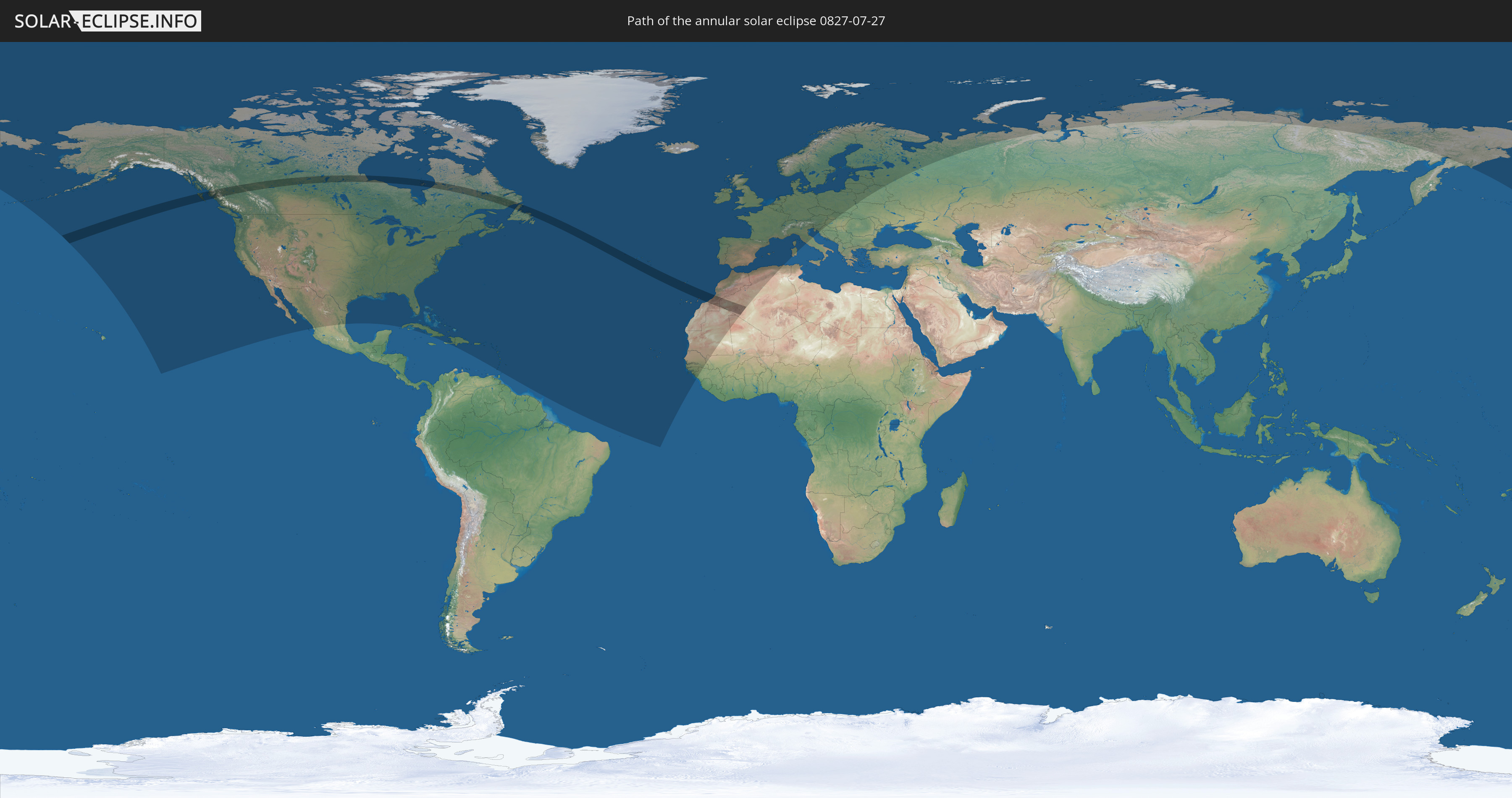
Annular solar eclipse of 07/27/0827
| Day of week: | Tuesday |
| Maximum duration of eclipse: | 03m15s |
| Maximum width of eclipse path: | 161 km |
| Saros cycle: | 107 |
| Coverage: | 96.4% |
| Magnitude: | 0.9642 |
| Gamma: | 0.5966 |
Wo kann man die Sonnenfinsternis vom 07/27/0827 sehen?
Die Sonnenfinsternis am 07/27/0827 kann man in 76 Ländern als partielle Sonnenfinsternis beobachten.
Der Finsternispfad verläuft durch 6 Länder. Nur in diesen Ländern ist sie als annular Sonnenfinsternis zu sehen.
In den folgenden Ländern ist die Sonnenfinsternis annular zu sehen
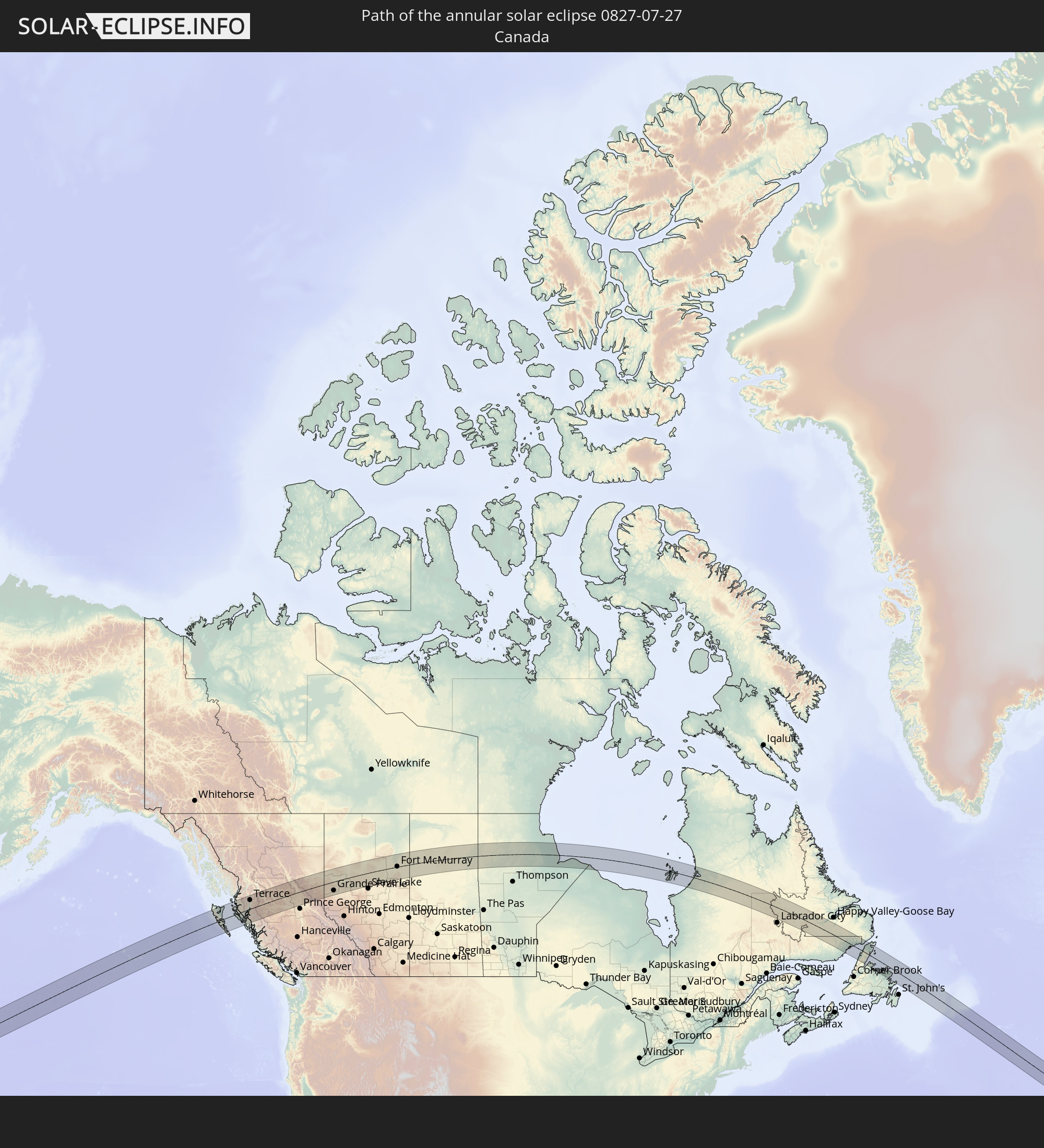 Canada
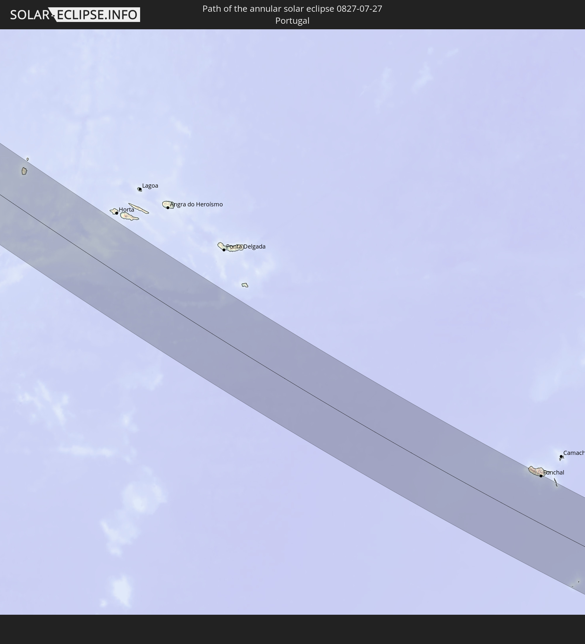 Portugal
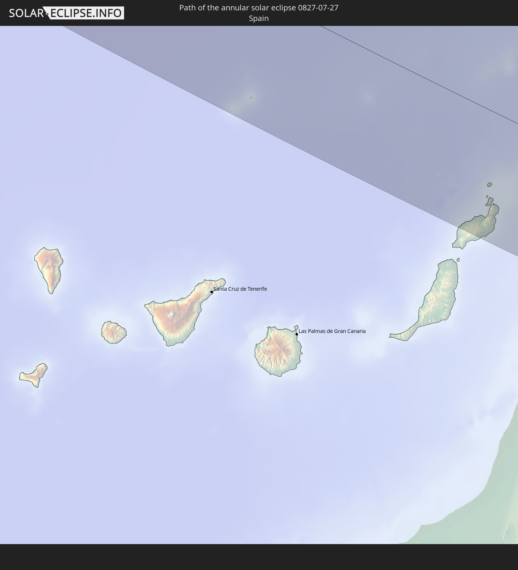 Spain
Spain
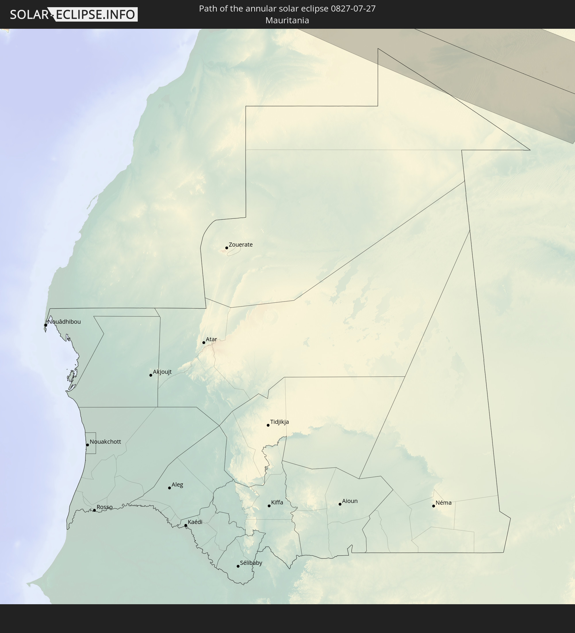 Mauritania
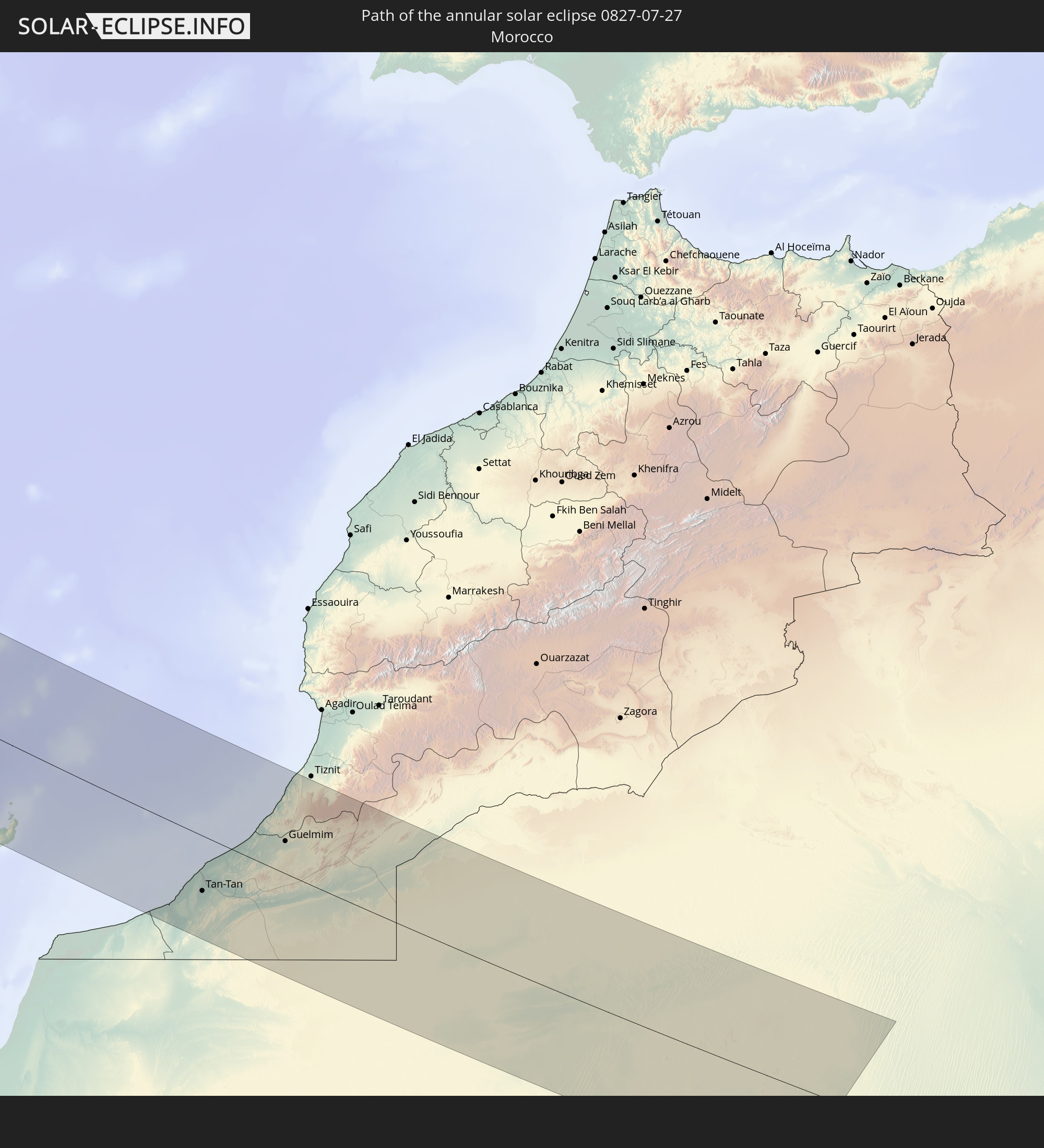 Morocco
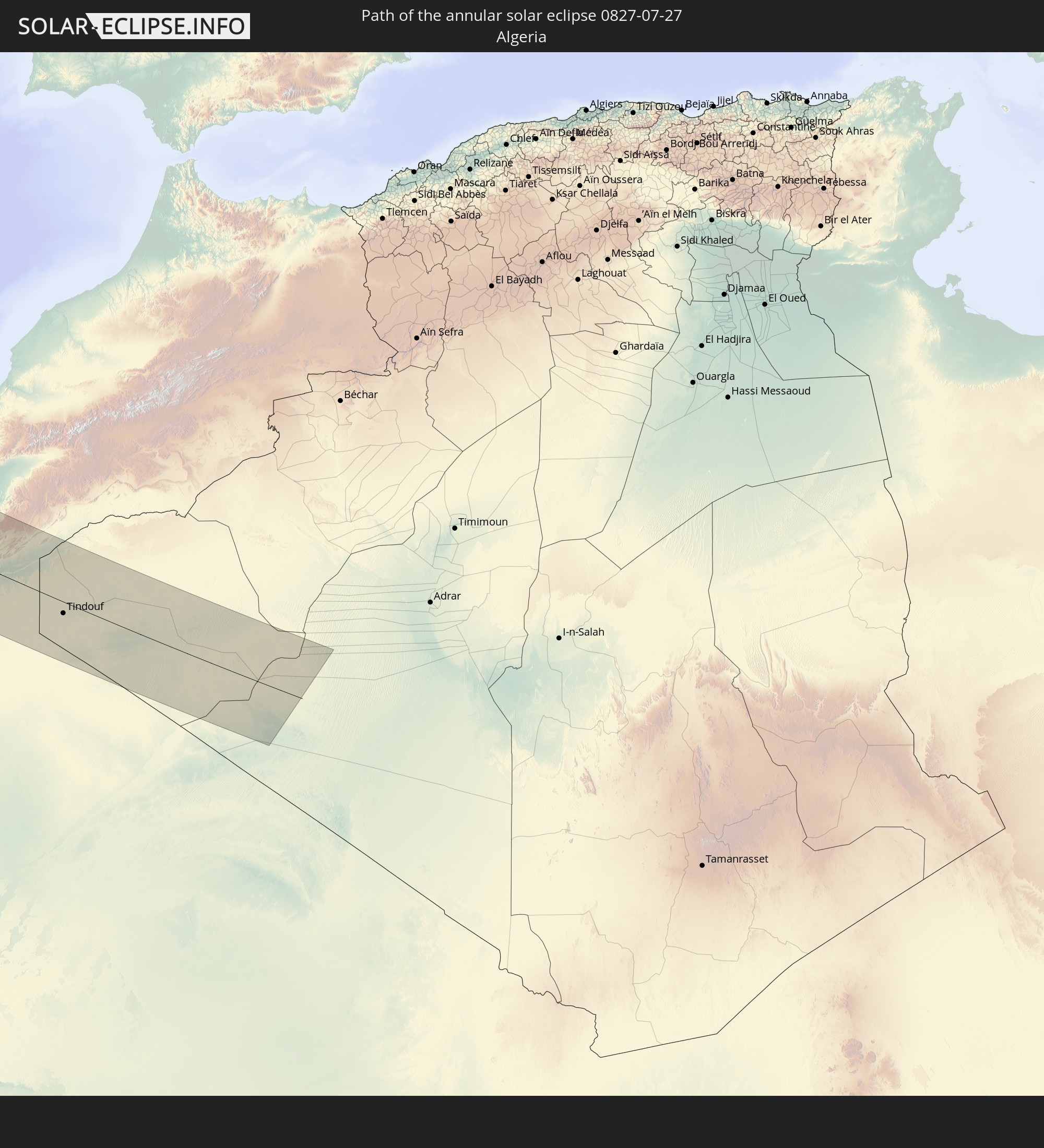 Algeria
In den folgenden Ländern ist die Sonnenfinsternis partiell zu sehen
 Russia
 United States
 Canada
 Mexico
 Greenland
 Cuba
Cuba
 The Bahamas
 Haiti
Haiti
 Turks and Caicos Islands
 Dominican Republic
 Puerto Rico
 United States Virgin Islands
 Bermuda
 British Virgin Islands
 Anguilla
 Collectivity of Saint Martin
 Saint Barthélemy
 Saint Kitts and Nevis
 Antigua and Barbuda
 Montserrat
 Guadeloupe
 Grenada
 Dominica
 Saint Vincent and the Grenadines
 Martinique
 Saint Lucia
 Barbados
 Saint Pierre and Miquelon
 Portugal
 Cabo Verde
 Iceland
 Spain
Spain
 Senegal
 Mauritania
 The Gambia
 Guinea-Bissau
 Guinea
 Morocco
 Mali
Mali
 Republic of Ireland
 Svalbard and Jan Mayen
 Algeria
 United Kingdom
 Faroe Islands
 Gibraltar
 France
 Isle of Man
 Guernsey
 Jersey
 Andorra
 Belgium
 Netherlands
 Norway
 Luxembourg
 Germany
 Switzerland
 Italy
Italy
 Monaco
 Denmark
 Liechtenstein
 Austria
 Sweden
 Czechia
 San Marino
 Slovenia
 Croatia
 Poland
 Hungary
 Slovakia
 Åland Islands
 Finland
 Lithuania
 Latvia
 Estonia
 Ukraine
 Belarus
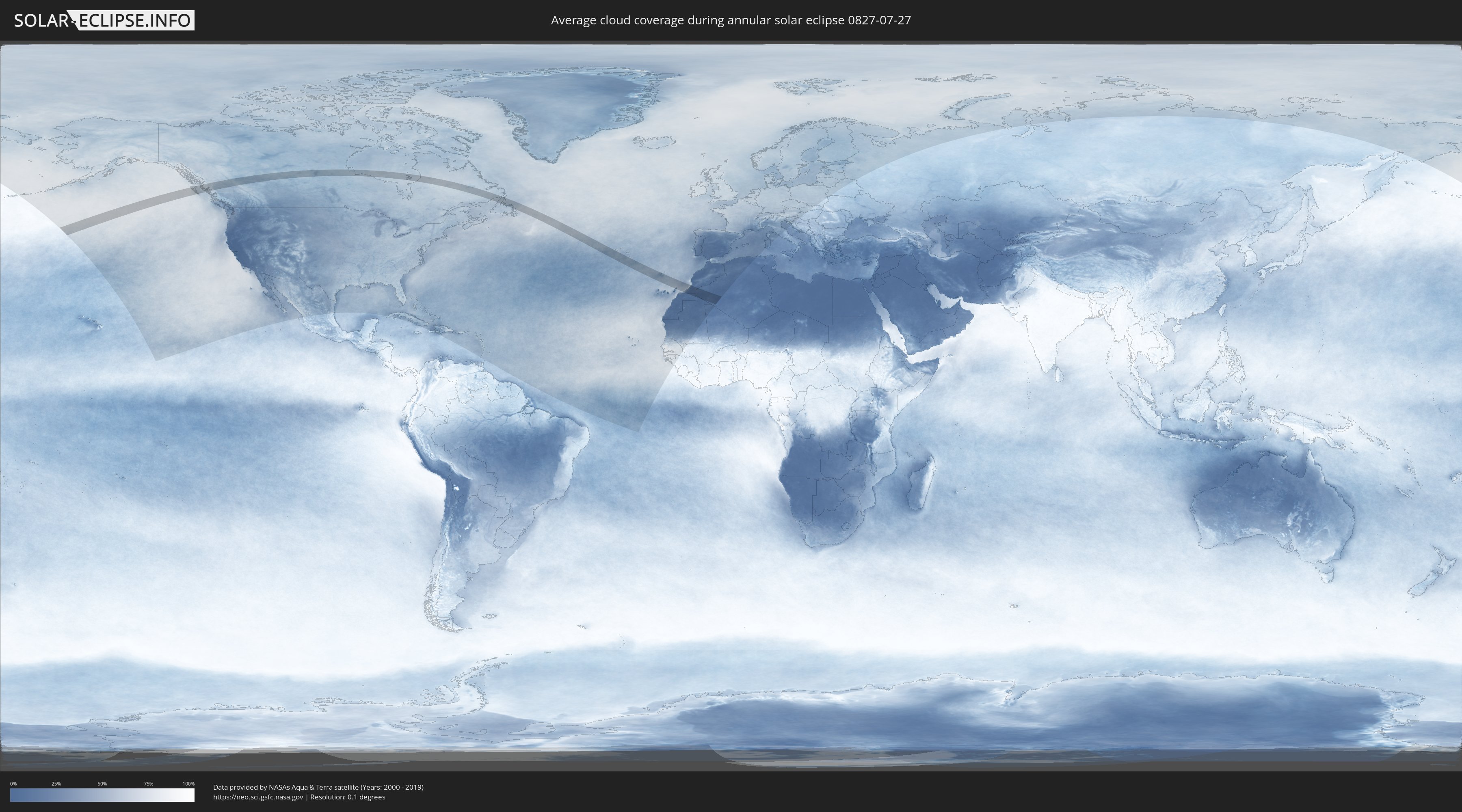
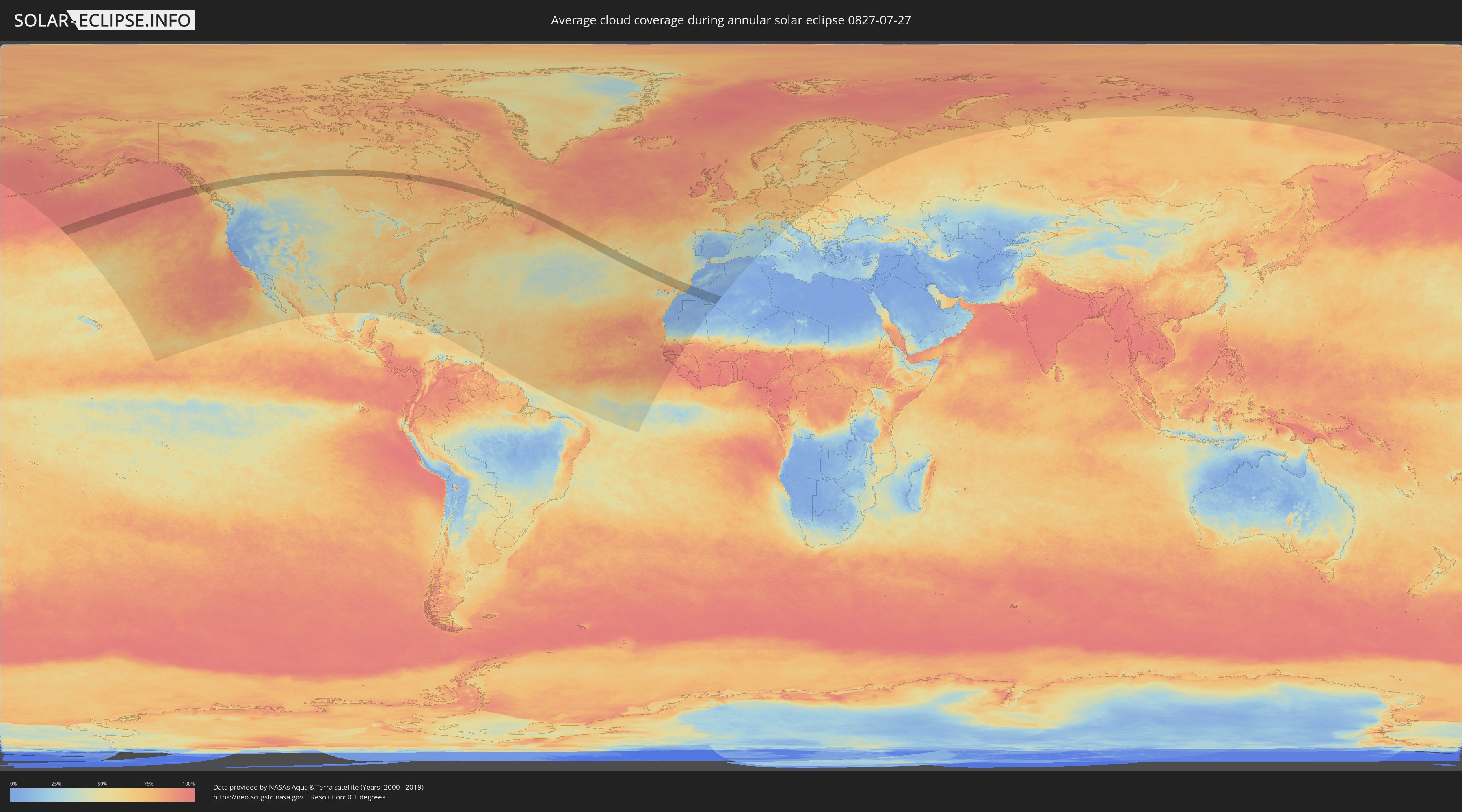
How will be the weather during the annular solar eclipse on 07/27/0827?
Where is the best place to see the annular solar eclipse of 07/27/0827?
The following maps show the average cloud coverage for the day of the annular solar eclipse.
With the help of these maps, it is possible to find the place along the eclipse path, which has the best
chance of a cloudless sky.
Nevertheless, you should consider local circumstances and inform about the weather of your chosen
observation site.
The data is provided by NASAs satellites
AQUA and TERRA.
The cloud maps are averaged over a period of 19 years (2000 - 2019).
Detailed country maps
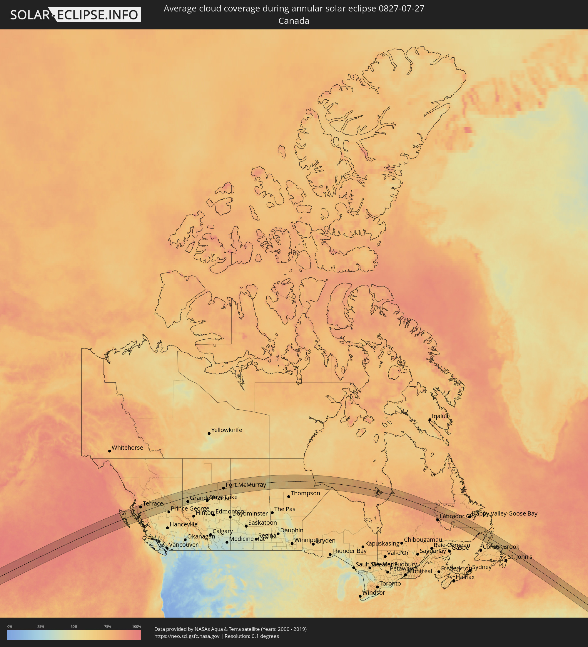 Canada
 Portugal
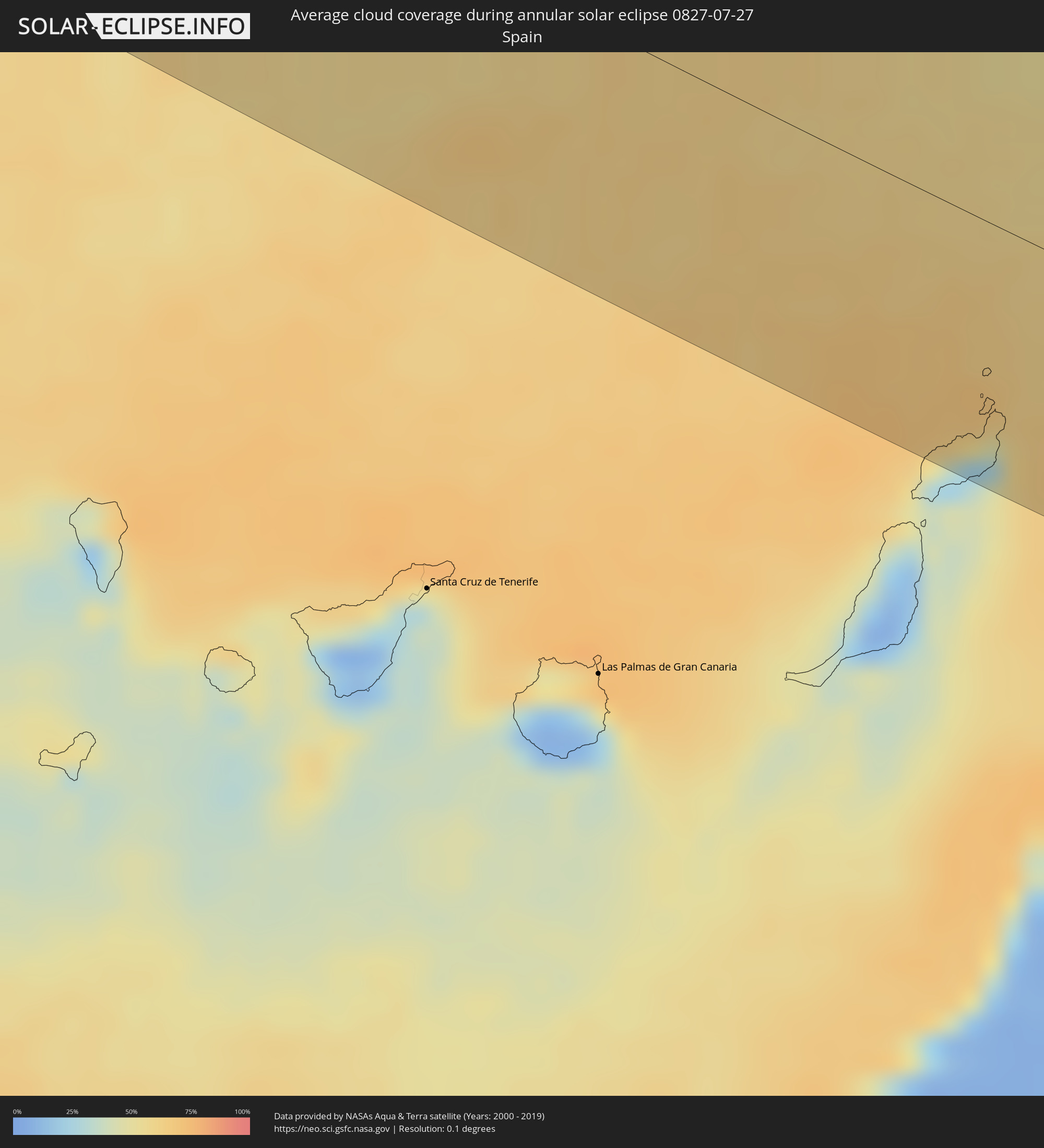 Spain
Spain
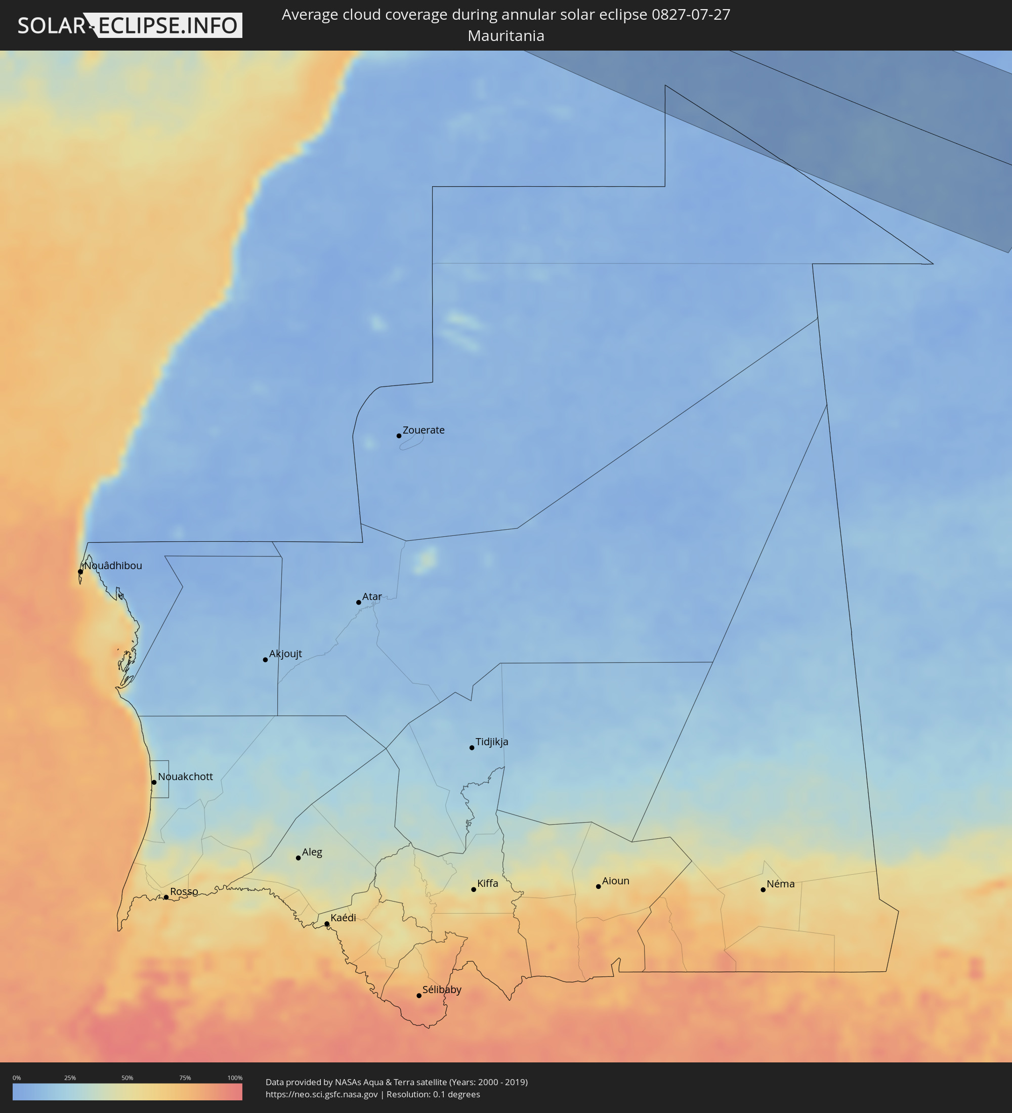 Mauritania
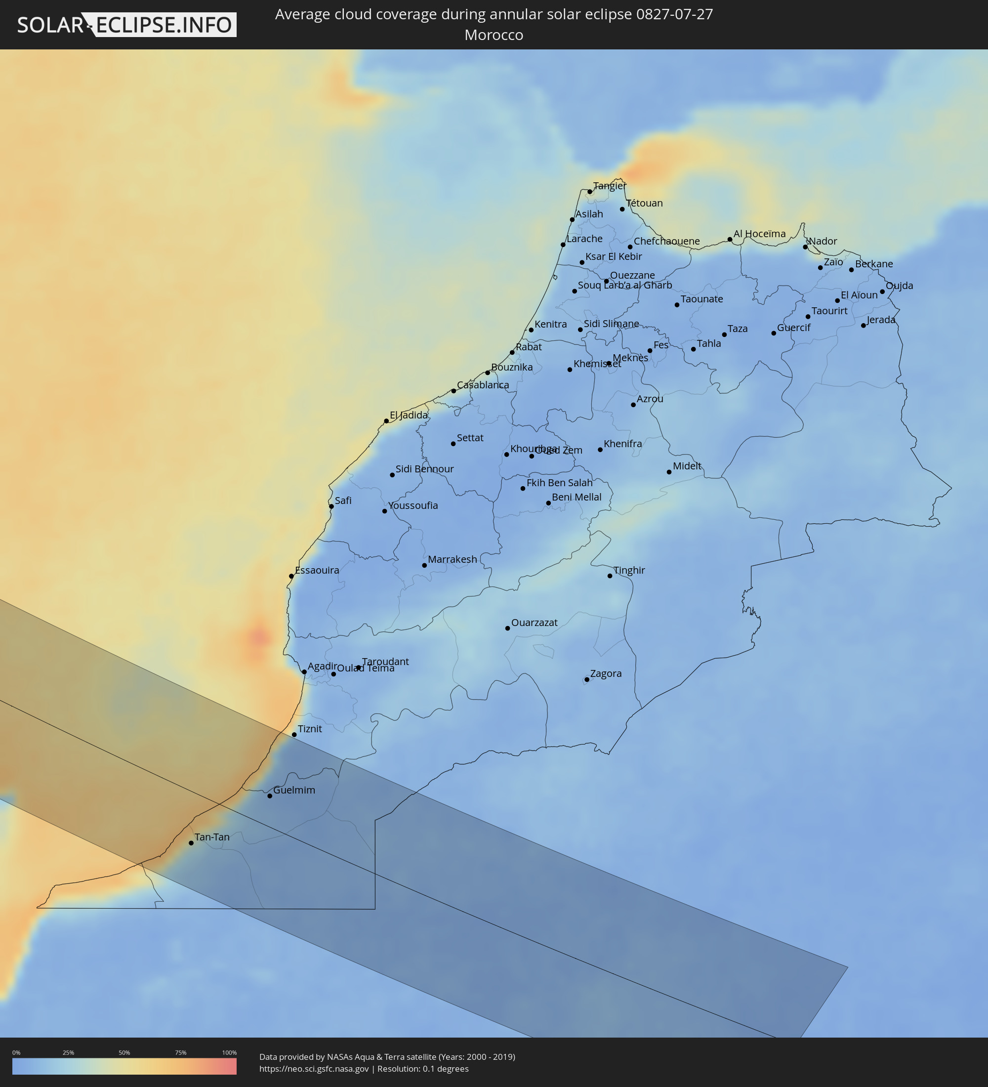 Morocco
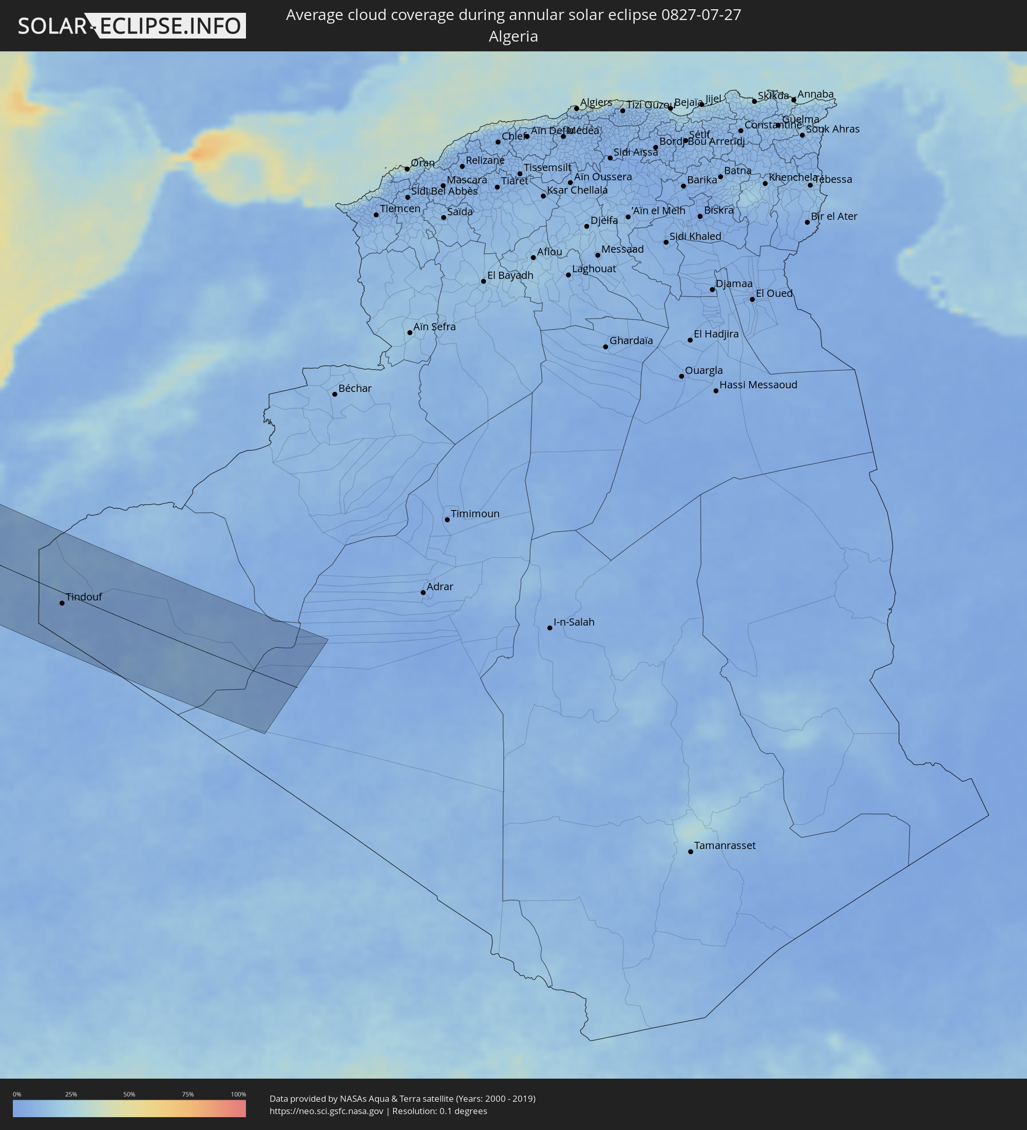 Algeria
Cities inside the path of the eclipse
The following table shows all locations with a population of more than 5,000 inside the eclipse path. Cities which have more than 100,000 inhabitants are marked bold. A click at the locations opens a detailed map.
| City | Type | Eclipse duration | Local time of max. eclipse | Distance to central line | Ø Cloud coverage |
|
Prince Rupert, British Columbia
|
annular | - | 08:06:04 UTC-08:00 | 83 km | 80% |
|
Kitimat, British Columbia
|
annular | - | 08:06:30 UTC-08:00 | 17 km | 73% |
|
Terrace, British Columbia
|
annular | - | 08:07:16 UTC-08:00 | 65 km | 71% |
|
Smithers, British Columbia
|
annular | - | 08:08:29 UTC-08:00 | 60 km | 70% |
|
Fort St. John, British Columbia
|
annular | - | 08:14:53 UTC-08:00 | 90 km | 55% |
|
Dawson Creek, British Columbia
|
annular | - | 08:14:36 UTC-08:00 | 28 km | 56% |
|
Grande Prairie, Alberta
|
annular | - | 08:40:58 UTC-07:33 | 62 km | 53% |
|
Peace River, Alberta
|
annular | - | 08:43:47 UTC-07:33 | 31 km | 56% |
|
Fort McMurray, Alberta
|
annular | - | 08:49:49 UTC-07:33 | 8 km | 65% |
|
Ribeira Brava, Madeira
|
annular | - | 18:47:59 UTC+00:00 | 104 km | 57% |
|
Câmara de Lobos, Madeira
|
annular | - | 18:48:01 UTC+00:00 | 107 km | 50% |
|
Nossa Senhora do Monte, Madeira
|
annular | - | 18:11:13 UTC-00:36 | 113 km | 61% |
|
Funchal, Madeira
|
annular | - | 18:48:01 UTC+00:00 | 110 km | 55% |
|
Caniço, Madeira
|
annular | - | 18:11:16 UTC-00:36 | 112 km | 55% |
|
Tinajo, Canary Islands
|
annular | - | 17:51:28 UTC-01:01 | 105 km | 35% |
|
Tías, Canary Islands
|
annular | - | 17:51:36 UTC-01:01 | 114 km | 33% |
|
San Bartolomé, Canary Islands
|
annular | - | 17:51:33 UTC-01:01 | 109 km | 33% |
|
Teguise, Canary Islands
|
annular | - | 17:51:27 UTC-01:01 | 101 km | 24% |
|
Nazaret, Canary Islands
|
annular | - | 17:51:29 UTC-01:01 | 103 km | 33% |
|
Arrecife, Canary Islands
|
annular | - | 17:51:35 UTC-01:01 | 110 km | 43% |
|
Tan-Tan, Guelmim-Es Smara
|
annular | - | 18:23:11 UTC-00:30 | 64 km | 21% |
|
Sidi Ifni, Souss-Massa-Drâa
|
annular | - | 18:21:44 UTC-00:30 | 71 km | 50% |
|
Guelmim, Guelmim-Es Smara
|
annular | - | 18:22:14 UTC-00:30 | 36 km | 10% |
|
Tindouf, Tindouf
|
annular | - | 19:03:11 UTC+00:09 | 23 km | 6% |