Annular solar eclipse of 10/11/1018
| Day of week: | Sunday |
| Maximum duration of eclipse: | 00m45s |
| Maximum width of eclipse path: | 27 km |
| Saros cycle: | 108 |
| Coverage: | 99.2% |
| Magnitude: | 0.9923 |
| Gamma: | -0.0806 |
Wo kann man die Sonnenfinsternis vom 10/11/1018 sehen?
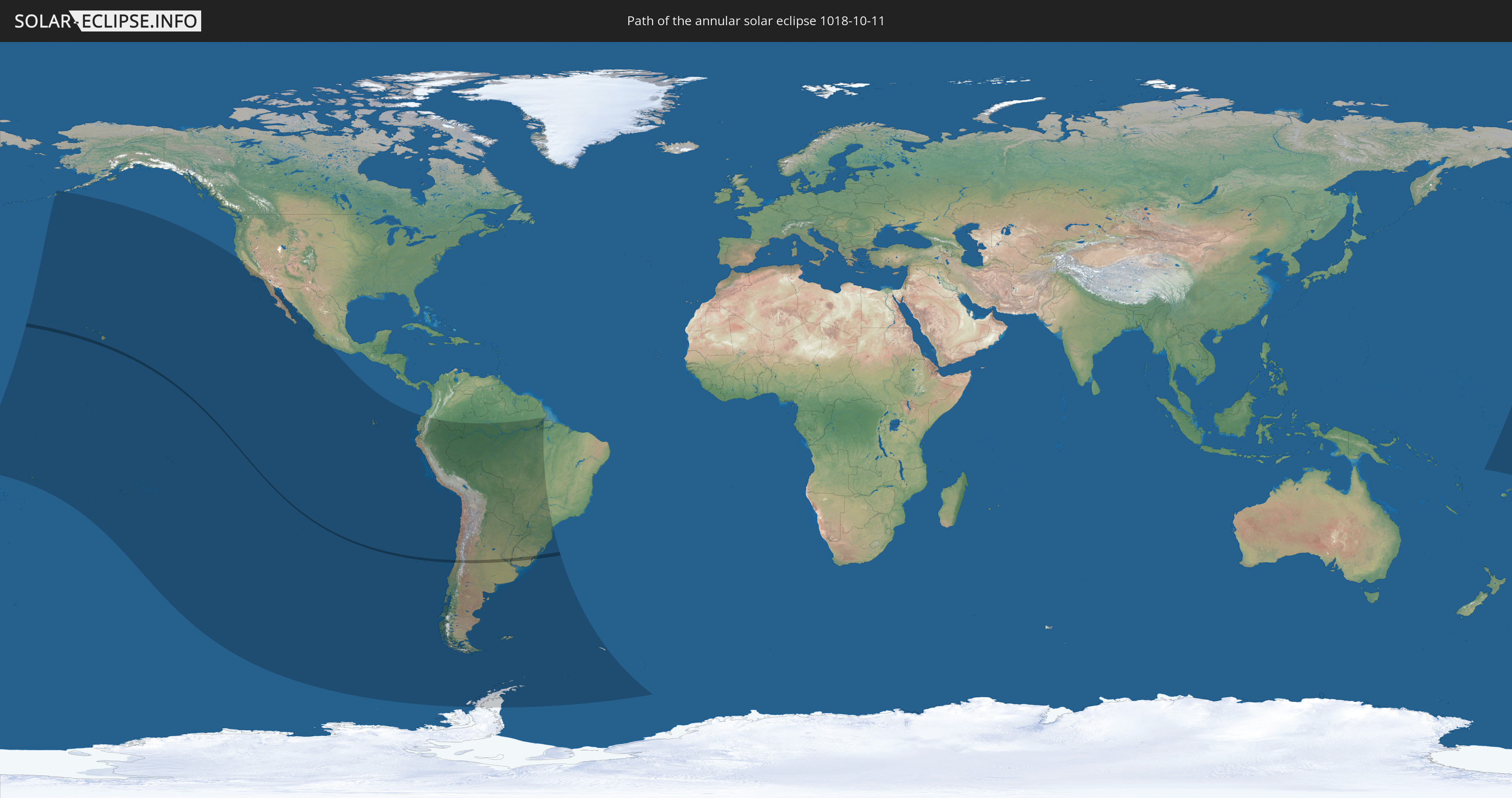
Die Sonnenfinsternis am 10/11/1018 kann man in 24 Ländern als partielle Sonnenfinsternis beobachten.
Der Finsternispfad verläuft durch 4 Länder. Nur in diesen Ländern ist sie als annular Sonnenfinsternis zu sehen.
In den folgenden Ländern ist die Sonnenfinsternis annular zu sehen
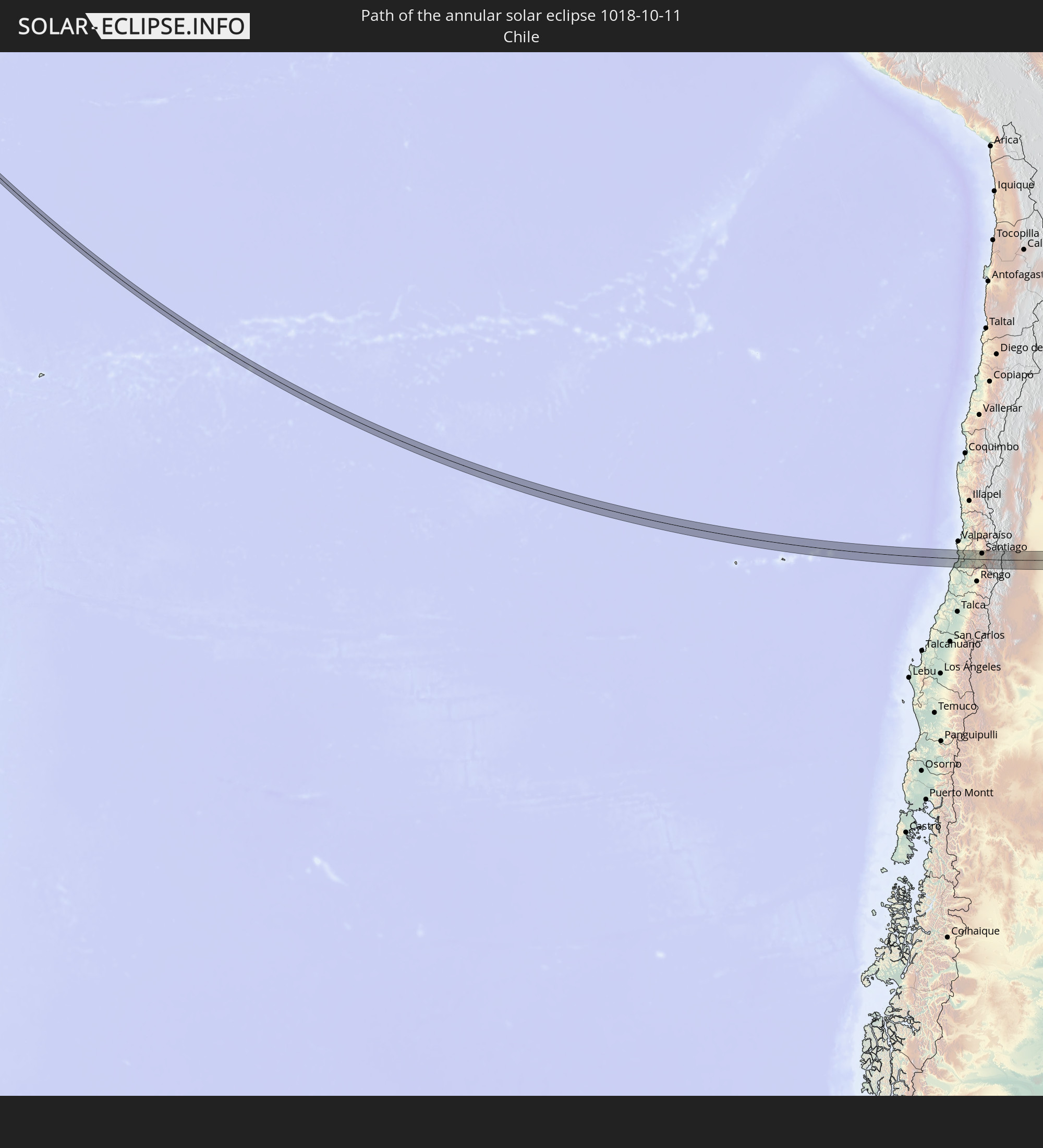 Chile
Chile
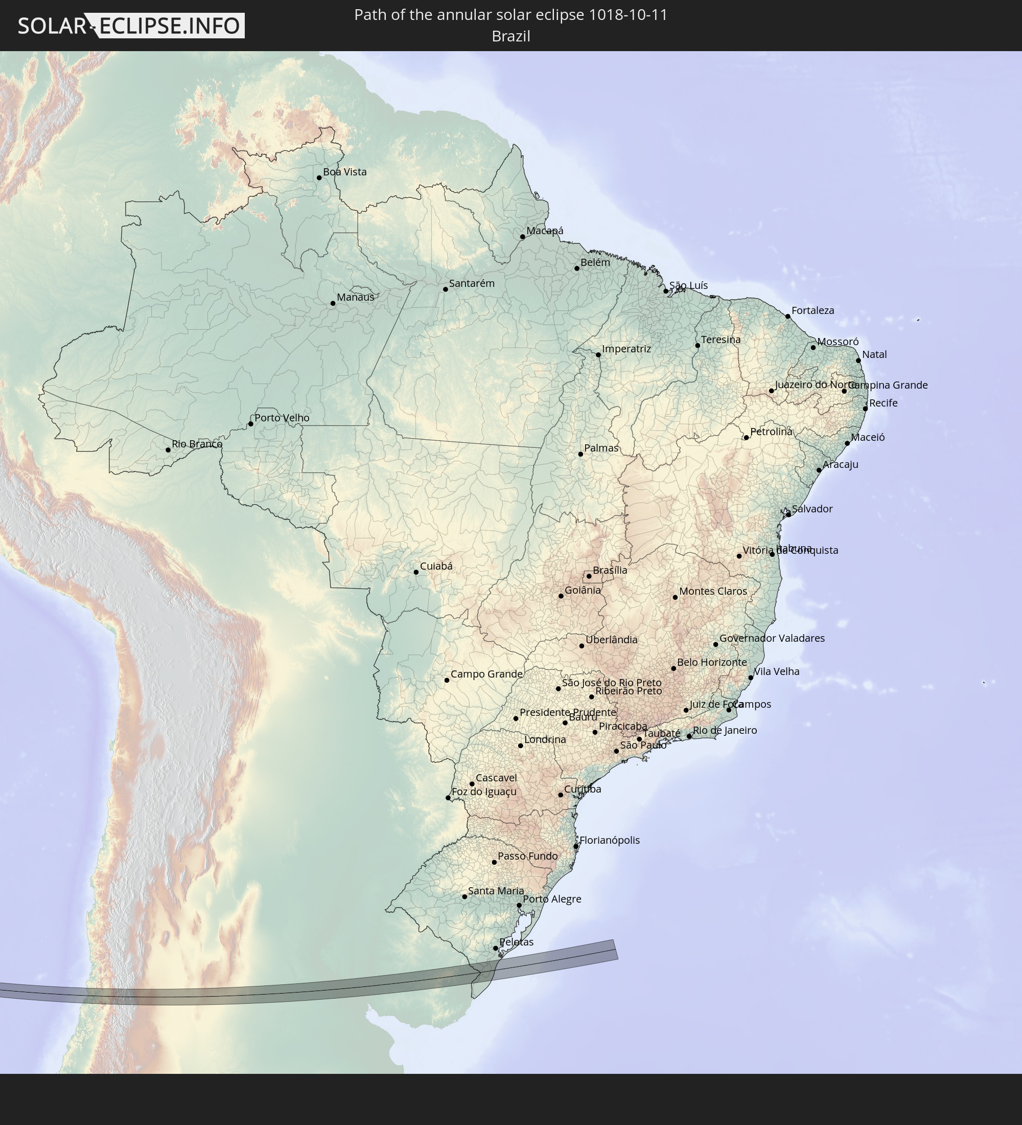 Brazil
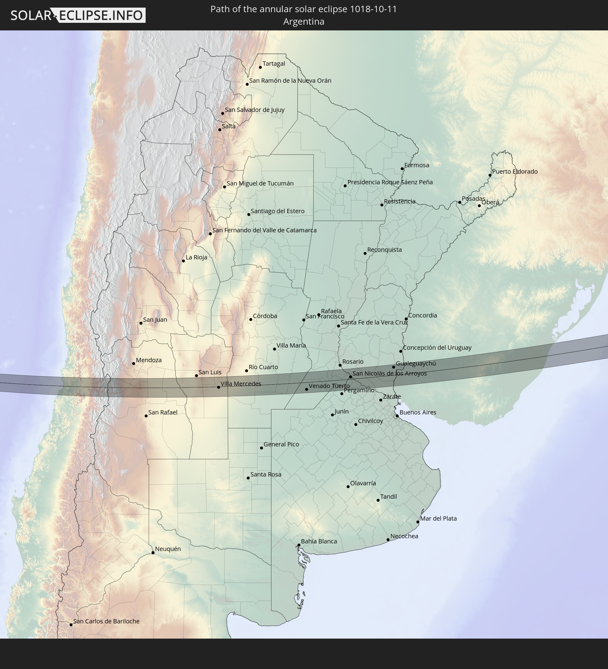 Argentina
 Uruguay
In den folgenden Ländern ist die Sonnenfinsternis partiell zu sehen
 Antarctica
 United States
 United States Minor Outlying Islands
 Wallis and Futuna
 Kiribati
 Samoa
Samoa
 Tokelau
 American Samoa
 Cook Islands
 French Polynesia
 Pitcairn Islands
 Mexico
 Chile
Chile
 Ecuador
 Colombia
 Peru
Peru
 Brazil
 Argentina
 Bolivia
 Paraguay
 Falkland Islands
 Uruguay
 South Georgia and the South Sandwich Islands
 Tuvalu
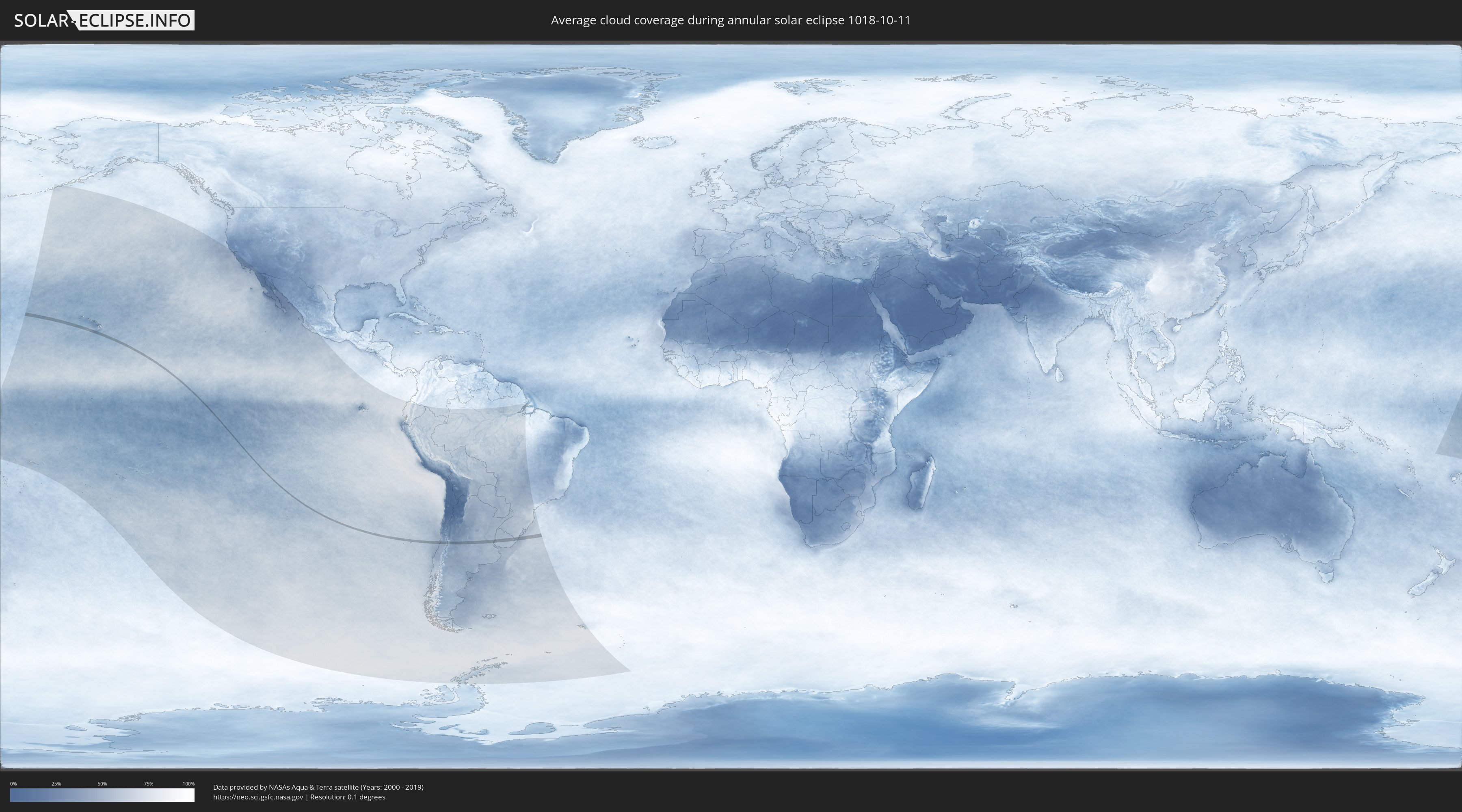
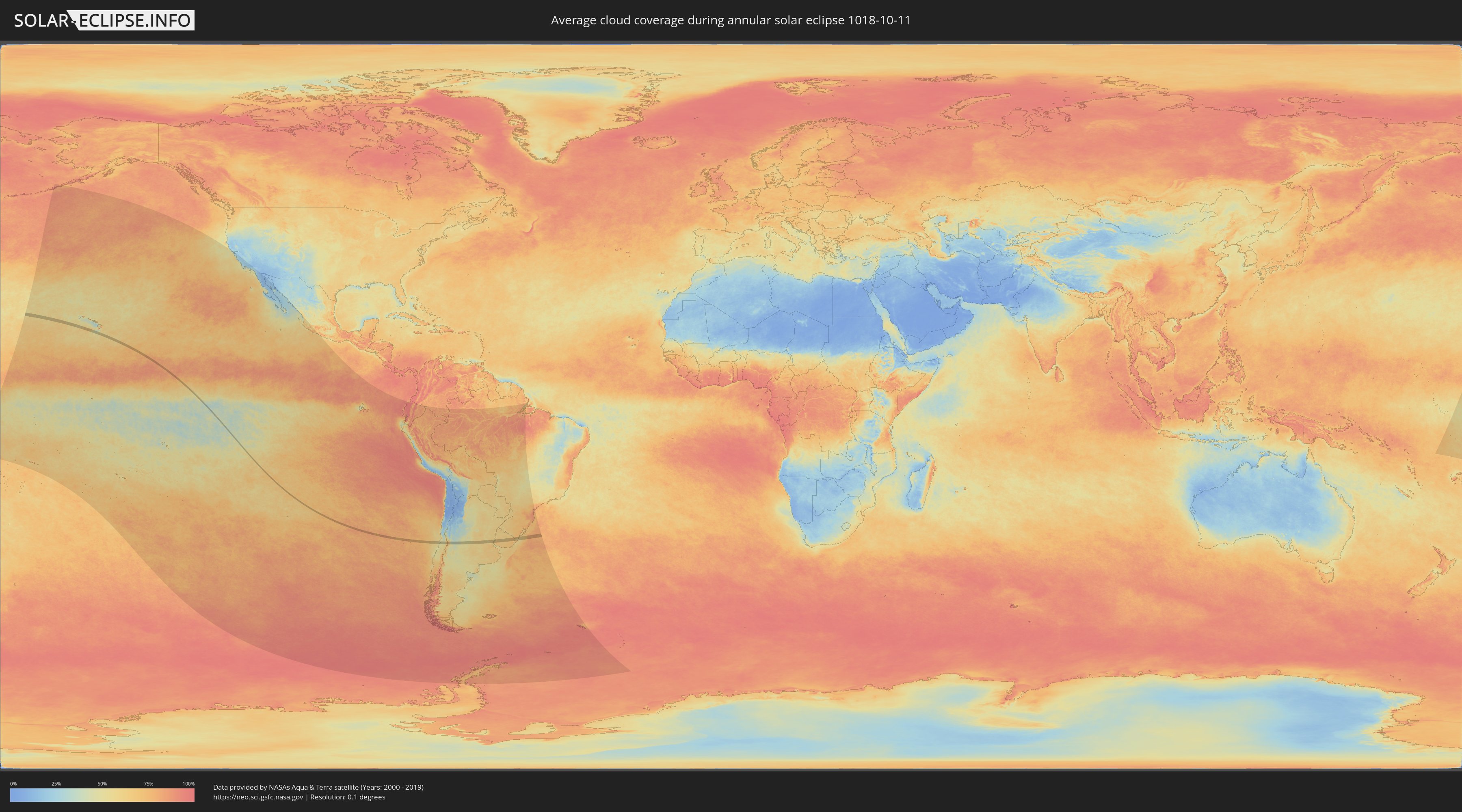
How will be the weather during the annular solar eclipse on 10/11/1018?
Where is the best place to see the annular solar eclipse of 10/11/1018?
The following maps show the average cloud coverage for the day of the annular solar eclipse.
With the help of these maps, it is possible to find the place along the eclipse path, which has the best
chance of a cloudless sky.
Nevertheless, you should consider local circumstances and inform about the weather of your chosen
observation site.
The data is provided by NASAs satellites
AQUA and TERRA.
The cloud maps are averaged over a period of 19 years (2000 - 2019).
Detailed country maps
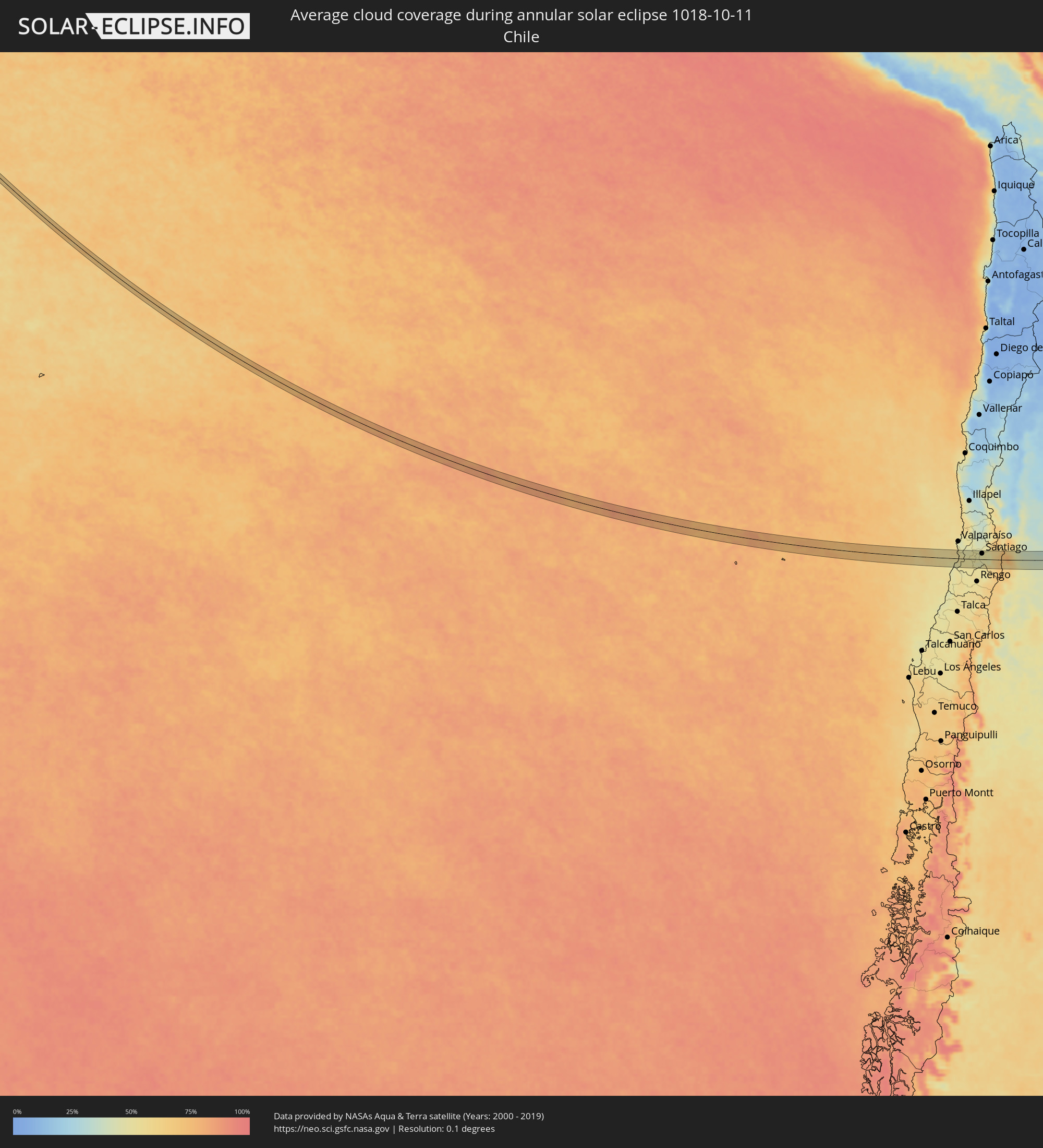 Chile
Chile
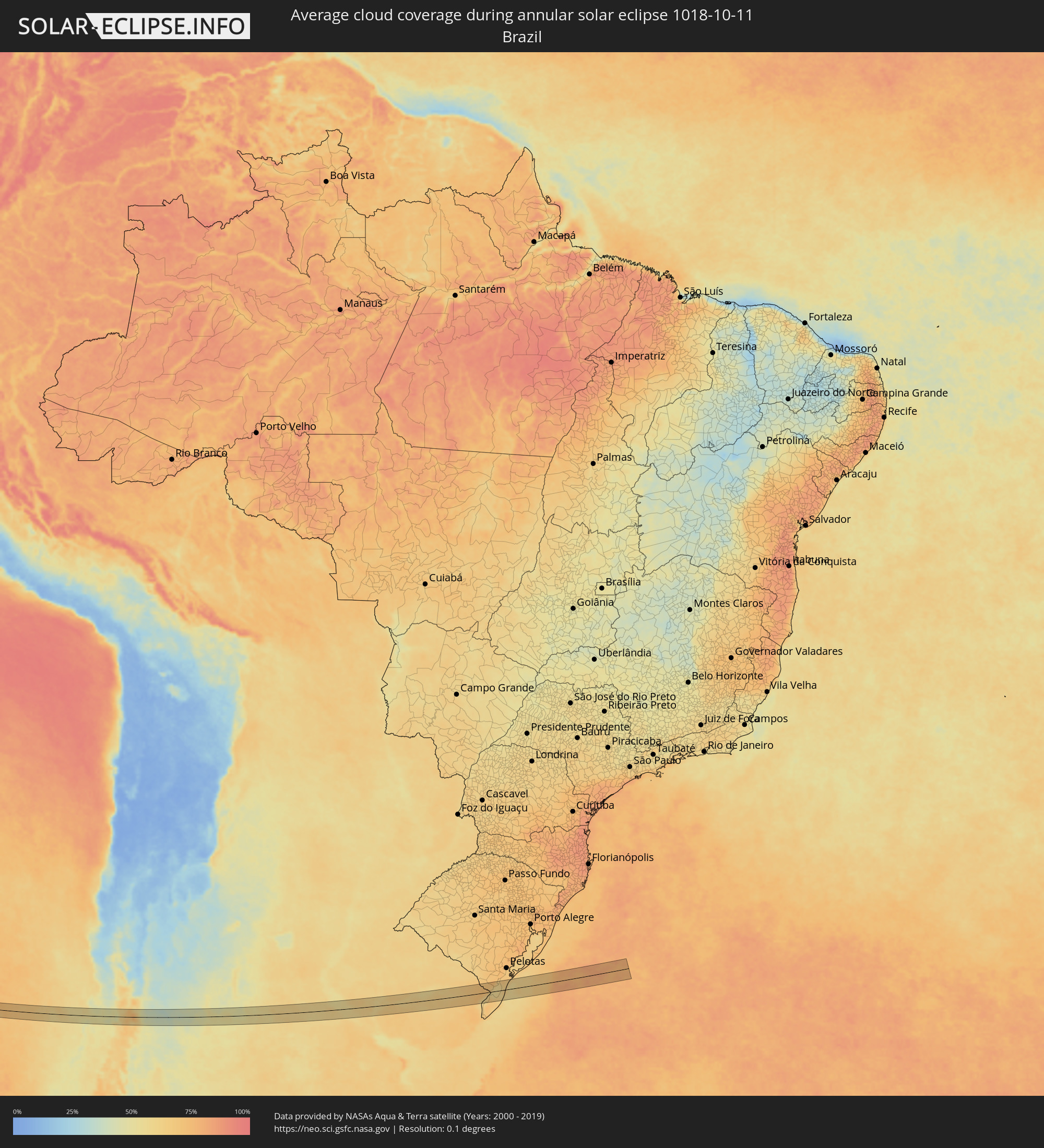 Brazil
 Argentina
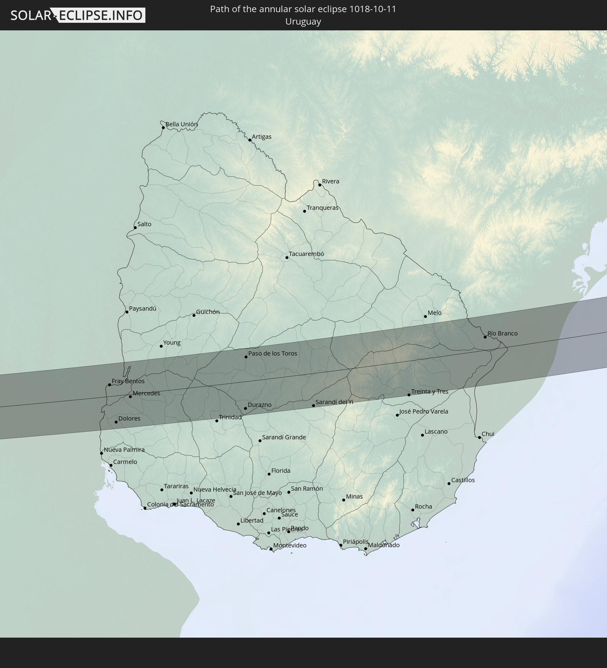
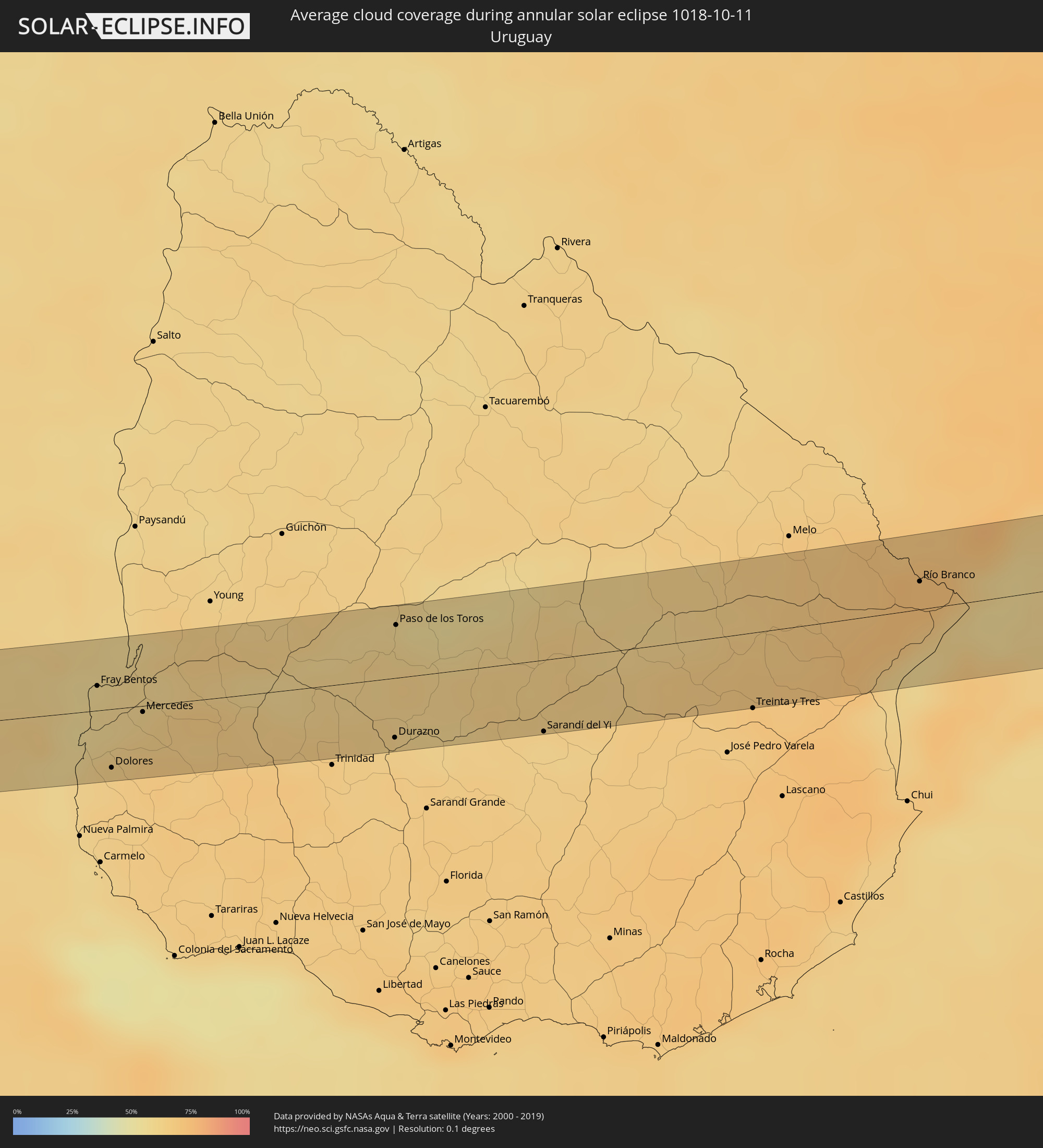 Uruguay
Cities inside the path of the eclipse
The following table shows all locations with a population of more than 5,000 inside the eclipse path. Cities which have more than 100,000 inhabitants are marked bold. A click at the locations opens a detailed map.
| City | Type | Eclipse duration | Local time of max. eclipse | Distance to central line | Ø Cloud coverage |
|
Cartagena, Valparaíso
|
annular | - | 16:24:46 UTC-04:42 | 8 km | 51% |
|
San Antonio, Valparaíso
|
annular | - | 16:24:45 UTC-04:42 | 3 km | 51% |
|
Melipilla, Santiago Metropolitan
|
annular | - | 16:25:02 UTC-04:42 | 6 km | 50% |
|
El Monte, Santiago Metropolitan
|
annular | - | 16:25:12 UTC-04:42 | 4 km | 48% |
|
Talagante, Santiago Metropolitan
|
annular | - | 16:25:15 UTC-04:42 | 2 km | 46% |
|
Peñaflor, Santiago Metropolitan
|
annular | - | 16:25:17 UTC-04:42 | 4 km | 49% |
|
Buin, Santiago Metropolitan
|
annular | - | 16:25:22 UTC-04:42 | 9 km | 45% |
|
Paine, Santiago Metropolitan
|
annular | - | 16:25:21 UTC-04:42 | 18 km | 46% |
|
Lo Prado, Santiago Metropolitan
|
annular | - | 16:25:25 UTC-04:42 | 23 km | 46% |
|
San Bernardo, Santiago Metropolitan
|
annular | - | 16:25:25 UTC-04:42 | 6 km | 47% |
|
Santiago, Santiago Metropolitan
|
annular | - | 16:25:28 UTC-04:42 | 22 km | 48% |
|
La Pintana, Santiago Metropolitan
|
annular | - | 16:25:28 UTC-04:42 | 8 km | 47% |
|
Villa Presidente Frei, Ñuñoa, Santiago, Chile, Santiago Metropolitan
|
annular | - | 16:25:31 UTC-04:42 | 21 km | 48% |
|
Puente Alto, Santiago Metropolitan
|
annular | - | 16:25:30 UTC-04:42 | 5 km | 47% |
|
Villa Mercedes, San Luis Province
|
annular | - | 16:54:35 UTC-04:16 | 4 km | 52% |
|
Justo Daract, San Luis Province
|
annular | - | 16:54:41 UTC-04:16 | 25 km | 50% |
|
Sampacho, Cordoba Province
|
annular | - | 16:55:01 UTC-04:16 | 27 km | 47% |
|
Coronel Moldes, Cordoba Province
|
annular | - | 16:55:02 UTC-04:16 | 0 km | 49% |
|
Vicuña Mackenna, Cordoba Province
|
annular | - | 16:55:04 UTC-04:16 | 34 km | 54% |
|
Adelia María, Cordoba Province
|
annular | - | 16:55:18 UTC-04:16 | 4 km | 53% |
|
La Carlota, Cordoba Province
|
annular | - | 16:55:41 UTC-04:16 | 17 km | 57% |
|
Canals, Cordoba Province
|
annular | - | 16:55:50 UTC-04:16 | 2 km | 60% |
|
Monte Maíz, Cordoba Province
|
annular | - | 16:56:03 UTC-04:16 | 37 km | 61% |
|
Arias, Cordoba Province
|
annular | - | 16:56:01 UTC-04:16 | 13 km | 61% |
|
Corral de Bustos, Cordoba Province
|
annular | - | 16:56:12 UTC-04:16 | 26 km | 61% |
|
Chañar Ladeado, Santa Fe Province
|
annular | - | 16:56:15 UTC-04:16 | 20 km | 61% |
|
Venado Tuerto, Santa Fe Province
|
annular | - | 16:56:11 UTC-04:16 | 27 km | 60% |
|
Firmat, Santa Fe Province
|
annular | - | 16:56:27 UTC-04:16 | 2 km | 56% |
|
Arroyo Seco, Santa Fe Province
|
annular | - | 16:56:53 UTC-04:16 | 29 km | 62% |
|
Villa Constitución, Santa Fe Province
|
annular | - | 16:56:56 UTC-04:16 | 19 km | 57% |
|
San Nicolás de los Arroyos, Buenos Aires
|
annular | - | 16:56:56 UTC-04:16 | 6 km | 59% |
|
Gualeguay, Entre Ríos Province
|
annular | - | 16:57:18 UTC-04:16 | 20 km | 62% |
|
Larroque, Entre Ríos Province
|
annular | - | 16:57:25 UTC-04:16 | 30 km | 64% |
|
Gualeguaychú, Entre Ríos Province
|
annular | - | 16:57:35 UTC-04:16 | 28 km | 59% |
|
Fray Bentos, Río Negro
|
annular | - | 17:29:33 UTC-03:44 | 14 km | 58% |
|
Dolores, Soriano
|
annular | - | 17:29:28 UTC-03:44 | 32 km | 64% |
|
Mercedes, Soriano
|
annular | - | 17:29:36 UTC-03:44 | 3 km | 64% |
|
Durazno, Durazno
|
annular | - | 17:29:57 UTC-03:44 | 33 km | 64% |
|
Paso de los Toros, Tacuarembó
|
annular | - | 17:30:07 UTC-03:44 | 29 km | 60% |
|
Sarandí del Yi, Durazno
|
annular | - | 17:30:09 UTC-03:44 | 40 km | 62% |
|
Río Branco, Cerro Largo
|
annular | - | 17:30:45 UTC-03:44 | 15 km | 73% |
|
Jaguarão, Rio Grande do Sul
|
annular | - | 18:09:09 UTC-03:06 | 19 km | 73% |