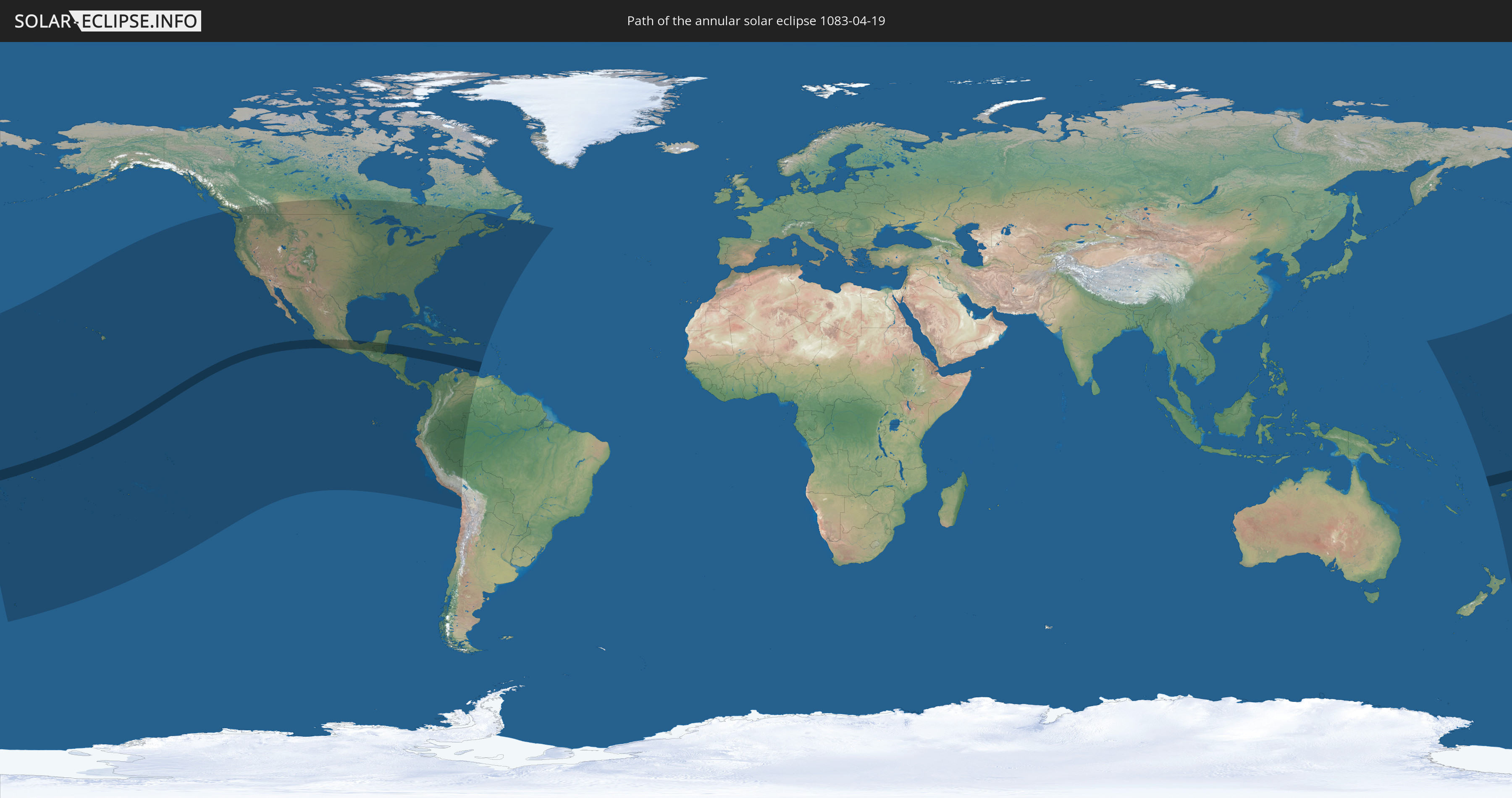
Annular solar eclipse of 04/19/1083
| Day of week: | Thursday |
| Maximum duration of eclipse: | 07m28s |
| Maximum width of eclipse path: | 210 km |
| Saros cycle: | 104 |
| Coverage: | 94.3% |
| Magnitude: | 0.9432 |
| Gamma: | -0.0173 |
Wo kann man die Sonnenfinsternis vom 04/19/1083 sehen?
Die Sonnenfinsternis am 04/19/1083 kann man in 44 Ländern als partielle Sonnenfinsternis beobachten.
Der Finsternispfad verläuft durch 12 Länder. Nur in diesen Ländern ist sie als annular Sonnenfinsternis zu sehen.
In den folgenden Ländern ist die Sonnenfinsternis annular zu sehen
 Wallis and Futuna
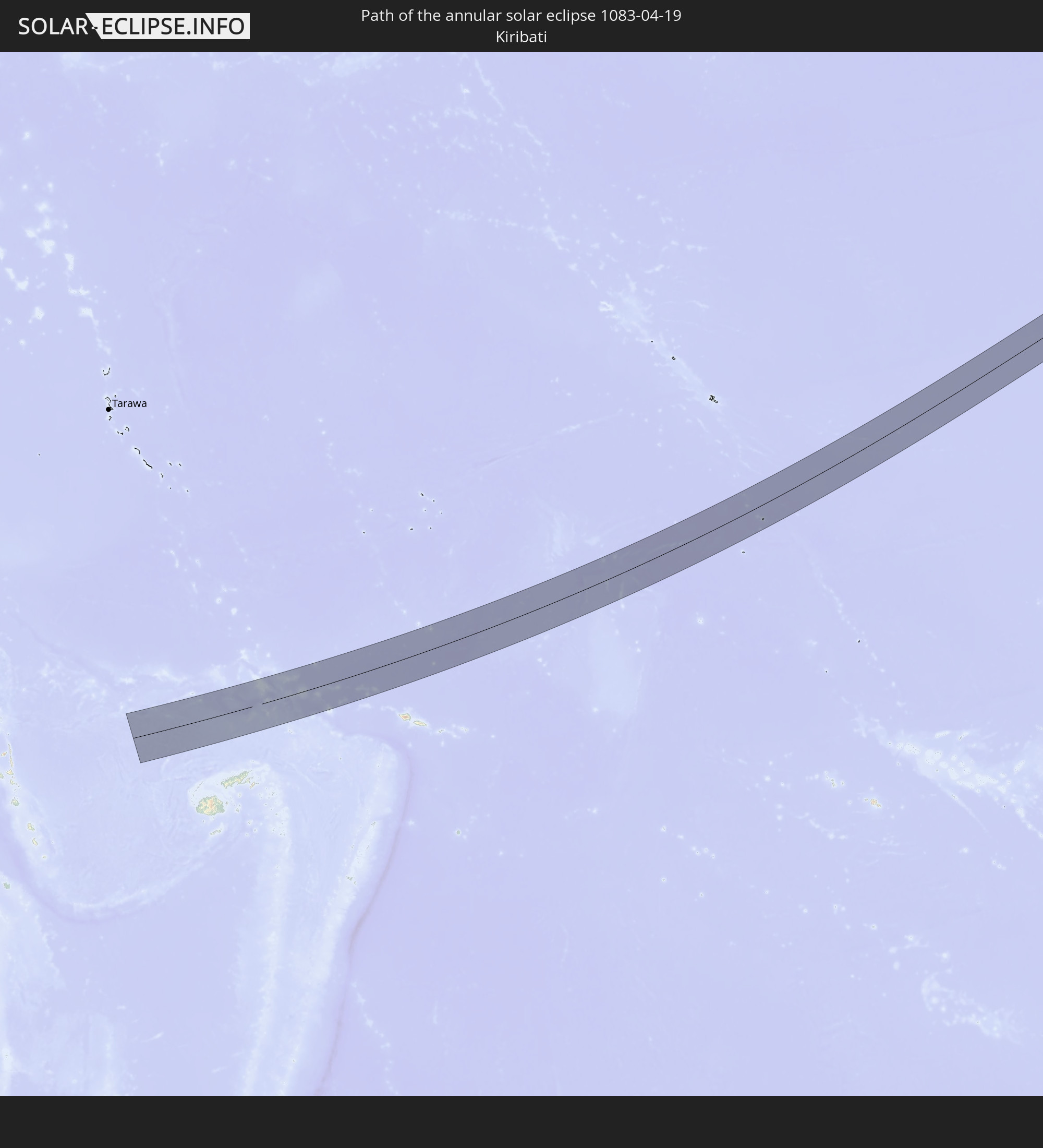 Kiribati
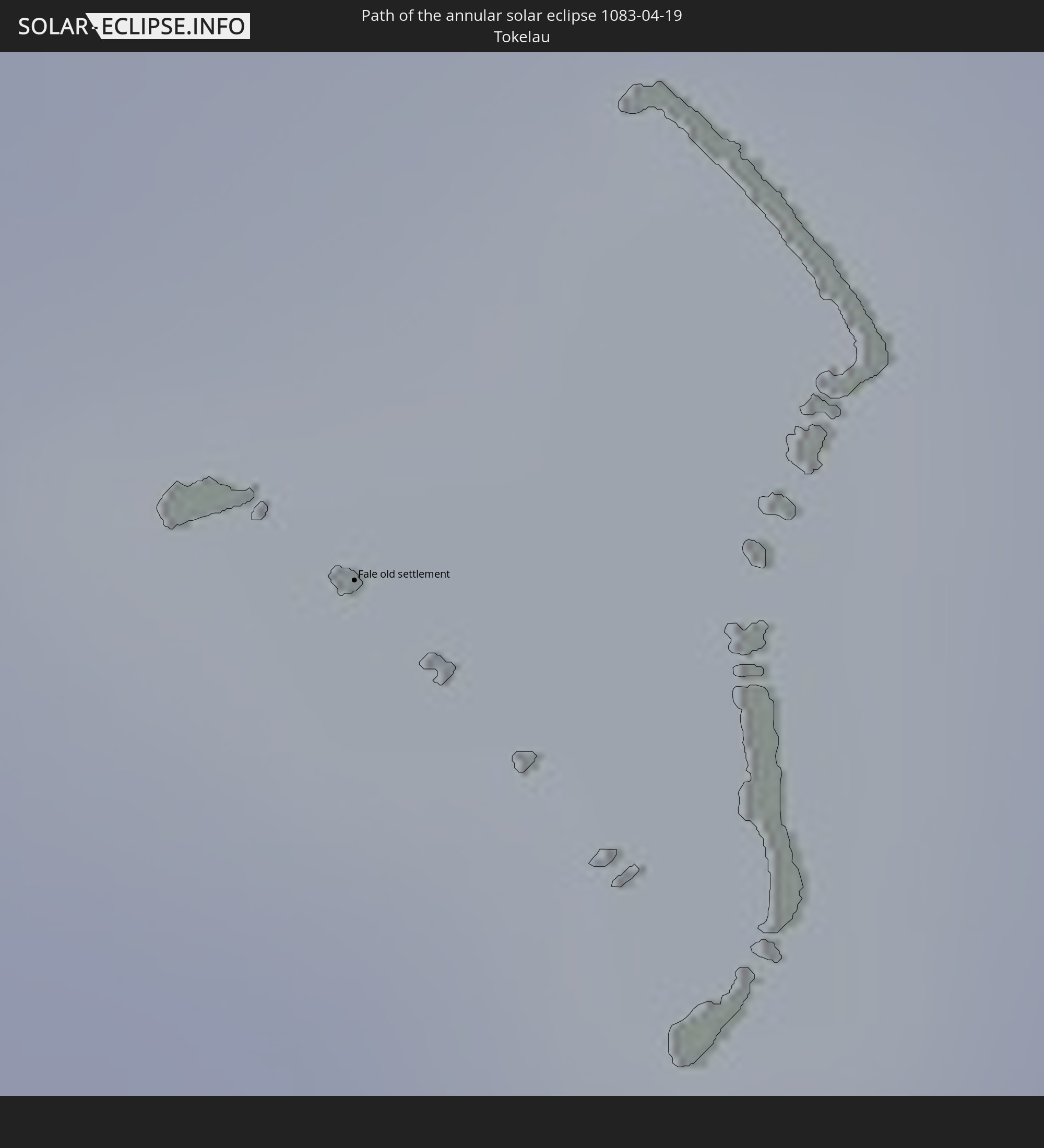 Tokelau
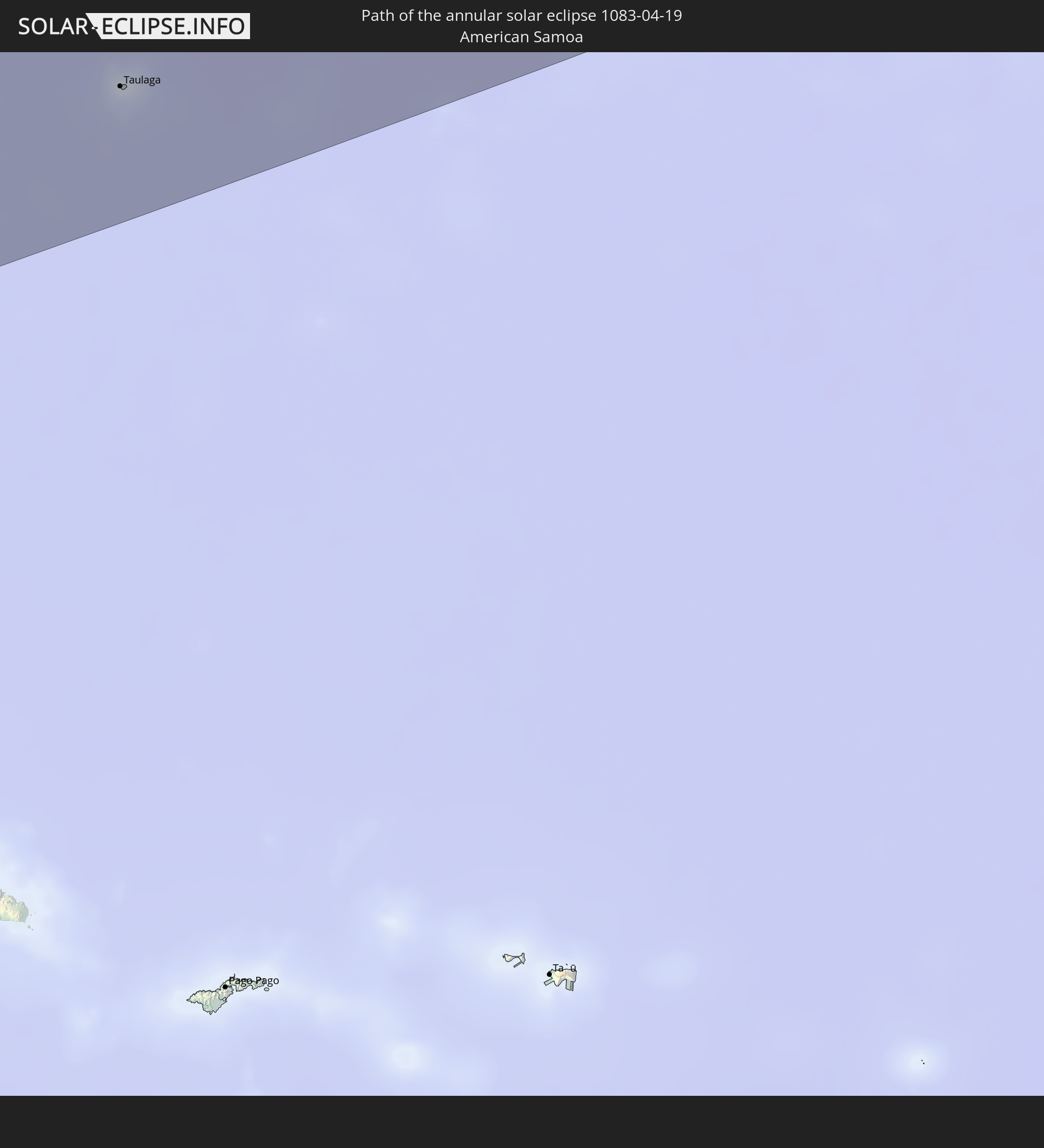 American Samoa
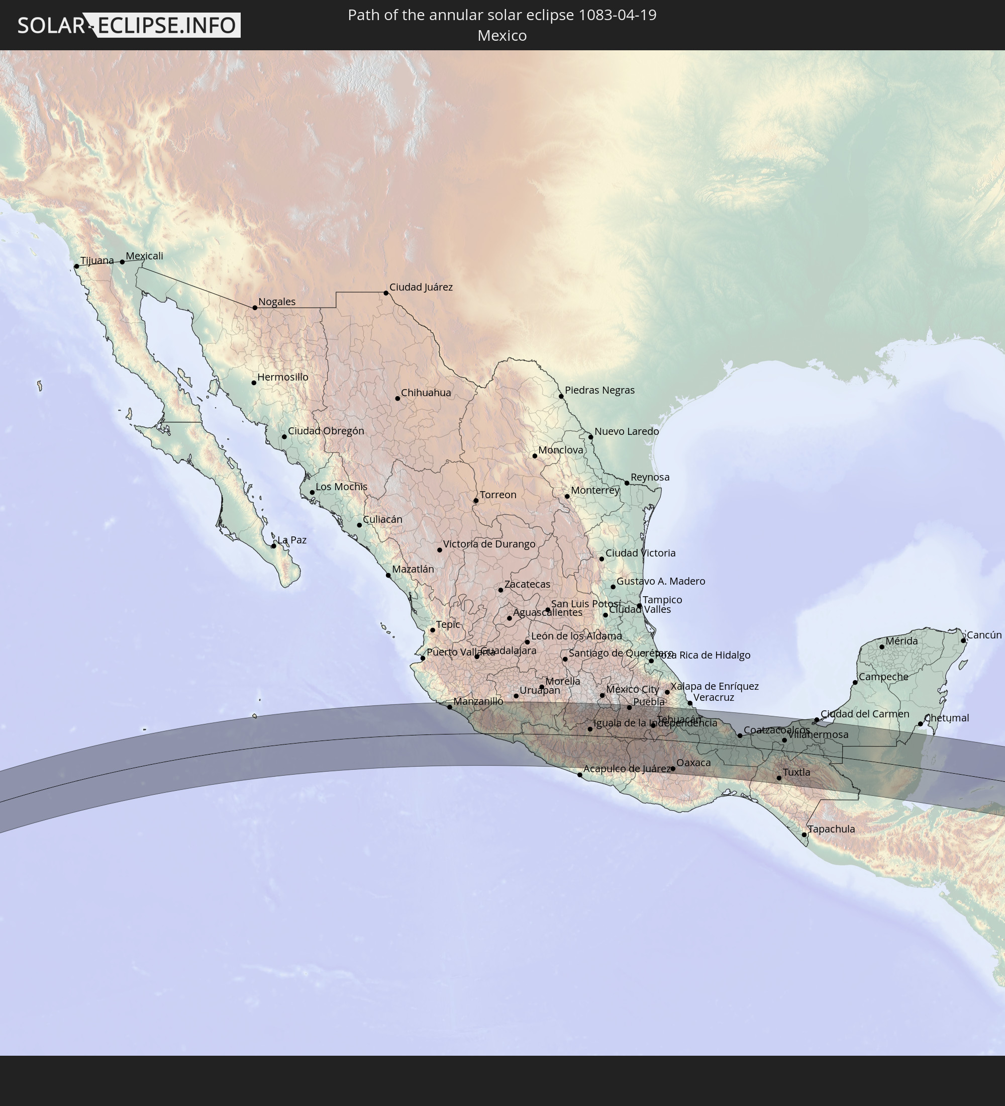 Mexico
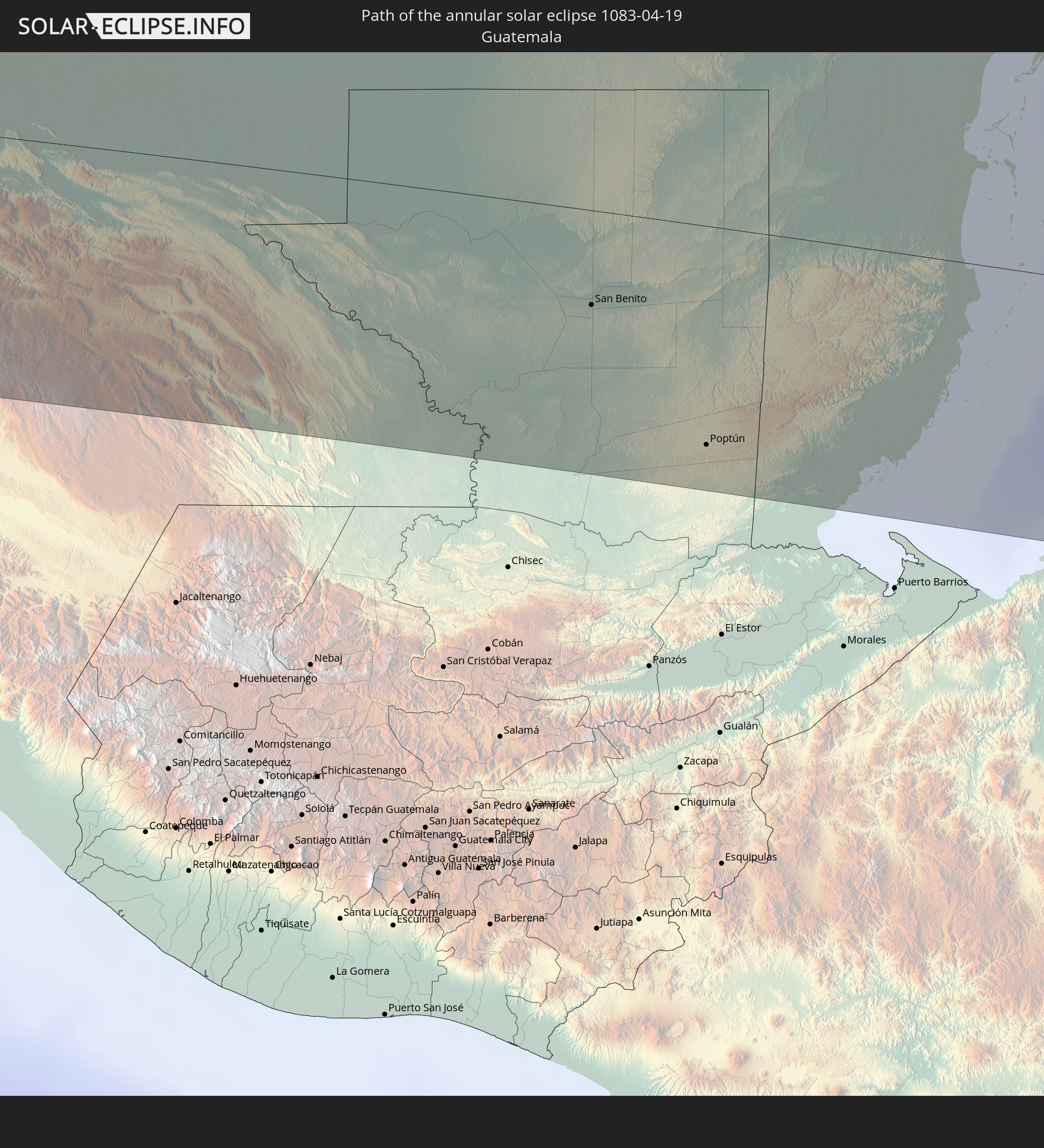 Guatemala
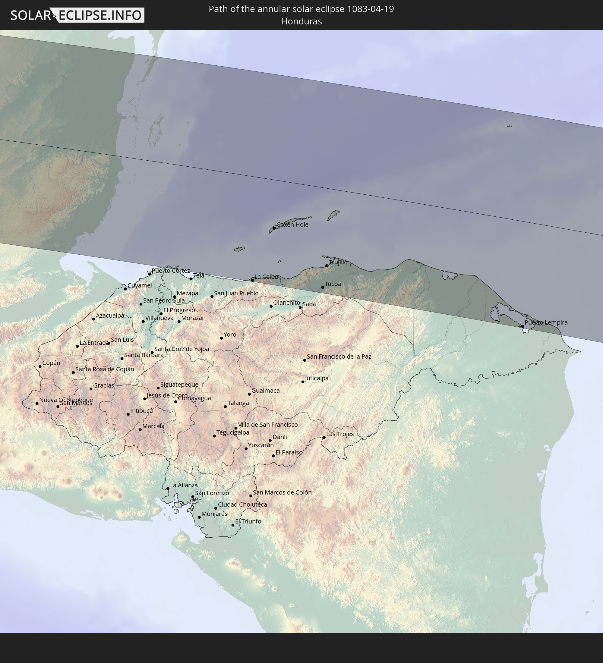 Honduras
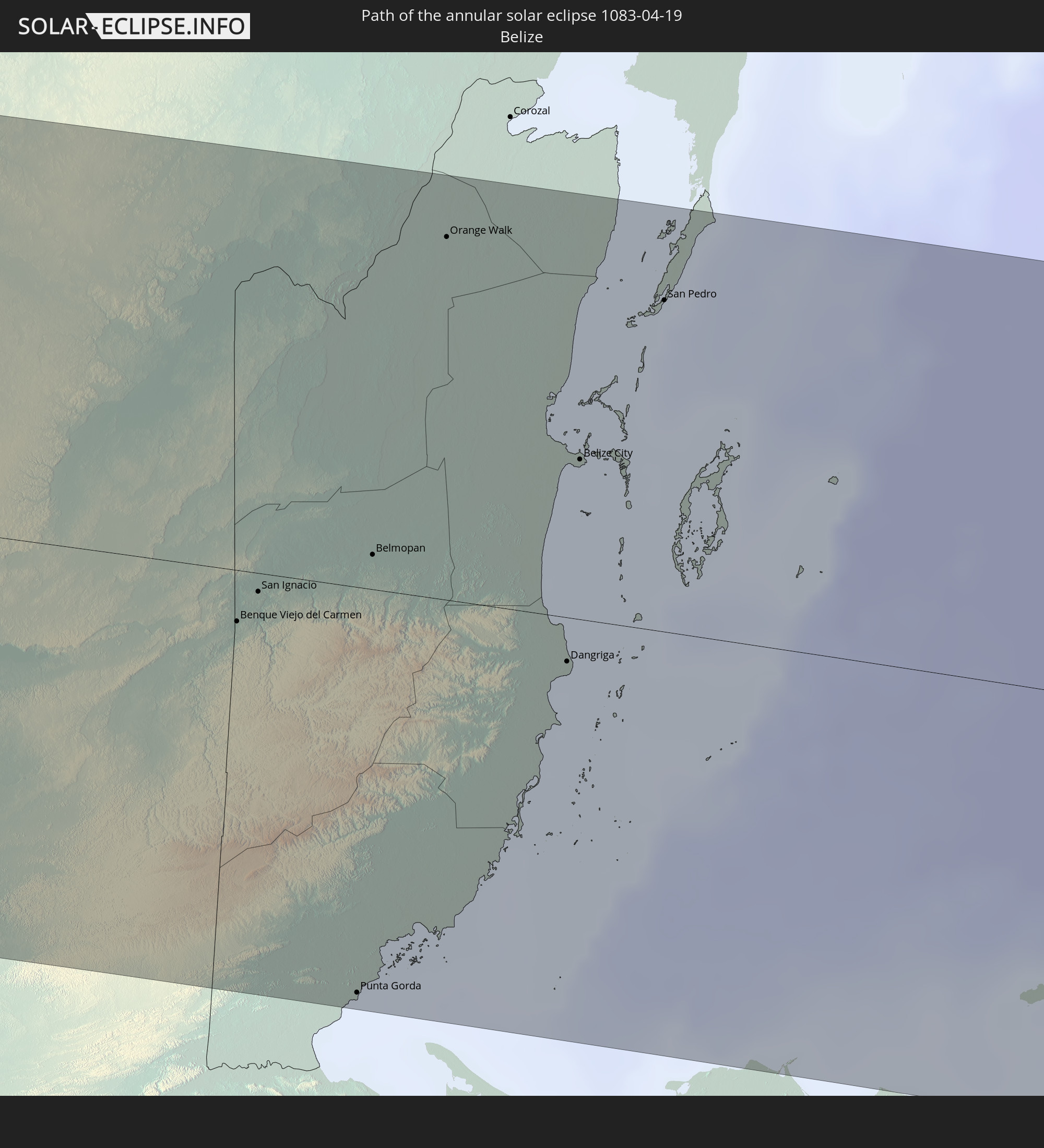 Belize
 Venezuela
 Aruba
Aruba
 Curaçao
 Caribbean Netherlands
In den folgenden Ländern ist die Sonnenfinsternis partiell zu sehen
 Fiji
Fiji
 United States
 New Zealand
 United States Minor Outlying Islands
 Wallis and Futuna
 Tonga
Tonga
 Kiribati
 Samoa
Samoa
 Tokelau
 American Samoa
 Niue
Niue
 Cook Islands
 French Polynesia
 Canada
 Pitcairn Islands
 Mexico
 Chile
Chile
 Guatemala
 Ecuador
 El Salvador
 Honduras
 Belize
 Nicaragua
 Costa Rica
 Cuba
Cuba
 Panama
 Colombia
 Cayman Islands
 Peru
Peru
 The Bahamas
 Jamaica
 Haiti
Haiti
 Brazil
 Venezuela
 Turks and Caicos Islands
 Dominican Republic
 Aruba
Aruba
 Puerto Rico
 United States Virgin Islands
 Bermuda
 British Virgin Islands
 Saint Pierre and Miquelon
 Marshall Islands
 Tuvalu
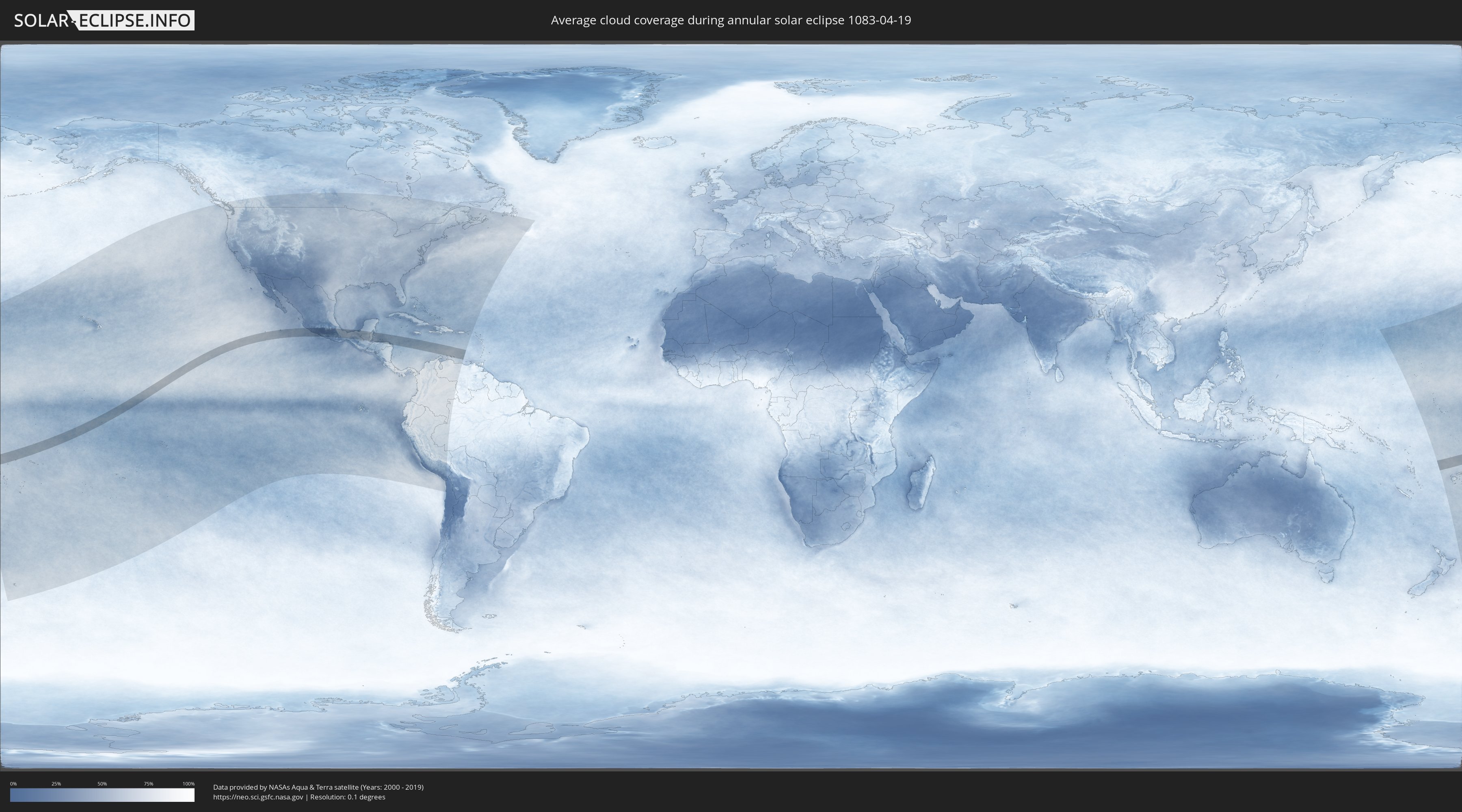
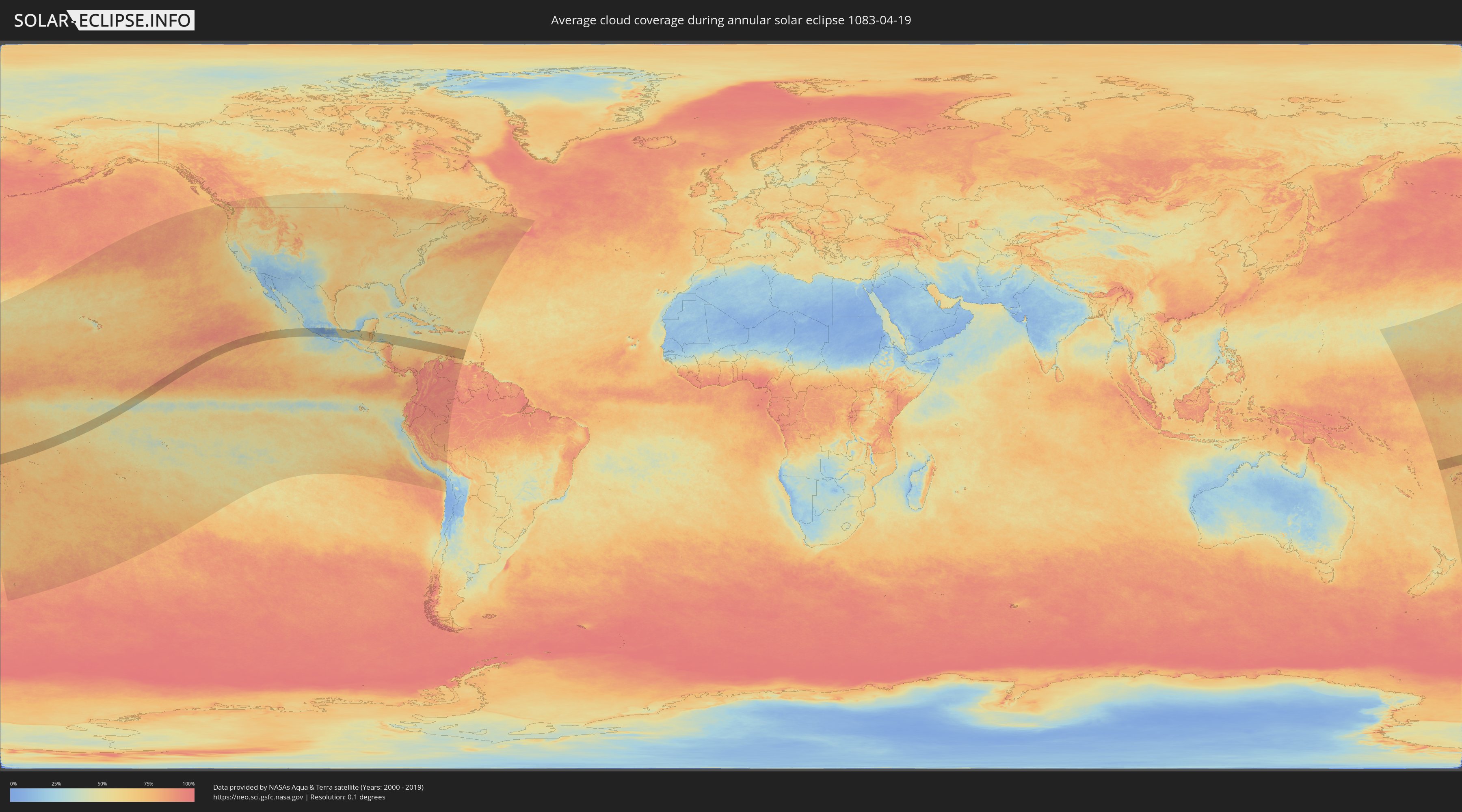
How will be the weather during the annular solar eclipse on 04/19/1083?
Where is the best place to see the annular solar eclipse of 04/19/1083?
The following maps show the average cloud coverage for the day of the annular solar eclipse.
With the help of these maps, it is possible to find the place along the eclipse path, which has the best
chance of a cloudless sky.
Nevertheless, you should consider local circumstances and inform about the weather of your chosen
observation site.
The data is provided by NASAs satellites
AQUA and TERRA.
The cloud maps are averaged over a period of 19 years (2000 - 2019).
Detailed country maps
 Wallis and Futuna
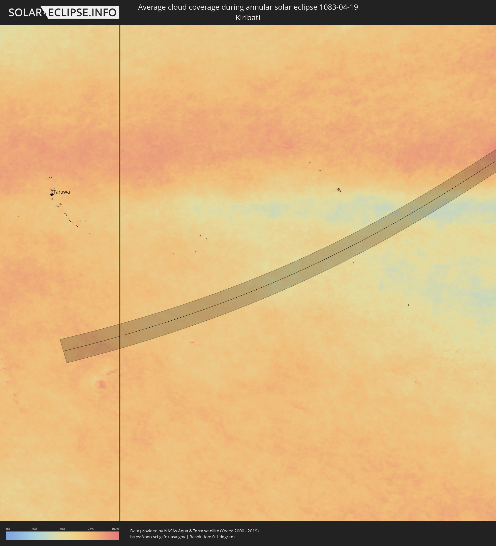 Kiribati
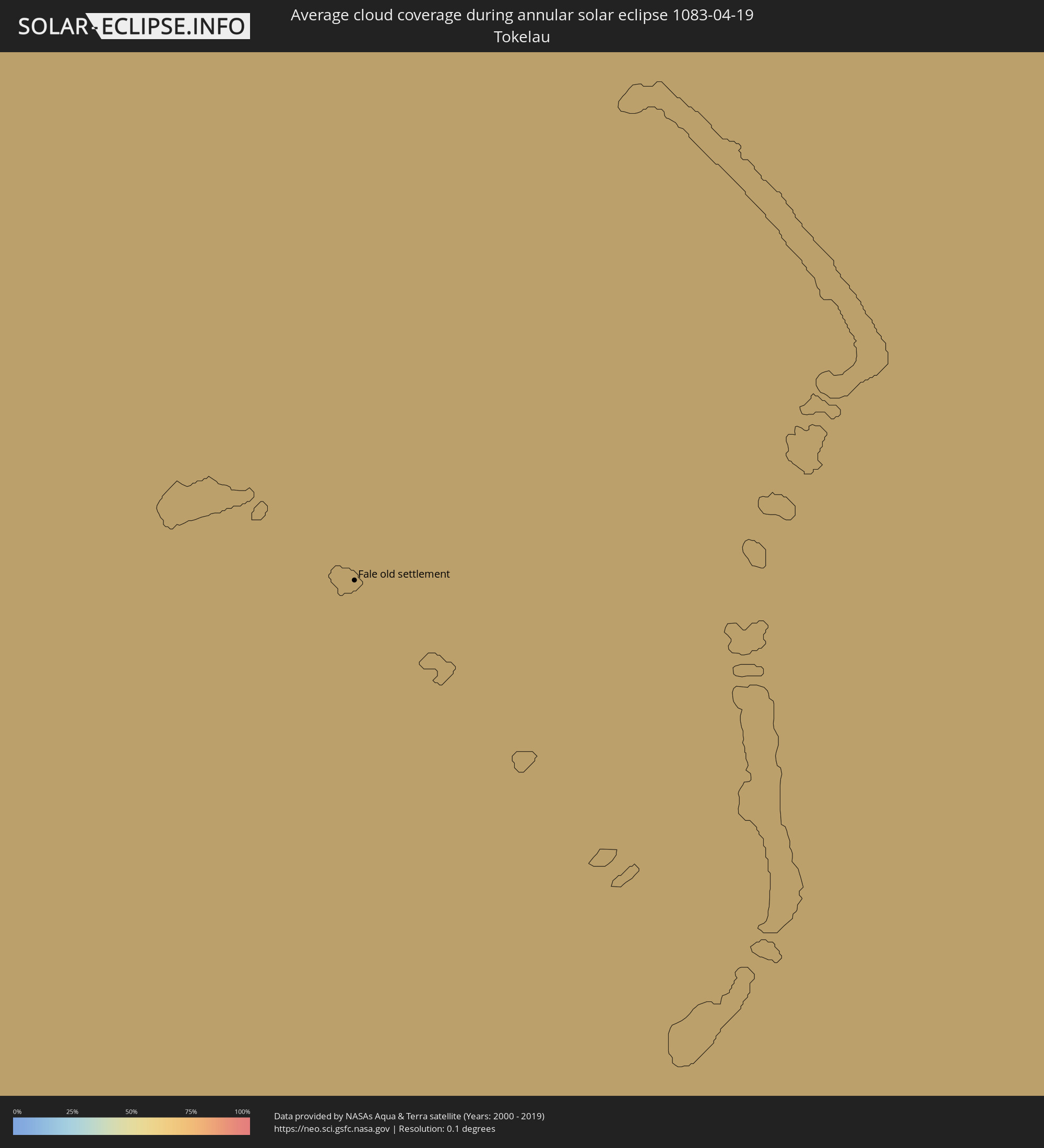 Tokelau
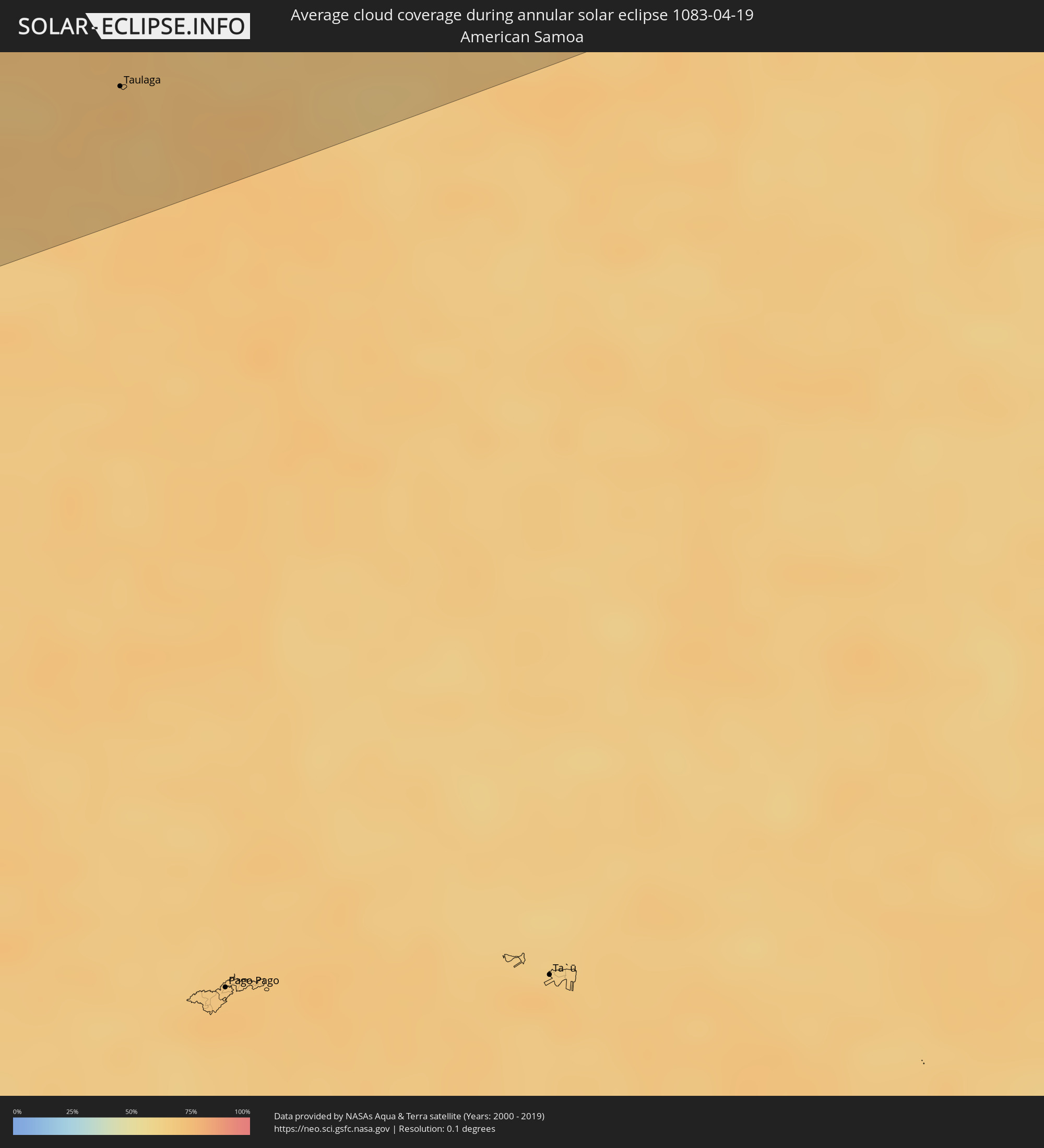 American Samoa
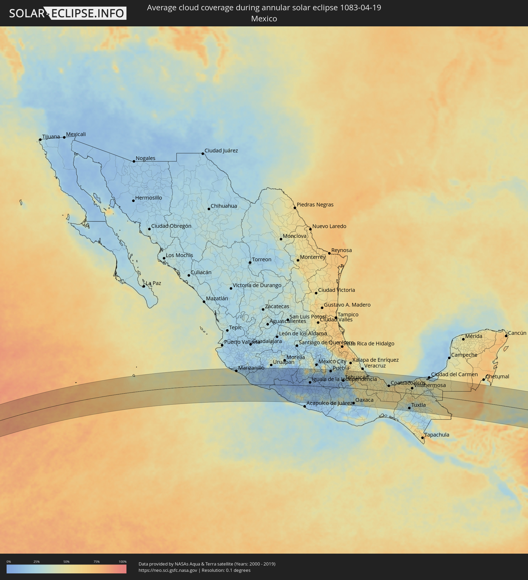 Mexico
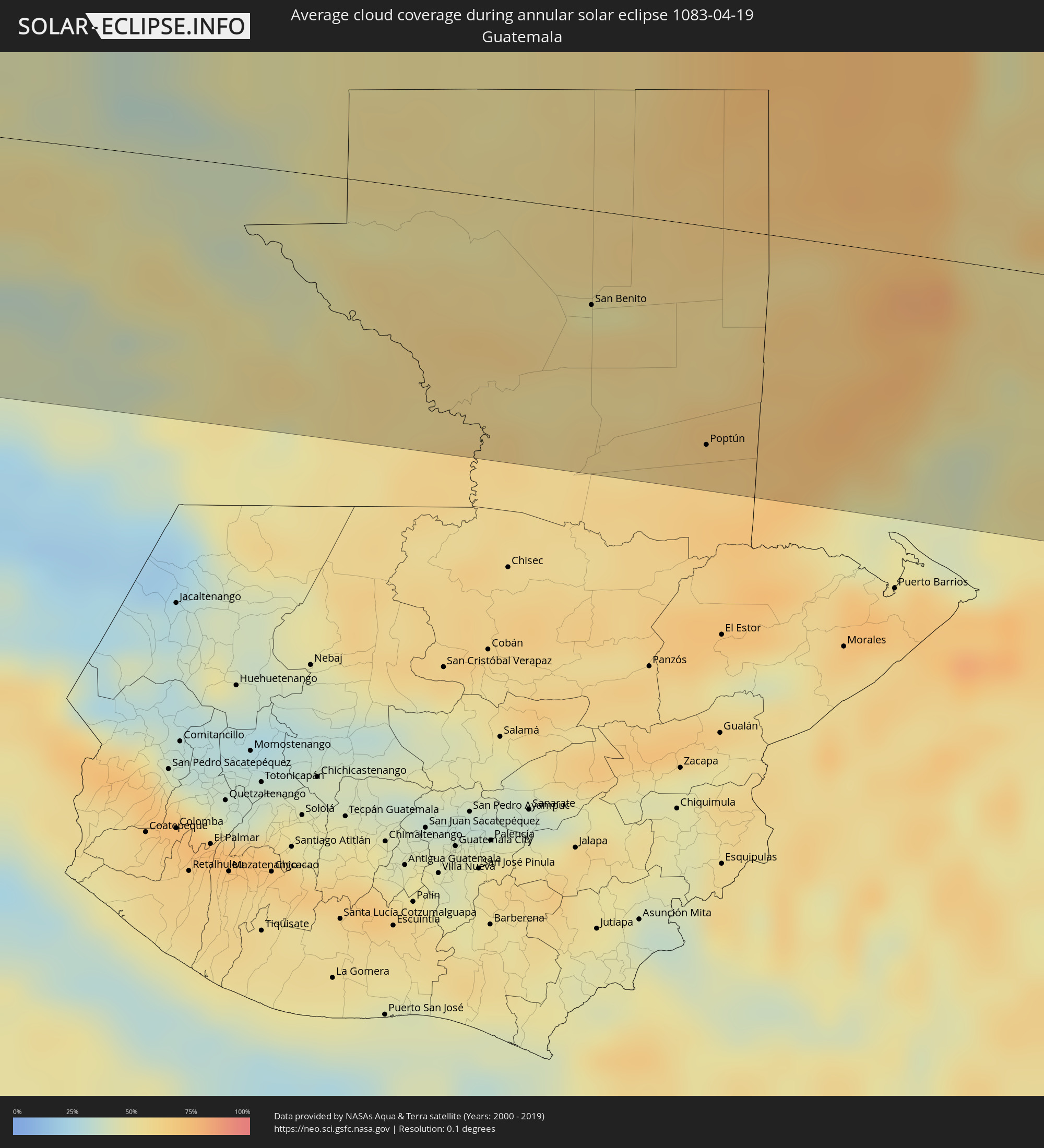 Guatemala
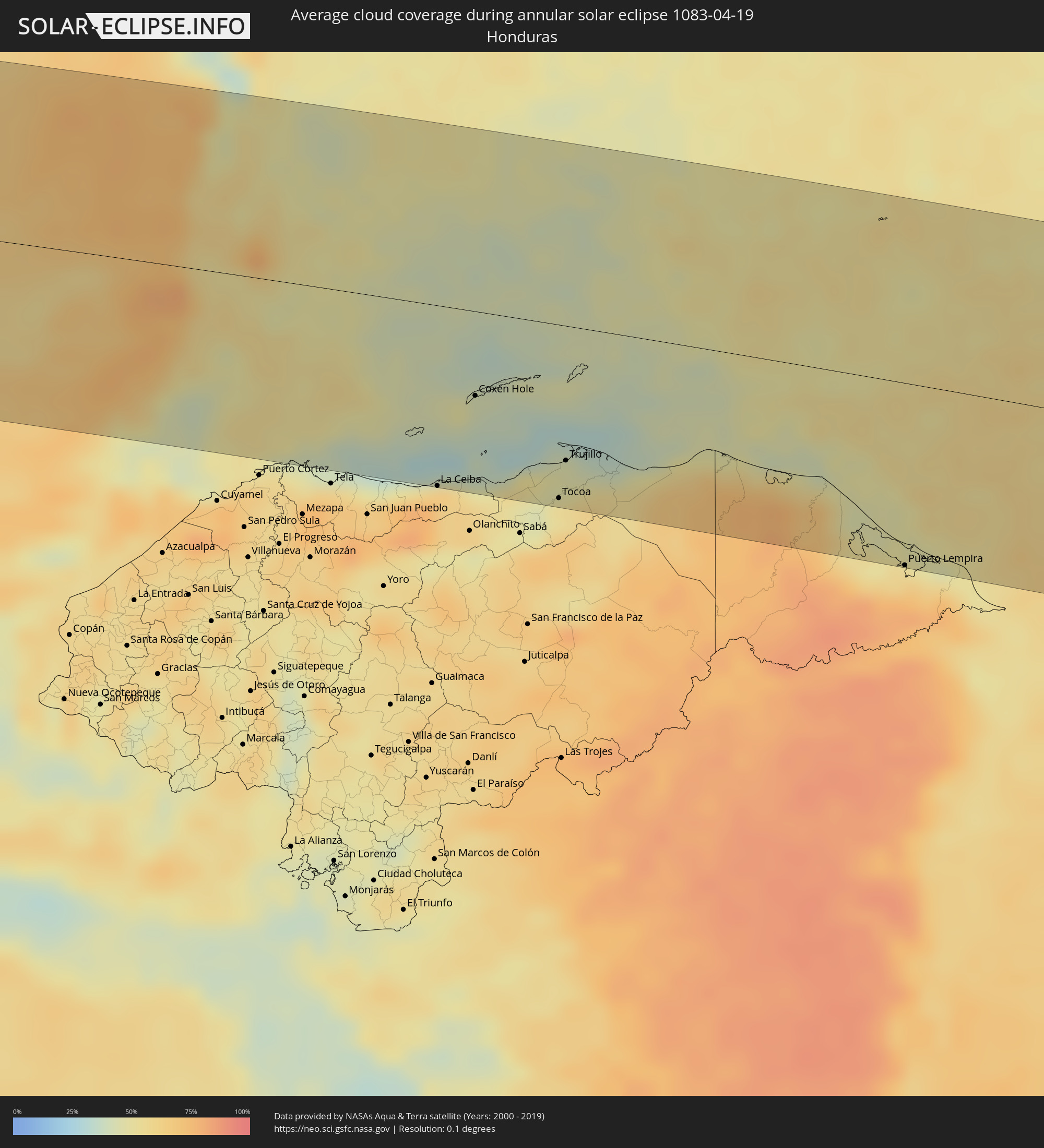 Honduras
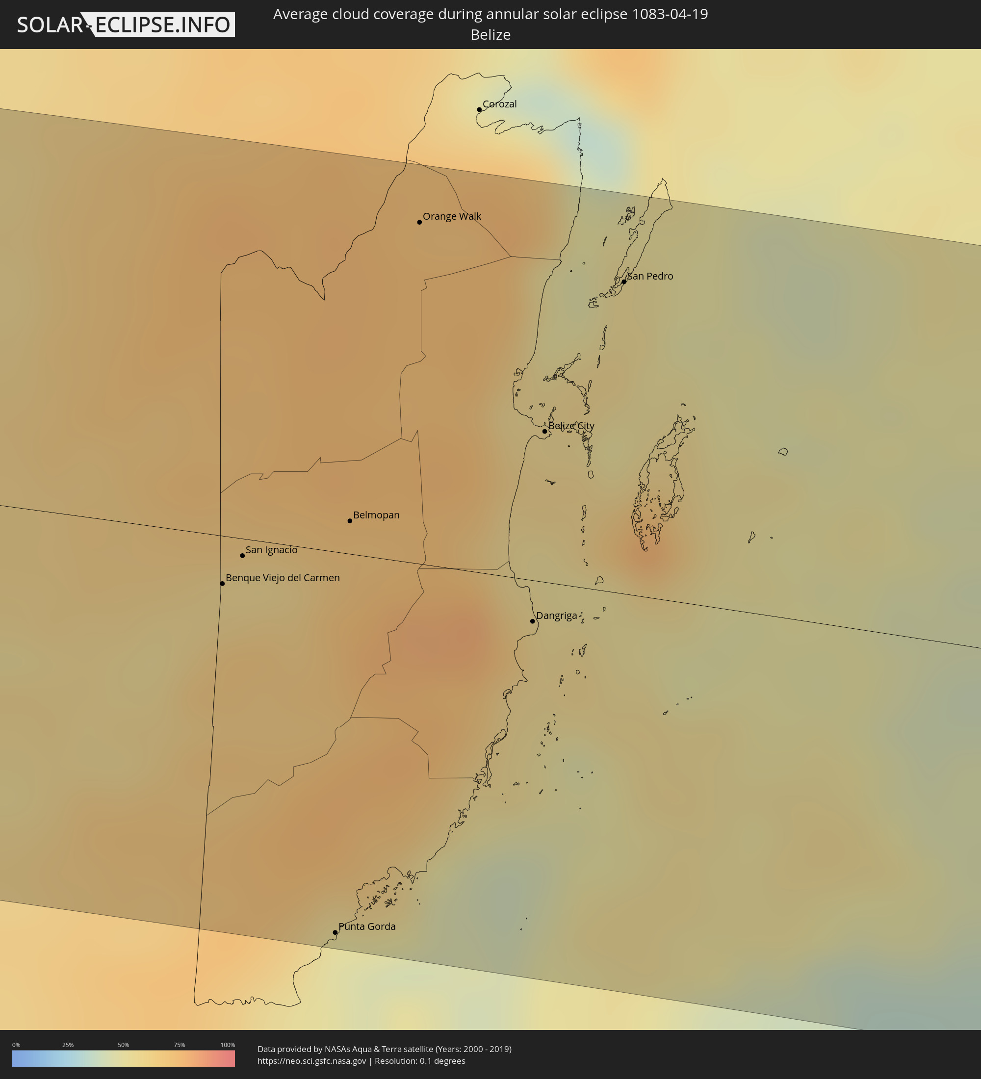 Belize
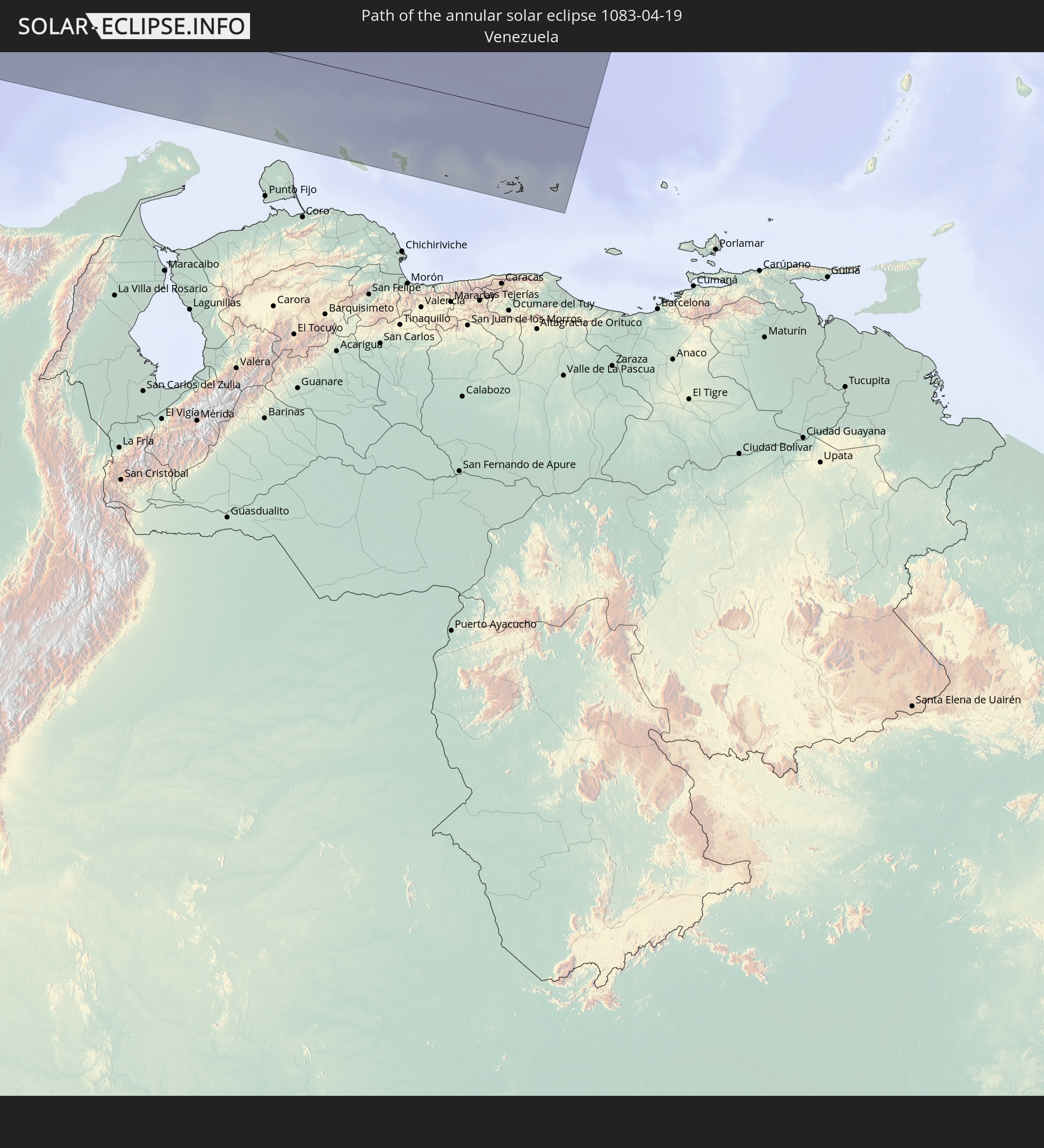
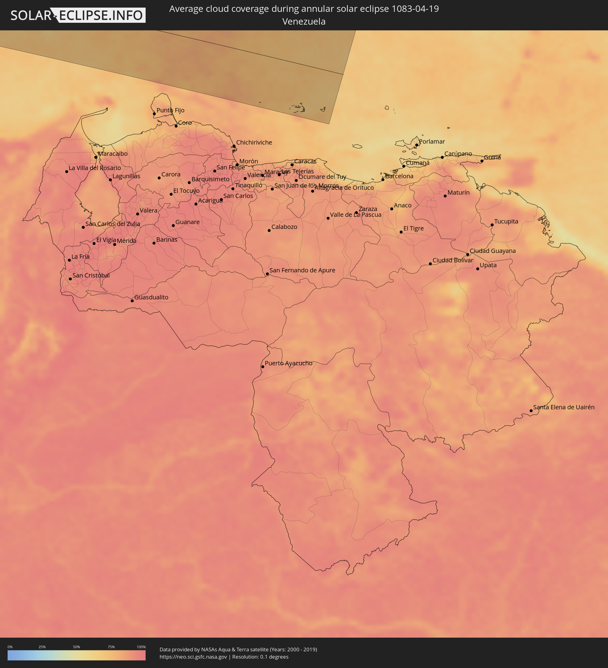 Venezuela
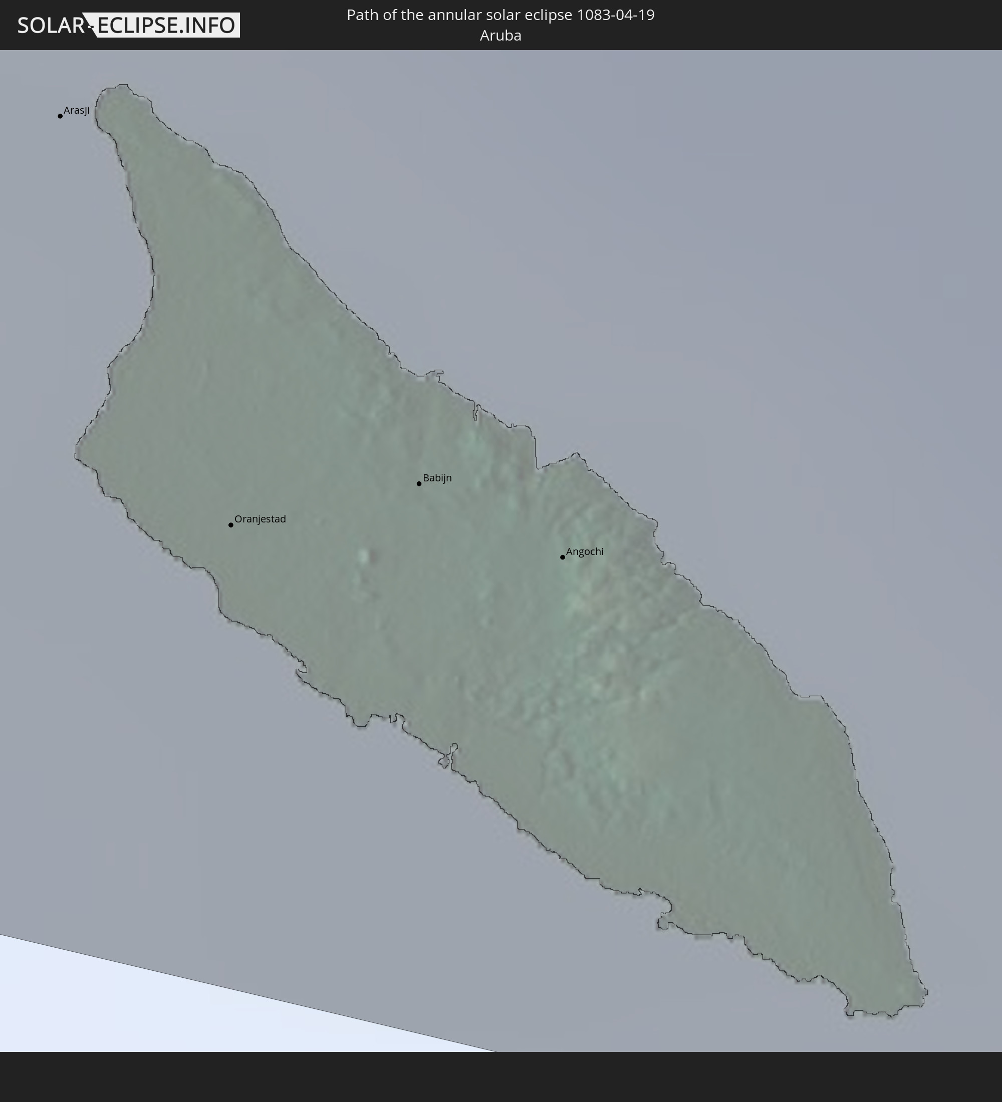
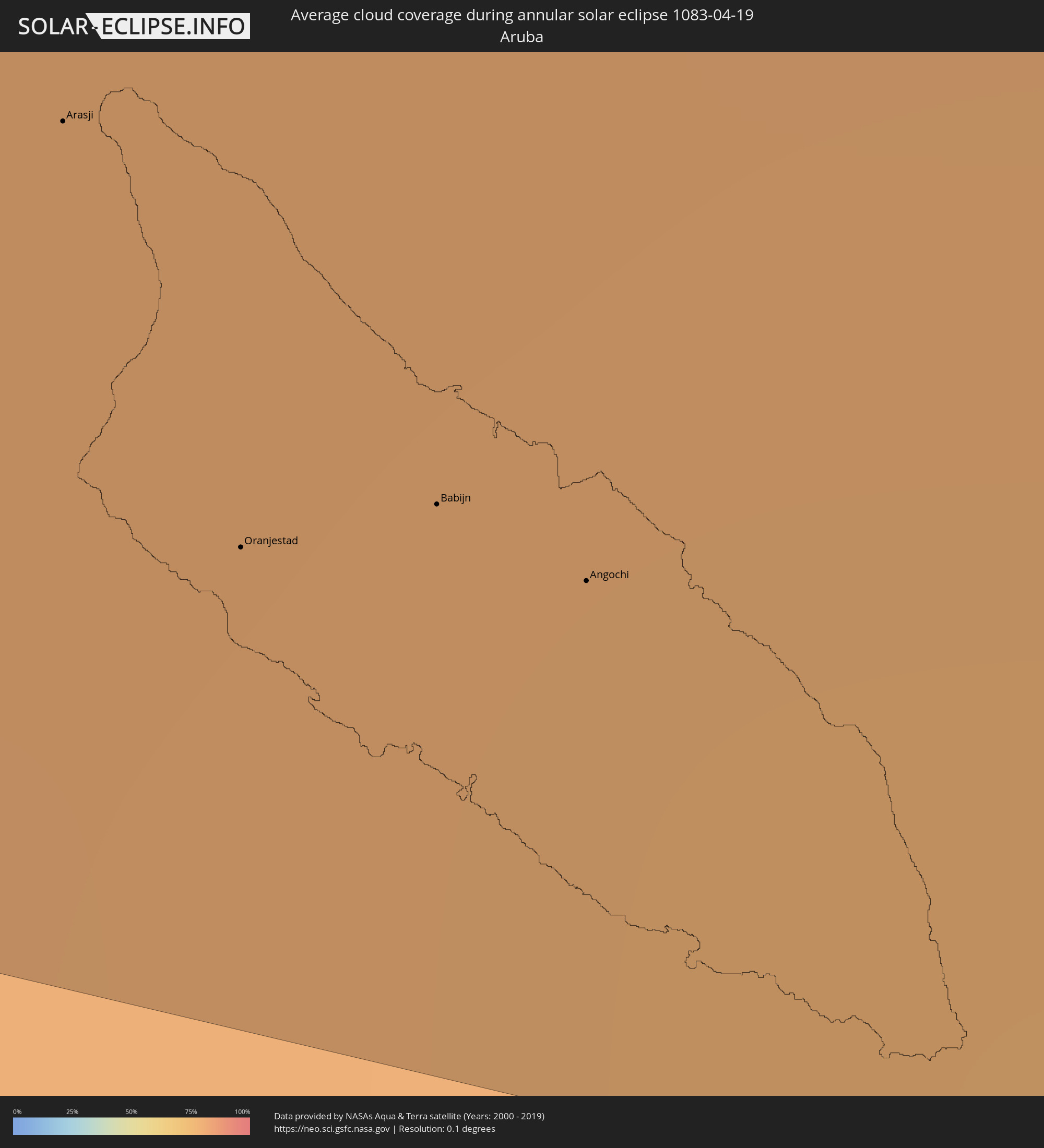 Aruba
Aruba
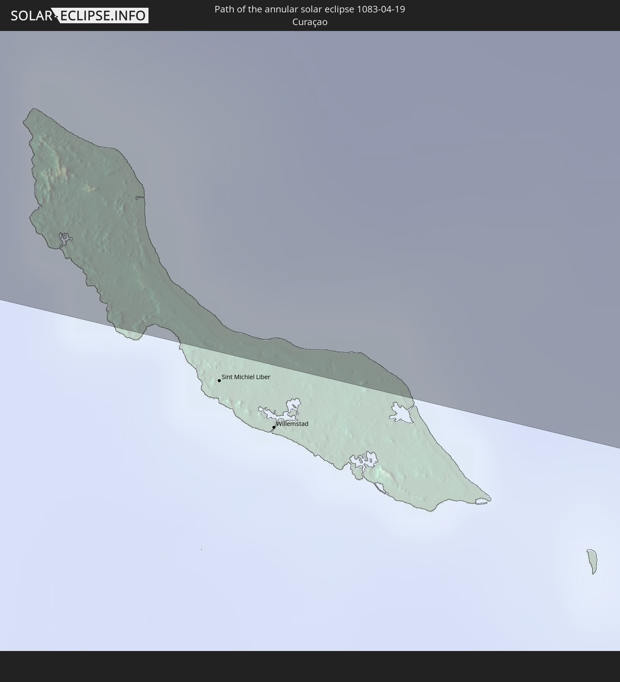
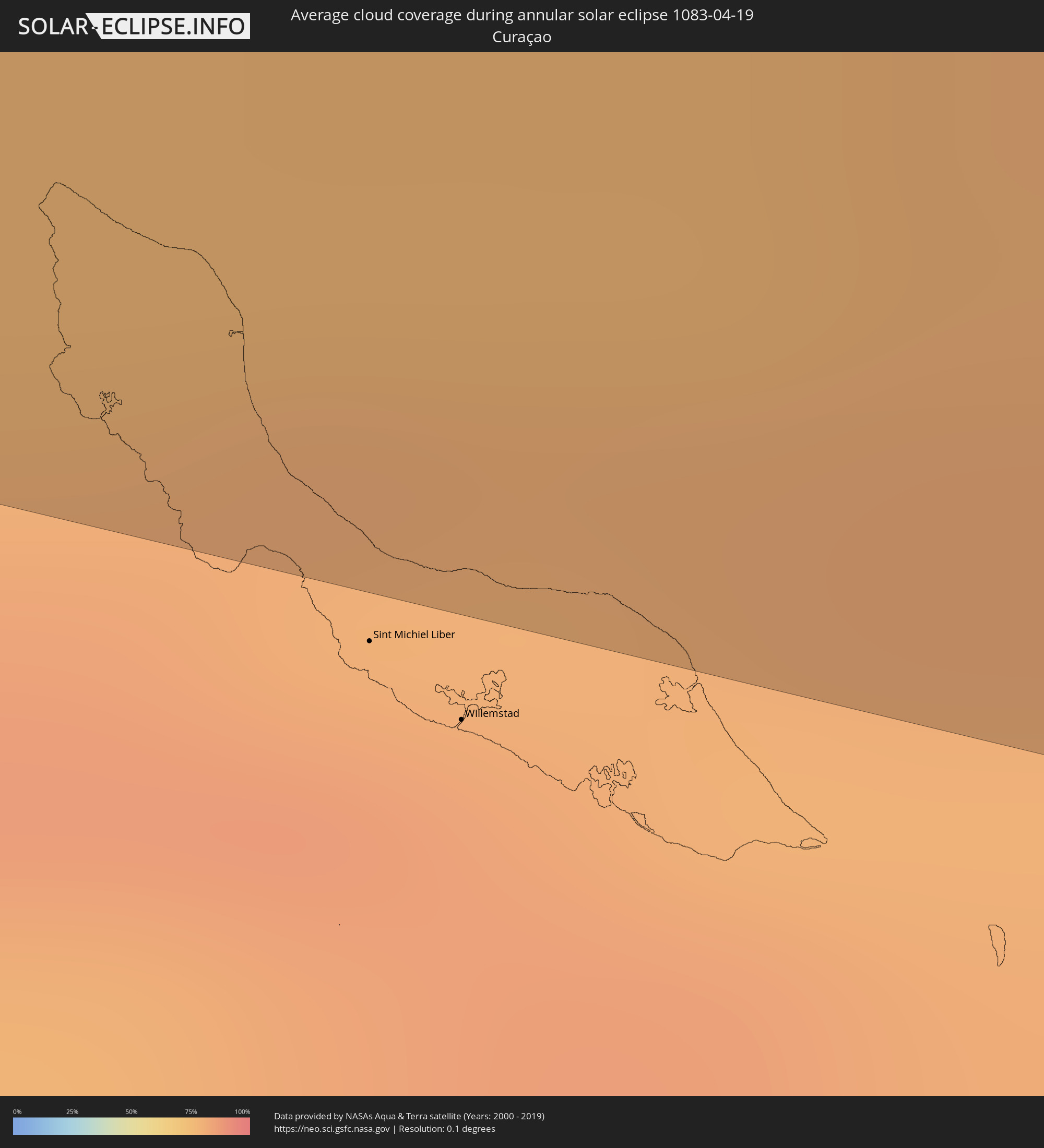 Curaçao
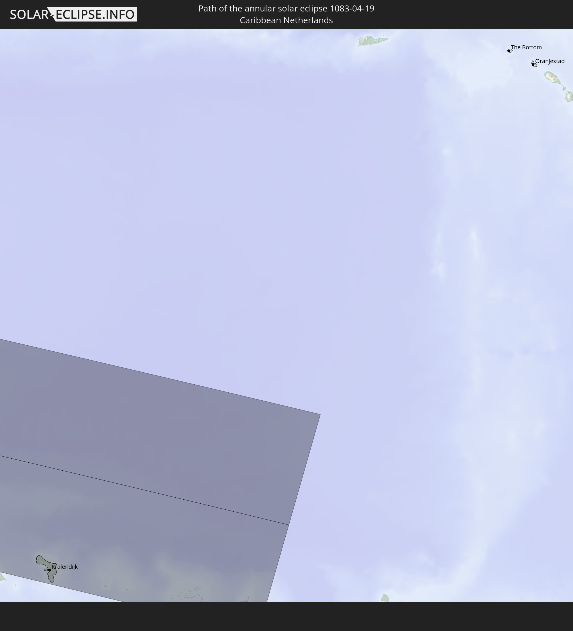
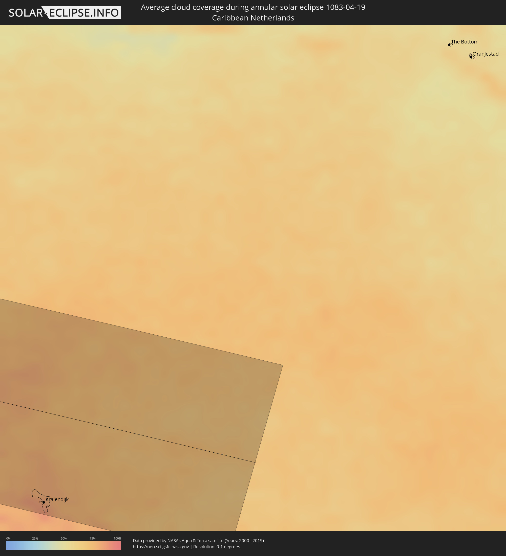 Caribbean Netherlands
Cities inside the path of the eclipse
The following table shows all locations with a population of more than 5,000 inside the eclipse path. Cities which have more than 100,000 inhabitants are marked bold. A click at the locations opens a detailed map.
| City | Type | Eclipse duration | Local time of max. eclipse | Distance to central line | Ø Cloud coverage |
|
Fale old settlement, Fakaofo
|
annular | - | 07:39:33 UTC-11:00 | 105 km | 69% |
|
Taulaga, Swains Island
|
annular | - | 18:38:45 UTC+00:00 | 76 km | 68% |
|
Manzanillo, Colima
|
annular | - | 15:18:27 UTC-06:36 | 94 km | 38% |
|
Tecoman, Colima
|
annular | - | 15:19:23 UTC-06:36 | 78 km | 31% |
|
Apatzingán, Michoacán
|
annular | - | 15:22:33 UTC-06:36 | 97 km | 13% |
|
Ciudad Lázaro Cárdenas, Michoacán
|
annular | - | 15:22:50 UTC-06:36 | 28 km | 24% |
|
Ixtapa-Zihuatanejo, Guerrero
|
annular | - | 15:24:11 UTC-06:36 | 63 km | 31% |
|
Taxco de Alarcón, Guerrero
|
annular | - | 15:27:52 UTC-06:36 | 45 km | 18% |
|
Iguala de la Independencia, Guerrero
|
annular | - | 15:28:00 UTC-06:36 | 22 km | 8% |
|
Chilpancingo, Guerrero
|
annular | - | 15:28:07 UTC-06:36 | 67 km | 17% |
|
Cuernavaca, Morelos
|
annular | - | 15:28:30 UTC-06:36 | 88 km | 13% |
|
Cuautla Morelos, Morelos
|
annular | - | 15:29:01 UTC-06:36 | 76 km | 13% |
|
Atlixco, Puebla
|
annular | - | 15:29:53 UTC-06:36 | 90 km | 15% |
|
Puebla, Puebla
|
annular | - | 15:30:16 UTC-06:36 | 106 km | 17% |
|
Amozoc de Mota, Puebla
|
annular | - | 15:30:32 UTC-06:36 | 108 km | 16% |
|
Tehuacán, Puebla
|
annular | - | 15:31:42 UTC-06:36 | 47 km | 17% |
|
Orizaba, Veracruz
|
annular | - | 15:32:07 UTC-06:36 | 92 km | 50% |
|
Córdoba, Veracruz
|
annular | - | 15:32:23 UTC-06:36 | 97 km | 51% |
|
Oaxaca, Oaxaca
|
annular | - | 15:32:59 UTC-06:36 | 103 km | 21% |
|
Tuxtepec, Oaxaca
|
annular | - | 15:33:48 UTC-06:36 | 15 km | 51% |
|
San Andres Tuxtla, Veracruz
|
annular | - | 15:35:07 UTC-06:36 | 63 km | 51% |
|
Minatitlan, Veracruz
|
annular | - | 15:36:10 UTC-06:36 | 20 km | 47% |
|
Coatzacoalcos, Veracruz
|
annular | - | 15:36:18 UTC-06:36 | 36 km | 53% |
|
Cárdenas, Tabasco
|
annular | - | 15:37:49 UTC-06:36 | 32 km | 52% |
|
Tuxtla, Chiapas
|
annular | - | 15:38:26 UTC-06:36 | 102 km | 27% |
|
Villahermosa, Tabasco
|
annular | - | 15:38:25 UTC-06:36 | 36 km | 47% |
|
San Cristóbal de las Casas, Chiapas
|
annular | - | 15:39:04 UTC-06:36 | 100 km | 42% |
|
Sayaxché, Petén
|
annular | - | 16:16:43 UTC-06:02 | 91 km | 56% |
|
La Libertad, Petén
|
annular | - | 16:16:43 UTC-06:02 | 61 km | 58% |
|
San Benito, Petén
|
annular | - | 16:16:55 UTC-06:02 | 44 km | 57% |
|
San Andrés, Petén
|
annular | - | 16:16:54 UTC-06:02 | 38 km | 49% |
|
Flores, Petén
|
annular | - | 16:16:56 UTC-06:02 | 43 km | 57% |
|
Santa Ana, Petén
|
annular | - | 16:17:02 UTC-06:02 | 55 km | 60% |
|
San Luis, Petén
|
annular | - | 16:17:37 UTC-06:02 | 116 km | 64% |
|
Poptún, Petén
|
annular | - | 16:17:37 UTC-06:02 | 101 km | 65% |
|
Dolores, Petén
|
annular | - | 16:17:35 UTC-06:02 | 81 km | 68% |
|
Melchor de Mencos, Petén
|
annular | - | 16:17:44 UTC-06:02 | 16 km | 58% |
|
Benque Viejo del Carmen, Cayo
|
annular | - | 16:27:00 UTC-05:52 | 15 km | 60% |
|
San Ignacio, Cayo
|
annular | - | 16:27:03 UTC-05:52 | 5 km | 58% |
|
Punta Gorda, Toledo
|
annular | - | 16:27:36 UTC-05:52 | 118 km | 48% |
|
Belmopan, Cayo
|
annular | - | 16:27:21 UTC-05:52 | 10 km | 68% |
|
Orange Walk, Orange Walk
|
annular | - | 16:27:20 UTC-05:52 | 105 km | 72% |
|
Dangriga, Stann Creek
|
annular | - | 16:27:59 UTC-05:52 | 13 km | 57% |
|
Belize City, Belize
|
annular | - | 16:27:53 UTC-05:52 | 46 km | 60% |
|
San Pedro, Belize
|
annular | - | 16:27:59 UTC-05:52 | 96 km | 55% |
|
La Ceiba, Atlántida
|
annular | - | 16:33:39 UTC-05:48 | 123 km | 61% |
|
Coxen Hole, Bay Islands
|
annular | - | 16:33:45 UTC-05:48 | 57 km | 42% |
|
Tocoa, Colón
|
annular | - | 16:34:24 UTC-05:48 | 118 km | 52% |
|
Trujillo, Colón
|
annular | - | 16:34:23 UTC-05:48 | 91 km | 48% |
|
Puerto Lempira, Gracias a Dios
|
annular | - | 16:36:21 UTC-05:48 | 124 km | 61% |
|
Arasji
|
annular | - | 17:55:50 UTC-04:35 | 113 km | 85% |
|
Oranjestad
|
annular | - | 17:55:52 UTC-04:35 | 122 km | 84% |
|
Babijn
|
annular | - | 17:55:52 UTC-04:35 | 120 km | 84% |
|
Angochi
|
annular | - | 17:55:52 UTC-04:35 | 121 km | 84% |
 Kralendijk, Bonaire
|
annular | - | 17:56:05 UTC-04:35 | 119 km | 86% |