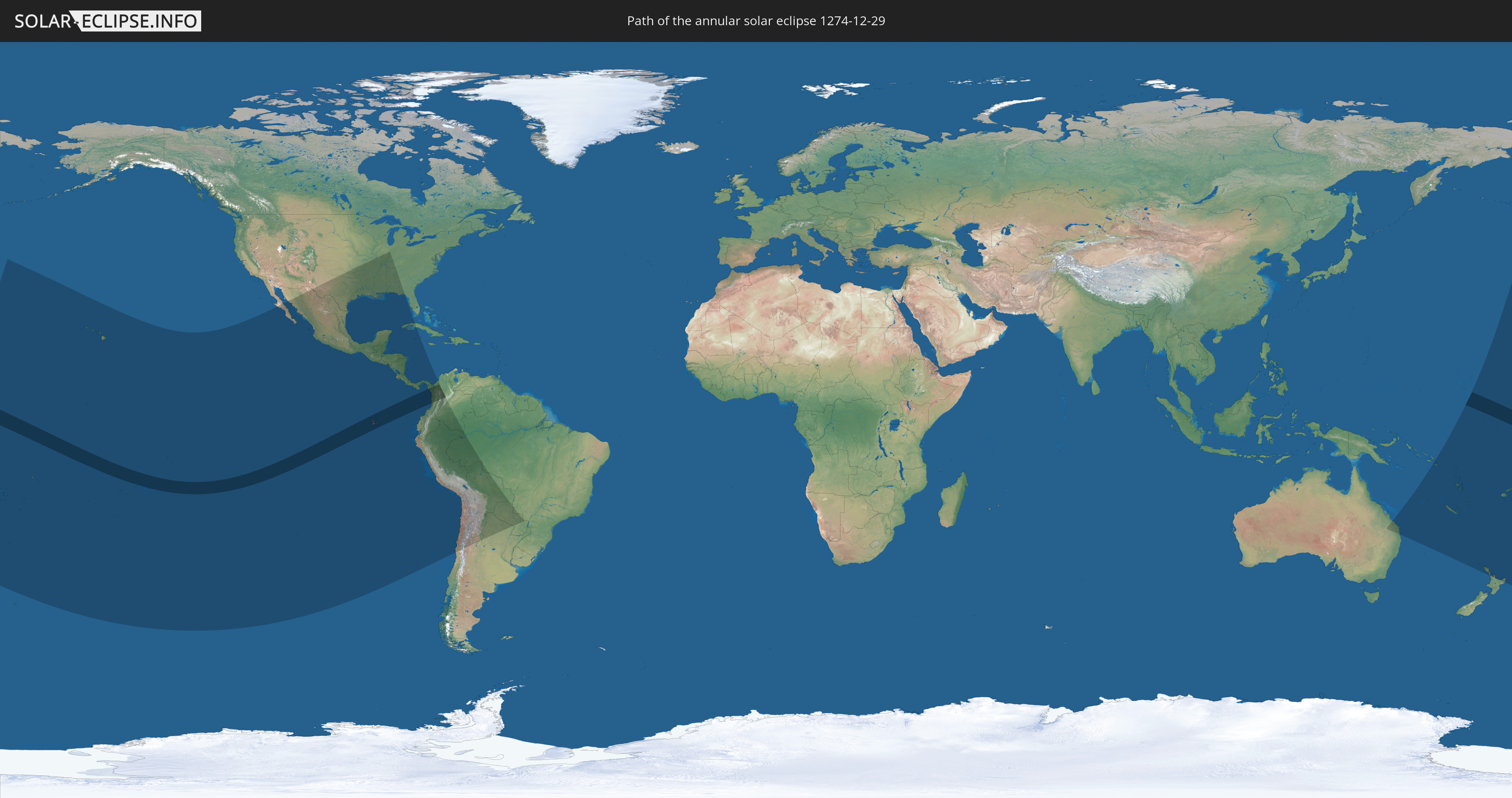
Annular solar eclipse of 12/29/1274
| Day of week: | Saturday |
| Maximum duration of eclipse: | 11m44s |
| Maximum width of eclipse path: | 316 km |
| Saros cycle: | 110 |
| Coverage: | 91.8% |
| Magnitude: | 0.9175 |
| Gamma: | 0.1138 |
Wo kann man die Sonnenfinsternis vom 12/29/1274 sehen?
Die Sonnenfinsternis am 12/29/1274 kann man in 40 Ländern als partielle Sonnenfinsternis beobachten.
Der Finsternispfad verläuft durch 8 Länder. Nur in diesen Ländern ist sie als annular Sonnenfinsternis zu sehen.
In den folgenden Ländern ist die Sonnenfinsternis annular zu sehen
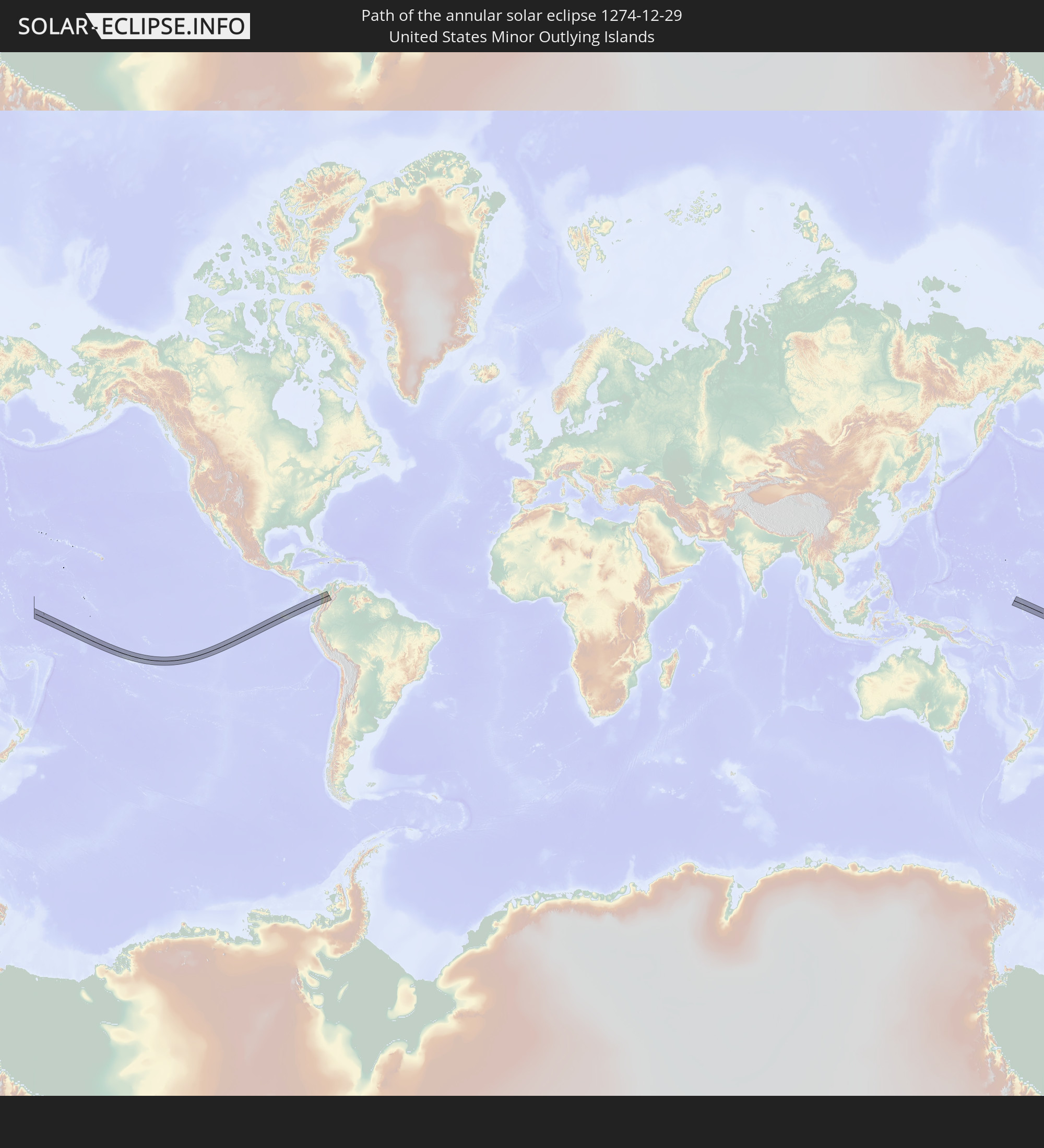 United States Minor Outlying Islands
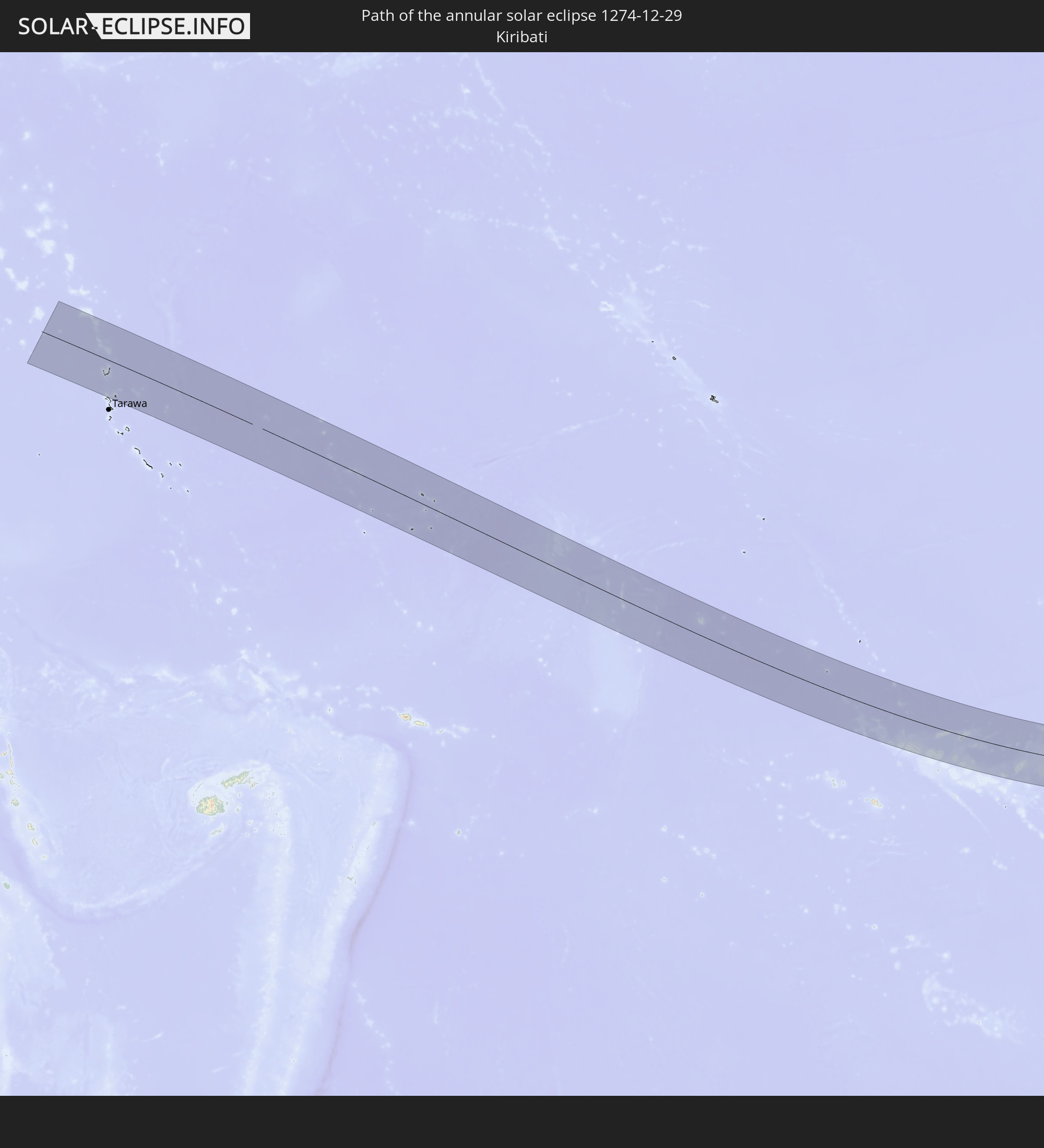 Kiribati
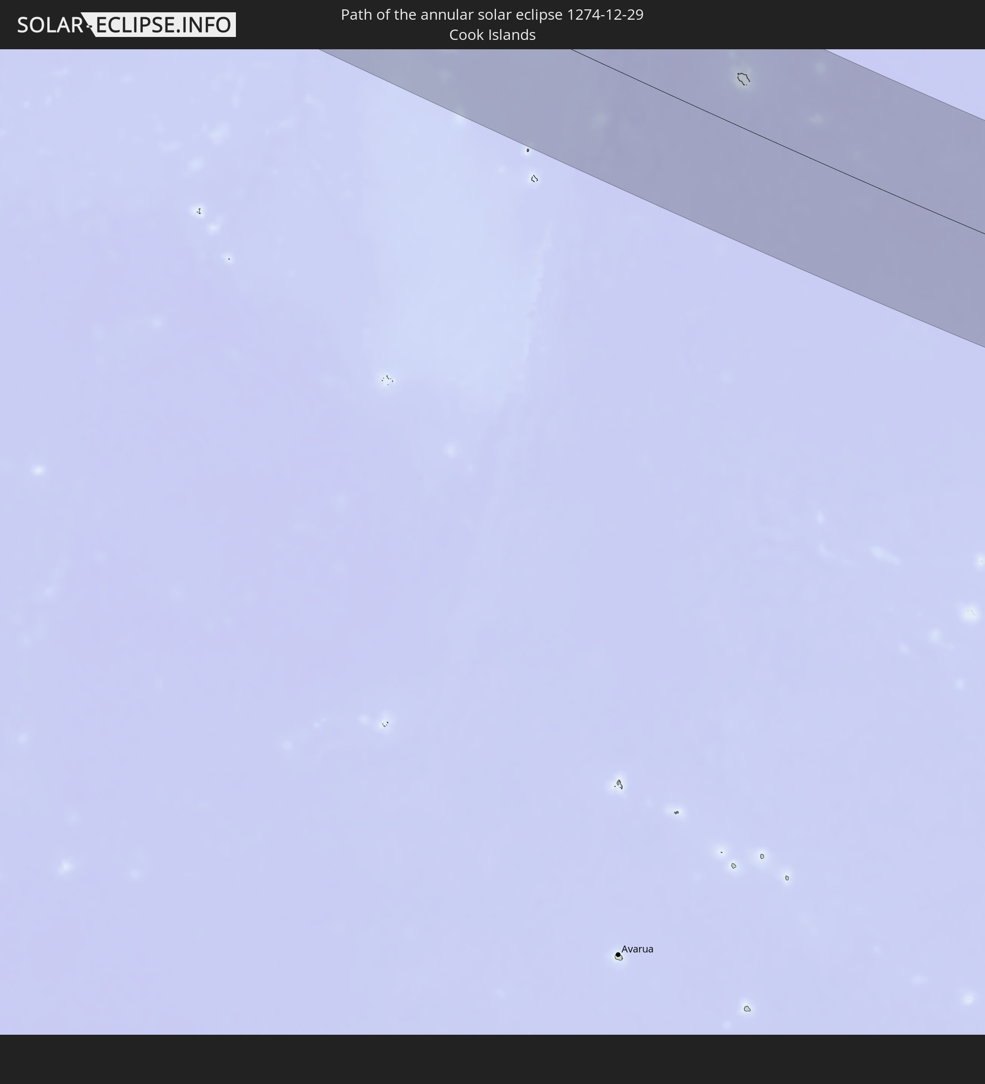 Cook Islands
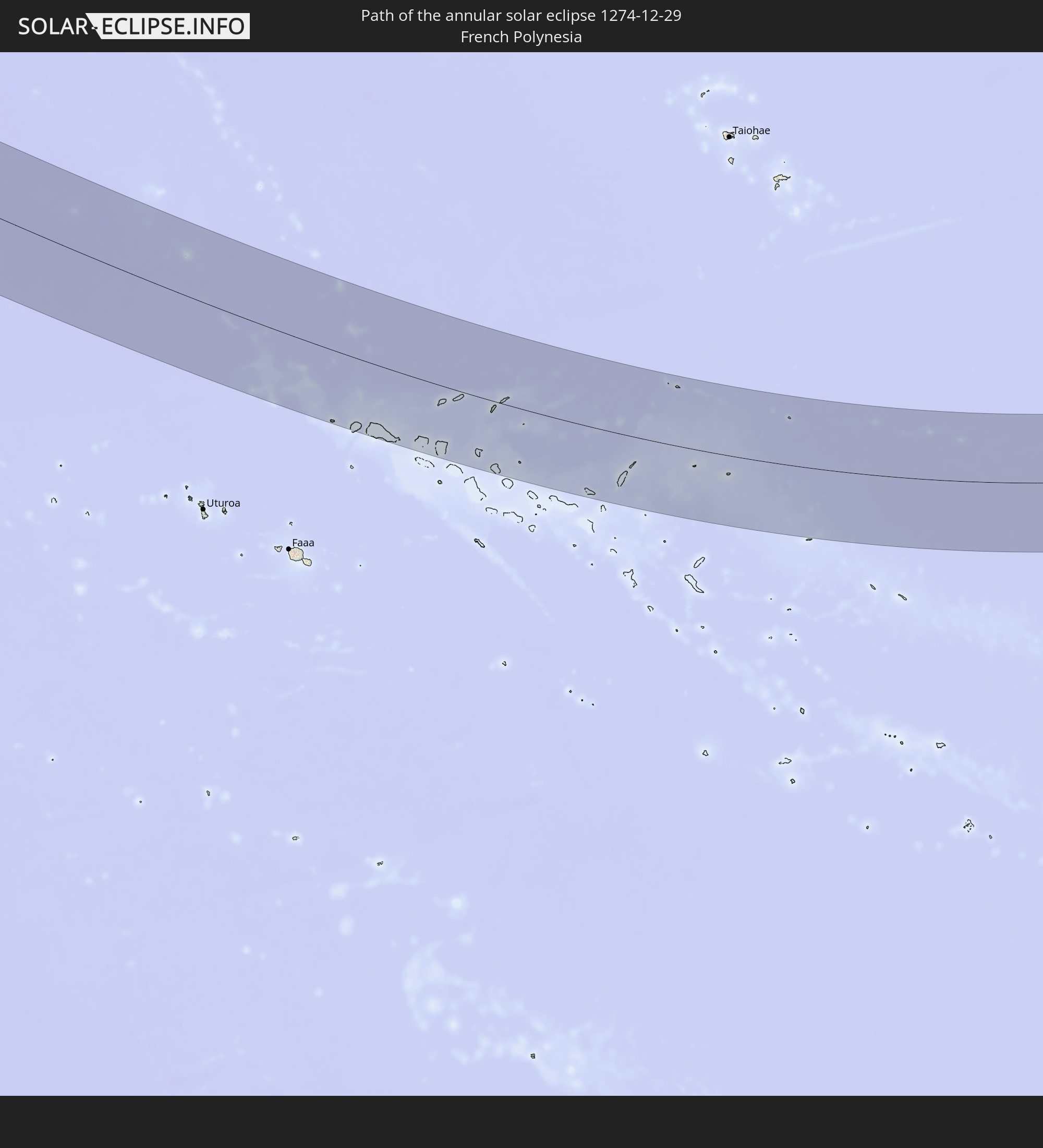 French Polynesia
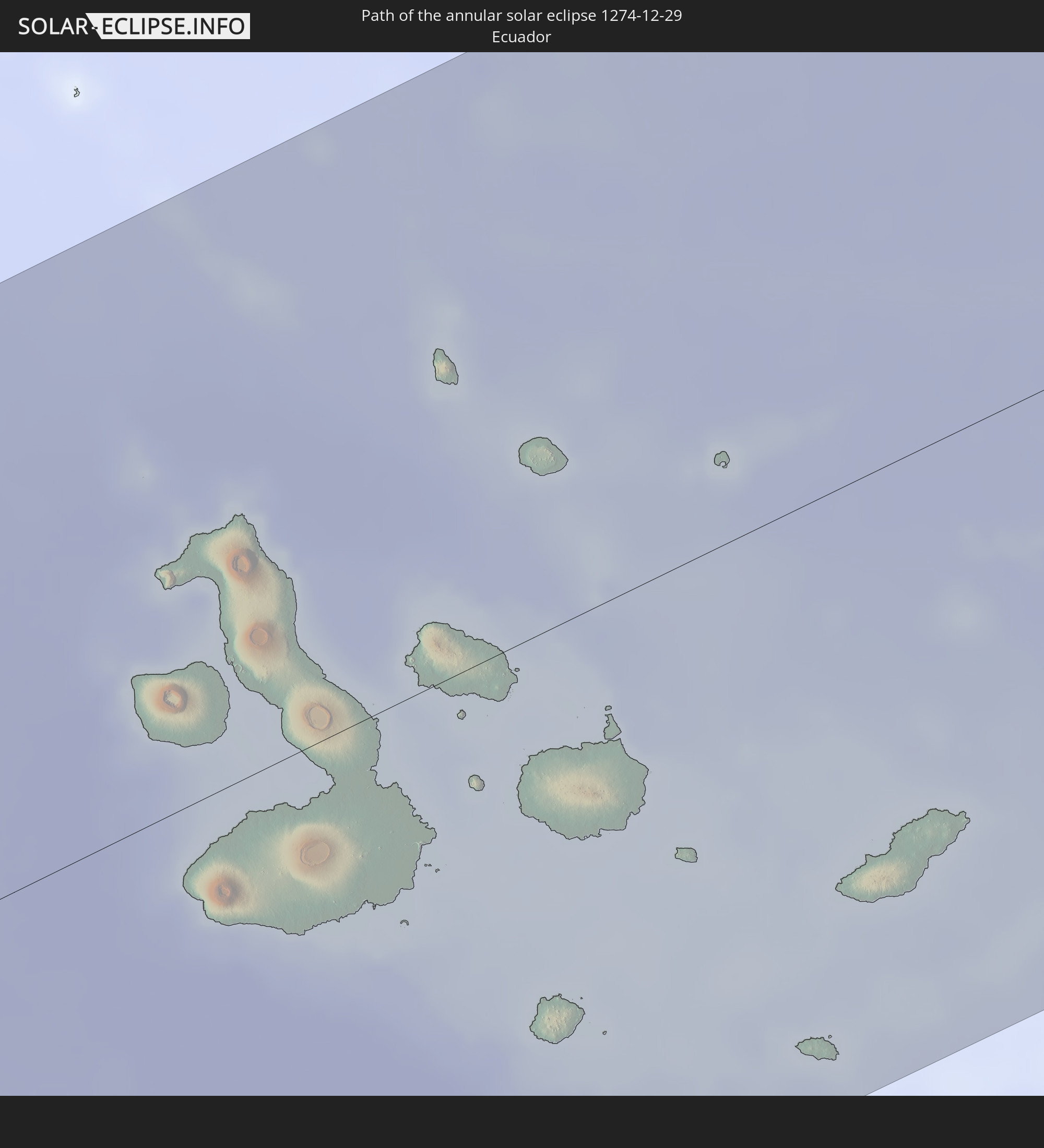 Ecuador
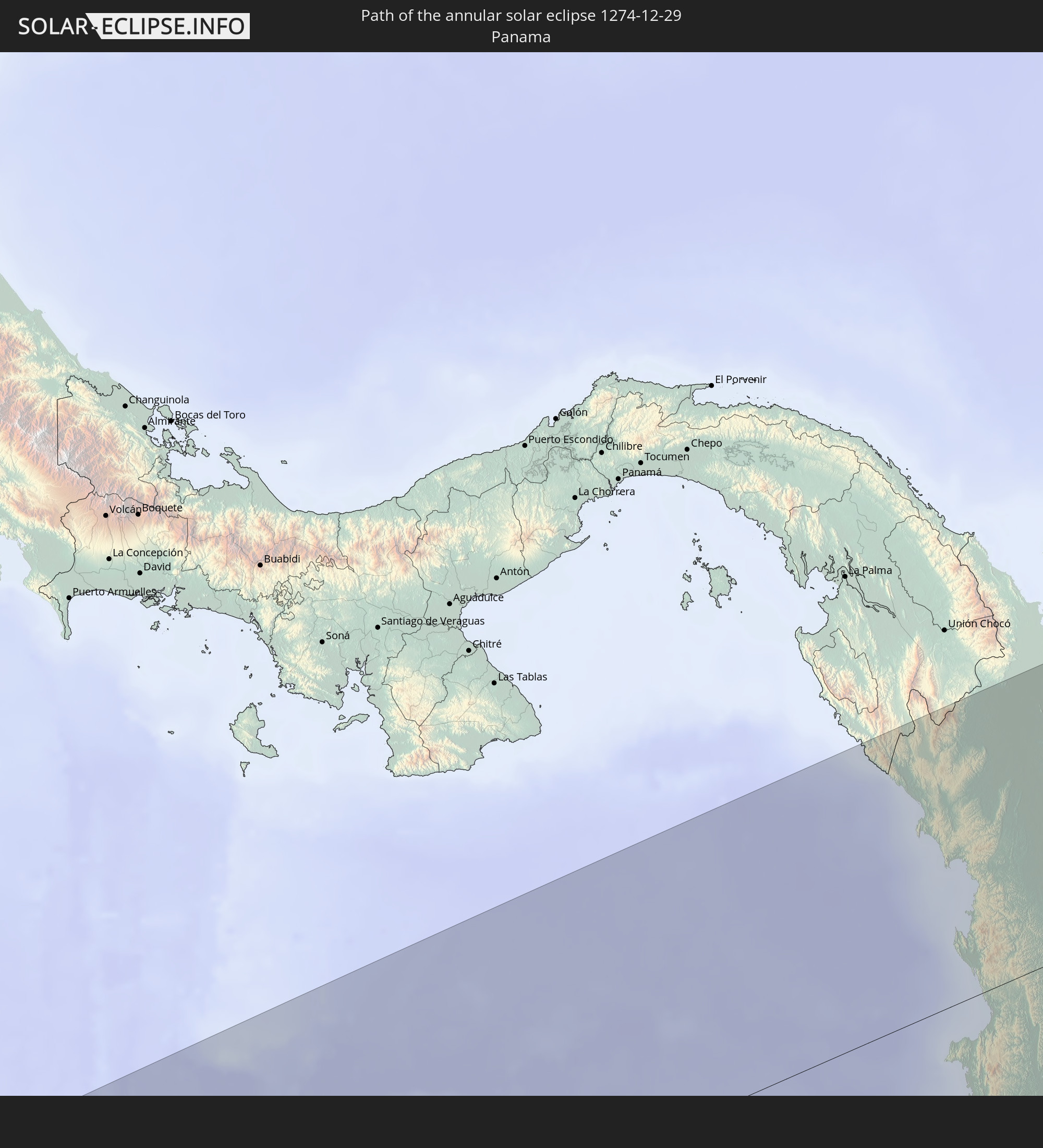 Panama
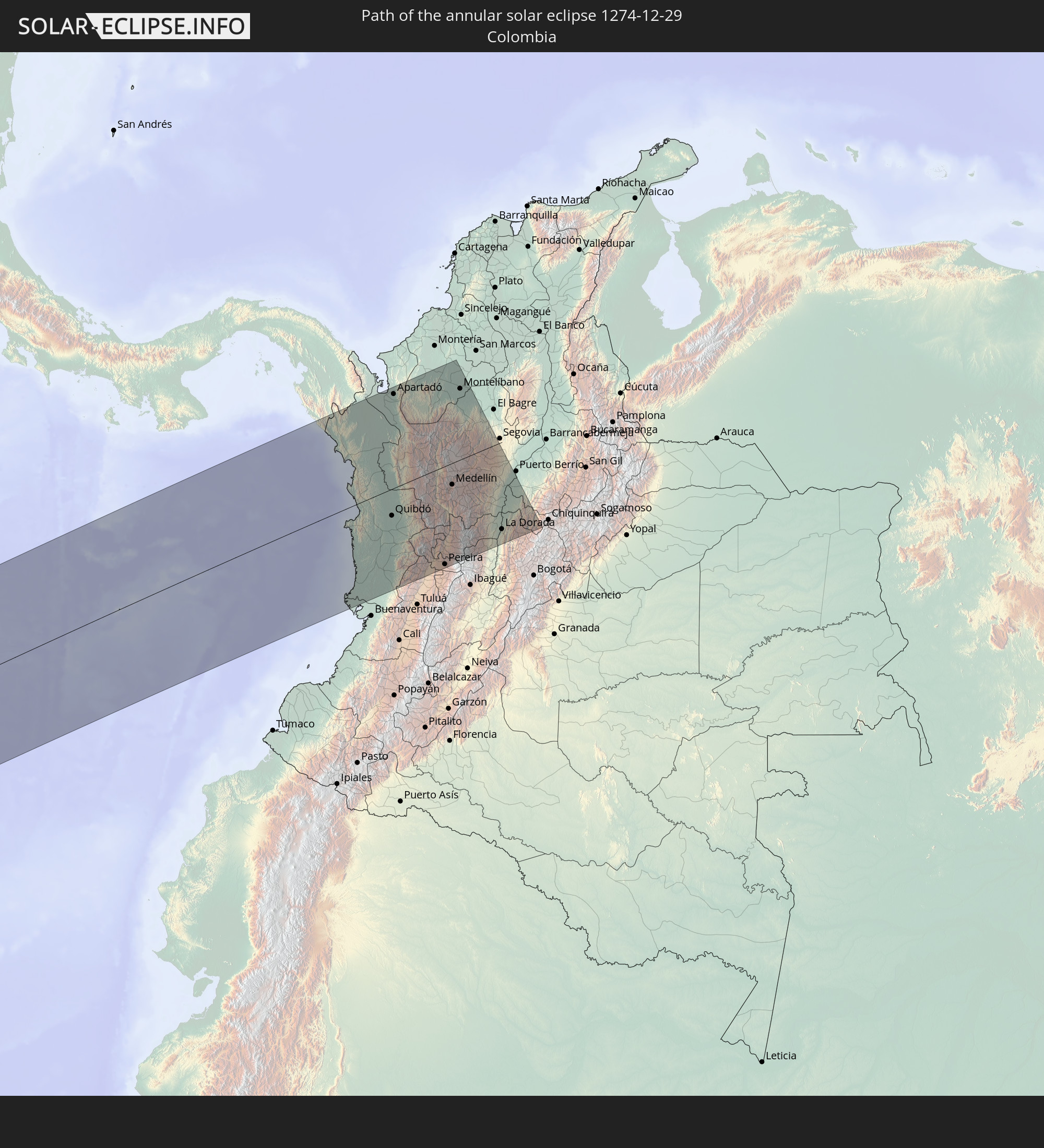 Colombia
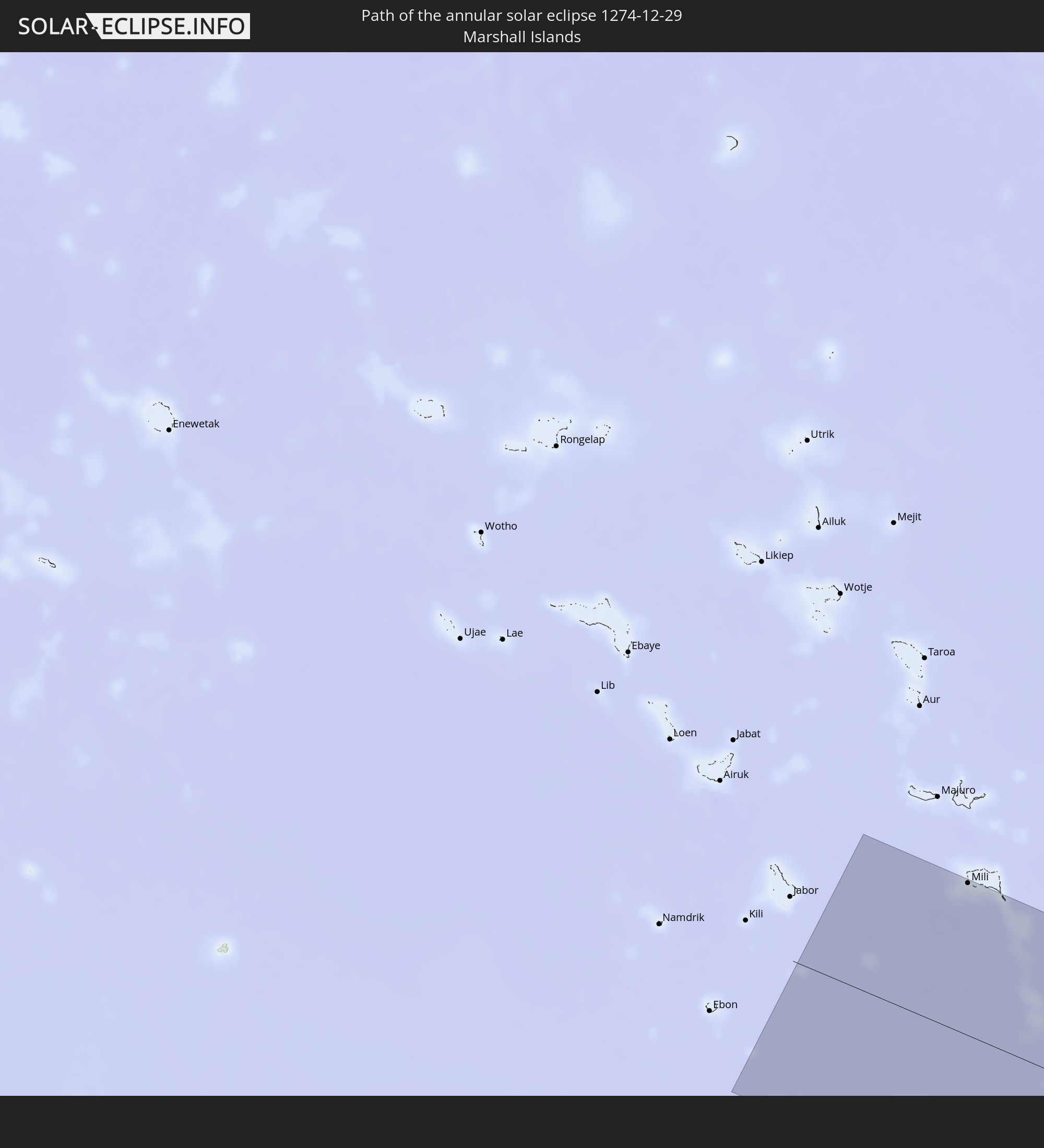 Marshall Islands
In den folgenden Ländern ist die Sonnenfinsternis partiell zu sehen
 Fiji
Fiji
 United States
 New Zealand
 United States Minor Outlying Islands
 Wallis and Futuna
 Tonga
Tonga
 Kiribati
 Samoa
Samoa
 Tokelau
 American Samoa
 Niue
Niue
 Cook Islands
 French Polynesia
 Pitcairn Islands
 Mexico
 Chile
Chile
 Guatemala
 Ecuador
 El Salvador
 Honduras
 Belize
 Nicaragua
 Costa Rica
 Cuba
Cuba
 Panama
 Colombia
 Cayman Islands
 Peru
Peru
 Brazil
 Argentina
 Bolivia
 Paraguay
 Australia
 Solomon Islands
 New Caledonia
 Marshall Islands
 Vanuatu
 Nauru
Nauru
 Norfolk Island
 Tuvalu
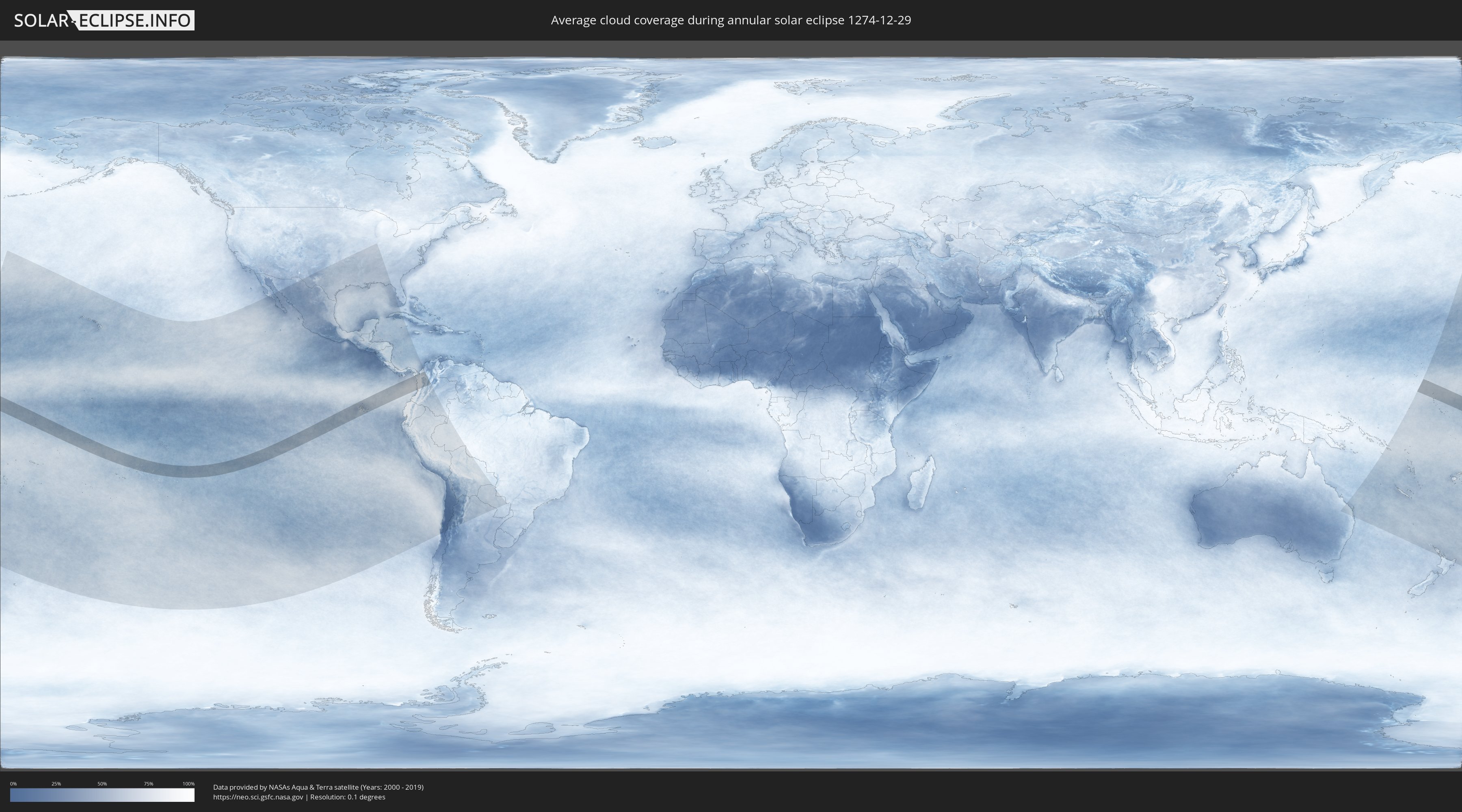
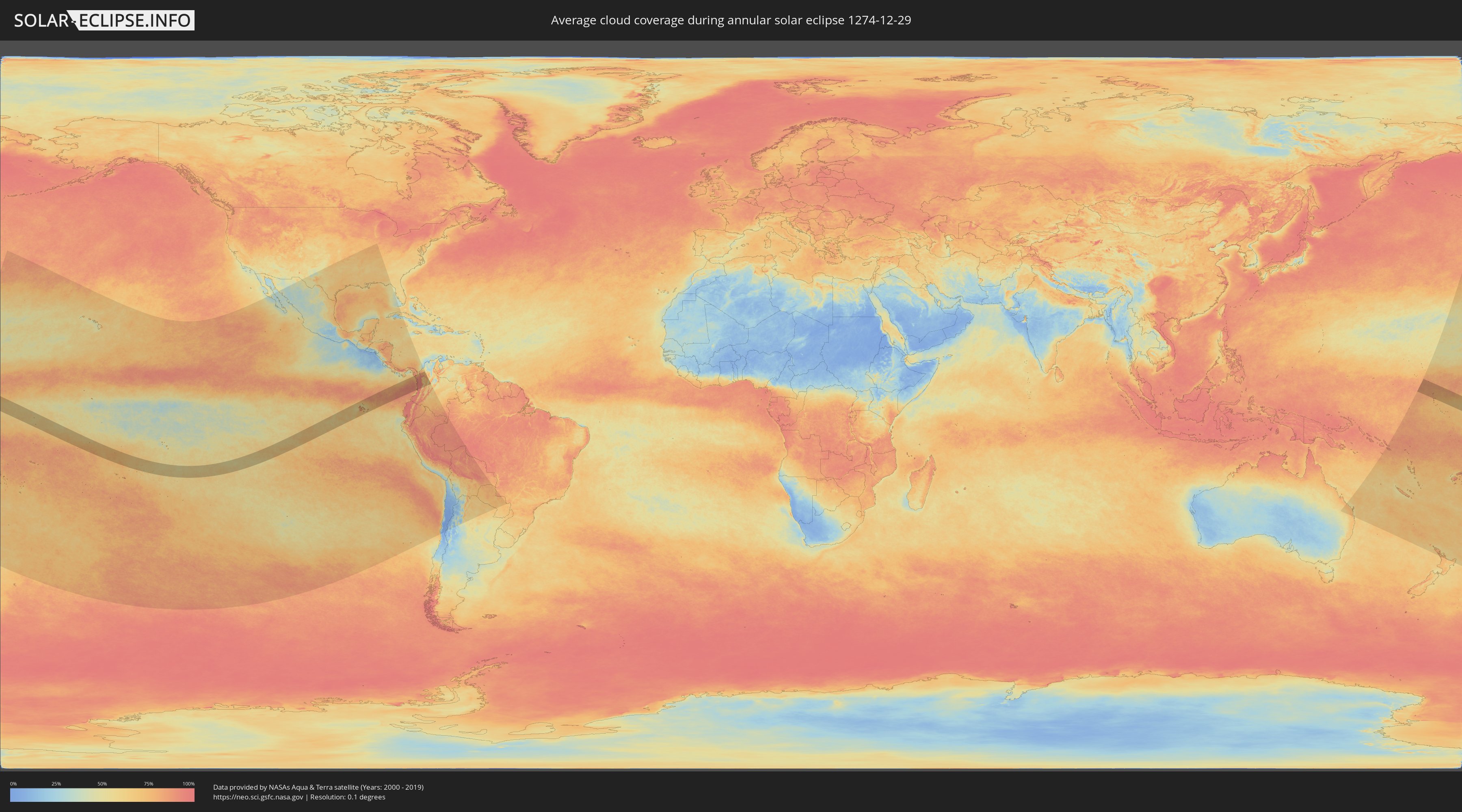
How will be the weather during the annular solar eclipse on 12/29/1274?
Where is the best place to see the annular solar eclipse of 12/29/1274?
The following maps show the average cloud coverage for the day of the annular solar eclipse.
With the help of these maps, it is possible to find the place along the eclipse path, which has the best
chance of a cloudless sky.
Nevertheless, you should consider local circumstances and inform about the weather of your chosen
observation site.
The data is provided by NASAs satellites
AQUA and TERRA.
The cloud maps are averaged over a period of 19 years (2000 - 2019).
Detailed country maps
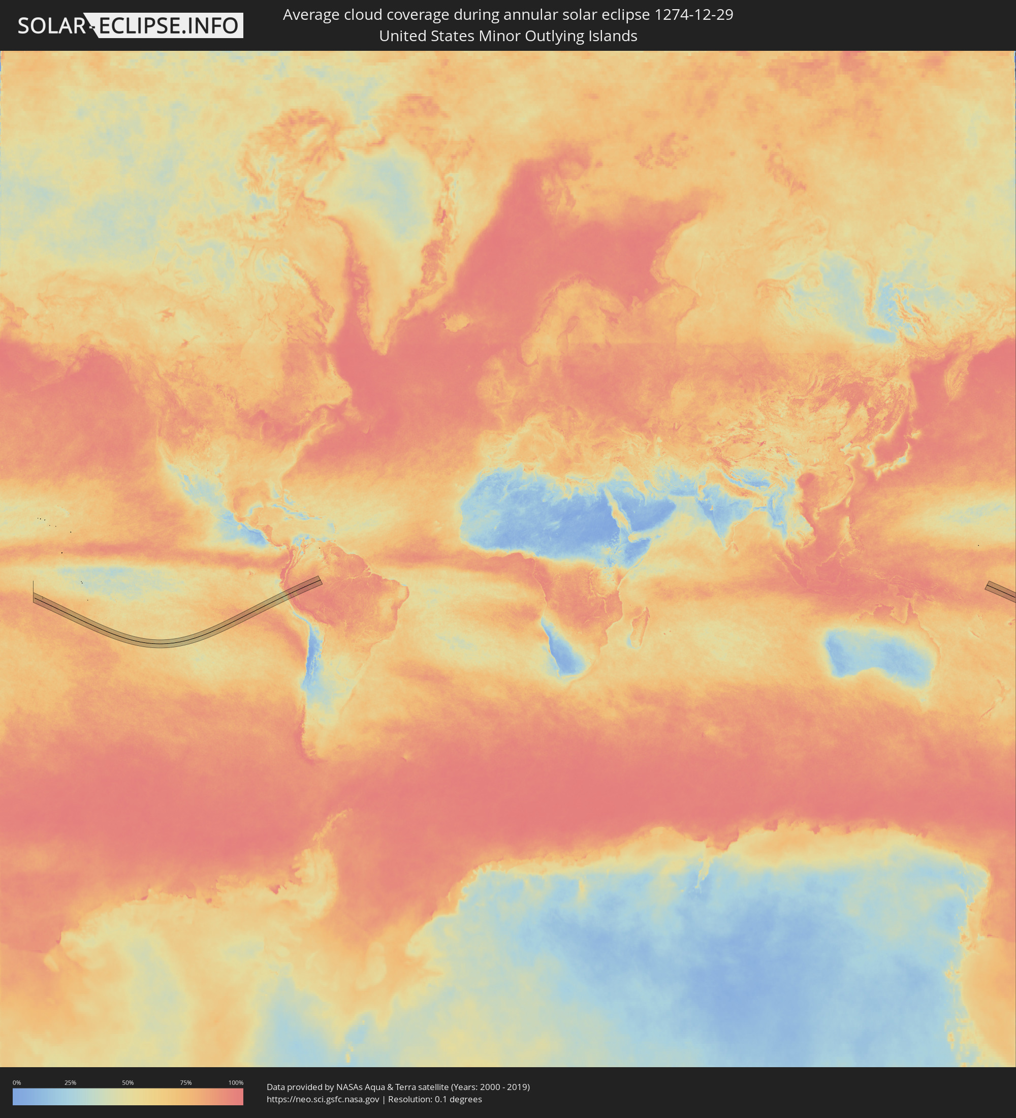 United States Minor Outlying Islands
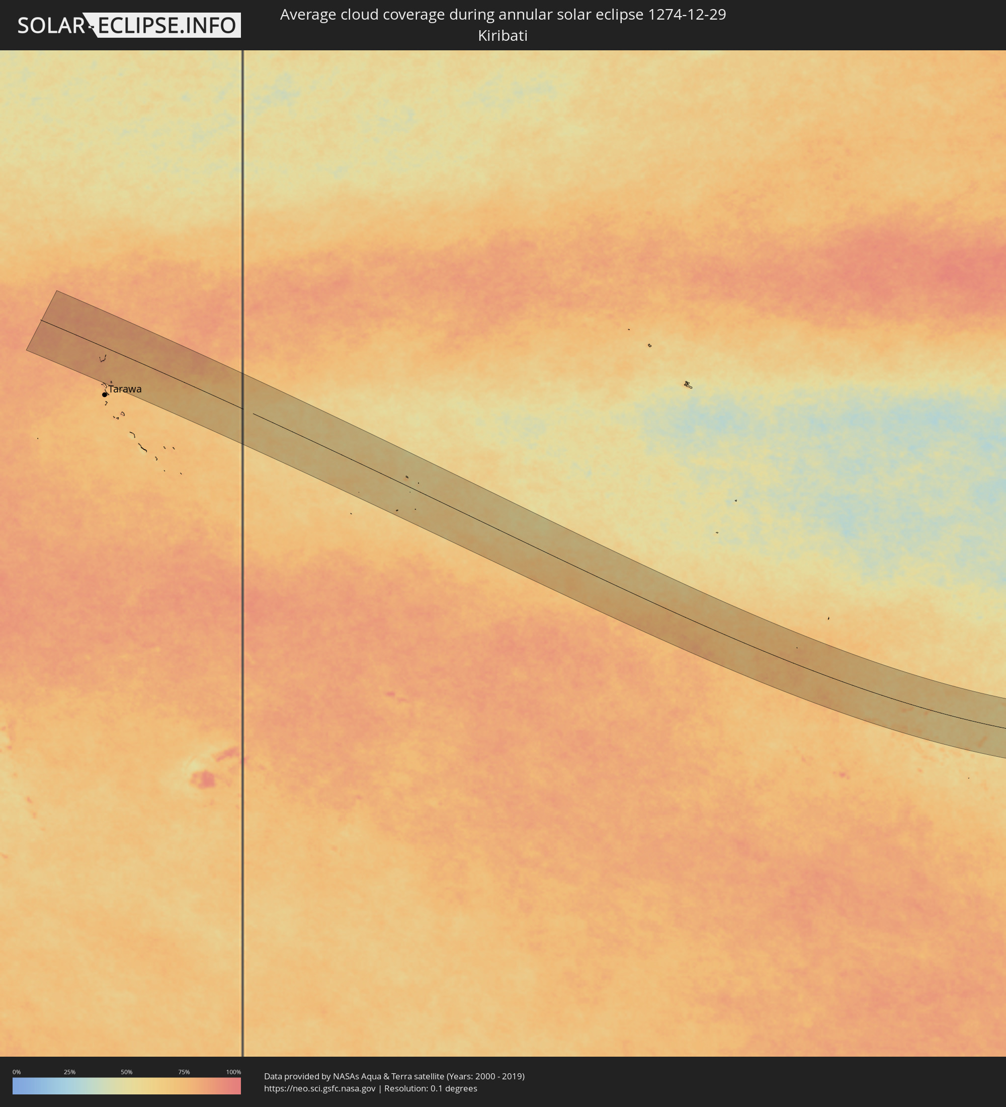 Kiribati
 Cook Islands
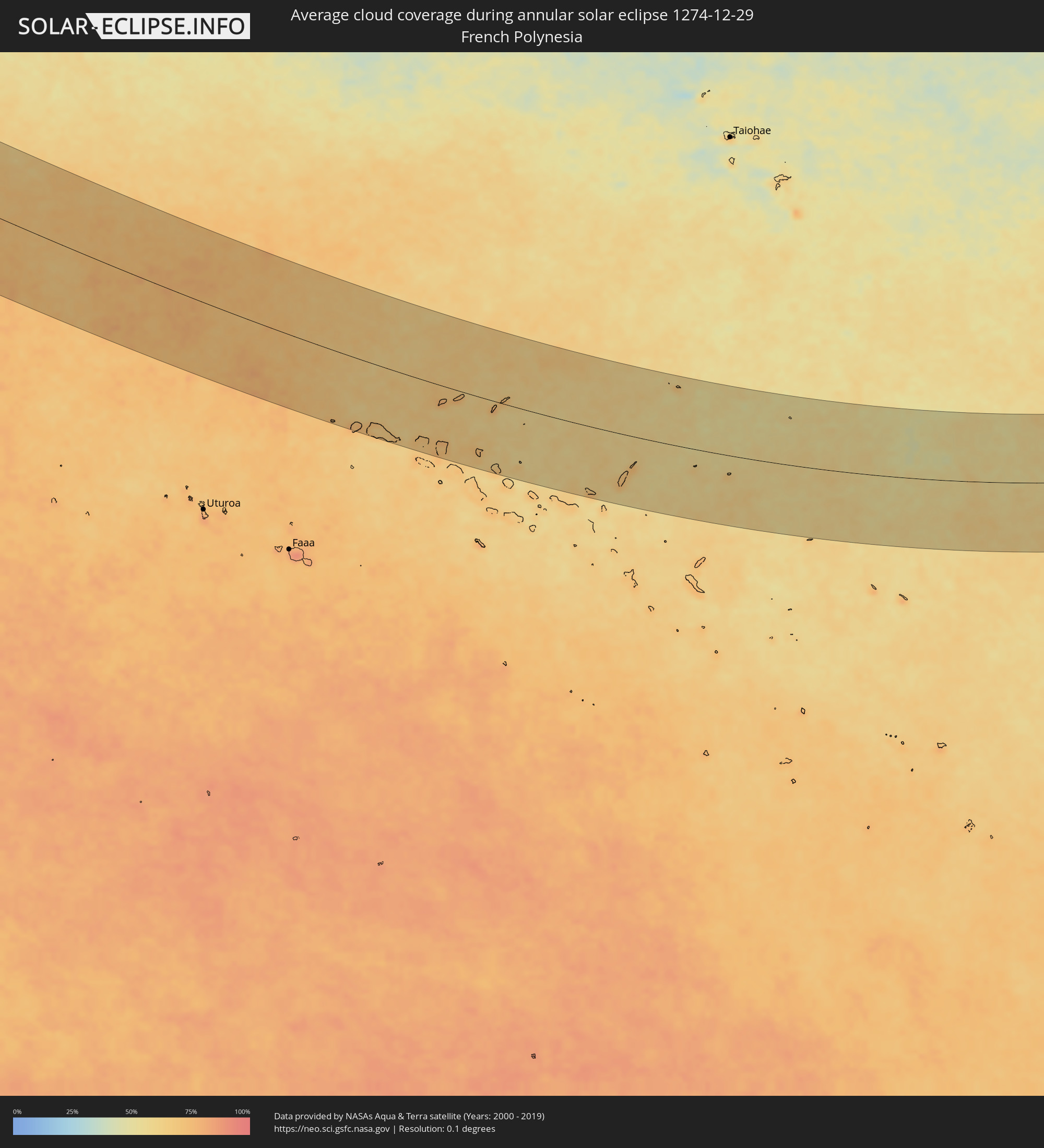 French Polynesia
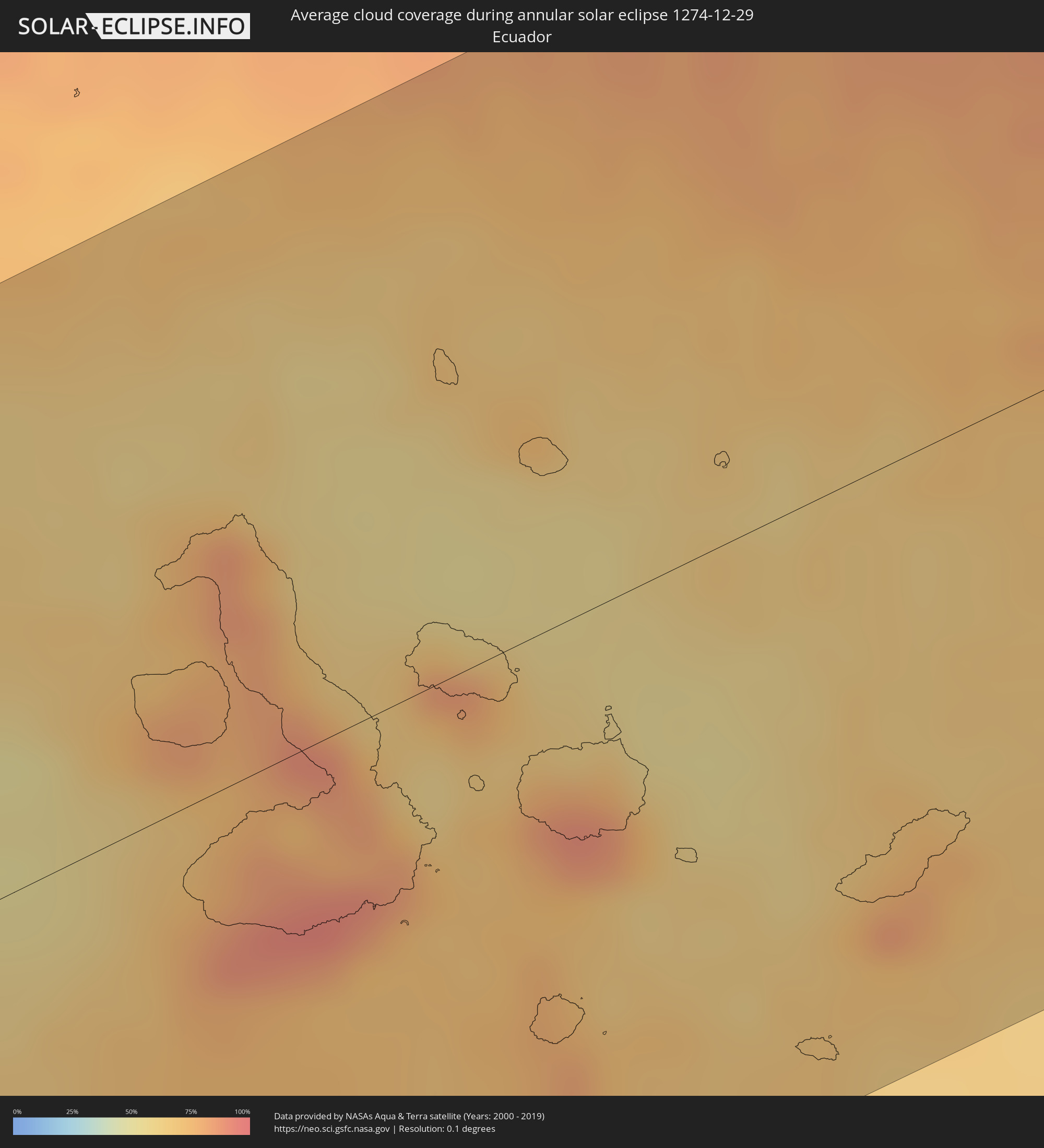 Ecuador
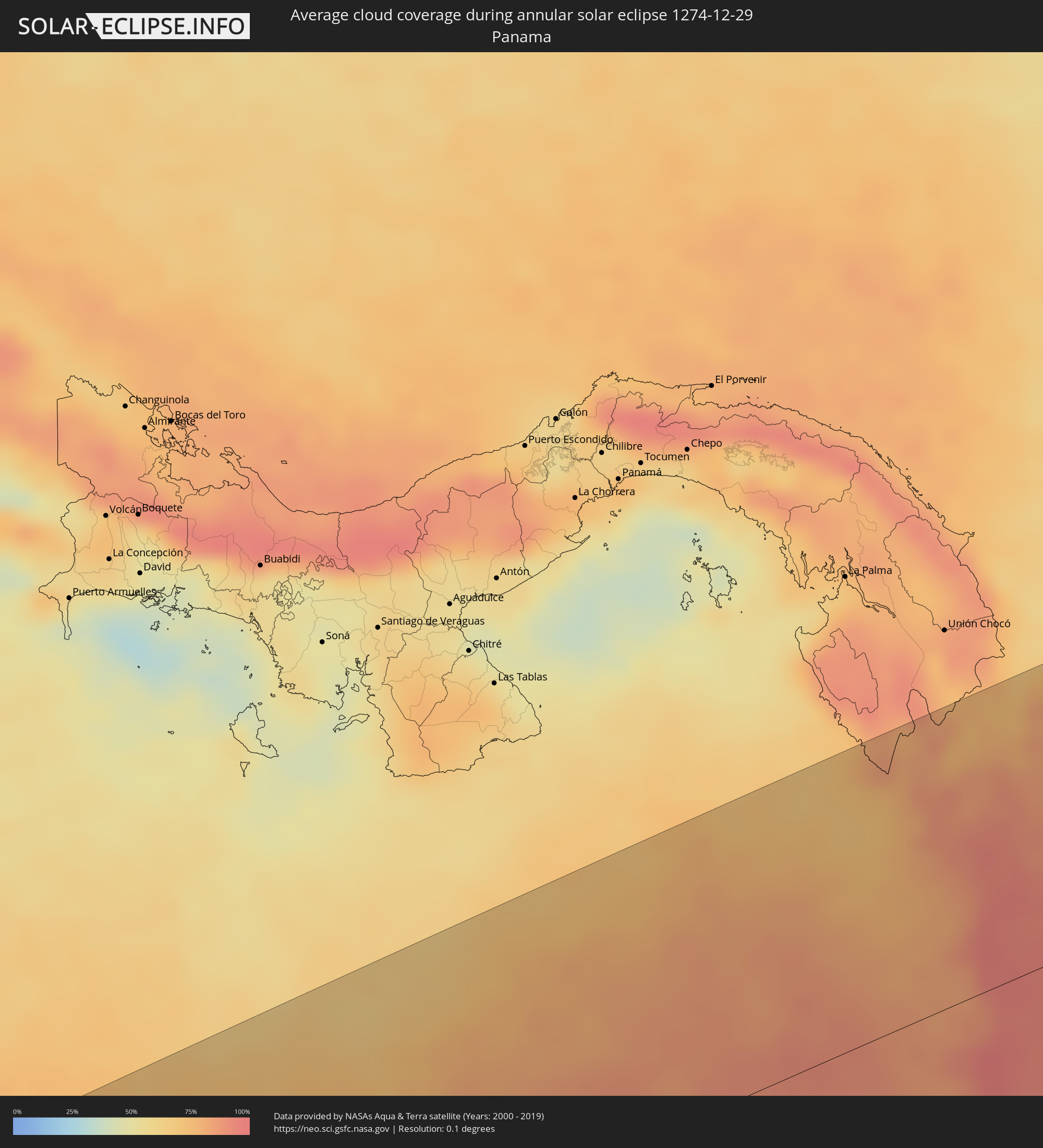 Panama
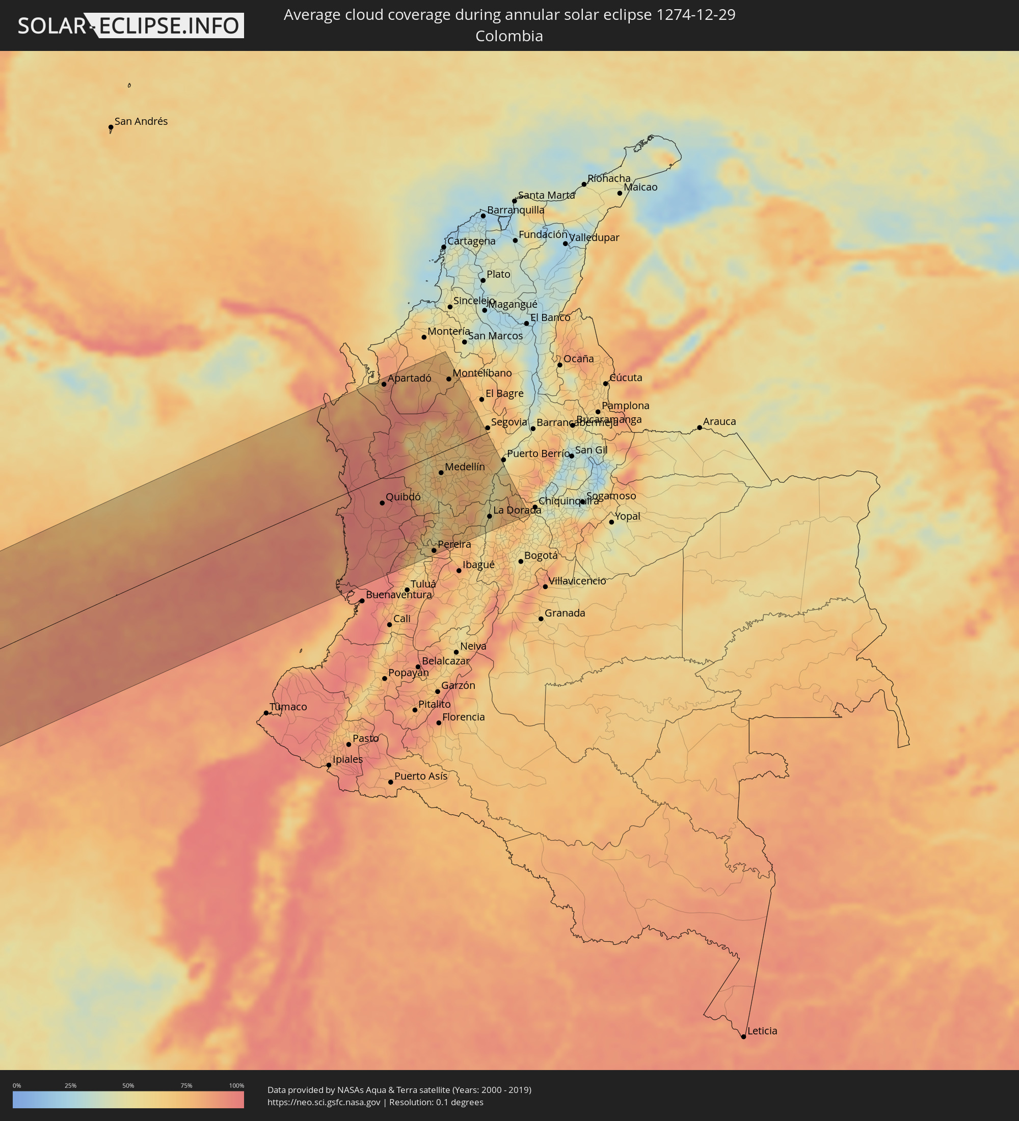 Colombia
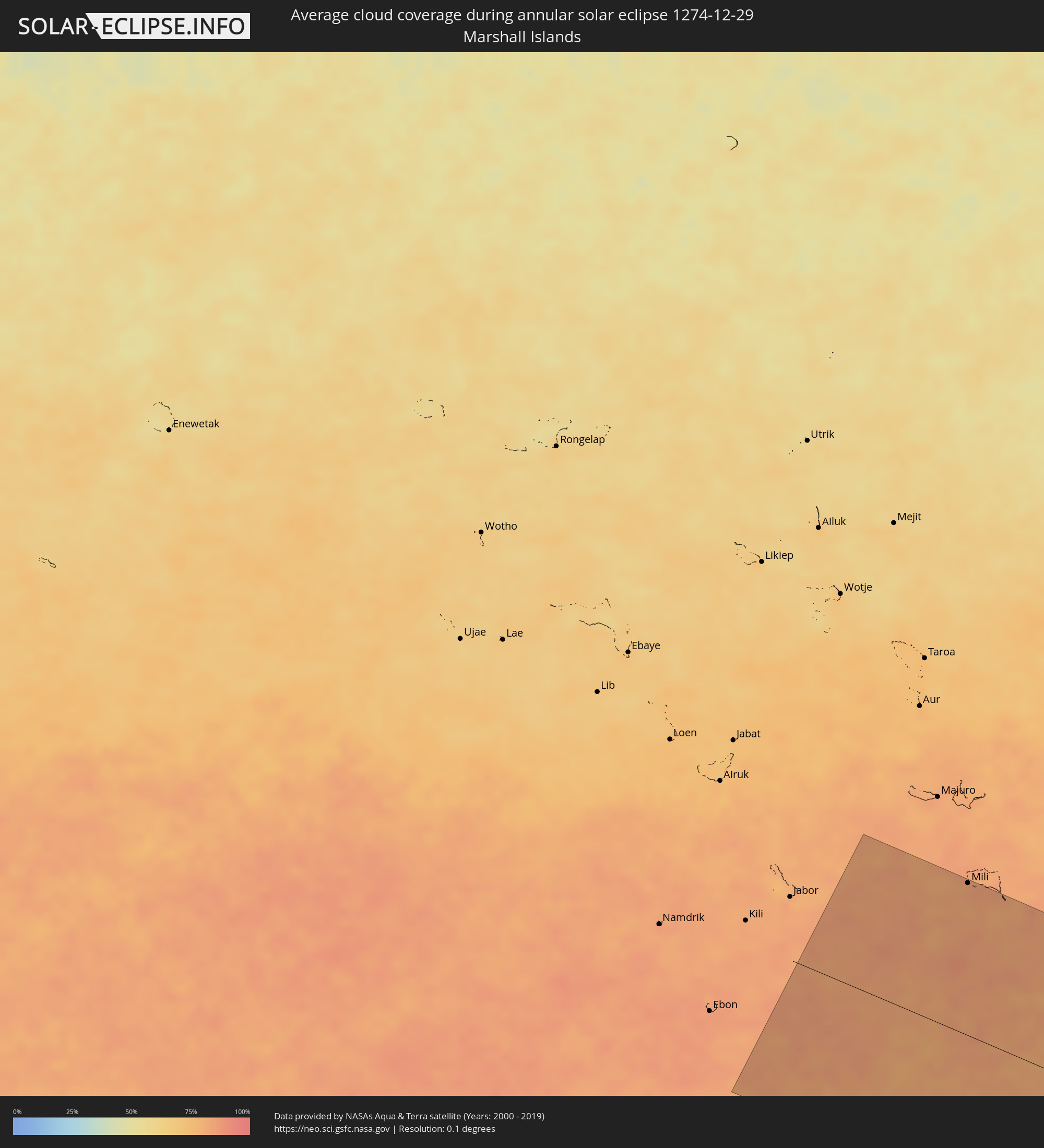 Marshall Islands
Cities inside the path of the eclipse
The following table shows all locations with a population of more than 5,000 inside the eclipse path. Cities which have more than 100,000 inhabitants are marked bold. A click at the locations opens a detailed map.
| City | Type | Eclipse duration | Local time of max. eclipse | Distance to central line | Ø Cloud coverage |
|
Puerto Ayora, Galápagos
|
annular | - | 16:49:25 UTC-05:58 | 64 km | 83% |
|
Puerto Baquerizo Moreno, Galápagos
|
annular | - | 16:49:44 UTC-05:58 | 117 km | 75% |
|
Istmina, Chocó
|
annular | - | 17:57:51 UTC-04:56 | 102 km | 93% |
|
Chigorodó, Antioquia
|
annular | - | 17:58:21 UTC-04:56 | 154 km | 84% |
|
Quibdó, Chocó
|
annular | - | 17:57:59 UTC-04:56 | 49 km | 91% |
|
Condoto, Chocó
|
annular | - | 17:57:50 UTC-04:56 | 111 km | 93% |
|
Apartadó, Antioquia
|
annular | - | 17:58:23 UTC-04:56 | 173 km | 87% |
|
Tadó, Chocó
|
annular | - | 17:57:53 UTC-04:56 | 97 km | 94% |
|
Dabeiba, Antioquia
|
annular | - | 17:58:14 UTC-04:56 | 67 km | 83% |
|
Urrao, Antioquia
|
annular | - | 17:58:07 UTC-04:56 | 8 km | 73% |
|
Frontino, Antioquia
|
annular | - | 17:58:12 UTC-04:56 | 38 km | 62% |
|
Toro, Valle del Cauca
|
annular | - | 17:57:43 UTC-04:56 | 185 km | 67% |
|
Tierralta, Córdoba
|
annular | - | 17:58:25 UTC-04:56 | 178 km | 76% |
|
Ciudad Bolívar, Antioquia
|
annular | - | 17:58:01 UTC-04:56 | 60 km | 65% |
|
Ansermanuevo, Valle del Cauca
|
annular | - | 17:57:46 UTC-04:56 | 170 km | 57% |
|
Cartago, Valle del Cauca
|
annular | - | 17:57:45 UTC-04:56 | 179 km | 60% |
|
Concordia, Antioquia
|
annular | - | 17:58:03 UTC-04:56 | 46 km | 58% |
|
La Virginia, Risaralda
|
annular | - | 17:57:47 UTC-04:56 | 164 km | 55% |
|
Andes, Antioquia
|
annular | - | 17:57:58 UTC-04:56 | 87 km | 70% |
|
Viterbo, Caldas
|
annular | - | 17:57:50 UTC-04:56 | 148 km | 61% |
|
Belén de Umbría, Risaralda
|
annular | - | 17:57:52 UTC-04:56 | 134 km | 73% |
|
Antioquia, Antioquia
|
annular | - | 17:58:09 UTC-04:56 | 3 km | 54% |
|
Jardín, Antioquia
|
annular | - | 17:57:57 UTC-04:56 | 95 km | 83% |
|
Anserma, Risaralda
|
annular | - | 17:57:53 UTC-04:56 | 124 km | 71% |
|
Jericó, Antioquia
|
annular | - | 17:58:00 UTC-04:56 | 77 km | 69% |
|
Ituango, Antioquia
|
annular | - | 17:58:15 UTC-04:56 | 63 km | 65% |
|
Marsella, Risaralda
|
annular | - | 17:57:48 UTC-04:56 | 167 km | 75% |
|
Quinchía, Risaralda
|
annular | - | 17:57:53 UTC-04:56 | 126 km | 56% |
|
Amagá, Antioquia
|
annular | - | 17:58:03 UTC-04:56 | 55 km | 68% |
|
Pereira, Risaralda
|
annular | - | 17:57:46 UTC-04:56 | 181 km | 76% |
|
Fredonia, Antioquia
|
annular | - | 17:58:01 UTC-04:56 | 69 km | 57% |
|
Supía, Caldas
|
annular | - | 17:57:55 UTC-04:56 | 118 km | 66% |
|
Caldas, Antioquia
|
annular | - | 17:58:03 UTC-04:56 | 53 km | 78% |
|
Palestina, Caldas
|
annular | - | 17:57:49 UTC-04:56 | 163 km | 73% |
|
Planeta Rica, Córdoba
|
annular | - | 17:58:25 UTC-04:56 | 182 km | 75% |
|
Santa Bárbara, Antioquia
|
annular | - | 17:58:00 UTC-04:56 | 78 km | 58% |
|
Medellín, Antioquia
|
annular | - | 17:58:05 UTC-04:56 | 40 km | 65% |
|
San Pedro, Antioquia
|
annular | - | 17:58:07 UTC-04:56 | 18 km | 71% |
|
Neira, Caldas
|
annular | - | 17:57:51 UTC-04:56 | 153 km | 76% |
|
Manizales, Caldas
|
annular | - | 17:57:49 UTC-04:56 | 163 km | 76% |
|
El Retiro, Antioquia
|
annular | - | 17:58:02 UTC-04:56 | 62 km | 72% |
|
Aranzazu, Caldas
|
annular | - | 17:57:52 UTC-04:56 | 143 km | 77% |
|
Salamina, Caldas
|
annular | - | 17:57:54 UTC-04:56 | 130 km | 67% |
|
Santa Rosa de Osos, Antioquia
|
annular | - | 17:58:09 UTC-04:56 | 4 km | 66% |
|
Pácora, Caldas
|
annular | - | 17:57:55 UTC-04:56 | 119 km | 61% |
|
Aguadas, Caldas
|
annular | - | 17:57:57 UTC-04:56 | 110 km | 65% |
|
Guarne, Antioquia
|
annular | - | 17:58:05 UTC-04:56 | 42 km | 70% |
|
La Ceja, Antioquia
|
annular | - | 17:58:02 UTC-04:56 | 68 km | 69% |
|
Abejorral, Antioquia
|
annular | - | 17:57:59 UTC-04:56 | 93 km | 65% |
|
Montelíbano, Córdoba
|
annular | - | 17:58:22 UTC-04:56 | 131 km | 77% |
|
Yarumal, Antioquia
|
annular | - | 17:58:12 UTC-04:56 | 27 km | 66% |
|
Don Matías, Antioquia
|
annular | - | 17:58:07 UTC-04:56 | 23 km | 67% |
|
Rionegro, Antioquia
|
annular | - | 17:58:03 UTC-04:56 | 58 km | 66% |
|
La Unión, Antioquia
|
annular | - | 17:58:01 UTC-04:56 | 77 km | 69% |
|
Barbosa, Antioquia
|
annular | - | 17:58:06 UTC-04:56 | 31 km | 75% |
|
Sonsón, Antioquia
|
annular | - | 17:57:58 UTC-04:56 | 106 km | 71% |
|
Pensilvania, Caldas
|
annular | - | 17:57:53 UTC-04:56 | 146 km | 76% |
|
Manzanares, Caldas
|
annular | - | 17:57:52 UTC-04:56 | 152 km | 73% |
|
Cisneros, Antioquia
|
annular | - | 17:58:07 UTC-04:56 | 31 km | 75% |
|
Amalfi, Antioquia
|
annular | - | 17:58:11 UTC-04:56 | 9 km | 76% |
|
Fresno, Tolima
|
annular | - | 17:57:49 UTC-04:56 | 175 km | 76% |
|
San Carlos, Antioquia
|
annular | - | 17:58:03 UTC-04:56 | 71 km | 80% |
|
Mariquita, Tolima
|
annular | - | 17:57:49 UTC-04:56 | 177 km | 62% |
|
Vegachí, Antioquia
|
annular | - | 17:58:08 UTC-04:56 | 21 km | 77% |
|
Honda, Tolima
|
annular | - | 17:57:49 UTC-04:56 | 183 km | 53% |
|
La Dorada, Caldas
|
annular | - | 17:57:52 UTC-04:56 | 161 km | 54% |
|
Puerto Salgar, Cundinamarca
|
annular | - | 17:57:52 UTC-04:56 | 160 km | 51% |
|
Puerto Boyacá, Boyacá
|
annular | - | 17:57:58 UTC-04:56 | 110 km | 48% |
|
Muzo, Boyacá
|
annular | - | 17:57:51 UTC-04:56 | 176 km | 73% |
|
Mili, Mili Atoll
|
annular | - | 05:57:10 UTC+11:00 | 183 km | 81% |