Hybrid solar eclipse of 05/07/1426
| Day of week: | Sunday |
| Maximum duration of eclipse: | 01m03s |
| Maximum width of eclipse path: | 38 km |
| Saros cycle: | 109 |
| Coverage: | 100% |
| Magnitude: | 1.01 |
| Gamma: | -0.4294 |
Wo kann man die Sonnenfinsternis vom 05/07/1426 sehen?
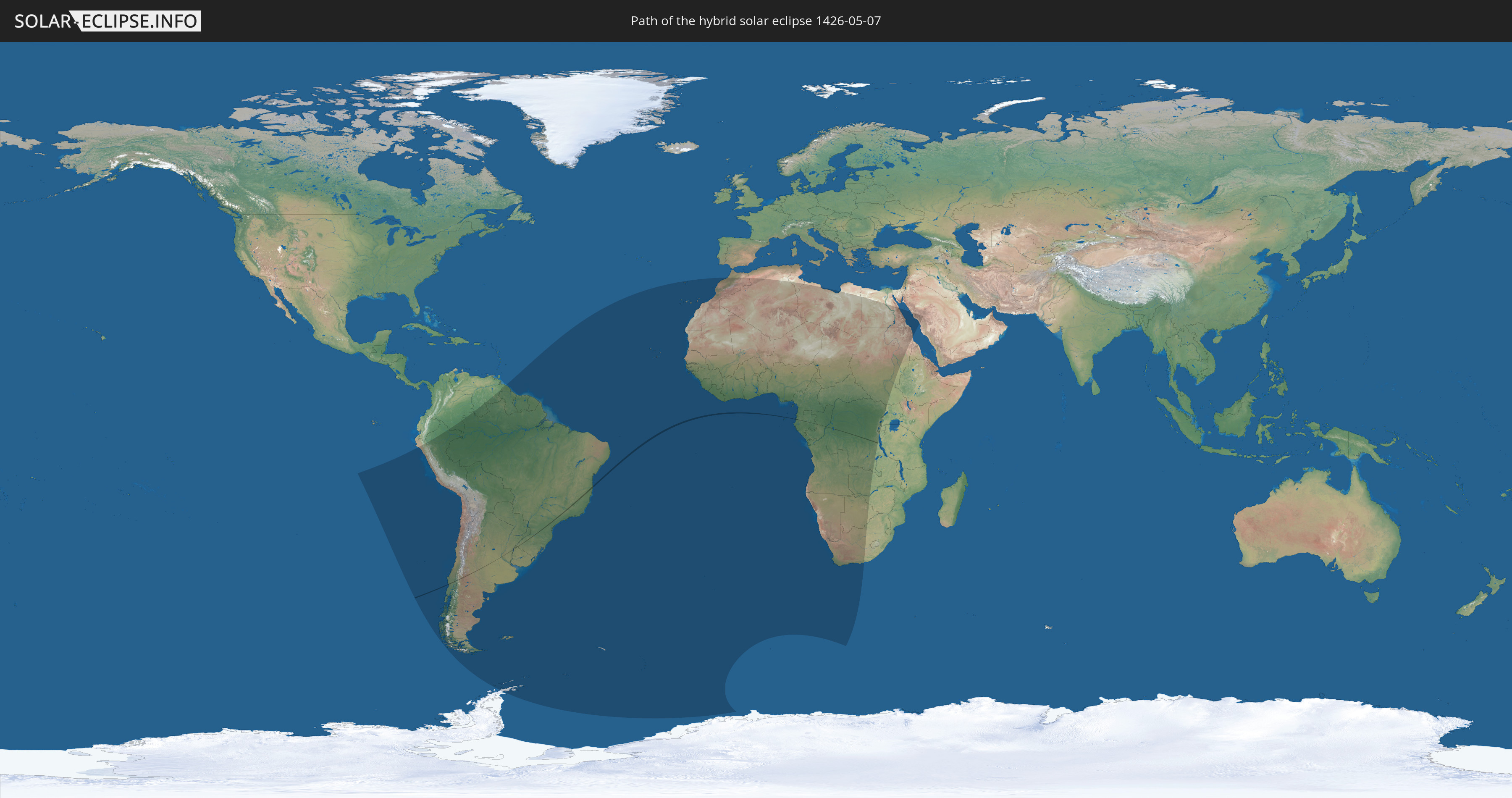
Die Sonnenfinsternis am 05/07/1426 kann man in 58 Ländern als partielle Sonnenfinsternis beobachten.
Der Finsternispfad verläuft durch 7 Länder. Nur in diesen Ländern ist sie als hybrid Sonnenfinsternis zu sehen.
In den folgenden Ländern ist die Sonnenfinsternis hybrid zu sehen
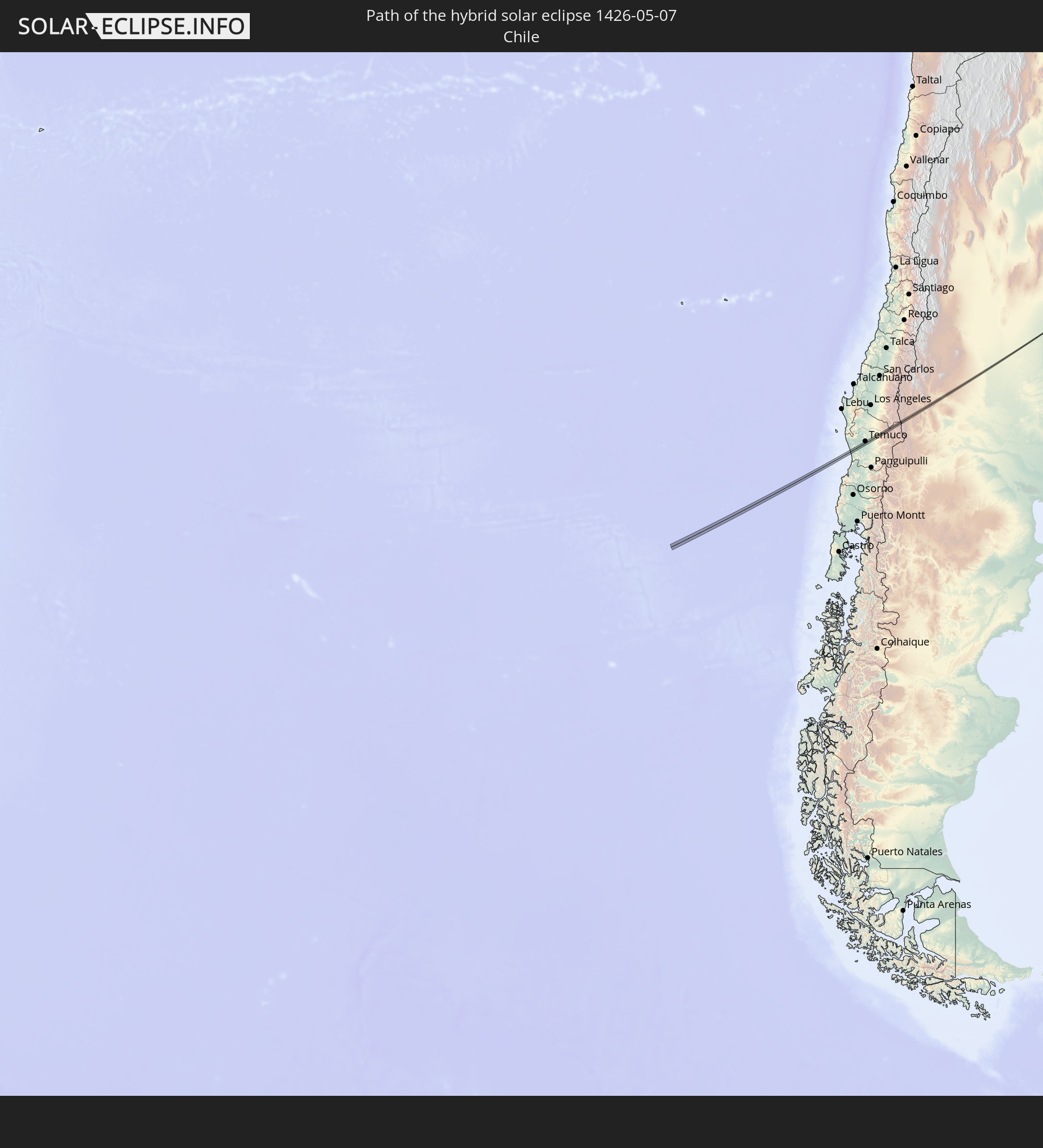 Chile
Chile
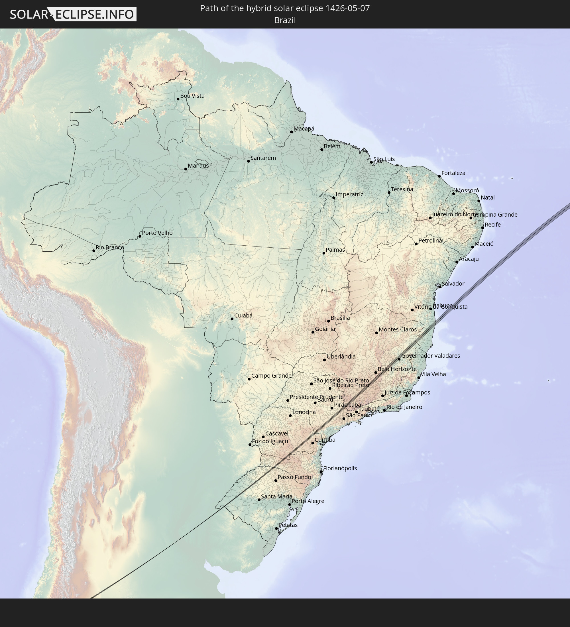 Brazil
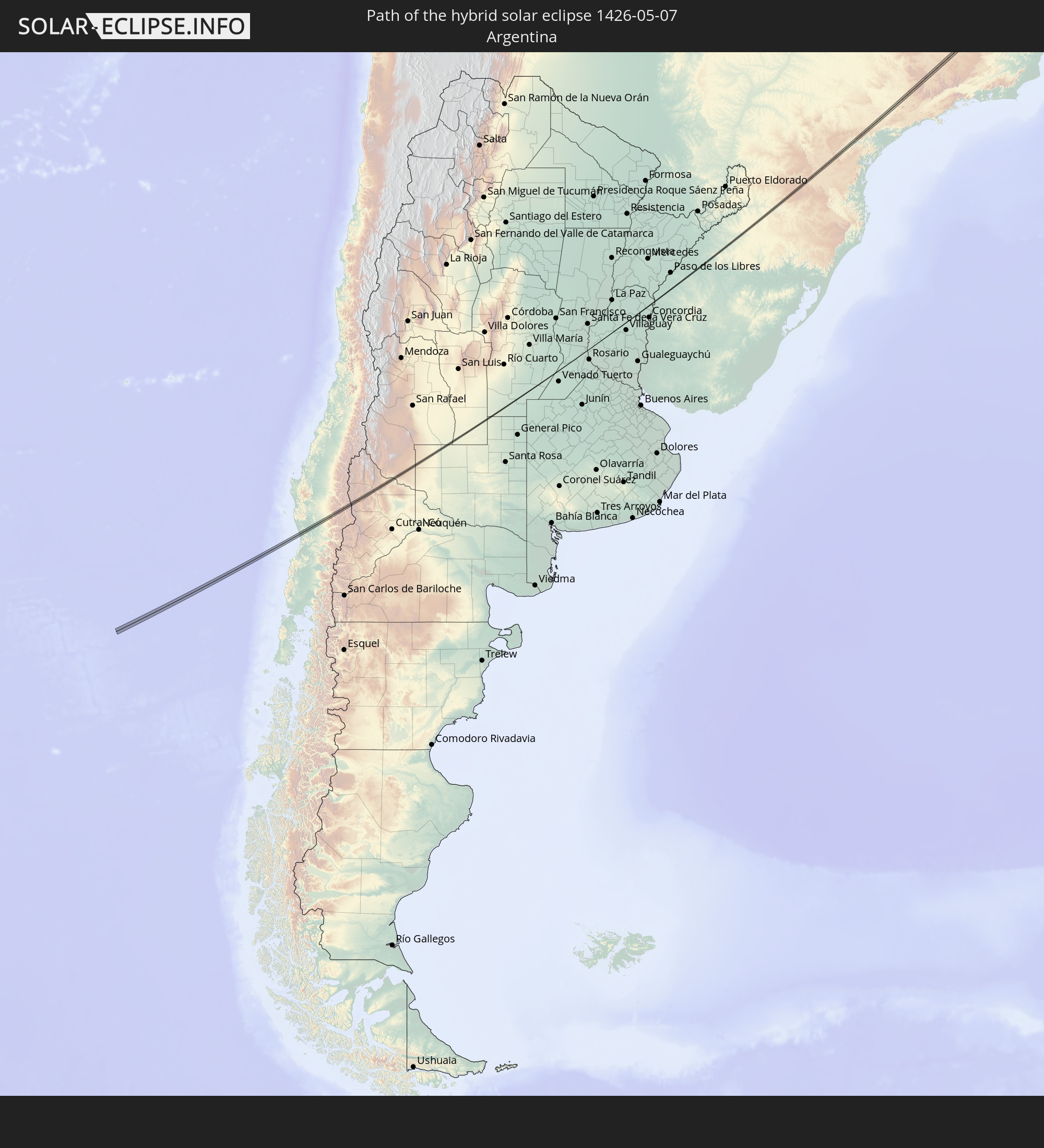 Argentina
 Uruguay
 Gabon
Gabon
 Republic of the Congo
 Democratic Republic of the Congo
In den folgenden Ländern ist die Sonnenfinsternis partiell zu sehen
 Antarctica
 Chile
Chile
 Colombia
 Peru
Peru
 Brazil
 Argentina
 Venezuela
 Bolivia
 Paraguay
 Falkland Islands
 Guyana
 Uruguay
 Suriname
 French Guiana
 South Georgia and the South Sandwich Islands
 Portugal
 Cabo Verde
 Spain
Spain
 Senegal
 Mauritania
 The Gambia
 Guinea-Bissau
 Guinea
 Saint Helena, Ascension and Tristan da Cunha
 Sierra Leone
 Morocco
 Mali
Mali
 Liberia
 Algeria
 Ivory Coast
 Burkina Faso
 Ghana
Ghana
 Togo
Togo
 Niger
Niger
 Benin
Benin
 Nigeria
 Equatorial Guinea
 São Tomé and Príncipe
 Tunisia
 Cameroon
 Gabon
Gabon
 Libya
Libya
 Republic of the Congo
 Angola
 Namibia
 Democratic Republic of the Congo
 Chad
Chad
 Central African Republic
 South Africa
 Botswana
 Sudan
Sudan
 Zambia
 Egypt
Egypt
 Zimbabwe
 Rwanda
 Burundi
 Uganda
 Saudi Arabia
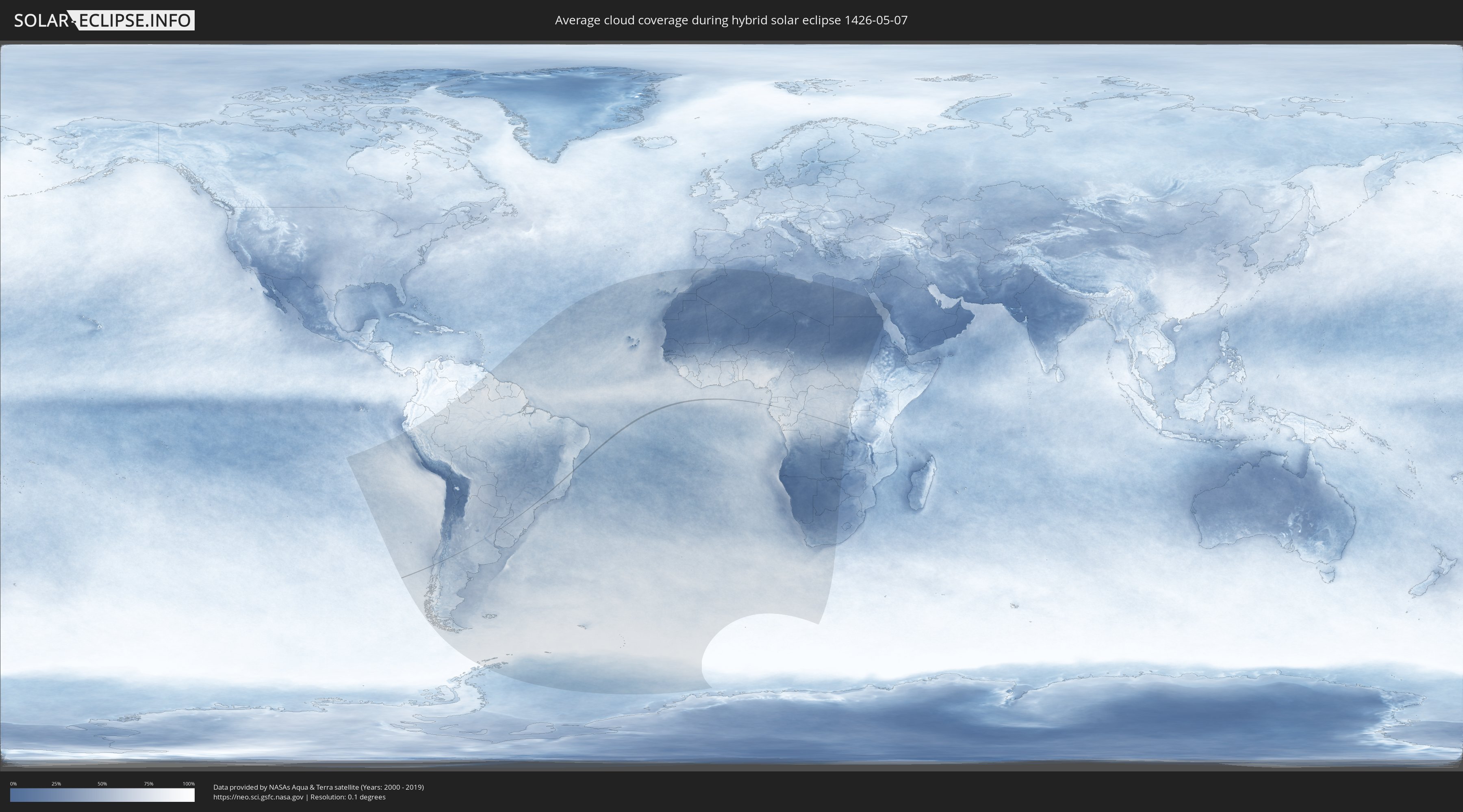
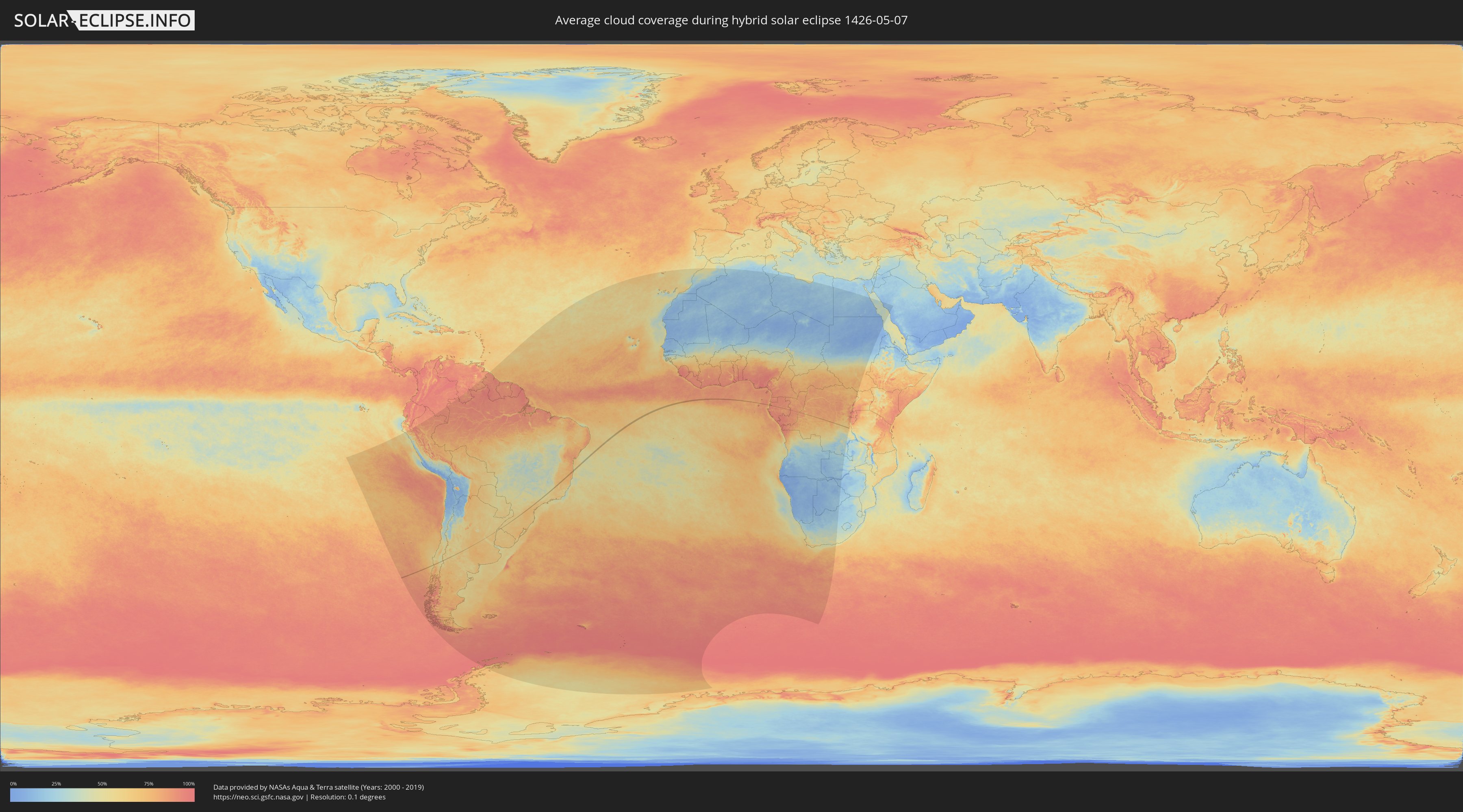
How will be the weather during the hybrid solar eclipse on 05/07/1426?
Where is the best place to see the hybrid solar eclipse of 05/07/1426?
The following maps show the average cloud coverage for the day of the hybrid solar eclipse.
With the help of these maps, it is possible to find the place along the eclipse path, which has the best
chance of a cloudless sky.
Nevertheless, you should consider local circumstances and inform about the weather of your chosen
observation site.
The data is provided by NASAs satellites
AQUA and TERRA.
The cloud maps are averaged over a period of 19 years (2000 - 2019).
Detailed country maps
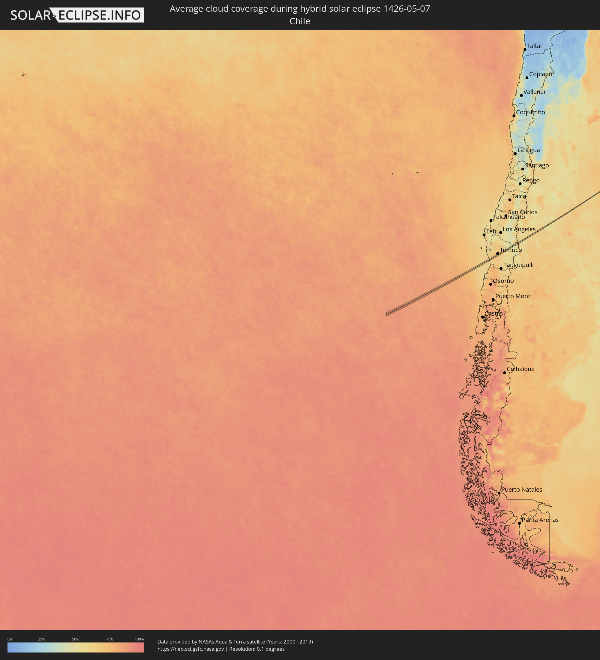 Chile
Chile
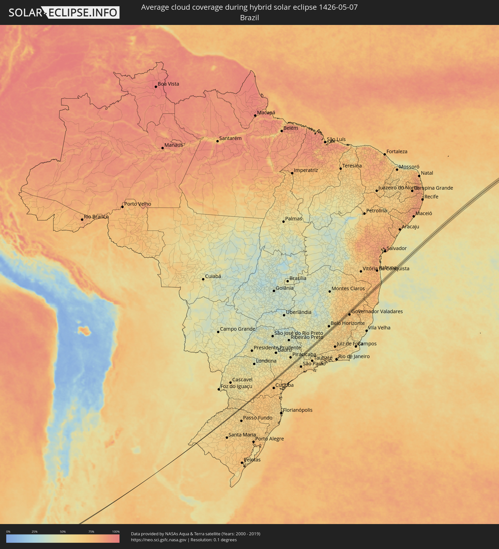 Brazil
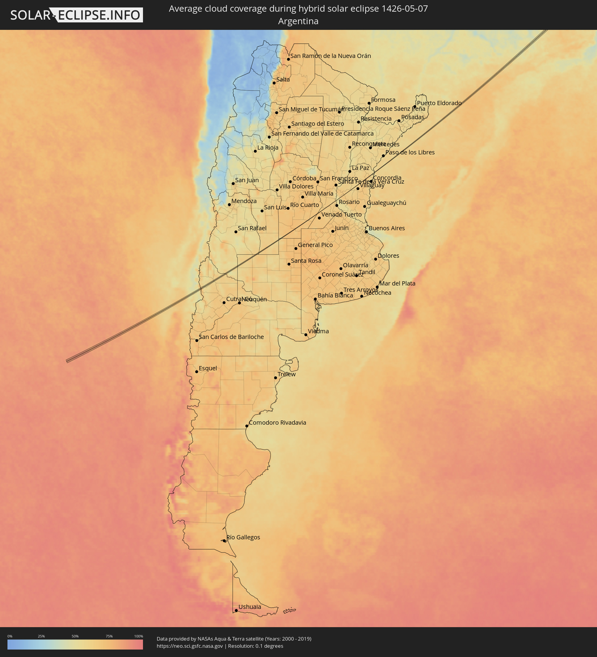 Argentina
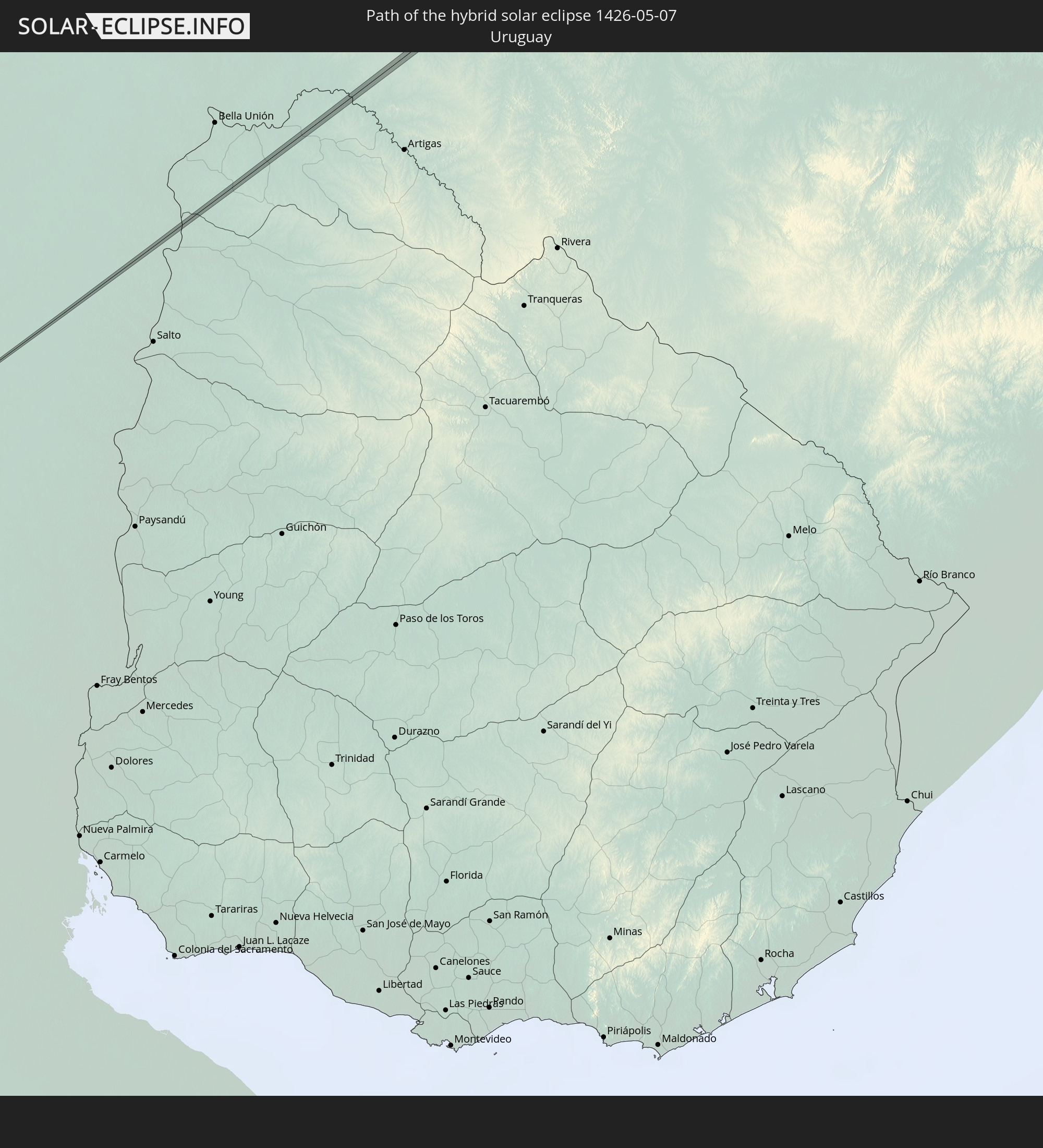
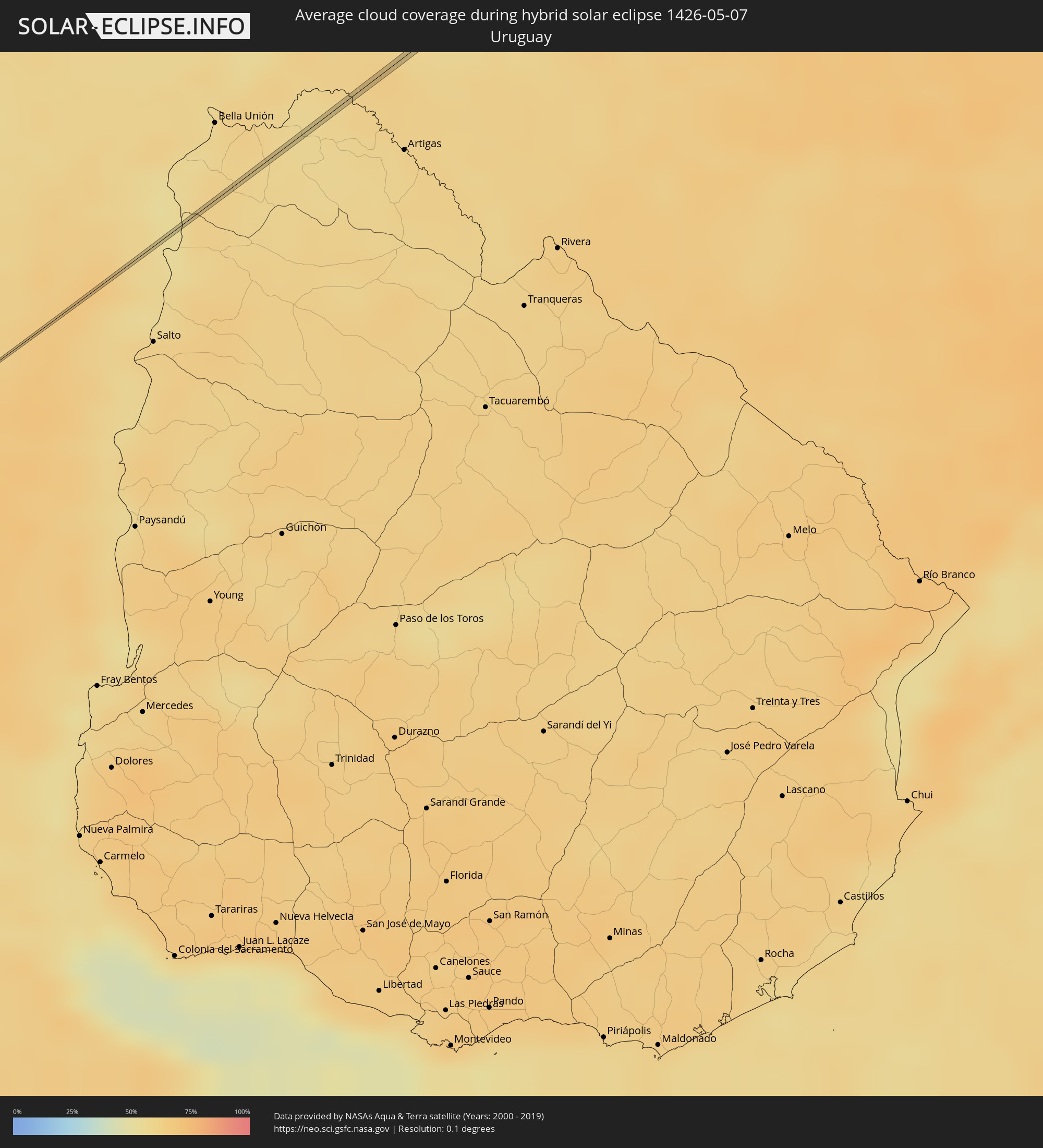 Uruguay
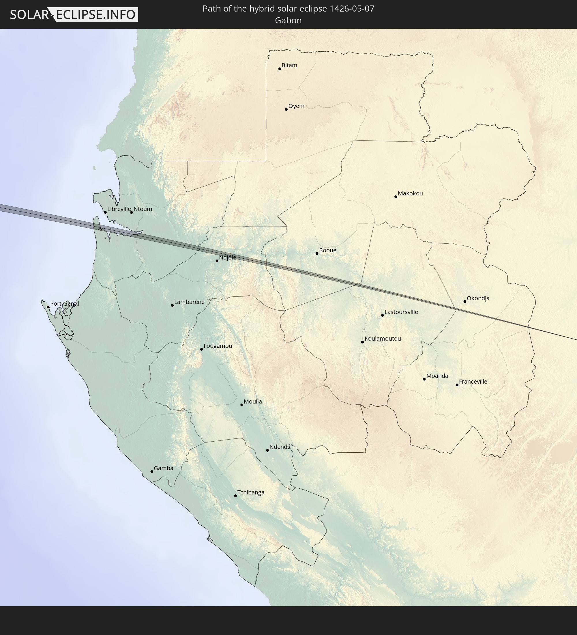
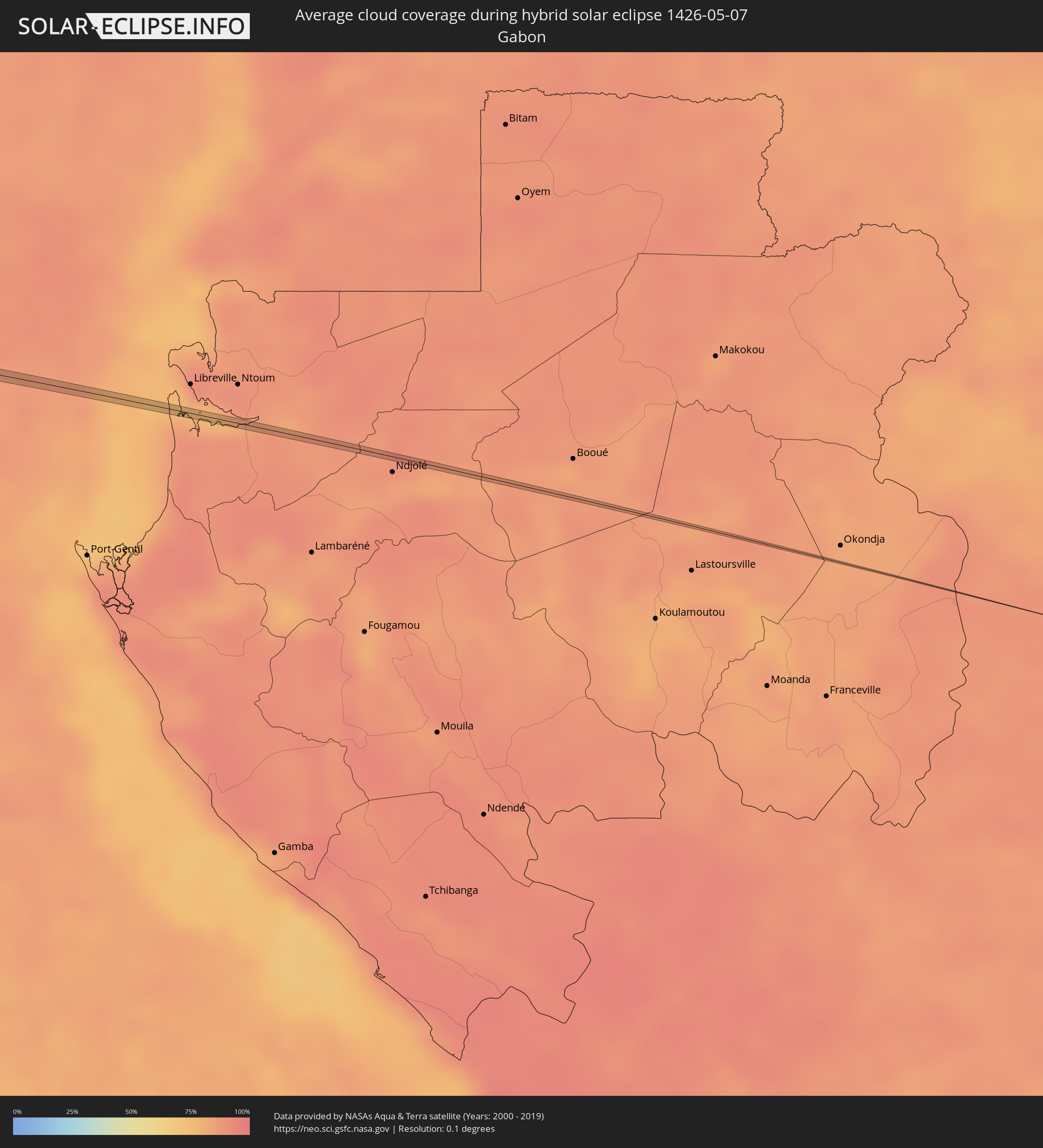 Gabon
Gabon
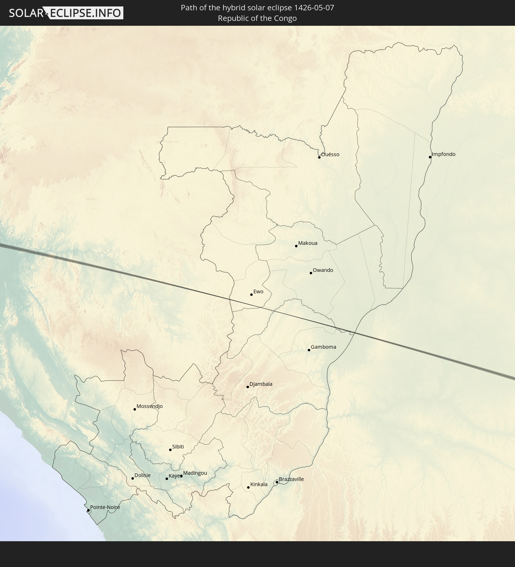
 Republic of the Congo
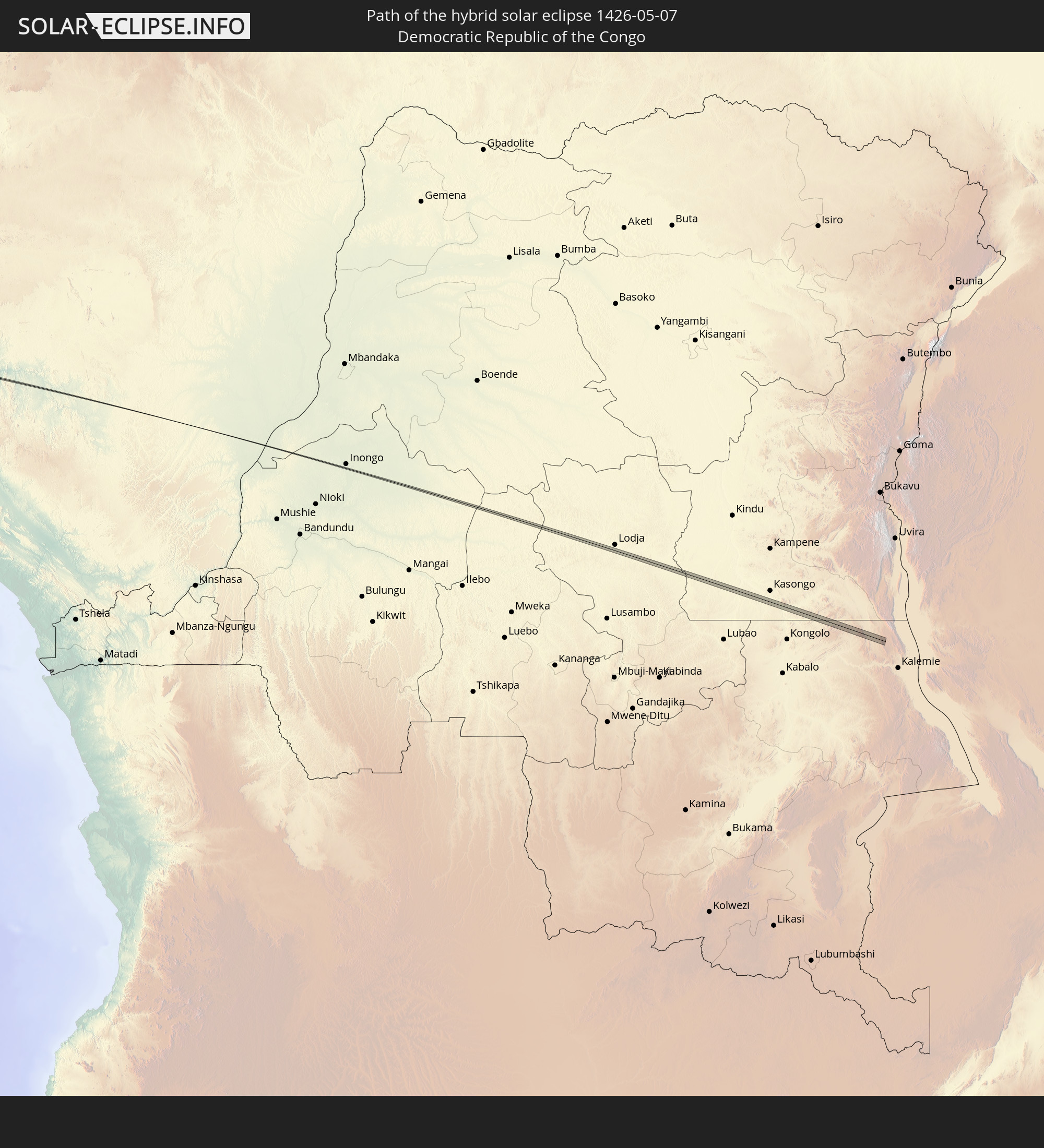
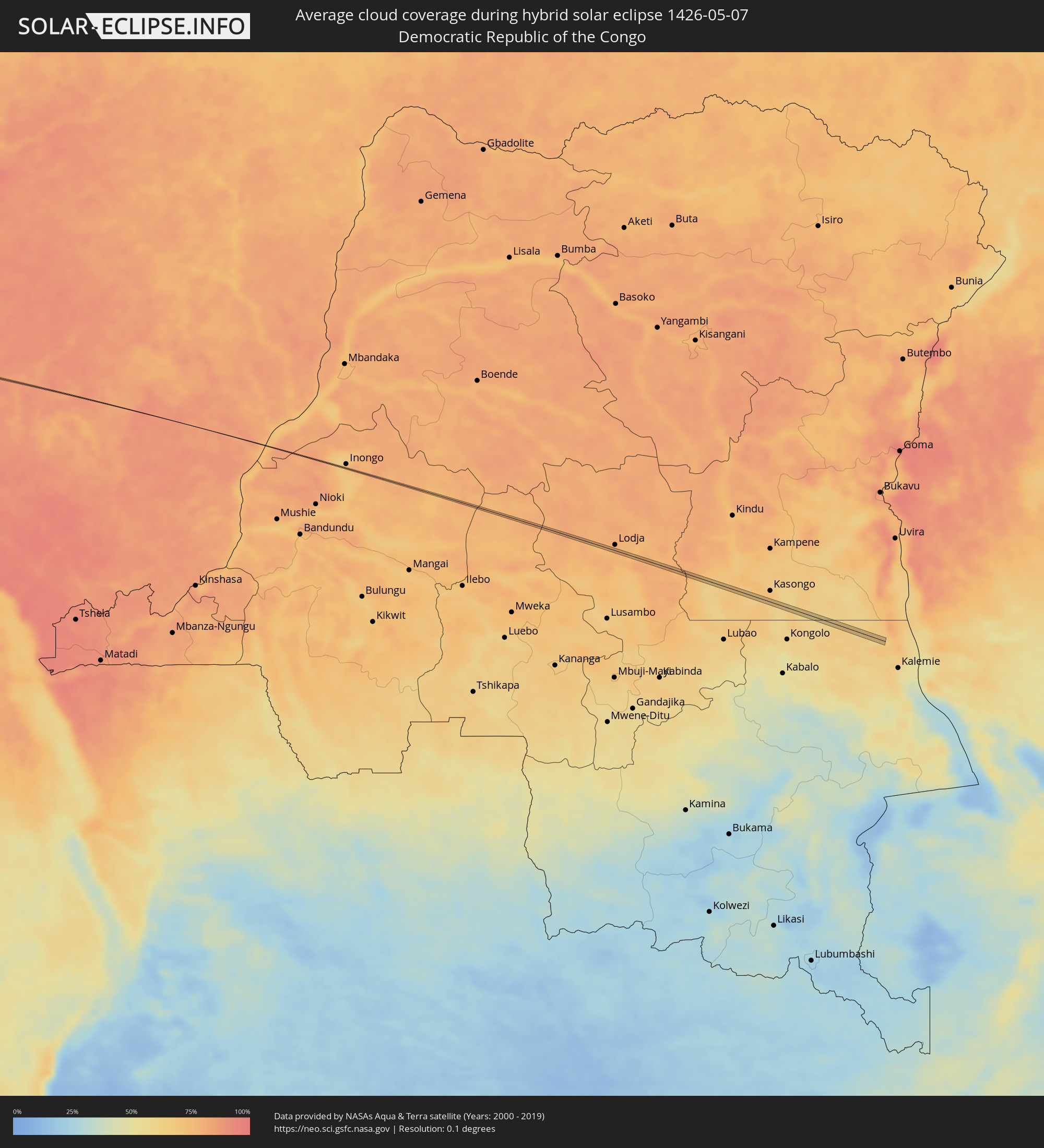 Democratic Republic of the Congo
Cities inside the path of the eclipse
The following table shows all locations with a population of more than 5,000 inside the eclipse path. Cities which have more than 100,000 inhabitants are marked bold. A click at the locations opens a detailed map.
| City | Type | Eclipse duration | Local time of max. eclipse | Distance to central line | Ø Cloud coverage |
|
Temuco, Araucanía
|
annular | - | 07:52:00 UTC-04:42 | 5 km | 67% |
|
Vilcún, Araucanía
|
annular | - | 07:52:08 UTC-04:42 | 5 km | 64% |
|
Carcarañá, Santa Fe Province
|
annular | - | 08:24:01 UTC-04:16 | 0 km | 66% |
|
Capâo Bonito, São Paulo
|
total | - | 09:51:49 UTC-03:06 | 0 km | 64% |
|
Capela do Alto, São Paulo
|
total | - | 09:53:06 UTC-03:06 | 3 km | 55% |
|
Araçoiaba da Serra, São Paulo
|
total | - | 09:53:15 UTC-03:06 | 8 km | 57% |
|
Salto, São Paulo
|
total | - | 09:53:58 UTC-03:06 | 4 km | 55% |
|
Indaiatuba, São Paulo
|
total | - | 09:54:10 UTC-03:06 | 0 km | 56% |
|
Campinas, São Paulo
|
total | - | 09:54:33 UTC-03:06 | 5 km | 51% |
|
Valinhos, São Paulo
|
total | - | 09:54:35 UTC-03:06 | 5 km | 53% |
|
Pedreira, São Paulo
|
total | - | 09:54:55 UTC-03:06 | 8 km | 47% |
|
Amparo, São Paulo
|
total | - | 09:55:10 UTC-03:06 | 2 km | 47% |
|
Serra Negra, São Paulo
|
total | - | 09:55:20 UTC-03:06 | 5 km | 48% |
|
Socorro, São Paulo
|
total | - | 09:55:37 UTC-03:06 | 5 km | 47% |
|
Bueno Brandão, Minas Gerais
|
total | - | 09:56:01 UTC-03:06 | 5 km | 50% |
|
Borda da Mata, Minas Gerais
|
total | - | 09:56:27 UTC-03:06 | 4 km | 52% |
|
Varginha, Minas Gerais
|
total | - | 09:58:15 UTC-03:06 | 6 km | 50% |
|
Lavras, Minas Gerais
|
total | - | 09:59:14 UTC-03:06 | 1 km | 54% |
|
Bom Sucesso, Minas Gerais
|
total | - | 09:59:50 UTC-03:06 | 1 km | 55% |
|
Itabirito, Minas Gerais
|
total | - | 10:02:12 UTC-03:06 | 2 km | 54% |
|
Barão de Cocais, Minas Gerais
|
total | - | 10:03:03 UTC-03:06 | 1 km | 61% |
|
Itabira, Minas Gerais
|
total | - | 10:03:51 UTC-03:06 | 10 km | 64% |
|
João Monlevade, Minas Gerais
|
total | - | 10:03:45 UTC-03:06 | 10 km | 67% |
|
Açucena, Minas Gerais
|
total | - | 10:05:39 UTC-03:06 | 6 km | 66% |
|
Belo Oriente, Minas Gerais
|
total | - | 10:05:36 UTC-03:06 | 11 km | 62% |
|
Carlos Chagas, Minas Gerais
|
total | - | 10:10:32 UTC-03:06 | 11 km | 72% |
|
Itanhém, Bahia
|
total | - | 10:44:30 UTC-02:34 | 1 km | 70% |
|
Guaratinga, Bahia
|
total | - | 10:46:19 UTC-02:34 | 8 km | 75% |
|
Belmonte, Bahia
|
total | - | 10:49:05 UTC-02:34 | 1 km | 52% |