Total solar eclipse of 06/22/2104
| Day of week: | Sunday |
| Maximum duration of eclipse: | 02m26s |
| Maximum width of eclipse path: | 103 km |
| Saros cycle: | 148 |
| Coverage: | 100% |
| Magnitude: | 1.0231 |
| Gamma: | -0.6438 |
Wo kann man die Sonnenfinsternis vom 06/22/2104 sehen?
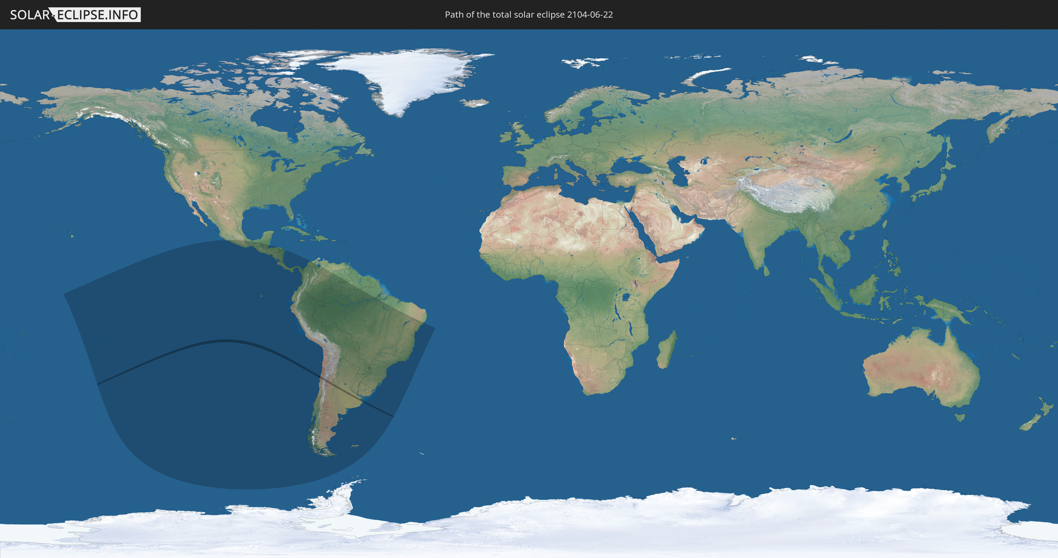
Die Sonnenfinsternis am 06/22/2104 kann man in 23 Ländern als partielle Sonnenfinsternis beobachten.
Der Finsternispfad verläuft durch 3 Länder. Nur in diesen Ländern ist sie als total Sonnenfinsternis zu sehen.
In den folgenden Ländern ist die Sonnenfinsternis total zu sehen
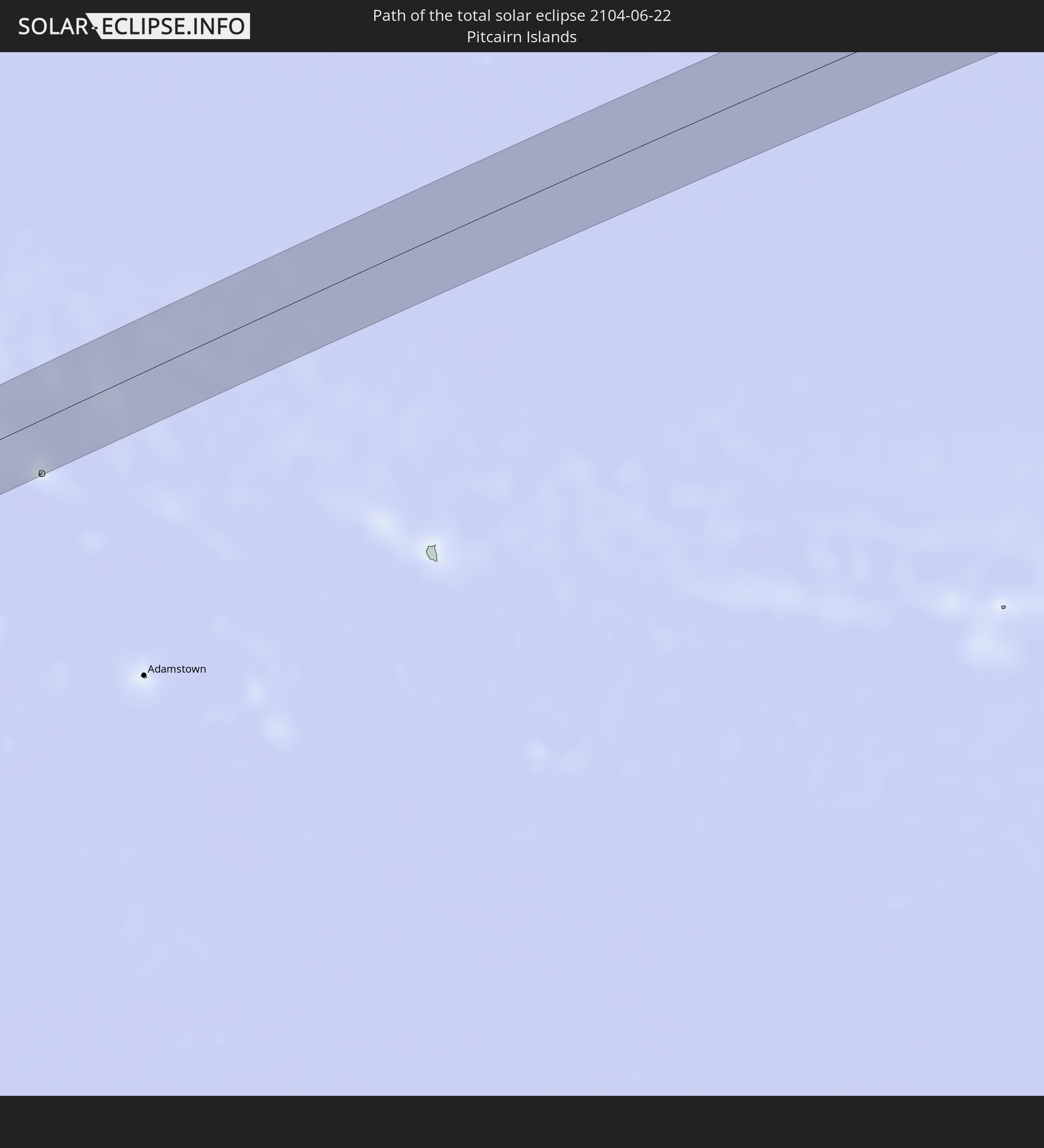 Pitcairn Islands
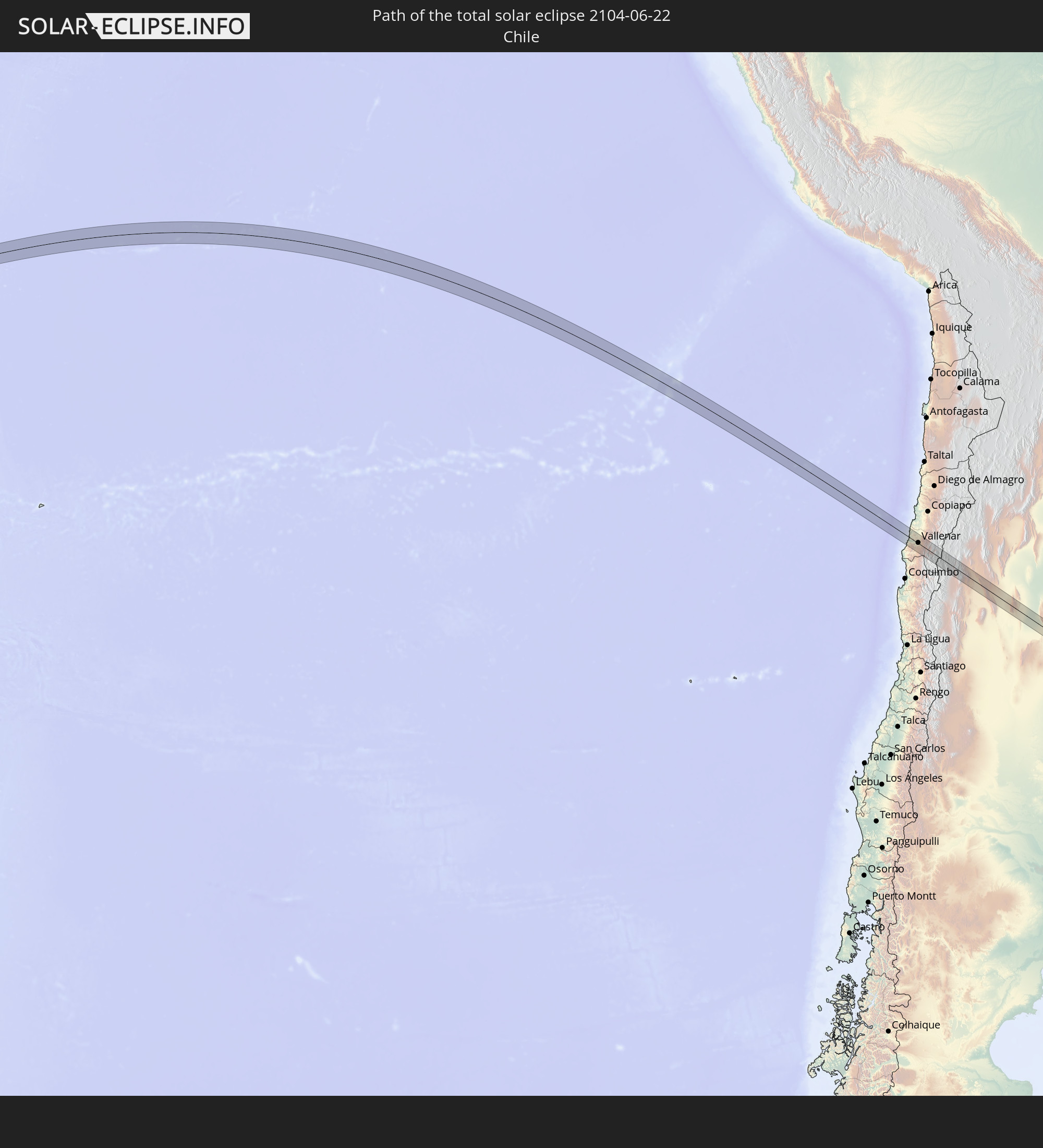 Chile
Chile
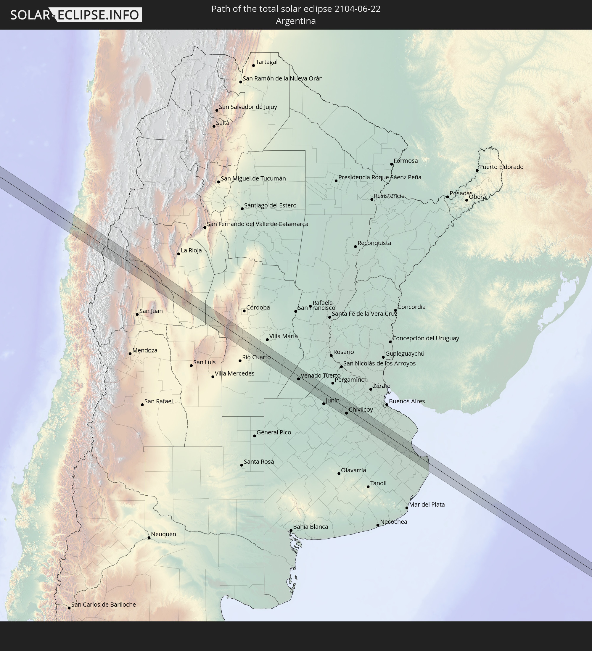 Argentina
In den folgenden Ländern ist die Sonnenfinsternis partiell zu sehen


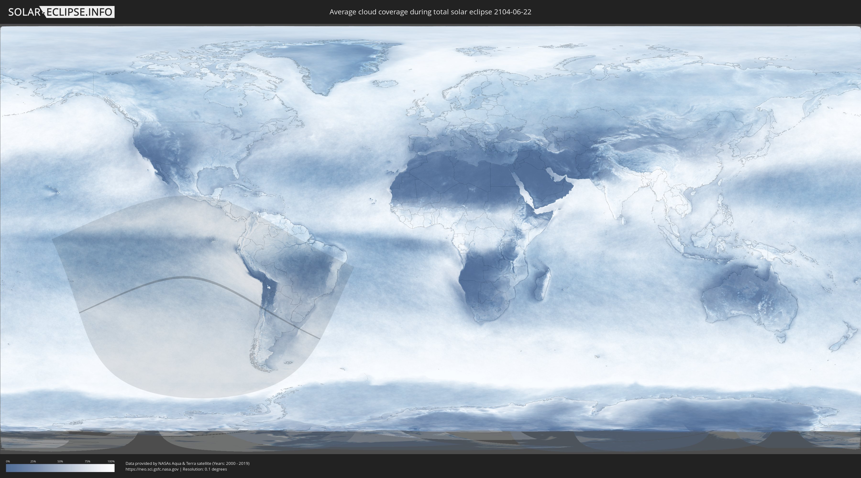
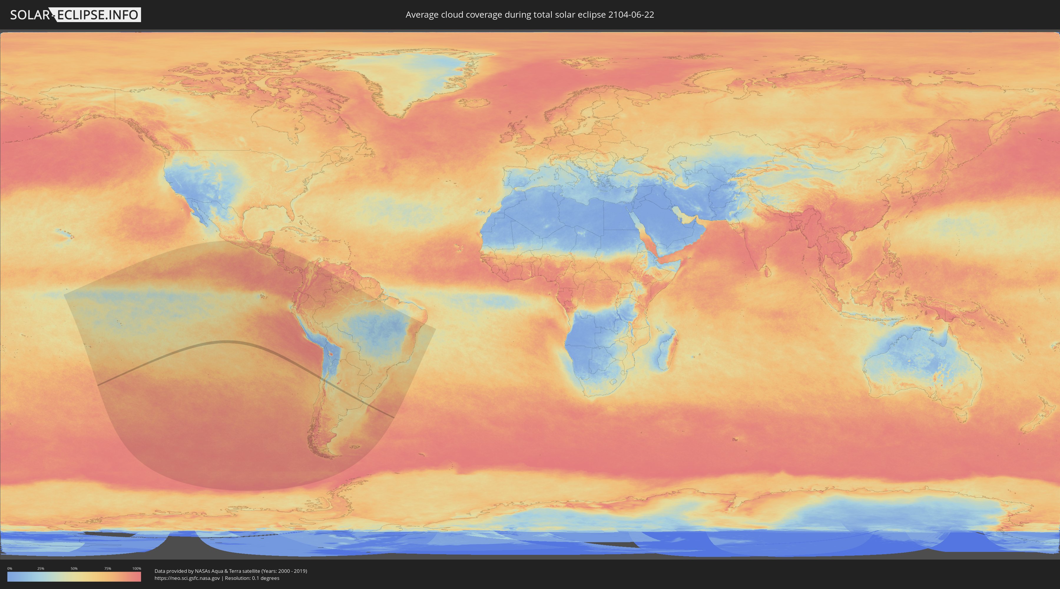
How will be the weather during the total solar eclipse on 06/22/2104?
Where is the best place to see the total solar eclipse of 06/22/2104?
The following maps show the average cloud coverage for the day of the total solar eclipse.
With the help of these maps, it is possible to find the place along the eclipse path, which has the best
chance of a cloudless sky.
Nevertheless, you should consider local circumstances and inform about the weather of your chosen
observation site.
The data is provided by NASAs satellites
AQUA and TERRA.
The cloud maps are averaged over a period of 19 years (2000 - 2019).
Detailed country maps
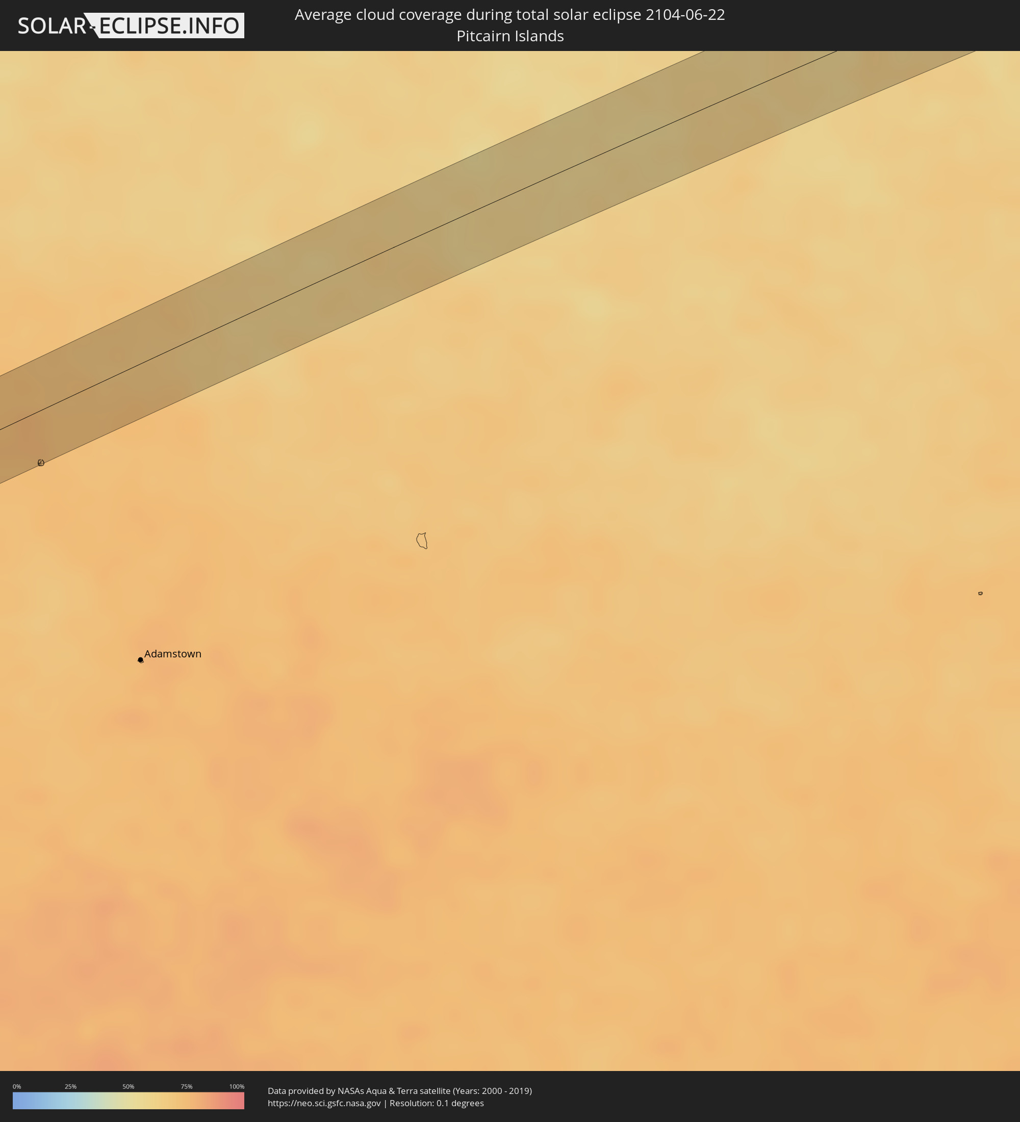 Pitcairn Islands
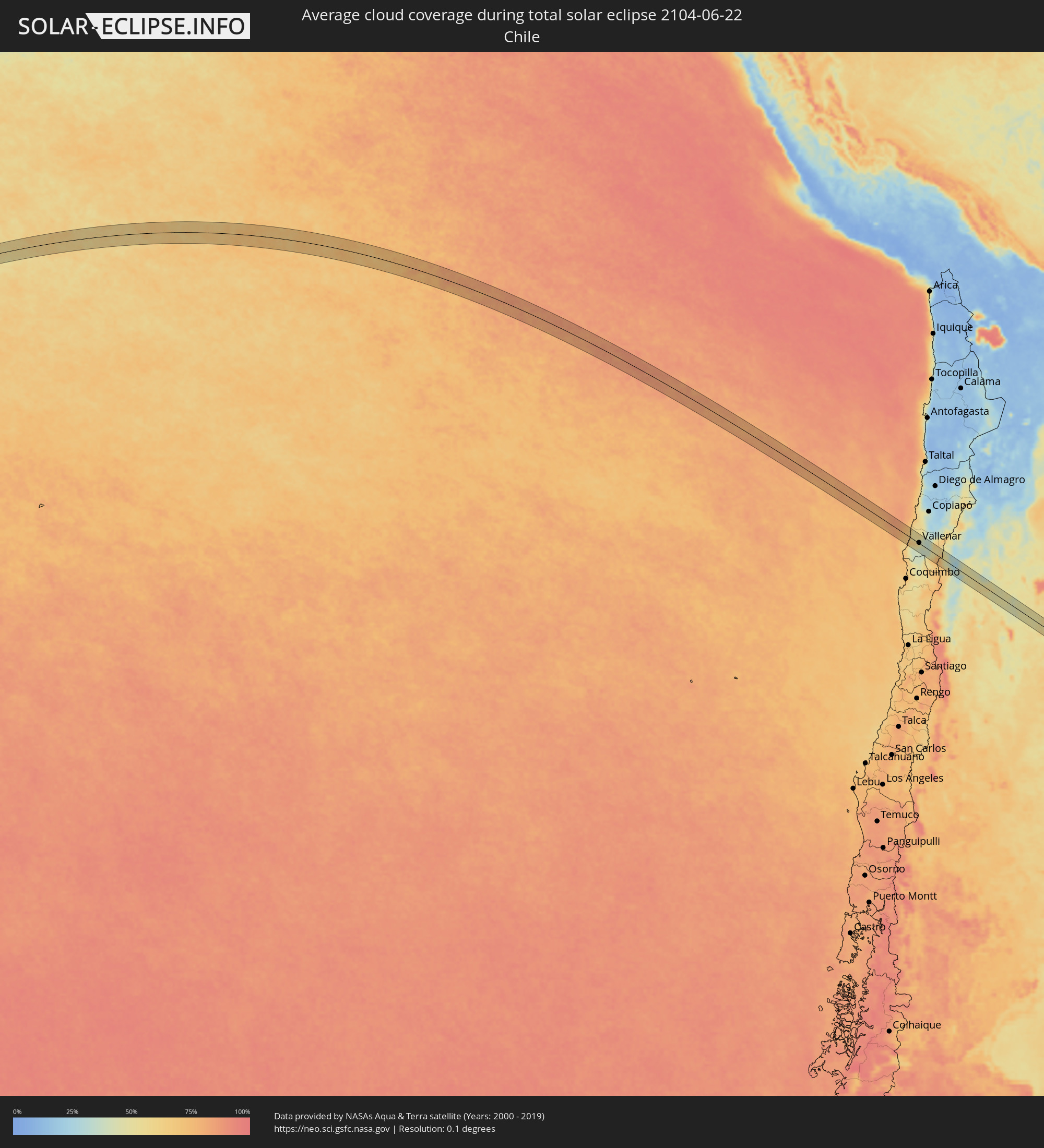 Chile
Chile
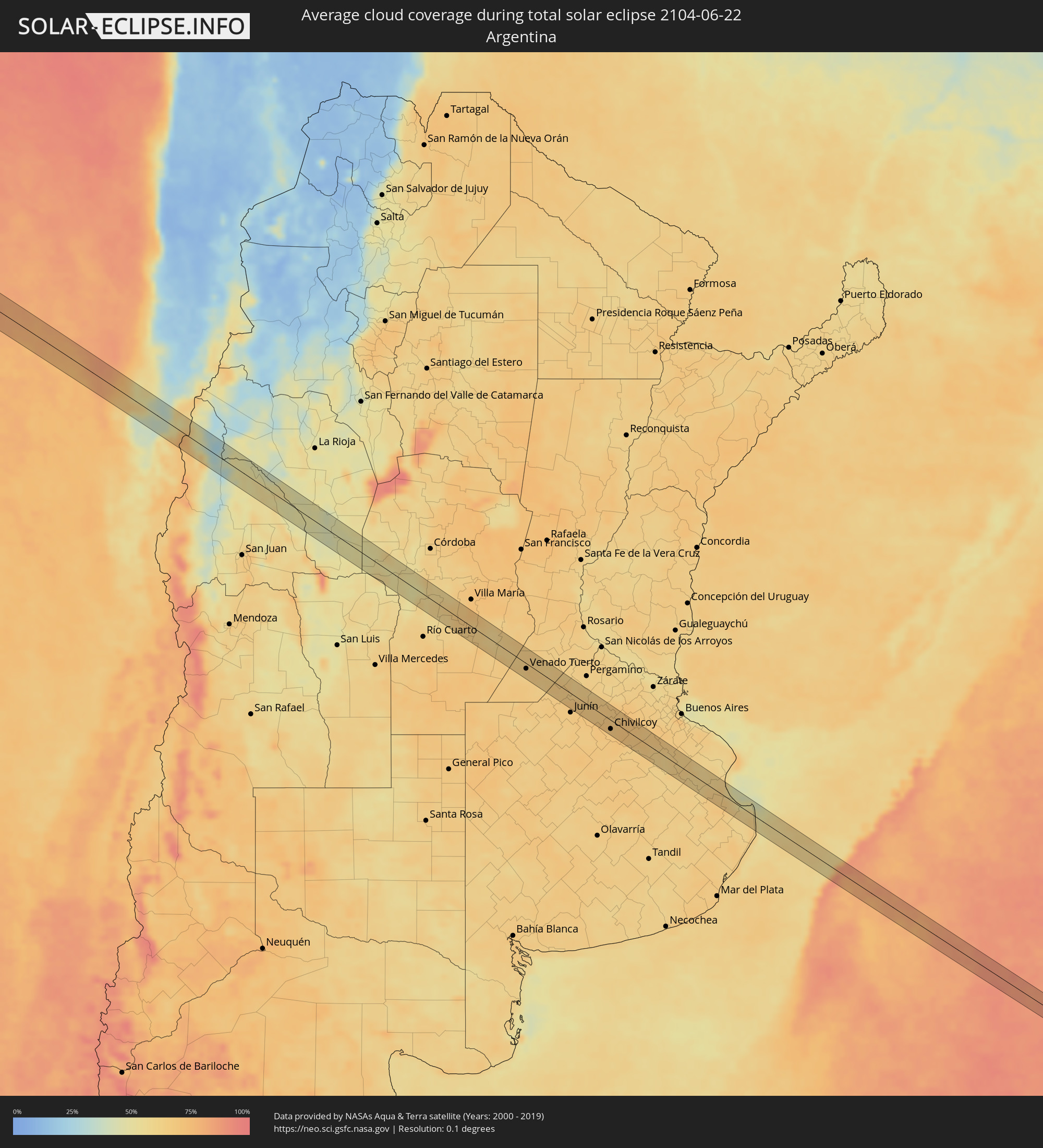 Argentina
Cities inside the path of the eclipse
The following table shows all locations with a population of more than 5,000 inside the eclipse path. Cities which have more than 100,000 inhabitants are marked bold. A click at the locations opens a detailed map.
| City | Type | Eclipse duration | Local time of max. eclipse | Distance to central line | Ø Cloud coverage |
 Vallenar, Atacama
|
total | - | 16:20:38 UTC-03:00 | 2 km | 53% |
 San Agustín de Valle Fértil, San Juan Province
|
total | - | 16:24:52 UTC-03:00 | 11 km | 47% |
|
Villa Dolores, Cordoba Province
|
total | - | 16:27:19 UTC-03:00 | 11 km | 57% |
|
Mina Clavero, Cordoba Province
|
total | - | 16:27:38 UTC-03:00 | 19 km | 53% |
|
Villa General Belgrano, Cordoba Province
|
total | - | 16:28:04 UTC-03:00 | 19 km | 49% |
|
Santa Rosa de Calamuchita, Cordoba Province
|
total | - | 16:28:03 UTC-03:00 | 12 km | 50% |
|
Embalse, Cordoba Province
|
total | - | 16:28:09 UTC-03:00 | 8 km | 53% |
|
Berrotarán, Cordoba Province
|
total | - | 16:28:03 UTC-03:00 | 16 km | 60% |
|
Almafuerte, Cordoba Province
|
total | - | 16:28:20 UTC-03:00 | 15 km | 58% |
|
Río Tercero, Cordoba Province
|
total | - | 16:28:31 UTC-03:00 | 24 km | 58% |
|
Tancacha, Cordoba Province
|
total | - | 16:28:38 UTC-03:00 | 25 km | 58% |
|
General Cabrera, Cordoba Province
|
total | - | 16:28:30 UTC-03:00 | 22 km | 58% |
|
Hernando, Cordoba Province
|
total | - | 16:28:50 UTC-03:00 | 21 km | 62% |
|
Laborde, Cordoba Province
|
total | - | 16:29:29 UTC-03:00 | 1 km | 64% |
|
Monte Maíz, Cordoba Province
|
total | - | 16:29:44 UTC-03:00 | 8 km | 62% |
|
Arias, Cordoba Province
|
total | - | 16:29:43 UTC-03:00 | 22 km | 66% |
|
Corral de Bustos, Cordoba Province
|
total | - | 16:30:09 UTC-03:00 | 22 km | 65% |
|
Chañar Ladeado, Santa Fe Province
|
total | - | 16:30:17 UTC-03:00 | 26 km | 65% |
|
Venado Tuerto, Santa Fe Province
|
total | - | 16:30:08 UTC-03:00 | 9 km | 65% |
|
Villa Cañás, Santa Fe Province
|
total | - | 16:30:22 UTC-03:00 | 15 km | 62% |
|
Chacabuco, Buenos Aires
|
total | - | 16:31:10 UTC-03:00 | 15 km | 67% |
|
Chivilcoy, Buenos Aires
|
total | - | 16:31:27 UTC-03:00 | 15 km | 68% |
|
San Clemente del Tuyú, Buenos Aires
|
total | - | 16:33:28 UTC-03:00 | 14 km | 55% |