Total solar eclipse of 02/08/2111
| Day of week: | Sunday |
| Maximum duration of eclipse: | 03m17s |
| Maximum width of eclipse path: | 130 km |
| Saros cycle: | 142 |
| Coverage: | 100% |
| Magnitude: | 1.0374 |
| Gamma: | -0.265 |
Wo kann man die Sonnenfinsternis vom 02/08/2111 sehen?
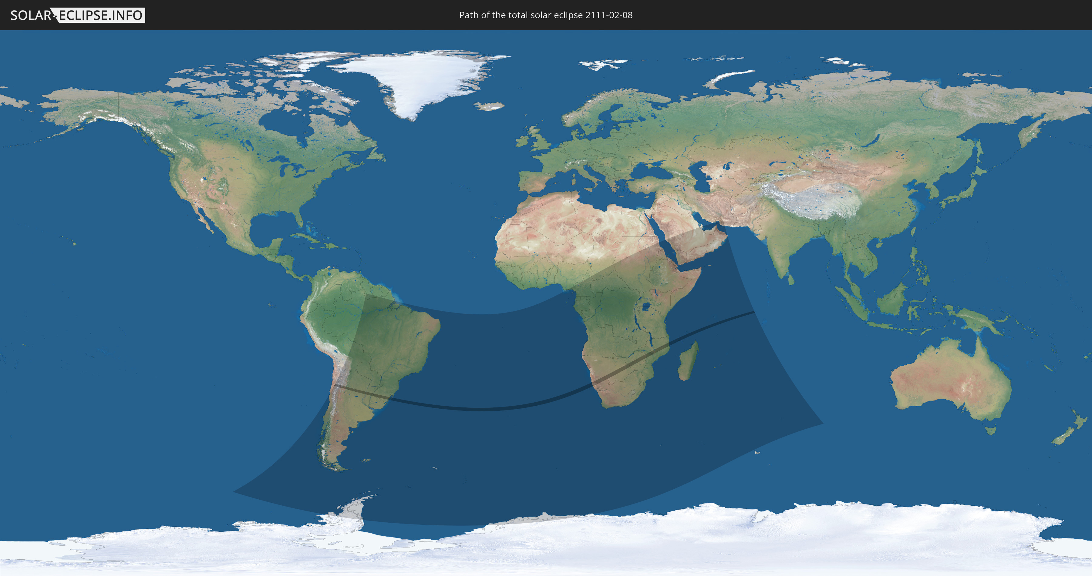
Die Sonnenfinsternis am 02/08/2111 kann man in 55 Ländern als partielle Sonnenfinsternis beobachten.
Der Finsternispfad verläuft durch 12 Länder. Nur in diesen Ländern ist sie als total Sonnenfinsternis zu sehen.
In den folgenden Ländern ist die Sonnenfinsternis total zu sehen
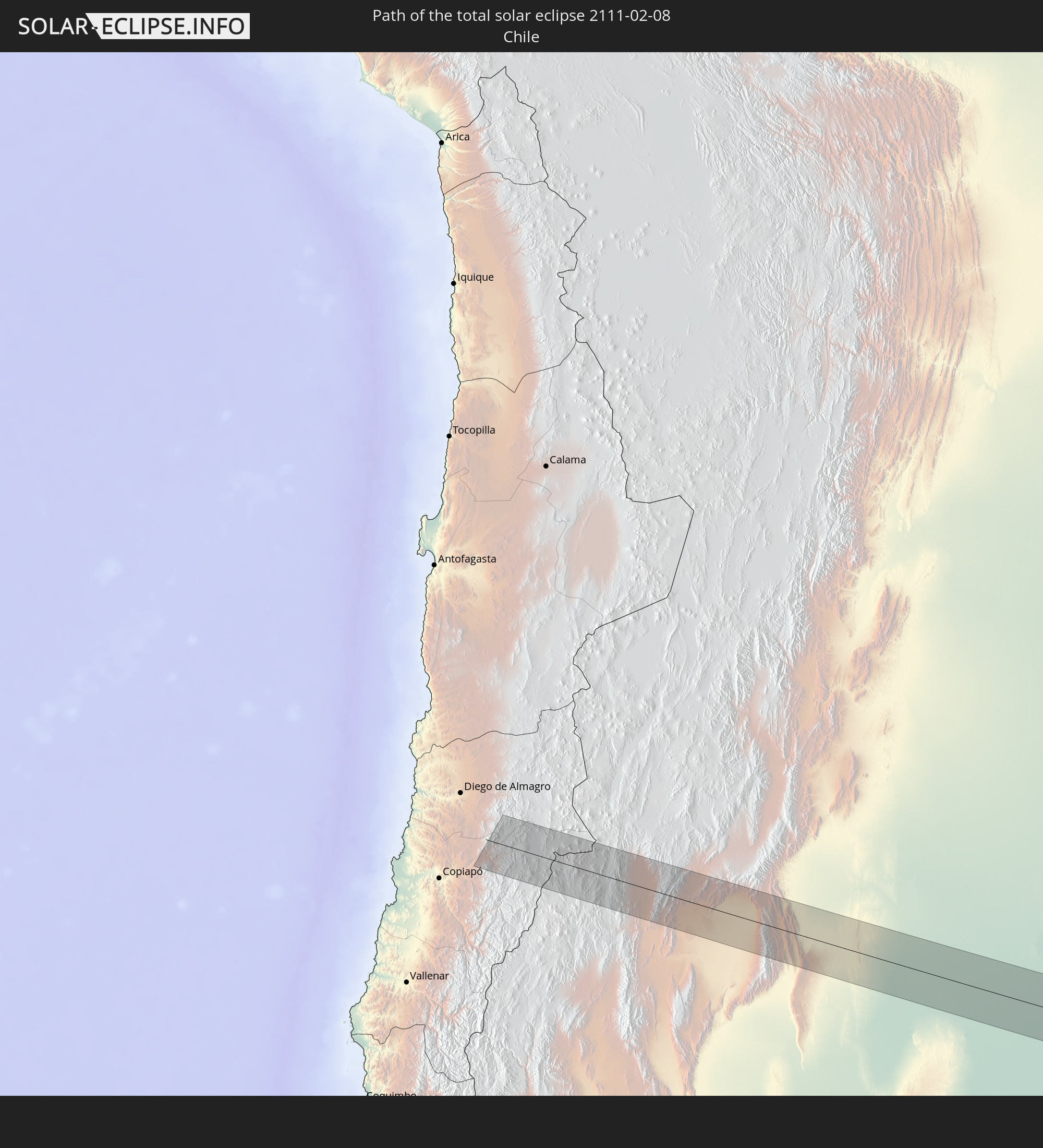 Chile
Chile
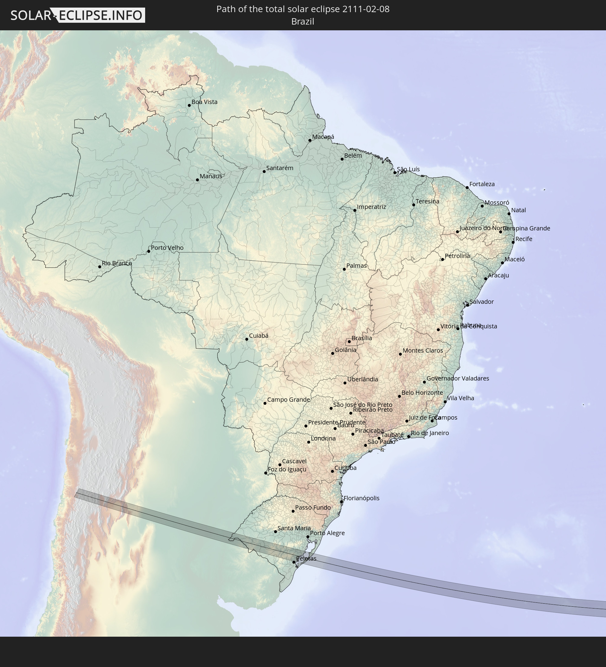 Brazil
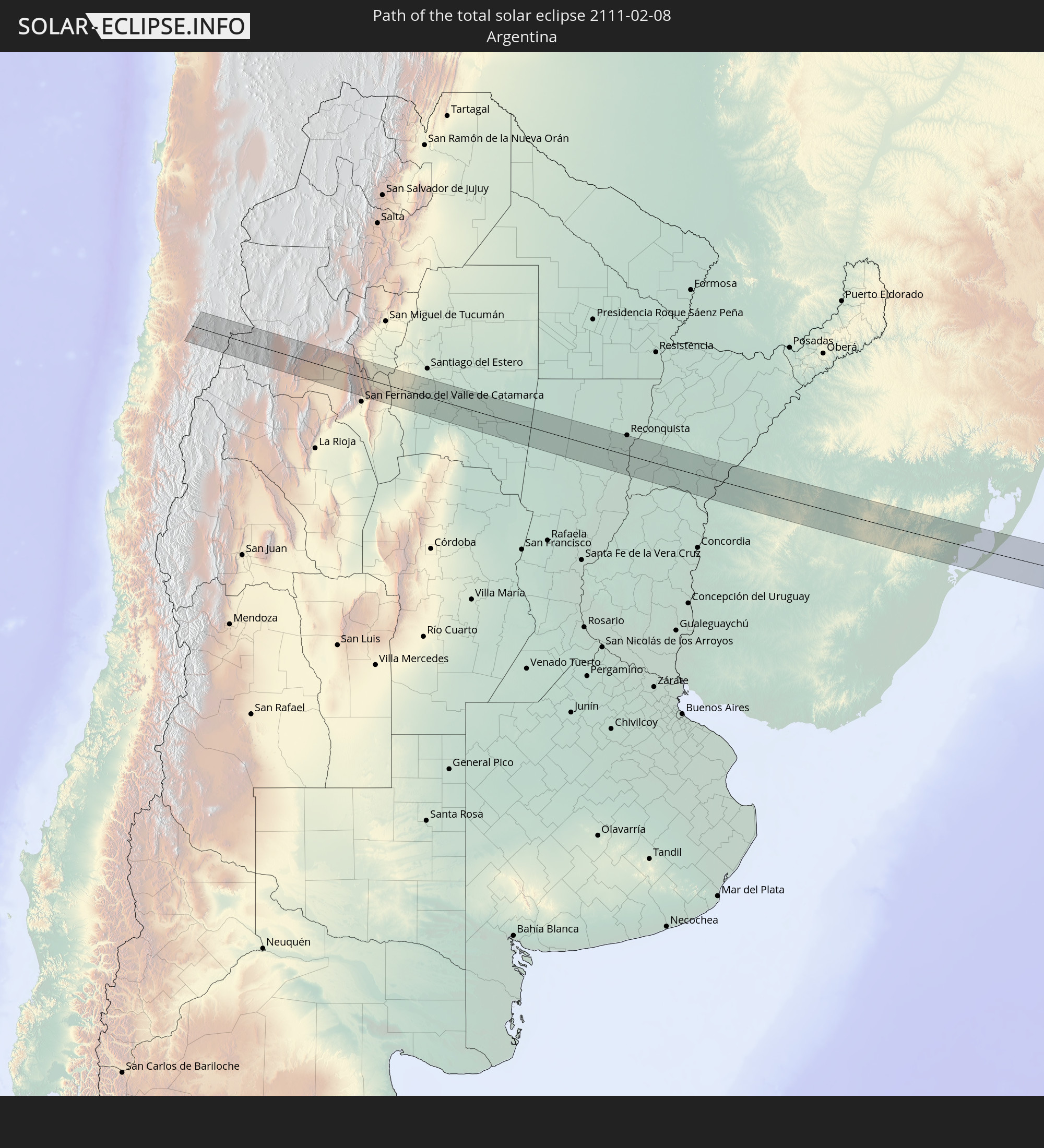 Argentina
 Uruguay
 Namibia
 South Africa
 Botswana
 Zimbabwe
 Mozambique
 Malawi
 Comoros
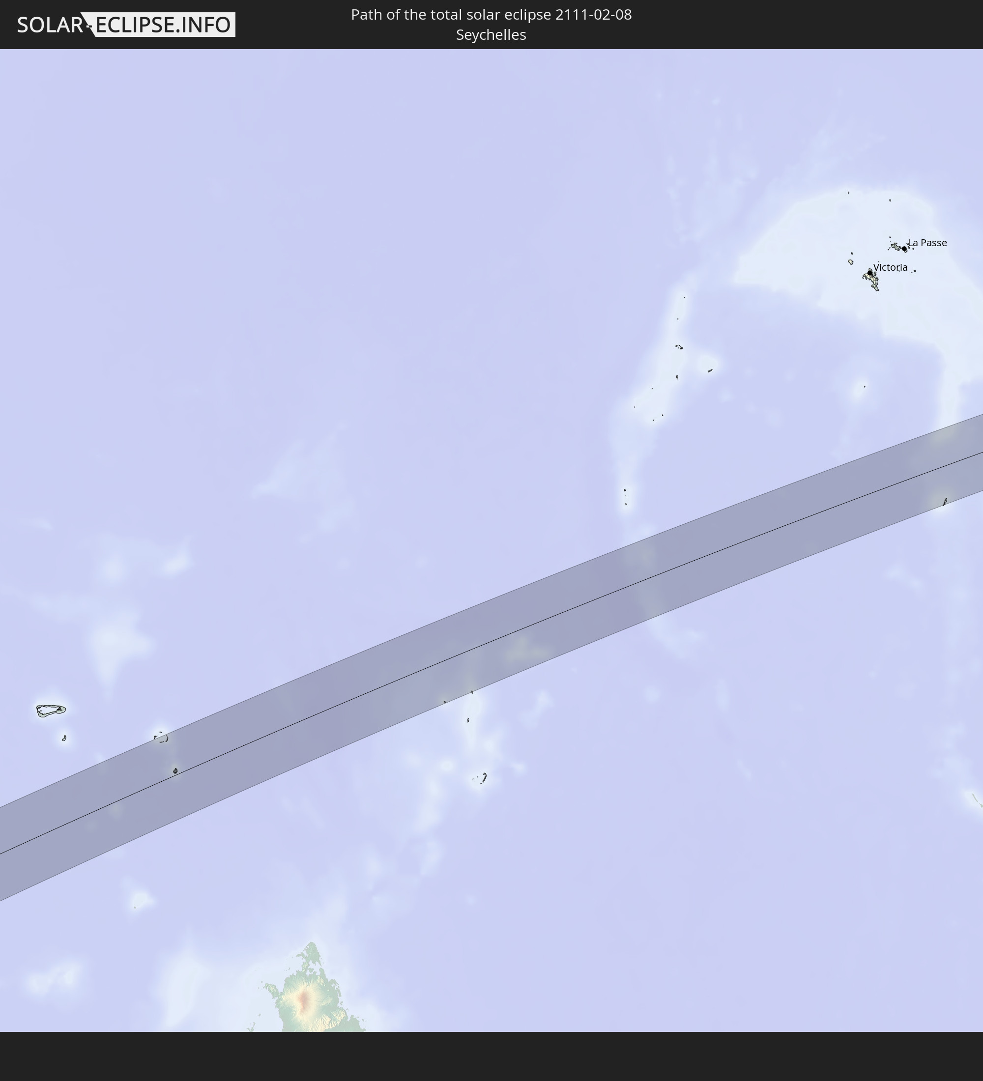 Seychelles
In den folgenden Ländern ist die Sonnenfinsternis partiell zu sehen
 Antarctica
 Chile
Chile
 Brazil
 Argentina
 Bolivia
 Paraguay
 Falkland Islands
 Guyana
 Uruguay
 Suriname
 South Georgia and the South Sandwich Islands
 Saint Helena, Ascension and Tristan da Cunha
 Nigeria
 Bouvet Island
 Equatorial Guinea
 São Tomé and Príncipe
 Cameroon
 Gabon
Gabon
 Republic of the Congo
 Angola
 Namibia
 Democratic Republic of the Congo
 Chad
Chad
 Central African Republic
 South Africa
 Botswana
 Sudan
Sudan
 Zambia
 Zimbabwe
 Lesotho
 Rwanda
 Burundi
 Tanzania
 Uganda
 Mozambique
 Swaziland
 Malawi
 Ethiopia
 Kenya
Kenya
 Saudi Arabia
 Eritrea
 French Southern and Antarctic Lands
 Somalia
 Djibouti
 Yemen
Yemen
 Madagascar
 Comoros
 Iran
Iran
 Mayotte
 Seychelles
 Qatar
Qatar
 United Arab Emirates
 Oman
Oman
 Réunion
 Mauritius
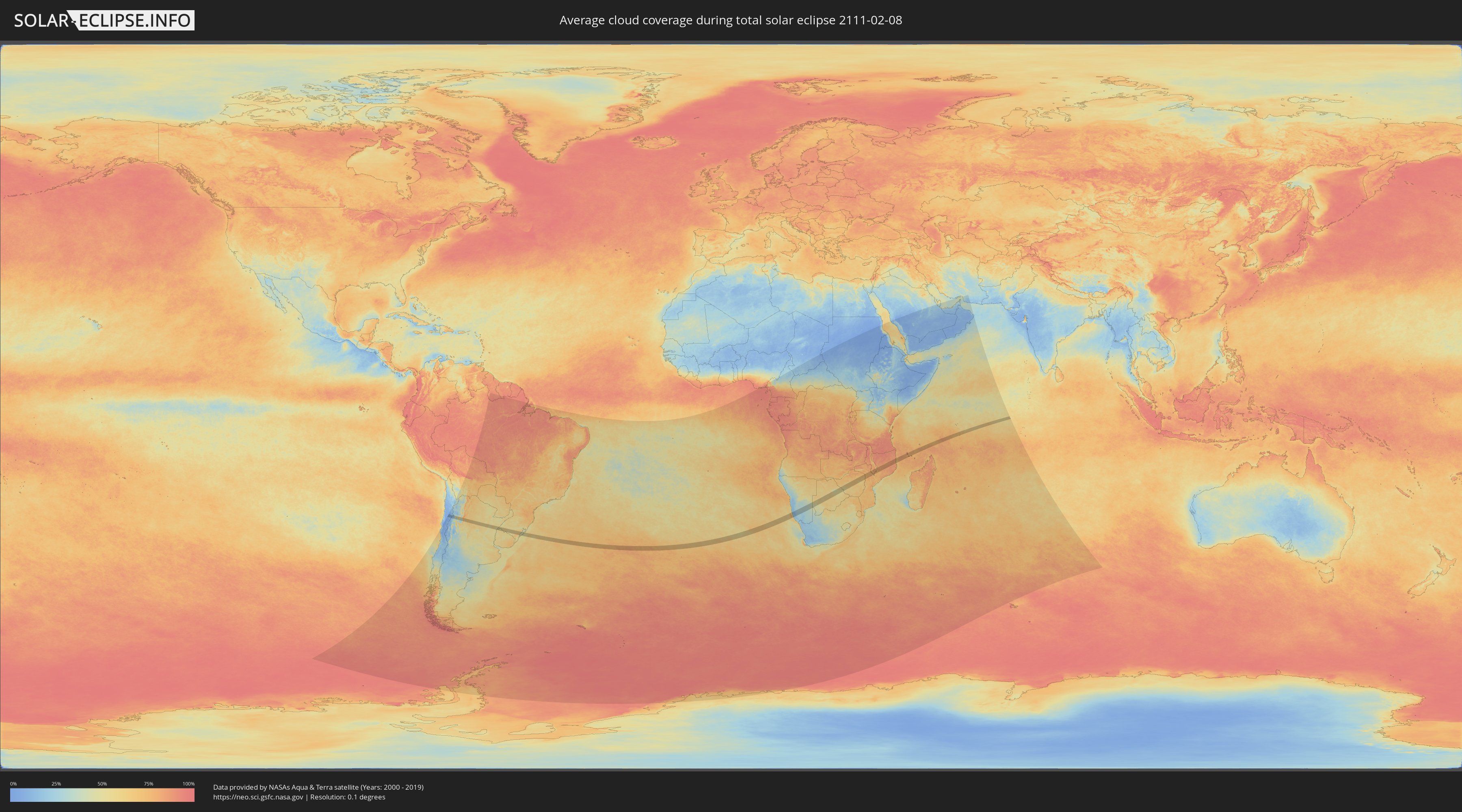
How will be the weather during the total solar eclipse on 02/08/2111?
Where is the best place to see the total solar eclipse of 02/08/2111?
The following maps show the average cloud coverage for the day of the total solar eclipse.
With the help of these maps, it is possible to find the place along the eclipse path, which has the best
chance of a cloudless sky.
Nevertheless, you should consider local circumstances and inform about the weather of your chosen
observation site.
The data is provided by NASAs satellites
AQUA and TERRA.
The cloud maps are averaged over a period of 19 years (2000 - 2019).

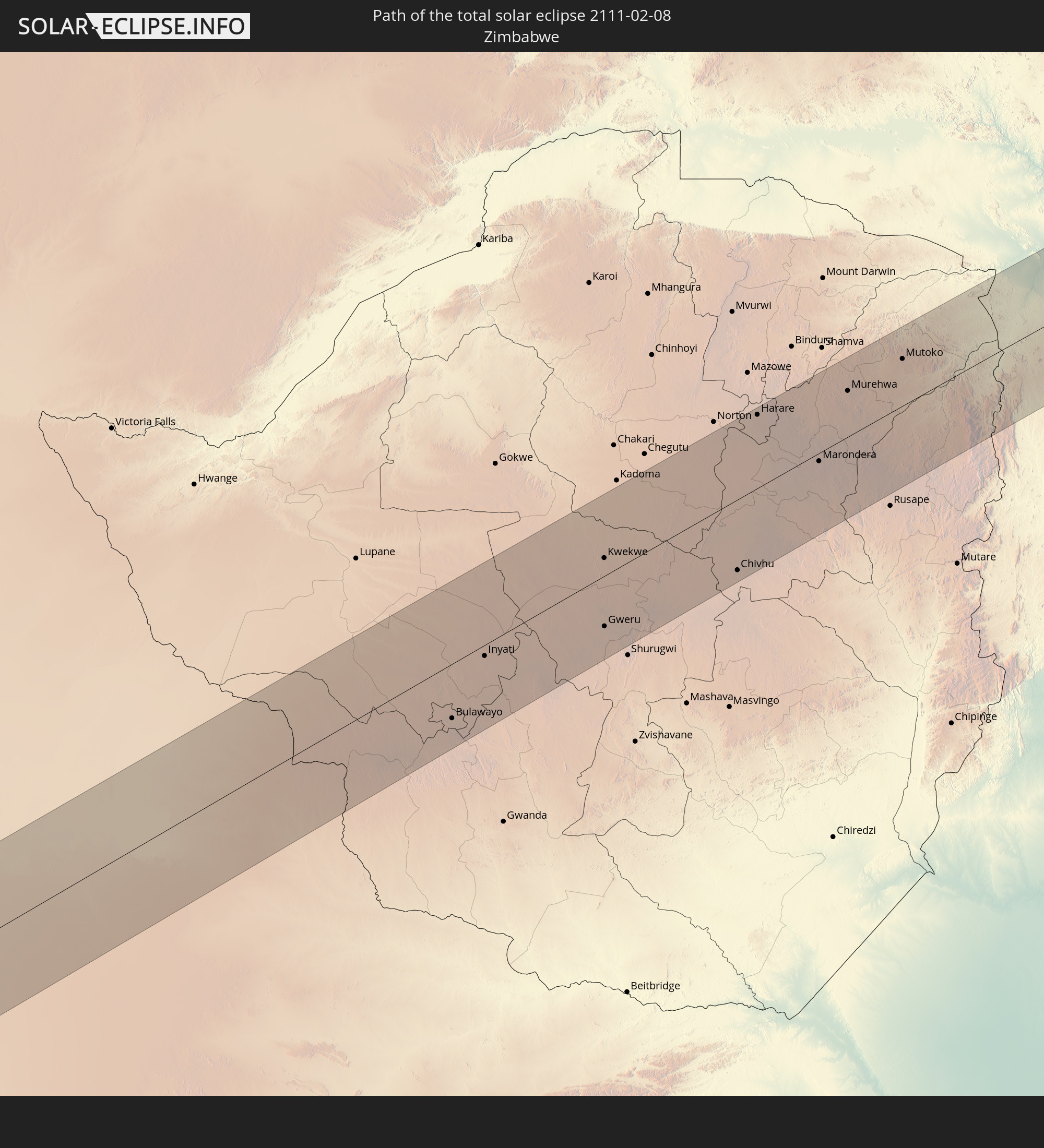
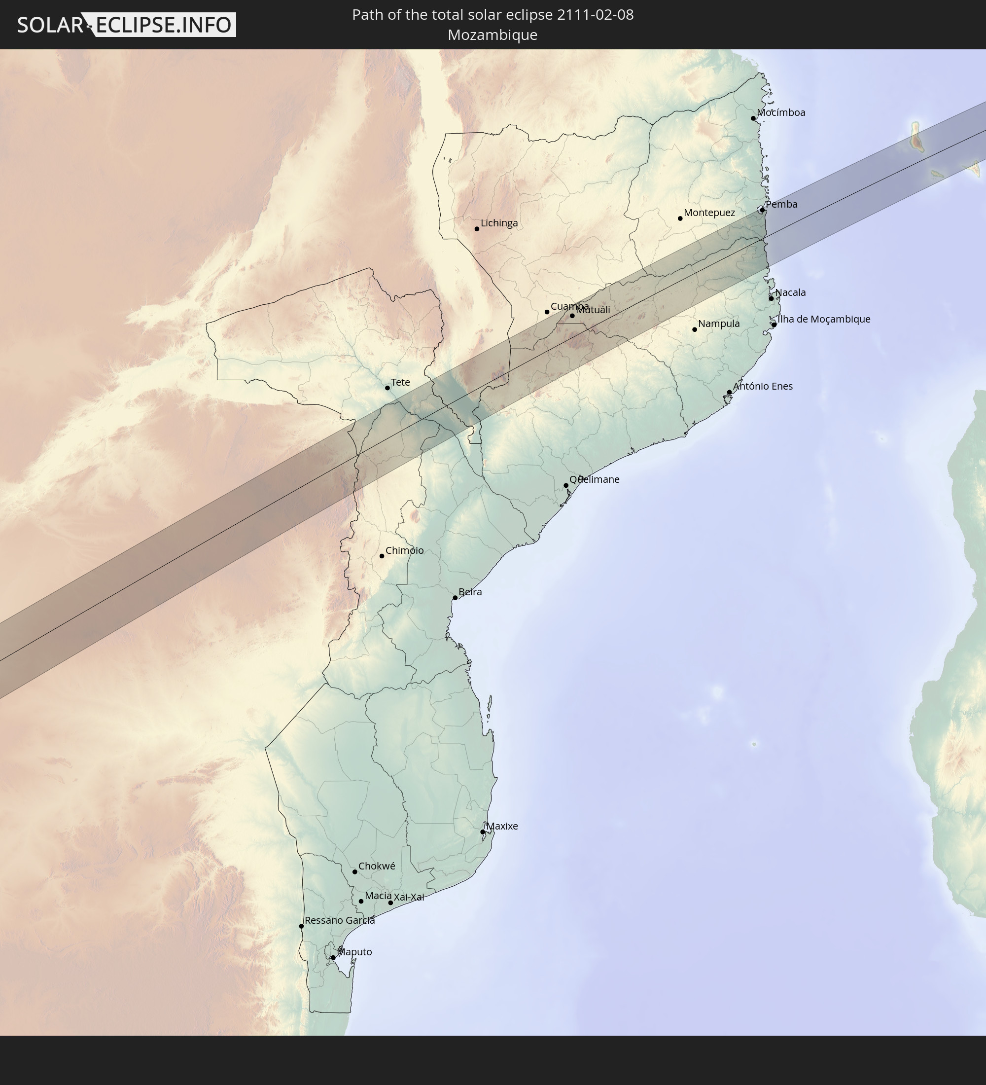
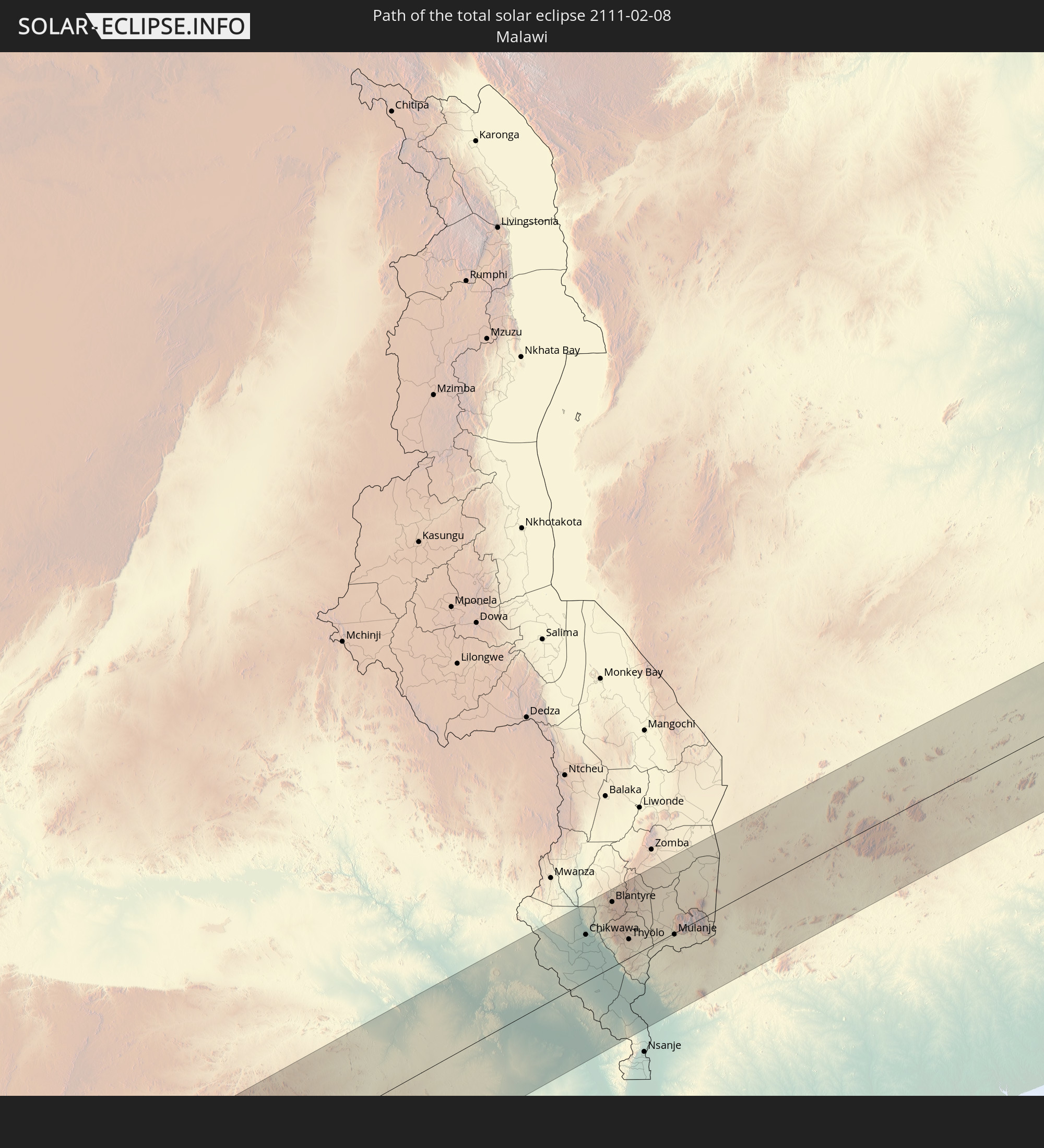
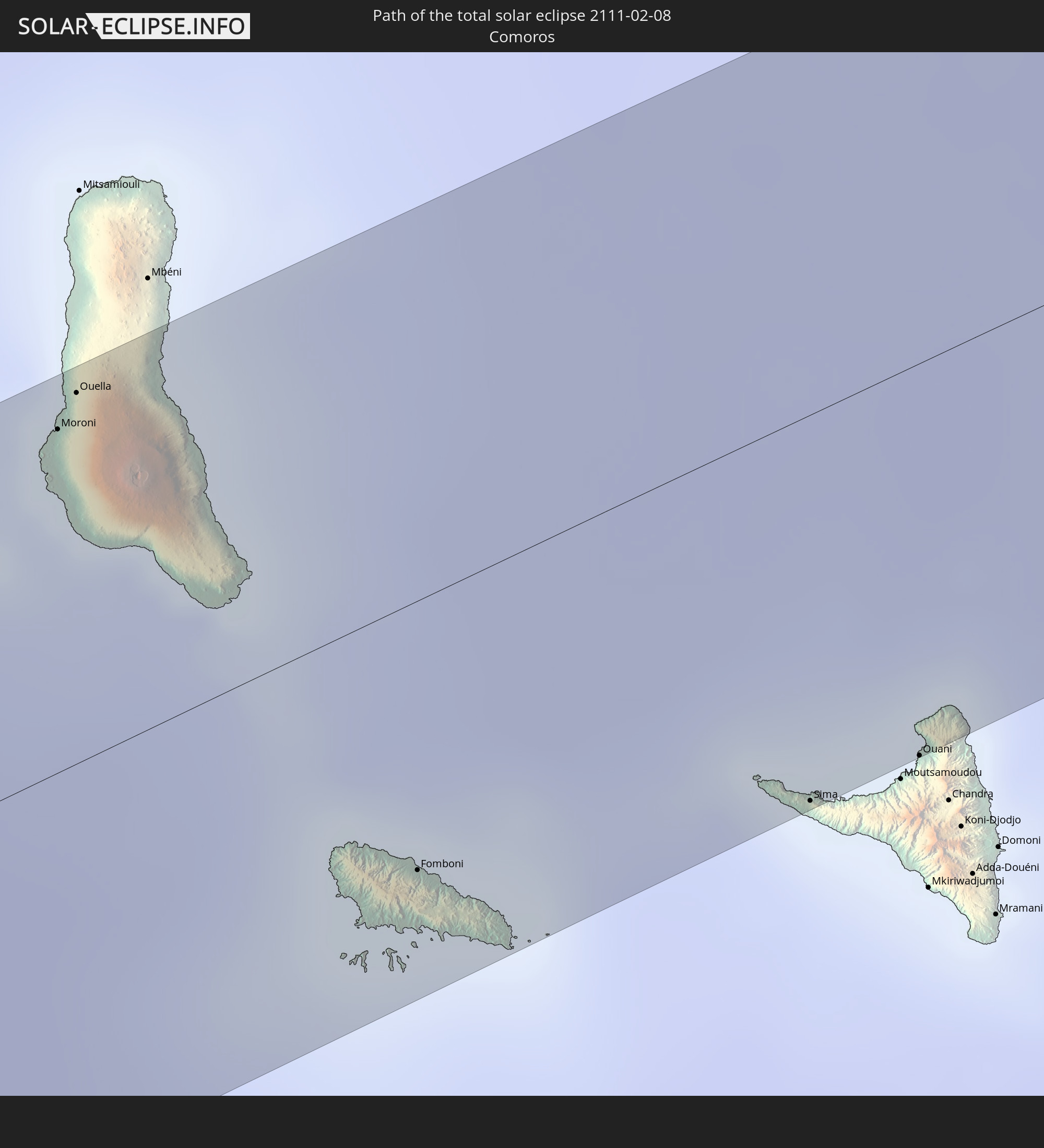
Detailed country maps
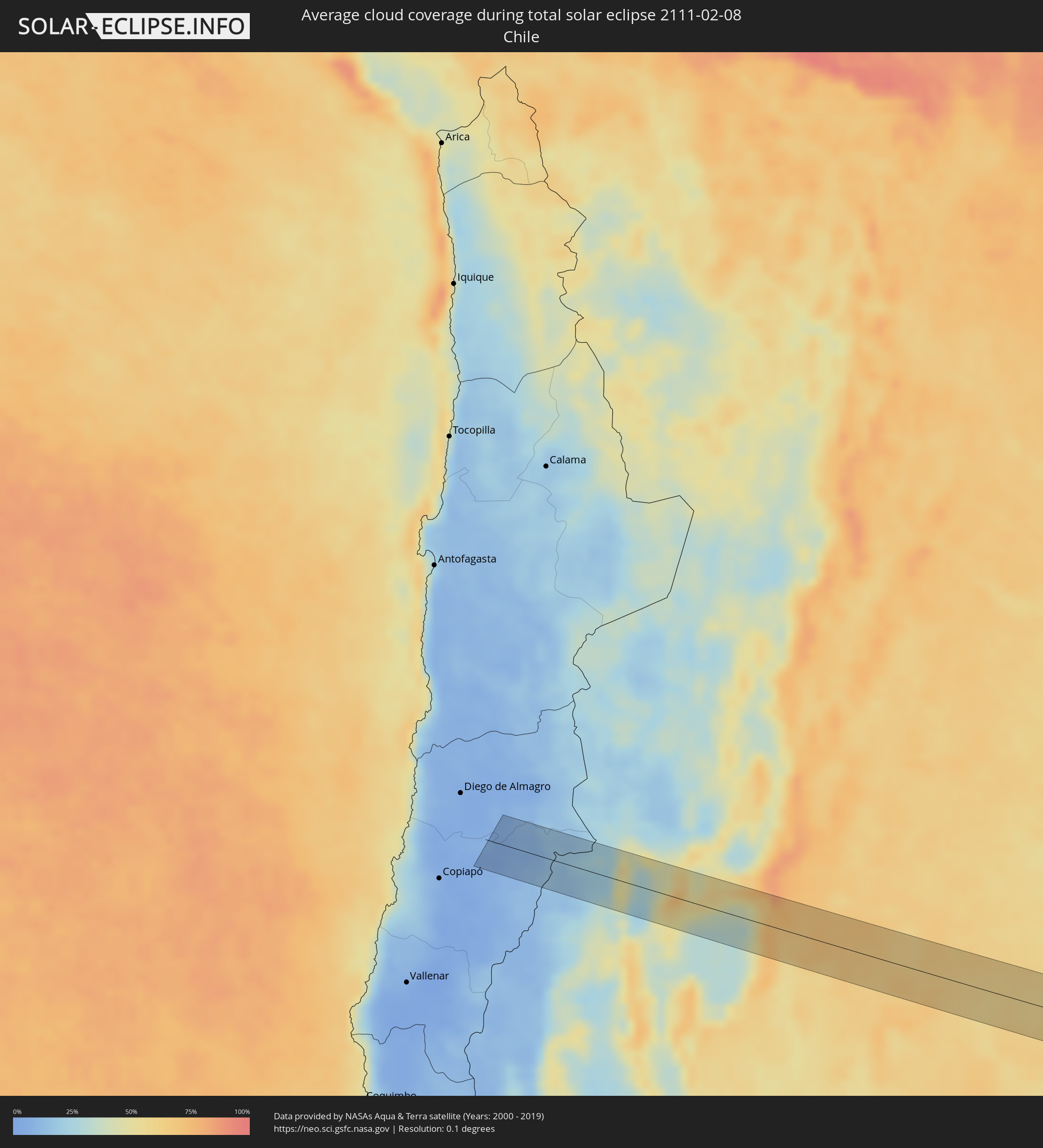 Chile
Chile
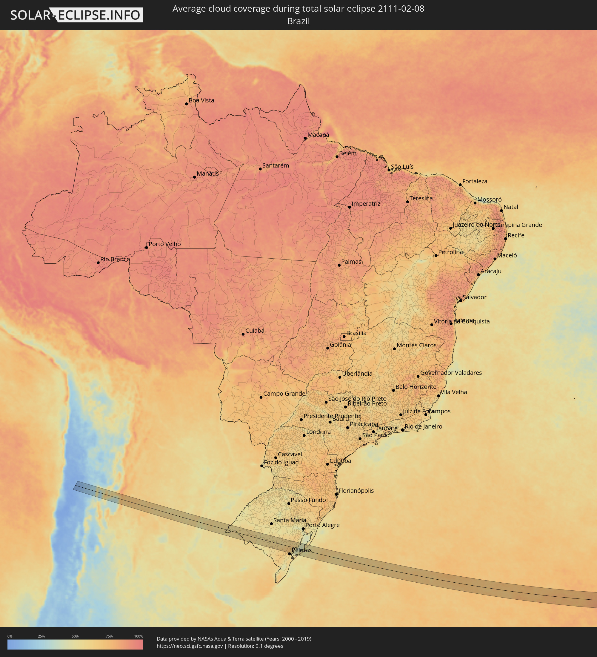 Brazil
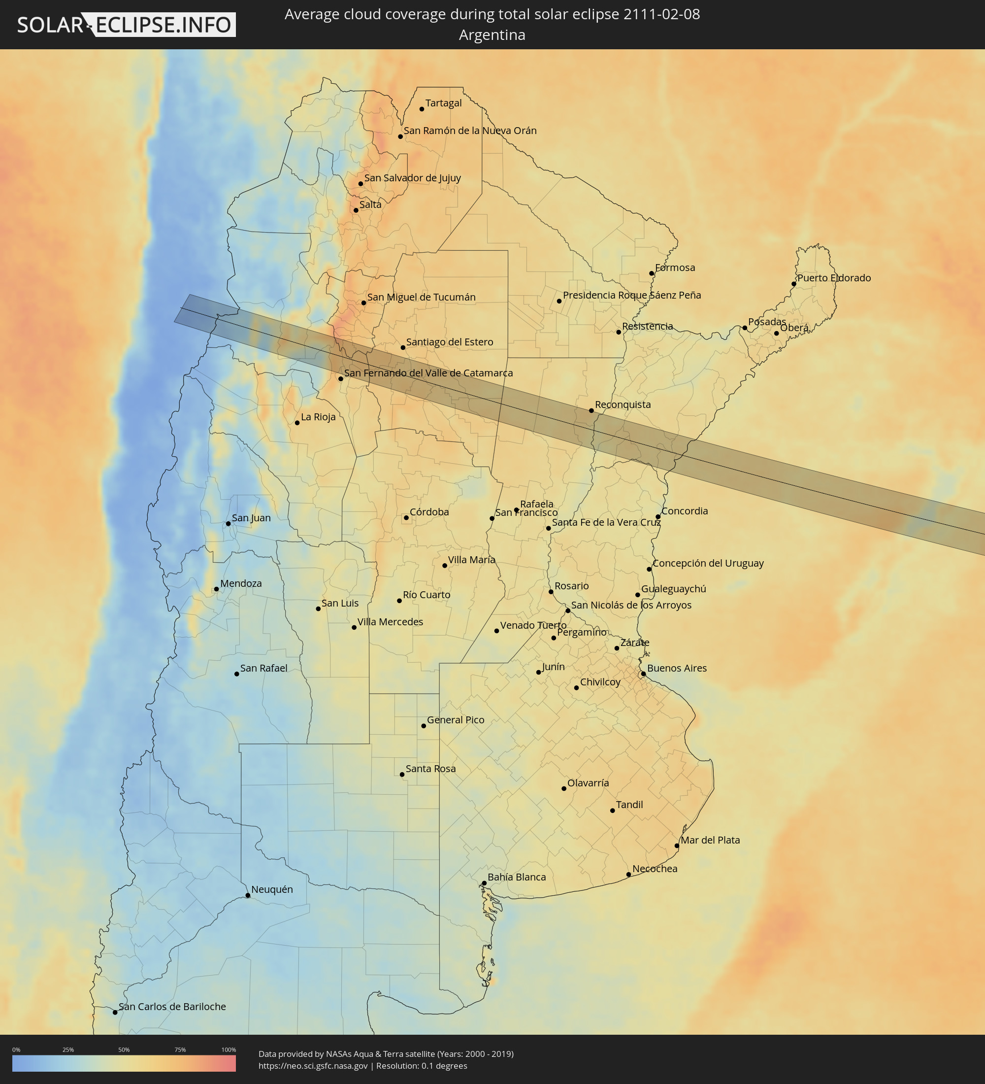 Argentina
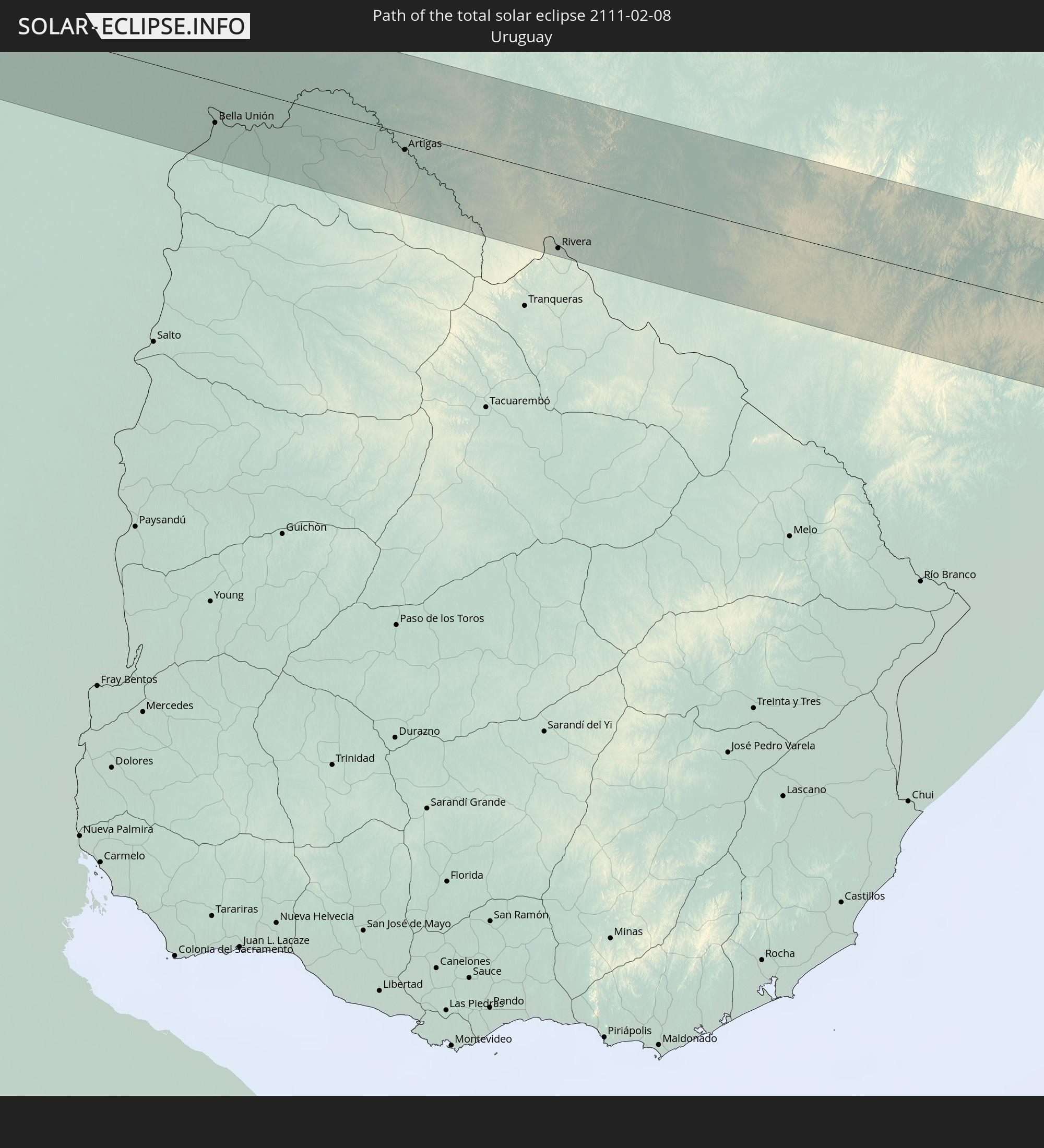
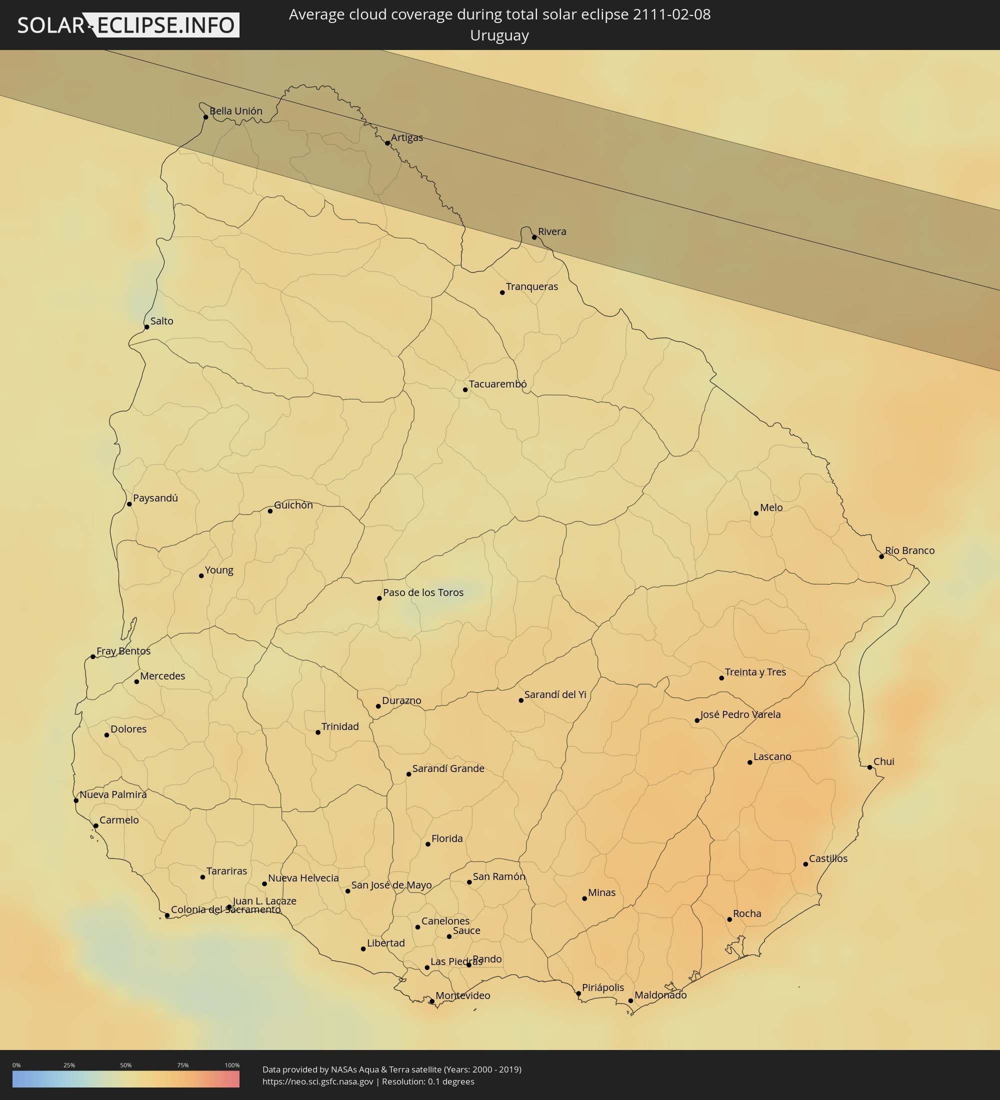 Uruguay
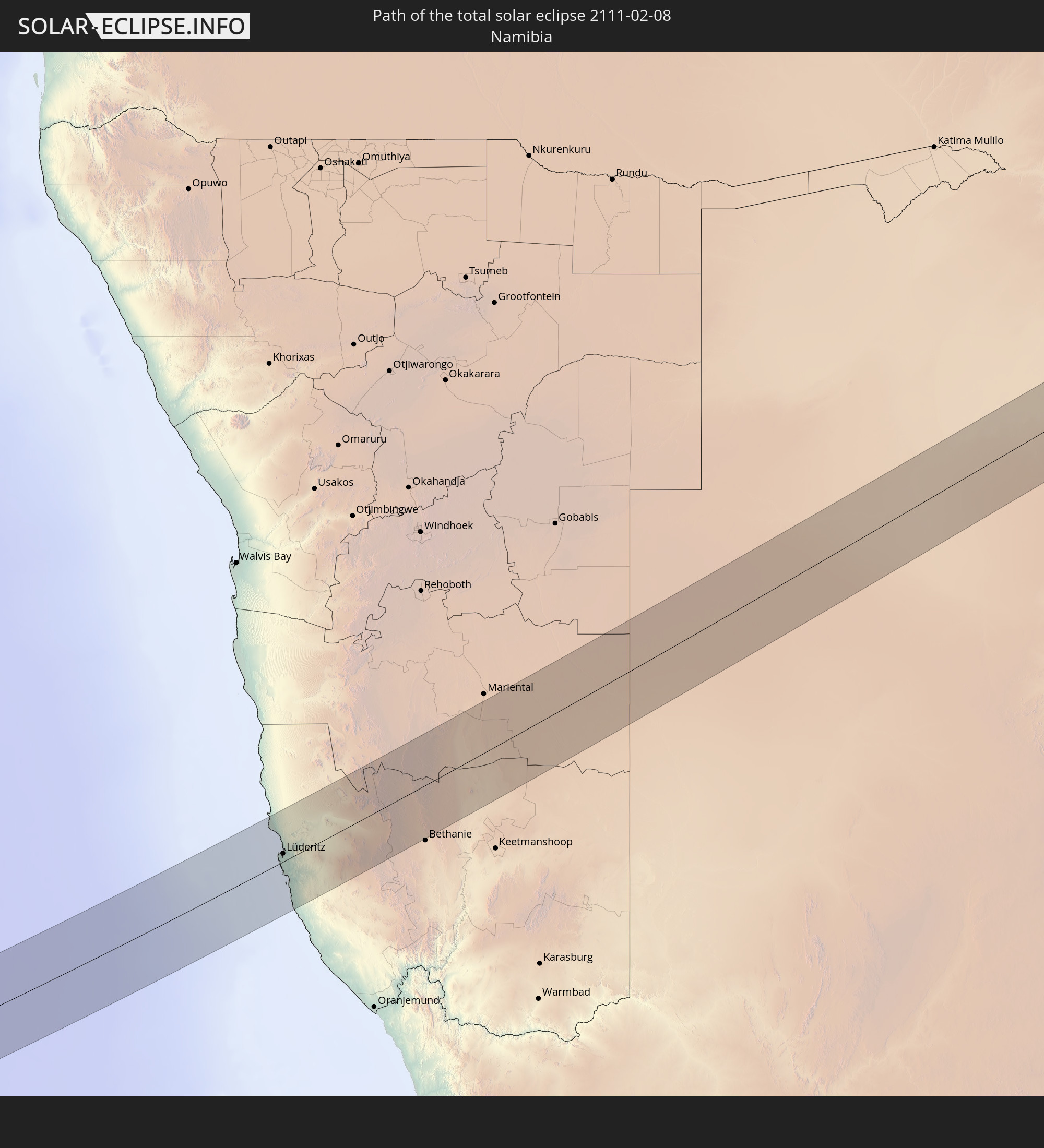
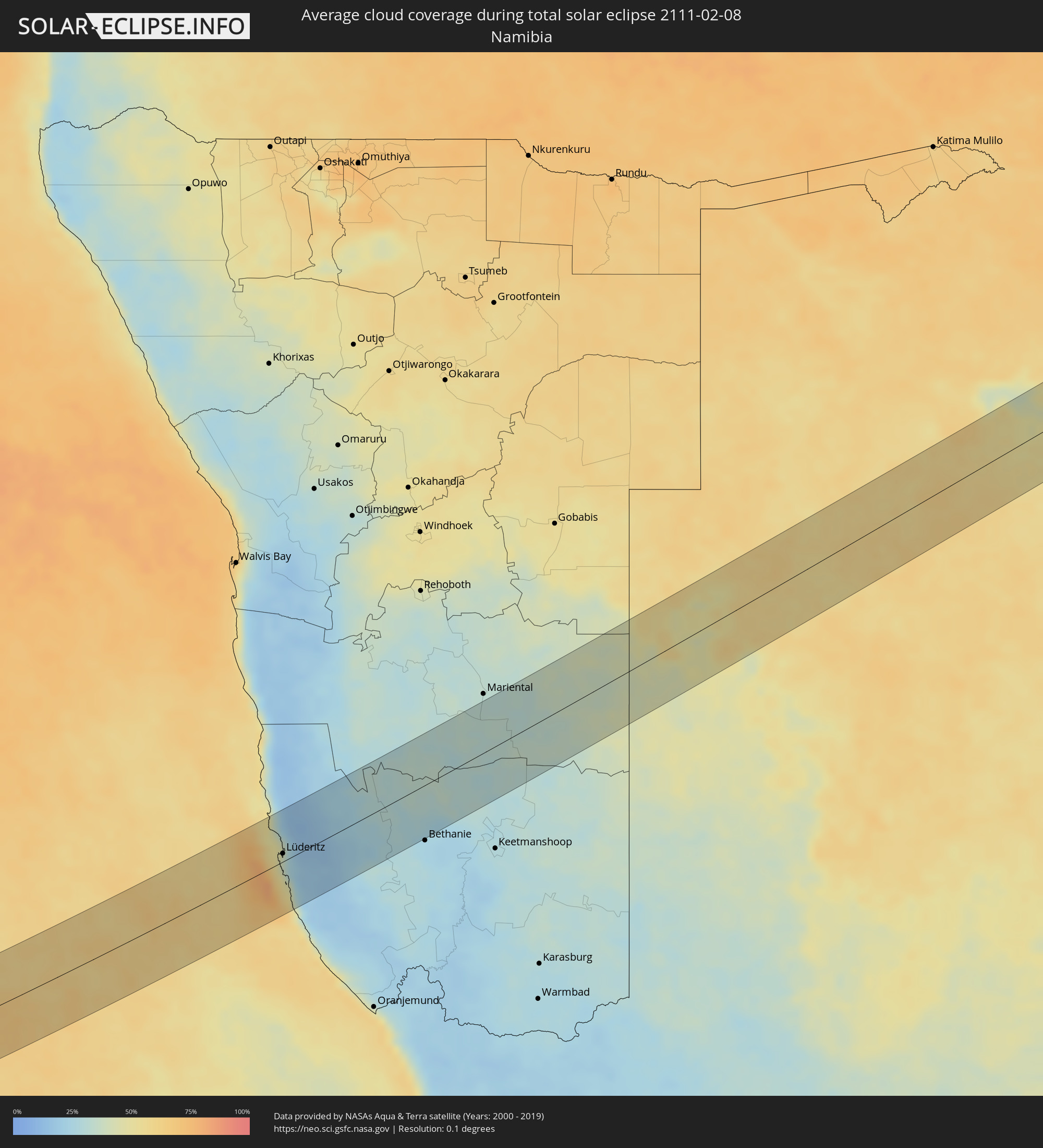 Namibia
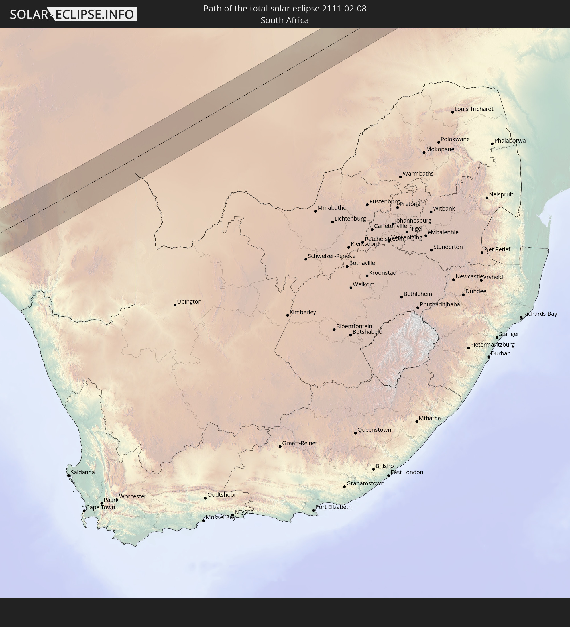
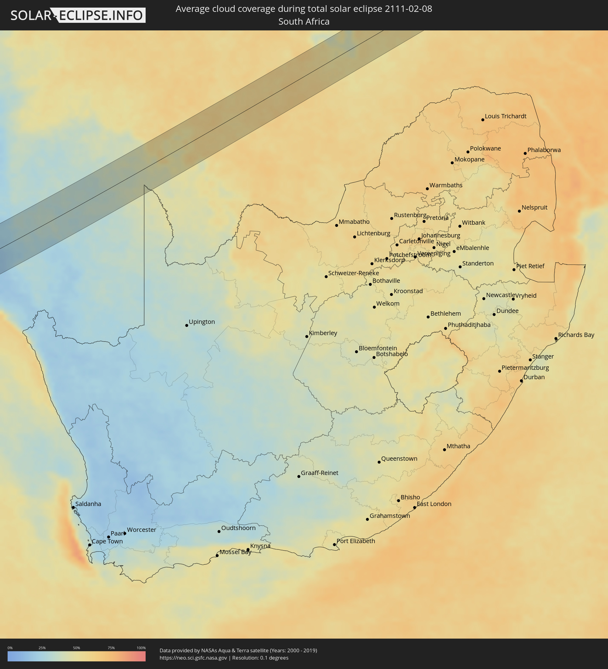 South Africa
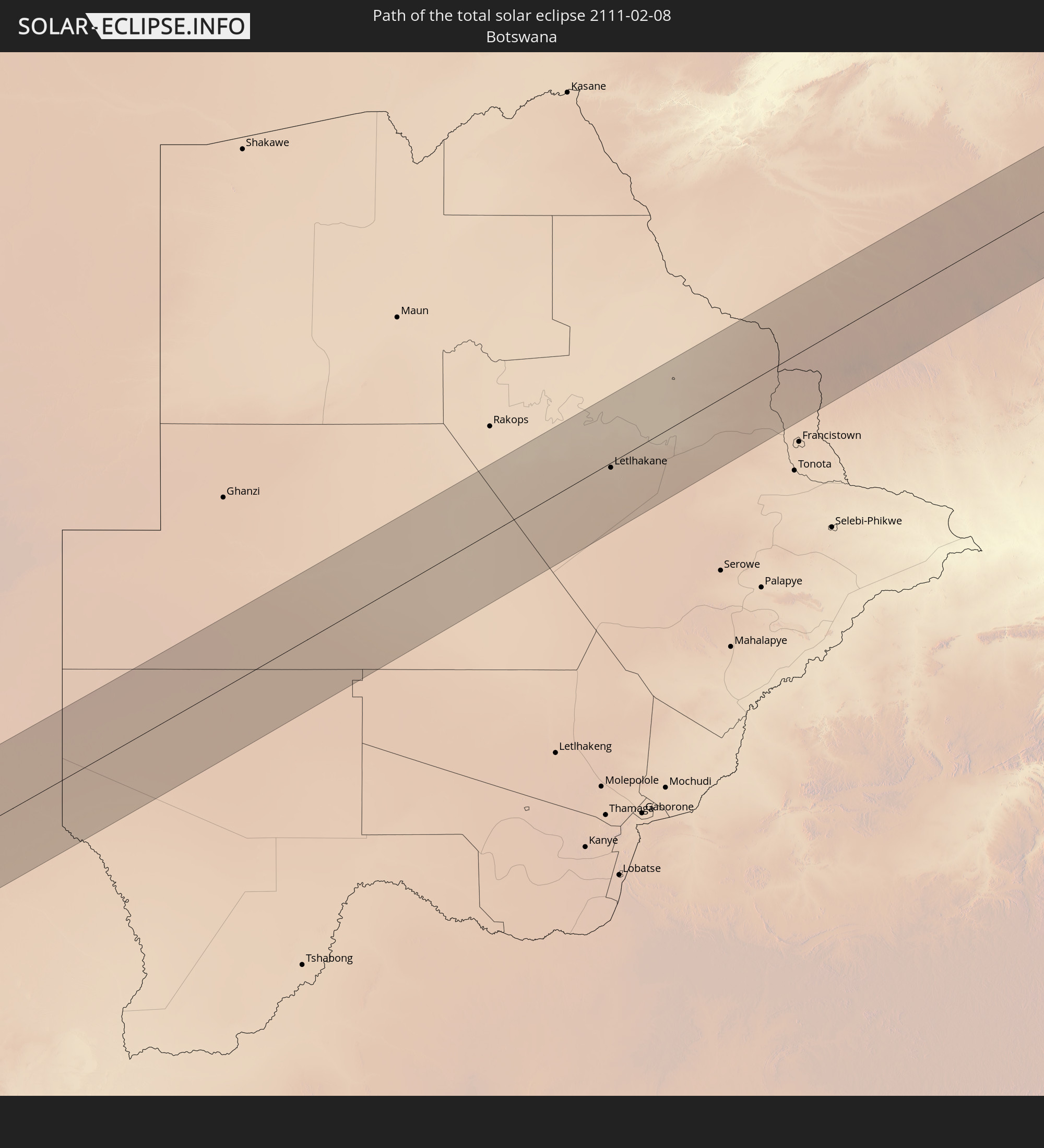
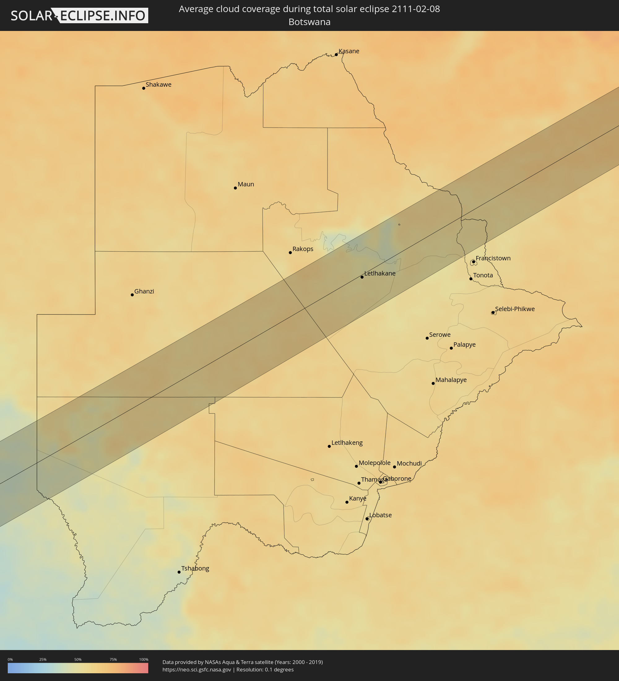 Botswana
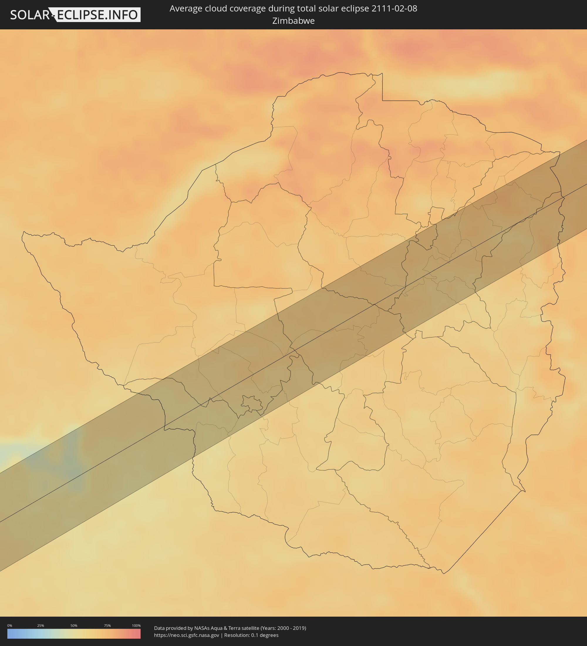 Zimbabwe
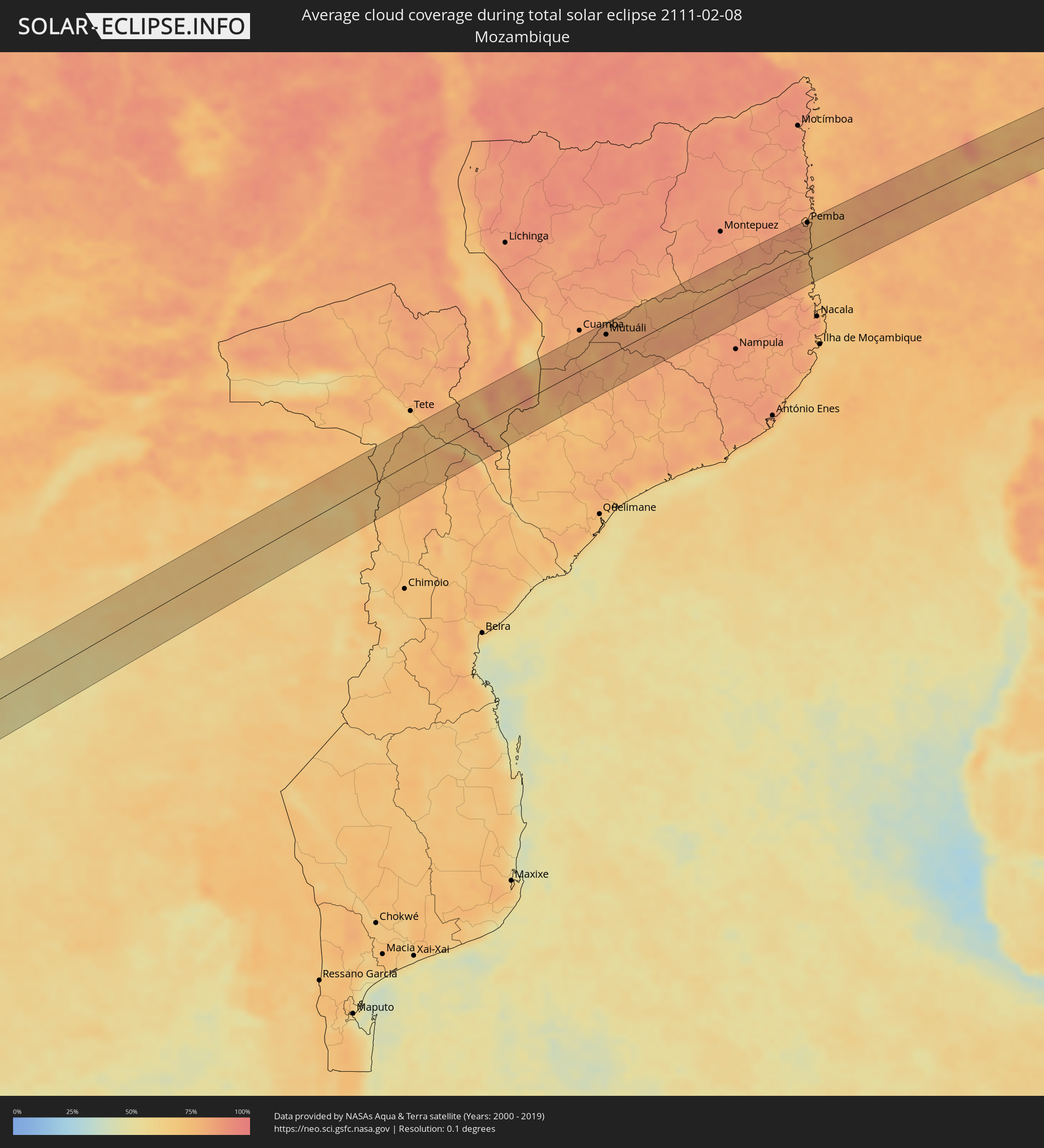 Mozambique
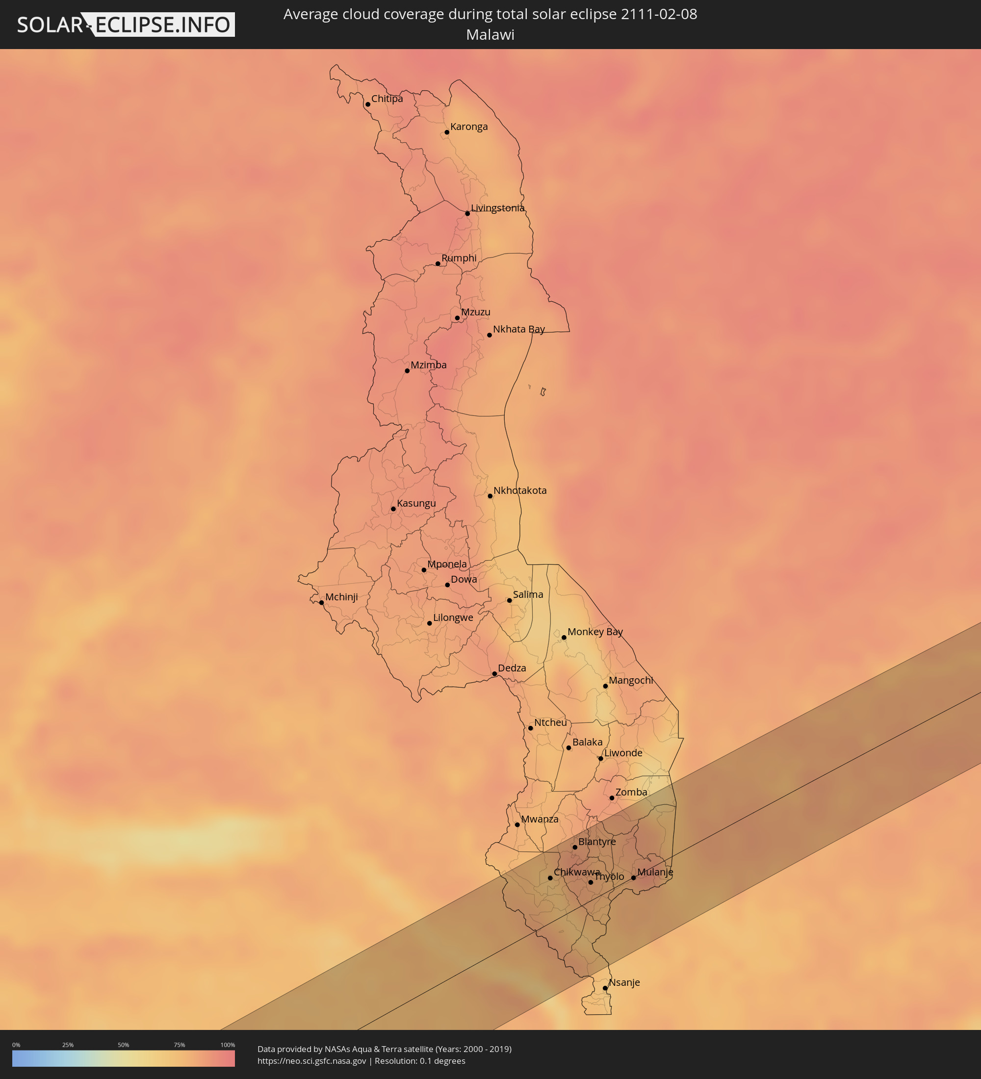 Malawi
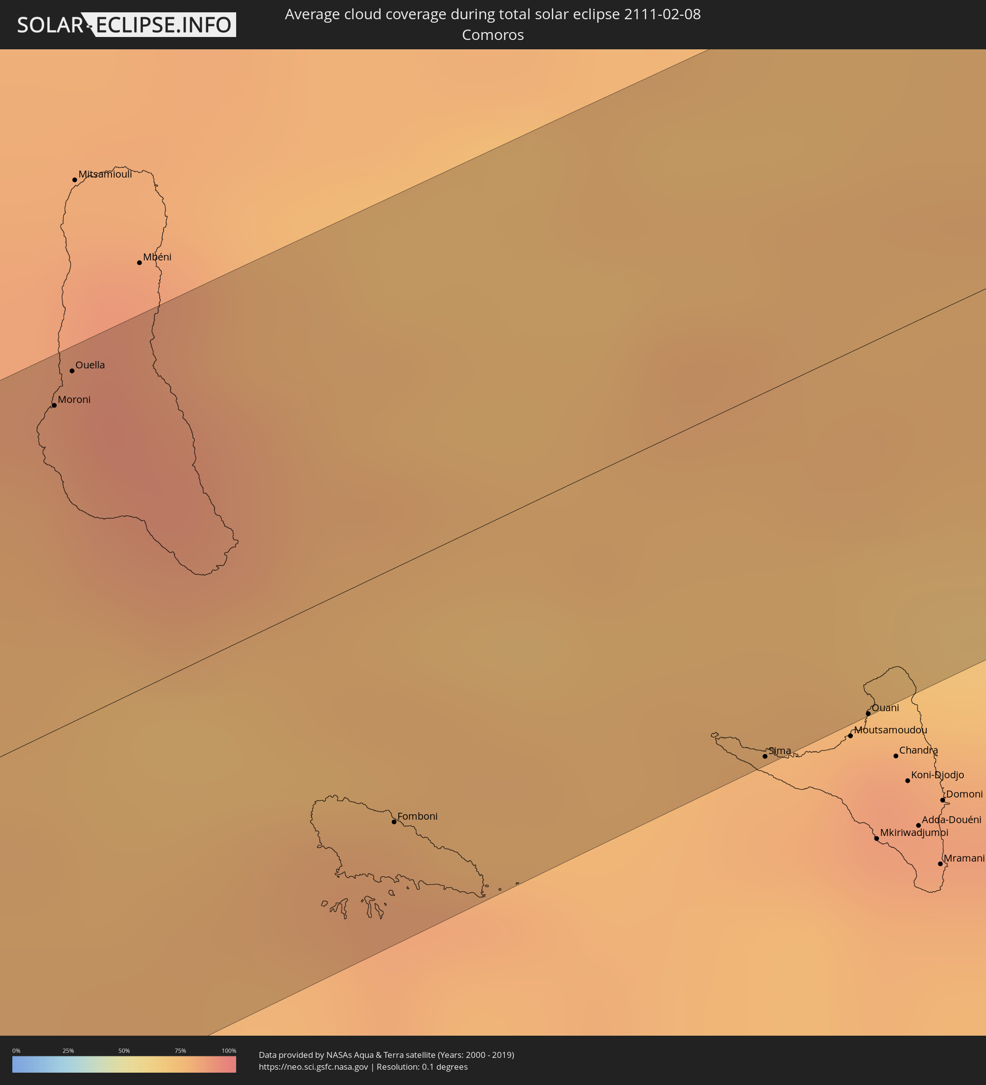 Comoros
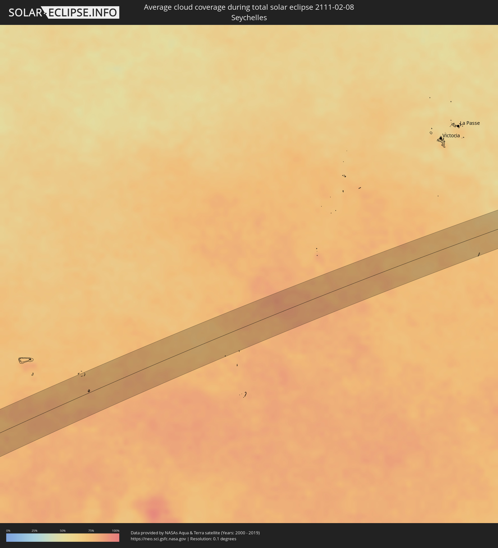 Seychelles
Cities inside the path of the eclipse
The following table shows all locations with a population of more than 5,000 inside the eclipse path. Cities which have more than 100,000 inhabitants are marked bold. A click at the locations opens a detailed map.
| City | Type | Eclipse duration | Local time of max. eclipse | Distance to central line | Ø Cloud coverage |
|
Fiambalá, Catamarca Province
|
total | - | 07:21:31 UTC-03:00 | 22 km | 27% |
|
Andalgalá, Catamarca Province
|
total | - | 07:21:20 UTC-03:00 | 25 km | 44% |
|
La Cocha, Tucumán Province
|
total | - | 07:21:24 UTC-03:00 | 27 km | 68% |
|
Los Altos, Catamarca Province
|
total | - | 07:21:35 UTC-03:00 | 0 km | 65% |
|
Añatuya, Santiago del Estero Province
|
total | - | 07:21:49 UTC-03:00 | 30 km | 59% |
|
Tostado, Santa Fe Province
|
total | - | 07:22:25 UTC-03:00 | 23 km | 61% |
|
Vera, Santa Fe Province
|
total | - | 07:22:42 UTC-03:00 | 6 km | 57% |
|
Malabrigo, Santa Fe Province
|
total | - | 07:22:39 UTC-03:00 | 13 km | 59% |
|
Reconquista, Santa Fe Province
|
total | - | 07:22:32 UTC-03:00 | 42 km | 58% |
|
Curuzú Cuatiá, Corrientes Province
|
total | - | 07:23:15 UTC-03:00 | 15 km | 56% |
|
Monte Caseros, Corrientes Province
|
total | - | 07:23:40 UTC-03:00 | 23 km | 53% |
|
Bella Unión, Artigas
|
total | - | 07:23:41 UTC-03:00 | 23 km | 53% |
|
Artigas, Artigas
|
total | - | 07:24:01 UTC-03:00 | 9 km | 57% |
|
Quaraí, Rio Grande do Sul
|
total | - | 07:24:01 UTC-03:00 | 7 km | 57% |
|
Rivera, Rivera
|
total | - | 07:24:38 UTC-03:00 | 40 km | 58% |
|
Santana do Livramento, Rio Grande do Sul
|
total | - | 07:24:38 UTC-03:00 | 38 km | 58% |
|
Rosário do Sul, Rio Grande do Sul
|
total | - | 07:24:18 UTC-03:00 | 45 km | 54% |
|
Dom Pedrito, Rio Grande do Sul
|
total | - | 07:24:56 UTC-03:00 | 27 km | 53% |
|
Canguçu, Rio Grande do Sul
|
total | - | 07:25:54 UTC-03:00 | 23 km | 68% |
|
São Lourenço do Sul, Rio Grande do Sul
|
total | - | 07:26:08 UTC-03:00 | 4 km | 50% |
|
Lüderitz, Karas
|
total | - | 14:25:07 UTC+02:00 | 10 km | 27% |
|
Orapa, Central
|
total | - | 14:52:59 UTC+02:00 | 17 km | 52% |
|
Letlhakane, Central
|
total | - | 14:53:11 UTC+02:00 | 5 km | 52% |
|
Chikwawa, Southern Region
|
total | - | 15:14:19 UTC+02:00 | 35 km | 70% |
|
Blantyre, Southern Region
|
total | - | 15:14:54 UTC+02:00 | 48 km | 87% |
|
Thyolo, Southern Region
|
total | - | 15:14:40 UTC+02:00 | 14 km | 81% |
|
Luchenza, Southern Region
|
total | - | 15:14:57 UTC+02:00 | 11 km | 78% |
|
Mulanje, Southern Region
|
total | - | 15:15:08 UTC+02:00 | 1 km | 78% |
|
Mutuáli, Nampula
|
total | - | 15:18:22 UTC+02:00 | 36 km | 80% |
|
Pemba, Cabo Delgado
|
total | - | 15:24:13 UTC+02:00 | 50 km | 83% |
|
Moroni, Grande Comore
|
total | - | 16:27:59 UTC+03:00 | 46 km | 87% |
|
Ouella, Grande Comore
|
total | - | 16:28:03 UTC+03:00 | 49 km | 87% |
|
Fomboni, Mohéli
|
total | - | 16:27:39 UTC+03:00 | 36 km | 82% |
|
Sima, Anjouan
|
total | - | 16:28:09 UTC+03:00 | 52 km | 80% |
|
Ouani, Anjouan
|
total | - | 16:28:19 UTC+03:00 | 52 km | 85% |