Total solar eclipse of 08/28/2231
| Day of week: | Sunday |
| Maximum duration of eclipse: | 04m43s |
| Maximum width of eclipse path: | 402 km |
| Saros cycle: | 158 |
| Coverage: | 100% |
| Magnitude: | 1.0661 |
| Gamma: | -0.8506 |
Wo kann man die Sonnenfinsternis vom 08/28/2231 sehen?
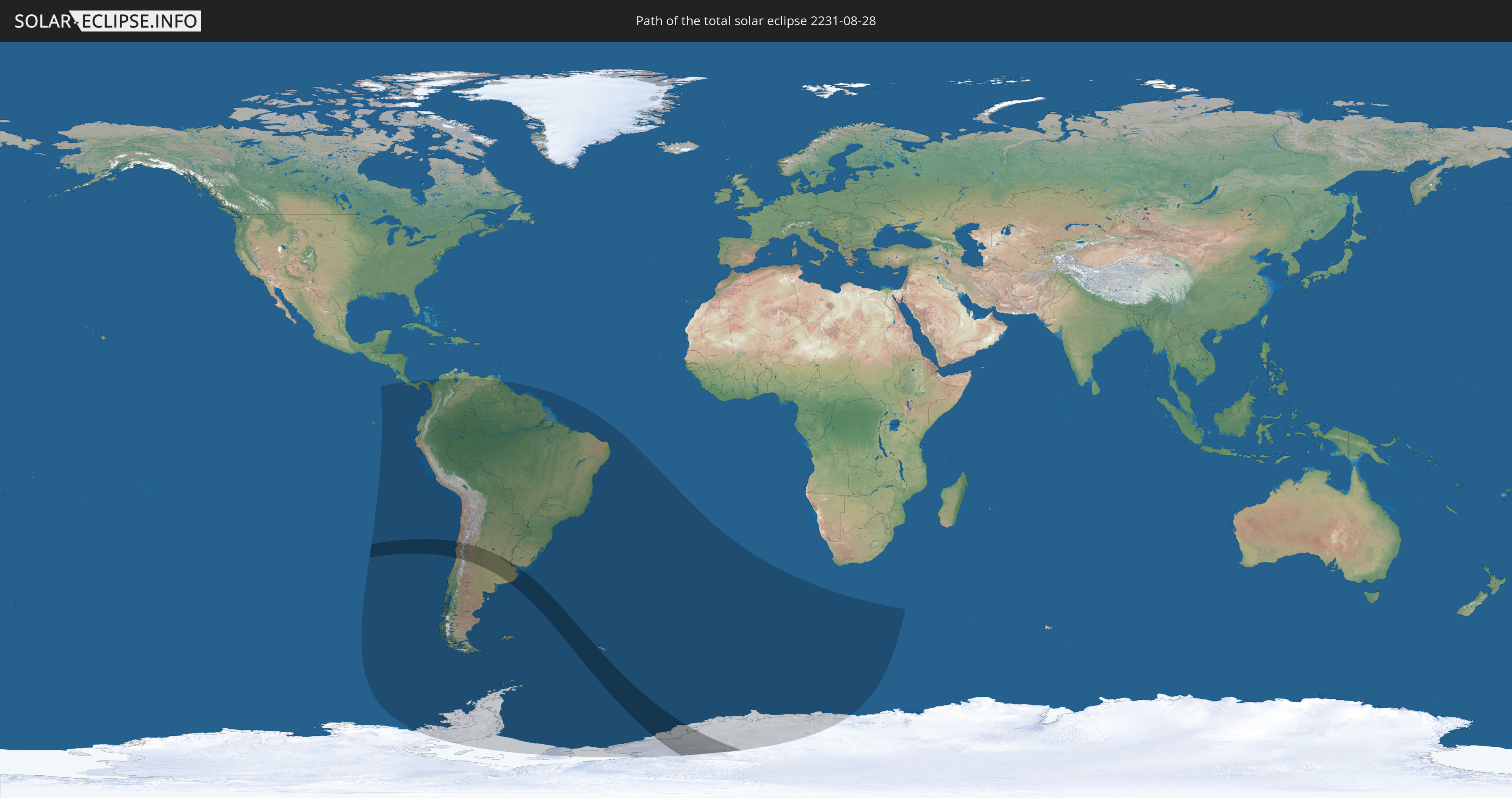
Die Sonnenfinsternis am 08/28/2231 kann man in 20 Ländern als partielle Sonnenfinsternis beobachten.
Der Finsternispfad verläuft durch 5 Länder. Nur in diesen Ländern ist sie als total Sonnenfinsternis zu sehen.
In den folgenden Ländern ist die Sonnenfinsternis total zu sehen
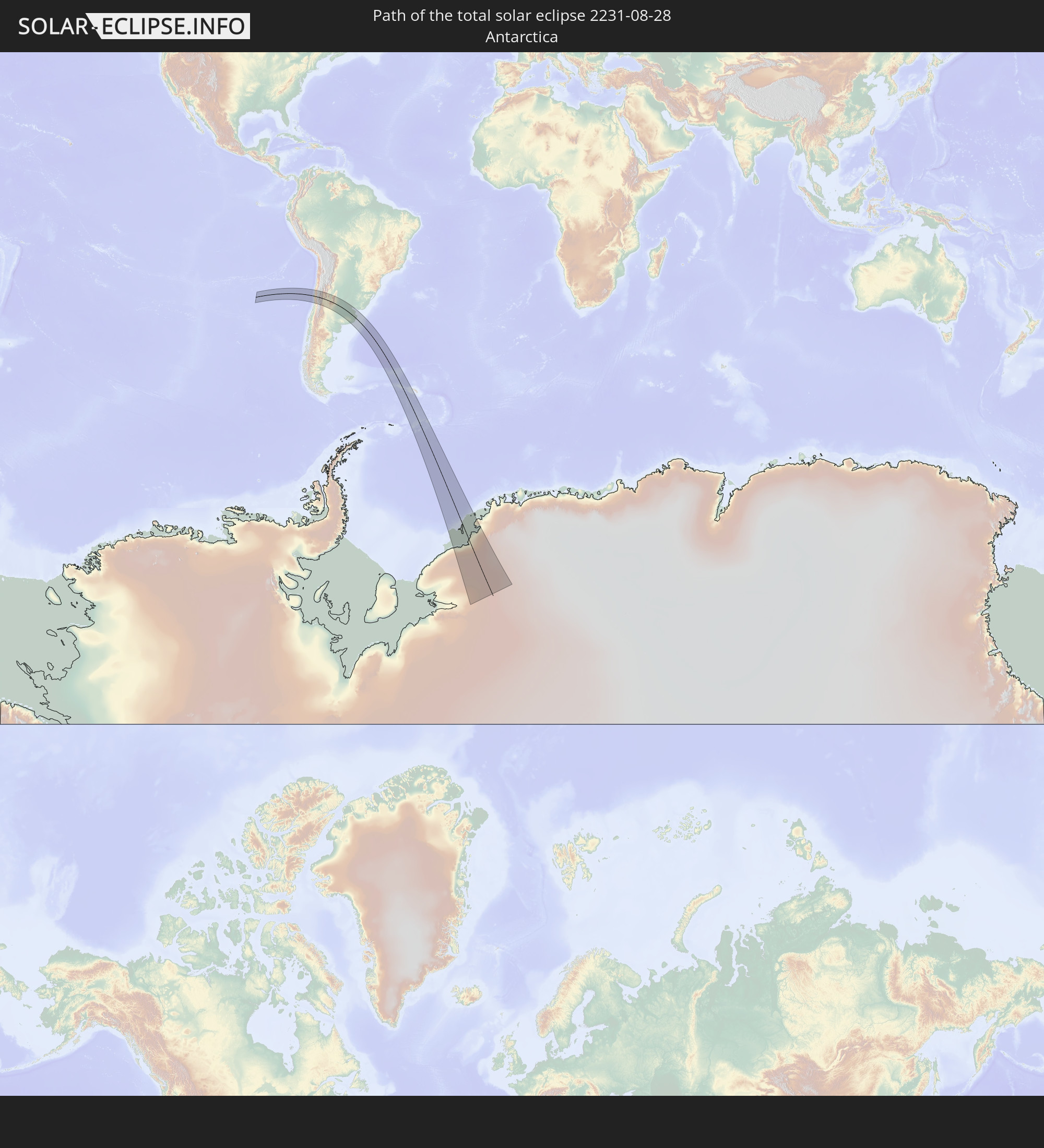 Antarctica
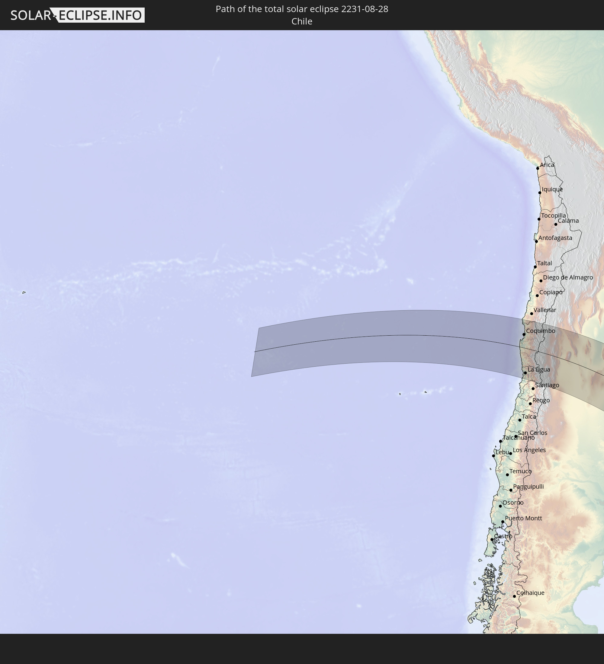 Chile
Chile
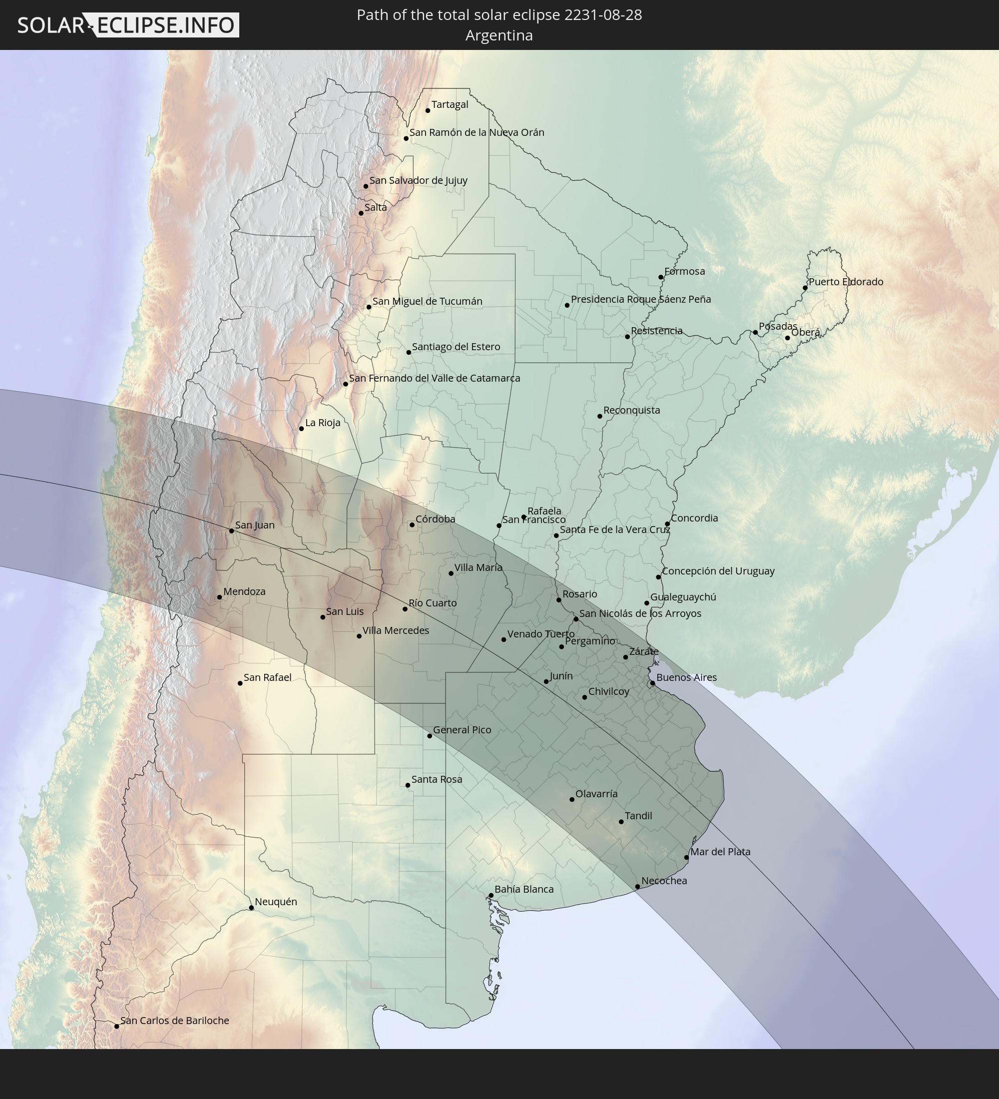 Argentina
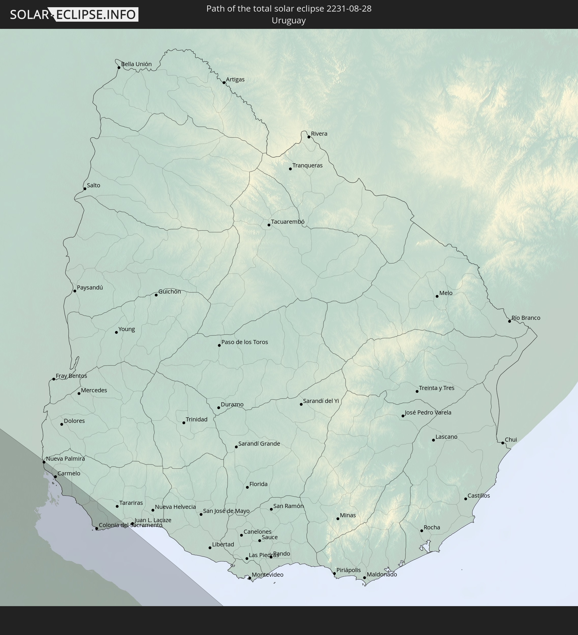 Uruguay
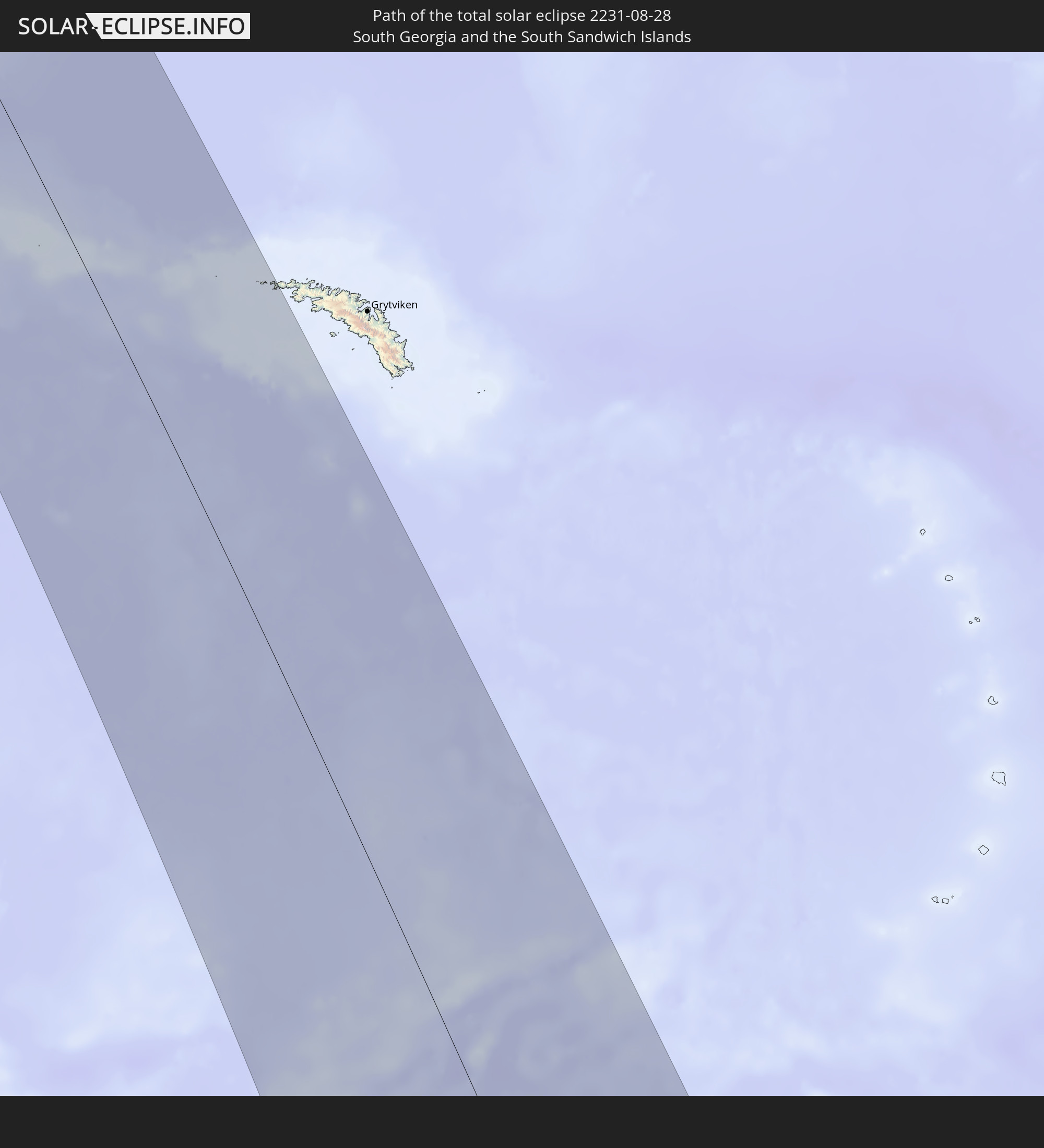 South Georgia and the South Sandwich Islands
In den folgenden Ländern ist die Sonnenfinsternis partiell zu sehen


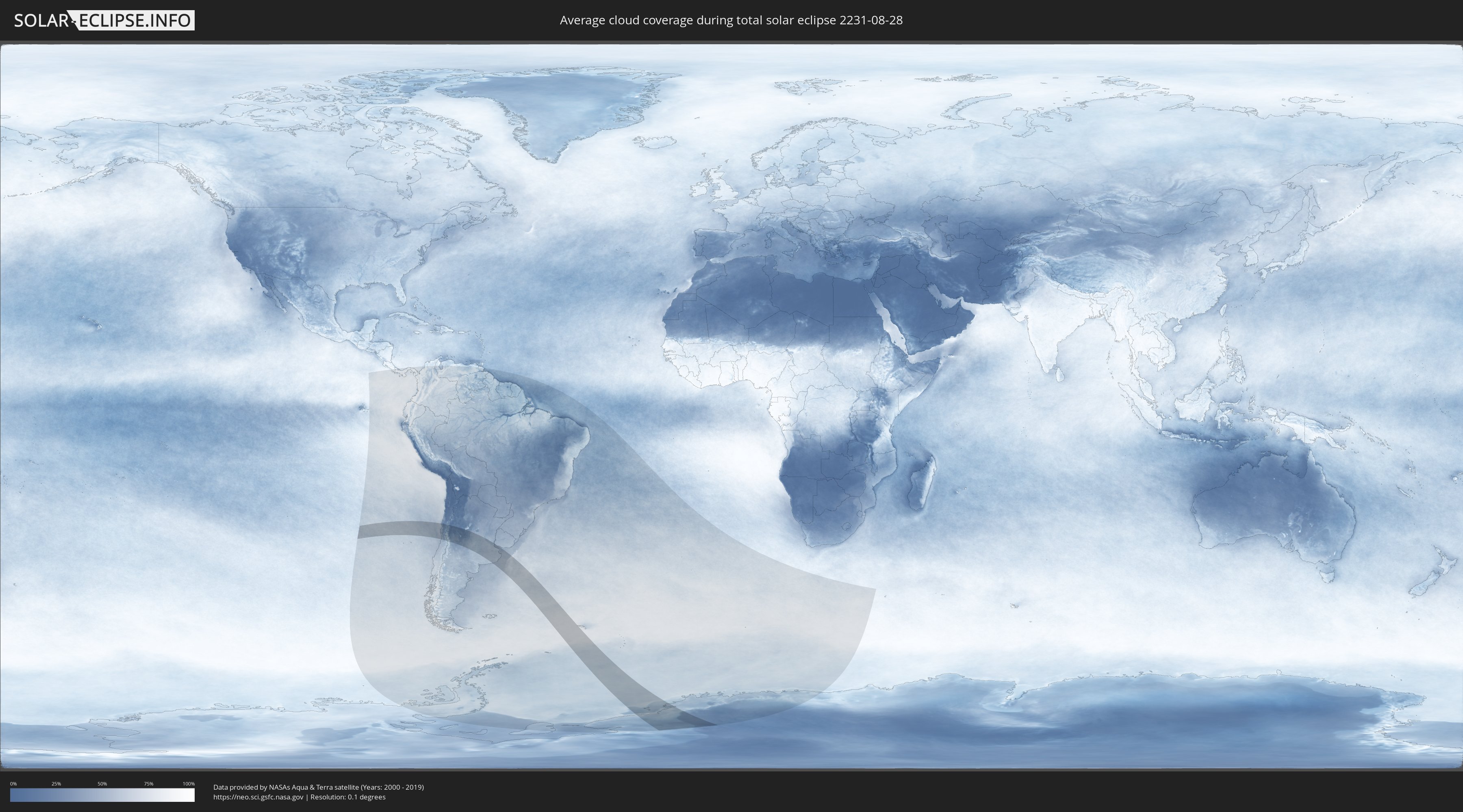
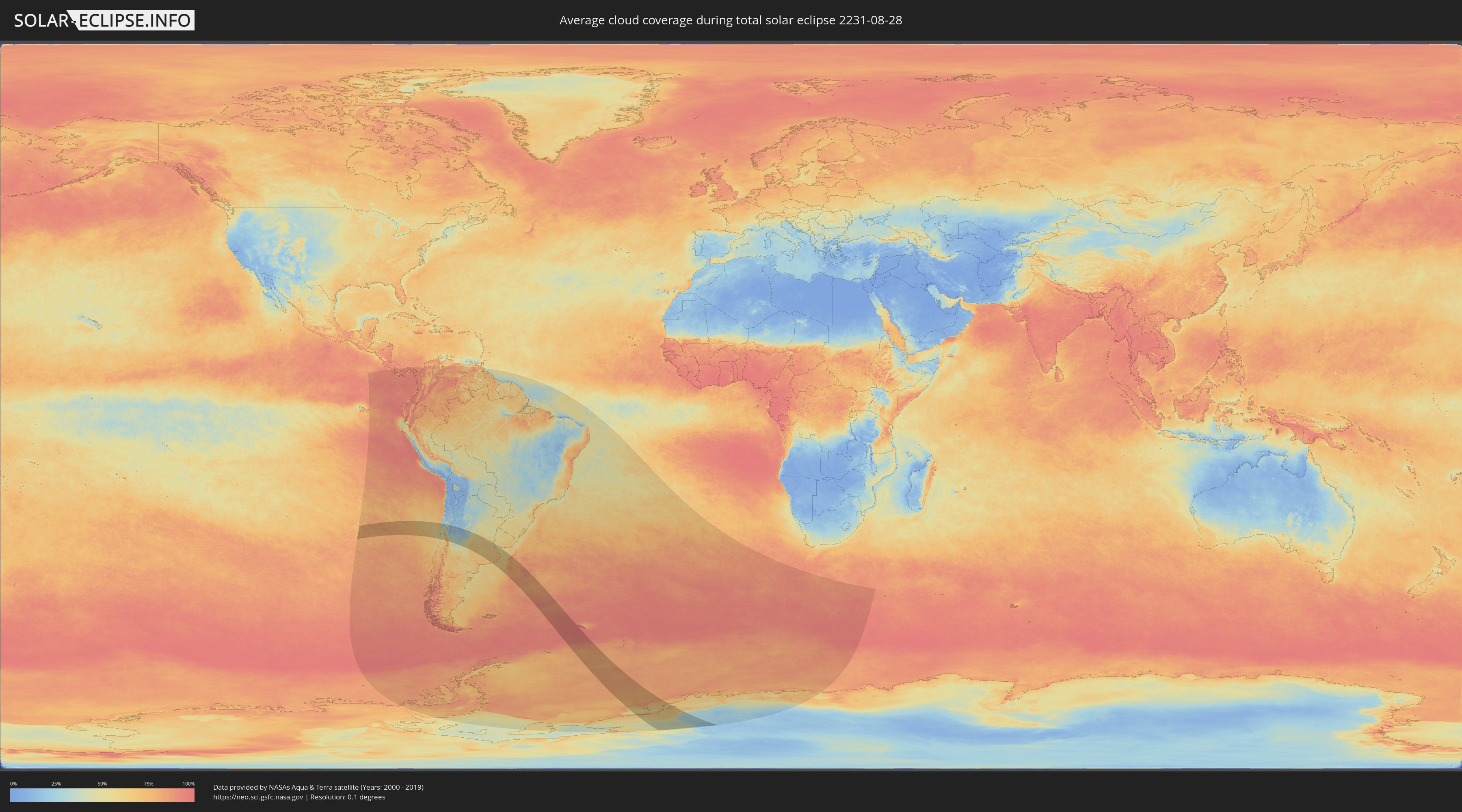
How will be the weather during the total solar eclipse on 08/28/2231?
Where is the best place to see the total solar eclipse of 08/28/2231?
The following maps show the average cloud coverage for the day of the total solar eclipse.
With the help of these maps, it is possible to find the place along the eclipse path, which has the best
chance of a cloudless sky.
Nevertheless, you should consider local circumstances and inform about the weather of your chosen
observation site.
The data is provided by NASAs satellites
AQUA and TERRA.
The cloud maps are averaged over a period of 19 years (2000 - 2019).
Detailed country maps
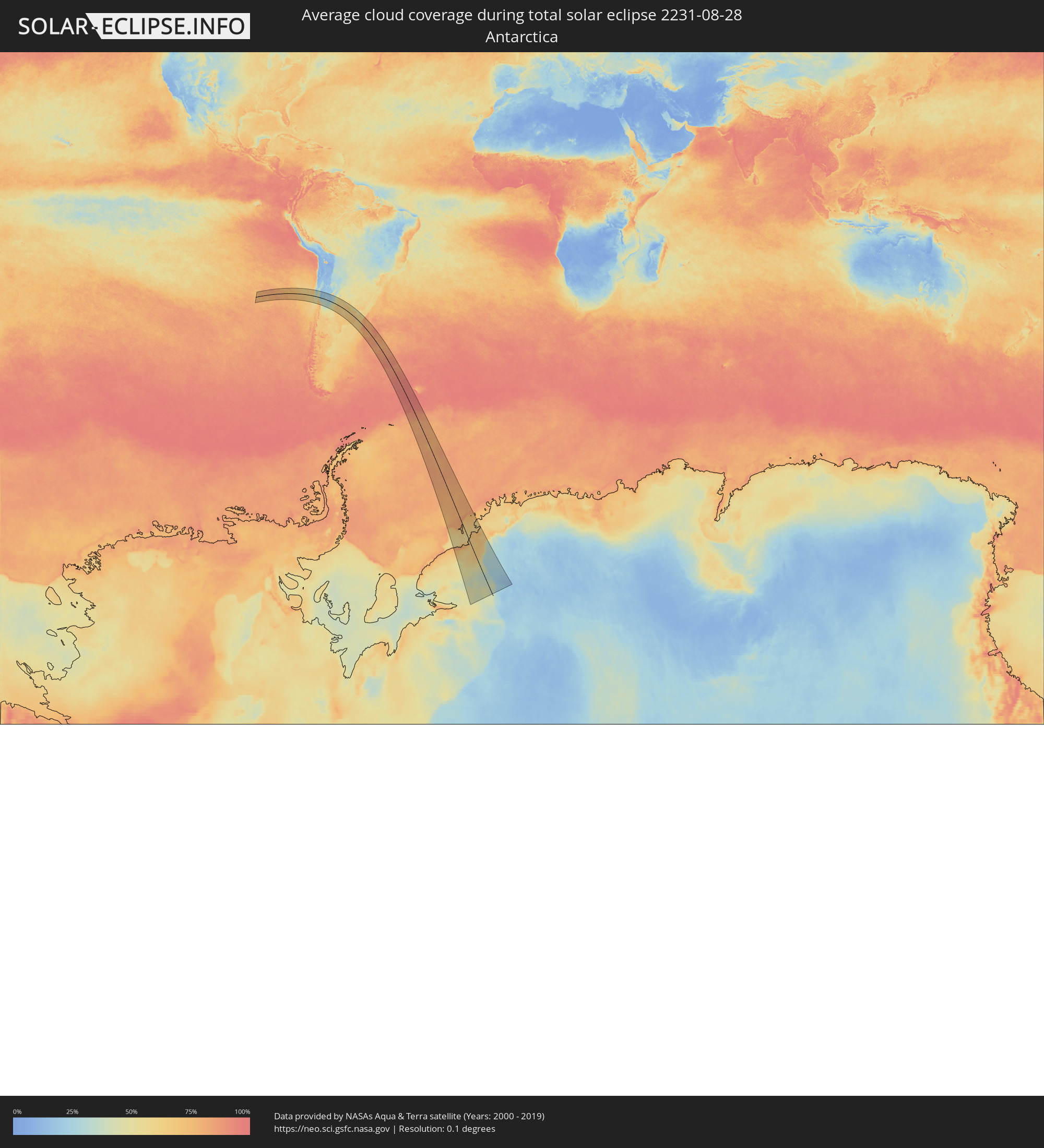 Antarctica
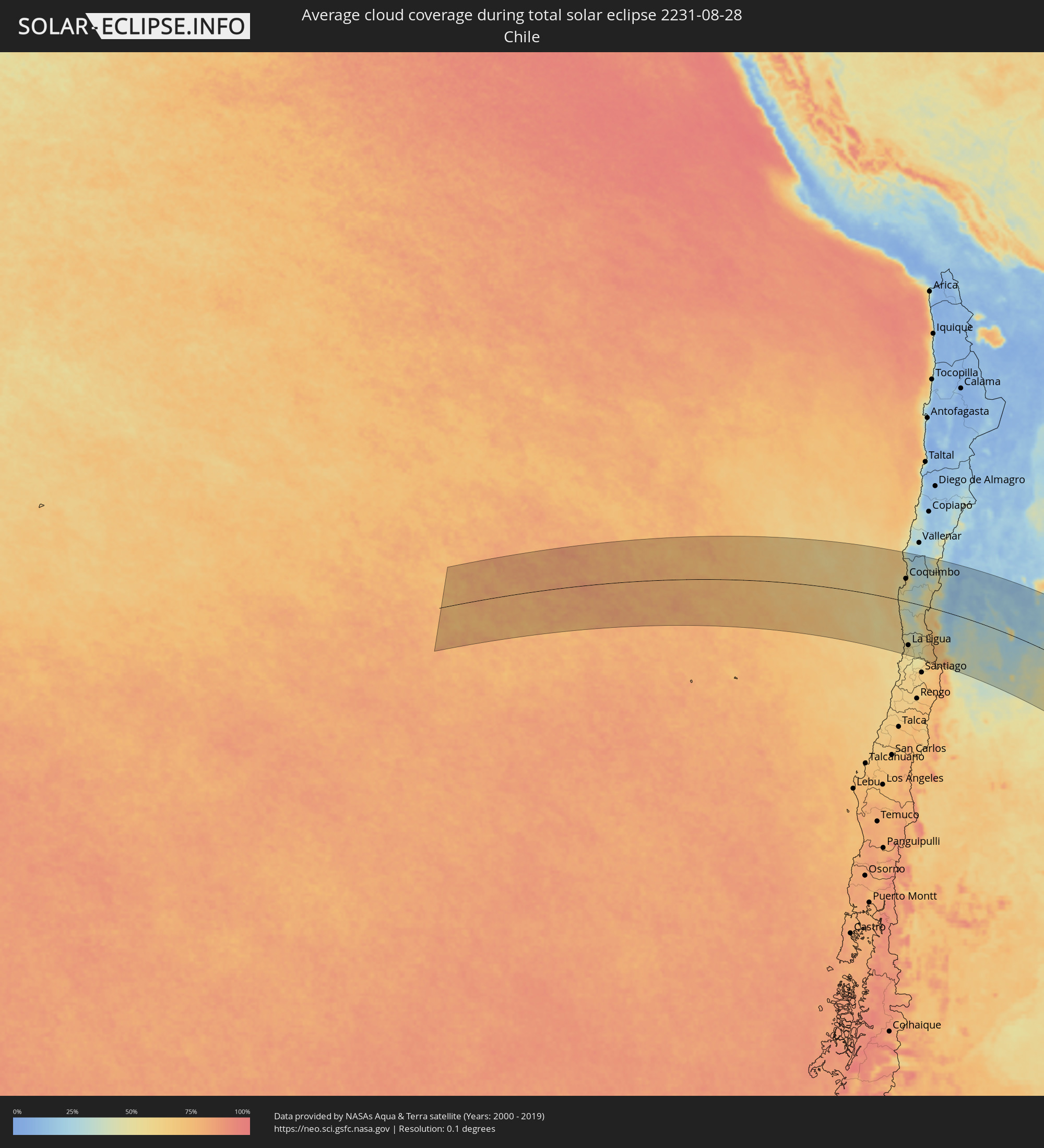 Chile
Chile
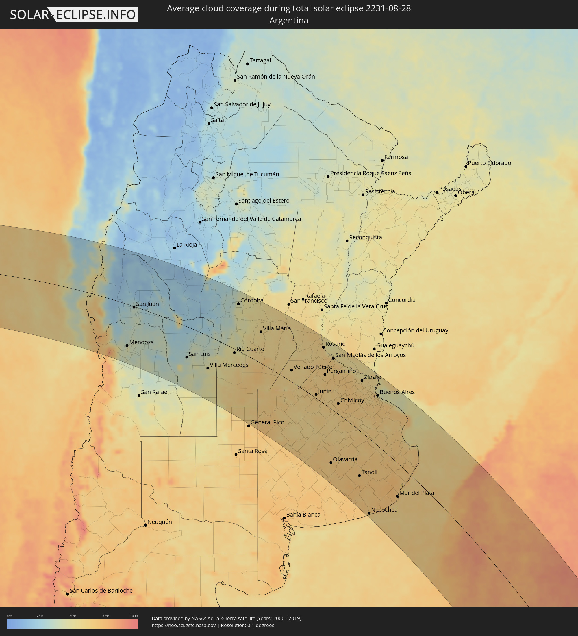 Argentina
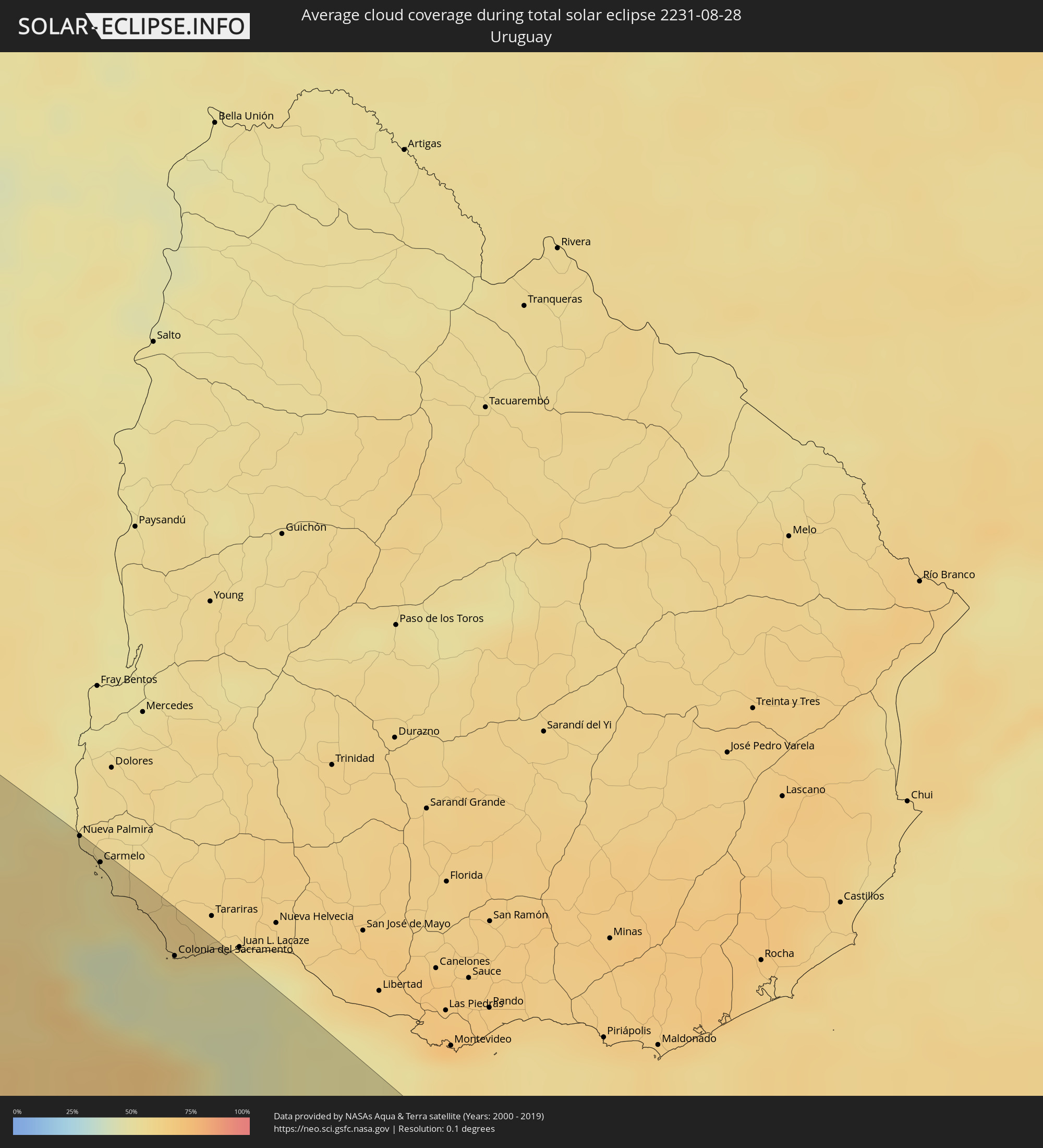 Uruguay
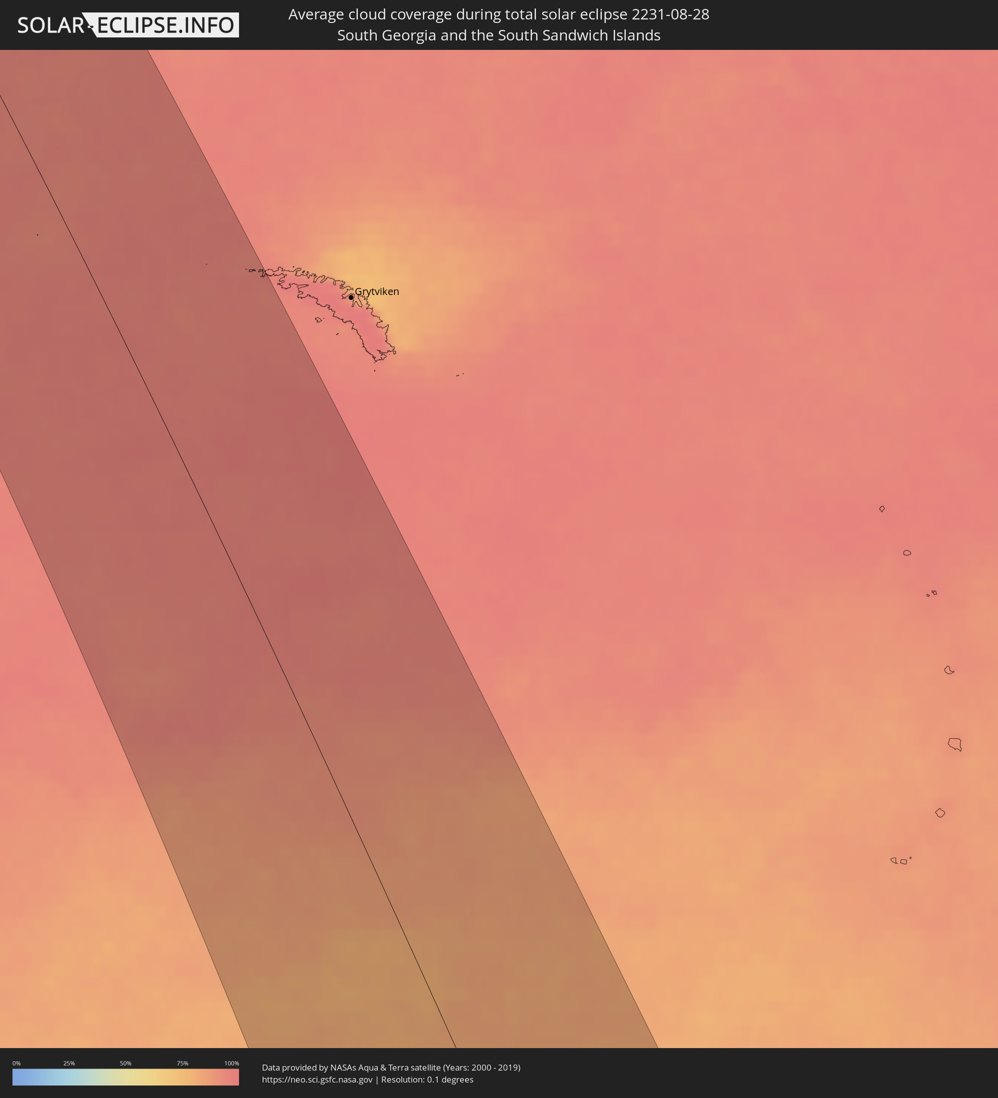 South Georgia and the South Sandwich Islands
Cities inside the path of the eclipse
The following table shows all locations with a population of more than 5,000 inside the eclipse path. Cities which have more than 100,000 inhabitants are marked bold. A click at the locations opens a detailed map.
| City | Type | Eclipse duration | Local time of max. eclipse | Distance to central line | Ø Cloud coverage |
 Coquimbo, Coquimbo
|
total | - | 09:43:31 UTC-03:00 | 93 km | 58% |
|
La Serena, Coquimbo
|
total | - | 09:43:31 UTC-03:00 | 101 km | 58% |
|
La Ligua, Valparaíso
|
total | - | 09:47:58 UTC-03:00 | 174 km | 54% |
|
Hacienda La Calera, Valparaíso
|
total | - | 09:48:34 UTC-03:00 | 210 km | 54% |
|
Ovalle, Coquimbo
|
total | - | 09:44:46 UTC-03:00 | 26 km | 45% |
|
Illapel, Coquimbo
|
total | - | 09:46:36 UTC-03:00 | 85 km | 45% |
|
Salamanca, Coquimbo
|
total | - | 09:47:03 UTC-03:00 | 96 km | 41% |
|
Monte Patria, Coquimbo
|
total | - | 09:45:10 UTC-03:00 | 21 km | 36% |
|
Llaillay, Valparaíso
|
total | - | 09:48:55 UTC-03:00 | 210 km | 50% |
|
San Felipe, Valparaíso
|
total | - | 09:48:59 UTC-03:00 | 194 km | 48% |
|
Vicuña, Coquimbo
|
total | - | 09:44:16 UTC-03:00 | 98 km | 30% |
|
Los Andes, Valparaíso
|
total | - | 09:49:16 UTC-03:00 | 200 km | 51% |
 Mendoza, Mendoza Province
|
total | - | 09:51:11 UTC-03:00 | 155 km | 46% |
|
San José de Jáchal, San Juan Province
|
total | - | 09:46:36 UTC-03:00 | 127 km | 21% |
|
Pocito, San Juan Province
|
total | - | 09:49:18 UTC-03:00 | 21 km | 34% |
|
San Juan, San Juan Province
|
total | - | 09:49:06 UTC-03:00 | 4 km | 37% |
|
San Martín, Mendoza Province
|
total | - | 09:51:54 UTC-03:00 | 164 km | 36% |
|
Caucete, San Juan Province
|
total | - | 09:49:34 UTC-03:00 | 8 km | 35% |
|
San Luis, San Luis Province
|
total | - | 09:54:37 UTC-03:00 | 110 km | 38% |
|
Chamical, La Rioja Province
|
total | - | 09:49:27 UTC-03:00 | 192 km | 17% |
|
La Punta, San Luis Province
|
total | - | 09:54:27 UTC-03:00 | 98 km | 36% |
|
Villa Mercedes, San Luis Province
|
total | - | 09:56:18 UTC-03:00 | 114 km | 47% |
|
Villa Dolores, Cordoba Province
|
total | - | 09:53:32 UTC-03:00 | 71 km | 29% |
|
Cruz del Eje, Cordoba Province
|
total | - | 09:51:50 UTC-03:00 | 210 km | 29% |
|
Villa Carlos Paz, Cordoba Province
|
total | - | 09:53:26 UTC-03:00 | 151 km | 34% |
|
La Falda, Cordoba Province
|
total | - | 09:52:51 UTC-03:00 | 185 km | 34% |
|
Cosquín, Cordoba Province
|
total | - | 09:53:09 UTC-03:00 | 171 km | 31% |
|
Alta Gracia, Cordoba Province
|
total | - | 09:53:55 UTC-03:00 | 131 km | 39% |
|
Embalse, Cordoba Province
|
total | - | 09:54:52 UTC-03:00 | 79 km | 39% |
|
Río Cuarto, Cordoba Province
|
total | - | 09:56:38 UTC-03:00 | 13 km | 53% |
|
La Calera, Cordoba Province
|
total | - | 09:53:29 UTC-03:00 | 166 km | 42% |
|
Río Ceballos, Cordoba Province
|
total | - | 09:53:11 UTC-03:00 | 184 km | 37% |
|
Córdoba, Cordoba Province
|
total | - | 09:53:47 UTC-03:00 | 165 km | 46% |
|
Río Tercero, Cordoba Province
|
total | - | 09:55:13 UTC-03:00 | 92 km | 47% |
|
Jesús María, Cordoba Province
|
total | - | 09:53:08 UTC-03:00 | 212 km | 43% |
|
Río Segundo, Cordoba Province
|
total | - | 09:54:32 UTC-03:00 | 152 km | 52% |
|
Oncativo, Cordoba Province
|
total | - | 09:55:17 UTC-03:00 | 136 km | 51% |
|
Laboulaye, Cordoba Province
|
total | - | 09:59:33 UTC-03:00 | 67 km | 64% |
|
Villa María, Cordoba Province
|
total | - | 09:56:42 UTC-03:00 | 107 km | 56% |
|
Arroyito, Cordoba Province
|
total | - | 09:55:11 UTC-03:00 | 212 km | 55% |
|
Las Varillas, Cordoba Province
|
total | - | 09:56:23 UTC-03:00 | 183 km | 56% |
|
Rufino, Santa Fe Province
|
total | - | 10:00:39 UTC-03:00 | 48 km | 64% |
|
Bell Ville, Cordoba Province
|
total | - | 09:57:46 UTC-03:00 | 110 km | 59% |
|
Marcos Juárez, Cordoba Province
|
total | - | 09:58:37 UTC-03:00 | 131 km | 56% |
|
Venado Tuerto, Santa Fe Province
|
total | - | 10:00:39 UTC-03:00 | 37 km | 58% |
|
Las Rosas, Santa Fe Province
|
total | - | 09:58:53 UTC-03:00 | 177 km | 60% |
|
Lincoln, Buenos Aires
|
total | - | 10:03:11 UTC-03:00 | 45 km | 60% |
|
Firmat, Santa Fe Province
|
total | - | 10:00:45 UTC-03:00 | 88 km | 60% |
|
Cañada de Gómez, Santa Fe Province
|
total | - | 09:59:44 UTC-03:00 | 153 km | 60% |
|
Casilda, Santa Fe Province
|
total | - | 10:00:25 UTC-03:00 | 143 km | 59% |
|
Carcarañá, Santa Fe Province
|
total | - | 10:00:06 UTC-03:00 | 161 km | 61% |
|
Junín, Buenos Aires
|
total | - | 10:03:26 UTC-03:00 | 11 km | 64% |
|
Nueve de Julio, Buenos Aires
|
total | - | 10:05:02 UTC-03:00 | 64 km | 64% |
|
Funes, Santa Fe Province
|
total | - | 10:00:39 UTC-03:00 | 173 km | 63% |
|
Fray Luis A. Beltrán, Santa Fe Province
|
total | - | 10:00:32 UTC-03:00 | 189 km | 59% |
|
Capitán Bermúdez, Santa Fe Province
|
total | - | 10:00:36 UTC-03:00 | 186 km | 59% |
|
Rosario, Santa Fe Province
|
total | - | 10:00:56 UTC-03:00 | 179 km | 55% |
|
Pergamino, Buenos Aires
|
total | - | 10:02:41 UTC-03:00 | 94 km | 64% |
|
Arroyo Seco, Santa Fe Province
|
total | - | 10:01:28 UTC-03:00 | 166 km | 65% |
|
Chacabuco, Buenos Aires
|
total | - | 10:04:08 UTC-03:00 | 31 km | 60% |
|
Villa Constitución, Santa Fe Province
|
total | - | 10:01:50 UTC-03:00 | 168 km | 58% |
|
Olavarría, Buenos Aires
|
total | - | 10:08:17 UTC-03:00 | 161 km | 67% |
|
San Nicolás de los Arroyos, Buenos Aires
|
total | - | 10:02:09 UTC-03:00 | 163 km | 59% |
|
Veinticinco de Mayo, Buenos Aires
|
total | - | 10:05:55 UTC-03:00 | 24 km | 60% |
|
Chivilcoy, Buenos Aires
|
total | - | 10:05:11 UTC-03:00 | 32 km | 66% |
|
Azul, Buenos Aires
|
total | - | 10:08:41 UTC-03:00 | 124 km | 66% |
|
Mercedes, Buenos Aires
|
total | - | 10:05:31 UTC-03:00 | 86 km | 66% |
|
Tandil, Buenos Aires
|
total | - | 10:10:35 UTC-03:00 | 129 km | 68% |
|
Luján, Buenos Aires
|
total | - | 10:05:49 UTC-03:00 | 111 km | 65% |
|
Zárate, Buenos Aires
|
total | - | 10:05:05 UTC-03:00 | 157 km | 61% |
|
Necochea, Buenos Aires
|
total | - | 10:13:13 UTC-03:00 | 206 km | 58% |
|
Morón, Buenos Aires
|
total | - | 10:06:36 UTC-03:00 | 130 km | 60% |
|
San Isidro, Buenos Aires
|
total | - | 10:06:25 UTC-03:00 | 151 km | 63% |
 Nueva Palmira, Colonia
|
total | - | 10:05:31 UTC-03:00 | 212 km | 55% |
|
Buenos Aires, Buenos Aires F.D.
|
total | - | 10:06:52 UTC-03:00 | 147 km | 63% |
|
Carmelo, Colonia
|
total | - | 10:05:55 UTC-03:00 | 207 km | 51% |
|
Quilmes, Buenos Aires
|
total | - | 10:07:13 UTC-03:00 | 144 km | 62% |
|
La Plata, Buenos Aires
|
total | - | 10:07:58 UTC-03:00 | 144 km | 67% |
|
Colonia del Sacramento, Colonia
|
total | - | 10:07:19 UTC-03:00 | 191 km | 48% |
|
Dolores, Buenos Aires
|
total | - | 10:10:46 UTC-03:00 | 41 km | 69% |
|
Mar del Plata, Buenos Aires
|
total | - | 10:13:50 UTC-03:00 | 90 km | 68% |
|
Villa Gesell, Buenos Aires
|
total | - | 10:13:22 UTC-03:00 | 5 km | 62% |