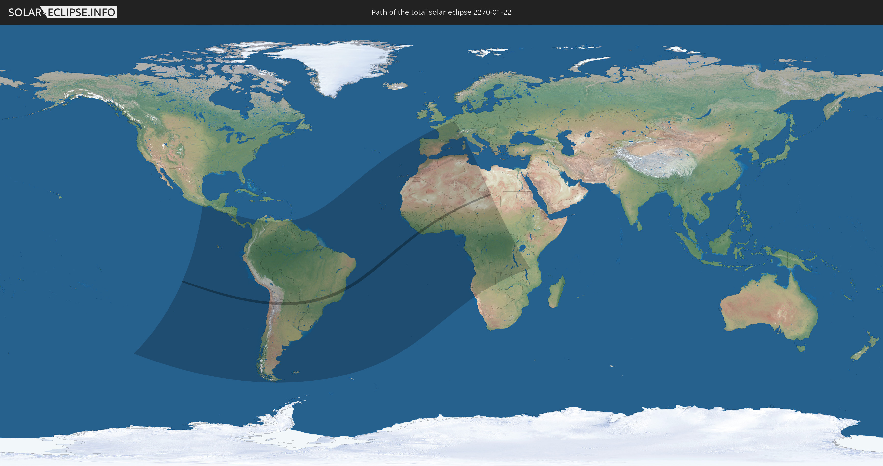
Total solar eclipse of 01/22/2270
| Day of week: | Saturday |
| Maximum duration of eclipse: | 03m29s |
| Maximum width of eclipse path: | 130 km |
| Saros cycle: | 145 |
| Coverage: | 100% |
| Magnitude: | 1.0385 |
| Gamma: | 0.056 |
Wo kann man die Sonnenfinsternis vom 01/22/2270 sehen?
Die Sonnenfinsternis am 01/22/2270 kann man in 70 Ländern als partielle Sonnenfinsternis beobachten.
Der Finsternispfad verläuft durch 13 Länder. Nur in diesen Ländern ist sie als total Sonnenfinsternis zu sehen.
In den folgenden Ländern ist die Sonnenfinsternis total zu sehen
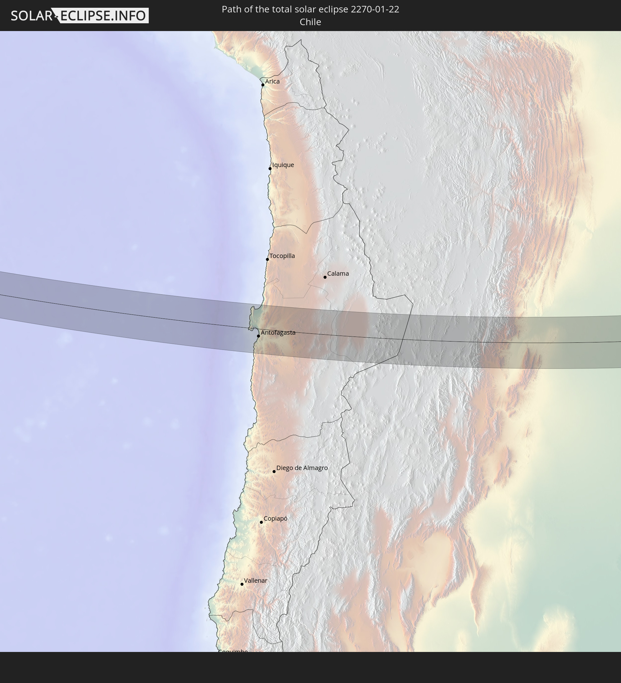 Chile
Chile
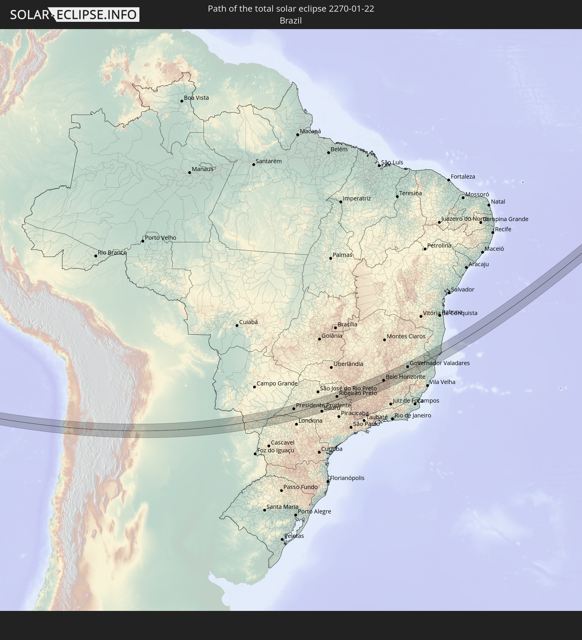 Brazil
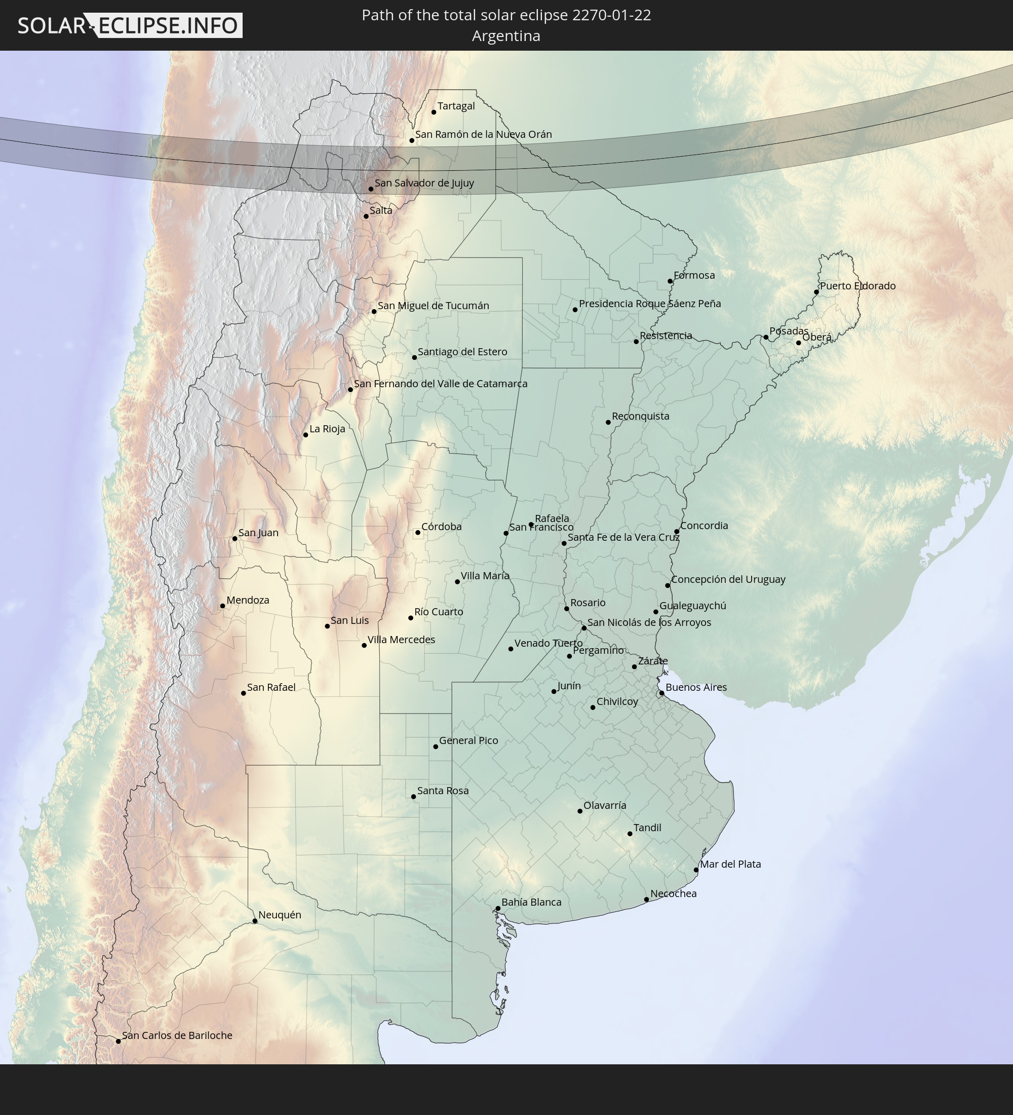 Argentina
 Paraguay
 Liberia
 Ivory Coast
 Burkina Faso
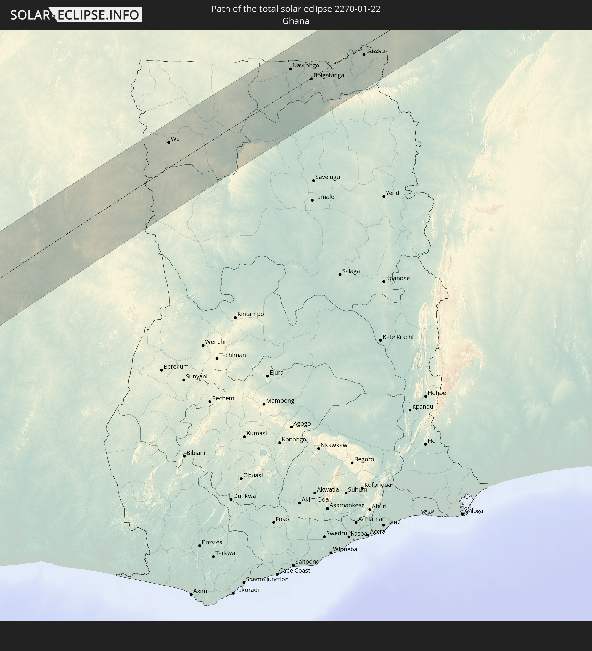 Ghana
Ghana
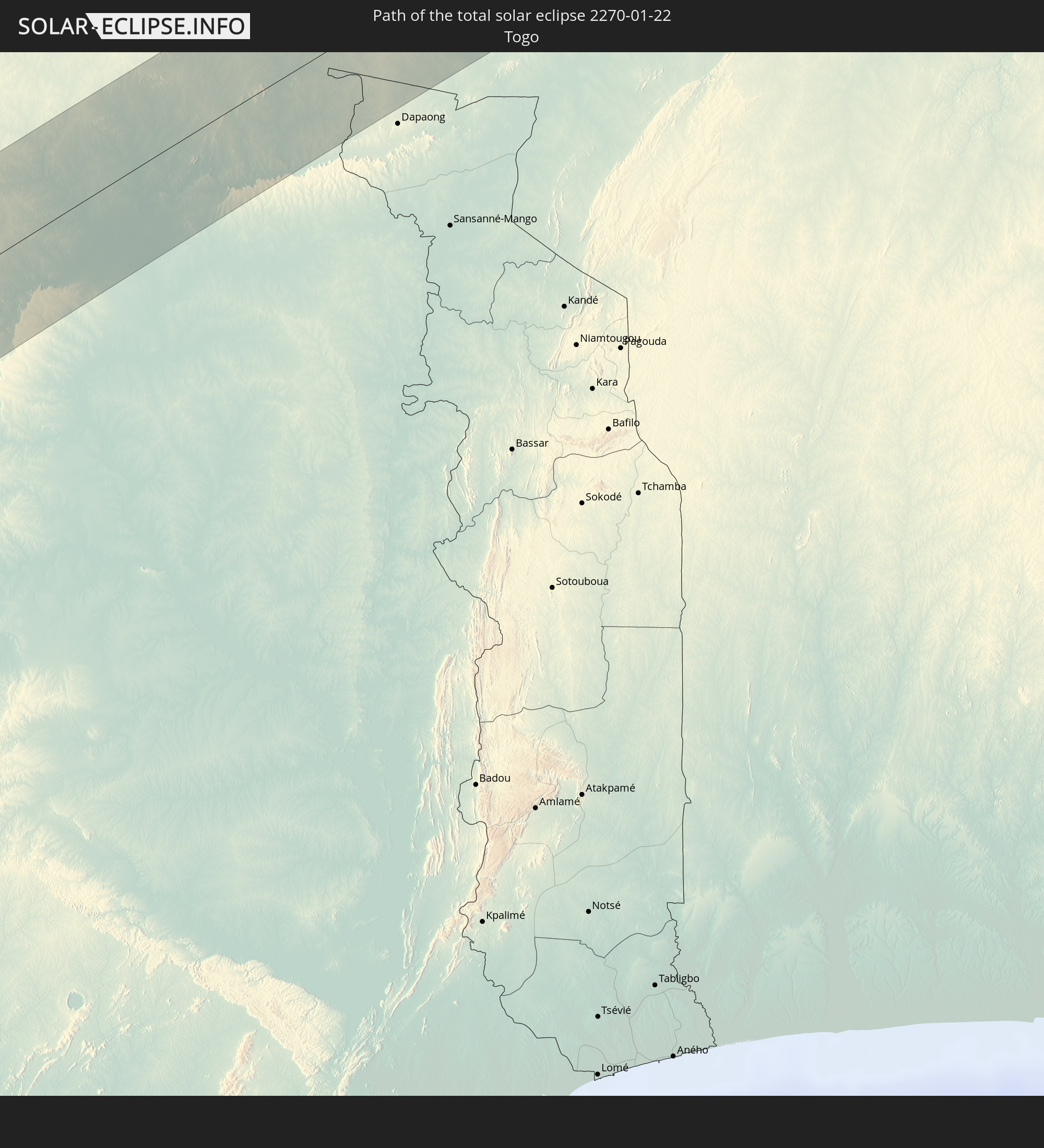 Togo
Togo
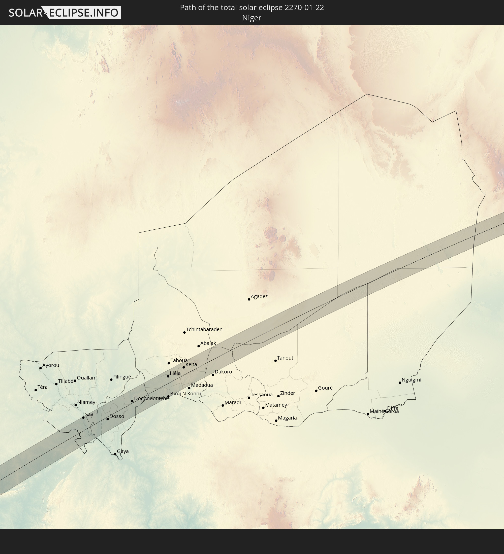 Niger
Niger
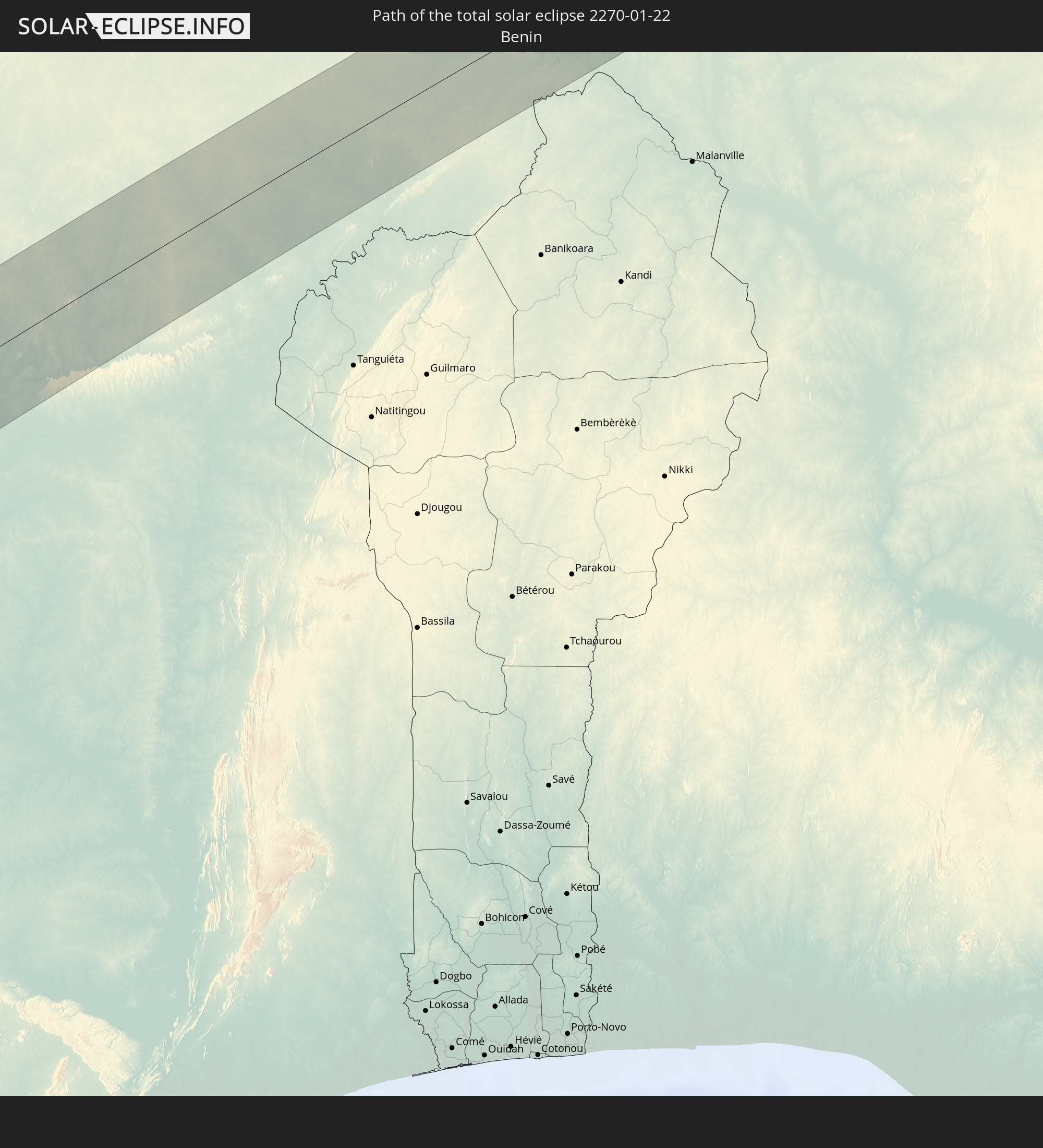 Benin
Benin
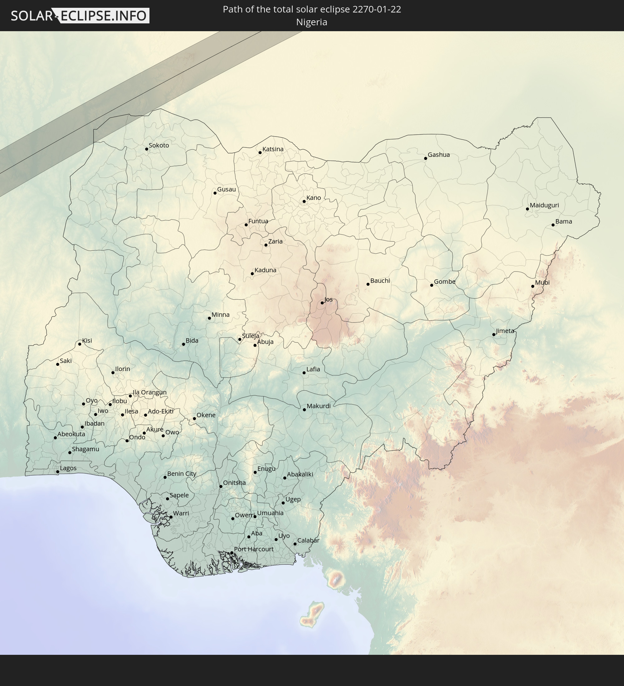 Nigeria
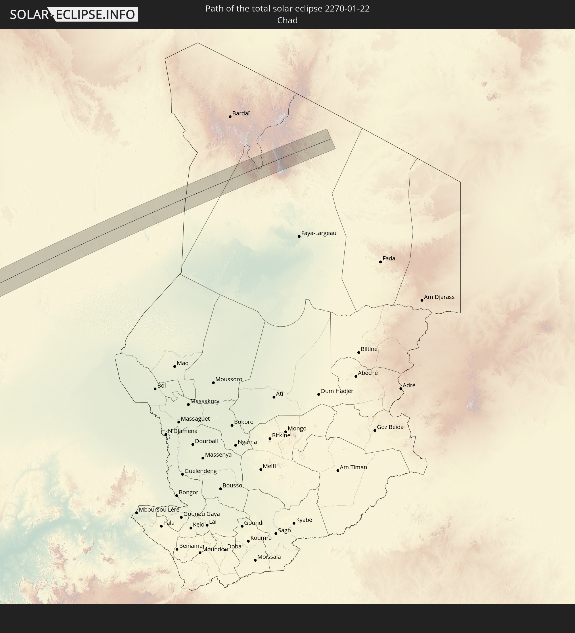 Chad
Chad
In den folgenden Ländern ist die Sonnenfinsternis partiell zu sehen
 Mexico
 Chile
Chile
 Guatemala
 Ecuador
 El Salvador
 Honduras
 Nicaragua
 Costa Rica
 Panama
 Colombia
 Peru
Peru
 Brazil
 Argentina
 Venezuela
 Bolivia
 Paraguay
 Trinidad and Tobago
 Falkland Islands
 Guyana
 Uruguay
 Suriname
 French Guiana
 Portugal
 Cabo Verde
 Spain
Spain
 Senegal
 Mauritania
 The Gambia
 Guinea-Bissau
 Guinea
 Saint Helena, Ascension and Tristan da Cunha
 Sierra Leone
 Morocco
 Mali
Mali
 Liberia
 Algeria
 Ivory Coast
 Burkina Faso
 Gibraltar
 France
 Ghana
Ghana
 Togo
Togo
 Niger
Niger
 Benin
Benin
 Andorra
 Belgium
 Nigeria
 Equatorial Guinea
 Luxembourg
 Switzerland
 São Tomé and Príncipe
 Italy
Italy
 Monaco
 Tunisia
 Cameroon
 Gabon
Gabon
 Libya
Libya
 Republic of the Congo
 Angola
 Namibia
 Democratic Republic of the Congo
 Chad
Chad
 Central African Republic
 Sudan
Sudan
 Zambia
 Rwanda
 Burundi
 Tanzania
 Uganda
 Malawi
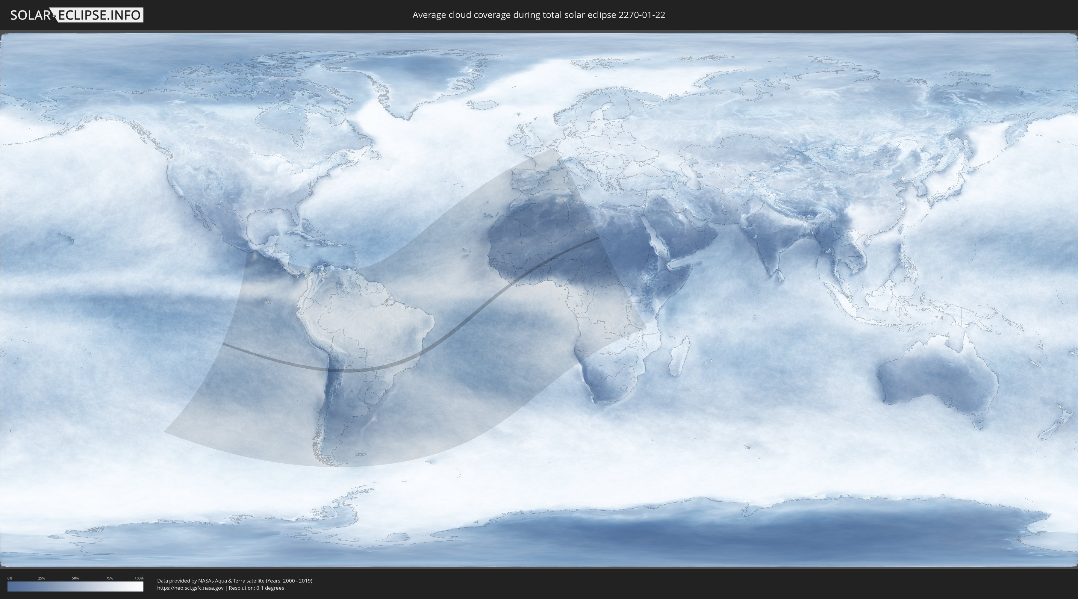
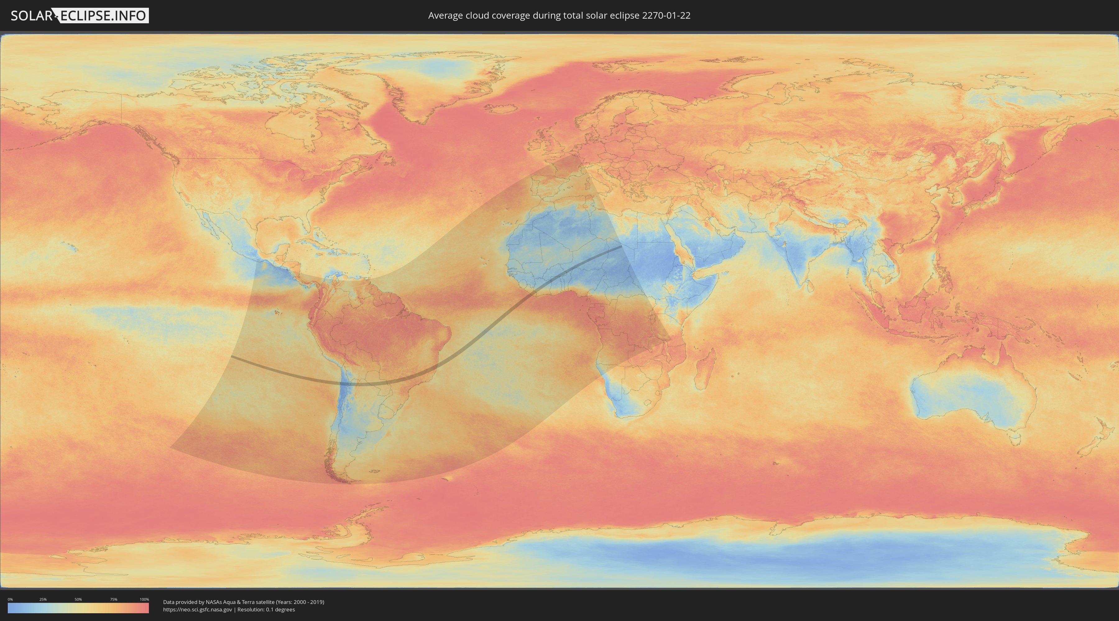
How will be the weather during the total solar eclipse on 01/22/2270?
Where is the best place to see the total solar eclipse of 01/22/2270?
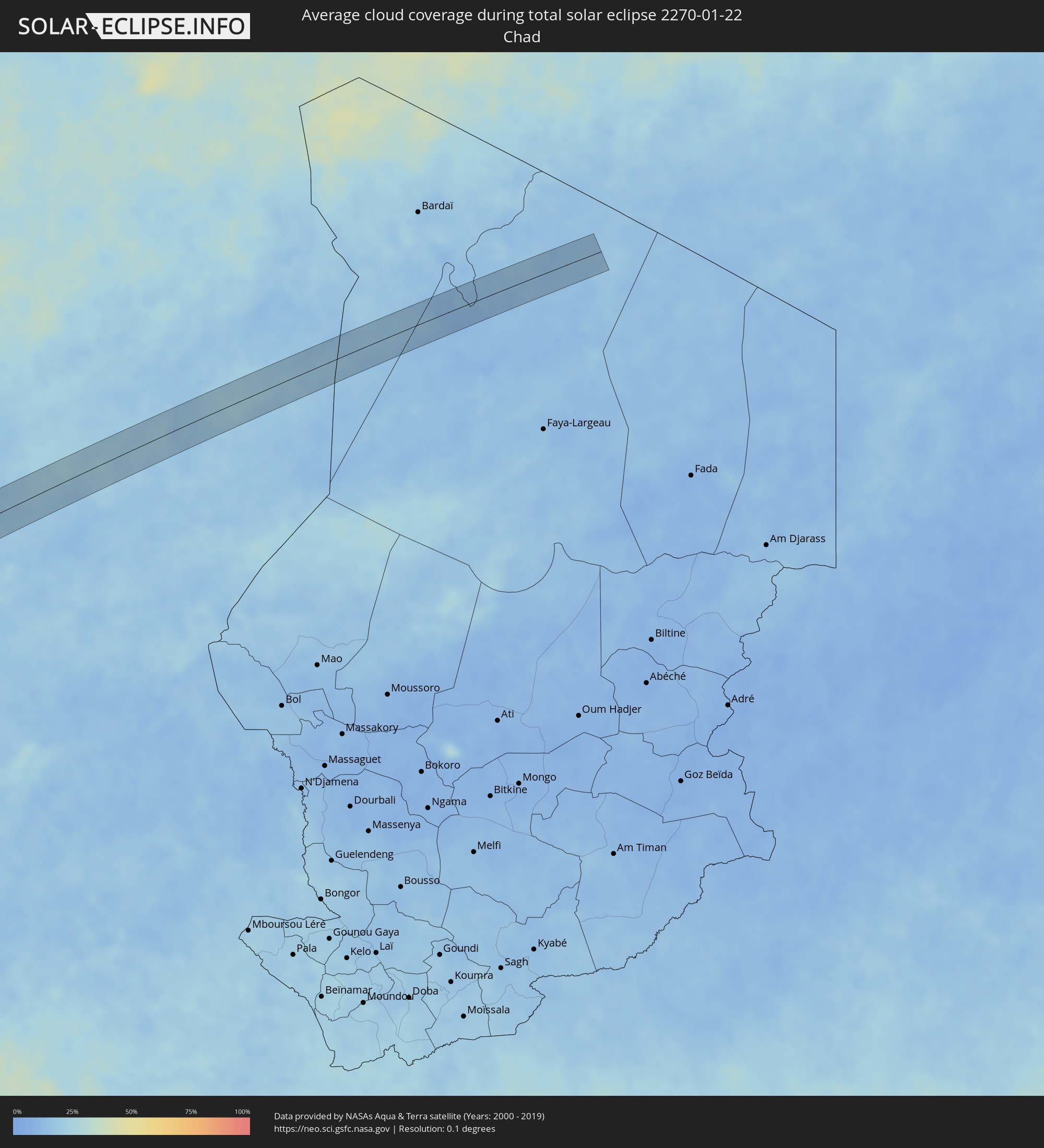
The following maps show the average cloud coverage for the day of the total solar eclipse.
With the help of these maps, it is possible to find the place along the eclipse path, which has the best
chance of a cloudless sky.
Nevertheless, you should consider local circumstances and inform about the weather of your chosen
observation site.
The data is provided by NASAs satellites
AQUA and TERRA.
The cloud maps are averaged over a period of 19 years (2000 - 2019).
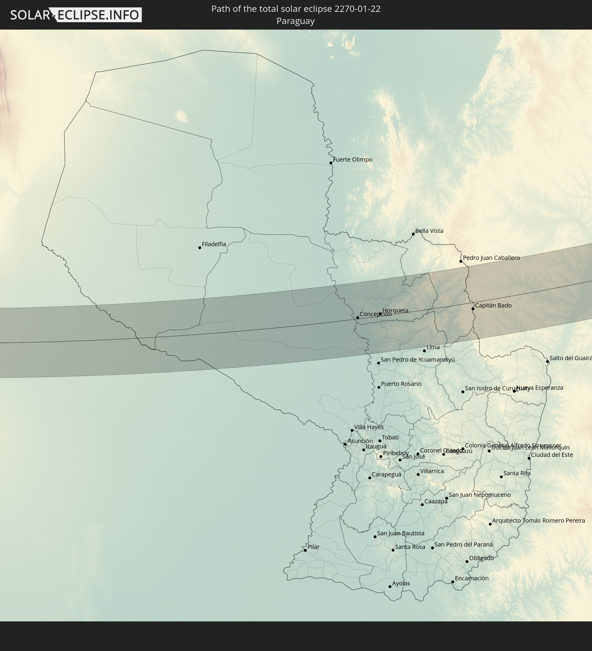
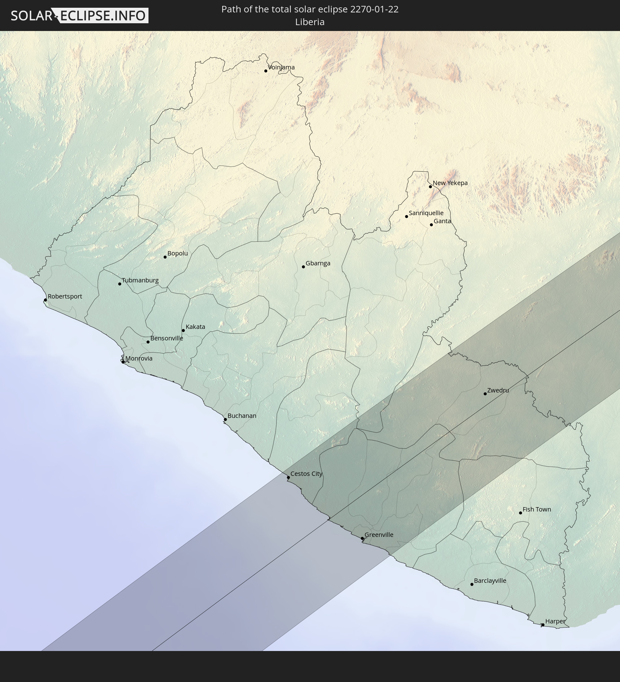
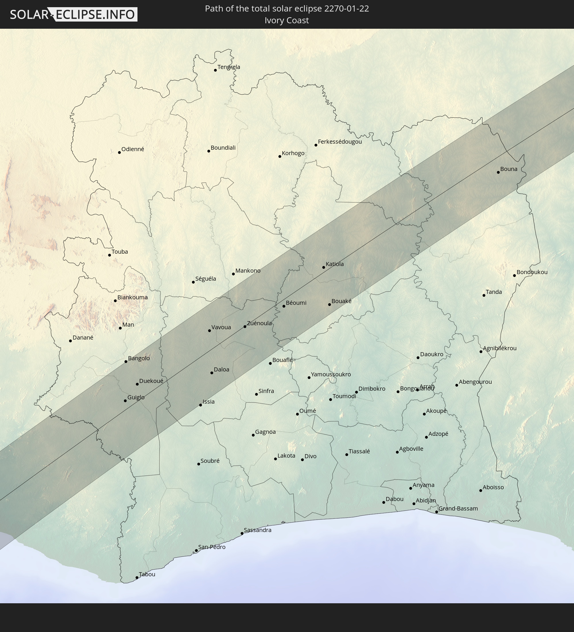
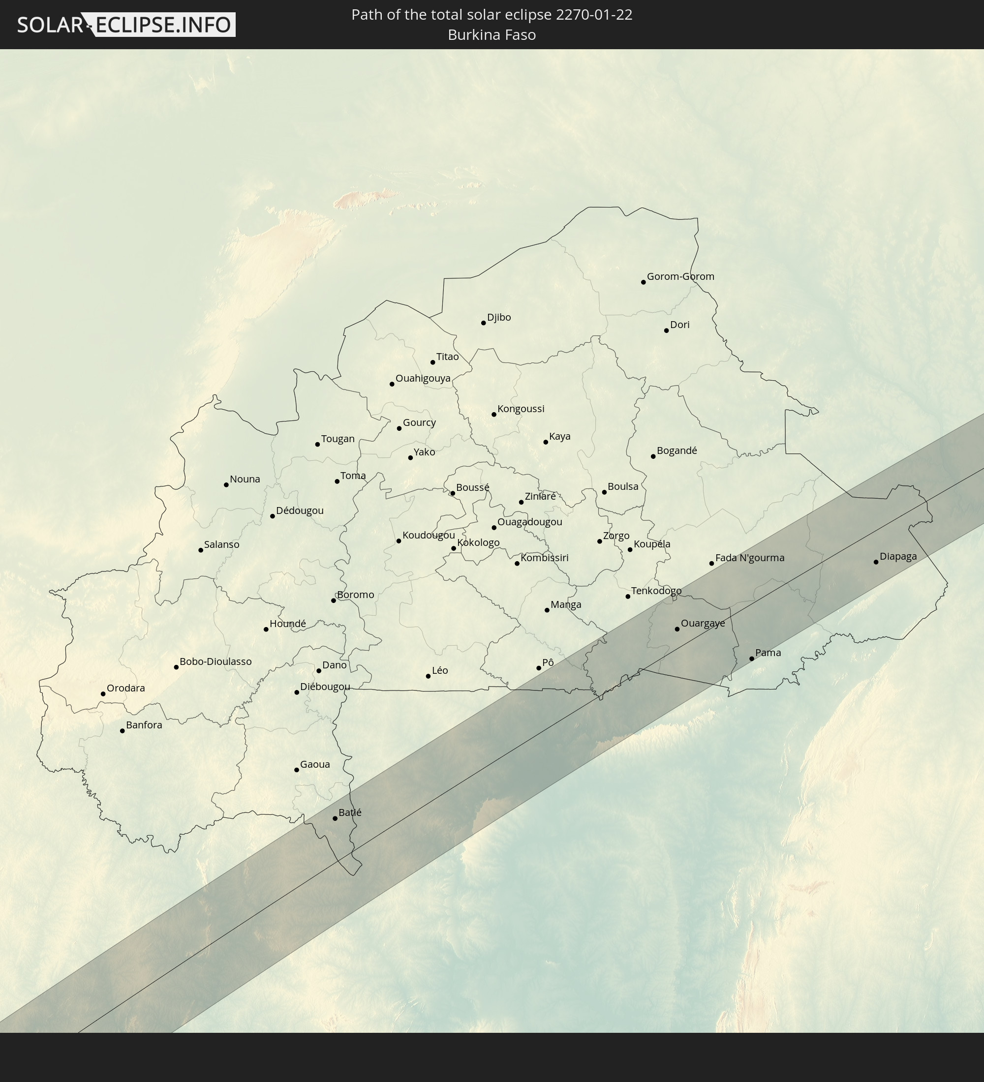
Detailed country maps
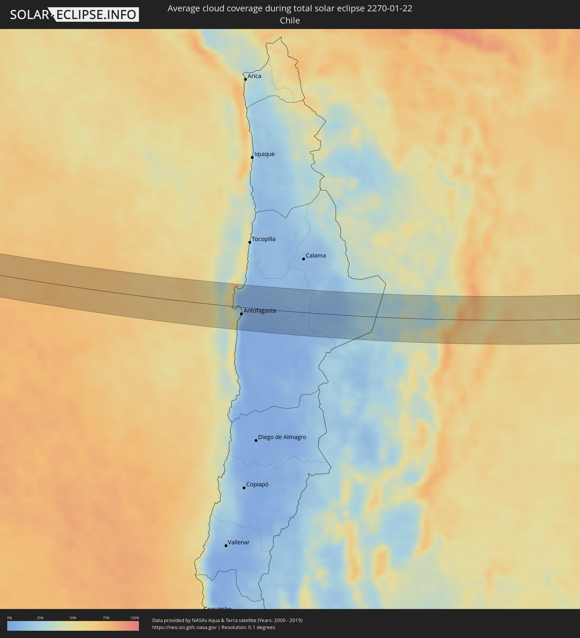 Chile
Chile
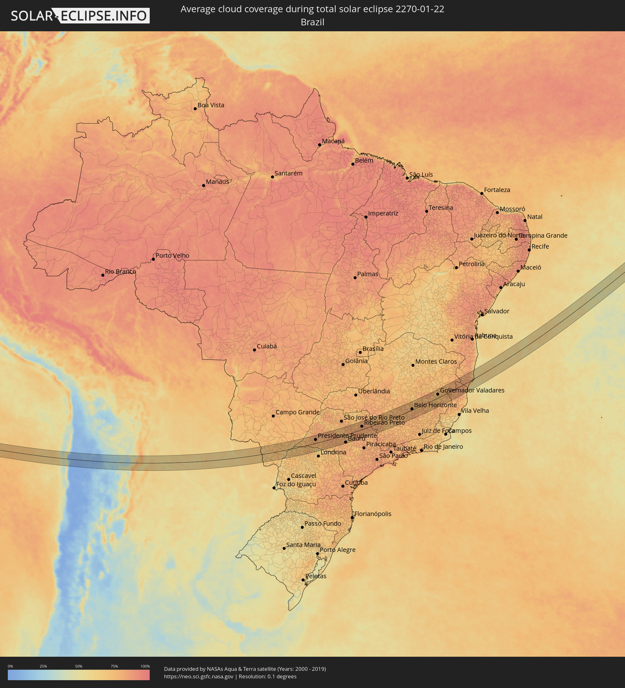 Brazil
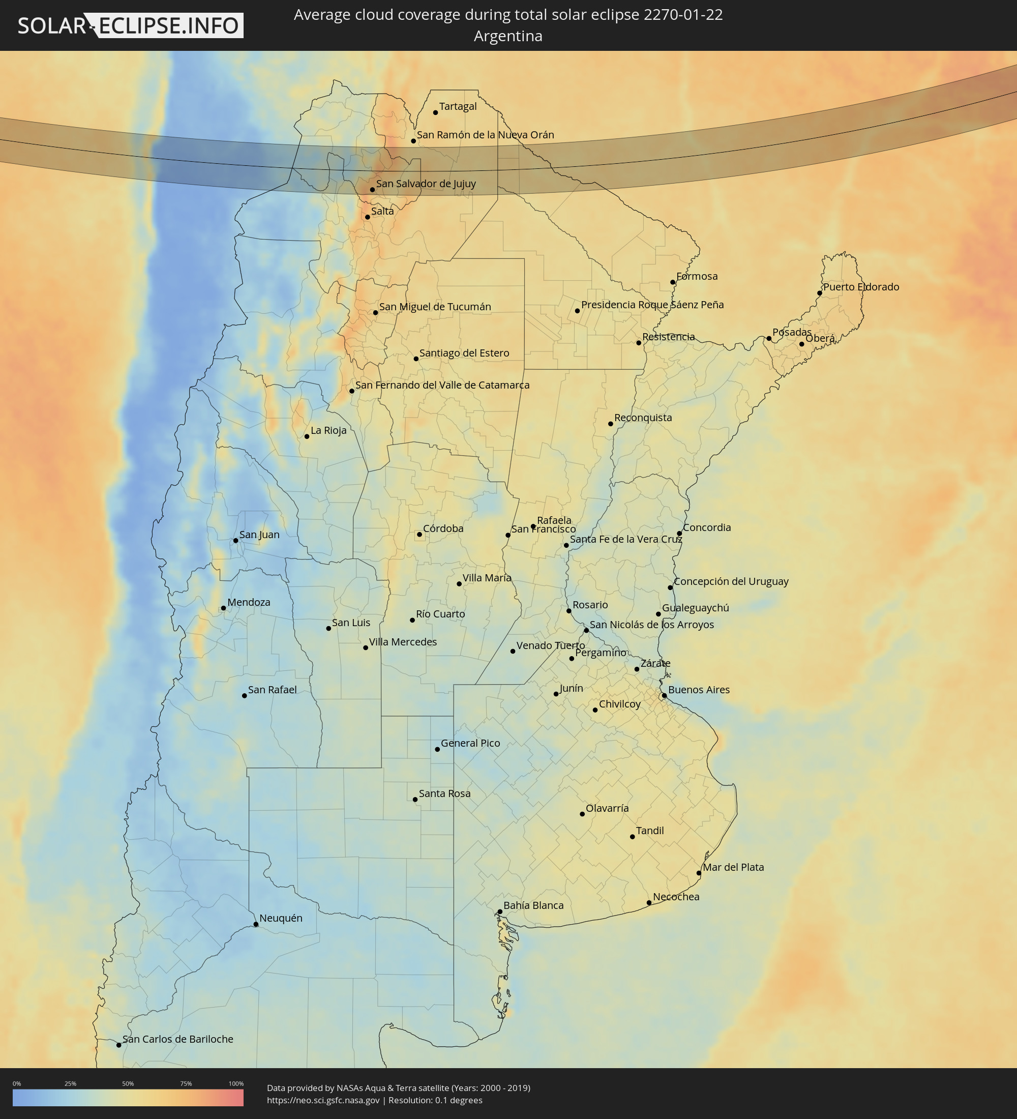 Argentina
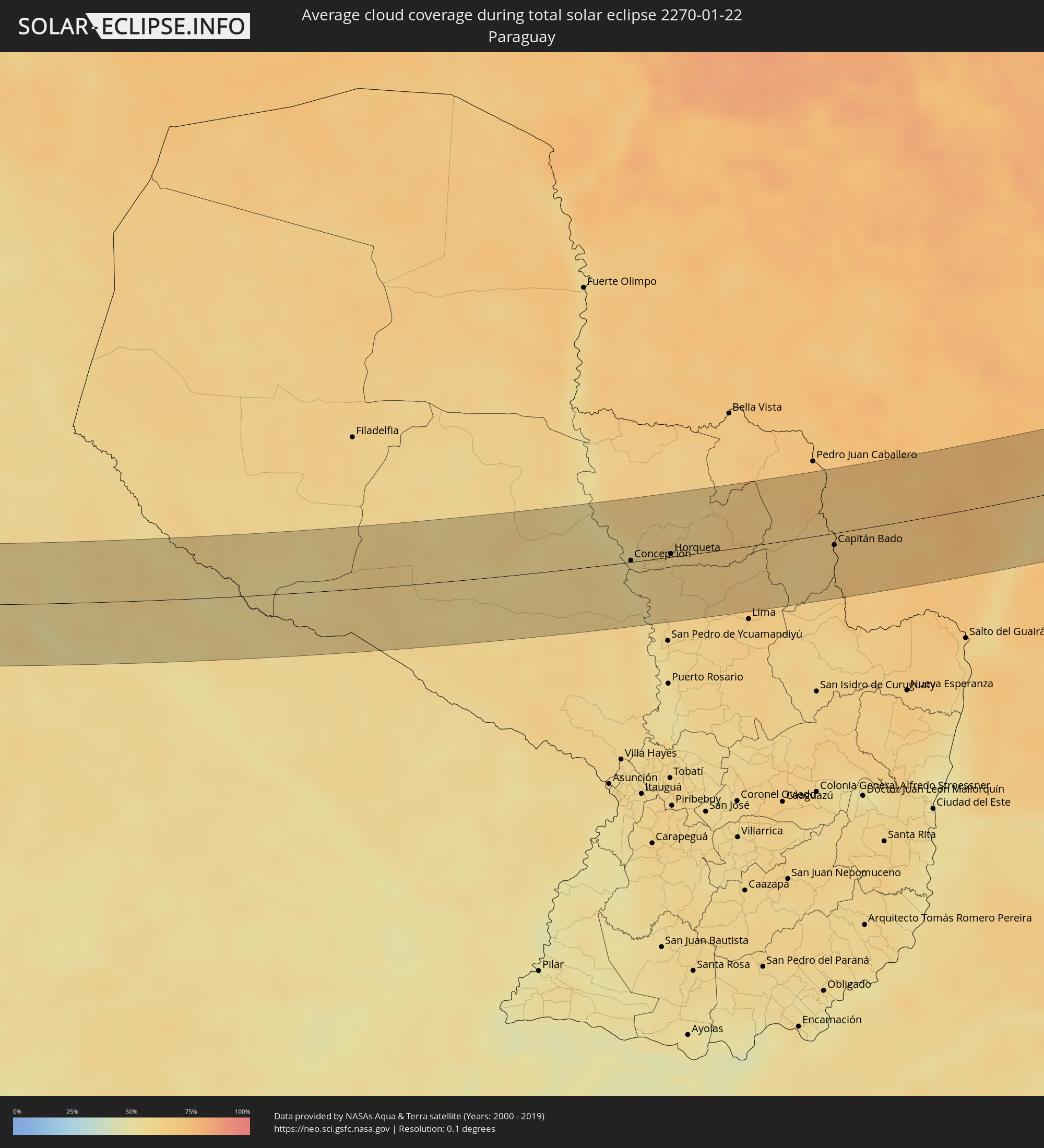 Paraguay
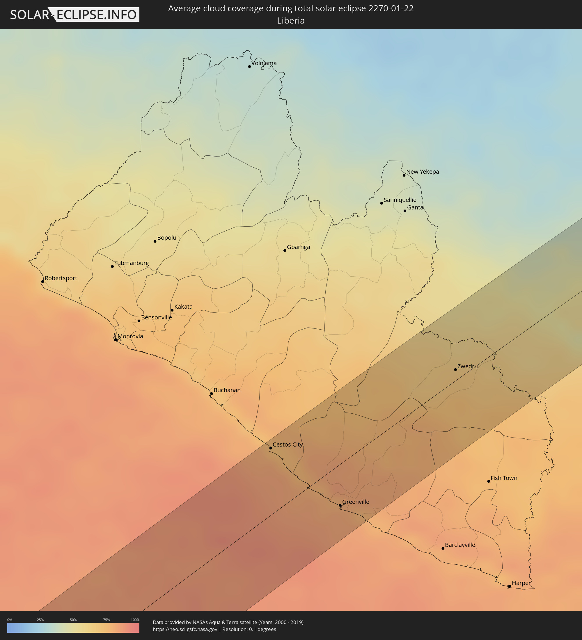 Liberia
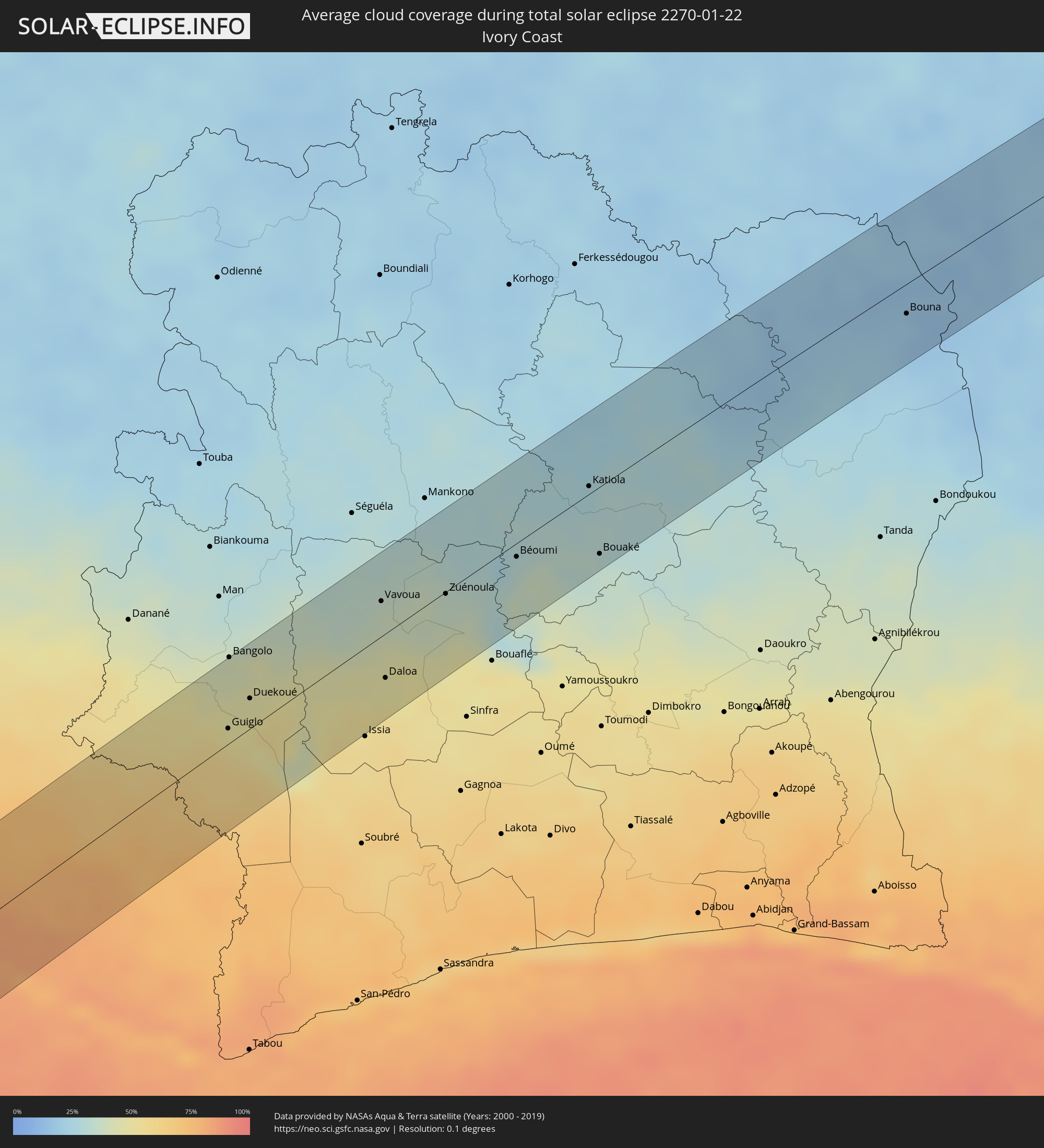 Ivory Coast
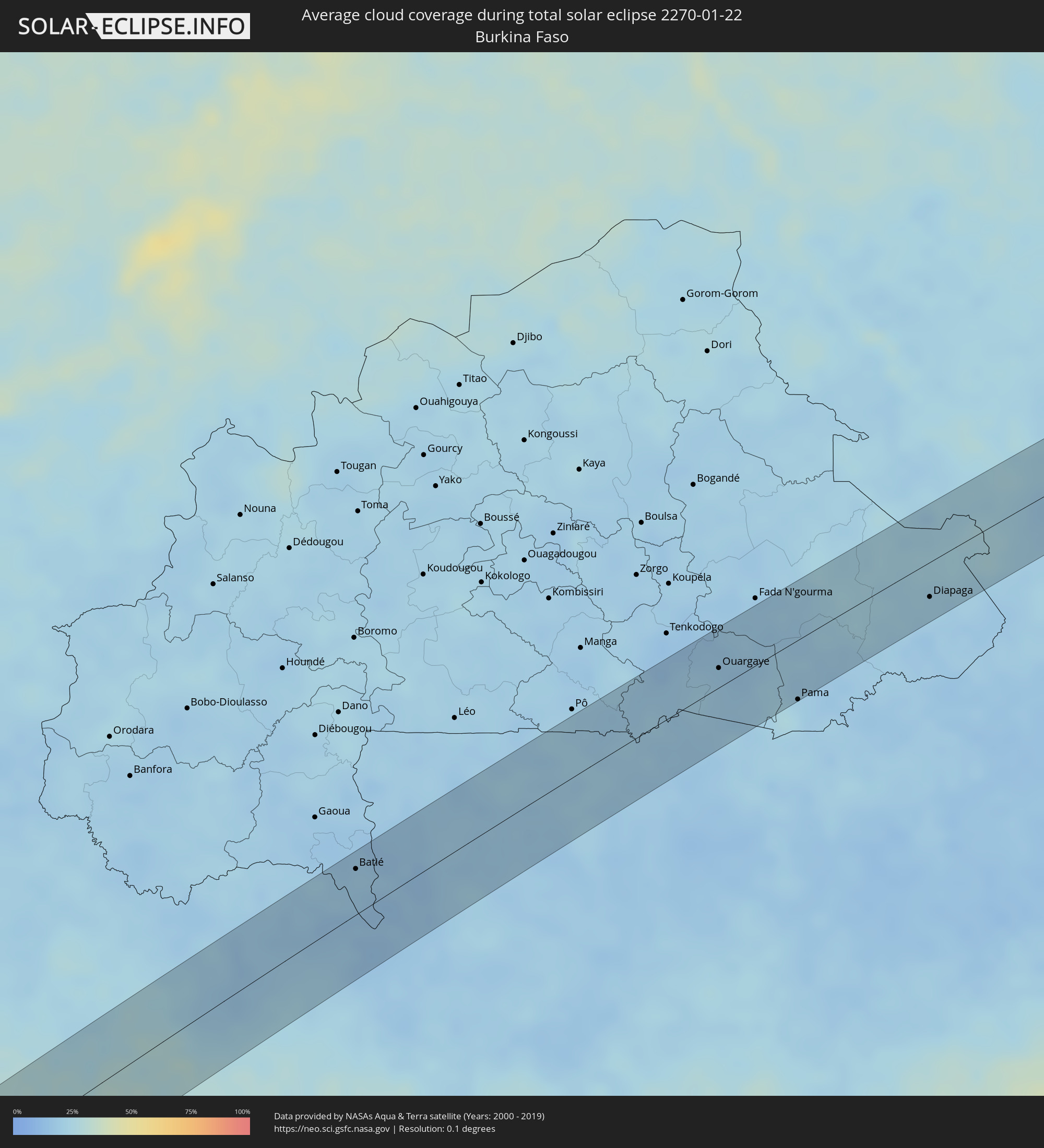 Burkina Faso
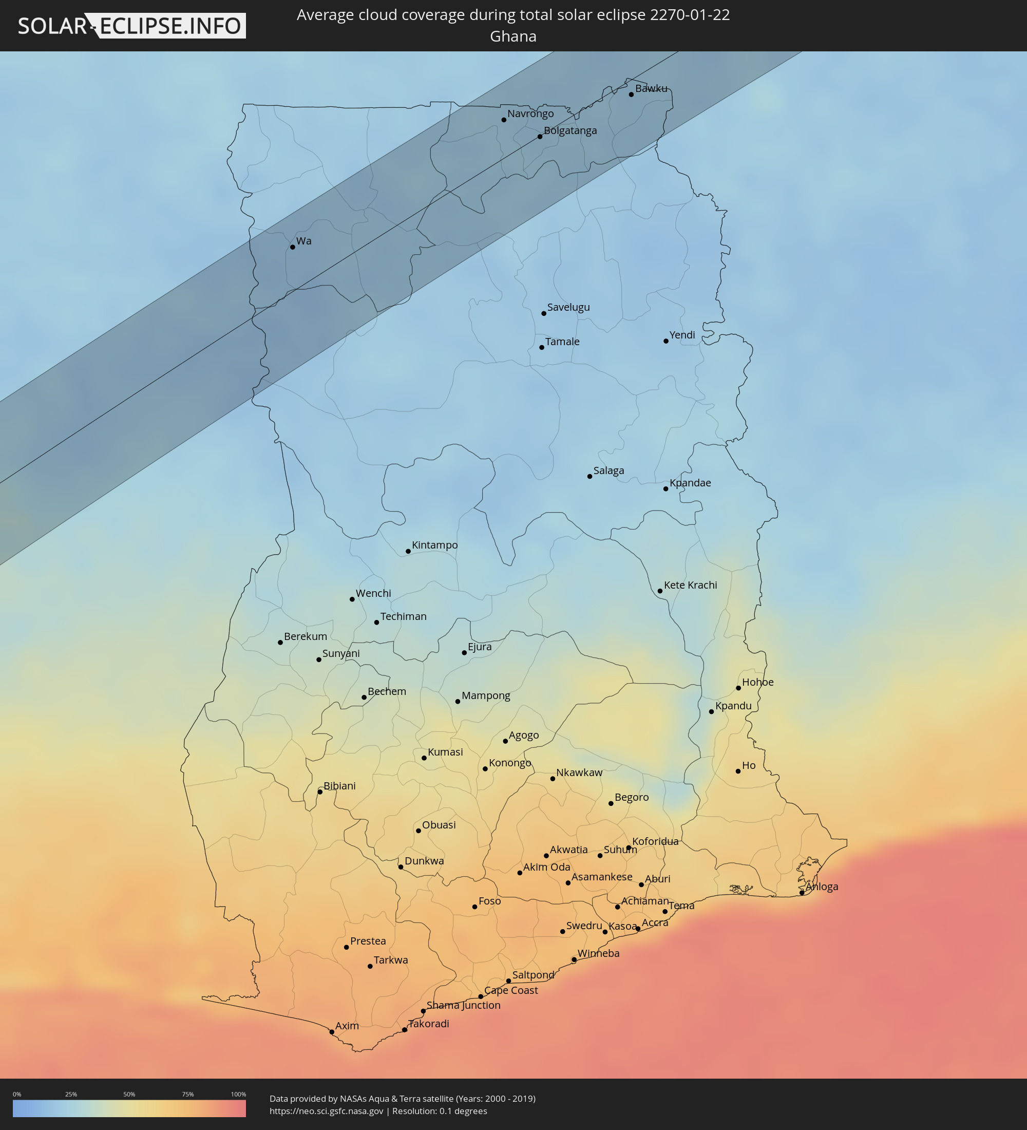 Ghana
Ghana
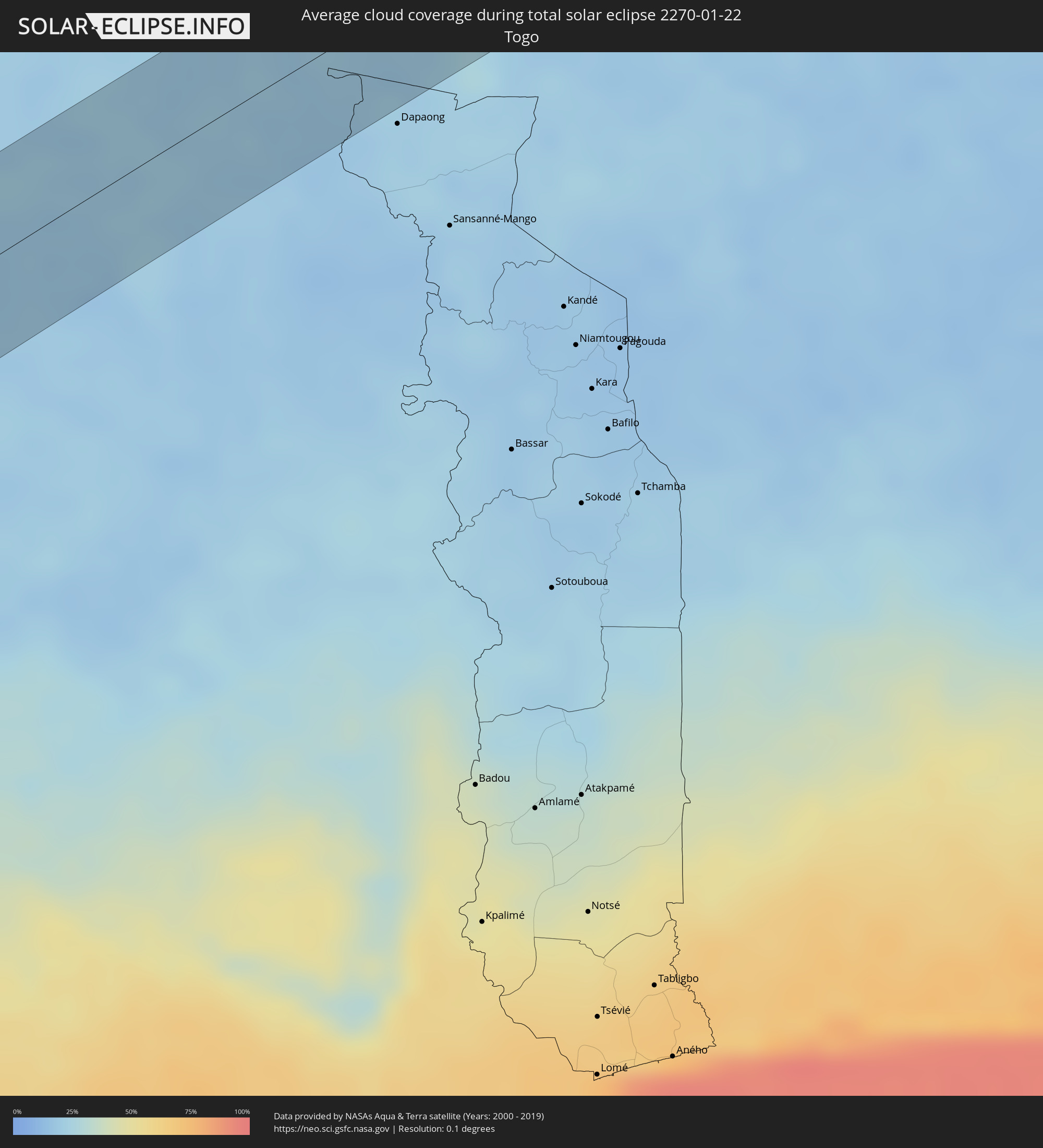 Togo
Togo
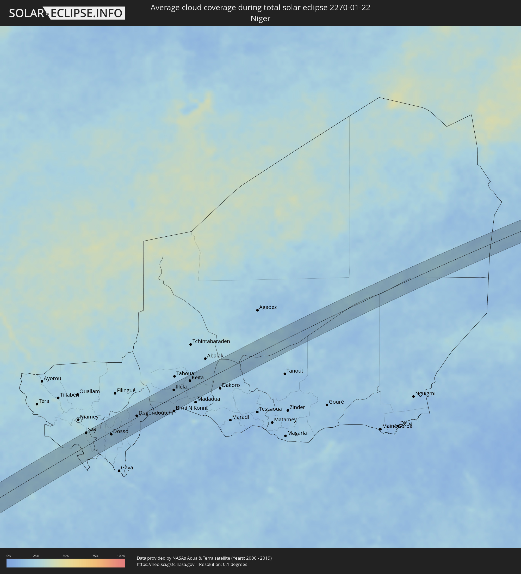 Niger
Niger
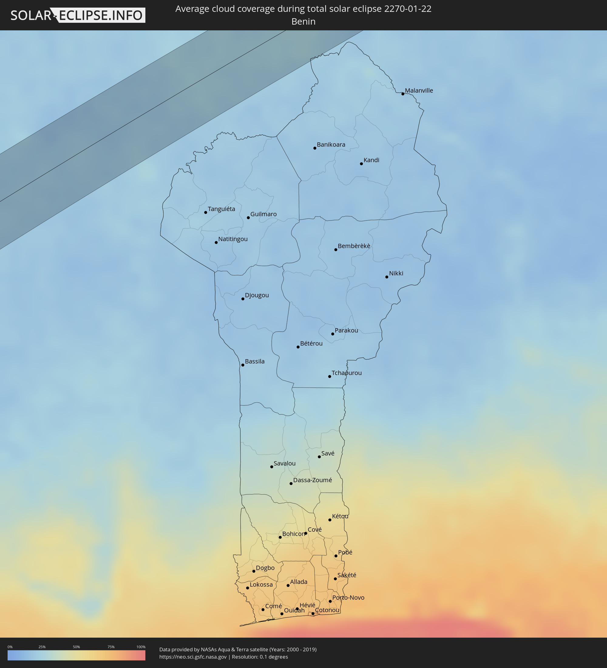 Benin
Benin
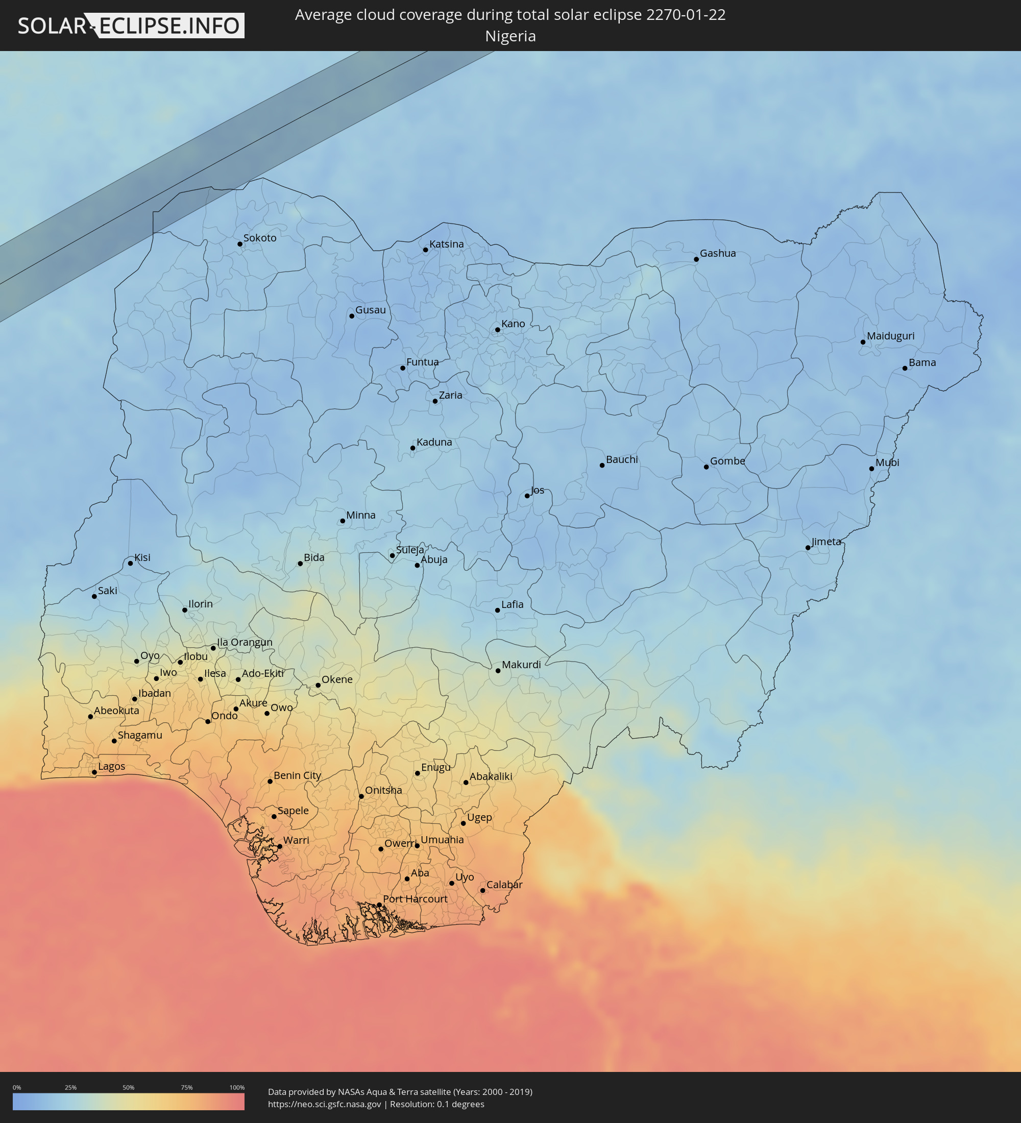 Nigeria
 Chad
Chad
Cities inside the path of the eclipse
The following table shows all locations with a population of more than 5,000 inside the eclipse path. Cities which have more than 100,000 inhabitants are marked bold. A click at the locations opens a detailed map.
| City | Type | Eclipse duration | Local time of max. eclipse | Distance to central line | Ø Cloud coverage |
|
Antofagasta, Antofagasta
|
total | - | 10:16:34 UTC-03:00 | 17 km | 12% |
|
Tilcara, Jujuy Province
|
total | - | 10:24:35 UTC-03:00 | 21 km | 43% |
|
San Salvador de Jujuy, Jujuy Province
|
total | - | 10:24:39 UTC-03:00 | 47 km | 64% |
|
Palpalá, Jujuy Province
|
total | - | 10:24:47 UTC-03:00 | 54 km | 59% |
|
San Pedro, Jujuy Province
|
total | - | 10:25:23 UTC-03:00 | 51 km | 55% |
|
Ingenio La Esperanza, Jujuy Province
|
total | - | 10:25:26 UTC-03:00 | 50 km | 55% |
|
Fraile Pintado, Jujuy Province
|
total | - | 10:25:31 UTC-03:00 | 18 km | 56% |
|
Libertador General San Martín, Jujuy Province
|
total | - | 10:25:33 UTC-03:00 | 3 km | 58% |
|
Calilegua, Jujuy Province
|
total | - | 10:25:35 UTC-03:00 | 0 km | 58% |
|
Caimancito, Jujuy Province
|
total | - | 10:25:54 UTC-03:00 | 4 km | 53% |
|
Yuto, Jujuy Province
|
total | - | 10:26:07 UTC-03:00 | 15 km | 52% |
|
Palma Sola, Jujuy Province
|
total | - | 10:26:24 UTC-03:00 | 20 km | 65% |
|
Ingeniero Guillermo N. Juárez, Formosa Province
|
total | - | 10:30:54 UTC-03:00 | 18 km | 56% |
|
Concepción, Concepción
|
total | - | 10:39:56 UTC-03:00 | 1 km | 57% |
|
Horqueta, Concepción
|
total | - | 10:40:45 UTC-03:00 | 3 km | 61% |
|
Capitán Bado, Amambay
|
total | - | 10:44:06 UTC-03:00 | 11 km | 67% |
|
Presidente Prudente, São Paulo
|
total | - | 10:54:19 UTC-03:00 | 27 km | 80% |
|
Assis, São Paulo
|
total | - | 10:56:13 UTC-03:00 | 57 km | 74% |
|
Marília, São Paulo
|
total | - | 10:57:41 UTC-03:00 | 21 km | 80% |
|
Bauru, São Paulo
|
total | - | 10:59:44 UTC-03:00 | 58 km | 81% |
|
Araraquara, São Paulo
|
total | - | 11:02:21 UTC-03:00 | 31 km | 83% |
|
Sertãozinho, São Paulo
|
total | - | 11:03:26 UTC-03:00 | 33 km | 78% |
|
São Carlos, São Paulo
|
total | - | 11:02:50 UTC-03:00 | 63 km | 81% |
|
Ribeirão Preto, São Paulo
|
total | - | 11:03:50 UTC-03:00 | 23 km | 83% |
|
Passos, Minas Gerais
|
total | - | 11:07:17 UTC-03:00 | 29 km | 77% |
|
Divinópolis, Minas Gerais
|
total | - | 11:12:15 UTC-03:00 | 23 km | 77% |
|
Pará de Minas, Minas Gerais
|
total | - | 11:13:17 UTC-03:00 | 40 km | 78% |
|
Itaúna, Minas Gerais
|
total | - | 11:13:07 UTC-03:00 | 17 km | 77% |
|
Esmeraldas, Minas Gerais
|
total | - | 11:14:09 UTC-03:00 | 38 km | 76% |
|
Betim, Minas Gerais
|
total | - | 11:14:12 UTC-03:00 | 12 km | 75% |
|
Ribeirão das Neves, Minas Gerais
|
total | - | 11:14:43 UTC-03:00 | 28 km | 78% |
|
Ibirité, Minas Gerais
|
total | - | 11:14:29 UTC-03:00 | 1 km | 76% |
|
Belo Horizonte, Minas Gerais
|
total | - | 11:14:54 UTC-03:00 | 6 km | 76% |
|
Santa Luzia, Minas Gerais
|
total | - | 11:15:19 UTC-03:00 | 18 km | 75% |
|
Itabira, Minas Gerais
|
total | - | 11:17:04 UTC-03:00 | 6 km | 80% |
|
Timóteo, Minas Gerais
|
total | - | 11:18:34 UTC-03:00 | 16 km | 73% |
|
Ipatinga, Minas Gerais
|
total | - | 11:19:00 UTC-03:00 | 9 km | 67% |
|
Governador Valadares, Minas Gerais
|
total | - | 11:21:18 UTC-03:00 | 26 km | 74% |
|
São Mateus, Espírito Santo
|
total | - | 11:26:43 UTC-03:00 | 63 km | 72% |
|
Cestos City, River Cess
|
total | - | 15:58:50 UTC+00:00 | 47 km | 74% |
|
Greenville, Sinoe
|
total | - | 15:58:54 UTC+00:00 | 29 km | 81% |
|
Zwedru, Grand Gedeh
|
total | - | 16:00:51 UTC+00:00 | 7 km | 67% |
|
Guiglo, Montagnes
|
total | - | 16:01:54 UTC+00:00 | 9 km | 53% |
|
Bangolo, Montagnes
|
total | - | 16:02:22 UTC+00:00 | 51 km | 41% |
|
Duekoué, Montagnes
|
total | - | 16:02:13 UTC+00:00 | 18 km | 51% |
|
Vavoua, Sassandra-Marahoué
|
total | - | 16:03:35 UTC+00:00 | 21 km | 37% |
|
Daloa, Sassandra-Marahoué
|
total | - | 16:03:08 UTC+00:00 | 27 km | 48% |
|
Zuénoula, Sassandra-Marahoué
|
total | - | 16:03:59 UTC+00:00 | 1 km | 37% |
|
Béoumi, Vallée du Bandama
|
total | - | 16:04:35 UTC+00:00 | 8 km | 31% |
|
Botro, Vallée du Bandama
|
total | - | 16:04:58 UTC+00:00 | 9 km | 31% |
|
Sakassou, Vallée du Bandama
|
total | - | 16:04:37 UTC+00:00 | 46 km | 37% |
|
Katiola, Vallée du Bandama
|
total | - | 16:05:23 UTC+00:00 | 5 km | 28% |
|
Bouaké, Vallée du Bandama
|
total | - | 16:05:02 UTC+00:00 | 41 km | 33% |
|
Dabakala, Vallée du Bandama
|
total | - | 16:06:06 UTC+00:00 | 16 km | 30% |
|
Bouna, Zanzan
|
total | - | 16:07:53 UTC+00:00 | 18 km | 18% |
|
Batié, Sud-Ouest
|
total | - | 16:08:26 UTC+00:00 | 35 km | 20% |
|
Wa, Upper West
|
total | - | 16:08:50 UTC+00:00 | 27 km | 16% |
|
Navrongo, Upper East
|
total | - | 16:10:21 UTC+00:00 | 23 km | 21% |
|
Bolgatanga, Upper East
|
total | - | 16:10:25 UTC+00:00 | 1 km | 21% |
|
Bawku, Upper East
|
total | - | 16:10:58 UTC+00:00 | 10 km | 18% |
|
Ouargaye, Centre-Est
|
total | - | 16:11:27 UTC+00:00 | 15 km | 19% |
|
Pama, Est
|
total | - | 16:11:38 UTC+00:00 | 46 km | 24% |
|
Diapaga, Est
|
total | - | 16:12:44 UTC+00:00 | 27 km | 21% |
|
Say, Tillabéri
|
total | - | 17:13:39 UTC+01:00 | 41 km | 25% |
|
Dosso, Dosso
|
total | - | 17:13:59 UTC+01:00 | 9 km | 18% |
|
Dogondoutchi, Dosso
|
total | - | 17:14:41 UTC+01:00 | 4 km | 15% |
|
Illéla, Tahoua
|
total | - | 17:15:35 UTC+01:00 | 21 km | 16% |
|
Keïta, Tahoua
|
total | - | 17:15:55 UTC+01:00 | 23 km | 17% |
|
Bouza, Tahoua
|
total | - | 17:15:51 UTC+01:00 | 23 km | 18% |