Hybrid solar eclipse of 11/03/2385
| Day of week: | Sunday |
| Maximum duration of eclipse: | 00m03s |
| Maximum width of eclipse path: | 2 km |
| Saros cycle: | 149 |
| Coverage: | 100% |
| Magnitude: | 1.0004 |
| Gamma: | -0.1212 |
Wo kann man die Sonnenfinsternis vom 11/03/2385 sehen?
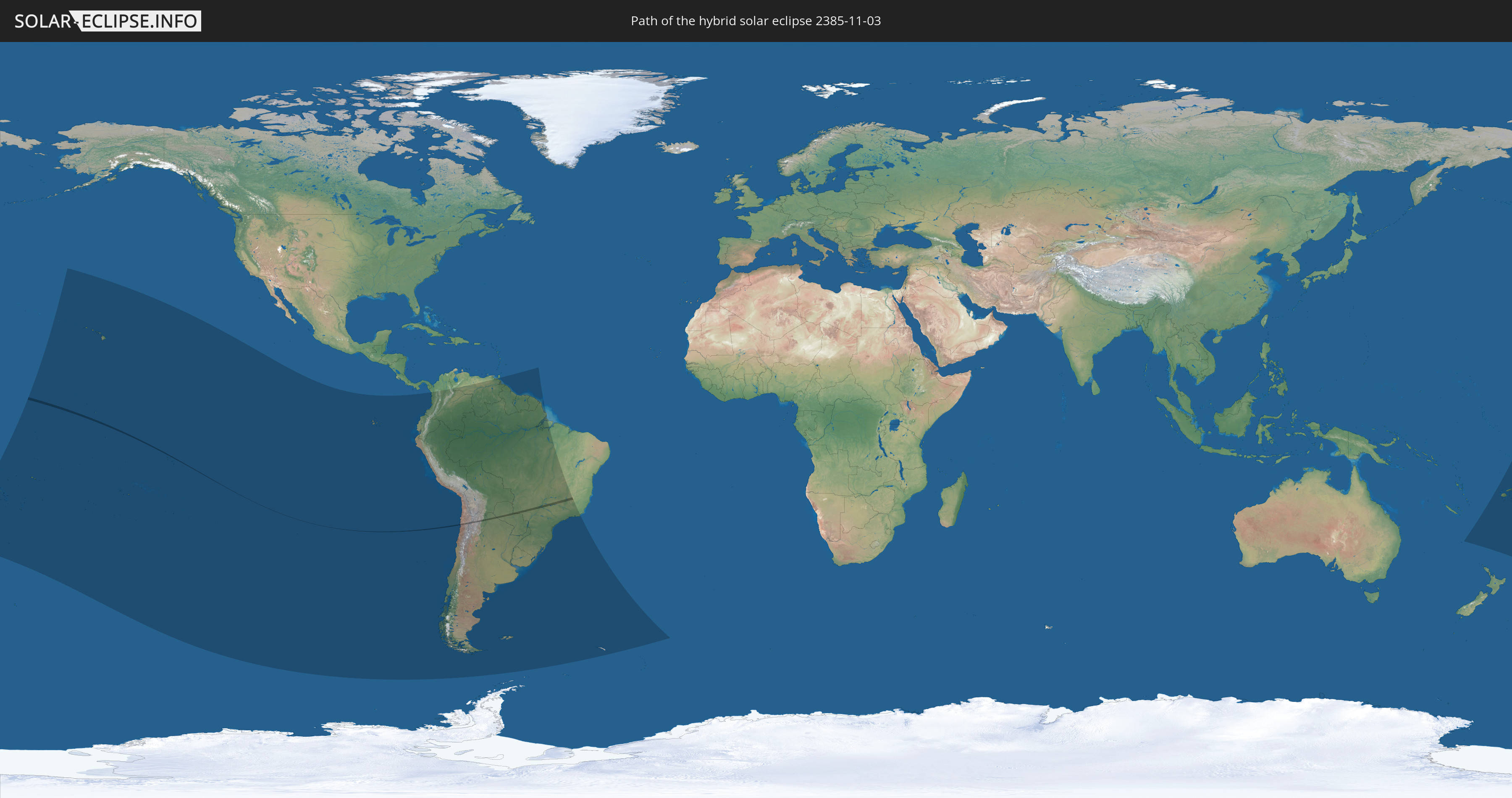
Die Sonnenfinsternis am 11/03/2385 kann man in 31 Ländern als partielle Sonnenfinsternis beobachten.
Der Finsternispfad verläuft durch 5 Länder. Nur in diesen Ländern ist sie als hybrid Sonnenfinsternis zu sehen.
In den folgenden Ländern ist die Sonnenfinsternis hybrid zu sehen
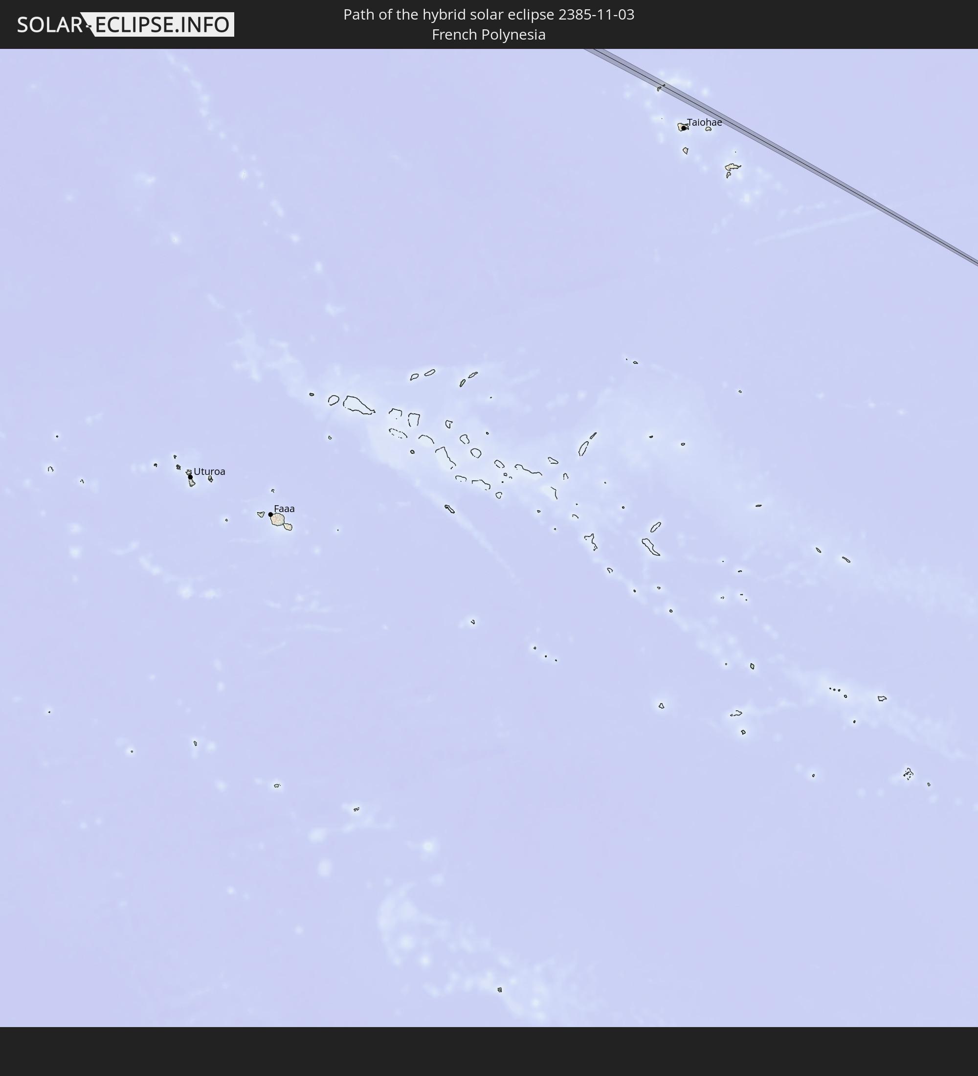 French Polynesia
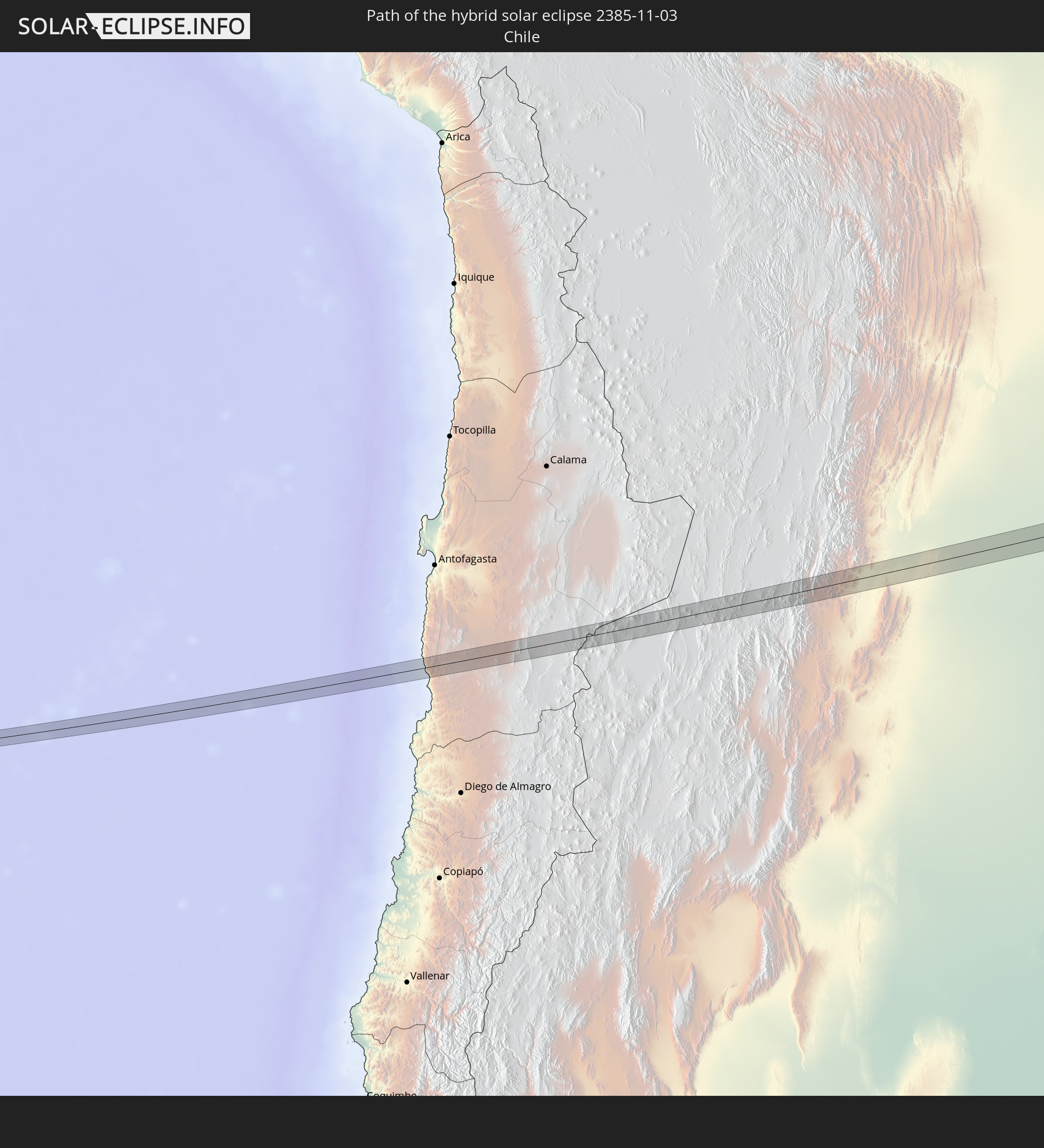 Chile
Chile
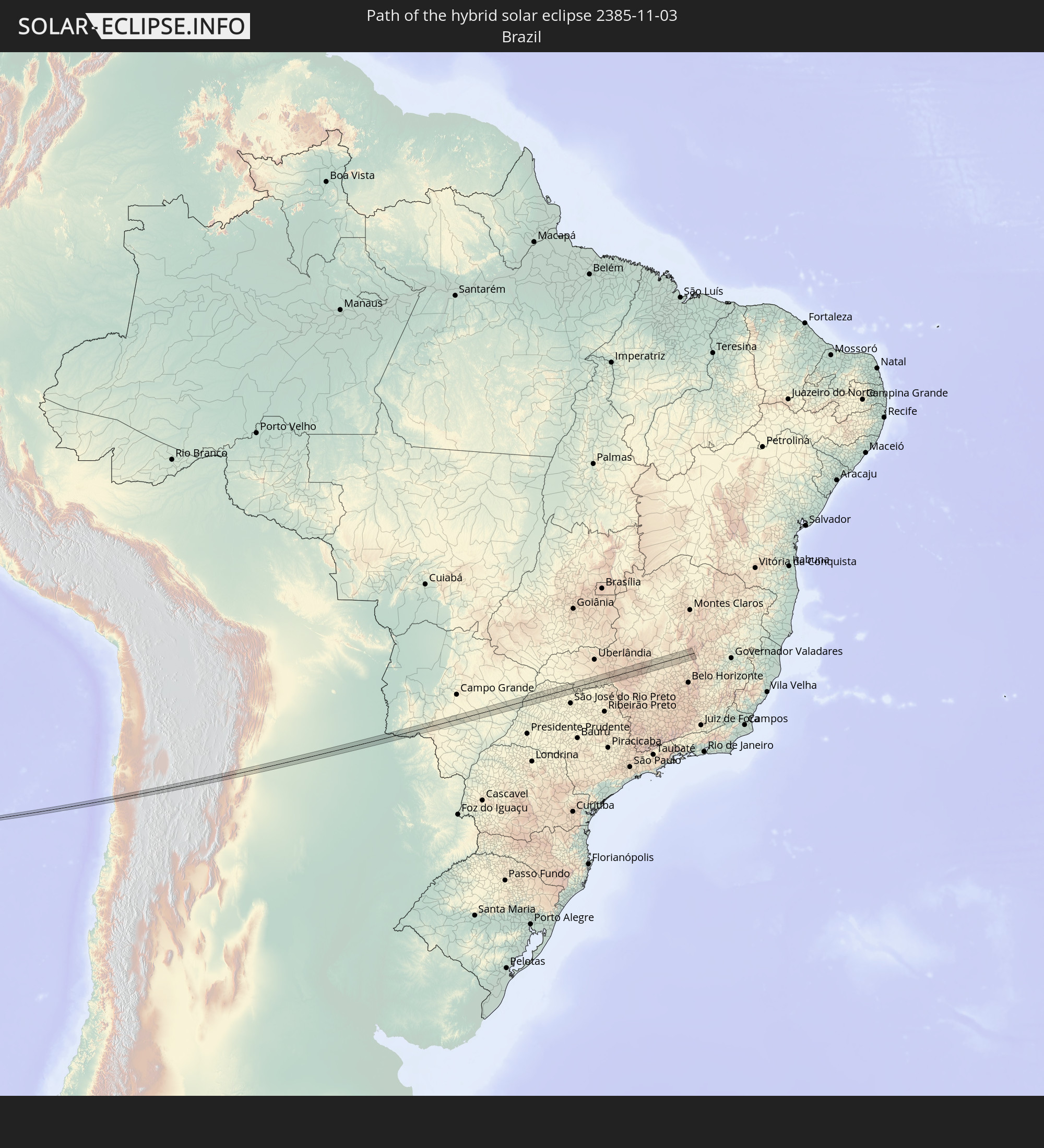 Brazil
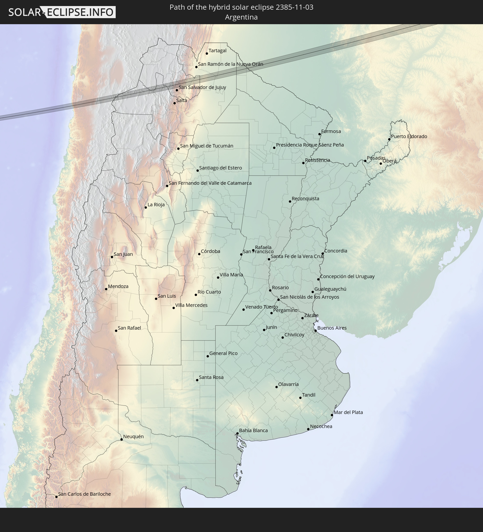 Argentina
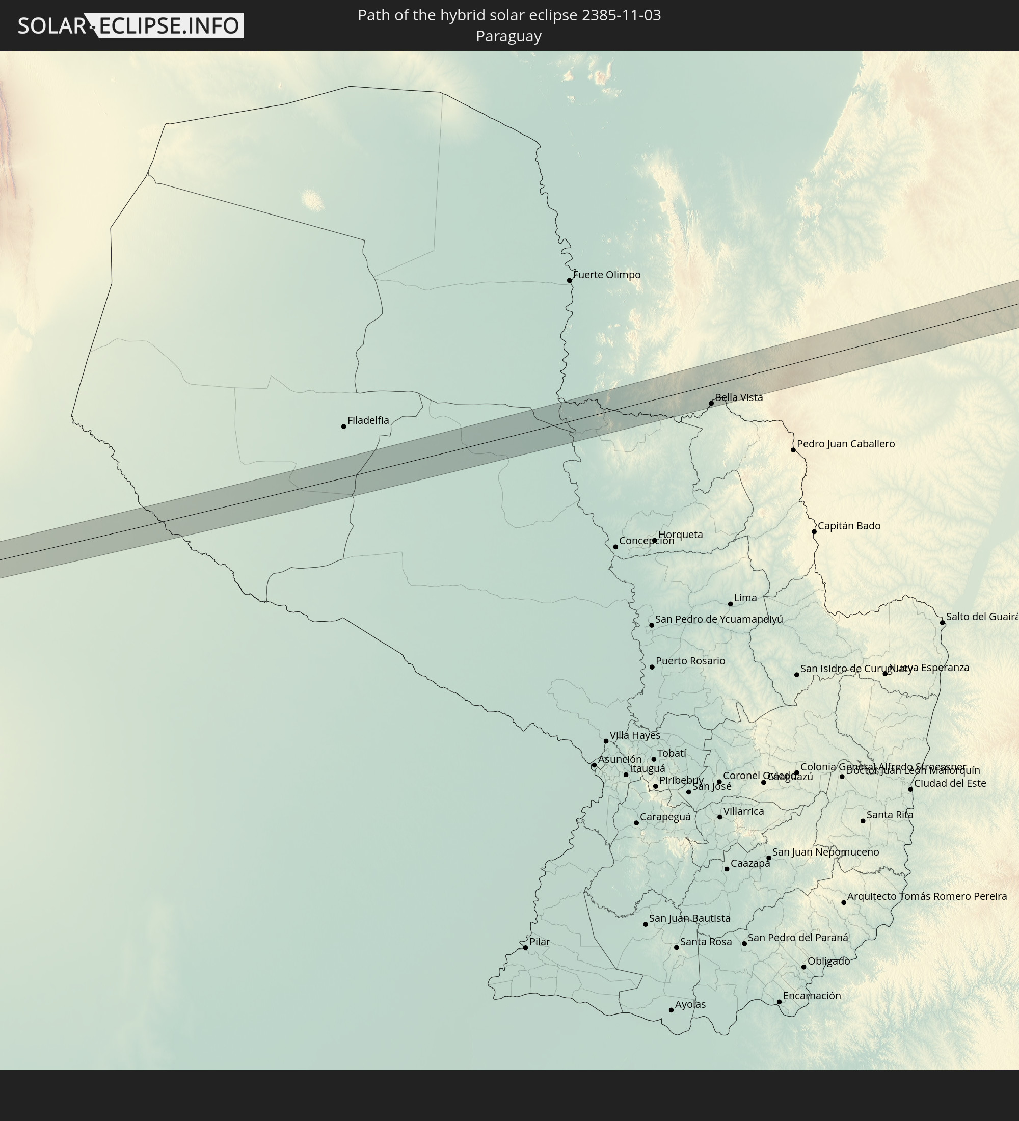 Paraguay
In den folgenden Ländern ist die Sonnenfinsternis partiell zu sehen
 Fiji
Fiji
 United States
 New Zealand
 United States Minor Outlying Islands
 Wallis and Futuna
 Tonga
Tonga
 Kiribati
 Samoa
Samoa
 Tokelau
 American Samoa
 Niue
Niue
 Cook Islands
 French Polynesia
 Pitcairn Islands
 Chile
Chile
 Ecuador
 Costa Rica
 Colombia
 Peru
Peru
 Brazil
 Argentina
 Venezuela
 Bolivia
 Paraguay
 Falkland Islands
 Guyana
 Uruguay
 Suriname
 French Guiana
 South Georgia and the South Sandwich Islands
 Tuvalu
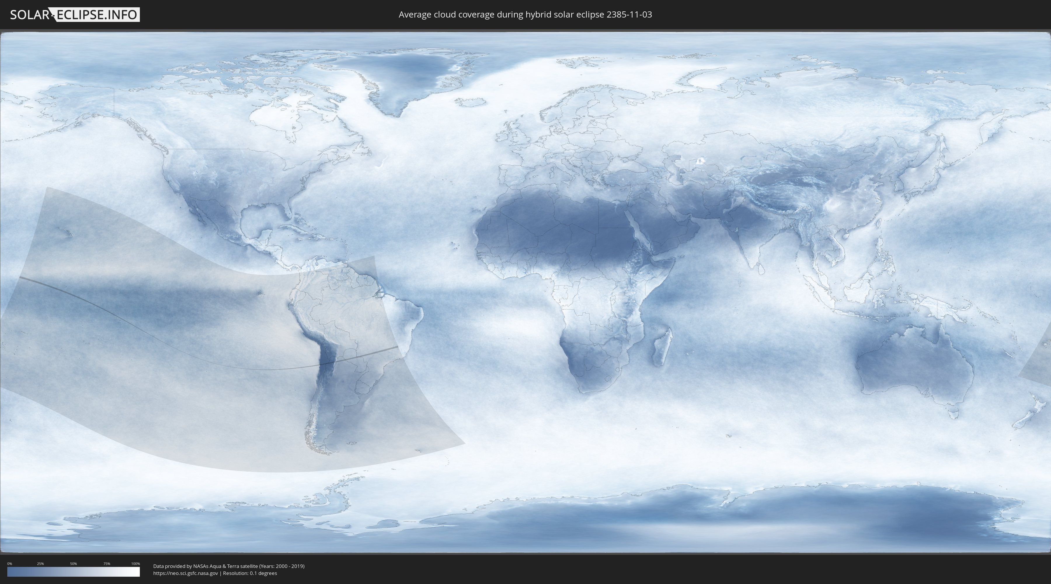
How will be the weather during the hybrid solar eclipse on 11/03/2385?
Where is the best place to see the hybrid solar eclipse of 11/03/2385?
The following maps show the average cloud coverage for the day of the hybrid solar eclipse.
With the help of these maps, it is possible to find the place along the eclipse path, which has the best
chance of a cloudless sky.
Nevertheless, you should consider local circumstances and inform about the weather of your chosen
observation site.
The data is provided by NASAs satellites
AQUA and TERRA.
The cloud maps are averaged over a period of 19 years (2000 - 2019).

Detailed country maps
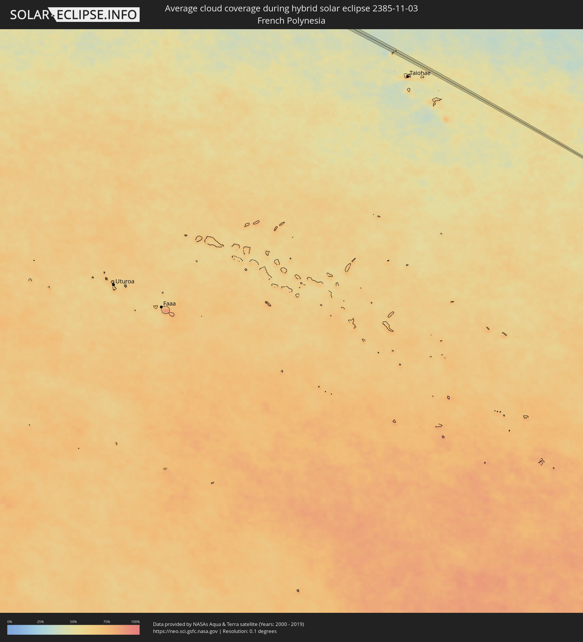 French Polynesia
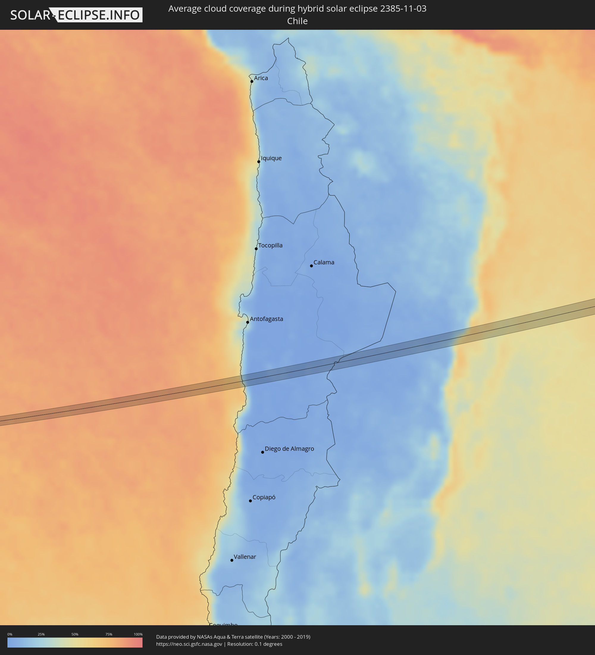 Chile
Chile
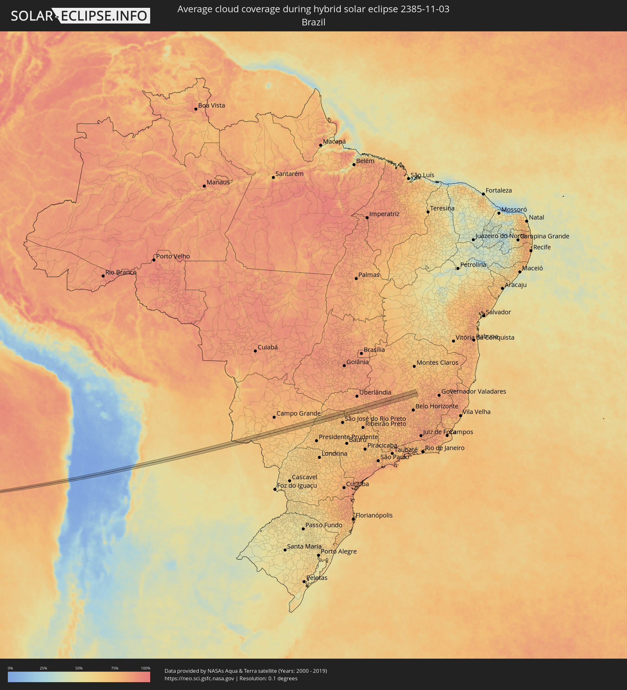 Brazil
 Argentina
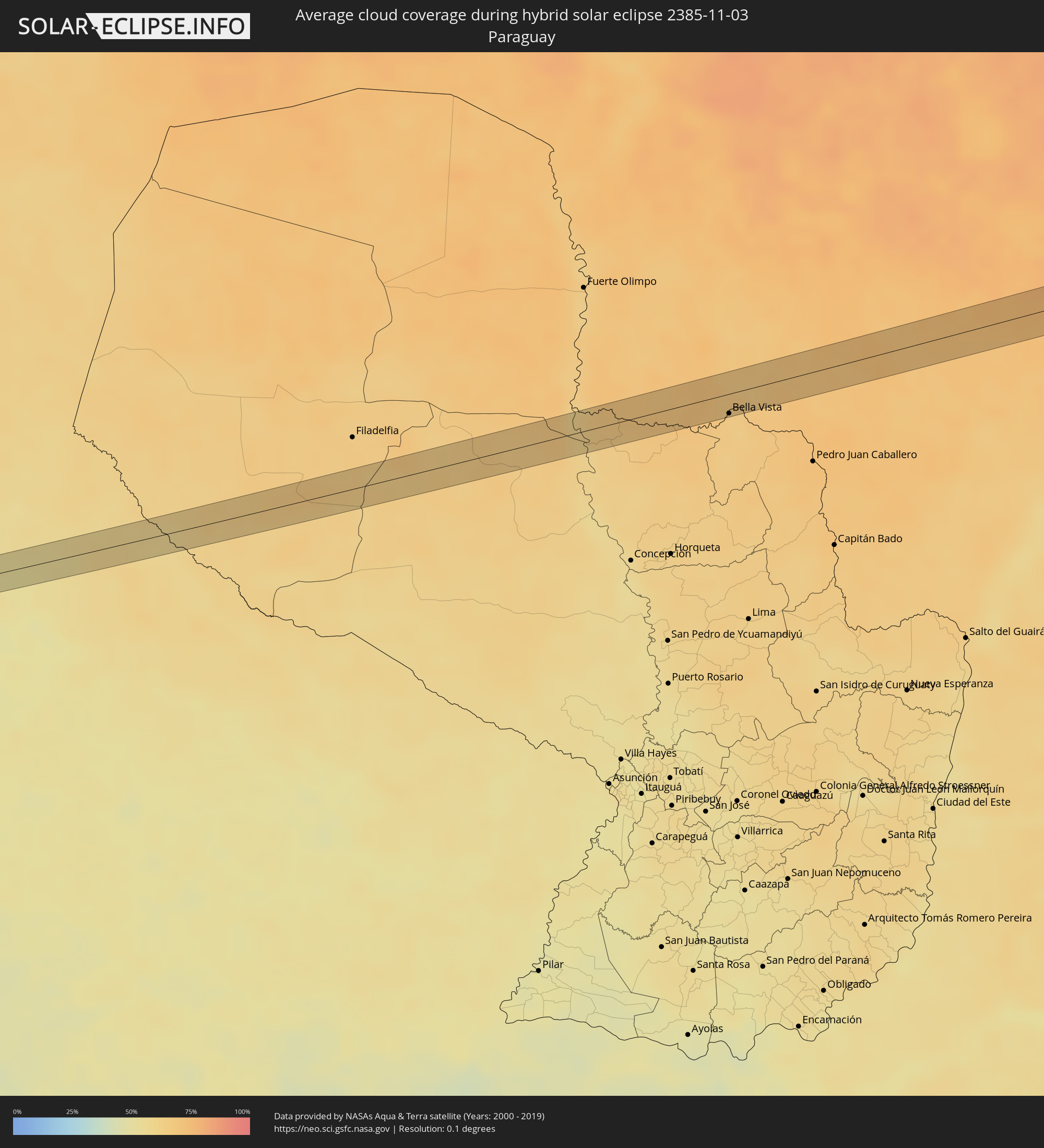 Paraguay
Cities inside the path of the eclipse
The following table shows all locations with a population of more than 5,000 inside the eclipse path. Cities which have more than 100,000 inhabitants are marked bold. A click at the locations opens a detailed map.
| City | Type | Eclipse duration | Local time of max. eclipse | Distance to central line | Ø Cloud coverage |
|
Fraile Pintado, Jujuy Province
|
annular | - | 17:50:57 UTC-03:00 | 14 km | 45% |
|
Libertador General San Martín, Jujuy Province
|
annular | - | 17:51:03 UTC-03:00 | 0 km | 47% |
|
Calilegua, Jujuy Province
|
annular | - | 17:51:05 UTC-03:00 | 3 km | 47% |
|
Caimancito, Jujuy Province
|
annular | - | 17:51:13 UTC-03:00 | 3 km | 48% |
|
Yuto, Jujuy Province
|
annular | - | 17:51:21 UTC-03:00 | 11 km | 49% |
|
Bela Vista, Mato Grosso do Sul
|
annular | - | 17:56:12 UTC-03:00 | 16 km | 65% |
|
Bella Vista, Amambay
|
annular | - | 17:56:11 UTC-03:00 | 18 km | 65% |
|
Maracaju, Mato Grosso do Sul
|
annular | - | 16:56:53 UTC-04:00 | 2 km | 71% |
|
Três Lagoas, Mato Grosso do Sul
|
annular | - | 16:58:03 UTC-04:00 | 2 km | 69% |
|
Castilho, São Paulo
|
annular | - | 17:58:03 UTC-03:00 | 17 km | 72% |
|
Andradina, São Paulo
|
annular | - | 17:58:03 UTC-03:00 | 23 km | 72% |
|
Pereira Barreto, São Paulo
|
annular | - | 17:58:13 UTC-03:00 | 3 km | 69% |
|
Auriflama, São Paulo
|
annular | - | 17:58:15 UTC-03:00 | 23 km | 71% |
|
Jales, São Paulo
|
annular | - | 17:58:28 UTC-03:00 | 21 km | 77% |
|
Fernandópolis, São Paulo
|
annular | - | 17:58:29 UTC-03:00 | 11 km | 76% |
|
Votuporanga, São Paulo
|
annular | - | 17:58:27 UTC-03:00 | 11 km | 75% |
|
Cardoso, São Paulo
|
annular | - | 17:58:37 UTC-03:00 | 24 km | 75% |
|
Frutal, Minas Gerais
|
annular | - | 17:58:43 UTC-03:00 | 2 km | 77% |
|
Conceição das Alagoas, Minas Gerais
|
annular | - | 17:58:47 UTC-03:00 | 2 km | 78% |
|
Uberaba, Minas Gerais
|
annular | - | 17:58:53 UTC-03:00 | 3 km | 78% |
|
Sacramento, Minas Gerais
|
annular | - | 17:58:49 UTC-03:00 | 23 km | 79% |
|
Araxá, Minas Gerais
|
annular | - | 17:58:57 UTC-03:00 | 9 km | 80% |
|
Ibiá, Minas Gerais
|
annular | - | 17:59:00 UTC-03:00 | 8 km | 82% |
|
São Gotardo, Minas Gerais
|
annular | - | 17:59:03 UTC-03:00 | 4 km | 86% |
|
Abaeté, Minas Gerais
|
annular | - | 17:59:05 UTC-03:00 | 5 km | 82% |
|
Pompéu, Minas Gerais
|
annular | - | 17:59:01 UTC-03:00 | 27 km | 82% |
|
Curvelo, Minas Gerais
|
annular | - | 17:59:11 UTC-03:00 | 8 km | 77% |