Annular solar eclipse of 11/15/2449
| Day of week: | Monday |
| Maximum duration of eclipse: | 07m35s |
| Maximum width of eclipse path: | 0 km |
| Saros cycle: | 140 |
| Coverage: | 91.9% |
| Magnitude: | 0.9186 |
| Gamma: | 0.981 |
Wo kann man die Sonnenfinsternis vom 11/15/2449 sehen?
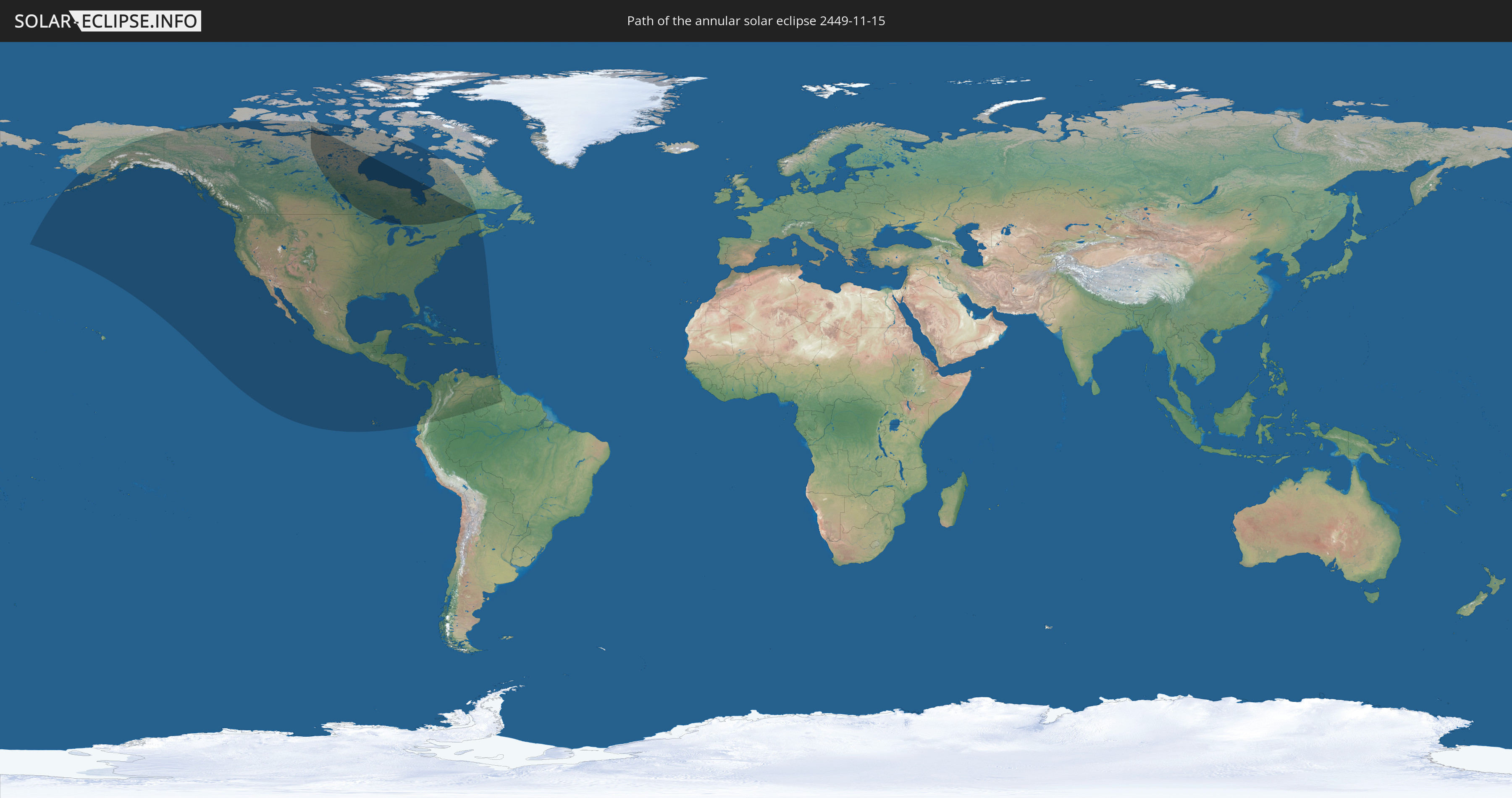
Die Sonnenfinsternis am 11/15/2449 kann man in 35 Ländern als partielle Sonnenfinsternis beobachten.
Der Finsternispfad verläuft durch 3 Länder. Nur in diesen Ländern ist sie als annular Sonnenfinsternis zu sehen.
In den folgenden Ländern ist die Sonnenfinsternis annular zu sehen
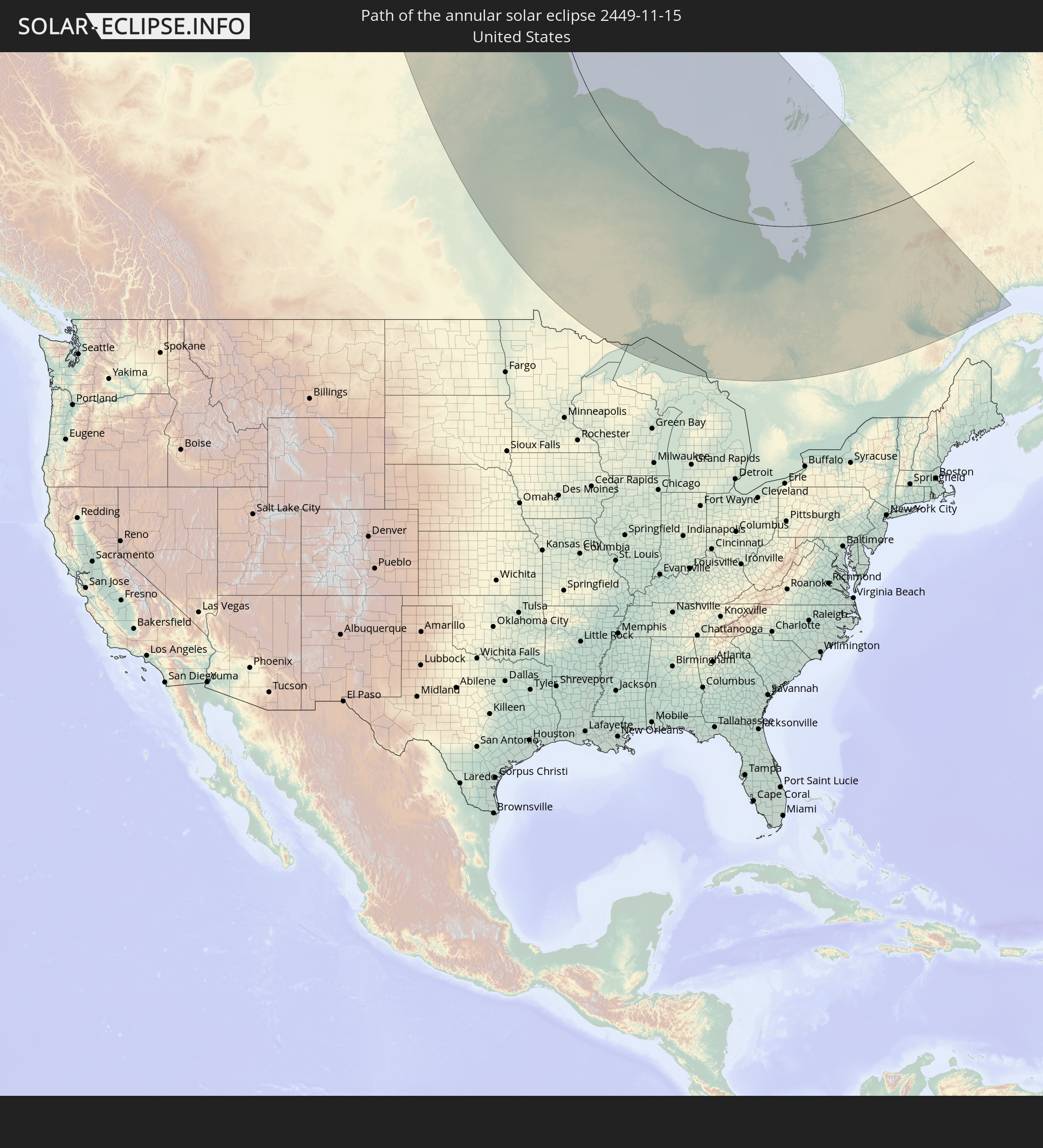 United States
 Canada
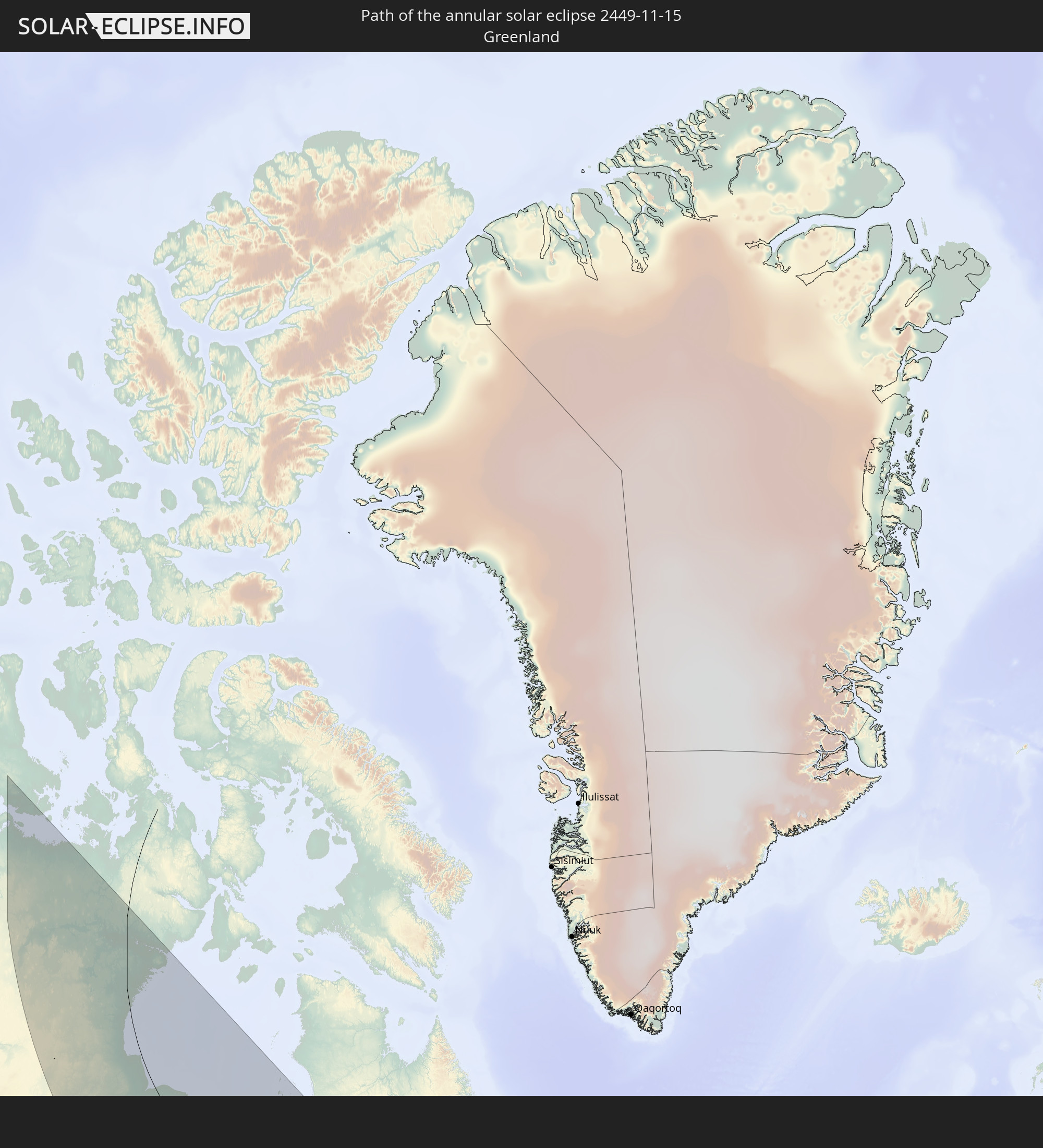 Greenland
In den folgenden Ländern ist die Sonnenfinsternis partiell zu sehen
 United States
 United States Minor Outlying Islands
 Canada
 Mexico
 Greenland
 Guatemala
 Ecuador
 El Salvador
 Honduras
 Belize
 Nicaragua
 Costa Rica
 Cuba
Cuba
 Panama
 Colombia
 Cayman Islands
 The Bahamas
 Jamaica
 Haiti
Haiti
 Brazil
 Venezuela
 Turks and Caicos Islands
 Dominican Republic
 Aruba
Aruba
 Puerto Rico
 United States Virgin Islands
 Bermuda
 British Virgin Islands
 Anguilla
 Collectivity of Saint Martin
 Saint Barthélemy
 Saint Kitts and Nevis
 Trinidad and Tobago
 Grenada
 Guyana
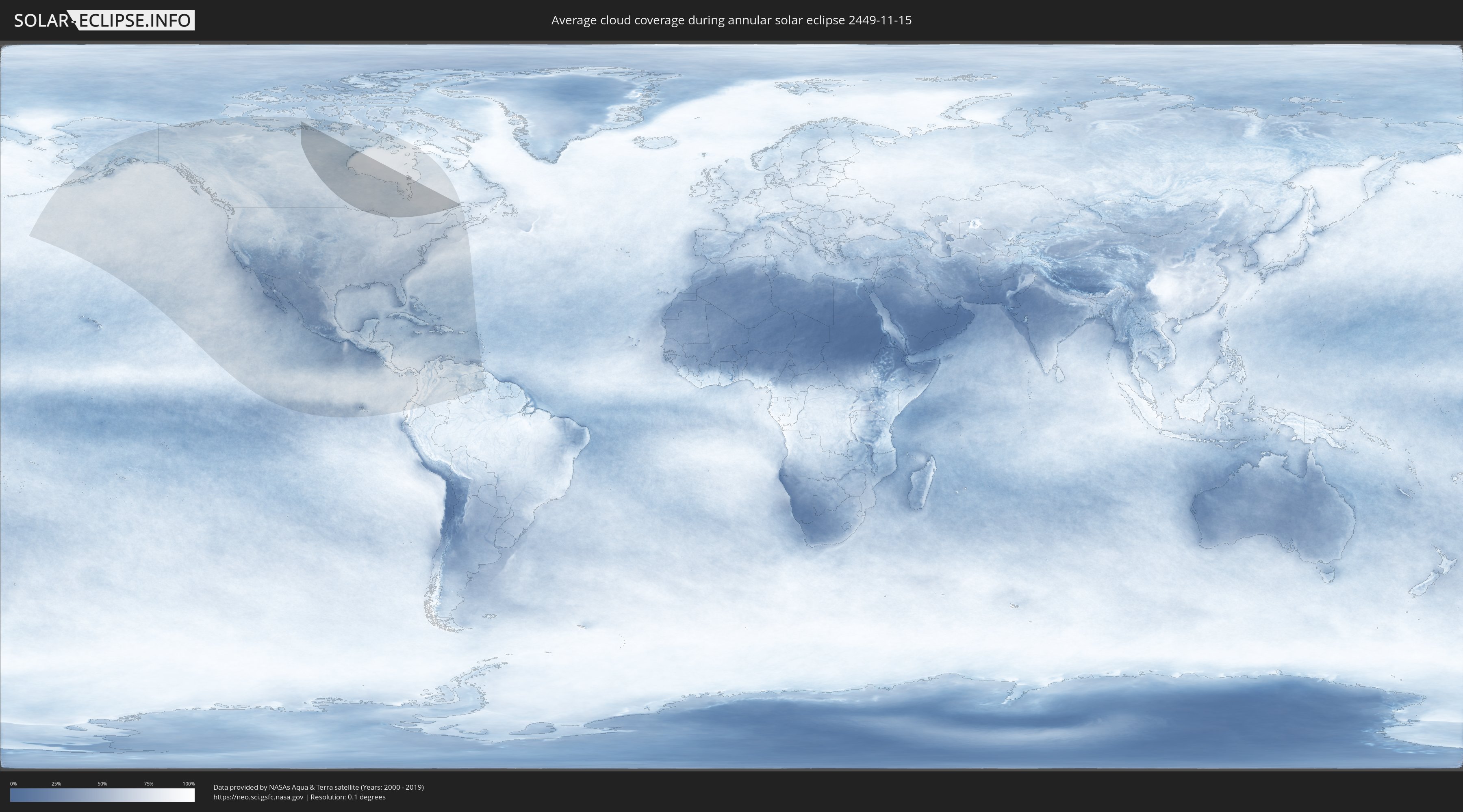
How will be the weather during the annular solar eclipse on 11/15/2449?
Where is the best place to see the annular solar eclipse of 11/15/2449?
The following maps show the average cloud coverage for the day of the annular solar eclipse.
With the help of these maps, it is possible to find the place along the eclipse path, which has the best
chance of a cloudless sky.
Nevertheless, you should consider local circumstances and inform about the weather of your chosen
observation site.
The data is provided by NASAs satellites
AQUA and TERRA.
The cloud maps are averaged over a period of 19 years (2000 - 2019).

Detailed country maps
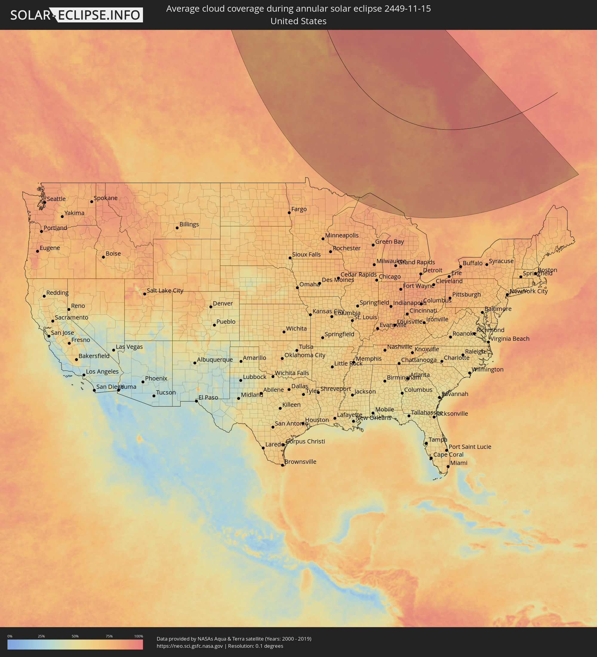 United States
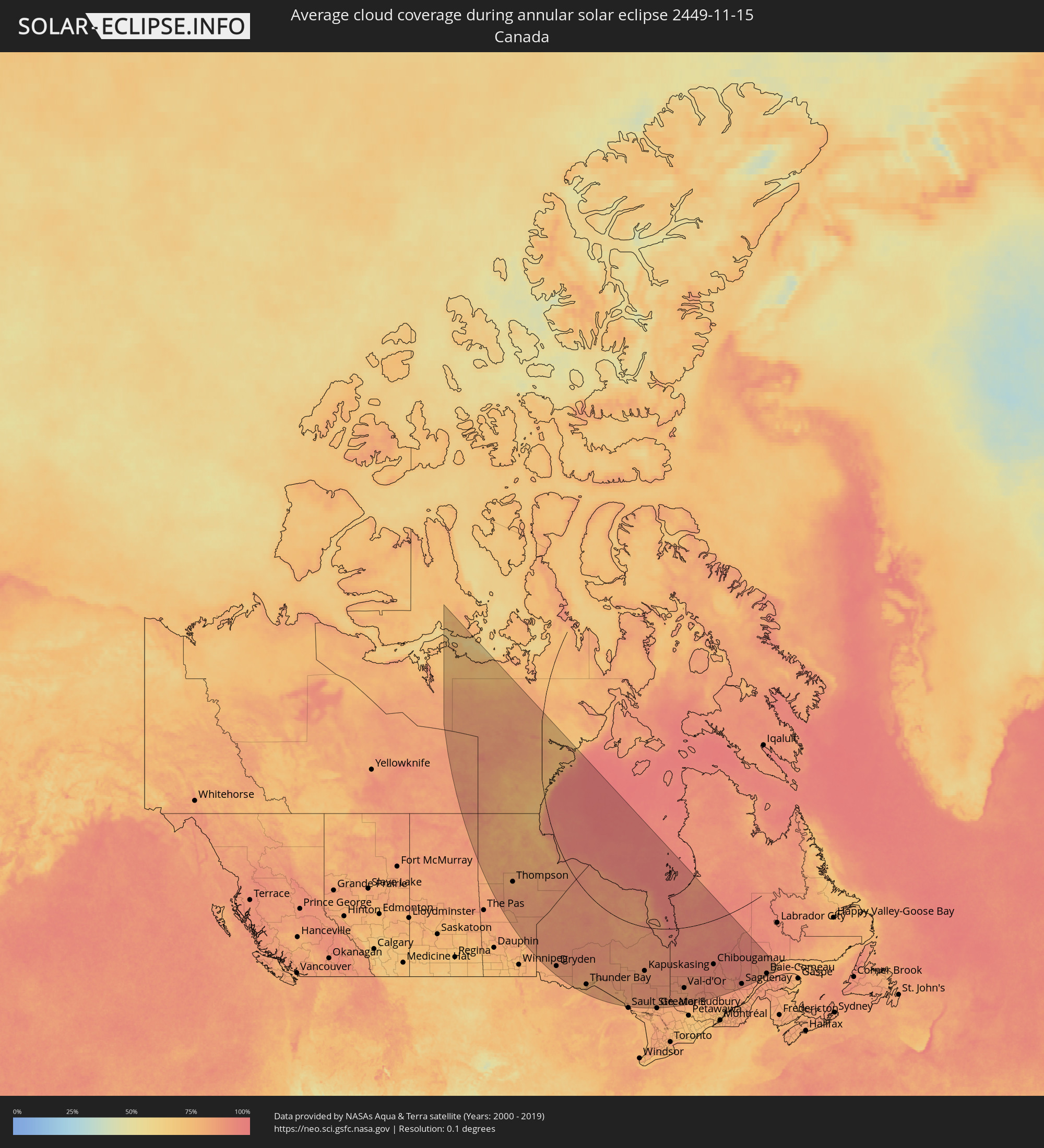 Canada
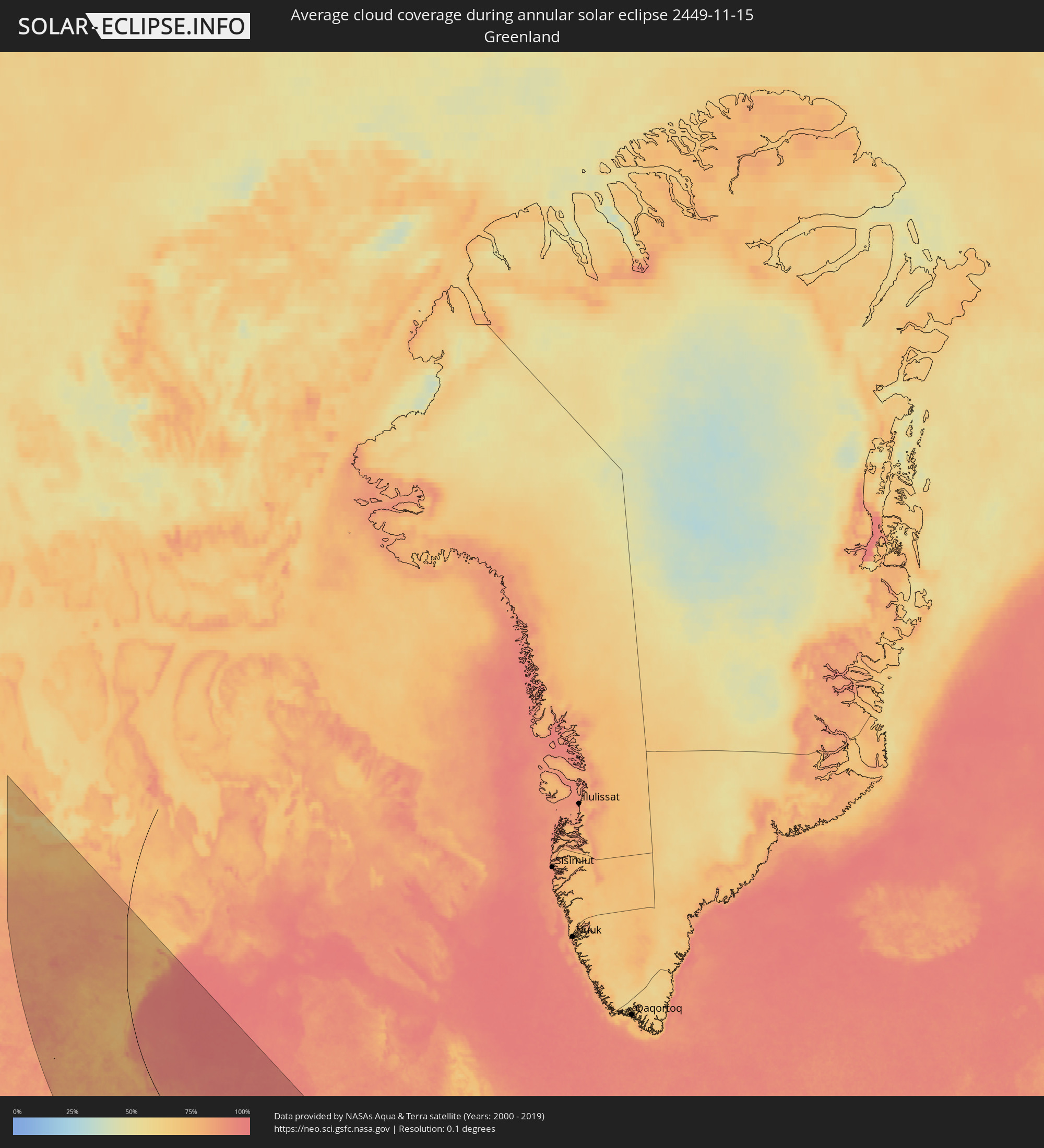 Greenland
Cities inside the path of the eclipse
The following table shows all locations with a population of more than 5,000 inside the eclipse path. Cities which have more than 100,000 inhabitants are marked bold. A click at the locations opens a detailed map.
| City | Type | Eclipse duration | Local time of max. eclipse | Distance to central line | Ø Cloud coverage |
|
Thompson, Manitoba
|
annular | - | 13:50:12 UTC-06:00 | 401 km | 79% |
|
Dryden, Ontario
|
annular | - | 14:05:56 UTC-06:00 | 597 km | 85% |
|
Thunder Bay, Ontario
|
annular | - | 15:13:34 UTC-05:00 | 607 km | 78% |
|
Kapuskasing, Ontario
|
annular | - | 15:21:15 UTC-05:00 | 356 km | 85% |
|
Timmins, Ontario
|
annular | - | 15:24:24 UTC-05:00 | 454 km | 88% |
|
Rayside-Balfour, Ontario
|
annular | - | 15:28:02 UTC-05:00 | 660 km | 82% |
|
Kirkland Lake, Ontario
|
annular | - | 15:26:36 UTC-05:00 | 486 km | 87% |
|
Temiskaming Shores, Ontario
|
annular | - | 15:28:14 UTC-05:00 | 559 km | 85% |
|
La Sarre, Quebec
|
annular | - | 15:26:22 UTC-05:00 | 414 km | 87% |
|
Rouyn-Noranda, Quebec
|
annular | - | 15:27:39 UTC-05:00 | 477 km | 89% |
|
Amos, Quebec
|
annular | - | 15:28:04 UTC-05:00 | 445 km | 88% |
|
Val-d'Or, Quebec
|
annular | - | 15:29:20 UTC-05:00 | 499 km | 85% |
|
Chibougamau, Quebec
|
annular | - | 15:29:28 UTC-05:00 | 343 km | 93% |
|
Saint-Félicien, Quebec
|
annular | - | 15:33:49 UTC-05:00 | 517 km | 90% |
|
Roberval, Quebec
|
annular | - | 15:34:17 UTC-05:00 | 535 km | 88% |
|
Dolbeau-Mistassini, Quebec
|
annular | - | 15:33:34 UTC-05:00 | 497 km | 90% |
|
Pont Rouge, Quebec
|
annular | - | 15:33:42 UTC-05:00 | 500 km | 90% |
|
Alma, Quebec
|
annular | - | 15:34:45 UTC-05:00 | 545 km | 93% |
|
Jonquière, Quebec
|
annular | - | 15:35:23 UTC-05:00 | 568 km | 91% |
|
Saguenay, Quebec
|
annular | - | 15:35:33 UTC-05:00 | 573 km | 90% |
|
Baie-Comeau, Quebec
|
annular | - | 15:36:24 UTC-05:00 | 569 km | 83% |