Annular solar eclipse of 12/01/2635
| Day of week: | Tuesday |
| Maximum duration of eclipse: | 07m47s |
| Maximum width of eclipse path: | 272 km |
| Saros cycle: | 162 |
| Coverage: | 93% |
| Magnitude: | 0.9302 |
| Gamma: | -0.2774 |
Wo kann man die Sonnenfinsternis vom 12/01/2635 sehen?

Die Sonnenfinsternis am 12/01/2635 kann man in 20 Ländern als partielle Sonnenfinsternis beobachten.
Der Finsternispfad verläuft durch 5 Länder. Nur in diesen Ländern ist sie als annular Sonnenfinsternis zu sehen.
In den folgenden Ländern ist die Sonnenfinsternis annular zu sehen
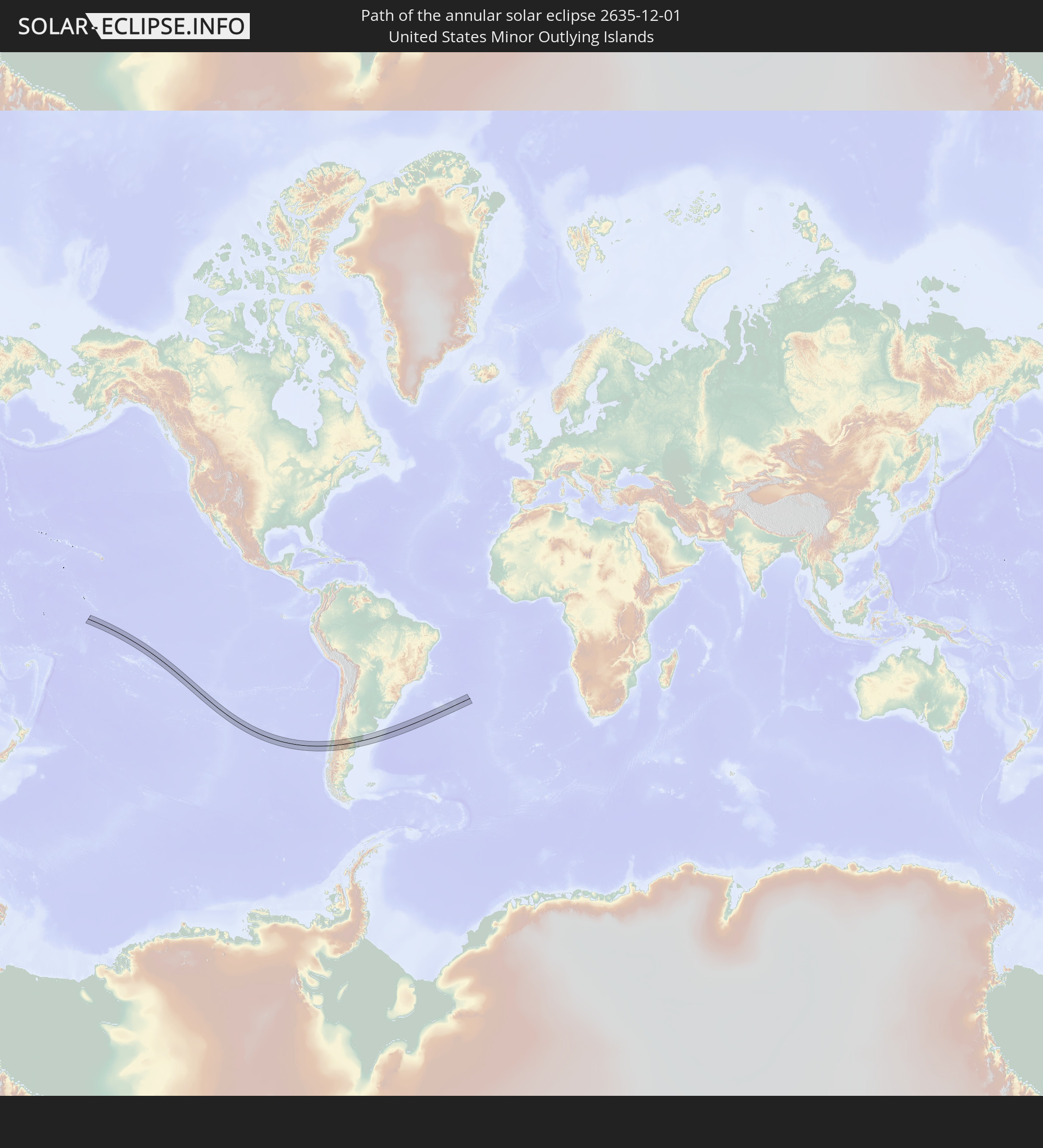 United States Minor Outlying Islands
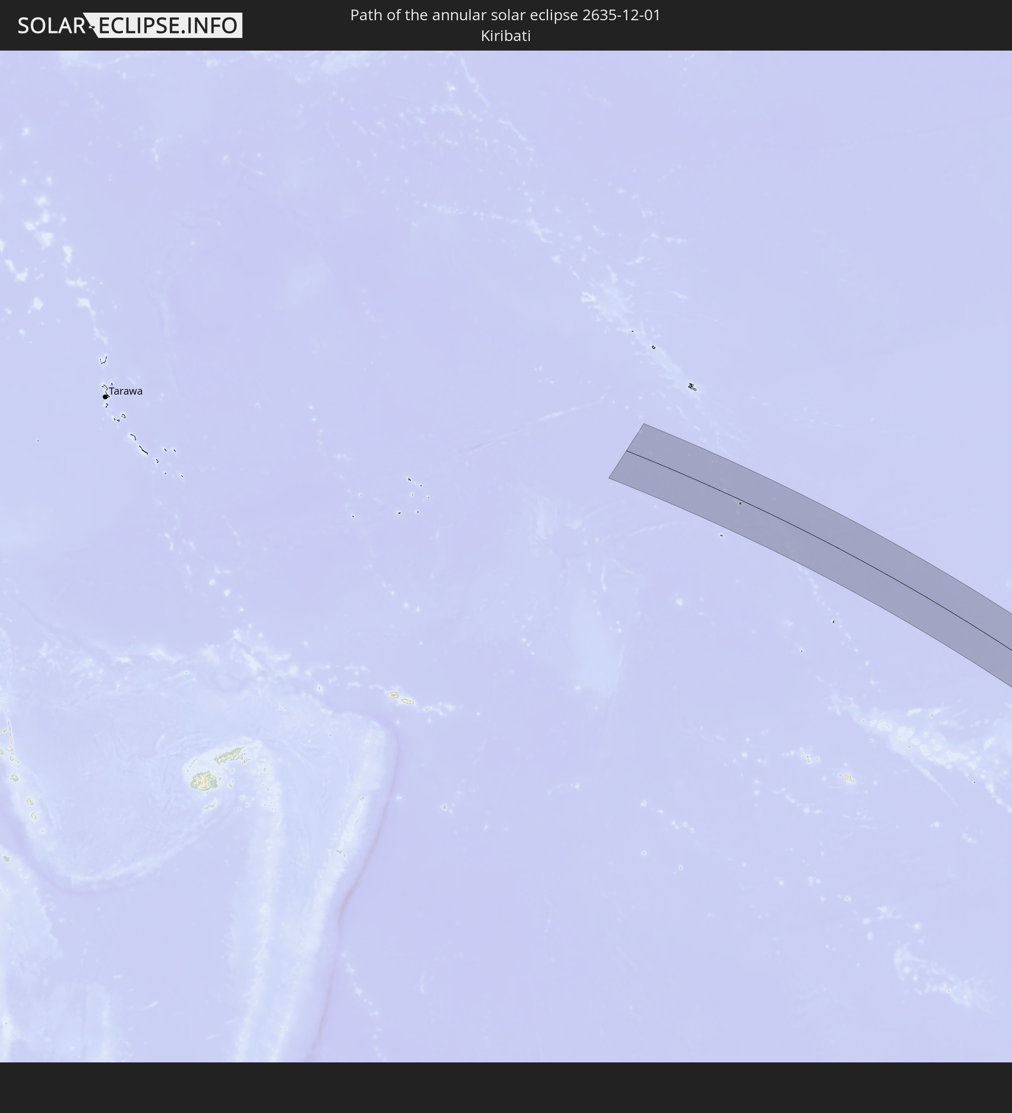 Kiribati
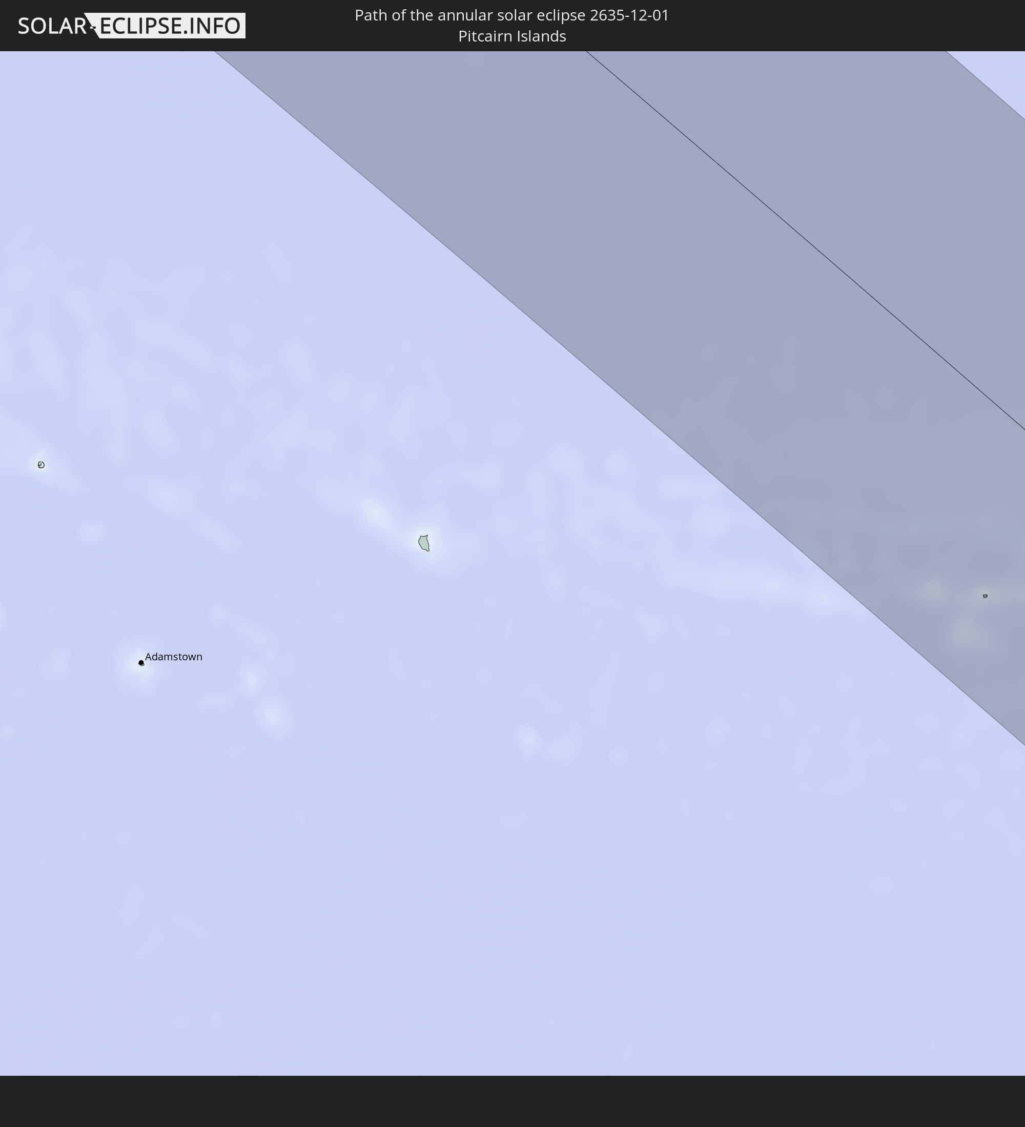 Pitcairn Islands
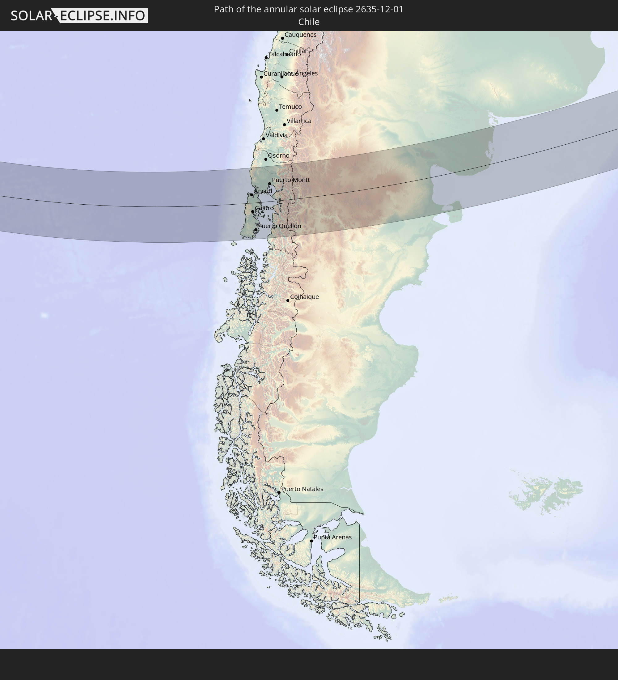 Chile
Chile
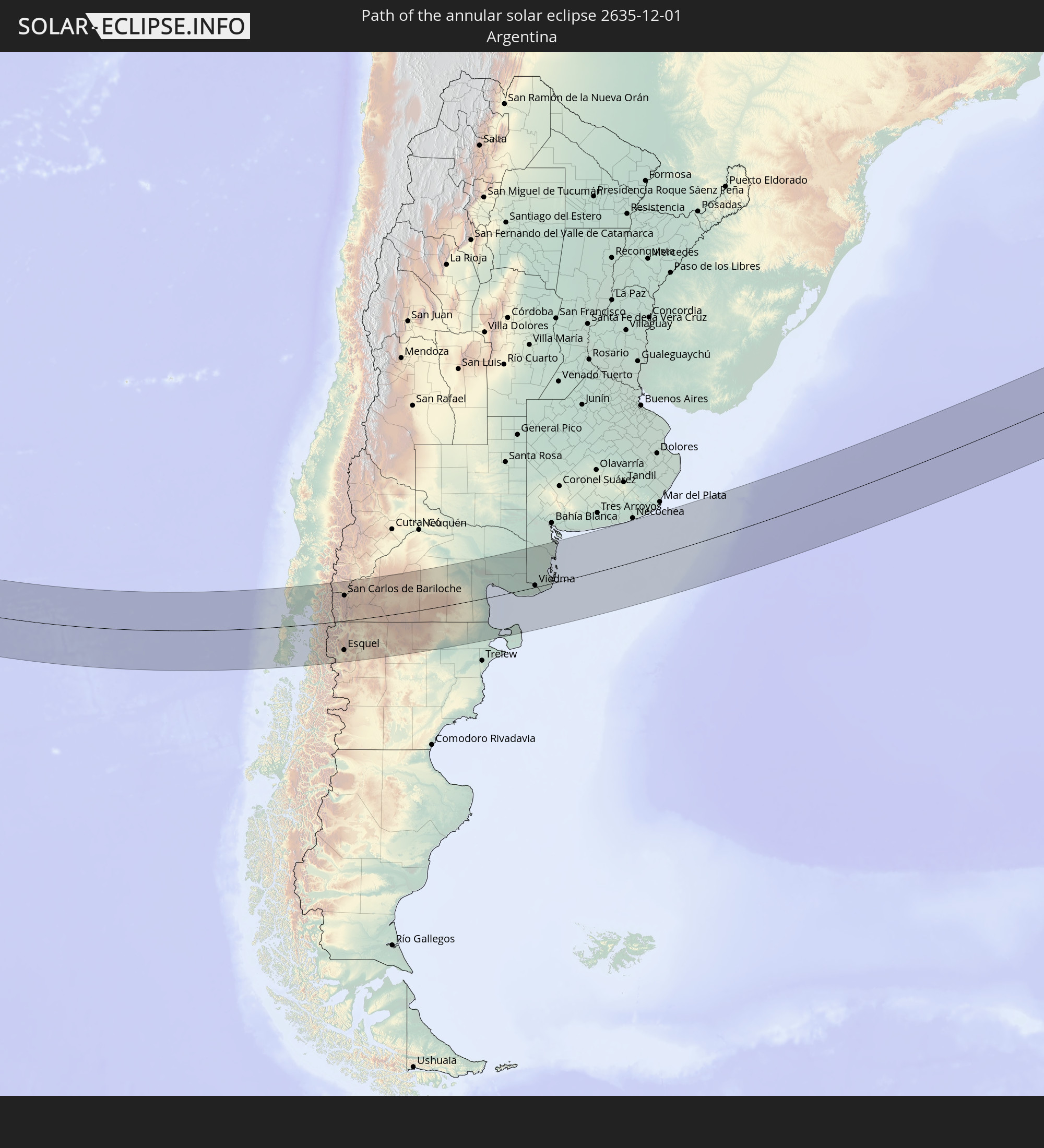 Argentina
In den folgenden Ländern ist die Sonnenfinsternis partiell zu sehen


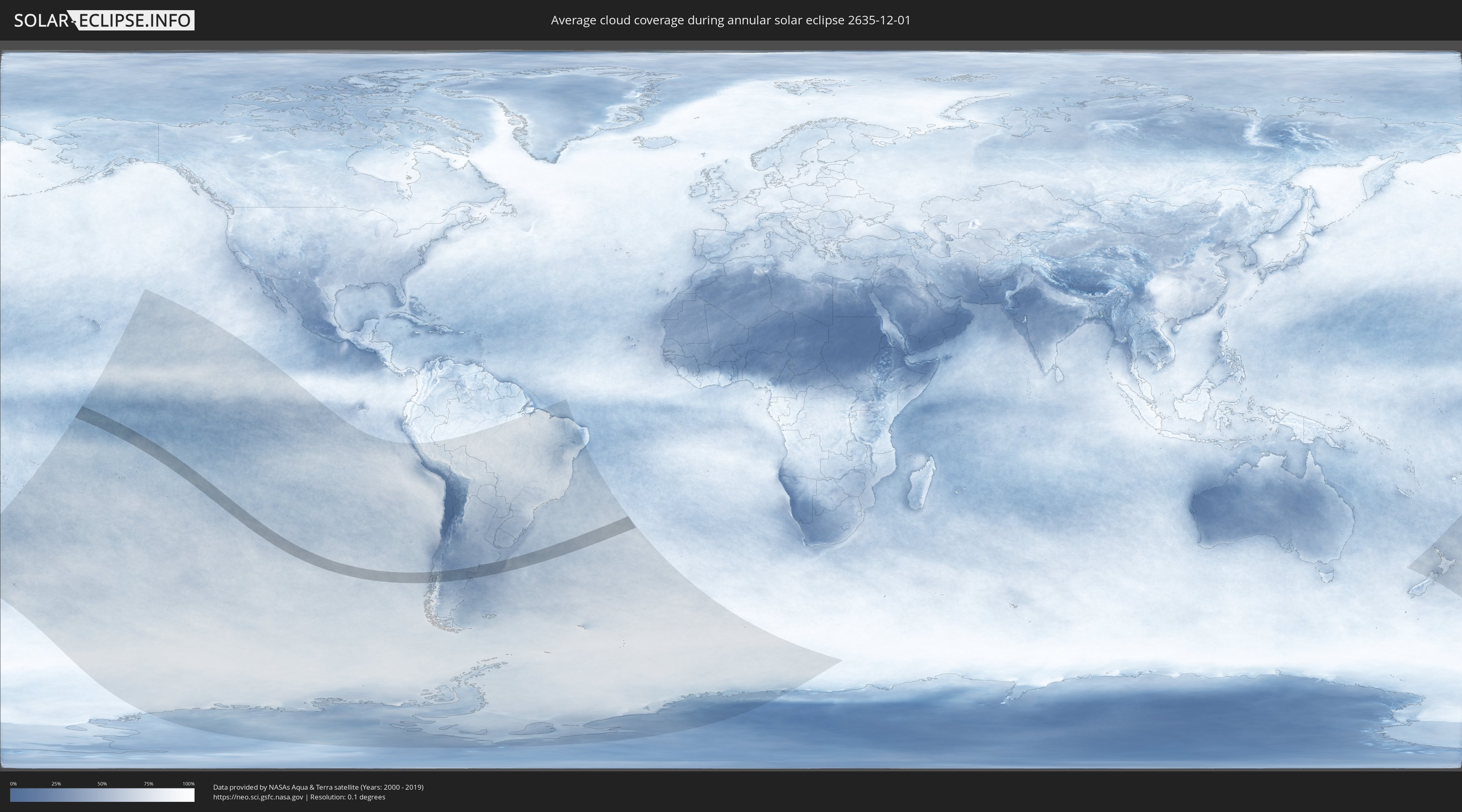
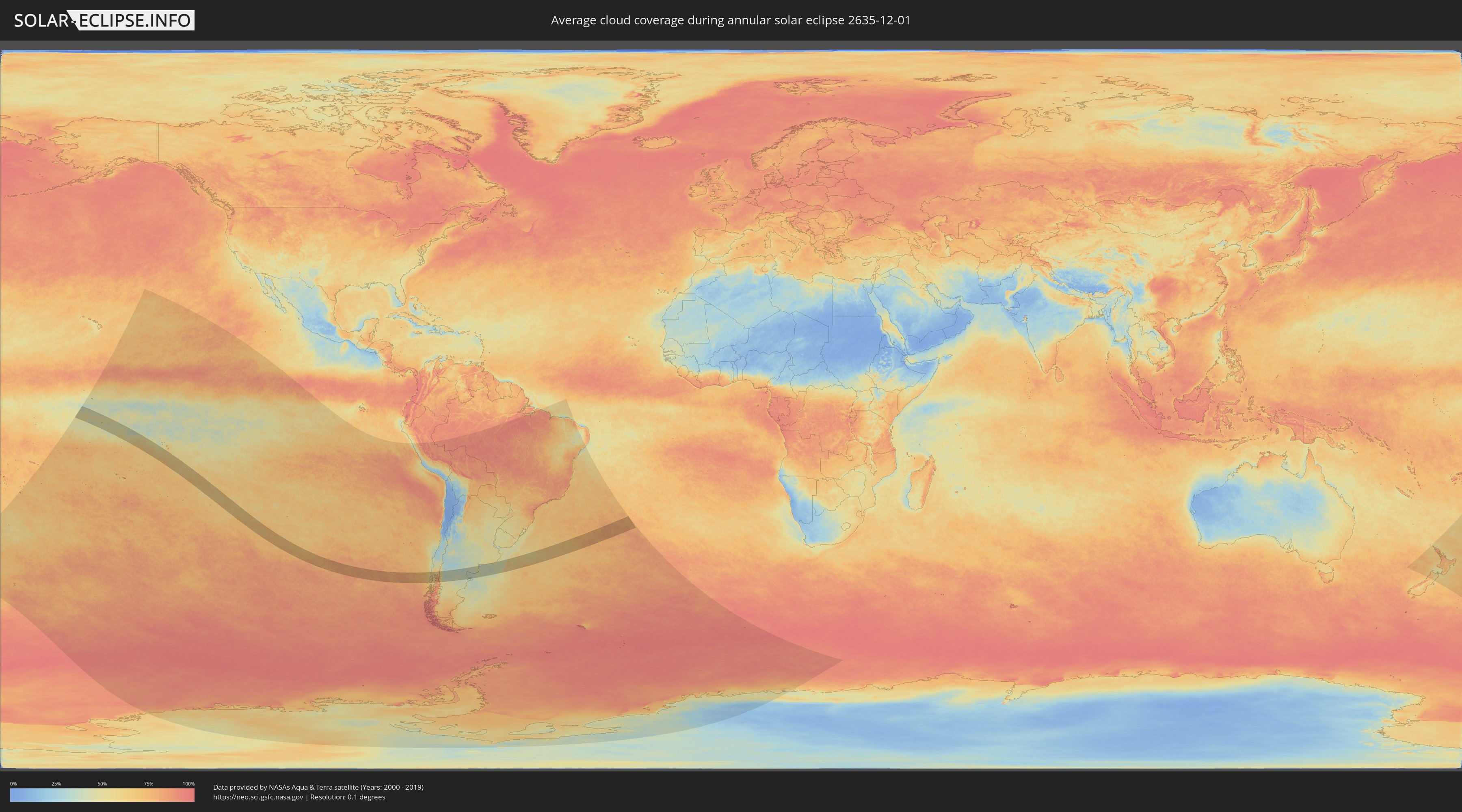
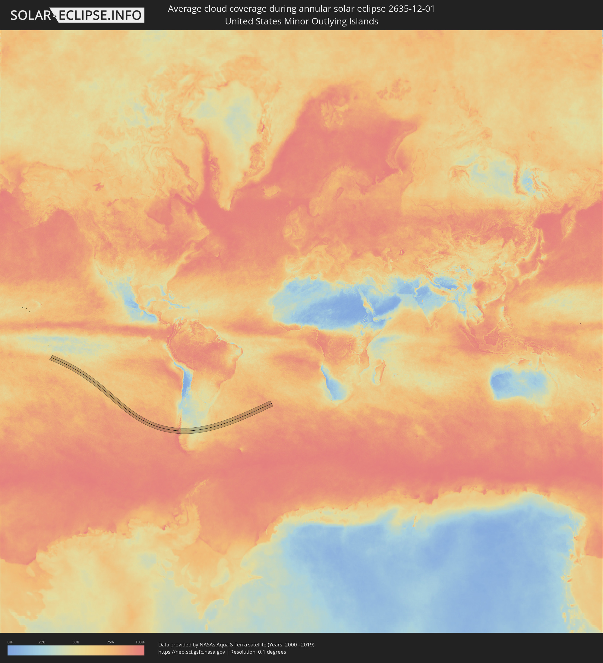
How will be the weather during the annular solar eclipse on 12/01/2635?
Where is the best place to see the annular solar eclipse of 12/01/2635?
The following maps show the average cloud coverage for the day of the annular solar eclipse.
With the help of these maps, it is possible to find the place along the eclipse path, which has the best
chance of a cloudless sky.
Nevertheless, you should consider local circumstances and inform about the weather of your chosen
observation site.
The data is provided by NASAs satellites
AQUA and TERRA.
The cloud maps are averaged over a period of 19 years (2000 - 2019).
Detailed country maps
 United States Minor Outlying Islands
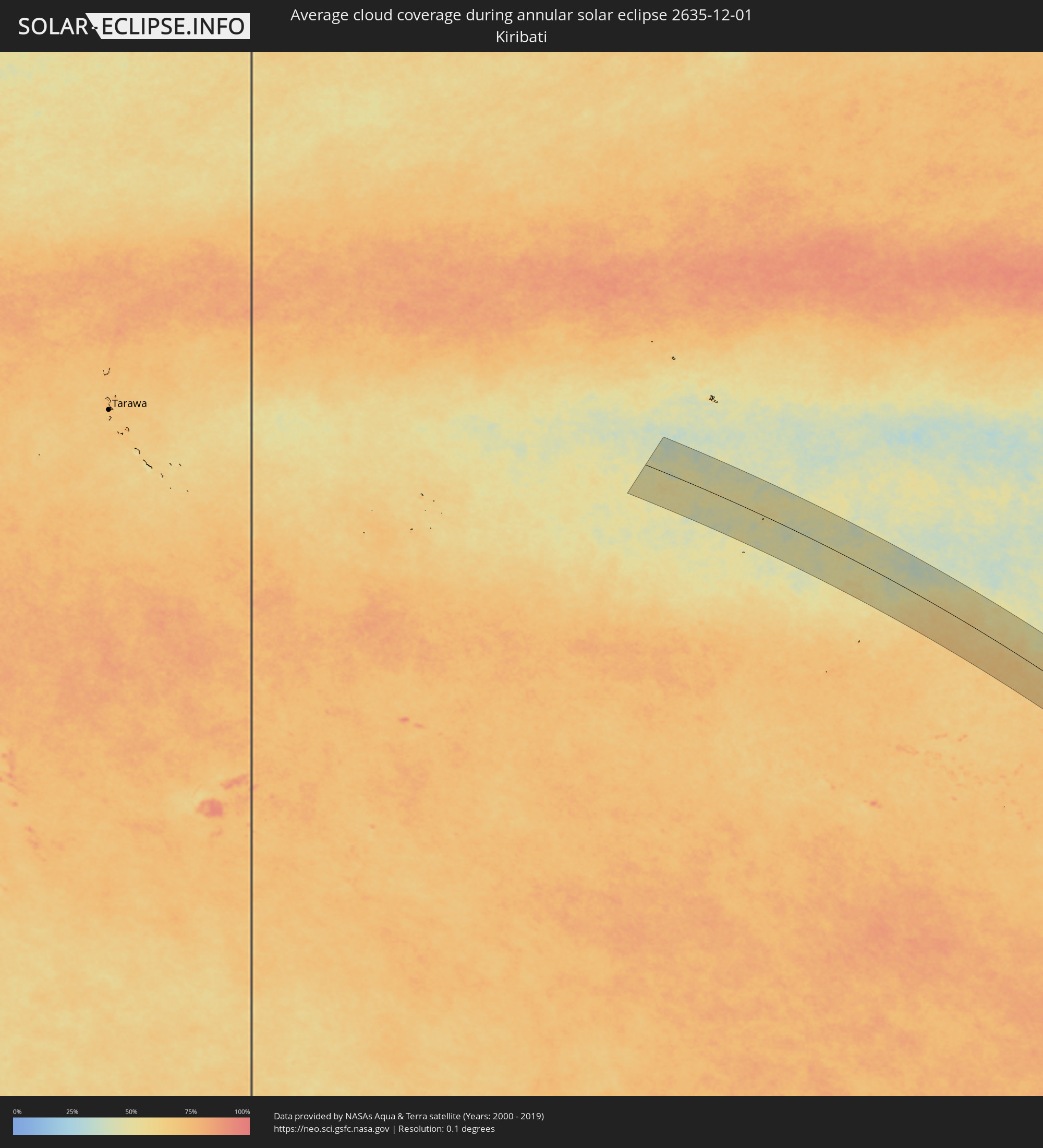 Kiribati
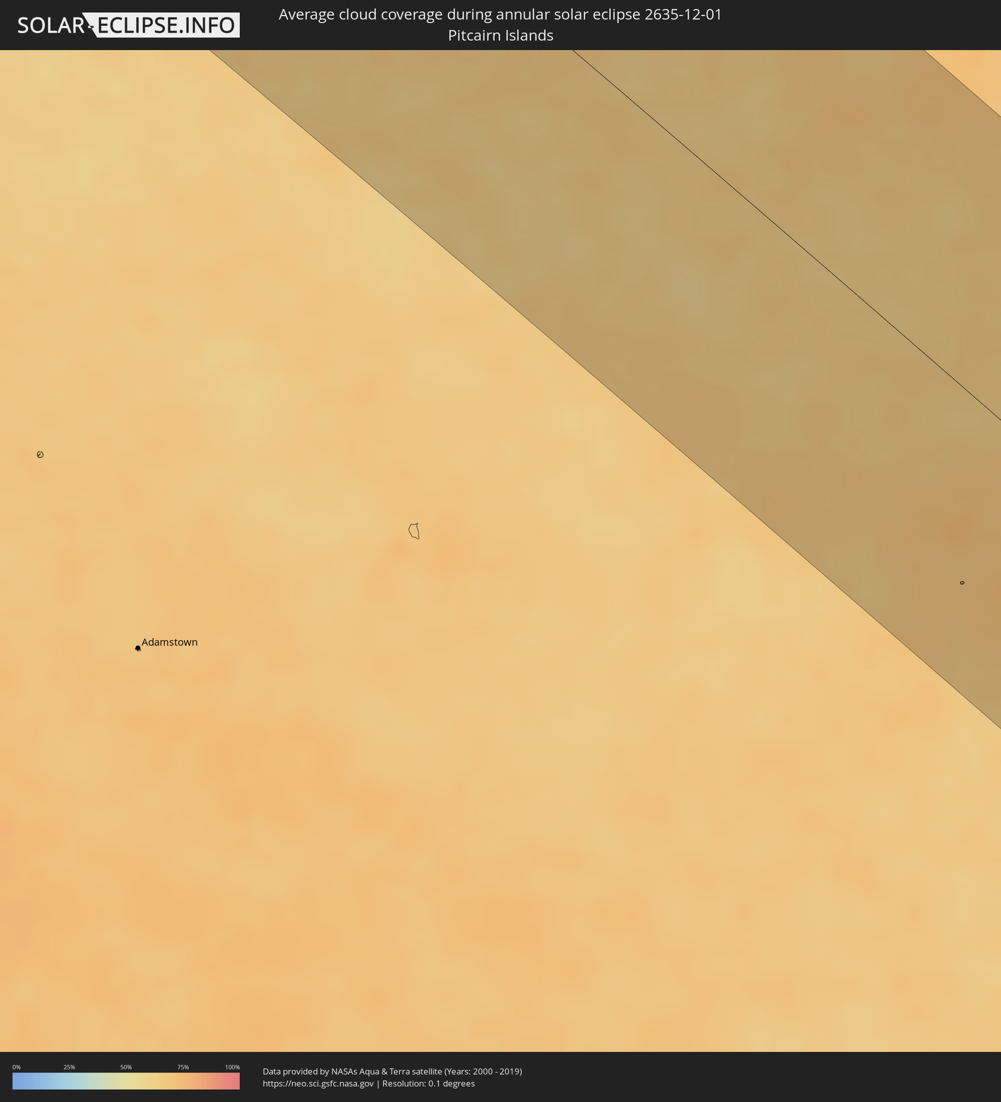 Pitcairn Islands
 Chile
Chile
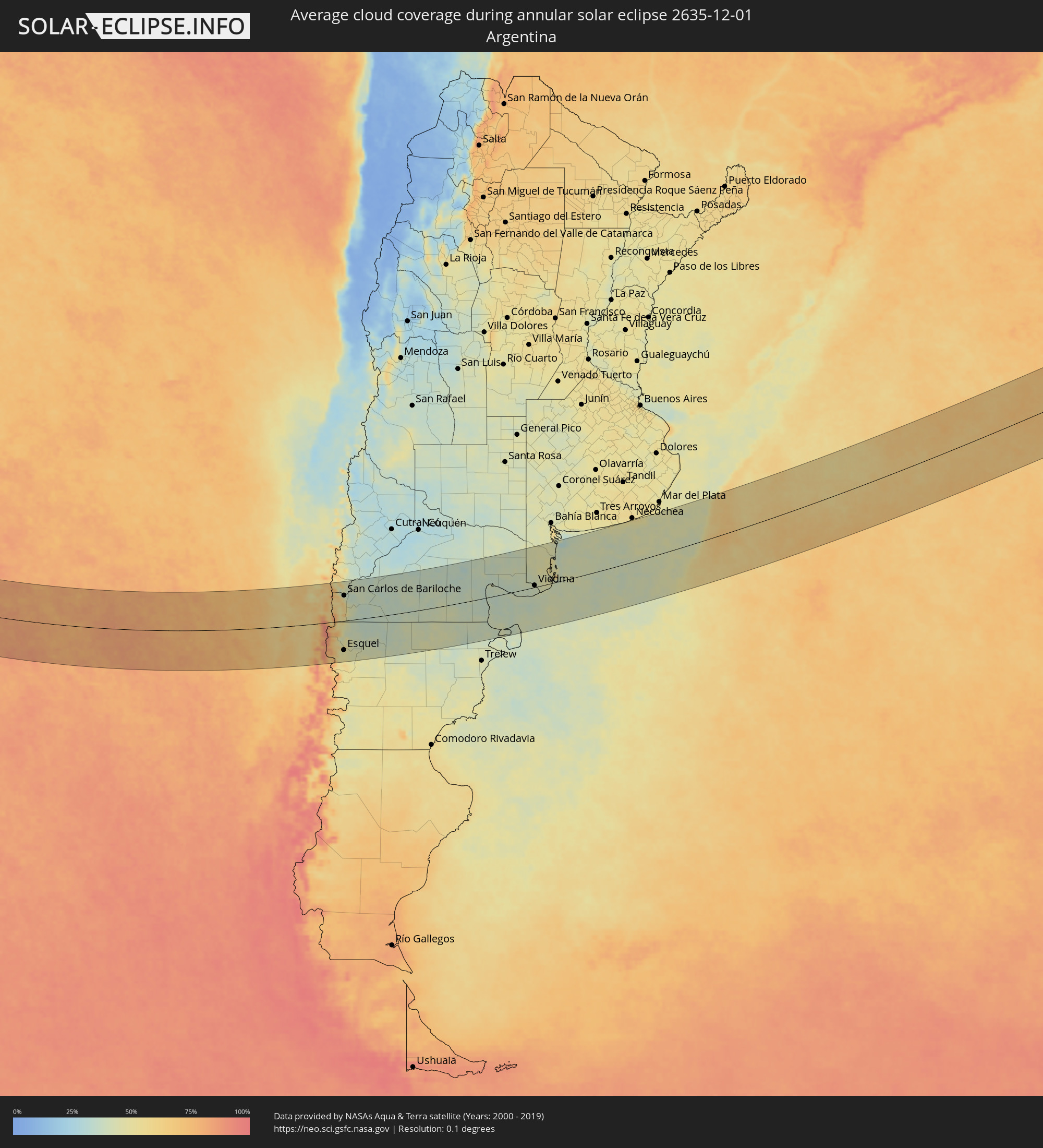 Argentina
Cities inside the path of the eclipse
The following table shows all locations with a population of more than 5,000 inside the eclipse path. Cities which have more than 100,000 inhabitants are marked bold. A click at the locations opens a detailed map.
| City | Type | Eclipse duration | Local time of max. eclipse | Distance to central line | Ø Cloud coverage |
 Ancud, Los Lagos
|
annular | - | 16:30:54 UTC-03:00 | 31 km | 62% |
|
Chonchi, Los Lagos
|
annular | - | 16:30:27 UTC-03:00 | 52 km | 65% |
|
Castro, Los Lagos
|
annular | - | 16:30:33 UTC-03:00 | 36 km | 63% |
|
Puerto Quellón, Los Lagos
|
annular | - | 16:30:21 UTC-03:00 | 109 km | 65% |
|
Purranque, Los Lagos
|
annular | - | 16:32:43 UTC-03:00 | 133 km | 65% |
|
Calbuco, Los Lagos
|
annular | - | 16:32:08 UTC-03:00 | 37 km | 63% |
|
Frutillar, Los Lagos
|
annular | - | 16:32:45 UTC-03:00 | 108 km | 59% |
|
Puerto Varas, Los Lagos
|
annular | - | 16:32:43 UTC-03:00 | 86 km | 65% |
|
Puerto Montt, Los Lagos
|
annular | - | 16:32:40 UTC-03:00 | 70 km | 63% |
 Villa La Angostura, Neuquén Province
|
annular | - | 16:35:23 UTC-03:00 | 137 km | 45% |
|
El Bolsón, Río Negro Province
|
annular | - | 16:34:37 UTC-03:00 | 3 km | 51% |
|
Trevelin, Chubut Province
|
annular | - | 16:33:49 UTC-03:00 | 122 km | 50% |
|
Esquel, Chubut Province
|
annular | - | 16:34:11 UTC-03:00 | 104 km | 49% |
|
San Carlos de Bariloche, Río Negro Province
|
annular | - | 16:35:38 UTC-03:00 | 91 km | 37% |
|
Ingeniero Jacobacci, Río Negro Province
|
annular | - | 16:38:15 UTC-03:00 | 52 km | 37% |
|
Sierra Grande, Río Negro Province
|
annular | - | 16:43:55 UTC-03:00 | 38 km | 35% |
|
San Antonio Oeste, Río Negro Province
|
annular | - | 16:45:20 UTC-03:00 | 51 km | 44% |
|
General Conesa, Río Negro Province
|
annular | - | 16:46:39 UTC-03:00 | 110 km | 39% |
|
Viedma, Río Negro Province
|
annular | - | 16:47:41 UTC-03:00 | 6 km | 41% |