Total solar eclipse of 03/18/2732
| Day of week: | Friday |
| Maximum duration of eclipse: | 04m15s |
| Maximum width of eclipse path: | 200 km |
| Saros cycle: | 151 |
| Coverage: | 100% |
| Magnitude: | 1.0544 |
| Gamma: | -0.4552 |
Wo kann man die Sonnenfinsternis vom 03/18/2732 sehen?
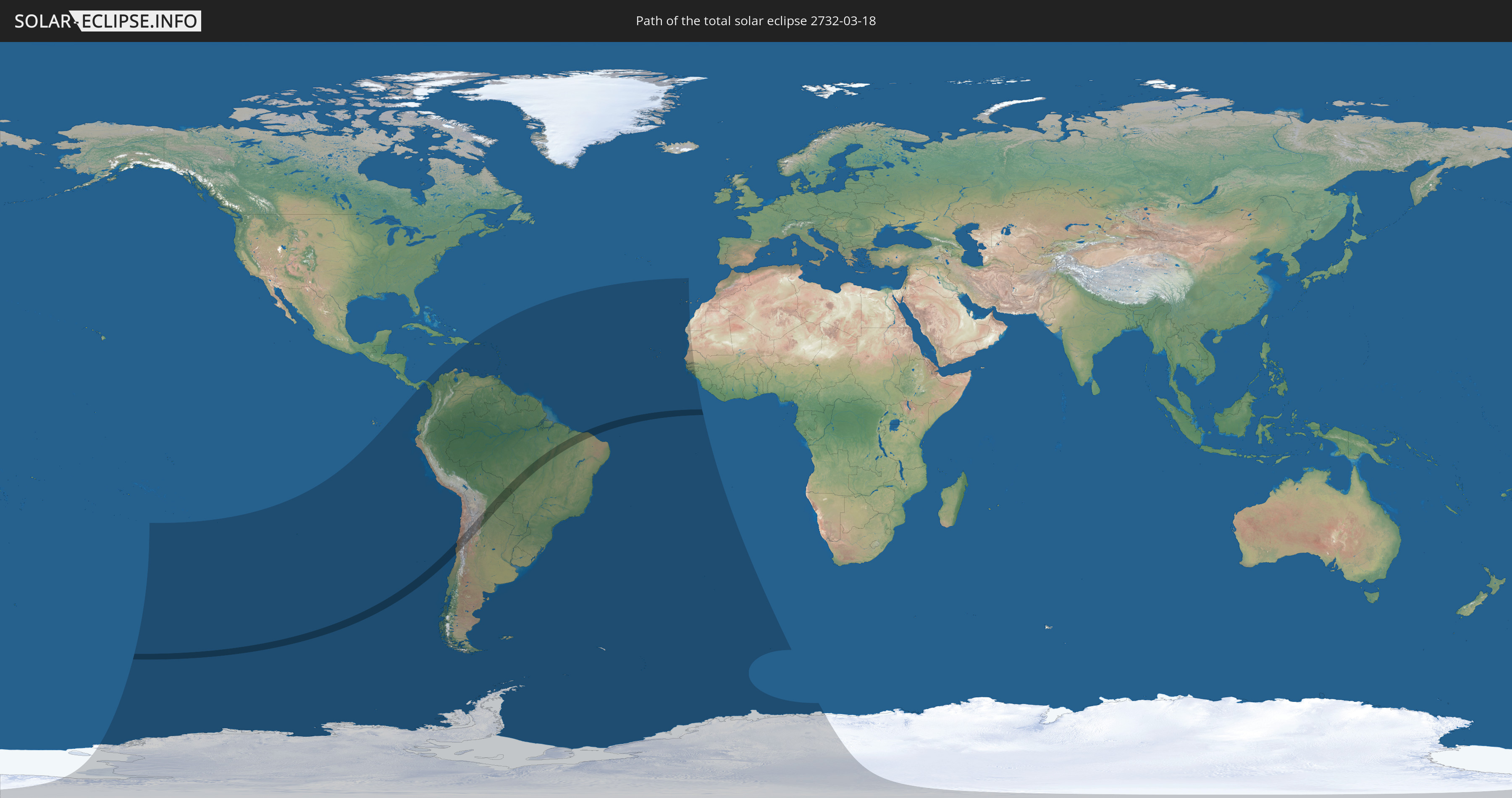
Die Sonnenfinsternis am 03/18/2732 kann man in 48 Ländern als partielle Sonnenfinsternis beobachten.
Der Finsternispfad verläuft durch 5 Länder. Nur in diesen Ländern ist sie als total Sonnenfinsternis zu sehen.
In den folgenden Ländern ist die Sonnenfinsternis total zu sehen
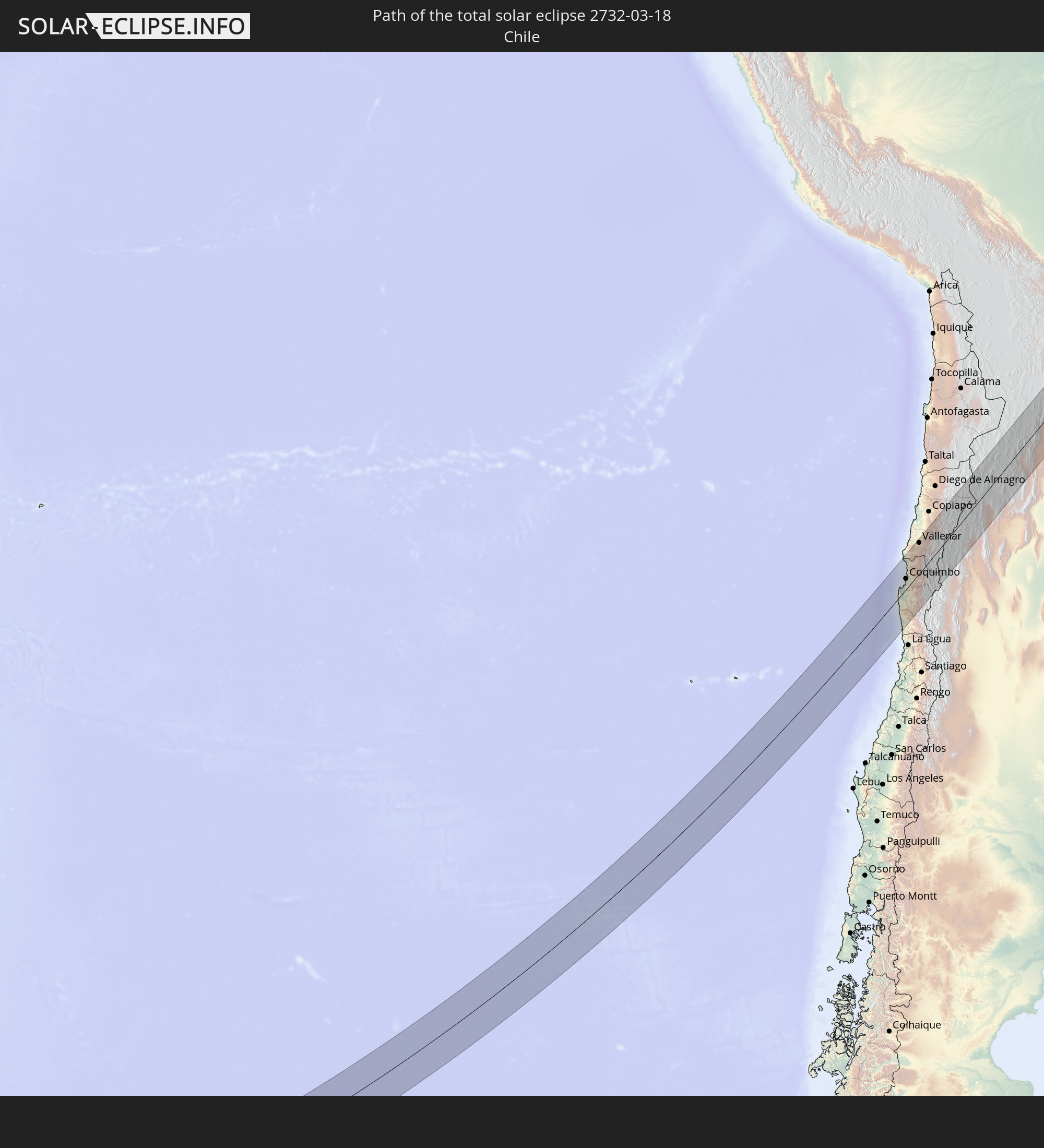 Chile
Chile
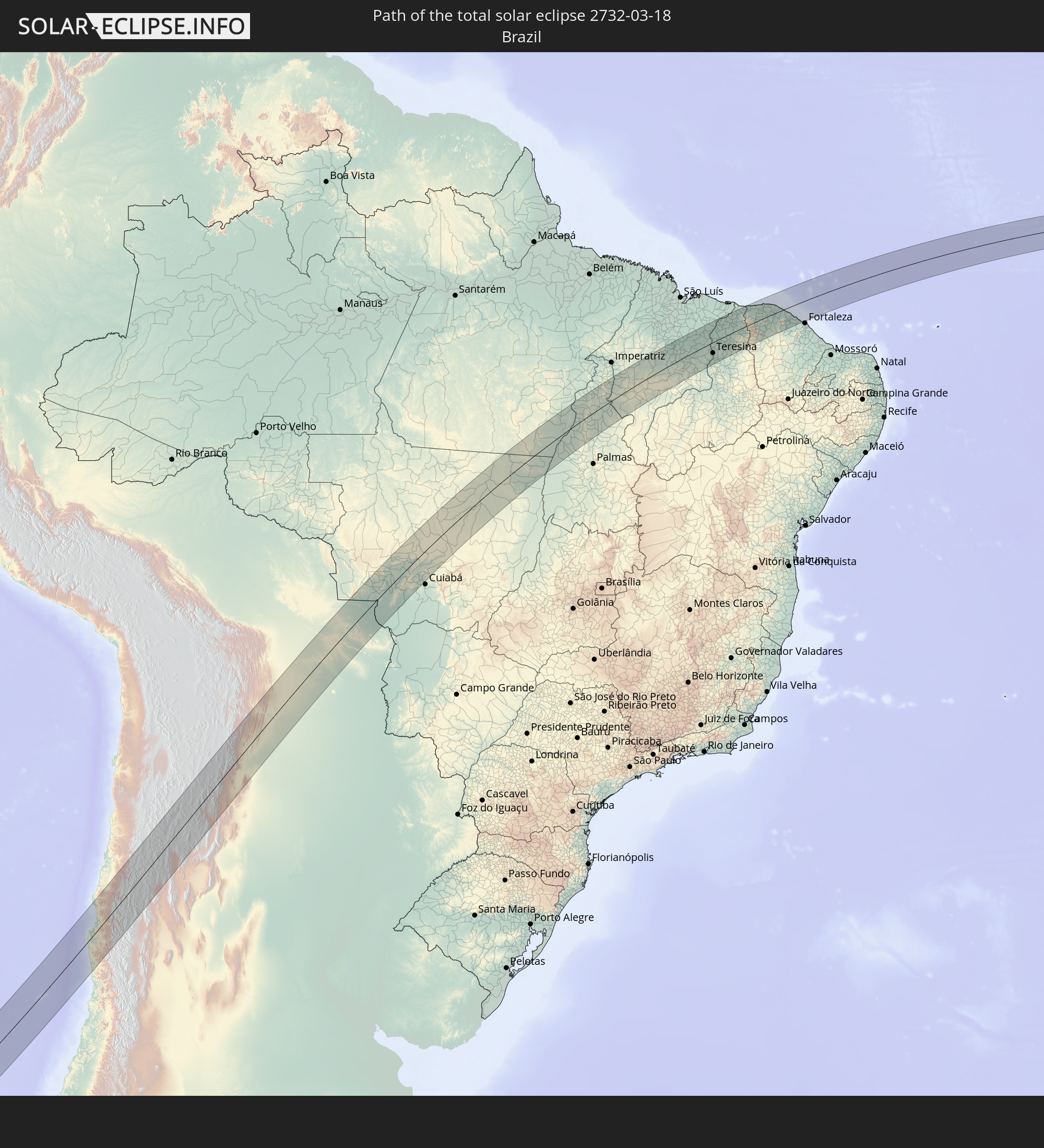 Brazil
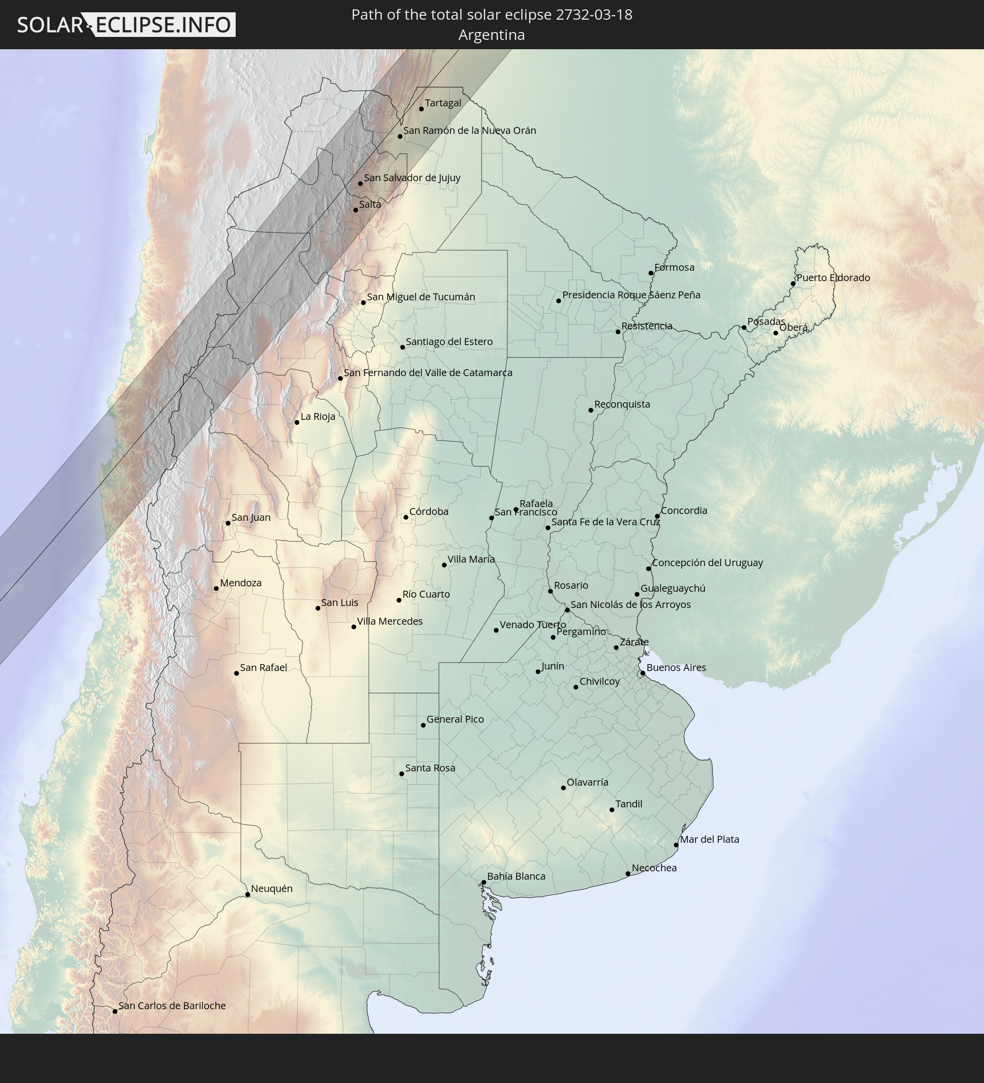 Argentina
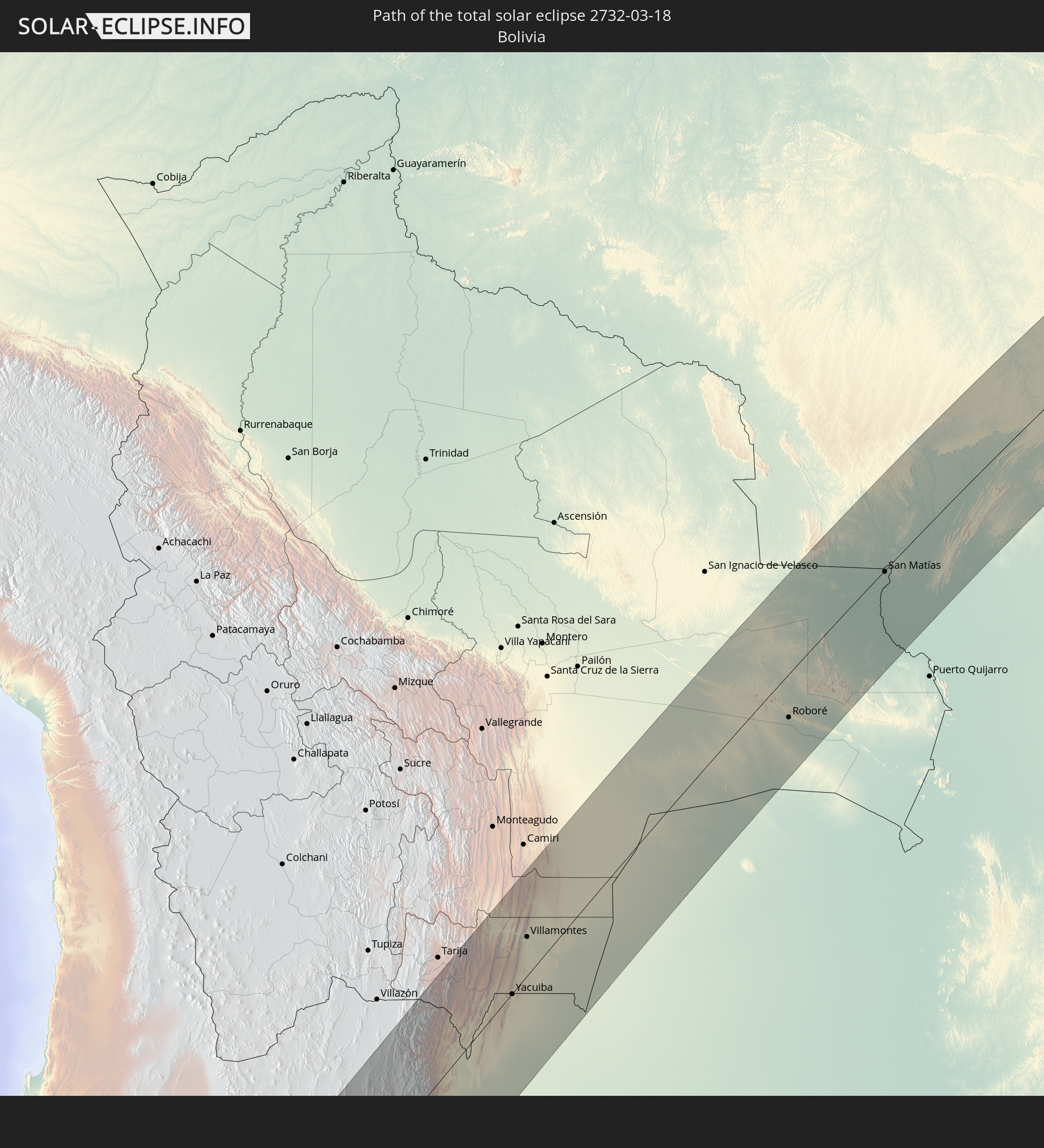 Bolivia
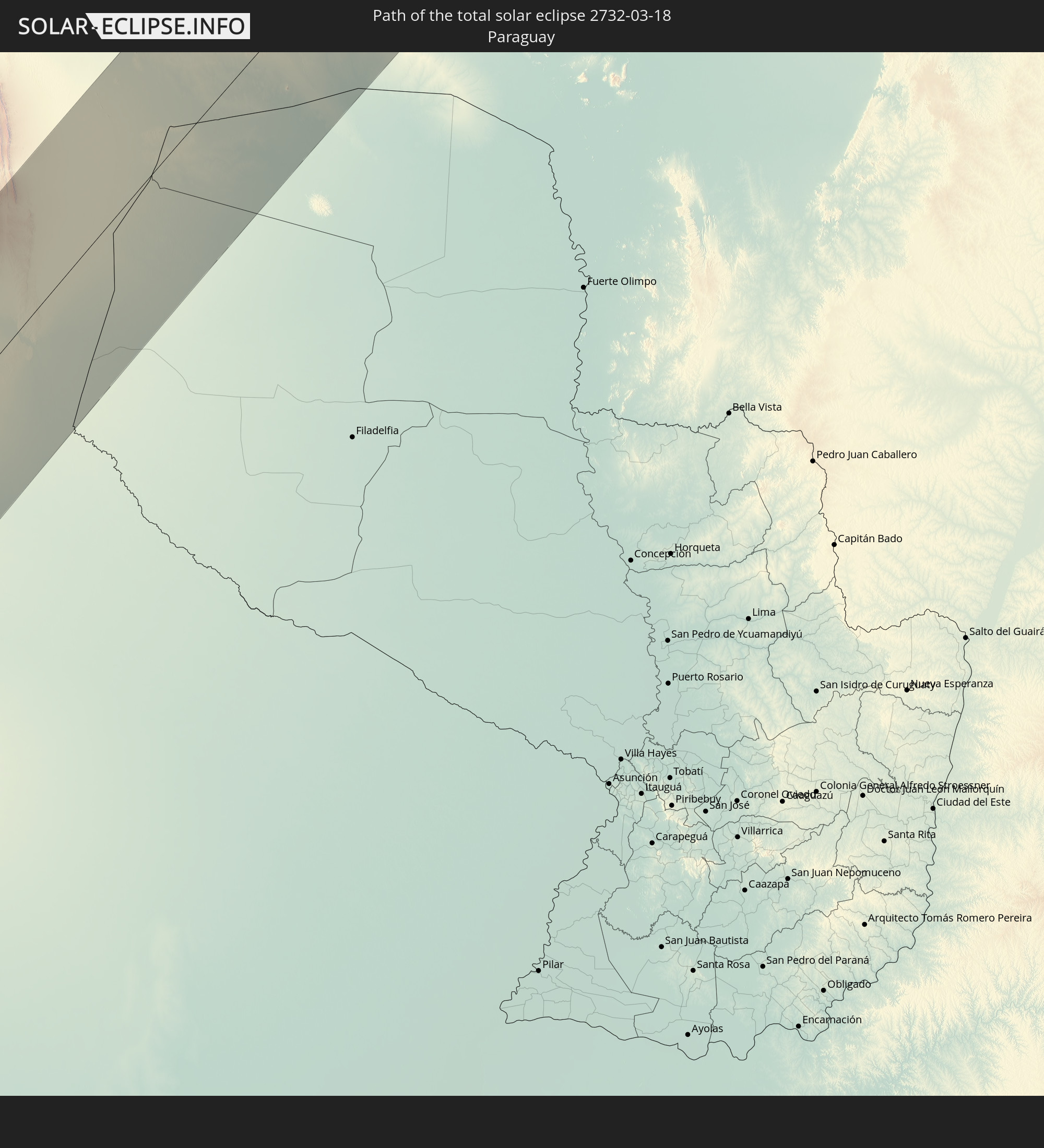 Paraguay
In den folgenden Ländern ist die Sonnenfinsternis partiell zu sehen
 Antarctica
 French Polynesia
 Pitcairn Islands
 Chile
Chile
 Ecuador
 Panama
 Colombia
 Peru
Peru
 Brazil
 Argentina
 Venezuela
 Dominican Republic
 Aruba
Aruba
 Bolivia
 Puerto Rico
 United States Virgin Islands
 British Virgin Islands
 Anguilla
 Collectivity of Saint Martin
 Saint Barthélemy
 Saint Kitts and Nevis
 Paraguay
 Antigua and Barbuda
 Montserrat
 Trinidad and Tobago
 Guadeloupe
 Grenada
 Dominica
 Saint Vincent and the Grenadines
 Falkland Islands
 Guyana
 Martinique
 Saint Lucia
 Barbados
 Uruguay
 Suriname
 French Guiana
 South Georgia and the South Sandwich Islands
 Portugal
 Cabo Verde
 Spain
Spain
 Senegal
 Mauritania
 The Gambia
 Guinea-Bissau
 Guinea
 Saint Helena, Ascension and Tristan da Cunha
 Bouvet Island
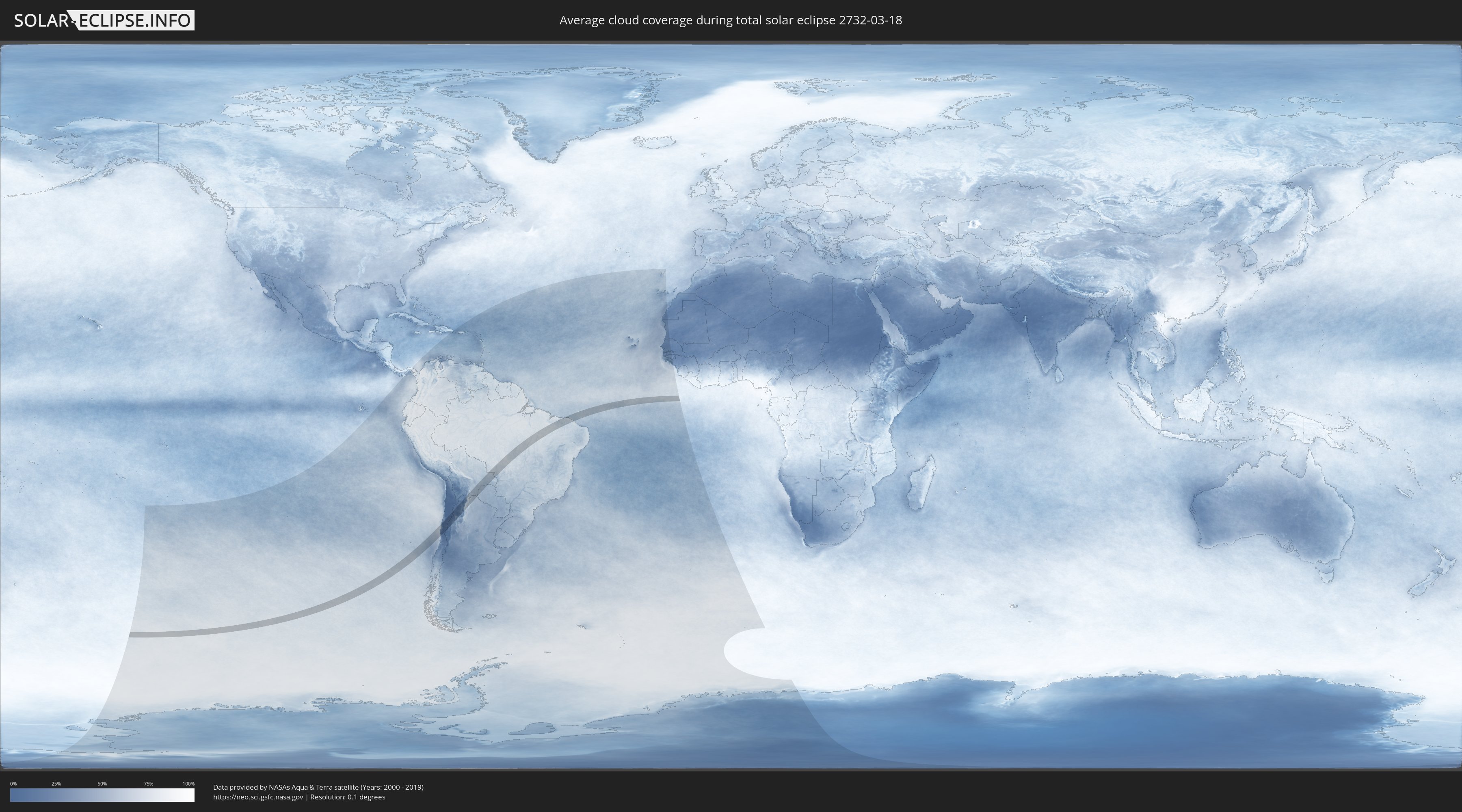
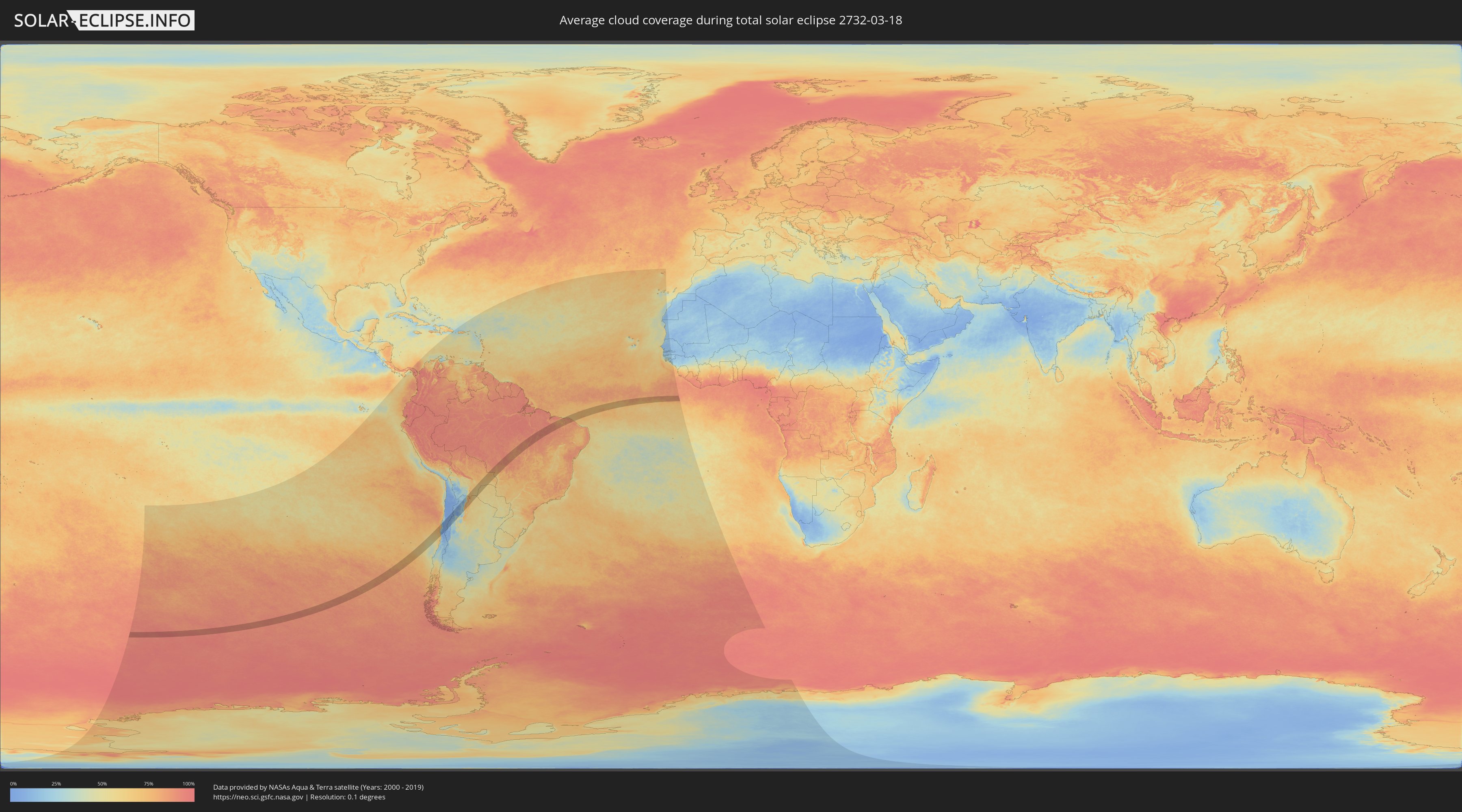
How will be the weather during the total solar eclipse on 03/18/2732?
Where is the best place to see the total solar eclipse of 03/18/2732?
The following maps show the average cloud coverage for the day of the total solar eclipse.
With the help of these maps, it is possible to find the place along the eclipse path, which has the best
chance of a cloudless sky.
Nevertheless, you should consider local circumstances and inform about the weather of your chosen
observation site.
The data is provided by NASAs satellites
AQUA and TERRA.
The cloud maps are averaged over a period of 19 years (2000 - 2019).
Detailed country maps
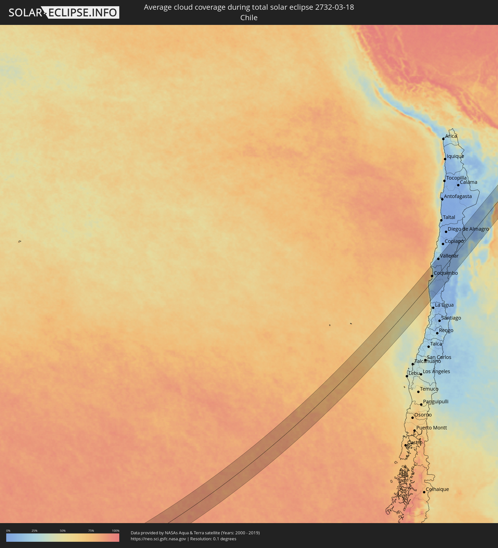 Chile
Chile
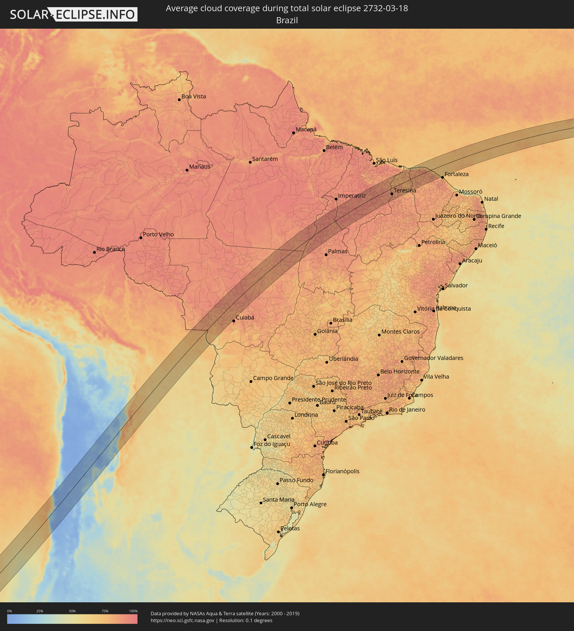 Brazil
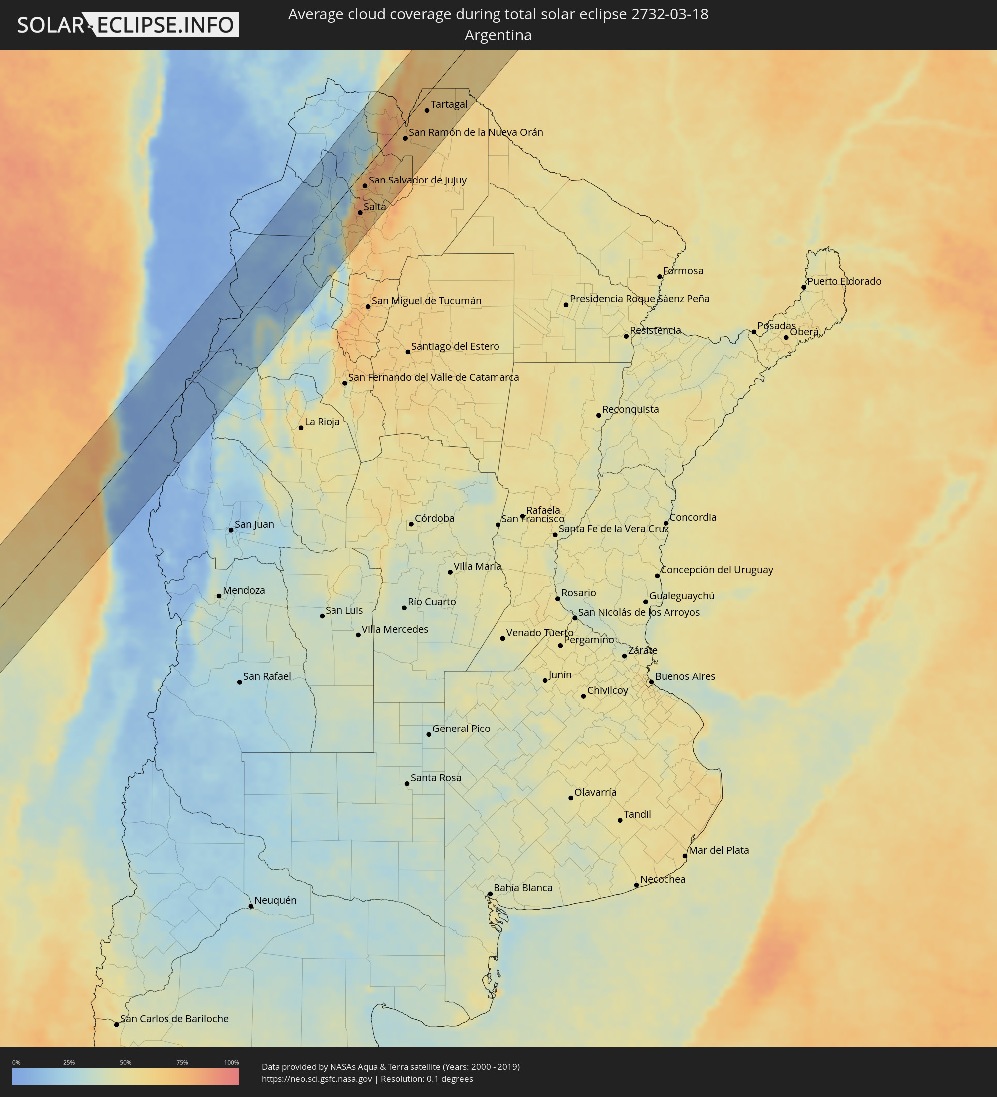 Argentina
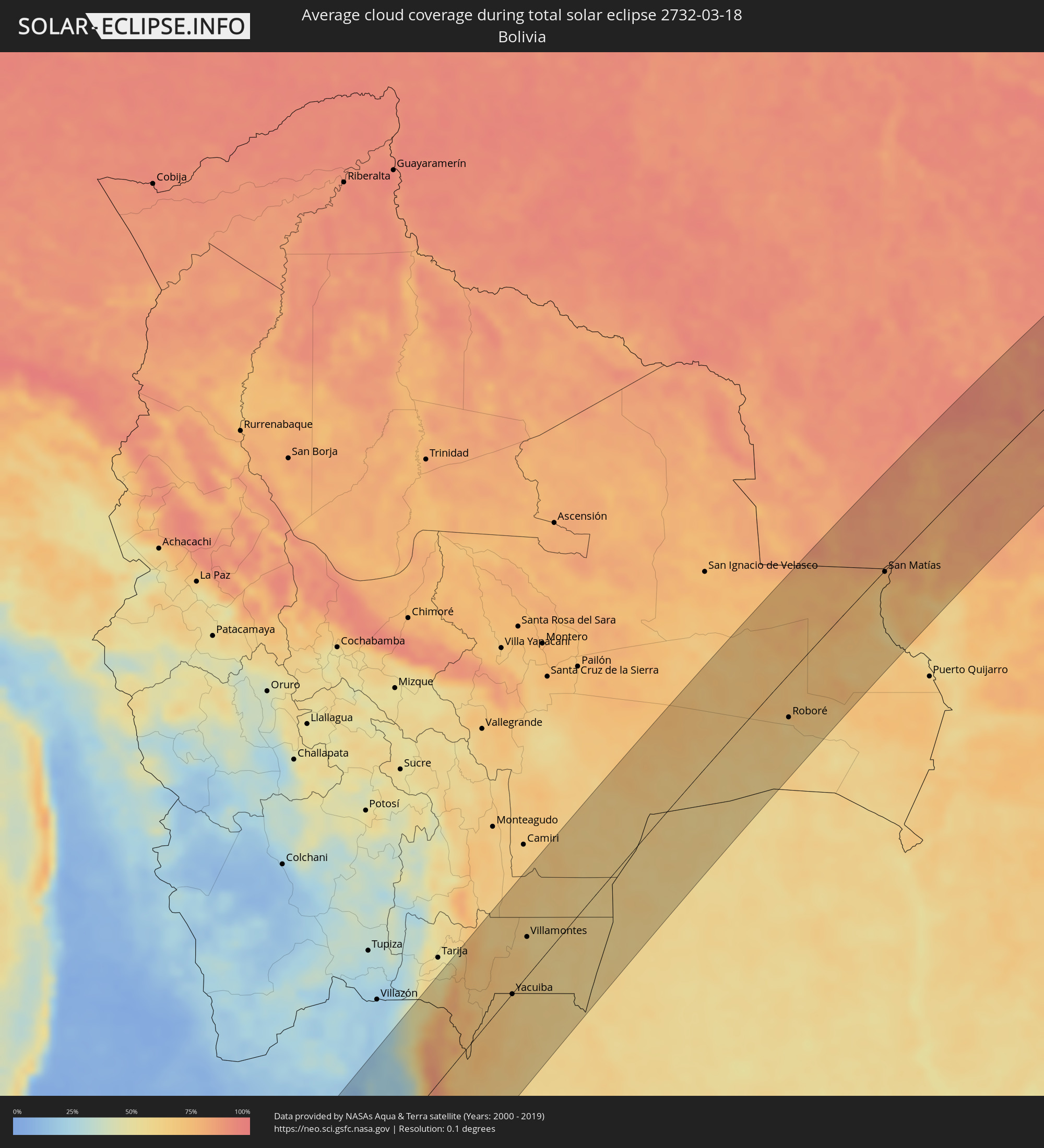 Bolivia
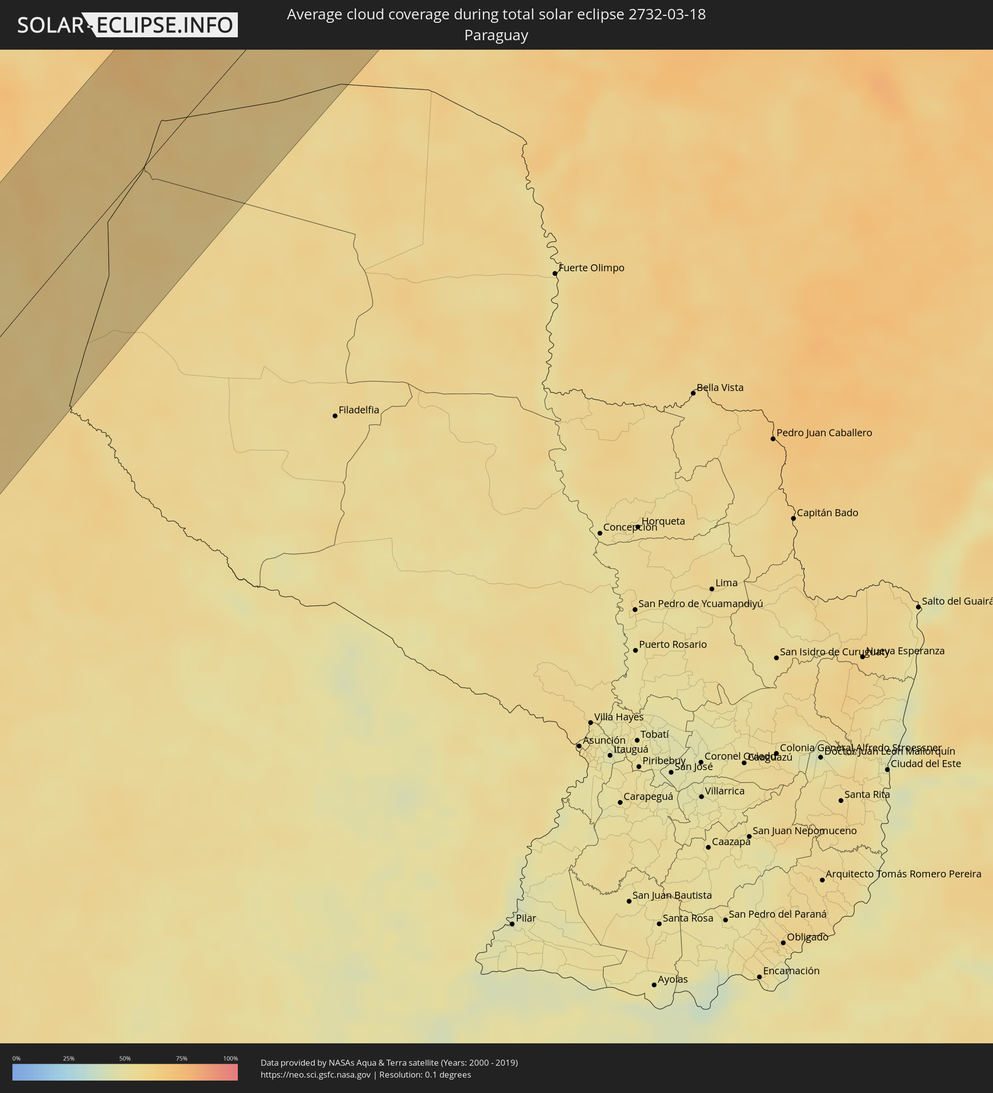 Paraguay
Cities inside the path of the eclipse
The following table shows all locations with a population of more than 5,000 inside the eclipse path. Cities which have more than 100,000 inhabitants are marked bold. A click at the locations opens a detailed map.
| City | Type | Eclipse duration | Local time of max. eclipse | Distance to central line | Ø Cloud coverage |
|
Coquimbo, Coquimbo
|
total | - | 14:07:45 UTC-03:00 | 29 km | 39% |
|
La Serena, Coquimbo
|
total | - | 14:07:58 UTC-03:00 | 25 km | 39% |
|
Ovalle, Coquimbo
|
total | - | 14:06:54 UTC-03:00 | 28 km | 15% |
|
Monte Patria, Coquimbo
|
total | - | 14:07:08 UTC-03:00 | 53 km | 7% |
|
Vallenar, Atacama
|
total | - | 14:11:01 UTC-03:00 | 84 km | 10% |
|
Vicuña, Coquimbo
|
total | - | 14:08:37 UTC-03:00 | 24 km | 6% |
|
Fiambalá, Catamarca Province
|
total | - | 14:17:39 UTC-03:00 | 92 km | 26% |
|
Chicoana, Salta Province
|
total | - | 14:25:46 UTC-03:00 | 72 km | 69% |
|
El Carril, Salta Province
|
total | - | 14:25:54 UTC-03:00 | 74 km | 69% |
|
Salta, Salta Province
|
total | - | 14:26:34 UTC-03:00 | 60 km | 74% |
|
Tilcara, Jujuy Province
|
total | - | 14:28:58 UTC-03:00 | 21 km | 27% |
|
Humahuaca, Jujuy Province
|
total | - | 14:29:41 UTC-03:00 | 47 km | 24% |
|
San Salvador de Jujuy, Jujuy Province
|
total | - | 14:27:52 UTC-03:00 | 27 km | 76% |
|
Palpalá, Jujuy Province
|
total | - | 14:27:54 UTC-03:00 | 38 km | 71% |
|
San Pedro, Jujuy Province
|
total | - | 14:28:30 UTC-03:00 | 64 km | 65% |
|
Ingenio La Esperanza, Jujuy Province
|
total | - | 14:28:33 UTC-03:00 | 65 km | 63% |
|
Fraile Pintado, Jujuy Province
|
total | - | 14:29:10 UTC-03:00 | 49 km | 66% |
|
Libertador General San Martín, Jujuy Province
|
total | - | 14:29:26 UTC-03:00 | 40 km | 70% |
|
Calilegua, Jujuy Province
|
total | - | 14:29:32 UTC-03:00 | 39 km | 70% |
|
Caimancito, Jujuy Province
|
total | - | 14:29:53 UTC-03:00 | 51 km | 66% |
|
Yuto, Jujuy Province
|
total | - | 14:30:16 UTC-03:00 | 53 km | 64% |
|
San Ramón de la Nueva Orán, Salta Province
|
total | - | 14:31:29 UTC-03:00 | 29 km | 67% |
|
Palma Sola, Jujuy Province
|
total | - | 14:29:56 UTC-03:00 | 90 km | 73% |
|
Embarcación, Salta Province
|
total | - | 14:31:42 UTC-03:00 | 52 km | 64% |
|
General Enrique Mosconi, Salta Province
|
total | - | 14:33:21 UTC-03:00 | 31 km | 64% |
|
Tartagal, Salta Province
|
total | - | 14:33:31 UTC-03:00 | 27 km | 65% |
|
Yacuiba, Tarija
|
total | - | 13:34:42 UTC-04:00 | 1 km | 65% |
|
Villamontes, Tarija
|
total | - | 13:36:31 UTC-04:00 | 36 km | 64% |
|
Roboré, Santa Cruz
|
total | - | 13:48:13 UTC-04:00 | 44 km | 61% |
|
San Matías, Santa Cruz
|
total | - | 13:54:14 UTC-04:00 | 2 km | 72% |
|
Nova Olímpia, Mato Grosso
|
total | - | 13:59:02 UTC-04:00 | 34 km | 85% |
|
Barra do Bugres, Mato Grosso
|
total | - | 13:58:39 UTC-04:00 | 5 km | 85% |
|
Diamantino, Mato Grosso
|
total | - | 14:01:04 UTC-04:00 | 1 km | 85% |
|
Conceição do Araguaia, Pará
|
total | - | 15:22:30 UTC-03:00 | 19 km | 85% |
|
Araguaína, Tocantins
|
total | - | 15:25:41 UTC-03:00 | 51 km | 93% |
|
Carolina, Maranhão
|
total | - | 15:26:21 UTC-03:00 | 7 km | 86% |
|
Porto Franco, Maranhão
|
total | - | 15:28:06 UTC-03:00 | 82 km | 89% |
|
Santa Luzia, Maranhão
|
total | - | 15:26:07 UTC-03:00 | 51 km | 90% |
|
Grajaú, Maranhão
|
total | - | 15:30:25 UTC-03:00 | 59 km | 92% |
|
Barra do Corda, Maranhão
|
total | - | 15:31:57 UTC-03:00 | 39 km | 90% |
|
Tuntum, Maranhão
|
total | - | 15:32:59 UTC-03:00 | 30 km | 92% |
|
Presidente Dutra, Maranhão
|
total | - | 15:33:06 UTC-03:00 | 19 km | 93% |
|
Dom Pedro, Maranhão
|
total | - | 15:33:34 UTC-03:00 | 41 km | 93% |
|
São Domingos do Maranhão, Maranhão
|
total | - | 15:32:46 UTC-03:00 | 15 km | 91% |
|
Colinas, Maranhão
|
total | - | 15:32:12 UTC-03:00 | 66 km | 90% |
|
Timbiras, Maranhão
|
total | - | 15:35:18 UTC-03:00 | 91 km | 88% |
|
Codó, Maranhão
|
total | - | 15:35:03 UTC-03:00 | 69 km | 88% |
|
Buriti Bravo, Maranhão
|
total | - | 15:32:57 UTC-03:00 | 70 km | 90% |
|
Caxias, Maranhão
|
total | - | 15:34:59 UTC-03:00 | 1 km | 90% |
|
Estreito, Maranhão
|
total | - | 15:33:39 UTC-03:00 | 95 km | 92% |
|
Coelho Neto, Maranhão
|
total | - | 15:36:16 UTC-03:00 | 44 km | 84% |
|
União, Piauí
|
total | - | 15:35:55 UTC-03:00 | 3 km | 83% |
|
Teresina, Piauí
|
total | - | 15:35:12 UTC-03:00 | 50 km | 90% |
|
Demerval Lobão, Piauí
|
total | - | 15:34:55 UTC-03:00 | 83 km | 87% |
|
José de Freitas, Piauí
|
total | - | 15:35:57 UTC-03:00 | 28 km | 83% |
|
Santa Quitéria do Maranhão, Maranhão
|
total | - | 15:37:51 UTC-03:00 | 94 km | 75% |
|
Altos, Piauí
|
total | - | 15:35:38 UTC-03:00 | 62 km | 84% |
|
Barras, Piauí
|
total | - | 15:37:01 UTC-03:00 | 9 km | 82% |
|
Esperantina, Piauí
|
total | - | 15:37:35 UTC-03:00 | 40 km | 75% |
|
Campo Maior, Piauí
|
total | - | 15:36:15 UTC-03:00 | 55 km | 85% |
|
Piripiri, Piauí
|
total | - | 15:37:29 UTC-03:00 | 19 km | 76% |
|
Piracuruca, Piauí
|
total | - | 15:38:04 UTC-03:00 | 13 km | 79% |
|
Pedro II, Piauí
|
total | - | 15:37:34 UTC-03:00 | 49 km | 82% |
|
Viçosa do Ceará, Ceará
|
total | - | 15:39:12 UTC-03:00 | 20 km | 81% |
|
Tianguá, Ceará
|
total | - | 15:39:03 UTC-03:00 | 1 km | 82% |
|
Camocim, Ceará
|
total | - | 15:40:23 UTC-03:00 | 76 km | 85% |
|
Granja, Ceará
|
total | - | 15:40:05 UTC-03:00 | 53 km | 85% |
|
Guaraciaba do Norte, Ceará
|
total | - | 15:38:38 UTC-03:00 | 57 km | 86% |
|
Ipu, Ceará
|
total | - | 15:38:27 UTC-03:00 | 74 km | 83% |
|
Varjota, Ceará
|
total | - | 15:38:51 UTC-03:00 | 72 km | 73% |
|
Sobral, Ceará
|
total | - | 15:39:43 UTC-03:00 | 26 km | 82% |
|
Santana do Acaraú, Ceará
|
total | - | 15:40:10 UTC-03:00 | 9 km | 84% |
|
Marco, Ceará
|
total | - | 15:40:43 UTC-03:00 | 22 km | 88% |
|
Acaraú, Ceará
|
total | - | 15:41:05 UTC-03:00 | 45 km | 88% |
|
Itapagé, Ceará
|
total | - | 15:40:25 UTC-03:00 | 60 km | 86% |
|
Itapipoca, Ceará
|
total | - | 15:40:42 UTC-03:00 | 41 km | 89% |
|
Pentecoste, Ceará
|
total | - | 15:40:33 UTC-03:00 | 85 km | 84% |
|
Trairi, Ceará
|
total | - | 15:41:17 UTC-03:00 | 32 km | 81% |
|
Paracuru, Ceará
|
total | - | 15:41:19 UTC-03:00 | 56 km | 78% |
|
São Gonçalo do Amarante, Ceará
|
total | - | 15:41:05 UTC-03:00 | 79 km | 81% |