Total solar eclipse of 07/22/2753
| Day of week: | Wednesday |
| Maximum duration of eclipse: | 03m35s |
| Maximum width of eclipse path: | 458 km |
| Saros cycle: | 148 |
| Coverage: | 100% |
| Magnitude: | 1.0646 |
| Gamma: | 0.8853 |
Wo kann man die Sonnenfinsternis vom 07/22/2753 sehen?
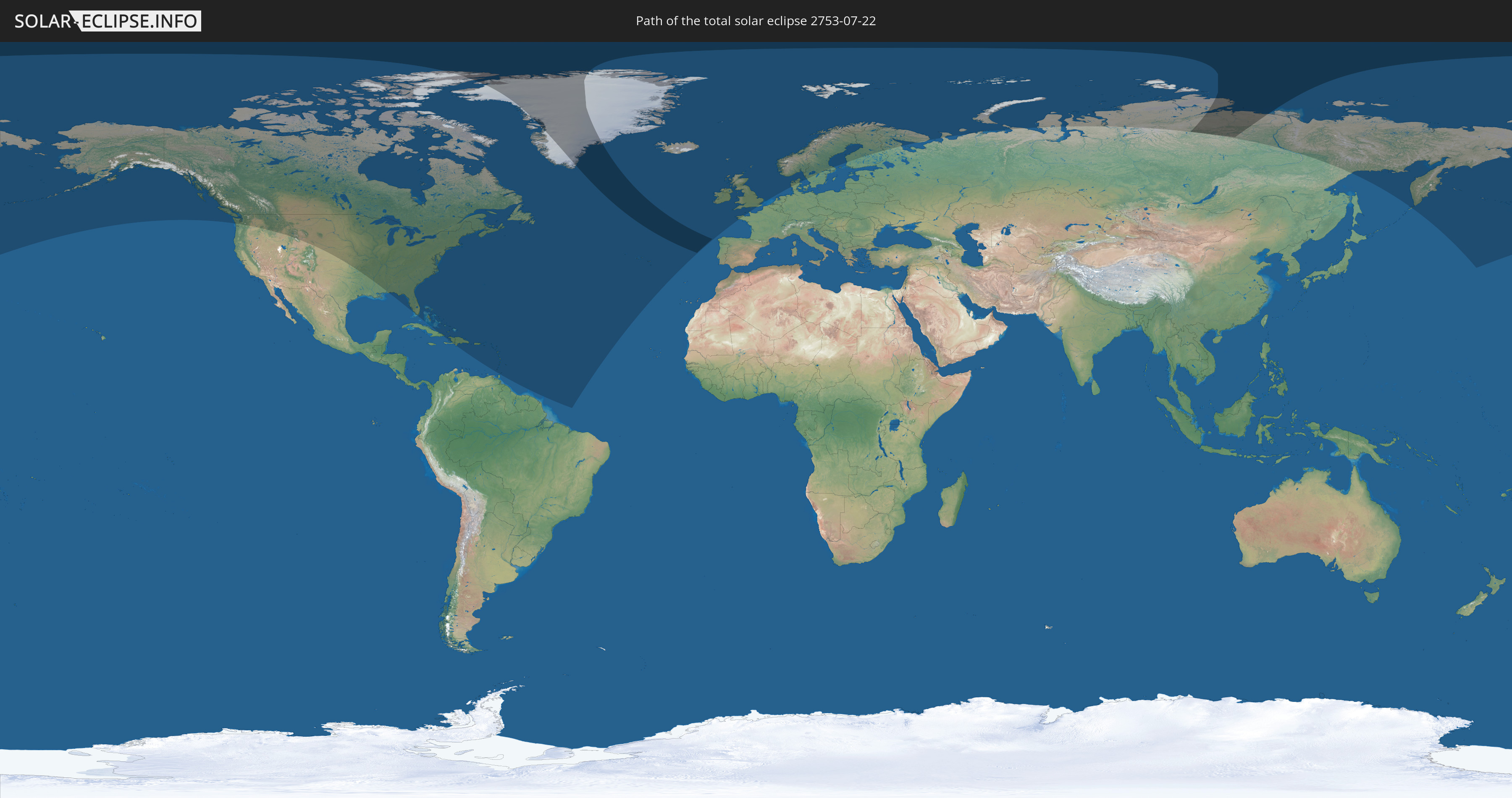
Die Sonnenfinsternis am 07/22/2753 kann man in 42 Ländern als partielle Sonnenfinsternis beobachten.
Der Finsternispfad verläuft durch 3 Länder. Nur in diesen Ländern ist sie als total Sonnenfinsternis zu sehen.
In den folgenden Ländern ist die Sonnenfinsternis total zu sehen
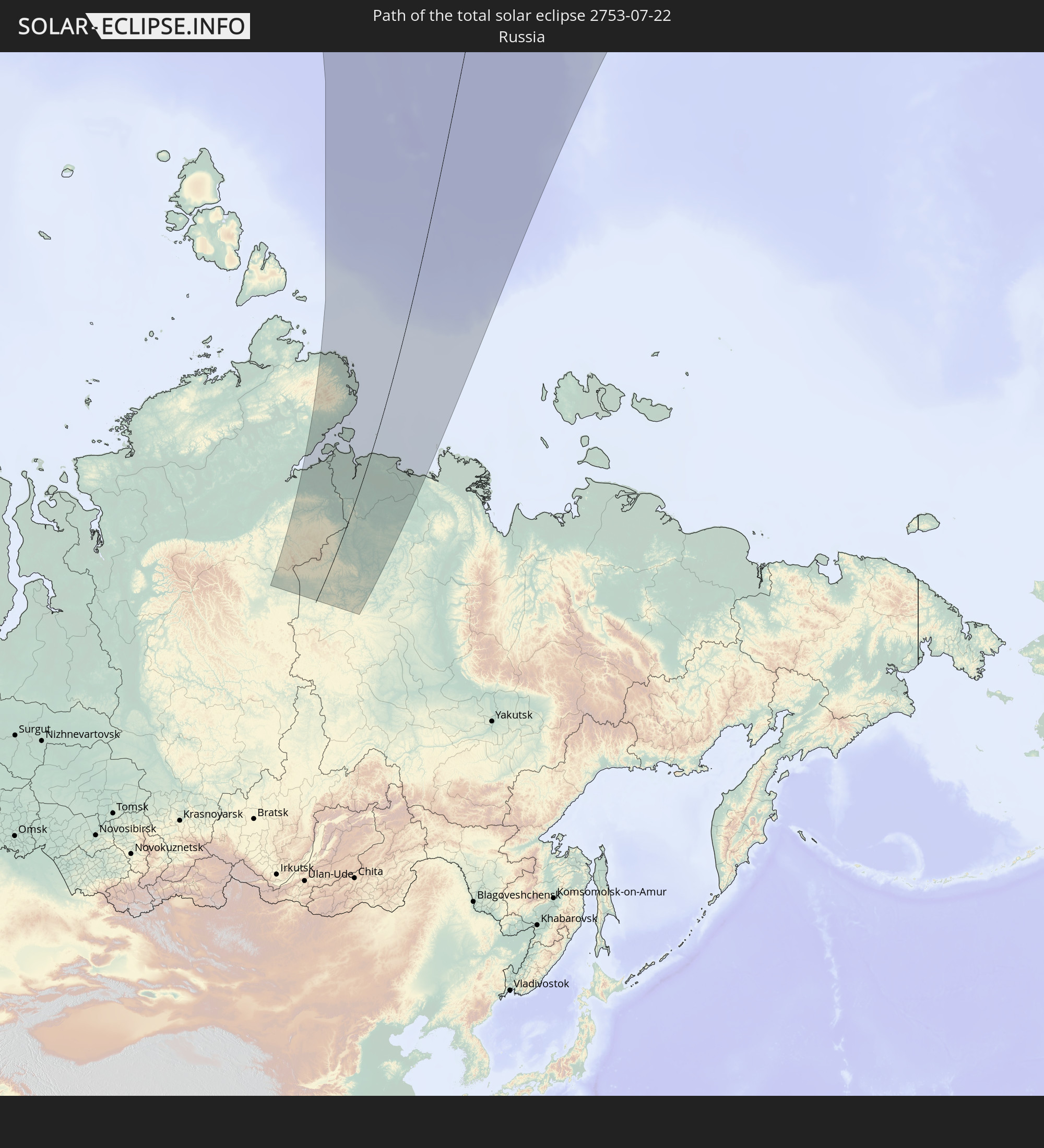 Russia
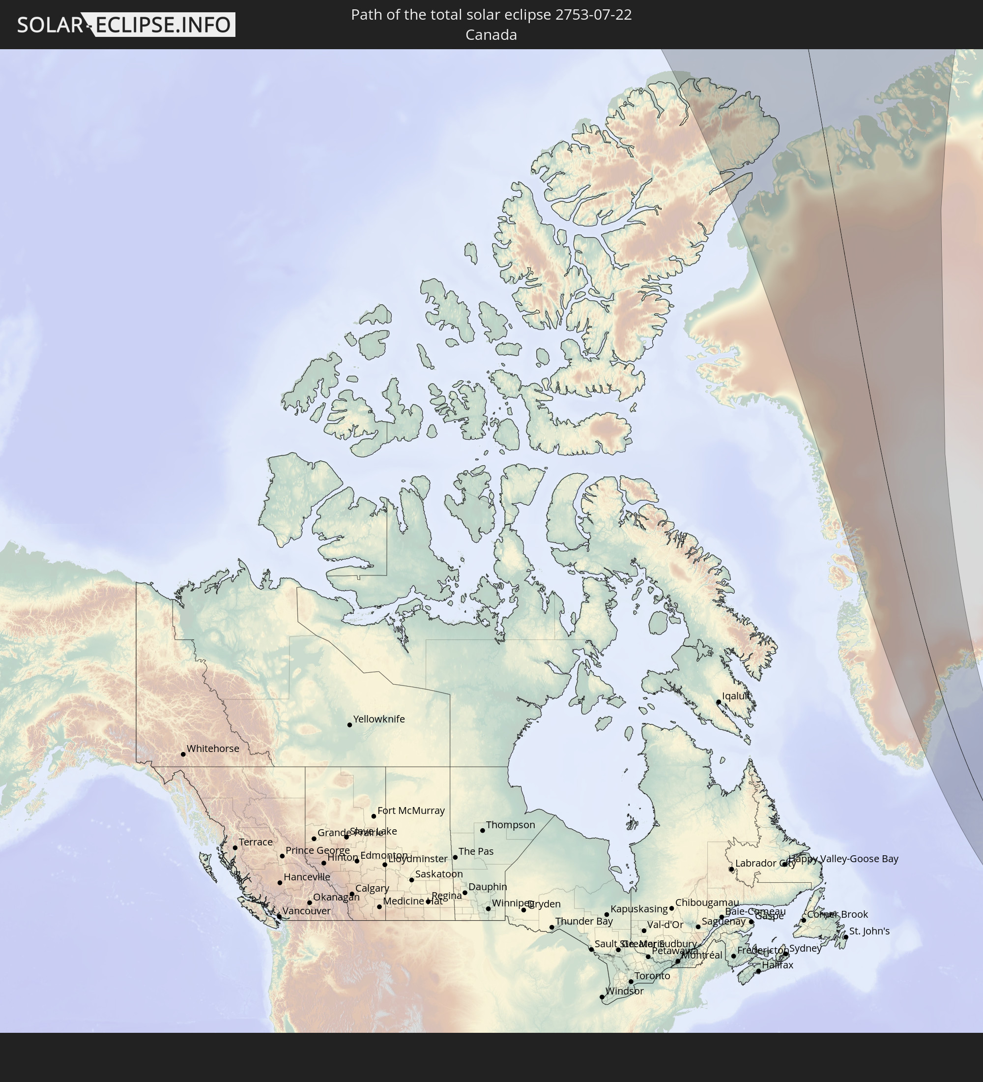 Canada
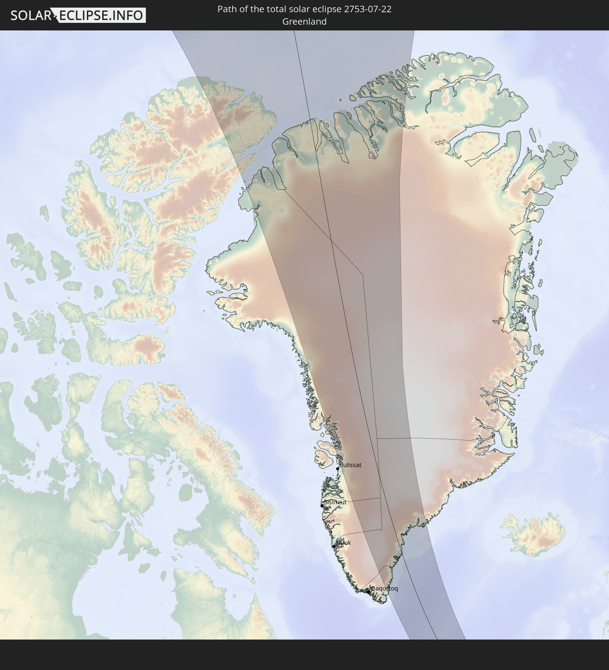 Greenland
In den folgenden Ländern ist die Sonnenfinsternis partiell zu sehen
 Russia
 United States
 Canada
 Greenland
 Cuba
Cuba
 The Bahamas
 Haiti
Haiti
 Turks and Caicos Islands
 Dominican Republic
 Puerto Rico
 United States Virgin Islands
 Bermuda
 British Virgin Islands
 Anguilla
 Collectivity of Saint Martin
 Saint Barthélemy
 Saint Kitts and Nevis
 Antigua and Barbuda
 Montserrat
 Trinidad and Tobago
 Guadeloupe
 Grenada
 Dominica
 Saint Vincent and the Grenadines
 Martinique
 Saint Lucia
 Barbados
 Saint Pierre and Miquelon
 Portugal
 Iceland
 Republic of Ireland
 Svalbard and Jan Mayen
 United Kingdom
 Faroe Islands
 France
 Isle of Man
 Guernsey
 Jersey
 Norway
 Denmark
 Sweden
 Finland
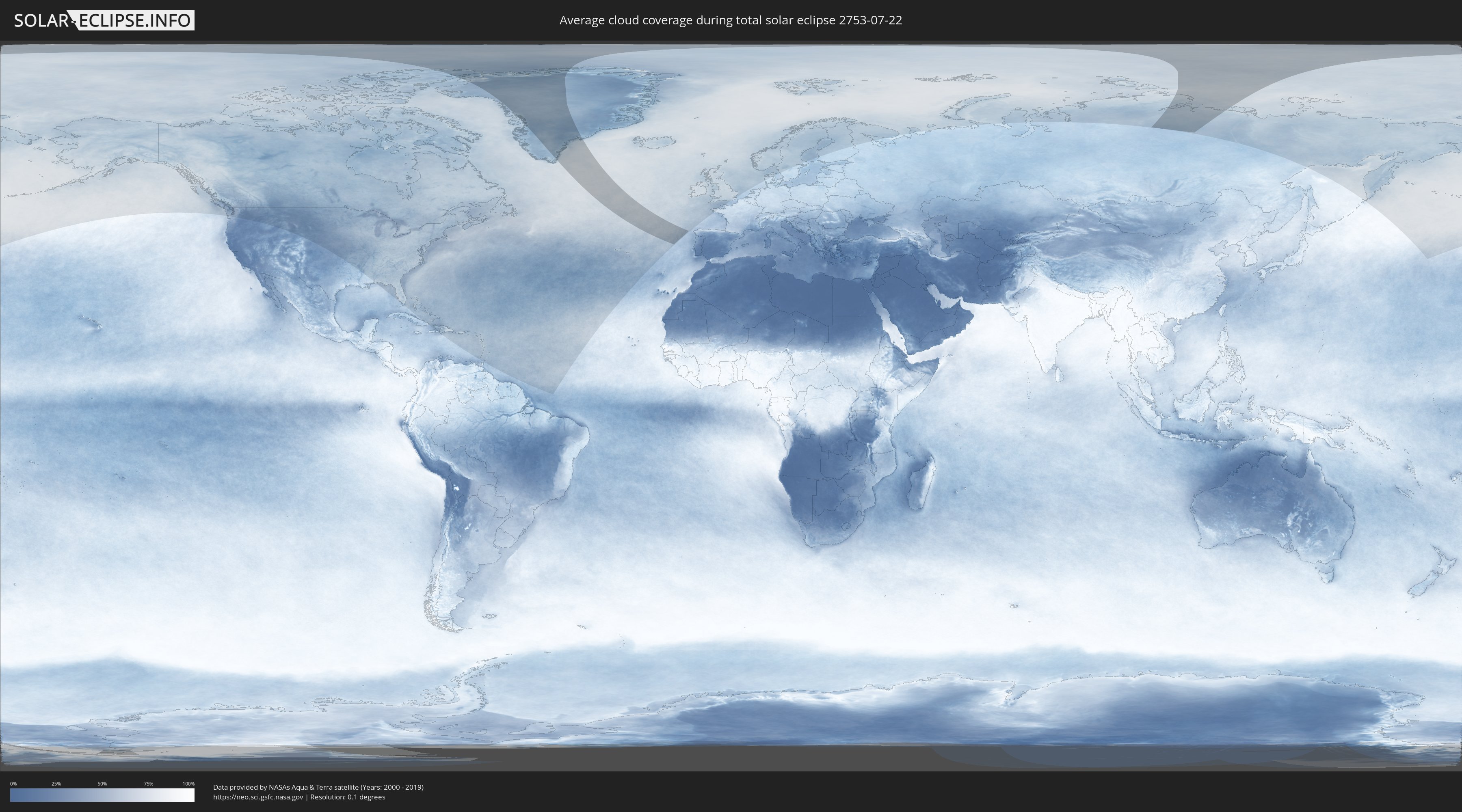
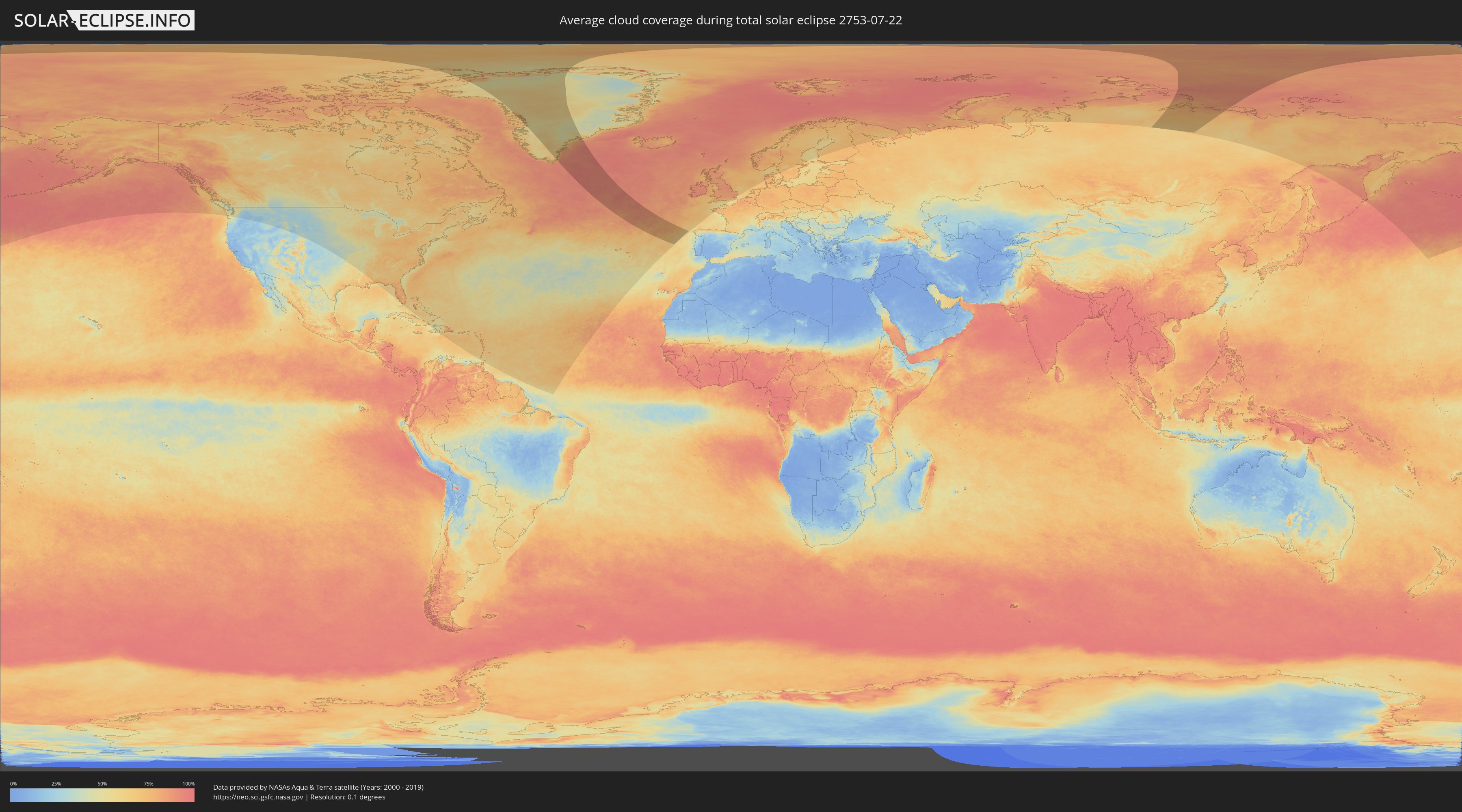
How will be the weather during the total solar eclipse on 07/22/2753?
Where is the best place to see the total solar eclipse of 07/22/2753?
The following maps show the average cloud coverage for the day of the total solar eclipse.
With the help of these maps, it is possible to find the place along the eclipse path, which has the best
chance of a cloudless sky.
Nevertheless, you should consider local circumstances and inform about the weather of your chosen
observation site.
The data is provided by NASAs satellites
AQUA and TERRA.
The cloud maps are averaged over a period of 19 years (2000 - 2019).
Detailed country maps
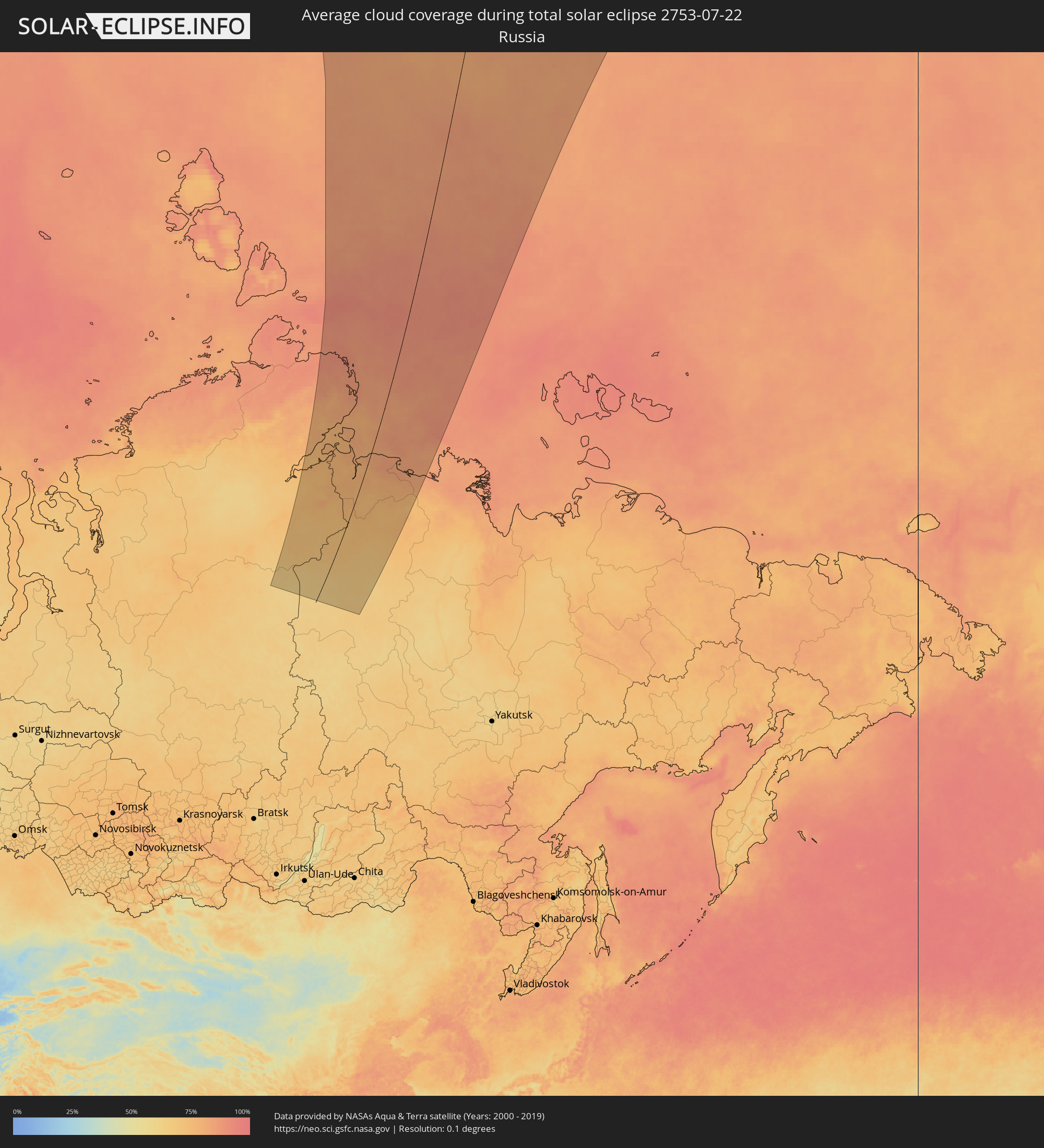 Russia
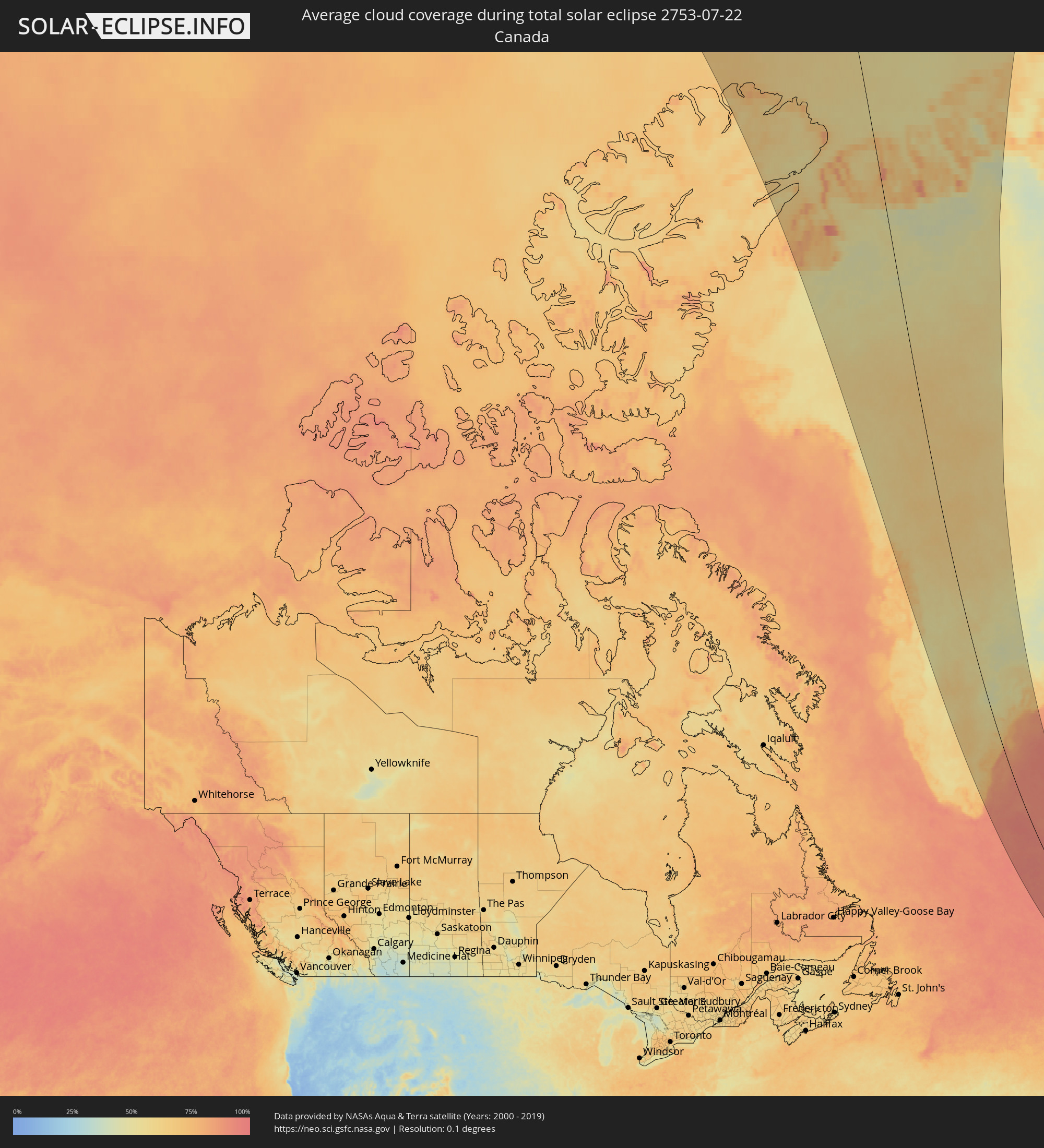 Canada
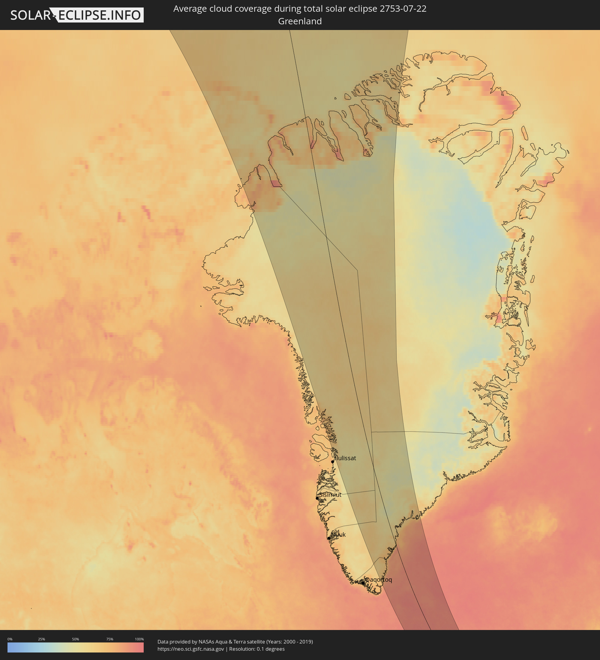 Greenland