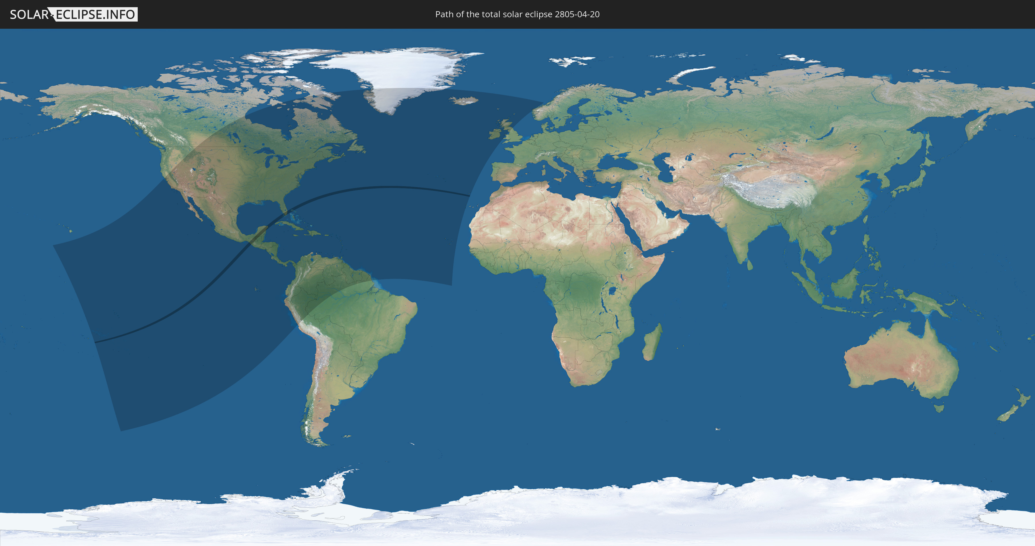
Total solar eclipse of 04/20/2805
| Day of week: | Wednesday |
| Maximum duration of eclipse: | 02m46s |
| Maximum width of eclipse path: | 106 km |
| Saros cycle: | 161 |
| Coverage: | 100% |
| Magnitude: | 1.0313 |
| Gamma: | 0.1129 |
Wo kann man die Sonnenfinsternis vom 04/20/2805 sehen?
Die Sonnenfinsternis am 04/20/2805 kann man in 60 Ländern als partielle Sonnenfinsternis beobachten.
Der Finsternispfad verläuft durch 6 Länder. Nur in diesen Ländern ist sie als total Sonnenfinsternis zu sehen.
In den folgenden Ländern ist die Sonnenfinsternis total zu sehen
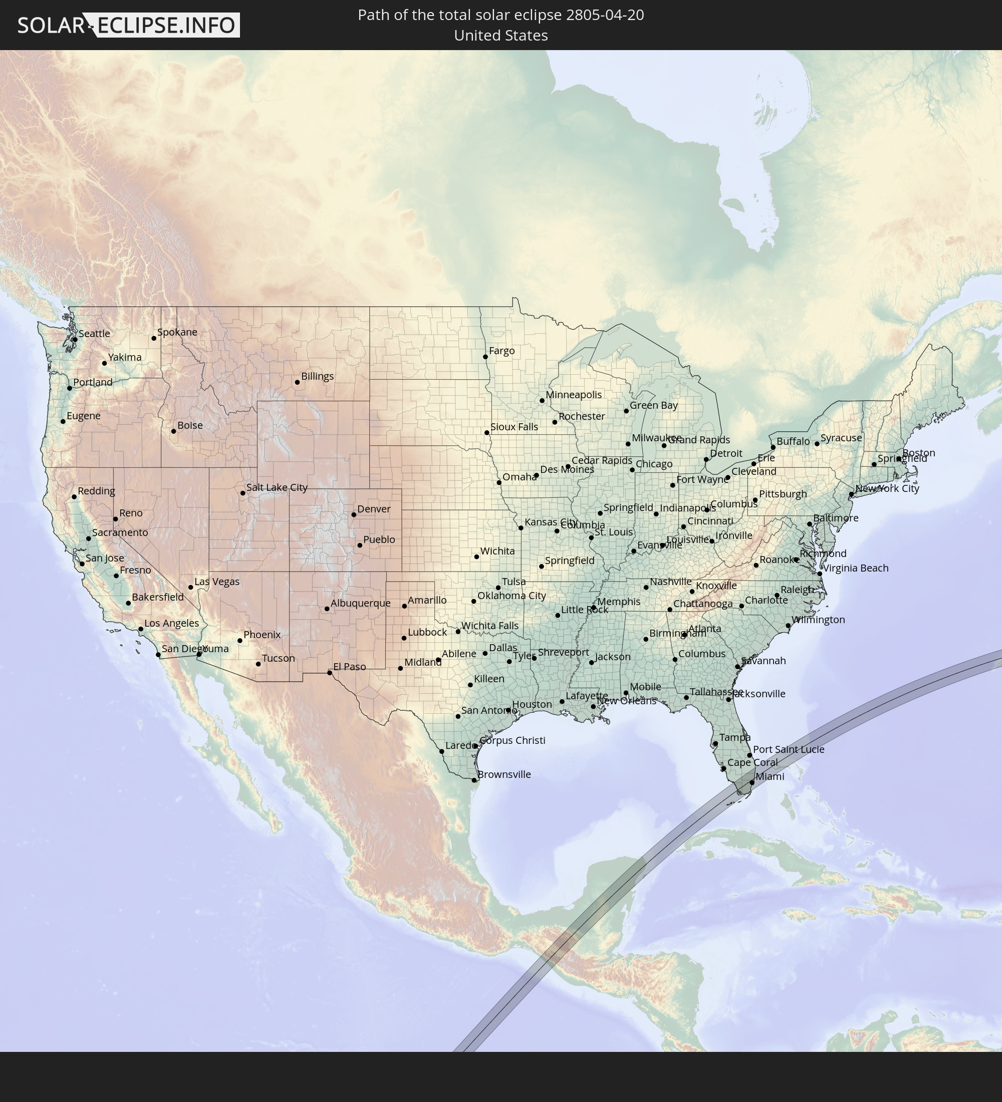 United States
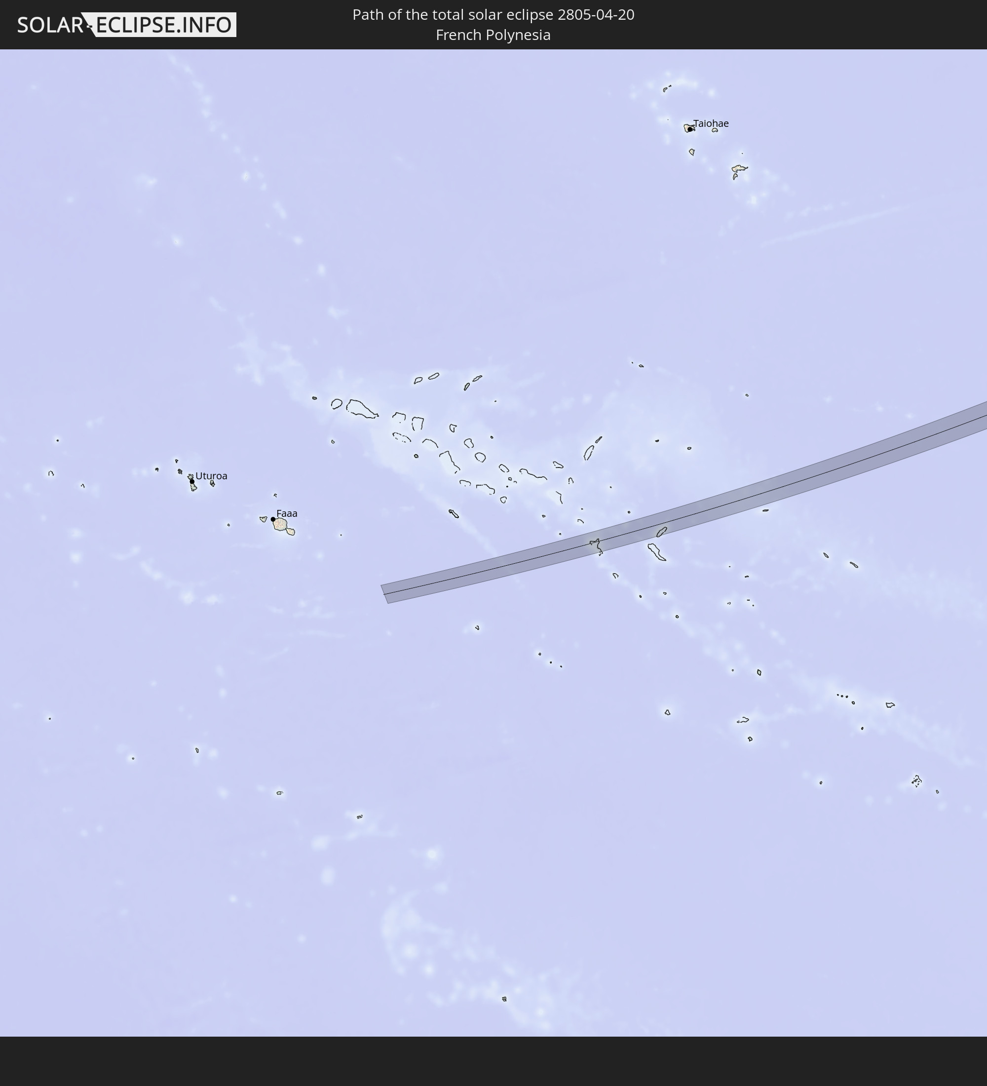 French Polynesia
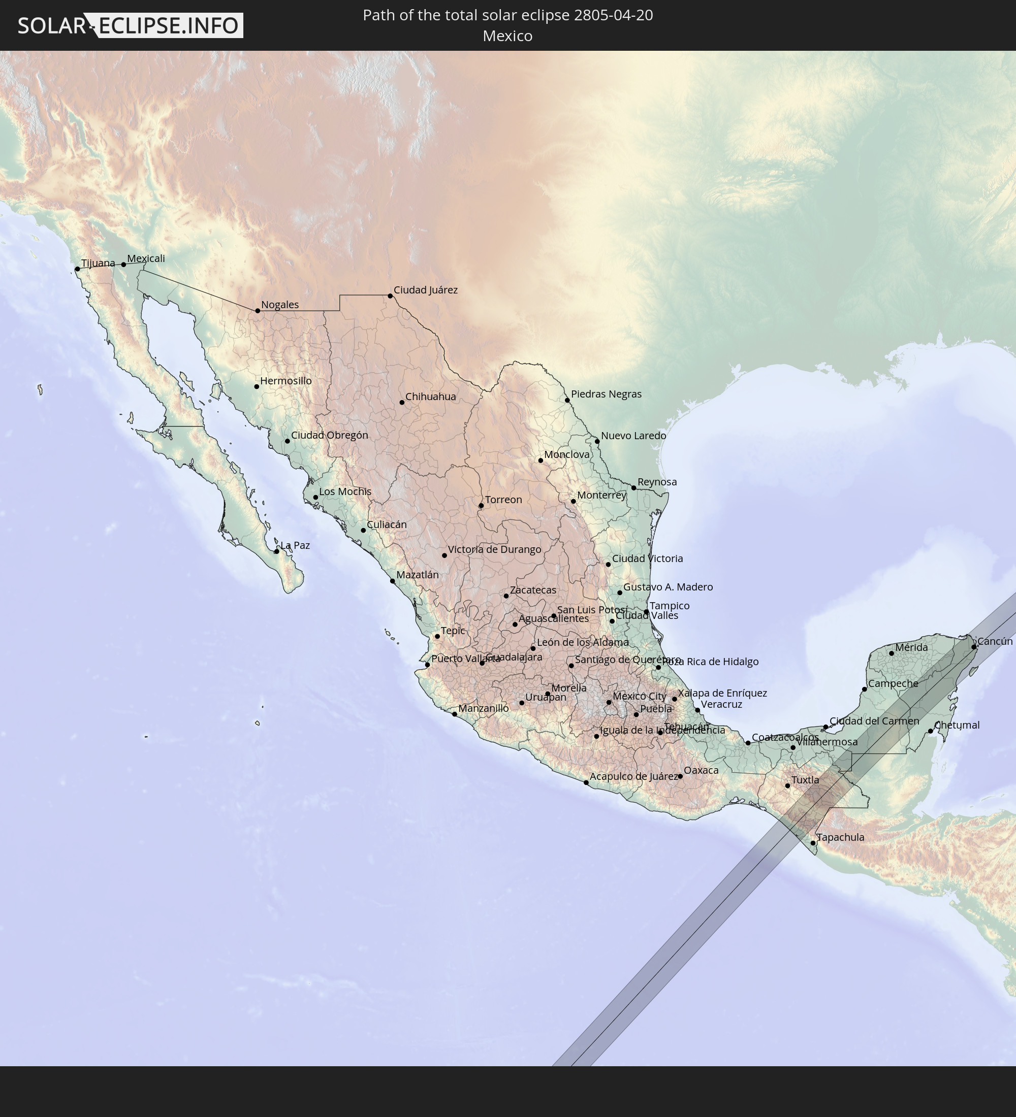 Mexico
 Guatemala
 The Bahamas
 Bermuda
In den folgenden Ländern ist die Sonnenfinsternis partiell zu sehen
 United States
 United States Minor Outlying Islands
 Kiribati
 French Polynesia
 Canada
 Pitcairn Islands
 Mexico
 Chile
Chile
 Greenland
 Guatemala
 Ecuador
 El Salvador
 Honduras
 Belize
 Nicaragua
 Costa Rica
 Cuba
Cuba
 Panama
 Colombia
 Cayman Islands
 Peru
Peru
 The Bahamas
 Jamaica
 Haiti
Haiti
 Brazil
 Venezuela
 Turks and Caicos Islands
 Dominican Republic
 Aruba
Aruba
 Puerto Rico
 United States Virgin Islands
 Bermuda
 British Virgin Islands
 Anguilla
 Collectivity of Saint Martin
 Saint Barthélemy
 Saint Kitts and Nevis
 Antigua and Barbuda
 Montserrat
 Trinidad and Tobago
 Guadeloupe
 Grenada
 Dominica
 Saint Vincent and the Grenadines
 Guyana
 Martinique
 Saint Lucia
 Barbados
 Suriname
 Saint Pierre and Miquelon
 French Guiana
 Portugal
 Cabo Verde
 Iceland
 Spain
Spain
 Republic of Ireland
 United Kingdom
 Faroe Islands
 Isle of Man
 Norway
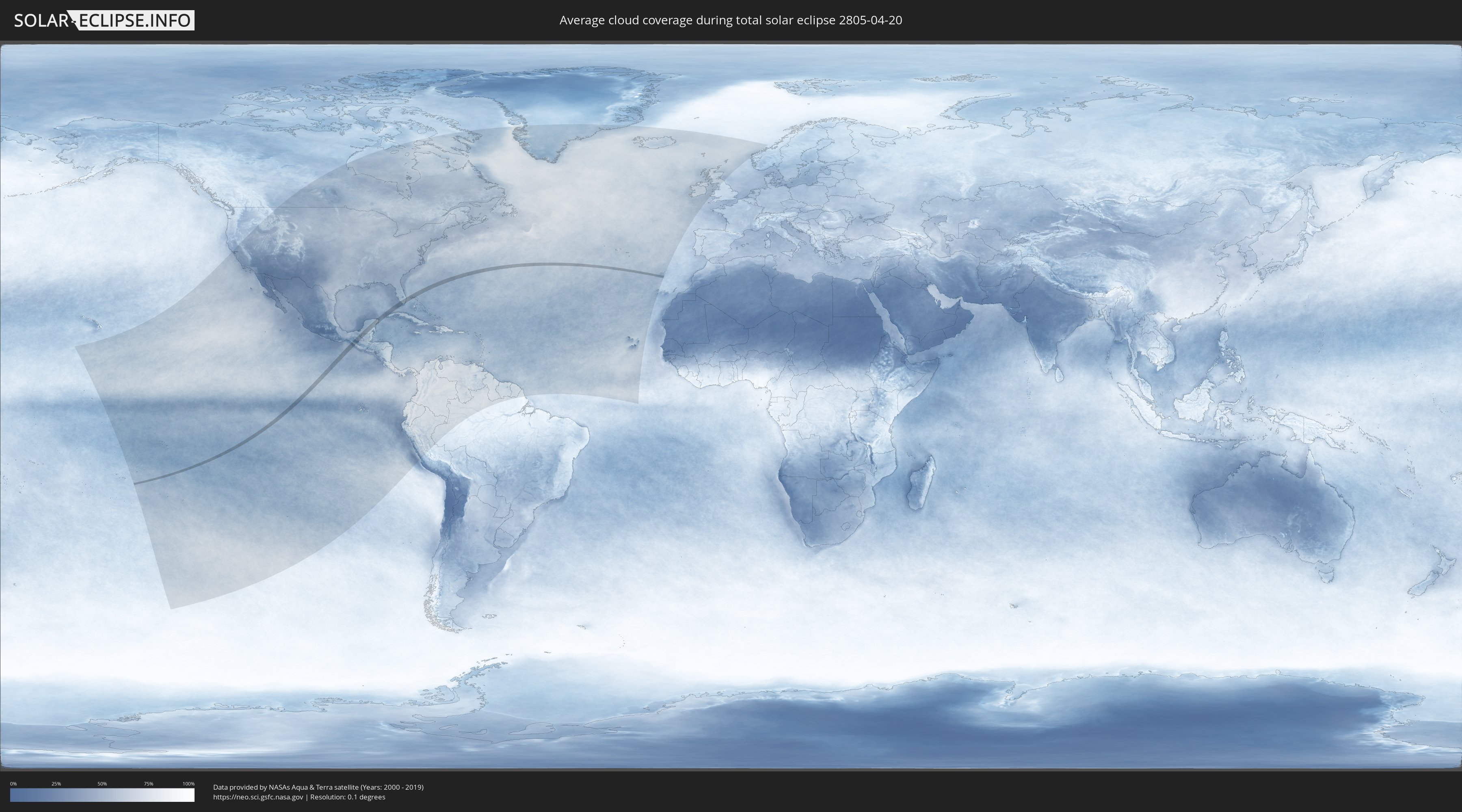
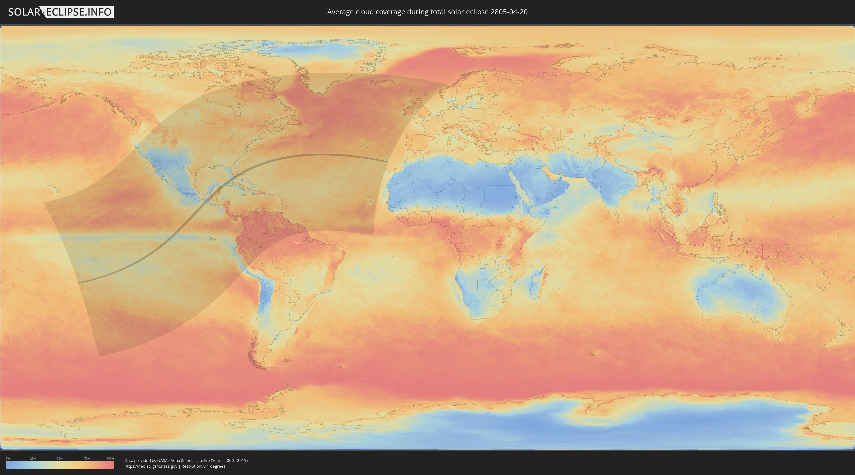
How will be the weather during the total solar eclipse on 04/20/2805?
Where is the best place to see the total solar eclipse of 04/20/2805?
The following maps show the average cloud coverage for the day of the total solar eclipse.
With the help of these maps, it is possible to find the place along the eclipse path, which has the best
chance of a cloudless sky.
Nevertheless, you should consider local circumstances and inform about the weather of your chosen
observation site.
The data is provided by NASAs satellites
AQUA and TERRA.
The cloud maps are averaged over a period of 19 years (2000 - 2019).
Detailed country maps
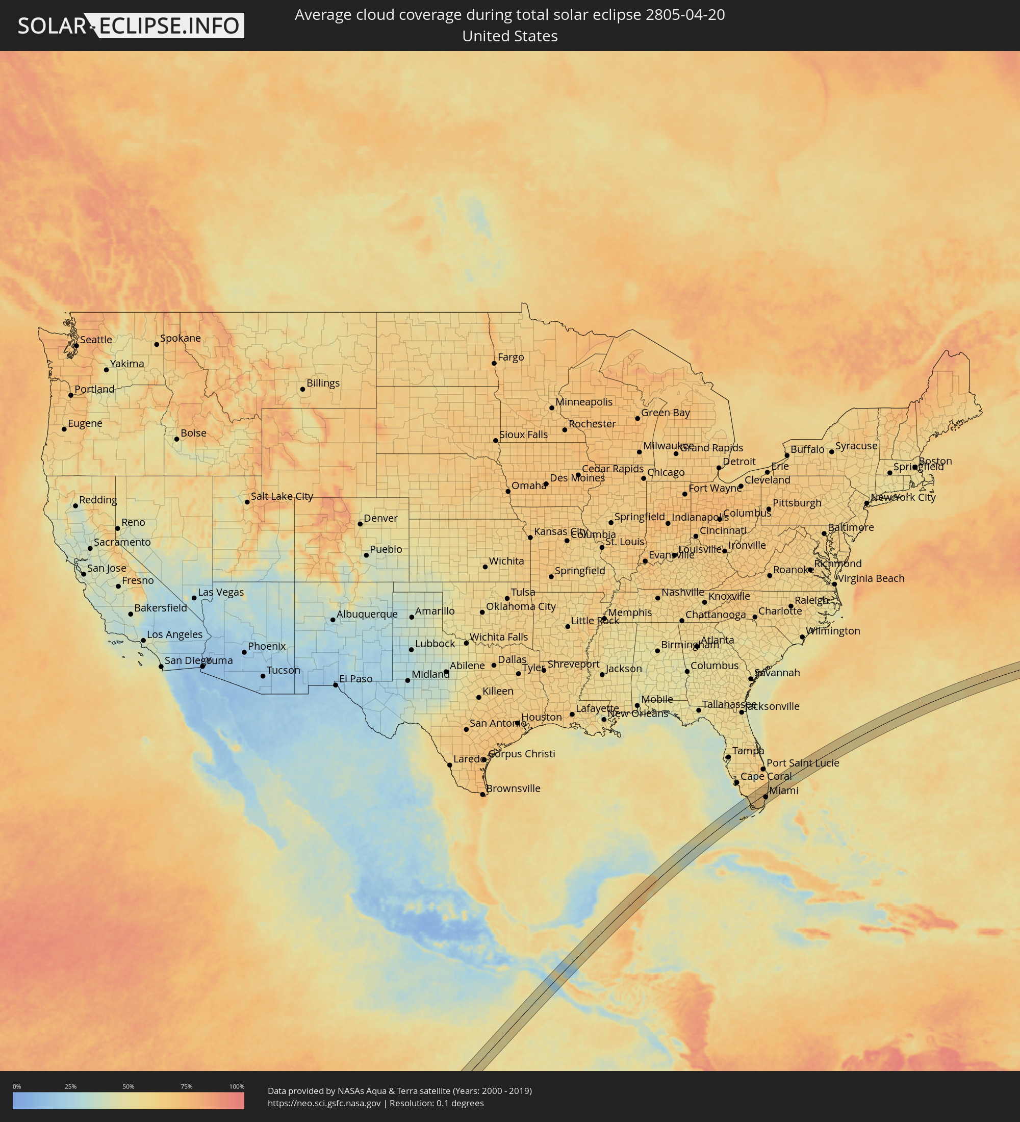 United States
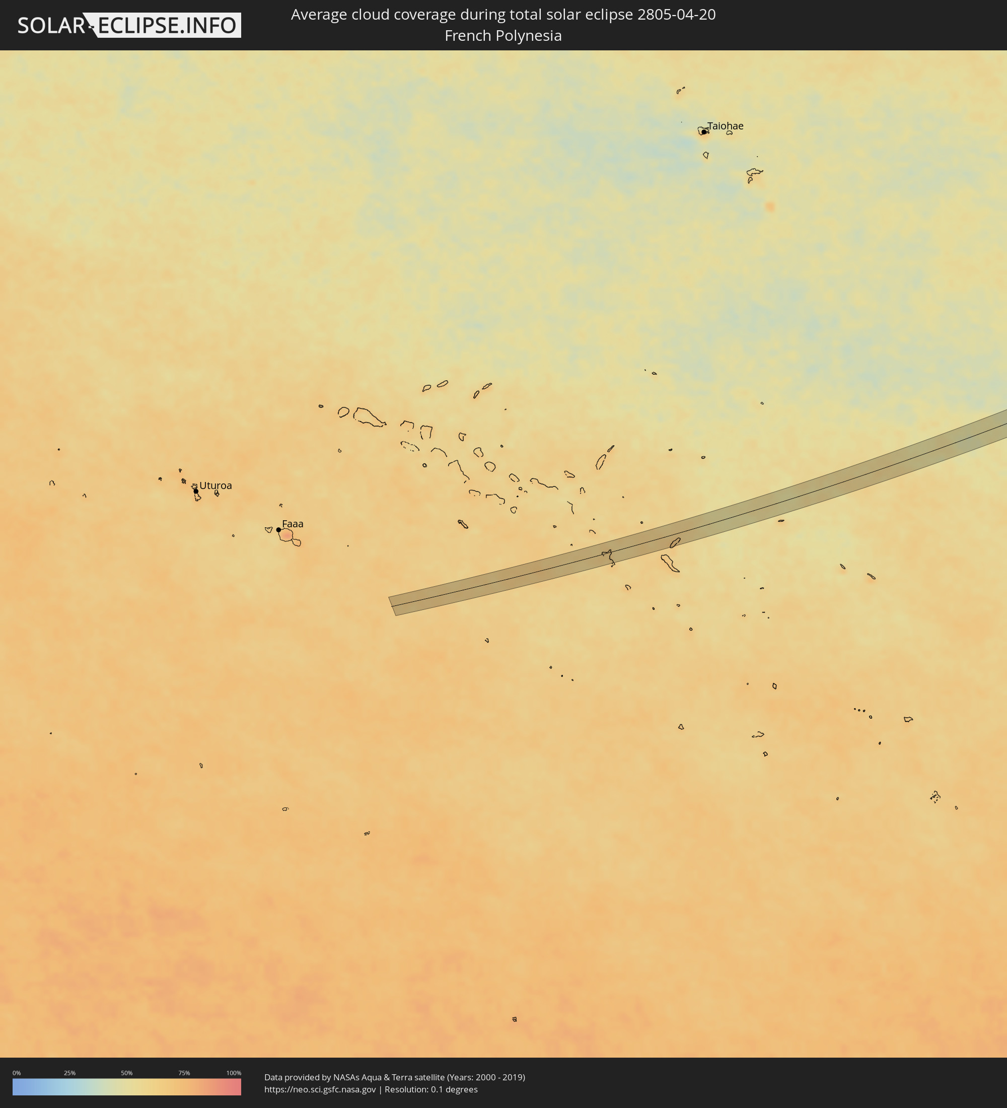 French Polynesia
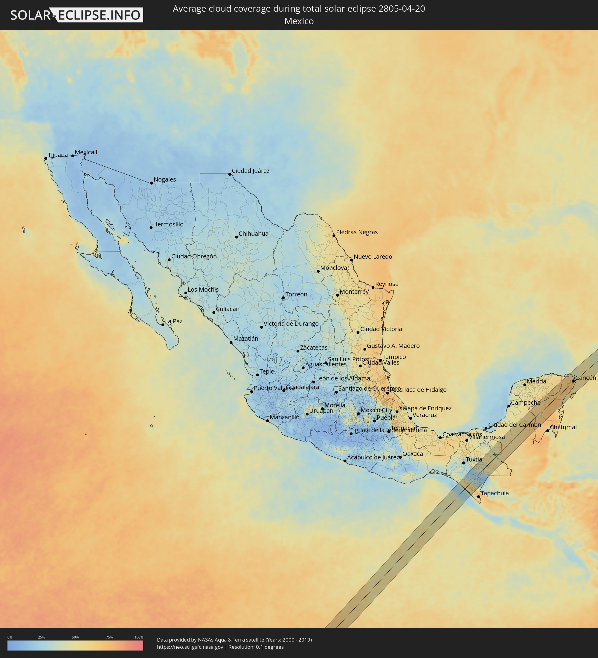 Mexico
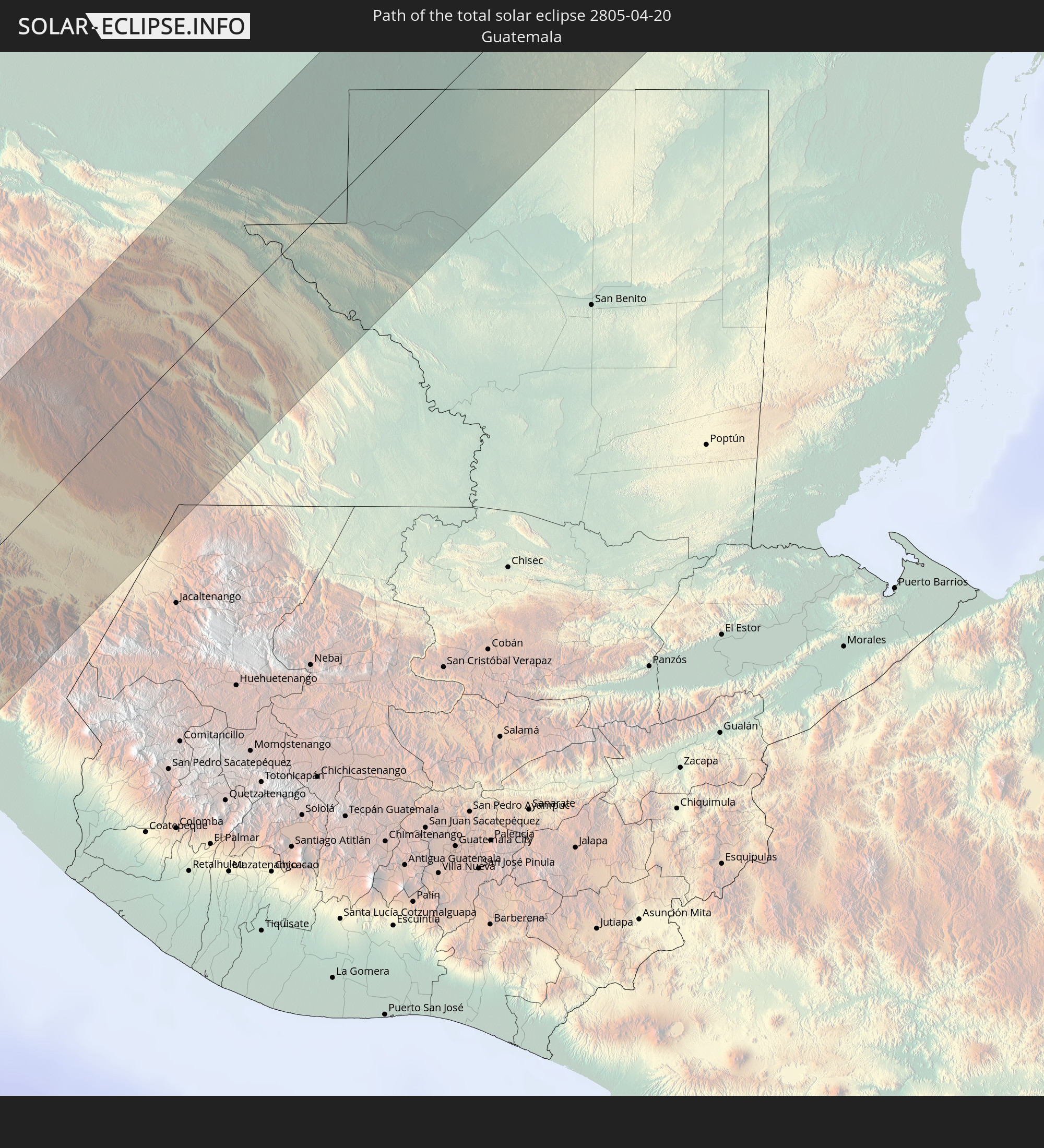
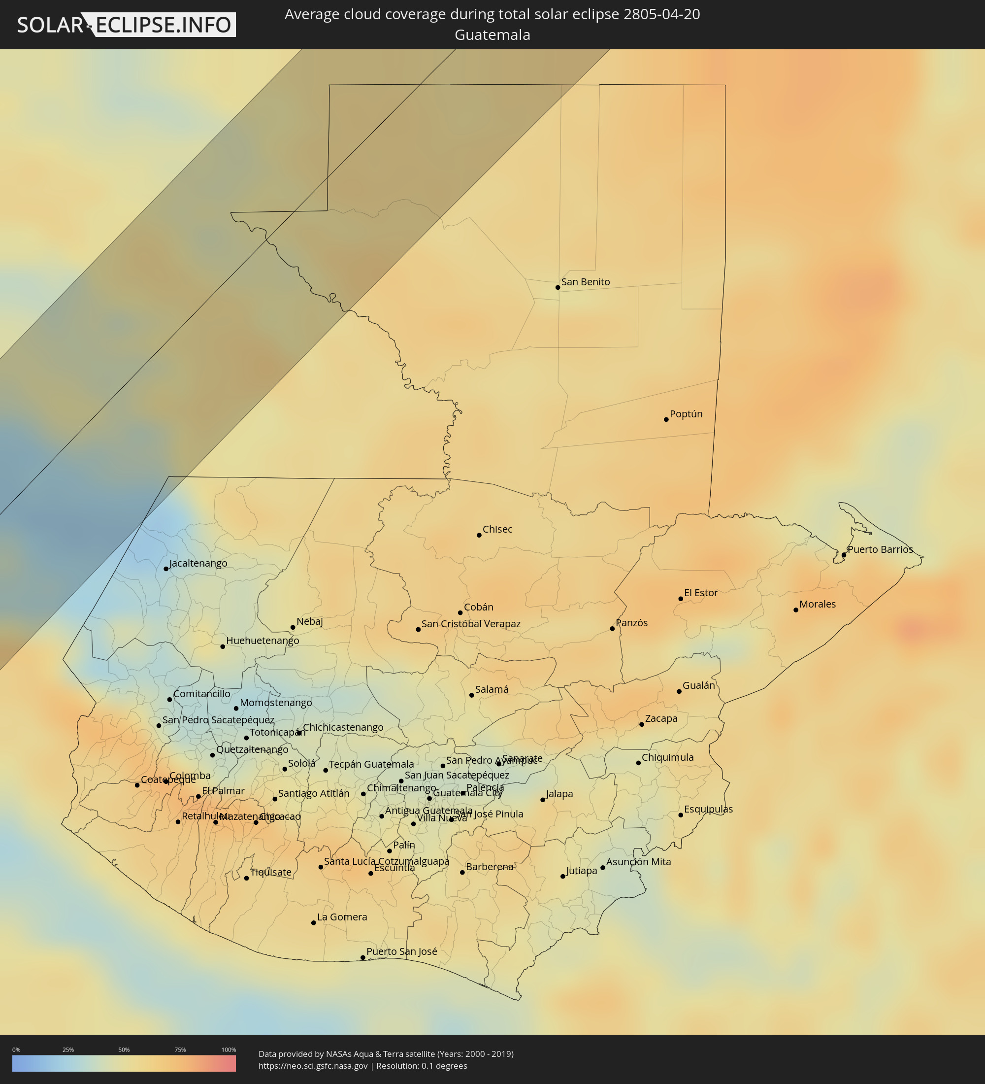 Guatemala
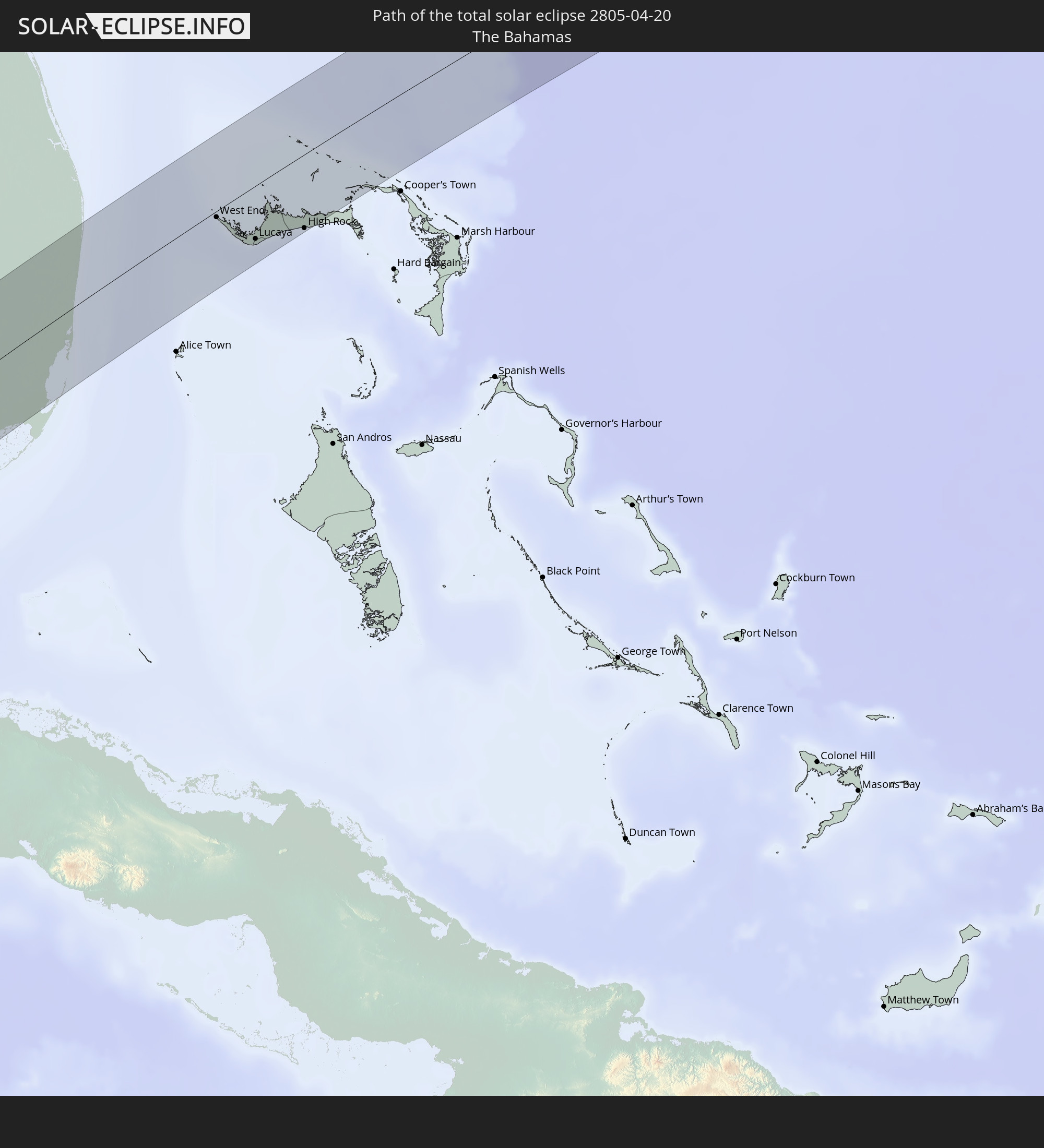
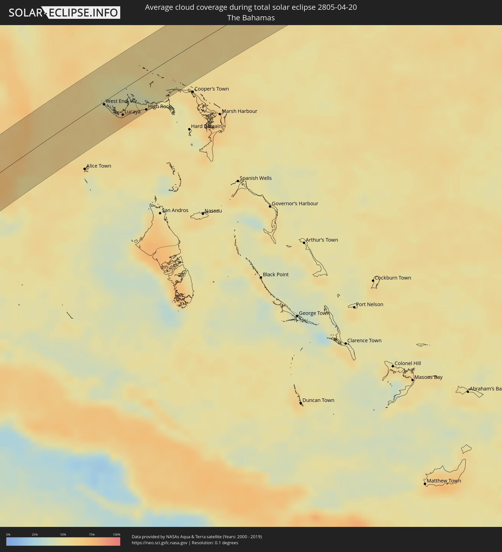 The Bahamas
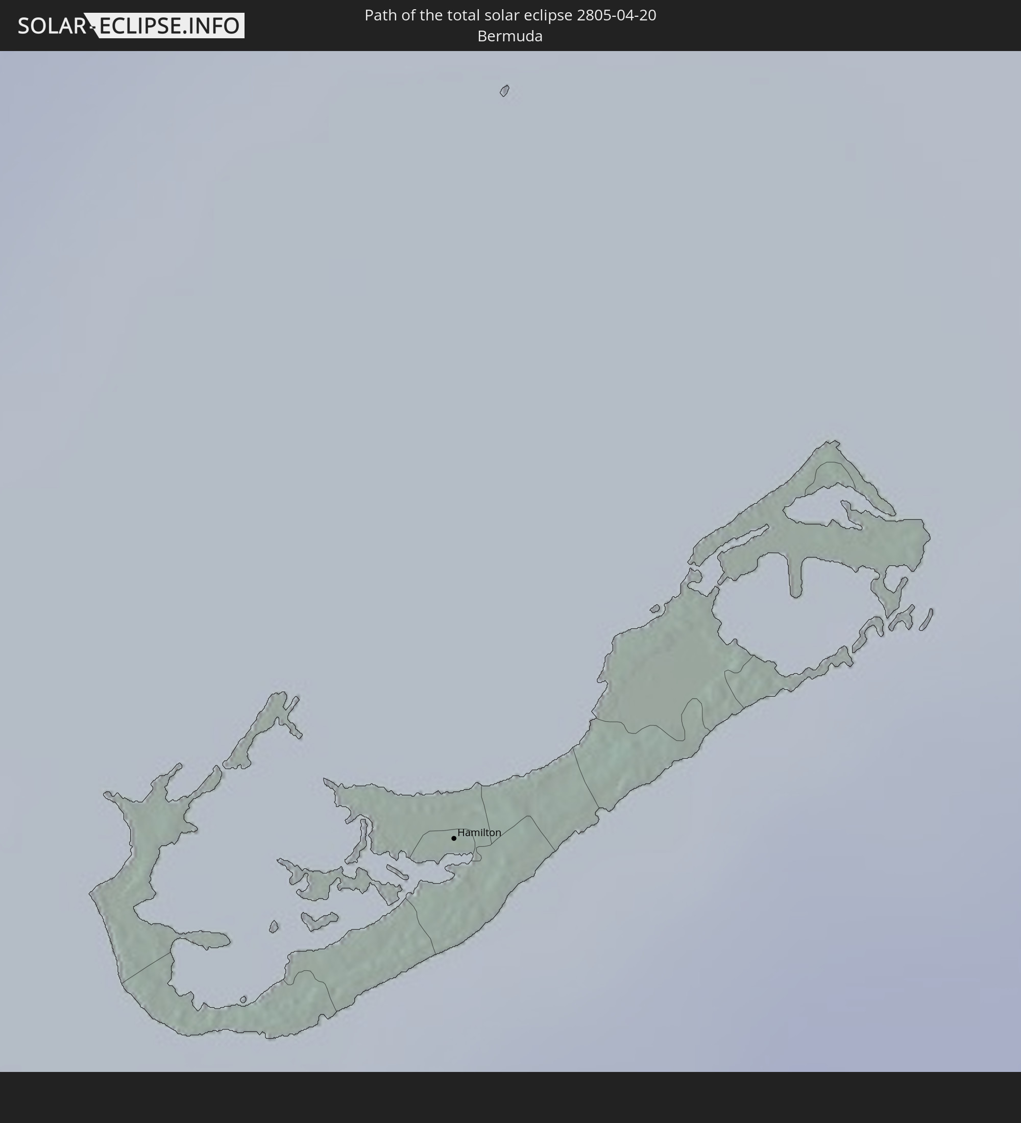
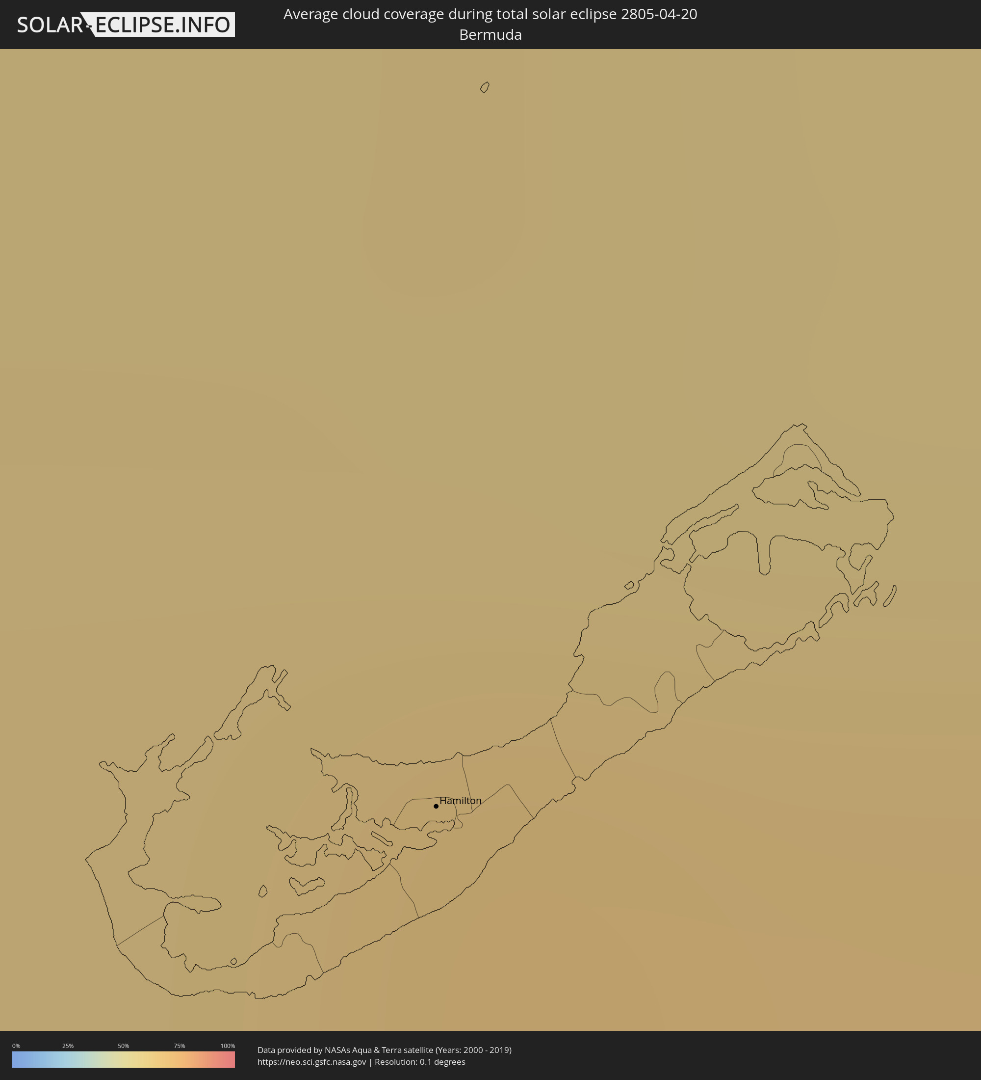 Bermuda
Cities inside the path of the eclipse
The following table shows all locations with a population of more than 5,000 inside the eclipse path. Cities which have more than 100,000 inhabitants are marked bold. A click at the locations opens a detailed map.
| City | Type | Eclipse duration | Local time of max. eclipse | Distance to central line | Ø Cloud coverage |
|
Pijijiapan, Chiapas
|
total | - | 11:40:39 UTC-06:00 | 37 km | 45% |
|
Mapastepec, Chiapas
|
total | - | 11:40:43 UTC-06:00 | 6 km | 49% |
|
Nueva Palestina, Chiapas
|
total | - | 11:41:47 UTC-06:00 | 11 km | 39% |
|
Angel Albino Corzo, Chiapas
|
total | - | 11:41:59 UTC-06:00 | 14 km | 30% |
|
Acapetahua, Chiapas
|
total | - | 11:40:49 UTC-06:00 | 34 km | 51% |
|
Acacoyagua, Chiapas
|
total | - | 11:40:58 UTC-06:00 | 31 km | 51% |
|
Escuintla, Chiapas
|
total | - | 11:40:57 UTC-06:00 | 34 km | 51% |
|
Villa Comaltitlán, Chiapas
|
total | - | 11:40:53 UTC-06:00 | 48 km | 52% |
|
Venustiano Carranza, Chiapas
|
total | - | 11:43:15 UTC-06:00 | 37 km | 22% |
|
Teopisca, Chiapas
|
total | - | 11:43:51 UTC-06:00 | 46 km | 37% |
|
Chanal, Chiapas
|
total | - | 11:44:31 UTC-06:00 | 38 km | 44% |
|
Tzimol, Chiapas
|
total | - | 11:43:39 UTC-06:00 | 3 km | 26% |
|
Altamirano, Chiapas
|
total | - | 11:45:11 UTC-06:00 | 48 km | 41% |
|
Frontera Comalapa, Chiapas
|
total | - | 11:42:40 UTC-06:00 | 47 km | 25% |
|
Comitán, Chiapas
|
total | - | 11:43:54 UTC-06:00 | 3 km | 30% |
|
Ocosingo, Chiapas
|
total | - | 11:45:21 UTC-06:00 | 45 km | 43% |
|
La Trinitaria, Chiapas
|
total | - | 11:43:47 UTC-06:00 | 19 km | 24% |
|
Las Margaritas, Chiapas
|
total | - | 11:44:20 UTC-06:00 | 9 km | 36% |
|
Tenosique de Pino Suárez, Tabasco
|
total | - | 11:47:49 UTC-06:00 | 38 km | 46% |
|
Nueva Palestina, Chiapas
|
total | - | 11:46:47 UTC-06:00 | 25 km | 57% |
|
San Carlos, Tabasco
|
total | - | 11:48:30 UTC-06:00 | 24 km | 52% |
|
Frontera Corozal, Chiapas
|
total | - | 11:47:31 UTC-06:00 | 53 km | 56% |
|
Chunhuhub, Quintana Roo
|
total | - | 12:57:41 UTC-05:00 | 4 km | 63% |
|
Felipe Carrillo Puerto, Quintana Roo
|
total | - | 12:58:46 UTC-05:00 | 44 km | 73% |
|
Chemax, Yucatán
|
total | - | 12:01:05 UTC-06:00 | 36 km | 65% |
|
Kantunilkin, Quintana Roo
|
total | - | 13:02:50 UTC-05:00 | 41 km | 66% |
|
Tulum, Quintana Roo
|
total | - | 13:01:11 UTC-05:00 | 34 km | 57% |
|
Leona Vicario, Quintana Roo
|
total | - | 13:03:12 UTC-05:00 | 12 km | 73% |
|
Playa del Carmen, Quintana Roo
|
total | - | 13:02:45 UTC-05:00 | 27 km | 56% |
|
San Miguel de Cozumel, Quintana Roo
|
total | - | 13:02:47 UTC-05:00 | 47 km | 64% |
|
Alfredo V. Bonfil, Quintana Roo
|
total | - | 13:04:06 UTC-05:00 | 5 km | 58% |
|
Cancún, Quintana Roo
|
total | - | 13:04:16 UTC-05:00 | 2 km | 60% |
|
Isla Mujeres, Quintana Roo
|
total | - | 13:04:37 UTC-05:00 | 1 km | 56% |
|
Key West, Florida
|
total | - | 13:20:31 UTC-05:00 | 37 km | 39% |
|
Florida City, Florida
|
total | - | 13:24:33 UTC-05:00 | 33 km | 64% |
|
Homestead, Florida
|
total | - | 13:24:35 UTC-05:00 | 32 km | 67% |
|
Country Walk, Florida
|
total | - | 13:24:55 UTC-05:00 | 19 km | 60% |
|
Naranja, Florida
|
total | - | 13:24:46 UTC-05:00 | 30 km | 62% |
|
Weston, Florida
|
total | - | 13:25:41 UTC-05:00 | 21 km | 68% |
|
Three Lakes, Florida
|
total | - | 13:25:00 UTC-05:00 | 21 km | 60% |
|
Goulds, Florida
|
total | - | 13:24:55 UTC-05:00 | 29 km | 60% |
|
Sweetwater, Florida
|
total | - | 13:25:14 UTC-05:00 | 11 km | 69% |
|
Westwood Lake, Florida
|
total | - | 13:25:11 UTC-05:00 | 14 km | 64% |
|
Richmond Heights, Florida
|
total | - | 13:25:03 UTC-05:00 | 23 km | 60% |
|
West Perrine, Florida
|
total | - | 13:25:01 UTC-05:00 | 26 km | 60% |
|
Palmetto Estates, Florida
|
total | - | 13:25:03 UTC-05:00 | 24 km | 60% |
|
Olympia Heights, Florida
|
total | - | 13:25:13 UTC-05:00 | 15 km | 64% |
|
Doral, Florida
|
total | - | 13:25:21 UTC-05:00 | 7 km | 69% |
|
Sunset, Florida
|
total | - | 13:25:12 UTC-05:00 | 17 km | 64% |
|
East Perrine, Florida
|
total | - | 13:25:04 UTC-05:00 | 27 km | 51% |
|
Southwest Ranches, Florida
|
total | - | 13:25:45 UTC-05:00 | 14 km | 71% |
|
Glenvar Heights, Florida
|
total | - | 13:25:15 UTC-05:00 | 19 km | 56% |
|
Lakes by the Bay, Florida
|
total | - | 13:25:03 UTC-05:00 | 31 km | 51% |
|
Kendall, Florida
|
total | - | 13:25:13 UTC-05:00 | 22 km | 56% |
|
Cutler, Florida
|
total | - | 13:25:08 UTC-05:00 | 28 km | 51% |
|
Pinecrest, Florida
|
total | - | 13:25:13 UTC-05:00 | 23 km | 56% |
|
South Miami, Florida
|
total | - | 13:25:19 UTC-05:00 | 21 km | 56% |
|
Miami Springs, Florida
|
total | - | 13:25:30 UTC-05:00 | 10 km | 67% |
|
Coral Springs, Florida
|
total | - | 13:26:12 UTC-05:00 | 30 km | 70% |
|
Opa-locka, Florida
|
total | - | 13:25:42 UTC-05:00 | 5 km | 66% |
|
Westview, Florida
|
total | - | 13:25:41 UTC-05:00 | 8 km | 61% |
|
Lake Lucerne, Florida
|
total | - | 13:25:48 UTC-05:00 | 0 km | 64% |
|
Brownsville, Florida
|
total | - | 13:25:35 UTC-05:00 | 13 km | 61% |
|
Gladeview, Florida
|
total | - | 13:25:38 UTC-05:00 | 12 km | 61% |
|
Scott Lake, Florida
|
total | - | 13:25:47 UTC-05:00 | 3 km | 61% |
|
Pembroke Pines, Florida
|
total | - | 13:25:54 UTC-05:00 | 3 km | 64% |
|
Pinewood, Florida
|
total | - | 13:25:43 UTC-05:00 | 10 km | 61% |
|
Andover, Florida
|
total | - | 13:25:52 UTC-05:00 | 1 km | 64% |
|
West Park, Florida
|
total | - | 13:25:55 UTC-05:00 | 1 km | 64% |
|
Miami, Florida
|
total | - | 13:25:37 UTC-05:00 | 20 km | 61% |
|
Melrose Park, Florida
|
total | - | 13:26:07 UTC-05:00 | 11 km | 65% |
|
Miami Shores, Florida
|
total | - | 13:25:45 UTC-05:00 | 12 km | 61% |
|
Key Biscayne, Florida
|
total | - | 13:25:33 UTC-05:00 | 29 km | 54% |
|
Ojus, Florida
|
total | - | 13:25:58 UTC-05:00 | 7 km | 61% |
|
North Andrews Gardens, Florida
|
total | - | 13:26:20 UTC-05:00 | 15 km | 61% |
|
Fort Lauderdale, Florida
|
total | - | 13:26:14 UTC-05:00 | 9 km | 59% |
|
Kings Point, Florida
|
total | - | 13:26:43 UTC-05:00 | 38 km | 63% |
|
Wilton Manors, Florida
|
total | - | 13:26:18 UTC-05:00 | 12 km | 61% |
|
Pompano Beach Highlands, Florida
|
total | - | 13:26:32 UTC-05:00 | 21 km | 61% |
|
Lighthouse Point, Florida
|
total | - | 13:26:34 UTC-05:00 | 20 km | 61% |
|
Boca Raton, Florida
|
total | - | 13:26:42 UTC-05:00 | 27 km | 63% |
|
Boynton Beach, Florida
|
total | - | 13:26:59 UTC-05:00 | 41 km | 64% |
|
Lantana, Florida
|
total | - | 13:27:06 UTC-05:00 | 46 km | 63% |
|
West End, West Grand Bahama
|
total | - | 13:29:22 UTC-05:00 | 4 km | 56% |
|
Freeport, Freeport
|
total | - | 13:29:42 UTC-05:00 | 33 km | 60% |
|
Lucaya, Freeport
|
total | - | 13:29:46 UTC-05:00 | 35 km | 60% |
|
High Rock, East Grand Bahama
|
total | - | 18:30:39 UTC+00:00 | 49 km | 60% |
|
Hamilton, Hamilton city
|
total | - | 15:00:31 UTC-04:00 | 28 km | 65% |