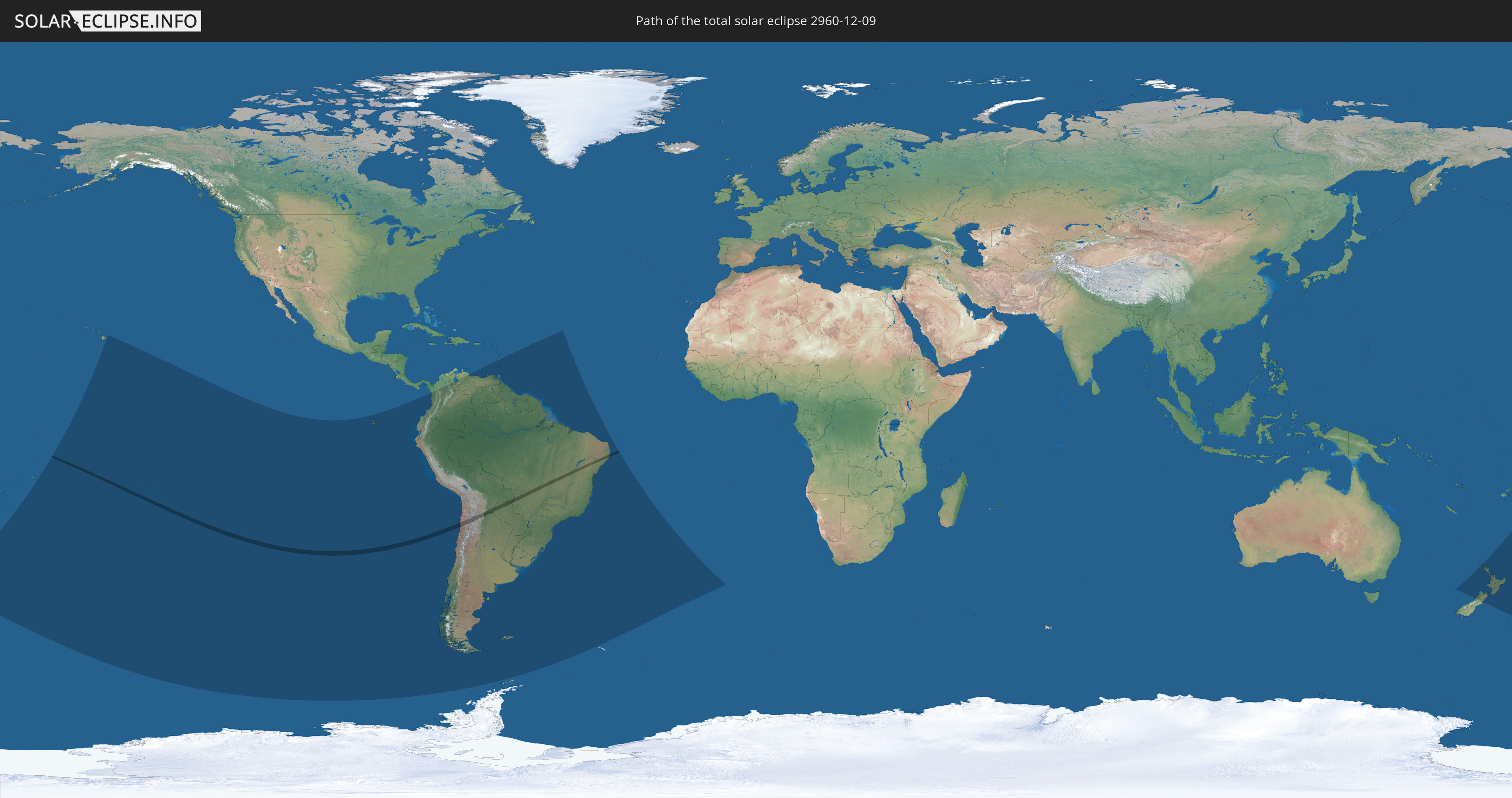
Total solar eclipse of 12/09/2960
| Day of week: | Tuesday |
| Maximum duration of eclipse: | 02m57s |
| Maximum width of eclipse path: | 111 km |
| Saros cycle: | 167 |
| Coverage: | 100% |
| Magnitude: | 1.0323 |
| Gamma: | -0.1517 |
Wo kann man die Sonnenfinsternis vom 12/09/2960 sehen?
Die Sonnenfinsternis am 12/09/2960 kann man in 31 Ländern als partielle Sonnenfinsternis beobachten.
Der Finsternispfad verläuft durch 7 Länder. Nur in diesen Ländern ist sie als total Sonnenfinsternis zu sehen.
In den folgenden Ländern ist die Sonnenfinsternis total zu sehen
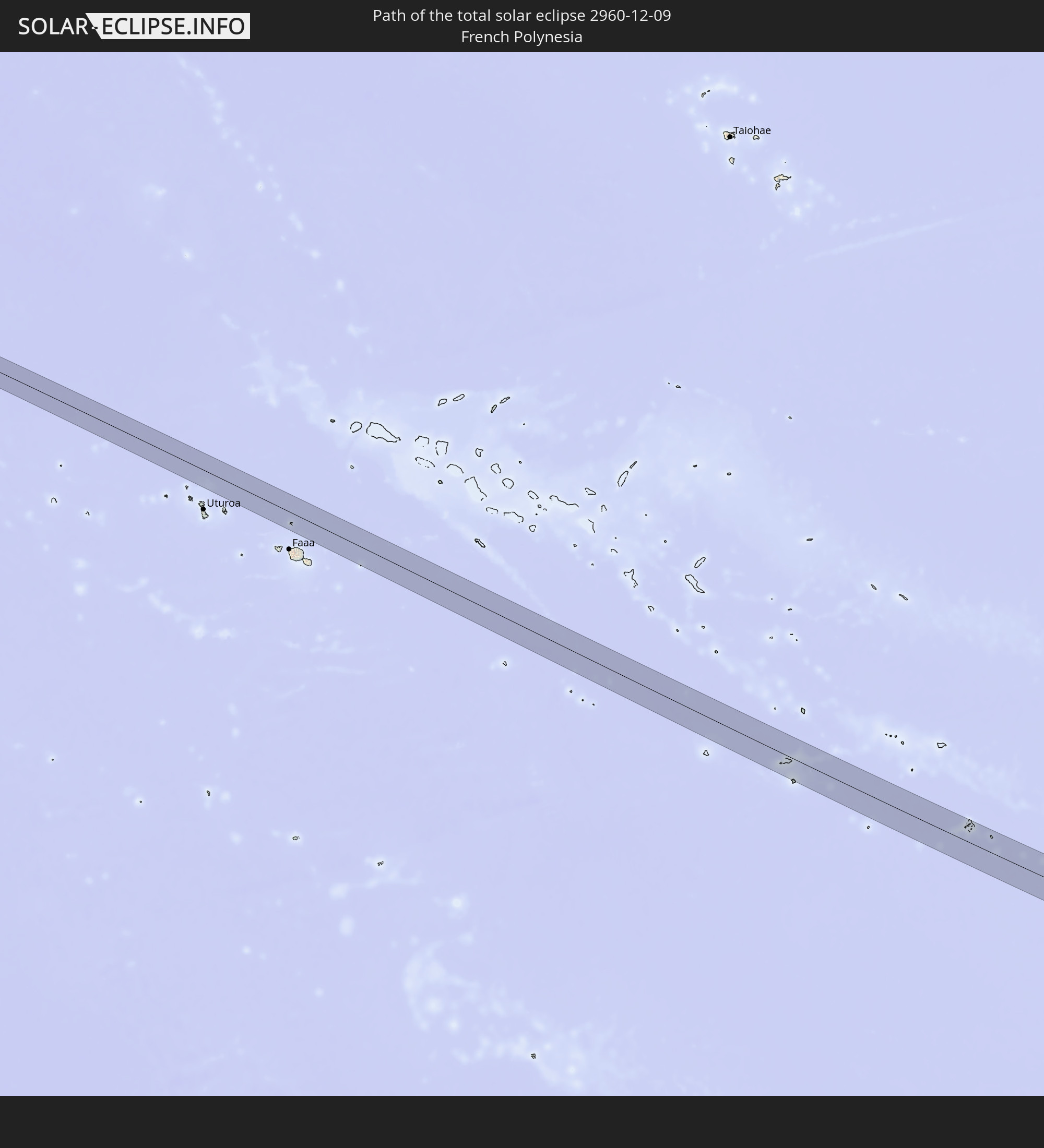 French Polynesia
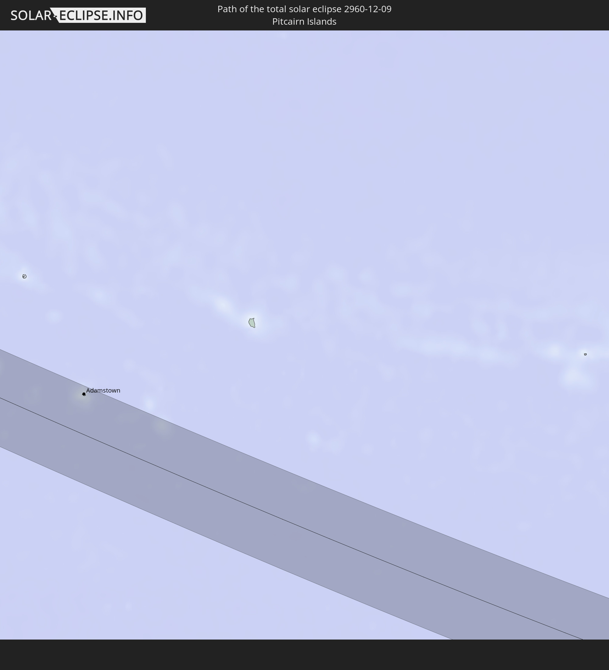 Pitcairn Islands
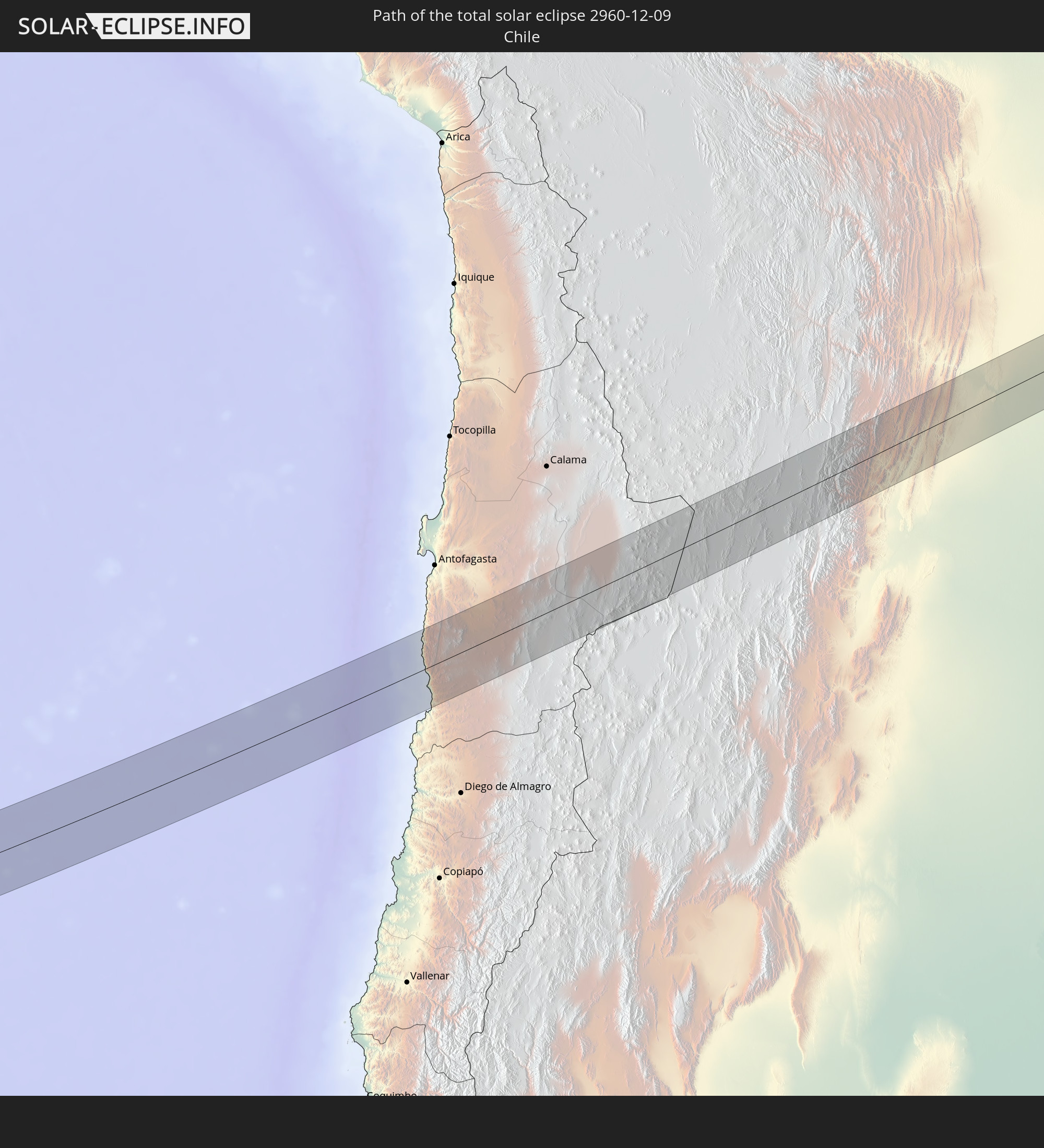 Chile
Chile
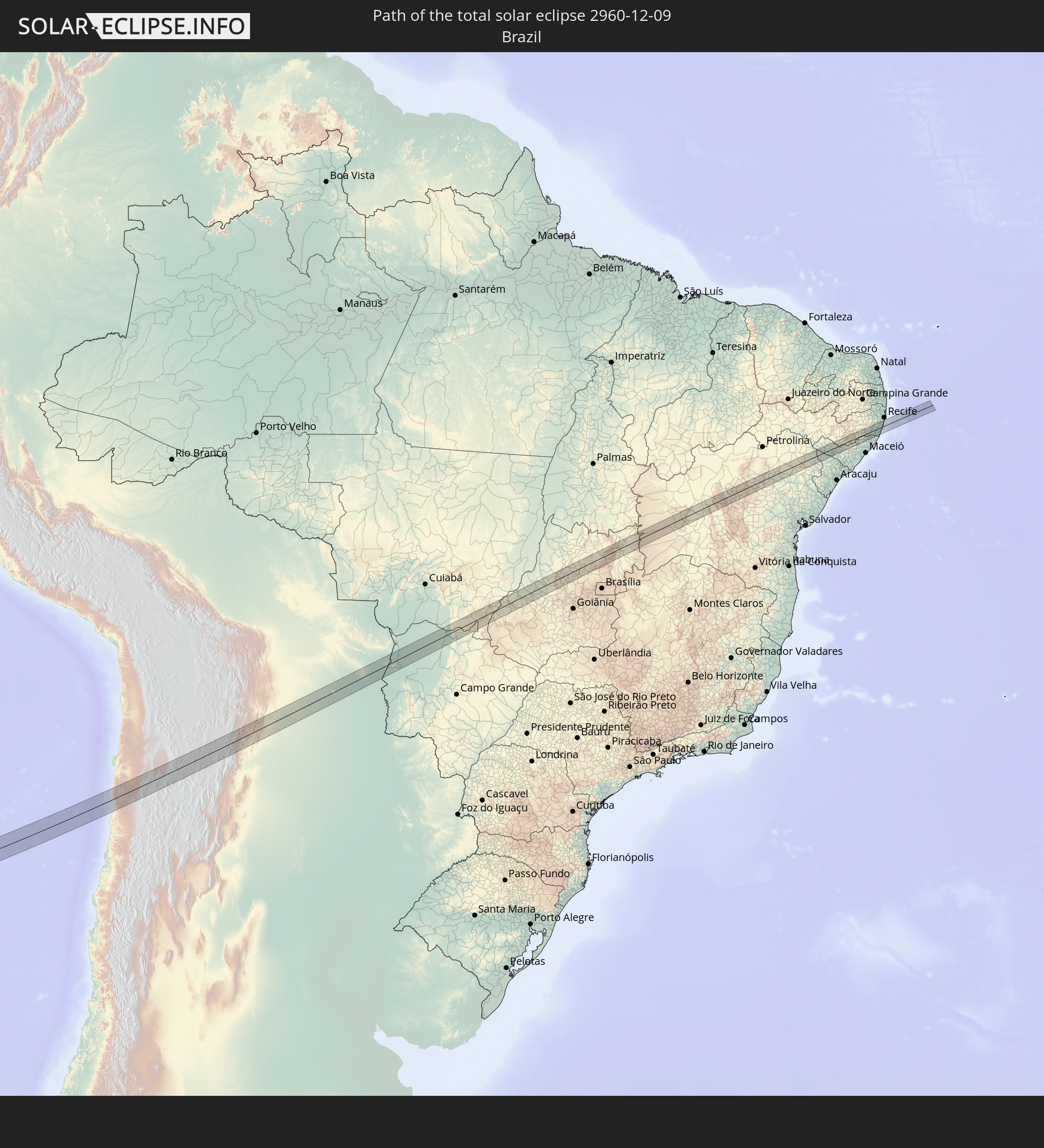 Brazil
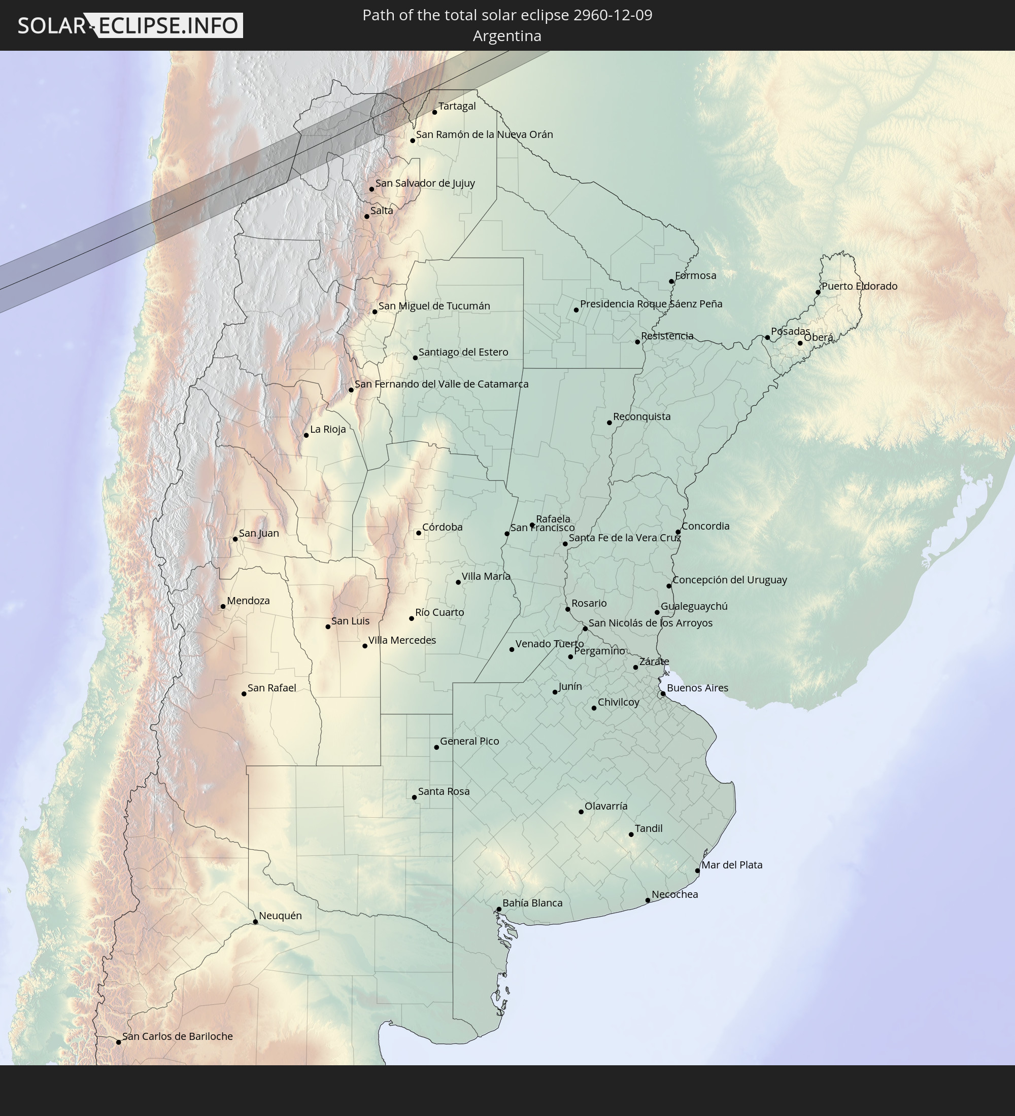 Argentina
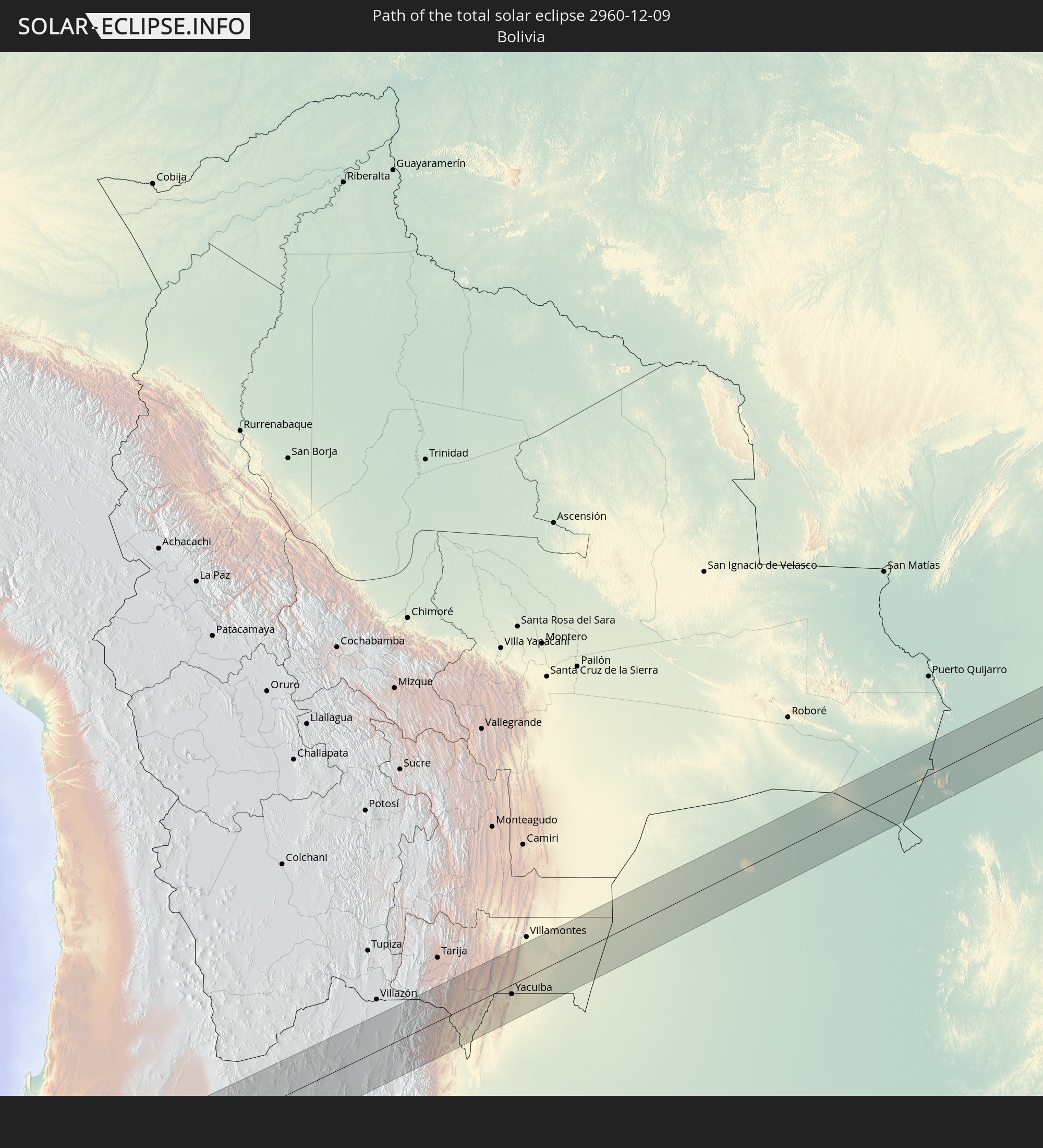 Bolivia
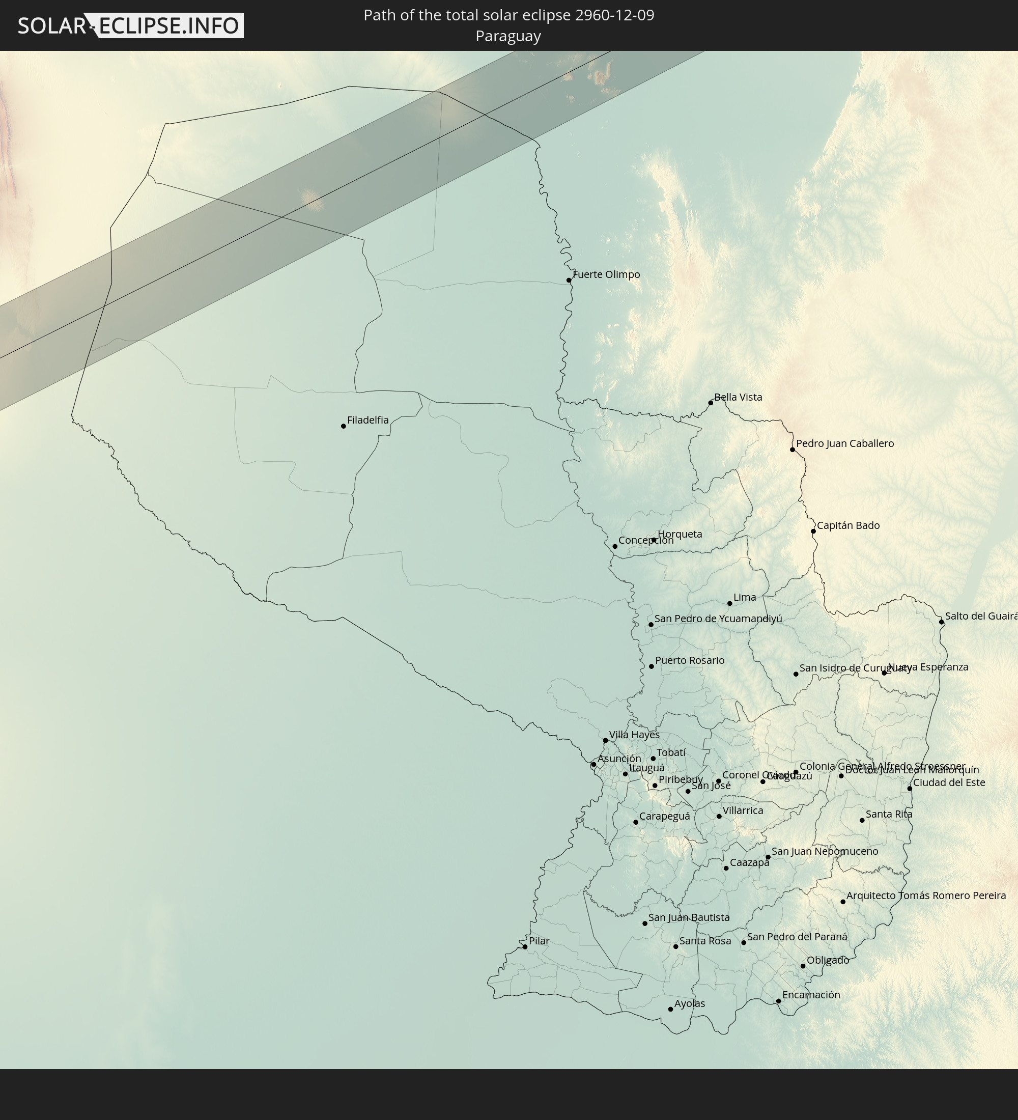 Paraguay
In den folgenden Ländern ist die Sonnenfinsternis partiell zu sehen
 New Zealand
 United States Minor Outlying Islands
 Tonga
Tonga
 Kiribati
 American Samoa
 Niue
Niue
 Cook Islands
 French Polynesia
 Pitcairn Islands
 Chile
Chile
 Ecuador
 Colombia
 Peru
Peru
 Brazil
 Argentina
 Venezuela
 Bolivia
 Paraguay
 Trinidad and Tobago
 Grenada
 Saint Vincent and the Grenadines
 Falkland Islands
 Guyana
 Martinique
 Saint Lucia
 Barbados
 Uruguay
 Suriname
 French Guiana
 South Georgia and the South Sandwich Islands
 Saint Helena, Ascension and Tristan da Cunha
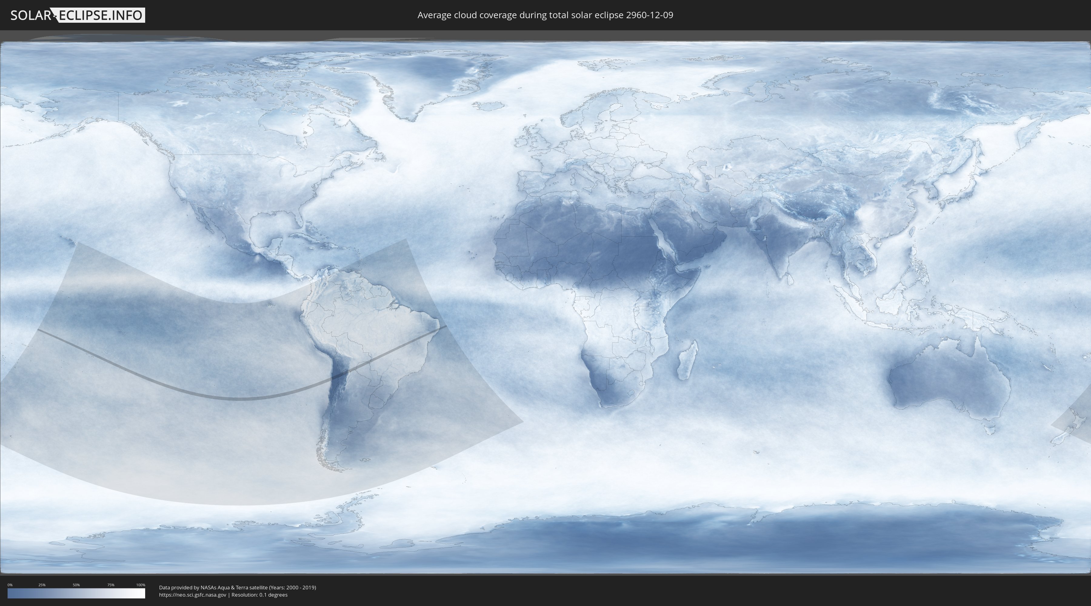
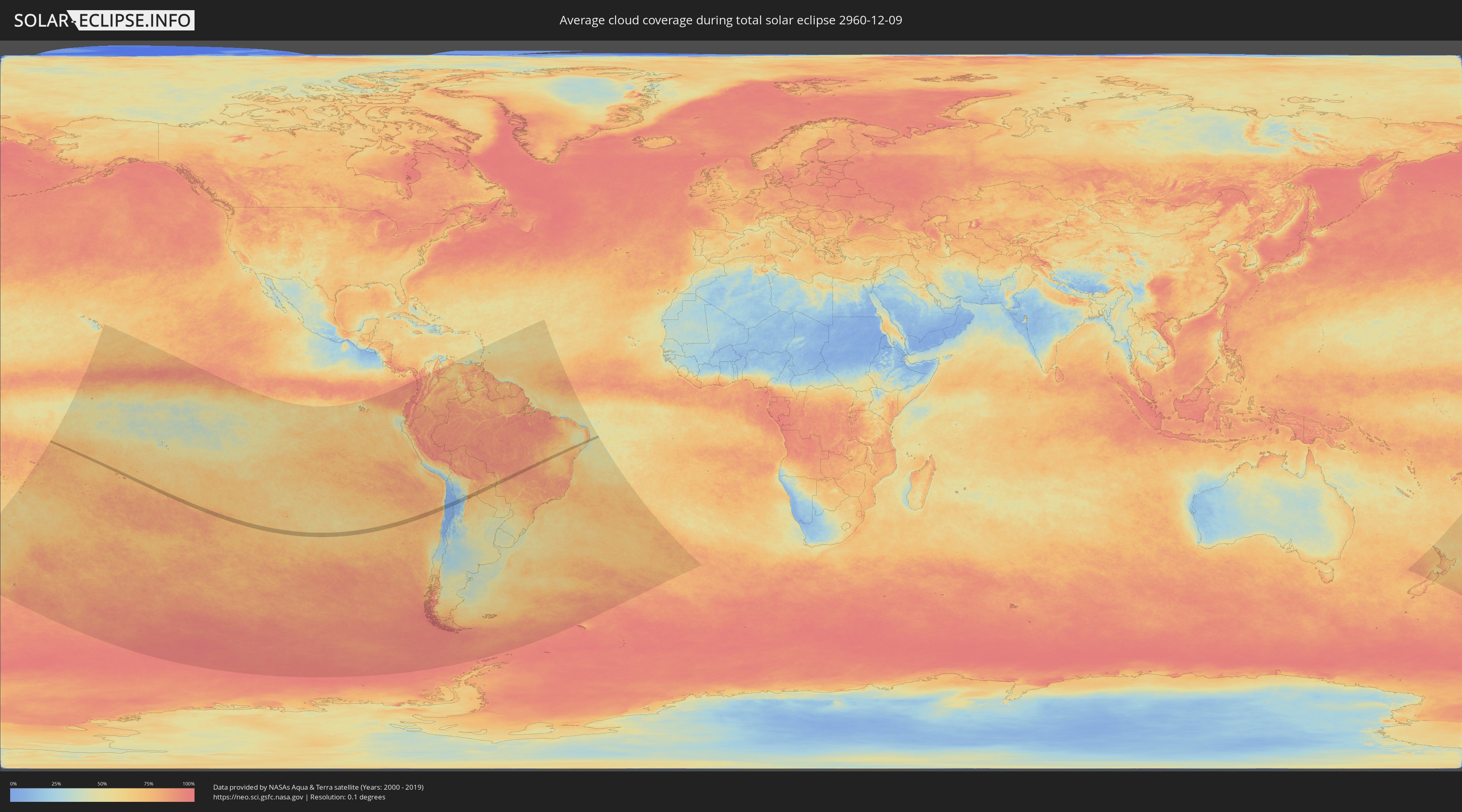
How will be the weather during the total solar eclipse on 12/09/2960?
Where is the best place to see the total solar eclipse of 12/09/2960?
The following maps show the average cloud coverage for the day of the total solar eclipse.
With the help of these maps, it is possible to find the place along the eclipse path, which has the best
chance of a cloudless sky.
Nevertheless, you should consider local circumstances and inform about the weather of your chosen
observation site.
The data is provided by NASAs satellites
AQUA and TERRA.
The cloud maps are averaged over a period of 19 years (2000 - 2019).
Detailed country maps
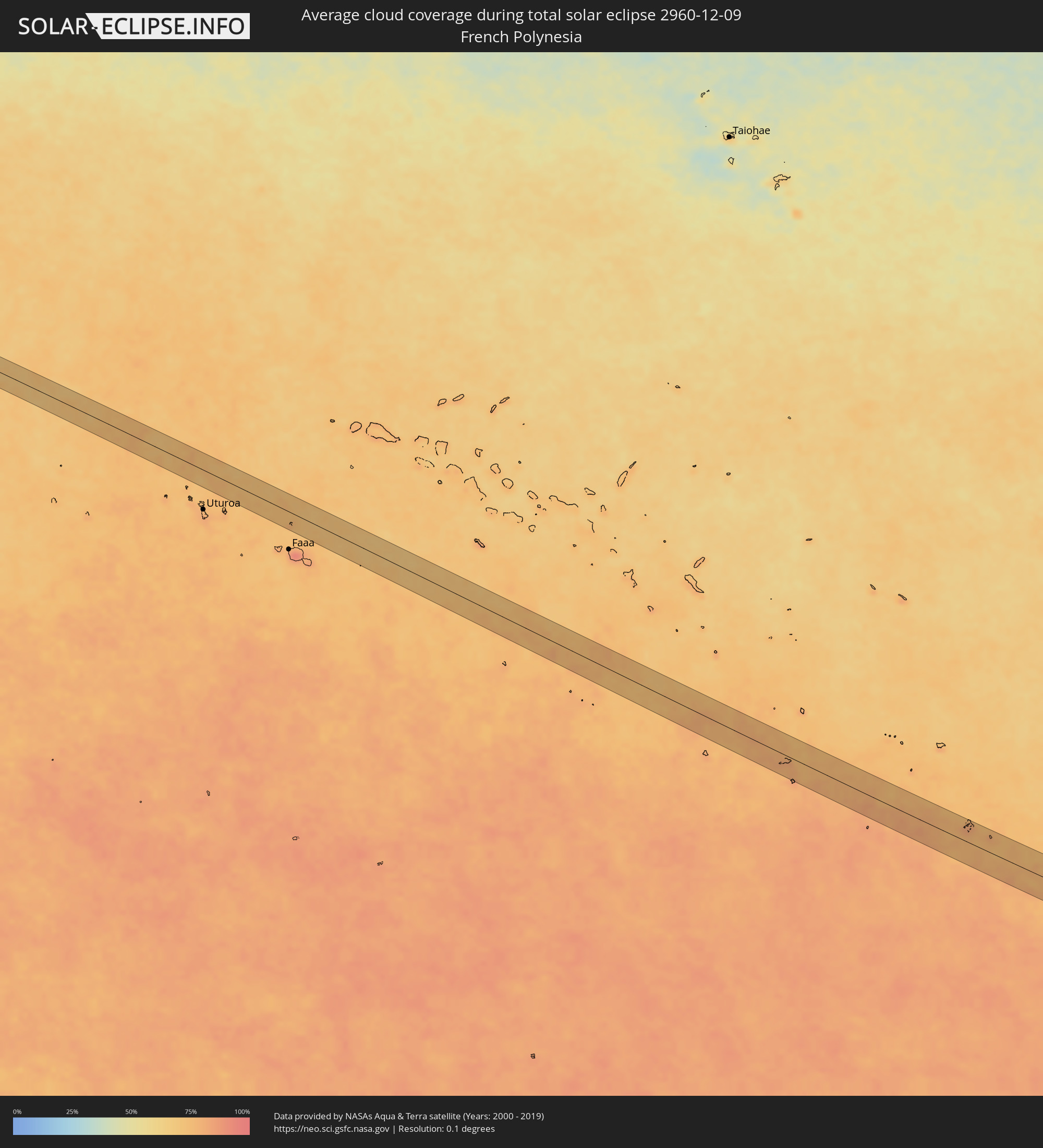 French Polynesia
 Pitcairn Islands
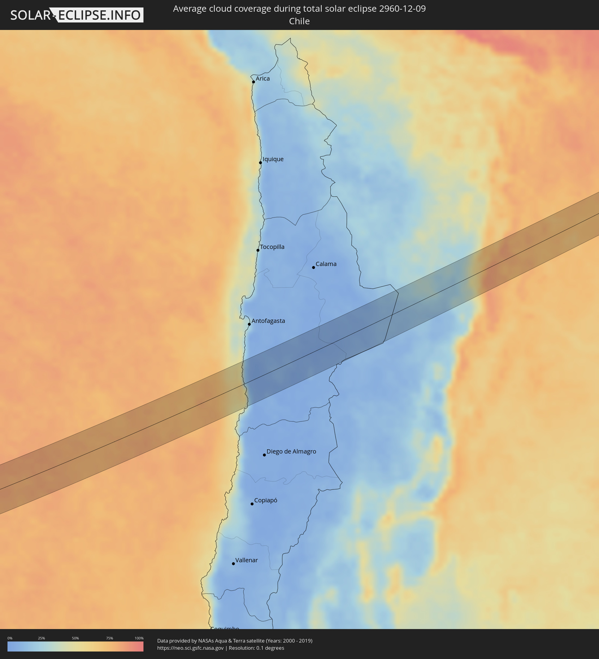 Chile
Chile
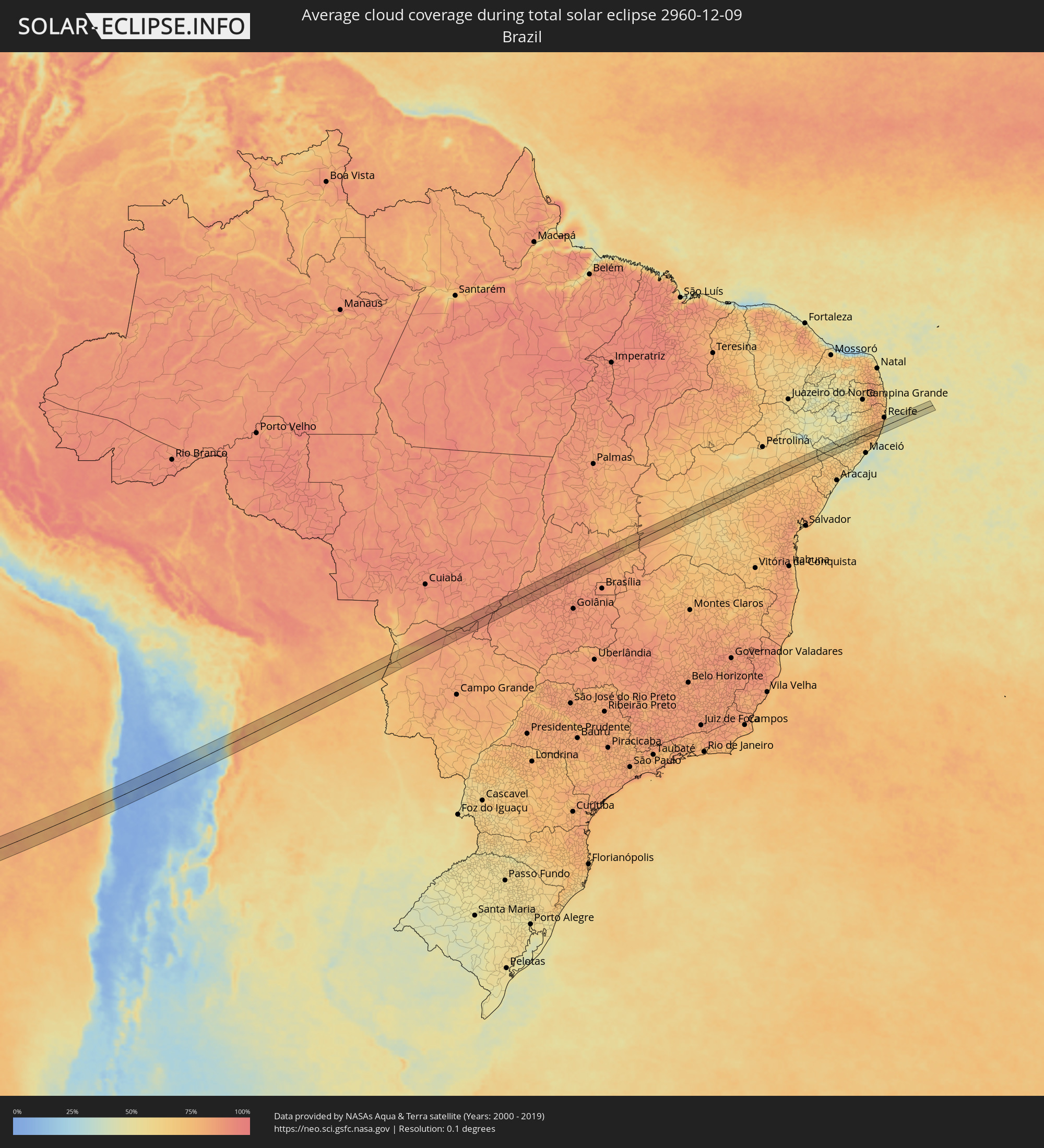 Brazil
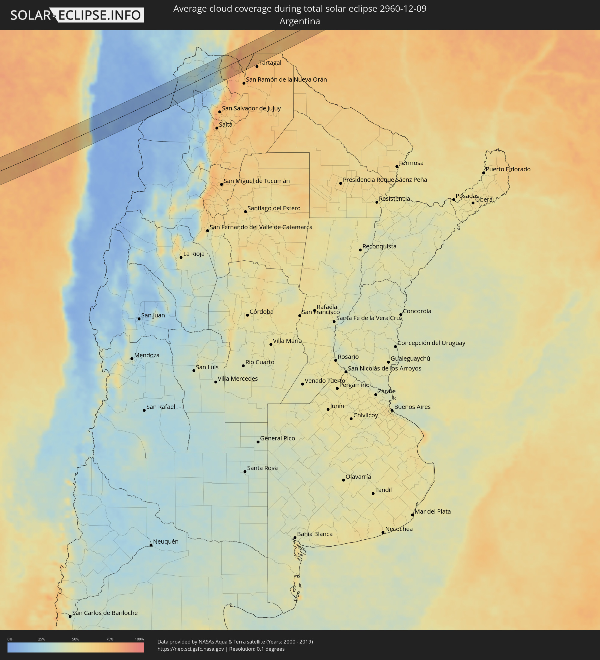 Argentina
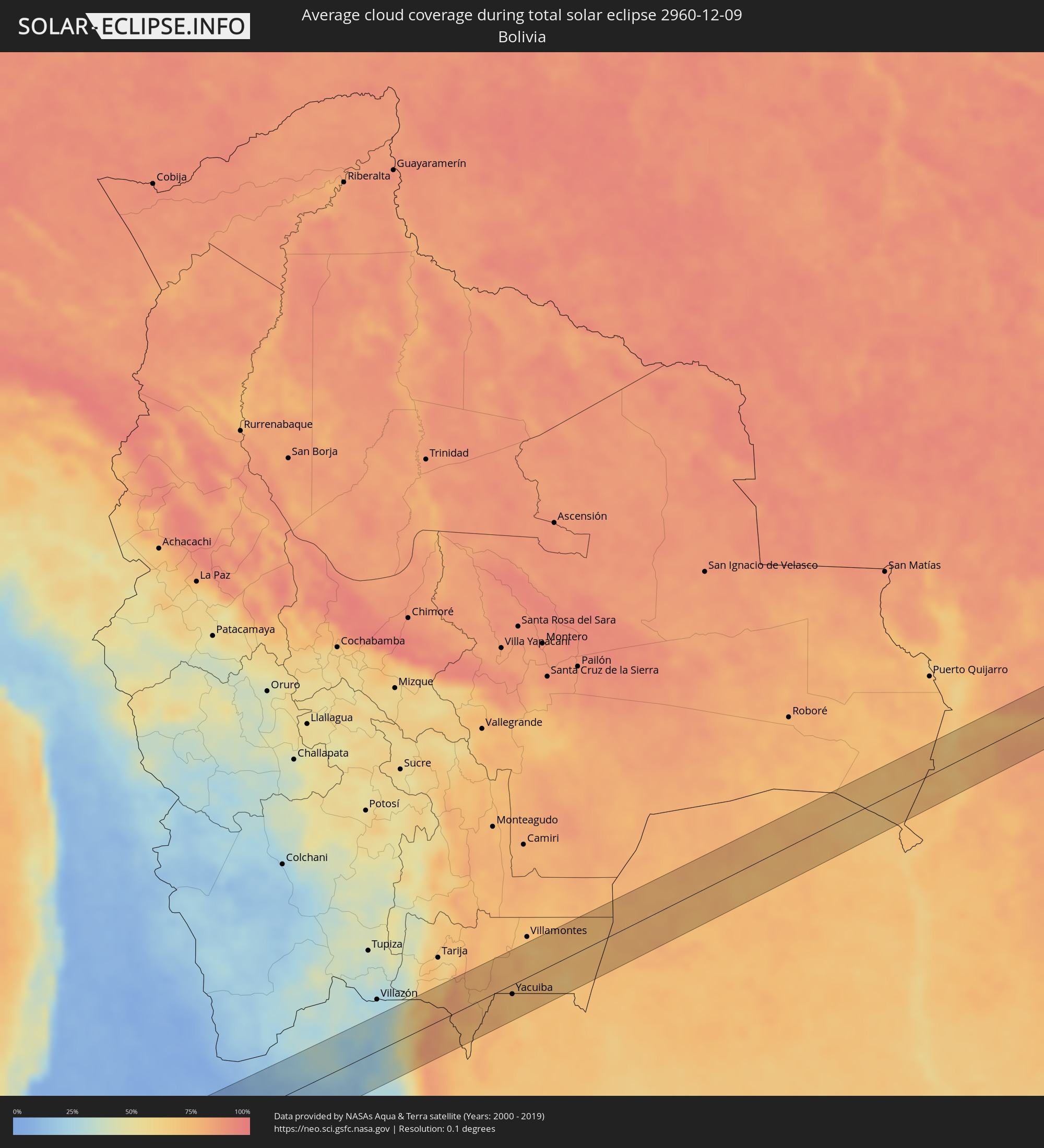 Bolivia
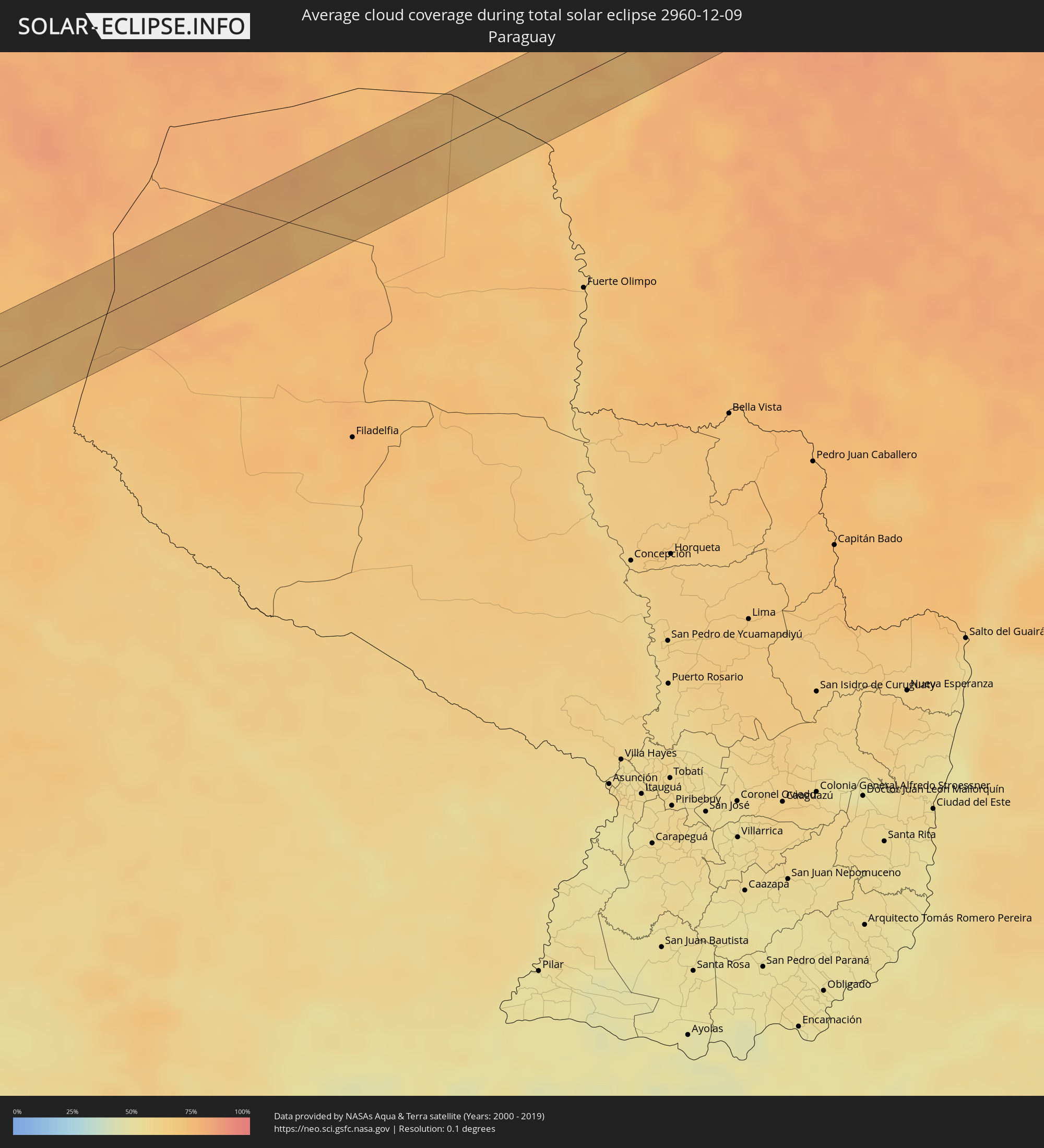 Paraguay
Cities inside the path of the eclipse
The following table shows all locations with a population of more than 5,000 inside the eclipse path. Cities which have more than 100,000 inhabitants are marked bold. A click at the locations opens a detailed map.
| City | Type | Eclipse duration | Local time of max. eclipse | Distance to central line | Ø Cloud coverage |
|
Adamstown
|
total | - | 09:19:54 UTC-08:00 | 40 km | 77% |
|
Abra Pampa, Jujuy Province
|
total | - | 16:48:38 UTC-03:00 | 9 km | 20% |
|
Yacuiba, Tarija
|
total | - | 15:51:40 UTC-04:00 | 13 km | 72% |
|
Corumbá, Mato Grosso do Sul
|
total | - | 16:00:17 UTC-04:00 | 5 km | 75% |
|
Ladário, Mato Grosso do Sul
|
total | - | 16:00:19 UTC-04:00 | 3 km | 71% |
|
Piranhas, Goiás
|
total | - | 17:06:16 UTC-03:00 | 17 km | 86% |
|
Itapuranga, Goiás
|
total | - | 17:07:50 UTC-03:00 | 21 km | 88% |
|
Rubiataba, Goiás
|
total | - | 17:08:14 UTC-03:00 | 12 km | 88% |
|
Uruana, Goiás
|
total | - | 17:07:59 UTC-03:00 | 28 km | 88% |
|
Ceres, Goiás
|
total | - | 17:08:11 UTC-03:00 | 12 km | 88% |
|
Itapaci, Goiás
|
total | - | 17:08:31 UTC-03:00 | 21 km | 87% |
|
Goianésia, Goiás
|
total | - | 17:08:21 UTC-03:00 | 36 km | 85% |
|
Niquelândia, Goiás
|
total | - | 17:09:17 UTC-03:00 | 17 km | 84% |
|
Ibotirama, Bahia
|
total | - | 17:12:11 UTC-03:00 | 1 km | 66% |
|
Ibipeba, Bahia
|
total | - | 17:12:42 UTC-03:00 | 3 km | 67% |
|
Barro Alto, Bahia
|
total | - | 17:12:37 UTC-03:00 | 19 km | 66% |
|
Irecê, Bahia
|
total | - | 17:12:56 UTC-03:00 | 24 km | 65% |
|
Lapão, Bahia
|
total | - | 17:12:53 UTC-03:00 | 15 km | 64% |
|
Canarana, Bahia
|
total | - | 17:12:41 UTC-03:00 | 18 km | 64% |
|
Cafarnaum, Bahia
|
total | - | 17:12:41 UTC-03:00 | 33 km | 68% |
|
América Dourada, Bahia
|
total | - | 17:12:51 UTC-03:00 | 10 km | 67% |
|
Morro do Chapéu, Bahia
|
total | - | 17:12:48 UTC-03:00 | 33 km | 71% |
|
Jacobina, Bahia
|
total | - | 17:13:05 UTC-03:00 | 25 km | 70% |
|
Pindobaçu, Bahia
|
total | - | 17:13:23 UTC-03:00 | 12 km | 65% |
|
Euclides da Cunha, Bahia
|
total | - | 17:13:32 UTC-03:00 | 26 km | 72% |
|
Jeremoabo, Bahia
|
total | - | 17:13:47 UTC-03:00 | 6 km | 64% |
|
Canindé de São Francisco, Sergipe
|
total | - | 17:14:00 UTC-03:00 | 5 km | 60% |
|
Pão de Açúcar, Alagoas
|
total | - | 17:13:55 UTC-03:00 | 20 km | 64% |
|
São José da Tapera, Alagoas
|
total | - | 17:14:02 UTC-03:00 | 4 km | 60% |
|
Santana do Ipanema, Alagoas
|
total | - | 17:14:08 UTC-03:00 | 9 km | 55% |
|
Batalha, Alagoas
|
total | - | 17:13:56 UTC-03:00 | 27 km | 62% |
|
Águas Belas, Pernambuco
|
total | - | 17:14:17 UTC-03:00 | 30 km | 50% |
|
Bom Conselho, Pernambuco
|
total | - | 17:14:12 UTC-03:00 | 4 km | 48% |
|
Garanhuns, Pernambuco
|
total | - | 17:14:21 UTC-03:00 | 26 km | 54% |
|
Canhotinho, Pernambuco
|
total | - | 17:14:19 UTC-03:00 | 12 km | 58% |
|
São José da Laje, Alagoas
|
total | - | 17:14:14 UTC-03:00 | 7 km | 65% |
|
União dos Palmares, Alagoas
|
total | - | 17:14:08 UTC-03:00 | 24 km | 66% |
|
Quipapá, Pernambuco
|
total | - | 17:14:19 UTC-03:00 | 9 km | 63% |
|
Cupira, Pernambuco
|
total | - | 17:14:26 UTC-03:00 | 28 km | 63% |
|
Maraial, Pernambuco
|
total | - | 17:14:20 UTC-03:00 | 5 km | 70% |
|
Colônia Leopoldina, Alagoas
|
total | - | 17:14:15 UTC-03:00 | 12 km | 74% |
|
Catende, Pernambuco
|
total | - | 17:14:23 UTC-03:00 | 13 km | 70% |
|
Palmares, Pernambuco
|
total | - | 17:14:21 UTC-03:00 | 5 km | 72% |
|
Joaquim Nabuco, Pernambuco
|
total | - | 17:14:23 UTC-03:00 | 9 km | 73% |
|
Água Preta, Pernambuco
|
total | - | 17:14:20 UTC-03:00 | 0 km | 75% |
|
Gameleira, Pernambuco
|
total | - | 17:14:23 UTC-03:00 | 6 km | 76% |
|
Ribeirão, Pernambuco
|
total | - | 17:14:25 UTC-03:00 | 13 km | 76% |
|
Escada, Pernambuco
|
total | - | 17:14:29 UTC-03:00 | 22 km | 78% |
|
Barreiros, Pernambuco
|
total | - | 17:14:13 UTC-03:00 | 26 km | 59% |
|
Rio Formoso, Pernambuco
|
total | - | 17:14:18 UTC-03:00 | 12 km | 65% |
|
Sirinhaém, Pernambuco
|
total | - | 17:14:20 UTC-03:00 | 6 km | 55% |
|
Tamandaré, Pernambuco
|
total | - | 17:14:15 UTC-03:00 | 24 km | 46% |
|
Cabo, Pernambuco
|
total | - | 17:14:30 UTC-03:00 | 21 km | 57% |