Annular solar eclipse of 03/14/2993
| Day of week: | Thursday |
| Maximum duration of eclipse: | 08m53s |
| Maximum width of eclipse path: | 289 km |
| Saros cycle: | 165 |
| Coverage: | 92.4% |
| Magnitude: | 0.9238 |
| Gamma: | -0.1176 |
Wo kann man die Sonnenfinsternis vom 03/14/2993 sehen?

Die Sonnenfinsternis am 03/14/2993 kann man in 88 Ländern als partielle Sonnenfinsternis beobachten.
Der Finsternispfad verläuft durch 17 Länder. Nur in diesen Ländern ist sie als annular Sonnenfinsternis zu sehen.
In den folgenden Ländern ist die Sonnenfinsternis annular zu sehen
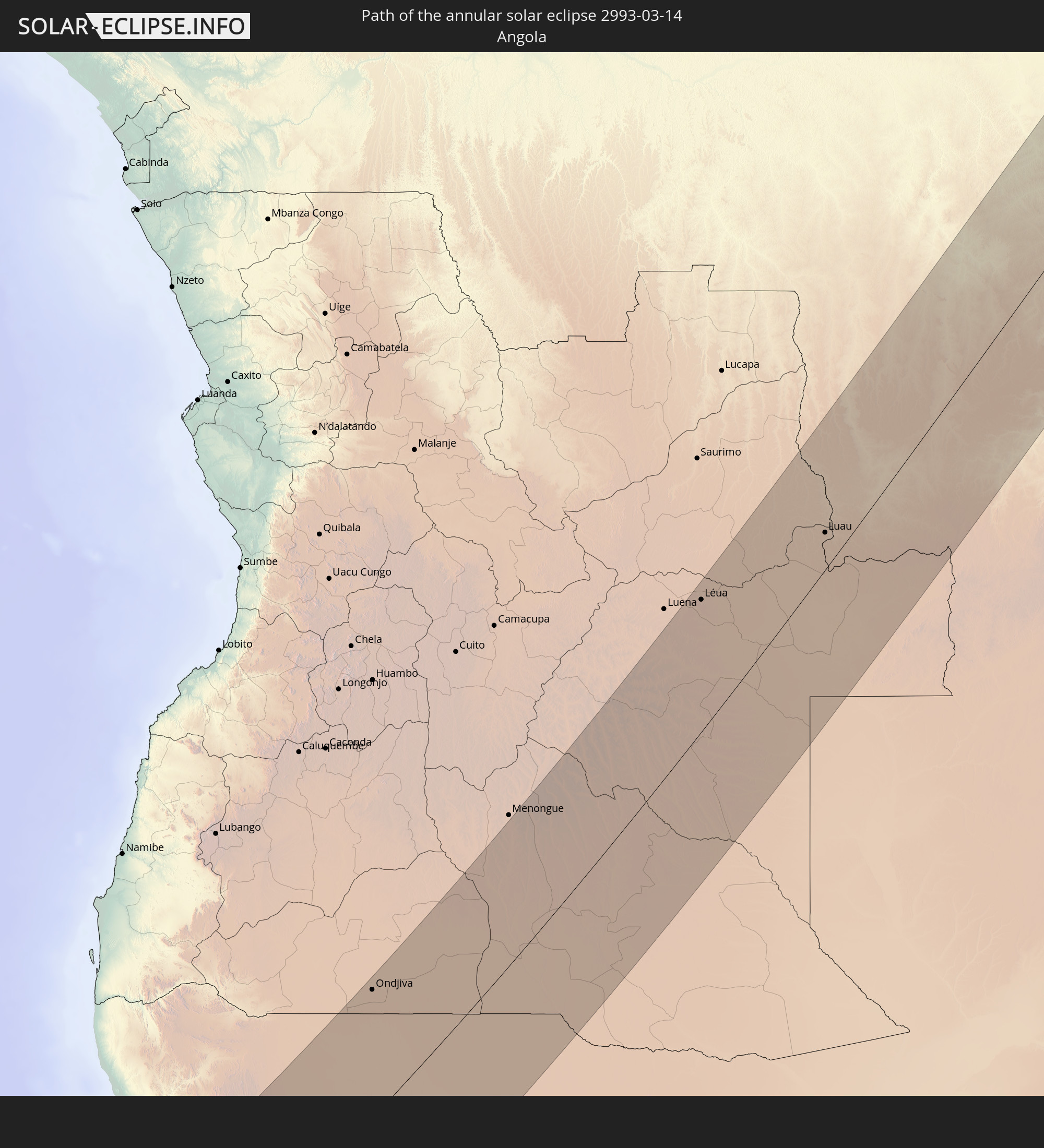 Angola
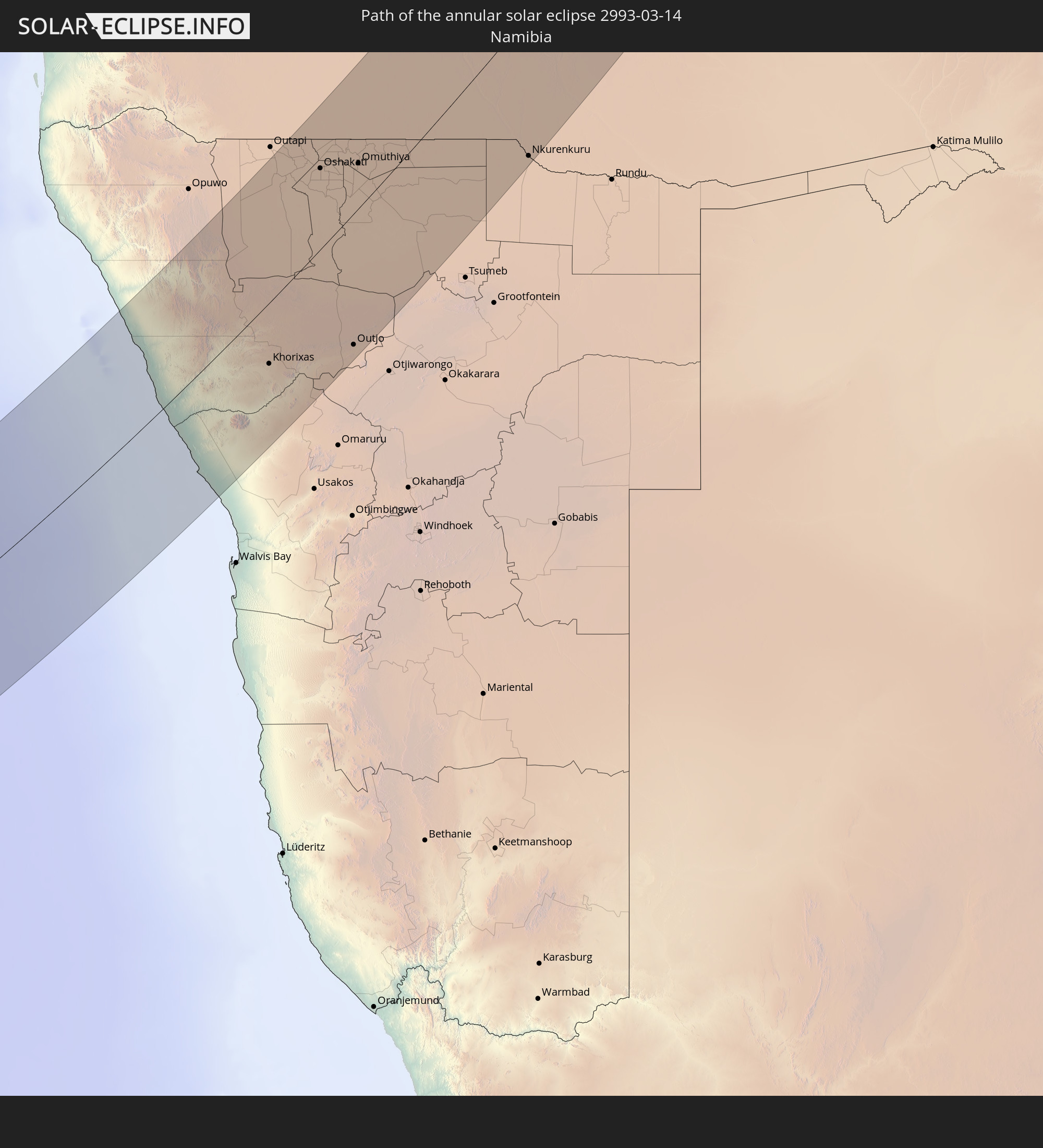 Namibia
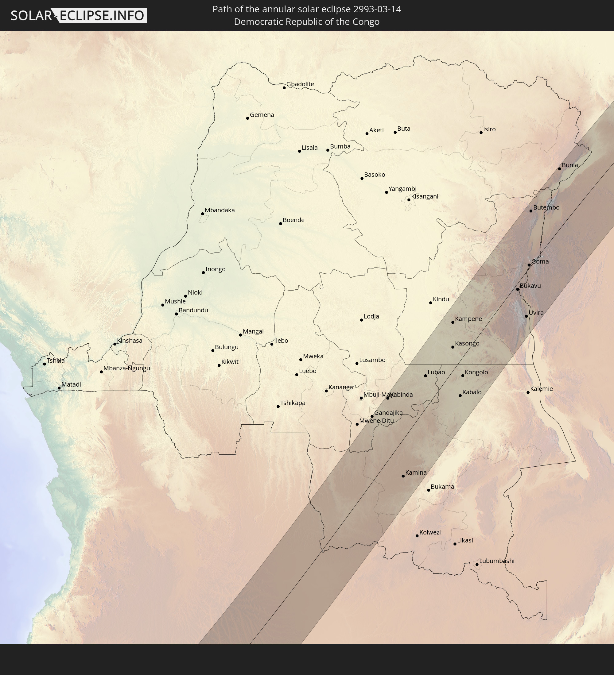 Democratic Republic of the Congo
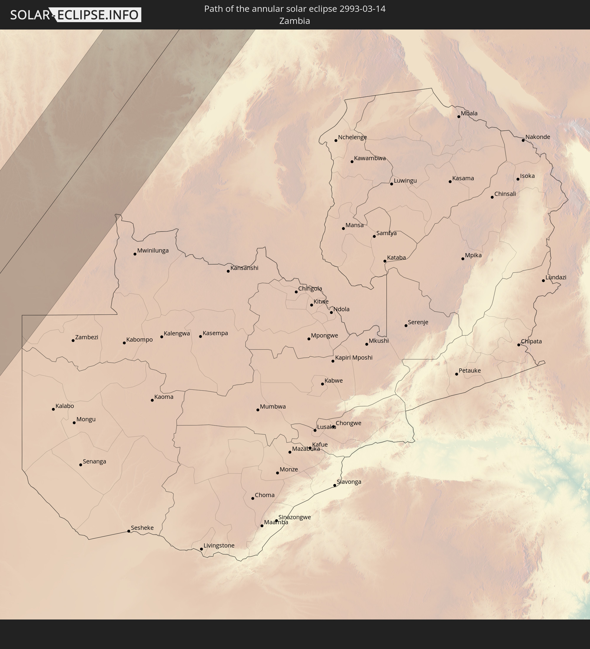 Zambia
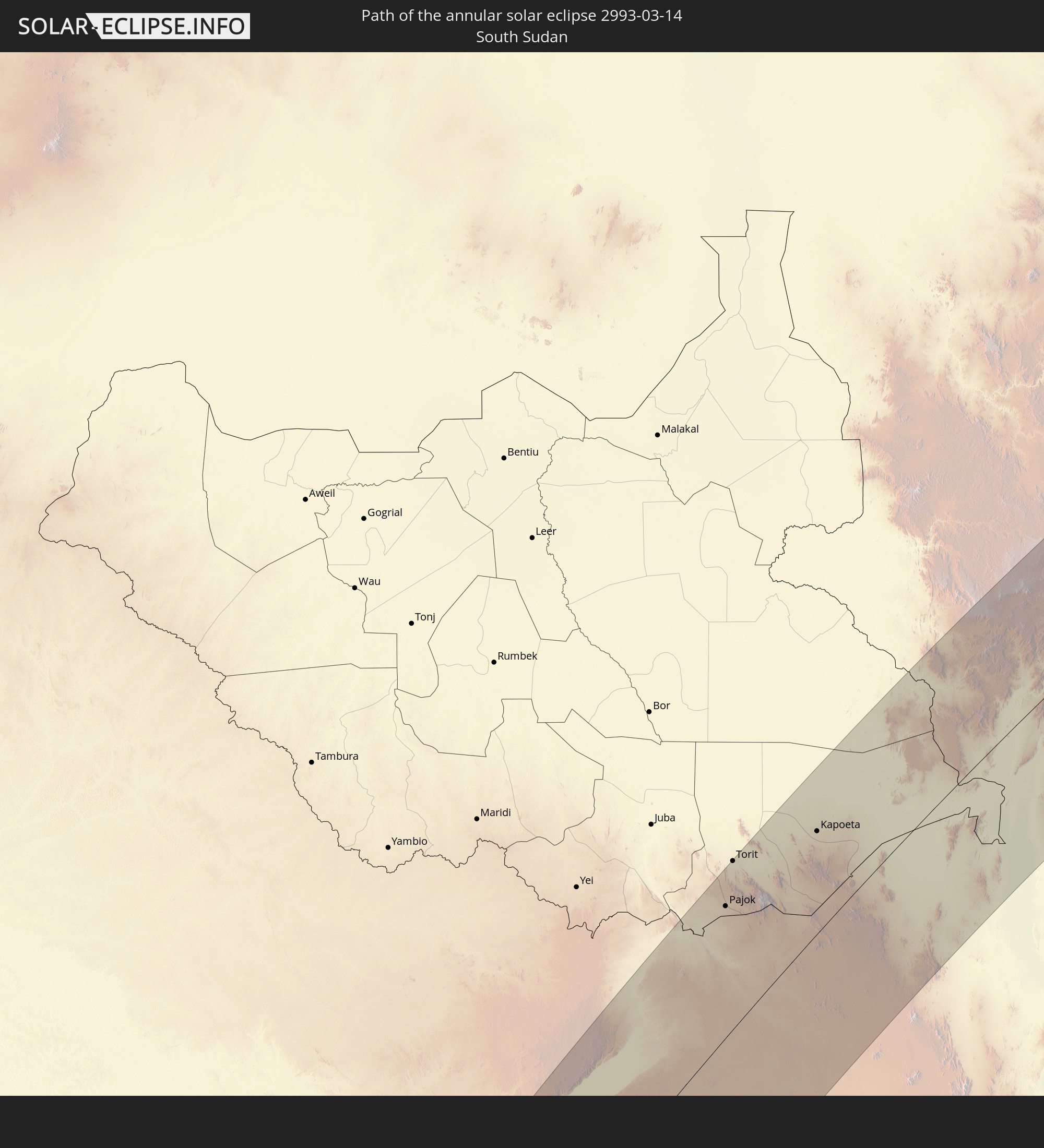 South Sudan
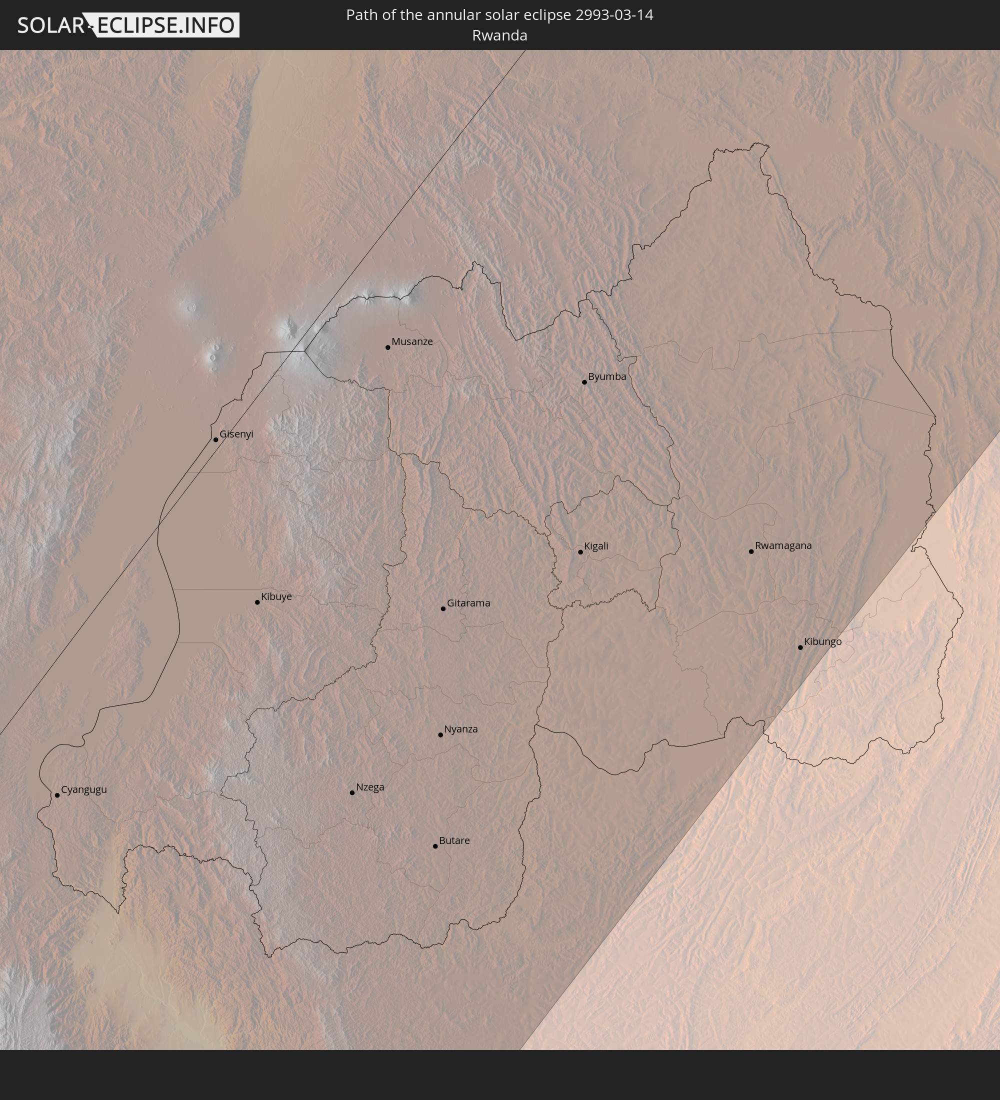 Rwanda
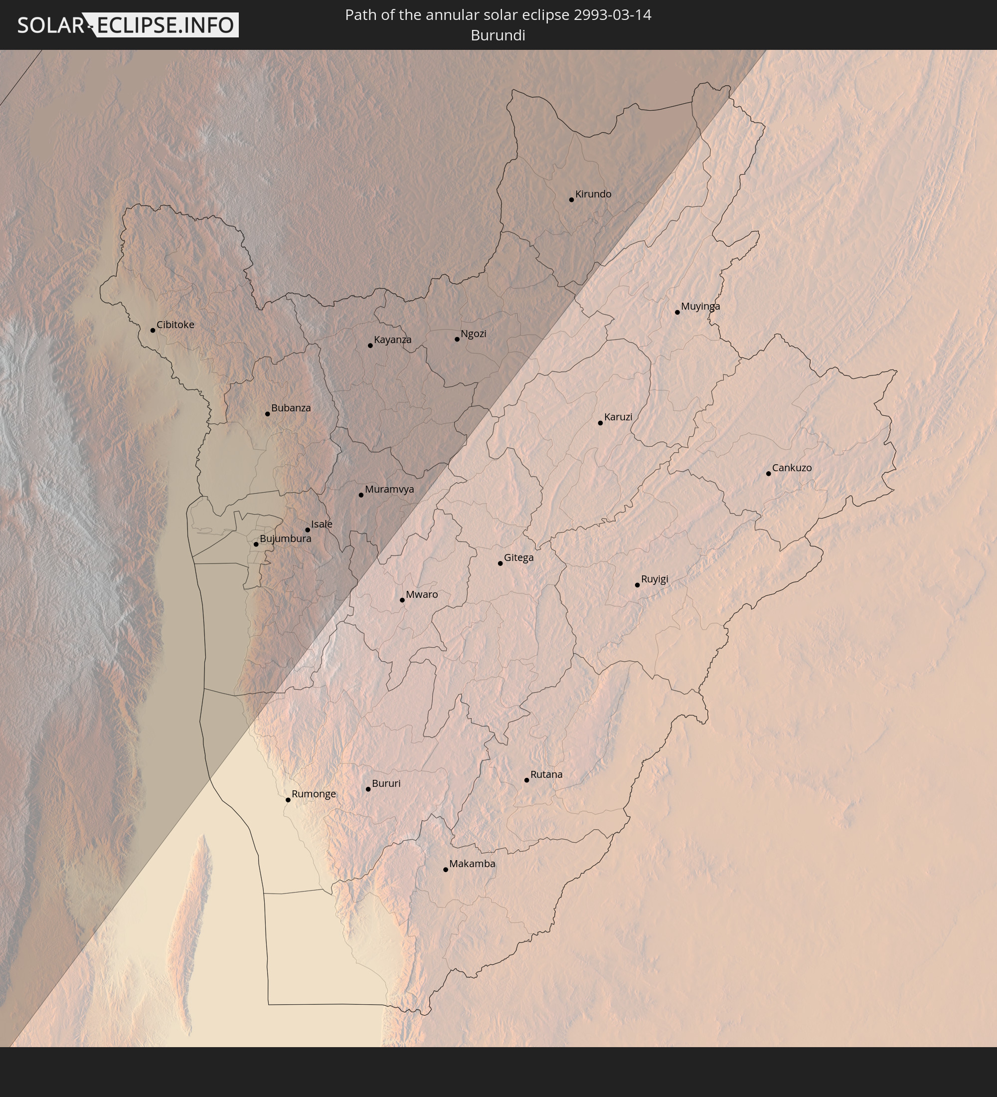 Burundi
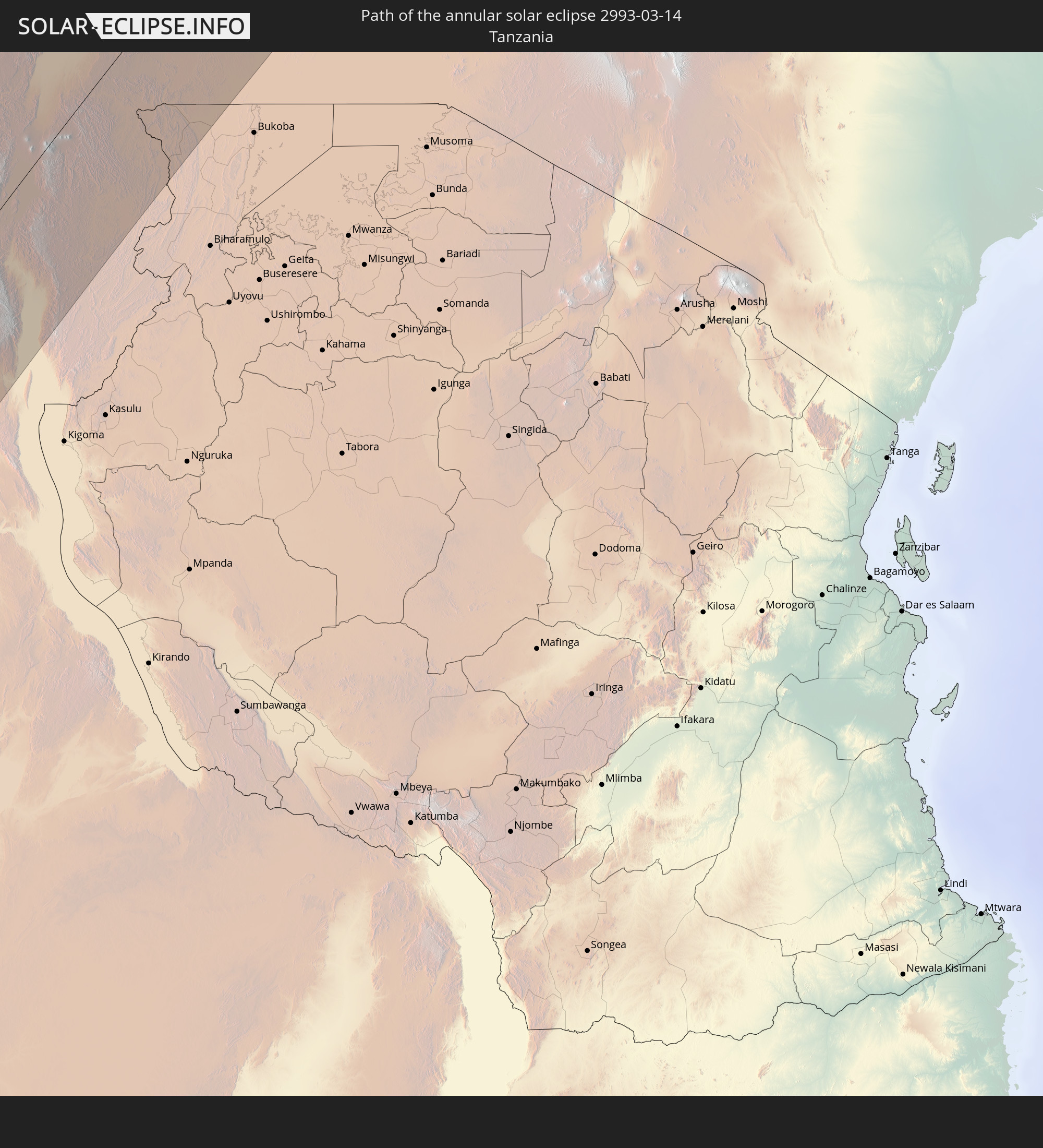 Tanzania
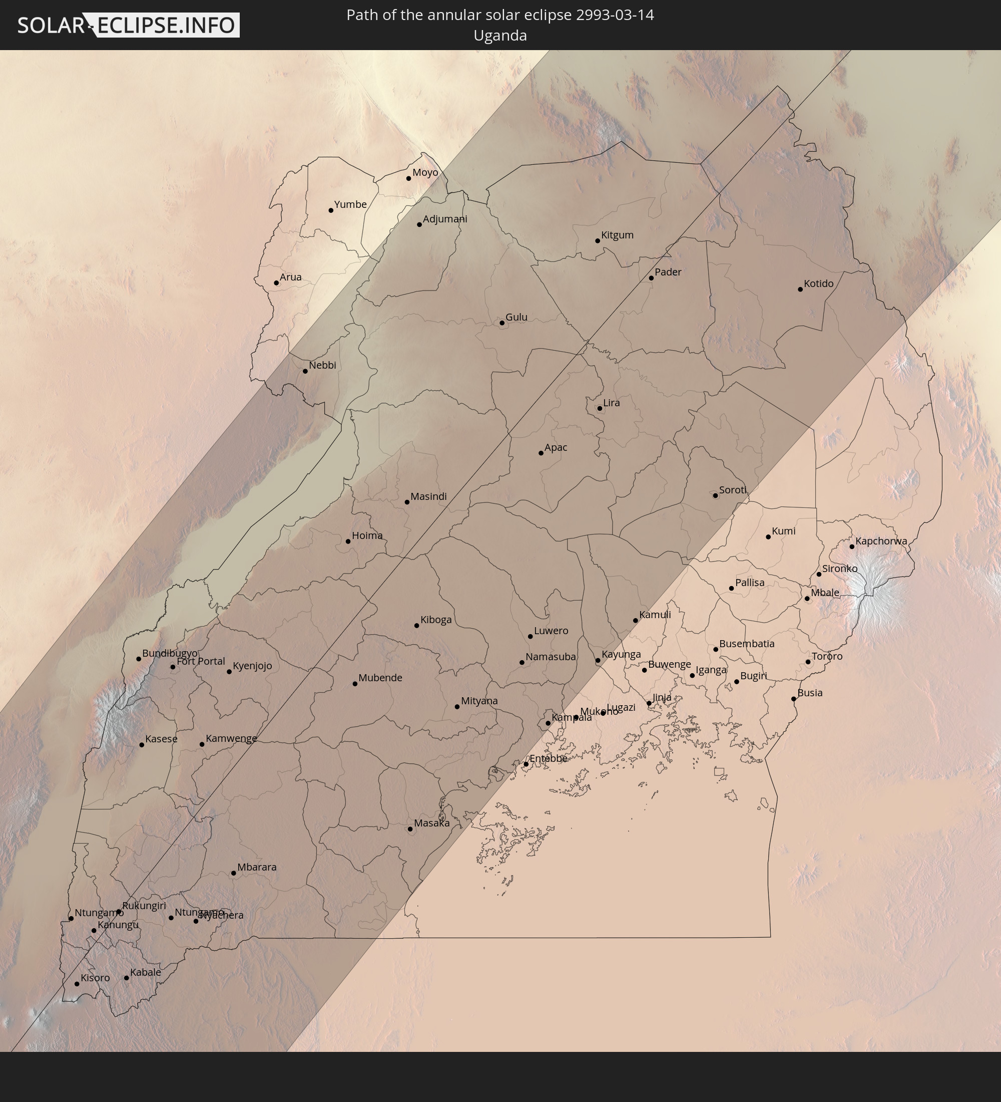 Uganda
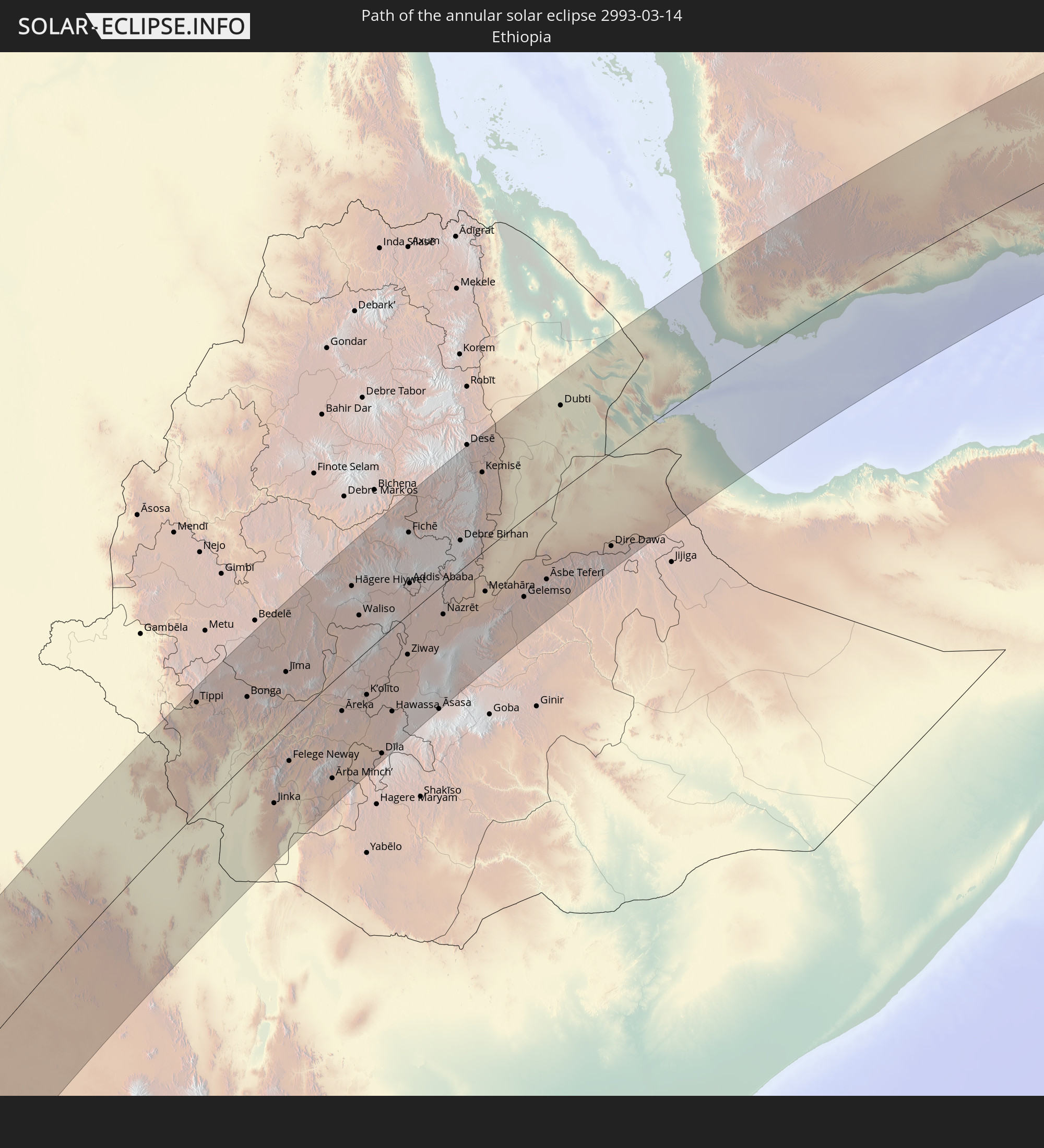 Ethiopia
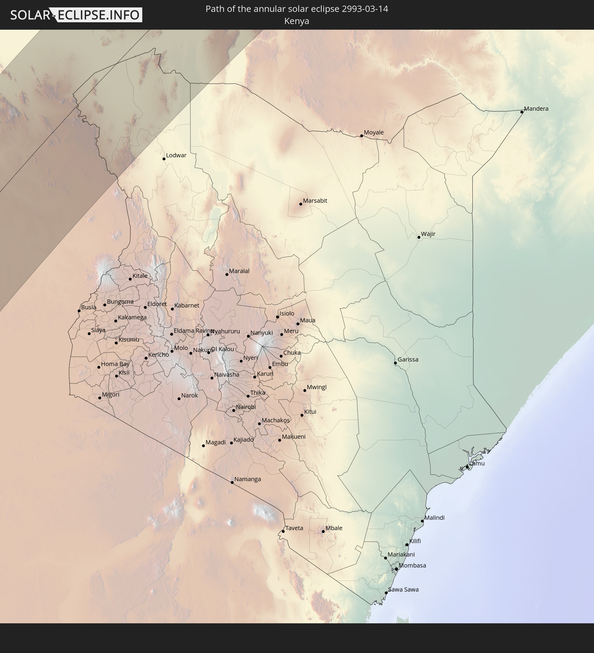 Kenya
Kenya
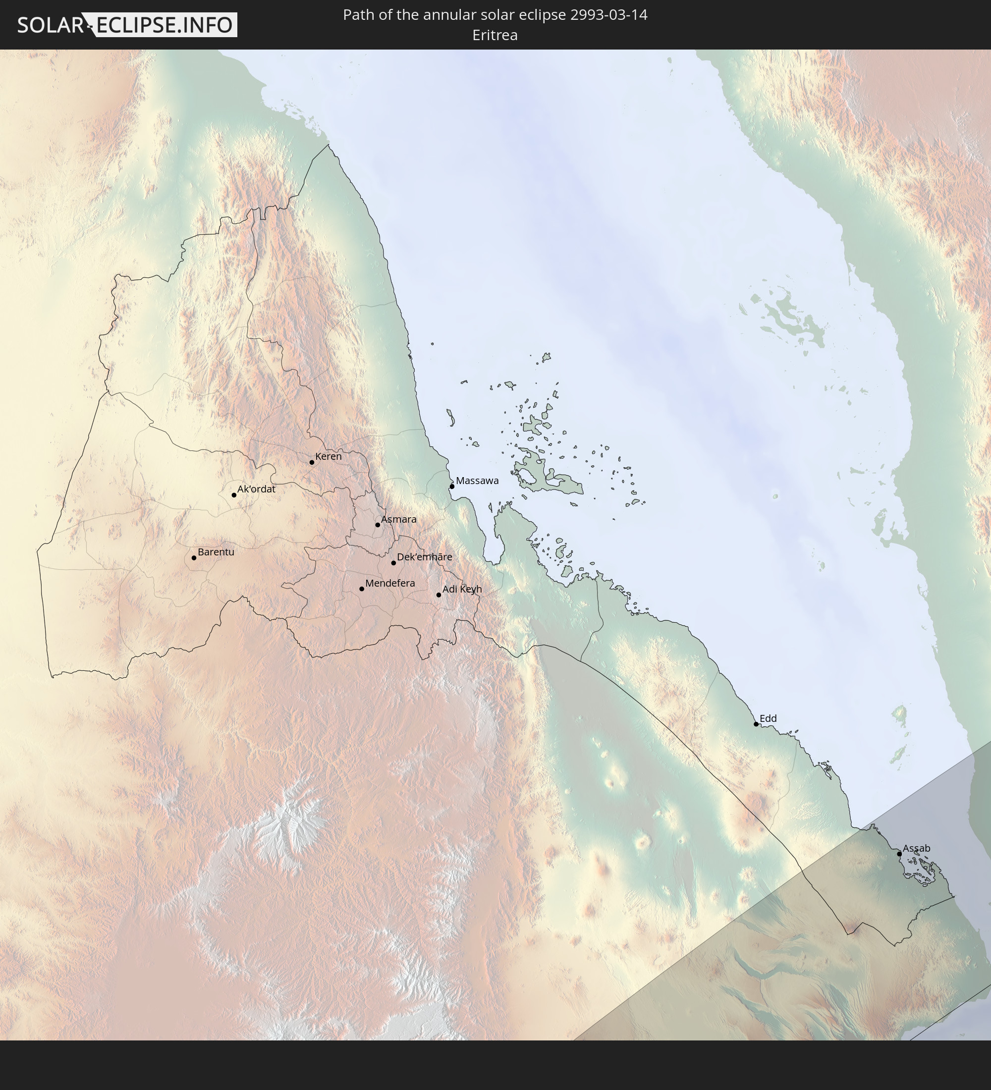 Eritrea
 Somalia
 Djibouti
 Yemen
Yemen
 Oman
Oman
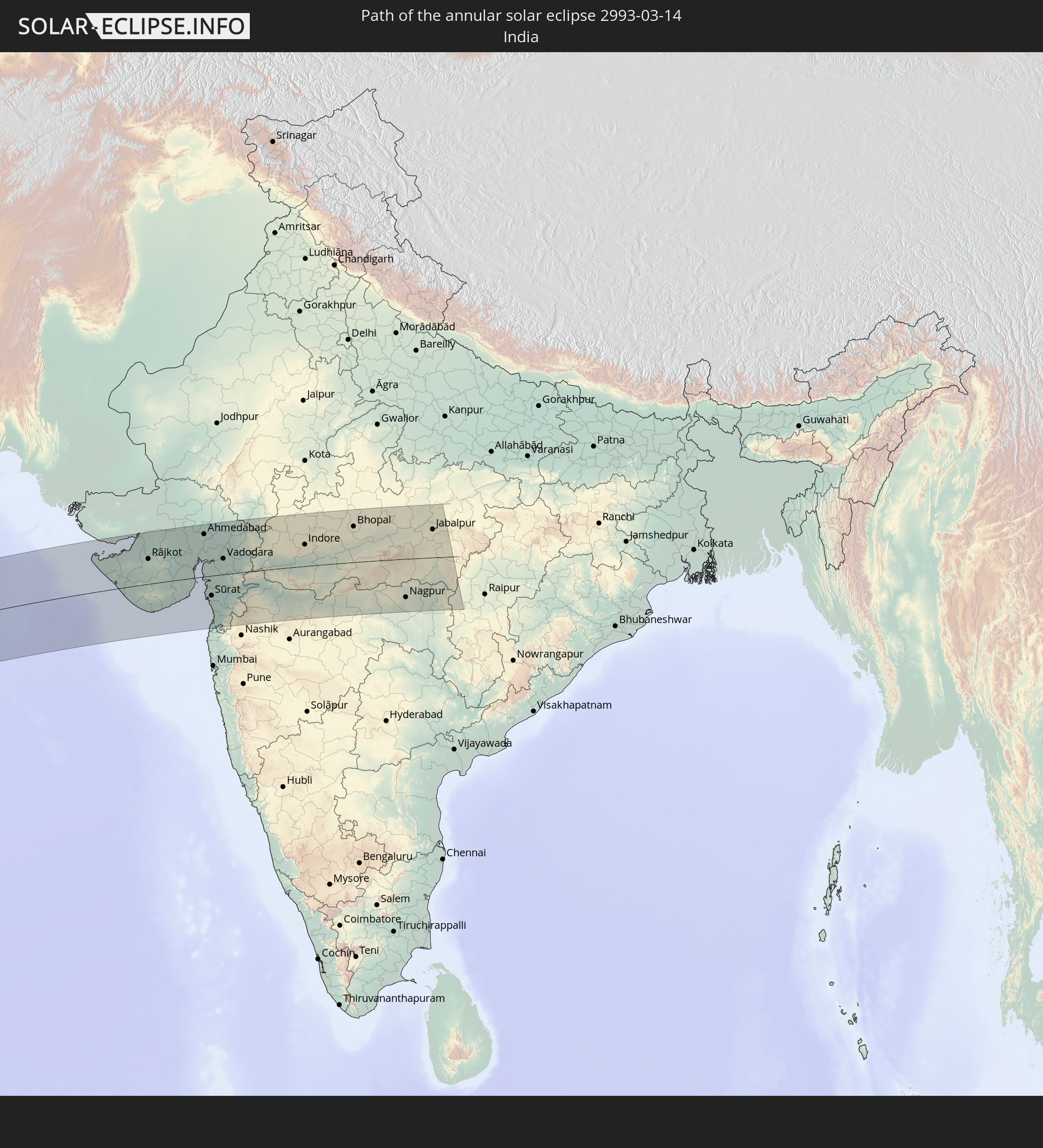 India
India
In den folgenden Ländern ist die Sonnenfinsternis partiell zu sehen
 Russia
 Antarctica
 Brazil
 South Georgia and the South Sandwich Islands
 Saint Helena, Ascension and Tristan da Cunha
 Mali
Mali
 Liberia
 Algeria
 Ivory Coast
 Burkina Faso
 Ghana
Ghana
 Togo
Togo
 Niger
Niger
 Benin
Benin
 Nigeria
 Bouvet Island
 Equatorial Guinea
 São Tomé and Príncipe
 Cameroon
 Gabon
Gabon
 Libya
Libya
 Republic of the Congo
 Angola
 Namibia
 Democratic Republic of the Congo
 Chad
Chad
 Central African Republic
 South Africa
 Greece
 Botswana
 Sudan
Sudan
 Zambia
 Ukraine
 Bulgaria
 Egypt
Egypt
 Zimbabwe
 Turkey
 Lesotho
 Rwanda
 Burundi
 Tanzania
 Uganda
 Mozambique
 Swaziland
 Cyprus
 Malawi
 Ethiopia
 Kenya
Kenya
 State of Palestine
 Israel
 Saudi Arabia
 Jordan
 Lebanon
 Syria
Syria
 Eritrea
 Iraq
Iraq
 Georgia
 French Southern and Antarctic Lands
 Somalia
 Djibouti
 Yemen
Yemen
 Madagascar
 Comoros
 Armenia
 Iran
Iran
 Azerbaijan
 Mayotte
 Seychelles
 Kazakhstan
 Kuwait
 Bahrain
 Qatar
Qatar
 United Arab Emirates
 Oman
Oman
 Turkmenistan
 Réunion
 Uzbekistan
 Mauritius
 Afghanistan
 Pakistan
 Tajikistan
 India
India
 Kyrgyzstan
 British Indian Ocean Territory
 Maldives
 China
China
 Sri Lanka
 Nepal
Nepal
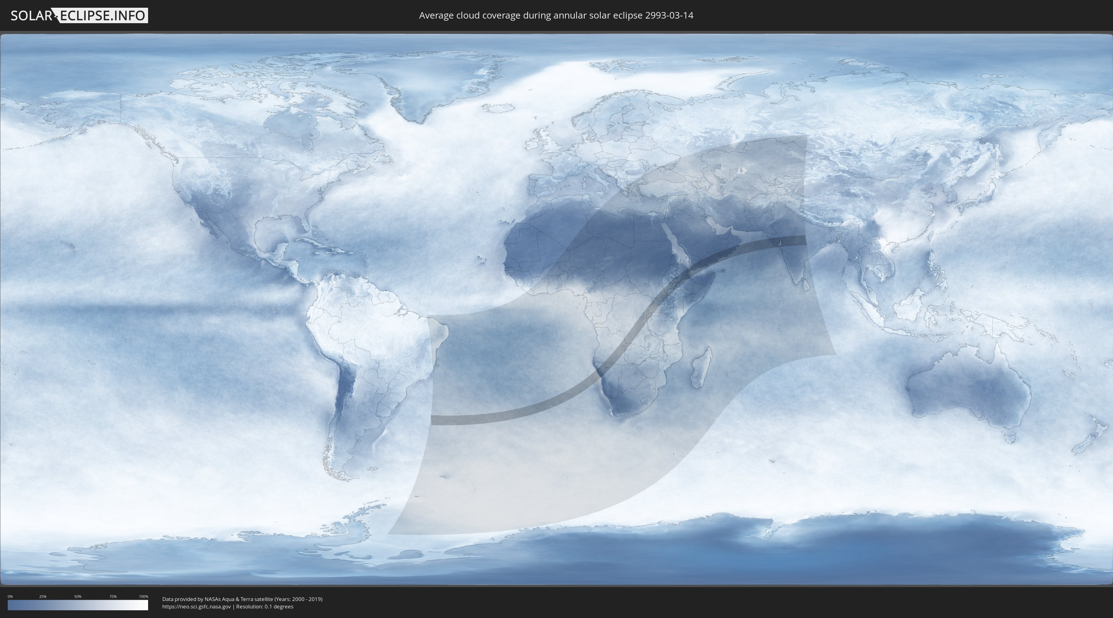
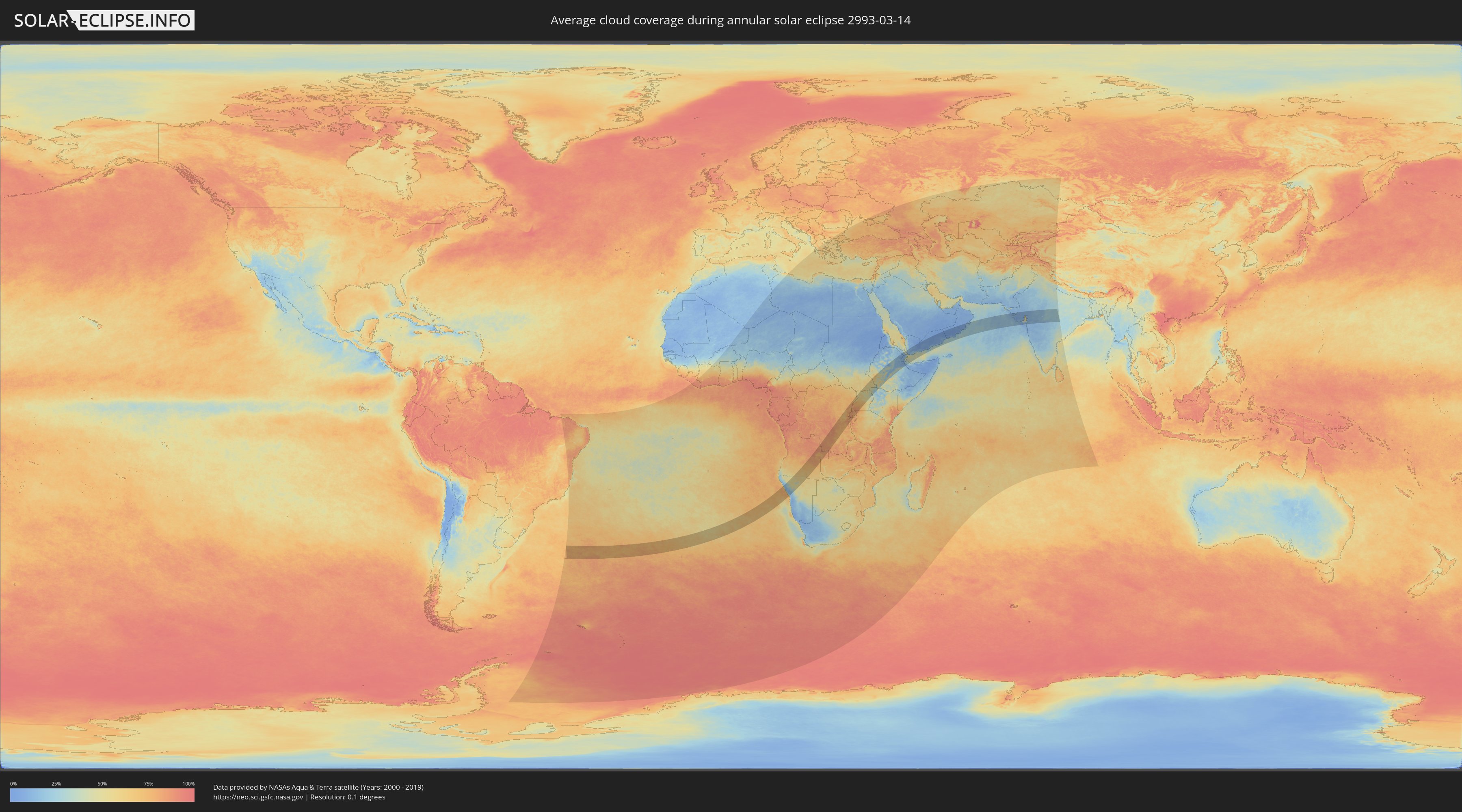
How will be the weather during the annular solar eclipse on 03/14/2993?
Where is the best place to see the annular solar eclipse of 03/14/2993?
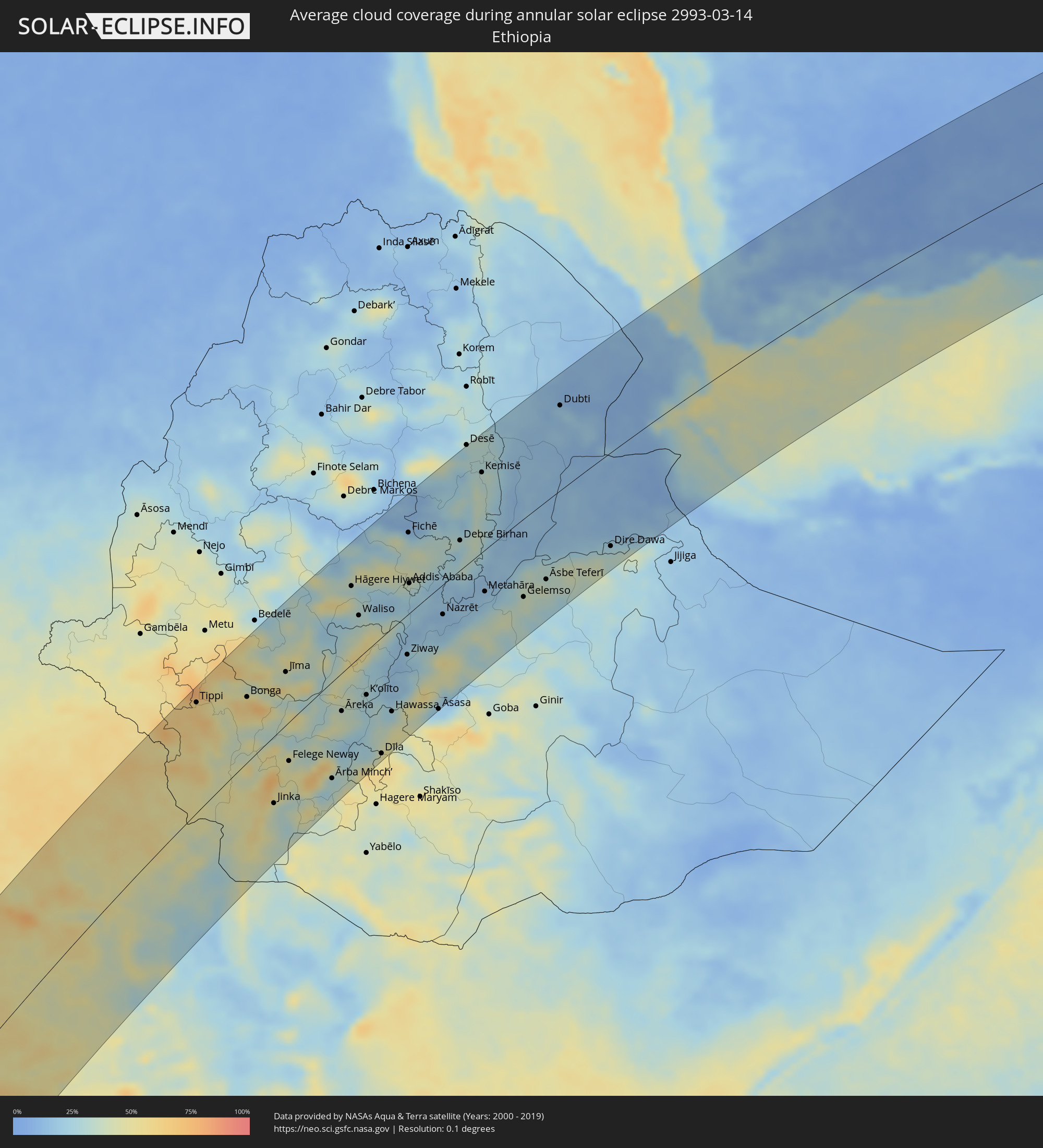
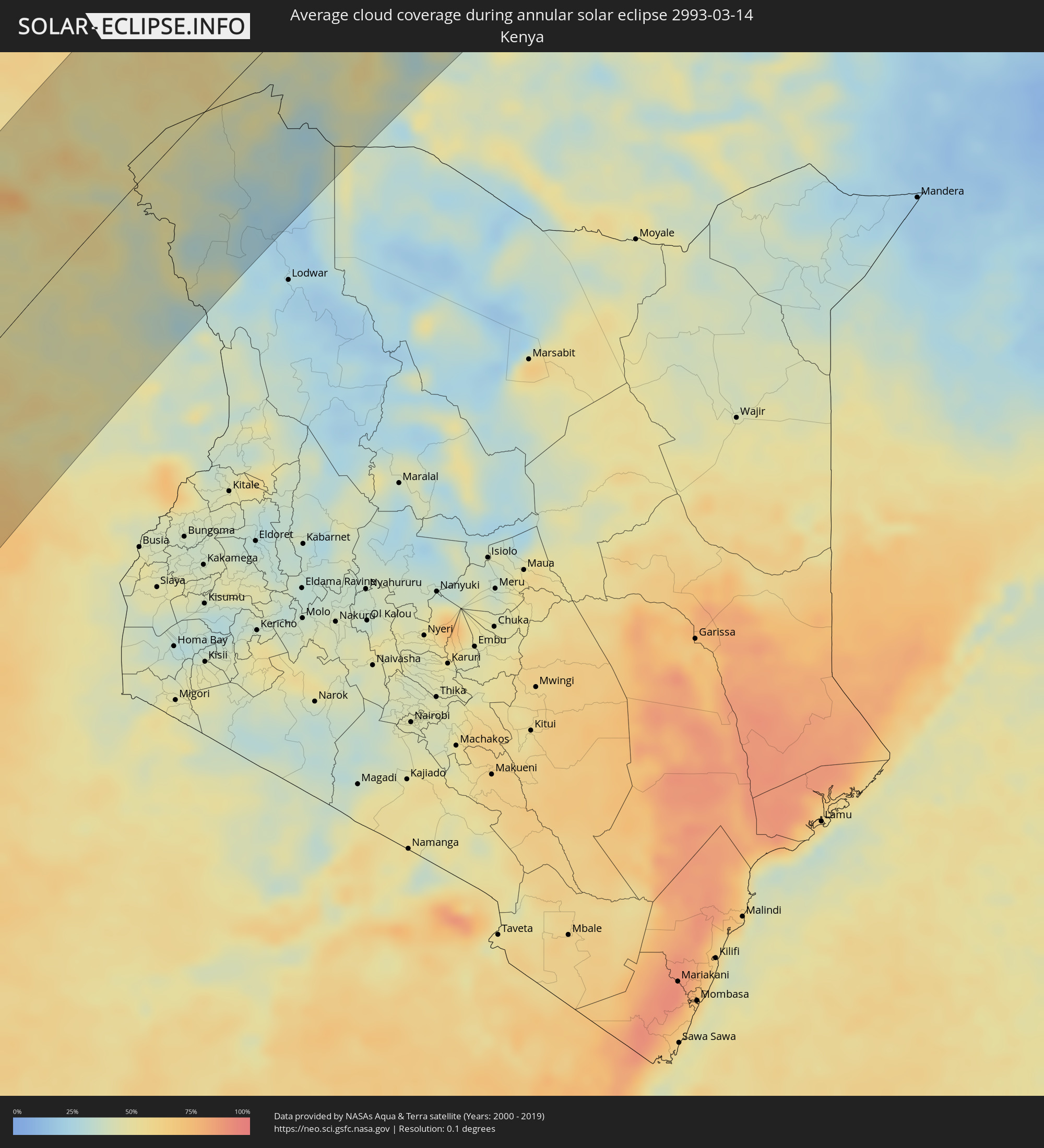
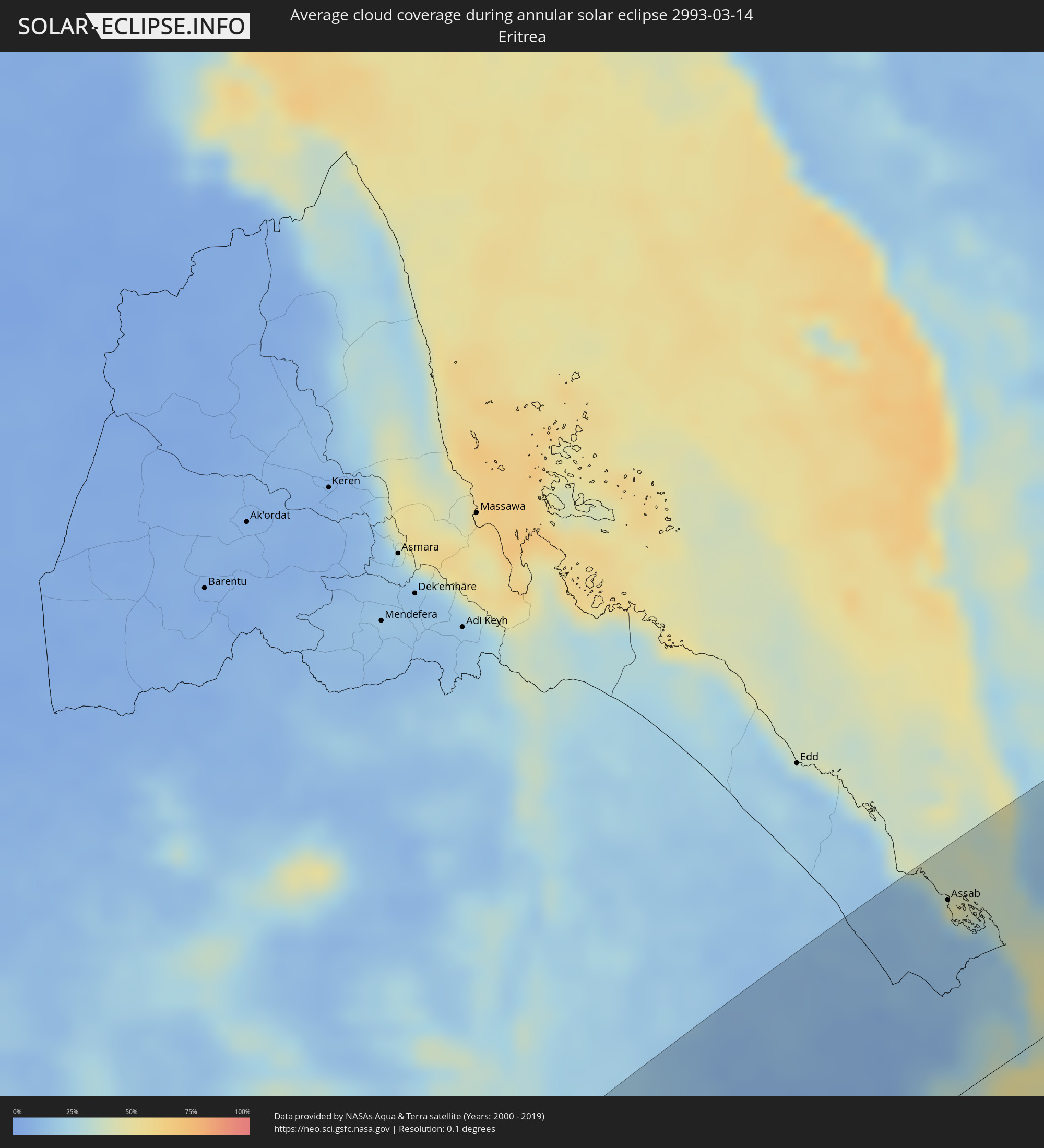
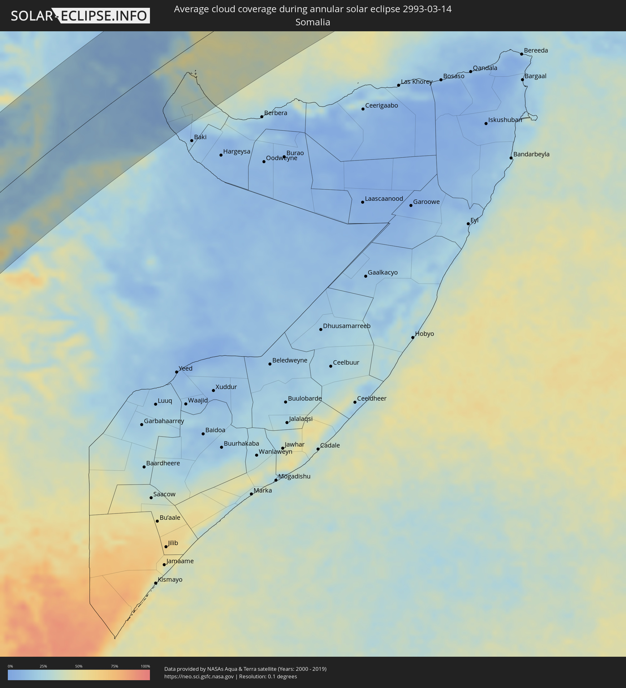
The following maps show the average cloud coverage for the day of the annular solar eclipse.
With the help of these maps, it is possible to find the place along the eclipse path, which has the best
chance of a cloudless sky.
Nevertheless, you should consider local circumstances and inform about the weather of your chosen
observation site.
The data is provided by NASAs satellites
AQUA and TERRA.
The cloud maps are averaged over a period of 19 years (2000 - 2019).
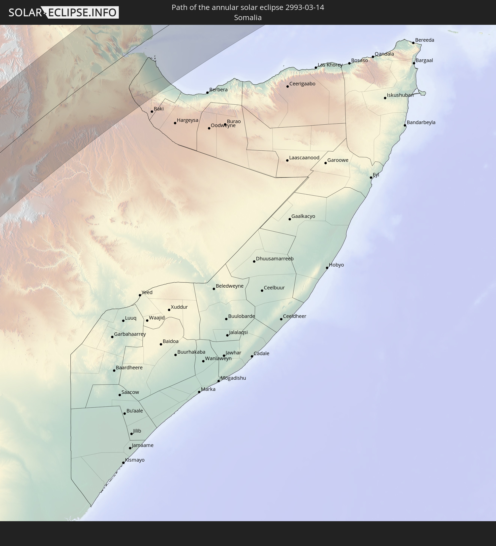
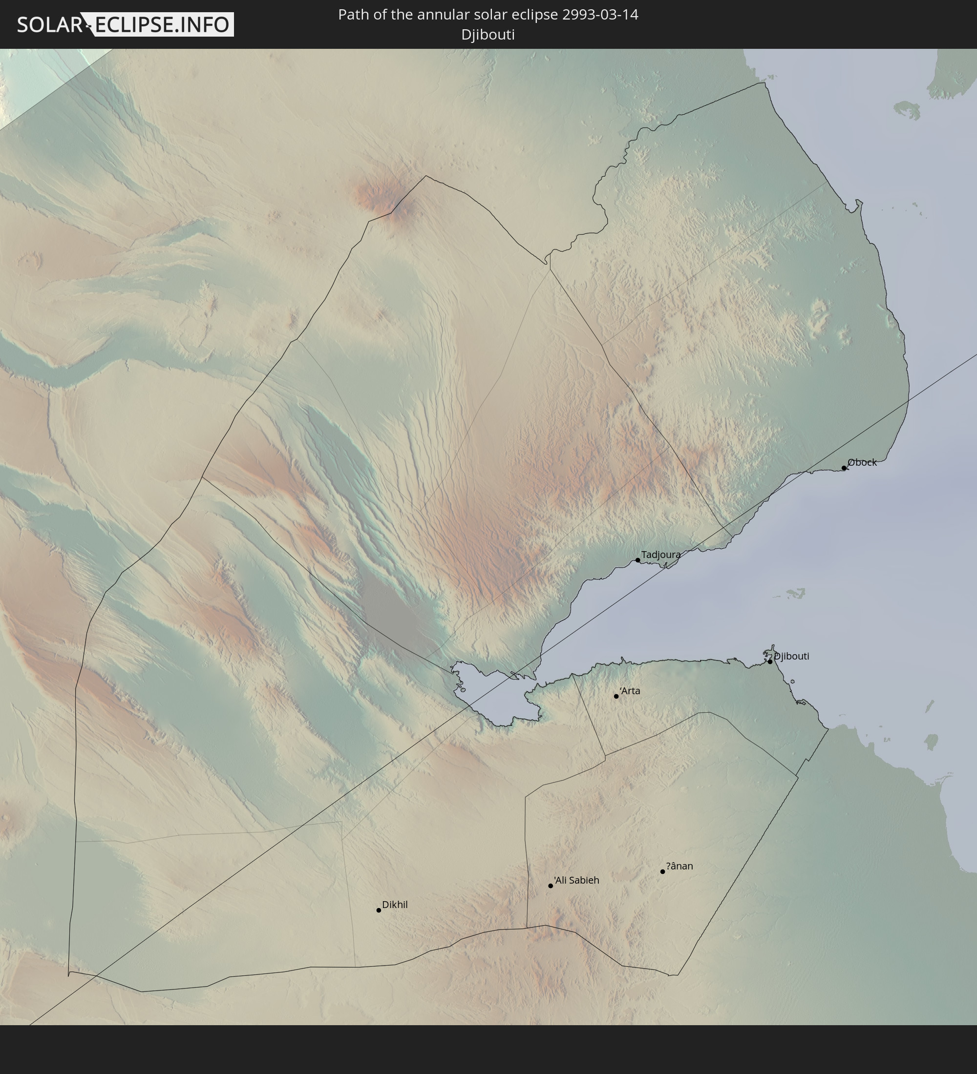
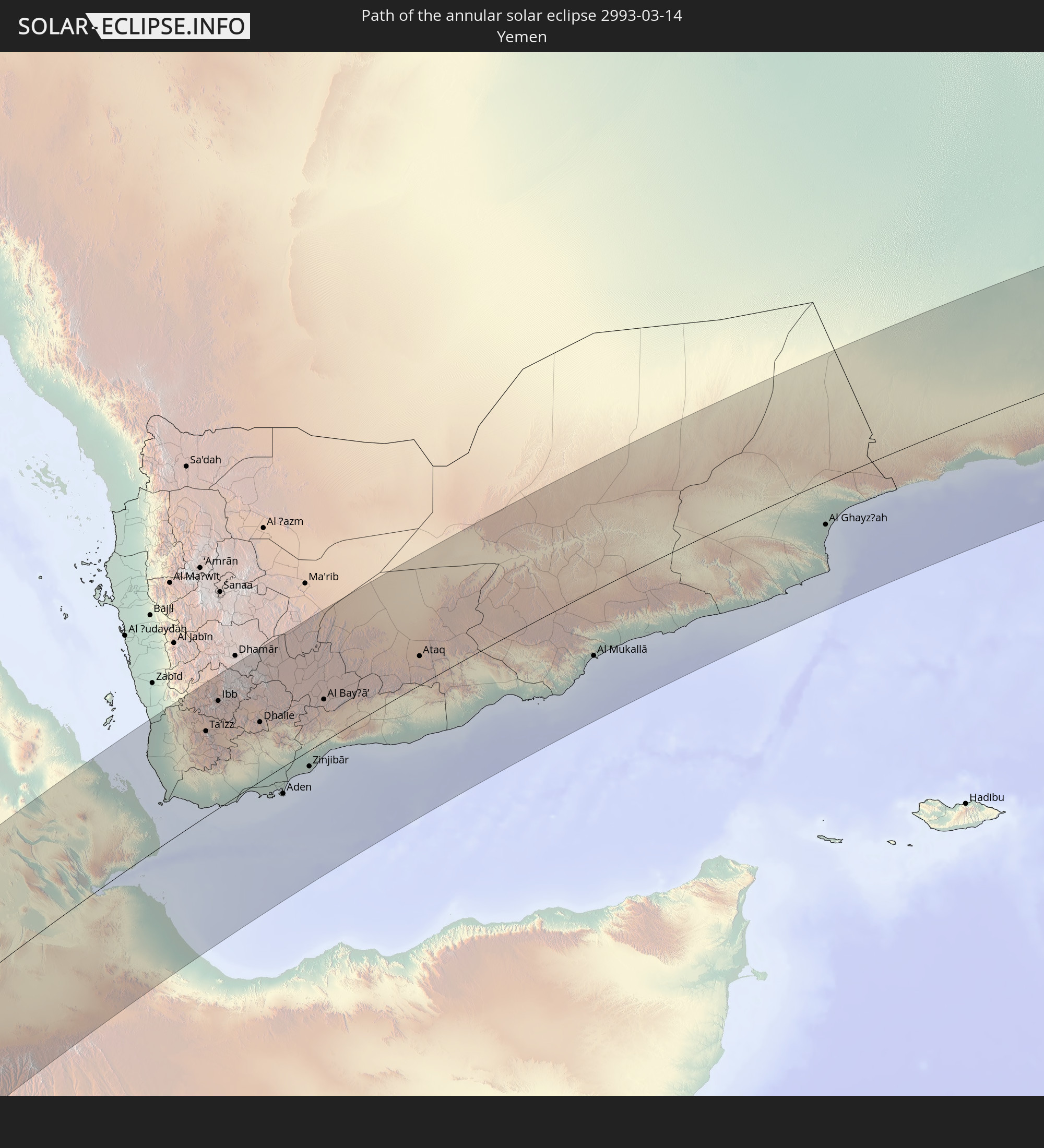
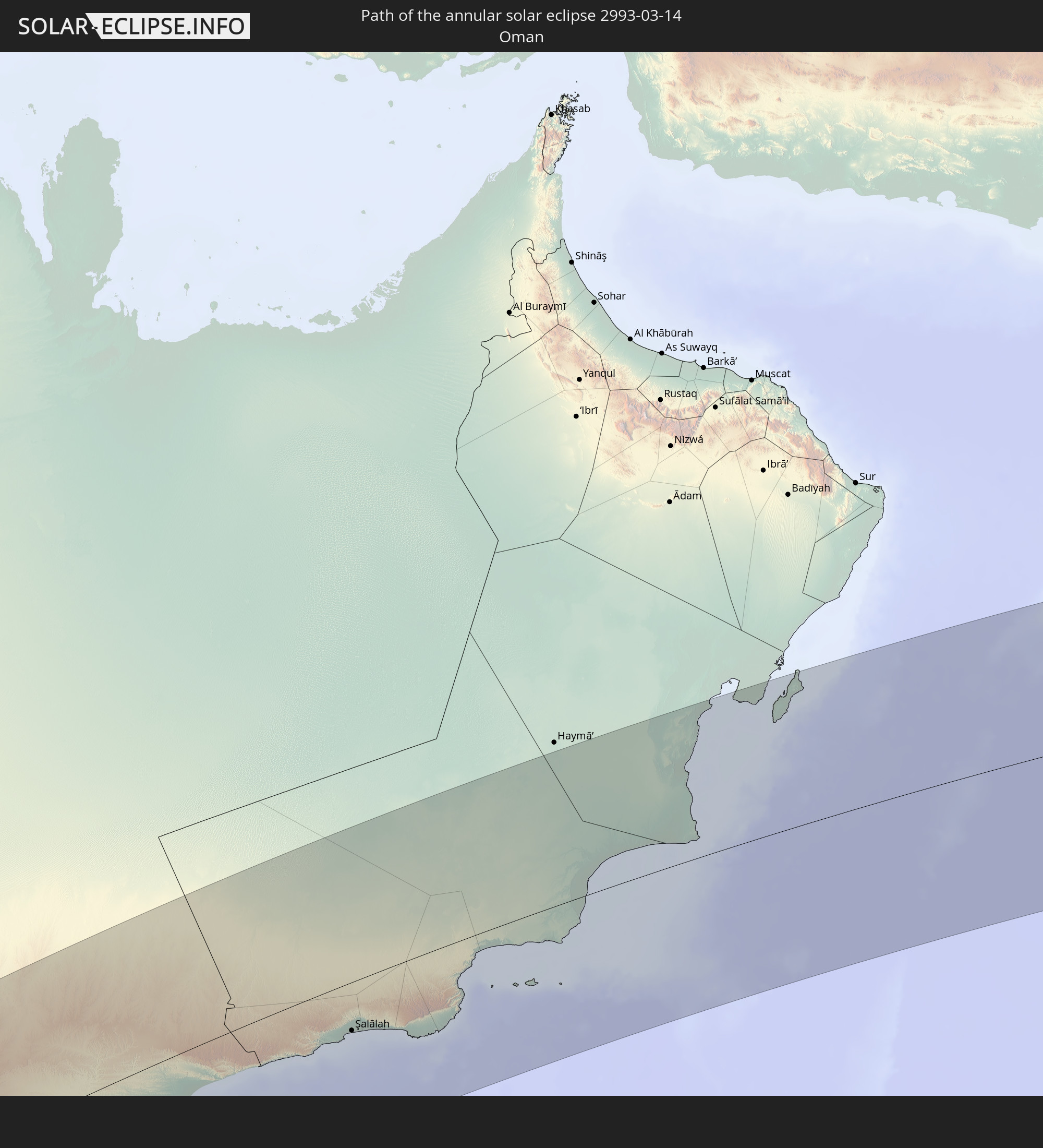
Detailed country maps
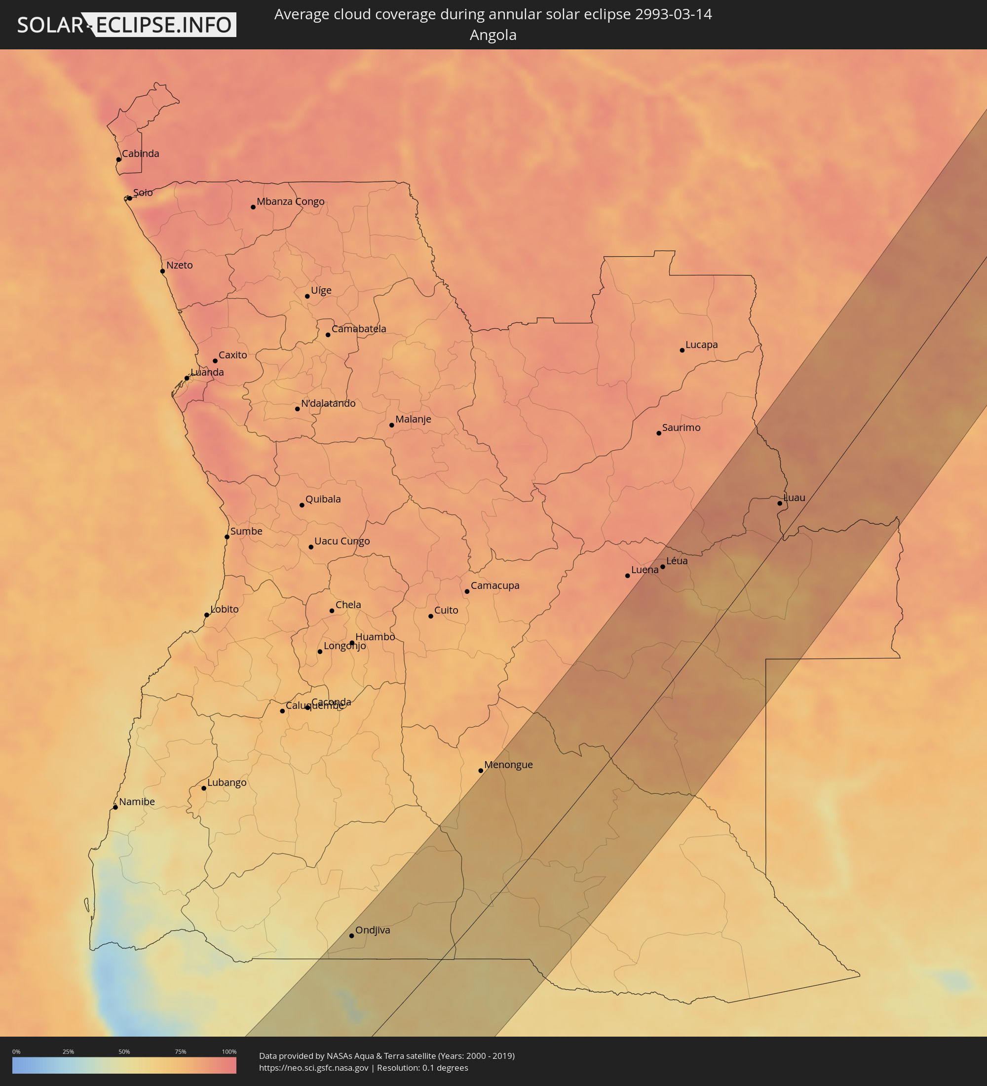 Angola
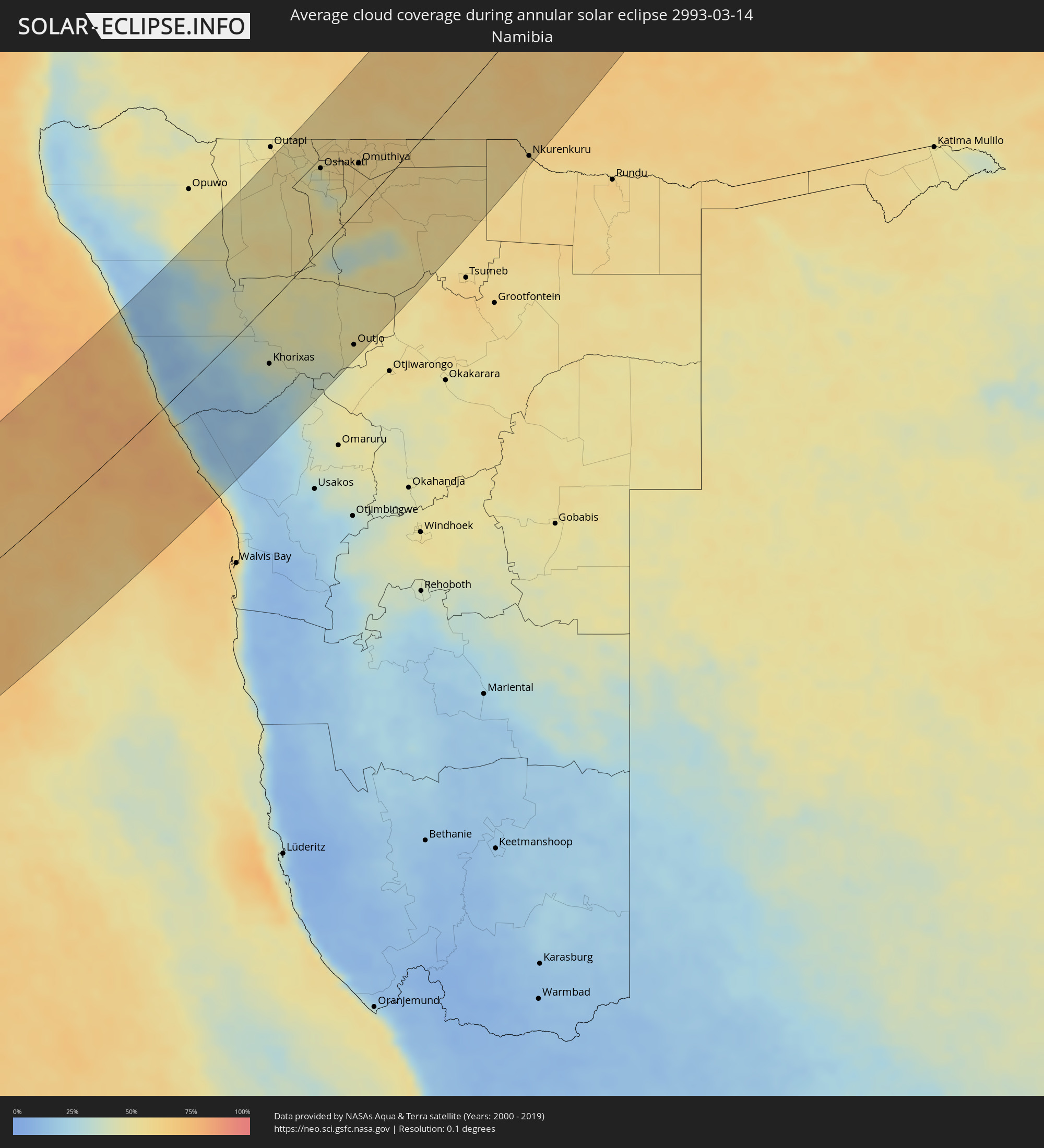 Namibia
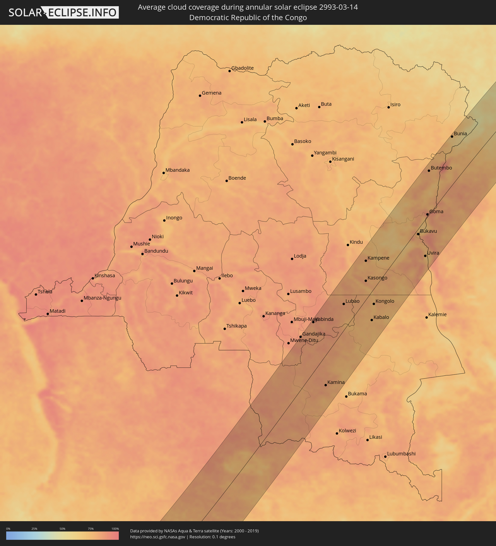 Democratic Republic of the Congo
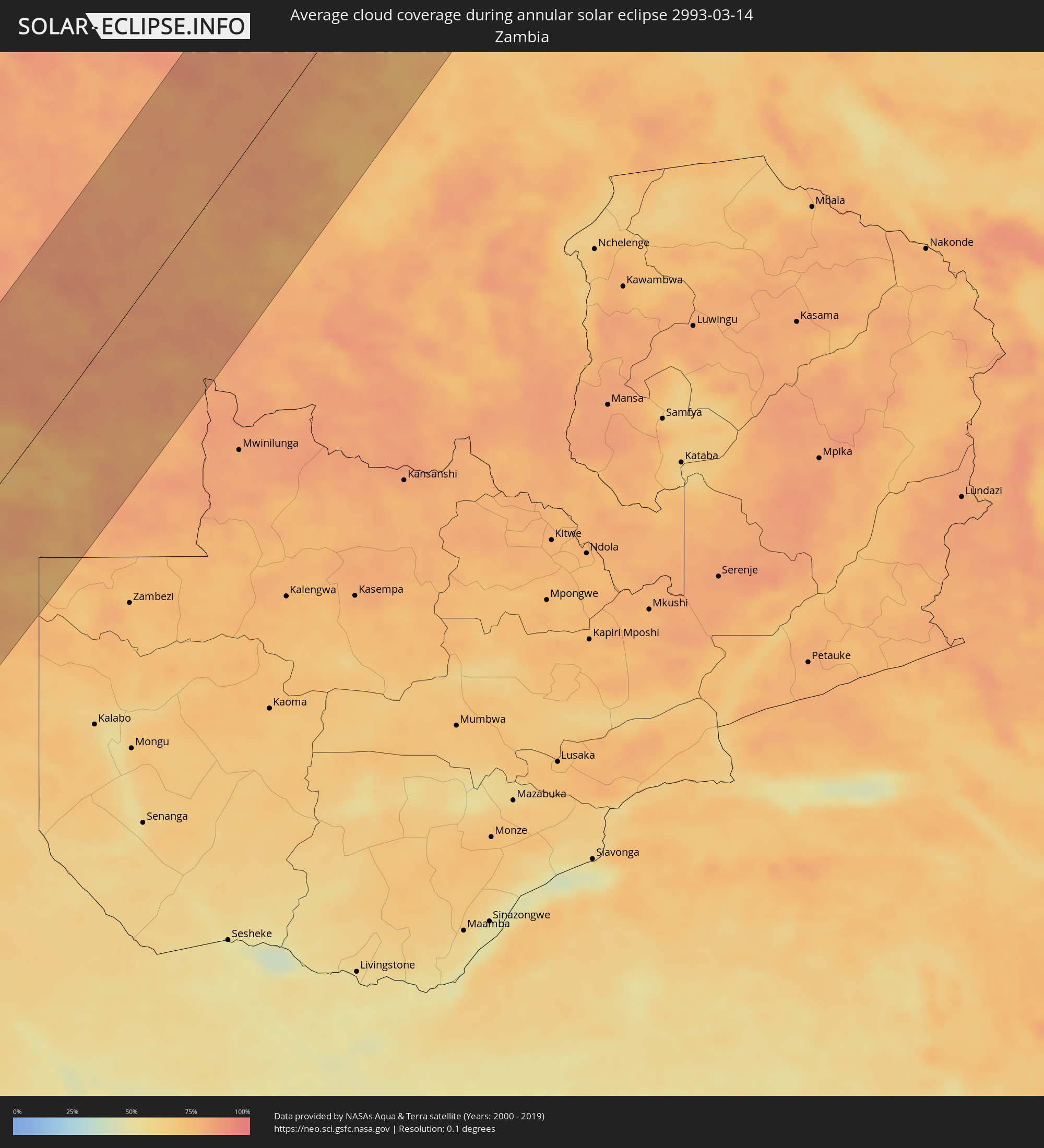 Zambia
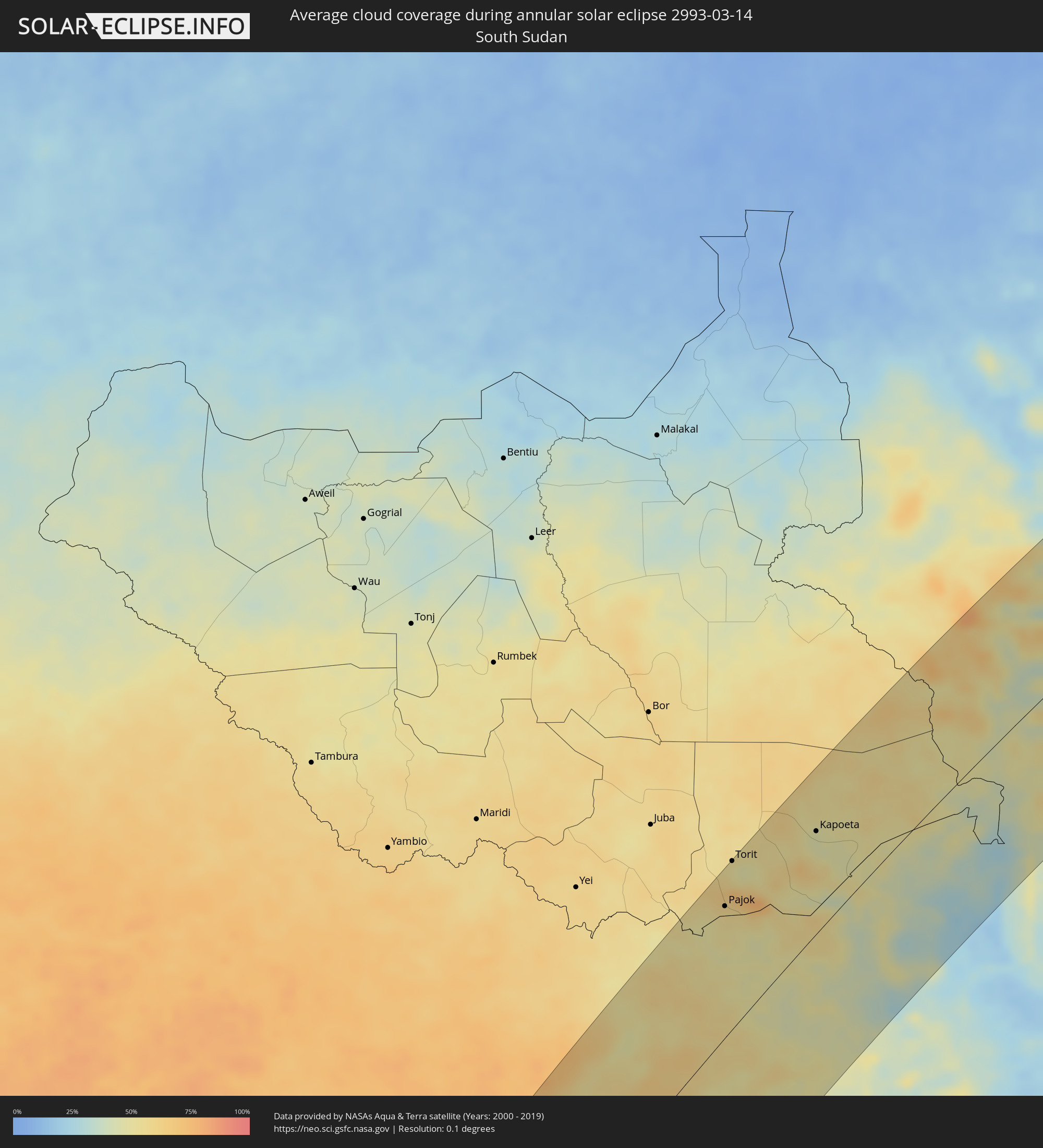 South Sudan
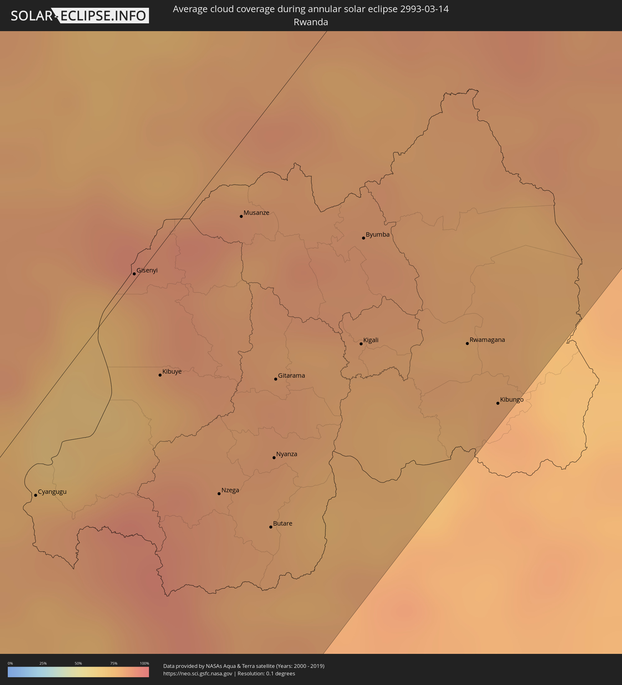 Rwanda
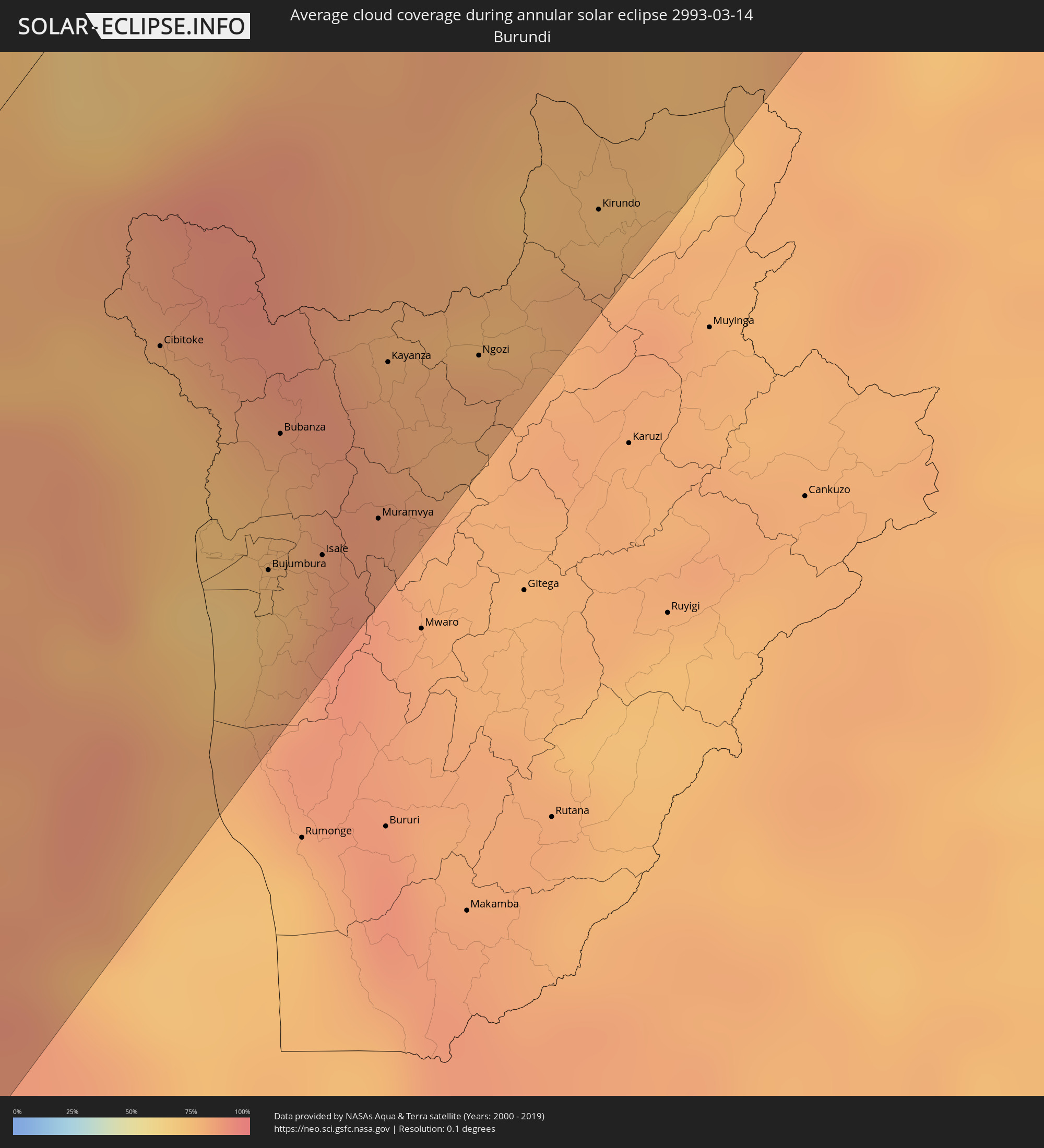 Burundi
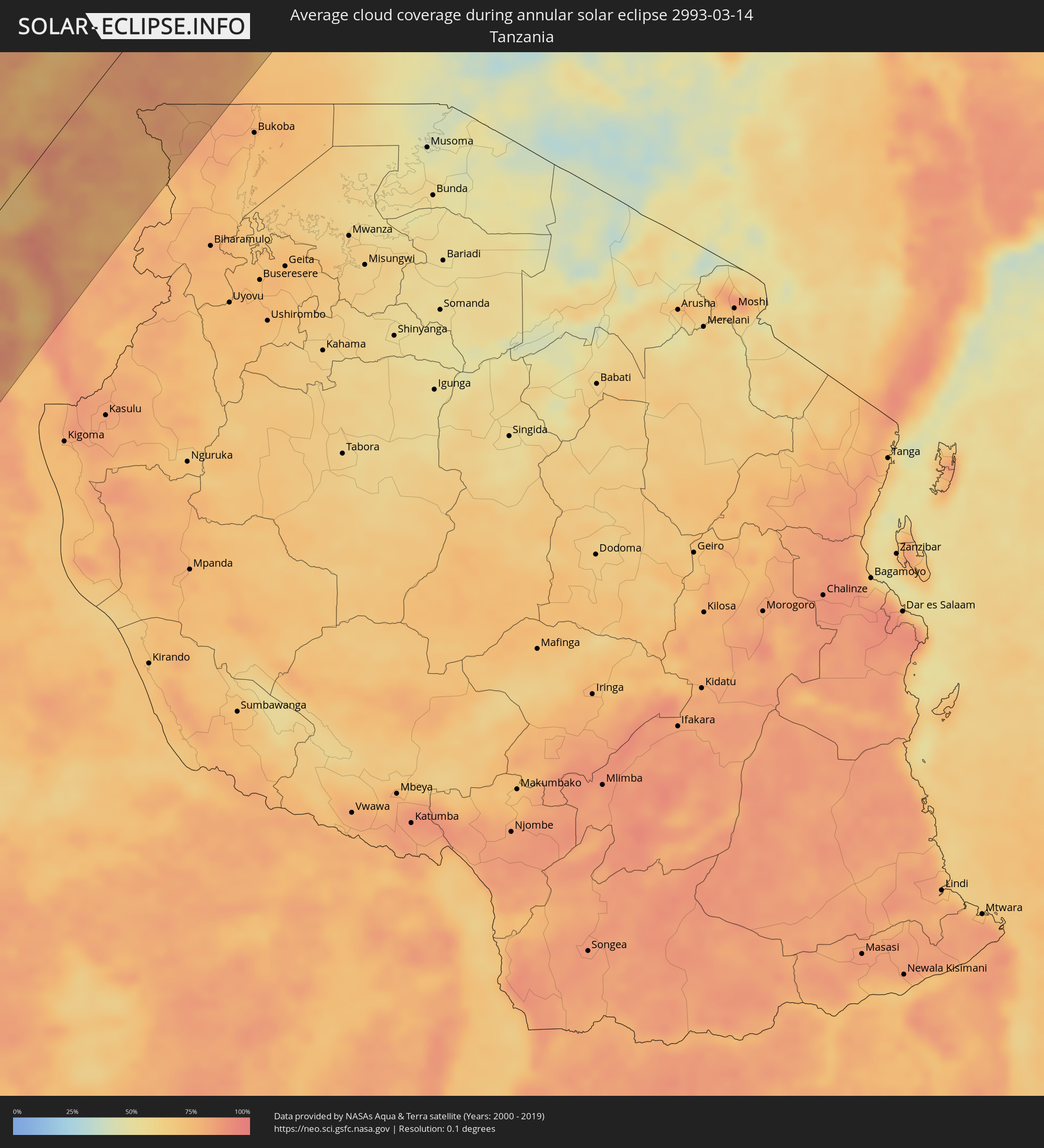 Tanzania
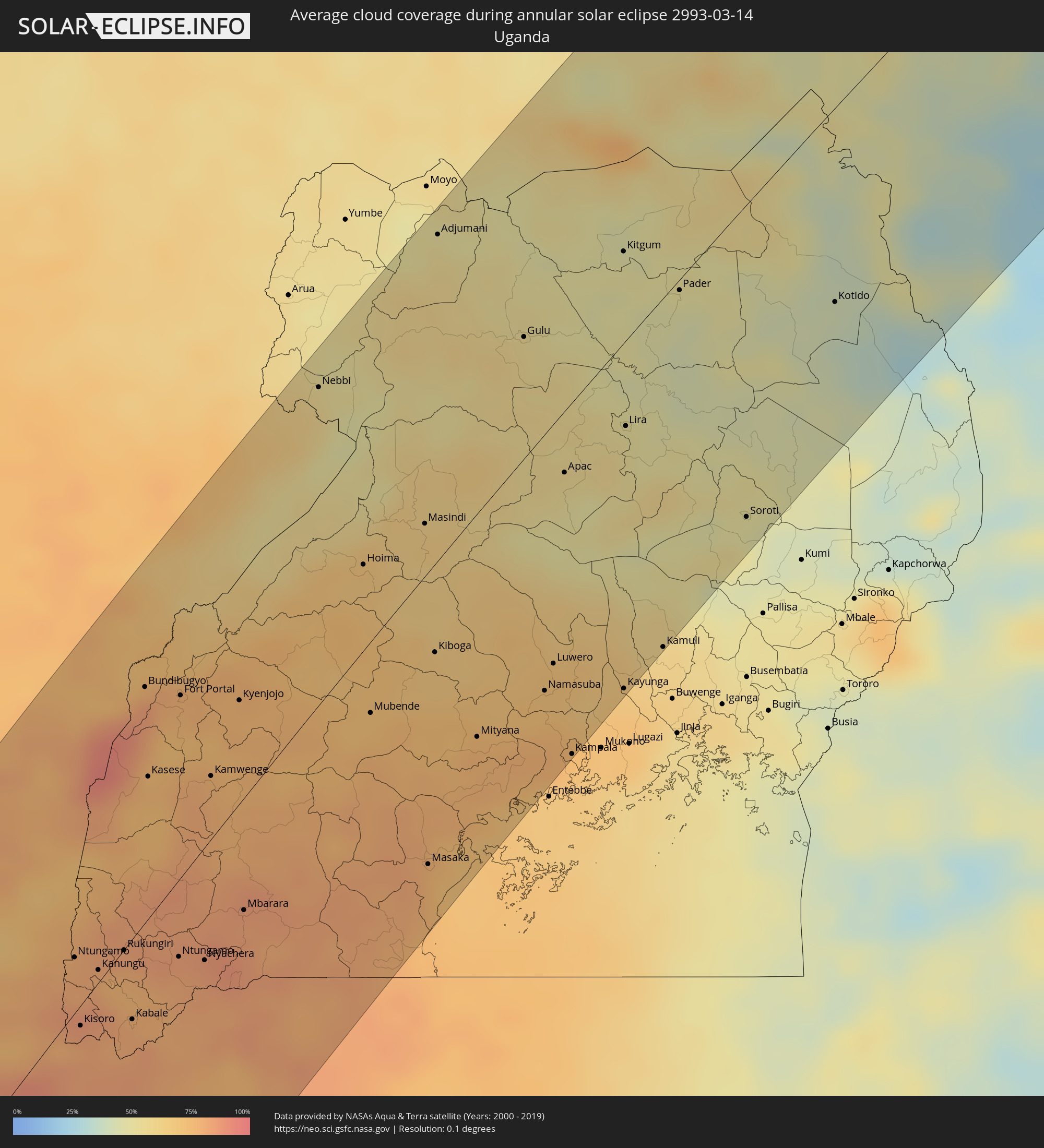 Uganda
 Ethiopia
 Kenya
Kenya
 Eritrea
 Somalia
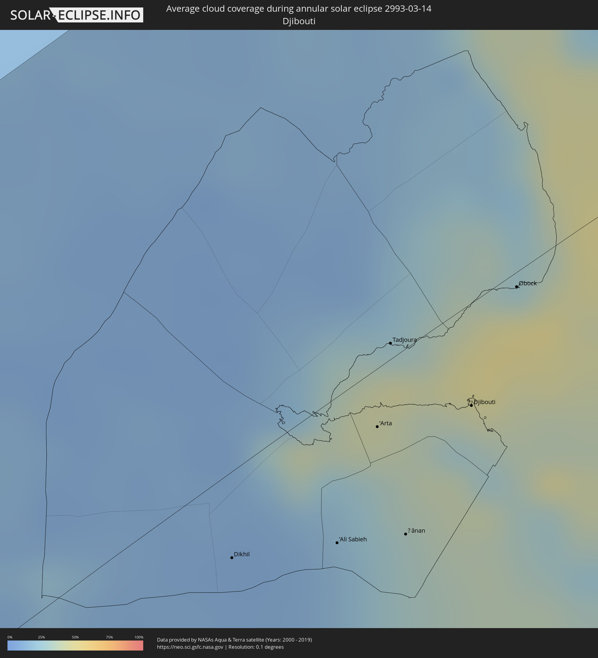 Djibouti
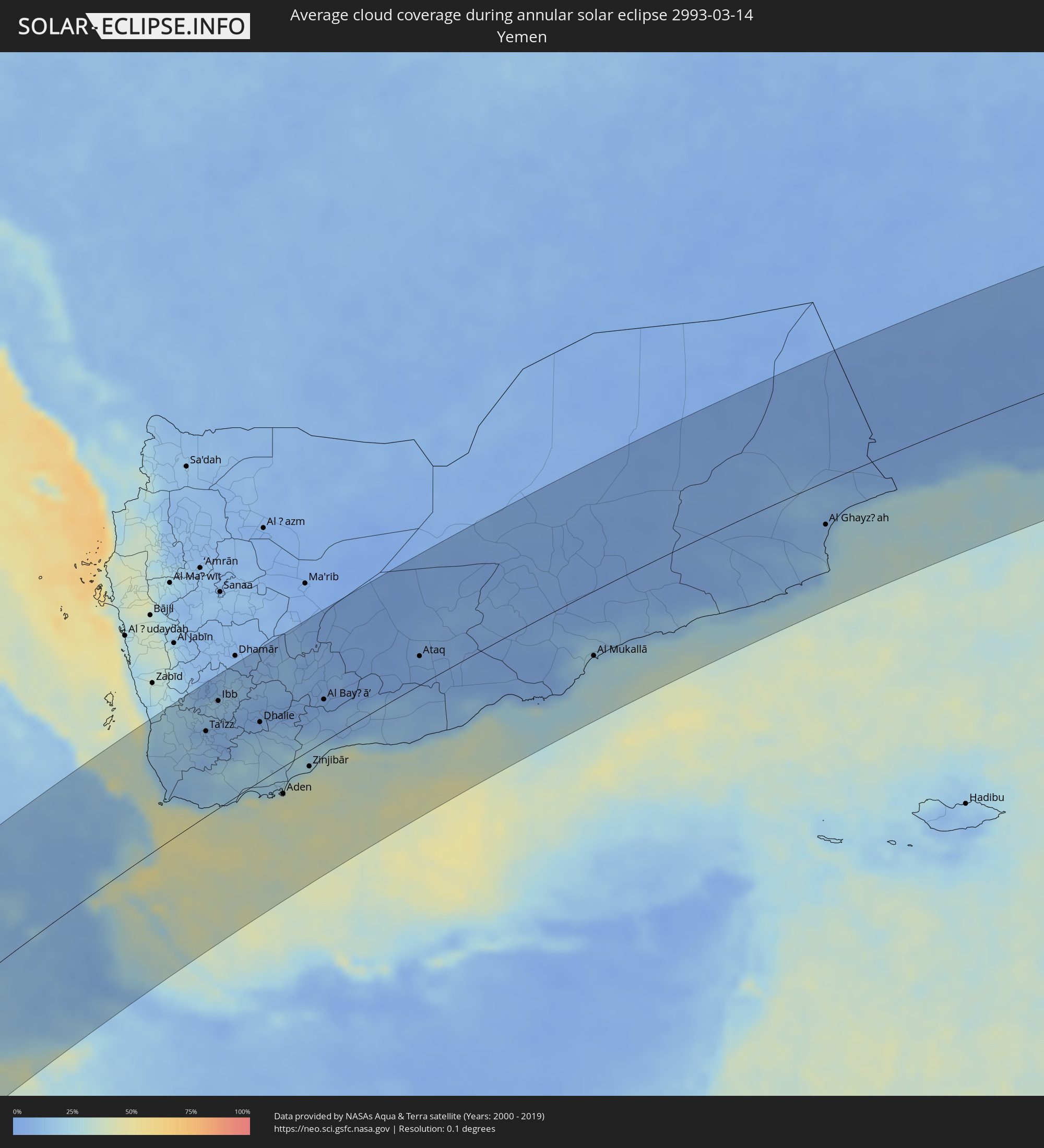 Yemen
Yemen
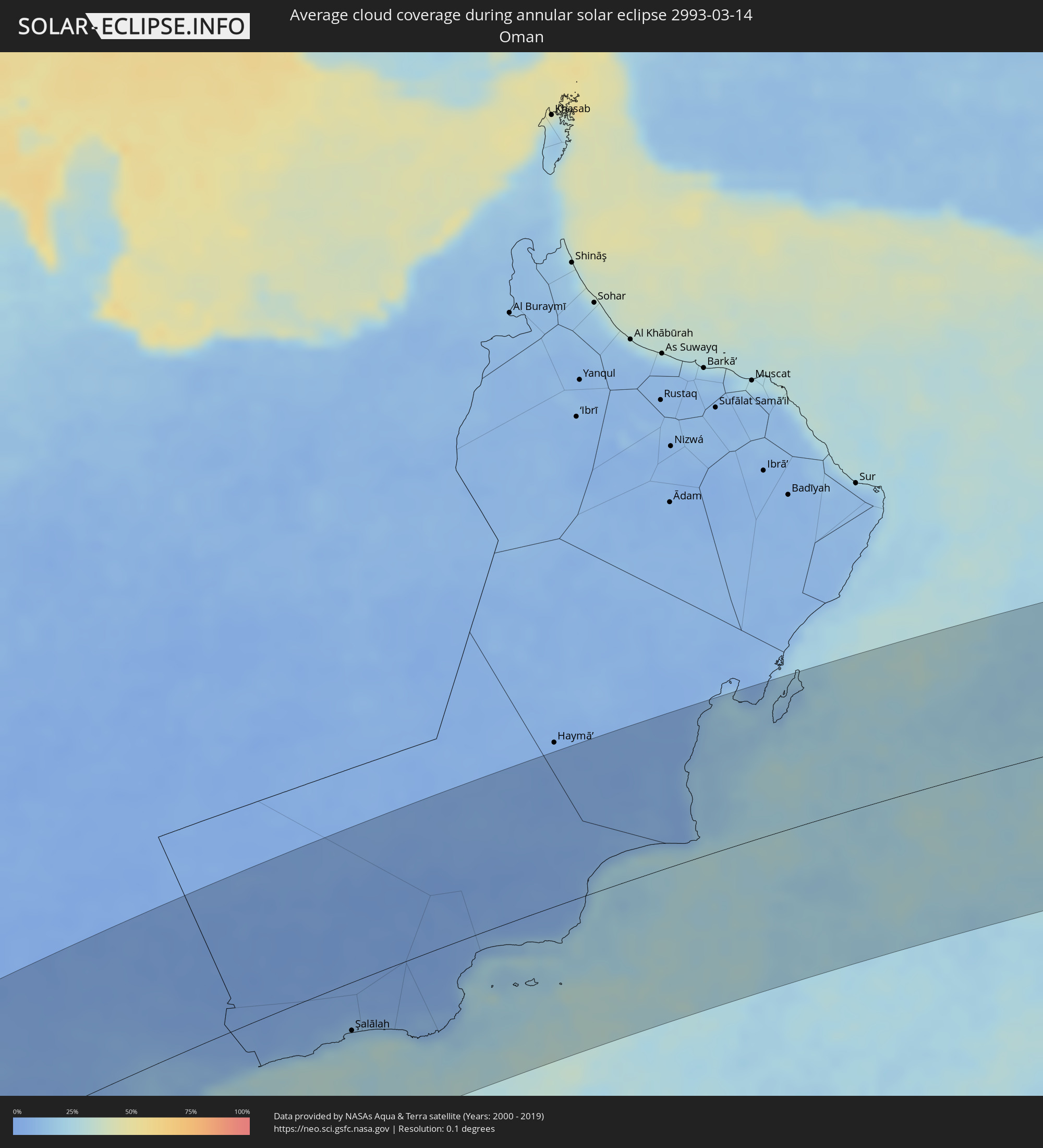 Oman
Oman
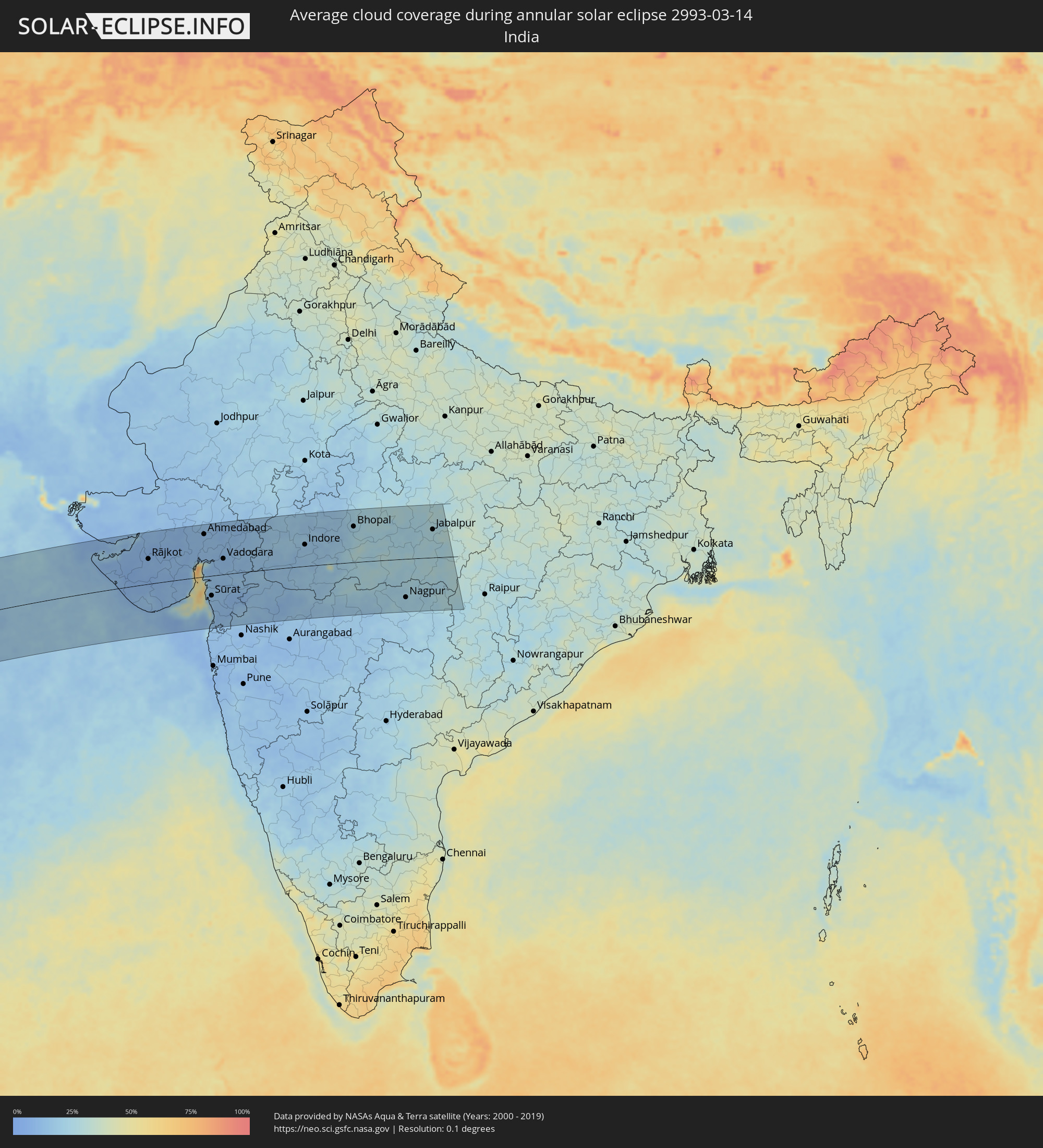 India
India
Cities inside the path of the eclipse
The following table shows all locations with a population of more than 5,000 inside the eclipse path. Cities which have more than 100,000 inhabitants are marked bold. A click at the locations opens a detailed map.
| City | Type | Eclipse duration | Local time of max. eclipse | Distance to central line | Ø Cloud coverage |
|
Khorixas, Kunene
|
annular | - | 11:53:26 UTC+02:00 | 62 km | 36% |
|
Oshakati, Oshana
|
annular | - | 12:00:31 UTC+02:00 | 82 km | 49% |
|
Ondjiva, Cunene
|
annular | - | 11:02:16 UTC+01:00 | 132 km | 58% |
|
Ongwediva, Oshana
|
annular | - | 12:00:41 UTC+02:00 | 75 km | 57% |
|
Ondangwa, Oshana
|
annular | - | 12:00:44 UTC+02:00 | 51 km | 56% |
|
Outjo, Kunene
|
annular | - | 11:56:15 UTC+02:00 | 132 km | 50% |
|
Omuthiya, Oshikoto
|
annular | - | 12:01:43 UTC+02:00 | 45 km | 58% |
|
Eenhana, Ohangwena
|
annular | - | 12:02:32 UTC+02:00 | 55 km | 59% |
|
Nkurenkuru, Kavango West
|
annular | - | 12:06:40 UTC+02:00 | 137 km | 60% |
|
Léua, Moxico
|
annular | - | 11:25:24 UTC+01:00 | 126 km | 87% |
|
Luau, Moxico
|
annular | - | 11:31:32 UTC+01:00 | 35 km | 87% |
|
Gandajika, Kasaï-Oriental
|
annular | - | 12:45:51 UTC+02:00 | 142 km | 86% |
|
Kabinda, Kasaï-Oriental
|
annular | - | 12:48:35 UTC+02:00 | 134 km | 85% |
|
Kamina, Katanga
|
annular | - | 12:42:29 UTC+02:00 | 81 km | 83% |
|
Lubao, Kasaï-Oriental
|
annular | - | 12:53:12 UTC+02:00 | 70 km | 83% |
|
Kasongo, Maniema
|
annular | - | 12:57:40 UTC+02:00 | 51 km | 82% |
|
Kampene, Maniema
|
annular | - | 12:59:57 UTC+02:00 | 105 km | 75% |
|
Kabalo, Katanga
|
annular | - | 12:53:42 UTC+02:00 | 78 km | 77% |
|
Kongolo, Katanga
|
annular | - | 12:55:42 UTC+02:00 | 42 km | 74% |
|
Kabare, South Kivu
|
annular | - | 13:07:08 UTC+02:00 | 11 km | 80% |
|
Bukavu, South Kivu
|
annular | - | 13:07:15 UTC+02:00 | 15 km | 80% |
|
Cyangugu, Western Province
|
annular | - | 13:07:24 UTC+02:00 | 20 km | 81% |
|
Cibitoke, Cibitoke
|
annular | - | 13:06:44 UTC+02:00 | 67 km | 75% |
|
Uvira, South Kivu
|
annular | - | 13:05:23 UTC+02:00 | 102 km | 75% |
|
Goma, Nord Kivu
|
annular | - | 13:10:13 UTC+02:00 | 6 km | 76% |
|
Gisenyi, Western Province
|
annular | - | 13:10:11 UTC+02:00 | 2 km | 82% |
|
Butembo, Nord Kivu
|
annular | - | 13:15:11 UTC+02:00 | 124 km | 79% |
|
Kibuye, Western Province
|
annular | - | 13:09:24 UTC+02:00 | 31 km | 76% |
|
Bujumbura, Bujumbura Mairie
|
annular | - | 13:05:52 UTC+02:00 | 121 km | 81% |
|
Bubanza, Bubanza
|
annular | - | 13:06:44 UTC+02:00 | 103 km | 79% |
|
Beni, Nord Kivu
|
annular | - | 13:16:27 UTC+02:00 | 132 km | 80% |
|
Isale, Bujumbura Rural
|
annular | - | 13:06:11 UTC+02:00 | 130 km | 88% |
|
Nzega, Southern Province
|
annular | - | 13:08:41 UTC+02:00 | 78 km | 82% |
|
Muramvya, Muramvya
|
annular | - | 13:06:39 UTC+02:00 | 135 km | 86% |
|
Kayanza, Kayanza
|
annular | - | 13:07:38 UTC+02:00 | 114 km | 83% |
|
Musanze, Northern Province
|
annular | - | 13:11:28 UTC+02:00 | 18 km | 79% |
|
Butare, Southern Province
|
annular | - | 13:08:43 UTC+02:00 | 102 km | 80% |
|
Nyanza, Southern Province
|
annular | - | 13:09:24 UTC+02:00 | 86 km | 77% |
|
Gitarama, Southern Province
|
annular | - | 13:10:10 UTC+02:00 | 68 km | 82% |
|
Ngozi, Ngozi
|
annular | - | 13:08:04 UTC+02:00 | 131 km | 79% |
|
Kabale, Western Region
|
annular | - | 14:12:50 UTC+03:00 | 32 km | 80% |
|
Kigali, Kigali
|
annular | - | 13:11:05 UTC+02:00 | 86 km | 79% |
|
Byumba, Northern Province
|
annular | - | 13:12:06 UTC+02:00 | 62 km | 83% |
|
Kasese, Western Region
|
annular | - | 14:16:49 UTC+03:00 | 58 km | 75% |
|
Kirundo, Kirundo
|
annular | - | 13:09:27 UTC+02:00 | 132 km | 80% |
|
Bunia, Orientale
|
annular | - | 13:20:44 UTC+02:00 | 139 km | 65% |
|
Fort Portal, Western Region
|
annular | - | 14:18:26 UTC+03:00 | 75 km | 77% |
|
Nyachera, Western Region
|
annular | - | 14:14:35 UTC+03:00 | 46 km | 82% |
|
Rwamagana, Eastern Province
|
annular | - | 13:11:49 UTC+02:00 | 119 km | 79% |
|
Kibungo, Eastern Province
|
annular | - | 13:11:28 UTC+02:00 | 143 km | 78% |
|
Mbarara, Western Region
|
annular | - | 14:15:49 UTC+03:00 | 46 km | 84% |
|
Nebbi, Northern Region
|
annular | - | 14:24:40 UTC+03:00 | 133 km | 56% |
|
Hoima, Western Region
|
annular | - | 14:22:29 UTC+03:00 | 36 km | 68% |
|
Nsunga, Kagera
|
annular | - | 14:15:50 UTC+03:00 | 148 km | 82% |
|
Masindi, Western Region
|
annular | - | 14:23:47 UTC+03:00 | 22 km | 63% |
|
Masaka, Central Region
|
annular | - | 14:18:37 UTC+03:00 | 122 km | 79% |
|
Mityana, Central Region
|
annular | - | 14:21:08 UTC+03:00 | 94 km | 77% |
|
Gulu, Northern Region
|
annular | - | 14:27:40 UTC+03:00 | 52 km | 55% |
 Pajok, Eastern Equatoria
|
annular | - | 13:30:43 UTC+02:00 | 117 km | 59% |
|
Torit, Eastern Equatoria
|
annular | - | 13:32:13 UTC+02:00 | 150 km | 49% |
|
Kampala, Central Region
|
annular | - | 14:21:56 UTC+03:00 | 149 km | 71% |
|
Kitgum, Northern Region
|
annular | - | 14:30:00 UTC+03:00 | 40 km | 48% |
|
Lira, Northern Region
|
annular | - | 14:27:28 UTC+03:00 | 37 km | 53% |
|
Kapoeta, Eastern Equatoria
|
annular | - | 13:34:56 UTC+02:00 | 93 km | 47% |
|
Soroti, Eastern Region
|
annular | - | 14:27:27 UTC+03:00 | 136 km | 48% |
|
Jīma, Oromiya
|
annular | - | 14:47:14 UTC+03:00 | 66 km | 39% |
|
Ārba Minch’, Southern Nations, Nationalities, and People's Region
|
annular | - | 14:44:52 UTC+03:00 | 121 km | 30% |
|
Hāgere Hiywet, Oromiya
|
annular | - | 14:51:43 UTC+03:00 | 100 km | 31% |
|
Waliso, Oromiya
|
annular | - | 14:50:58 UTC+03:00 | 54 km | 32% |
|
Dīla, Southern Nations, Nationalities, and People's Region
|
annular | - | 14:47:02 UTC+03:00 | 147 km | 45% |
|
Yirga ‘Alem, Southern Nations, Nationalities, and People's Region
|
annular | - | 14:47:56 UTC+03:00 | 127 km | 39% |
|
Hawassa, Southern Nations, Nationalities, and People's Region
|
annular | - | 14:48:42 UTC+03:00 | 106 km | 25% |
|
Shashemenē, Oromiya
|
annular | - | 14:49:13 UTC+03:00 | 104 km | 33% |
|
Ziway, Oromiya
|
annular | - | 14:50:58 UTC+03:00 | 51 km | 17% |
|
Addis Ababa, Addis Ababa
|
annular | - | 14:53:16 UTC+03:00 | 38 km | 32% |
|
Bishoftu, Oromiya
|
annular | - | 14:53:05 UTC+03:00 | 1 km | 21% |
|
Nazrēt, Oromiya
|
annular | - | 14:53:09 UTC+03:00 | 39 km | 15% |
|
Debre Birhan, Amhara
|
annular | - | 14:55:51 UTC+03:00 | 39 km | 31% |
|
Kombolcha, Amhara
|
annular | - | 14:58:53 UTC+03:00 | 146 km | 29% |
|
Dire Dawa, Dire Dawa
|
annular | - | 14:59:22 UTC+03:00 | 127 km | 28% |
|
Dikhil, Dikhil
|
annular | - | 15:02:56 UTC+03:00 | 25 km | 10% |
|
'Ali Sabieh, Ali Sabieh
|
annular | - | 15:03:32 UTC+03:00 | 42 km | 15% |
|
Assab, Southern Red Sea
|
annular | - | 15:06:46 UTC+03:00 | 126 km | 20% |
|
‘Arta, Arta
|
annular | - | 15:04:22 UTC+03:00 | 17 km | 29% |
|
Tadjoura, Tadjourah
|
annular | - | 15:04:53 UTC+03:00 | 5 km | 44% |
|
Ḏânan, Ali Sabieh
|
annular | - | 15:03:54 UTC+03:00 | 53 km | 28% |
|
Djibouti, Djibouti
|
annular | - | 15:04:56 UTC+03:00 | 30 km | 29% |
|
Obock, Obock
|
annular | - | 15:05:47 UTC+03:00 | 4 km | 48% |
|
Ta‘izz, Ta‘izz
|
annular | - | 15:09:30 UTC+03:00 | 102 km | 13% |
|
Dhī as Sufāl, Ibb
|
annular | - | 15:10:01 UTC+03:00 | 120 km | 10% |
|
Ibb, Ibb
|
annular | - | 15:10:20 UTC+03:00 | 128 km | 15% |
|
Yarīm, Ibb
|
annular | - | 15:11:06 UTC+03:00 | 148 km | 16% |
|
Dhalie, Aḑ Ḑāli‘
|
annular | - | 15:10:39 UTC+03:00 | 71 km | 10% |
|
Laḩij, Laḩij
|
annular | - | 15:09:51 UTC+03:00 | 2 km | 25% |
|
Aden, Aden
|
annular | - | 15:09:37 UTC+03:00 | 33 km | 43% |
|
Zinjibār, Abyan
|
annular | - | 15:10:38 UTC+03:00 | 19 km | 41% |
|
Al Bayḑā’, Al Bayḑāʼ
|
annular | - | 15:12:13 UTC+03:00 | 51 km | 5% |
|
Jawf al Maqbābah, Abyan
|
annular | - | 15:12:21 UTC+03:00 | 22 km | 9% |
|
Ataq, Shabwah
|
annular | - | 15:14:40 UTC+03:00 | 35 km | 4% |
|
Al Mukallā, Muḩāfaz̧at Ḩaḑramawt
|
annular | - | 15:17:31 UTC+03:00 | 82 km | 25% |
|
Al Ghayz̧ah, Al Mahrah
|
annular | - | 15:23:05 UTC+03:00 | 56 km | 13% |
|
Şalālah, Z̧ufār
|
annular | - | 16:25:55 UTC+04:00 | 52 km | 24% |
|
Jāmnagar, Gujarat
|
annular | - | 18:09:54 UTC+05:30 | 113 km | 9% |
|
Rājkot, Gujarat
|
annular | - | 18:10:03 UTC+05:30 | 82 km | 8% |
|
Bhāvnagar, Gujarat
|
annular | - | 18:10:12 UTC+05:30 | 7 km | 16% |
|
Ahmedabad, Gujarat
|
annular | - | 18:10:47 UTC+05:30 | 140 km | 12% |
|
Sūrat, Gujarat
|
annular | - | 18:10:07 UTC+05:30 | 66 km | 13% |
|
Bilimora, Gujarat
|
annular | - | 18:09:58 UTC+05:30 | 114 km | 13% |
|
Vadodara, Gujarat
|
annular | - | 18:10:39 UTC+05:30 | 52 km | 10% |
|
Mālegaon, Maharashtra
|
annular | - | 18:10:13 UTC+05:30 | 157 km | 10% |
|
Jalgaon, Maharashtra
|
annular | - | 18:10:35 UTC+05:30 | 117 km | 14% |
|
Ujjain, Madhya Pradesh
|
annular | - | 18:11:23 UTC+05:30 | 123 km | 16% |
|
Indore, Madhya Pradesh
|
annular | - | 18:11:15 UTC+05:30 | 71 km | 17% |
|
Bhopal, Madhya Pradesh
|
annular | - | 18:11:34 UTC+05:30 | 118 km | 22% |
|
Amrāvati, Maharashtra
|
annular | - | 18:10:50 UTC+05:30 | 142 km | 17% |
|
Nagpur, Maharashtra
|
annular | - | 18:11:01 UTC+05:30 | 127 km | 23% |
|
Jabalpur, Madhya Pradesh
|
annular | - | 18:11:38 UTC+05:30 | 93 km | 27% |